degradation of philippine marine life (2013)
TRANSCRIPT

Degradation of Philippine Marine Life
Geog 111
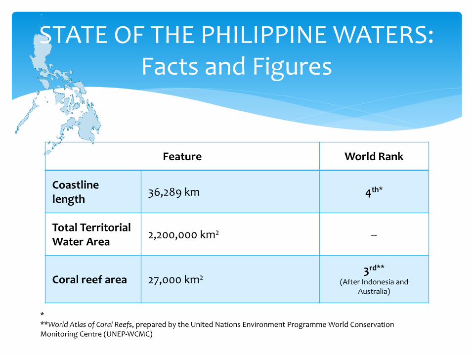
Feature World Rank
Coastline length
36,289 km 4th*
Total Territorial Water Area
2,200,000 km2 --
Coral reef area 27,000 km23rd**
(After Indonesia and Australia)
STATE OF THE PHILIPPINE WATERS:Facts and Figures
***World Atlas of Coral Reefs, prepared by the United Nations Environment Programme World Conservation Monitoring Centre (UNEP-WCMC)
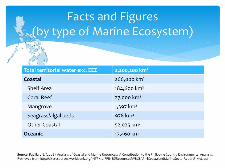
Total territorial water exc. EEZ 2,200,200 km2
Coastal 266,000 km2
Shelf Area 184,600 km2
Coral Reef 27,000 km2
Mangrove 1,397 km2
Seagrass/algal beds 978 km2
Other Coastal 52,025 km2
Oceanic 17,460 km
Facts and Figures(by type of Marine Ecosystem)
Source: Padilla, J.E. (2008). Analysis of Coastal and Marine Resources: A Contribution to the Philippine Country Environmental Analysis. Retrieved from http://siteresources.worldbank.org/INTPHILIPPINES/Resources/WBCEAPhilCoastalandMarineSectorReportFINAL.pdf
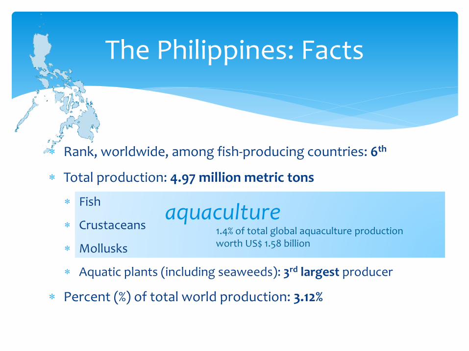
Rank, worldwide, among fish-producing countries: 6th
Total production: 4.97 million metric tons
Fish
Crustaceans
Mollusks
Aquatic plants (including seaweeds): 3rd largest producer
Percent (%) of total world production: 3.12%
The Philippines: Facts
aquaculture1.4% of total global aquaculture productionworth US$ 1.58 billion
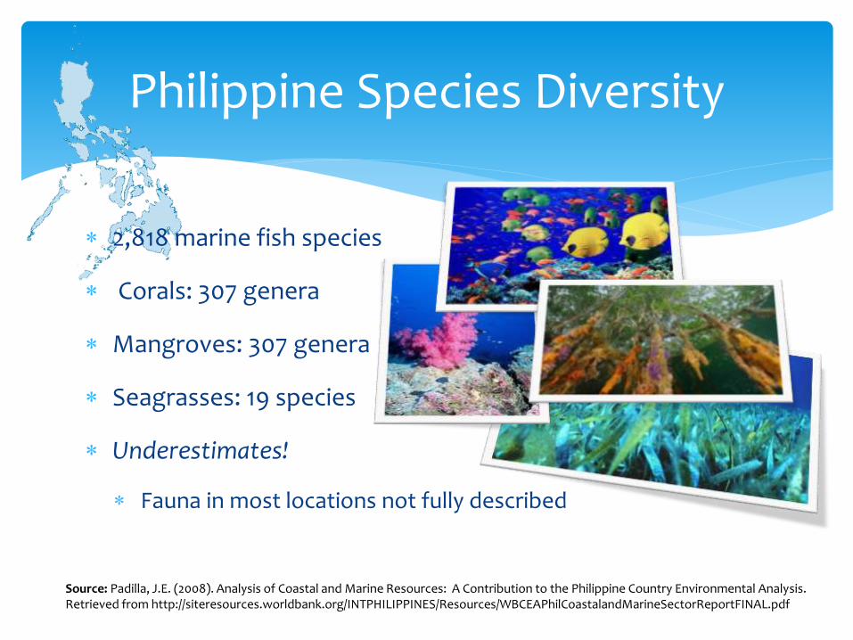
2,818 marine fish species
Corals: 307 genera
Mangroves: 307 genera
Seagrasses: 19 species
Underestimates!
Fauna in most locations not fully described
Philippine Species Diversity
Source: Padilla, J.E. (2008). Analysis of Coastal and Marine Resources: A Contribution to the Philippine Country Environmental Analysis. Retrieved from http://siteresources.worldbank.org/INTPHILIPPINES/Resources/WBCEAPhilCoastalandMarineSectorReportFINAL.pdf
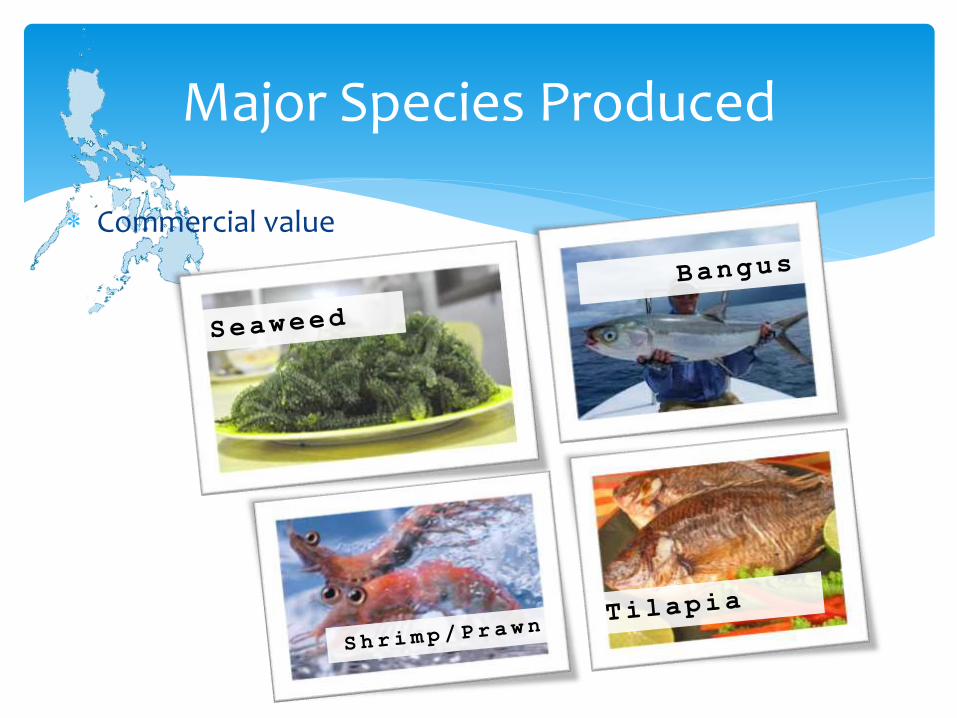
Commercial value
Major Species Produced

FISHERIES
Harvest
Process
Market
Develop
Conserve& Manage
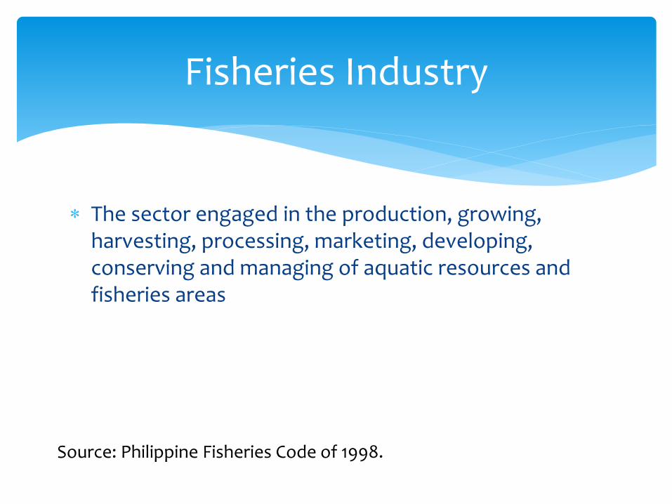
The sector engaged in the production, growing, harvesting, processing, marketing, developing, conserving and managing of aquatic resources and fisheries areas
Fisheries Industry
Source: Philippine Fisheries Code of 1998.
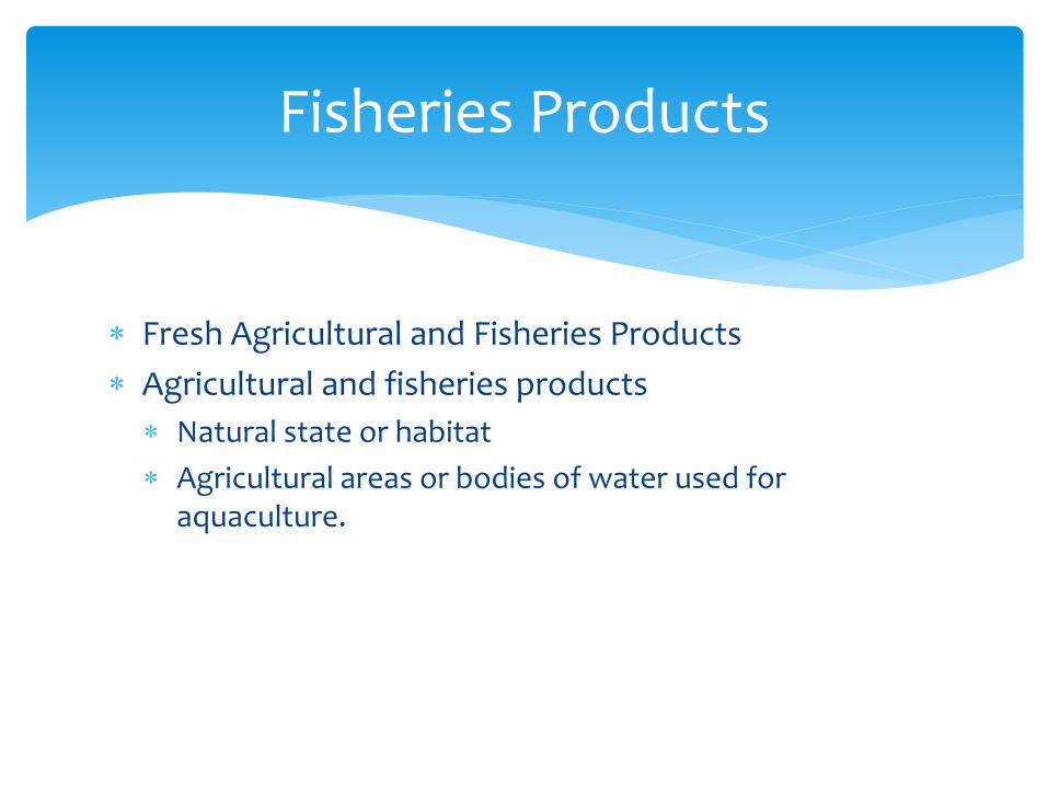
Fresh Agricultural and Fisheries Products
Agricultural and fisheries products
Natural state or habitat
Agricultural areas or bodies of water used for aquaculture.
Fisheries Products

Contribution to GDP:
2.2 - 4.4% (inflation-dependent)
24.4% of GDP derived from agriculture
How important is fisheries?
55%
33%
9%
3%
12%
% of Philippine GDP
Services
Industry
Agriculture (otherkinds)
Fisheries (as partof Agriculture)
Source: The Philippines Country Report, Global Finance Maghttp://www.gfmag.com/gdp-data-country-reports/198-the-philippines-gdp-country-
~3% contribution to PHL GDP
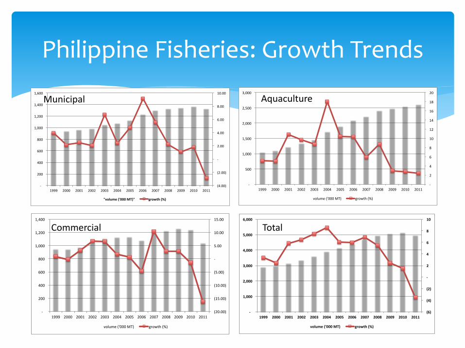
Philippine Fisheries: Growth Trends
(4.00)
(2.00)
-
2.00
4.00
6.00
8.00
10.00
-
200
400
600
800
1,000
1,200
1,400
1,600
1999 2000 2001 2002 2003 2004 2005 2006 2007 2008 2009 2010 2011
"volume('000MT)" growth(%)
(20.00)
(15.00)
(10.00)
(5.00)
-
5.00
10.00
15.00
-
200
400
600
800
1,000
1,200
1,400
1999 2000 2001 2002 2003 2004 2005 2006 2007 2008 2009 2010 2011
volume('000MT) growth(%)
-
2
4
6
8
10
12
14
16
18
20
-
500
1,000
1,500
2,000
2,500
3,000
1999 2000 2001 2002 2003 2004 2005 2006 2007 2008 2009 2010 2011
volume('000MT) growth(%)
(6)
(4)
(2)
-
2
4
6
8
10
-
1,000
2,000
3,000
4,000
5,000
6,000
1999 2000 2001 2002 2003 2004 2005 2006 2007 2008 2009 2010 2011
volume('000MT) growth(%)
Municipal
Commercial
Aquaculture
Total
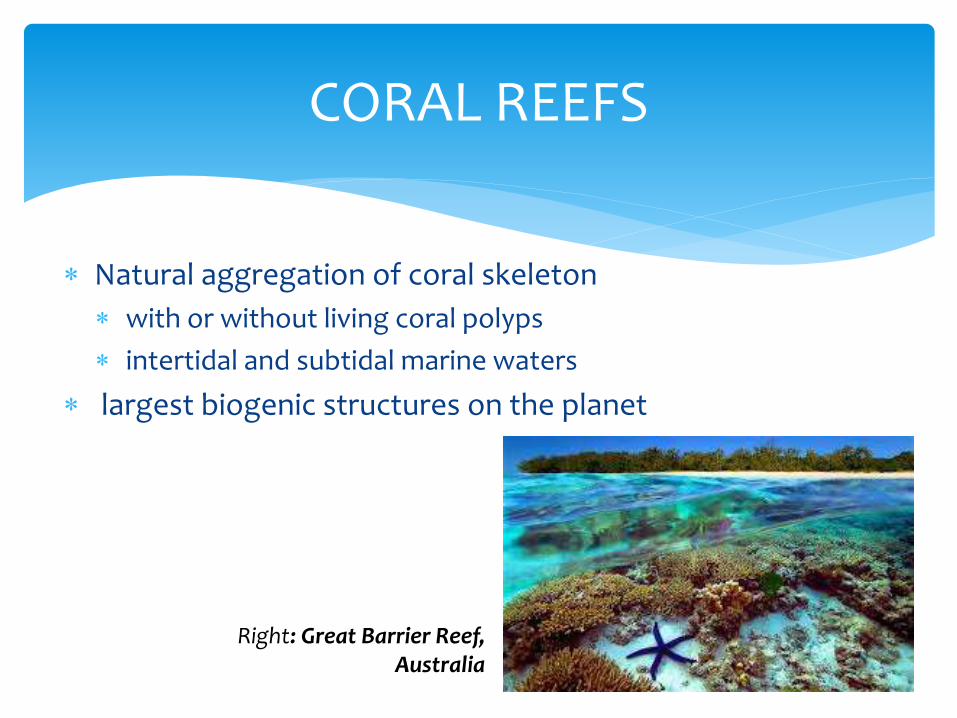
Natural aggregation of coral skeleton
with or without living coral polyps
intertidal and subtidal marine waters
largest biogenic structures on the planet
CORAL REEFS
Right: Great Barrier Reef, Australia

support assemblages of living corals and many other organisms
Fish
Mollusks
Marine worms
Crustaceans
Algae
Sponges
Coral Reefs
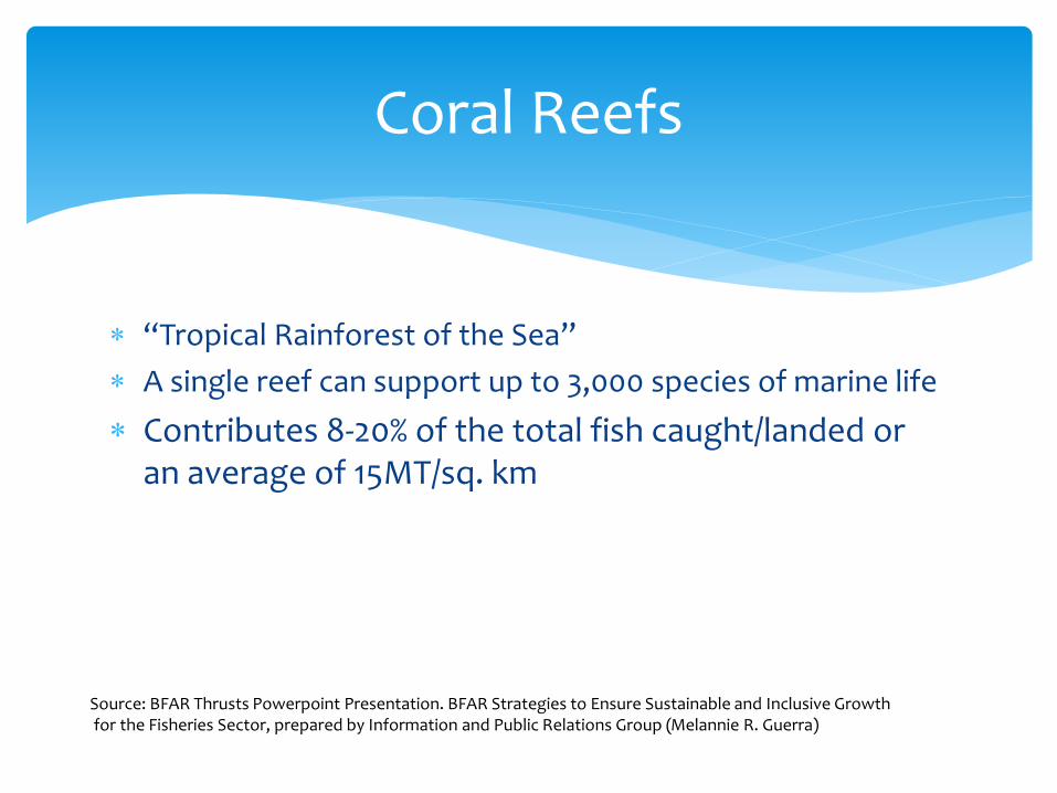
“Tropical Rainforest of the Sea”
A single reef can support up to 3,000 species of marine life
Contributes 8-20% of the total fish caught/landed or an average of 15MT/sq. km
Coral Reefs
Source: BFAR Thrusts Powerpoint Presentation. BFAR Strategies to Ensure Sustainable and Inclusive Growthfor the Fisheries Sector, prepared by Information and Public Relations Group (Melannie R. Guerra)
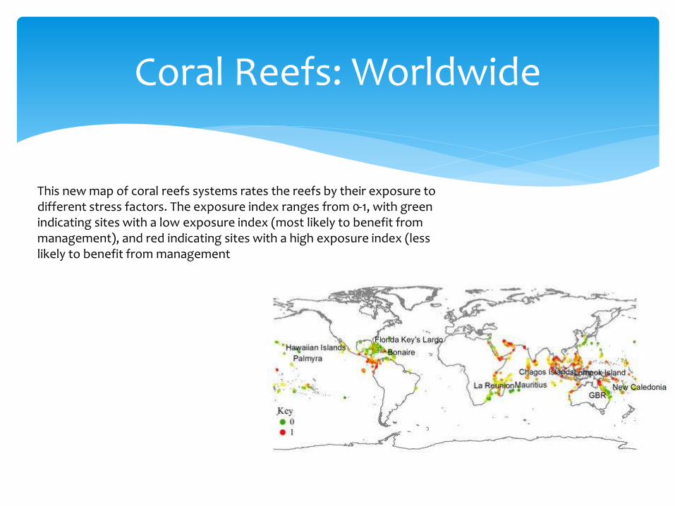
Coral Reefs: Worldwide
This new map of coral reefs systems rates the reefs by their exposure to different stress factors. The exposure index ranges from 0-1, with green indicating sites with a low exposure index (most likely to benefit from management), and red indicating sites with a high exposure index (less likely to benefit from management

The Philippines has about 25,000 to
27,000 km2 coral reef areas
Annual economic benefits US$1.1
billion per year
But only about 5% are in good
condition, and only 1% in excellent
condition
Major threats are destructive fishing
practices including cyanide poisoning
and blast fishing; sediment spilling
into the sea due to deforestation and
urbanization; and climate change
Coral Reefs: Philippines
Coral reef conditions in the Philippines(Nanola et al, 2004)
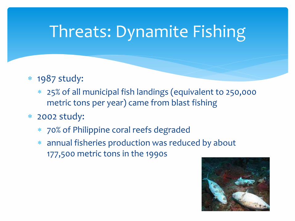
1987 study:
25% of all municipal fish landings (equivalent to 250,000 metric tons per year) came from blast fishing
2002 study:
70% of Philippine coral reefs degraded
annual fisheries production was reduced by about 177,500 metric tons in the 1990s
Threats: Dynamite Fishing
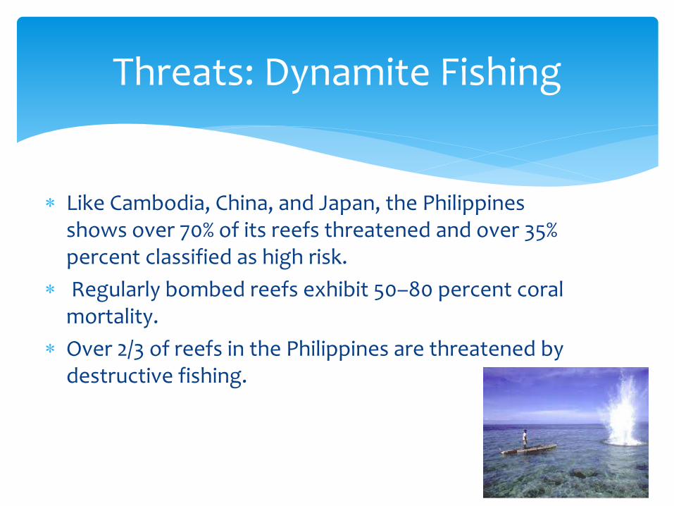
Like Cambodia, China, and Japan, the Philippines shows over 70% of its reefs threatened and over 35% percent classified as high risk.
Regularly bombed reefs exhibit 50–80 percent coral mortality.
Over 2/3 of reefs in the Philippines are threatened by destructive fishing.
Threats: Dynamite Fishing
Trawl Nets
Muro-ami
Superlights
Threats: Fishing Malpractices

Deliberate disposal of waste at sea
Pollutants, mainly man-generated
Ballast water
Wastes soak up oxygen in the sea and release toxic chemicals
Ballast water may encourage proliferation of organisms that hamper the growth of naturally-occurring fishes
Threats: Ocean Dumping

Oil spills
Threats: Ocean Dumping
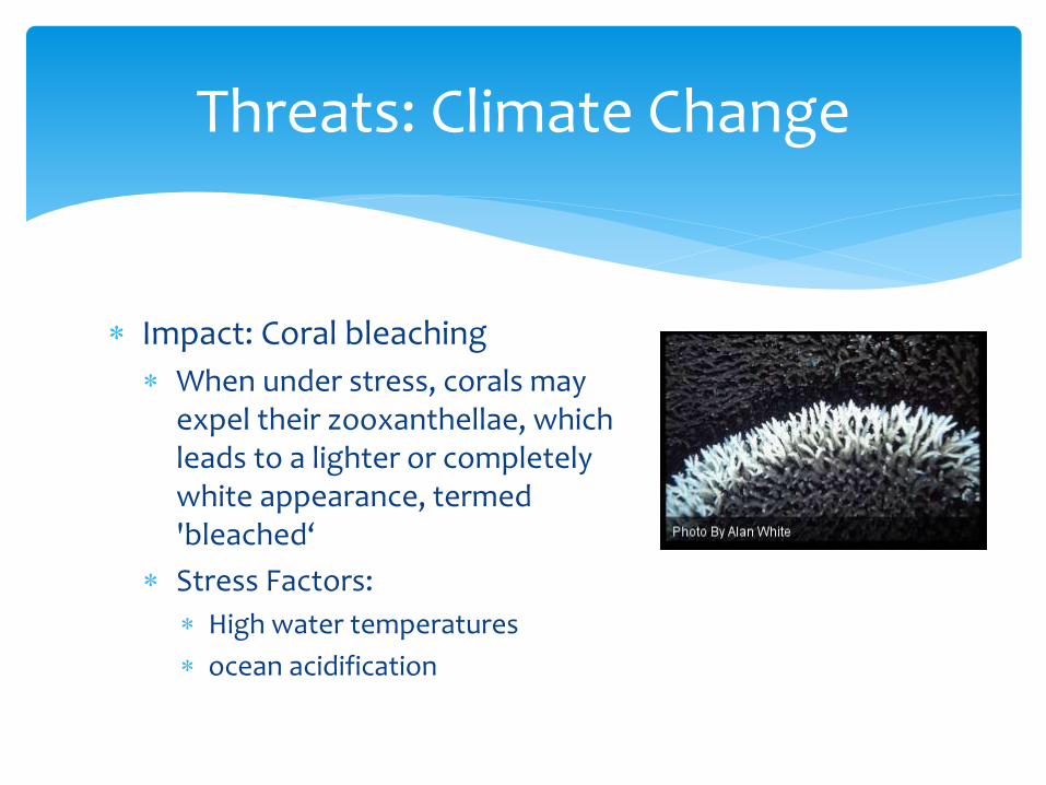
Impact: Coral bleaching
When under stress, corals may expel their zooxanthellae, which leads to a lighter or completely white appearance, termed 'bleached‘
Stress Factors:
High water temperatures
ocean acidification
Threats: Climate Change
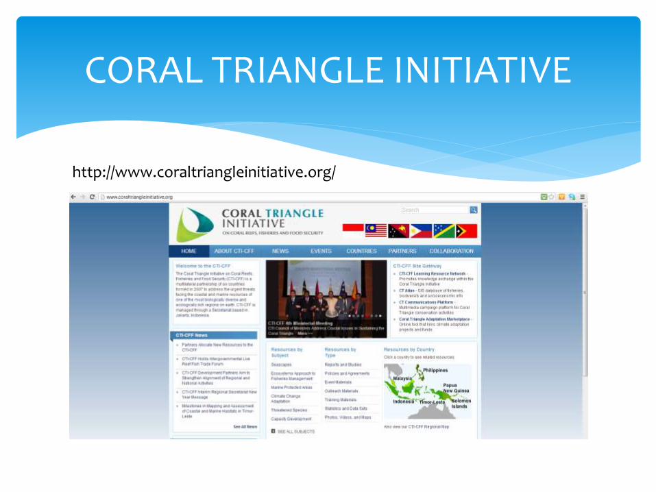
CORAL TRIANGLE INITIATIVE
http://www.coraltriangleinitiative.org/

The Coral Triangle Initiative on Coral Reefs, Fisheries, and Food Security (CTI-CFF) is a multilateral partnership of six countries working together to sustain extraordinary marine and coastal resources by addressing crucial issues such as food security, climate change and marine biodiversity.
Coral Triangle Initiative:What is it?

Indonesia
Malaysia
Papua New Guinea
Philippines
Solomon Islands
Timor-Leste
Coral Triangle Initiative:Area Spanned, Component Countries
5.7 sq. km of ocean water
Contains at least 500 species of reef-building corals in each ecoregion
Global center of marine biodiversity
Resources sustain the lives of over 120 million people
WWF: Top priority for marine conservation
Coral Triangle:Why so special?

Port Moresby, Papua New Guinea in March 2009
living and non-legally binding document
conserve and sustainably manage coastal and marine resources within the Coral Triangle region
takes into consideration laws and policies of each country
CTI Regional Plan of Action
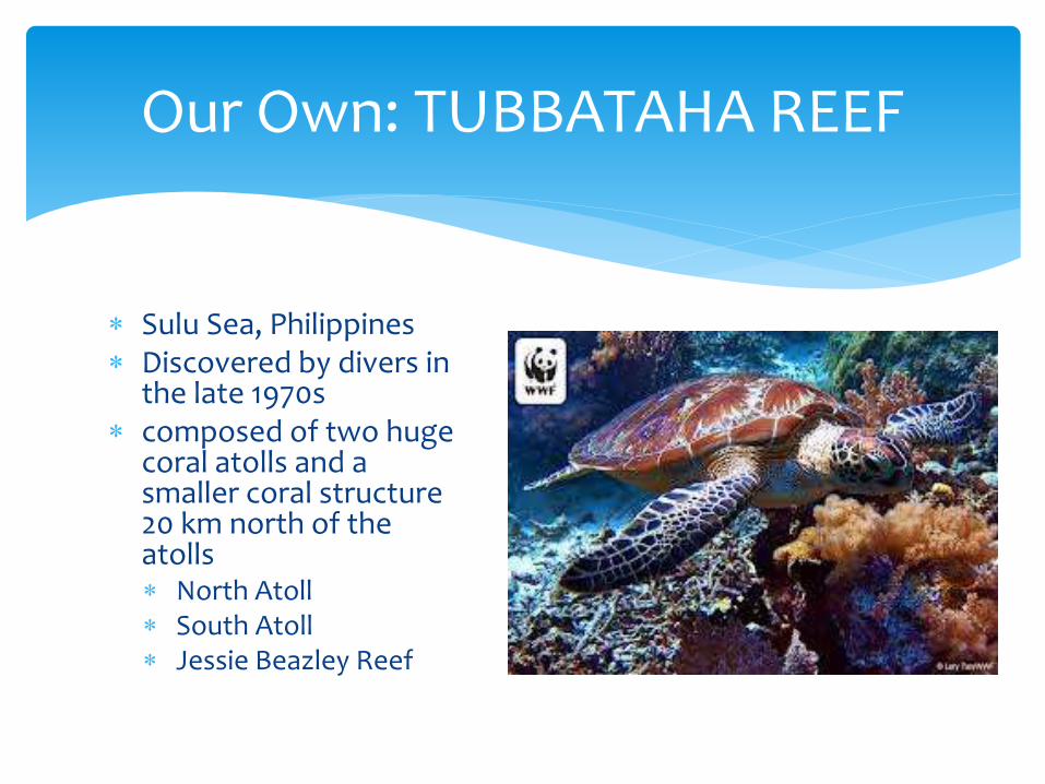
Sulu Sea, Philippines Discovered by divers in
the late 1970s composed of two huge
coral atolls and a smaller coral structure 20 km north of the atolls North Atoll South Atoll Jessie Beazley Reef
Our Own: TUBBATAHA REEF
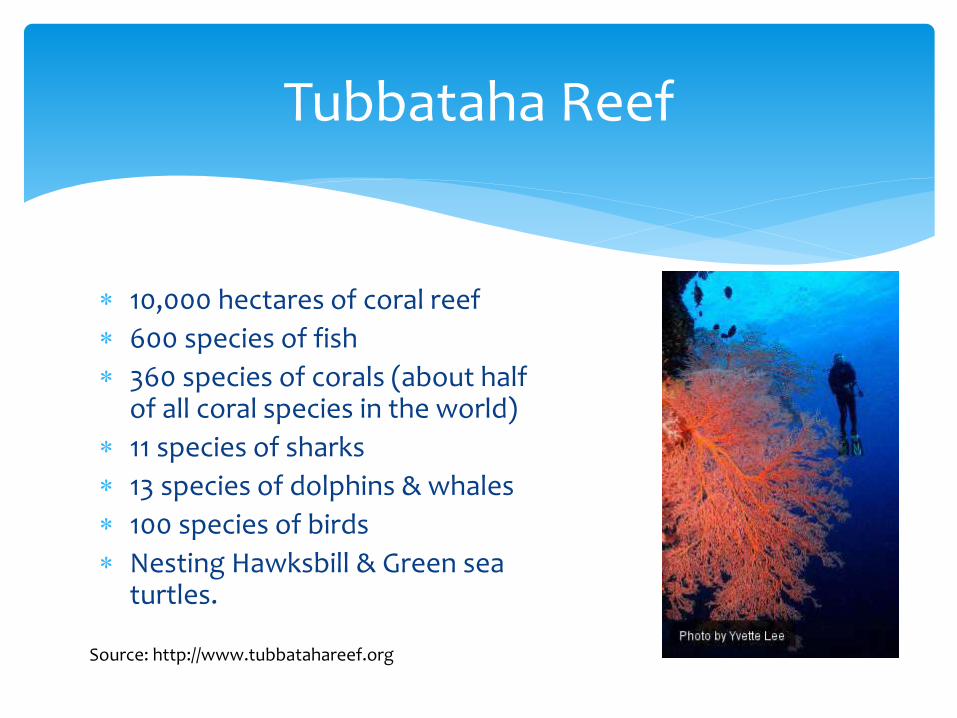
10,000 hectares of coral reef
600 species of fish
360 species of corals (about half of all coral species in the world)
11 species of sharks
13 species of dolphins & whales
100 species of birds
Nesting Hawksbill & Green sea turtles.
Tubbataha Reef
Source: http://www.tubbatahareef.org

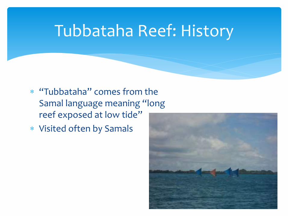
“Tubbataha” comes from the Samal language meaning “long reef exposed at low tide”
Visited often by Samals
Tubbataha Reef: History
1980s: Overfishing due to emergence of motorized boats
Became a fishing destination
Cyanide fishing
Dynamite fishing
In 1988, in response to a strong campaign by scuba divers and environmentalists, and with the endorsement of the Provincial Government of Palawan, then President Corazon Aquino declared Tubbataha as a national marine park – the first of its kind in the country.
Tubbataha Reef: Concerns
Source: http://tubbatahareef.org/wp/history

Tubbataha Reefs Natural Park:
97,030-hectare Marine Protected Area (MPA)
Palawan
Tubbataha Reefs Natural Park
A region in which human activity has been placed under some restrictions in the interest of conserving the natural environment
Idea similar to that of national parks
2.47% of Philippine territorial waters*
What is a marine protected area?
http://www.indexmundi.com/facts/philippines/marine-protected-areas

TUBBATAHA REEF: DISASTER

Tubbataha Reef Disaster: Details
January 17, 2:25 AM
USS Guardian, a United States minesweeper, ran aground
on Tubbata
“The ship had been transiting the Sulu Sea between the
southwest Philippines and Malaysia after a port visit to
Subic Bay. The ship was stuck about 80 miles east-
southeast of Palawan Island.” http://www.stripes.com/news/navy/sasebo-
based-navy-ship-runs-aground-off-philippine-coast-1.204215
As of January 19, 2013, 2/3 of the boat was submerged beneath the reef, according to WWF
Damage estimated at P12,000 per square meter
Will take more than 200 years for the reef to recover
Coral reefs take time to rehabilitate
Tubbataha Reef Disaster: Damage
MANILA, February 5, 2013 - Since the grounding of the USS Guardian on the Tubbataha Reef on January 17, a series of meetings between the Philippine Government and the United States (U.S.) Embassy officials have been held to discuss the incident. http://www.gmanetwork.com/news/story/293562/news/nation/joint-phl-us-statement-on-the-uss-guardian-grounding-on-tubbataha-reef
“the United States will provide appropriate compensation for damage to the reef caused by the ship” – Ambassador Harry K. Thomas, Jr. How can this damage be measured?
Tubbataha Reef Disaster: Liabilities
Philippine action: formation of the Maritime Casualty Investigation Team (MCIT) by the Philippine Coast Guard in accordance with its standard procedures and resolutions of the International Maritime Organization (IMO) on serious maritime incidents to establish the circumstances and causes of the grounding on Tubbataha Reef and to formulate safety measures to prevent a repetition of this incident.
Tubbataha Reef Disaster: Liabilities
In the meantime, the United States is coordinating closely with PCG in the salvage operation to extract the USS Guardian from the reef.
Tubbataha Reef Disaster: Liabilities

Act as nursery to young fish, crabs, prawns and a feeding ground to many economically important fish species
Protect coastal villages from waves and storms
MANGROVES
Source: BFAR Thrusts Powerpoint Presentation. BFAR Strategies to Ensure Sustainable and Inclusive Growthfor the Fisheries Sector, prepared by Information and
Public Relations Group (Melannie R. Guerra)

One hectare of mangroves generates 1,100 kg - 11,800 kg fisheries catch; with a market value of US$900 –US$12,400 per year
Mangroves: Resource Potential
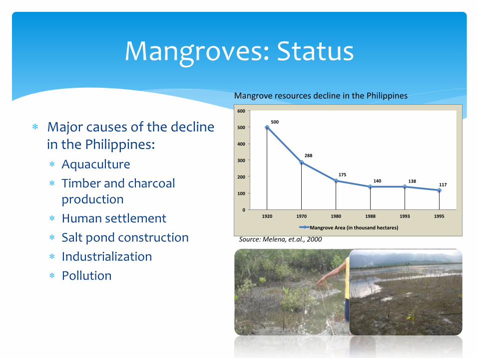
Major causes of the decline in the Philippines:
Aquaculture
Timber and charcoal production
Human settlement
Salt pond construction
Industrialization
Pollution
Mangroves: Status
500
288
175140 138
117
0
100
200
300
400
500
600
1920 1970 1980 1988 1993 1995
MangroveArea(inthousandhectares)
Source: Melena, et.al., 2000
Mangrove resources decline in the Philippines
Department of Agriculture Administrative Order #6, Series of 1998. Implementing Rules and Regulations Pursuant to Republic Act 8435: An Act Prescribing Urgent Related Measures to Modernize the Agriculture and Fisheries Sector of the Country in order to Enhance their Profitability and Prepare Said Sector for the Challenges of Globalization Through An Adequate Focused and Rational Delivery of Necessary Support Services, Appropriate Funds Transfer, and for Other Purposes
Philippine Fisheries Code of 1998

Objectives

Principles Accorded To

Bureau of Fisheries and Aquatic Resources (BFAR)
Under the Department of Agriculture
government agency responsible for the development, improvement, management and conservation of the country's fisheries and aquatic resources
Conservation Efforts
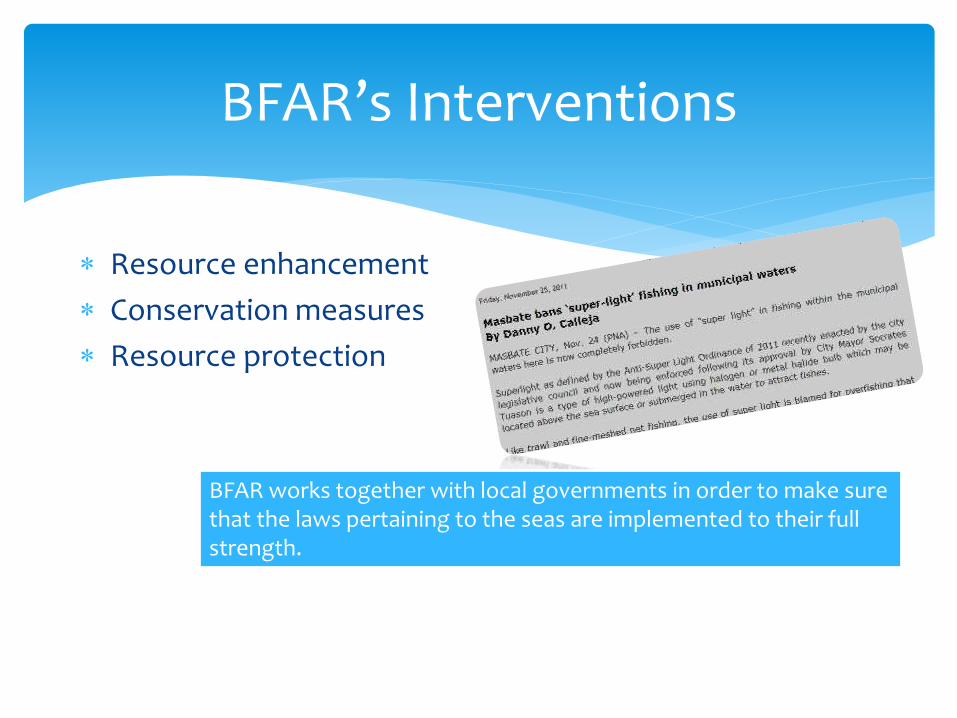
Resource enhancement
Conservation measures
Resource protection
BFAR’s Interventions
BFAR works together with local governments in order to make sure that the laws pertaining to the seas are implemented to their full strength.

Mangrove enhancement for
aquasilviculture
Mangroves can be managed
for silviculture and give annual
income up to $11,000/ha/yr
(Primavera, 1993).
At 3T mangrove trees per
hectare; the total expected
mangrove cover from 2011 to
2012 is estimated at 8,758 ha
BFAR: Resource Enhancement
Mangrove Propagules Planted

Mangrove Rehabilitation
Of the total cost of 8 pesos per
mangrove propagules planted, 6 pesos
will go directly to the participating
fisherfolk as additional income
The remaining 2 pesos will cover the
hiring of Community Organizers -
hence, jobs are also being generated.
BFAR: Resource Enhancement
Particulars Unit Cost
Mangrove propagule
P1.50
Planting (per pc.) P2.00
Survival (per pc.) P2.50
Administrative Cost (organizing, meetings and other related activities)
P2.00
Total P8.00

Sardine “closed season;” fishing bans
Seasonal closure to promote regrowth of fish populations
Expansion of sardine closure area to include Visayan Sea and the Burias Pass
Sardine production volume is expected to increase by 3-folds after 2 years of continuous compliance by commercial fishing vessels
Tuna catch is also expected to improve; the sardines being part of its food
BFAR: Conservation Measures

Apprehension and control over illegal harvesting and trade of precious corals
Minimization of overfishing and other forms of destructive fishing
Intensified monitoring, control and surveillance activities
BFAR: Resource Protection
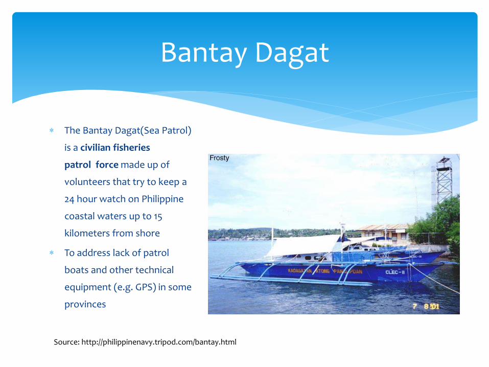
The Bantay Dagat(Sea Patrol)
is a civilian fisheries
patrol force made up of
volunteers that try to keep a
24 hour watch on Philippine
coastal waters up to 15
kilometers from shore
To address lack of patrol
boats and other technical
equipment (e.g. GPS) in some
provinces
Bantay Dagat
Source: http://philippinenavy.tripod.com/bantay.html

While extremely helpful to provincial fisheries, many have risked their lives in the dangerous effort of pursuing fishermen who conduct illegal activities.
Bantay Dagat