delta smelt turbidity monitoring project...federal judge oliver wanger ruled (case number...
TRANSCRIPT

Delta Smelt
Turbidity Monitoring Project
Jared FrantzichEnvironmental ScientistCalifornia Department of Water ResourcesDivision of Planning and Local Assistance Central District – Water Quality Evaluation SectionEmail: [email protected] Office: (916) 651-0718

Why the Delta Smelt?
Hypomesus transpacificus
(Delta Smelt)
Unusual-Life History:
Most live only one-year.
Females only produce between 1000 and 2600 eggs.
Larvae are planktonic (float with the water currents).
Limited diet.
Small Geographic Range
Spawning occurs in narrow temperature range (15-
20ºC).
Ultimately the delta smelt persists by maximizing
growth, survival, and reproduction on an
annual basis despite all the environmental and
human factors that exist in the Sacramento-
San Joaquin Delta.
Indicator Species

Project Background
August, 21-24 and 29-31, 2007 Evidentiary Hearing:
Federal Judge Oliver Wanger ruled (case number 1:05-CV-
01207-OWW-GSA):
Natural Resources Defense Council, et al.
vs.
Dirk Kempthorne (Secretary of the Interior), et al.,
2005 Long-Term State and Federal Water Projects' Pumping Operations
Criteria Plan (OCAP) and Biological Opinion.
Unlawful and inadequate in regards to the protection of the
threatened species delta smelt.
Delta Smelt Risk Assessment Matrix (DSRAM) was in violation of the
Administrative Procedure Act, 5 U.S.C. § 705 et seq.
Court Findings:

Establishment of several measures that would trigger restrictions to
both State Water Project and Central Valley Project water export
operations to reduce salvage and prevent the extinction of delta smelt.
Court Remedies:
Project Background
continued…
Turbidity and Export Pumping Compliance Criteria
As a result of the scientific evidence provided in court,
Judge Wanger included in his measures, the requirement
to monitor turbidity levels by December 25, 2007 at three
compliance stations:
1. Holland Cut near Bethel Island
2. Victoria Canal near Byron
3. San Joaquin River at Prisoner’s Point
Included in those triggers…

SJR at Prisoner’s Point
Holland Cut near Bethel Island
Victoria Canal near Byron
Map of Water Quality
Compliance Stations
Frank’s Tract
Clifton Court Forebay
Old River
Middle River

If the turbidity levels at anyone of these stations exceeds 12 NTU,
after December 25th
.
Turbidity and Export Pumping
Compliance Criteria
To insure net upstream Old and Middle
River flows are < 2,000 cfs.
Flows measured at Sacramento
River at Freeport do not exceed
80,000 cfs.
If the turbidity levels at anyone of these stations exceeds
+
= Exports for 10 days
SWP
CVP
1. Holland Cut near Bethel Island (HOL)
2. Victoria Canal near Byron (VCU)
3. San Joaquin River at Prisoner’s Point (PPT)

1. The three-day average of flow in the Sacramento River
at Freeport exceeds 80,000 cfs.
2. The Spring Kodiak Trawl survey or export facilities
show the presence of spent female delta smelt.
3. The larval delta smelt are recovered at either the
Federal (CVP) or State Water (SWP) export salvage
facility or recovered during the California Department
of Fish and Game’s 20mm survey.
TH E PU M PI N G R E STR I CTI O N CA N B E TE R M I N A TE D
I F A N Y O N E O F TH E SE TH R E E F A CTO R S E X I ST:
Turbidity and Export Pumping
Compliance Criteria continued…

Project Objectives
It is anticipated that the data gathered from this project will help
State and Federal water managers better understand delta smelt
populations to minimize possible entrainment and salvage as a
result of water export operations.
3. Establish a historical collection of accurate continuous water quality
data that can be used for future model studies.
2. Guide and coordinate the development of a complex network of continuous water quality stations that will provide information as it relates to the survival and movement of delta smelt.
1. To address Judge Wanger’s written order of turbidity compliance at stations:
- Holland Cut near Bethel Island - Victoria Canal near Byron- San Joaquin River at Prisoner’s Point
Overall Objective

Water Quality Equipment
Range: Accuracy:
0 – 1,000 NTU ± 0.3 NTU
YSI 6136
Optical Turbidity Sensor
CR1000 Datalogger Raven AirLink
Cellular Modem
CDEC

QA/QC Process
Project Response
QA/QC Protocols
Discrete Monitoring
YSI Sonde Calibrations
2100P Portable Turbidimeter
Turbidity Statistical Outlier Identification Procedure
Water Data Library
STEP 1
STEP 2
STEP 3
STEP 4
CDEC
Real-Time Event / Hourly Data

Significant Findings
Wind/Storm Event December 24 – 25, 2007
HOL turbidity levels were averaging 6.06 NTU for the month of
December, but levels changed dramatically by December 25 with a
daily average of 19.05 NTU
Turbidity levels rose above the court ordered value of 12 NTU and
reached a maximum value of 66.4 NTU.
This triggered a curtailment of pumping for 10 days

Central District and USGS staff took a closer
look at Frank’s Tract
What else could have contributed to the high turbidity levels
on December 25th?
1. WT ↓ = Bio-activity ↓ :during the late fall and early winter.
- This provides bottom sediment stability and sediment filtration.
- Bio-activity ↓ = bed material accumulation in Franks Tract and it
becomes increasingly vulnerable to mixing by a high wind event
much like the one that took place on December 24 – 25, 2007.
2. Fall/Winter estuary wind and tidal conditions in Sacramento-San
Joaquin Delta are typically associated with weak winds and weak
tides, therefore allowing for sediments to settle to the bottom and
accumulate.

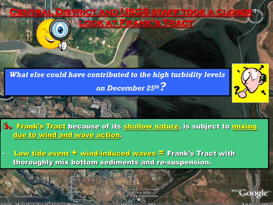
Central District and USGS staff took a closer
look at Frank’s Tract
What else could have contributed to the high turbidity levels
on December 25th?
3. On December 24th and 25th, Sacramento–San Joaquin Delta was
experiencing strong tides (solstice).
- This contributes to greater turbidity levels and allow turbidity levels
to persist for longer periods of time.
4. Franks Tract is an expansive, shallow water body with low
currents, providing ideal conditions for sediment deposition.
Central District and USGS staff took a closer
look at Frank’s Tract
What else could have contributed to the high turbidity levels
on December 25th?
5. Frank’s Tract because of its shallow nature, is subject to mixing
due to wind and wave action.
- Low tide event + wind-induced waves = Frank’s Tract with
thoroughly mix bottom sediments and re-suspension.

-2
02
4
68
10
1214
161820
22
12/23/2007 12/24/2007 12/25/2007 12/26/2007 12/27/2007 12/28/2007
Date
Win
d Sp
eed
(mph
)
Wind Speed (mph) -Ironhorse Sanitary District
-40000
-30000
-20000
-10000
0
10000
20000
30000
40000
12/23/2007 12/24/2007 12/25/2007 12/26/2007 12/27/2007 12/28/2007
Date
Flow
(cfs
)
0612182430364248546066727884
Turbidity (NTU
)
Flow (cfs) - HOLTurbidity (NTU) - HOL
12 NTU Reference
Turbidity and Flow Data
collected at
Holland Cut near Bethel Island
-December 24-25, 2007 Wind
Event
Hourly Averaged Wind Speed
Data collected at
Ironhorse Sanitary District -
December 24-25, 2007
Wind Event

Significant Findings
Onsite Investigation by Boat on December 28, 2007
HOL station was visited and the instrumentation was operating
correctly.
Discrete samples were taken using a HACH 2100P turbidimeter
starting from Old River near Bacon Island, northwest through
Franks Tract to False River near Oakley.
Staff concluded that turbid conditions in Franks Tract is probably the
source of the high turbidity readings at the HOL compliance station on
December 25.
Staff installed two new YSI 6136 optical turbidity probes on
December 28 at False River near Oakley and Old River near Bacon
Island.

Ebb-Tide
Flood-Tide

Significant Findings
Wind/Storm Event January 4, 2008
The wind event caused average turbidity levels to increase
considerably at all three stations.
HOL 7.16 NTU, OBI 5.39 NTU, and FAL 10.81 NTU.
After December 25th
HOL 15.14 NTU, OBI 15.34 NTU, and FAL 29.34 NTU.
Max at HOL = 41.20 NTU, FAL = 77.70 NTU
Maximum hourly wind speed reached an average of 26 mph – from
South East

-30000
-20000
-10000
0
10000
20000
30000
1/3/2008 1/4/2008 1/5/2008 1/6/2008 1/7/2008 1/8/2008
Date
Flow
(cfs
)
0
6
12
18
24
30
36
42
48
54
60
Turbidity (NTU)
Flow (cfs) - HOLTurbidity (NTU) - HOL
-202468
10121416182022242628
1/3/2008 1/4/2008 1/5/2008 1/6/2008 1/7/2008 1/8/2008Date
Win
d Sp
eed
(mph
)
Wind Speed (mph) -Ironhorse SanitaryDistrict
Wind Speed Data collected at
Ironhorse Sanitary District
January 4, 2008
Turbidity and Flow Data
collected on
January 4, 2008
HOL

-202468
10121416182022242628
1/3/2008 1/4/2008 1/5/2008 1/6/2008 1/7/2008 1/8/2008Date
Win
d Sp
eed
(mph
)
Wind Speed (mph) -Ironhorse SanitaryDistrict
-20000
-15000
-10000
-5000
0
5000
10000
15000
20000
1/3/2008 1/4/2008 1/5/2008 1/6/2008 1/7/2008 1/8/2008Date
Flow
(cfs
)
0
6
12
18
24
30
36
42
Turbidity (NTU)
Flow (cfs) - OBITurbidity (NTU) - OBI
Wind Speed Data collected at
Ironhorse Sanitary District
January 4, 2008
Turbidity and Flow Data
collected on
January 4, 2008
OBI

-202468
10121416182022242628
1/3/2008 1/4/2008 1/5/2008 1/6/2008 1/7/2008 1/8/2008Date
Win
d Sp
eed
(mph
)
Wind Speed (mph) -Ironhorse SanitaryDistrict
Wind Speed Data collected at
Ironhorse Sanitary District
January 4, 2008
Turbidity and Flow Data
collected on
January 4, 2008
-120000
-100000
-80000
-60000
-40000
-20000
0
20000
40000
60000
80000
100000
120000
1/3/2008 1/4/2008 1/5/2008 1/6/2008 1/7/2008 1/8/2008
Date
Flow
(cfs
)
0
6
12
18
24
30
36
42
48
54
60
66
72
78
84
Turbidity (NTU)
Flow (cfs) - FALTurbidity (NTU) - FAL
FAL

Data Summary
The use of wind speed and direction data from
Ironhouse Sanitary District
The lack of turbid water entering Sacramento-
San Joaquin Delta
It seems highly probable that Franks Tract was the source of increased turbidity levels at
all three of our monitoring locations.
Based on DWR’s continuous turbidity data
++
=

Current Network
of Water Quality Stations
Sacramento River at Verona
Export
Facilities
Compliance WQ Stations1. SJR at Prisoner’s Point
2.Holland Cut near Bethel Island3.Victoria Canal near Byron, CA.
Additional WQ Stations4. Old River at Bacon Island5. False River near Oakley6. Three Mile Slough near SJR7. Mokelumne River at HWY 128. Sacramento River at Verona9. SJR at Jersey Island
Proposed Network of
Water Quality Stations
Proposed WQ Stations10. Cache Slough at Ryer Island11. Middle River at Middle River12. Sac Deep Ship Channel13. SJR at Bradford Island14. Lisbon Slough in Yolo Bypass15. Sac River at Emmaton

Project Recommendations
First Priority:
CO M PL E TE D
Second Priority:
Cache Slough at Ryer Island
Middle River at Middle River
Sacramento Ship Channel
San Joaquin River at Bradford Island
Lisbon Slough in Yolo Bypass
Sacramento River at Emmaton
Third Priority:
Napa River at Mare Island
Suisun/Grizzly Bay
Honker Bay
Suisun Gates
Increase Water Quality Monitoring throughout the Sacramento-San Joaquin Delta by:
Establishing the remaining 10 WQ stations recommended by staff from DWR, DFG, USGS, USBR,
the State Water Contractors and The Delta Smelt Working Group.