demonstration: where’s the mote? ask the motehunter! · where’s the mote? ask the motehunter!...
TRANSCRIPT

Demonstration:Where’s the Mote? Ask the MoteHunter!
Csaba Kiraly and Gian Pietro PiccoDISI - University of Trento, via Sommarive 14, 38123 Trento, Italy
{csaba.kiraly, gianpietro.picco}@disi.unitn.it
Abstract—Contrary to laboratory environments, real-worldwireless sensor network deployments face harsh conditions wheremotes can be lost during deployment or in operation. Wedemonstrate MOTEHUNTER, a tool designed to support searchingfor such lost motes. It uses a directional antenna, a digitalcompass, and RSSI measurement, and provides a Java GUI toassist field work. It can be used to search for any mote compliantwith IEEE 802.15.4, although a special small-footprint softwarecomponent can be integrated with the mote’s application toimprove the search process.
MOTEHUNTER is described in more detail in our companionpaper accepted for SENSEAPP 2012.
Index Terms—Demonstration, wireless sensor networks, real-world deployments, localization, IEEE 802.15.4.
I. SCOPE
“Where’s the mote?” The question is not unheard whenwireless sensor networks (WSNs) are applied in-field.
Fig. 1. A WSN mote, as (not) seen from the distance of a meter.
Installing and maintaining Wireless Sensor Networks issometimes more challenging than it seems in the planningphase, especially when some of the tiny motes get lost duringthe process. Whether these have fallen in high grass, havebeen displaced by heavy rains, or one simply forgets wherethey were mounted, finding them could take considerable time.It could even lead to loss of equipment and loss of importantdata. Figure 1 demonstrates this problem showing a mote from
the distance of a meter in high grass. Barely visible — as itis known to many WSN researchers.
MOTEHUNTER is a tool developed to search for these lostmotes, supporting WSN researchers in their field work. Themain part of MOTEHUNTER is the so called “Hunter”, a com-bination of special purpose hardware, a TinyOS applicationsimilar to a sniffer, and a Java graphical user interface.
Fig. 2. The Hunter in its full configuration, equipped with a 14 dBi directionalpatch antenna.
We have developed two variants of the Hunter, one thatis based on a laptop, a mote attached to it, a directionalantenna and a digital compass (this full configuration is shownon Figure 2), and another one which is small and fits in ahand even when operating on difficult terrain (we call this thestandalone configuration, as shown on Figure 3).
Fig. 3. The Standalone Hunter with a home-made Yagi antenna constructedon a dipole base.
The mote to search for (which we call “Prey”) can be anyIEEE 802.15.4 compliant mote. The Hunter works even if no

modifications are made to this mote. However, we developeda small software-only TinyOS component that can optionallybe embedded in the Prey’s code to facilitate the hunt.
We designed the Hunter based on the following guidelines:• we try to create a cheap and readily available solution
using components that are usually already on stock inresearch groups dealing with WSNs;
• we aim at the design of a tool that someone can easilybring along while doing field work;
• our tool should be composed more like a swiss army knifethan like a monolithic tool;
• we design a graphical user interface that focuses on anintuitive visualization of the gathered data. The presenta-tion and logging of exact measurements is less important;
• we provide backup options for extreme situations, whene.g. components are not available or when the tool hasto be used on difficult terrain.
Principles of Operation MOTEHUNTER locates the Preyby taking advantage of the directionality of the Hunter’santenna, by taking RSSI (Received Signal Strength Indicator)measurements, and by using the acknowledgement feature of802.15.4.
As the Hunter’s antenna is rotated by the operator, it mea-sures the reception strength of messages sent by the Prey node.Contrary to tools that try to estimate distance based on RSSI,we only look at relative changes in the RSSI as function ofantenna orientation, and we search for the absolute maximum,and possibly local maximum points in these measurements.These correspond to the arrival angle of line-of-sight andreflected signals. After these are identified, it is the operator’srole to move around, interpret the results, and finally arrivenear enough to actually see the node with naked eyes.
Even if objects could hamper line-of-sight or rocks couldcreate strong reflections, by having a human operator thatactually sees and interprets the scene and potential reflectivesurfaces, the mote can easily be found.
Specially crafted ”ping” messages are sent out periodicallyto solicit the Prey to send messages while the antenna is beingrotated. A ping message is a standard IEEE 802.15.4 messagewith the A (ACK request) flag set. Almost any standard-compliant mote could be pinged this way, although with someissues:
• 802.15.4 acknowledgements are usually sent with the lastused (or the default) TX power level, which could be setvery low in some WSN applications;
• if LPL (Low Power Listening) is used, the mote will onlyreceive and respond to part of the ping messages.
If the software running on the mote includes the Prey compo-nent, it also recognizes the message type of the ping message,and actively responds with an application level pong messagethat resolves these problems.Software Interface The Hunter Java application presents thescreen as shown on Figure 4. It is composed of a measurementlist (left), a panorama view (middle), a time view (top), and aconfiguration panel (bottom).
Fig. 4. The user interface of the Hunter application.
The measurement list presents the list of nodes discovered inthe vicinity. The time view, at the top of the window, shows all(selected) measurements as a function of time. It could alsoshow direction measurements, thus providing correspondingRSSI and direction values on the same plot.
The panorama view, which occupies the middle of thescreen, presents the reception power from the Prey as afunction of yaw and pitch (horizontal and vertical angle). Inother words, it presents a 360◦ panorama picture of where themote could be. Brighter (green) colors indicate stronger signallevels, while darker (red) colors mean weaker measured values.The view is rotated as one turns the device.
More details about MOTEHUNTER can be found in ourcompanion paper accepted at the SENSEAPP workshop [1].
II. DEMO DESCRIPTION
We plan to demonstrate MOTEHUNTER by positioningsome WSN nodes in the demo area, showing how their relativeposition is retrieved real time by the tool. Various versions ofthe tool (full configuration with a patch antenna, standaloneconfiguration with a small home-made yagi antenna) will bepresent at the demo booth, available for visitors to pick upand try live.
Since the tool and the GUI provide a highly interactiveinterface and user experience, the live demo can show detailsthat we had no space to explain in the companion paper.For instance, users will be able to play with visualizationpossibilities, such as the ones demonstrated on Figure 5. Inour experience bin size, colors, time decay, roll sensitivityand even gamma settings have huge influence on the searchprocess, and only a live demo can provide the feeling of it.Moreover, the tool’s visualization is sensitive to position anddirection of the antenna, which is also best seen live.
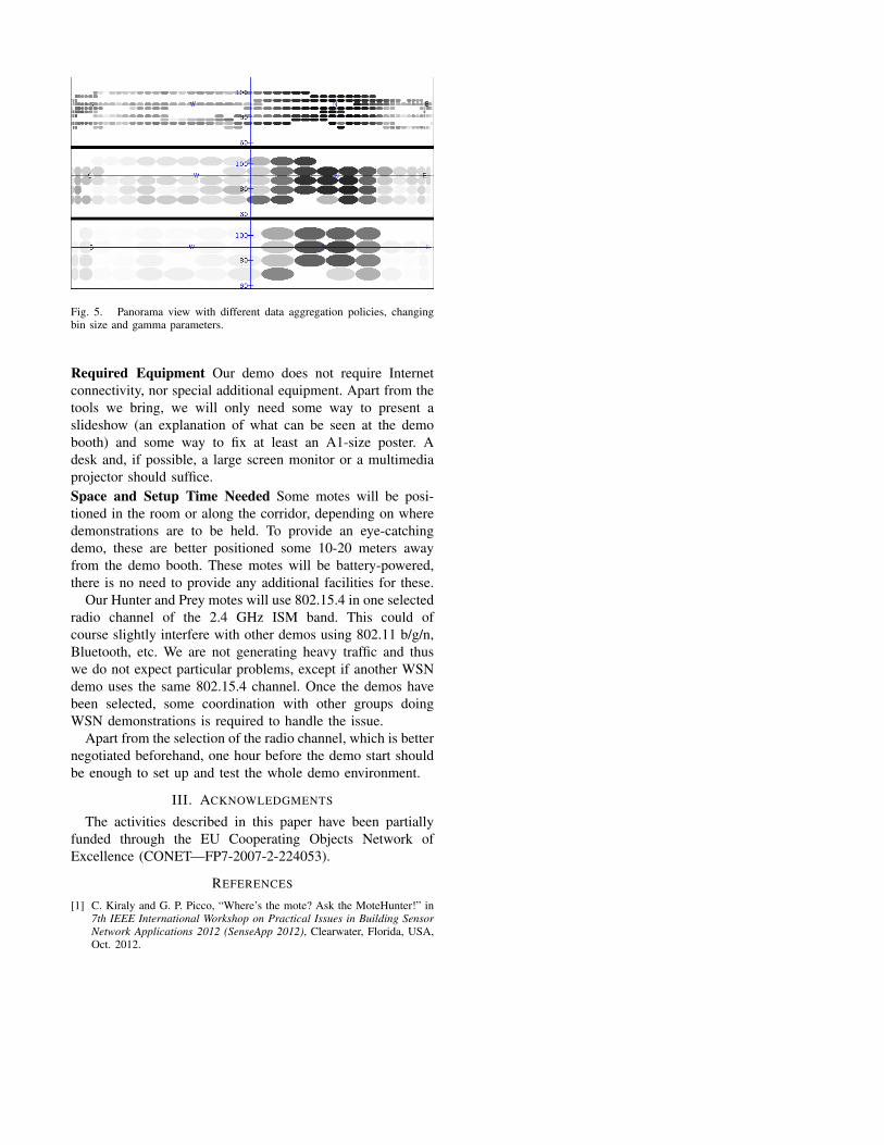
Fig. 5. Panorama view with different data aggregation policies, changingbin size and gamma parameters.
Required Equipment Our demo does not require Internetconnectivity, nor special additional equipment. Apart from thetools we bring, we will only need some way to present aslideshow (an explanation of what can be seen at the demobooth) and some way to fix at least an A1-size poster. Adesk and, if possible, a large screen monitor or a multimediaprojector should suffice.Space and Setup Time Needed Some motes will be posi-tioned in the room or along the corridor, depending on wheredemonstrations are to be held. To provide an eye-catchingdemo, these are better positioned some 10-20 meters awayfrom the demo booth. These motes will be battery-powered,there is no need to provide any additional facilities for these.
Our Hunter and Prey motes will use 802.15.4 in one selectedradio channel of the 2.4 GHz ISM band. This could ofcourse slightly interfere with other demos using 802.11 b/g/n,Bluetooth, etc. We are not generating heavy traffic and thuswe do not expect particular problems, except if another WSNdemo uses the same 802.15.4 channel. Once the demos havebeen selected, some coordination with other groups doingWSN demonstrations is required to handle the issue.
Apart from the selection of the radio channel, which is betternegotiated beforehand, one hour before the demo start shouldbe enough to set up and test the whole demo environment.
III. ACKNOWLEDGMENTS
The activities described in this paper have been partiallyfunded through the EU Cooperating Objects Network ofExcellence (CONET—FP7-2007-2-224053).
REFERENCES
[1] C. Kiraly and G. P. Picco, “Where’s the mote? Ask the MoteHunter!” in7th IEEE International Workshop on Practical Issues in Building SensorNetwork Applications 2012 (SenseApp 2012), Clearwater, Florida, USA,Oct. 2012.