development and subdivision of land
TRANSCRIPT
GUIDELINES
FOR
DEVELOPMENT AND SUBDIVISION
OF LAND
LAST REVISED DECEMBER 2003

© The AUS-SPEC Joint Venture date: Feb 2002 Copying strictly prohibited
AUS-SPEC-1\NSW-GUIDE Feb 2002 1 COUNCIL
GUIDELINES FOR DEVELOPMENT AND SUBDIVISION OF LAND
This Booklet
This Guidelines Booklet is divided into five sections:
Section ntroduction Section pplication Process Section .......................................................................................Council equirements Section ngineering Requirements Section .........................................................................Provision for ale of Allotments
Each section has a plain English description of the processes and requirements necessary progressively taking the reader from the decision to subdivide and develop land to the stage where land allotments can be sold. Keywords are provided in the right hand margin to enable readers to conveniently find passages relevant to key issues. This Guidelines Booklet is an introduction to other documentation prepared to manage Development/Subdivision matters. Other documents include: Department of Infrastructure Planning and Natural Resources (DIPNR)
• Guiding Development – better outcomes • State Environmental Planning Policies (SEPPs) • Regional Environmental Plans (REPs)
Council
• Local Environmental Plans (LEPs) • Section 94 Contribution Plans • Development Control Plans (DCPs) • Councils Policy Manual • Strategic Development Control Guidelines • Development Application Form • Construction Certificate Application Form • Subdivision Certificate Application Form • AUS-SPEC Development Design Specifications • AUS-SPEC Development Construction Specifications
Revision Note September 2001: Subdivision development was previously controlled by the Local Government Acts of 1919 and 1993. In 1998 this control was incorporated into the Environmental Planning and Assessment Act (as amended) and coincided with the introduction of private certification by accredited certifiers. This edition reflects these changes.

© The AUS-SPEC Joint Venture date: Feb 2002 Copying strictly prohibited
AUS-SPEC-1\NSW-GUIDE Feb 2002 2 COUNCIL
SECTION
INTRODUCTION
CONTENTS Flow Diagram I - Overall Process I1 Council's Objectives I2 Council's Authority I3 Restrictions to Council's Activities I4 Development and Subdivision Processes.

© The AUS-SPEC Joint Venture date: Feb 2002 Copying strictly prohibited AUS-SPEC-1\NSW-GUIDE Feb 2002 3 COUNCIL
FLOW DIAGRAM – OVERALL PROCESS
Applicant
Applicant Consults with Council Staff
Applicant Lodges Development Application with Council
Council Considers Impacts and Issues Development Consent with Conditions (if appropriate)
Applicant Applies for Construction Certificate from Council or Accredited Certifier
Council or Accredited Certifier Checks Plans and Specifications for Compliance
Council or Accredited Certifier Issues Construction Certificate
Applicant Appoints Principal Certifying Authority (PCA)
Applicant Confirms Work, Fees and Any Other Requirements
Applicant Notifies Council of Commencement, 2 days before Contractor Begins Work
Contractor Commences Construction, PCA Determines Inspections
Compliance Certificates issued, Construction Completed to PCA’s Satisfaction
PCA Issues Subdivision Certificate / Occupation Certificate
Use / land available for commencement of occupation / sale
DE
VE
LO
PM
EN
T A
PP
LIC
AT
ION
C
ON
ST
RU
CT
ION
C
ER
TIF
ICA
TE
A
PP
OIN
TM
EN
T O
F P
CA
C
ON
ST
RU
CT
ION

© The AUS-SPEC Joint Venture date: Feb 2002 Copying strictly prohibited AUS-SPEC-1\NSW-GUIDE Feb 2002 4 COUNCIL
I1. COUNCIL'S OBJECTIVES
Council has the following objectives in providing for the development and subdivision of land:
• To provide a functional, attractive and safe environment for residents that is consistent with community standards and needs.
• To minimise adverse effects on the natural environment.
• To provide for the needs of future users of the land in respect to building requirements, vehicular and pedestrian access, provision of services and an amenity appropriate to the zoning of the land.
• To assist developers by providing for the economic utilisation of the land resource of the area.
• To achieve a balance between the development / subdivision of residential, commercial and industrial land and the amenity of existing occupants .
• To provide for an equitable and efficient distribution of public amenities and services.
• To minimise Council's future maintenance costs for roads, services and open spaces.
This Guidelines Booklet provides an outline of the procedures to be followed and refers to most standards and requirements. It is not intended to be comprehensive or totally definitive. Liverpool City Council's, Local Environmental Plan, Development Control Plans, Policies, various State Legislation, Design Specifications and Construction Specifications, as well as DUAP’s (now DIPNR) publication ‘Guiding Development’, provide necessary additional information.
Additional Information
I2. COUNCIL'S AUTHORITY
Council is the authority responsible for consent to development and approval of developments and subdivisions within the Liverpool City Council area.
Council has declared Development Control Plans (DCPs) and Local Environmental Plans (LEPs) which set out Council's necessary provisions for development and subdivision. In some circumstances Council is required to obtain the concurrence of the Department of Infrastructure Planning and Natural Resources Urban Affairs and Planning, and Council must also comply with particular legislative requirements. Compliance with the provisions of Council's DCPs and LEPs does not necessarily imply that Council is required to consent to, or approve, an application.
Concurrence of DUAP
I3. RESTRICTIONS TO COUNCIL'S ACTIVITIES
Restrictions to Council's powers to approve the subdivision of land are set out in the various planning instruments, Local Environmental Plans (LEPs), State Environmental Planning Policies (SEPPs), etc which are applicable throughout Council's Area. Advice as to which of these restrictions apply to a property should be initially obtained from Council's Planning/Engineering/Environmental/Services Section.
LEPs SEPPs

© The AUS-SPEC Joint Venture date: Feb 2002 Copying strictly prohibited AUS-SPEC-1\NSW-GUIDE Feb 2002 5 COUNCIL
I4. DEVELOPMENT AND SUBDIVISION PROCESSES
A Development Application is a requirement of the Environment Planning and Assessment Act (1979) requesting consent for the proposed development in relation to Council's controls and requirements eg. land use, community facilities, traffic generation, environmental considerations etc. It is important to understand that development consent is required before land can be developed or subdivided. Council in some cases identifies minor development as Complying or Exempt Development. Detail of these minor developments and the requirements of the approval process may be obtained from Council.
Development Application and Consent
Following Development Consent being issued by Council, the more detailed requirements of the development or subdivision are investigated during the preparation of construction / engineering designs and other matters for completion as tabled in Council’s conditions of consent. A Construction Certificate is required before any works may be commenced. Construction Certificates are issued by a consent authority (Council or the Minister for Urban Affairs and Planning) or an accredited certifier and allows Developers to nominate Council or a private certifier as the Principal Certifying Authority (PCA). Subject to the provisions of section 109E of the Environment Planning and Assessment Act (1979).
Construction Certificate
Compliance Certificates are issued in relation to the completion of all or various components of a development. The PCA shall identify each stage of work to be provided with certification.
Compliance Certificates
Prior to the occupation of a new building (excluding a Class 1a or 10 building under BCA), an Occupation Certificate is to be acquired. The PCA shall upon receiving a Compliance Certificate for the various aspects of the development, provide an Occupation Certificate.
Occupation Certificates
In the case of subdivision, a Subdivision Certificate is issued by the PCA endorsing the plan of subdivision and any associated instruments when all aspects of the Development Consent have been satisfied including the Plan Registration and the Title Issue. The issue of a Subdivision Certificate occurs upon completion of all conditions and payment of fees / levies as required in the Development Consent. Councils have varying standards for the strict compliance of works or staging of developments. Council's DCP's, Policies and Standards identify any departures that may be accepted.
Subdivision Certificates
Following endorsement of the final plan of subdivision, the Developer may lodge the plan for registration by the Land Titles Office at Land and Property Information NSW. Separate titles for the new lots created will subsequently be issued.
Plan, Registration and Title Issue

© The AUS-SPEC Joint Venture date: Feb 2002 Copying strictly prohibited
AUS-SPEC-1\NSW-GUIDE Feb 2002 6 COUNCIL
SECTION
APPLICATION PROCESS
CONTENTS Flow Diagram A - The Development Application Process A1 Formulating a Development / Subdivision Application. A2 Making Application for Development / Subdivision. A3 Council's Consideration of Applications for Development / Subdivision. A4 Time Requirement to Complete Development / Subdivision Works. Appendix 1 Council's Development Application Form

© The AUS-SPEC Joint Venture date: Feb 2002 Copying strictly prohibited AUS-SPEC-1\NSW-GUIDE Feb 2002 7 COUNCIL
FLOW DIAGRAM - APPLICATION PROCESS
Prepare Outline of Proposal and Preliminary Sketch Plans
Preliminary Discussions with Council
Prepare Development Application (DA)
Is DA Required?
No
Yes
Proceed as advised
S
S
C
S
R
C
E
S NOTE:
C
denotes Applicant (Developer / Subdivider) responsibility
denotes Council responsibility
PROCEED TO FLOW DIAGRAM FOR ENGINEERING REQUIREMENTS
R denotes proceed to a flow diagram for consideration of Council’s Requirements (R)
DEVELOPMENT CONSENT GRANTED?
No
Yes
Review Proposal

© The AUS-SPEC Joint Venture date: Feb 2002 Copying strictly prohibited AUS-SPEC-1\NSW-GUIDE Feb 2002 8 COUNCIL
A1 FORMULATING A DEVELOPMENT / SUBDIVISION APPLICATION
A person or company making application to develop and/or subdivide an area of land within Liverpool City Council's area will be required to lodge a Development Application on Council's standard application form, and accompany this form with supporting information which is detailed in Section R.
Development Application Form
Before formally applying to Council to develop and/or subdivide, a considerable amount of information about the site needs to be sought. The Applicant should be aware of the nature of title of the land, easements, items of heritage significance, topography, slope and aspect, stormwater flows, surrounding development, vegetation, trees, road and traffic situations and other physical characteristics pertinent to the design of the development.
Site Information
It is recommended that a preliminary consultation with Council will enable the Applicant to determine what Council and State environmental planning instruments (SEPP, REP or LEP) are applicable, what zone classification applies and which legislative requirements are applicable and most importantly whether professional assistance is required.
Early Consultation
It is advantageous to prepare a preliminary sketch plan at this early stage indicating the location, aspect and size of the various elements of the development including subdivision patterns surrounding the site. Appendix 2 is an example of a sketch plan. The more information shown on the preliminary sketch plan, the more likely the consultations with Council and others will give a true indication of possible success with a subsequent formal application.
Sketch Plan
The purpose of consultation about preliminary sketch plans/proposals (which may be accompanied by explanatory reports or background material) is to:
Purpose of Consultation
• assess whether any modifications to the proposal are necessary prior to its being formally submitted;
• identify Council's requirements in regard to the particular Development Application;
• identify any problems which may necessitate the Applicant reviewing his/her approach;
• indicate Council's likely subsequent requirements (eg financial contributions for services and amenities, standards for construction, for the asset to be accepted by Council, etc.).
While consultation with Council at this early stage and the preparation of preliminary sketch plans is not mandatory, it is obviously in the Applicant’s interest. It will reduce costs in preparing plans, increase the likelihood of Development Consent, and reduce the time the Council needs to consider the formal application. Similarly early consultation with Public Utility Authorities is also advantageous to ascertain their requirements, eg water, sewer, gas, telephone, electricity.
The applicant is advised to contact council to seek the current process of pre DA meetings/consultation. At the time of the creation of this guidelines document Liverpool City Council organised weekly pre DA meetings for applicants.
Consultation is Not Mandatory
Fees for Development Applications are prescribed in the Environmental Planning and Assessment Regulations. A fee schedule can be obtained from Council including fees/contributions which are not prescribed, but are likely to be required as a condition of Development Consent.
Fees/ Contributions

© The AUS-SPEC Joint Venture date: Feb 2002 Copying strictly prohibited AUS-SPEC-1\NSW-GUIDE Feb 2002 9 COUNCIL
A2 MAKING APPLICATION FOR DEVELOPMENT / SUBDIVISION
A Development Application is only required if stated in the environmental planning instrument(s) applying to the land (SEPP, REP or LEP). Minor development and subdivisions such as boundary adjustments which meet specified standards, as set out in councils DCP Number 32 – “Exempt Development”, do not require consent. The applicant is advised to contact council to confirm whether an application falls under exempt development. All the necessary information should have been compiled in consultation with Council. Whilst formulating the application and preparing the development/subdivision sketch plan, a description of the existing and proposed site and a statement of environmental effects should be included.
Development Application Information
The written authority of the owner is required to be submitted with the application form if the application is not by the owner of the land to be developed.
Owner's Approval
A Development Application is required for all types of subdivision and all forms of building construction not identified by Council as being Exempt or Complying Development. Development Applications are made on Council's standard Development Application form which is included in these Guidelines as Appendix 1.
Development Application Form
Development Applications are to be accompanied by three (3) copies of development/ subdivision sketch plans drawn on one of the following paper size sheets, A1, A2, A3 or A4. For sketch plan requirements, refer to Section R of these Guidelines.
Number of Plan Copies
In addition, the Applicant may be required to provide details of consultation with public authorities responsible for provision, alteration or amplification of utility services required by the proposed development / subdivision.
Details of Consultation with Public Authorities
Council may require additional information about the proposed development to be provided where that information is essential to the assessment of the Development Application.
Additional Information
Additional information required may include:
• principles, assumptions and calculations behind stormwater drainage and on-site detention (OSD) proposals;
• rationale for the design of utilities, roads, open space, bicycle and pedestrian ways, bus routes, etc;
• a contamination assessment. (SEPP 55)
• evaluation of housing types, house type distribution, building lines, fencing, building materials etc.
A checklist used by Councils Land Development Engineers to assess development applications received, is enclosed in Appendix 2. The applicant is encouraged to utilise these checklists and ensure all items suggested are incorporated into plans submitted as part of any development application.
During preparation of the Application, the Applicant must incorporate
the Council requirements. Refer to Section R for more detailed information.
R

© The AUS-SPEC Joint Venture date: Feb 2002 Copying strictly prohibited AUS-SPEC-1\NSW-GUIDE Feb 2002 10 COUNCIL
A3 COUNCIL'S CONSIDERATION OF APPLICATIONS FOR DEVELOPMENT AND SUBDIVISION
Council will deal with each application on its merits, however, the assessment criteria in the Environmental Planning and Assessment Act 1979 (Section 79C) shall be applied.
Assessment Criteria
These criteria relate to site specific relevant matters such as:
• the provisions of any environmental planning instruments, development control plans and regulations pertaining specifically to the subject site;
• natural and built environmental impacts;
• social and economic environmental impacts;
• suitability of the site;
• public interest.
Council's LEP, DCPs and other planning instruments incorporate minimum design standards for different types of developments. These standards should not be interpreted as relieving the Applicant of the responsibility to properly address all criteria and to use sound planning and engineering practices in the development of designs. Council is prepared to consider alternative approaches to development / subdivision design where the Applicant satisfies Council that its objectives have been achieved.
Design Standards
Planning legislation requires Council to determine applications within 40 days of receipt of the application, or 60 days where the application requires referral to other authorities. Upon determination of any application, a written notification will be sent to the Applicant stating that consent has been granted subject to detailed conditions, or that consent has been refused (with reasons).
Determination within 40 days
Where an Applicant is dissatisfied with the determination of an application, a request for review of the application or of particular conditions of consent may be lodged by the Applicant as specified in Section 82A of the EP & A Act 1979. The request for reconsideration must be lodged within 28 days of determination. A reconsideration fee will be required and details of the reasons for reconsideration must be submitted with the request.
Re- consideration
Alternatively, (and preferably as a last resort), the Applicant may lodge an appeal with the Land and Environment Court. Such an appeal is required to be lodged with the Court within twelve months of receipt of Council's determination of the application.
Appeal to Court
Applicants are reminded that any third party person may lodge an appeal to the Land and Environment Court where they believe a breach of the EP & A Act (1979) has occurred (Section 123 of the EP & A Act).
Appeal by Third Party
Council can revoke or modify consent in circumstances where there is fraud or failure to comply with the Local Government Act (1993) or conditions of consent. The Environmental Planning & Assessment Act 1979, Orders also allows Council to issue orders for breaches of the EP&A Act such as non compliance with conditions of consent.
Revocation of Consent

© The AUS-SPEC Joint Venture date: Feb 2002 Copying strictly prohibited AUS-SPEC-1\NSW-GUIDE Feb 2002 11 COUNCIL
Once an application for development or subdivision receives consent, the Applicant becomes the Developer.
Development Consent Received
A4 TIME REQUIREMENTS FOR DEVELOPMENT / SUBDIVISION WORKS
A development consent for development / subdivision requires works to be commenced within the consent period of five years (or such other shorter period stipulated in the consent). The development / subdivision should be fully completed within a reasonable period or as directed by Council.
Maximum 5 Year Limit on Development Consent
In some cases a development may be of sufficient magnitude that it requires staging. Where staged development is proposed, the Applicant should prepare a sketch plan showing the complete concept so that Council can see the various stages in the overall context. Each stage should comply with the standard requirements.
Staged Development
When all conditions of Development Consent and Construction Certificate approval have been satisfied, including all construction works required as part of the subdivision being completed, the Developer will arrange for a Registered Surveyor to prepare the final survey plan. This “original” plan, plus 15 copies, together with any Section 88B Instrument under the Conveyancing Act (detailing easements, restrictions etc) is submitted to the PCA with the appropriate fees for the PCA’s endorsement of the Subdivision Certificate.
Where council is the PCA the applicant should ensure that all items on the subdivision certificate checklist (copy enclosed in appendix 3) have been provided to council with the subdivision certificate application. Council will not commence assessment of the certificate prior to all this information being provided.
Subdivision Final Survey Plan Original Plan Release Fees
Council may allow the private sector to issue subdivision certificates by identifying, in its Local Environmental Plans, the type of subdivision that can be privately certified.
Private Certification
The original plan, plus one copy, together with any Section 88B Instrument, all personally signed by the PCA, are then released to the Developer.
Section 88B Instrument
In order to effect plan registration and the issue of new titles for the proposed subdivision lots, the documents released should be lodged promptly with Land and Property Information NSW (Land Titles Office).
Issue of New Titles

© The AUS-SPEC Joint Venture date: Feb 2002 Copying strictly prohibited AUS-SPEC-1\NSW-GUIDE Feb 2002 12 COUNCIL
SECTION
COUNCIL REQUIREMENTS FOR THE DEVELOPMENT APPLICATION
CONTENTS Flow Diagram R - Council Control and Requirements R1 Environmental Considerations R2 Development /Subdivision Requirements - Urban Residential Areas R3 Development /Subdivision Requirements - Rural Residential Areas R4 Development /Subdivision Requirements - Rural Development Areas R5 Development /Subdivision Requirements - Industrial/Commercial Areas R6 Development /Subdivision Requirements - Natural Hazard Areas R7 Provision of Open Space and Section 94 Contributions Plan R8 Development /Subdivision Sketch Plan Requirements

© The AUS-SPEC Joint Venture date: Feb 2002 Copying strictly prohibited AUS-SPEC-1\NSW-GUIDE Feb 2002 13 COUNCIL
NOTE: * Council's Staff Referal comments will Consider among other things:
• Environmental Assessment - is an Environmental Impact Statement (EIS) or Review of Environmental Factors (REF) required? - is a geotechnical or hydrological report required? - is a tree preservation or heritage preservation an issue? • Zoning requirements. • Infrastructure requirements (roads, water, sewer, drainage). • Easements. • LEP & DCP compliance
FLOW DIAGRAM - COUNCIL DEVELOPMENT APPLICATION CONTROL AND REQUIREMENTS
A Prepare Development Application (DA) Council Development Control
Plans/Soecifications/Policies
Submit DA to Council
* Staff provide referral comments on DA
Does Council Support
Proposal? Reconsider Application
Are Authorities Comments Required?
Seek Comments Plans & seek public comments
Consider Responses
Reconsider Application or appeal to the Land and
Environment Court
Is Public Comment Required?
Is Proposal Acceptable?
Development Consent Granted
E
C S
S
C
S
C
C
C
C
S
S NOTE:
C
denotes Applicant (Subdivider) responsibility
denotes Council responsibility
E denotes proceed to a flow diagram for Engineering Requirements (E)
No
Yes
No No
Yes Yes
Yes No

© The AUS-SPEC Joint Venture date: Feb 2002 Copying strictly prohibited AUS-SPEC-1\NSW-GUIDE Feb 2002 14 COUNCIL
R1 ENVIRONMENTAL CONSIDERATIONS
Statement of Environmental Effects
A Statement of Environmental Effects is required for most development applications for development / subdivision. This statement normally addresses such matters as:
Information
• suitability of the land
• access
• traffic generation
• risk of flooding or other natural hazard
• flora and fauna
• local amenity
• waste management
• Threatened Species Act
• filling / earthworks
• erosion and sediment control/soil and water management
Tree Preservation
The development / subdivision sketch plan shall identify vegetation that is significant to the overall landscape of the area. Trees to be removed shall also be identified on the sketch plan.
Trees are not to be pruned, damaged or removed without the prior consent of Council in accordance with Council's Tree Preservation Order. Council's Tree Preservation Officer is to be contacted prior to any clearing or underscrubbing being carried out.
Tree Preservation Officer
Any significant tree/s identified by Council shall be protected at all times during excavation and/or construction, and Council may require the Developer to lodge a bond at the time of Construction Certificate approval, to be forfeited in the event that the trees are either damaged or removed. Any such bond is to remain in force for a period of six (6) months after the issue of the Compliance Certificate for a component of the work, Occupation Certificate or Subdivision Certificate whichever is applicable.
Lodging of Bond
Heritage Items
In general any sites of Aboriginal carvings or relics or sites significant to heritage for other reasons shall be identified in the application. The National Parks and Wildlife Service should be contacted for details and verification.
Aboriginal and other Relics
All recognised heritage items, including natural features of the site and man-made buildings, works and sites are to be identified and retained, wherever possible. For Heritage items identified in Council’s LEP development consent is required for alterations, additions or development. The Heritage Council should be contacted for details and verification. Adequate curtiledge is to be retained around any heritage item to protect its setting.

© The AUS-SPEC Joint Venture date: Feb 2002 Copying strictly prohibited AUS-SPEC-1\NSW-GUIDE Feb 2002 15 COUNCIL
R2 DEVELOPMENT / SUBDIVISION REQUIREMENTS - Urban Residential Areas
Urban residential land is defined as land within areas zoned residential, village or township. Applicants will be required to provide fully serviced subdivisions including the provision of a sealed road system with drainage, and kerb and gutter to adequately and safely provide both vehicular and pedestrian access to each allotment. The Applicant will be required to meet the full cost of kerb and guttering across all existing road frontages of any development / subdivision in urban areas except where direct vehicular access is restricted. Roads adjoining a reserve are to be provided with kerb and gutter to adequately and safely provide both vehicular and pedestrian access. Footpaths may also be required as tabled within Councils standards .
Full Service
Kerb & Gutter
There are statutory requirements and Council requirements pertinent to lot sizes, lot widths, building line set backs etc, and the supply of services to allotments. Council sets out these requirements for each zone type. The designer of a subdivision is required to provide for the requirements of Council's LEP/DCPs. Council will have requirements on access to developments / subdivisions with the objectives of:-
Lot Size
• providing for flow of through traffic with least disruption; Road Traffic
• establishing a hierarchy of roads in accordance with function and usage;
• providing a variation in alignment to allow for existing natural features and create interest in the streetscape;
• providing a network of safe pedestrian and cycle paths. Pedestrians and Cyclists
Legal easements of width as determined by the Council Codes and Specifications are to be provided over stormwater drains and watercourses.
Applicants will be required to augment and meet the full cost of water and sewerage reticulations, as arranged with the relevant water and sewerage Authority, within developments / subdivisions plus the cost of connecting to existing services.
Water and Sewerage
Electricity services are to be extended to the development / subdivision in accordance with the requirements of the relevant electricity Authority and at full cost to the Applicant. Underground electricity services will be required except where it can be shown that it is not appropriate.
Electricity
Streetlighting shall be designed by the applicant to Councils Streetlighting code and applicants will be required to meet the full cost of streetlighting installation.
Streetlighting
Applicants will be required to provide for Telephone facilities within the design. Where underground electricity is used, underground telephone facilities are also to be provided by the applicant.
Telephone
Urban stormwater runoff will need to be assessed in terms of satisfactory performance both within the development and external to the development to a legal point of discharge.
Stormwater Runoff
Notwithstanding the requirements above the development shall be designed in accordance with the relevant DCP/s for the area and councils Development Design Specifications

© The AUS-SPEC Joint Venture date: Feb 2002 Copying strictly prohibited AUS-SPEC-1\NSW-GUIDE Feb 2002 16 COUNCIL
R3 DEVELOPMENT / SUBDIVISION REQUIREMENTS - Rural Residential Areas
Rural residential land defined as rural homesite and hobby farm land shall require kerb and guttering and underground stormwater drainage where specified in Council’s standards. Concrete lined table drains shall be required where scour velocities are exceeded and/or the soils are susceptible to erosion from stormwater.
Kerb & Gutter
There are statutory requirements and Council requirements pertinent to lot sizes, lot widths, building line set backs etc and the supply of services to allotments. Council's DCPs, LEP or other adopted standard set out these requirements for each zone type. The designer of a subdivision is required to comply with the requirements of Council's Development Control Plans (or Interim Development Orders) LEP and various Acts of State Legislation.
Lot Size
Effluent disposal will normally be by way of appropriate on-site disposal. However where the development is in near proximity to an existing sewered area or where, in the opinion of the Department of Health or Council's Health and Building Department, the land is unsuitable for site disposal of effluent, connection to sewerage will be required. A geotechnical report to support sewerage treatment proposals is to accompany an application for on site sewage management this type of the development.
Sewerage
The configuration of the subdivision is to have consideration for natural features such as rivers, creeks, topography of the land, tree groupings and prominent natural features. The design should also consider buffers for conflicting land uses, water courses, etc.
Natural Features
Sites considered to be environmentally sensitive, such as estuarine wetlands, rainforests, dunal areas, steep slopes and flood prone lands will not be considered for subdivisional development.
Sensitive Environments
SEPP 46 identifies the protection and management of native vegetation in rural areas, in addition to the Threatened Species Act.
A covenant may be required on larger lots being subdivided prohibiting the ringbarking, cutting down, topping, pruning, removal, endangering or wilful destruction of any tree without the consent of Council. Where it can be demonstrated that such actions would not result in a loss of any significant stands of trees and/or soil erosion could not be accelerated due to tree removal, a covenant is not required.
Covenant on Land Clearing
R4 DEVELOPMENT / SUBDIVISION REQUIREMENTS - Rural Development Areas
Rural land is defined as that land other than urban and rural residential and land generally comprising larger holdings. Applicants will be required to provide an all-weather road system to provide a functional and safe vehicular access to the development or each allotment.
All Weather Roads
The designer of a development / subdivision is required to provide for the requirements of Council's Subdivision Code Development Design Specifications and Development Control Plans.
Bitumen sealing of the road system will be required on all new roads and existing roads which will be an extension of existing sealed roads unless specified otherwise by Council. Council will not approve the development / subdivision of lands proposing non-dedicated road access (eg private road systems) however consideration will be given to the creation of a right-of-way to serve allotments having the minimum dedicated road frontage but not
Sealing of Roads

© The AUS-SPEC Joint Venture date: Feb 2002 Copying strictly prohibited AUS-SPEC-1\NSW-GUIDE Feb 2002 17 COUNCIL
having road access. Such right-of-way is to link directly to an existing or proposed dedicated road and constructed in accordance with Councils standards.
Minor subdivisions in isolated rural areas require a reasonable standard of all-weather access road suitable for all year round access for essential services, ie school bus, ambulance etc. Each proposal will be considered on its merits in accordance with the following guidelines:
(a) The status of the road.
(b) Existing road surface condition.
(c) Cost of upgrading.
(d) Flooding frequency and hazards of creek or river crossings.
(e) Potential population catchment.
(f) Bush Fire Hazard
The extension of electricity mains to each allotment within the subdivision is required. However, subdivisions in areas remote from electricity mains may be relieved of this requirement, if special circumstances prevail and details of such circumstances are submitted to Council by the Applicant, together with the written agreement from the electricity supply authority.
Electricity
R5 DEVELOPMENT / SUBDIVISION REQUIREMENTS – Industrial/ Commercial Areas
The Local Environment Plan identifies various types of commercial and industrial zones. All proposed commercial and industrial subdivisions would be anticipated to be located in these zones. It is essential that early consultation with Council Officers is sought to determine that the proposed development/subdivision is in an allowable zoning and is in conformity with Council’s planning principles for the area.
LEP
The Applicant should provide for a range of lot sizes for the needs of large as well as small developments. Any lot should be large enough for parking and landscaping as well as the specific industrial or commercial use. Industrial developments/subdivisions should generally comply to the standards suggested in the State Planning Authority Technical Bulletin No.6 “Design and Standards for New Industrial Areas” (June 1974). Both commercial and industrial subdivisions will need to comply with the Development Control Plan (DCP) for the area.
Lot Size
Engineering Road Design and Pavement Design will need to provide for heavy traffic conditions as specified by Council.
Pavement for Heavy Traffic
Applicants will be required to meet the full cost of water and sewerage reticulations within developments/subdivisions plus the cost of connecting to existing supplies in accordance with the relevant water and sewerage Authority requirements.
Water and Sewerage
Electricity services are to be extended to the developments/subdivision and in accordance with the requirements of the relevant electricity supply Authority at full cost to the Applicant. Determination of the maximum loading of the electricity service, and whether the service is provided above ground or underground, will be made by the relevant electricity Authority and Councils acceptance.
Electricity
Applicants will be required to provide for telephone facilities within the development. Where underground electricity is used, underground telephone facilities are also to be
Telephone

© The AUS-SPEC Joint Venture date: Feb 2002 Copying strictly prohibited AUS-SPEC-1\NSW-GUIDE Feb 2002 18 COUNCIL
provided by the Applicant.
R6 DEVELOPMENT/SUBDIVISION REQUIREMENTS - Natural Hazard Areas
Development/Subdivisions of land susceptible to tidal inundation or coastal erosion are considered Designated Developments and require Environmental Impact Statements in accordance with the Director of DIPNR (formally Department of Urban Affairs and Planning) requirements.
Flooding Coastal Erosion
The subdivision of flood prone land is to comply with the requirements of Council's Development Control Plans, Floodplain Management Plan, Flood Prone Land Policies and the New South Wales Government's Floodplain Management Manual, the Management of Flood Liable Land, 2001.
Policies
Council will only support development/subdivisions of rural properties, part of which are flood prone, if in Council's opinion there are adequate flood free homestead and stock-holding areas on each allotment as well as access to higher ground. Development will not be allowed to significantly alter flooding patterns, accordingly development of internal roads etc will not be permitted to form significant embankments. Each case to be treated on its merits.
Adequate Flood Free Areas
The development/subdivision of urban land, other than boundary adjustments, will only be considered where it can be clearly demonstrated that flood free building sites/allotments can be provided and that the creation of these developments/allotments will not adversely affect flood patterns or levels in the area. Where council requests a flood study/ report may be required to address flooding concerns.
Flooding in Urban Areas
Applicants will be required to provide suitable protection zones and access for fire fighting vehicles and maintenance vehicles so as to minimise the risk of bushfire damage.
Bushfire Protection
R7 PROVISION OF OPEN SPACE AND SECTION 94 CONTRIBUTIONS PLAN
Council's authority to impose conditions of contribution is derived from the Environmental Planning and Assessment Act 1997, Section 94. Accordingly Council's contribution requirements for all subdivisions will be in accordance with an adopted "Section 94 Contributions Plan", Liverpool Contributions Plan 2001 (as amended). The contributions plan is available for a fee from councils customer service counter.
In residential subdivision (both rural and urban) Council requires the creation of an area of public reserve (open space) useable for recreation, or payment of a monetary contribution in lieu of land or a combination of both.
Public Reserve
Public reserve will not normally be required in rural subdivision, unless the subdivision contains significant areas of special scenic or public recreational value.
Rural Public Reserve
In rural subdivisions, commercial or industrial subdivisions contributions of open space are less often required, however contributions towards upgrading roads, community facilities and bushfire protection will be required as determined by the appropriate "Section 94 Contributions Plan".
Contributions in Rural, Commercial, Industrial Subdivisions
Applicants will also be required to contribute towards the augmentation of water supply if reticulation is available to the development in the form of sewerage headworks and arterial roadworks where upgrading requirements can be attributed to the development.

© The AUS-SPEC Joint Venture date: Feb 2002 Copying strictly prohibited AUS-SPEC-1\NSW-GUIDE Feb 2002 19 COUNCIL
R8 THE DEVELOPMENT/SUBDIVISION SKETCH PLAN REQUIREMENTS
The development/subdivision sketch plans to accompany the Development Application Form shall show the following:
Plan Detail Required
(a) Reduction ratio (preferably 1:500 for subdivisions, 1:100 for structures / developments).
(b) The location, boundary dimensions, site area and north point of the land.
(c) The existing vegetation and trees on the land (attention is drawn to Council’s Tree Preservation Order).
(d) The location and uses of existing buildings on the land and adjoining properties. (Measured floor plans of existing buildings may also be necessary in order for Council to calculate floor space ratios.)
(e) Contours based on existing levels of the site (preferably one metre intervals drawn to Australian Height Datum). Design contours where the site is to be cut and/or filled.
(f) Any natural features of the site, including rock formations or cliffs, watercourses, flood levels, wetlands, forest areas and slip areas.
(g) Any existing drains, easements or rights-or-way affecting the site.
(h) Title description of land.
(i) Details of existing and proposed subdivision pattern (including the number of lots and location of roads).
(j) Any heritage items (buildings and sites), or relics defined by the Heritage Act or considered of local significance.
(k) Details of proposed access to the site and the legal status of that access.
(l) Other details relevant to consideration of the application
**Notwithstanding the above, additional items may need to be shown on the DA sketch plans to incorporate the requirements of the relevant DCP for the development, and engineering checklists items provided in Appendix 2.
© The AUS-SPEC Joint Venture date: Feb 2002 Copying strictly prohibited AUS-SPEC-1\NSW-GUIDE Feb 2002 20 COUNCIL
SECTION
ENGINEERING REQUIREMENTS
CONTENTS Flow Diagram E - Engineering Requirements E1 Engineering Drawings and Specifications E2 Commencement of Work E3 Inspection and Testing E4 Insurances E5 Work-as-executed Drawings E6 Quality Assurance Principles

© The AUS-SPEC Joint Venture date: Feb 2002 Copying strictly prohibited AUS-SPEC-1\NSW-GUIDE Feb 2002 21 COUNCIL
FLOW DIAGRAM - ENGINEERING REQUIREMENTS
R
Engineering Design Drawings & Specifications
Arrangement with Utility Authorities
Design Specifications
Construction Specifications
Council or Accredited Certifier issues Construction
Certificate & Commencement of Work
Council or Accredited Certifier’s Staff Checks
Design and Specifications
S
Council checks not required
S
C
C
S S
C
C
S NOTE:
C
denotes Applicant (Subdivider) responsibility
denotes Council responsibility
S denotes proceed to a flow diagram for the Provision of Sale of Allotments (S).
S or
or S

© The AUS-SPEC Joint Venture date: Feb 2002 Copying strictly prohibited AUS-SPEC-1\NSW-GUIDE Feb 2002 22 COUNCIL
E1 ENGINEERING DRAWINGS AND SPECIFICATIONS
All Drawings for earthworks (site regrading), roadworks, drainage works, water supply, sewerage works, and foreshore works are to be certified by a Civil Engineer or Registered Surveyor accredited by the Institution of Surveyors for civil design in the appropriate area. All Drawings for bridgeworks, retaining walls, other major structures and pumping stations are to be certified by a Civil Engineer.
Qualification of Designers
Standard Drawings, Design Specifications and Construction Specifications have been prepared by Council and can be purchased for use in developments/subdivisions. Specifications other than those supplied by Council are required to be prepared by a Civil Engineer and will need to be submitted to the Principal Certifying Authority (PCA) for approval with each set of engineering Design Drawings. Such alternative specifications will be required to meet Council’s minimum standards contained in Council’s specifications.
Council's Specifications
In summary the requirements for Design Drawings are provided in Annexure DQS-B of councils “Quality Assurance for Engineering Design” document. A copy of this annexure s provided in Appendix 4 of this guidelines document. In Councils Development Construction Specifications the “Superintendent” shall mean Liverpool City Councils Engineer for all developments undertaken in councils road reserve, public reserve or drainage reserve, council owned land or easements and for all subdivision/engineering works on private land where council will issue the Construction Certificate as per Part 4A of the Environmental Planning and Assessment Act (1979). For all other subdivision works the “Superintendent” shall mean the Accredited Certifier (subdivisions) or Liverpool City Councils Engineer or councils nominated representative.
E2 COMMENCEMENT OF WORKS
No development/subdivision works are to be undertaken until the Design Drawings and Specifications are formally approved by Council or an Accredited Certifier with the issue of a Construction Certificate.
Works within a public road reserve, public reserve or council drainage reserve or easement must be approved by council via a Permit to Carry out Works (Section 138 Roads Act 1993 or Section 68 Local Government Act 1993 Permit). No works are to commence or construction certificate/s issued prior to the applicant obtaining these permits.
Any plans submitted whether to Council or an Accredited Certifier shall include certification reports in accordance with the requirements set out in councils “Quality Assurance Requirements for Design”, Development Design Specification. This information shall be provided to the Council or Accredited Certifier’s satisfaction prior to the issue of any Construction Certificate/s.
Necessary Conditions
Development consent to the development/subdivision will stipulate whether the development/subdivision is to be constructed as a "Quality Assured Contract" in which case a Quality Plan will need to be submitted to cover all construction works in accordance with Council's Contract Quality System Requirements Specification. Acceptance of the submitted Quality Plan will be required prior to commencement of Works.
Quality Assurance
Where a Quality Assurance contract is not a requirement and a Quality Plan is not Quality

© The AUS-SPEC Joint Venture date: Feb 2002 Copying strictly prohibited AUS-SPEC-1\NSW-GUIDE Feb 2002 23 COUNCIL
therefore provided, it will be necessary as a minimum requirement that the Developer’s Superintendent or Superintendent's Representative under the Contract be nominated and approved as suitably qualified and experienced.
Control
The Developer must ensure that the Works are carried out in compliance with the Local Government Act 1993. Attention is drawn specifically to Chapter 16 Offences. Part 3 Clause 634(1) and (4) especially refer to unauthorised work for water and sewerage.
Unauthorised Work for Water and Sewerage
The Developer must ensure that water and sewerage works abide by the Local Government Act and associated Regulations, in particular, Clauses 18 and 19 of the Local Government Act (Approvals) Regulation 1999 regarding complying with any operating requirements notified by the Council.
Water and Sewerage, Operating Requirements
E3 INSPECTIONS AND TESTING
Whether the development/subdivision proceeds under Quality Assurance Contract or not, the full cost of all testing is to be met by the Applicant (Developer). Test results will be required to ensure that the material supplied and the Work carried out conforms with the approved specification.
Cost of Quality Testing
Similarly joint inspections at key stages of construction will be required to be carried out by representatives of both Works Certifier and the Developer/Supervising Consultant (Contractor). All inspections shall require at least 24 hours prior notification to the Works Certifier. Key stages may include: • Site regrading and clearing • Installation of erosion control measures • Preservation measures installed for trees, vegetation or heritage sites as determined • Site sampling and testing • Formwork and reinforcement prior to placing of concrete • Drainage line installation prior to backfilling • Water and sewer line installation prior to backfilling • Subgrade preparation • Establishment of line and level for kerb and gutter placement • Road Pavement construction • Road Pavement surfacing • Prior to the construction of Path Paving • Final Inspection • End of maintenance period • Others deemed critical by Council or the Accredited Certifier
Inspections
The Works Certifier will insist on uninterrupted access at all times so as to enable audit inspections or testing. Records of all test results required will be made available to the Works Certifier promptly when requested and tests will be undertaken strictly to prescribed test procedures by testing organisations approved by Council prior to work commencement. Certain stages of construction will be subject to a hold on works pending acceptable test results. See construction specifications for further details.
Records of Testing and Inspections
E4 INSURANCES
The Developer’s Supervising Consultant (contractor) shall take out professional indemnity insurance indemnifying themselves. The Developer’s Supervising Consultant will also provide the PCA with evidence that all Contractors have obtained appropriate third party and public risk insurance ( minimum insured value $10 million) satisfactory to the PCA’s requirements and prior to the commencement of any works.
Third Party Insurance Public Risk

© The AUS-SPEC Joint Venture date: Feb 2002 Copying strictly prohibited AUS-SPEC-1\NSW-GUIDE Feb 2002 24 COUNCIL
E5 WORK-AS-EXECUTED DRAWINGS
Following completion of the work, one two full set of Work-As-Executed (WAE) Drawings marked up in red showing any discrepancies from the design is to be submitted to and retained by Council. All WAE Drawings shall bear the Supervising Consultant’s or Accredited Certifier’s Certification stating that all information shown on the Drawings is accurate. Council may also accept WAE Drawings in electronic format with suitable certification.
Accredited Certifiers are to ensure that all compliance certificates and reports are submitted to council. (refer to subdivision certificate plan checklist in Appendix 3 for an indicative list of compliance certificates and reports required to be provided)
Certification
For water supply WAE Drawings must allow Councils to meet their obligations under Clause 17 of the Local Government (Water Services) Regulation 1999.
Council’s Obligations, Water Services
E6 NOT USED

© The AUS-SPEC Joint Venture date: Feb 2002 Copying strictly prohibited AUS-SPEC-1\NSW-GUIDE Feb 2002 25 COUNCIL
SECTION
ALLOTMENTS FOR SALE
CONTENTS Flow Diagram S - Provision of Allotments for Sale S1 Completion of Works and Certification. S2 Early Release of Allotment by Application of Engineering Bonds


© The AUS-SPEC Joint Venture date: Feb 2002 Copying strictly prohibited AUS-SPEC-1\NSW-GUIDE Feb 2002 27 COUNCIL
NOTE: W.A.E. denotes Works-as Executed and describes plans and drawings showing as built details. LPINSW denotes Land and Property Information NSW
* Refer to Subdivision Certificate checklist in Appendix 3 for general Compliance Certificate requirements
FLOW DIAGRAM - PROVISION OF ALLOTMENTS FOR SALE
E
Construction. Final Inspection Completed.
PCA checks that all works conform to approval
Original Plan of Subdivision & 88B
* W.A.E. Drawings/ compliance
certificates/reports
Section 94 & other contributions, fees &
securities
S
S S S
C
Council’s Subdivision Officer certifies Original Plan
and issues Subdivision Certificate
Original Plan lodged with LPINSW
LPINSW issues Titles SALE OF LAND
C
S
S
S
C
denotes Applicant (Subdivider) responsibility
denotes Council responsibility
© The AUS-SPEC Joint Venture date: Feb 2002 Copying strictly prohibited AUS-SPEC-1\NSW-GUIDE Feb 2002 28 COUNCIL
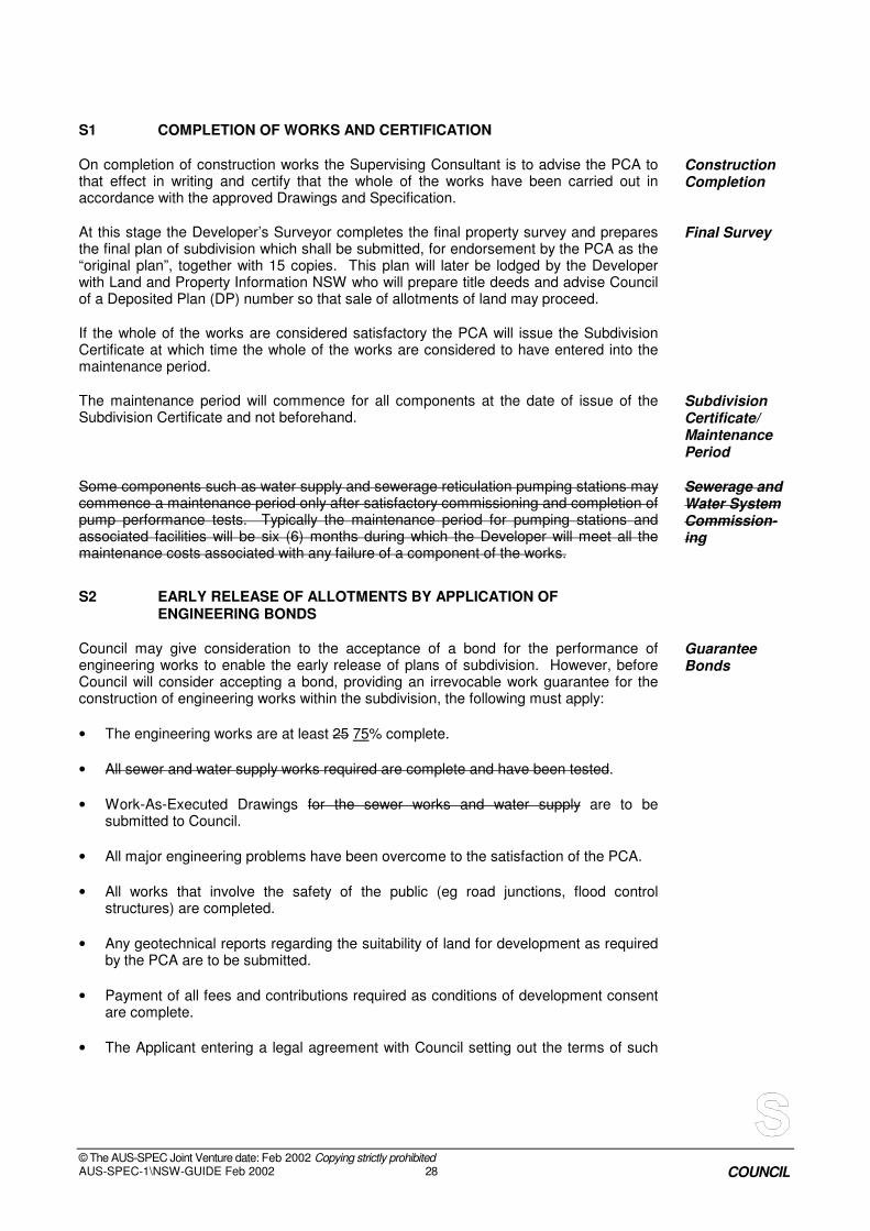
S1 COMPLETION OF WORKS AND CERTIFICATION
On completion of construction works the Supervising Consultant is to advise the PCA to that effect in writing and certify that the whole of the works have been carried out in accordance with the approved Drawings and Specification.
Construction Completion
At this stage the Developer’s Surveyor completes the final property survey and prepares the final plan of subdivision which shall be submitted, for endorsement by the PCA as the “original plan”, together with 15 copies. This plan will later be lodged by the Developer with Land and Property Information NSW who will prepare title deeds and advise Council of a Deposited Plan (DP) number so that sale of allotments of land may proceed.
Final Survey
If the whole of the works are considered satisfactory the PCA will issue the Subdivision Certificate at which time the whole of the works are considered to have entered into the maintenance period.
The maintenance period will commence for all components at the date of issue of the Subdivision Certificate and not beforehand.
Subdivision Certificate/ Maintenance Period
Some components such as water supply and sewerage reticulation pumping stations may commence a maintenance period only after satisfactory commissioning and completion of pump performance tests. Typically the maintenance period for pumping stations and associated facilities will be six (6) months during which the Developer will meet all the maintenance costs associated with any failure of a component of the works.
Sewerage and Water System Commission-ing
S2 EARLY RELEASE OF ALLOTMENTS BY APPLICATION OF ENGINEERING BONDS
Council may give consideration to the acceptance of a bond for the performance of engineering works to enable the early release of plans of subdivision. However, before Council will consider accepting a bond, providing an irrevocable work guarantee for the construction of engineering works within the subdivision, the following must apply:
Guarantee Bonds
• The engineering works are at least 25 75% complete.
• All sewer and water supply works required are complete and have been tested.
• Work-As-Executed Drawings for the sewer works and water supply are to be submitted to Council.
• All major engineering problems have been overcome to the satisfaction of the PCA.
• All works that involve the safety of the public (eg road junctions, flood control structures) are completed.
• Any geotechnical reports regarding the suitability of land for development as required by the PCA are to be submitted.
• Payment of all fees and contributions required as conditions of development consent are complete.
• The Applicant entering a legal agreement with Council setting out the terms of such

© The AUS-SPEC Joint Venture date: Feb 2002 Copying strictly prohibited AUS-SPEC-1\NSW-GUIDE Feb 2002 29 COUNCIL
bonds.
Bonds for engineering works required as a condition of subdivision approval will generally be for a maximum period of one (1) year.
Period of Bonds
Bank guarantees and interest bearing deposits in the name of Council only will be accepted for works with a value in excess of $5,000.00.
A bond fee is payable where a bond has been lodged to guarantee the completion of engineering works. (The bond fee is set out in Council's Schedule of Fees and Charges.)
Bond Fee
The bond amount may be progressively reduced as the work covered by the bond is carried out but at no time will the bond amount fall below 10% of the contract amount or the estimated total cost of the works. The Supervising Consultant will be required to lodge a schedule of quantities of all outstanding works to enable the bond amount to be determined. Any bonds accepted for incomplete works shall be at the rate of 130 150%.
Limits on
Outstanding
Bonds


© The AUS-SPEC Joint Venture date: Feb 2002 Copying strictly prohibited
AUS-SPEC-1\NSW-GUIDE Feb 2002 COUNCIL
APPENDIX 1
Council’s Development Application Form

© The AUS-SPEC Joint Venture date: Feb 2002 Copying strictly prohibited
AUS-SPEC-1\NSW-GUIDE Feb 2002 COUNCIL
(To be provided by Council)

© The AUS-SPEC Joint Venture date: Feb 2002 Copying strictly prohibited
AUS-SPEC-1\NSW-GUIDE Feb 2002 COUNCIL
APPENDIX 2
Development Application Checklist

© The AUS-SPEC Joint Venture date: Feb 2002 Copying strictly prohibited
AUS-SPEC-1\NSW-GUIDE Feb 2002 COUNCIL
Development Application Checklist
Lot and DP description:
DA file number:
Location Description:
EXISTING TOPOGRAPHIC PLAN, SUPPLIED BY APPLICANT:
Trees indicated? Existing site contours shown in sufficient extent? Are scales indicated on the plan? Does plan qualify scale ie NTS
Spot levels shown on critical points? Natural Water Courses identified? Dimensions of the property boundaries shown? North Point shown on the plan Contours and levels in AHD? Levels extend into adjoining properties? Overhead power and other services shown on the street frontage?
INFORMATION PROVIDED BY ADMIN. OFFICER:
Eview street and site plan with flood layer? Council use only Dates on referral correct? Council use only File reference number shown? Council use only Copy provided of the DP and 88B instrument? Council use only
SITE INSPECTION
Visual verification on site of submitted existing topographic (topo) plan, Deposited Plans and 88B?
Council use only
Observe any features not shown on topo plan including location of neighbours assets.
Council use only
Observe adjoining properties and conditions. (Sight over fences for relative levels, and changes proposed to any existing overland flow paths across boundaries)
Council use only
Observe existing drainage infrastructure Council use only Observe existing road infrastructure. Council use only
SITE LAYOUT / CONCEPT GRADING PLAN SUPPLIED BY APPLICANT
Does site conform to DA plan? Boundary dimensions shown. North point and scales shown. Existing contours and levels shown and in AHD(metres)
Details of retaining walls shown?

© The AUS-SPEC Joint Venture date: Feb 2002 Copying strictly prohibited
AUS-SPEC-1\NSW-GUIDE Feb 2002 COUNCIL
Cut and fill limits shown? Is subdivision lot layout proposed in accordance with councils DCP’s? i.e. frontage widths and lot areas conform.
Have following items been shown in accordance with councils DCP - Road layout
- Road widening identified - Public open space identified - Drainage reserve identified - Cycleway’s identified - Roundabouts/traffic facilities accounted for - Landscape strips/acoustic fence/s
accounted for
Check lot access to Council Roads.
CONCEPT DRAINAGE PLAN
Are design contours shown that adequately describe the finished site?
Is the drainage connecting to an existing Council Drainage system.?
Is the drainage connecting to a pipeline in a private easement? If so does the property have rights to connect? (check 88B instrument)
If the drainage connects to the easement pipe has the pipe sufficient capacity for site and roof water of new proposal? (If insufficient may need pre DA provision of new easement purchase from neighbours!)
Has the applicant provided hydrological and hydraulic calculations addressing the suitability of future connections to Council or private drainage?
Is there any on site detention? (Refer to Council’s On Site Detention Policy and Design Specification requirements.)
On site detention check list: 1. Proposed location of OSD facility
accurately dimensioned? 2. Type of onsite detention identified? 3. Point of discharge identified? 4. Overland flow path for surcharge
identified? 5. Grades, pipe sizes, orifices, pits,
swales shown and dimensioned? 6. Design contours shown? 7. Weir location and RL identified? 8. Pre and post development drainage
calculations shown?

© The AUS-SPEC Joint Venture date: Feb 2002 Copying strictly prohibited
AUS-SPEC-1\NSW-GUIDE Feb 2002 COUNCIL
Is the stormwater both onsite and overland from neighbouring properties adequately controlled within this site? Have they been included in the calculations?
Details provided demonstrating that the overland flow off this site will not cause a nuisance to neighbours and makes its way to existing council trunk drainage system.
Details provided demonstrating that the upstream catchment has been adequately catered for?
Details provided demonstrating that the downstream discharge will not cause any nuisance to downstream properties.
Is the site flood affected? If there is any doubt has the applicant gained a 149 Certificate indicating 1% AEP level. Is the floor level identified as per policy?
Has the existing downstream drainage system been assessed?
Are any works within 40 metres of a natural watercourse requiring DIPNR notification and certification?
Is the trunk drainage infrastructure proposed in accordance with councils DCPs?
FOR RURAL DEVELOPMENTS ONLY
Has the applicant indicated discharge to rubble pit? Has a design size been provided? Check location of rubble pit for proximity of overflow to neighbours assets
CONCEPT ROAD AND TRAFFIC ACCESS PLAN
Is this site affected by road widening? Traffic interface of driveways with existing road? (Has a referral been sent to Traffic. Ask Planner to see referral from Traffic!)
Does subdivision have access to a dedicated public road?
Is road layout and road reserve width in accordance with councils DCP ?
Is proposed road widening shown in accordance with councils DCP and LEP?
Is interface with existing adjoining roads safe? Need to pre-empt if site distance and rider comfort will become an obvious problem.
Is there an interface with RTA or crown lands? If so has comment been sought from the RTA?
Has a temporary turning head facility been shown, to accommodate garbage vehicle turning movements.
Does the road suggest any grudge strips? If so will need to amend to remove.
Turning movements OK to get access for each designated garage and carspace?

© The AUS-SPEC Joint Venture date: Feb 2002 Copying strictly prohibited
AUS-SPEC-1\NSW-GUIDE Feb 2002 COUNCIL
FOR RURAL DEVELOPMENTS ONLY
Does the development create increased traffic movements ? Will it cause problems for the public road shoulder? Will any required vehicle access create dust problems for neighbours ?
Does the proposal detail a new vehicle crossing driveway on Council road?
Will the driveway require a pipe culvert or dish concrete across the table drain ?
SEDIMENTATION AND EROSION CONTROL
Does the concept drainage plan include a sedimentation and erosion control plan?
Does the plan conform to Councils Policy and Code.? If the sedimentation plan failed would the overflow go to the street or cause neighbour nuisance?
Does the sedimentation plan need integration with staged drainage construction to prevent failure?
VEGETATION
Have impacts on existing vegetation on site in regards to:
- locations of proposed roads - amount of filling - possible utility and infrastructure
placement been checked
SITE INSPECTION NOTES:

© The AUS-SPEC Joint Venture date: Feb 2002 Copying strictly prohibited
AUS-SPEC-1\NSW-GUIDE Feb 2002 COUNCIL
APPENDIX 3 Subdivision Certificate (Linen Plan)
Checklist

© The AUS-SPEC Joint Venture date: Feb 2002 Copying strictly prohibited
AUS-SPEC-1\NSW-GUIDE Feb 2002 COUNCIL
SUBDIVISION CERTIFICATE (LINEN PLAN) CHECK LIST
Str
ata
Subdiv
isio
n
Bdy A
dju
stm
ent
Subd.. +
roadw
ork
Subd. N
o r
oadw
ork
Com
m. T
itle (
no r
oad)
Easem
ent only
Neighbourhood Management Statement Neighbourhood Development Contact Assets Management Plan ( if specified in the Da consent only) Linen + 10 copies 88B instrument Water Board Section 73 Certificate Telecommunication Certificate Integral Energy Notification of Arrangement Work as Executed Plans Compliance Certificates for:
Road Pavement Drainage Service Crossings Structures Pits, headwalls etc,. Road fill areas identified on the plan Road fill compaction reports from geotechnical engineer Lot fill areas identified on the plan Lot fill compaction report from the geotechnical engineer Imported fill contamination report
Lot Classifications Section 94 fees, and payment letter Linen release and 88B fees paid Footpath paving contribution paid Maintenance bond for roadworks (not required for private certification) Asphalt bond for final seal layer at 80% house completion. Other bonds as required by the DA or requested by applicant.
Notes: 1. Section 73 certificates may be delayed until immediately prior to linen release 2. Any bonding requests not required by Council policy are subject to an administration fee 3. Bonds require a completed application form 4. Bonds can be cash or unconditional bank guarantee.

© The AUS-SPEC Joint Venture date: Feb 2002 Copying strictly prohibited
AUS-SPEC-1\NSW-GUIDE Feb 2002 COUNCIL
APPENDIX 4 Requirements for Design Drawings

© The AUS-SPEC Joint Venture date: Feb 2002 Copying strictly prohibited
AUS-SPEC-1\NSW-GUIDE Feb 2002 COUNCIL
The following is an extract taken from councils “Quality Assurance for Engineering Design” Specification - ANNEXURE DQS-B. It represents typical drawing requirements council expects for Engineering Requirements.
EXAMPLE COMPILATION OF DRAWINGS A. ROADWORKS PLANS An example of the sequence of drawing sheets acceptable to Council in the compilation of a full set of Roadworks Drawings is set out as follows. Sheet N
o TOPIC
1 Development Consent Number and/or Roads Act Section 138 permit number
Locality Sketch and Index of Sheets.
2 General Subdivision Plan with contour details, proposed and existing, and a clear indication of the extent of work.
3 Typical Road Cross Sections showing road widths, pavement (design) configuration, batter
slopes, footpath location, kerb and gutter types.
4. Plan and Longitudinal Section of each road showing setout data and services. 5. Road Cross Sections.
6. Kerb Return profiles/details.
7. Intersection Layout Details.
8. Traffic calming devices details (including roundabout details).
5. Drainage Catchment Plan and Schedule of Drainage Elements (Pipe lines and structures).
NOTE: Drainage drawings documentation to be provided shall be in accordance with the requirements detailed in Development Design Specification “D5 – Stormwater Drainage Design” clauses D5.22 and D5.24.
6. Drainage Profiles/longsections
7. Drainage Structure Details.
9. Drainage calculation tables 10. Pavement Marking and Signposting.
11. Traffic Management Plan
11. Erosion and Sedimentation Control Plan / Soil and Water Management Plans in
accordance with the requirements of development design specification “D7 – erosion Control and Stormwater Management” (short term and long term treatment).
12. Structure Details – Bridges, Retaining Walls, etc. 13. Street Lighting Design Plan
NOTE 1. Any one set of Roadworks Plans may require more than 1 sheet for each of the topics listed
and may also require supplementary sheets for site specific details 2. Scales are required to be nominated on all drawings and north points shown on all plan
views. 3. Site Specific drawings may need to be added to list to include supplementary works required for the subdivision/engineering works (i.e. water pollution control ponds, basins, drainage channels, cycleways, public reserve and drainage reserve works, bridge crossings, gross pollutant trap structures, landscape plans).