digitalglobe evolving geospatial technologies in new paradigm yong.pdf · digitalglobe proprietary...
TRANSCRIPT

DigitalGlobe Proprietary and Business Confidential
DigitalGlobe Evolving Geospatial Technologies in New Paradigm Derren Yong Senior Director, Asia Pacific Commercial Sales
Sentosa,Singapore | June 14, 2012 | WorldView-2

DigitalGlobe Proprietary and Business Confidential
GeoSmart Asia 2015 Plenary
DigitalGlobe is…
The market leader in remote sensing
IKONOS® .82 meter resolution 9 m CE90
QuickBird® .65 meter resolution 23 m CE90
WorldView-4® Launch
scheduled: Fall 2016
WorldView-3® .30 meter resolution
<3.0 m CE90
WorldView-2® .46 meter resolution
<3.5 m CE90
GeoEye-1® .46 meter resolution
<3.5 m CE90
WorldView-1® .50 meter resolution <4 m CE90
AVAILABLE VIA DIGITALGLOBE ARCHIVE
CURRENTLY IMAGING IN ORBIT

DigitalGlobe Proprietary and Business Confidential
30 cm
GeoSmart Asia 2015 Plenary
DigitalGlobe is…
The undisputed resolution king
1 m 70 cm 50 cm 30 cm

DigitalGlobe Proprietary and Business Confidential
ONLY in the industry BEST in the industry
GeoSmart Asia 2015 Plenary
DigitalGlobe is…
An industry pioneer in technological innovation.
FIRST in the industry
First 30 cm satellite imagery
First to deliver high-resolution SWIR capabilities
First satellite with better than 5 m accuracy
Best current and historical library of Earth imagery
Best daily refresh rates
Best comprehensive Earth coverage
Only company with sub-70cm satellite imagery
Only company with over 5 billion sq. km. of archived imagery
Only company with 4 high-resolution satellites in orbit
98% coverage
>5 billion sq. km.
30 cm

GeoSmart Asia 2015 Plenary
Leading the evolution of analytics The Commercial Geospatial Intelligence industry has experienced four eras:
1st Era: Resolution
2nd Era: Accuracy
3rd Era: Speed
4th Era: Analytics
Customer needs evolve beyond aerial
DigitalGlobe drives “one meter” standard
Emergence of map making industry and
greater accuracy drives
growth
DigitalGlobe drives the
5.0 meter CE90 spec
Reliance on imagery at an all-time high and
customer priority
becomes speed and
relevancy
DigitalGlobe drives on-demand standard
DigitalGlobe drives 8-band standard and custom analysis
New valuable problem- solving uses emerging
and priority becomes
measuring on surface
and below water
DigitalGlobe Proprietary and Business Confidential
DigitalGlobe Evolving Geospatial Technologies in New Paradigm

DigitalGlobe Proprietary and Business Confidential
The answers DigitalGlobe delivers are enabled by our geospatial analytics approach
GeoSmart Asia 2015 Plenary

100 Resilient Cities: DigitalGlobe’s Offerings
Infrastructure Development and Disaster Management
GeoSmart Asia 2015 Plenary

DigitalGlobe Proprietary and Business Confidential
HuangShi National Mining Area
GeoSmart Asia 2015 Plenary

DigitalGlobe Proprietary and Business Confidential
Infrastructure Development • Create highly accurate maps that can be created quickly to help you effectively plan for
resources such as roads, bridges, tunnels, canals, dams, and buildings. • Huangshi is growing rapidly, and it can be difficult to keep land use records accurate
and current. Combine DigitalGlobe satellite imagery with current city land information to get the most up-to-date data for your city. This is perfect for better understanding land applications like infrastructure planning.
2014 Mar 2015 Jun
Changes in Huangshi Industrial Area
GeoSmart Asia 2015 Plenary

DigitalGlobe Proprietary and Business Confidential
Disaster Mitigation and Crisis Response ~Mitigate the impact of disasters before they happen~
• DigitalGlobe's satellite imagery and elevation technologies allow you to map evacuation
routes and areas of importance as well as increase environmental awareness. • Pre disaster imagery can be compared with post disaster imagery to get an accurate
assessment of the damaged and affected areas
Landslide in Huangshi
2014 Mar 2015 Jun
GeoSmart Asia 2015 Plenary
DigitalGlobe Proprietary and Business Confidential
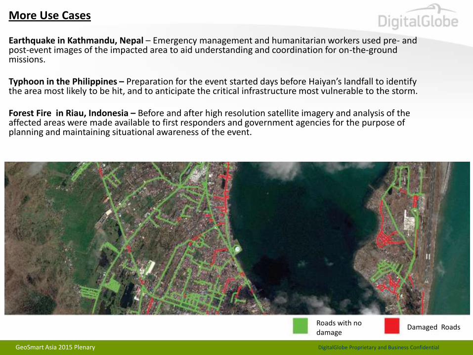
More Use Cases Earthquake in Kathmandu, Nepal – Emergency management and humanitarian workers used pre- and post-event images of the impacted area to aid understanding and coordination for on-the-ground missions.
Typhoon in the Philippines – Preparation for the event started days before Haiyan’s landfall to identify the area most likely to be hit, and to anticipate the critical infrastructure most vulnerable to the storm.
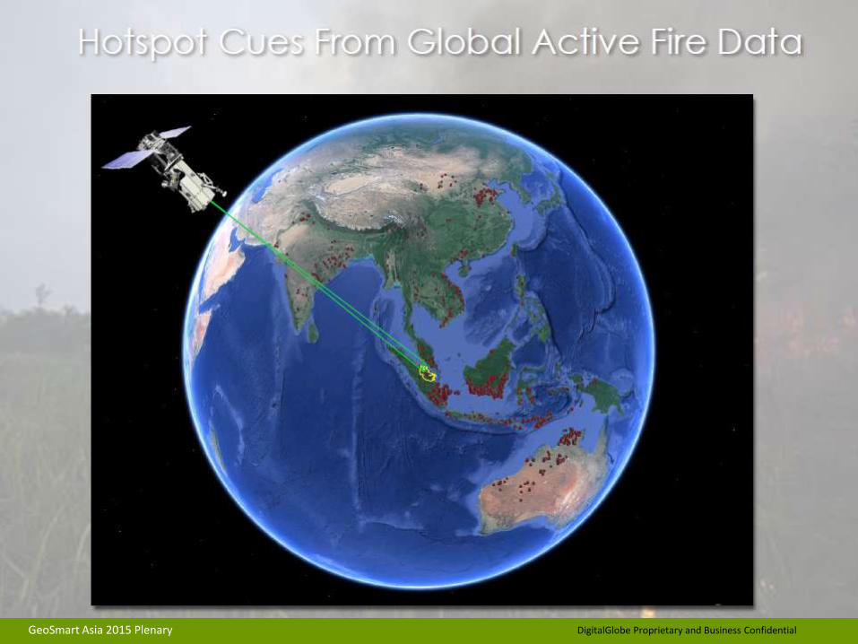
Forest Fire in Riau, Indonesia – Before and after high resolution satellite imagery and analysis of the affected areas were made available to first responders and government agencies for the purpose of planning and maintaining situational awareness of the event.
Roads with no damage
Damaged Roads
GeoSmart Asia 2015 Plenary

DigitalGlobe Proprietary and Business Confidential
Kathmandu Earthquake, Nepal Case Study

DigitalGlobe Proprietary and Business Confidential
DigitalGlobe Proprietary and Business Confidential
GeoSmart Asia 2015 Plenary

DigitalGlobe Proprietary and Business Confidential
ACQUIRED: 27.APR.2015 (WV3) ACQUIRED: 25.OCT.2014 (WV3)
Nepal Earthquake (25.APR.2015) – DigitalGlobe Supports Response Efforts
Dharahara Tower in Kathmandu, Nepal
GeoSmart Asia 2015 Plenary

DigitalGlobe Proprietary and Business Confidential
FirstLook Service – 7 Days of Imagery Collections over Nepal
GeoSmart Asia 2015 Plenary

DigitalGlobe Proprietary and Business Confidential
DigitalGlobe Proprietary and Business Confidential
GeoSmart Asia 2015 Plenary
59,000 TAGGERS
900,000 TAGS PLACED
5.3 MAP
VIEWS
MILLIO
N

DigitalGlobe Proprietary and Business Confidential
DigitalGlobe Proprietary and Business Confidential
7,027 MAJOR DESTRUCTI0N
10,058 DAMAGED BUILDINGS
420 DAMAGED ROADS /
BRIDGES
4,229 TENTS / SHELTERS
GeoSmart Asia 2015 Plenary

DigitalGlobe Proprietary and Business Confidential
Rapid, light-weight delivery to the field GeoSmart Asia 2015 Plenary
DigitalGlobe Proprietary and Business Confidential
Tyhoon Haiyan, Philippines Case Study

DigitalGlobe Proprietary and Business Confidential
Tacloban City, The Philippines: Disaster Response
DigitalGlobe’s rapid and comprehensive response to the damaging Typhoon in Tacloban City, Philippines is a good case-study of how the constellation, analysis and the FirstLook program can help a variety of customers
19,000 sqkm of imagery (3 days after event) Event Date : Friday, November 8, 2013
GeoSmart Asia 2015 Plenary

DigitalGlobe Proprietary and Business Confidential
ACQUIRED: 11.NOV.2013 ACQUIRED: 1.SEP.2013
Pre and Post Event Imagery Available
Super Typhoon Haiyan: The Philippines
GeoSmart Asia 2015 Plenary

DigitalGlobe Proprietary and Business Confidential
FirstLook Report
GeoSmart Asia 2015 Plenary
DigitalGlobe Proprietary and Business Confidential
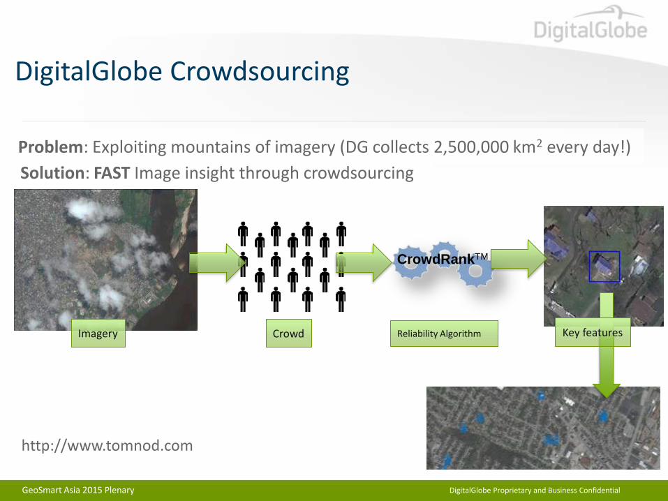
DigitalGlobe Crowdsourcing
Solution: FAST Image insight through crowdsourcing
Problem: Exploiting mountains of imagery (DG collects 2,500,000 km2 every day!)
CrowdRankTM
Imagery Crowd Reliability Algorithm Key features
http://www.tomnod.com
GeoSmart Asia 2015 Plenary

DigitalGlobe Proprietary and Business Confidential
Crowdsourcing: Tacloban City, The Philippines
GeoSmart Asia 2015 Plenary

DigitalGlobe Proprietary and Business Confidential
CrowdSourcing – Support Statistics for Haiyan
GeoSmart Asia 2015 Plenary

DigitalGlobe Proprietary and Business Confidential
Forest Fire, Riau,Indonesia Case Study
DigitalGlobe Proprietary and Business Confidential
GeoSmart Asia 2015 Plenary

DigitalGlobe Proprietary and Business Confidential
GeoSmart Asia 2015 Plenary

DigitalGlobe Proprietary and Business Confidential
GeoSmart Asia 2015 Plenary

DigitalGlobe Proprietary and Business Confidential
GeoSmart Asia 2015 Plenary

DigitalGlobe Proprietary and Business Confidential
GeoSmart Asia 2015 Plenary
DigitalGlobe Proprietary and Business Confidential
GeoSmart Asia 2015 Plenary
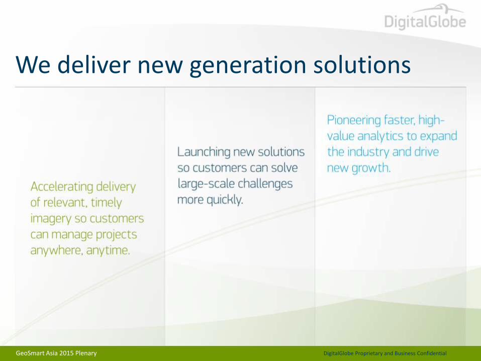
We deliver new generation solutions

DigitalGlobe Proprietary and Business Confidential
GeoSmart Asia 2015 Plenary
Bandarbi, Sudan | February 1, 2012 | WorldView-2
THANK YOU !

DigitalGlobe Proprietary and Business Confidential
GeoSmart Asia 2015 Plenary