disaster risk reduction a planning approach
TRANSCRIPT

DISASTER RISK REDUCTION –A PLANNING APPROACH
Sanjukta Bhaduri
Director & HOD
Department Of Urban Planning
School Of Planning And Architecture New Delhi, India

EMERGING AREAS
• Shift from Disaster relief and response to Disaster mitigation/risk reduction
• Participatory planning approach
• Multi hazard, multi stakeholder approach
• Linkages between government, non-government and people
DEPTT. OF URBAN PLANNING SCHOOL OF PLANNING AND ARCHITECTURE , NEW DELHI.

The way forward
• Spatial context of social vulnerability
• Mainstreaming disaster risk management in the planning process
• Risk sensitive planning process
DEPTT. OF URBAN PLANNING SCHOOL OF PLANNING AND ARCHITECTURE , NEW DELHI.

Planning ProcessRisk Sensitive Planning Process
Vision, Aim and Objectives
Surveys/ Baseline Information
Collection
Status Assessment
Plan Preparation
Estimations/ Future Projections
SAFE CITY/ RESILIENT CITY
Risk and Hazard mapping, Vulnerability Atlas, Land use
& Development Pattern, Comprehensive Database
Impact Studies, Future Growth patterns, possibility of future
disaster risk
Hazard & Vulnerability assessmentCapacity & Capability assessment
Impact assessment
Disaster Mitigation Plan
Plan Implementation – Evaluation and Monitoring

Detailed Data and Information of the
• Drainage patterns of the area surrounding the river basin
• Floodplain mapping
• Catchment areas
• Low-lying areas
• Other important geographical features
• Population densities therein
• Settlement patterns
• Land use pattern and activity structure
• Nature and types of buildings, etc
DEPTT. OF URBAN PLANNING SCHOOL OF PLANNING AND ARCHITECTURE , NEW DELHI.
Generation of Comprehensive Information Base

1. The Flood Prone Areas in the river plans (protected / unprotected) are indicated in the Flood Atlas of India.
2. Besides above areas, other areas can be flooded, mainly because of ;
a. Heavy Intensity Rains,
b. Inundation on Depression,
c. Back flow in Drains,
d. Inadequate Drainage,
e. Failure of protection Works.
3. These areas can be identified through Local Contour Surveys, & Flood History of Planning Area.
STRATEGIES FOR FLOOD PRONE AREAS
DEPTT. OF URBAN PLANNING SCHOOL OF PLANNING AND ARCHITECTURE , NEW DELHI.
IDENTIFICATION OF FLOOD PRONE AREAS :
LAND USE ZONING FOR FLOOD SAFETY.
1. Preparation Flood Contour Map.
2. Regulation for Land Use Zoning.

TWO ZONE APPROACH : FLOOD-PRONE AREA MAY BE BROKEN DOWN
INTO FLOODWAY AND FLOOD PLAIN COMPONENTS

ONE ZONE APPROACH

Land Use Restructuring & Zoning in the Flood plain
The Land use and the activity pattern of the flood prone area is extremely crucial in
the effectiveness of the flood mitigation measures.
A detailed plot-wise land use survey needs to be conducted so as to create an
accurate picture of the river basin as well as the surrounding flood prone areas.
Some of the main measures to be undertaken during the landuse planning are-
• Prohibition of any Industrial & manufacturing activities in the flood plain.
• Creation of buffer zone all along the river and strong regulatory measures to
prevent any encroachments.
• Only recreational activities like parks, gardens, playareas may be allowed
within the buffer zone. This will also add to the green cover of the city.
Construction of strong, high, steep sloped embankment walls along the river would
control the overflowing river during monsoons. This would also create a barrier to
halt the encroachments on the river banks.
STRATEGIES FOR FLOOD PRONE AREAS
DEPTT. OF URBAN PLANNING SCHOOL OF PLANNING AND ARCHITECTURE , NEW DELHI.

Various legislations have been enacted regarding the land use zoning regulations in
hazard prone area, with the purpose of
1.Providing regulations for development in particular area to serve desired purpose
efficiently & to preserve its character.
2.Providing a legal tool fop guiding the use of land & protection of public health,
welfare safety.
STRATEGIES FOR FLOOD PRONE AREAS
DEPTT. OF URBAN PLANNING SCHOOL OF PLANNING AND ARCHITECTURE , NEW DELHI.
REGULATIONS FOR LAND USE ZONING FOR NATURAL HAZARD PRONE AREAS
NOTIFIED UNDER SECTION :
1.u/s 73 (f) MODEL TOWN & COUNTRY PLANNING ACT 1960
2.u/s 143 (f) MODEL TOWN & COUNTRY PLANNING AND DEVELOPMMENT
LAWS
3.u/s 180 (f) MODEL TOWN & COUNTRY PLANNING AND DEVELOPMMENT
LAWS OF UDPFI GUIDELINES

No consideration of conserving/protecting the
• natural drainage system of Greater Mumbai , that is a major problem in the city and have facilitated floods.
• watershed areas,
• river basins,
• drainage network, etc.
• wetlands, marshy areas, forest areas
No attempt to identify the vulnerable communities due to high densities, poor built structures and infrastructure status.
No mention about the adaptive capacities of the people, institutions, localised options in case of emergency.
No focus on capacity building and community empowerment
DEPTT. OF URBAN PLANNING SCHOOL OF PLANNING AND ARCHITECTURE , NEW DELHI.
Development Plan of Mumbai

DEPTT. OF URBAN PLANNING SCHOOL OF PLANNING AND ARCHITECTURE , NEW DELHI
Land use changes in Mumbai

• Coherent process of Policies - Plans – Programmes – Projects
• Implementation and post implementation management of risk reduction projects
• Coordinated effort by organisations/ overcoming jurisdictional conflicts
• Regulating the development
• Enforcement of zoning regulations
• Interface within Disaster Management Act, State Town and Country Planning Act and Municipal Acts
The way forward
DEPTT. OF URBAN PLANNING SCHOOL OF PLANNING AND ARCHITECTURE , NEW DELHI.

•Geological & Seismic Conditions
•Density
•Housing Conditions
•Land use Changes
•Environmental assessment (EIA) & social
impact assessment ( SIA)
•Poverty reduction strategies.
•Project cycle management- at project level how
to integrate DRR and create synergy
•Logical and result-based frameworks
•Economic analysis
•Vulnerability and capacity analysis
•Sustainable livelihoods approaches
•Construction design, building standards & site
selection
•Evaluating DRR initiatives
Tools for Mainstreaming
Disaster Risk Reduction (DRR)
Vulnerability Indicators
•Curitiba: integrated urban drainage and flood plain master plan are the main instruments developed as sustainable policy to manage flood impact in urban area.•Dresden: after the disastrous floods of 2002, a flood management ordinance was enacted on July 27, 20043000 ha area fixed by law as flood hazard area were to follow strict building regulation.
LESSONS FROM STUDIES………..
STRATEGIES FOR FLOOD PRONE AREAS
DEPTT. OF URBAN PLANNING SCHOOL OF PLANNING AND ARCHITECTURE , NEW DELHI.
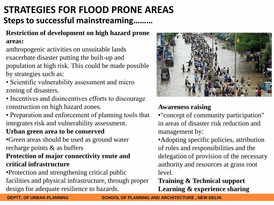
Restriction of development on high hazard prone
areas:
anthropogenic activities on unsuitable lands
exacerbate disaster putting the built-up and
population at high risk. This could be made possible
by strategies such as:
• Scientific vulnerability assessment and micro
zoning of disasters.
• Incentives and disincentives efforts to discourage
construction on high hazard zones.
• Preparation and enforcement of planning tools that
integrates risk and vulnerability assessment.
Urban green area to be conserved
•Green areas should be used as ground water
recharge points & as buffers
Protection of major connectivity route and
critical infrastructure
•Protection and strengthening critical public
facilities and physical infrastructure, through proper
design for adequate resilience to hazards.
Awareness raising
•"concept of community participation"
in areas of disaster risk reduction and
management by:
•Adopting specific policies, attribution
of roles and responsibilities and the
delegation of provision of the necessary
authority and resources at grass root
level.
Training & Technical support
Learning & experience sharing
Steps to successful mainstreaming………STRATEGIES FOR FLOOD PRONE AREAS
DEPTT. OF URBAN PLANNING SCHOOL OF PLANNING AND ARCHITECTURE , NEW DELHI.

FLOOD MANAGEMENT GUIDELINES IN INDIA
DISASTER MANAGEMENT ACT 2005
The NDMA has the responsibility of laying down the
policies, plans and guidelines for effective Disaster
Management emphasize :-
1.Importance of non-structural measures which are very
effective in reducing loss of life and property and can be
implemented in a short time.
2.Proposed to set up establishment of River Basin
Organizations as a mechanism for inter state coordination .
3.Proposed to set up a National Institute of Flood
Management for taking up training, research and
development activities related to floods and their
management.
4.The guidelines envisage that the states will enact and
enforce the flood plain zoning regulations on the lines of
model bill circulated by the ministry of water resources.
STRATEGIES FOR FLOOD PRONE AREAS
DEPTT. OF URBAN PLANNING SCHOOL OF PLANNING AND ARCHITECTURE , NEW DELHI.

Produced national standards, which are of direct relevance to the construction industry
and some of them particular to the mitigation of disasters. IS 13739:1993 ‘Guidelines
for estimation of flood damages; Protection to the river banks by construction of
stone revetments, impermeable bed bars etc
Provide guidelines for:-
IS 13739:1993-Guidelines for estimation of flood damages
IS 13028:1991 -Guidelines for overall planning of river basin
BUREAU OF INDIAN STANDARDS
Planning Of River Basin has 2 parts
(i)mitigation of flood damages
(ii)utilizing the flood waters for beneficial uses(Central
Water Commission) Flood control measures –
1.Structural measures include reservoirs, embankments,
channel improvements etc.
2.Non-structural measures include flood plain zoning,
watershed management, flood forecasting and flood
warning.
In any given case, instead of a single measure, a
combination of measures may be ideal and optimal
STRATEGIES FOR FLOOD PRONE AREAS
DEPTT. OF URBAN PLANNING SCHOOL OF PLANNING AND ARCHITECTURE , NEW DELHI.

BUILDINGS
High plinths; No basements allowed
All buildings to be at least G+1 structures
Mechanisms to prevent collapse, buckling and
cave-ins of buildings during and after floods
Minimum use of timber in construction(rails,
posts, door frames) as it tends to rot.
Emergency shutdown and evacuation
mechanisms in every building (especially for
lifts/escalators)
All community facilities/centres/halls to be on
high plinth or on upper floors (with open
staircases) so that they can serve as emergency
shelters during floods.
STRATEGIES FOR FLOOD PRONE AREAS
DEPTT. OF URBAN PLANNING SCHOOL OF PLANNING AND ARCHITECTURE , NEW DELHI.

INFRASTRUCTURE
Water Supply and sewage lines to be laid with minimum bends and joints
Waterproof, leak proof casing for the pipelines, especially at the joints and bends
POWER SUPPLY (Most dangerous in case of floods)
Electrical supply mains, wires, etc to be strictly overhead.
High voltage installations strictly not allowed in the flood prone zone
Electrical installations, transformers, etc, to be strictly placed
at safe levels (mounted on poles or on high plinths.
Planning and management of power supply networks
STRATEGIES FOR FLOOD PRONE AREAS
DEPTT. OF URBAN PLANNING SCHOOL OF PLANNING AND ARCHITECTURE , NEW DELHI.

INDUSTRIES
Survey needed to check the locations, numbers and
types of industries, their equipments, waste generated,
etc.
Welding/fabricating works, chemical and other related
industries, warehouses, workshops, other hazardous
industries, etc. to be checked and mapped.
All these industries to be either disallowed or
compulsorily placed on high plinths/upper floors
STRATEGIES FOR FLOOD PRONE AREAS
DEPTT. OF URBAN PLANNING SCHOOL OF PLANNING AND ARCHITECTURE , NEW DELHI.

DRAINAGE AND SOLID WASTE
Detailed analysis of the drainage patterns and measures to keep them effectively working
All the manholes/inspection chambers to be of larger dimensions than those in other normal
areas
Solid waste dumping is main cause for water clogging and flooding in most of the cases. A
detailed survey is essential to locate such critical areas and measures taken to prevent
dumping.
Effective solid waste management systems to be set in place.
STRATEGIES FOR FLOOD PRONE AREAS
DEPTT. OF URBAN PLANNING SCHOOL OF PLANNING AND ARCHITECTURE , NEW DELHI.

Others
All cars (now-a-days with automatic functions) to have manual door, window
opening/closing facility
Emergency toolkits inside every car in case a person gets trapped.
All possible evacuation routes to be no-parking zones
Emergency pumping facilities at critical locations
Systems for preventing spread of epidemics after the floods (hospitals, clinics,
cleaning, etc)
STRATEGIES FOR FLOOD PRONE AREAS
DEPTT. OF URBAN PLANNING SCHOOL OF PLANNING AND ARCHITECTURE , NEW DELHI.

• Rejuvenation of Mithi river , cleaning and widening
• Floodplain zoning / Land use restructuring/ activities along Mithi river
• Solid waste management in order to reduce choking of the drains and river
• Protection of water bodies from encroachments
• Resettlement options
• Phasing
DEPTT. OF URBAN PLANNING SCHOOL OF PLANNING AND ARCHITECTURE , NEW DELHI.
The way forward

The way forward
1. Strategies & Proposals for Mumbai Mega City
• Greater Mumbai Level
• Mithi River Area Level
• Local Hotspots – Kalina & Rajiv Gandhi Nagar
2. Strategies for Flood Prone Areas
DEPTT. OF URBAN PLANNING SCHOOL OF PLANNING AND ARCHITECTURE , NEW DELHI.
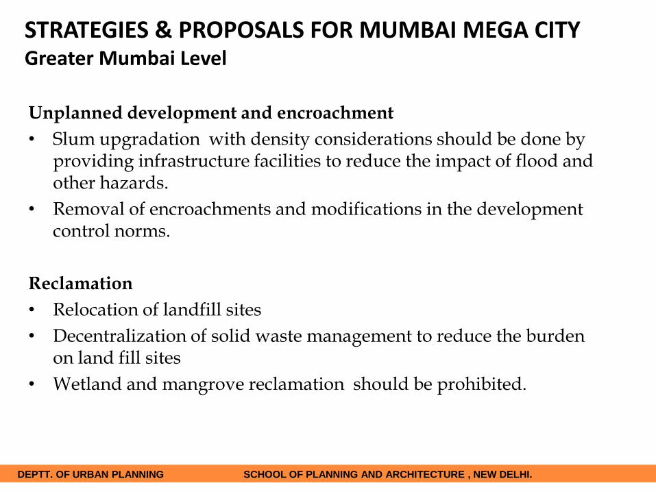
STRATEGIES & PROPOSALS FOR MUMBAI MEGA CITYGreater Mumbai Level
Unplanned development and encroachment
• Slum upgradation with density considerations should be done by providing infrastructure facilities to reduce the impact of flood and other hazards.
• Removal of encroachments and modifications in the development control norms.
Reclamation
• Relocation of landfill sites
• Decentralization of solid waste management to reduce the burden on land fill sites
• Wetland and mangrove reclamation should be prohibited.
DEPTT. OF URBAN PLANNING SCHOOL OF PLANNING AND ARCHITECTURE , NEW DELHI.

STRATEGIES & PROPOSALS FOR MUMBAI MEGA CITYGreater Mumbai LevelCRZ Regulations
• Integration of CRZ norms in the
development projects.
Fragile Areas
• Modifications in the development
control norms.
• Formulation of norms for development
in hazard prone areas for various types
of disasters.
Budget Allocation
• Budget allocation for disaster
management to various wards should be
in proportion to vulnerable population in
these wards.
Socio-economic aspects
• Socio economic surveys and short term
and long term assessment of disasters to
be done
DEPTT. OF URBAN PLANNING SCHOOL OF PLANNING AND ARCHITECTURE , NEW DELHI.
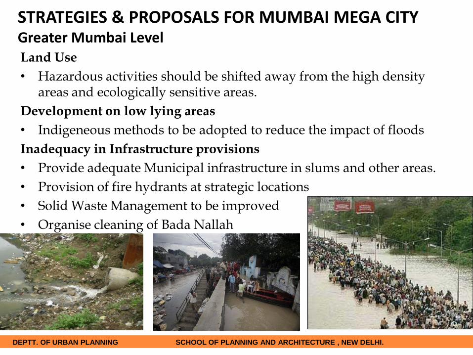
Land Use
• Hazardous activities should be shifted away from the high density areas and ecologically sensitive areas.
Development on low lying areas
• Indigeneous methods to be adopted to reduce the impact of floods
Inadequacy in Infrastructure provisions
• Provide adequate Municipal infrastructure in slums and other areas.
• Provision of fire hydrants at strategic locations
• Solid Waste Management to be improved
• Organise cleaning of Bada Nallah
STRATEGIES & PROPOSALS FOR MUMBAI MEGA CITYGreater Mumbai Level
DEPTT. OF URBAN PLANNING SCHOOL OF PLANNING AND ARCHITECTURE , NEW DELHI.

STRATEGIES & PROPOSALS FOR MUMBAI MEGA CITYMithi River Area Level
• Monitoring Wetlands and Mangroves for upkeep and reclamation should be
strictly prohibited.
• Conservation of Ecologically sensitive areas like Mangroves, city greens like
bird sanctuaries by strict development norms to avoid reclamation and
encroachments
• Solid waste Management to be improved with area specific solutions with
proper segregation and disposal methods adopted to restrict disposal in river
course.
DEPTT. OF URBAN PLANNING SCHOOL OF PLANNING AND ARCHITECTURE , NEW DELHI.

STRATEGIES & PROPOSALS FOR MUMBAI MEGA CITYMithi River Area Level
• Regular Monitoring of Water quality of the river specially in slums and
industrial areas
• Pre-monsoon cleaning of Mithi River Basin should be ensured to increase
its carrying capacity thereby reducing flood risk.
• Formation of a Nodal Agency responsible for management of Mithi river to
avoid overlapping jurisdiction.
DEPTT. OF URBAN PLANNING SCHOOL OF PLANNING AND ARCHITECTURE , NEW DELHI.

STRATEGIES & PROPOSALS FOR MUMBAI MEGA CITYLocal Area Level•Slum up gradation/improvement should be done
by providing infrastructure facilities to reduce the
impact of flood and other hazards.
•Only the environment friendly developments
along this course of river should be permitted.
•Hazardous industries shifted outside.
DEPTT. OF URBAN PLANNING SCHOOL OF PLANNING AND ARCHITECTURE , NEW DELHI.

STRATEGIES & PROPOSALS FOR MUMBAI MEGA CITYLocal Area Level•Sewerage network for slum pockets should be
improved; Dumping of solid waste directly in the river
should be restricted with involvement of the
community.
•Involvement of stakeholders and community based
organization at each level, for overall development of
the slum pockets with adequate infrastructural facilities.
DEPTT. OF URBAN PLANNING SCHOOL OF PLANNING AND ARCHITECTURE , NEW DELHI.

STRATEGIES & PROPOSALS FOR MUMBAI MEGA CITYLocal Area Level
Proposed Infrastructure For Rajiv Gandhi Nagar onthe basis of Clustered development
DEPTT. OF URBAN PLANNING SCHOOL OF PLANNING AND ARCHITECTURE , NEW DELHI.

Institutional Set-up
Various agencies have their jurisdictions across the entire stretch of Mithi river.
This creates issues of conflicting and overlapping functions and responsibilities.
Therefore there is need for a single agency in charge of the operations across the
entire Mithi River Basin.
The Mithi River Development Authority can be assigned the authority and
responsibility for the development & maintenance of the entire Mithi River Basin
as well as the Flood Mitigation measures to be undertaken.
STRATEGIES FOR FLOOD PRONE AREAS
DEPTT. OF URBAN PLANNING SCHOOL OF PLANNING AND ARCHITECTURE , NEW DELHI.

GOVERNANCE
AN UMBRELLA AUTHORITY FOR GOVERNING THE MITHI RIVER BASIN
WITH REPRESENTATIVES FROM
• MITHI RIVER DEVELOPMENT AUTHORITY
• DHARAVI DEVELOPMENT AUTHORITY
• AIRPORT AUTHORITY
• MIDC
• WARD LEVEL REPRESENTATIVES
ROLES AND RESPONSIBILITIES
DEPTT. OF URBAN PLANNING SCHOOL OF PLANNING AND ARCHITECTURE , NEW DELHI.