disaster risk reduction and climate change adaptation in ... pres/18th... · disaster risk...
TRANSCRIPT

Disaster Risk Reduction andClimate Change Adaptation
in the Australia-Pacific Region
Greg ScottPresident, PCGIAP
Group Leader, National Mapping & InformationGeoscience Australia
United Nations Regional Cartographic Conference for Asia-PacificBangkok Thailand, 26-29 October 2009

Disaster Risk Reduction
Presentation context…
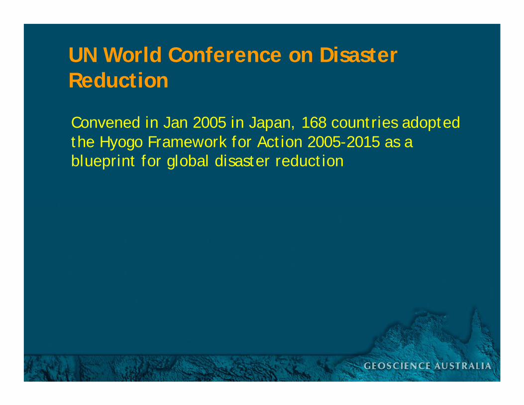
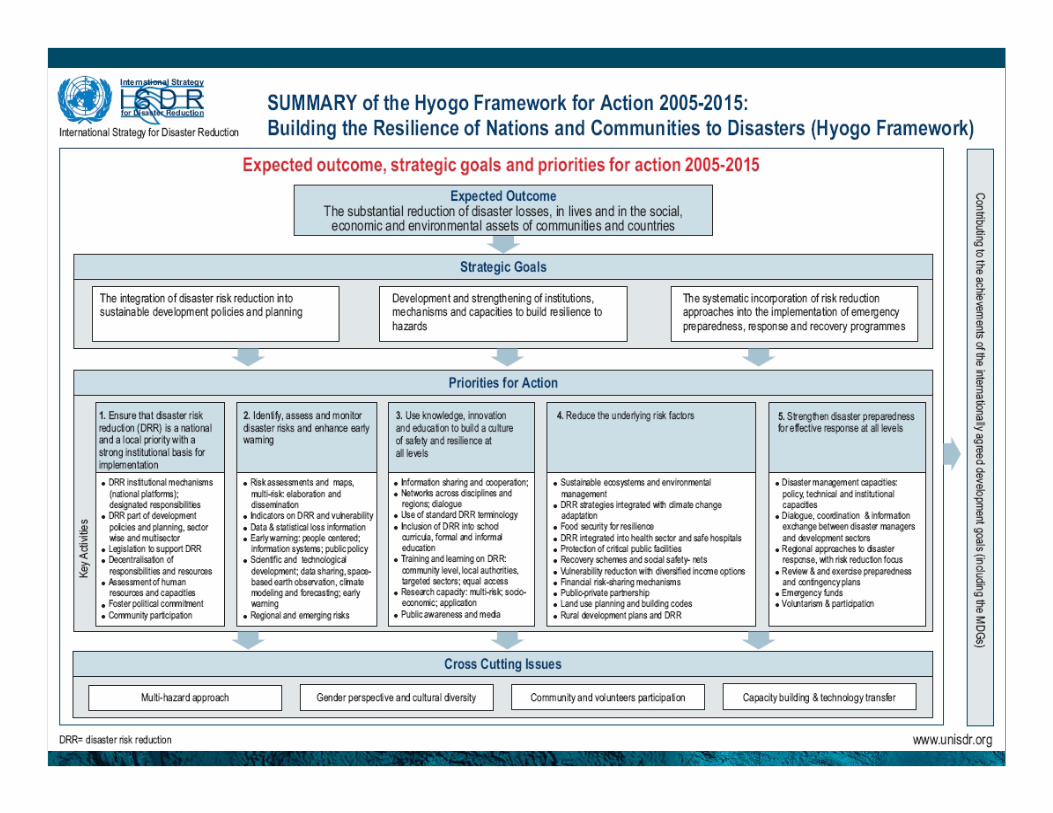
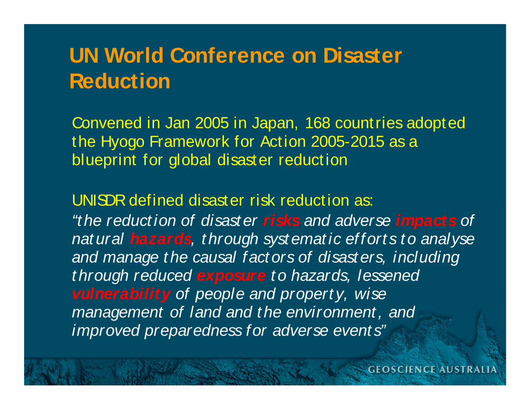
UN World Conference on Disaster Reduction
Convened in Jan 2005 in Japan, 168 countries adopted the Hyogo Framework for Action 2005-2015 as a blueprint for global disaster reduction
UN World Conference on Disaster Reduction
Convened in Jan 2005 in Japan, 168 countries adopted the Hyogo Framework for Action 2005-2015 as a blueprint for global disaster reduction
UNISDR defined disaster risk reduction as:“the reduction of disaster risks and adverse impacts of natural hazards, through systematic efforts to analyse and manage the causal factors of disasters, including through reduced exposure to hazards, lessened vulnerability of people and property, wise management of land and the environment, and improved preparedness for adverse events”

Climate Change Adaptation
Presentation context…
UN World Conference on Disaster Reduction
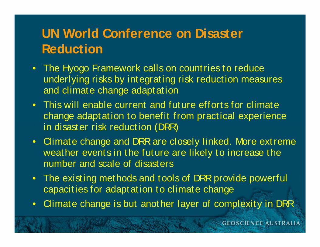
• The Hyogo Framework calls on countries to reduce underlying risks by integrating risk reduction measures and climate change adaptation
• This will enable current and future efforts for climate change adaptation to benefit from practical experience in disaster risk reduction (DRR)
• Climate change and DRR are closely linked. More extreme weather events in the future are likely to increase the number and scale of disasters
• The existing methods and tools of DRR provide powerful capacities for adaptation to climate change
• Climate change is but another layer of complexity in DRR

The Asia-Pacific Region
Presentation context…
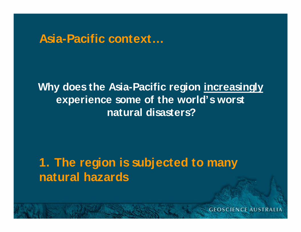
Why does the Asia-Pacific region increasinglyexperience some of the world’s worst
natural disasters?
Asia-Pacific context…
1. The region is subjected to many natural hazards

200 million people in developing countries in the Asia-Pacific live within 50 km of a volcano
Volcanoes

Earthquakes
Earthquake events between 1900 and 2002 from USGS
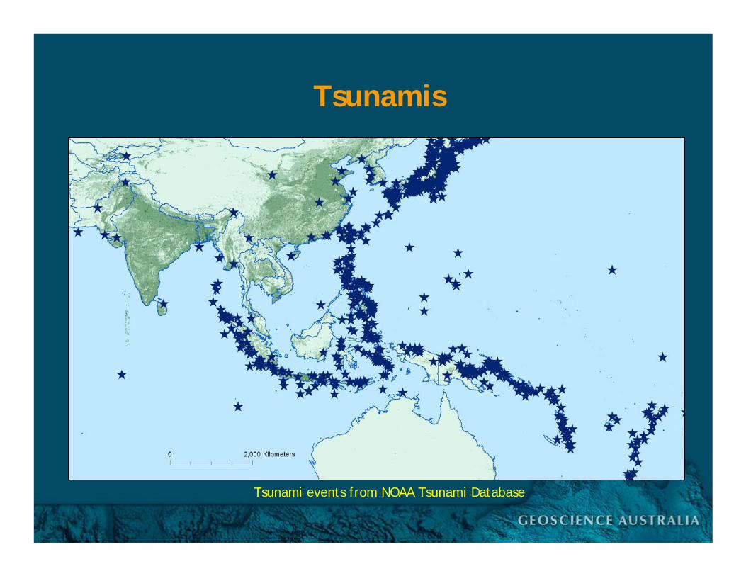
Tsunamis
Tsunami events from NOAA Tsunami Database
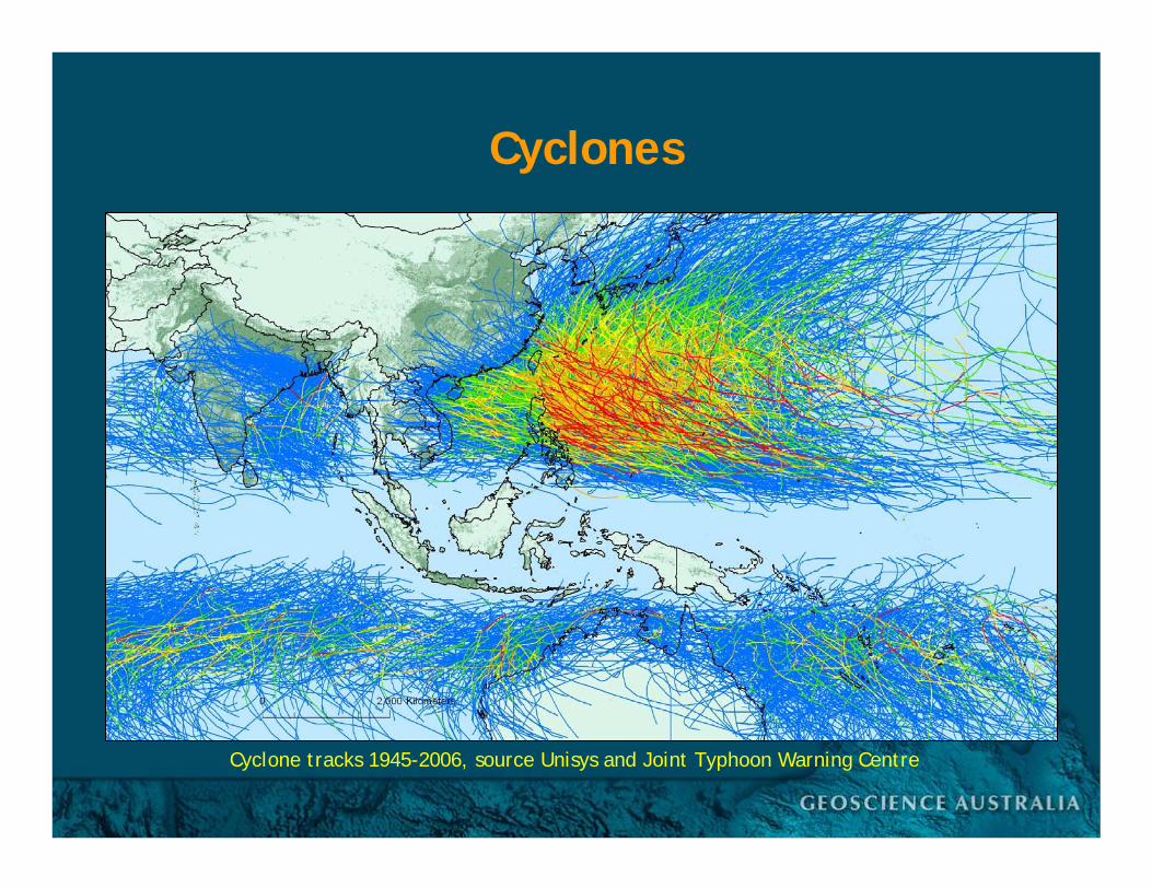
Cyclone tracks 1945-2006, source Unisys and Joint Typhoon Warning Centre
Cyclones
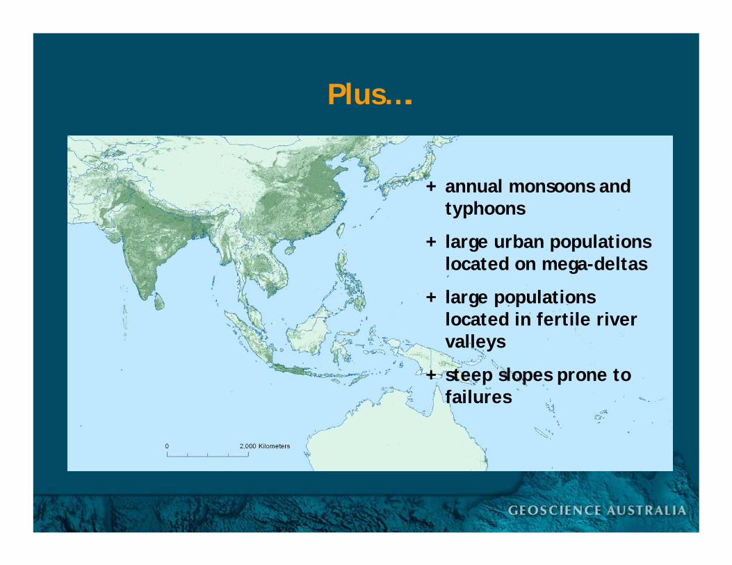
Plus….
+ annual monsoons and typhoons
+ large urban populations located on mega-deltas
+ large populations located in fertile river valleys
+ steep slopes prone to failures
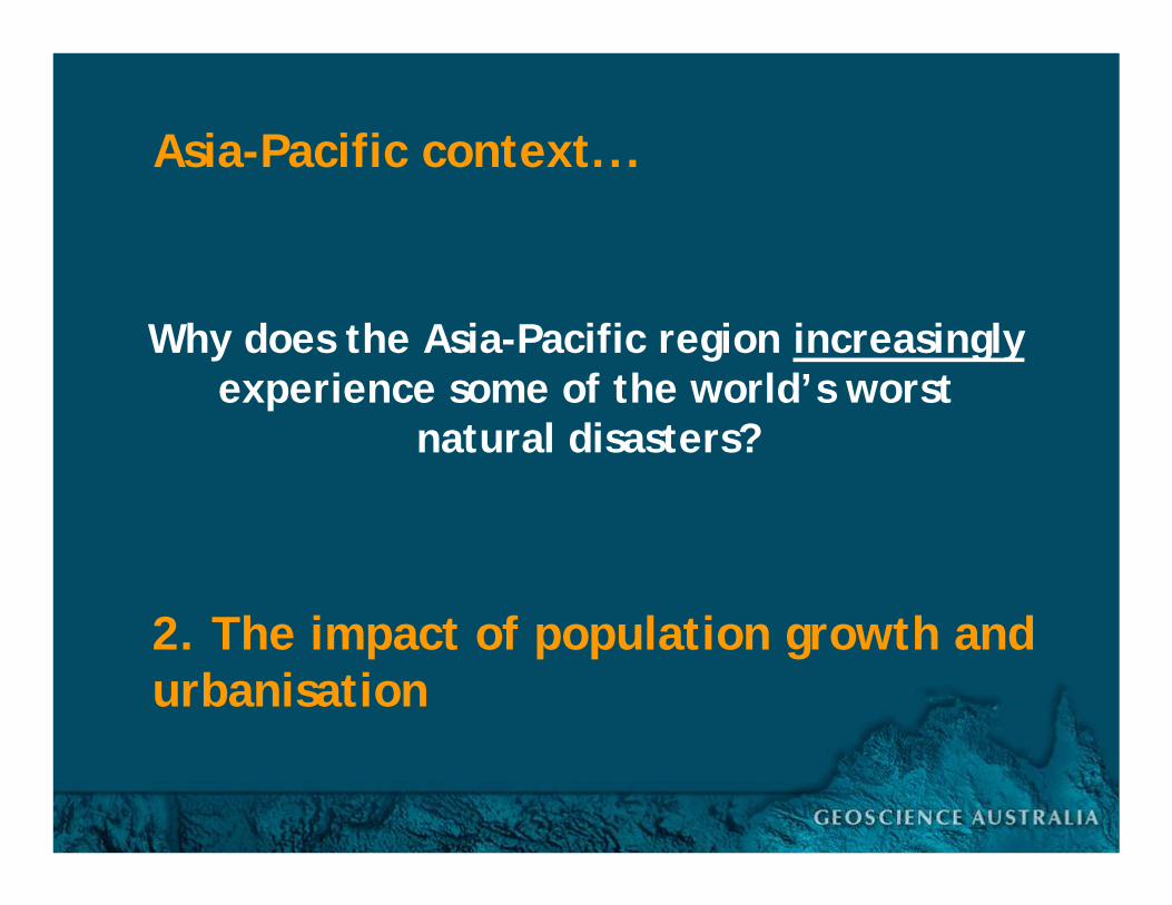
Why does the Asia-Pacific region increasinglyexperience some of the world’s worst
natural disasters?
Asia-Pacific context...
2. The impact of population growth and urbanisation

Population
Population Density, source Landscan
0 - 1010 - 100
100 – 1,0001,000 – 5,000
5,000+
Population Density (per km2)

Developing Countries
Developed Countries
Least Developed Countries
20th century population explosion

Developing Countries Rural Population
Developing Countries Urban Population
Least Developed Countries Rural Population
Least Developed Countries Urban Population
Increasing urbanisation
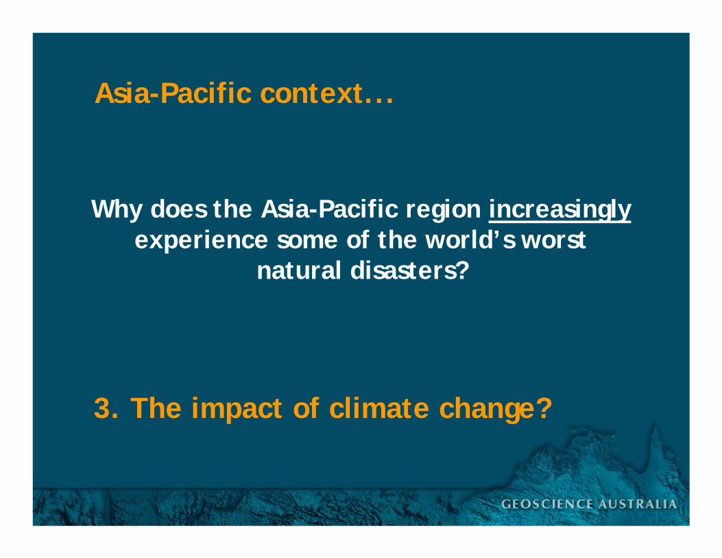
Why does the Asia-Pacific region increasinglyexperience some of the world’s worst
natural disasters?
Asia-Pacific context...
3. The impact of climate change?
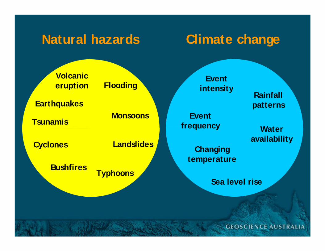
Volcaniceruption
Tsunamis
Earthquakes
Flooding
Cyclones
BushfiresTyphoons
Monsoons
Landslides
Natural hazards
Changingtemperature
Sea level rise
Eventfrequency
Rainfallpatterns
Eventintensity
Wateravailability
Climate change

Volcaniceruption
Tsunamis
Earthquakes
Flooding
Cyclones
BushfiresTyphoons
Monsoons
Landslides
Natural hazards
Changingtemperature
Sea level rise
Eventfrequency
Rainfallpatterns
Eventintensity
Wateravailability
Climate change
Asia-Pacific context… summary
• Region frequently subjected to many natural hazards• Population and urbanisation is growing• Development unplanned and in the most vulnerable
regions• Disasters are common. Many countries affected by
multiple hazards• Countries with high population densities at high risk• Mega-disasters have happened…and will continue• Disaster risk reduction is an emerging priority, and
recognised by national leaders• The effects of climate change is an unknown variable• More detailed analyses are being undertaken
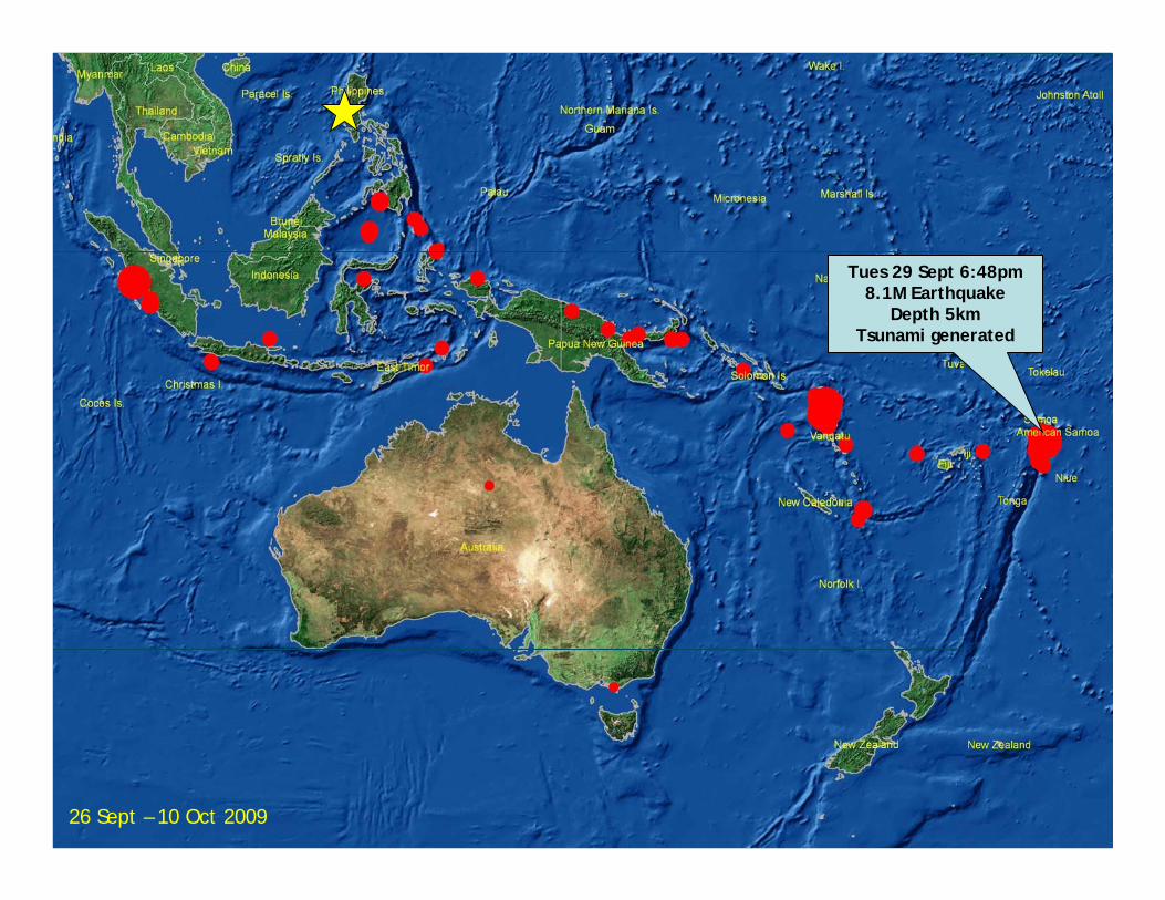
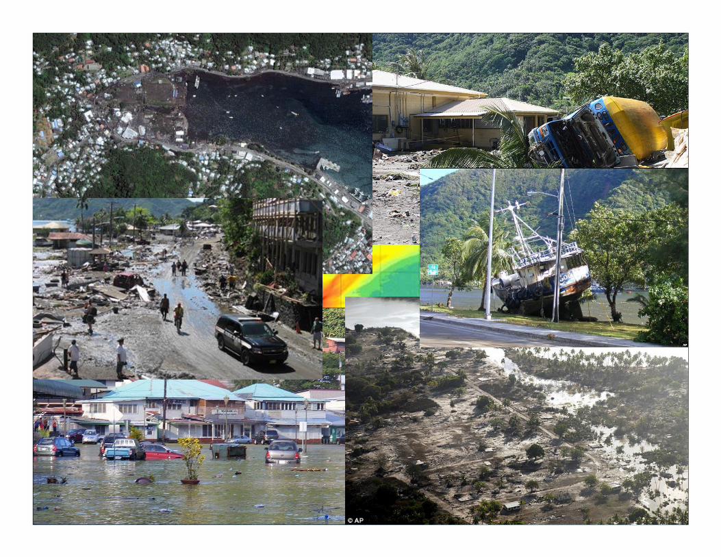
Tues 29 Sept 6:48pm8.1M Earthquake
Depth 5kmTsunami generated
26 Sept – 10 Oct 2009

Wed 30 Sept 11:16am7.6M Earthquake
Depth 68km
Tues 29 Sept 6:48pm8.1M Earthquake
Depth 5kmTsunami generated
Thurs 1 Oct 2:52am6.5M Earthquake
Depth 0km
26 Sept – 10 Oct 2009


Wed 30 Sept 11:16am7.6M Earthquake
Depth 68km
Tues 29 Sept 6:48pm8.1M Earthquake
Depth 5kmTsunami generated
Thurs 1 Oct 2:52am6.5M Earthquake
Depth 0km
Thurs 8 OctEarthquake cluster
Up to 7.9M
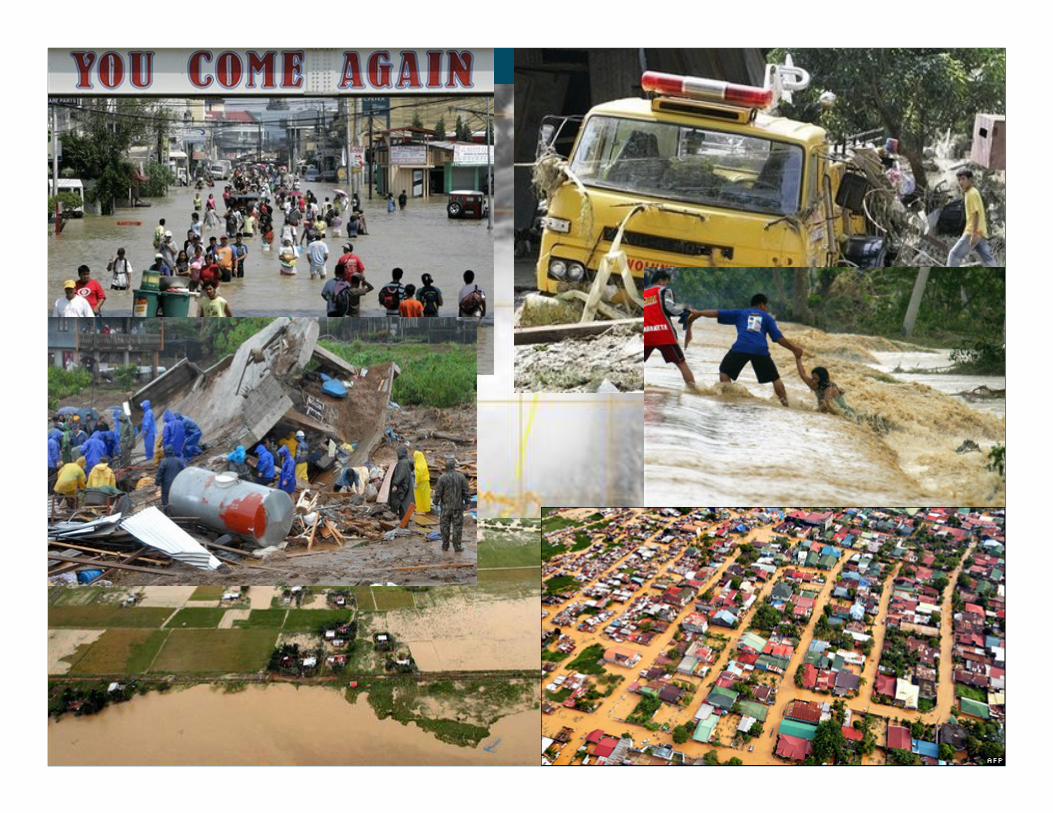
Sat 26 SeptTropical Storm Ketsana
Sat 3 OctTyphoon Parma
26 Sept – 10 Oct 2009
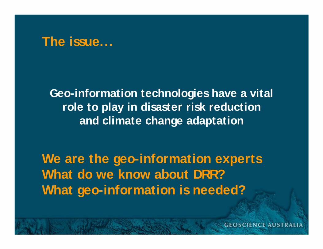
Geo-information technologies have a vital role to play in disaster risk reduction
and climate change adaptation
The issue...
We are the geo-information expertsWhat do we know about DRR?

UNRCC background
Governments of Member States stimulate surveying and mapping of their national territories
Include application of modern technology in surveying and mapping in developing countries, GIS for application in basic mapping and applied mapping such as mapping for statistics, population census, environmental protection, tourism, land use, and cadastral registration; legal aspects in map production; and toponymy
This is about providing fundamental data
PCGIAP Statutes
Cooperate in the development of a regional geographic information infrastructure
To define the nature of a regional geographic information infrastructure that each country in the region can contribute to in order to meet regional and global mapping and GIS requirements
This is about making data and information available to a wider community
17th UNRCC-AP, Bangkok Sept 2006: Resolution 1
1. Geo-information for mitigating large scale disasters
“make more effective and efficient use of geo-information by decision makers for disaster monitoring, assessment and management”
“realization of improved environmental and sustainable development decision making”
“apply best practices in the development of appropriate geo-databases and applications”
This is getting into delivery of data and information to support risk management
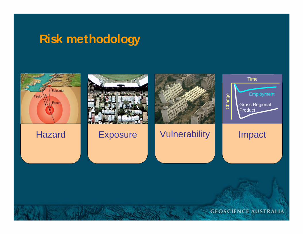
Hazard Exposure Vulnerability Impact
$Gross RegionalProduct
Employment
Time
Cha
nge
Risk methodology
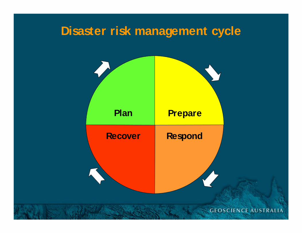
Plan Prepare
RespondRecover
Disaster risk management cycle

Plan Prepare
RespondRecover
Disaster risk management cycle
ReactiveAccountabilityVery politicalMakes newsSignificant aid/fundingCost: social & economicData MUST be up to date
Hazard
DisasterDisplacement
ReconstructionRehabilitationDevelopment
EconomicSocial
Disaster impactCrisis responseEvacuationSearch & rescueUncertaintyLoss
Mitigation
Impact

• Bushfire map ex russell…
• RICS pics russell


Plan Prepare
RespondRecover
Disaster risk management cyclePre-emptiveLong lead timesNo interestMinimal fundingNot politicalDoes not make newsCost/benefit unknownData often out of date
ReactiveAccountabilityVery politicalMakes newsSignificant aid/fundingCost: social & economicData MUST be up to date
Hazard
Disaster
HazardsExposure
VulnerabilityRisk assessments
MonitoringEarly warningMitigationEducationAwarenessResilience
DisplacementReconstructionRehabilitationDevelopment
EconomicSocial
Disaster impactCrisis responseEvacuationSearch & rescueUncertaintyLoss
Mitigation
Impact
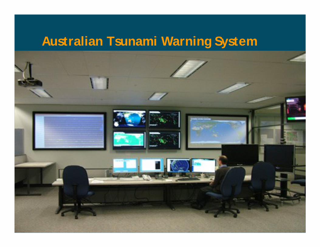
Australian Tsunami Warning System
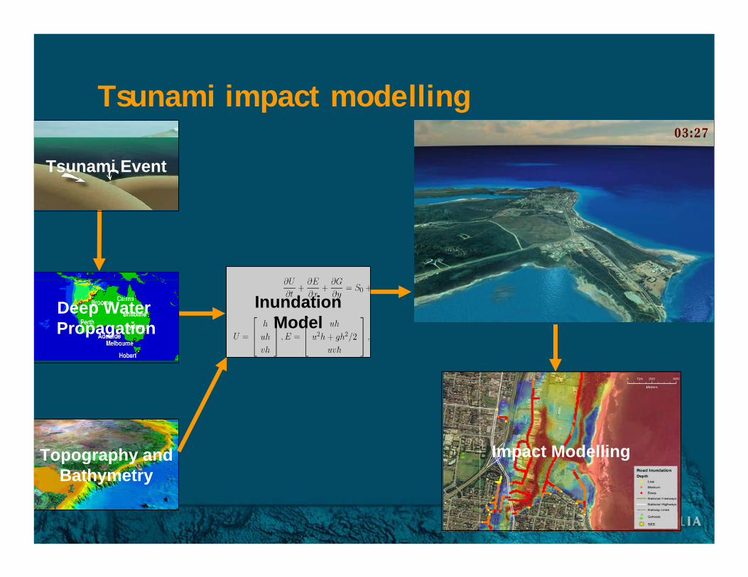
Topography andBathymetry
InundationModel
Impact Modelling
Deep Water Propagation
Tsunami Event
Tsunami impact modelling
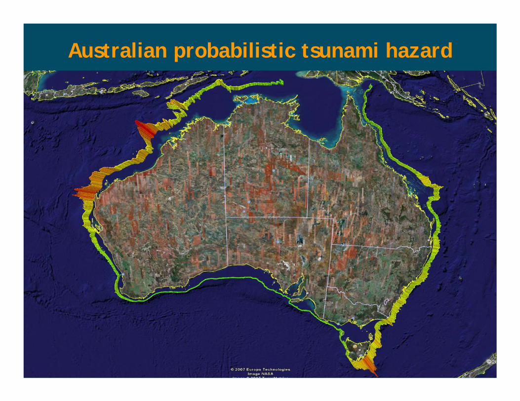
Australian probabilistic tsunami hazard
Geo-information technologies have a vital role to play in disaster risk reduction
and climate change adaptation
The issue...
We are the geo-information expertsWhat do we know about DRR?What geo-information is needed?

Earthquake
Flood
Cyclone
Climate Change
Tsunami
Bushfire
Hazards
Environment
People
Buildings
Infrastructure
SocietyEvent propagation
Hazard models
Area ofimpact
over time
Impacts
Damage, Disruption
Recovery, Cost
Exposure
VulnerabilityGeo-information
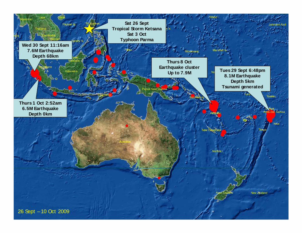
Wed 30 Sept 11:16am7.6M Earthquake
Depth 68km
Tues 29 Sept 6:48pm8.1M Earthquake
Depth 5kmTsunami generated
Thurs 1 Oct 2:52am6.5M Earthquake
Depth 0km
Thurs 8 OctEarthquake cluster
Up to 7.9M
Sat 26 SeptTropical Storm Ketsana
Sat 3 OctTyphoon Parma
26 Sept – 10 Oct 2009
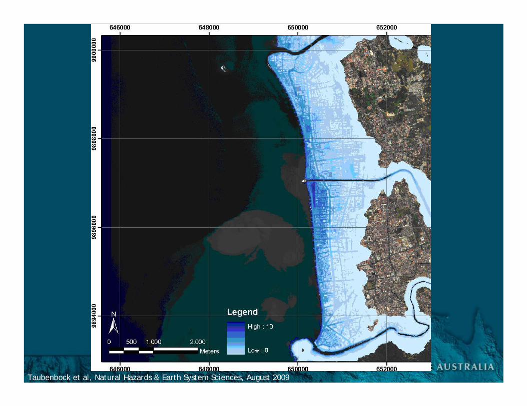
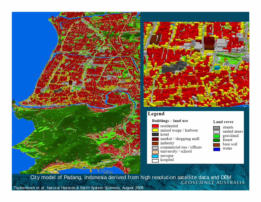
Taubenbock et al, Natural Hazards & Earth System Sciences, August 2009
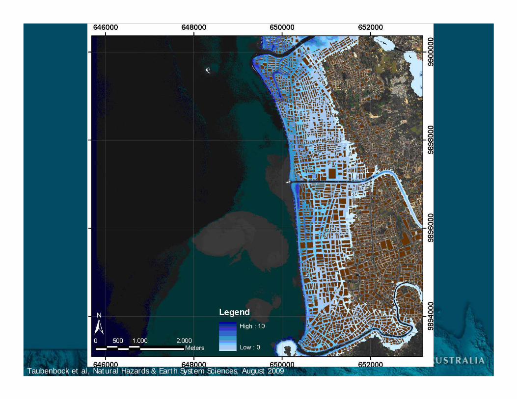
Taubenbock et al, Natural Hazards & Earth System Sciences, August 2009
City model of Padang, Indonesia derived from high resolution satellite data and DEM
Taubenbock et al, Natural Hazards & Earth System Sciences, August 2009
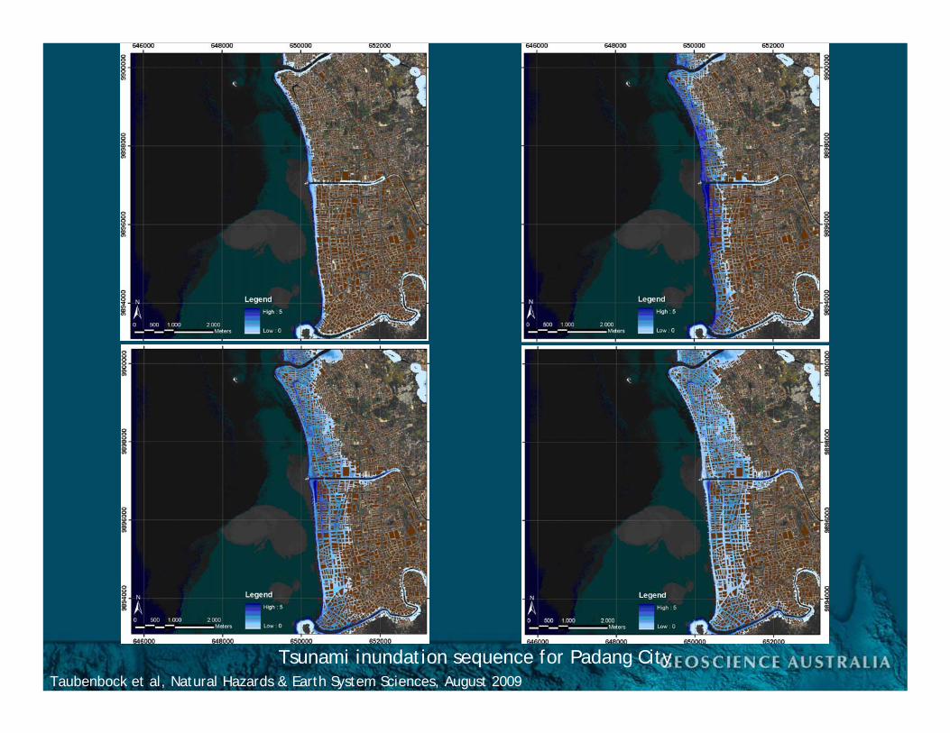
Tsunami inundation sequence for Padang City
Taubenbock et al, Natural Hazards & Earth System Sciences, August 2009
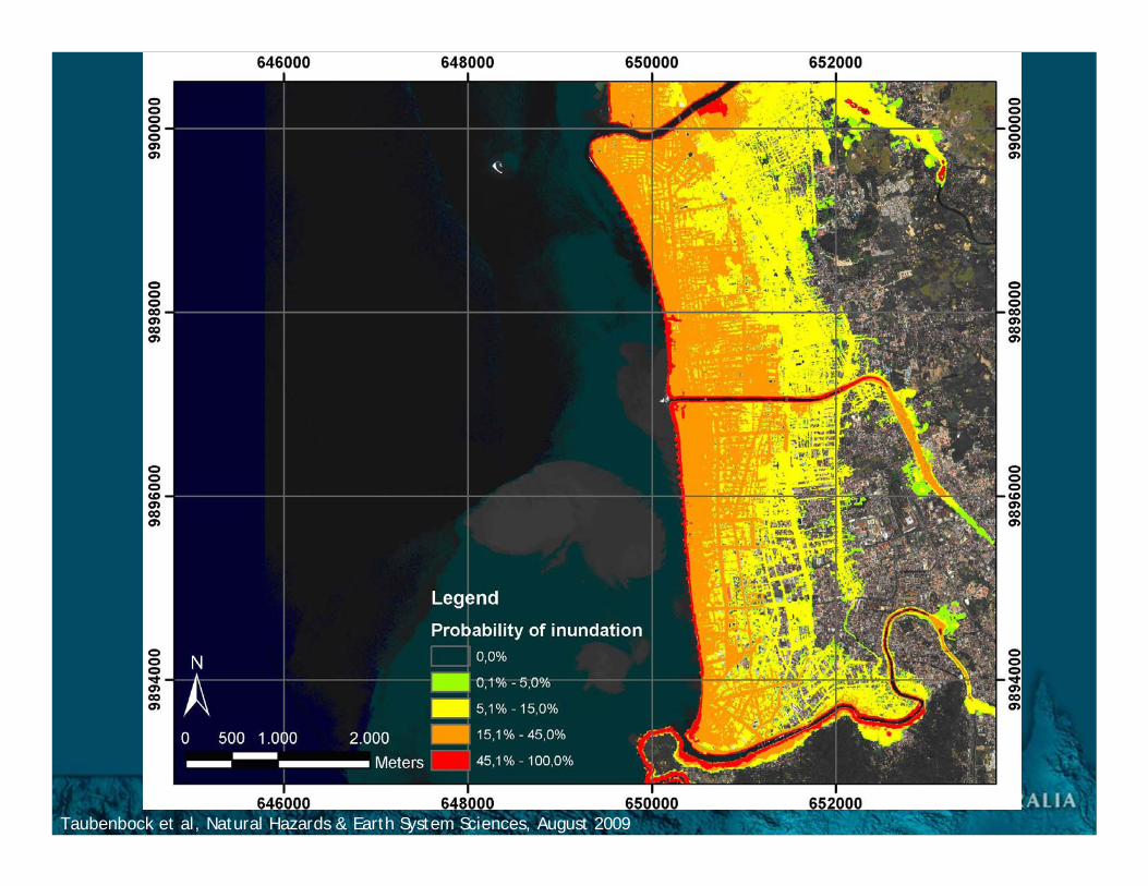
Taubenbock et al, Natural Hazards & Earth System Sciences, August 2009
Taubenbock et al, Natural Hazards & Earth System Sciences, August 2009
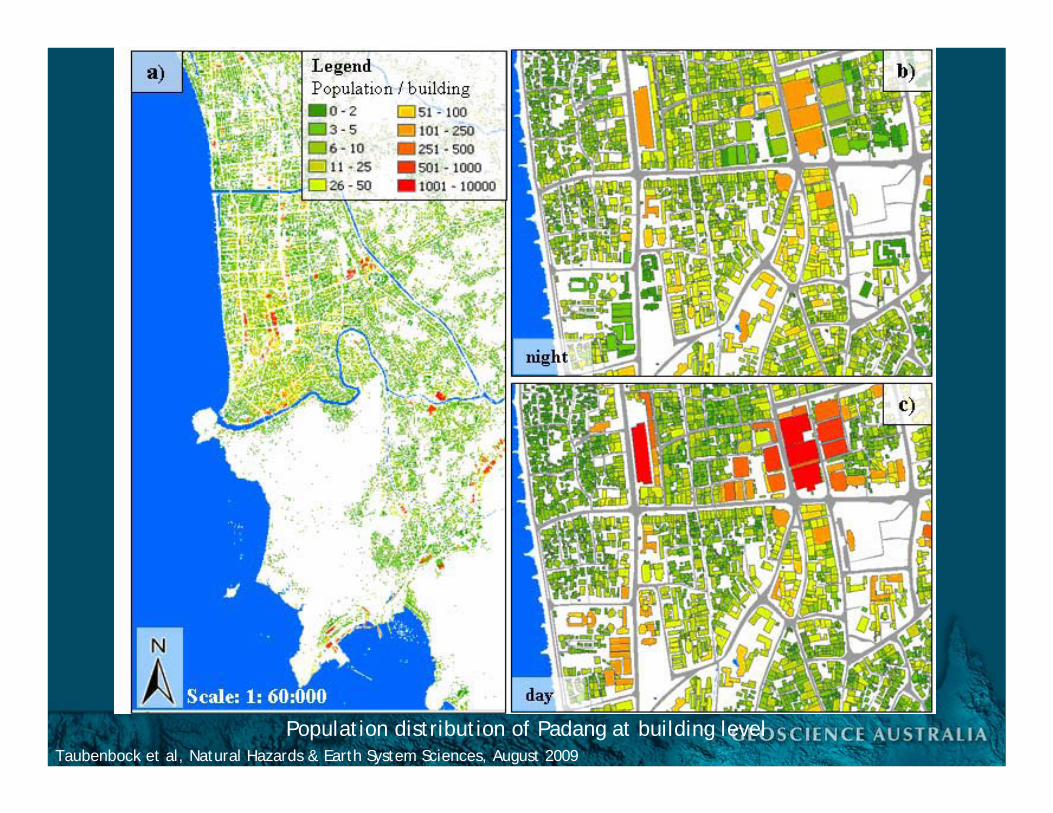
Population distribution of Padang at building level
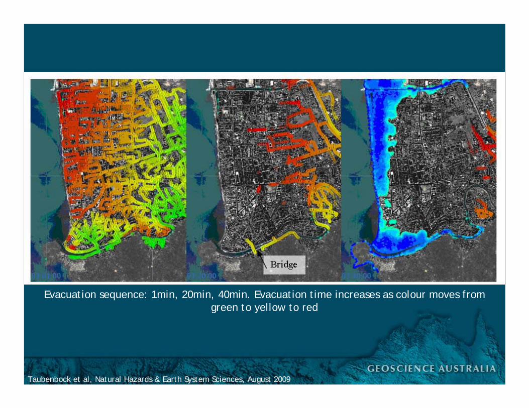
Taubenbock et al, Natural Hazards & Earth System Sciences, August 2009
Evacuation sequence: 1min, 20min, 40min. Evacuation time increases as colour moves from green to yellow to red

FUNDAMENTALImageryTopographyBathymetryRoadsCadastreAddressesCensusDemographyAdmin. Bdys.
SERVICESPoliceFireAmbulanceSESSchoolsHospitalsAged careCommunityfacilitiesBuildings
INFRASTRUCTUREElectricityGasTelecomsWaterTransportHealthBroadcastingBankingIndustry
Spatial Data Infrastructures
Scenarios Exposure Social profiles CasualtiesEvent models Vulnerability Economic loss FatalitiesImpact analysis Hazard maps Risk assessments Cost
Disaster Risk Reduction
Environment
People
Buildings
Infrastructure
ReduceExposure
andVulnerability

Geo-information technologies have a vital role to play in disaster risk reduction
and climate change adaptation
The issue...
We are the geo-information expertsWhat do we know about DRR?What geo-information is needed?What can we do about it?
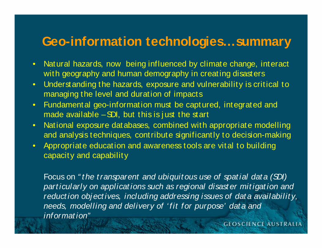
Geo-information technologies… summary
• Natural hazards, now being influenced by climate change, interact with geography and human demography in creating disasters
• Understanding the hazards, exposure and vulnerability is critical to managing the level and duration of impacts
• Fundamental geo-information must be captured, integrated and made available – SDI, but this is just the start
• National exposure databases, combined with appropriate modellingand analysis techniques, contribute significantly to decision-making
• Appropriate education and awareness tools are vital to building capacity and capability
Focus on “the transparent and ubiquitous use of spatial data (SDI) particularly on applications such as regional disaster mitigation and reduction objectives, including addressing issues of data availability, needs, modelling and delivery of ‘fit for purpose’ data and information”

Geo-information technologies… directions
• Many organisations and governments have major investments in spatial data. Important to establish an interoperability framework that allows the existing SDI to be leveraged by actors for purposes beyond mapping
• Requires agreed and established data access policy and protocols• Establishment of an authoritative data catalogue service would
increase the effectiveness of spatial capability by improving the access, coordination, quality, usage and understanding of data and data services available for emergency management
• Business as usual and crisis management operational arrangements, for the sharing of spatial information in a timelymanner, must be fully defined and agreed
• Geo-information tools are critical for incident management and crisis coordination. However, there is a recognised requirement for senior decision makers to be made aware of the benefits of this technology, what can be provided and by whom