discussion no. 15 the astonishing genesis flood part 2: some evidence ariel a. roth...
TRANSCRIPT

DISCUSSION No. 15DISCUSSION No. 15
THE ASTONISHING THE ASTONISHING GENESIS FLOODGENESIS FLOOD
Part 2: Some EvidencePart 2: Some Evidence
Ariel A. RothAriel A. Rothsciencesandscriptures.comsciencesandscriptures.com
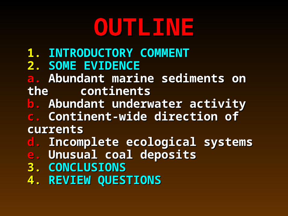
OUTLINEOUTLINE1.1. INTRODUCTORY COMMENT INTRODUCTORY COMMENT2.2. SOME EVIDENCE SOME EVIDENCE
a.a. Abundant marine sediments on the Abundant marine sediments on the continentscontinents
b.b. Abundant underwater activity Abundant underwater activityc.c. Continent-wide direction of currents Continent-wide direction of currentsd.d. Incomplete ecological systems Incomplete ecological systemse.e. Unusual coal deposits Unusual coal deposits
3.3. CONCLUSIONS CONCLUSIONS4.4. REVIEW QUESTIONSREVIEW QUESTIONS

1.1. INTRODUCTORY INTRODUCTORY COMMENTCOMMENT

1.1. INTRODUCTORY COMMENTINTRODUCTORY COMMENT
This discussion titled This discussion titled SOME EVIDENCE,SOME EVIDENCE, is is the second in a three part series (No. 14, 15, 16,) the second in a three part series (No. 14, 15, 16,) about about THE ASTONISHING GENESIS FLOOD.THE ASTONISHING GENESIS FLOOD.
Unless you have a good perspective of the Unless you have a good perspective of the Flood events, the first discussion subtitled Flood events, the first discussion subtitled INTRODUCTIONINTRODUCTION should be read first. should be read first.
The third part of the series titled The third part of the series titled MORE MORE
EVIDENCEEVIDENCE should also be read, so as to get a should also be read, so as to get a more complete understanding of all this evidence. more complete understanding of all this evidence.

1.1. INTRODUCTORY COMMENT INTRODUCTORY COMMENT
When considering the Genesis Flood, the sedimentary rocks of the earth are especially important. Sedimentary rocks are usually formed by water transport, and almost all fossils are found in sedimentary rocks. An outstanding characteristic of sedimentary rocks is that they have many layers that range from very thin to very thick.

1.1. INTRODUCTORY COMMENT INTRODUCTORY COMMENT
While present scientific interpretations tend to ignore the great Genesis Flood, there are a number of significant features of the sedimentary layers of the earth that are better explained by a model of a worldwide Flood than by slow gradual changes over millions of years. Five of these features are explained below, while three more will be considered in the next discussion.

2.2. SOME EVIDENCE SOME EVIDENCE FOR THE FLOODFOR THE FLOOD
a.a. Abundant marine sediments Abundant marine sediments on the continentson the continents
2.2. SOME EVIDENCE SOME EVIDENCE a. a. ABUNDANT MARINE SEDIMENTS ON THE ABUNDANT MARINE SEDIMENTS ON THE
CONTINENTSCONTINENTS
The rocks forming our continents are relatively light (lower density) and literally float on top of heavier rocks found below them. Heavier rocks (i.e. higher density) are also found just below the floor of the oceans. On a worldwide scale, rock is relatively soft, and lighter rock rides on top of heavier rock like a boat floats over heavier water. This arrangement keeps our continents above sea level and gives us a dry place to live on. Hence, it is unusual that we find so much sediment from the oceans on the continents. Why is it there? Something unusual must have happened in the past, for it to be up there on the continents.
You can tell that you have sediments from the ocean by the kind of rock you have, but especially by the fossils found therein. If the fossils represent marine organisms, such as marine starfish, etc., this indicates that the deposit came from the ocean.
In the next illustration, which is a sedimentary deposit from California, you know that it came from the ocean, because the shells found are those of organisms that live only in the ocean.

Shells of marine organisms, California coast

2.2. SOME EVIDENCE SOME EVIDENCE a. a. ABUNDANT MARINE SEDIMENTS ON THE ABUNDANT MARINE SEDIMENTS ON THE
CONTINENTSCONTINENTS
The problem the marine sediments pose for a normal slowly evolving earth is well illustrated in the next slide. This is a cross section of part of a continent and part of an ocean over deeper rocks.
The granite forming the mass of the
continent to the left of the figure has a density of around 2.7. The basalt and schist rocks below the ocean floor and lower down below the continents have a density of 3.0 or higher. That is why we can say that the continents literally float above denser rocks.


2.2. SOME EVIDENCE SOME EVIDENCE a.a. ABUNDANT MARINE SEDIMENTS ON THE ABUNDANT MARINE SEDIMENTS ON THE
CONTINENTSCONTINENTS
The incongruity is that when we look at the sediments of the earth, the sediments from the ocean are thicker on the continents than in the oceans! See the last illustration where more than half of the thick layers of sediment on the continent come from the ocean. Compare that to the thin sediments on the floor of the ocean.
This is what you would expect from a worldwide Flood as the continents were inundated from the oceans. The Flood waters brought ocean sediments with them. You would not expect this from ordinary conditions where ocean sediments stay in the oceans.

2.2. SOME EVIDENCE SOME EVIDENCE a.a. ABUNDANT MARINE SEDIMENTS ON THE ABUNDANT MARINE SEDIMENTS ON THE
CONTINENTSCONTINENTS
Some geologists suggest that the reason we find so few marine sediments in the ocean is because the sediments of the ocean were subducted (swallowed) into the earth at the deep ocean trenches. But this is not an adequate explanation because subduction of sediments into the ocean trenches is too slow. For instance, our present rivers pour sediments into the oceans at a rate that is at least five to ten times as fast as sediments are subducted by the ocean trenches. If the present rates of sediment production by rivers into the oceans were extended over the long geologic ages, our oceans could have been filled up many times with sediments.

2.2. SOME EVIDENCE SOME EVIDENCE a.a. ABUNDANT MARINE SEDIMENTS ON THE ABUNDANT MARINE SEDIMENTS ON THE
CONTINENTSCONTINENTS
Some geologists suggest that the reason we have so much marine material from the oceans on the continents is that the continents were lower in the past and oceans inundated the continents. However, in making such a suggestion they are inadvertently moving into a Flood model! That is what the Flood was all about!
The statement quoted in the next frame is from a respected geologist and illustrates the dilemma of the marine sediments. If the community of geologists believed in the Genesis Flood, there would be no problem since a worldwide flood would be expected to put marine sediments on the continents.

Shelton JS. 1969. Geology Illustrated. San Francisco: W.H. Freeman & Co., p 28.
“Marine sedimentary rocks are far more common and widespread on land today than all other kinds of sedimentary rocks combined. This is one of those simple facts that fairly cry out for explanation and that lie at the heart of man’s continuing effort to understand more fully the changing geography of the geologic past.”

2.2. SOME EVIDENCE SOME EVIDENCE a.a. ABUNDANT MARINE SEDIMENTS ON THE ABUNDANT MARINE SEDIMENTS ON THE
CONTINENTSCONTINENTS
The following picture of the Grand Canyon of the Colorado River illustrates the abundance of sediments from the ocean on the continents. While the Grand Canyon lies many hundreds of kilometers inland from the ocean, about ¾ of the layers you see in the wall of the canyon are from the ocean.
The succeeding picture is of earth’s highest mountain, Mount Everest, that rises 8848 meters above sea level. Yet, Everest is composed of rocks from the ocean.

Grand Canyon, Arizona


2.2. SOME EVIDENCE SOME EVIDENCEFOR THE FLOODFOR THE FLOOD
b.b. Abundant underwater Abundant underwater activity on the continents activity on the continents

2.2. SOME EVIDENCE SOME EVIDENCE b. b. ABUNDANT UNDERWATER ACTIVITY ON ABUNDANT UNDERWATER ACTIVITY ON
THE CONTINENTSTHE CONTINENTS
Turbidites are an interesting type of sedimentary deposit often found on the continents. They only form under water, and they form very rapidly. Turbidites result when large quantities of loose sediment flow down an underwater slope.
The mixture of sediment and water that flows down a slope to form a turbidite has a greater density (heavier) than ordinary water; hence it tends to keep its integrity as a separate heavier flow called a turbidity current. Both the turbidity current and the water above it are fluid. The denser turbidity current flows below the lighter water somewhat like denser water flows on land (streams and rivers) below lighter air.

2.2. SOME EVIDENCE SOME EVIDENCE b. b. ABUNDANT UNDERWATER ACTIVITY ON ABUNDANT UNDERWATER ACTIVITY ON
THE CONTINENTSTHE CONTINENTS
As the turbidity current slows down towards the end of its flow, it lays down a characteristic kind of deposit called a turbidite. Turbidites are complicated and often consist of many layers originating from a single turbidity current.
The next figure illustrates the process of forming a turbidite in a large body of water.


2.2. SOME EVIDENCE SOME EVIDENCE b.b. ABUNDANT UNDERWATER ACTIVITY ON ABUNDANT UNDERWATER ACTIVITY ON
THE CONTINENTSTHE CONTINENTS
A significant turbidite was formed in 1929 in the North Atlantic Ocean when an earthquake near Nova Scotia and Newfoundland shook some sediments loose along the edge of the continental shelf. A turbidity current flowed down the slope of the shelf and spread 100 cubic kilometers of sediments as a turbidite nearly a meter thick over 100,000 square kilometers on an abyssal plain of the North Atlantic. Some of the sediment traveled over 700 kilometers from its source. The turbidity current ran into the hulk of the ship Titanic that had sunk in 1912.

2.2. SOME EVIDENCE SOME EVIDENCE b.b. ABUNDANT UNDERWATER ACTIVITY ON ABUNDANT UNDERWATER ACTIVITY ON
THE CONTINENTSTHE CONTINENTS
Unfortunately for commercial telegraphy, but fortunately for geology, there were twelve transatlantic cables between North America and Europe lying in the pathway of this turbidity current, and the current broke most of them. By comparing the location of the cables and the time when the messages quit being transmitted across the Atlantic it was possible to determine how fast the turbidity current was traveling.
The next figure sketches the general location.


2.2. SOME EVIDENCE SOME EVIDENCE b.b. ABUNDANT UNDERWATER ACTIVITY ON ABUNDANT UNDERWATER ACTIVITY ON
THE CONTINENTSTHE CONTINENTS
The data indicates that the turbidity current was sometimes traveling in excess of 100 kilometers per hour. The last cable, more than 650 kilometers from the continental shore, broke a little more than 13 hours after the earthquake.
Turbidites, that represent underwater activity, have turned out to be surprisingly abundant on the continents of the earth.
It is not only turbidites that indicate underwater activity on the continents. There are several other kinds of rapid “mass flow” types of sediment layers now on the continents. The large sedimentary layer called the Niesen Nappe in Switzerland, that is very far from any ocean, is interpreted to be of marine origin. It exhibits a variety of rapid kinds of sediment deposition. (See: 1980. Geology of Switzerland: A guide book. International Geological Congress, G10, p 168.)

2.2. SOME EVIDENCE SOME EVIDENCE b.b. ABUNDANT UNDERWATER ACTIVITY ON ABUNDANT UNDERWATER ACTIVITY ON
THE CONTINENTSTHE CONTINENTSThe next three pictures are examples of
turbidites at various localities on the continents of our globe. (1) Ventura Basin, inland California, the slanted layers of the stream bank are made of turbidites - each one is 10-30 centimeters thick and consists of many layers; (2) Switzerland, in a rock quarry, far from the oceans - each layer, thick or thin, is a separate turbidite; (3) New Zealand, near the ocean - each layer seen is a turbidite.

Turbidites, Ventura Basin, California

Turbidites, Fayaux Quarry, Switzerland

Turbidites, Castle Point, New Zealand

2.2. SOME EVIDENCE SOME EVIDENCE b.b. ABUNDANT UNDERWATER ACTIVITY ON ABUNDANT UNDERWATER ACTIVITY ON
THE CONTINENTSTHE CONTINENTS
On rare occasions, when the right conditions prevail, turbidites will form on the bottom of lakes on the continents of the earth. However, the great abundance of turbidites and related deposits, found in the sedimentary deposits of the continents seems out of character with the less abundant stream and slow lake deposits now being laid down on the continents. In other words, the great abundance of turbidites in the ancient sedimentary layers of the continents suggests that in the past, they were subjected to a lot of underwater activity, as expected from the Flood.

2.2. SOME EVIDENCE SOME EVIDENCE FOR THE FLOODFOR THE FLOOD
c.c. Continent-wide direction of Continent-wide direction of currentscurrents

2.2. SOME EVIDENCE SOME EVIDENCE c. c. CONTINENT-WIDE DIRECTION OF CURRENTSCONTINENT-WIDE DIRECTION OF CURRENTS
Often when looking at sediments you can tell in which direction the water that deposited the sediment was flowing. One uses ripple marks, comparison of size and orientation of particles, etc. to tell this. A comprehensive comparison of numerous reports in the geologic literature [Arthur Chadwick. 1993. Megatrends in North American paleocurrent. SEPM Abstracts with Programs 8:58] of the direction of flow of sediments as they were being deposited up through the geologic column indicates major unique directional trends, as expected for a world-wide catastrophe such as the Genesis Flood.

2.2. SOME EVIDENCE SOME EVIDENCE c. c. CONTINENT-WIDE DIRECTION OF CURRENT CONTINENT-WIDE DIRECTION OF CURRENT
At present on our continents, sediments are being deposited in all directions as streams flowing in different directions deposit sediments along their banks or into lakes or even the oceans.
When we look in the geologic layers, especially for the Paleozoic and Mesozoic of the Phanerozoic in North and South America, it appears that the direction of deposition of sediment was mainly towards the west in the Paleozoic and early Mesozoic, while it shifts towards the east higher up in the upper Mesozoic. This suggests very major catastrophic activity in one direction, and not the usual deposition we now have in all directions.

2.2. SOME EVIDENCE SOME EVIDENCE c. c. CONTINENT-WIDE DIRECTION OF CURRENTSCONTINENT-WIDE DIRECTION OF CURRENTS
In the Cenozoic, which is higher up, we don’t see a dominant directionality, and this is what one would expect in the later stages of the Flood as the waters receded off the continents in all directions.
The arrows in the next figure show the dominance of flow in sediments towards the southwest for North America for the Paleozoic portion of the geologic layers. This is based on hundreds of thousands of samples from all over North America, and reflects world-wide directional activity. (See: http://origins.swau.edu, look under “paleocurrents.”) This major directionality is what we would expect from the Genesis Flood, and not at all what is going on now, nor what would be expected for activity over many millions of years of slow erosion and transport of sediments on the continents as inferred in most geology books.

Courtesy of Arthur Chadwick

2.2. SOME EVIDENCE SOME EVIDENCEFOR THE FLOODFOR THE FLOOD
d.d. Incomplete ecological systems Incomplete ecological systems

2.2. SOME EVIDENCE SOME EVIDENCE d. d. INCOMPLETE ECOSYSTEMSINCOMPLETE ECOSYSTEMS
In our food chain, animals usually get their energy from plants that get their energy from the sun. If you don’t have plants for the animals to eat, they don’t survive.
However, in several localities in the fossil record, we find the animals, but there does not seem to be enough plant material for them to survive. How could they survive and evolve for millions of years without an adequate food supply?

2.2. SOME EVIDENCE SOME EVIDENCE d. d. INCOMPLETE ECOSYSTEMSINCOMPLETE ECOSYSTEMS
For instance, in the Coconino Sandstone layer of the Grand Canyon we find many hundreds of animal trackways, almost all of which are going uphill, -- they might be trying to escape the Flood waters! – and animals were obviously there; but, so far, no fossil plants have been found in the Coconino. If the animals lived there for the postulated millions of years for the Coconino, what did they eat? The data favors the idea that the Coconino was deposited rapidly during the Flood.

2.2. SOME EVIDENCE SOME EVIDENCE d. d. INCOMPLETE ECOSYSTEMSINCOMPLETE ECOSYSTEMS
The next illustration points out the Coconino Sandstone (arrow) and the following shows some of the tracks that have been formed on soft mud as might occur during flood conditions. Dry sand does not preserve toe tracks this clearly. (See Brand LR, Tang T. 1991. Geology 19:1201-1204.) Geologists commonly interpret the Coconino as a dry desert sand dune type of deposit, but at least a major part was wet.

Grand Canyon, arrow points to Coconino Sandstone

Tracks in CoconinoCourtesy Leonard Brand
2.2. SOME EVIDENCE SOME EVIDENCE d. d. INCOMPLETE ECOSYSTEMSINCOMPLETE ECOSYSTEMS
The same kind of situation seems to apply to the small dinosaur Protoceratops in Mongolia. Dinosaurs would seem to require lots of food. The next figure illustrates a Protoceratops skeleton. The flat teeth in the back of the jaw (arrow), unquestionably indicate that this was a plant eater.
Following the skeletal picture is a quotation from paleontological researchers in Mongolia delineating the dilemma of lack of plants.

Protoceratops. Arrow points to flat teeth. From Vienna Museum

Fastovsky DE, et al. 1997. The paleoenvironments of Tugrikin-Shireh (Gobi Desert, Mongolia) and aspects of the taphonomy and paleoecology of Protoceratops (Dinosauria: Ornithishichia). Palaios 12:59-70.
“The abundance of an unambiguous herbivore (Protoceratops) and a rich trace fossil fauna [probably tubes made by insects] reflect a region of high productivity [i.e. of food by plants]. The absence of well-developed plant colonization is, therefore anomalous and baffling.”
The animals need plants to survive, but few plants were found.

2.2. SOME EVIDENCE SOME EVIDENCE d. d. INCOMPLETE ECOSYSTEMSINCOMPLETE ECOSYSTEMS
The same kind of situation seems to be the case for the Morrison Formation in the United States, a rich source for dinosaur bones. The next four slides illustrate this.
• The first slide is a general view of the Morrison Formation• The second shows dinosaur bones in the Morrison• The third is a life size model of a Diplodocus dinosaur• The fourth slide delineates the problem by quoting from
the scientific literature about the Morrison.How did these dinosaur behemoths survive for
millions of years without adequate food? The Morrison data also favors the Flood model. The animals did not live in the Morrison for millions of years. They were buried there during the Flood.
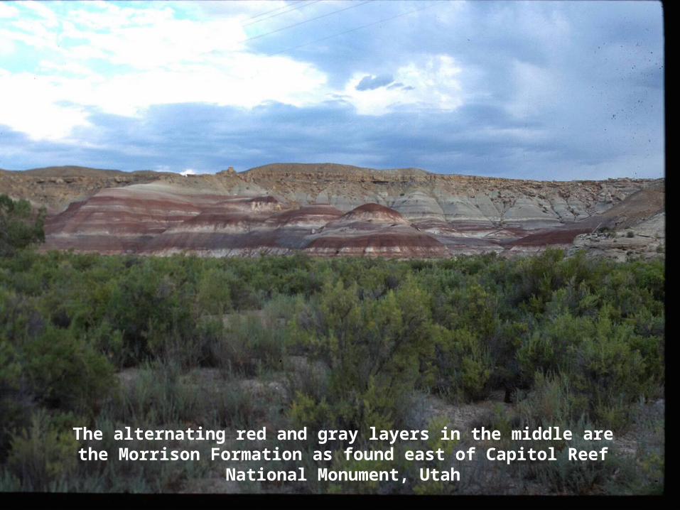
The alternating red and gray layers in the middle are the Morrison Formation as found east of Capitol Reef National Monument, Utah

Dinosaur bones in the Morrison Formation,
Dinosaur National Monument, Utah

Model of Diplodocus, Vernal, Utah. This dinosaur reached a length of 28 meters (84 feet).

White TE. 1964. The dinosaur quarry. In: Sabatka EF, editor. Guidebook to the Geology and Mineral Resources of the Uinta Basin. Salt Lake City: Intermountain Association of Geologists, p 21-28.
The paleontologist T. E. White comments: “Although the Morrison plain was an area of reasonably rapid accumulation of sediment, identifiable plant fossils are practically nonexistent.”
White further muses that by comparing to elephants the dinosaur Apatosaurus “would consume 3 ½ tons of green fodder daily.”

2.2. SOME EVIDENCE SOME EVIDENCE FOR THE FLOODFOR THE FLOOD
e.e. Unusual coal deposits Unusual coal deposits

2.2. SOME EVIDENCE SOME EVIDENCE
e. e. UNUSUAL COAL DEPOSITSUNUSUAL COAL DEPOSITS
Dinosaurs need food if they are going to survive and evolve for the millions of years evolutionists postulate for the Morrison, but the evidence there for plants is sparse. Could the waters of the Genesis Flood have floated and transported away the plant material from the region where the dinosaurs originally lived?
Water is a great sorting agent. At times, floating tree logs and branches are transported by water and deposited as great piles on river banks and shorelines.

2.2. SOME EVIDENCE SOME EVIDENCE
e. e. UNUSUAL COAL DEPOSITSUNUSUAL COAL DEPOSITS
When we look into the rock layers, we sometimes find huge coal deposits that originally came from trees and other vegetation. These huge deposits indicate transport of the original vegetation on a scale anomalous to our present earth, but in agreement with the powerful activity one would expect from the Flood.
The next picture shows a deep soft coal deposit at Morwell, Australia. Note the power line poles for scale and note the parallel layers of coal and clay deposit towards the lower right corner (arrow). Such parallel deposits are typical of water transport and not of growth in place as commonly attributed to coal deposits. The huge size and widespread flat layering of the coal favor the kind of activity expected during the Genesis Flood and is not like what goes on under normal conditions on our earth at present.

Coal seam, Morwell, Australia. Note power line poles for scale. Arrow points to flat sedimentary layers

2.2. SOME EVIDENCE SOME EVIDENCE
e. e. UNUSUAL COAL DEPOSITSUNUSUAL COAL DEPOSITS
The following picture depicts some typical coal seams found in Utah. The parallel nature of these coal deposits suggests transport as expected during the Flood and not local growth of vegetation in the place where the coal is presently found. Growth would tend to produce irregular layers of vegetation. Some geologists admit water transport for these particular seams.
The second picture is a coal parting (arrow) near Castle Gate, Utah. Occasionally, in coal seams we find thin widespread sedimentary layers within a coal seam which is called a parting. It would take widespread water activity to spread these thin partings which can sometimes cover well over 1,000 square kilometers! The red arrow points to one of these partings in a black coal seam. The coal seam is about 40 centimeters thick. Partings are further evidence for the water transport expected during the Flood.


Coal seam, Castle Gate, Utah. The arrow points to a thin parting in the coal. You can follow it across the picture.

3. CONCLUSIONSABOUT
“SOME EVIDENCE”

3.3. CONCLUSIONS CONCLUSIONS THE FOLLOWING DATA FAVOR THETHE FOLLOWING DATA FAVOR THE
GENESIS FLOODGENESIS FLOOD
a. Abundant sediments from the oceans on the continentsb. Abundant underwater activity such as turbidites on the
continents c. Continent-wide current activityd. Incomplete ecological systems, i.e. lack of plant food for
the animals founde. Anomalously thick and widespread coal deposits
Further significant information that favors the Flood is presented in Discussion 16: THE ASTONISHING GENESIS FLOOD: More Evidence.

4.4. REVIEW REVIEW QUESTIONSQUESTIONS
(Answers given later below)(Answers given later below)

4.4. REVIEW QUESTIONS – 1 REVIEW QUESTIONS – 1(Answers given later below)(Answers given later below)
1. What peculiarity about the distribution of marine sedimentary layers over the earth suggests a Genesis Flood? Why is subduction of marine sediments into the trenches of the ocean floor not an explanation for this peculiarity?
2. Why is the abundance of turbidites on the continents evidence for the Flood?
3. At present, on the continents, sediments are being deposited on river banks and lakes in all kinds of directions. What is the situation as far as direction of deposition of sediments in the Paleozoic (lower) and Mesozoic (middle) parts of the Phanerozoic, and what does this mean with respect to the Genesis Flood?

REVIEW QUESTIONS – 2
4. Explain why incomplete ecosystems challenge the long geologic time proposed for the deposition of the environments in which they are found.
5. What features of coal deposits suggest that they represent transported vegetation instead of plants growing where the coal is found, a process that would take many years?

REVIEW QUESTIONS AND ANSWERS - 1REVIEW QUESTIONS AND ANSWERS - 1
1. What peculiarity about the distribution of marine sedimentary layers over the earth suggests a Genesis Flood? Why is subduction of marine sediments into the trenches of the ocean floor not an explanation for this peculiarity?
Strangely, the marine sediments are thicker on the continents and are often higher in elevation than in the oceans where they form. It looks like a lot of sediments from the ocean have been poured onto the continents.
Subduction of marine sediments into the trenches is not an explanation for the thinness of marine sediments in the ocean because subduction is slow. It is at least five times as slow as for the sediments being brought into the ocean by the rivers.
2. Why is the abundance of turbidites on the continents evidence for the Flood?
Because turbidites form only under water. The more widespread ones indicate large volumes of water.

REVIEW QUESTIONS AND ANSWERS - 2REVIEW QUESTIONS AND ANSWERS - 2
3. At present, on the continents, sediments are being deposited on river banks and lakes in all kinds of directions. What is the situation as far as direction of deposition of sediments in the Paleozoic (lower) and Mesozoic (middle) parts of the Phanerozoic, and what does this mean with respect to the Genesis Flood?
In the Paleozoic and Mesozoic one finds a strong dominance of deposition in the same direction over entire continents. This strongly suggests worldwide catastrophic transport of sediments as expected during the Flood.
4. Explain why incomplete ecosystems challenge the long geologic time
proposed for the deposition of the environments in which they are found.
Several formations provide fossil evidence of abundant animal existence, but they lack evidence of sufficient vegetation to support the animals. It is postulated that these animal species lived for millions of years, but how could they do that without sufficient nutrition? The dilemma can be solved by proposing the sorting of the plants from the animals into different sedimentary layers by the waters of the Flood.

REVIEW QUESTIONS AND ANSWERS - 3REVIEW QUESTIONS AND ANSWERS - 3
5. What features of coal deposits suggest that they represent transported vegetation instead of plants growing where the coal is found, a process that would take many years?
The abundance, flat contacts and widespread distribution of the coal seams strongly suggest mass transport. Furthermore, the presence of thin, widespread partings in a number of coal seams also suggest that these deposits would have been laid down by widespread water activity, as expected during the Genesis Flood.

ADDITIONAL REFERENCESADDITIONAL REFERENCESFor further discussions by the author (Ariel A. Roth) and many additional references, see the
author’s books titled:1. ORIGINS: LINKING SCIENCE AND SCRIPTURE. Hagerstown, MD. Review and
Herald Publishing Association.2. SCIENCE DISCOVERS GOD: Seven Convincing Lines of Evidence for His Existence.
Hagerstown, MD. Autumn House Publishing, an imprint of Review and Herald Publishing Association.
Additional information is available on the author’s Web Page: Sciences and Scriptures. www.sciencesandscriptures.com. Also see many articles published by the author and others in the journal ORIGINS which the author edited for 23 years. For access see the Web Page of the Geoscience Research Institute www.grisda.org.
Highly Recommended URLs are:Earth History Research Center http://origins.swau.eduTheological Crossroads www.theox.orgSean Pitman www.detectingdesign.comScientific Theology www.scientifictheology.comGeoscience Research Institute www.grisda.org Sciences and Scriptures www.sciencesandscriptures.com
Other Web Pages providing a variety of related answers are: Creation-Evolution Headlines, Creation Ministries International, Institute for Creation Research, and Answers in Genesis.

USE PERMITUSE PERMIT
Free unrevised use for personal and non-commercial distribution of this material in its original publication medium is granted and encouraged. Proper attribution should be given. Permission for multiple printing for classroom use or not-for-profit public meetings is also freely allowed.
In using this material in this format, accurate attribution should be maintained for any illustrations where credit is designated. Many illustrations are by the author and free use is granted for all media. However, when credit to another source is given, permission might be necessary from the source for certain different kinds of communication media than the present use.