×
Log in
Upload File
Most Popular
Study
Business
Design
Technology
Travel
Explore all categories
Download -
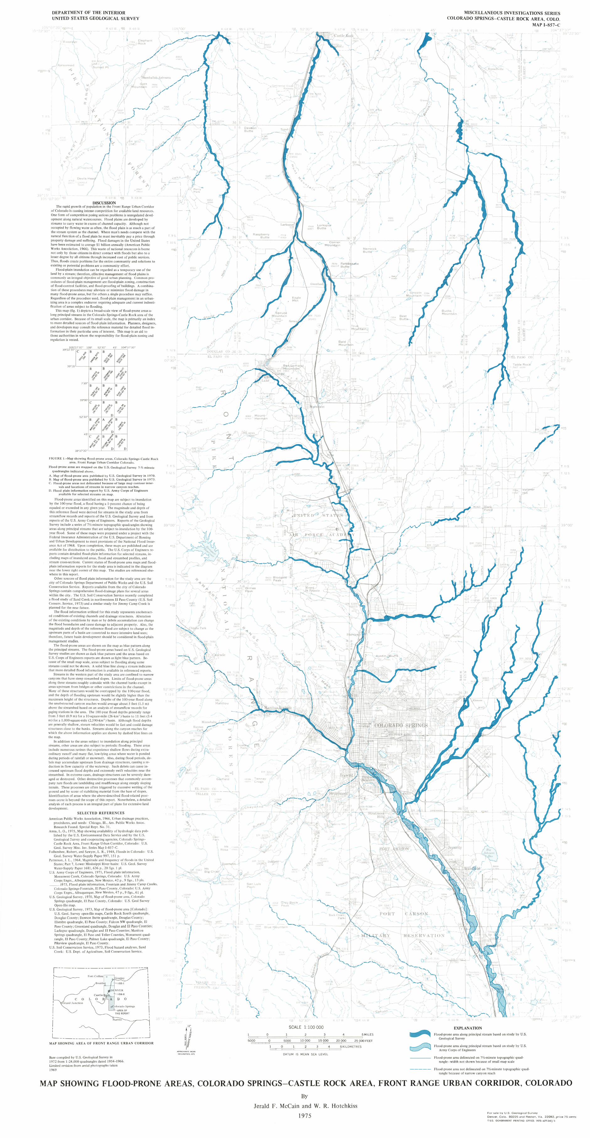
1969 MAP SHOWING FLOOD-PRONE AREAS, COLORADO …BM 5847 5894 S E ltVXTION ity 5703 , rews \ Re s 5839 rpor iii in Rosern«fÄ untain gagmg stations In the area. 00-year flood depths
Download
Transcript
Page 1
Top Related
Comrie (Potentially Vulnerable Area 08/14) · Natural flood management works Natural flood management study Flood protection scheme/works Flood protection study A flood protection
02-09-2014 Practical considerations on the REWS approach Peder Enevoldsen
AlftOVfD FGR REWS£ 19M CIA HISTORI:Al. REViEW PROGWI · AlftOVfD FGR REWS£ 19M CIA HISTORI:Al. REViEW PROGWI ... models of power stations and nuclear ... We anived about 7:30 p.m
Flood Hazard Mapping and its Utilization for Flood ... · PDF fileUtilization for Flood Disaster Mitigation ... Session “Flood control and mitigation measures ... Flood mapping of
COUNTY ADMINISTRATOR: C.H. Huckelberry FLOOD CONTROL FLOOD ...webcms.pima.gov/UserFiles/Servers/Server_6/File... · FLOOD CONTROL FLOOD CONTROL FLOOD CONTROL FLOOD CONTROL FLOOD CONTROL
GREEN M®UNTAIN GE® L®GIST - Vermont › sites › dec › files › geo › GMG › GMG_1984.pdfTHE GREEN M®UNTAIN GE® L®GIST QUARTERLY NEWSLETTER OF THE VERMONT GEOLOGICAL SOCIETY
FLOOD S AND FLASH FLOOD S
Flood Estimation following the Flood Studies Report - … Estimation FSR... · Flood Estimation following the Flood Studies Report ... flood estimation methods ... (Some important