×
Log in
Upload File
Most Popular
Study
Business
Design
Technology
Travel
Explore all categories
Download -
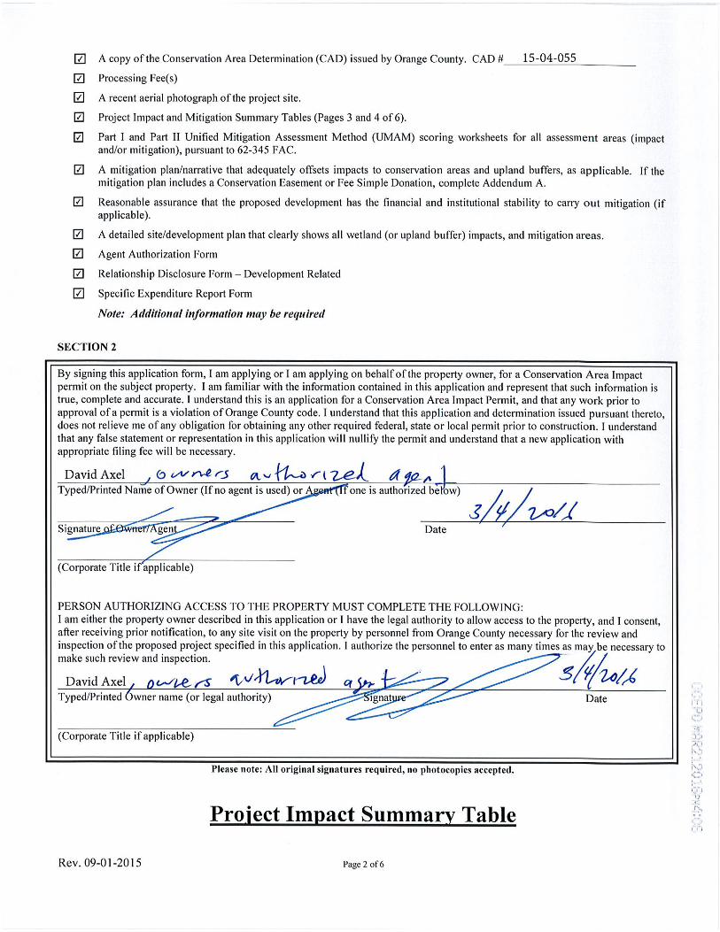
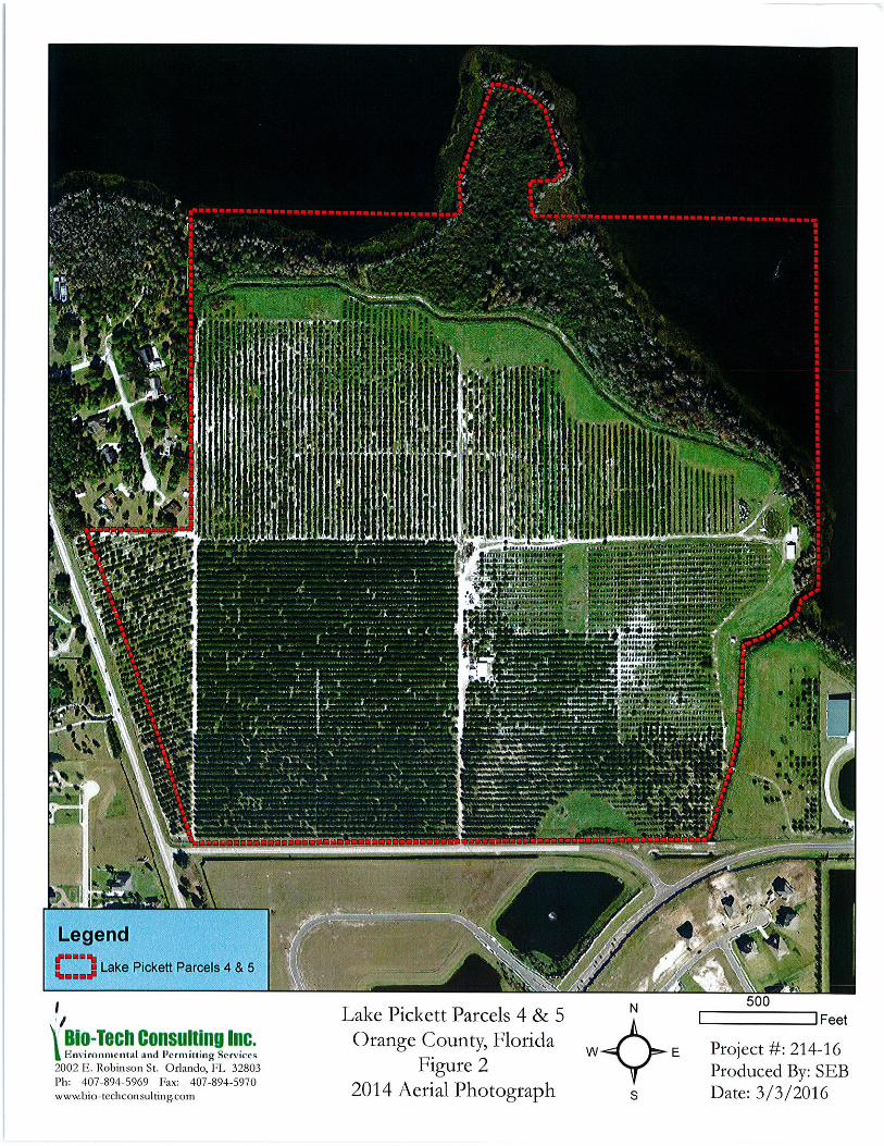
· A copy of the Conservation Area Determination (CAD) issued by Orange County. CAD # Processing Fee(s) A recent aerial photograph of the project site
Download
Transcript
Page 1
Page 2
Page 3
Page 4
Page 5
Page 6
Page 7
Page 8
Page 9
Page 10
Page 11
Page 12
Page 13
Page 14
LOAD MORE
Top Related
4 Aerial Imagery Trends Changing CAD/911
APPENDIX B: Aerial Photograph APPENDIX C: Boring Location
The Rectification Of A Tilted Aerial Photograph
Topography and flight: The creative application of aerial ... · 7.1 Links of Noltland and Grobust beach behind. Kite aerial photograph by the research-practitioner, 2014. 140 7.2
Low Crosby FIR v2 Final (1kb pdf) - Cumbria · 2017-03-01 · Low Crosby Flood Investigation Report Aerial photograph taken looking east from Carlisle Photograph provided by Peter
Aerial photograph of the Williams Power plant taken prior ... · PDF fileWilliams Dam Historical Photographs Lawson-Fisher Associates P.C. 1 Aerial photograph of the Williams Power
Introduction To Aerial Photographsncert.nic.in/textbook/pdf/kegy306.pdf · b. Time freezing ability: An aerial photograph is a record of the surface features at an instance of exposure
LAND REGISTRATION USING AERIAL PHOTOGRAPH IN NAMIBIA …€¦ · USING AERIAL PHOTOGRAPH IN NAMIBIA COSTS AND LESSONS Customary Land Right Registration: Aerial photos 2 1. Introduction