
Approaches to supporting coverages and multidimensional arrays required by Annex II and III
Dean HintzSafe Software
INSPIRE 2017, Strasbourg

Agenda
Use of coverages in INSPIRE Data model representations Read and Extract tools Transform approaches Application examples Challenges & lessons Upcoming developments

#fmewebinar
Convert data
Transform data
Share data
Integrate data
Validate data
And more
FME transforms data to use and share.
What is FME?

Extraction – Formats & Services
FME’s power for data extraction is unparalleled with support for 400+ data formats & services
Reads vector, raster, point cloud, non-spatial SQL databases, no-SQL databases, web sources: GML, XML, JSON, API’s, cloud
CAD VECTOR RASTER DATABASE BIM/3D WEB POINT CLOUD
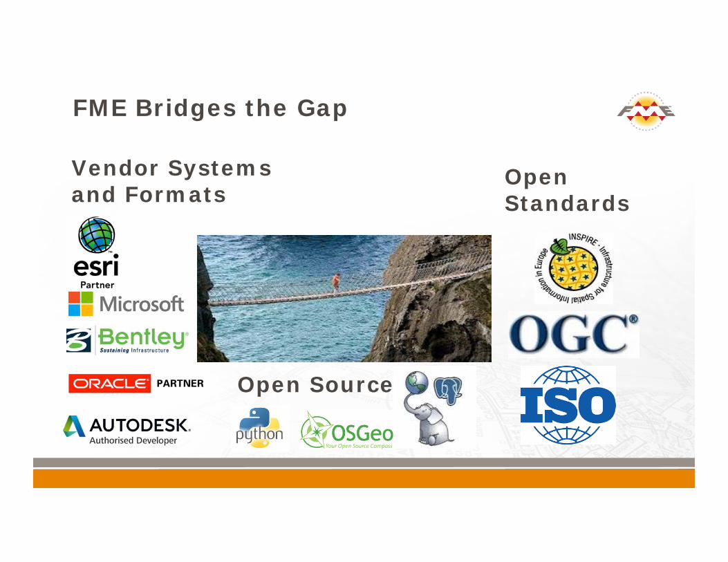
FME Bridges the Gap
Vendor Systems and Formats
Open Standards
Open Source

FME - INSPIRE Life Cycle Support

Key Raster Formats
Orthophotos: GeoTIFF, JPEG2000, ECW OGC Services: WMS, WCS Cloud based satellite imagery distribution:
Sentinal, Planet, Urthcast (near daily)
Elevation: GeoTIFF, ESRI ASCII Grid, DTED
Model / Sensor: NetCDF, web services: JSON, XML, text, HTML tables

Raster Extraction Tools
Data suitability – Data Inspector Read Format readers: Raster, OGC, Cloud readers FeatureReader – each record triggers (automation) Web sources – almost any format can accept a URL ImageFetcher, HTTPCaller
Filter Spatial – extents: Clipper, SpatialRelator Attribute – range: Tester, RangeFilter

Sentinal-2 on AWS – Daraa Refugee Camp

Workflows: Raster Handling
Less known capability of FME Full range of raster processing tools Change raster structure to match destination
requirements Raster algebra & statistics Custom transformers: RasterStatisticsCalculator See Transformer Guide & Tutorial: Rasters

Reinterpretation, Resampling Tiling, Mosaicking, Nodata Reprojection Clipping Offsetting, scaling DEM creation, surface modeling 3D raster, draping Rasterization, raster value extraction Vectorization, RasterToPolygonCoercer
Raster Transformations

ADRG ASRPAircom ENTERPRISE BMPBathymetric Attributed Grid
(BAG)CADRG CDED DTEDECWENVI .hdr RAW RasterER Mapper ERSESRI .hdr RAW RasterESRI ASCII GridESRI ArcGIS Binary Grid ESRI ArcGIS Image ServerESRI ArcSDE Raster CatalogESRI ArcSDE Raster MapESRI Geodatabase Raster GIF
GeoTIFFGolden Software Surfer Binary
GridHierarchical Data Format 4
(HDF4) JPEGJPEG 2000 Landmark Z-MAPLeica Geosystems ERDAS
IMAGINELeica Geosystems ERDAS
RAWMaptech BSB Nautical ChartMarconi PlaNetMrSIDNETCDF (reading / writing)NITF Oracle Spatial GeoRasterPCI Geomatics Database FilePNG
R Statistical Raster (RDATA)RADARSAT-2 XMLShuttle Radar Topography
Mission Height (SRTM HGT)
TIFF USGS DEM Vertical Mapper Grid (NGrid)Web Map ServiceWorld Meteorological
Organization GRIBX11 Pixmap (XPM)
FME Raster Format List

Manipulating Bands
Band combining, splitting
OffsetingScalingAffineGeoreferencing

Controlling Interpretation
Data Type Bit Depth Data Interpretation Importance Removing or Resolving Palettes RasterInterpretationCoercer
INT32 GRAY8 JPEG

Clipping
Basic Raster Transformations
Mosaicking No-data values

Raster Cell Manipulation & Algebra
Raster Cell Calculation RasterCellValueReplacer RasterCellValueCalculator RasterExpressionEvaluator

3D and Raster
Appearances Surfaces, TINs Draping 2.5D vs 3D
Overlaying:PointOnRasterOverlay

Raster and Vector Interaction
Generate DEM and estimate flood areas Raster DEM to flood polygon RasterCellValueReplacer RasterToPolygon Generalization

Workflows: Point Clouds
Full range of point cloud processing tools Clip, reproject, resample Manipulate components structure and data types Change array structure to match destination
requirements Point cloud calculations & statistics PointCloudStatisticsCalculator See Transformer Guide & Tutorial: Rasters

Point Cloud Format Support
LAS (plus LAZ, zLAS)XYZASTM E57Oracle SpatialPointools PODRIEGL Laser Scan Db Terrasolid TerraScanZ+F LaserControl ZFSMinecraftCARIS Spatial ArchiveAutodesk ReCapCesium (in progress)
Ras
ter F
orm
ats
Vect
or F
orm
ats

Transform: Classify, Split, Clip

Transform: Merge Values from Raster
Surface modelling

Surface Modelling: Bare Earth
DTM DSMINPUT

What is a Coverage?
Values over space and time Can be regular or irregular grids Usually some form of measurement, weather in
situ or remote sensing Represented by a domain (extent) and range of
values that correspond to that domain Often stored as arrays with dimension
information defining the space, time and value types
Coverage Examples
Gridded data May be grids of points or raster cells Applications: imagery elevation models model outputs, often with time series
(precipitation, flood) risk formats: NetCDF, GeoTIFF, GML coverages

Coverage examples: INSPIRE Types
CoverageByDomainAndRange CoverageFunction GridFunction RectifiedGridCoverage ReferenceableGridCoverage

Coverage examples: INSPIRE Themes
AC-MF: Atmospheric Conditions and Meteorological Features
EL: Elevation Grid Coverage ER: Energy Resources GE: Geology OF: Ocean Features OI: Ortho Imagery LC: Land Cover NZ : Natural Risk Zones (risk coverage) SO: Soils
Workflows: NetCDF to KML
Read NetCDF dimensions as multiband raster RasterBandSplitter to break bands into individual
features ListIndexer to associate band index value with
associated raster geometry

NetCDF to KML: Workspace
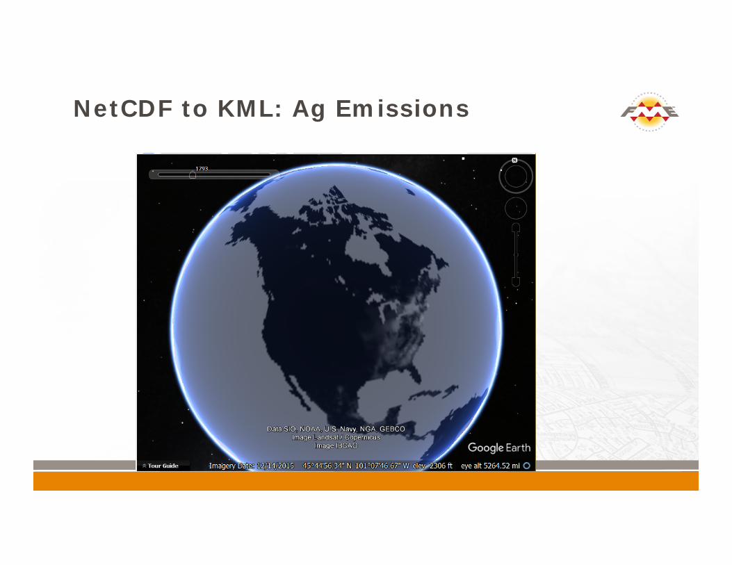
NetCDF to KML: Ag Emissions

NetCDF to KML: Ag Emissions

NetCDF to KML: Ag Emissions

Transformation Approaches
Split arrays: NetCDF to GeoTIFF Data model conversion: raster <> arrays Read range and domain separately and then
combine

Challenges
GML coverage definition for INSPIRE is too loosely defined – subject to customization via extensions
Need more guidance as to what type of coverages are most important for us to support
Lack of easily accessible sample data per theme At a minimum this presentation gave us an
opportunity to see these challenges and adjust our development to address them

GML Coverage Sample from Finnish Meteorological Institute
<om:result><gmlcov:MultiPointCoverage gml:id="mpcv-1-1"><gml:domainSet>
<gmlcov:SimpleMultiPoint gml:id="mp-1-1" srsName="http://xml.fmi.fi/gml/crs/compoundCRS.php?crs=4258&time=unixtime" srsDimension="3">
<gmlcov:positions> 60.09726 19.93481 146184480060.09726 19.93481 1461848400 ...
</gmlcov:positions></gmlcov:SimpleMultiPoint></gml:domainSet><gml:rangeSet>
<gml:DataBlock><gml:rangeParameters/> <gml:doubleOrNilReasonTupleList>
4.93 8.53 1010.89 75.46 92.0 8.39 -8.12 -2.15 8.47 13.63 2.91 100.0 2.0 11.7 24.9 100.0 0.0 0.0 12813444.0 6044484.0 -1445534.13 11573148.0 11462539.0 4.93 8.81 1010.2 75.02 92.0 8.6 -8.33 -2.11 8.6 13.97 3.07 0.0 1.0 0.0 0.0 0.0 0.0 0.0 15244839.0 6989885.5 -1743936.5 13769114.0 12932554.0

GML Coverage to Point Cloud

GML Coverage Viewer

INSPIRE GML Coverage – GML Reader

GML Coverage: Point Cloud

GML Coverage: Point Cloud

GML Coverage: RangeSet Update

INSPIRE Web Services
1. OGC WMS: 1.0, 1.1, 1.32. OGC WFS: 1.0, 1.1, 2.03. Atom/RSS 4. ArcGIS Online5. REST6. JSON, GeoJSON7. Amazon Web Services

XML Reading
Metadata GML embedded in XML Leveraging web services and content: RSS, XML
streams, HTML Use metadata to drive workflow automation Parse GetCapabilities to compose GetFeature
requests

British Geological Survey Demonstration WCS
http://ogcdev.bgs.ac.uk/ogcclient/WCS/GetCoverage_v2_0_1.html

FME Custom WCS Reader

WCS GetCapabilities Response
<?xml version="1.0" encoding="UTF-8"?><wcs:Capabilities xmlns:inspire_dls =
"http://inspire.ec.europa.eu/schemas/inspire_dls/1.0" xmlns:inspire_common = “http://inspire.ec.europa.eu/schemas/common/1.0” xmlns:gmlcov="http://www.opengis.net/gmlcov/1.0" xmlns:gml="http://www.opengis.net/gml/3.2" xmlns:wcs="http://www.opengis.net/wcs/2.0">
. . .<wcs:Contents>
<wcs:CoverageSummary><wcs:CoverageId>OneGDev__CentralMed-MCol</wcs:CoverageId><wcs:CoverageSubtype>RectifiedGridCoverage</wcs:CoverageSubtype>
</wcs:CoverageSummary><wcs:CoverageSummary>
<wcs:CoverageId>OneGDev__AegeanLevantineSeas-MCol</wcs:CoverageId><wcs:CoverageSubtype>RectifiedGridCoverage</wcs:CoverageSubtype>
</wcs:CoverageSummary></wcs:Contents></wcs:Capabilities>

GetCoverage Response

Consuming INSPIRE data and Services
INSPIRE services should be results oriented and driven by user requirements
FME takes the pain out of reading and leveraging complex GML, XML and web services
Data Inspector makes it easy Visualize all data types: 2D / 3D, vector /
raster, non-spatial / complex geometries Consume directly from URLs or web services Inspect complex data models and geometries

Your INSPIRE Viewer: Data Inspector
Read any GML

Complex Attributes: Land Cover Units

FME Desktop
Author data transformation workflows in a simple GUI.
Take FME to the enterprise with enhanced automation.
Get the benefits of FME Server in a hosted version.
FME Server FME Cloud
Three Ways to use FME

Coming in FME 2018
Preliminary GML coverage support NetCDF 4.0 support (FME 2017) GDAL upgrade WCS 2.0 reader WCS Server template Raster and Coverage examples in the FME
INSPIRE Tutorial

FME completes the INSPIRE Life Cycle

FME and INSPIRE
FME simplifies the process of achieving EU INSPIRE* compliance - without any coding - through its abilities to: Read INSPIRE data and services, using a number of
readers, including the INSPIRE GML Reader Prepare data for contribution to INSPIRE through data
transformation and schema mapping Write INSPIRE GML using the INSPIRE GML Writer,
with built-in application schemas Validate INSPIRE GML to ensure compliance with EU
standards Share INSPIRE data using FME Server’s web services

Conclusion
INSPIRE coverage requirements are still evolving and range from simple raster imagery to complex array structures BUT: FME gives you access to whatever data is needed FME provides full control over your data model Share it an way that is easily accessible INSPIRE coverages provide opportunities for data
integration across modelling environments such as weather and climate models – increasingly important in a climate change context

ResourcesINSPIRE Tutorial:knowledge.safe.com/articles/1321/eu-inspire-initiative-tutorial.htmlFME Community:knowledge.safe.com/search.html?f=&q=inspireSafe.com:safe.com/inspirehub.safe.comSearch: rasterplayground.fmeserver.com/Other tutorials: XML, GML, JSON, 3DGoogle: INSPIRE FME


