
AWheelchair Rider’s Guide
Los Angeles and Orange County Coast
E R I C K & E L I S A M I K I T E N
AWheelchair Rider’s Guide
COASTWALK with the COASTAL CONSERVANCYCOASTWALK with the COASTAL CONSERVANCY

C O A S T W A L K , a nonprofit organization, is working for thecompletion of the California Coastal Trail, and promotesstewardship of coastal resources. Coastwalk organizescoastal hikes, and has published the two-volume guide-book Hiking the California Coastal Trail.
T H E C O A S TA L C O N S E R VA N C Y, a state agency, workswith the people of California to expand public access tothe coast and San Francisco Bay, and to preserve andrestore coastal resources. The Conservancy has openedover 70 miles of shoreline to the public and has helped topreserve over 60,000 acres of wetlands, wildlife habitat,parks, and farmland. The Conservancy provided fundingto Coastwalk to prepare and distribute this guide.
C R E D I T S
Produced by Rasa GustaitisEdited by Hal Hughes and Rasa Gustaitis Designed and composed by Seventeenth Street StudiosSpecial thanks to photographers Malcolm Lubliner and Larry Wanand to Irene BarnardCover photos by Malcolm Lubliner
© 2001 Coastal Conservancy
Coastal Conservancy Publications1330 Broadway, 11th Floor, Oakland, CA 94612510/[email protected]
Coastwalk7207 Bodega Avenue, Sepbastopol, CA 95472800/[email protected]
T H I S G U I D E G U I D E I S A VA I L A B L E F R E E O F C H A R G E
and will also be accessible on-line through the web sitesof Coastwalk, www.coastwalk.org, and the CoastalConservancy, www.scc.ca.gov.

Table of Contents
INTRODUCTION viiHOW TO USE THIS BOOK ix
Los Angeles County 1
Malibu 3
Leo Carrillo State Park 4
Nicholas Canyon County Beach 6
Robert H. Meyer Memorial State Beaches: El Pescador, La Piedra, El Matador 7
Charmlee Wilderness Park 8
Zuma Beach County Park 10
Westward Beach / Point Dume State Preserve 11
Paradise Cove / Sand Castle Beach 12
Malibu Bluffs Community Park 13
Malibu Lagoon Museum and Lagoon 13
Topanga County Beach 15
Santa Monica Bay 17
South Bay Bicycle Trail 18
Will Rogers State Beach 20
SANTA MONIC A 22
Santa Monica Municipal Pier 23
Santa Monica State Beach 24
HI-Santa Monica Hostel (Hostelling International/AYH) 25
Palisades Park 26
Crescent Bay Park 27iii
VENICE DISTRICT 27
Venice Beach / The Strand 28
Venice Pier 29
Canal Park 30
Marina del Rey 31
Marina del Rey Information Center 32
Audrey E. Austin Jr. Memorial Park / Ballona Lagoon Walkway 33
Mother’s Beach 34
Burton W. Chace Park 35
Fisherman’s Village 36
Dockweiler State Beach 36
Manhattan Beach 39
Manhattan County Beach 40
Roundhouse Marine Studies Lab and Aquarium at Manhattan Beach Pier 41
Hermosa Beach 41
Redondo Beach 43
Redondo Beach Municipal Pier, International Boardwalk, and Sport Fishing Pier 44
Redondo County Beach 45
Torrance County Beach 46
Southern Los Angeles County 47
Wayfarers Chapel 48
Ocean Trails 49
White’s Point Beach / Royal Palms County Beach 49
Marine Exchange Vessel Traffic Center 51
iv A W H E E L C H A I R R I D E R ’ S G U I D E
LOS ANGELES HARBOR 51
Cabrillo Beach and Marine Aquarium 52
Los Angeles Maritime Museum 55
LONG BEACH AND BELMONT SHORE 55
Queen Mary 57
Long Beach Aquarium of the Pacific 59
Long Beach Shoreline Park and Rainbow Harbor 60
Pine Avenue 61
Shoreline Village 61
Long Beach Downtown Shoreline Marina 61
Long Beach City Beach to Alamitos Bay 62
Bluff Park 64
Orange County 65
Seal Beach 67
Seal Beach and Municipal Pier 68
Bolsa Chica Ecological Reserve 68
Bolsa Chica State Beach 70
Huntington City Beach and Pier 71
Huntington State Beach 73
Talbert Marsh 74
Newport Beach 75
Balboa Peninsula 76
Balboa Island 77
Upper Newport Bay State Ecological Reserve / Interpretive Center 78
Corona del Mar State Beach 80
Crystal Cove State Park 81
T A B L E O F C O N T E N T S v
Laguna Beach 85
Crescent Bay Point Park 86
Heisler Park 87
Main Beach 88
Downtown 88
Friends of the Sea Lion Marine Mammal Center 89
Aliso Beach County Park 90
Dana Point 91
Salt Creek Beach Park 92
Ken Sampson Lookout 93
Heritage Park 94
Dana Point Harbor 94
Doheny State Beach 96
Capistrano Beach Park 98
San Clemente 99
San Clemente City Beach / Municipal Pier 100
San Clemente State Beach 101
Calafia State Beach 102
P U B L I C T R A N S P O R TA T I O N 103
T O T H E G U I D E B O O K U S E R 107
vi A W H E E L C H A I R R I D E R ’ S G U I D E
A WheelchairRider’s Guide
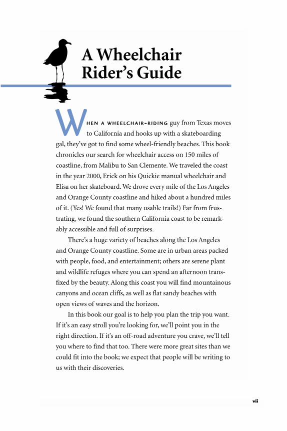
WH E N A W H E E L C H A I R-R I D I N G guy from Texas moves
to California and hooks up with a skateboarding
gal, they’ve got to find some wheel-friendly beaches. This book
chronicles our search for wheelchair access on 150 miles of
coastline, from Malibu to San Clemente. We traveled the coast
in the year 2000, Erick on his Quickie manual wheelchair and
Elisa on her skateboard. We drove every mile of the Los Angeles
and Orange County coastline and hiked about a hundred miles
of it. (Yes! We found that many usable trails!) Far from frus-
trating, we found the southern California coast to be remark-
ably accessible and full of surprises.
There’s a huge variety of beaches along the Los Angeles
and Orange County coastline. Some are in urban areas packed
with people, food, and entertainment; others are serene plant
and wildlife refuges where you can spend an afternoon trans-
fixed by the beauty. Along this coast you will find mountainous
canyons and ocean cliffs, as well as flat sandy beaches with
open views of waves and the horizon.
In this book our goal is to help you plan the trip you want.
If it’s an easy stroll you’re looking for, we’ll point you in the
right direction. If it’s an off-road adventure you crave, we’ll tell
you where to find that too. There were more great sites than we
could fit into the book; we expect that people will be writing to
us with their discoveries.
vii

Southern California’s passion for exercise has advantages
for wheelchair riders: in central Los Angeles County and
southern Orange County, concrete bicycle paths have been
built on most of the beaches. They are great for explorations
on wheels. And if your family or friends want to join in, they
can rent a set of wheels at a bicycle or skate shop.
We’ve tried to describe each site in this book in enough
detail for you to evaluate in advance whether it’s worth visiting.
We’ve described degrees of difficulty on trails, and the features
of restrooms and other facilities. The word “accessible” occurs
sparingly because it means different things to different people.
When we do use it in describing restrooms, we mean “modern
textbook accessible,” with five-foot turning radius, two grab
bars, and a high toilet.
As we traveled along this coastline, we learned a few things
about comfort. First, even southern California beaches can
suddenly become cool, especially in the early evening, so wind-
breakers are a must. Second, you always stay longer than you
intend, so bring snacks and especially water. And finally, there’s
a lot of glare on a sandy beach: sunscreen, sunglasses, and base-
ball caps are a real help. We stuffed these things into a backpack
and hitched it onto Erick’s chair. We also brought binoculars
for watching birds and whales, fingerless weightlifting gloves,
which Erick likes to wear on longer hikes, and moist towelettes
for easy cleanup after dusty trails.
Happy travels!
Erick and Elisa Mikiten
viii A W H E E L C H A I R R I D E R ’ S G U I D E
How to use this bookSOME HINTS TO HELP YOU USE
THIS GUIDE TO BEST ADVANTAGE
TH I S G U I D E is an invitation to explore wheelchair-accessible beaches,
parks, preserves, and other coastal places between Malibu and San
Clemente. We hope it will be useful not only to residents and visitors who
travel by wheelchair but also to many other people, including parents wheel-
ing strollers and elderly people with canes.
What’s Inside
Take a moment to get acquainted with what’s inside. The sites we included
are generally within walking distance of the shore and offer something spe-
cial, be it great views, interesting activities, or opportunities to watch
wildlife, get to know native plants, or learn something of local history.
There are more accessible sites every year. When we first toured the Los
Angeles coastline for the Coastal Conservancy in 1993, we found far fewer
than we did in 2000. Each year more obstacles are being removed from path-
ways and more facilities are brought up to the standards of the Americans
with Disabilities Act (ADA). Explore, inquire, and check web sites.
Organization and Maps
The guide moves downcoast, from northern Los Angeles County to southern
Orange County, following the Pacific Coast Highway most of the way. The
sketchy maps of the two counties on p. 2 and p. 66 provide an idea of dis-
tances between some of the sites and suggest the shape of the coastline. It’s
easy to navigate north of Santa Monica, where the highway follows the coast,
but we suggest you get a road map for destinations from Santa Monica south.
Diagrams of individual sites are provided only where they seemed essential.
ix

Hiking SafelyThe trails in this guide are not all flat. Many are, but others are at the upper
limit of what an athletic and daring wheelchair rider would attempt with a
manual chair. If we call a trail “steep” or “difficult,” believe it. That trail is
likely to include real risks, such as steep passages where you can’t come to a
complete stop, potholes, or slippery surfaces, and it will require great phys-
ical strength and balance to travel its length. Likewise, if we say that a trail is
“too steep for wheelchair riding,” we mean it.
You are your own best judge for choosing trails that are safe for you.
Rather than making assumptions about people’s ability or interest, we’ve
included trails of widely varied difficulty. But please, exercise your own
judgment.
Terminology
We use the terms “walk” and “ride” interchangeably. “Walk” means travel at
a slow speed, whether you’re on foot or on wheels.
In most communities, “Pacific Coast Highway” is synonymous with
“Highway 1.” In a few places, one or the other is used exclusively, but you
probably won’t notice unless you’re looking at a local map.
x A W H E E L C H A I R R I D E R ’ S G U I D E
I C O N S
PARKING: Blue cars indicate parking areas with dedicated bluespaces. Check the text for accessibility.
FREE BEACH WHEELCHAIRS: Available at some sites, but morebeaches may have them by the time you read this. Call ahead if youcan, to ask and reserve.
RESTROOMS: Don’t rely only on the symbol. Read the text for details:some “accessible” restrooms are old and not up to ADA standards.Some that are not marked “accessible” may work for you.
PICNIC AREAS: Indicated only where they are wheelchair-accessible.
INFORMATION CENTER
PLAY STRUCTURE

The steepness of ramps is measured by a ratio. A standard ramp is 1:12,
meaning that the ramp rises 1 inch for every 12 inches of length.
Where to Find Out More
The Public Transportation section, p. 103, lists public transit information.
We’ve also included phone numbers for most of the sites. Use these sources
for information about facilities, beach wheelchairs, docent-led walks, and
special events. If they can’t answer accessibility questions, they likely will
refer you to someone who can. Among helpful web sites are those of the
State Parks Department, www.cal-parks.ca.gov; the Los Angeles Department
of Beaches and Harbors, beaches.co.la.ca.us; and the County of Orange
Harbors, Beaches, and Parks, www.ocparks.com. On all these sites you will
find photographs, maps, and short descriptions of beaches and parks that
you can download. The State Parks site also links to a list of currently ac-
cessible features in each park. These sites are likely to carry updates on proj-
ects to improve accessibility. This guide will also be accessible on-line by
2002 through the web sites of Coastwalk, www.coastwalk.org, and the Coastal
Conservancy, www.scc.ca.gov.
Beach Wheelchairs
Large chairs with balloon tires that can roll over sand are available free of
charge at several beaches. They require someone other than the rider to push
from behind, and are easiest to push on wet sand. Income from sales of the
special Coast 4-U automobile license plate enabled the Coastal Conservancy
and Coastal Commission to fund the purchase of beach wheelchairs. Call
ahead to confirm that a chair is available. Also call ahead if you need more
than one.
Fishing
Anyone may fish from a public pier at the ocean or a bay without a license.
If you are 16 years or older, you need a license to fish from any other loca-
tion. Most bait and tackle shops sell licenses.
H O W T O U S E T H I S B O O K xi

Wildlife
Please respect local wildlife. Remember—the quieter you are, the more you
will see and hear. If a dog is with you, please use a leash to prevent it from
flushing and chasing shorebirds. Many birds are on long migrations and
need to feed and rest.
Comments
We’d like to hear from you. Let us know if this book was useful, if anything
needs to be changed, and if you found barriers that could be removed. Send
your comments to the Coastal Conservancy, 1330 Broadway, 11th floor,
Oakland, CA 94612. In the bottom left corner of the envelope, write: Attention
Wheelchair Guides. You can also e-mail the editors at [email protected] or
call (510) 286-0934.
xii A W H E E L C H A I R R I D E R ’ S G U I D E
The authors on the trail
ER
ICK
MIK
ITE
N

Los Angeles CountyTHE LOS ANGELES COUNTY COAST
F R O M T H E R U G G E D Santa Monica Mountains in Malibu
through Long Beach Harbor to Belmont, the Los Angeles
County coast is richly varied, offering many opportunities for
recreation and adventure. More than half of the coast is publicly
owned, and much of it can be easily explored with a wheelchair.
Where the terrain is difficult, there are often scenic drives.
Malibu’s 27-mile coast lies at the base of the Santa Monica
Mountains. Steep slopes keep a few beaches inaccessible, but
others are open for wheelchair riding. Camping facilities and
nature trails at the foot of the mountains are outstanding, and
the views from the Pacific Coast Highway are breathtaking.
South of Malibu, on Santa Monica Bay, wheelchair access
is easy at Los Angeles city beaches. There are numerous piers
and boardwalks, and beach wheelchairs are available in several
locations for traveling across sand. The paved 22-mile South
Bay Bicycle Trail runs on the beach between Will Rogers State
Beach and Torrance County Beach.
Farther downcoast, the Pacific Coast Highway cuts across
the Palos Verdes Peninsula, which separates Santa Monica Bay
from the Long Beach Harbor area. Palos Verdes Drive provides
dramatic views of rugged shores and the ocean.
The south end of the county is not to be missed, despite
the utilitarian landscape at the shipping ports. Among several
interesting stops in the Los Angeles Harbor area is Cabrillo
Marine Aquarium, especially great for wheelchair-riding chil-
dren. Long Beach has a wonderful larger aquarium and miles
of paved walks along the shore.

Long Beach
LeoCarrillo
Zuma PointDume
MalibuPier
Topanga
Venice Beach
Redondo Beach
Torrance
Palos Verdes
White’s Point / Royal Palms
Cabrillo Beach
Will Rogers
LOS ANGELESCOUNTY
ORANGECOUNTY
Pacific Coast Highway Topa
nga
Can
yon
Santa Monica
Kanan
Road
Charmlee
EncinalCanyon
Road
5
10
101
605
110
710
105
1
405
N
LOS ANGELES COUNTYBEACHES
This map includes onlyenough locations androutes to give a generalidea where the sitesdescribed in this bookcan be found.

MalibuLEO CARRILLO STATE PARK TO
TOPANGA COUNTY BEACH
TH E P A C I F I C C O A S T H I G H W A Y ( P C H ) travels Malibu’s
dramatic 27-mile shoreline at the edge of the Santa Monica
Mountains. You can pull off the road at numerous spots and
take in the view. Leo Carrillo State Park Campground at the
north end of Malibu has especially good beach access, and also
camping facilities. Downcoast of Topanga Canyon Boulevard
the popular beaches are broad and flat. Malibu Lagoon and the
Malibu Lagoon Museum are particularly interesting for wild-
life viewing and local history.
Back garden of Adamson House (see p. 14)
MA
LCO
LM L
UB
LIN
ER

4 L O S A N G E L E S C O U N T Y
Leo Carrillo State ParkONE MILE DOWNCOAST OF THE VENTURA COUNTY LINE
ENTRANCE ON PACIFIC COAST HIGHWAY, 35000 BLOCK, INLAND SIDE
TH I S 3 , 0 0 0 - A C R E P A R K is at the upcoast end of Malibu, on the floor of
a sycamore-shaded canyon that opens to a sandy beach. The park ex-
tends on both sides of the PCH. A pedestrian and vehicle underpass con-
nects the canyon to the beach. It’s well worth a visit, for it offers good beach
access, picnic grounds, and 127 campsites for tents and recreational vehi-
cles. Six campsites are wheelchair accessible. (Reserve early.)
Day Use
There are two day-use parking areas: inland, just left of the entrance (3 blue
spaces), and on the beach side of the underpass. From the inland parking
area, a sloping walkway with handrails
leads through the underpass beneath the
highway to a paved area with a view of the
LEO C ARRILLO
H O U R S
Dawn to dusk for day use
I N F O R M AT I O N
818/880-0350Monday–Friday 8am–5pm
R E S E R VAT I O N S
800/444-PARK
F E E S
Day use$3 per vehicle, $2 seniorsHike and bike$1 per personCamping$12, $10 seniors per night
B E AC H W H E E L C H A I R S
Available. Call ahead310/457–1324, or inquireat the entrance.Balloon-tired wheelchairs take you right
to the water.
LA
RR
Y W
AN
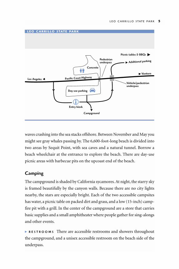
waves crashing into the sea stacks offshore. Between November and May you
might see gray whales passing by. The 6,600-foot-long beach is divided into
two areas by Sequit Point, with sea caves and a natural tunnel. Borrow a
beach wheelchair at the entrance to explore the beach. There are day-use
picnic areas with barbecue pits on the upcoast end of the beach.
Camping
The campground is shaded by California sycamores. At night, the starry sky
is framed beautifully by the canyon walls. Because there are no city lights
nearby, the stars are especially bright. Each of the two accessible campsites
has water, a picnic table on packed dirt and grass, and a low (15-inch) camp-
fire pit with a grill. In the center of the campground are a store that carries
basic supplies and a small amphitheater where people gather for sing-alongs
and other events.
� R E S T R O O M S There are accessible restrooms and showers throughout
the campground, and a unisex accessible restroom on the beach side of the
underpass.
L E O C A R R I L L O S T A T E P A R K 5
Concrete
Day use parking
Pacific Coast Highway
Additional parking
Entry kiosk
Pedestrianunderpass
Vehicle/pedestrianunderpass
Ventura
Los Angeles
Campground
Picnic tables & BBQs �
L E O C A R R I L LO S TAT E PA R K

6 L O S A N G E L E S C O U N T Y
Nicholas Canyon County BeachPACIFIC COAST HIGHWAY AT NICHOLAS CANYON ROAD
NI C H O L A S C A N Y O N C O U N T Y
B E A C H lies at the base of sea cliffs.
From the Pacific Coast Highway, a narrow
entrance road winds down a steep hill to a
parking area. The walk from there to the
beach is steep, but cars with disabled plac-
ards or plates may drive to a lower parking
area next to the lifeguard station, where
there are two picnic tables. From there a
gently sloping road carved into the bluff
leads to accessible restrooms and an excel-
lent 1:12 ramp, with landings and hand-
rails, down to the sand. There is only sand between the ramp and the water,
so access across the beach would be difficult.
N I C H O L A S C A N YO N
H O U R S
6am to sunset
I N F O R M AT I O N
310/305–9503 or Lifeguard Headquarters310/457–2525
F E E S
Weekdays $2 per vehicleWeekends $6Free with disabled placard or plates
This good ramp takes you to the sand.
LA
RR
Y W
AN

Robert H. Meyer Memorial State Beaches:El Pescador, La Piedra, El MatadorPACIFIC COAST HIGHWAY NEAR ENCINAL CANYON ROAD
E A C H O F T H E S E B E A C H E S has a blufftop parking lot with ocean views,
but the paths down to the beaches are too narrow and steep for wheel-
chair riding. Each gravel parking lot has one asphalt-paved blue space and
accessible chemical toilets, with short 1:10 or 1:12 ramps. At El Pescador
State Beach, 32900 Pacific Coast Highway,
west of Encinal Canyon Road, rough grav-
el walkways extend from the parking lot
toward the shore, but become impassable
to wheelchairs before they reach the sand.
At La Piedra State Beach, 32700 Pacific
Coast Highway, walkways are narrow and
rough through grasses, impassable for most
R O B E R T H . M E Y E R M E M O R I A L S T A T E B E A C H E S 7
R O B E R T H. M E Y E R
H O U R S
8am to sunset
I N F O R M AT I O N
310/457–8143
F E E S
$2
Pacific Coast Highway
Authorized Vehicles Placard/DP
OK
Main parking lot
Lifeguard
Exit only
Ramp to Beach
� Los Angeles
N I C H O L A S C A N YO N C O U N T Y B E AC H

wheelchair riders. A narrow dirt
path leads to three picnic tables that
are not easy to find. The “coastal ac-
cess” path turns to steps. At El Mata-
dor State Beach, 32350 Pacific Coast
Highway, east of Encinal Canyon
Road, a picnic table on asphalt in
front of the blue space has a view of
the ocean. The trail to the beach is
impassable.
Charmlee Wilderness Park2577 SOUTH ENCINAL CANYON ROAD,
INLAND FROM PACIFIC COAST HIGHWAY
MO U N TA I N O U S C H A R M L E E W I L D E R N E S S PA R K is rough terrain for a
wheelchair rider, but if you’re interested in canyon flora, it’s well worth
the effort. With a manual wheelchair, good balance, and a lot of upper body
strength, you’ll be able to reach the Nature Center, a picturesque oak grove, the
first leg of the Botany Trail, and a fair bit of
the fire trail (see map). Many electric wheel-
chair riders will also be able to reach the oak
grove and perhaps the Nature Center, al-
though you may need a companion to help
navigate the slopes and bumps along the
way. Most people will find that they can go
only a short distance before erosion and
cross-slopes make wheelchair travel haz-
ardous. However, even the first few hundred
feet of the Botany Trail make a pleasurable
trip through sage, wildflowers, coyote bush,
and oaks. The park is especially lovely dur-
8 L O S A N G E L E S C O U N T Y
C H A R M L E E W I L D E R N E S S
H O U R S
8am to sunset
N AT U R E C E N T E R
Weekdays 9am–5pmWeekends10 am–noon, 2 pm–4 pm
I N F O R M AT I O N
310/457-7247
F E E S
Parking $3 per day
Inaccessible beach, seen from blufftopparking lot
LA
RR
Y W
AN

ing the spring bloom (late February through March). Occasionally the trail
opens to views of the ocean and the canyon below.
The Nature Center is up an asphalt drive from the parking area, and has
a seven-inch and a three-inch step up at the entrance. It offers displays on
Chumash Indian history, the park’s history as a working ranch, geology, local
flora and fauna, and other subjects. Rangers are glad to talk about the area.
Even if you reach Charmlee Park and decide the terrain is too rough,
you will have had a lovely drive into the canyon. In fact, we recommend the
drive to everyone.
� R E S T R O O M S The accessible restroom building and drinking fountain are
halfway up the steep road to the Nature Center. The parking lot is hard-
packed dirt with a challenging slope at the driveway. There are no blue
spaces. Cars are not permitted beyond the parking area, so be ready for a
good push up the hill.
C H A R M L E E W I L D E R N E S S P A R K 9
Highway 101 �
� Pacific Coast Highway
Official vehicles only
Encinal Canyon Road
Big hill
Slope
Park here if gate is closed.
Botany Trail
Oak Grove
Fire Trail
Cross slope begins
Washed outPark here if
gate is open.
Narrow sloping dirtpedestrian path
GATE
GA
TE
Dirt area
Nature Center
C H A R M L E E W I L D E R N E S S PA R K

Zuma Beach County Park30000 BLOCK OF PACIFIC COAST HIGHWAY
UPCOAST OF KANAN DUME ROAD
Z U M A B E A C H is a four-mile expanse of flat sand backed by a string of
parking lots. Zuma shares two beach wheelchairs with other beaches
in Malibu. Call ahead to make sure they will be available. The wheelchairs
are housed at the lifeguard headquarters
half a mile in from the entrance gates.
Without them it would be a challenge to
cross the vast expanse of sand between the
parking lot and the ocean. There are con-
cession stands near the second and fourth
restroom buildings from the entrance. A set
of gymnastics rings is on soft sand 25 feet
from the third restroom building.
� R E S T R O O M S All restrooms are easily
accessible, with wide doorways and spacious
interiors. Accessible showers are mounted
on the outside walls. Most of the blue park-
ing spaces are near restroom buildings.
Some wheelchair riders may want to explore the Charmlee Botany Trail, others may prefer adrive into the canyon (see p. 8).
Z U M A
H O U R S
Sunrise to sunset
I N F O R M AT I O N
Monday–Thursday 310/305-9503 Lifeguard Headquarters 310/457-2525
F E E S
Free to $6 (varies with time ofday and season)
B E AC H W H E E L C H A I R S
Available at lifeguardheadquarters
LA
RR
Y W
AN
10

W E S T W A R D B E A C H / P O I N T D U M E S T A T E P R E S E R V E 11
Westward Beach/Point Dume State PreserveEND OF WESTWARD BEACH ROAD, OFF PACIFIC COAST HIGHWAY
W E S T WA R D B E AC H ROA D runs at the
base of sea cliffs that jut out into
the ocean at Point Dume. The public beach
adjoins Westward Beach Road and the
parking lot.
Point Dume is quieter than Zuma
Beach because it’s farther from the highway.
The beach is fairly narrow, so even without a
beach wheelchair you can enjoy views of the
water from the vicinity of the parking lot or
from the asphalt pad near the third rest-
room building past the parking lot entrance.
WEST WARD BEACHP O I N T D U M E P R E S E R V E
H O U R S
Sunrise to sunset
I N F O R M AT I O N
310/457-8143
F E E S
Parking$6 parking lot entrance feeFree on-street parking
Cliffs
Cliffs
Cliffs
RestorationTrail
Westward
Beach Road
Pacific Coast Highway
Los Angeles �
� Ventura
ENTR
YG
ATE
Zuma Exit
Parallel parking
P O I N T D U M E S TAT E P R E S E R V E

A hard-packed gravel road
leads from a new parking area
off Cliffside Drive to a 500-foot
boardwalk just below the sum-
mit of Point Dume. The nine-
percent grade is manageable for
a strong rider, for assisted rid-
ers, or motorized wheelchairs.
The boardwalk overlooks the
State Preserve, where volunteers
are removing invasive iceplant
to restore native coastal scrub
habitat. It’s a good place for whale watching in season.
� R E S T R O O M S An accessible restroom building is at the curve of Westward
Beach Road. It has a changing area with a seat, and an outdoor shower with
a flip-down seat. Restrooms in the parking lot area are not accessible. The
six-space parking lot off Cliffside Drive has two blue spaces.
Paradise Cove/Sand Castle Beach28128 PACIFIC COAST HIGHWAY
P A R A D I S E C O V E is a private beach,
open to the public for a hefty fee.
It offers a full-service restaurant and a
bumpy boardwalk that juts out about 200
feet over the water. There is no level path
from the parking lot to the beach.
� R E S T R O O M S The restroom building
next to the parking lot is cramped and inac-
cessible due to tight turns at the entry. The
Sand Castle Restaurant has a restroom with
more maneuvering room.
PA R A D I S E C OV ES A N D C A S T L E B E AC H
H O U R S
Sunrise to sunset
I N F O R M AT I O N
Monday–Friday 8am–5pm310/457-2511
F E E S
Parking $20Walk-in $5
Beach trail at Point DumeL
AR
RY
WA
N

Malibu Bluffs Community ParkMALIBU CANYON ROAD, ACROSS FROM PEPPERDINE UNIVERSITY
W I D E L E V E L S I D E W A L K S circle soc-
cer and baseball fields and lead to
an overlook high on the bluff, where three
view scopes are installed, one at wheelchair
height.
Malibu Lagoon Museum and Lagoon23200 PACIFIC COAST HIGHWAY
Malibu Lagoon Museum
The museum inside the Adamson House offers a wonderful and moderately
accessible view of local history. Parking for the museum is in the Surfrider
Beach lot next to PCH, but if you show your disabled parking placard you
can drive through the gate to the Adamson House. If you park in the lot and
walk to the house, you can enjoy the gar-
dens and views of the lagoon and read the
interpretive signs along the path.
The Adamson House, a registered his-
torical landmark, was built in 1929 as a
showcase for Malibu Potteries. From the
front drive, a two-inch step leads to a con-
crete patio and the kitchen courtyard.
From there a ramp allows access to the first
floor of the house.
From the main courtyard (with un-
even but navigable stone paving) you
enter a museum of ceramic art and design
in the former garage. You must go up a
steep two-foot-long ramp to get into the
garage.
M A L I B U L A G O O N M U S E U M 13
M A L I B U B L U F F S
PA R K I N G
Three free blue parking spaces
M A L I B U L AG O O N
H O U R S
Museum grounds and lagoon Monday–Friday 8 am to sunsetMuseumWednesday–Saturday 11 am–3 pmFree group tours Tuesdays by reservation
I N F O R M AT I O N
310/456-8432
F E E S
Museum and groundsNo charge Parking in lot $2–6

The rear courtyard (one
three-inch step up from the
path) is filled with vibrantly
colored hand-painted tiles.
Look carefully for the spider
and web in the metal tracery of
the screen doors, and try to
find the one asymmetrical tile
in the fountain wall. The unof-
ficial record time for finding it
is 23 seconds, but many people
spot it only after several visits.
A stone path circles the
house, but you have to cross
some uneven grass in the back.
If you can get down the grassy hill west of the house (the path has steps), you
will find a picnic table shaded by large trees close to the beach.
� R E S T R O O M S Large restrooms with grab bars are in the garage.
Malibu Lagoon
The entrance to Malibu Lagoon is at Cross Creek Road, about .2-mile west
of the museum. From the parking lot (two blue spaces), packed dirt trails
lead through a 13-acre wetland preserve, and solid wooden footbridges
cross Malibu Creek channels. Displays describe the flora and fauna that live
above and below the water line. Bring binoculars for watching birds or
whales. Gray whales pass by between late November and May.
The trails are overgrown in some places, but in dry weather most are
passable. If you explore shortly after rain, your casters might sink into pud-
dles and your chair can become a muddy mess.
� R E S T R O O M S A picnic table and two accessible chemical toilets are at the
parking lot.
14 L O S A N G E L E S C O U N T Y
Adamson House Museum
MA
LCO
LM L
UB
LIN
ER

Malibu Lagoon State Beach, also known as “Surfrider Beach,” has no
accessible facilities or features. Nearby Malibu Pier is closed for restora-
tion. It is scheduled to reopen in 2002.
Topanga County Beach18500 PACIFIC COAST HIGHWAY
TO PA N G A C O U N T Y B E A C H is a broad,
flat expanse of fine-grained sand. On a
clear day you can see Catalina Island 22
miles from shore. Wheelchair access is
good. The main entrance is just downcoast
of Topanga Canyon Boulevard, but with a
disabled placard or plates you can take the
second entrance (750 feet farther down-
coast) to some beach-level blue spaces near
picnic tables on hard-packed dirt. The
T O P A N G A C O U N T Y B E A C H 15
Lagoon
Adamson HouseMuseum
1Pacific Coast Highway
Cro
ss C
reek
Ro
ad
Ramp
Wall
Bridge
Beach
StonePath
Garage
M A L I B U L AG O O N
T O PA N G A
H O U R S
8:00 am to dusk
I N F O R M AT I O N
Monday–Thursday 310/305-9503 Lifeguard Headquarters310/394-3261
F E E S
ParkingWeekdays $2–5Weekends $6
B E AC H W H E E L C H A I R S
Available at lifeguardheadquarters
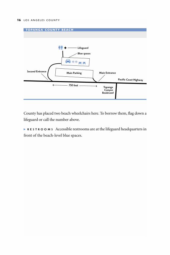
County has placed two beach wheelchairs here. To borrow them, flag down a
lifeguard or call the number above.
� R E S T R O O M S Accessible restrooms are at the lifeguard headquarters in
front of the beach-level blue spaces.
16 L O S A N G E L E S C O U N T Y
Pacific Coast Highway
750 feet
Main EntranceSecond Entrance Main Parking
Lifeguard
Blue spaces
Topanga Canyon
Boulevard
T O PA N G A C O U N T Y B E AC H

Santa Monica BayWILL ROGERS STATE BEACH TO
TORRANCE COUNTY BEACH
MO S T O F T H E B E A C H E S on Santa Monica Bay are
wide, flat swaths of golden sand. There’s a pier or a
boardwalk every few miles, often near shops and restaurants.
Outdoor dining, entertainment, and equipment rentals are easy
to find, especially in Venice and Hermosa Beach. The Pacific
Coast Highway does not adhere to the shoreline, so you may
want to pick up a local map.
Palisades Park overlooks Santa Monica State Beach.
ER
ICK
MIK
ITE
N

South Bay Bicycle Trail
TH E S O U T H B AY B I C YC L E T R A I L is a 22-mile paved path that runs from
Will Rogers State Beach to Torrance County Beach. Most of the trail is
on the beach, although a few sections are on city streets. The trail connects
to all the piers and the Strand in Venice Beach. Bicyclists, joggers, skaters,
wheelchair riders, and pedestrians all share the trail, which is 14 feet wide
(in most places) with a smooth asphalt or concrete surface. It’s busy, but
we never saw anyone collide.
Several rental stands along the trail offer bicycles, rollerskates, and
rollerblades. A few have three-wheel recumbent bikes. If you’ve got a little
leg strength, recumbent bikes are a lot of fun. Most of the shop owners will
let you try out the bike before you rent it, so feel free to experiment.
We traveled most of the trail with a manual wheelchair and a skate-
board. (Skateboards aren’t exactly permitted everywhere, but we figured it’s
not 30-something women who get ticketed.) For the most part, the trip was
smooth sailing, although we encountered a few obstacles:
■ Stairs between the Manhattan Beach section of the trail and Hermosa
Beach. If you are traveling down the coast from Manhattan Beach,
the stairs are on the ocean side and a residential street is directly
ahead. Go straight onto the street and look for the alley between the
tenth and eleventh houses. The alley is steep and cluttered with
planter boxes. If you are traveling up the coast from Hermosa Beach,
turn around when you reach the stairs, go back ten houses, and look
for the alley.
■ Narrow sidewalk in Redondo Beach. Just south of Hermosa Beach,
the trail detours to a commercial street with fast-moving traffic. The
sidewalk is very narrow—too narrow for most electric and some
manual chairs—and the bike lane on the street feels pretty scary be-
cause of the traffic. You might prefer to go a few blocks inland to a
friendlier street, then rejoin the trail at the Redondo Pier.
18 L O S A N G E L E S C O U N T Y

S O U T H B A Y B I C Y C L E T R A I L 19
Sepulveda
Torrance Blvd.
Artesia Blvd.
Manhattan Beach Blvd.
Rosecrans Ave.
El Segundo Blvd.
GrandAve.
Imperial Hwy.
Herm
osa
Vista D
el Mar
The Strand
Aviation
Blvd.
Los AngelesInternational
Airport
Jefferson Blvd.
Washington Blvd.Venice Blvd.
Oceanpark Blvd.Pico Blvd.
California Ave.
Temescal Canyon Road
Chautauqua Blvd.
Culver B
lvd.
Sepu
lved
a
Lincoln
WILL ROGERS STATE BEACH
SANTA MONICA STATE BEACH
VENICE CITY BEACH
DOCKWEILER STATE BEACH
EL PORTO BEACH
MANHATTAN COUNTY BEACH
HERMOSA CITY BEACH
KING HARBOR
REDONDO COUNTY BEACH
TORRANCE COUNTY BEACH
Redondo Beach Municipal Pier
Hermosa Beach Municipal Pier
Manhattan Beach Municipal Pier
Pacific Avenue Bridge
Venice Fishing Pier
Santa Monica Municipal Pier
Pacific
Coast Highway
MARINA DEL REY
PCH
PCHPC
H
PCH
PCH
PCH
S O U T H B AY B I C YC L E T R A I L
+ indicates accessible restroom

Will Rogers State Beach16000 BLOCK OF PACIFIC COAST HIGHWAY, PACIFIC PALISADES
WILL ROGERS STATE BEACH is a broad
two-mile stretch of beach. There
are blue spaces in all three parking lots
along Pacific Coast Highway.
Upcoast Entrance at Gladstone’s 4 Fish
This restaurant, a Los Angeles landmark, is
perched on a low bluff above the beach. In
good weather you can dine on the deck,
hang out on the rocks at the edge of the
bluff, or take the steep asphalt road down
to the beach.
� PA R K I N G/R E S T R O O M S The parking lot
below Gladstone’s offers valet parking,
but self-parking is allowed. The restau-
rant’s accessible restroom stalls are small-
er than standard. The men’s room has barely enough room to get a wheel-
chair into the stall and transfer forward onto the very low toilet. There is
one low urinal.
Central Entrance at Temescal Canyon Road
The South Bay Bicycle Trail begins here and runs south 22 miles to Torrance
Beach. There is also a pedestrian-only path north of the parking lot, perfect
for a leisurely stroll.
� R E S T R O O M S The restrooms near the lifeguard headquarters are mod-
erately accessible, with one modified stall, but there’s a tight turn at the
entrance.
20 L O S A N G E L E S C O U N T Y
W I L L R O G E R S
H O U R S
8:00 am to sunset
I N F O R M AT I O N
Monday–Thursday 310/305-9503 Lifeguard Headquarters310/394-3261
R E S E R VAT I O N S
800/444-PARK
F E E S
$2–6 per vehicle
B E AC H W H E E L C H A I R S
Two at the Chautauqua Blvd. parking lot

W I L L R O G E R S S T A T E B E A C H 21
Entrada Dr.
1
1
Pacific Coast Highway
Pacific Coast Highway
Pacific Coast Highway
Concessionsbuilding
Good connectionto Bike Trail
Concessions building
Pedestrian-only path
Concessions building
Beginning of South Bay Bicycle Trail
Lifeguard headquarters
Steep ramp down to Bike Trail
Ramp down toconcessions patio
South BayBike Trail
Temescal Cyn. Rd.
Sunset Blvd.
Gladstone’s 4 Fish
Path1
Good connectionto Bike Trail
W I L L R O G E R S S TAT E B E AC H
UpcoastEntrance
DowncoastEntrance
Central Entrance

Downcoast Entrance at Entrada Drive
The downcoast end of Will Rogers State Beach is a typical flat southern
California beach. At this entrance (about three miles downcoast of
Gladstone’s 4 Fish) you will find picnic tables, a concession stand, and sand
volleyball courts. Two beach wheelchairs are available at the parking lot.
Sidewalks at each end of the parking lot connect to the South Bay Bicycle
Trail. There are benches on concrete along the trail, and a bicycle rental shop
with a three-wheel recumbent bike near the concession stand.
� PA R K I N G/R E S T R O O M S There is a blue space on each side of the conces-
sion building. The building has a spacious, single-user restroom with a wide
door and locking lever handle.
Santa Monica
E V E R Y Y E A R , 15 million people come to play on Santa Monica’s shores.
On a sunny day the beach and pier are crowded with families, fisher-
men, street performers, tourists, surfers, and sunbathers. The city has many
wonderful restaurants and attractions, including the Third Street Prome-
nade, an outdoor pedestrian mall.
There is always lots of action on Santa Monica beaches in the summer.
22
ER
ICK
MIK
ITE
N

Santa Monica Municipal PierEND OF COLORADO AVENUE, SANTA MONICA
TH E R E A R E T W O distinct sections of
the Santa Monica Pier. Pacific Park, at
the foot of the pier, is an amusement park
with a carousel, bumper cars, arcade games,
restaurants, and other attractions. In this
area, the pier is made of wooden boards with occasional gaps wide enough
to catch a wheelchair caster. This makes for slow and careful travel, but it
didn’t keep us from enjoying ourselves. Beyond this section, the long fish-
ing pier has a smooth asphalt surface, pleasant for a stroll. The pier is ac-
cessible from Colorado Avenue or a series of ramps on the downcoast side
of the pier. Access to the pier’s fishing platforms is difficult, and the
handrails are too high for fishing from a wheelchair.
S A N T A M O N I C A M U N I C I P A L P I E R 23
S A N TA M O N I C A P I E R
I N F O R M AT I O N
310/458-8900
Santa Monica Pier
ER
ICK
MIK
ITE
N

Santa Monica State BeachOFF PACIFIC COAST HIGHWAY, SANTA MONICA
S A N TA M O N I C A S TA T E B E A C H offers many wheelchair-riding adven-
tures. The South Bay Bicycle Trail makes travel easy. Two beach wheel-
chairs are available at the lifeguard station, and there’s a bike rental shop at the
foot of the pier, where you can try some dif-
ferent wheels.
The Promenade is a pedestrian-only
sidewalk at the back of the beach. It begins
just south of the pier and runs all the way to
Venice Beach. Restaurants and food stands
are clustered around the pier, and the near-
by picnic tables are popular for chess games.
On the beach upcoast of the pier, there’s
an 11-foot-wide boardwalk. During the
summer, when the beach is at its widest, this
boardwalk runs about halfway to the water.
24 L O S A N G E L E S C O U N T Y
S A N TA M O N I C A B E AC H
I N F O R M AT I O N
Lifeguard headquarters310/394-3261
F E E S
Parking $5–8 per vehicle
B E AC H W H E E L C H A I R S
Available at lifeguard station
South Bay Bicycle Trail
Palisades Park
Santa MonicaState Beach
Boardwalk across the sand
Stairs
Carousel
Ramps up andSea Monster
Ocean Ave.
Bluff
Ocean Ave.
Appian Way2nd Street
Santa MonicaHostel
Santa MonicaBlvd.
Arizona Ave. BroadwayColorado
Blvd.
The Promenade
SeasideTerr.
PCH
10PCH
Shops& food
S A N TA M O N I C A S TAT E B E AC H
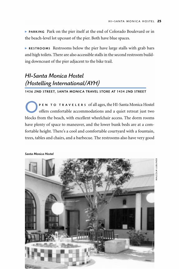
� PA R K I N G Park on the pier itself at the end of Colorado Boulevard or in
the beach-level lot upcoast of the pier. Both have blue spaces.
� R E S T R O O M S Restrooms below the pier have large stalls with grab bars
and high toilets. There are also accessible stalls in the second restroom build-
ing downcoast of the pier adjacent to the bike trail.
HI-Santa Monica Hostel (Hostelling International/AYH)1436 2ND STREET, SANTA MONICA TRAVEL STORE AT 1434 2ND STREET
O P E N T O T R A V E L E R S of all ages, the HI-Santa Monica Hostel
offers comfortable accommodations and a quiet retreat just two
blocks from the beach, with excellent wheelchair access. The dorm rooms
have plenty of space to maneuver, and the lower bunk beds are at a com-
fortable height. There’s a cool and comfortable courtyard with a fountain,
trees, tables and chairs, and a barbecue. The restrooms also have very good
H I - S A N T A M O N I C A H O S T E L 25
Santa Monica HostelM
ALC
OLM
LU
BLI
NE
R

access. Each shower room has a stall with a
fold-down wooden seat, grab bars, and a
hand-held shower. Most of the cabinets
and counter tops in the self-service kitchen
are three feet high, but there is one low
counter, open underneath, with a sink and
a stove with front-mounted controls. The
hostel also has lockers, a game room, a li-
brary with travel information, and a laun-
dry room with standard top-loading wash-
ers. You may meet people from many
countries here.
Palisades ParkOCEAN AVENUE BETWEEN COLORADO AVENUE
AND ADELAIDE DRIVE, SANTA MONICA
P A L I S A D E S P A R K is on a bluff over-
looking Santa Monica Beach. There
are plenty of benches and shady places to
rest, and a two-mile paved path that weaves
among the palm trees. The Palisades Park
Shuffleboard Club and the Senior Citizens Recreation Center are near
Broadway. Most of the park is wheelchair accessible, but there are steep
slopes where California Avenue bisects the park, and occasional cross-
slopes throughout the park. Overpasses across Pacific Coast Highway to the
beach have stairs at each end.
A Visitor Assistance Stand on the west side of Ocean Avenue at Arizona
Street (open from 10 to 4) has free maps and brochures, film, and postcards.
The counter is very high, but you can get service at the back door.
� RESTROOMS There are restrooms with large wheelchair-accessible stalls
with handrails, raised toilets, and low hand dryers at San Vicente Boulevard,
Idaho Avenue, and California Avenue.
PA L I S A D E S PA R K
H O U R S
5 am to midnight
26 L O S A N G E L E S C O U N T Y
HI-SANTA MONICA HOSTEL
H O U R S
Dawn to dusk for day use
I N F O R M AT I O N
310/393-9913
R E S E R VAT I O N S
800/444-PARK
F E E S
About $21 a night for a bed in the dorm, surcharge for family rooms and private suites

Crescent Bay ParkOCEAN AVENUE AND BAY STREET, SANTA MONICA
IN THIS SMALL PARK half a mile south of the
Santa Monica Pier, lawns and yucca plants
surround a picnic area shaded by a wooden
trellis. Picnic tables are accessible through
four-foot-wide openings in the low wall.
A smooth wooden boardwalk begins at
the restrooms near the parking entrance
and runs about halfway across the beach. It is less crowded than the one
north of the Santa Monica Pier. A paved boardwalk with separate lanes for
pedestrians and bikers and skaters runs several miles through the park.
� R E S T R O O M S The restroom at the north end of the parking lot has one
narrow, poorly accessible stall with hand rails and a raised toilet. Restrooms
at the south end are not accessible.
� PA R K I N G Blue spaces are at the seaward side of the parking lot. There are
occasional breaks in the curb between the parking lot and the bike and
pedestrian paths. There is also short-term parking in the two south beach
lots. Metered parking can be found on Ocean Avenue and Bay Street, but
there’s a steep hill on Bay Street leading to the park.
Venice DistrictBETWEEN OCEAN PARK AND MARINA DEL REY, LOS ANGELES
I N 1 9 0 4 cigarette magnate Abbot Kinney created an amusement park,
“Venice of America,” digging a network of canals into 160 acres of marsh-
land. By the 1920s, stagnant waters had become a health hazard and all but
four canals were paved over. In the 1950s, Venice became a neighborhood of
artists and bohemians. It still retains that character, even though high rents
and real estate prices have displaced many locals.
V E N I C E D I S T R I C T 27
C R E S C E N T B AY PA R K
H O U R S
6 am to 11 pm
F E E S
Parking $5 per vehicle

Venice Beach/The Strand
TH E V E N I C E S T R A N D (Ocean Front
walk) is the place on the Los Angeles
coast to see and be seen. This beachfront
sidewalk is lined with shops and restau-
rants, and all who use it are onstage. With
street performers, bodybuilders, and beach
bums, there’s hardly a dull day on the
Strand. The Strand is for pedestrians; bicy-
clists and skaters are supposed to stick to
the South Bay Bicycle Trail farther out on
the beach.
The Strand begins west of the Rose
Avenue parking lot. The heart of the acti-
vity is near Windward Avenue. Skaters and
skateboarders gather amid throngs of people. Enormous bodybuilders work
out at an outdoor gym called “Muscle Beach.”Staring is legal in Venice, so stop
and watch. Or if you’re really brave, purchase a day pass at the office next to the
barbell-shaped building. In addition to weightlifting equipment, Muscle
Beach has basketball, squash, and handball on wheelchair-accessible courts.
28 L O S A N G E L E S C O U N T Y
V E N I C E B E AC H
I N F O R M AT I O N
310/305-9546 Lifeguard Headquarters310/577-5700
F E E S
Summer parkingWeekdays $5–6.75, Weekends $7–9.50
B E AC H W H E E L C H A I R S
At lifeguard headquarters near Venice Boulevard parking lot
Along the Venice boardwalk
MA
LCO
LM L
UB
LIN
ER
The gymnastics equipment is on
sand with no accessible surface.
There are occasional competi-
tions on an outdoor stage.
Venice Pier
TH E 1, 3 0 0 - F O O T Venice Pier,
built in 1963, was falling to
pieces by the 1980s. It was closed
and scheduled for demolition in
1986.Venice residents rallied to the cause, and after years of perseverance the
pier was restored and reopened in 1997. The restored pier is fully accessible,
with special cutouts for fishing from wheelchairs.
� B I C Y C L E S The Spokes and Blades shop near Washington Street has a
recumbent three-wheel bicycle for rent.
� R E S T R O O M S There is one ac-
cessible restroom near Windward
Avenue, and another near Brooks
Avenue. The door at the Brooks
Avenue restroom opens directly to
the outdoors and there is no lock.
� P A R K I N G Parking can be dif-
ficult at Venice Beach. If you find
a space on the street, you’re
lucky. Otherwise try for a blue
space in the lots at Washington
Street or Rose Avenue. There is
also a blue space on the north cor-
ner of Pacific Avenue at Washing-
ton Street.
V E N I C E P I E R 29
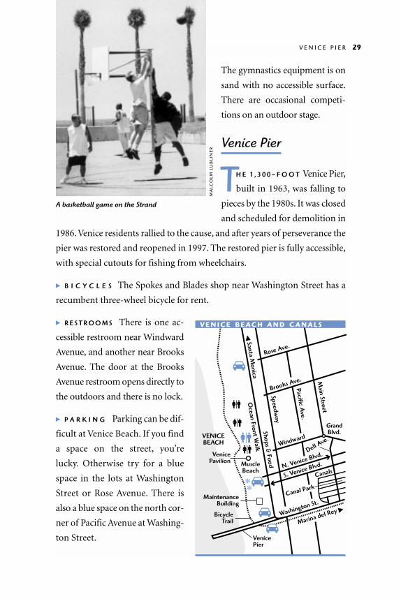
A basketball game on the Strand
N. Venice Blvd.Dell A
ve.Windward
Brooks Ave.
Rose Ave.
S. Venice Blvd.
Canals
Canal Park
Marina del Rey �Washington St.
Main Street
Pacific Ave.
Speedway
Ocean Front W
alk�
Santa Monica
Shops & Food
GrandBlvd.
BicycleTrail
VenicePavilion
VENICEBEACH
MaintenanceBuilding
Venice Pier
MuscleBeach
V E N I C E B E AC H A N D C A N A L S
MA
LCO
LM L
UB
LIN
ER

Canal ParkLINNIE CANAL AND DELL AVENUE, VENICE
C A N A L P A R K is a small strip of
uneven rolling grass and sand next
to Linnie Canal, one of four canals re-
maining from “Venice of America.” The
footbridges over the canal are very steep,
so we suggest driving in on Dell Avenue (off 28th Street). We watched the
waterfowl for a few minutes, then drove around the neighborhood looking
at the odd assortment of expensive new houses mixed with modest ones
from eras past.
30 L O S A N G E L E S C O U N T Y
C A N A L PA R K
H O U R S
5 am to 10:30 pm
Marina del ReyMARINA DEL REY TO DOCKWEILER STATE BEACH
MA R I N A D E L R E Y boasts of having the world’s
largest man-made small-craft harbor. Built in
wetlands in 1960, the main channel is 18–24 feet deep, 1,000
feet wide, and one mile long. Up to 7,500 boats are tucked
into row after row of docks.
It’s easy to feel lost when driving around the marina. You
can’t rely on the shoreline for orientation because buildings often
hide it from view, and the shoreline changes direction every few
hundred yards. Just remember you can’t go too far wrong if you
stay between Washington Street, Lincoln Boulevard, and Fiji Way.
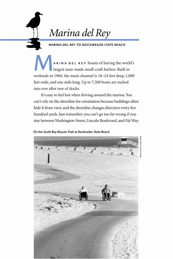
On the South Bay Bicycle Trail at Dockweiler State Beach
MA
LCO
LM L
UB
LIN
ER

Marina del Rey Information CenterCORNER OF ADMIRALTY WAY AND MINDANAO WAY
TH E M A R I N A D E L R E Y Information
Center stocks maps and brochures.
The Center is on the South Bay Bicycle
Trail. Look for a stucco building with a tile
roof and a small lighthouse-shaped cupola.
� R E S T R O O M S Restrooms are outside
the building. They have narrow front-
transfer stalls with grab bars. The men’s
room has a low urinal. The entrance doors
are heavy, and the 90-degree turn into the
stalls might be too tight for a large chair.
32 L O S A N G E L E S C O U N T Y
M A R I N A D E L R E Y
H O U R S
9 am to 5 pm
I N F O R M AT I O N
310/305-9546
F E E S
$2 parking in all County lots
B E AC H W H E E L C H A I R S
Available at Mother’s Beach
Esplanade
Washington St.
Pacific Ave.
Lincoln Blvd.
Admiralty
Way
Marina Fwy.
Fiji Way
Culve
r Blvd
.
62nd
Via M
arina
PLAYA DEL REY
Ballona Creek
Entrance
Channel
Ballona Lagoon
Pacific Ave.
Vista del Mar
ArgonautStreet
VeniceCity
BeachAudrey E.
Austin, Jr. Park
Breakwater
Lincoln Blvd.
Jefferson
Fisherman’s Village
Burton W.Chace Park
Mindanao Way
Mother’s Beach(Marina Beach)
MARINA DEL REY
South BayBicycle Trail
South Bay Bicycle Trail
South BayBicycle Trail
M A R I N A D E L R E Y

Audrey E. Austin Jr. Memorial Park/Ballona Lagoon WalkwayBOTH SIDES OF VIA MARINA
A U D R E Y E . A U S T I N J R . M E M O R I A L PA R K and Ballona Lagoon Walkway
are narrow parks alongside waterways. Memorial Park lies between a
parking lot and the entrance channel to Marina del Rey. It’s a great place for
watching boats. Across the street from the Memorial Park parking lot, the
Ballona Lagoon Walkway runs alongside a remnant of the wetlands that were
diked and filled in the 1960s. This is a great bird-watching spot.
Once slated for conversion to boat docks, Ballona Lagoon was preserved
through the efforts of local citizens, the Coastal Conservancy, and the City of
Los Angeles. From the walkway you might see blue herons, egrets, and various
small shorebirds, including the endangered California least tern, which nests
in a fenced enclosure on Venice Beach. Watch out for gaps between the pave-
ment and the guardrail, and drainage grates with slots wide enough to catch a
caster. There’s also a pair of steps about a third of a mile down the path.
A U D R E Y E . A U S T I N J R . M E M O R I A L P A R K / B A L L O N A L A G O O N W A L K W A Y 33
Ballona Lagoon is a great bird-watching spot.K
EN
GA
RD
INE
R

� PA R K I N G A metered parking lot on Via Marina has blue spaces. Parking
is scarce on weekends when the crowd from Venice Beach overflows to
Marina del Rey. There are no restrooms at these parks.
Mother’s Beach (Marina Beach)PANAY WAY AND PALAWAN WAY
M O T H E R ’ S B E A C H is a small swimming beach on the interior of the
marina where there is no surf. The main attraction is a wheelchair-
accessible ramp that runs right into the water. You can borrow a beach
wheelchair from the lifeguards if you want to avoid getting saltwater on
your own. The ramp is about 33 inches wide and 150 feet long. The hand-
rail is made of two-by-ten boards. Depending on the tide, the far end of the
ramp will be a few inches or a few feet underwater.
Mother’s Beach has picnic tables on pavement next to metal stands for
portable barbecues. A concession stand and a soft drink machine are north
of the restroom building. At the
south end of the beach near Panay
Way there’s a play structure with an
accessible rubber surface at the
swings and the slide.
� PA R K I N G/R E S T R O O M S There are
blue spaces in the lot at Panay Way,
and in the lot off Admiralty Way.
Restrooms have three-foot-wide stalls
with grab bars mounted too high,
and the flush valve is hard to reach.
There are spacious changing areas in
the restrooms.
Using the handrails on this ramp at Mother’sBeach you can take your wheelchair into thewater to a comfortable depth.
LA
RR
Y W
AN
34 L O S A N G E L E S C O U N T Y

Burton W. Chace ParkMINDANAO WAY
TH I S W E L L - G R O O M E D , pretty park overlooks the marina. It has shade
trees, rolling lawns, sheltered picnic tables, barbecues, and a snack bar.
It is a good place for a walk or a jog along the South Bay Bicycle Trail. Public
fishing docks have been built along the edge of the park, and there’s a dog run
next to the parking lot. The park office displays historical photographs of Santa
Monica, Playa del Rey, and the canals of Venice in 1905, when they were new.
� PA R K I N G / R E S T R O O M S There are blue spaces in the parking lot. Rest-
rooms near the picnic shelter have front transfer stalls with one grab bar,
but the stalls are too small to close the door with a wheelchair inside.
Restrooms at the park office have twist doorknobs and front transfer stalls
with two grab bars.
B U R T O N W . C H A C E P A R K 35
Mother’s Beach
LA
RR
Y W
AN

Fisherman’s VillageFIJI WAY
F I S H E R M A N ’ S V I L L AG E is a
collection of shops along
some docks on the marina. The
shops are accessible except for
the occasional cramped aisle.
You can buy fish and chips,
clothing, kites, tee shirts, and
souvenirs. There are fishing
platforms on the docks.
Several tour boats depart
from the docks at Fisherman’s
Village. We took a half-hour cruise around Marina del Rey on the Sunset
Hornblower. Boarding was awkward: there was a steep ramp down to the
boat, a four-inch step onto the boat, and another three-inch step to the
seating area. Other tour boats may be different, so inquire at the counter. To
arrange a private party or charter call 310/ 301-9900.
� R E S T R O O M S Shanghai Red’s Restaurant at the south end of Fisherman’s
Village has an accessible restroom. All other restrooms at Fisherman’s Village
are inaccessible, even the one marked “Employees Only. For Handicapped Ac-
cess and Public Access, Please See Store Owners for Keys.”
Dockweiler State BeachWEST OF VISTA DEL MAR AT IMPERIAL HIGHWAY, EL SEGUNDO
TH I S B R O A D 255-acre beach lies beneath the flight path of Los Angeles
International Airport. The main entrance is on Vista del Mar at
Imperial Highway. An RV campground is left of the main entrance, a day-
use area is to the right. Airplane noise is a drawback, but the beach is close
to amenities in Manhattan Beach and Marina del Rey.
LA
RR
Y W
AN

The RV campground has three large
blue spaces with seven-foot-wide access
aisles and hookups for water, electricity, and
sewer lines. Each space has its own barbecue
and picnic table, usually on an asphalt sur-
face. There is a coin-operated laundromat
with top-loading machines in the building at
the eastern end of the campground. Tent
camping is not permitted at Dockweiler.
The South Bay Bicycle Trail runs through
Dockweiler’s day-use area and campground.
Dockweiler is about midway on the 22-mile
trail. A jog to Manhattan Beach Pier, 3.5
miles south, would make a nice day trip.
Dockweiler State Beach Recreation Cen-
ter is a secondary entrance to the beach, on
Vista del Mar south of the main entrance,
.2 mile past Hyperion. The public parking
D O C K W E I L E R S T A T E B E A C H 37
D O C K W E I L E R
H O U R S
Campground office 6 am to 10 pm
I N F O R M AT I O N
310/305-9503 Lifeguard Headquarters310/372-2166
F E E S
Day use$2 at the Recreation Center$6 at the main entranceRV camping$12–$22 depending on siteSummer parkingWeekdays $5–6Weekends $6.75
B E AC H W H E E L C H A I R S
Two available near the main entrance
Wheelies on Dockweiler State Beach
MA
LCO
LM L
UB
LIN
ER

lot sign is small and hard to find. There’s a parking lot and a long ramp
down to the beach, bike trail, and accessible restrooms.
� R E S T R O O M S Restrooms at Dockweiler State Beach Recreation Center have
spacious accessible stalls with grab bars. The best restrooms in the camp-
ground are behind the campground office building. They have hand-held
showers with flip-down seats, and large stalls with rear grab bars. Restrooms
in the day-use area north of the main entrance are not accessible.
38 L O S A N G E L E S C O U N T Y

Manhattan BeachINFORMATION: 310 / 802-5000
MA N H A T T A N B E A C H is primarily a residential
community with two miles of glorious beaches
south of Los Angeles International Airport. The hilly topog-
raphy reflects the original sand dunes that in many other
locations were bulldozed. There is one relatively level street,
Manhattan Avenue, which is great for window shopping.
It is not far from the shore, and runs parallel to it. The cross
streets tend to get very steep as they drop down toward the
ocean. The beach itself is a perfect stretch of golden sand
with beach-level parking lots and several great wheelchair
riding adventures.
MA
LCO
LM L
UB
LIN
ER

Manhattan County Beach
M A N H A T T A N C O U N T Y B E A C H
is a classic southern California
beach with volleyball, surfers, and sun-
bathers. The South Bay Bicycle Trail runs
through the beach and is a great place to
jog. If you want to avoid bicyclists, try the
pedestrian-only “Strand” just above the
bike path. Ramps connect the Strand to
the bike path every few blocks, although
occasionally you may encounter a three-
inch curb. Two beach wheelchairs are
available at lifeguard headquarters near
the Rosecrans Avenue parking lot.
40 L O S A N G E L E S C O U N T Y
M A N H AT TA NC O U N T Y B E AC H
H O U R S
7 am–10 pm
I N F O R M AT I O N
Lifeguard Headquarters310/372-2166
R E S E R VAT I O N S
800/444-PARK
F E E S
Parking free in blue spaces
B E AC H W H E E L C H A I R S
Available
Manhattan Beach Pier
MA
LCO
LM L
UB
LIN
ER

H E R M O S A B E A C H 41
Roundhouse Marine Studies Lab and Aquarium at Manhattan Beach Pier
TH E R O U N D H O U S E , a small building at
the tip of Manhattan Beach Pier, is
home to a casual and informative exhibit of
Santa Monica Bay’s native flora and fauna.
Docents are eager to talk about the crea-
tures in the aquaria and touch tanks.
Programs for children are offered, including
a “Sleep with the Sharks”slumber party, Sea
Story time, and Discovery Hour, so call be-
fore you visit to find out what’s going on.
The Roundhouse is available by reservation
for birthday parties or field trips.
� PA R K I N G/R E S T R O O M S Enter the beach/pier parking lot at the end of ei-
ther Rosecrans Avenue or Manhattan Beach Boulevard. Blue spaces are at
the north end of the lot and at the base of the pier. Restrooms along the bike
path have good access, but the tile in the showers is slippery. The Round-
house has accessible restrooms and a lift to the second floor.
Hermosa Beach
HE R M O S A B E A C H has two miles
of beach with a flat stretch of the
South Bay Bicycle Trail, a pier, and a pleas-
ant shopping district. A wheelchair-riding
resident told us “everybody comes here to
work out,” so work out we did. With a pair
of rented rollerblades and a manual chair,
we took a swift 12-wheel cruise on the
trail. Bicyclists and joggers were respectful
H E R M O S A B E AC H
H O U R S
7 am–10 pm
I N F O R M AT I O N
Lifeguard Headquarters310/372-2166
F E E S
Parking free in blue spaces
B E AC H W H E E L C H A I R S
Available at lifeguardheadquarters
R O U N D H O U S EM A R I N E S T U D I E S L A B
H O U R S
Weekdays3 pm to sunsetWeekends10 am to sunset
I N F O R M AT I O N
310/379-8117
F E E S
$2 donation recommended

company, and pedestrians kept the
overall speed down. One mile south of
the pier, the trail leaves the beach and
becomes a bike lane on a busy street
with a cross-slope. About .75 mile
north of the pier (just before Manhat-
tan Beach) the trail is interrupted by
steps. (See p. 18 for detours.)
Hermosa Beach Municipal Pier
at the end of Pier Avenue is popular
for fishing because it’s longer than
many others on Santa Monica Bay.
� P A R K I N G / R E S T R O O M S There
are blue spaces in the parking garage
on 13th Street. Ramps to the rest-
rooms are steep, and the stalls have
only minor access modifications. The first restroom building west of the
pier has a large stall with grab bars. There are front transfer stalls in the rest-
room building at 22nd Street.
MA
LCO
LM L
UB
LIN
ER

Redondo Beach
R E D O N D O ’ S M A I N AT T R A C T I O N S are a broad flat
beach and piers with restaurants, funky shops, bumper
cars, arcade games, and opportunities for recreational fishing.
MA
LCO
LM L
UB
LIN
ER
44 L O S A N G E L E S C O U N T Y
Redondo Beach Municipal Pier, International Boardwalk, and Sport Fishing Pier
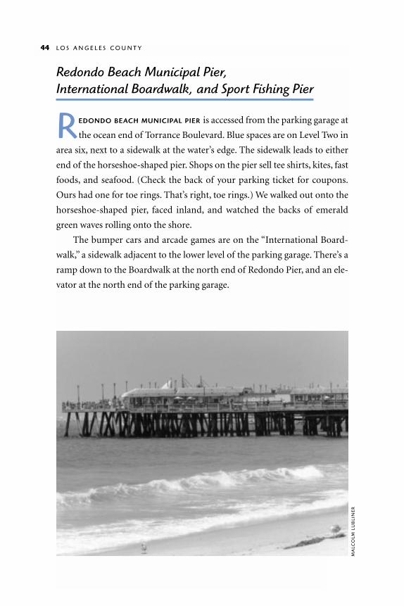
R EDONDO BEACH MUNICIPAL PIER is accessed from the parking garage at
the ocean end of Torrance Boulevard. Blue spaces are on Level Two in
area six, next to a sidewalk at the water’s edge. The sidewalk leads to either
end of the horseshoe-shaped pier. Shops on the pier sell tee shirts, kites, fast
foods, and seafood. (Check the back of your parking ticket for coupons.
Ours had one for toe rings. That’s right, toe rings.) We walked out onto the
horseshoe-shaped pier, faced inland, and watched the backs of emerald
green waves rolling onto the shore.
The bumper cars and arcade games are on the “International Board-
walk,” a sidewalk adjacent to the lower level of the parking garage. There’s a
ramp down to the Boardwalk at the north end of Redondo Pier, and an ele-
vator at the north end of the parking garage.
MA
LCO
LM L
UB
LIN
ER

R E D O N D O C O U N T Y B E A C H 45
The South Bay Bicycle Trail
passes through Level Two of the
parking garage. We followed it
north toward Hermosa Beach.
About a quarter-mile from the
parking garage, there is a small
wooden sport-fishing pier where
you can rent equipment and buy
bait and fishing licenses. Al-
though it’s a bumpy ride on a
wheelchair, we liked this rustic
old pier with its diner and tackle
shop, a pier more attractive for
fishing than for sightseeing.
Redondo County Beach
SO U T H O F T H E P A R K I N G garage, the South Bay Bicycle Trail de-
scends gradually onto Redondo County Beach. The bicycle trail is the
easiest entrance since the next mile of beach is accessible only by stairs
down the cliffs. The beach itself is another broad stretch of golden sand.
� R E S T R O O M S A large unisex restroom
with grab bars is on level one of the
Redondo Beach Pier parking garage be-
hind the elevator at International Boule-
vard. Restrooms at the Sport Fishing Pier
are not accessible. Most restroom build-
ings on Redondo County Beach are ac-
cessed by 1:12 ramps. They have large stalls
and grab bars.
R E D O N D OC O U N T Y B E AC H
H O U R S
7 am–10 pm
I N F O R M AT I O N
Lifeguard Headquarters310/372-2166
F E E S
Parking free in blue spaces
MA
LCO
LM L
UB
LIN
ER
Torrance County BeachWEST OF PASEO DEL MAR, TORRANCE
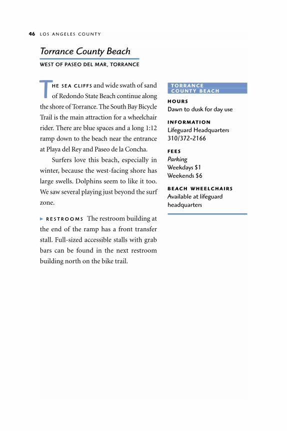
TH E S E A C L I F F S and wide swath of sand
of Redondo State Beach continue along
the shore of Torrance. The South Bay Bicycle
Trail is the main attraction for a wheelchair
rider. There are blue spaces and a long 1:12
ramp down to the beach near the entrance
at Playa del Rey and Paseo de la Concha.
Surfers love this beach, especially in
winter, because the west-facing shore has
large swells. Dolphins seem to like it too.
We saw several playing just beyond the surf
zone.
� R E S T R O O M S The restroom building at
the end of the ramp has a front transfer
stall. Full-sized accessible stalls with grab
bars can be found in the next restroom
building north on the bike trail.
46 L O S A N G E L E S C O U N T Y
T O R R A N C EC O U N T Y B E AC H
H O U R S
Dawn to dusk for day use
I N F O R M AT I O N
Lifeguard Headquarters310/372-2166
F E E S
Parking Weekdays $1Weekends $6
B E AC H W H E E L C H A I R S
Available at lifeguardheadquarters

Southern Los Angeles CountyPALOS VERDES PENINSULA TO LONG BEACH
PA LO S V E R D E S P E N I N S U L A juts into the ocean between
Santa Monica Bay and San Pedro Bay. The Pacific Coast
Highway bypasses the peninsula, so if you want to explore its
15 miles of craggy and dramatic shore, you’ll have to detour
onto Palos Verdes Drive.
Long Beach Aquarium of the Pacific
MA
LCO
LMLU
BLI
NE
R

Wayfarers Chapel5755 PALOS VERDES DRIVE SOUTH
TH I S A R C H I T E C T U R A L G E M, designed
by Lloyd Wright (Frank’s son), stands
on a hill overlooking the ocean. It was in-
spired by the natural cathedrals of Califor-
nia’s redwood forests. The chapel walls and ceiling are glass. It’s not the
structure of the building that commands your attention; it’s the trunks of
the trees outside the building, framed so beautifully by the windowpanes.
Wayfarers Chapel is especially lovely in the rain when rivulets trickle down
the panes.
� PA R K I N G/R E S T RO O M S There are blue spaces in the parking lot, and a new
wheelchair ramp to the chapel. A new visitor center at the top of the drive-
way has restrooms with wide stalls with five-foot turning radius and grab
bars. Sinks have clear space below.
48 L O S A N G E L E S C O U N T Y
WAY FA R E R S C H A P E L
I N F O R M AT I O N
310/377-1650
ER
ICK
MIK
ITE
N

Ocean TrailsOFF PALOS VERDES DRIVE SOUTH AT
OCEAN TRAILS DRIVE OR LA ROTUNDA DRIVE
O C E A N T R A I L S is a private golf course on a bluff above the ocean. There
is public access through 90 acres of restored coastal sage scrub around
the golf course. We intended to make our visit quick, but got caught up in the
birdsong and the plants and spent several hours. The terrain is moderately
steep, but the pavement is scored to give golf carts (and wheelchairs) good trac-
tion. Not all of the trails are for pedestrians, so follow the signs. There are some
hard-packed dirt trails at the edge of the bluff, and although we encountered a
few rough spots, these trails are generally smooth and easy to travel.
� PA R K I N G/R E S T R O O M S The main entrance at Ocean Trails Drive has blue
spaces and accessible restrooms in the clubhouse. We preferred the quieter
entrance off La Rotunda, which also has blue spaces and excellent restrooms.
White’s Point Beach/Royal Palms County BeachWHERE WESTERN AVENUE MEETS THE COAST
AND BECOMES PASEO DEL MAR
TH I S I S O N E O F T H E B E S T spots for a
family retreat. A park on the bluffs has
convenient wheelchair access and sweep-
ing views of Catalina Island. The paths are
smooth and level, and the entire children’s
play structure has a wheelchair-accessible
surface. Look for the historic photographs
mounted in a case near the entrance. In the
1920s and ’30s, the beach below was the site
of a hotel and spa popular with Japanese-
Americans. You can still see the ruins on
the beach.
W H I T E ’ S P O I N T B E A C H / R O Y A L P A L M S C O U N T Y B E A C H 49
WHITE’S POINTR OYA L PA L M S B E AC H
H O U R S
310/305-9503
F E E S
Blufftop parking Weekdays, free Weekends, $2 Royal Palms lot Weekdays, $2 Weekends, $5–6

The paved road to the beach is steep, so it’s best to drive down. The large
patio at the upcoast end of the beach was once the dance floor of the Royal
Palms Recreation Center. Now the area is a lovely picnic spot shaded by
palm trees and furnished with benches. A stream (dry in the summer) runs
down the cliff face, under the patio, and out to the ocean.
White’s Point, at the downcoast end of the beach is less accessible.
Boulders line the shore and surround the ruins of mineral baths. In 1933 an
earthquake closed the warm-water vent. There are tidepools among the
rocks and ruins, but you’d have to leave your chair behind and climb over
the boulders to see them.
� P A R K I N G / R E S T R O O M S
There are six blue spaces in the
lot at the beach, none in the
blufftop lot. Park restrooms
have wide stalls and grab bars.
50 L O S A N G E L E S C O U N T Y
Royal Palms playground withaccessible surface
hcaebotnwoddaoR
Patio
Western Ave.
Park
Tidepools
Beach
W H I T E ’ S P O I N T B E AC H/R OYA L PA L M S C O U N T Y B E AC H
MA
LCO
LM L
UB
LIN
ER

Marine Exchange Vessel Traffic CenterANGELS GATE PARK, GAFFEY STREET NEAR 36TH STREET, SAN PEDRO
TH E MARINE EXCHANGE VESSEL T R A F F I C
C E N T E R controls all ocean traffic within
a 25-mile radius. If you call ahead, you can
arrange to tour the lookout on the second
floor, which has sweeping views and three-
foot-wide radar screens that show the location of vessels. Boats 131 feet and
longer are required to identify themselves via radio. Smaller boats, called
“passive users,” identify themselves only when they’re in distress. It’s the traf-
fic center that answers the call of “Mayday, Mayday” on Channel 16 and
helps the Coast Guard find the boat. One interesting fact: The traffic center
identifies the boat on the radar screen by tracing the direction of its radio
signal. If the call comes in on a cell phone instead of ship-to-shore radio,
there is no way to pinpoint the boat.
The nearby Marine Mammal Care Center is also worth a visit.
� PA R K I N G/R E S T R O O M S To reach the traffic center from the main gate of
Angels Gate Park, take the first right onto Leary Merrian Drive. Follow it to
the top of the hill and take the first left. The parking lot has blue spaces. Ring
the doorbell if the doors are locked. There’s an elevator to the second floor,
and a spacious restroom with grab bars on the first floor.
Los Angeles Harbor
TH E S O U T H E R N Los Angeles County shoreline is dominated by the
7,000-acre Los Angeles Harbor. San Pedro, the last tourist-friendly town
on the harbor’s north edge, has noteworthy educational facilities and a small
beach. Then it’s a drive around the harbor’s 28-mile industrial shoreline to
Long Beach, a recently refreshed vacation destination.
L O S A N G E L E S H A R B O R 51
M A R I N E E XC H A N G EVESSEL TRAFF IC CENTER
I N F O R M AT I O N
310/832-6411
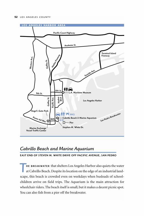
Cabrillo Beach and Marine AquariumEAST END OF STEVEN M. WHITE DRIVE OFF PACIFIC AVENUE, SAN PEDRO
TH E B R E A K WAT E R that shelters Los Angeles Harbor also quiets the water
at Cabrillo Beach. Despite its location on the edge of an industrial land-
scape, this beach is crowded even on weekdays when busloads of school-
children arrive on field trips. The Aquarium is the main attraction for
wheelchair riders. The beach itself is small, but it makes a decent picnic spot.
You can also fish from a pier off the breakwater.
52 L O S A N G E L E S C O U N T Y
36th
Pacific Coast Highway
Anaheim St.
9th St.
Paseo del Mar
6th St.
Paci
fic A
ve.
Har
bor
Blvd
.
Gaf
fey
St.
Gaf
fey
St.
Har
bor F
reew
ay
Wes
tern
Ave
.
Seaside Ave.
Terminal IslandFreeway
San Pedro Breakwater
Cabrillo Beach & Marine Aquarium
Pier
Stephen M. White Dr.
L.A. Maritime Museum
Marine ExchangeVessel Traffic Center
BBQ
Los Angeles Harbor
Angel’s Gate Park
LO S A N G E L E S H A R B O R A R E A

Cabrillo Marine Aquarium
Cabrillo Marine Aquarium is what a school
biology lab should be: an adventure. Life-
size models and skeletons of whales and
dolphins hang from the ceiling, and a wave
tank shows how sand is pushed up onto the
beach. Aquariums and touch tanks display
marine life. Enthusiastic docents—some of
whom are students—encourage visitors to
participate in the exhibits. The tidepool
touch tank holds sea stars, anemones,
urchins, and a leopard shark (out of reach).
Be sure to check out the “Aquaculture
Research Lab,” where Garibaldi (one of
California’s state fish) are raised and jelly-
fish are hatched and raised on brine shrimp.
The Aquarium is interesting for people
of all ages. It’s especially great for wheel-
chair-riding children because the exhibits are at a kid’s eye level. Except for a
long gradual slope from the ticket booth to
the exhibit hall, wheelchair access is very easy.
� PARKING/RESTROOMS Free parking with
disabled placard, except weekends and holi-
days. Blue parking spaces are at the right side
of the Aquarium. Aquarium restrooms have
large accessible stalls, push-button faucets,
and a baby-changing table in the women’s
room. Beach restrooms are smaller and less
accessible.
C A B R I L L O M A R I N E A Q U A R I U M 53
C A B R I L LO AQ U A R I U M
H O U R S
Tuesday–Friday Noon–5 pmSaturday–Sunday 10 am–5 pm
I N F O R M AT I O N
310/548-7562
F E E S
Admission $2 donation recommended$1 for seniors and childrenFree with parking receiptParking Weekdays: Free with disabled placardWeekends and holidays: $4
B E AC H W H E E L C H A I R S
Three available
The Cabrillo Coastal Park Trail leads to tidepools at Point Fermin.
GA
RY
FLO
RIN
/CA
BR
ILLO
MA
RIN
E A
QU
AR
IUM
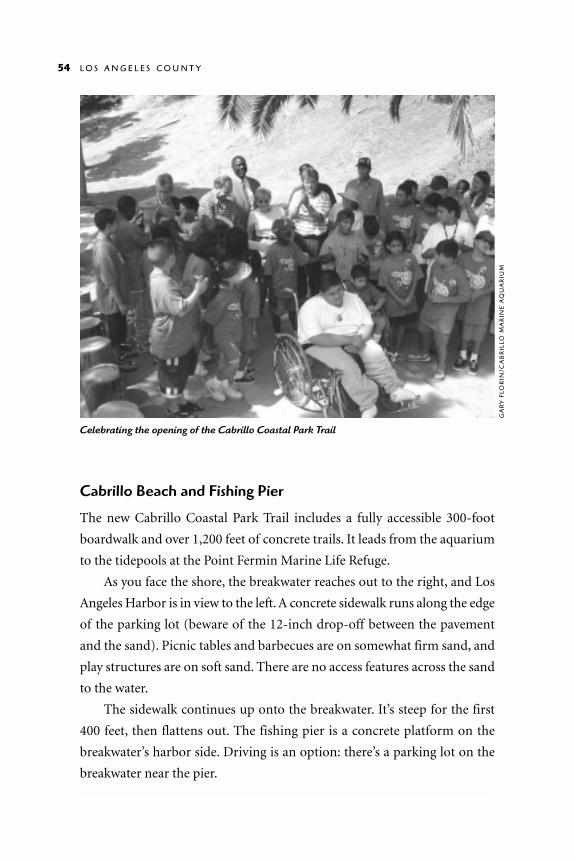
Cabrillo Beach and Fishing Pier
The new Cabrillo Coastal Park Trail includes a fully accessible 300-foot
boardwalk and over 1,200 feet of concrete trails. It leads from the aquarium
to the tidepools at the Point Fermin Marine Life Refuge.
As you face the shore, the breakwater reaches out to the right, and Los
Angeles Harbor is in view to the left. A concrete sidewalk runs along the edge
of the parking lot (beware of the 12-inch drop-off between the pavement
and the sand). Picnic tables and barbecues are on somewhat firm sand, and
play structures are on soft sand. There are no access features across the sand
to the water.
The sidewalk continues up onto the breakwater. It’s steep for the first
400 feet, then flattens out. The fishing pier is a concrete platform on the
breakwater’s harbor side. Driving is an option: there’s a parking lot on the
breakwater near the pier.
54 L O S A N G E L E S C O U N T Y
Celebrating the opening of the Cabrillo Coastal Park Trail
GA
RY
FLO
RIN
/CA
BR
ILLO
MA
RIN
E A
QU
AR
IUM
Los Angeles Maritime MuseumEAST END OF SIXTH STREET OFF PACIFIC AVENUE, SAN PEDRO
TH E M A R I T I M E M U S E U M houses a his-
tory of boats from canoes to battle-
ships. Most exhibits are models and draw-
ings, but there are also a few small boats,
fascinating both as artistic and technolog-
ical achievements. A 16-foot model of the
Titanic displays a cross-section through
the vessel’s steam rooms, galleys, quarters,
and banquet halls. Our favorite exhibit was
a display of 76 different knots. A rope
hangs from the bottom of it so you can try to copy what you see.
The Museum does pose some access challenges. First, the slope up to
the front door is moderately difficult. Second, the ramp to the second floor
is continuous, with no landings, making it difficult to stop at exhibits along
the way. Bathrooms have recently been improved, and each now has an ac-
cessible stall.
Long Beach and Belmont Shore
L O N G B E A C H is an outstanding holi-
day destination. Long Beach Harbor,
at the west end of the city, is the perma-
nent home of the Queen Mary, a luxury
ocean liner. The Aquarium of the Pacific
occupies the opposite shore, within walk-
ing distance of the pedestrian-friendly
downtown. The east end of Long Beach has miles of sandy beaches.
L O N G B E A C H A N D B E L M O N T S H O R E 55
L A M A R I T I M E M U S E U M
H O U R S
Tuesday–Sunday 10 am to 4:30 pm
I N F O R M AT I O N
310/548-7618
F E E S
$1 donation suggested
LO N G B E AC H
I N F O R M AT I O N
Long Beach Area Conventionand Visitor’s Bureau 562/436-3645

56 L O S A N G E L E S C O U N T Y
Atl
anti
c A
ve.
Long
Bea
ch B
lvd.
Pine
Ave
.
Paci
fic A
ve.
Mag
nolia
Ave
.
Anaheim St.
Pacific Coast Highway
Broadway
7th St.
Ocean Blvd.
Long Beach City Beach
1
710
710
Long
Bea
ch F
reew
ay
Los A
ngel
es R
iver
Ala
mito
s Ave
.
Che
rry
Ave
.
Shore
line D
r.
QueenswayBay
RainbowHarbor
Que
en’s
Way
Harbor Scenic Dr.
Downtown
Marina
Long Beach Aquarium ofthe Pacific
Queen Mary
Shoreline VillageShoreline Park
LO N G B E AC H
Queen Mary1126 QUEENS HIGHWAY
W H E N S H E WA S L A U N C H E D in 1934, the Queen Mary was the largest
luxury liner in the world. On her maiden voyage she carried 2,000
passengers and 1,200 crew across the Atlantic in less than four days, a record
that held for 40 years. During World War II she was stripped of her lavish
décor and used as a British transport ship. Restored after the war, she re-
sumed passenger service, but the era of ocean liner travel soon ended. In
1967 she was moved to Long Beach Harbor, where she is now a hotel, restau-
rant, and tourist attraction. Much of her old Art Deco magnificence has
been preserved.
As you might expect, wheelchair access
on a vintage ocean liner is quirky at best;
large portions of the ship are simply un-
reachable, but she’s still well worth a visit.
The ship’s main entrance has several
flights of stairs and no elevator. Wheelchair
access is from the hotel at the opposite end
of the ship. Follow the signs to the
hotel/handicapped/valet area and park in
any numbered blue space. From the hotel
lobby, take the elevator to the Promenade
level. As you exit the elevator to the ship’s
deck, stop at the information counter for a
guide map. It shows the locations of bath-
rooms and secondary elevators; although
none are fully accessible, they may be usable
by some.
Fortunately, the main exhibits are on
the Promenade level, so there’s much to see
even if the secondary elevators don’t work
Q U E E N M A R Y 57
Q U E E N M A RY
H O U R S
10 am to 6 pm
I N F O R M AT I O N
562/435-3511
F E E S
AdmissionFree for wheelchair ridersGeneral $17 Seniors and Military $15Children $13Additional fees for toursParkingFree to $8.00
F E R RY
Catalina Express ferry to Santa Catalina Island docks near the bow of the Queen Mary.Adult fare $39Information 800/316-8767

for you. Check out the railings in the Observation Bar at the bow of the ship,
and the woodwork and lighting throughout. Remnants of the Queen Mary’s
art collection (including the bronze grille doors that used to hang in the
first-class dining room) are exhibited near the middle of the ship. Before you
leave the Promenade level, stand near the prow and look down the deck to-
ward the stern to get a sense of the ship’s grand scale.
Elevators to other decks are hidden in dark or cramped corners. Use the
guide map to find them. The elevator to Deck D is very small and slow. If
your chair is large, you won’t be able to turn around. When you get to Deck
D, go through the unmarked door to the left. You’ll find yourself standing in
58 L O S A N G E L E S C O U N T Y
The legendary Queen Mary and Scorpion, a Russian Foxtrot-Class submarine
QU
EE
N M
AR
Y M
AR
KE
TIN
G C
OM
MU
NIC
ATI
ON
S

an exhibition hall with a film about the Queen Mary, stories, pictures, maps
of her routes, and a steep circular ramp that leads nowhere.
Deck E is spooky and interesting. The elevator deposits you underneath
a stairway in a pitch-black room. Watch your head and remember where the
door is for your return. We took two jogs to the right through the dark room
and found ourselves in a chamber outside the ship looking down into the
water at one of the enormous propellers. We continued toward the stern of
the ship to the engine room. Parts of the room are too cramped to roll
through, but you can see a lot from the entrance.
� R E S T R O O M S Restrooms in the Queen’s Village at the main entrance have
no accessible stalls. Things aren’t much better on the ship. There’s a front
transfer stall in the center of the Promenade level (dot #9 on the guide map),
but the toilet is very low and the doors have twist knobs.
Long Beach Aquarium of the Pacific100 AQUARIUM WAY
TH E L O N G B E A C H A Q U A R I U M
entertains the whole family with won-
drously large tanks and exhibits represent-
ing three different regions of the Pacific.
The Southern California Gallery focuses on
tidepools, kelp forests, sea lions, rays, and
turtles. The Northern Pacific Gallery de-
picts the subarctic waters of Russia and
northern Japan; sea otters, diving birds, oc-
topuses, and eels are star attractions. The
Tropical Pacific Gallery contains coral la-
goons, warm-water reefs, and vibrantly col-
ored fish. The Aquarium has a 200-seat the-
ater, a seal show, and a wheelchair-accessi-
ble playground with a replica of a whale’s
L O N G B E A C H A Q U A R I U M O F T H E P A C I F I C 59
LONG BEACHAQUARIUM OF THE PACIFIC
H O U R S
9 am to 6 pm
I N F O R M AT I O N
562/590-3100
R E S E R VAT I O N S
800/444-PARK
F E E S
AdmissionGeneral $15.95 Seniors $12.95Children $8.95 Parking $6 with Aquarium ticket stub
W H E E L C H A I R S
Free wheelchairs available

skeleton that children can crawl
through.
The Aquarium is marvel-
ously wheelchair-accessible: ex-
hibits are spacious, elevators are
huge, ramps are comfortable,
and the gift shop aisles are wide.
Restrooms have large accessible
stalls. There is a unisex rest-
room on the first floor next to
the elevators near the entrance.
The frustration factor at this
Aquarium is zero.
Long Beach Shoreline Park and Rainbow Harbor
JU S T O U T S I D E the Aquarium of the Pacific, Shoreline Park wraps around
Rainbow Harbor and extends onto a small peninsula that sticks out into
Queensway Bay. From a brick-paved promenade on the edge of Rainbow
Harbor, we looked at boats and peered over the railing at clusters of mussels
on the rocks.
Following the promenade south, you come to a store called Pierpoint
Landing, where you can buy bait and fishing licenses or book a trip on a fish-
ing boat. On the peninsula beyond the store, a boardwalk runs across a sand
dune on the harbor side; a park with a fishing pier and a view of the Queen
Mary is on the bay side. All the surfaces in the park are smooth and easy to
travel.
� R E S T R O O M S There are good accessible restrooms south of the Aquarium
at Pierpoint Landing. Stalls are wide with grab bars and automatic fixtures
with sensors—no dexterity or strength is necessary.
LON
G B
EA
CH
AQ
UA
RIU
M O
F TH
E P
AC
IFIC
60

Pine Avenue
IF YO U F O L L O W the brick promenade north around Rainbow Harbor,
you’ll come to a pedestrian bridge that crosses over Shoreline Drive to the
Hyatt Hotel on Pine Avenue, the main street in downtown Long Beach.
Remarkably, the bridge has an elevator. There has been much renovation
downtown in recent years, so there are plenty of accessible shops, restau-
rants, and restrooms on Pine Avenue.
Shoreline VillageSHORELINE VILLAGE DRIVE OFF OCEAN BOULEVARD
IF YO U C O N T I N U E on the promenade past the bridge to Pine Avenue,
you’ll come to Shoreline Village, a shopping center with outdoor dining,
a merry-go-round (no ramp), and a good ice cream shop. The promenade
continues along the water’s edge to the Long Beach Downtown Shoreline
Marina.
� R E S T R O O M S Shoreline Village has one unisex accessible restroom behind
the merry-go-round pavilion near the parking lot.
Long Beach Downtown Shoreline Marina450 EAST SHORELINE DRIVE
JU S T B E Y O N D Shoreline Village, the
promenade that began at the Aquarium
connects to a smooth concrete bike path
that follows the inland side of the marina
to Long Beach City Beach, then runs south
along Belmont Shore to 54th Place. The path has a pedestrian-only lane and
two bicycle lanes. It’s a good place for a workout.
L O N G B E A C H D O W N T O W N S H O R E L I N E M A R I N A 61
LONG BEACH DOWNTOWNSHORELINE MARINA
I N F O R M AT I O N
562/570-4950

You can also walk or drive onto the jetty that shelters the marina. A con-
crete sidewalk runs the full length of the jetty (about 1/3 mile), so you can
take in a view of the marina on one side and the bay on the other. There are
three fishing piers on the bay side. The handrails are a little high for fishing
from a wheelchair, but the lower portion of the rail is fairly open, so visibili-
ty is good.
� PA R K I N G/R E S T RO O M S Park in the Aquarium garage, the Shoreline Village
lot, or in the blue spaces at the second fishing pier on the jetty. A public rest-
room near the second pier has a wide stall with grab bars, and sinks with pad-
dle handles.
Long Beach City Beach to Alamitos BayALONG OCEAN BOULEVARD
L O N G B E A C H C I T Y B E A C H is a flat
two-mile stretch of sand. The water is
calm, protected by breakwaters on
Queensway Bay. The bike path that began
at the Downtown Shoreline Marina trav-
els the length of City Beach and continues
LO N G B E AC HC I T Y B E AC H
B E AC H W H E E L C H A I R S
Available
Rainbow Harbor
62
MA
LCO
LM L
UB
LIN
ER

along Belmont Shore to 54th Place. There is no clear boundary between City
Beach and Belmont Shore; locals use the names interchangeably.
Most of the cross-streets along Ocean Boulevard end with stairs down to
the beach. Wheelchair-accessible entrances are at the Alamitos parking lot off
Shoreline Drive, at First Place, Junipero Avenue, 39th Place (Belmont Pier),
and 54th Place. You can borrow a beach wheelchair from the snack and rental
stand next to the Alamitos parking lot. A concrete path leads from this lot to-
ward the water. If the Alamitos lot is full, try the one at the ocean end of
Junipero Avenue.
The 1,620-foot-long, T-shaped, smooth concrete Belmont Pier, at the
foot of 39th Place in Belmont Shore, closed for repairs and improvements in
fall 2001. Metered parking is at Termino Avenue, off Ocean Boulevard.
You might also want to explore the Alamitos Bay area, which offers
boating, beaches, a paved bike trail, quaint neighborhoods, shops, and
restaurants. The Marine Stadium, a long, narrow, rectangular body of water
connected to Alamitos Bay, was built in the 1920s as the rowing venue for
L O N G B E A C H C I T Y B E A C H 63
Entry to Aquarium
MA
LCO
LM L
UB
LIN
ER

the 1932 Olympics, and is now used for water sports events. The Alamitos
Bay Marina has 1,880 slips, including public berths.
From the Pacific Coast Highway, take East Second Street toward Long
Beach. Cross the bridge over the Marine Stadium to Naples Island, a quaint
neighborhood built to resemble Venice, Italy. It is composed of three islands
separated by canals. Parking is on-street. If you turn right onto Appian Way
just past this bridge, to your right will be Marine Park and Mothers Beach,
a narrow sandy shore with gentle water backed by grass and trees. Look for
blue parking spaces.
If you continue on Appian Way across a second bridge, you can park
next to the rock embankment and watch activities in the Stadium.
To get to Alamitos Bay Beach on the Bay, follow East Second Street to
Bay Shore Avenue, go south three blocks to Ocean Boulevard and turn left
into the parking lot. There is paved access to a concession stand where you
can borrow a beach wheelchair. For information, call 562/570-1715.
� R E S T R O O M S Most of the restrooms at City Beach and Belmont Shore
have narrow front-transfer stalls with grab bars. There is a full-width acces-
sible stall in the restroom next to the lifeguard headquarters at Junipero
Avenue, and an accessible chemical toilet on the Belmont Pier.
Bluff ParkOCEAN SIDE OF OCEAN BOULEVARD
BETWEEN 20TH AND REDONDO
BL U F F P A R K overlooks Long Beach City Beach. Sidewalks are smooth,
and the railing allows an open view from a wheelchair. There are no
restrooms at the park. Parking is on-street.
64 L O S A N G E L E S C O U N T Y

Orange CountyTHE ORANGE COUNTY COAST
TH E 40-M I L E Orange County coast is wonderfully com-
plex, with wetlands, estuaries, seacliffs, headlands, coves,
and wide stretches of golden sand. You’ll find quiet nature
preserves and busy beaches that attract people from across
California—and the world—to surf, swim, ride bicycles,
play volleyball, or just gaze out to sea.
We found easy wheelchair access to at least part of every
beach community except Sunset Beach. But Huntington Beach
was right next door, and we found plenty of access there.

Seal Beach
Bolsa Chica
Huntington Beach
LOS ANGELES COUNTY
ORANGE COUNTY
Newport BeachCorona del Mar
Laguna Beach
Aliso Beach
Dana Point
San Clemente
Pacific Coast Highway
N
ORANGE COUNTYBEACHES
5
5
710
605
133
55
405
This map includes onlyenough locations androutes to give a generalidea where the sitesdescribed in this bookcan be found.
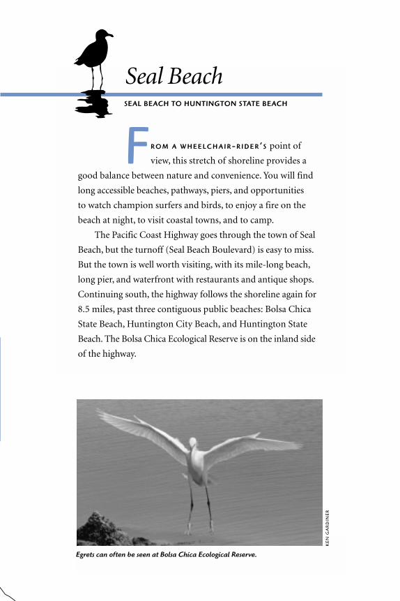
Seal BeachSEAL BEACH TO HUNTINGTON STATE BEACH
F R O M A W H E E L C H A I R-R I D E R ’ S point of
view, this stretch of shoreline provides a
good balance between nature and convenience. You will find
long accessible beaches, pathways, piers, and opportunities
to watch champion surfers and birds, to enjoy a fire on the
beach at night, to visit coastal towns, and to camp.
The Pacific Coast Highway goes through the town of Seal
Beach, but the turnoff (Seal Beach Boulevard) is easy to miss.
But the town is well worth visiting, with its mile-long beach,
long pier, and waterfront with restaurants and antique shops.
Continuing south, the highway follows the shoreline again for
8.5 miles, past three contiguous public beaches: Bolsa Chica
State Beach, Huntington City Beach, and Huntington State
Beach. The Bolsa Chica Ecological Reserve is on the inland side
of the highway.
Egrets can often be seen at Bolsa Chica Ecological Reserve.
KE
N G
AR
DIN
ER

Seal Beach and Municipal PierMAIN STREET AND OCEAN AVENUE
TH E W I D E , mile-long beach is south of
the mouth of the San Gabriel River, in
the City of Seal Beach. Seal Beach Pier is at
the foot of Main Street. Steep driveways
lead down to the beach on either side of
the pier: the one on the south side is a little
easier to negotiate. (There’s another en-
trance north of the pier at Ocean Avenue
and 1st Street, but that end of the beach
lacks good accessibility features.) Parking is on-street.
A paved path runs from Seal Beach Pier south about half a mile to
Electric Avenue.You can borrow a regular adult- or child-sized wheelchair to
use on the pier from the Community Safety Building at the foot of Main
Street. We asked if only disabled people may use it. The answer was no, so if
you want to take an eye-to-eye stroll with a friend, this is one place to do it. A
beach wheelchair is available at the lifeguard headquarters just west of the
pier on the beach level.
The 1,865-foot-long wooden pier is a rough ride, but there’s a diner
with great ocean views at the end of it. Sport-fishing boats offer half-day or
full-day trips.
� PARKING/RESTROOMS Blue spaces are on Ocean Avenue at Main Street. Rest-
rooms beneath the pier have wide stalls with grab bars and push-button sinks.
Bolsa Chica Ecological ReserveEAST OF PACIFIC COAST HIGHWAY
SOUTH OF WARNER AVENUE
BO L S A C H I C A E C O L O G I C A L R E S E R V E is the largest coastal saltmarsh
preserve in the Los Angeles/Orange County metropolitan region. Its
300 acres are a vital oasis for resident shorebirds and millions of migrating
68 T H E O R A N G E C O U N T Y C O A S T
S E A L B E AC H
H O U R S
4:30 am–10 pm
I N F O R M AT I O N
562/431-2527
B E AC H W H E E L C H A I R S
One available at lifeguardheadquarters

birds traveling between the Arctic and
South America along the Pacific Flyway.
Colonies of elegant terns and endangered
California least terns nest here. Take some
time to observe and you will see a variety
of wetland creatures.
Wheelchair access is easy to moderate.
A 1.5-mile loop trail begins at the parking
lot on the Pacific Coast Highway and cross-
es the marsh on a flat wooden bridge.
Interpretive displays on and near the bridge
describe wildlife and habitat you may see
there. Both ends of this bridge have dropoffs
and short moderate slopes. Most of the trail
is hard packed dirt; part is asphalt.
Look for least terns on and around the
nesting islands that were built for them, and for jellyfish, sea sponges, and
crabs in the water. In the intertidal zone, look for the low-growing pickleweed,
B O L S A C H I C A E C O L O G I C A L R E S E R V E 69
BOL S A C HIC A PRESERVE
H O U R S
ReserveSunrise to sunsetInterpretive Center on Warner AvenueTuesday–Friday, 10 am–4 pm,Saturday, 9 am–noon, Sunday, 12:30–3 pm
I N F O R M AT I O N
714/846-1114
PA R K I N G
Lots at 3842 Warner Avenueand off Pacific Coast Highwayacross from the entrance toBolsa Chica State Beach
MA
LCO
LM L
UB
LIN
ER

which survives in salty water by concentrating the salt into the ends of its
fleshy stems; and for the taller cordgrass, which produces as much oxygen,
acre per acre, as a tropical rain forest. You don’t have to travel far; in fact, the
longer you can stay still in one spot, the more you’ll see.
The Interpretive Center is accessible by ramp. It has a saltwater aquarium,
various exhibits, books, aerial and trail maps, and offers docent led tours.
� R E S T R O O M S There are accessible portable restrooms at each of the park-
ing lots.
Bolsa Chica State BeachALONG THE PACIF IC COAST HIGHWAY
FROM WARNER AVENUE TO SEA POINT
SIX MILES of wide sandy beach are backed
by an asphalt bike path that connects
with the Santa Ana River Trail to the south-
east. This bike path is far from the surf zone,
but it crosses other paths that run a few
hundred yards toward the shore. Some of
those paths are partially covered in sand,
but they are easy to roll over.
If you come at low tide, you’re likely to
see many shorebirds feeding in the inter-
tidal zone, especially in spring and au-
tumn. If you have a good pair of binocu-
lars you can identify various birds and ob-
serve details of their behavior. You can
learn more about birds at the Bolsa Chica
Ecological Reserve across the highway.
There are many fire pits in the sand
along this beach. We found one on pavement in front of the first set of blue
spaces as you enter the parking lot. An RV campground, with water, electri-
70 T H E O R A N G E C O U N T Y C O A S T
B O L S A C H I C A B E AC H
H O U R S
6 am–10 pm (Entry gates close 9 pm)
I N F O R M AT I O N
714/846-3460
C A M P G R O U N DR E S E R VAT I O N S
800/444-7265
F E E S
Parking$6 per vehicle$1 with State Parks disabled placardRV camping General $18, Seniors $16 (RV campground closed forrenovation till early 2002)

cal hookups, and a dump station,
is at the south end of the beach.
Four campsites are designated
accessible.
� R E S T R O O M S Accessible rest-
rooms are in the RV and picnic
areas at the south end of the
parking lot. The RV area has
spacious single-user restrooms
with grab bars, high toilets, and
push-button sinks, as well as ac-
cessible showers (warm water)
with seats.
Huntington City Beach and PierALONG PACIFIC COAST HIGHWAY
BET WEEN MAIN STREET AND BEACH BOULEVARD
TH E U.S. S U R F BOA R D C H A M P I O N S H I P S
draw thousands to Huntington City
Beach every August. The 1,850-foot-long
pier at Main Street offers great views of
surfers in action. The pier was rebuilt in
1992 and has a smooth concrete surface.
At the pier’s ocean end is a popular diner.
Restaurants at the foot of the pier offer
fancier fare. Check out the plentiful out-
door dining facilities along Main Street,
which runs directly inland from the pier.
Facilities at Huntington City Beach
are older and less accessible than those at
Huntington State Beach or the pier area.
H U N T I N G T O N C I T Y B E A C H A N D P I E R 71
H U N T I N G T O N C I T Y
H O U R S
5 am–midnight
I N F O R M AT I O N
714/536-5281
F E E S
Day use $7Free with disabled placardCamping November–April $15 per night$7.50 with disabled placard
Endangered light-footed clapper rails are rarelyseen, but can be found at Bolsa Chica.
PE
TER
KN
AP
P

Paved paths run toward the water from the main path north of the pier, but
dead-end far from the shore. The restrooms are too small for most wheel-
chairs. Major beach renovations were begun in summer 2001, including new
accessible restrooms in the RV camping area. Call ahead to find out whether
they have been completed. There are no RV hookups for water or electrici-
ty.
� PA R K I N G At Sixth Street, north of the pier, enter the three-level parking
structure. Blue spaces are free. There is a walkway to the pier plaza, and a
ramp to the pier. There is also a ramp to the bike path below the pier. You
can also take the elevator to the right of Duke’s Restaurant. (The sign above
the elevator reads Chimayo.) This is a great alternative, especially for getting
back up to your car. The parking lot closest to Huntington Street has blue
spaces at beach level.
� R E S T R O O M S Recently constructed accessible restrooms with wide stalls
and grab bars are at Beach Blvd., at the pier plaza, and on the pier.
72 T H E O R A N G E C O U N T Y C O A S T
MA
LCO
LM L
UB
LIN
ER
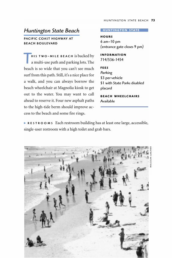
Huntington State BeachPACIFIC COAST HIGHWAY AT
BEACH BOULEVARD
TH I S T W O - M I L E B E A C H is backed by
a multi-use path and parking lots. The
beach is so wide that you can’t see much
surf from this path. Still, it’s a nice place for
a walk, and you can always borrow the
beach wheelchair at Magnolia kiosk to get
out to the water. You may want to call
ahead to reserve it. Four new asphalt paths
to the high-tide berm should improve ac-
cess to the beach and some fire rings.
� R E S T R O O M S Each restroom building has at least one large, accessible,
single-user restroom with a high toilet and grab bars.
H U N T I N G T O N S T A T E B E A C H 73
H U N T I N G T O N S TAT E
H O U R S
6 am–10 pm (entrance gate closes 9 pm)
I N F O R M AT I O N
714/536-1454
F E E S
Parking$3 per vehicle$1 with State Parks disabledplacard
B E AC H W H E E L C H A I R S
Available
MA
LCO
LM L
UB
LIN
ER

Talbert Marsh
O N T H E I N L A N D S I D E of Pacific Coast Highway, across from
Huntington State Beach near the mouth of the Santa Ana River, is a
special place you’re not likely to find on most tourist maps: Talbert Marsh,
a 25-acre wetland restored for wildlife and flood control. Turn inland at
Brookhurst Street, drive past Bushard Street (first light), park along the
street, enter the marsh from the sidewalk and follow the asphalt bicycle path.
You’ll see interpretive signs along the path.
This marsh used to be an informal parking lot. Now it’s popular with
birds—about 80 species have been counted here. At low tide you are likely to
see shorebirds, at high tide pelicans, cormorants, least terns, and others. In
mid-2001 plans were under way to add another 17 acres to this preserve.
74 T H E O R A N G E C O U N T Y C O A S T

Newport BeachN E W P O R T B E A C H T O
C R Y S TA L C O V E S TAT E PA R K
TH E T O W N S OF Newport Beach and Corona del Mar were
built around natural waterways, now greatly altered. In New-
port Beach, a peninsula shelters a harbor and an inland estuary.
Most of the area’s big beaches are on the peninsula. Balboa Island
lies in Newport Harbor between the peninsula and the mainland.
The tides flow into the estuary, an ancient riverbed carved into
a mesa. This is a landscape worth exploring.
View from Inspiration Point, Corona del Mar State Beach
ER
ICK
MIK
ITE
N

Balboa Peninsula
B A L B O A B O U L E V A R D crosses the
Pacific Coast Highway and runs east
along the six-mile peninsula. Just a few
blocks south of the boulevard, there’s a
huge stretch of beach with an oceanfront promenade and two piers,
Newport and Balboa.
If you are heading for the beach from Balboa Boulevard, use Sixth Street
or Island Avenue. Many other streets have stairs. There are free blue spaces
in the lot at B Street. The A Street parking lot provides blue spaces for a fee.
We toured the peninsula from the promenade. This smooth concrete
pathway runs the full length of the beach, with shops and restaurants along-
side it, similar to the Strand in Venice Beach.
Peninsula Park (at the east end of Balboa Beach, near B Street) is a good
place to access the promenade because there are free blue spaces in the ad-
jacent parking lot. This park is also a good place to picnic or play Frisbee be-
cause the lawn is mowed short enough to roll over.
The ocean is not always visible from the promenade.You can get an ocean
view from the piers or from the sidewalks that extend from the promenade to-
ward the water. There’s a long sidewalk east of the Peninsula Park parking lot,
and another at Eleventh Street close to Balboa Pier, at the foot of Main Street.
Southern California has a lot of piers, but Balboa Pier was one of our fa-
vorites for several reasons. First, it provides a good view, thanks to its narrow
metal handrails (many other piers have thick wooden handrails right at a
wheelchair rider’s eye level). Second, the concrete surface makes for a com-
fortable ride. Third, the landscape visible from the pier is lovely, with the
beach curving off into the distance. There are often free concerts in the
bandstand at the foot of the pier.
To get onto Newport Pier, at 20th Street, you have to negotiate a steep
slope at the foot of the pier. Handrails on the east edge of the slope are use-
ful for pulling yourself up.
76 T H E O R A N G E C O U N T Y C O A S T
B A L B OA P E N I N S U L A
B E AC H W H E E L C H A I R
Available

The peninsula still has a remnant working waterfront. The Dory Fishing
Fleet, in operation here since 1891, heads out before dawn from its docks
next to the Newport Pier, returning around 9 A.M. to sell the catch on the
beach. Fishermen assured us that you don’t have to roll across the sand in
order to buy; just come on through their wooden dock and wave to them.
� R E S T R O O M S There is a unisex restroom with a large stall and grab bars
near the men’s room at Balboa Pier. The restrooms at 15th Street are spa-
cious and usable if you can tolerate the lack of doors. Accessible stalls have
grab bars and metal toilets. Bathrooms at Newport Pier at 20th Street are
similar, but may be crowded.
Balboa Island
BALBOA ISL AND is a small residential community, with a tourist-oriented
commercial district, between the peninsula and the mainland. You can
reach it from the mainland via the bridge at Jamboree Street, but we chose to
ferry over from the peninsula. The Balboa Ferry departs every few minutes
from the end of Palm Street north of Balboa Boulevard.You can drive your car
onto the Ferry if you’re willing to wait in line (sometimes for an hour or
more); pedestrians are usually able to board within a few minutes. The four-
minute ride costs 50 cents. Depending on the tide, there may be a step at the
end of the boarding ramp, but the boat crew is ready to assist.
B A L B O A I S L A N D 77
Jamboree Road
MacArthur Blvd.
Mar
guer
ite A
ve.
Ocean Blvd.
Newport Blvd.
W. Balboa Blvd.BalboaIslandFerry
BalboaPier
NewportPier
Lido Island
Balboa Blvd.
Corona del MarState Beach
Pacific Coast Highway
PeninsulaPark
B A L B OA P E N I N S U L A

From the ferry landing you can travel straight ahead to Balboa Island’s
downtown, where you will find galleries, stores, and restaurants; or you can
turn left and explore the docks. The walkway is accessible most of the way
around the island. Our half-hour trip from the ferry to the far side of the is-
land was a quiet sunset stroll past docks and tiny beaches on the water side
and homes and gardens on the other. A low wall separates the walkway from
bits of sandy shore.
� R E S T R O O M S The public restrooms near the ferry landing on the island
side are completely inaccessible. There are new accessible restrooms at the
fire station at Marine Avenue and Park Avenue. Enter the restrooms from
the street on the left side of the building.
Upper Newport Bay State Ecological Reserve/Interpretive CenterSTATE ECOLOGICAL RESERVE, BACK BAY DRIVE AT JAMBOREE ROAD
INTERPRETIVE CENTER, 2301 UNIVERSIT Y DRIVE
TH E E C O L O G I C A L R E S E R V E is a beauti-
ful inland estuary carved into a coastal
mesa. Marsh plants, water, and birds are
main attractions at this oasis within the city.
Wheelchair access is good on Back
Bay Drive, a one-way asphalt road which
hugs the edge of the estuary. Though used
by pedestrians, bicycles, and motorists,
there are few cars and the speed limit is 15
mph, so we were comfortable sharing the
road. The views are great the whole way.
The estuary is especially vibrant in the
evening when the low sunlight strikes the
water, fish jump, and birds gather to feed
and roost.
78 T H E O R A N G E C O U N T Y C O A S T
U P P E R N E W P O R T B AY
State Ecological ReserveH O U R S
Unrestricted
I N F O R M AT I O N
Upper Newport Bay Naturalists 949/640-6746
Interpretive CenterH O U R S
Saturday–Sunday9 am–4:30 pm
I N F O R M AT I O N
714/973-6820

U P P E R N E W P O R T B A Y S T A T E E C O L O G I C A L P R E S E R V E 79
MiddleIsland
UpperIsland
To CoronaDel MarFreeway
To 405Freeway
San JoaquinHills Rd.
To PacificCoast
Highway
ShellmakerIsland
Jamboree Rd.(with bike trail)
Creek
EastcliffDrive
Bristol Rd.
Mesa Dr.Ba
y V
iew
Ave
.
Birc
h A
ve.
Del Mar University
InterpretiveCenter
Back
Bay
Dr.
Back
Bay Dr.
Irvi
ne A
ve.
Irvi
ne A
ve.
Mar
iner D
r.
Dover Dr.
Westcliff
Santiago Dr.
GalaxyDr.
Santiago Dr.
NewportDunes Park
U P P E R N E W P O R T B AY S TAT E E C O LO G I C A L R E S E R V E

The Upper Newport Bay Naturalists host many wheelchair-accessible pro-
grams, including walks with local naturalists and campfire events for families.
Check what’s happening at the Interpretive Center, at the head of the bay.
� PA R K I N G / R E S T R O O M S Park in the dirt lot on Back Bay Drive just past
San Joaquin Hills Road. The lot and the trail are flat in that area. You can also
park at the Interpretive Center. Accessible restrooms are at Newport Dunes
Resort, at the south end of Back Bay Drive, and at the Interpretive Center.
Corona del Mar State BeachOCEAN BOULEVARD WEST OF MARGUERITE AVENUE
C O R O N A D E L M A R S TA T E B E A C H is on the east shore of the Newport
Harbor channel, opposite the tip of Balboa Peninsula. This beach is
best reached by car because the road down is very steep. With pavement at
the water’s edge and no guardrail to block your view, this is a great place to
watch the water and boats. Head west from the parking lot toward the rock
outcropping beyond the lawns to get to the pavement by the channel.
80 T H E O R A N G E C O U N T Y C O A S T
Inspiration Point, with ramp to Corona del Mar State BeachE
RIC
KM
IKIT
EN
The channel is a great fishing spot if
your brakes are good enough to keep you
out of the water. (Remember, there’s no
guardrail or curb to keep you from rolling
into the drink!) Halibut is the prize catch,
according to local fishermen. But you don’t
need a fishing pole to have fun on the
channel. At high tide, waves suck the water
down then splash it up over your feet in an
exhilarating display.
� PA R K I N G / R E S T R O O M S Blue spaces are at the west end of the parking lot.
Both restroom buildings are moderately accessible. Men’s rooms have spa-
cious stalls with grab bars, and twist faucet sinks. Women’s rooms at the west
end of the beach have a similar stall, but no handle to open the stall door;
you have to lean forward and pull the door’s bottom edge. The women’s
room east of the entrance has an easier door, but the entrance is narrow and
requires a hairpin turn.
Crystal Cove State ParkPACIFIC COAST HIGHWAY BETWEEN LAGUNA BEACH AND
CORONA DEL MAR, ABOUT FOUR MILES FROM EACH
C RY S TA L CO V E S TAT E PA R K , totaling
about 2,800 acres, extends on both
sides of Pacific Coast Highway. On the
ocean side there are three miles of quiet
trails on the bluffs above the beach. The
Pelican Point area has the greatest number
of accessible trails and an outstanding na-
tive plant restoration project. On the in-
land side, single-track fire roads used by
mountain bicyclists run through 2,400
acres of rough terrain in El Moro Canyon.
C R Y S T A L C O V E S T A T E P A R K 81
C RY S TA L C OV E
H O U R S
6 am–sunset
I N F O R M AT I O N
949/494-3539
F E E S
Parking$3 per vehicle$2 seniors$1 with State Parks disabled placard
C O R O N A D E L M A R
H O U R S
6 am–10 pm (Entry gate closes 9 pm)
I N F O R M AT I O N
949/644-3044
F E E S
Parking$6 per vehicle $1 with disabled placard

You might skip Los Trancos and Reef Point, where the trails down to the
beach are steep. Restoration of the historic cottages at Los Trancos will in-
clude accessible parking and some access to the cottages and the beach.
Pelican PointPACIFIC COAST HIGHWAY AT NEWPORT COAST DRIVE
Lilac, California sage, elderberry, and sunflower—Pelican Point is a plant
lover’s dream. The trails immerse you in the coastal sage scrub, home to the
endangered California gnatcatcher and many other birds. With a vast net-
work of paved trails, Pelican Point is one of the best places on the Orange
County coast for long walks. Group outings with multiple sets of wheels
would be very comfortable here because the east-west paths are wide
enough for side-by-side travel.
Our favorite paved trail takes off from the west end of the parking area
and heads westward, cutting through a landscape rich with plants and birds.
Slopes are manageable at a slow pace; at a jog they’re a workout. The smooth
pavement is about 10 feet wide. The trail turns south and heads downhill to
the beach about .75 mile from the parking lot. We went partway down the
hill before it became uncomfortably steep.
We also enjoyed the Tidepool Walk, a southbound ground-level wooden
boardwalk through a botanical restoration area. The five-foot-wide boardwalk
82 T H E O R A N G E C O U N T Y C O A S T
Reef Point
VisitorCenter
Tidepool Walk
Los Trancos
Overlook
Beach
El Moro Canyon
Pacific Coast HighwayPelican PointN
ewpo
rt C
oast
Driv
e
C RY S TA L C OV E S TAT E PA R K

begins near the restroom build-
ing in parking lot number 2 (see
map) and runs toward the ocean
through drifts of windswept sage.
Native plants are labeled with
both their common and scientif-
ic names. Birds you may see in-
clude California towhees, mourn-
ing doves, turkey vultures, and
white-tailed kites.
The Tidepool Walk ends at
the edge of the bluffs overlook-
ing the tidepool area below. Since
there’s only a steel cable handrail on the perimeter, the sweeping ocean view
is unobstructed. A smaller sand path continues down the bluff. It’s narrow
and difficult—definitely not officially wheelchair-accessible—but an adven-
turer with a manual wheelchair may want to try it. There are some severe
cross-slopes at washed-out areas, and the steel cable handrail is not much
help. This is the equivalent of mountain biking on a wheelchair. Turn around
when you get to the driftwood interpretive sign and the bench overlook, just
before the metal cord handrail changes to wood. There are stairs on the next
turn and very little room to turn around. The return trip up the hill is tough,
and it’s helpful to have someone behind you to push and balance.
� PA R K I N G / R E S T R O O M S Parking lots, restrooms, outdoor showers, and
drinking fountains all have good access. Restroom buildings have large acces-
sible stalls with high toilets, grab bars, and sinks with stiff push buttons.
El Moro Canyon
El Moro Canyon, a 2,400-acre watershed on the inland side of the highway,
has 18 miles of trails, but they’re rough going by wheelchair. The trail on the
right side of the road just before the parking lot is probably the easiest, but
it’s dusty and steep in places.
E L M O R O C A N Y O N 83
Dunes at Pelican PointE
RIC
KM
IKIT
EN

The Visitor Center is open sporadically on weekends only. (It’s open
only when a volunteer is available.) The center has tabletop exhibits of na-
tive flora and fauna.
� R E S T R O O M S The spacious accessible restroom at the Visitor Center is
open during park hours even when the center is closed. It has grab bars and
a sink with stiff push buttons.
84 T H E O R A N G E C O U N T Y C O A S T

Laguna BeachCRESCENT BAY POINT PARK TO
ALISO BEACH COUNTY PARK
L A G U N A B E A C H is an intimate seaside town built
around an ocean cove and surrounded by hills. The
town’s northern waterfront is a spectacular stretch of cliffs with
wheelchair-accessible parks and vistas. In central Laguna Beach,
a charming and walkable downtown, famous for its art galleries,
lies just across the street from the beach. South Laguna has
another stretch of cliffs, with wheelchair access to one beach.
View from Heisler Park toward Laguna Beach
ER
ICK
MIK
ITE
N

Crescent Bay Point ParkWEST END OF CRESCENT BAY DRIVE
C RESCENT BAY POINT PARK is
on a bluff overlooking the
ocean. It’s small, well-manicured,
and offers panoramic views of the
ocean and the rugged shore. Waves
crash onto enormous rock outcrop-
pings below, heaving up ocean spray.
As the waves recede, thick cascades of
turquoise water plummet down the
sides of the black rocks. There is beauty here even on a gray day.
Several paths are paved, so you can visit after (or even during) heavy rains.
Stormy waters are especially beautiful on the rocks below. Bring your thermos
of coffee and watch the sea lions draped over the rocks. From December
through March, you might see migrating whales just beyond the surf zone.
� P A R K I N G / R E S T R O O M S Park on the street in the adjacent residential
neighborhood. There are no restrooms.
86 T H E O R A N G E C O U N T Y C O A S T
Elisa Mikiten at Crescent Bay Point Park
To Newport
Stairs
Pacific Coast Highway
Heisler Park
CrescentBay Point
Park
CrescentBay Point Dr.
Main Beach
Hwy 133
Broa
dway
Downtown
To Dana Point
Dogpark
Friends of the Sea Lion Marine Animal Center
2 mi
Aster A
ve.Laguna
Art Museum
Cliff Dr.
L AG U N A B E AC H
ER
ICK
MIK
ITE
N
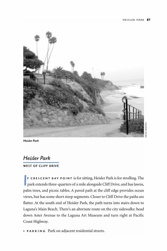
Heisler ParkWEST OF CLIFF DRIVE
IF C R E S C E N T B A Y P O I N T is for sitting, Heisler Park is for strolling. The
park extends three-quarters of a mile alongside Cliff Drive, and has lawns,
palm trees, and picnic tables. A paved path at the cliff edge provides ocean
views, but has some short steep segments. Closer to Cliff Drive the paths are
flatter. At the south end of Heisler Park, the path turns into stairs down to
Laguna’s Main Beach. There’s an alternate route on the city sidewalks: head
down Aster Avenue to the Laguna Art Museum and turn right at Pacific
Coast Highway.
� P A R K I N G Park on adjacent residential streets.
H E I S L E R P A R K 87
Heisler Park
ER
ICK
MIK
ITE
N

Main BeachWEST END OF BROADWAY AT PACIFIC COAST HIGHWAY
MA I N B E A C H is a crescent-shaped cove beach with a boardwalk
parallel to the shore a few hundred yards from the surf. Lawns, pic-
nic areas, benches, and basketball courts—all accessible from the board-
walk—allow you to enjoy the beach without hassling with the sand. The
children’s playground at the southern end of the beach has a wheelchair-ac-
cessible surface at the play structure. Across the street, downtown Laguna
Beach provides an easy retreat into the shade.
� R E S T R O O M S Restrooms at the south end of the beach have large stalls and
grab bars.
Downtown
A C R O S S T H E S T R E E T from Main Beach, downtown Laguna Beach has
restaurants, art galleries, and boutiques. It’s easy to wander about con-
tentedly for an entire afternoon. Downtown is generally flat, and the curb
cuts are good. Most restaurants and shops have accessible front entrances.
This town is known as an artists’ colony, and several art festivals are held
here in midsummer. For festival information call 714/494-3050.
88 T H E O R A N G E C O U N T Y C O A S T
Lifeguard tower
Lawn
Patio
Playstructure
Pacific Coast Highway
Oce
an A
ve.
Broa
dway
Downtown(on-street parking
and small public lots)
Stairs toHeisler Park
Basketball
Beach headquarters
M A I N B E AC H
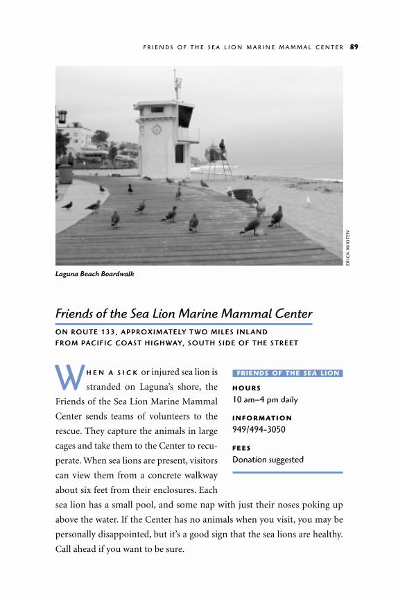
Friends of the Sea Lion Marine Mammal CenterON ROUTE 133, APPROXIMATELY T WO MILES INL AND
FROM PACIFIC COAST HIGHWAY, SOUTH SIDE OF THE STREET
W H E N A S I C K or injured sea lion is
stranded on Laguna’s shore, the
Friends of the Sea Lion Marine Mammal
Center sends teams of volunteers to the
rescue. They capture the animals in large
cages and take them to the Center to recu-
perate. When sea lions are present, visitors
can view them from a concrete walkway
about six feet from their enclosures. Each
sea lion has a small pool, and some nap with just their noses poking up
above the water. If the Center has no animals when you visit, you may be
personally disappointed, but it’s a good sign that the sea lions are healthy.
Call ahead if you want to be sure.
F R I E N D S O F T H E S E A L I O N M A R I N E M A M M A L C E N T E R 89
FRIENDS OF THE SEA LION
H O U R S
10 am–4 pm daily
I N F O R M AT I O N
949/494-3050
F E E S
Donation suggested
Laguna Beach Boardwalk
ER
ICK
MIK
ITE
N
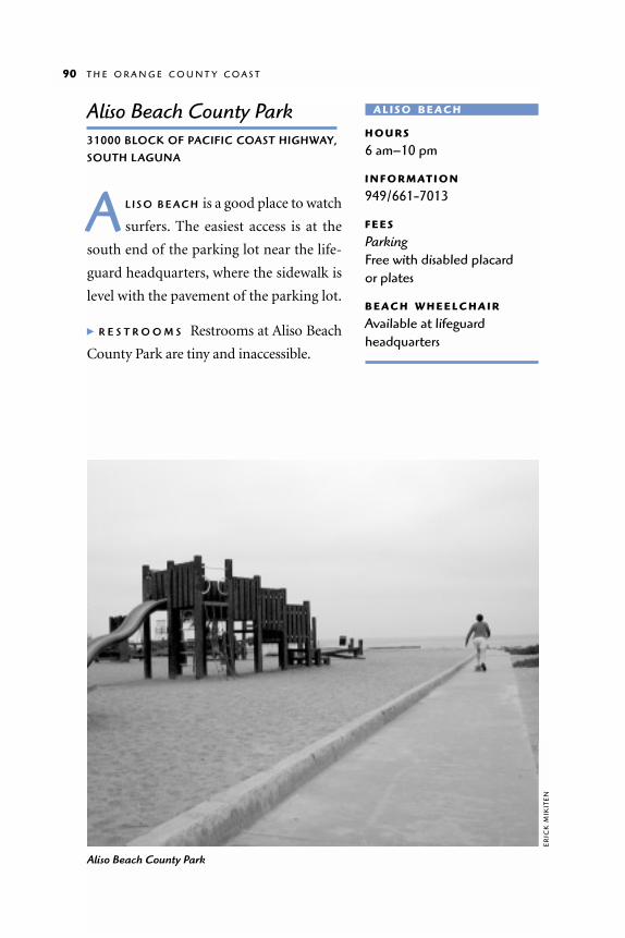
Aliso Beach County Park31000 BLOCK OF PACIFIC COAST HIGHWAY,
SOUTH LAGUNA
A L I S O B E A C H is a good place to watch
surfers. The easiest access is at the
south end of the parking lot near the life-
guard headquarters, where the sidewalk is
level with the pavement of the parking lot.
� R E S T R O O M S Restrooms at Aliso Beach
County Park are tiny and inaccessible.
90 T H E O R A N G E C O U N T Y C O A S T
A L I S O B E AC H
H O U R S
6 am–10 pm
I N F O R M AT I O N
949/661-7013
F E E S
Parking Free with disabled placard or plates
B E AC H W H E E L C H A I R
Available at lifeguardheadquarters
Aliso Beach County Park
ER
ICK
MIK
ITE
N

Dana PointDANA POINT TO C APISTRANO BEACH PARK
WH I L E T H E B L U F F S at Crystal Cove State Park
remained almost undisturbed, those at Dana Point
were built up with residential neighborhoods and a Ritz
Carlton Hotel. Where there’s development there is pavement,
and that can be great for a wheelchair rider. Below the cliffs,
Dana Point has constructed a 2,500-slip yacht harbor, a shop-
ping center, and beachfront parks with campgrounds.
Seagull at Dana Point Harbor
ER
ICK
MIK
ITE
N

Salt Creek Beach ParkWEST OF PACIFIC COAST HIGHWAY OFF RITZ C ARLTON DRIVE
A L T H O U G H A C C E S S is not perfect,
there are good reasons to visit this
beach: to watch the whales or surfers, to sit
high above the ocean, or to relax on a
beach-level lawn. The road from the park-
ing lot down to the beach is too long and
steep for wheelchair riding. Fortunately,
the park allows cars with disabled parking
placards or plates to drive down to a drop-
off zone near beach level. There is no park-
ing at beach level, so someone is supposed to take the car up to the parking
lot and hike back down.
As you drive down to the beach, check out the park beside the road. Its
terraces are blanketed in plush green lawn overlooking the ocean. With
binoculars the park makes a great whale-watching spot.
From the drop-off zone, you’ll find asphalt access roads that are easy to
roll over despite a thin covering of sand. The north road ends at a restroom
92 T H E O R A N G E C O U N T Y C O A S T
S A LT C R E E K
H O U R S
5 am–midnight
I N F O R M AT I O N
949/661-7013
F E E S
ParkingFree with disabled placard or plates
Pacific Coast Highway
Ritz Carlton Drive
Sea Terrace Community Park
Pedestrian Only orDrop-Off Access
Drop-Off Zone
Park
Pedestrian Tunnel
Pergola
Lawn
Lawn
S A LT C R E E K B E AC H PA R K

building behind which is a pleasant,
hedge-lined lawn with a picnic table
and a barbecue. The lawn is just above
beach level, so it’s a wonderful place to
view the beach without contending
with sand. The rabbits that fed on the
grass at twilight delighted us. The
south road also ends at a restroom
building (inaccessible) with a smaller
lawn behind it.
Sea Terrace Community Park, on
the inland side of Pacific Coast High-
way, is accessible through a pedestrian
tunnel from the Salt Creek Beach
parking lot. It’s a hilly park with beau-
tiful lawns and nice concrete paths. You have to cross about six feet of gently
sloping lawn to reach the nearest picnic table. This would be a nice place to
fly a kite or play with children.
� R E S T R O O M S The only wheelchair-accessible restroom at Salt Creek is at
beach level near the north lawn. The restroom has wide stalls and grab bars.
The restrooms at the main parking lot have two-foot-wide doors and no
wide stalls.
Ken Sampson LookoutSOUTH END OF STREET OF THE BLUE L ANTERN
D A N A P O I N T has several small parks on the clifftops overlooking the
harbor. Ken Sampson Lookout is one of the best because it has bench-
es and no stairs. With thousands of boats in the glistening water, the harbor
is a pretty sight.
� P A R K I N G / R E S T R O O M S There is on-street parking, but there are no
restroom facilities.
K E N S A M P S O N L O O K O U T 93
Southern end of Salt Creek Beach Park
ER
ICK
MIK
ITE
N

Heritage ParkSOUTH END OF STREET OF THE GOLDEN L ANTERN
Y O U M I G H T E N J O Y a wild downhill
ride at Heritage Park. The park is on
a steep hillside that is terraced from Dana
Point’s blufftops down to the harbor.
There are some level spots at the top with
benches and grassy areas. Below that a
steep concrete path zigzags down the terraces. The path is steeper than it
looks, perhaps 1:6 or 1:7 on the hairpin turns. It’s a fun ride down, but man-
ual wheelchair riders should bring gloves, as your wheel rims will heat up
from all the braking. Getting back up the hill is not easy. Either have some-
one meet you with a car at the bottom of the hill on Dana Point Harbor
Drive, or just park at the bottom of the park, push up the hill as far as you
can, then coast back down to the car.
� PA R K I N G/R E S T R O O M S The on-street parking area has one blue space and
a curb cut. There are no restroom facilities.
Dana Point HarborA L O N G D A N A P O I N T H A R B O R D R I V E
DA N A P O I N T H A R B O R ’ S mile-long
shoreline extends from the massive
headlands of Dana Point south to Doheny
State Beach. North of Island Drive, a park
with a smooth concrete path hugs the shore-
line. It’s a pleasant place for an afternoon
stroll. At the north end of the park, there are two tourist attractions: the Ocean
Institute and the Pilgrim, a square-rigged brig.
As this book went to press, the Ocean Institute was beginning a major
upgrade and expansion of its buildings and facilities, due to be completed in
94 T H E O R A N G E C O U N T Y C O A S T
H E R I TAG E
H O U R S
7 am–10 pm
I N F O R M AT I O N
562/946-6476
DA N A P O I N T
I N F O R M AT I O N
Ocean Institute and Pilgrim949/496-2274Dana Point Sportfishing 949/496-5794

D A N A P O I N T H A R B O R 95
Paci
fic C
oast
Hig
hway
Pacif
ic Co
ast H
ighw
ay
� S
an C
lem
ente
1
1
5
Del
Pra
do A
ve.
Stre
et o
f the
Gol
den
Lant
ern
Her
itag
e Pa
rk
Doh
eny
Stat
e Be
ach
Day
Use
/Cam
ping
Cat
alin
a Ex
pres
s
Shop
ping
Cen
ter
Ken
Sam
pson
Look
out Th
e Pi
lgrim
Street of the Blue Lantern
Har
bor
Har
bor
�Pi
cnic
Tab
les &
BBQ
s
Ora
nge
Cou
ntry
Mar
ine
Inst
itut
e
Island Drive
Dan
a Po
int
Har
bor D
rive
Dan
aPo
int
Har
bor
Drive
DA N A P O I N T H A R B O R

2002. A rich variety of exhibits and displays will be fully accessible, along
with an area restored with native plants and a rustic picnic area.
The Pilgrim is a full-size replica of the square-rigged brig Richard Henry
Dana, Jr., wrote about in Two Years Before the Mast. The original ship was
built in 1825, and the replica in 1945. The public is welcome aboard on
Sundays from 10 A.M. to 2:30 P.M. when the ship is in port (call to check).
About half of the ship’s deck is accessible via a ramp. Next to the Pilgrim,
there is a small wheelchair-accessible fishing pier.
South of Island Drive there is a shopping center with restaurants, a
small public fishing pier, and commercial boat docks. Dana Point
Sportfishing offers fishing and whale-watching trips. There is a step at the
end of the loading ramp, but the crew is available to assist. If you’re going on
a fishing trip, we suggest that you arrive early so that you can board first and
stake out a fishing station that works well for you.
Catalina Express launches its ferries to Catalina Island from the docks
behind the shopping center. The reservation agent can schedule you on a
ferry that has an accessible bathroom. All the boats are boarded from a ramp
that may have a step at the bottom at low tide. The crew is ready to help.
� R E S T R O O M S The Ocean Institute restrooms have narrow stalls with grab
bars suitable for a front transfer. Sinks have twist faucets. The situation
should be improved when renovations are
completed. The public restrooms at the
shopping center have wide accessible stalls
with grab bars and raised toilets, but the
tight turns at the entrance may be impass-
able for large wheelchairs.
Doheny State BeachDEL OBISPO AND PACIFIC COAST HIGHWAY
SA N J U A N C R E E K divides Doheny State
Beach into a day-use area and a camp-
ground. Both are attractive for wheelchair
96 T H E O R A N G E C O U N T Y C O A S T
D O H E N Y S TAT E
H O U R S
6 am–10 pm
I N F O R M AT I O N
949/496-6172
F E E S
Day use $3 per vehicle$1 with disabled placard
B E AC H W H E E L C H A I R S
Available
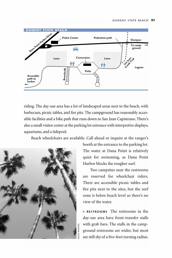
riding. The day-use area has a lot of landscaped areas next to the beach, with
barbecues, picnic tables, and fire pits. The campground has reasonably acces-
sible facilities and a bike path that runs down to San Juan Capistrano. There’s
also a small visitor center at the parking lot entrance with interpretive displays,
aquariums, and a tidepool.
Beach wheelchairs are available. Call ahead or inquire at the ranger’s
booth at the entrance to the parking lot.
The water at Dana Point is relatively
quiet for swimming, as Dana Point
Harbor blocks the rougher surf.
Two campsites near the restrooms
are reserved for wheelchair riders.
There are accessible picnic tables and
fire pits next to the sites, but the surf
zone is below beach level so there’s no
view of the water.
� R E S T R O O M S The restrooms in the
day-use area have front-transfer stalls
with grab bars. The stalls in the camp-
ground restrooms are wider, but most
are still shy of a five-foot turning radius.
D O H E N Y S T A T E B E A C H 97
Dana P
oint Harb
or Driv
eVisitor Center
Lawn
Boar
dwal
k
Concessions
Accessible path to harbor
Pedestrian pathOverpass
To camp-ground
San J
uan
Creek
TrailLawn
LagoonPatio
D O H E N Y S TAT E B E AC H
ER
ICK
MIK
ITE
N
Capistrano Beach ParkPACIFIC COAST HIGHWAY AT PALISADES DRIVE,
C APISTRANO BEACH
TH I S S A N D Y B E A C H between Doheny
State Beach and San Clemente has a
beach-level parking lot, so it’s easy to get out
onto the sand. There’s a basketball court
next to the beach, and a stand where you
can rent a ball, umbrellas, lounge chairs,
and several types of bicycles. The bicycle
trail on the beach runs through Doheny
State Beach to Dana Point Harbor, about
nine miles. We met one manual wheelchair jock who pushes it regularly.
� R E S T R O O M S Restroom access is limited: the accessible stalls are front-
transfer only, and there is no clear space beneath the sinks.
98 T H E O R A N G E C O U N T Y C O A S T
C A P I S T R A N O
H O U R S
6 am–10 pm
I N F O R M AT I O N
714/661-7013
F E E S
Blue spaces free

San ClementeSAN CLEMENTE CITY BEACH TO
CALAFIA STATE BEACH
SA N C L E M E N T E is a casual collection of twisting streets
with low-roofed stucco homes and small, locally owned
shops. Except for the military base at the south end of the town,
the public has access to San Clemente’s entire coastline; the ques-
tion for the wheelchair rider is how to get to it. Most of the coast-
line is a thin ribbon of sand between the ocean and the bluffs, bi-
sected by railroad tracks that run along the shore. Some of the
coast is accessible only by stairs or steep trails. The railroad tracks
can be another barrier. Still, there are a few places that work.
San Clemente Municipal Pier
JAC
K L
IEB
STE
R
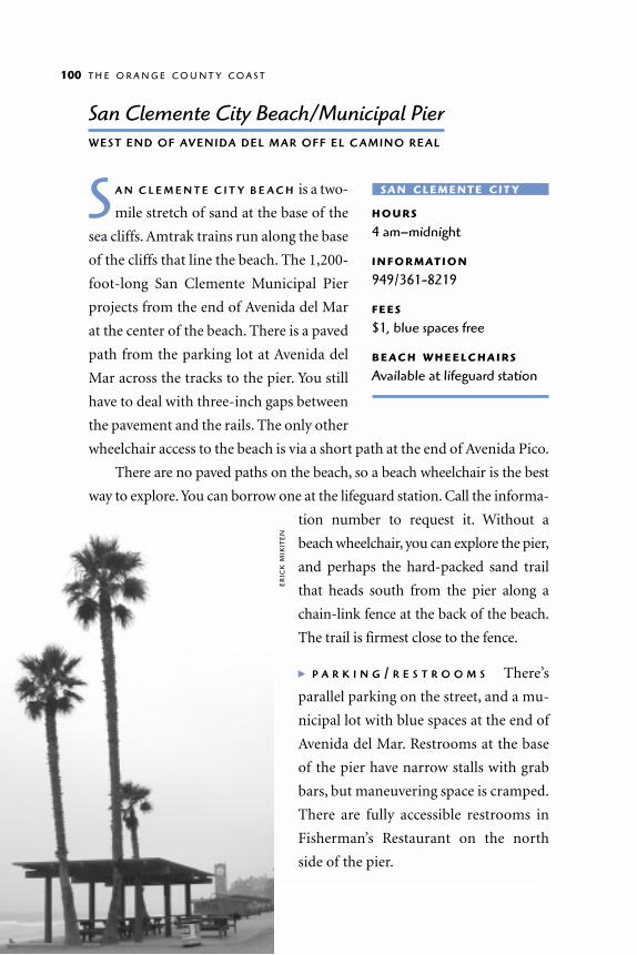
San Clemente City Beach/Municipal PierWEST END OF AVENIDA DEL MAR OFF EL C AMINO REAL
S A N C L E M E N T E C I T Y B E A C H is a two-
mile stretch of sand at the base of the
sea cliffs. Amtrak trains run along the base
of the cliffs that line the beach. The 1,200-
foot-long San Clemente Municipal Pier
projects from the end of Avenida del Mar
at the center of the beach. There is a paved
path from the parking lot at Avenida del
Mar across the tracks to the pier. You still
have to deal with three-inch gaps between
the pavement and the rails. The only other
wheelchair access to the beach is via a short path at the end of Avenida Pico.
There are no paved paths on the beach, so a beach wheelchair is the best
way to explore. You can borrow one at the lifeguard station. Call the informa-
tion number to request it. Without a
beach wheelchair, you can explore the pier,
and perhaps the hard-packed sand trail
that heads south from the pier along a
chain-link fence at the back of the beach.
The trail is firmest close to the fence.
� P A R K I N G / R E S T R O O M S There’s
parallel parking on the street, and a mu-
nicipal lot with blue spaces at the end of
Avenida del Mar. Restrooms at the base
of the pier have narrow stalls with grab
bars, but maneuvering space is cramped.
There are fully accessible restrooms in
Fisherman’s Restaurant on the north
side of the pier.
100 T H E O R A N G E C O U N T Y C O A S T
S A N C L E M E N T E C I T Y
H O U R S
4 am–midnight
I N F O R M AT I O N
949/361-8219
F E E S
$1, blue spaces free
B E AC H W H E E L C H A I R S
Available at lifeguard station
ER
ICK
MIK
ITE
N

San Clemente State BeachAVENIDA CALAFIA .2-MILE WEST OF INTERSTATE 5
TH E C A M P G R O U N D S at San Clemente
State Beach are on bluffs high above
the ocean. They are great for tent or RV
camping (full hookups are available). Most
of the campsites are hard-packed dirt with
low shrubbery. All are wheelchair accessi-
ble. Two in the hookup area and one in the
tent area are are reserved for campers with
wheelchairs.
The paths leading from the camp-
grounds down to the beach are extremely
long and steep. We skidded down (danger-
ously) only to encounter soft sand on the
inland side of the railroad tracks. We were still quite far from the water. But
S A N C L E M E N T E S T A T E B E A C H 101
S A N C L E M E N T E S TAT E
H O U R S
6 am–10 pm
I N F O R M AT I O N
949/492-3156
F E E S
Day use$6 per vehicle$3 with disabled placard
B E AC H W H E E L C H A I R S
Two available
Picnic area near San Clemente Municipal Pier
ER
ICK
MIK
ITE
N
there are better ways: if you call (949) 492-5172, you can get a ride down to the
beach. Pack everything you’ll need for the day because there are no facilities on
the beach. The beautiful ribbons of color in the cliffs are one reason to make
the journey.
� R E S T R O O M S Restrooms on the bluffs have good access, with wide stalls
and grab bars. Coin-operated showers have flip-down seats and low shower
heads. There are no temperature controls for the showers, and the water was
barely warm on our visit.
Calafia State BeachEND OF AVENIDA C AL AFIA
A V E N I D A C A L A F I A comes to a dead
end at a small park facing the ocean.
A row of granite boulders blocks wheel-
chair access from the parking lot to the
beach. However, there is a decent patio in
front of the concession stand in the center
of the parking lot. The patio would make a
nice place to rest or watch the sunset.
� R E S T R O O M S Restrooms off the patio have wide stalls with steel toilets,
grab bars, but no doors.
102 T H E O R A N G E C O U N T Y C O A S T
C A L A F I A
H O U R S
6 am–10 pm
I N F O R M AT I O N
714/492-5172
F E E S
Free with disabled placard or plates
Public Transportation
General Transit Information
For information on transit systems serving the Los Angeles and Orange
County coasts, and on specific routes and trips, call 213/922-6235, or
within the 213 area code, 800/COMMUTE (800/266-6883); or look on-line
at: www.mta.net, which has links to all other systems listed below. Fares
for persons with disabilities are 25 cents unless otherwise noted; monthly
discount passes are available for most systems. You may need to present
special ID to get reduced rates or to buy passes.
Los Angeles County
MTA (Metropolitan Transportation Authority)/Metro Rail is the main pub-
lic transit system for Los Angeles. For information, call 213/922-6235, or
within the 213 area code, 800/COMMUTE (800/266-6883); or see their
website at www.mta.net. Fares are 45 cents plus 10 cents for transfers or
25 cents for express bus transfers. Monthly discount passes for unlimited
use of rail and bus lines are $12.
MTA issues a LACTOA (Los Angeles County Transit Operators Asso-
ciation) card that is good for discount fares for people with disabilities on
all public transportation in the county. To apply for the card, go to any
Metro Customer Center.
The 434 line serves the coast from Topanga County Beach south to
Santa Monica State Beach and Pier. Other lines with coast routes are:
304, Will Rogers State Beach
22 and 304, Santa Monica State Beach and Pier
33, 333, and 436, Venice Beach
108, Marina del Rey

125 and 439, Dockweiler State Beach
126 and 439, Manhattan County Beach
232 and 439, Redondo County Beach
445, 446, and 447, Los Angeles Harbor
60, 232 and the Metro Blue Line, Long Beach
LADOT (Los Angeles Department of Transportation)/ DASH (Downtown
Area Short Hop) provides CityRide programs, Commuter Express, and
summer beach shuttles. For information, call 213/808-2273, or check their
website at www.ladottransit.com. For people with disabilities, LADOT
offers the Cityride program, which includes discount METRO passes, and
discounts on taxi and lift-van services. Group trips are possible. To join,
or for general information on CityRide, call (213, 310, or 818) 808-RIDE or
contact the nearest Senior Multipurpose Center.
The DASH Venice line runs from the Marina Freeway parking lot to
Venice Beach on summer weekends and holidays (Memorial Day through
Labor Day). Other lines to beaches include:
LC142 and LC147, Los Angeles Harbor
LX437, Venice and Marina del Rey
LX438, Dockweiler, Hermosa, and Manhattan Beaches
(The “LX” lines are Commuter Express Lines. These make limited
stops and run Monday through Friday during peak commute hours
only. Fares are 85 cents; interagency transfers for use on other bus
systems cost 10 cents.)
Santa Monica Municipal Bus Lines (the “Big Blue Bus”) serves the Santa
Monica area. Information is available at 310/451-5444 or
www.bigbluebus.com on the web. These lines go to beaches:
SM9,Will Rogers State Beach
SM1, SM2, and SM8, Santa Monica State Beach and Pier
SM2 and SM8, Venice Beach
104 A W H E E L C H A I R R I D E R ’ S G U I D E

Torrance Transit is the Torrance public transportation system. Information
is available at 310/792-0560 or on the web at www.ci.torrance.ca.us/city/
dept/transit/index.html. Transfers for any connecting bus continuing in
the same direction cost 15 cents. Reduced fare cards can be bought at the
Torrance Transit Store (Torrance City Hall, West Annex, 3031 Torrance
Blvd.). The Dial-A-Lift program, which uses vans with wheelchair lifts,
offers a book of 10 tickets for $5. Lines to beaches include:
TR3 and TR7, Redondo Beach Pier
TR3, downtown Long Beach
TR4, Torrance County Beach
TR8, Manhattan County Beach and North Redondo Beach
Long Beach Transit provides public transportation for Long Beach. Infor-
mation is available at 562/591-2301 or on the web at www.lbtransit.com.
“Passport” lines (the LBA, LBB, LBC, and LBD) have free fares in downtown
Long Beach. Lines serving the area include:
LBA and LBD, Belmont Shore
LBC, Long Beach Harbor
Orange County
Orange County Transportation Authority information is available at 714/
636-RIDE (714/636-7433) or on the web at www.octa.net. OCTA Reduced
Fare ID card, Medicare card, Braille Institute ID card, Service Connected
Veteran ID card, other transit agencies’ disabilities card, or DMV Disabled
Person Placard ID required for discount fares and discount monthly bus
passes ($10.00). Day passes are 50 cents. Lines that serve the coast include:
1, Long Beach
1, 70, and 72, Huntington Beach
1 and 42, Seal Beach
1, Newport Beach
P U B L I C T R A N S P O R T A T I O N 105

47 and 73, Balboa
1 and 89, Laguna Beach
1, 70, 85, and 191, Dana Point
ACCESS is OCTA’s shared-ride service for people whose disabilities
prevent them from using the regular, fixed-route bus service. Eligible for
OCTA ACCESS service are people who are unable to board a fixed route
bus, cannot reach a bus stop because of physical or environmental
barriers, or do not understand how to ride the bus. OCTA has a formal
certification process that follows ADA guidelines. For applications, call
877/OCTA-ADA (877/628-2232).
106 A W H E E L C H A I R R I D E R ’ S G U I D E

To the guidebook user
YO U C A N H E L P make the coast more accessible to
wheelchair riders by writing to us. Did you find this
book useful? Did it lead you to places you might not have
visited without it? Did it tell you what you needed to know to
get to the places described? What should we change or improve
in any future edition? We would like to hear about other fully
accessible places along the coast, and about any barriers that
need to be removed.
W R I T E TO:
Coastal Conservancy Publications
1330 Broadway, 11th Floor
Oakland, CA 94612
510/286-0933
O R
Coastwalk
7207 Bodega Avenue
Sebastopol, CA 95472
800/550-6854


