Download - Baidu ApolloHD Map - UN-GGIM
21/11/2018
1
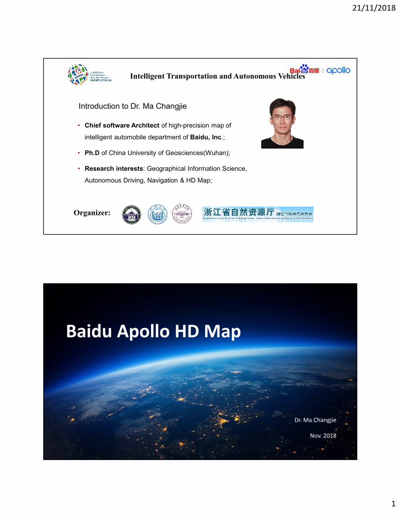
• Chief software Architect of high-precision map of
intelligent automobile department of Baidu, Inc.;
• Ph.D of China University of Geosciences(Wuhan);
• Research interests: Geographical Information Science,
Autonomous Driving, Navigation & HD Map;
1
Introduction to Dr. Ma Changjie
Organizer:
Intelligent Transportation and Autonomous Vehicles
Baidu Apollo HD Map
Dr. Ma Changjie
Nov. 2018
21/11/2018
2
Open
Capability
Shared
ResourcesAccelerated
Innovation
Sustained
Mutual Benefit
���������� � ������
������������� � ������
������������ � ������
������� !� � ������
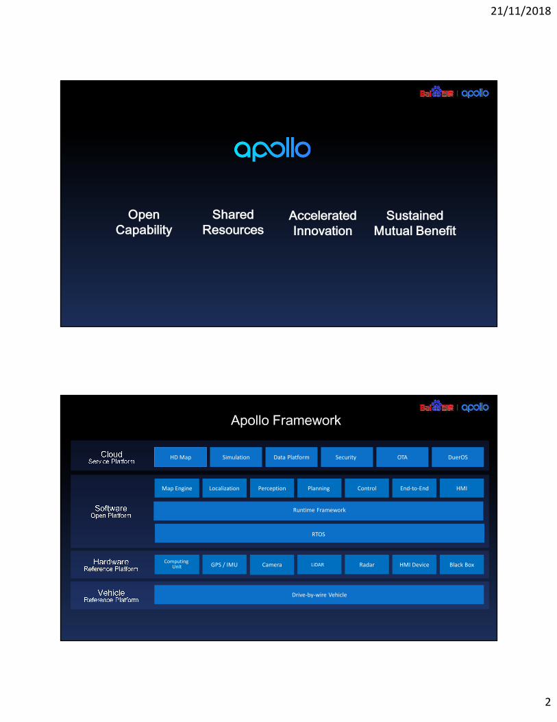
HD Map Simulation Data Platform Security OTA DuerOS
Map Engine Localization Perception Planning Control End-to-End HMI
Runtime Framework
RTOS
GPS / IMU Camera LiDAR Radar HMI Device Black Box
Drive-by-wire Vehicle
Computing Unit
Apollo Framework

21/11/2018
3
Apollo is Accelerating Innovation for Autonomous Driving
"#$%&' "#$%&% "#$%&( "#$)&$ "#$)&'
*+,,- ./-,,- ./-,,- 012 ./-,,- 013 ./-,,- 412 ./-,,- 413
567887 98:;<7=>5??7@?ABC
D87EBC FB?@B G=:AHI?J5@;7?7>7@E K=ILI?J
MINBC O:?B5@;7?7>7@E
K=ILI?J
5@;7?7>7@E K=ILI?J<7= PI>68B Q=R:? S7:C
D7?CI;I7?E
Lines of codePartners
131 230,000+
"#$)&%
./-,,- T12
FIEI7?UR:EBC VIJWX:Y5@;7?7>7@E K=ILI?J
I? OI>I;BC 5=B:
Q6J=:CBC
5=AWI;BA;@=B
Developers
11,000+
Z[\]^_`ab[c\ bd_e fghij kglmnop qrsttuv wsx ysxz{|
}np~�g���nop ��g��l�n�nop
��j� �goi��~gopnop
��� go� lg���
����_��� ��_�[dc
��_��[� �_�
���d�_�[� _��� ¡_�¢[c\
fghij kglmnop�£����onop �lg¤¤n� ¥g� knh�j
£j�� ¦ §� £����lji� £jgjn�o kglmnop�¨©�jg�hi�ªg�n�o
���dcd�d�� �]�����ad«��_�[dc
¬
®¯¯°±²°³ ´°µ¶·¸° ¹d�����[_� �][���
³¶º®»° ¼®³
½¾sr¿À ysr
Ár¿u¾à Ä{|
ÅuÀÆ|uÇ¿ÅuÈuÆ|uÇ¿
ÉÊËÌÍÎÏÐÍÑÍÒÓ ÔÕÖÒ×ÐÍØÙ Ú@8;IUFBWIA8B GY6BE
Apollo Pilot: Making Driving Safer

21/11/2018
4
Apollo HD Map
One Road Network
ArchitectureFull-Scenario
Features
AI Driven
Technology
One Road Network Architecture
Dynamic Data ( RTTI, Traffic Events etc.)
Sensor Feature
Lane Topology Traffic Signs
Parking FacilityLane-Level
Navigation
Data
AD Assisted Driving Data (e.g. Speed up, Slow down, etc.)
Data Adapter/Cross-reference
Road-Level
Navigation
Data
BMD
Routing Names
POI
Road Network
HD Map
SD Map
21/11/2018
5
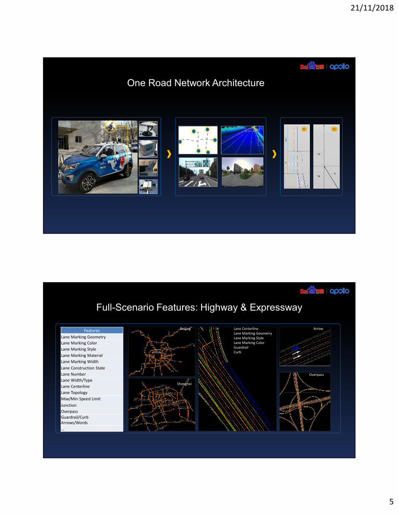
One Road Network Architecture
Full-Scenario Features: Highway & Expressway
ArrowFeatures
Lane Marking Geometry
Lane Marking Color
Lane Marking Style
Lane Marking Material
Lane Marking Width
Lane Construction State
Lane Number
Lane Width/Type
Lane Centerline
Lane Topology
Max/Min Speed Limit
Junction
Overpass
Guardrail/Curb
Arrows/Words
…
Overpass
Lane Centerline
Lane Marking Geometry
Lane Marking Style
Lane Marking Color
Guardrail
Curb
Beijing
Shanghai

21/11/2018
6
Full-Scenario Features: Urban Road & Close Area
Features
Lane Marking Geometry
Lane Marking Color
Lane Marking Style
Lane Marking Material
Lane Marking Width
Lane Construction State
Virtual Lane Connectivity of
Intersection
Intersection Boundary
Traffic Light
Stop Line
Speed Bump
Zebra Line
Overpass
Traffic Sign
No Parking Area
…
Speed Bumps
No Parking Area
Road Intersection
Full-Scenario Features: Parking Facility
Features
Parking Facility Region
Parking Space ID
Parking Space Geometry
Parking Wheel Marker
Parking Lane Marking
Pole
Drivable Area
Connection to Road
Handover Zone
Arrow
No Parking Area
Zebra Line
Curvature
Traffic Sign
Ramp Area
…
Parking Space ID &wheel marker
Lane Marking & traffic sign
Parking Facility Region

21/11/2018
7
AI Driven Technology: HD Map Production Pipeline
CameraCamera
LiDARLiDAR
IMUIMU
GPSGPS
GPS TrackGPS Track
Point CloudPoint Cloud
Photo imagePhoto image
Point Cloud Fusion & RecognitionPoint Cloud Fusion & Recognition
Image RecognitionImage Recognition
FusionFusion PolePole
CurbCurb GuardrailGuardrail
ArrowArrow SignboardSignboard
Lane markingLane marking Traffic signTraffic sign
MapmakerMapmaker NDS ReleaseNDS Release
Data SourcingData Sourcing Backend AutomationBackend Automation Map making & ValidationMap making & Validation Map Compile & ReleaseMap Compile & Release
Map production managementMap production management
AI Driven Technology: Point Clouds & Images Automated Processing
TSR
Image Recognition
MSF
3D->2D
Mapping
Motion
Compensation
3D Modeling
Feature extraction
Point Cloud Fusion
Point Cloud
Recognition
PCF&PCR
Element track
cluster Filter & fill-up
Deep Learning Neural Network (CNN/RCNN/RNN)

21/11/2018
8
AI Driven Technology: Point Clouds & Images Automated Recognition
Chinese standard traffic sign list above, 200 types or so.Lane marking and Guardrail in China about 50 types
FeatureAccuracy
rate
Lane Marking 96.6%
Guardrail 99.1%
Curb 99.1%
Sign 95.4%
Pole 95.5%
AI Driven Technology: Intelligent Map Ecosystem
Intelligent Map Platform
DC DC DCSD/HD
Smartphone Crowd-Sourcing In-Car Smart Device Intelligent Connected Car
Data Data
Baidu Survey Fleet
Autonomous Driving Car
Data
DCHD
Data

21/11/2018
9
Open Road testing with BMW/Bosch/Cherry
Bosch AD road testing on SuZhou Highway 2017BMW AD road testing on Open road 2016 Cherry AD road testing on Wuhu Highway 2018
OEM Partners Testing Reports & Nomination

21/11/2018
10
Thanks


