Download - Building a Map for the Met App
Building a Map for The Met app
Spencer Kiser and Subathra Thanabalan The Metropolitan Museum of Art
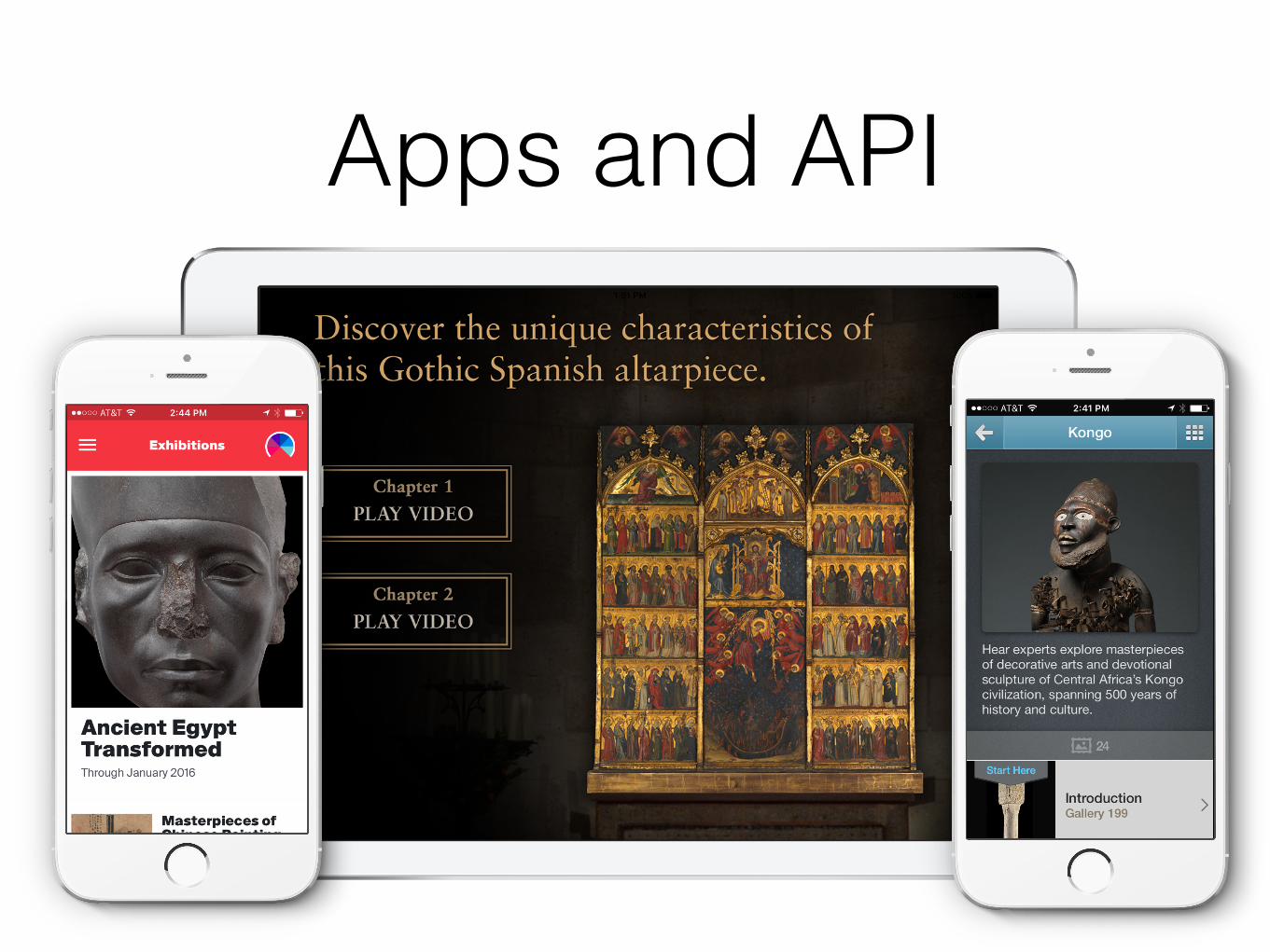
Apps and API
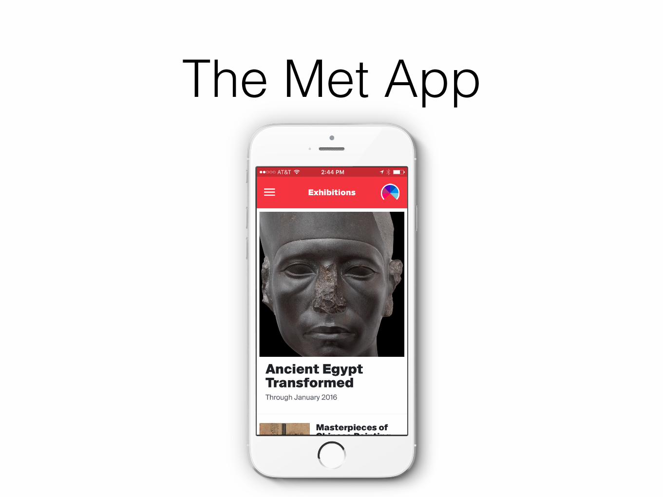
The Met App
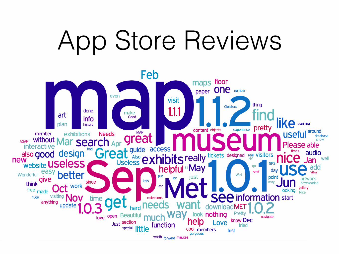
App Store Reviews
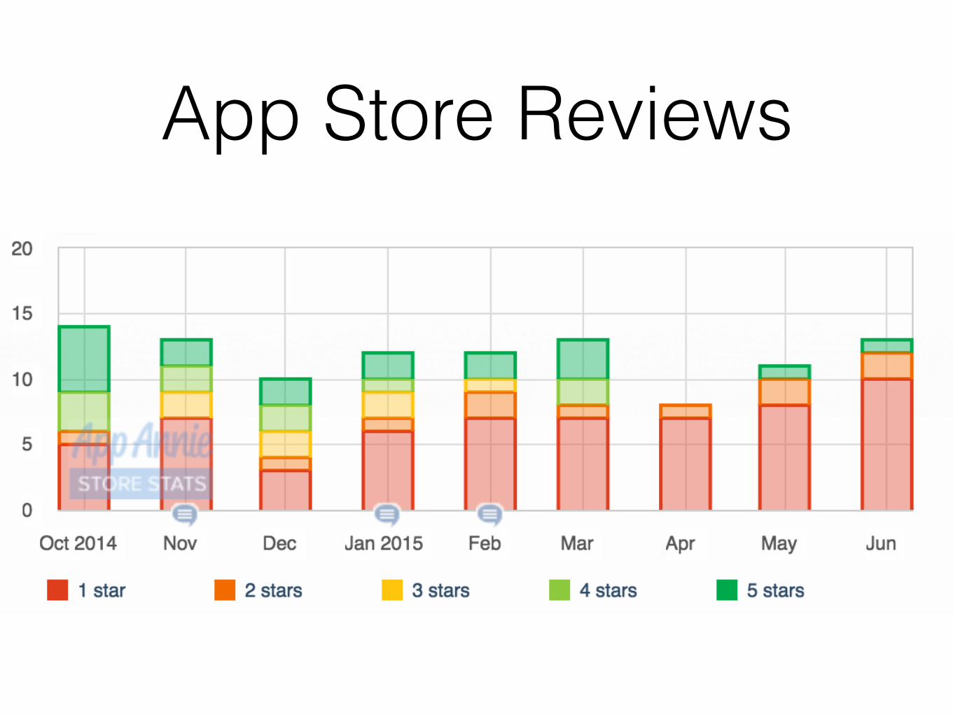
App Store Reviews
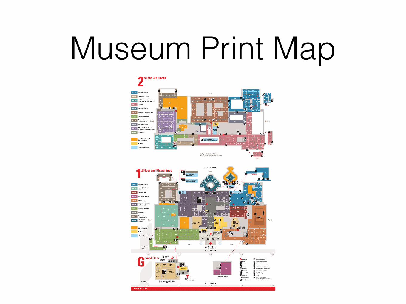
Museum Print Map
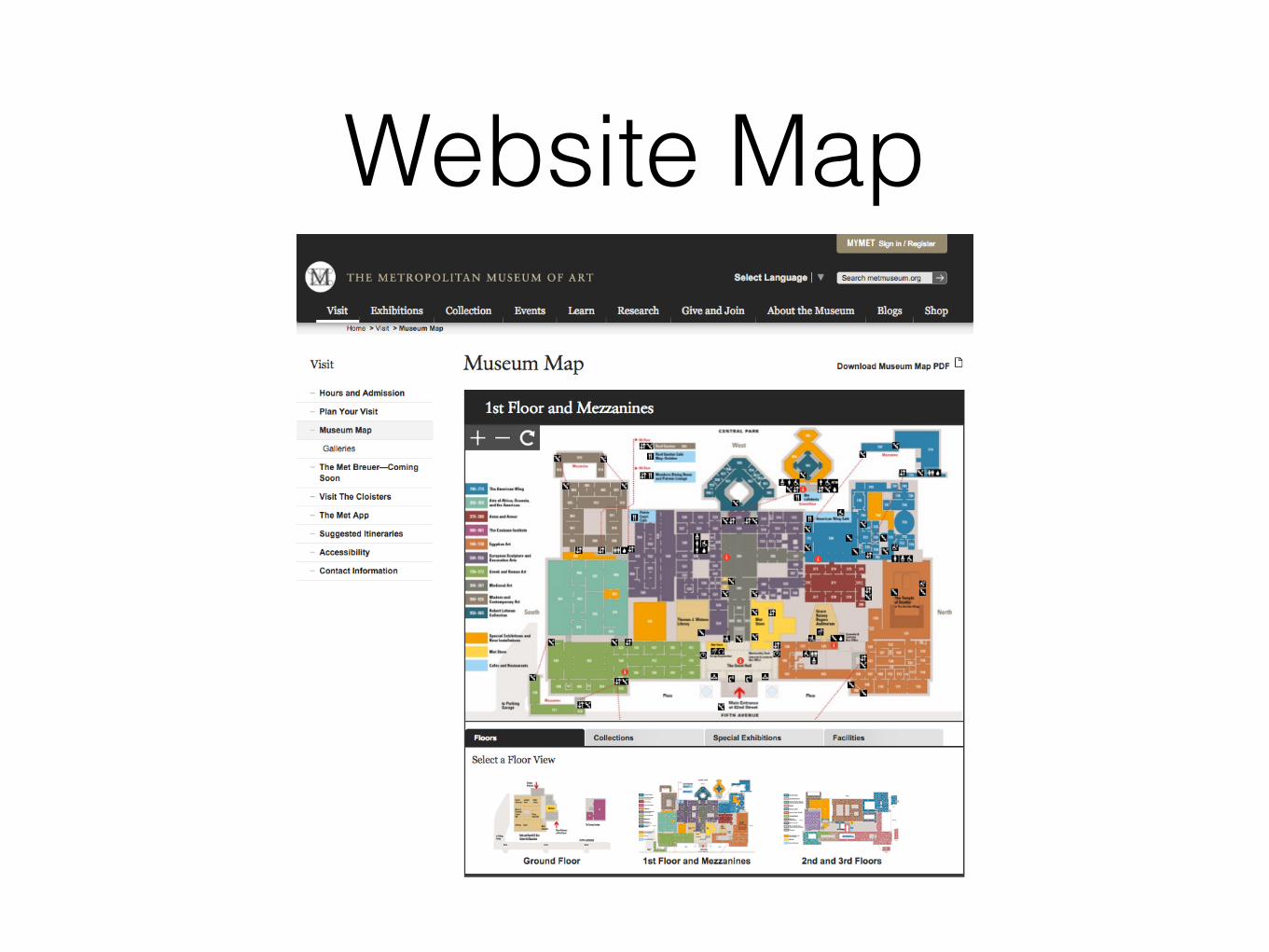
Website Map
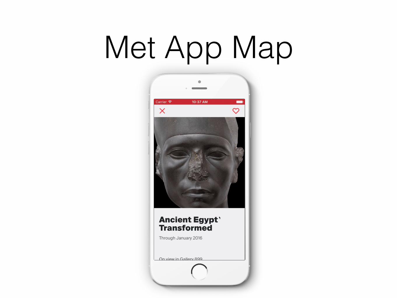
Met App Map

Tech Stack
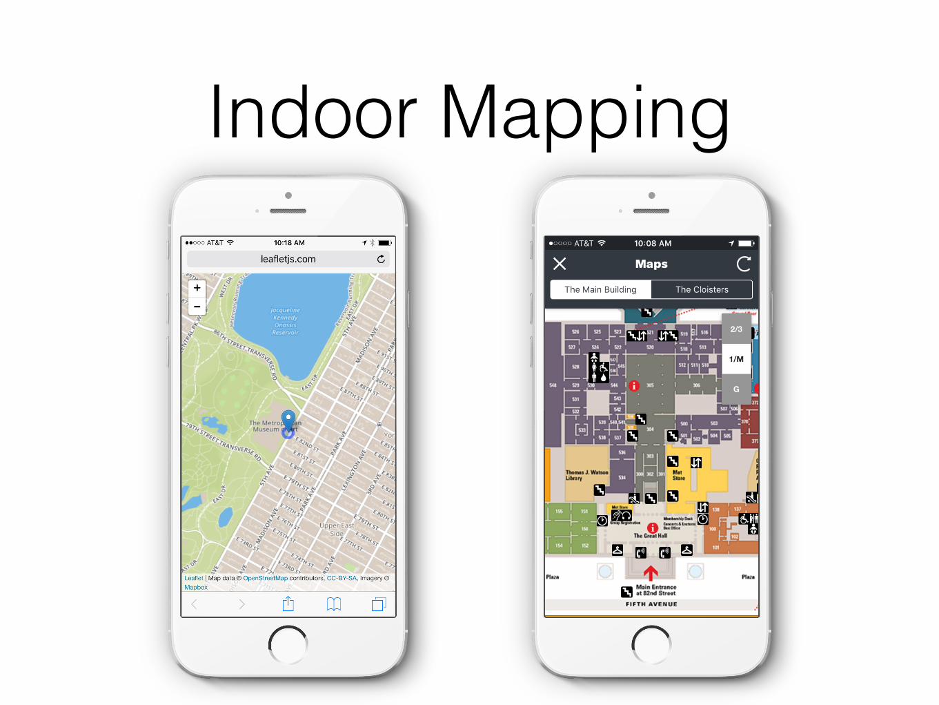
Indoor Mapping
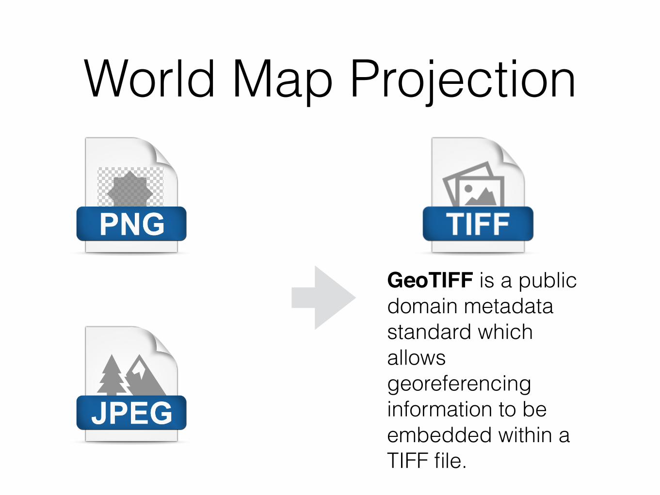
World Map Projection
GeoTIFF is a public domain metadata standard which allows georeferencing information to be embedded within a TIFF file.

World Map Projection
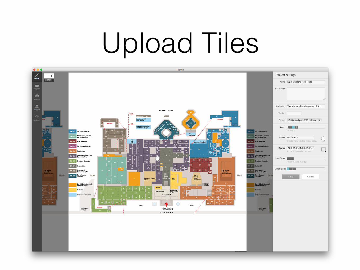
Upload Tiles
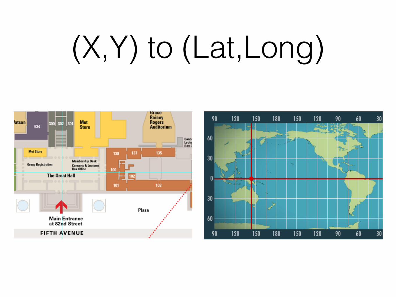
(X,Y) to (Lat,Long)
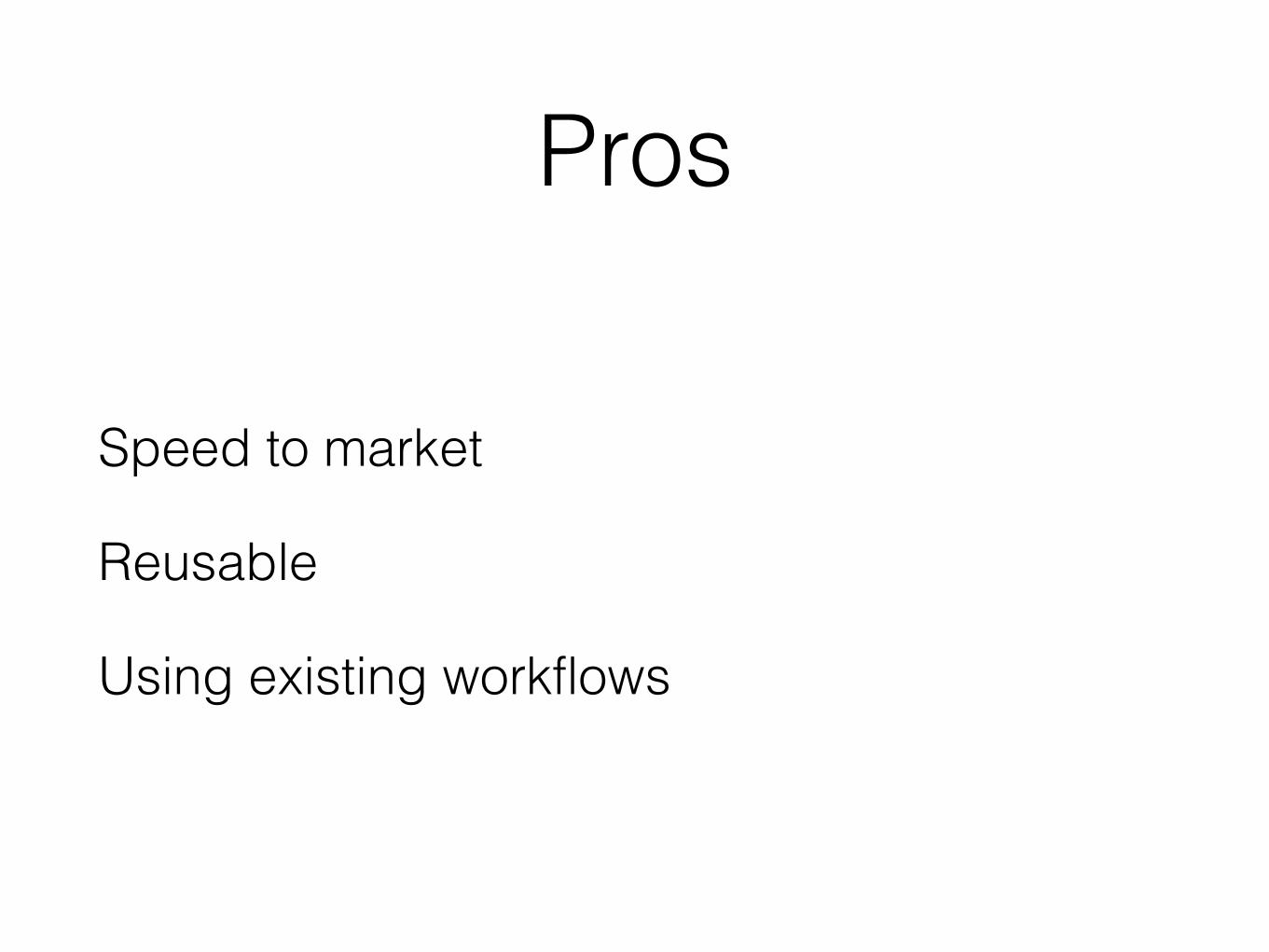
Pros
Speed to market
Reusable
Using existing workflows
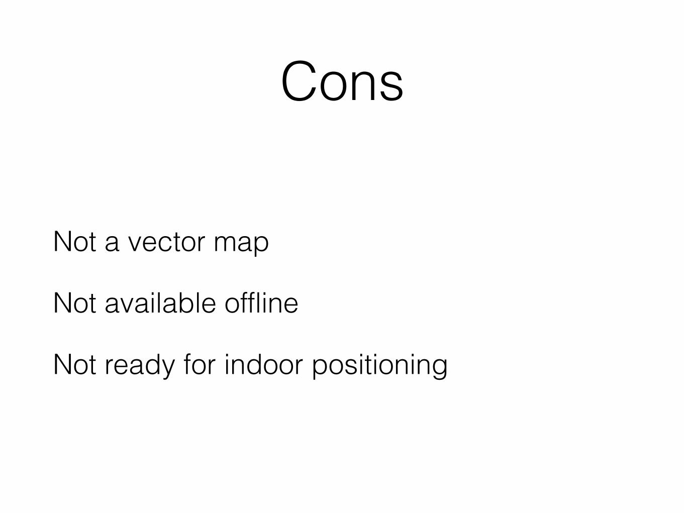
Cons
Not a vector map
Not available offline
Not ready for indoor positioning
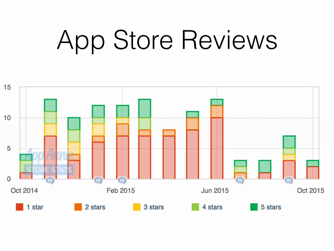
App Store Reviews
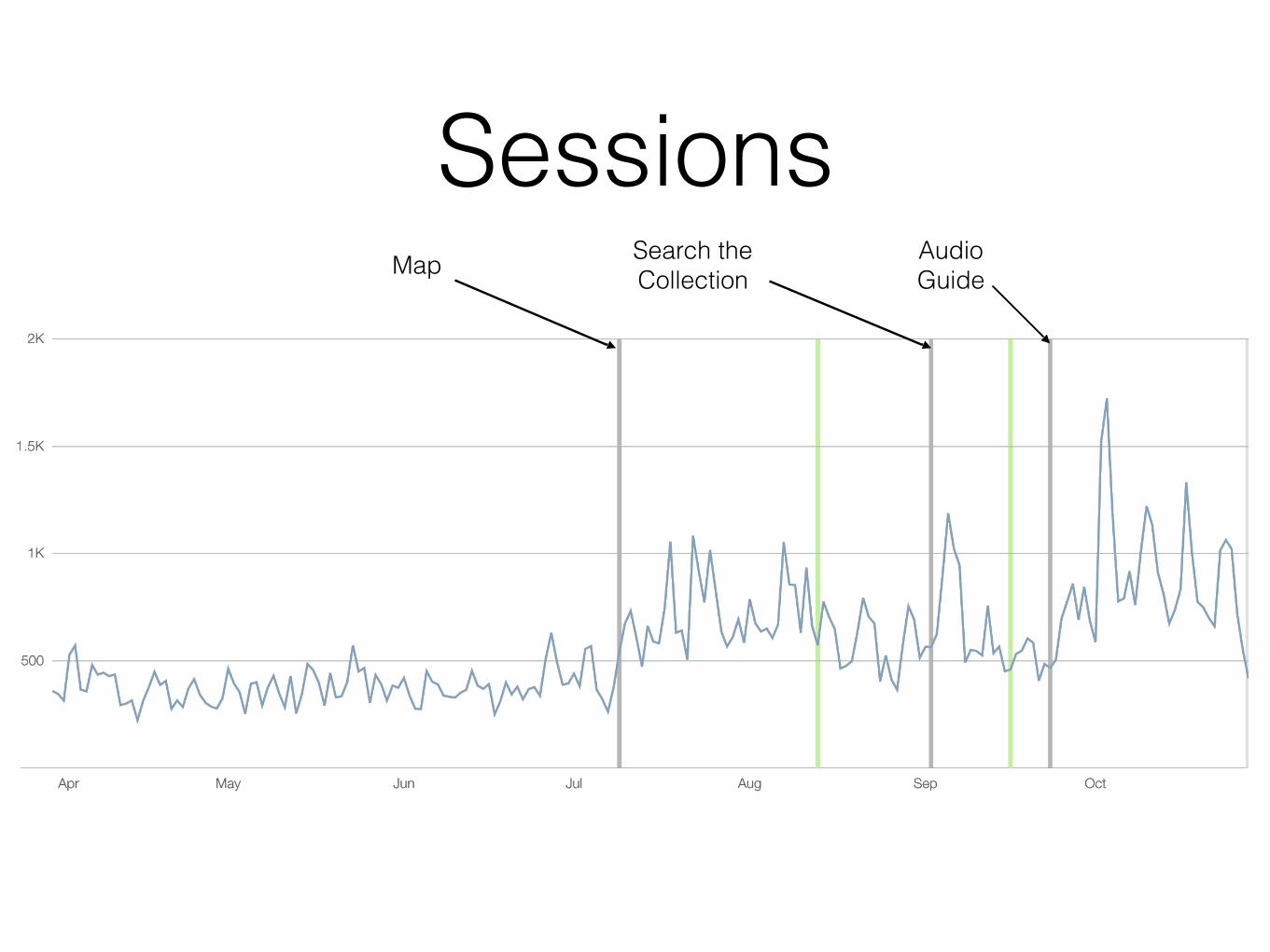
SessionsMap Search the
CollectionAudio Guide
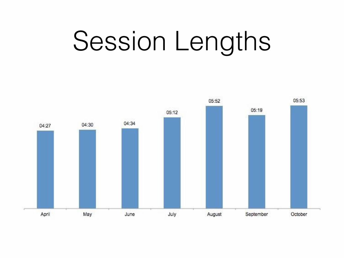
Session Lengths
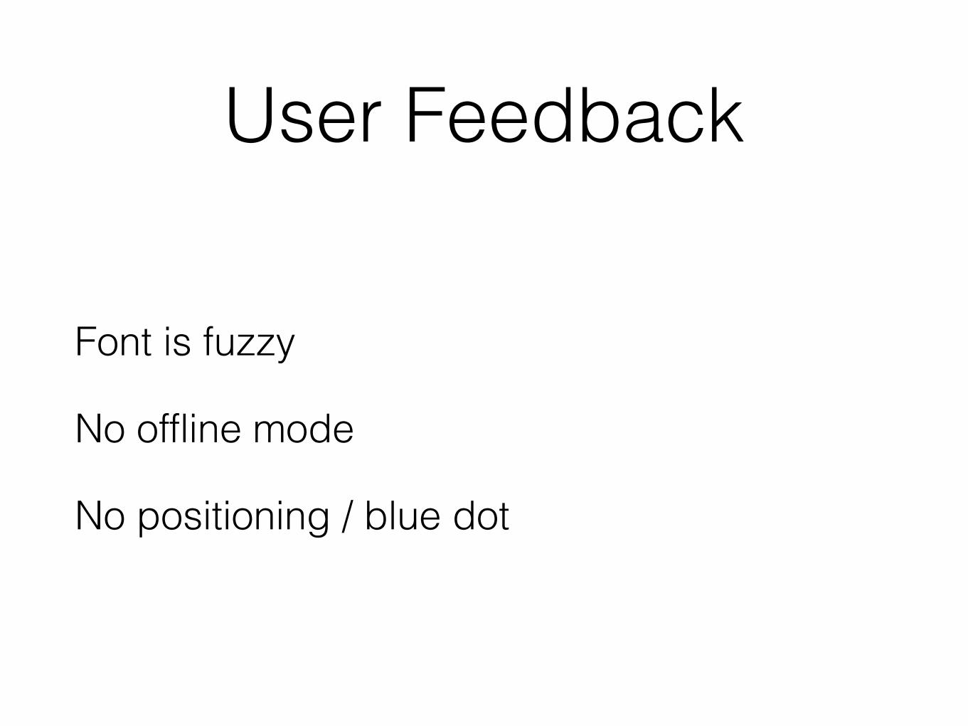
User Feedback
Font is fuzzy
No offline mode
No positioning / blue dot
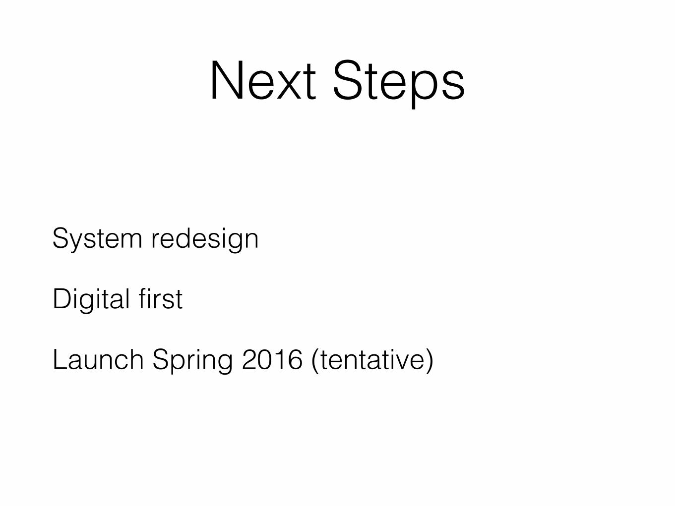
Next Steps
System redesign
Digital first
Launch Spring 2016 (tentative)
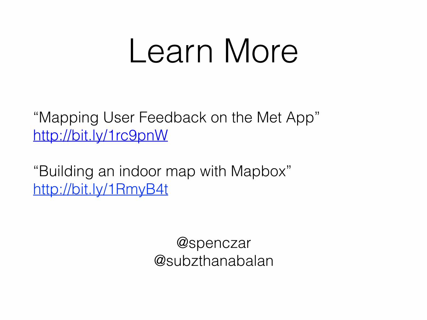
Learn More
“Mapping User Feedback on the Met App” http://bit.ly/1rc9pnW
“Building an indoor map with Mapbox” http://bit.ly/1RmyB4t
@spenczar @subzthanabalan


