EAST-WEST CENTER SEMINAR SERIES
examining current trends and implications of rapid urbanization of cities in Asia
URBAN ASIA— CHALLENGES OF TRANSITION
AND GOVERNANCE

The Urban Transformation in Asia: Policy Implications of Decentralization
Challenges and Opportunities
10-13 August 2008 East-West Center
Honolulu, Hawaii, U.S.A.
East-West Seminars 1601 East-West Road
Honolulu, Hawaii 96848 Mr. Ray Burghardt, Director
[email protected] www.eastwestcenter.org
Maui Headquarters 1305 North Holopono Street Suite 2, Kihei, Hawaii 96753
Mr. Ray Shirkhodai, Executive Director [email protected]; www.pdc.org
INAUGURAL SEMINAR

0
TABLE OF CONTENTS
New URBAN ASIA Seminar Series……………………………………………………………...1 Inaugural Seminar Executive Summary………………………………………………………....3 List of Participants……………………………………………………………………………...7 Program Agenda……………………………………………………………………………..11 Roundtable Dialogue Discussion Topics and Questions……………………………………….17 Participating Cities
Jakarta, Indonesia…………………………………………………………………….27
Seoul, Korea………………………………………………………………………….33
Kathmandu, Nepal……………………………………………………………………39
Quezon City/Metropolitan Manila, Philippines……...………………………………....45
Honolulu, Hawaii, USA………………………………………………………………..53
Los Angeles, California, USA…………………………………………………………59
San Diego, California, USA…………………………………………………………..65
Ho Chi Minh City, Vietnam……………………………………………………………71 Program Session Chairs………………………………………………………………………79 Program Discussion Leaders…………………………………………………………………..89 Other Program Participants………………………………………………………………....105 East-West Center Representatives…………………………………………………………..115 Suggested Readings…………………………………...……………………………………117
1
New Urbanization Seminar Series
URBAN ASIA – CHALLENGES OF TRANSITION AND GOVERNANCE
The East-West Center is launching a new seminar series that will examine the current trends and implications of rapid urbanization of cities in Asia from a broad systems-wide approach (political, economic, social), with special focus on issues of urban governance. The seminar series will bring together government and non-government organizations, including elected and appointed city officials, urban planners, civil society representatives, and urbanization experts from Asia and the U.S. to discuss work already underway in the public and private sectors in preparing cities in Asia to effectively cope with the dramatic growth in the region. In small, informal roundtable discussions, seminar participants will have the opportunity to engage in peer-to-peer exchanges on policy options and implications, as well as exchange ideas, offer new perspectives, and share information about experiences, best practices, tools and strategies for managing the urbanization process and its consequences. Seminar participants will be encouraged to reflect on their long-term strategic visions, proactive political leadership, commitment to bold plans, and the ability to reconcile divergent interests for the common good. The year 2008 marks an unprecedented transformation in the history of human settlements, as more than half of the world’s population now lives in urban areas. By 2015, twelve of the 22 megacities projected to develop worldwide will be in Asia, and by 2030 Asia will account for more than half of the world’s urban population—2.66 billion people out of a total global urban population of 4.94 billion. (United Nations Population Fund, State of the World Population 2007: Unleashing the Potential of Urban Growth). This transformation is redefining peoples’ lifestyles, employment, welfare, housing needs, and social interactions. It is creating new power relationships in organizations and government, altering the geopolitical landscape. The extraordinary growth of cities in Asia has been pivotal to expanded economic development and increased wealth in the region. But it is also changing the social fabric and culture of the countries—exacerbating poverty, slums, and environmental degradation in the urban agglomerations and peri-urban areas. Policymakers at all levels must respond to both the challenges and opportunities of urbanization in order to maximize its potential to improve the quality of life for all citizens. Urban Governance Issues The rapid growth of Asian cities has already resulted in major strains on urban administrative systems as they strive to adequately respond to the rate of political, economic, social, and physical changes. There is an urgent need to strengthen and expand the management processes and capacities as well as participatory decision-making mechanisms at all levels. Good urban governance should address the interdependent and mutually reinforcing principles of sustainability, subsidiarity, equity, efficiency, transparency and accountability, civic engagement and citizenship, and security. Several major challenges that underlie the effectiveness and efficiency of governing cities in Asia include:
• complexity of governance resulting in boundary disputes and shifting responsibilities—poor coordination between and within local, national and regional governments and special-purpose authorities;
• inadequate capacity of governments and agencies to address the challenges of rapid urbanization effectively—local government as weakest link, discrepancies between function and technical capacity, inability to design, finance, and implement policies and programs that responsive to the priorities and needs of all citizens; and

2
• existing systems and processes of governance need to be strengthened—professional and
personal integrity and accountability of elected and appointed officials and civil servants; citizen participation and equal access to information; transparency in laws and public policies. (Urbanization and Sustainability in Asia, Asian Development Bank and Cities Alliance, 2006; The Global Campaign on Urban Governance, UN-Habitat, 2002)
3
Inaugural Seminar
The Urban Transformation in Asia: Policy Implications of Decentralization
10 – 13 August 2008 Imin International Conference Center
East-West Center, Honolulu, Hawaii, USA The inaugural seminar, co-sponsored by the East-West Center and the Pacific Disaster Center, will examine current trends of urban growth and decentralization and the policy implications for Asian cities. Participation in the seminar is by invitation only. The Challenge of Decentralization As urbanization and economic growth in Asia have increased, so have political and administrative pressures to decentralize government decision-making and transfer service delivery from central government to local government. National governments in Asia have recognized the political and financial benefits of decentralizing; and decentralizing policies of Asian governments are placing urbanization issues at the local government level with the expectation that these governments will play a more active role in managing urban development and financing urban services. The challenge to both national leadership and local governments across the region is to approach decentralization policies and processes consistently and systematically by developing strategic approaches that fit country conditions, but that also benefit from regional and global lessons of decentralization. This approach requires substantial investment in strategic planning, institutional development and capacity building, and management and financial systems development. (East Asia Decentralizes: Making Government Work, World Bank, 2005). While progress with decentralization has been encouraging, fundamental problems remain—many countries are caught in an “institutional” limbo between the dissolution of old, top-down service-delivery mechanisms and the emergency of still-weak decentralized structures. In many instances, local governments are being asked to undertake greater responsibility for raising public money to provide infrastructure and services, implement fiscal discipline and accountability, and provide opportunities for stakeholder decision-making. These local governments, however, often lack the resources and power to fulfill their new responsibilities. Seminar Sessions and Discussion Topics Working Session I: Democracy, Decentralization, and Urbanization in Asia: The Challenges of New Policies, Strategies, and Institutional Frameworks Topic 1: Decentralization and the Democratic State in Asia: Devolution with Accountability Topic 2: Urban Decentralization in Asia – Trends and Issues Topic 3: Fiscal and Administrative Capacities of Local Governments
4
Working Session II: Asia Urban Infrastructure: Challenges and Opportunities Topic 1: Governance and Finance: Challenges of Urban Infrastructure Development Topic 2: Multi-Source Urban Infrastructure Planning, Finance, and Development Topic 3: Regional Planning of Infrastructure Development and Access Working Session III: The Evolving Role of Civil Society in the Urban Transformation Topic 1: Forging Civil Society and Local Government Partnerships Topic 2: The Role of Civil Society in Improving Urban Governance Topic 3: Capacities and Accountability of Civil Society Organizations Working Session IV: Urban Adaptation to Environmental Change: An Integrated Approach to Risk Topic 1: Globalization of Urban Risk Topic 2: Urban Society and Adaptation Challenges: An Integrated Approach to Risk Topic 3: Practical Applications and Strategies
Content Description of Working Sessions Working Session 1 Democracy, Decentralization, and Urbanization in Asia: The Challenges of New Policies, Strategies, and Institutional Frameworks Key issues to be addressed include implications of realignment of enhanced local government responsibilities and relationship/institutional arrangements with unified metropolitan administrative authorities and impacts on economic development, fiscal power, political policy/decision-making, and governance (strengths and weaknesses, multi-level governance, civil society participation, ecological sustainability, social and spatial inequalities); need for creative thinking to identify new governance measures to address stresses and opportunities associated with rapid growth; defining and implementing appropriate levels of formal and informal institutional organizations and processes to guide the metropolitan centers created by decentralization; and development of metropolitan and megapolitan data sets to support strategic planning to facilitate understanding of real urbanization patterns. Working Session II Asia Urban Infrastructure: Challenges and Opportunities Key issues to be addressed include governance issues related to pro-active infrastructure development requiring large-scale lump investment that will yield returns for a century or more (sewer systems, rapid transit, expressways); need for new and innovative finance systems (municipal bonds, national government lending); fiscal-budget complexity (two-budget systems and transparency); and large scale improvement in financial information systems (taxation and fiscal reform).
5
Working Session III The Evolving Role of Civil Society in the Urban Transformation Process Key issues to be addressed include the emergence of “public governance;” incorporating public-private bodies and socially-oriented interest groups into metropolitan governance systems (labor/trade, environment, professional organizations (planners, architects, surveyors, business/industry associations); government as friend or foe; strategies for developing more practical and effective partnerships between civil society organizations and government; consolidation of NGOs to strengthen capacity; and private sector perception and collaboration. Working Session IV Urban Adaptation to Environmental Change: An Integrated Approach to Risk Key issues to be addressed include risk factors associated with climate change (economic costs, vulnerability of urban populations) and complex linkages between drivers of development and the human environment (land, water, and energy usage, impacts on carbon cycle); recent innovations by urban governments and community organizations (financial systems that incorporate risk reduction strategies); integrated planning strategies; and impacts on governance.

6
7
Inaugural Seminar
The Urban Transformation in Asia: Policy Implications of Decentralization
LIST OF PARTICIPANTS City Leaders Indonesia Ms. Aurora TAMBUNAN, Assistant Secretary for Community Welfare, Jakarta Capital City Government Mr. Reswan SOEWARDJO, M.D., Deputy Chairman, Economic Development, Regional Planning Board, Jakarta Capital City Government Korea Dr. LEE In-Keun, Director-General, Urban Planning, Seoul Metropolitan Government Dr. Won Bae KIM, Senior Fellow, Korea Research Institute for Human Settlements, Seoul Nepal The Honorable Dinesh Kumar THAPALIYA, Mayor/Chief Executive Officer, Kathmandu Metropolitan City Mr. Devendra DONGOL, Department Head, Physical Development & Construction, Kathmandu Metropolitan City Philippines The Honorable Feliciano BELMONTE, Jr., Mayor, Quezon City Secretary Bayani FERNANDO, Chairman, Metropolitan Manila Development Authority, Manila United States The Honorable Mufi HANNEMANN, Mayor, City & County of Honolulu, Hawaii Ms. Gail GOLDBERG, Director of Planning, City of Los Angeles, California Mr. Gary GALLEGOS, Executive Director, San Diego Association of Governments, San Diego, California Vietnam Mr. TRAN Du Lich, President, Institute for Economic Research, Ho Chi Minh City Dr. LE Van Thanh, Deputy Head, Department of Urban Development Studies, Institute for Economic Research, Ho Chi Minh City
8
Session Chairs Mr. David CADMAN, President, International Council for Local Environmental Initiatives-Local Governments for Sustainability (ICLEI), and Councillor, City of Vancouver, Canada Dr. Shabbir CHEEMA, Senior Fellow, Research Program, and Director, Asia-Pacific Governance and Democracy Initiative, East-West Center, Honolulu, Hawaii, USA Dr. Allen CLARK, Senior Fellow, Research Program, East-West Center, and former Executive Director, Pacific Disaster Center, Honolulu, Hawaii, USA Dr. Elliott SCLAR, Director, Center for Sustainable Urban Development, The Earth Institute at Columbia University, and Professor, Urban Planning and International Affairs, New York, New York, USA
Discussion Leaders Ms. Somsook BOONYABANCHA, Secretary General, Asian Coalition for Housing Rights, and Director, Community Organizations Development Institute, Bangkok, Thailand Dr. Tim CAMPBELL, Chairman, Urban Age Institute, and former Urban Advisor, City Management and Urban Development, The World Bank, Washington, D.C., USA Ms. Celine D’CRUZ, Co-Coordinator, Slum/Shack Dwellers International, Mumbai, India Mr. Gordon FELLER, Chief Executive Officer, Urban Age Institute, San Rafael, California, USA Dr. Maryam GOLNARAGHI, Chief, Disaster Risk Reduction Programme, World Meteorological Organization, Geneva, Switzerland Dr. Aprodicio LAQUIAN, Professor Emeritus, School of Community and Regional Planning, University of British Columbia, Vancouver, Canada Dr. Michael LEAF, Associate Professor, School of Community and Regional Planning, and Research Associate, Centre for Southeast Asia Research, Institute of Asian Research, University of British Columbia, Vancouver, Canada Dr. Bindu LOHANI, Vice-President, Finance and Administration, Asian Development Bank, Manila, Philippines Mr. Carlos RODRIGUES, Vice President and New Jersey Director, Regional Plan Association, Princeton, New Jersey, USA Dr. Patricia ROMERO LANKAO, Deputy Director, Institute for the Study of Society and Environment, National Center for Atmospheric Research, Boulder, Colorado, USA Dr. Mark TURNER, Deputy Director, Centre for Developing Cities, and Professor of Development Policy and Management, University of Canberra, Australia Dr. Shahid YUSUF, Economic Advisor, Development Economics Research Group, The World Bank, Washington, D.C., USA
9
Special Participant Dr. Eduardo LOPEZ MORENO, Chief, State of the World’s Cities Section, Monitoring and Research Division, UN-HABITAT, United Nations Settlement Programme, Nairobi, Kenya Rapporteurs Mr. Jerry BURRIS, Consultant, Office of External Affairs, East-West Center, Honolulu, Hawaii, USA, Lead Rapporteur Mr. James BELL, Principal, Belt Collins Hawaii Ltd., Honolulu, Hawaii, USA Ms. Mai Tuyet CHU, Former East-West Center Graduate Fellow, Public Administration Program, University of Hawaii at Manoa, Honolulu, Hawaii, USA Mr. Tom DINELL, Professor Emeritus, and former Chair, Department of Urban and Regional Planning, University of Hawaii at Manoa, Honolulu, Hawaii, USA Mr. Mark HASTERT, Former President and Chairman, Helber Hastert & Fee, Planners, Inc., Honolulu, Hawaii, USA Ms. Robin KIM, Designer, Suisman Urban Design, Santa Monica, California, USA Dr. Kem LOWRY, Professor, Department of Urban and Regional Planning, University of Hawaii at Manoa, Honolulu, Hawaii, USA Mr. Sanford MURATA, President, Sanford Murata, Inc., Honolulu, Hawaii, USA Mr. Pradip Raj PANT, PhD Candidate, East-West Center Graduate Fellow, Department of Urban and Regional Planning, University of Hawaii at Manoa, Honolulu, Hawaii, USA Interpretive Tour of Kapolei, Oahu’s New “Second City” Mr. Henry ENG, Director, Department of Planning and Permitting, City & County of Honolulu, Hawaii, USA Mr. David RAE, Senior Vice President for Development, Aina Nui Corporation and Kapolei Property Development, James Campbell Company, Kapolei, Hawaii, USA

10
11
Program Agenda
The Urban Transformation in Asia: Policy Implications of Decentralization
Inaugural Seminar East-West Center Seminar Series
URBAN ASIA — Challenges of Transition and Governance
10-13 August 2008 Honolulu, Hawaii, USA
SUNDAY 10 AUGUST
17:30 Meet in lobby of Hawaii Prince Hotel Waikiki Board shuttle bus to The Bayer Estate Escort: Ms. Mariko Davidson, East-West Seminars Program, Project Assistant
18:00 Welcome Reception
20:00 Board shuttle bus to return to hotel MONDAY 11 AUGUST
8:30 Meet in lobby of Hawaii Prince Hotel Waikiki Board shuttle bus to East-West Center East-West Center Escort: Ms. Mariko Davidson
All sessions will be held at the Hawaii Imin International Conference Center Koi Room, Garden Level
9:00 Continental Breakfast 9:20 Announcements and Introductions
Meril Dobrin Fujiki, Seminars Development Coordinator, East-West Seminars
9:30 Opening Remarks
Dr. Charles E. Morrison, President, East-West Center WORKING SESSION I Democracy, Decentralization, and Urbanization in Asia: The
Challenges of New Policies, Strategies, and Institutional Frameworks This session includes the following three topic area discussions.
10:00 Session Overview Session Chair, Dr. Shabbir Cheema Senior Fellow, Research Program and Director, Asia-Pacific Governance and Democracy Initiative, East-West Center, and Former Director, Management Development and Governance Division, United Nations Development Program, Honolulu, Hawaii, USA
12
10:15 TOPIC 1 Roundtable dialogue with city leaders and experts
Decentralization and the Democratic State in Asia: Devolution with Accountability Discussion Leader, Dr. Mark Turner Deputy Director, Centre for Developing Cities, and Professor of Development Policy and Management, University of Canberra, Canberra, Australia
11:15 Break 11:30 Group Photograph
Japanese Garden, Imin International Conference Center 12:00 Lunch, Ohana Room, Garden Level 13:15 TOPIC 2 Roundtable dialogue with city leaders and experts
Urban Decentralization in Asia– Trends and Issues Discussion Leader, Dr. Tim Campbell Chairman, Urban Age Institute, and former Urban Advisor, City Management and Urban Development, The World Bank, Washington, D.C., USA
14:15 Break
14:30 TOPIC 3 Roundtable dialogue with city leaders and experts
Fiscal and Administrative Capacities of Local Governments Discussion Leader, Dr. Shahid Yusuf Economic Advisor, Development Economics Research Group, The World Bank, Washington, D.C., USA
15:30 Summary of Discussions
Session Chair, Dr. Shabbir Cheema
16:00 Board shuttle bus to hotel
Evening free TUESDAY, 12 AUGUST
7:30 Meet in lobby of Hawaii Prince Hotel Waikiki Board shuttle bus to East-West Center East-West Center Escort: Ms. Mariko Davidson 8:00 Continental Breakfast WORKING SESSION II Asia Urban Infrastructure: Challenges and Opportunities
This session includes the following three topic area discussions.
8:30 Session Overview Session Chair, Dr. Elliott Sclar Director, Center for Sustainable Urban Development, The Earth Institute at Columbia University, and Professor, Urban Planning and International Affairs, New York, New York, USA
13
8:45 TOPIC 1 Roundtable dialogue with city leaders and experts
Governance and Finance: Challenges of Urban Infrastructure Development Discussion Leader, Dr. Bindu Lohani Vice President, Finance and Administration, Asian Development Bank, Manila, Philippines
9:45 Break
10:00 TOPIC 2 Roundtable dialogue with city leaders and experts
Multi-Source Urban Infrastructure Planning, Finance and Development Discussion Leaders: Dr. Aprodicio Laquian Professor Emeritus, School of Community and Regional Planning, University of British Columbia, Vancouver, Canada
Mr. Gordon Feller Chief Executive Officer, Urban Age Institute, San Rafael, California, USA
11:00 Break
11:15 TOPIC 3 Roundtable dialogue with city leaders and experts
Regional Planning of Infrastructure Development and Access Discussion Leaders: Mr. Carlos Rodrigues Vice President and New Jersey Director, Regional Plan Association, Princeton, New Jersey, USA
Dr. Michael Leaf Associate Professor, School of Community and Regional Planning, and Research Associate, Centre for Human Settlements, Institute of Asian Research, University of British Columbia, Vancouver, Canada
12:15 Summary of Discussions
Session Chair, Dr. Elliott Sclar
12:45 Lunch, Ohana Room, Garden Level WORKING SESSION III The Evolving Role of Civil Society in the Urban Transformation Process
This session includes the following three topic area discussions.
13:45 Session Overview Session Chair, Mr. David Cadman President, International Council for Environmental Initiatives – Local Governments for Sustainability (ICLEI), and Councillor, City of Vancouver, Canada
14
14:00 TOPIC 1 Roundtable dialogue with city leaders and experts
Forging Civil Society and Local Government Partnerships Discussion Leader, Ms. Somsook Boonyabancha Secretary General, Asian Coalition for Housing Rights, and Director, Community Organizations Development Institute, Bangkok, Thailand
15:00 Break
15:15 TOPIC 2 Roundtable dialogue with city leaders and experts
Capacities and Accountability of Civil Society Organizations Discussion Leader, Ms. Somsook Boonyabancha Secretary General, Asian Coalition for Housing Rights, and Director, Community Organizations Development Institute, Bangkok, Thailand
16:15 Break 16:30 TOPIC 3 Roundtable dialogue with city leaders and experts
The Role of Civil Society in Improving Urban Governance Discussion Leader, Ms. Celine d’Cruz Co-Coordinator, Slum/Shack Dwellers International, Mumbai, India
17:30 Summary of Discussions
Session Chair, Mr. David Cadman 18:00 Board shuttle bus to hotel Evening Free WEDNESDAY, 13 AUGUST
7:30 Meet in lobby of Hawaii Prince Hotel Waikiki Board shuttle bus to East-West Center East-West Center Escort: Ms. Mariko Davidson
8:00 Continental Breakfast WORKING SESSION IV Urban Adaptation to Environmental Change:
An Integrated Approach to Risk This session includes the following three topic area discussions.
8:30 Session Overview
Session Chair Dr. Allen Clark Senior Fellow, East-West Center Research Program, and former Executive Director, Pacific Disaster Center, Honolulu, Hawaii, USA
8:45 TOPIC 1 Roundtable dialogue with city leaders and experts
Globalization of Urban Risk Discussion Leader, Dr. Maryam Golnaraghi Chief, Programme for Disaster Prevention and Mitigation, World Meteorological Organization, Geneva, Switzerland
15
9:45 Break
10:00 TOPIC 2 Roundtable dialogue with city leaders and experts
Urban Society and Adaptation Challenges: An Integrated Approach to Risk Discussion Leader, Dr. Patricia Romero Lankao Deputy Director, Institute for the Study of Society and Environment, National Center for Atmospheric Research, Boulder, Colorado, USA
11:00 Break 11:15 TOPIC 3 Roundtable dialogue with city leaders and experts
Practical Applications and Strategies Session Chair, Dr. Allen Clark
12:15 Summary of Discussions
Session Chair, Dr. Allen Clark 12:45 Working Lunch, Ohana Room, Garden Level
Where Do We Go From Here? Seminar outcomes including identified issues and actions for follow-up workshops Facilitator, Mr. Gordon Feller Chief Executive Officer, Urban Age Institute, San Rafael, California, USA
13:45 Break
14:00 Board shuttle bus to Honolulu City Hall 14:30 Mass Transit for Honolulu: Opportunities and Challenges
Mayor’s Conference Room, 3rd Floor
A Conversation with The Honorable Mufi Hannemann Mayor, City & County of Honolulu, Hawaii, USA
15:30 Board shuttle bus to Kapolei
16:30 Interpretive Tour of Kapolei, Oahu’s New “Second City”
Mr. Henry Eng Director, Department of Planning and Permitting, City & County of Honolulu, Hawaii
Mr. David Rae Senior Vice President for Development, Aina Nui Corporation and Kapolei Property Development, James Campbell Company, Kapolei, Hawaii
18:30 Closing Dinner
Roy’s Restaurant at Ko Olina Resort
20:00 Board shuttle bus to hotel End of Program

16
17
Roundtable Dialogue with City Leaders and Experts Discussion Topics and Questions
WORKING SESSION I
Democracy, Decentralization, and Urbanization in Asia: The Challenges of New Policies, Strategies, and Institutional Frameworks
Dr. Shabbir Cheema, Session Chair Senior Fellow, Research Program, and Director, Asia-Pacific Governance and Democracy Initiative, East-West Center, Honolulu, Hawaii, USA
Key issues to be addressed in this Working Session include implications of realignment of enhanced local government responsibilities and the relationship or institutional arrangements with unified metropolitan administrative authorities and their impacts on economic development, fiscal power, political policy/decision-making, and governance (strengths and weaknesses, multi-level governance, civil society participation, ecological sustainability, social and spatial inequalities). Need for creative thinking to identify new governance measures to address stresses and opportunities associated with rapid growth. Defining and implementing appropriate levels of formal and informal institutional organizations and processes to guide the metropolitan centers created by decentralization. Development of metropolitan and megapolitan data sets to support strategic planning to facilitate understanding of real urbanization patterns.
♦♦♦♦
Topic 1 Decentralization and the Democratic State in Asia: Devolution with Accountability
Dr. Mark Turner, Discussion Leader Deputy Director, Centre for Developing Cities; and Professor of Development Policy and Management, University of Canberra, Australia Question #1 How can participatory mechanisms be made to enhance both efficiency and effectiveness in government?
Democratic decentralization should involve citizen participation. Such participation is seen as a good in itself, especially as it gives voice to the poor, and as a way of enhancing service delivery. However, one cannot assume such gains will be achieved automatically. For example, the democratic space provided by participatory governance can be exploited by elite interests; the time taken for participation may lead to delayed responses to urgent problems; or populism may triumph over the pursuit of clear developmental gains.
18
Question #2 What organizational arrangements should be made to coordinate decision-making and resource utilization between different levels of government, adjacent territories and non-state actors? In OECD countries there has been much talk and effort devoted to linking different levels of government and such terms as ‘joined-up government’ and ‘whole of government’ have been applied. In many Asia-Pacific countries there is frequently a lack of such coordination both between different levels of government (vertical) and between adjacent territories (horizontal). The situation is compounded by rapid urbanization and the absorption of new territories into urban areas and new issues which require coordination.
Question #3 What are the best instruments to ensure the accountability of urban local governments from the point of view of local officials and what are the best from the point of view of national officials? What type of leadership is needed for innovation and progress in urban areas and how can it be promoted and sustained?
The topic "devolution with accountability" is important because policymakers at the national level use lack of local accountability as an excuse to delay or impede decentralization (even though the central mechanisms are often not characterized by accountability and transparency). There are very good examples of devolution with accountability in the region and globally.
♦
Topic 2 Urban Decentralization in Asia – Trends and Issues
Dr. Tim Campbell, Discussion Leader Chairman, Urban Age Institute, and former Urban Adviser, City Management and Urban Development, The World Bank, Washington D.C., USA Question #1 Many local governments feel that they are at an impasse with central government. Locals want to do more, they want more autonomy in choice and spending (and fewer unfunded mandates), but central governments don't trust them. At the same time, local governments can't prove themselves without some slack from the center. Is this double bind part of your life and if so, what pathways out of the impasse would you suggest? Question #2 Most local governments are weak in capacity and have small populations while most large urban centers are rich and strong and are contained in few local governments, yet most national legislation treats all local governments largely indiscriminately, rich and poor, strong and weak. If you agree, what suggestions would you have to stratify local governments in terms of policy and autonomy so that the large, rich and anyway the stronger ones, can operate more on their own so that central governments can concentrate on the weaker ones?
19
Question #3 Different systems of professional management—public law, civil service, and private contract law—can all be made to strengthen local capacity, but what is the best pathway for nations and cities to professionalize local government personnel? Public law is still the predominant career employment structure in Europe. Some countries are in the process of extending national civil service to local levels. Certification systems are beginning to appear in Mexico and Thailand. In the US, certification is managed by professional associations of municipal employees, not by government. The issue is not so much the nature of legal framework, but rather that governments need to establish a unified system of merit-based public employment that offers career professional employment and mobility. Has your government taken these steps? What progress is being made?
♦
Topic 3 Fiscal and Administrative Capacities of Local Governments
Dr. Shahid Yusuf, Discussion Leader Economic Adviser, Development Economics Research Group, The World Bank, Washington, D.C., USA
Economic Performance and Livability of Cities is strongly influenced by the supply of infrastructure and other public services as well as their quality. The adequacy of financing for current and capital expenditures is a key determinant of both supply and quality. Successful fiscal management rests first on how effectively a city mobilizes finances from: (i) taxation; (ii)the capital market; (iii) local fees and charges; (iv) central and state governments; and (v) through public and private partnerships. And second, on how efficiently it manages expenditures so as to maximize returns and achieve longer term fiscal balance.
Question #1 Are the constraints imposed by central governments on the levying of local taxes (and tax rates) and retaining the proceeds a significant issue for local authorities and if so, how is this being resolved? Which local taxes (e.g. land, property, sales, income etc.) have proven to be the most dependable and elastic sources of revenue? Do these taxes encounter much political opposition? Are they costly to administer (is there much evasion?)? Is there significant tax competition with other localities and a risk that high taxes can drive households and businesses to other municipalities? Question #2 What are some of the major fees and charges (e.g. road tolls, transport charges etc) and how can these be used to influence urban development, improve services and the quality of life (e.g. by minimizing urban sprawl, reducing road congestion etc.)? What is the experience with outsourcing services e.g. schooling, security, public health etc to private providers? Overall, does the municipality benefit from lower costs, better maintenance and quality of services, and superior facilities than if these were provided by the public sector?
20
Question #3 How restrictive are the (central government) rules governing the access of local governments to the financial market? What characteristics of financial markets and lenders enhance access? And what steps (e.g. regulatory, legal, accounting, procedural etc.) can local (and central) governments take to improve the access to term financing for long lived projects? What have proven to be the most effective mechanisms and incentives for attracting private financing of infrastructure projects and real estate development? Question #4 Given the importance of grants and financial support from the central government, what are the most efficient mechanisms for obtaining financing for specific services and for major capital expenditures? What factors and negotiating procedures facilitate effective fiscal relations with the central authorities?
♦
WORKING SESSION II
Asia Urban Infrastructure: Challenges and Opportunities
Dr. Elliott Sclar, Session Chair Director, Center for Sustainable Urban Development, The Earth Institute at Columbia University, and Professor, Urban Planning and International Affairs, New York, New York, USA
Key issues to be addressed in this Working Session include governance issues related to pro-active infrastructure development requiring large-scale lump investment that will yield returns for a century or more (sewer systems, rapid transit, expressways). Need for new and innovative finance systems (municipal bonds, national government lending). Fiscal-budget complexity (two-budget systems and transparency). Large scale improvement in financial information systems (taxation and fiscal reform).
Topic 1 Governance and Finance: Challenges of Urban Infrastructure Development
Dr. Bindu Lohani, Discussion Leader Vice-President, Finance and Administration, Asian Development Bank, Manila, Philippines Question #1 Why and how is urban infrastructure critical for economic development of countries in Asia? What are examples that demonstrate the linkages and challenges? Question #2 One of the most critical challenges for urban infrastructure in Asia is the huge financing gap. How do we finance these gaps and make financing available to both the national and local governments? Question #3 In the delivery of financing to local governments and in strengthening local governance, how do we make urban infrastructure development commercially attractive to mobilize public-private-partnerships?
21
Topic 2 Multi-Source Urban Infrastructure Planning, Finance, and Development
Dr. Aprodicio Laquian, Co-Discussion Leader Professor Emeritus, School of Community and Regional Planning, University of British Columbia, Vancouver, Canada
Mr. Gordon Feller, Co-Discussion Leader Chief Executive Officer, Urban Age Institute, San Rafael, California, USA Question #1 How, in specific ways, could the competitiveness of your city be enhanced by the strengths of your own city's systems and processes for urban infrastructure planning, urban infrastructure finance, and urban infrastructure development? What weaknesses should be addressed?
Suggested pointers to lead the discussion: What is the business of your city, i.e., how do people in your city make a living? In what directions is your city growing to and why? What challenges accompany this growth process? How could the administrative framework be creatively improved to address these issues?
Question #2 How best to 'bust the barriers' that prevent multiple stakeholder engagement in your own city—from public and private and independent sectors—from working better together to help improve your city's urban infrastructure planning, urban infrastructure finance, and urban infrastructure development? Question #3 What would be the advantages/challenges of working with specific modalities of conventional and alternative financing in your city, such as direct finance, revenue schemes/improvement contributions, public-private partnerships, municipal bonds, soft approaches, others?
♦
Topic 3 Regional Planning of Infrastructure Development and Access
Mr. Carlos Rodrigues, Co-Discussion Leader Vice President and New Jersey Director, Regional Plan Association, Princeton, New Jersey, USA Dr. Michael Leaf, Co-Discussion leader Associate Professor, School of Community and Regional Planning, and Research Associate, Centre for Human Settlements, Institute of Asian Research, University of British Columbia, Vancouver, Canada Question #1 Are strong regional planning frameworks—responsible, among other things, for addressing large scale infrastructure—out of the question in Asia? What is the history and what obstacles might these types of framework confront?

22
Question #2 In the absence of strong regional planning, how can we build broad based coalitions that successfully advocate for needed but expensive regional infrastructure investments (transit, water and sewer, environmental remediation, etc.) and are capable of overcoming the obstacles of jurisdictional fragmentation, bureaucratic inertia, lack of interest from the general public and fierce competition for scarce public funding? Question #3 To what extent are the financing and equitable delivery of large-scale infrastructure constrained by conventional ways of thinking about infrastructure and/or established international standards of engineering and construction? How do conventional solutions, standards and technologies for infrastructure design influence environmental outcomes of urban development? What is the potential for thinking about alternative approaches to standards as a means of promoting technological innovation, public engagement and environmental betterment at regional scales?
♦
WORKING SESSION III
The Evolving Role of Civil Society in the Urban Transformation Process
Mr. David Cadman, Session Chair President, International Council for Local Environmental Initiatives-Local Government for Sustainability(ICLEI), and Councillor, City of Vancouver, Canada
Key issues to be addressed in this Working Session include the emergence of “public governance.” Incorporating public-private bodies and socially-oriented interest groups into metropolitan governance systems (labor/trade, environment, professional organizations (planners, architects, surveyors, business/industry associations). Government as friend or foe. Strategies for developing more practical and effective partnerships between civil society organizations and government. Consolidation of NGOs to strengthen capacity. Private sector perception and collaboration.
♦
Topic 1 Forging Civil Society and Local Government Partnerships
Ms. Somsook Boonyabancha, Discussion Leader Secretary-General, Asian Coalition for Housing Rights, and Director, Community Organizations Development Institute, Bangkok, Thailand Question #1 Partnership to what end?
Question #2 Do civil society organizations lose anything in partnering with government? If so, what and how can they deal with it? Question #3 What in government attitudes and manner of working prevents or supports an effective partnership?
23
Topic 2 Capacities and Accountability of Civil Society Organizations
Ms. Somsook Boonyabancha, Discussion Leader Secretary-General, Asian Coalition for Housing Rights, and Director, Community Organizations Development Institute, Bangkok, Thailand Question #1 Where is there a need to “evolve”? What are the limitations?
Question #2 How do we visualize the new diverse roles of civil society in order to actively participate in the management of the city to make it more as a “city for people by people,” and how can different actors jointly interact to this end? Question #3 What kind of support and intervention is necessary to build better capacities and accountabilities for all civil society actors and city governments so that a new culture of participatory management can emerge? Question #4 How can we encourage all urban poor communities in the city to become actively involved with development organizations as partners to ensure that their interests/issues are addressed, especially land and housing concerns? How do we build large scale capacity to tackle the large scale problems?
♦
Topic 3 The Role of Civil Society in Improving Urban Governance
Ms. Celine d’Cruz, Discussion Leader Co-Coordinator, Slum/Shack Dwellers International, Mumbai, India Question #1 How can we get cities to include the very poor in their governance systems? Question #2 How can we get cities to look at the poor as a resource rather than a liability? Particularly, how can we bridge the gap in influence on city policies between the middle class and poor communities; between those defined as "citizens" and those defined as "illegal"? This is huge challenge and the divide is only getting bigger in some of our cities. Question #3 What does it entail to build the capacity of urban poor communities to create a collective voice to negotiate for a city development strategy that works for them as well as the middle class in the city?
24
WORKING SESSION IV
Urban Adaptation to Environmental Change: An Integrated Approach to Risk
Dr. Allen Clark, Session Chair Senior Fellow, East-West Center Research Program, and former Executive Director, Pacific Disaster Center, Honolulu, Hawaii, USA
Key issues to be addressed in this Working Session include risk factors associated with climate change (economic costs, vulnerability of urban populations). Complex linkages between drivers of development and the human environment (land, water, and energy usage, impacts on carbon cycle). Recent innovations by urban governments and community organizations (financial systems that incorporate risk reduction strategies). Integrated planning strategies. Impacts on governance.
♦
Topic 1 Globalization of Urban Risk
Dr. Maryam Golnaraghi, Discussion Leader Chief, Disaster Risk Reduction Programme, World Meteorological Organization, Geneva, Switzerland
Question #1 Why does addressing urban risk require international attention?
Question #2 What are the challenges and opportunities through international cooperation for addressing urban risk nationally? Question #3 What are the international developments for addressing urban risk and how effective have these been?
♦
Topic 2 Urban Society and Adaptation Challenges: An Integrated Approach to Risk
Dr. Patricia Romero Lankao, Discussion Leader Deputy Director, Institute for the Study of Society and Environment, National Center for Atmospheric Research, Boulder, Colorado, USA Question #1 What are existing adaptation responses (governmental and otherwise) of Asian cities to floods, heat waves and other climate hazards? Question #2 What are major institutional constraints and opportunities to respond to climate risks? For example, has decentralization enhanced urban authorities’ capacity to manage climate risks? Question #3 What are the options and windows of opportunity for building better local responses to climate change in cities?
25
Topic 3 Practical Applications and Strategies
Dr. Allen Clark, Discussion Leader Senior Fellow, East-West Center Research Program, and former Executive Director, Pacific Disaster Center, Honolulu, Hawaii, USA Question #1 How do we ensure that over the intermediate term (the next 5-15 years) the issues/risks we define today will be integrated into both the political and planning processes in such a way that they will be effectively mitigated and/or dealt with in the future once the full impact (and cost) becomes known? Question #2 What are the major new concepts of urbanization that could potentially change the nature of the urbanization process overall and the risk of urban populations to both natural and man made disasters? Question #3 What are the key missing pieces (concepts, actions) to the puzzle of how you protect the environment while still fostering development, particularly in rapidly developing economies? What new concepts of "green development" are needed?

26
27
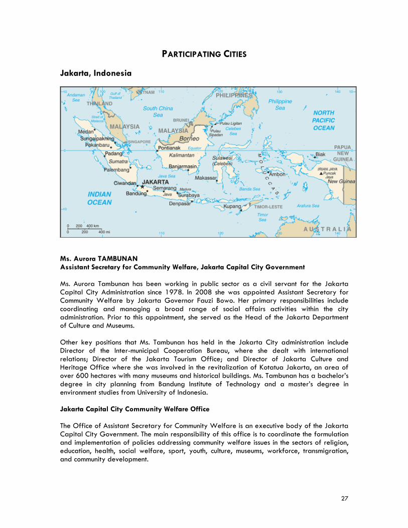
PARTICIPATING CITIES Jakarta, Indonesia
Ms. Aurora TAMBUNAN Assistant Secretary for Community Welfare, Jakarta Capital City Government Ms. Aurora Tambunan has been working in public sector as a civil servant for the Jakarta Capital City Administration since 1978. In 2008 she was appointed Assistant Secretary for Community Welfare by Jakarta Governor Fauzi Bowo. Her primary responsibilities include coordinating and managing a broad range of social affairs activities within the city administration. Prior to this appointment, she served as the Head of the Jakarta Department of Culture and Museums. Other key positions that Ms. Tambunan has held in the Jakarta City administration include Director of the Inter-municipal Cooperation Bureau, where she dealt with international relations; Director of the Jakarta Tourism Office; and Director of Jakarta Culture and Heritage Office where she was involved in the revitalization of Kotatua Jakarta, an area of over 600 hectares with many museums and historical buildings. Ms. Tambunan has a bachelor’s degree in city planning from Bandung Institute of Technology and a master’s degree in environment studies from University of Indonesia. Jakarta Capital City Community Welfare Office The Office of Assistant Secretary for Community Welfare is an executive body of the Jakarta Capital City Government. The main responsibility of this office is to coordinate the formulation and implementation of policies addressing community welfare issues in the sectors of religion, education, health, social welfare, sport, youth, culture, museums, workforce, transmigration, and community development.
28
Mr. Reswan SOEWARDJO Deputy Chairman, Economic Development, Regional Planning Board, Jakarta Capital City Government Mr. Reswan Soewardjo is the Deputy Chairman for Economic Development in the Regional Planning Board of the Jakarta Capital City Government. Prior to this appointment, Mr. Soewardjo served as Principal for the Jayakarta Nursing School Government of the Jakarta Capital City Government. Other previous positions include Head of the Department for Health of South Jakarta Municipality; Chairman for the Municipal Planning Board of South Jakarta; Head of the sub-division for Health, Social Welfare, and Mental Spiritual Development Regional Planning Board; Head of the sub-division for General Affairs Department of Health Government of the Capital City of Jakarta; and Head of the Community Health Center of Kepulaunan Seribu District Administration. Mr. Soewardjo holds both a law degree from and a master’s degree in management from the University of Indonesia. He is also a certified dentist. Jakarta Capital City Regional Planning Board The Regional Planning Board of Jakarta Capital City Government is the main planning institution charged with tasks to assist the Governor in development planning, research and development, monitoring, and evaluating the implementation of development plans. The Board has six main divisions: Community Welfare, Urban Infrastructures and Environment, Economy, Public Administration, Research and Development, and Monitoring, Assessment and Information. The Board also supervises planning offices at the municipal level in Jakarta. Jakarta Capital City Brief History Archaeological findings trace the history of modern-day Jakarta, on the banks of the Ciliwung River, to the fifth century. By the 16th century, it was a thriving port city known as Sunda Kelapa Harbor. By the time Christopher Columbus headed East in search of spices, Sunda Kelapa had already developed into a major international trading center. The city name was changed to Jayakerta “glorious victory” in 1527 when the Javanese prince Fatahillah defeated the Portuguese armed forces. The Dutch arrived in 1596 and established the East India Company in 1602 to take advantage of the lucrative spice trade. The Dutch razed the city in 1619 and rebuilt a walled canal city covering 700 hectares of land, renaming it Batavia. During this time, most city activities centered around the fortress and the company warehouses. Over the next hundred years, Indonesians and Chinese flocked to the prosperous port, and the city suffered from urban ills including poor sanitation, disease, overcrowded housing, and crime. During the 18th century, as the population grew, the city was extended to include higher and more healthful areas to the south which became a network of suburbs. The British arrived in 1811 and took over the land from the Dutch, but after only five years handed the city back to the Dutch. The city continued to grow and modernize until the Japanese occupation during World War II. Indonesian nationalists declared independence in 1945, renamed the city Djakarta, the capital of the Republic of Indonesia. The present name of Jakarta was recognized in 1949.
29
Jakarta has undergone tremendous growth and development since Indonesia’s independence. During the 1950s, the city underwent a building boom, modernizing its infrastructure and erecting large-scale construction projects including office towers. Jakarta became one of the largest metropolises of tropical Asia and emerged as a financial and commercial center. In 1996, the city was declared to be a special metropolitan district and it gained a status approximately equivalent to that of a state or province. After decades of economic growth, however, the city and country were hit hard by a financial crisis in Asia in 1997-98. Today Jakarta is at the epicenter of a program of renewal that straddles areas of the economy, the political system and society at large. Jakarta Today Jakarta is the capital city of the Republic of Indonesia and the center of the nation’s industrial, political, educational and cultural life. It is uniquely the seat of both the national and regional government. Strategically positioned in the archipelago, the city is also the principal gateway to the rest of Indonesia. As the largest city in Indonesia, it is considered one of Asia’s most prominent metropolitan centers. With a population of nearly nine million, Jakarta has undergone dramatic growth. Its skyline is covered by modern high rises. The many state-of-the-art shopping centers, recreation complexes and toll roads have become hallmarks of the city. The Capital City of Jakarta encompasses 256 square miles (662 square km) in land area. It lies on a low, flat alluvial plain with an average height of seven meters above the Java Sea. The city is easily flooded during the annual rainy season, and faces higher risk of dengue hemorrhagic fever. Jakarta is also vulnerable to rising sea levels due to climate change. Toward the south and east side of Jakarta lakes and swamps cover a total area of 121.4 hectares. This area is suitable as a water reservation region and also ideal for settlement due to its fresh climate. However, the draining of swamps for building purposes and the continuous decrease of upland forest vegetation has increased the danger of floods. There is a need to revitalize the city waterways, widening some river segments, to prevent further damage from the annual flooding. Manufacturing activities mostly occur in the northern and eastern areas of Jakarta, while business and office administration activities mostly occur in the western, center and southern sections of the city. The northern part of Jakarta is characterized by a coastal area which extends 35 square km from west to east. Nine rivers and two canals drain into this area. Jakarta Province is divided administratively into five municipalities and a Regency—the Kepulauan Seribu. The municipalities are South Jakarta (145.73 square km), East Jakarta (187.75 square km), Central Jakarta (48.2 square km), West Jakarta (126.15 square km), and North Jakarta (141.88 square km). The Kepulauan Seribu covers 11.81 square km. The population of Jakarta has grown dramatically since the 1940s. The majority of the city’s population is young, resulting in a very high natural increase potential. Based on the National Socio-Economic Survey (2006) the population of Jakarta Province is 8.96 million. Much of the population growth is attributed to rural-to- urban immigration which has transformed the city into one of the world’s largest urban agglomerations. Many of the migrants are jobless, uneducated, unskilled, and homeless. In 2007, the labor force was 4.39 million and non-labor force was 2.37 million. Most of the people work in trading/hotel/restaurant, services and manufacturing sectors.
30
The economic growth of Jakarta in 2007 was 6.4 percent. During this period, the highest growth was recorded in the transportation and communication sector, followed by the construction, trade, hotel and restaurant sectors. The largest contribution to the total GDP was realized by finance, ownership and business services. In 2007, per capita GDP of Jakarta inhabitants was US$3,800. The cost of living in the city continues to rise. Land is expensive and rents are high. Industrial development and the construction of new housing are usually undertaken on the outskirts, while commerce and banking remain concentrated in the city center. Traffic congestion is a major problem, as is pollution. Traffic jams occur particularly during the morning and the afternoon rush hours. Public transportation in the city is by bus or minibus. The tricycle taxi (becak) is used only for local neighborhood transportation, and regular taxis now operate throughout the metropolitan area. Although traffic threatens to overwhelm Jakarta’s street network, the city has dedicated valuable lane areas for the public bus system. Environmental degradation is also a major concern, especially in the areas of sanitation and waste disposal.
31
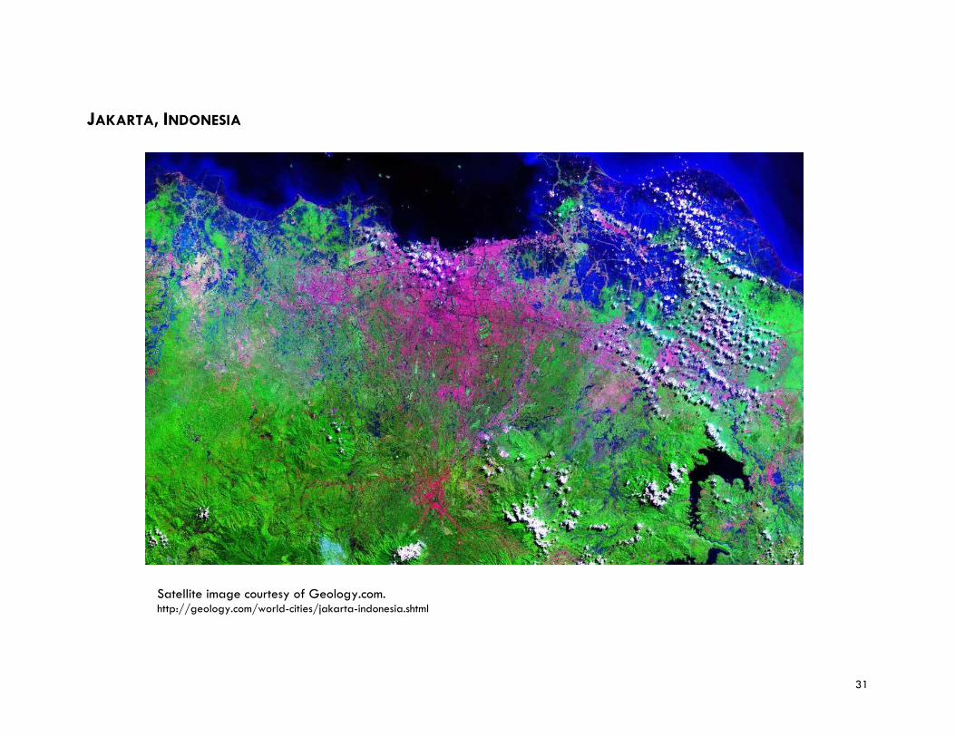
JAKARTA, INDONESIA
Satellite image courtesy of Geology.com. http://geology.com/world-cities/jakarta-indonesia.shtml

32
33
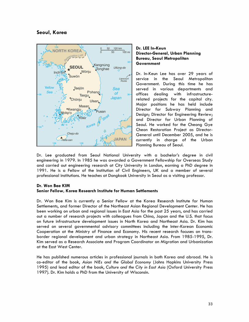
Seoul, Korea
Dr. LEE In-Keun Director-General, Urban Planning Bureau, Seoul Metropolitan Government Dr. In-Keun Lee has over 29 years of service in the Seoul Metropolitan Government. During this time he has served in various departments and offices dealing with infrastructure-related projects for the capital city. Major positions he has held include Director for Subway Planning and Design; Director for Engineering Review; and Director for Urban Planning of Seoul. He worked for the Cheong Gye Cheon Restoration Project as Director-General until December 2005, and he is currently in charge of the Urban Planning Bureau of Seoul.
Dr. Lee graduated from Seoul National University with a bachelor’s degree in civil engineering in 1979. In 1985 he was awarded a Government Fellowship for Overseas Study and carried out engineering research at City University in London, earning a PhD degree in 1991. He is a Fellow of the Institution of Civil Engineers, UK and a member of several professional institutions. He teaches at Dongkook University in Seoul as a visiting professor. Dr. Won Bae KIM Senior Fellow, Korea Research Institute for Human Settlements Dr. Won Bae Kim is currently a Senior Fellow at the Korea Research Institute for Human Settlements, and former Director of the Northeast Asian Regional Development Center. He has been working on urban and regional issues in East Asia for the past 25 years, and has carried out a number of research projects with colleagues from China, Japan and the U.S. that focus on future infrastructure development issues in North Korea and Northeast Asia. Dr. Kim has served on several governmental advisory committees including the Inter-Korean Economic Cooperation at the Ministry of Finance and Economy. His recent research focuses on trans-border regional development and urban strategy in Northeast Asia. From 1985-1995, Dr. Kim served as a Research Associate and Program Coordinator on Migration and Urbanization at the East West Center. He has published numerous articles in professional journals in both Korea and abroad. He is co-editor of the book, Asian NIEs and the Global Economy (Johns Hopkins University Press 1995) and lead editor of the book, Culture and the City in East Asia (Oxford University Press 1997). Dr. Kim holds a PhD from the University of Wisconsin.
34
Korea Research Institute for Human Settlements The Korea Research Institute for Human Settlements is a non-profit research organization, partially funded by the Government of Korea. The main tasks of the Institute are to develop long-term and short-term plans and policies to lead to more efficient use of the land resources and to restructure the unbalanced spatial structures of the country. The Institute carries out various research projects in the areas of national territorial development, environment, regional and urban development, infrastructure, land use, transportation, geographical information system, and regional development in Northeast Asia. The Institute’s Northeast Asian Regional Development Center aims at developing region-wide strategies for national and regional development to properly cope with the globalization and regionalization of Korean economies. The Center carries out research on two major themes: one on land use, housing, infrastructure, industry and environment in preparation for an eventual unification of the Korean Peninsula and the other on the trends of regional economies, industrial development, infrastructure and urban development in neighboring countries such as China, Japan, and Russia. City of Seoul Brief History The history of Seoul can be traced back 4000 BC, when it was established as a settlement in the Kingdom of Baekje. Historical and archaeological records indicate that the original site of the capital, Wiryesong, was in the northeastern part of present-day Seoul. It was not until King Munjong of Koryo built a summer palace in 1068, however, that a fairly large settlement existed on the site of the modern city. In 1394, General Yi Song-gye, the head of Korea’s Yi dynasty, chose the site to be his capital city, then known as Hangyang-gun. Seoul has since remained the capital city of Korea for over 600 years. The city was called Seoul in Korean during both the Yi dynasty (1392-1910) and the period of Japanese rule (1910-45), although the official names in those periods were Hansong and Kyongsong. The name “Seoul” has come to mean “capital” in the Korean language. The site for the capital was selected because of its natural defensive advantages and its location immediately north of navigable Han River, one of the peninsula’s major tributaries into the Yellow Sea. Two years after the city’s founding, an 11-mile wall was constructed along the ridges of the surrounding hills. The inland waterways and coastal sea routes were important for the transport of grain, taxes, and goods. After the formal establishment of Seoul as the capital of the unified Yi state, construction and growth were very rapid. By 1429 the population of the city had reached 100,000. A Japanese invasion in 1592 led to the capture and partial destruction of Seoul, but a combined force of Korean-Chinese armies defeated them. In their retreat from the city, the Japanese burned most of the temples and palaces to the ground and captured many of Korea’s top artisans. Seoul was again ransacked in 1636 by invading Manchus. In the mid-17th century, Korea withdrew into itself, known as the Hermit kingdom with little contact permitted with the outside world. In 1876 Korea opened to diplomatic contacts with the West, and a Korean Empire was founded in 1897. The empire lasted only seven years before the Japanese conquered Korea in 1905 as part of its war against Russia, establishing a protectorate over the kingdom. The Japanese completely annexed Korea in 1910. Seoul served as the center of Japanese rule, and a modernization program was initiated that paved
35
roads, introduced street cars, and erected new western-style buildings. The city limits were extended by successive stages, incorporating both banks of the Han River as well as banks of several tributary rivers. After the end of Japanese control in 1945, Seoul became part of the central government of Korea. The city’s first steps of autonomous administration after the liberation from Japan, however, were shattered by the devastation of the Korean War, which virtually destroyed the entire city. In an ambitious attempt to revitalize the city beyond even its pre-war prominence, the government instituted aggressive economic policies in the 1960’s and 1970’s, bringing about a whirlwind of modern developmental changes to both the physical and cultural fabric of the city. Seoul now stands at a crossroads of future progression. Seoul Today Seoul today is a dynamic metropolis serving as a major financial and cultural center of Asia, with headquarters of the major stock exchanges and banks located here. The city plays host to many annual international trade shows. The population of Seoul has greatly increased since 1950, and the city now has one of the highest population densities in the world. The present boundary of Seoul was largely established in 1963 and encompasses roughly 234 square miles (606 square km), more than twice the city area in 1948. Seoul has grown rapidly since the Korean War (1950-53). The most densely populated areas are distributed within and outside the old city and in the apartment belts along the Han River. The rapid population growth in the suburbs has resulted in the creation of satellite cities around Seoul, including Songnam, Suwon, and Inchon. Koreans constitute nearly all of the population, as the number of foreign residents is very small. Since the 1960s, Korea has achieved an incredible record of growth and integration into the high tech modern world economy. The GDP real growth rate in 2007 was five percent. Moderate inflation, low unemployment, and an export surplus in 2007 characterized this economy in 2007. The per capita GDP in 2007 was US$24,800. Many of the challenges Seoul faces today are results of the rapid urbanization that occurred in its recent past. Rapid urbanization spawned unbalanced development growth, with certain areas languishing behind others. Seoul no longer experiences population growth. It has entered into a post-urbanization stage, where restructuring and redevelopment are geared to making a livable city. A shortage of housing has been a chronic problem. Current housing stock is 2,242,149 units, whereas the number of households is 3,978,938. Urban renewal projects have been carried out since the 1960s. Most of these projects deal with dilapidated housing and poor conditions of residential environment. The Chengyecheon project, one of the urban renewal highlights, restored the inner city stream. In 2002, the urban renewal law was replaced by the urban and residential environment rehabilitation law. Up until 2007, there were 427 districts designated as residential environment rehabilitation areas, with the aim of providing a decent living environment for the residents. Air pollution has become a serious problem, caused in large part by the increasing number of automobiles and factories. The city’s road and highway system, with its radial routes supplemented by circular ring roads, has resulted in increasing traffic congestion, with crowded streets and frequent traffic jams. In order to reverse this trend, the city has taken steps to ensure public transportation is an attractive and convenient alternative. The city government recently introduced a central lane bus system to reduce travel time. Seoul’s subway system is perhaps one of the best and certainly an efficient mode of public
36
transportation. Currently, there are eight subway lines and four more will be added in the future. The city recognizes the importance of mass transit system in sustainable urban development and recently more so against rapidly rising oil prices. Possibly the most harmful effects of urbanization has been the disregard for history and environment. Following the geomancy (Fengshui) principle, Seoul is surrounded by mountains and the Han River flows through the city. Such natural features provide favorable conditions for an attractive city, in spite of its population size. For years the Han River was highly polluted, but since the early 1980s pollution levels have been reduced significantly by measures to control the river’s water level and by the construction of large-scale sewage treatment facilities. With renewed emphasis on protecting history and environment, Seoul has begun a series of traditional house conservation initiatives, and preserving the beauty and ecology of the Han River with the Han River Renaissance project and the Recreation of Inner City project. Seoul suffered severe floods until late 1990s. Flood control facilities were built and an early warning system developed to mitigate the disasters. Even though Seoul is safe from earthquakes, most of infrastructures and buildings have been strengthened or erected according to seismic design code. With quantitative or “hard” development no longer the focus of its progression, Seoul has committed its future development on the qualitative or “soft” variety, such as technology and culture. These qualitative improvements will focus on five primary sectors: finance, culture, welfare, environment, and public participation. Steps will be taken to attract foreign investment and businesses, develop an unrivaled R&D industry, and become a leader in information technology. Culture and art infrastructure will be drastically expanded, fostering the convention, culture, and tourism industries to befit the revitalized cultural standard of the city. Programs for the handicapped, the elderly, and the poor will be expanded to enable and empower the disadvantaged to have rich and self-sustainable lives. Green spaces throughout the city will be introduced, expanded, or preserved along with an improved public transportation system to lessen the environmental impact of congestion and pollution. Public participation in municipal activities will be encouraged, with a renewed dedication to government transparency and trust. This most recent urban master plan for Seoul sets the vision as “a global city, combining nature and human as well as history and new.” The plan aims at developing a “world city,” “cultural city,” “eco city,” and “welfare city.” The continuing urban challenges in Seoul, however, such as housing shortage and associated real estate speculation, traffic congestion and air pollution cannot be adequately addressed by the city government alone. A region-wide approach is necessary, since these problems originate from a larger city-region. In this respect, the Central Government of Korea has been deeply involved in the management of the Capital Region including the cities of Seoul and Incheon, and Gyeonggi Province.
37
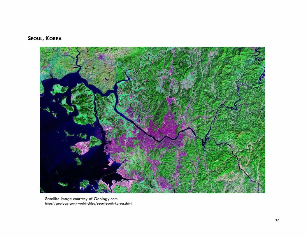
SEOUL, KOREA
Satellite image courtesy of Geology.com. http://geology.com/world-cities/seoul-south-korea.shtml

38
39
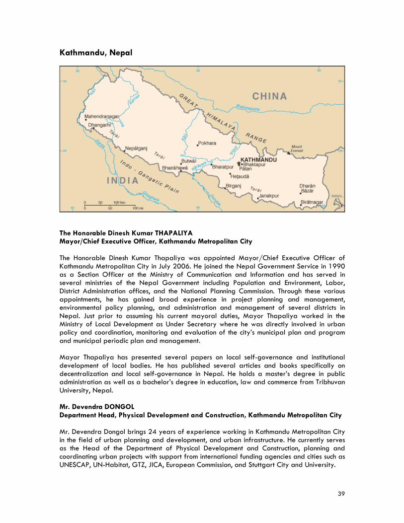
Kathmandu, Nepal
The Honorable Dinesh Kumar THAPALIYA Mayor/Chief Executive Officer, Kathmandu Metropolitan City The Honorable Dinesh Kumar Thapaliya was appointed Mayor/Chief Executive Officer of Kathmandu Metropolitan City in July 2006. He joined the Nepal Government Service in 1990 as a Section Officer at the Ministry of Communication and Information and has served in several ministries of the Nepal Government including Population and Environment, Labor, District Administration offices, and the National Planning Commission. Through these various appointments, he has gained broad experience in project planning and management, environmental policy planning, and administration and management of several districts in Nepal. Just prior to assuming his current mayoral duties, Mayor Thapaliya worked in the Ministry of Local Development as Under Secretary where he was directly involved in urban policy and coordination, monitoring and evaluation of the city’s municipal plan and program and municipal periodic plan and management. Mayor Thapaliya has presented several papers on local self-governance and institutional development of local bodies. He has published several articles and books specifically on decentralization and local self-governance in Nepal. He holds a master’s degree in public administration as well as a bachelor’s degree in education, law and commerce from Tribhuvan University, Nepal. Mr. Devendra DONGOL Department Head, Physical Development and Construction, Kathmandu Metropolitan City Mr. Devendra Dongol brings 24 years of experience working in Kathmandu Metropolitan City in the field of urban planning and development, and urban infrastructure. He currently serves as the Head of the Department of Physical Development and Construction, planning and coordinating urban projects with support from international funding agencies and cities such as UNESCAP, UN-Habitat, GTZ, JICA, European Commission, and Stuttgart City and University.
40
In 1981, Mr. Dongol joined Planning and Development Collaborative International/USAID-Kathmandu as a local consultant and worked for integrated rural development projects in various districts of Nepal. He later worked for the Kathmandu Metropolitan City as a civil engineer. Mr. Dongol’s other positions include working for the Building Permit Division, the Construction Planning Division, and as a project manager for Construction of Kathmandu Bus terminal project (a Japanese Government Grant Aid Project). In 1995 Mr. Dongol was promoted to the post of Department Head of the Urban Development Department of Kathmandu Metropolitan City. In this capacity, Mr. Dongol was actively involved in the promotion and implementation of the urban development plan and program which specifically focused on urban planning, land use, housing, environmental management, conservation of historic sites, and waste management. In 2002 he was appointed as a national co-director for the Kathmandu Valley Mapping Project in Kathmandu Valley (a European Union Grant Aid Project). This urban planning and development project was to improve the planning and implementation capacities of Kathmandu Metropolitan City. Mr. Dongol undertook study and research visits in the field of urban planning and development at the University of Stuttgart in 2001 and 2005 and participated in several urban planning and development workshops and conferences in France, Spain, Germany and Japan. He has presented several papers in the field of urban planning and development of Kathmandu Metropolitan City and published reports on the planned development of Kathmandu Metropolis in 1996 and solid waste management in Kathmandu Valley in 2000. Mr. Dongol holds a master’s degree in infrastructure planning from the University of Stuttgart, Germany (1995) and a bachelor’s degree in civil engineering from Nagpur University, India. Kathmandu Metropolitan City Department of Physical Development and Construction The Department of Physical Development and Construction is mainly responsible for promoting the city’s physical development plan and program including implementation of urban infrastructure projects including roads, drainage, parks and greenery, housing, and conservation of historic and heritage sites within Kathmandu Metropolis in accordance with the Local Self Governance ACT. The department is also responsible for the promotion, implementation, and coordination of development projects in the Kathmandu Metropolis with support from international funding agencies and cities. Kathmandu Metropolitan City Brief History According to legend, the Kathmandu Valley was a lake surrounded by hills in ancient times and visited by various primordial Buddhas. The lake attracted pilgrims and a saint created the valley by slashing the southern rim of the Chobhar gorge with his sword and releasing the water. Thus a civilization began on the fertile lake bed. Archeological findings do show that Kathmandu ranks among the oldest settlements in the central Himalaya, dating to 167 BC. The Newars are regarded as the original inhabitants of the Kathmandu Valley, and their ancient, sophisticated, and artistic culture can still be seen in the area’s skillfully built temples and palaces, delicately engraved stone and metal images, carved wooden columns and pillars, and the history laden shrines. The Newari golden age peaked in the 17th century when the valley consisted of small city-states.
41
The city of Kathmandu was founded in 723 by Raja Gunakamadeva at the confluence of the Baghmati and Bishnumati rivers. The town was laid out in the shape of a sword with the tip pointing north and the hilt to the south. The temples of the eight mother goddesses (which still stand today) defined its perimeter. The city’s early name was Manju-Patan. The name was changed to Kathmandu (“temple of wood” in Sanskrit) by Raja Lachmina Singh in 1596. A temple, supposedly the original built from the wood of a single tree, still stands in the central square. By this time, Kathmandu was already a relatively large city containing about 18,000 houses. In 1768 King Prithvi Narayan Shah of the Gorkha people unified Nepal and designated Kathmandu as the seat of the ruling Shah family. Nearly fifty years later in 1816, the Shahs closed the borders of Nepal and kept the country isolated until the mid 20th century. During this period the Ranas led a bloody coup and became the city’s new leaders. After traveling to Europe, the Rana maharaja introduced European architectural and neo-classical buildings in Nepal. In 1934 a huge earthquake struck Kathmandu Valley killing thousands of people and destroying many of the city’s temples and palaces. The destruction caused by the earthquake resulted in the construction of many modern-style buildings. After more than a century, Nepal opened itself to westerners again in 1951. In 1956, the first paved road in Nepal was built, linking Kathmandu with India, and ten years later another highway opened. In the 1960s and 1970s the construction of new roads and the expansion of air service were centered in Kathmandu, making it the hub of the national transportation system, which for centuries was limited to footpaths. Kathmandu’s population during this period tripled and the city sprawled as modern houses sprang up to meet the needs of foreign workers and immigrants. Tourists also started arriving in droves and Kathmandu was transformed into a tourist mecca for a new trekking industry. Since the 1980s, the city has been spreading out to the surrounding farmland in an unprecedented building frenzy. These new suburbs, fringing the traditional city core, consist of new settlements of high-rise businesses, wide boulevards and expensive housing. Kathmandu Today Kathmandu Metropolitan City, the capital and the largest city of Nepal, is considered the historic, touristic, cultural and business center of the country. It is situated in Kathmandu Valley at an altitude of 4,344 feet (1,380 meters) above sea level and covers an area of 50 square km. Eight rivers run through the city. The Kathmandu Valley is bowl shaped and surrounded by the mountains on all sides. The valley is comprised of five municipalities (including Kathmandu) and 114 village development committees that cover an area of 257 square miles (667 square km) with a total population of approximately 1.65 million people (2001 census). Kathmandu Valley was designated a UNESCO World Heritage Site in 1979. In 2003, the valley was placed on the List of World Heritage in Danger because of uncontrolled urban development. Agriculture is the mainstay of the economy of Nepal, providing a livelihood for three-fourths of the population of the country and accounting for 38 percent of the GDP. The economy, one of the poorest in the world, has considerable potential for growth in hydropower and increased tourism. The GDP growth rate in 2007 was 2.5 percent. The per capita GDP in 2007 was US$1,200. Kathmandu Metropolitan City is divided into 35 wards (the old city core encompasses 12 of these wards). The total population according to the 2001 census is 671, 846. It was 421,258 in 1991 and 235,160 in 1981. The city’s population growth rate was six percent during 1991-2001, one of the highest of the cities in Nepal. The trend of migration from other towns
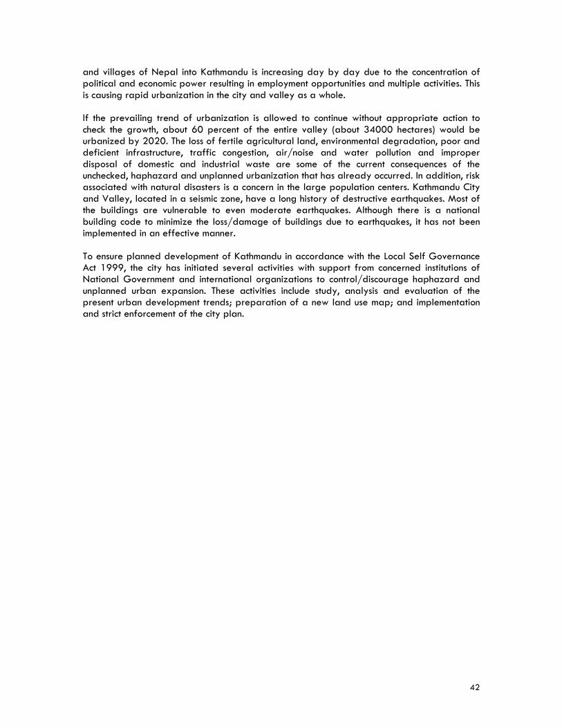
42
and villages of Nepal into Kathmandu is increasing day by day due to the concentration of political and economic power resulting in employment opportunities and multiple activities. This is causing rapid urbanization in the city and valley as a whole. If the prevailing trend of urbanization is allowed to continue without appropriate action to check the growth, about 60 percent of the entire valley (about 34000 hectares) would be urbanized by 2020. The loss of fertile agricultural land, environmental degradation, poor and deficient infrastructure, traffic congestion, air/noise and water pollution and improper disposal of domestic and industrial waste are some of the current consequences of the unchecked, haphazard and unplanned urbanization that has already occurred. In addition, risk associated with natural disasters is a concern in the large population centers. Kathmandu City and Valley, located in a seismic zone, have a long history of destructive earthquakes. Most of the buildings are vulnerable to even moderate earthquakes. Although there is a national building code to minimize the loss/damage of buildings due to earthquakes, it has not been implemented in an effective manner. To ensure planned development of Kathmandu in accordance with the Local Self Governance Act 1999, the city has initiated several activities with support from concerned institutions of National Government and international organizations to control/discourage haphazard and unplanned urban expansion. These activities include study, analysis and evaluation of the present urban development trends; preparation of a new land use map; and implementation and strict enforcement of the city plan.
43
KATHMANDU, NEPAL
Satellite image courtesy of The European Earth Observation Website for Secondary Schools. http://www.eduspace.esa.int/casestudy/images/kathmandu_fuse_800.jpg

44

45
Quezon City, Philippines
The Honorable Feliciano BELMONTE, Jr. Mayor, Quezon City The Honorable Feliciano Belmonte, Jr. has led Quezon City, a part of Metropolitan Manila, since 2001. In the past seven years, he has introduced fiscal and aggressive tax management strategies that have made Quezon City one of the best managed local governments in the Philippines. His focus on computer technology has instituted efficiency and service innovations that has made taxpaying easy, accurate and less prone to graft. Through these initiatives, Quezon City has also become the most bankable local government unit in the country with increased efficiency and discipline in the management and use of the city’s resources. Urban transformation strategies are a priority for the Belmonte administration, including paving and widening of streets, and development of inter-linking roads. Redevelopment efforts include new shopping malls and other wide-scale real estate developments for commercial and residential uses. Mayor Belmonte’s formula for development for 2007-2010 is spelled out in his ABCs of Development: Alleviate poverty; Build up the city; and Compete on efficiencies. Mayor Belmonte sees the city as a center of economic competition in a new global era where cities are like new nations, able to obtain their own investments, business opportunities, and resources. Prior to his term as mayor, he served as
President/General Manager of the Government Service and Insurance System, the Manila Hotel, and the President and Chief Executive Officer of the Philippine Airlines. Mayor Belmonte was also thrice elected Congressman of the 4th District of Quezon City, able to serve both as House Minority Leader and House Speaker of the 11th Congress. He became president of the Philippine Jaycees in 1973, and in 1976 president of Jaycees International. In the mid 1990s, he was selected President of the University of the Philippines Open University Foundation. He was also a member of the Philippine Delegation to the 1957, 1997
46
and 2000 International Labor Organization’s International Conferences held in Geneva, Switzerland. Mayor Belmonte is the recipient of many awards including the Outstanding Congressman of the 9th, 10th and 11th Congress; the Paul Harris Fellow of the Rotary Club of Manila; the Model Filipino Awardee of the World Family Institute in 1994; the Outstanding Filipino in Government Service of the Philippine Jaycees; the Most Outstanding City Mayor (Local Government Leadership Awards) 2003; as well as the CEO Excel Awards for Communications Excellence in the Government Sector 2006. Quezon City Brief History Quezon City is very young. It was established in 1939 by former Philippine President Manuel Luis Quezon on 1,529 hectares of land that he purchased in 1938 from the vast Diliman Estate of the Tuason Family. Quezon City was the capital of the Philippines from 1948 until 1976. Before the city was created, it was composed of small towns. In 1896 a revolution against the occupying country of Spain was declared in one of the towns, Pugad Lawin (now known as Bahay Toro). The first inhabitants of the Philippines arrived around 250,000 years ago, probably migrating over a land bridge from Asia. Little is known of the society and history of the area prior to the arrival of Ferdinand Magellan who claimed the archipelago for Spain in 1521. Archaeological findings in the area indicate trade with Asian neighbors and the Hindu empires in Java and Sumatra and later with China and the Arabs. Spain ruled for 327 years. The Americans occupied the Philippines in 1899 after their war with Spain, and the Japanese ruled during World War II. The Philippines became independent in 1946. Considered part of Metropolitan Manila, Quezon City began to grow after World War II with the construction of government buildings. Light industry developed and a circular road linking the city to other suburbs was built, along with large resettlement housing projects for low-income government workers. Quezon City Today Quezon City is one of the fastest growing metropolitan areas in the Philippines. Located on the island of Luzon immediately northeast of Manila, Quezon City is one of 16 cities and one municipality that make up the National Capital Region (Metropolitan Manila). Strategically situated at the heart of Metro Manila, the city is the convergence point of every major highway. It contains about 23 percent of the total land area, 62 square miles (161 square km), and population of the entire region. Its urban sprawl is spread over one fourth of the Philippines’ metropolitan area. Many national government offices are located in the city, and it is also home to the main campus of the University of the Philippines. The city has one of the widest roads in the Philippines, where some parts stretch to as much as 16 lanes across. While the city has one of the largest squatters’ communities in the country, it also has some of the richest residential subdivisions—gated communities where many of the moneyed elite live, including President Macapagal-Arroyo.
47
Quezon City is known especially for the dynamism of its local economy, the quality of life of its residents and the responsiveness of the local government in responding to business needs. In 2007 it was ranked the most competitive city in Metro Manila and number 2 in the entire country by a study that evaluated cities according to how effective they were in providing an environment conducive to business and industry. Quezon City has also been selected one of the top 10 Asian Cities of the Future. The country’s economy grew at its fastest pace in three decades with real GDP growth exceeding seven percent in 2007. The per capita GDP in 2007 was US$3,400. With 2.68 million people, Quezon City is the most populated city of the Philippines and has the third biggest population among the country’s local government units. The city government views its young population (average age is 24 years old) both as a large, trainable human resource pool as well as a big, dynamic, consumer market. An estimated 55 percent of the total population is poor migrants, many of them from provinces who come to the city in search of a better life and end up as informal settlers. One of the city government’s challenges is to resettle and assimilate the in-migrants into well-organized and upgraded communities and assist them in becoming productive, contributing citizens through an integrated poverty alleviation program focusing on health, education, and social services. The city owns and manages its own housing corporation that has constructed medium-rise housing projects to resettle informal settlers, as well as provides affordable homes for low-income wage earners. It facilitates community mortgage programs for secure land tenure, as well as partners with private shelter institutions for housing subsidized by “sweat equity.” Cubao is the commercial center of Quezon City. The city continues to encourage investments in vast parcels of raw land available for large-scale development. In addition, there are plans to create new town centers as mixed-use communities, designed to decongest traffic and provide new opportunities for commerce in more areas of the city. One project underway is the development of an environmentally balanced, mixed-use, 250-hectare Central Business District. Public transportation within the city, like in most urban areas in the Philippines, is facilitated mostly by using inexpensive jeepneys and buses. Tricycles give access to more secluded areas, while taxi cabs are available as well. In recent years the city has made large investments in road building and sidewalk development to create an interconnected system of national highways so that people and commerce can move and reach their destinations with ease. One of Quezon City’s major tasks is to manage a burgeoning garbage problem. Its population generates more than two million cubic meters of garbage every year. It is the first local government in the Philippines to earn carbon credits from its biogas emission reduction project, initiated under the Clean Development Mechanism—an arrangement under the Kyoto Protocol and registered with the United Nations Framework Convention on Climate Change. Under a contract with an Italian firm, the biogas plant will harvest the methane gas to generate electricity. It is expected that the plant will be able to generate as much as 42,000 megawatts of electricity from the waste over a ten-year operating life. While Quezon City has not experienced a major natural disaster, it is at risk to typhoons, flooding, and earthquakes.
48
Metropolitan Manila Secretary Bayani FERNANDO Chairman, Metropolitan Manila Development Authority Secretary Bayani Fernando was appointed Chairman of the Metropolitan Manila Development Authority by Philippine President Gloria Macapagal-Arroyo in 2002. He concurrently holds the position of Secretary of the Department of Public Works and Highways for the National Capital Region. Prior to leading the Metropolitan Manila Development Authority, Secretary Fernando was a two-term mayor of Marikina City, transforming the city from a 4th class municipality to one of the best-managed cities in the Philippines and a paradigm of responsive and effective governance. During his incumbency, Marikina City was accorded 55 citations and distinctions. He also served as President of the Metro Manila’s Mayors’ League from 2000–2001. His wife, Maria Lourdes Fernando, is the present Mayor of Marikina City. Secretary Fernando is the recipient of many awards including, a Doctor of Humanities, Honoris Causa, Ateneo de Cagayan; The Outstanding Filipino Award for Government Service; the H.R. Reyes Academic Medallion of Honor, Central Colleges of the Philippines; and a Doctor of Public Administration, Honoris Causa by the Polytechnic University of the Philippines. A professional mechanical engineer with over 25 years of experience, Secretary Fernando is the founder of the BF GROUP OF COMPANIES, dealing with general construction, steel fabrication, manufacturing and real estate. His firm has built some of the the country’s tallest buildings, shopping malls, industrial and residential subdivisions and facilities. Metropolitan Manila Development Authority Brief History The Philippine National Government first considered the need for a multisectoral management planning and development body in the early 1970’s in response to requests from local government for infrastructure funding or specialized local support programs and as a better way to allocate common resources to achieve economies of scale. Philippine President Ferdinand Marcos created the Metropolitan Manila Commission in 1975, integrating Manila and Quezon City with two additional cities and 13 municipalities, and appointed his wife, Imelda Marcos, as Governor. President Corazon Aquino created the Metro Manila Authority in 1990 under an Executive Order that required the Metro Manila mayors to choose among themselves a chairman of the Authority. The Metropolitan Manila Development Authority was established by the Philippine Congress in 1995, and President Fidel Ramos appointed the first Chairman, making him independent of the Metro Manila mayors. Metropolitan Manila Development Authority Today The Metropolitan Manila Development Authority (MMDA) is an agency of the Philippine Government with regulatory and supervisory authority over the delivery of those metro-wide services within Metro Manila that have regional impact and transcend local political boundaries or entail huge expenditures. The services include development planning; transport and traffic management; solid waste disposal and management; flood control and sewerage management; urban renewal zoning and land use planning and shelter services; health and
49
sanitation, urban protection and pollution control; and public safety. The MMDA is governed by the Metro Manila Council, a policy making body that is comprised of the mayors of all the cities and municipalities in Metro Manila, as well as the President of the Metro Manila Vice-Mayors League and the President of Metro Manila Councilors League. Metropolitan Manila Metro Manila—also known as Metropolitan Manila, National Capital Region and Greater Metro Manila—is a special development and administrative region subject to the direct supervision of the President of the Philippines. It is regarded as the country’s premier urban center and one of the largest metropolitan areas in the world. Metro Manila houses the national government which includes the executive, legislative, and judiciary branches. The region also hosts many central offices of government agencies and all foreign embassies. Metro Manila is considered by all Filipinos as the central nerve of all activities in the country. It is characterized by the concentration of economic, social and political activities evident by the presence of 90 out of the 100 biggest corporations in the country, all major newspapers, radio, and TV networks and 60 percent of the country’s non-agricultural labor force. Metro Manila’s estimated (2007) daytime population is 14 million, due to the influx of workers and students from neighboring areas. Its residential population is 11.5 million. Metro Manila covers an area of over 245 square miles (636 square km) and includes 16 cities and one municipality, each independently managed. Metro Manila is the country’s center of industrial and commercial activities, with 50 percent of total industrial production and 35 percent of total services. Its land use is predominantly residential at 44.83 percent, followed by road networks, parks and open spaces at 28.43 percent. The current GDP accounts for 32 percent of the total Philippine GDP. Metro Manila attracts large numbers of migrants from all over the country, and in-migration has created great pressures on the economic and political leaders as well as a tremendous strain on the resources of the metropolis. Metro Manila is confronted with major problems and issues such as flooding, informal settlers, urban decay, garbage, traffic congestion, worsening vehicular emissions and increasing number of road accidents that continue to affect the health, environment, business and governmental functions. Other hazards like typhoons, fires and earthquakes are present dangers in Metro Manila. A recent study indicated that Metro Manila is vulnerable to a 7.2 magnitude earthquake that may be generated along an active fault on its eastern part.

50
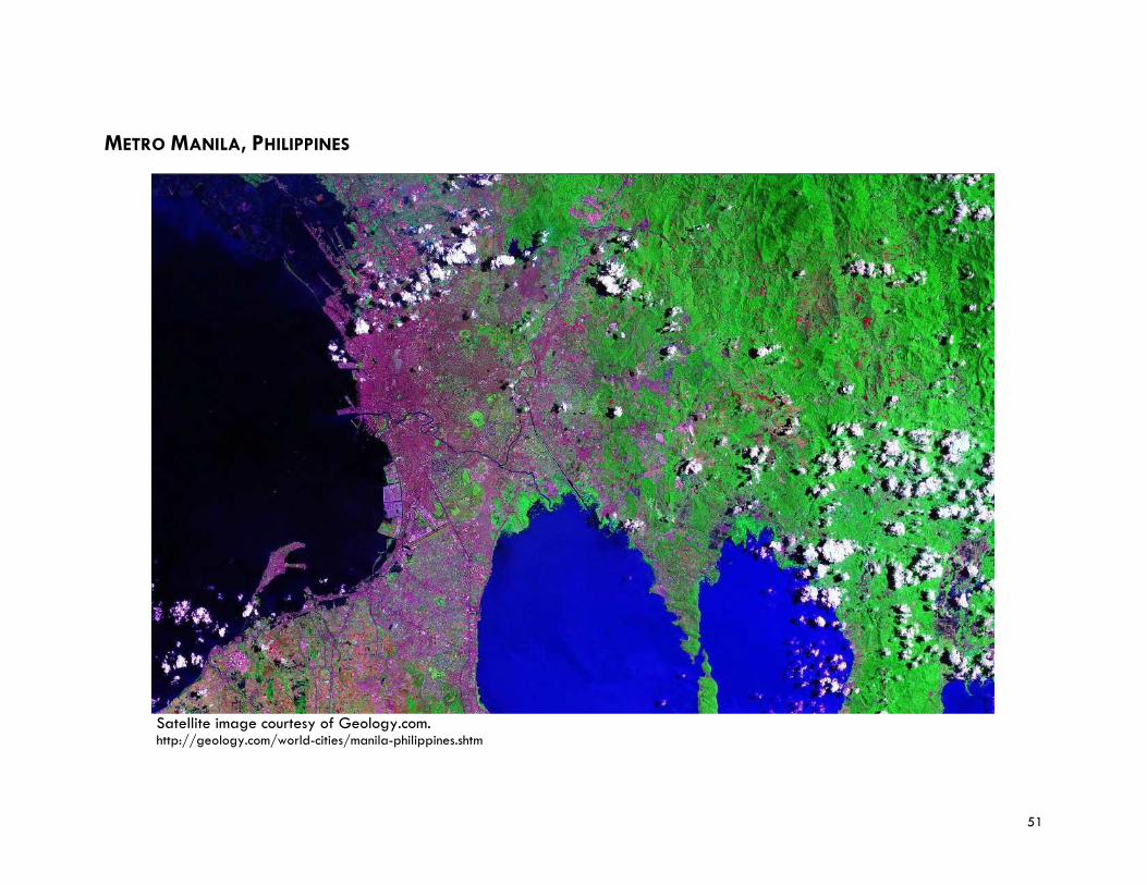
51
METRO MANILA, PHILIPPINES
Satellite image courtesy of Geology.com. http://geology.com/world-cities/manila-philippines.shtm

52
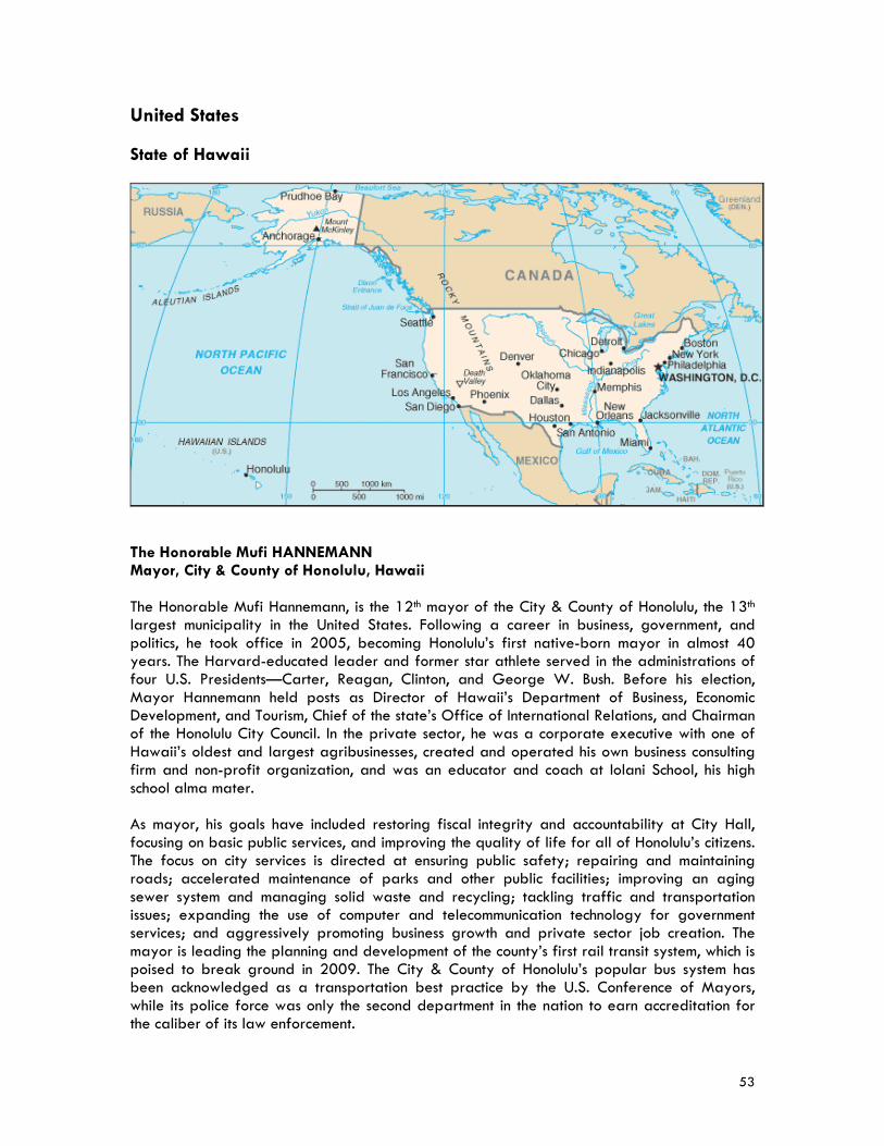
53
United States
State of Hawaii
The Honorable Mufi HANNEMANN Mayor, City & County of Honolulu, Hawaii The Honorable Mufi Hannemann, is the 12th mayor of the City & County of Honolulu, the 13th largest municipality in the United States. Following a career in business, government, and politics, he took office in 2005, becoming Honolulu’s first native-born mayor in almost 40 years. The Harvard-educated leader and former star athlete served in the administrations of four U.S. Presidents—Carter, Reagan, Clinton, and George W. Bush. Before his election, Mayor Hannemann held posts as Director of Hawaii’s Department of Business, Economic Development, and Tourism, Chief of the state’s Office of International Relations, and Chairman of the Honolulu City Council. In the private sector, he was a corporate executive with one of Hawaii’s oldest and largest agribusinesses, created and operated his own business consulting firm and non-profit organization, and was an educator and coach at Iolani School, his high school alma mater. As mayor, his goals have included restoring fiscal integrity and accountability at City Hall, focusing on basic public services, and improving the quality of life for all of Honolulu’s citizens. The focus on city services is directed at ensuring public safety; repairing and maintaining roads; accelerated maintenance of parks and other public facilities; improving an aging sewer system and managing solid waste and recycling; tackling traffic and transportation issues; expanding the use of computer and telecommunication technology for government services; and aggressively promoting business growth and private sector job creation. The mayor is leading the planning and development of the county’s first rail transit system, which is poised to break ground in 2009. The City & County of Honolulu’s popular bus system has been acknowledged as a transportation best practice by the U.S. Conference of Mayors, while its police force was only the second department in the nation to earn accreditation for the caliber of its law enforcement.
54
Nationally, Mayor Hannemann serves on the U.S. Secretary of Labor’s Advisory Committee on Apprenticeship and was recognized as an outstanding advocate by Easter Seals for his achievements in helping the physically challenged and less-fortunate. He is also member of the advisory board of the U.S. Conference of Mayors and chairman of the group’s standing committee on tourism, arts, parks, entertainment, and sports. Mayor Hannemann has drawn on his international experience as a Fulbright Scholar in New Zealand, U.S. Department of the Interior insular affairs specialist, international relations director, and U.S. South Pacific Commissioner to build sister-city relationships and promote trade and commerce. City & County of Honolulu Brief History The first settlers to the Hawaiian Islands arrived from the Marquesas sometime between 500 and 750. Settlers from Tahiti arrived several hundred years later and may have enslaved the Marquesans, forced them to build temples and work in the fields. In 1778, British explorer Captain James Cook was the first known Westerner to visit the island of Oahu, and on a second visit a year later he was killed by the native Hawaiians. By the late 18th century, powerful Hawaiian rulers battled for control of the archipelago. In 1795 Kamehameha the Great (who controlled the Big Island of Hawaii) conquered the islands of Maui and Molokai and then crossed the channel to Oahu, landing his fleet of canoes in Waikiki and pursuing Kalanikupule, the King of Oahu, into the valley and mountains. Kamehameha conquered Oahu and became the first ruler of a united Kingdom of Hawaii. During the time of Kamehameha’s invasion of Oahu, Honolulu was a village of small huts near the water. It is not clear how the harbor became known as Honolulu (“protected bay”), but it was visited by many foreign ships and became a stop over on the route between North America and Asia. In 1809 King Kamehameha moved his residence from Waikiki to Honolulu—which was then a village of about 1,800 people—to tighten his control on the valuable sandalwood trade. Honolulu became the center of commerce in the kingdom. By the 1820s, whaling ships began arriving in Honolulu harbor, bringing a rough crowd of sailors. To meet their needs, taverns and brothels sprang up around the harbor, but the Christian missionaries gained enough influence with the Hawaiian royal family that laws were passed against drunkenness and prostitution. The sons of the original missionaries became businessmen who wielded enormous power in the islands. Downtown Honolulu soon became the headquarters for the emerging corporations that eventually gained control of Hawaii’s commerce, operating large and profitable sugar plantations. In 845 the last son of Kamehameha the Great, Kamehameha III, moved the capital of the kingdom from Maui to Honolulu. An 1853 census counted 11,450 residents (15 percent of the kingdom’s total population). A number of stately buildings in the city center were built during this period, and by the mid 19th century, Honolulu had a prominent foreign community comprised mainly of Americans and British expatriates. King David Kalakaua was Hawaii’s last king, reigning from 1874 until 1891. In 1893 U.S. businessmen overthrew the monarchy, headed by Queen Liliuokalani, and she was imprisoned in her palace in Honolulu. The U.S. annexed the islands in 1898. The Territory of Hawaii (as it was then called), became a key U.S. Navy post and continued to grow steadily through the early 1900s. Large military installations were built, including bases inside Diamond Head, an extinct volcano, with massive guns pointing out to sea. The city was incorporated in 1907.
55
In 1941 the Japanese attacked Pearl Harbor as well as other military targets throughout the island, and the U.S. entered World War II. In the middle of the Pacific, Honolulu played a crucial role in the war against Japan. More than one million soldiers passed through the city on their way to battles in the Pacific. The years 1941-1945 would forever alter the character of Honolulu and the Hawaiian islands. During the war, as much as one-third of the island of Oahu was occupied by military forces. Thousands who died in the war were buried in a cemetery in Honolulu. The lives of regular citizens were drastically changed by the war as well. The loyalty of the Japanese immigrants and their American-born second generation was questioned, and many of their businesses, banks, shrines, and schools were confiscated. Some Japanese Americans (1,875) were arrested and sent to relocation or internment camps on the U.S. mainland. Hawaii was admitted in the United States as the 50th state in the union in 1959, after 61 years of territorial status, and Honolulu was named the capital of the new state. With statehood, the islands soon became a major travel destination for Americans. Honolulu’s Waikiki District, which in the early 20th century was mostly wetlands and fertile agricultural land, experienced rapid and uncontrolled growth. Thousands (and eventually millions) of visitors arrived on any given day of the year, and Honolulu felt the growing pressures. Honolulu Today Today Honolulu is a modern city with numerous high-rise buildings, and Waikiki is the center of the tourism industry in Hawaii, with thousands of hotel rooms. It is also the State of Hawaii’s center of business, culture, and politics. The City & County of Honolulu and the island of Oahu are coterminous. Its population of 905,601 (seventy percent of the State’s population) makes it the 12th largest city in the United States. Oahu has been called the gathering place, and it is home to people from throughout the Pacific. With no ethnic majority, Honolulu’s ethnicity is diverse, with 55.9 percent of Asian ancestry (19.2 percent Japanese), 20.3 percent Hawaiian/part Hawaiian and 11.3 percent Caucasian. Because of this diversity, Honolulu hosts a wide variety of ethnic celebrations. Hawaii is located approximately 2,000 miles from the mainland U.S. Honolulu’s land area is approximately 600 square miles (1560 square km); 26.1 percent or 100,764 acres are in an urban district; 33.4 percent or 128,810 acres are in an agricultural district; and 40.5 percent or 156,614 acres are in a conservation district. The conservation district, consisting of mountain and ocean areas, is under State jurisdiction through the Department of Land and Natural Resources. The agricultural district is managed jointly by the State and the city and county. The urban district is regulated by the city and county government. Honolulu’s primary industries are tourism and government. The economic growth of the State of Hawaii in 2007 was 4.9 percent. The per capita GDP for Honolulu residents was US$39,239 in 2007. While Honolulu has enjoyed rapid growth, the city has its share of challenges resulting from urbanization activities, especially finding the balance between accommodating a growing population and retaining those features of the environment that make the city one of the most attractive places to live and visit. Other challenges include a limited fresh water resource, the need to focus on sustainable development (recycling and harnessing energy through use of solar power and reducing dependency on fossil fuels), and providing a rapid transit system to address issues of road congestion.
56
To address many of these issues, the city’s development plan envisions growth and development of a secondary urban center, focused on Kapolei. This will be a new center to provide jobs and housing outside of downtown Honolulu. By contrast, other areas are envisioned for little or no growth with objectives established to retain the rural character and low density of existing developments. For example, the State accommodated approximately 7.5 million visitors last year, and a large percentage of them chose to spend time in Waikiki. As part of city efforts to decentralize, Ko Olina, at Kapolei, is emerging as a strong tourist destination area.

57
HONOLULU, HAWAII, USA Island of Oahu
Satellite image of Honolulu, Oahu, Hawaii courtesy of Geology.com. http://geology.com/satellite/cities/honolulu-satellite-image.jpg

58
59
State of California Ms. Gail GOLDBERG Director of Planning, City of Los Angeles, California Ms. Gail Goldberg was appointed Director of the Los Angeles Department of City Planning in 2006. As Director, she is responsible for organizing and directing the City’s policies and planning activities, including the development, maintenance and implementation of all elements of the City’s General Plan as well as a range of other special zoning plans. Prior to joining the Los Angeles Department of City Planning, Ms. Goldberg worked for 17 years in the Planning Department of the City of San Diego, the last five years serving as Planning Director. Her responsibilities included all long-range city-wide and community planning, specifically Facilities Financing, Transportation Planning, the Multiple Species Conservation Program, and other special projects. She oversaw the planning process to update the San Diego City’s 20-year-old General Plan. The initial result was the adoption of a strategic framework plan that articulated a 20-year vision for the City and a long-term strategy for achieving that vision known as the “City of Villages” plan. Ms. Goldberg is a native Californian and holds a degree in urban studies and planning from the University of California San Diego. She is an Urban Land Institute Trustee, as well as Chair of the San Diego/Tijuana ULI District Council; Past President of the San Diego Chapter of the Lambda Alpha Honorary Land Economics Society. Ms. Goldberg has also served on the Statewide Coordinating Committee for the Urban Land Institute’s California Smart Growth Initiative; as a board member of the American Planning Association; and as Co-Chair of the State American Planning Association 2002 Conference. She is currently a member of the American Institute of Certified Planners; and a member of the California Planners Roundtable. Los Angeles Department of City Planning The Los Angeles Department of City Planning is charged with the responsibility of preparing, maintaining, and implementing a General Plan for the development of the City of Los Angeles, including such elements as transportation, housing, open space, and land use. The Plan’s framework is based on a directed growth strategy which targets residential and commercial growth along boulevards, corridors, and clustered development around high activity centers and around transit opportunities. The land use element of the Plan depicts a range of allowable land uses and is intended to encourage and contribute to the economic, social, and physical health, safety, and welfare and convenience of the people who live and work in the city. The Department of City Planning is currently embarked on its most aggressive long-range planning agenda: updating 12 of the City’s 35 community plans and two new elements of the general plan; ten transit-oriented district plans and several specific and master plans. The Department is also leading a city-wide effort to reform and streamline its development process. To create a more effective and efficient department, City Planning has begun an ambitious reorganization of its more than 300 person staff to create planning teams that will provide a full range of planning services to each of the City’s seven geographic planning areas.
60
City of Los Angeles Brief History For many centuries, the area that is now Los Angeles was occupied by 10,000 Tongva (Gabrielino) and Chumash Indians who settled in villages there between 5,000 and 6,000 BC, hunting, fishing, and trading with each other. Europeans arrived in 1542 when a Spanish sea expedition led by Captain Juan Rodriguez Cabrillo sailed into Santa Monica Bay, calling the place “Bay of Smokes” after the Indian village fires. In 1769, the Spanish Governor of California and a Franciscan priest led an expedition north from San Diego, looking for places to build missions, military forts and civilian settlements. Two of the missions were built in the Los Angeles area: San Gabriel in 1771; and San Fernando in 1797. In 1781, 44 volunteer settlers from San Gabriel mission established a new town along a stream about nine miles (15 km) away next to the Native American village of Yang-na (Yabit). Most of these settlers were of mixed Filipino, African, and Spanish ancestry. They named the settlement El Pueblo de Nuestro Senora la Reina de los Angeles del Rio Porciuncula (the Town of Our Lady the Queen of the Angels of the Porciuncula River). Los Angeles, as the pueblo became known, soon developed into a thriving farming and ranch community, although many of the Native Americans in the area died due to diseases introduced by the new settlers. By 1820 the population had increased to about 650 residents. Spain’s influence over colonial California ended in 1822, and in 1835 newly independent Mexico secularized the missions—including Los Angeles—and gave out free land grants called rancheros. During this period, there were only about 29 U.S. citizens living in Los Angeles. After the Mexican-American War (1846-48), California became a province of the U.S. and admitted as the 31st state of the union in 1850. The subsequent gold rush of 1849— when tens of thousands of people poured into the area—had an enormous impact on Los Angeles. Nearly overnight, the farm and ranch community turned into a rough frontier town with dirt streets, mud homes, and many saloons, brothels and gambling houses. In the 1860s a severe drought destroyed crops, killed cattle and undermined the economic viability of the ranchero. By 1854 the gold rush had peaked, and the Los Angeles economy fell into a depression that continued through the American Civil War (1861-65). As late as the 1870s, Los Angeles remained isolated from the rest of the country due primarily to its location amidst vast deserts, mountains and stretches of foreboding frontier territory. Growth and development seemed to be out of the question, especially because the city lacked a natural harbor, no major fuel or lumber sources, no railway, and no water supply large enough to sustain a sizable population. The city’s metamorphosis into a world-class metropolis began in 1876 when a spur of the Southern Pacific Railroad was completed and provided transport services for the orange-growing industry, and by 1889 more than 5,200 hectares (13,000 acres) were planted in citrus. Oil was discovered in 1892 and by 1923 Los Angeles was producing one-quarter of the world’s petroleum. In addition, a newly-formed chamber of commerce joined with the railroads, citrus growers and hotel owners to promote the mild climate, unspoiled natural beauty, and ocean views of Los Angeles and large numbers of affluent easterners and mid-westerners flocked to the area to settle. By 1900, the population jumped to 100,000. The dramatic increase in the population, however, put pressure on the city’s water supply.
61
With the completion of the Panama Canal in 1914, there was need for a larger harbor in southern California. The annexation of the port town of San Pedro enabled Los Angeles to become a major international trading center. The population grew to 300,000. Another decisive step toward creating a metropolis was the development of a system that would import enough water from the eastern slopes of the Sierra Nevada to sustain a projected population of millions in the Los Angeles area. This huge infrastructure project involved difficult dealings with private land and business owners and the invention and application of new technologies (including the Caterpillar tractor). The water flowed entirely by gravity through open canals, pipes and tunnels into a spillway in the San Fernando Valley. In the 1920s Los Angeles experienced the largest internal migration in the history of the country, with hundreds of thousands of people arriving by automobile to make their fortunes in wildcat oil drilling, business speculation, extensive suburban development, and the new aircraft and film industries. By 1932 the population of Los Angeles grew to more than one million, and the city hosted the Summer Olympics. World War II and the expansion of the defense industry brought new growth and prosperity to the city. During the post-war years urban sprawl expanded the city, and new industries were created (including the birth of the Internet in 1969). Los Angeles was considered a world-class city in the 1980s, ranked second only to New York City. However, with the massive urbanization came many problems, including traffic jams, pollution, increasing poverty, inadequate low-income housing, overcrowded schools, and ethnic, racial and gang hostility. Los Angeles in the early 21st century was a city undergoing major changes. In downtown, the old City Hall building underwent history restoration and retrofitting for earthquake safety, and an abandoned railroad yard became the Los Angeles State Historic Park. Modernization of the Alameda Transportation Corridor—a 20 mile (30 km) pathway connecting the harbor with downtown—facilitated movement of freight and helped pour billions of dollars into the local economy. New dredging and construction expanded cargo handling at what was already the country’s busiest seaport. Los Angeles has a track record of confronting serious problems with inventive solutions, and the city has continued to attract millions of visitors annually and large numbers of new residents. Los Angeles Today Los Angeles is located along the southwestern coast of the State of California. The city is 468 square miles (1,212 square km) and has an irregular shape with the most expansive areas being in the northern part of the city and tapering down to a strip in the southern portion. Mountains and hillsides account for more than 45 percent of all land in the city. Los Angeles includes most of a major mountain range (Santa Monica Mountains) and extensive National Forest lands within its borders. Its terrain ranges from 0 feet at sea level to 5,074.3 feet above sea level at Mt. Lukens in the San Gabriel Mountains. There are about 400 publically owned parks including the 4,226 acre Griffith Park complex of hiking and riding trails, the Los Angeles World Zoo, a number of museums, and three large golf courses. The Griffith complex is believed to be the largest public recreational parkland in any major city, worldwide. There are 14 miles of public beaches and the 58 mile long Los Angeles River is almost entirely contained within city boundaries.
62
The City of Los Angeles, along with 87 other incorporated cities, is located within the County of Los Angeles. Some of these other cities such as Santa Monica, Beverly Hills, San Fernando, Universal City, and Culver City are surrounded, for the most part, by the City of Los Angeles, yet remain separate and distinct municipalities. Other cities surrounding LA include Pasadena, Burbank, Malibu, Torrance, and Long Beach. Los Angeles’ estimated population is just over 4,000,000 (2007). As of late 2007 there were almost 1.8 million jobs within city boundaries; this translates to a 1.25:1 ratio of jobs to housing. The Los Angeles public schools system has more students (over 700,000) than the total population of some of the largest cities in the U.S. There are four airports operated by the City of Los Angeles. Los Angeles International Airport (LAX) is the fifth busiest airport in the world. One of the city’s challenges is balancing the need to expand the airport (one of the city’s economic engines) to accommodate additional visitors and cargo with the need to minimize impacts to neighborhoods that are located within very close proximity to the airport. The combined Los Angeles and Long Beach deep water ports handle the greatest volume of trade of any port in the U.S. It is the world's third busiest container port complex. U.S Customs handles well over 200 billion dollars in trade annually in their Los Angeles region. The economic growth rate for the State of California in 2007 was 1.5 percent. The per capita income for the Los Angeles/Orange County area in 2007 was US$45,300. The urbanized area of Los Angeles accounts for more than 70 percent of all land uses, with most being used for residential purposes. Approximately 14 percent or all land is in commercial or industrial use with most of the balance in open land or public recreation. One of the biggest challenges for Los Angeles is the distribution of jobs and housing and the affordability of housing. Los Angeles’ physical size and its early development has resulted in a distribution of both housing and jobs that is spread out across more than 500 square miles. As population has grown, land in Los Angeles is now nearly fully built-out. The city is facing challenges of air quality and traffic congestion created by the increasing demand and dwindling supply of land within the city as people drive cars longer and longer distances to and from jobs and to access many services and amenities. The city needs to reduce automobile trips by creating alternative modes of transportation and by accommodating growth near transit stations and in larger centers of activity. A related challenge is the need to create affordable housing near jobs and in all neighborhoods throughout the city, to assure that all economic segments of the population can live in Los Angeles and to reduce the automobile trips created by increasingly expensive land in the city that forces families to secure housing many miles away. The Los Angeles region, as is most of California and Nevada, is located in a seismically active area with significant earthquakes recorded on a recurring basis. Since the early 1800s there have been more than 60 damaging earthquakes reported, or at least one significant earthquake every three to four years. This clearly has major implications for infrastructure planning within the city.
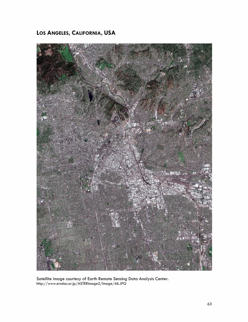
63
LOS ANGELES, CALIFORNIA, USA Satellite image courtesy of Earth Remote Sensing Data Analysis Center. http://www.ersdac.or.jp/ASTERimage2/Image/46.JPG

64
65
Mr. Gary GALLEGOS Executive Director, San Diego Association of Governments, San Diego, California Mr. Gary Gallegos was appointed Executive Director of the San Diego Association of Governments (SANDAG) in 2001. A nationally recognized expert in the areas of transportation, land use, regional public policymaking, and bi-national planning and diplomacy, he leads a staff of nearly 200 professionals who collaborate to develop public policy initiatives for elected officials on numerous issues encompassing population growth, transportation, environmental management, economic development, municipal finance, bi-national coordination, and public safety. Under his direction, SANDAG has crafted an innovative $42 billion Regional Transportation Plan, “Mobility 2030,” to address the region’s transportation needs. Mr. Gallegos also served as the catalyst for the creation and implementation, through its member governments, of the first-ever Regional Comprehensive Plan—the strategic planning blueprint—which balances population, housing, and employment growth with habitat preservation, agriculture, open space, and infrastructure needs. In 2004, Mr. Gallegos advocated successfully for a 67 percent voter approval to extend the local half-cent transportation sales tax program known as TransNet. Administered by SANDAG, TransNet will generate $14 billion to help fund highway, transit, and local road improvements. Prior to joining SANDAG in 2001, Mr. Gallegos held the position of district director for Caltrans District 11, covering San Diego and Imperial Counties. Mr. Gallegos holds a bachelor’s of science degree in civil engineering from the University of New Mexico, and is a registered civil engineer. San Diego Association of Governments The San Diego Association of Governments is the primary public planning, transportation and research agency for the San Diego Region, addressing region-wide issues about growth, including transportation planning, environmental management, housing, open space, air quality, energy, fiscal management, public safety and economic development. SANDAG establishes policies, adopts plans, allocates funds, and develops programs for regional issues. These interdependent and interrelated responsibilities permit a more streamlined, comprehensive, and coordinated approach to planning for the region’s future. Citizens and representatives from community, civic, environmental, education, and business groups are involved in the planning and approval process by participating in committees, workshops, and public hearings. The Association’s policy makers include the mayors, council members, and county supervisors from each of the region’s 19 local governments that make up the San Diego region, as well as advisory representatives from local, state and federal agencies. In its new and expanded role SANDAG now also plans, engineers, and builds public transit. San Diego County, California Brief History Evidence of human habitation in the region goes back to at least 18,000 BC based on archaeological findings in the form of middens (ancient refuse heaps). When Spanish explorer Juan Rodriguez Cabrillo sailed into San Diego Bay in 1542, he was the first European to visit the native Kumeyaay and Luiseno/Juaneno peoples. The first permanent European settlement in California was located in what is now San Diego County, on a hill now known as the
66
Presidio, in 1769. Settlement was confined inside the presidio walls until the 1820s when residents began to build the area that is Old Town. When Mexico took control of the mission in 1834, the site was re-designated a pueblo (town). The U.S. took California from Mexico in 1846. At that time, town of San Diego was little more than a ramshackle village. The community was incorporated in 1850—shortly before California was admitted into the union as the 31st state—and became the first of California’s original 27 counties. A property speculator from San Francisco bought 960 acres of waterfront land and successfully promoted it as a New Town in 1867. When gold was discovered in the hills east of San Diego in 1869, the flood of prospectors resulted in the construction of the Santa Fe Railroad, completed in 1884. The quiet village turned into a classic Wild West town with saloons, gambling houses and brothels behind the respectable facades of Victorian buildings. Growth of the area was rapid after 1900, with the population increasing from 20,000 to more than 200,000 by 1940. The city’s traditional economic base of agriculture and fishing also expanded to include manufacturing (aircraft) and shipping (after the opening of the Panama Canal in 1914). The bombing of Pearl Harbor in 1941 permanently changed the San Diego area. The U.S. military selected San Diego, with its deepwater, protected port, as home of the U.S. Pacific Fleet. The military reshaped the city, dredging the harbor, building landfill islands, and constructing vast tracts of housing. After World War II, San Diego’s land area and population each nearly quadrupled between 1950 and 2000. Industry expanded to include electronics, aerospace technology, and shipbuilding. San Diego County Today San Diego County is located in southern California with the Pacific Ocean to the west, a large military base to the north, the international border with Mexico to the south, and mountains and critical habitat to the east, a total of 4,255 square miles (11,020 square km). The population of San Diego County is over 3 million people (2006). The county is the regional government authority responsible for the health, protection and welfare of its residents. County government also provides municipal, or city-type services for the more than 447,000 residents who live in unincorporated areas. San Diego County is governed by a five-member Board of Supervisors. Members are elected by district on a non-partisan basis and serve four-year terms. Supervisors are nominated and elected from the district in which they live. District boundaries are based primarily on population, with each Supervisor representing about one-fifth of the County’s residents. It is faced with numerous urban growth challenges, including rapid population growth, sprawl, traffic congestion, and the disappearance of open space. Due to the natural barriers mentioned above, there is a limit to the growth that can occur in this region.
The City of San Diego San Diego is the second largest city in California and seventh largest in the U.S, with a population of approximately 1.3 million in 2007. The City covers 342.5 square miles (887 square km) and stretches nearly 40 miles from north to south, with a unique and varied topography composed mostly of mesas intersected by canyons. There are also 93 miles of shoreline including bays, lagoons and the Pacific Ocean. Elevations mostly range from sea level to 600 feet. High points include Mt. Soledad in La Jolla and Cowles Mountain in the eastern part of the city which is nearly 1,600 feet high.
67
San Diego’s population grew rapidly from 1940 to 1960 and again from 1970 to 1990. The population was approximately 200,000 in 1940, 700,000 in 1970 and over 1.22 million in 2000. During the last few years the rate of population growth in the city has slowed due, in part, to lack of vacant land and high housing costs relative to local incomes. San Diego’s population is diverse. Slightly less than half the population is composed of non-Hispanic whites. Hispanics make up 25-30 percent of the population. Approximately 15-20 percent of the population has Asian and Pacific Island origins and about seven percent are black. The overall average age of 33.5 years has been increasing with the fastest growing segment being people over the age of 65. San Diego has a varied economy with both high and low wage industries. The higher wage economic sectors include telecommunications, software, biotech and higher education. The tourism and visitor sectors of the economy provide many of the lower wage jobs. There are relatively few middle income jobs resulting in an increasingly hourglass economy. The military has long been a mainstay of the local economy offering middle income jobs although it is not as dominant as it once was. Defense industry jobs have declined in the past two decades. The city is a major tourist and convention destination, and in recent years has had very high hotel occupancy levels. The economic growth rate for the City of San Diego was 1.7 percent in 2007. The per capita GDP was US$46,800 (2007). The city’s growth and evolution have served as a catalyst for the development of numerous planning visions and plan documents. Through the years, all of the plans have shared a somewhat common vision including the preservation of the unique neighborhoods, good jobs and housing for all San Diegans, protection and enhancement of the environment, development of a diverse economy, an efficient and useful public transit system, well-maintained public facilities and services, and careful management of the growth and development of the city. In the 1960s and 1970s the City of San Diego experienced both significant growth and a serious recession. Residential development reached the city’s jurisdictional boundaries which also expanded during this period. The city’s economic base evolved from tourism and defense to include high technology research and manufacturing, and international trade. The citizens of San Diego reacted to the growth and change by participating in numerous visioning efforts. They produced several documents, ballot initiatives, and programs including: the Urban Form Action Plan, the Regional Growth Management Strategy, the Livable Neighborhoods Initiative, Towards Permanent Paradise, the Renaissance Commission Report, and many others. The city’s General Plan, originally adopted in 1979, provides policy guidance to balance the needs of a growing city while enhancing quality of life for current and future residents, including a strategy—the City of Villages—for how San Diego can enhance its many communities and neighborhoods as growth occurs over the next 20 plus years. The year 2008 finds the City of San Diego and its citizens facing new issues: a lack of vacant developable land for future growth, unmet public facilities standards, a changing economic base, and major environmental challenges.

68
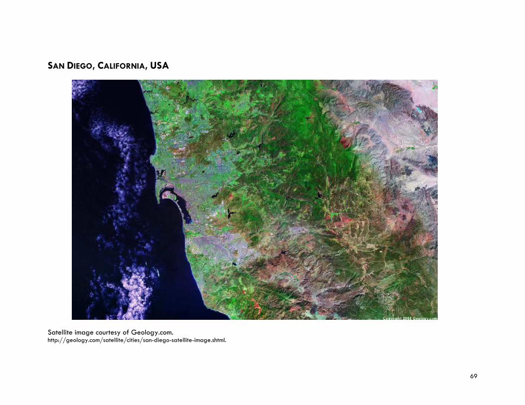
69
SAN DIEGO, CALIFORNIA, USA
Satellite image courtesy of Geology.com. http://geology.com/satellite/cities/san-diego-satellite-image.shtml.

70
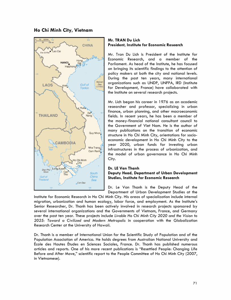
71
Ho Chi Minh City, Vietnam Mr. TRAN Du Lich President, Institute for Economic Research Mr. Tran Du Lich is President of the Institute for Economic Research, and a member of the Parliament. As head of the Institute, he has focused on bringing its scientific findings to the attention of policy makers at both the city and national levels. During the past ten years, many international organizations such as UNDP, UNFPA, IRD (Institute for Development, France) have collaborated with the Institute on several research projects. Mr. Lich began his career in 1976 as an academic researcher and professor, specializing in urban finance, urban planning, and other macroeconomic fields. In recent years, he has been a member of the money-financial national consultant council to the Government of Viet Nam. He is the author of many publications on the transition of economic structure in Ho Chi Minh City, orientations for socio-economic development in Ho Chi Minh City to the year 2020, urban funds for investing urban infrastructures in the process of urbanization, and the model of urban governance in Ho Chi Minh City. Dr. LE Van Thanh Deputy Head, Department of Urban Development Studies, Institute for Economic Research Dr. Le Van Thanh is the Deputy Head of the Department of Urban Development Studies at the
Institute for Economic Research in Ho Chi Minh City. His areas of specialization include internal migration, urbanization and human ecology, labor force, and employment. As the Institute’s Senior Researcher, Dr. Thanh has been actively involved in research projects sponsored by several international organizations and the Governments of Vietnam, France, and Germany over the past ten year. These projects include Livable Ho Chi Minh City 2020 and the Vision to 2025: Toward a Civilized and Modern Metropolis in cooperation with the Globalization Research Center at the University of Hawaii. Dr. Thanh is a member of International Union for the Scientific Study of Population and of the Population Association of America. He holds degrees from Australian National University and École des Hautes Études en Sciences Sociales, France. Dr. Thanh has published numerous articles and reports. One of his more recent publications is “Resettled People: Changing Life Before and After Move,” scientific report to the People Committee of Ho Chi Minh City (2007, in Vietnamese).
72
Institute for Economic Research The Institute for Economic Research is a public scientific organization that advises the People’s Committee of Ho Chi Minh City in formulating strategic planning and socio-economic development programs. Established in 1988 as a Vietnamese Public Science Research Institute, the Institute carries out research projects assigned by the Ho Chi Minh City People’s Council or proposed by other organizations. With a staff of more than 100, including 60 researchers and 40 technical and support staff and collaborators, the Institute is supported by a Scientific Council that serves as a consulting group on research and training activities. The Institute collaborates with all government organizations under the supervision of the Ho Chi Minh City’s People’s Committee, with research and training organizations at the government’s central level, and with local provincial governments. With these organizations, the Institute conducts studies, exchange programs, training workshops, as well as information release according to government regulations. Finally, the Institute also collaborates on projects with international institutions including The World Bank and the United Nations. With three main research departments—Development Studies, Economic Management Studies and Urban Development Studies—the primary roles and functions of the Institute include: (1) conducting research to inform the city’s strategies on sustainable socio-economic development, regional master planning and human resource development; (2) monitoring and evaluating the socio-economic development of Ho Chi Minh City by analyzing and updating quarterly, 6-month and annual socio-economic development reports prepared by the Ho Chi Minh City government for the Communist Party’s Committee and People’s Committee; (3) establishing and maintaining an information system to process the data related to national and international socio-economic development and publishing research and reference documents for city leaders; (4) providing local and foreign business enterprises with data on investment opportunities, marketing, marketing research and business administration; (5) organizing and developing economic and business entrepreneurship/administration courses and workshops for Institute staff, other government agencies, and enterprises managers; and (6) maintaining database of research papers and economic journals prepared by the Institute and distributing them to researchers and students from Vietnamese and foreign universities The Institute for Economic Research has undertaken research projects in different fields, including macro economic and development strategy, human resources and education, natural resources and environment, social issues, migration, urbanization, employment, urban poverty, urban infrastructures (investment and management), urban and regional planning, and urban management, and socio economic information systems. Many of the research findings have been applied in formulating development strategies in Ho Chi Minh City, such as policies for attracting foreign investment, developing the private sector, using urban land, and developing urban infrastructure. Department of Urban Development Studies The Institute’s Department of Urban Development Studies undertakes research on urban development philosophy, orientations and action plans in order to advise the Ho Chi Minh City government on modernization plans and strategies such as population distribution and the establishment of new cities and residential communities. Other research topics include the relationship between economic development, environment and social issues; urban infrastructure, transportation, electricity, water supply, drainage, garbage, urban environment; urban poverty, resettled people, living conditions, preservation of cultural sites, education, health care, and housing.
73
Ho Chi Minh City A Brief History Ho Chi Minh City began as a swampy, small village located near the Mekong Delta. In the 16th century, the Vietnamese pioneered the land. In 1698, as more Vietnamese settlers arrived, the Nguyen Dynasty sent General Nguyen Huu Canh to establish administrative structures in the area. Prey Nokor became known as Saigon and expanded into a significant settlement, and a large citadel “Gia Dinh” was constructed. Relations with France began in the 18th century when French traders and missionaries arrived. They captured the city in 1859, and it was ceded to France by the Vietnamese emperor Tu Duc. Saigon became a modern port city under French rule, with wide, well-paved and tree-lined avenues, parks, and classical Western-style buildings. Railway lines running north and south of the city were constructed, and Saigon became the principal collecting point for the export of rice grown in the Mekong River delta. The French referred to the city as the “Pearl of the Far East.” By 1876 the French has conquered all of southern Vietnam, renamed it “Cochinchine,” and made Saigon the capital. Saigon was occupied by the Japanese in 1940, but French colonial authorities continued to administer Vietnam until 1945 when Vietnamese independence was declared by Ho Chi Minh in Hanoi. The French seized control and the first Indochina War ended in 1954 with France’s defeat at Dien Bien Phu. The Geneva conference divided the country into northern and southern zones, and Saigon became the capital of the newly created state of South Vietnam. Almost a million refugees streamed from the rural areas in the communist north into South Vietnam during the 1960s and 1970s, creating serious housing problems and overcrowding. During the second Indochina War (Vietnam War), Saigon was the headquarters of U.S. military operations. It suffered considerable damage during the 1968 Tet offensive. At the conclusion of the war in 1975, the city came under the control of the Vietnam People’s Army. On April 30, 1975, Saigon was liberated. During the first meeting of the National Assembly of the Socialist Republic of Vietnam, Saigon was renamed Ho Chi Minh City. In 1976, at the establishment of the unified communist Socialist Republic of Vietnam, Saigon, Gia Dinh Province, and two suburban districts of nearby provinces were combined to create Ho Chi Minh City. Saigon lost its status as a capital city, and the local economy was disrupted. During the reunification process, the government confiscated the property of hundreds of thousands of people and sent many to re-education camps. Foreign investment was curtailed, commercial enterprises were nationalized, and many businesses were closed. Throughout the 1980s and 1990s conditions improved as the city gradually adapted to the new “Doi Moi” Policy and the government relaxed its economic policies, bringing about a period of rapid economic change where new buildings were constructed, and private enterprise was enthusiastically embraced.
74
Ho Chi Minh City Today Ho Chi Minh City stands poised to become one of Asia’s great metropolises. Located on the banks of the Saigon River, 60 km from the South China Sea, Ho Chi Minh City is the country’s the largest urban agglomeration in Vietnam. The city covers an area of 809 square miles (2,095 square km), or 6.3 percent of the surface of the country. As the commercial and industrial center of Vietnam, it boasts the country’s most important harbor and is the focus of the highways, railroads, and Mekong delta waterways. The city is at the crossroads of several regions: the South-East, the South of Central Highlands, the South of Central Coasts, and the Mekong Delta. These regions possess a great variety of resources including, agricultural, aquatic and oil. In recent years, urbanization has been taking place rapidly and vigorously in Ho Chi Minh City. As a result of the implementation of “doi moi” (renovation) policy in many fields, the economic growth of the city has grown more than 11 percent per year for the past decade. The GDP growth rate for Vietnam in 2007 was 8.5 percent. Ho Chi Minh City’s per capita GDP was estimated at US$2,600 (three times higher than the country’s average) in 2007 and accounts for 20 percent of the GDP of the country. Large enterprises and small businesses are involved in high-tech, electronic, processing, and light industries, but also in construction, building materials and agro-products. The city currently has 15 industrial parks, export-processing zones, and software and hi-tech parks. There are many shopping malls and plazas being developed in the city. The current population of Ho Chi Minh City is estimated to be over seven million people. It has an annual growth rate 3.5 percent; migrants make up about a third of the total population, with a well established ethnic Chinese population. Due to the urban development history, the city’s population is not distributed equally. Since 1997, establishment of new urban districts (from previous rural districts) has been a hallmark of the city’s vigorous urbanization plan. The division of three zones (urban, semi-urban and rural) is a significant characteristic of Ho Chi Minh City with regard to urban development and population distribution. Understanding the current situation of these zones and applying different policies of development to them is a priority to build a multi-polar conglomeration. The urban zone includes 13 districts, with a surface of 104.6 square km and a population of more than four million. It is the most urbanized zone and has been developed for a long time. The semi-urban zone, with a surface about of 300 square km, was recently created by the government by transforming parts of the rural districts into six new districts (district 2, 7, 9, 12, Thu Duc and Binh Tan). These five new districts are designated for the future growth and development of the city. The Greater Ho Chi Minh Metropolitan Area, covering most of Dong Nam Bo plus Tien Giang and Long An provinces will eventually have an area of 30,000 square km with a population of 20 million inhabitants by 2020. The rural zone, with a surface about of 1,600 square km, has five rural districts: Binh Chanh, Hoc Mon, Cu Chi, Nha be, and Can Gio. Due to large scale economic growth combined with rapid urbanization, Ho Chi Minh City requires major upgrade and expansion of its current infrastructure, including water and sanitation facilities. The city is facing environmental problems that require policies to protect the environmental but also address development within the context of an economy in transition. In addition, because the city is located on low land in the Mekong Delta region, it is affected by two tidal regimes, combined with heavy rain that causes severe annual flooding. In an effort to address these needs, the city and central governments have embarked on the
75
sustainable development of new urban centers. The two most prominent projects are the Thu Thiem City Center (District 2) and the Phu My Hung New City Center (District 7). Ho Chi Minh City’s road system also needs improvement. Many of its streets are riddled with potholes, especially its backstreets and alleys. City buses are some of the public transport available, although there are plans to build a subway and elevated trains. The number of motorbikes has increased to about 4 million. There are also over 500,000 cars, packing the city’s arterial roads and making traffic congestion and air pollution common problems.

76
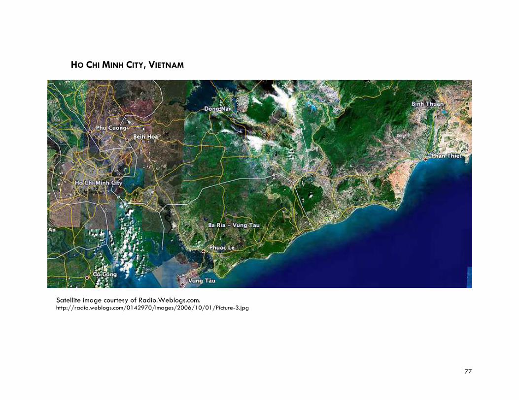
77
HO CHI MINH CITY, VIETNAM
Satellite image courtesy of Radio.Weblogs.com. http://radio.weblogs.com/0142970/images/2006/10/01/Picture-3.jpg

78
79
PROGRAM SESSION CHAIRS Mr. David CADMAN President, International Council for Local Environmental Initiatives–Local Governments for Sustainability (ICLEI) and Councillor, City of Vancouver, Canada Mr. David Cadman became President of the International Council for Local Environmental Initiatives in 2006, after having served as the organization’s vice president for three years. He also serves as Councillor in the Vancouver City Council, elected in 2002. Mr. Cadman has been a social and environmental activist for over 30 years. He has served as President of the Society Promoting Environmental Conservation, at the national and international levels of the United Nations Association, and was awarded the UN Peace medal and UN 50th Anniversary medal. Mr. Cadman spent several years in Tanzania and Kenya developing literacy programs. Later he worked for the Social Planning and Research Council in establishing a community development institute. In 1978 he began working for the Greater Vancouver Regional District and spent the better part of the next 20 years with them working in public consultation, communications and education. Prior to time in public office, Mr. Cadman worked as a private consultant. Mr. Cadman attended the University of the South in Tennessee and then moved on to Geneva where he earned a master’s degree in interdisciplinary and international development. He also studied adult education at the Sorbonne in Paris and is fluent in French. International Council for Local Environmental Initiatives–Local Governments for Sustainability Founded in 1990, ICLEI is an international association of local governments and national and regional local government organizations that have made a commitment to sustainable development. The Council’s basic premise is that locally designed initiatives can provide an effective and cost-efficient way to achieve local, national, and global sustainability objectives. Almost 900 cities, towns, counties, and their associations worldwide comprise ICLEI's growing membership. ICLEI works with these and hundreds of other local governments through international performance-based, results-oriented campaigns and programs. ICLEI’s members are based in 66 countries worldwide—223 of ICLEI’s members are in Asia-Pacific—and has about 80 metropolises in its membership. ICLEI has 13 offices covering all regions of the world, five of them being in Asia-Pacific (Jeju Province, Korea; Manila, Philippines; Tokyo, Japan; Noida/ Delhi, India; and Melbourne, Australia). ICLEI’s World Secretariat is based in Toronto, Canada. ICLEI also has an International Training Centre located in Freiburg, Germany. Partnering with many institutions worldwide, including the World Economic Forum, United Cities and Local Governments, UN Environmental Program, International Union for Conservation of Nature, and UN-HABITAT, ICLEI works to (1) build capacity within local governments; (2) engage communities; (3) magnify voices internationally; (4) reduce greenhouse gas emissions; (5) protect global resources; and (6) preserve vital ecosystems.
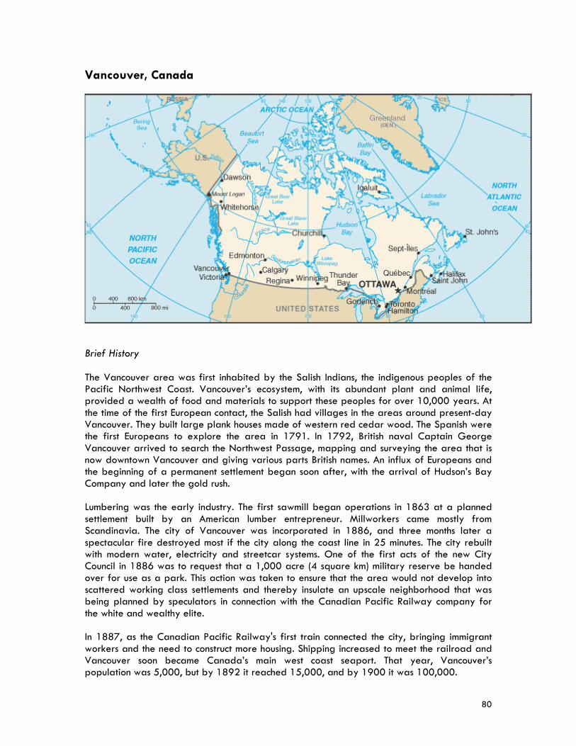
80
Vancouver, Canada
Brief History The Vancouver area was first inhabited by the Salish Indians, the indigenous peoples of the Pacific Northwest Coast. Vancouver’s ecosystem, with its abundant plant and animal life, provided a wealth of food and materials to support these peoples for over 10,000 years. At the time of the first European contact, the Salish had villages in the areas around present-day Vancouver. They built large plank houses made of western red cedar wood. The Spanish were the first Europeans to explore the area in 1791. In 1792, British naval Captain George Vancouver arrived to search the Northwest Passage, mapping and surveying the area that is now downtown Vancouver and giving various parts British names. An influx of Europeans and the beginning of a permanent settlement began soon after, with the arrival of Hudson’s Bay Company and later the gold rush. Lumbering was the early industry. The first sawmill began operations in 1863 at a planned settlement built by an American lumber entrepreneur. Millworkers came mostly from Scandinavia. The city of Vancouver was incorporated in 1886, and three months later a spectacular fire destroyed most if the city along the coast line in 25 minutes. The city rebuilt with modern water, electricity and streetcar systems. One of the first acts of the new City Council in 1886 was to request that a 1,000 acre (4 square km) military reserve be handed over for use as a park. This action was taken to ensure that the area would not develop into scattered working class settlements and thereby insulate an upscale neighborhood that was being planned by speculators in connection with the Canadian Pacific Railway company for the white and wealthy elite. In 1887, as the Canadian Pacific Railway's first train connected the city, bringing immigrant workers and the need to construct more housing. Shipping increased to meet the railroad and Vancouver soon became Canada’s main west coast seaport. That year, Vancouver’s population was 5,000, but by 1892 it reached 15,000, and by 1900 it was 100,000.
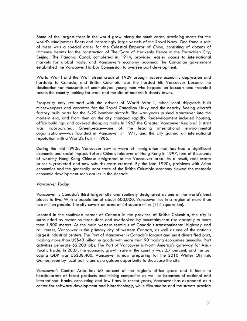
81
Some of the largest trees in the world grew along the south coast, providing masts for the world’s windjammer fleets and increasingly large vessels of the Royal Navy. One famous sale of trees was a special order for the Celestial Emperor of China, consisting of dozens of immense beams for the construction of The Gate of Heavenly Peace in the Forbidden City, Beijing. The Panama Canal, completed in 1914, provided easier access to international markets for global trade, and Vancouver’s economy boomed. The Canadian government established the Vancouver Harbor Commission to oversee port development. World War I and the Wall Street crash of 1929 brought severe economic depression and hardship to Canada, and British Columbia was the hardest hit. Vancouver became the destination for thousands of unemployed young men who hopped on boxcars and traveled across the country looking for work and the site of makeshift shanty towns. Prosperity only returned with the advent of World War II, when local shipyards built minesweepers and corvettes for the Royal Canadian Navy and the nearby Boeing aircraft factory built parts for the B-29 bomber aircraft. The war years pushed Vancouver into the modern era, and from then on the city changed rapidly. Redevelopment included housing, office buildings, and covered shopping malls. In 1967 the Greater Vancouver Regional District was incorporated, Greenpeace—one of the leading international environmental organizations—was founded in Vancouver in 1971, and the city gained an international reputation with a World’s Fair in 1986. During the mid-1990s, Vancouver saw a wave of immigration that has had a significant economic and social impact. Before China's takeover of Hong Kong in 1997, tens of thousands of wealthy Hong Kong Chinese emigrated to the Vancouver area. As a result, real estate prices skyrocketed and new suburbs were created. By the late 1990s, problems with Asian economies and the generally poor state of the British Columbia economy slowed the meteoric economic development seen earlier in the decade. Vancouver Today Vancouver is Canada's third-largest city and routinely designated as one of the world's best places to live. With a population of about 600,000, Vancouver lies in a region of more than two million people. The city covers an area of 44 square miles (114 square km). Located in the southwest corner of Canada in the province of British Columbia, the city is surrounded by water on three sides and overlooked by mountains that rise abruptly to more than 1,500 meters. As the main western terminus of Canada's transcontinental highway and rail routes, Vancouver is the primary city of western Canada, as well as one of the nation's largest industrial centers. The Port of Vancouver is Canada's largest and most diversified port, trading more than US$43 billion in goods with more than 90 trading economies annually. Port activities generate 62,200 jobs. The Port of Vancouver is North America's gateway for Asia-Pacific trade. In 2007, the economic growth rate in the country was 2.7 percent, and the per capita GDP was US$38,400. Vancouver is now preparing for the 2010 Winter Olympic Games, seen by local politicians as a golden opportunity to showcase the city. Vancouver's Central Area has 60 percent of the region's office space and is home to headquarters of forest products and mining companies as well as branches of national and international banks, accounting and law firms. In recent years, Vancouver has expanded as a center for software development and biotechnology, while film studios and the streets provide

82
a backdrop for the developing film industry. Two of the Port of Vancouver's container docks are located in the city. The Fraser River has barge and log traffic serving forestry and other water related industries. Around 1,800 acres of industrial land provide an important range of support services, manufacturing and wholesale premises for businesses throughout the city and region. Vancouver is recognized as a leader in sustainable practices, having taken a holistic approach to creating a sustainable city that balances and enhances the environmental, economic, and social needs of the community. The city’s current urban issues are related to its status as a mature, developed city in a growing and expanding region. One of the key challenges and initiatives is housing affordability and development of affordable housing strategies to maintain the current older housing and provide new housing. In addition, climate change and energy challenges continue to make environmental sustainability a high priority, with work continuing on a variety of fronts including green building requirements, food security policy, and provision of infrastructure for pedestrian and bicycle transportation, as well as transit. The new EcoDensity initiative recognizes that density, design, and land use are powerful tools under city control to help improve environmental sustainability, as well as housing affordability. City Council has recently approved the EcoDensity Charter and Initial EcoDensity Actions. Another key challenge for Vancouver is the Downtown Eastside, a traditionally low-income neighborhood that is the historic heart of the city. The area has struggled with problems facing other urban neighborhoods in big cities, such as drugs, HIV infection, prostitution, crime, inadequate housing, high unemployment, and the loss of many legitimate businesses. The Downtown Eastside Revitalization Program is a multi-faceted approach to restoring the area to a healthy, safe and livable community. In addition, Vancouver is situated in one of the highest seismic zones in Canada, with the potential for damage to many buildings and bridges should a major earthquake hit the region. To address these concerns the city has been carrying out seismic upgrades to the city bridges and in 2007, the city mandated higher qualifications and training for structural engineers, specifically in the area of seismic engineering. Vancouver's Building By-law, which regulates the design and construction of buildings in the city, adopts the most up to date seismic engineering requirements developed through the National Research Council of Canada.
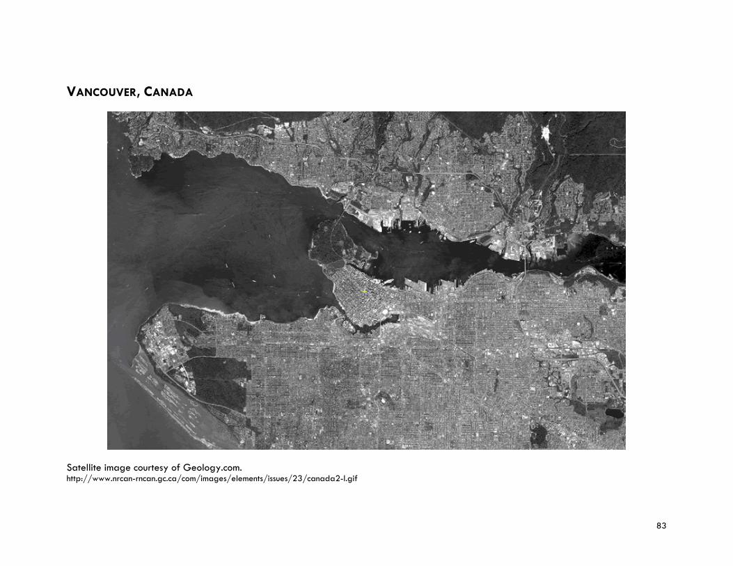
83
VANCOUVER, CANADA
Satellite image courtesy of Geology.com. http://www.nrcan-rncan.gc.ca/com/images/elements/issues/23/canada2-l.gif

84
85
Dr. Shabbir CHEEMA Senior Fellow, Research Program, and Director, Asia-Pacific Governance and Democracy Initiative, East-West Center, Honolulu, Hawaii, USA Dr. Shabbir Cheema's current work focuses on governance and democracy in Asia and the Pacific—including civil society engagement, cross-border governance, electoral and parliamentary processes, transparency and anti-corruption strategies, and civil service reform. Before joining the East-West Center, Dr. Cheema was Principal Adviser and Program Director for the Department of Economic and Social Affairs, United Nations (2001-07); the Director of Governance for the Division of United Nations Development Program (1995-2001); and Manager of the Urban Development Unit (1990-95). As a senior UN official, he provided leadership in crafting democratic governance and public administration programs at the country level, and designing regional and global research and training programs in electoral and parliamentary systems, human rights, transparency and accountability of government, urban management and decentralization. Dr. Cheema has been a visiting fellow at the Harvard University's Ash Institute for Democratic Governance and Innovation since 2005. He was the convener of the Ash Institute's Study Group of Eminent Scholars on Decentralizing Governance. From 1980 to 1988, Dr. Cheema was a development administration planner at the United Nations Center for Regional Development, Nagoya, Japan. He has taught at Universiti Sains Malaysia (1975-79), University of Hawaii (1988-89) and New York University (2002-07). Dr. Cheema is the author of Building Democratic Institutions: Governance Reform in Developing Countries (Kumarian Press, 2005); Urban Shelter and Services: Public Policies and Management Approaches (Praeger, 1987); the co-editor of Decentralizing Governance: Emerging Concepts and Practices (Brookings Institution Press in cooperation with Harvard University, 2007); and Reinventing Government for the Twenty First Century: State Capacity in a Globalizing Society (Kumarian Press, 2003). Dr. Cheema received a PhD in political science from the University of Hawaii at Manoa. Dr. Allen CLARK Senior Fellow, East-West Center Research Program, and former Executive Director, Pacific Disaster Center, Honolulu, Hawaii, USA As a Senior Fellow, Dr. Allen Clark’s research interests include formulation and implementation of policy and institutions in support of sustainable national and regional development; development and implementation of disaster management and humanitarian aid programs; impact of global climate change and variability on urban development; assessment and mitigation of social, cultural and environmental impacts of resource development; Integration of disenfranchised groups into economic development decision making and planning; and regional, national and project level assessment of social risks. Dr. Clark also serves as Project Manager of the Natural Disaster Policy, Legislation and Management Project and Senior Development Consultant to the Pacific Disaster Center. He is the founder and former Director General of the International Institute for Resource Development and Chief of the Office of Resource Analysis of the U.S. Geological Survey. Dr. Clark is also a consultant for the Agency for International Development, World Bank, Asian Development Bank and United Nations. He has worked directly in more than 90 countries. Dr. Clark is the author/co-author of more than 250 publications, and acted as the convener of more than 50 international conferences and training programs.
86
Dr. Clark’s publications include Social, Cultural and Economic Impacts of Natural Disasters; Poverty Issues in the Context of an Evolving Asia; Government Decentralization and resource Rent Revenue Sharing: Issues and Policy; and Managing Minesite and Local Community Issues—The New Reality of Mineral Development. Dr. Clark received a PhD in geology from the University of Idaho. He completed his post-graduate studies in mineral economics at Stanford University. East-West Center Officially known as the Center for Cultural and Technical Interchange Between East and West, the East-West Center is an education and research organization with an international Board of Governors established by the U.S. Congress in 1960 to strengthen relations and understanding among the peoples and nations of Asia, the Pacific, and the United States. The Center contributes to a peaceful, prosperous, and just Asia Pacific community by serving as a vigorous hub for cooperative research, education, and dialogue on critical issues of common concern to the Asia Pacific region and the United States. Funding for the Center comes from the U.S. government, with additional support provided by private agencies, individuals, foundations, corporations, and the governments of the region. Through its programs and nearly 50 years of service in the Asia Pacific region, the East-West Center has a worldwide network of more than 50,000 alumni and 600 partner organizations. As a national and regional resource, the Center offers: (1) an interdisciplinary research program that examines major issues of critical importance in U.S.-Asia Pacific relations; (2) dialogue and professional enrichment programs that focus on groups central to the communication of ideas: the media, political and policy leaders, and educators; and (3) educational programs to develop the human resources needed by the United States and the Asia Pacific region in a new era of increased interdependence. The East-West Center is located on a 21-acre campus in Honolulu, Hawaii. A Washington, D.C.-based office, established in 2001, undertakes research on key domestic and international political and security issues in the region with a view to reducing tension and conflict and promoting peaceful change. To this end, East-West Center Washington conducts Congressional Study Groups and forums to inform and stimulate discussions around U.S.-Asia relations and prepares publications that analyze key contemporary issues of regional significance. The office also is the Secretariat for the U.S. Asia Pacific Council that serves to enhance U.S. engagement in the region through multilateral organizations, conferences, and policy-related initiatives. Pacific Disaster Center The Pacific Disaster Center is an applied science, information and technology center, working to reduce disaster risks and impacts to peoples’ lives and property in the Asia Pacific and Indian Ocean regions. The Center provides applied information research and analysis support for the development of more effective policies, institutions, programs, and information products for disaster management and humanitarian assistance communities in the region. The overall goal of the Center is to promote disaster management as an integral part of national to local economic and social development to foster disaster-resistant communities. The Center’s core capabilities include: (1) hazard risk and vulnerability assessments; (2) web technology for collaboration; (3) geospatial information and sharing; (4) hazard mitigation planning; (5) technology assessment and support; and (6) impact assessment and scenario modeling. The

87
Center works in partnership with the Asia Disaster Preparedness Center, The Association of South East Asian Nations, the Center of Excellence for Disaster Management and Humanitarian Assistance, the Earthquakes and Megacities Initiative, Federal Emergency Management Agency, Japan-U.S. Science, Technology and Space Applications Program, National Ocean and Atmospheric Administration, United Nations International Strategy for Disaster Reduction, and U.S. Geological Survey. The Pacific Disaster Center has joined the Earthquakes and Megacities Initiative in implementing the Cross-Cutting Capacity Development Program as a collaborative effort between researchers, policymakers, and practitioners to assist megacities in reducing their vulnerability to disasters. One of the activities under this initiative is the Megacities Disaster Risk Management Knowledge Base to share and understand disaster risk management sound practices and systems in place in many of the world’s most disaster-prone urban environments. The Pacific Disaster Center was established in 1996 by the U.S. Congress in response to Hurricane Iniki—a powerful hurricane that devastated the Hawaiian Island of Kauai in 1992. The Center is headquartered on the island of Maui, Hawaii at the Research & Technology Park, and also has offices in Honolulu at Fort Shafter (co-located with the U.S. Army Corps of Engineers and the Federal Emergency Management Agency), and at Hawaii State Civil Defense. From 2001 through 2006, the Center was managed by East-West Center under a Cooperative Agreement with the U.S. Government, Department of Defense. Since 2006, University of Hawaii has been the managing partner for the Pacific Disaster Center. Dr. Elliott SCLAR Director, Center for Sustainable Urban Development, The Earth Institute at Columbia University, and Professor, Urban Planning and International Affairs, New York, New York, USA Dr. Elliott Sclar is the Director of the Center for Sustainable Urban Development, The Earth Institute at Columbia University, and Professor of Urban Planning and International Affairs at Columbia University. He also holds senior appointments in the Graduate School of Architecture, Planning, and Preservation and the School of International and Public Affairs. Dr. Sclar was the Co-Coordinator of the Taskforce on Improving the Lives of Slum Dwellers, one of the ten taskforces set up by the UN Millennium Project to help guide the implementation of the United Nation’s Millennium Development Goals. He was also one of the lead authors of The Taskforce's report, “A Home in the City” (2005). As a professional economist, Dr. Sclar has written extensively about the strengths and limitations of markets as mechanisms for effective public policy implementation. His book You Don’t Always Get What You Pay For: The Economics of Privatization (2000), a critique of over reliance on market mechanisms, has won two major academic prizes: the Louis Brownlow Award for the Best Book of 2000 from the National Academy of Public Administration and the 2001 Charles Levine Prize from the International Political Science Association for a major contribution to the public policy literature. In recent years he has been a leading figure in a scholarly movement to reconnect the work of population health experts and urban planners in creating healthier cities. He authored a recent series of articles in The Lancet, the American Journal of Public Health, the Journal of Urban Health and a report published by the Transportation Research Board Institute of Medicine. In 2007 Dr. Sclar received the Humanitarian of the Year Award from the International Society for Urban Health in recognition of his work in this field.
88
The Center for Sustainable Urban Development, Columbia University The Center for Sustainable Urban Development at Columbia University’s Earth Institute engages in and fosters interdisciplinary education and research for the advancement of physically and socially sustainable cities. The Center concentrates on understanding, articulating and disseminating information about the unique and important challenges and opportunities of urban development in low and middle-income countries, as well as in its home community of Metropolitan New York. Some of the issues that the Center is currently focusing on include the linkages between urban transport and land use to economic development, demographic shifts, population health, and climate change. Founded in 2004, the Center for Sustainable Urban Development is one of seven Centers of Excellence established by the Volvo Research and Education Foundations. It is also supported by the Rockefeller Foundation. Selected project include: (1) Nairobi/Ruiru Research and Education Pilot Site (on the border of the Nairobi, Kenya metropolitan area), where the Center is aiding in the creation of metropolitan land use and transport planning processes to demonstrate the effectiveness of comprehensive and community based metropolitan planning; (2) Congestion Pricing Study (in northern Manhattan where much of the population is lower-income African-American and Latino) assessing the potential impact of congestion pricing on access to public transportation and clean air; and (3) the Global Urban Summit, held in 2007, to help the Rockefeller Foundation define potential programming areas to address the world’s fastest growing population—the urban poor. The month-long summit was divided into four one-week meetings: financing shelter, water and sanitation; building resilience to climate change; improving urban population health; and orienting urban planning and design pedagogy and practice to meet the challenges of a 21st century urban world.
89
PROGRAM DISCUSSION LEADERS Ms. Somsook BOONYABANCHA Secretary General, Asian Coalition for Housing Rights, and Director, Community Organizations Development Institute, Bangkok, Thailand For the past 20 years, Ms. Somsook Boonyabancha has served as Secretary General of the Asian Coalition for Housing Rights in Bangkok, Thailand, a regional organization of NGOs, Community Based Organizations and professionals working in the field of human settlements. The Coalition also acts as the regional branch of Habitat International Coalition, implementing a wide range of activities in the Asia region and linking and networking NGOs, community organizations and professionals. Working with the Thai government, Ms. Boonyabancha helped to establish the Urban Community Development Office in 1992 and bring participatory development to more urban poor neighborhoods. In 2000, this organization was merged with the Rural Development Fund to become the Community Organizations Development Institute of which Ms. Boonyabancha is the Director. Ms. Boonyabancha has also worked as a consultant and adviser to various United Nations programs including the UN Development Program, UN Economic and Social Commission for Asia and the Pacific, and UN Center for Human Settlements. Her work has been published in many journals and conferences. Some of her most recent articles include “Baan Mankong: Going to Scale with Slum and Squatter Upgrading in Thailand, Environment and Urbanization” (International Institute for Environment and Development, London, 2005); “The Need for a New Approach to Sustainable Cities: Making People the Subject, not the Object” (Our Planet Magazine, UN Environmental Program, 2005); “How Upgrading of Thailand's Informal Settlements is Spearheading a Community-Driven, City-Wide, Integrated Social Development Process,” presented at a conference on housing and community upgrading in Berlin (2006); “Upgrading Thailand's Urban Informal Settlements: An Asset-Based Process of Community-Driven Social Development, Assets and Livelihoods and Social Policy” (The World Bank, 2008). Ms. Boonyabancha holds a bachelor’s degree in architecture from Chulalongkorn University, Bangkok and a certificate in housing and urbanization from the Royal Danish Academy of Arts, School of Architecture, Copenhagen, Denmark. Asian Coalition for Housing Rights Asian Coalition for Housing Rights, a non-profit foundation registered in Thailand. The Coalition’s Bangkok office serves as the secretariat for the regional network which draws together key activist groups, organizations, professionals and community groups in 15 countries. The network facilitates shared learning, assisting and working among all of its members, with the support of knowledge and small funding assistance and strategic interventions from experienced members. When the Asian Coalition for Housing Rights was formed in 1988, there was no common or regular forum for urban social activists, NGOs, professionals and especially for grassroots or community groups working in Asian cities to meet and exchange ideas. During the UN International Year for Shelter for the Homeless in 1987, several regional processes were organized which encouraged groups to share their experiences in addressing issues of urban poverty and housing and to discuss regional collaboration. At that time there was a shared recognition that new ideas and actions were needed to tackle the upsurge of forced evictions

90
in Asia and to develop opportunities for organizations of the poor and civic groups to gain due recognition and a meaningful role in city management and planning. In the early years of the Coalition (1988-1990), emphasis was placed on housing rights and problems of evictions in Asian cities, and international fact finding missions were organized in South Korea (twice), Hong Kong and the Philippines with positive outcomes. The second stage of work (1991-1993) developed solutions to eviction problems. The third stage (1994-2000) centered on the Training and Advisory Program supported by the British Government. This program was a comprehensive package of support activities with cross-country learning, exchange visits, regional workshops, training from key regional projects, new country action programs and research. It added significantly to the knowledge and capacity of the regional intervention process. The fourth stage, from 2000, represents a more mature process and a broader scale of intervention with the introduction of community savings and credit activities and the development of Community Development Funds. The project has influenced new forms of development change in Laos, Cambodia, Vietnam, Nepal, Mongolia, Sri Lanka, Thailand, Philippines and India. Regional responses to the Tsunami devastation have developed with the promotion of community-driven relief and rehabilitation. In terms of policy advocacy, the contribution of Coalition key activists has increasingly been recognized with requests to meet and share knowledge with policy makers including Asian Ministers. This reflects increasing interest in possible collaboration and support for urban community development and/or community upgrading programs. City-wide and country-wide slum upgrading in Thailand and India has been used to boost and support learning for structural change in other countries. Some Coalition interventions and support have been integrated into government policies, while others have been successfully up-scaled without government support. The upgrading of 100 slums per year in Cambodia and the community savings and credit groups initiatives in Laos and Mongolia have developed into large-scale programs. Other activities include the production and widespread dissemination of international publications including the Housing By People series, Eviction Watch, and Understanding Asian Cities; also the work on protecting the heritage of cities by the participation of communities, the Young Professionals Program and regional information activities. The Coalition is the Asian branch of the Habitat International Coalition and an executive Committee member of CITYNET. It also works closely with Slum/Shack Dwellers International and collaborates with UN HABITAT, UN-ESCAP, UNDP and The World Bank.
91
Community Organizations Development Institute The Community Organizations Development Institute is an independent agency formed in 2000 under the Thai Government’s Ministry of Social Development and Human Security. It supports community development activities including housing, income generation, community welfare, community finance, community-managed environment and natural resources and community culture in poor urban and rural areas throughout Thailand. One of important programs implementing by the Institute is "Baan Mankong" (“Secure Housing”) a city-wide, community-driven slum upgrading program launched in 2003 in 200 cities throughout Thailand to address the housing problems of the country’s poorest citizens. The program channels government funds, in the form of infrastructure subsidies and soft housing and land loans, directly to poor communities which plan and carry out improvements to their housing, environment, basic services and tenure security and manage the budget themselves. Instead of delivering housing units to individual poor families, the Baan Mankong Program puts Thailand’s slum communities (and their community networks) at the center of the process of developing long-term, comprehensive solutions to problems of land and housing in Thai cities. Dr. Tim CAMPBELL Chairman, Urban Age Institute, and former Urban Advisor, City Management and Urban Development, The World Bank, Washington, D.C., USA Dr. Tim Campbell currently serves as chairman of the Urban Age Institute. He has worked for more than 30 years in urban development with experience in scores of countries and hundreds of cities in Latin America, Asia, Eastern Europe, and Africa. His areas of expertise include strategic urban planning, city development strategies, decentralization, urban policy, and social and poverty impact of urban development. Dr. Campbell retired from The World Bank in December of 2005 after more than 17 years. His most recent positions at the Bank were as head of the urban team, and head of the Urban Partnership, which was responsible for identifying changing demand and developing new Bank products and services for cities. He was the Bank-wide coordinator for City Development Strategies, a new analytical tool focusing on cities as the unit of analysis in national development. Prior to this he served as a member of the Advisory Group in Latin America and the Caribbean Region and was the Region’s Chief of the Urban and Water Unit. Before joining the Bank, he worked for more than 13 years as a private consultant and university professor. His consulting clients included private sector firms, governments, and international organizations. He taught at Stanford University and the University of California at Berkeley. He lived in rural and small town Costa Rica for two years as a Peace Corps Volunteer. In addition to many policy papers on decentralization and urban policy, Dr. Campbell has authored several books. The Quiet Revolution, explores the rise of political participation in cities with the onset of decentralization in Latin America from 1983-1995 (University of Pittsburgh Press, 2003). A second book, Leadership and Innovation (The World Bank, 2004), is a collection of case studies about the innovation process in leading local governments in Latin America. Dr. Campbell holds a bachelor’s degree in political science from the University of California at Berkeley, a master’s degree in city and regional planning from the University of California at Berkeley, and a Ph.D. in urban studies and planning from the Massachusetts Institute of Technology.
92
Urban Age Institute The Urban Age Institute is an independent, international NGO that fosters leadership and innovation between and among cities. The Institute focuses its program activities where its global partners and innovative cities can find new support and new insights—especially where cities can bring home innovations and apply them inside their own institutions. As its efforts focus on both public and private sector actions, Urban Age Institute is not confined to government policies and practices. It promotes city-to-city learning, cooperation and exchange as mechanisms to improve performance, increase competitiveness and advance the sustainable development of cities. Key outputs and products include policy and analytical work, publication of Urban Age Magazine, and the design and delivery of structured learning programs for city leaders located around the globe. The Institute works closely with national and local governments, academia, private corporations and NGOs—all to identify, assess and publicize innovative sustainable solutions to the planet's most pressing urban problems. Present and past clients include Environmental Resource Management Ltd., GTZ (the technical assistance agency of the Government of Germany), Gordon and Betty Moore Foundation, Inter-American Development Bank, Lincoln Institute for Land Policy, Metropolis, United Cities and Local Governments, Toyota Corporation, Teijin Corporation, Urban Land Institute, The World Bank, World Health Organization, and many others. Urban Age Institute works with a wide variety of partners—associations, foundations, multilateral banks, companies and public agencies—to undertake initiatives that engage various constituencies and produce wide-ranging results. The programs aim to help leaders wherever they are building urban sustainability projects and seeking out smarter competitiveness strategies for their cities. An example of the Institute’s collaborative approach is The Meeting of the Minds—a special leadership conference—convened once a year, that aims to identify emerging trends and is built around a partnership linking the Institute with Toyota, the American Planning Association and Metropolis. Ms. Celine D’CRUZ Co-Coordinator, Slum/Shack Dwellers International, Mumbai, India Ms. Celine d’Cruz is currently one of the global coordinators of Slum/Shack Dwellers International, an umbrella organization formed by 15 national slum/shack/homeless people's federations to support each other and new emerging federations and to assist the development of federations of the poor in several countries including Thailand, Cambodia, the Philippines, Kenya, Uganda, Namibia and Zimbabwe. She was also one of the founding members, in 1984, of the Indian NGO Society for the Promotion of Area Resources. As coordinator of Slum/Shack Dwellers International, Ms. d’Cruz has been involved in planning and launching the United Nations Campaign for Secure Tenure in India, Philippines, South Africa and Namibia. These international processes and events have involved interaction with a wide range of stakeholders including poor communities, city agencies, government authorities, UN bodies and bilateral groups. Ms. d’Cruz has also worked with the Society for the Promotion of Area Resource Centers, the National Slum Dwellers Federation and Mahila Milan (a federation of women's slum and pavement dweller savings groups) on a large grassroots-managed program of house construction and upgrading.
93
During 2003-04, she was a World Fellow at Yale University, and spent six months as a visiting fellow in the offices of the International Institute for Environment and Development in London. Ms. d’Cruz has written extensively about grassroots-led development, particularly in the urban sector. She holds a master’s degree in social work from Mumbai University. Slum/Shack Dwellers International Slum/Shack Dwellers International is a loose network of urban poor organizations that is linked to a network of professionals who are committed to supporting federations of the urban poor. SDI’s main agenda is to give the urban poor a voice in negotiations for land and secure housing from their respective governments. SDI has a presence in the following countries: Cambodia, India, Kenya, Namibia, Nepal, Philippines, South Africa, Sri Lanka, Swaziland, Thailand, Zimbabwe, Madagascar, Uganda, Colombia, Indonesia, Malawi, Lesotho, Tanzania, Zambia, Argentina, Brazil and Ghana. Eighty percent of SDI’s members are women. SDI affiliates range from groups of a few hundred (at present) in Zambia to more than a million-and-a-half members in India. Some are decades old; others have been in existence for less than a year. They all share a common vision: that the State on its own cannot solve problems of poverty and under-development even though they have the monopoly on power because the monopoly of power and its ties to the local and global economy make it a very weak instrument for the delivery of resources and services needed to eradicate poverty. Since its inception, SDI has operated from a clear platform of engagement and negotiation with governments—both multi-and bi-lateral, academic institutions and other actors in the development sector to build partnerships, reorient roles, responsibilities, and relationships for the benefit of the urban poor. By engaging in precedent-setting projects where local urban poor communities identify their needs and find a solution at the city level, SDI affiliates are pioneering an alternative route to creating a common voice. By undertaking activities such as savings, mapping, household surveys, and house model exhibitions, local federations are organizing urban poor communities and proving to government and the middle class in the city that they are ready to take responsibility both for themselves and the city at large. This approach has changed the tone of negotiations with government from being confrontational to a having a dialogue. For many years, SDI focused on bringing equity issues surrounding the control or regulations of the commodities that the poor need for development (land, water, sanitation, electricity, housing finance) before the State government. More recently, however, SDI has also begun to engage multi-lateral institutions (particularly The World Bank and the UN) in bringing the voice of the urban poor to global forums in an attempt to shift policy at the transnational level. By developing complex political relationships with the various levels and forms of national and international bureaucracies, SDI—as the network representing the local federations—hopes to strengthen its member organizations locally. In addition to partnerships with State governments, SDI's primary affiliations include Cities Alliance, Homeless International, Ford Foundation, Rockefeller Foundation, Charles Stewart Mott Foundation, Miserior, Cordaid, Sweedish Sida, Sustainability Institute, and the International Institute for Environment and Development. In 2007, SDI received $10 million from the Gates Foundation to help the urban poor in Africa, Asia and Latin America to improve their housing, water, and sanitation.
94
Mr. Gordon FELLER Chief Executive Officer, Urban Age Institute, San Rafael, California, USA Mr. Gordon Feller has been building partnerships around urban environmental and urban transport issues that link private sector, public sector, independent sector and academia for more than 25 years. As a consultant to a wide variety of organizations including Chevron, Citigroup, Bechtel, The World Bank, Government of Canada, and World Urban Forum, he has linked key partners together around projects that cross boundaries and accelerate forward movement towards a more positive future. As Chief Executive Officer of the Urban Age Institute, Mr. Feller advises governments, foundations and multinational companies on urban sustainability issues. Urban Age Magazine was founded inside The World Bank in 1992; the international non-profit organization—with program activities in Asia, Africa and Europe—was created nearly ten years later. More than 400 of Mr. Feller's articles, commentaries and editorials have appeared in 100+ magazines and newspapers. In periodicals ranging from the Financial Times of London to TIME and Fortune, Mr. Feller has been arguing for a new and more holistic to seemingly intractable environmental, transport and energy issues. Mr. Feller received a bachelor’s degree and a master’s degree in International Affairs from Columbia University. Urban Age Institute The Urban Age Institute is an independent, international NGO that fosters leadership and innovation between and among cities. The Institute focuses its program activities where its global partners and innovative cities can find new support and new insights—especially where cities can bring home innovations and apply them inside their own institutions. As its efforts focus on both public and private sector actions, Urban Age Institute is not confined to government policies and practices. It promotes city-to-city learning, cooperation and exchange as mechanisms to improve performance, increase competitiveness and advance the sustainable development of cities. Key outputs and products include policy and analytical work, publication of Urban Age Magazine, and the design and delivery of structured learning programs for city leaders located around the globe. The Institute works closely with national and local governments, academia, private corporations and NGOs—all to identify, assess and publicize innovative sustainable solutions to the planet's most pressing urban problems. Present and past clients include Environmental Resource Management Ltd., GTZ (the technical assistance agency of the Government of Germany), Gordon and Betty Moore Foundation, Inter-American Development Bank, Lincoln Institute for Land Policy, Metropolis, United Cities and Local Governments, Toyota Corporation, Teijin Corporation, Urban Land Institute, The World Bank, World Health Organization, and many others. Urban Age Institute works with a wide variety of partners—associations, foundations, multilateral banks, companies and public agencies—to undertake initiatives that engage various constituencies and produce wide-ranging results. The programs aim to help leaders wherever they are building urban sustainability projects and seeking out smarter competitiveness strategies for their cities. An example of the Institute’s collaborative approach is The Meeting of the Minds—a special leadership conference—convened once a year, that aims to identify emerging trends and is built around a partnership linking the Institute with Toyota, the American Planning Association and Metropolis.
95
Dr. Maryam GOLNARAGHI Chief, Disaster Risk Reduction Programme, World Meteorological Organization, Geneva, Switzerland Dr. Maryam Golnaraghi joined the World Meteorological Organization (WMO) in 2004 to head up its new Disaster Risk Reduction Programme. Through extensive consultations with the organization’s network at international to national levels, Dr. Golnaraghi developed the Programme’s strategic goals and implementation plan, with particular focus on hydro-meteorological risk assessment, early warning systems and support of financial risk transfer markets. The plan was adopted by 188 countries during World Meteorological Organization Congress in 2007. She is currently building bi- and multi-lateral partnerships between the WMO and other United Nations agencies and the private sector to support national and regional projects in developing and least developed countries, including national and trans-boundary demonstration projects focused on capacity development and strengthening of institutional cooperation for multi-hazard early warning systems, flood and drought risk assessment and support of the catastrophe insurance and weather risk management markets. Dr. Golnaraghi was the WMO focal point for the development of the Tsunami Early Warning System in the Indian Ocean and in collaboration with UNESCO’s Intergovernmental Oceanographic Commission (IOC) and relevant WMO Programmes, she ensured that the Global Telecommunication System be adopted as the primary channel for the exchange of tsunami warnings and related information. Together with the IOC, she organized assessment missions to 18 countries in the region and raised funds for upgrading the telecommunication system infrastructure in eight countries in the region. Dr. Golnaraghi serves on a number of international committees and advisory groups including Advisor to the Global Humanitarian Forum, chaired by Kofi Annan; Co-Chair of the Task Team for Global Early Waning Survey, commissioned by Former UN Secretary-General Kofi Annan; Advisor on Early Warning Systems to the Office of UN Envoy for Tsunami Reconstruction, Former President Clinton; Advisor to the United Nation’s International Strategy for Disaster Reduction Management Oversight Board, chaired by Sir John Holmes, Under-Secretary-General for Humanitarian Affairs and Emergency Relief Coordinator; and Member of the Global Earth Observation Group working group on Tsunami. In 1996, she founded Climate Risk Solutions, Inc., and served as its president until 2004. Headquartered in Boston, Massachusetts, the company worked with government agencies in the United States, private sector, and academia to provide innovative risk management solutions for energy, agricultural and financial sectors that was based on the latest scientific and technological developments in the fields of climate and meteorology. Dr. Golnaraghi worked extensively in the area of Weather Risk Management, facilitated private/public partnerships, implemented technical capacity development and training within the private sector companies and developed specialized information products to support decision-processes. From 2000 to 2004, she worked as a consultant with Air Worldwide Corporation, a leading natural catastrophe risk modeling company, and oversaw the development of data enhancement methodologies and an operational climate forecasting system. She also served as the Principal Investigator on a number of projects with the U.S. National Oceanic and Atmospheric Administration related to applications of climate information and forecasting technologies.
96
Dr. Golnaraghi holds a bachelor’s of science degree in chemical engineering from Cornell University, a masters of science in applied physics, and a PhD in physical oceanography from Harvard University. From 1993 to 1995 she was a research associate at Harvard Business School, working in the areas of commercialization of technology and new product development. World Meteorological Organization The World Meteorological Organization became a specialized agency of the United Nations in 1951. It is the UN system's authoritative voice on the state and behavior of the Earth's atmosphere, its interaction with the oceans, the climate it produces and the resulting distribution of water resources. The organization has a membership of 188 Member States and Territories (since 2007). WMO provides the framework for international cooperation on a global scale related to the development of meteorology and operational hydrology research, development and application. The WMO originated from the International Meteorological Organization, founded in 1873. Since its establishment, the organization has played a unique and powerful role in contributing to the safety and welfare of humanity, contributing substantially to the protection of life and property against natural disasters, to safeguarding the environment and enhancing the economic and social well-being of all sectors of society in areas such as food security, water resources and transport. WMO facilitates the free and unrestricted exchange of data and information, products and services in real- or near-real time on matters relating to safety and security of society, economic welfare and the protection of the environment. It contributes to policy formulation in these areas at national and international levels. In the specific case of weather-, climate and water-related hazards, which account for nearly 90 percent of all natural disasters, WMO's programs provide vital information for the advance warnings that save lives and reduce damage to property and the environment. WMO also contributes to reducing the impacts of human-induced disasters, such as those associated with chemical and nuclear accidents, forest fire and volcanic ash. Studies have shown that, apart from the incalculable benefit to human well-being, every dollar invested in meteorological and hydrological services produces an economic return, often ten times or more. Dr. Aprodicio LAQUIAN Professor Emeritus, School of Community and Regional Planning, University of British Columbia, Vancouver, Canada Dr. Aprodicio Laquian is Professor Emeritus of the School of Community and Regional Planning at the University of British Columbia. He was Director of the University’s Centre for Human Settlements (1991-2000) and concurrently Project Director of the Asian Urban Research Network, a comparative study of Bangkok, Beijing, Jakarta, Guangzhou and Shanghai funded by the Canadian International Development Agency. In 2001-2002, Dr. Laquian was visiting scholar and Acting Director of the Special Program in Urban and Regional Studies at the Massachusetts Institute of Technology and a fellow at the Woodrow Wilson Center for International Scholars in Washington, D.C. (2002-2003). He has written 20 books on urban studies and more than 60 articles and book chapters, including Beyond Metropolis: the Planning and Governance of Asia’s Mega-Urban Regions (2005), and The Inclusive City: Infrastructure and Public Services for the Urban Poor in Asia (2007), both published by Woodrow Wilson Center Press and Johns Hopkins University Press.
97
Dr. Laquian was Country Director of the UN Population Fund in China (1984-1990) and Senior Adviser on Population for the South Pacific (1982-1984). He was Deputy Director for Social Sciences and Human Resources at the International Development Research Centre of Canada (1971-1979) where he headed the rural-urban dynamics program. In 1968, he was a senior specialist at the East West Center and visiting professor of political science at the University of Hawaii where he wrote Slums are for People (East West Center Press, 1973). He has a bachelor’s degree in public administration from the University of the Philippines (1959) and a PhD in political science, with a major in urban studies from the Massachusetts Institute of Technology (1965). Dr. Michael LEAF Professor, School of Community and Regional Planning, University of British Columbia, Vancouver, Canada Dr. Michael Leaf is an Associate Professor in the School of Community and Regional Planning at the University of British Columbia in Vancouver, Canada. He also serves as a Research Associate in the University’s Centre for Human Settlements and was former Director of the Centre for Southeast Asia Research within the University’s Institute of Asian Research. The primary focus of Dr. Leaf’s work has been on urbanization and planning in cities of developing countries, with particular interest in Asian cities. Since the time of his doctoral research in the 1990s on land development in Jakarta, Indonesia, Dr. Leaf has been extensively involved in urbanization research and capacity building projects in Indonesia, Vietnam, Thailand, China and Sri Lanka. The courses he teaches at the School of Community and Regional Planning covers the theory and practices of development planning and the social, institutional and environmental aspects of urbanization in developing countries. Dr. Leaf received a bachelor’s of science degree in architecture from the Massachusetts Institute of Techology, and a master’s degree and PhD in city and regional planning at the University of California at Berkeley. School of Community and Regional Planning, University of British Columbia The School of Community and Regional Planning at the University of British Columbia is a unit within the College for Interdisciplinary Studies. Its mission is to advance the transition to sustainability through excellence in integrated policy and planning research, professional education and community service. The School was the first dedicated planning school in Canada, and is one of the largest graduate planning programs in the country. With more than five decades of experience in graduate planning education and research, it pioneered the integrated approach to planning for development. The Centre for Human Settlements The Centre for Human Settlements conducts multidisciplinary research and capacity-building programs related to regional, urban, and community development. The Centre is a legacy of the 1976 United Nations Conference on Human Settlements, Habitat I, held in Vancouver. In 1990, the Centre was named a Centre of Excellence in human settlements planning by the Canadian International Development Agency. Faculty are currently undertaking policy-oriented research on community design, transportation and public health, gender equity, healthy and sustainable communities, international development planning and urbanization,
98
metropolitan governance, participatory planning, planning for disaster resilience, risk analysis, and rural-urban linkages. Dr. Bindu LOHANI Vice-President, Finance and Administration, Asian Development Bank, Manila, Philippines Dr. Bindu Lohani is the Vice-President of Finance and Administration of the Asian Development Bank (ADB). He assumed the position in 2007. Dr. Lohani oversees the operations of the following departments and offices: Office of the Secretary; Office of the General Counsel; Budget, Personnel, and Management Systems Department; Office of Administrative Services; Controller's Department; Treasury Department; and Office of Information Systems and Technology. Prior to his appointment as Vice-President, Dr. Lohani was the Director General of the ADB's Regional and Sustainable Development Department and the ADB's Chief Compliance Officer and Special Advisor to the President on Clean Energy and Environment (2005 – 2007). From 1985 until 2005, he held several leadership positions at the ADB, including Secretary; Deputy Director of the Infrastructure, Energy, and Financial Sectors Department; and Assistant Chief of the Environmental Division, Office of Environment and Social Development Department. From 1977 to 1985, Dr. Lohani served as Division Chairman of the Environmental Department at the Asian Institute of Technology. Before joining the ADB, he worked in the Departments of Housing and Physical Planning, Roads, and Local Development in Nepal. During that period, Dr. Lohani had the opportunity to be involved in various infrastructure projects. Dr. Lohani is an elected member of the National Academy of Engineering of United States—the highest professional distinction accorded to an engineer—for his work on economic-cum-environmental approach to sustainable development. He is a diplomate of the American Academy of Environmental Engineers (awarded for excellence in the practice of environmental engineering) and is a licensed professional engineer. He was also elected to the rank of Fellow by the American Association for the Advancement of Science Council for world leadership in development country planning for integrated economic-cum-environmental sustainable development through protection of natural/social resources. Dr. Lohani served on the 18-member Blue Ribbon Committee for "Grand Challenges for Engineering,” an American National Science Foundation Project to identify the world's greatest challenges and opportunities in the next century. More recently, Dr. Lohani was conferred the honor of Doctor of the University by the Griffith University, Queensland, Australia. Other recognitions and awards bestowed on Dr. Lohani include: Member of the Academy of Science for the Developing Countries in Italy; China Green Award for 2006 (the only foreigner to receive the award); and Environment & Development Award for 2007 by the Government of Nepal. Dr. Lohani has authored more than 100 publications, including seven books. He served as consultant to several UN agencies and international consulting firms. He completed several management development programs, including administrative training for senior government staff of Nepal, Executive Program conducted by the Business School of the University of Chicago; Management Development Program by Cornell University; and also programs organized by Arthur D. Little School of Management, and Corporate Leadership program at Yale University. Dr. Lohani holds a bachelor's degree in civil engineering, a master's degree in environmental and sanitary engineering, and a doctorate in environmental technology and management.
99
Asian Development Bank The Asian Development Bank (ADB) is an international development finance institution whose mission is to help its developing member countries reduce poverty and improve the quality of life of their people. Headquartered in Manila, Philippines and established in 1966, the ADB is owned and financed by its 67 members, 48 of which are from the region and 19 from other parts of the globe. The ADB’s main partners are governments, the private sector, nongovernment organizations, development agencies, community-based organizations, and foundations. Under Strategy 2020, a long-term strategic framework adopted in 2008, the ADB will follow three complementary strategic agendas: inclusive growth, environmentally sustainable growth, and regional integration. In pursuing its vision, the ADB’s main instruments comprise loans, technical assistance, grants, advice, and knowledge. Although most lending is in the public sector—and to governments—ADB also provides direct assistance to private enterprises of developing countries through equity investments, guarantees, and loans. In addition, its triple-A credit rating helps mobilize funds for development. Mr. Carlos RODRIGUES Vice President and New Jersey Director, Regional Plan Association, Princeton, New Jersey, USA Mr. Carlos Rodrigues is Vice President and New Jersey Director for Regional Plan Association, where he oversees a variety of statewide policy and legislative initiatives, including land use and environmental regulatory reform and climate change mitigation efforts. Before joining the Association, he was Director of Planning for the Princeton office of Looney Ricks Kiss Architects, where he managed a large portfolio of real estate development and redevelopment work for private, public and non-profit clients. Previously, he spent ten years with the New Jersey Office of Smart Growth—where he was responsible for physical planning and urban design issues statewide. He is the primary author of significant sections of the 2001 New Jersey State Development and Redevelopment Plan. Mr. Rodrigues has taught community design and planning studios at both Rutgers and Columbia. He has a degree in architecture from the University of Lisbon and a master’s degree in city and regional planning from Rutgers University. Regional Plan Association The Regional Plan Association is an independent, not-for-profit regional planning organization that works to improve the quality of life and the economic competitiveness of the Tri-State metropolitan region (New York-New Jersey-Connecticut) through research, planning and advocacy. The Association is the oldest independent planning organization in the United States. For over 80 years, it has been shaping transportation systems, protecting open space and promoting better community design for the region’s continued growth, anticipating the challenges the region will face in the years to come and mobilizing the region’s civic, business and government sectors to take action. The Association operates as a truly interdisciplinary organization with an established record of successful community-based design, economic development, open space preservation, housing, transportation and land-use planning, focusing its efforts on the 31 counties that compose and surround New York City and share critical economic, environmental and transportation systems.
100
The Regional Plan Association is active in all the relevant policy and legislative initiatives of interest to the region—such as smart growth planning, infrastructure financing, land use and environmental regulatory reform, housing finance and transit planning—as well as with respect to specific projects of regional significance, including Governor’s Island, Brooklyn waterfront greenway, Moynahan station, the new Trans-Hudson tunnel, Second Avenue subway, the New Jersey Highlands and many others. The Association’s activities in the Tri-State region are also seen as increasingly relevant to other metropolitan areas and to other parts of the country, and its America 2050 initiative has spurred a national debate around the need for a national plan focusing on infrastructure financing and new mechanisms for metropolitan planning. RPA is a pioneer in public participation and has set the benchmark over the years for effectively involving the broadest range of citizens and stakeholders in shaping their communities. Its efforts are guided by Smart Growth and sustainability principles emphasizing the interplay between environment, mobility and community. Perhaps the apex of these efforts was achieved with “Listening to the City,” an event held following the tragedy of 9/11. Over 5,000 people attended, from throughout the city, and were asked to comment on the Port Authority of New York and New Jersey’s plans for the reconstruction of the World Trade Center. Using modern “town hall” meeting technology that allowed each individual to vote on the various proposals with instantaneous results projected on a large screen, this event by itself changed the course of the World Trade Center site planning. Finally, the Association is also dedicated to the effective education of public officials on planning issues. The Mayor’s Institute on Community Design—first initiated in New Jersey and now held throughout the region—is a “hands-on” educational format that brings together Mayors and experts in a retreat setting to solve planning and design concerns specific to these communities. Dr. Patricia ROMERO LANKAO Deputy Director, Institute for the Study of Society and Environment, National Center for Atmospheric Research, Boulder, Colorado, USA Dr. Patricia Romero Lankao serves as Deputy Director of the Institute for the Study of Society and Environment, a division of National Center for Atmospheric Research’s Societal-Environmental Research and Education Laboratory. Her research seeks to understand the human dimensions of environmental issues related to climate change, energy use, urban development, and water management. With a background in sociology, she is a self-described multidisciplinary sociologist, collaborating with physical scientists as well as other social scientists and serving as a liaison between fields as different as ecology and economics. Her current research focuses on the relationship between urban areas and climate change, exploring such questions as why some cities emit more greenhouse gases than others. Dr. Romero Lankao uses this framework to illustrate the complex interaction between the environment and society when considering human vulnerability. Factors such as income, access to resources and services, and other stressors in the human environment have a real impact on how well or poorly local populations can cope with climate change and other stressors in the physical environment. Dr. Romero Lankao received the 2007 Nobel Peace Prize as part of the Intergovernmental Panel on Climate Change. Prior to her work at the National Center for Atmospheric Research, Dr. Romero Lankao worked as a professor in the department of social and political sciences,
101
teaching courses on environmental issues and development at the Autonomous Metropolitan University in Mexico. Dr. Romero Lankao holds a bachelor’s degree and master’s degree in sociology from the Autonomous National University of Mexico. She also holds two doctorates, one from the Mexico City's Autonomous Metropolitan University and one from the University of Bonn, Germany. Institute for the Study of Society and Environment The Institute for the Study of Society and Environment focuses its research on better understanding the societal and ecological processes that determine how humans and environmental systems will be affected by weather, climate change and other atmospheric processes. The Institute has three basic research goals: 1) to understand the socioeconomic determinants of human activities that affect the climate system; 2) to understand the drivers of vulnerability and adaptive capacity; and 3) to understand decision-making processes that affect vulnerability, adaptive practices, or climate-related policies. The research integrates the interests of individuals with relevant scales of public policy-making. The focus, in particular, is on the implications of uncertainty, and on identifying the type of atmospheric science-related information that is most needed, and how that information can best be communicated and incorporated in the decision or policy process. This work is targeted at a very broad audience including policy makers, resource managers, academics and the general public. Dr. Mark TURNER Deputy Director, Centre for Developing Cities, and Professor of Development Policy and Management, University of Canberra, Australia Dr. Mark Turner is the Deputy Director of the Centre for Developing Cities at the University of Canberra. He is also a Professor of Development Policy and Management at the University and head of the government discipline. He previously worked at the Australian National University and the Administrative College of Papua New Guinea. Dr. Turner has extensive experience in research, consultancy and teaching in the Asia-Pacific region including Papua New Guinea, Vanuatu, Philippines, Vietnam, Laos, Cambodia, Indonesia, Thailand, China, Afghanistan, Kazakhstan, Bhutan and Maldives. His special interests are in public sector reform, decentralization, governance and politics, and he has published widely including the recent books: Challenging Global Inequality (Palgrave Macmillan 2007 with A. Greig and D. Hulme); Trends and Challenges in Public Administration Reform in Asia and the Pacific (UNDP 2005); and Decentralisation in Indonesia (Asia Pacific Press, 2003). Dr. Turner has undertaken numerous consultancy assignments for the UN Development Program, The World Bank, Asian Development Bank, European Union, AusAID and other bilateral aid agencies and NGOs. He is a member of UN Development Program Governance Advisory Panel for Asia-Pacific and was a member of the Eminent Scholars Study Group on Decentralizing Governance at the Ash Institute for Democratic Governance, Harvard University. Dr. Turner has a PhD from the University of Hull. Centre for Developing Cities The Centre for Developing Cities is a self funding, not for profit Centre within the University of Canberra. It was founded in 1997, a result of the Habitat Conference in Istanbul, to service an internationally perceived need to increase capacity for urban governance and management in a rapidly urbanizing world. The Centre is an international network of academics and
102
practitioners in the area of urban governance, finance, planning and management, managed through a small administrative and academic core at the University of Canberra. The Centre's current strategic focus is on the rapidly growing shortfall in urban infrastructure in Australasia and the Pacific. Centre activities addressing this issue include research on identifying and developing systems to leverage key pressure points in the governance, finance and administrative environment to enable governments and the private sector to invest and manage integrated urban infrastructure. It is understood that these systems will differ from country to country and may even differ from region to region within a country. Through this research, the Centre will be targeting the major priorities areas in improving the performance of cities, namely to: (1) improve the development of urban policy, strategic planning and coordination for urban systems and its nexus with financing mechanisms; (2) improve the financial viability of city region authorities and associated financing mechanisms for the provision of infrastructure and services; (3) improve the sustainability of cities through an integrated approach involving environment, energy, economics and social systems; and (4) improve the capacity of city region governance, administration, and of the individual authorities of which it is comprised to develop and manage integrated urban infrastructure. Dr. Shahid YUSUF Economic Advisor, Development Economics Research Group, The World Bank, Washington, D.C., USA Dr. Shahid Yusuf currently serves as Economic Adviser on the Development Economics Research Group at The World Bank. He is the team leader for the World Bank-Japan project on East Asia’s Future Economy. He was the Director of the World Development Report 1999/2000, “Entering the 21st Century.” Prior to that, he was Economic Adviser to the Senior Vice President and Chief Economist (1997-98), Lead Economist for the East Africa Department (1995-97) and Lead Economist for the China and Mongolia Department (1989-1993). Dr. Yusuf has also served The World Bank in several other capacities since he first joined the Young Professionals Program in 1974. Dr. Yusuf has written extensively on development issues, with a special focus on East Asia. His publications include: China's Rural Development, co-authored with Dwight H. Perkins (Johns Hopkins Press 1984); The Dynamics of Urban Growth in Three Chinese Cities, with Weiping Wu (Oxford University Press 1997); Rethinking the East Asian Miracle, with co-editor Joseph Stiglitz (Oxford University Press 2001); Localization in an Era of Globalization, both co-edited with Weiping Wu and Simon Evenett (Oxford University Press 2000); Can East Asia Compete? Innovation for Global Markets with Simon Evenett (Oxford University Press 2002); Innovative East Asia: The Future of Growth, Shahid Yusuf et al., (Oxford University Press 2003); Global Production Networking and Technological Change in East Asia and Global Change and East Asian Policy Initiatives, both co-edited with M. Anjum Altaf and Kaoru Nabeshima (Oxford University Press 2004); Under New Ownership, co-authored with Kaoru Nabeshima and Dwight H. Perkins (Stanford University Press 2005); China’s Development Priorities, co-authored with Kaoru Nabeshima (World Bank 2006); Post Industrial East Asian Cities, co-authored with Kaoru Nabeshima (Stanford University Press 2006); Dancing with Giants co-edited with Alan Winters (World Bank 2007); China Urbanizes, co-edited with Tony Saich (World Bank 2008); How Universities Promote Economic Growth, co-edited with Kaoru Nabeshima (World Bank 2007); and Growing Industrial Clusters in Asia, co-edited with Kaoru Nabeshima and Shoichi Yamashita (World Bank 2008). He has also published widely in various academic journals.
103
Dr. Yusuf holds a PhD in economics from Harvard University, and a bachelor’s degree in economics from Cambridge University. Development Economics Research Group, The World Bank The Development Economics Vice Presidency (DEC) seeks to increase understanding of development policies and programs by providing intellectual leadership and analytical services to the Bank and the development community. It is the Bank’s research and data arm. The Development Research Group (DERG) comprises about half of DEC staff. It is the main research unit in the Bank, and unlike the operations departments (which also undertake some research), its mandate explicitly encompasses research of a broad cross-regional or cross-sectoral nature. Much of its work entails systematic investigations of policy experience within single countries, but with the goal of generating insights of a broader application than that country alone. DECRG houses research teams on finance and private sector development, human development and public services, macroeconomics and growth, poverty and inequality, sustainable rural and urban development and international trade and migration, although much research takes place across team boundaries and with researchers elsewhere in the Bank or outside. Much of the group’s efforts go into “tool development” to support Bank Operations and client countries, including primary survey data collection (households, firms, facilities) and software development. The team produces major global data sets, including the Bank's “$1 a day” poverty measures, as well as other widely used data on growth, inequality, governance, trade and finance. The team focuses on high quality and rigorous research, demonstrated by its strong publication record and engagement with academia. In FY2008, the group undertook in-depth research on over 70 developing countries as well as cross-country comparative work. DECRG published 25 new books, 175 journal articles and 90 book chapters. They also spent 30 percent of their time providing cross-support to operational units, which both keeps them current on the pressing problems of development and allows the immediate dissemination of research to where it is most needed.

104
105
OTHER PROGRAM PARTICIPANTS UN-HABITAT Dr. Eduardo LOPEZ MORENO Chief, State of the World’s Cities Section, Monitoring and Research Division, UN-HABITAT, United Nations Settlement Programme, Nairobi, Kenya Dr. Lopez Moreno is Chief of the State of the World’s Cities Section, UN-HABITAT, United Nations Human Settlements Programme headquartered in Nairobi, Kenya. He has over 20 years of academic and professional experience in housing and urban development policies, institutional analysis and urban poverty alleviation issues. Before his present position, Dr. Lopez Moreno was the Chief of the Global Urban Observatory (2002-08) and Senior Technical Adviser in the Bureau of Africa and the Arab States, UN-HABITAT (1999-2001). He was also Chief Technical Adviser in Angola for UN-HABITAT (1996-99). Dr. Lopez Moreno currently serves as the Task Manager and principal author of the State of the World’s Cities Report 2006/7 and 2008/9 (under preparation), one of the UN-HABITAT flagship reports. He has also issued the UN-HABITAT Report Slums of the World: the Face of Urban Poverty in the New Millennium (2003) and From Structural Adjustment to Poverty Reduction Strategies (2001). In addition, Dr. Lopez Moreno has published various articles for Habitat Debate, a magazine of UN-HABITAT for whom he is now member of the Editorial Board. Dr. Lopez Moreno has written an extensive number of publications including five books on topics related to social housing, land policies and urban development. His book Une Histoire du Logement Social au Mexique was translated into French and published by L’Harmattan in Canada, Hungry, Italy and France in 2001. His book La Cuadrícula en el Desarrollo de la Ciudad Hispanoamericana was awarded with the Prix of Research in Mexico and currently it is in its third edition. He has also published more than 30 articles in different national and international journals about urban history, local governance, urban policies and housing finance. During his academic career, Dr. Lopez Moreno was a visiting professor at the University Louvain-la-Neuve in Belgium (1993-96), and at the University of New Mexico in the U.S. (1991). He is member and founder of the Center of Metropolitan Studies in the University of Guadalajara, a research institute that he directed from 1992 to 1996. He also worked as a consultant in various development projects in Latin America and the Caribbean Region and Africa. Dr. Lopez Moreno has received numerous distinctions including Member of the Scientific Panel on Urbanization, University of Columbia. He is a Board Member of the Global Urban Development Programme, Prague Institute, and member of the Editorial Board of the International Magazine Urban Space, published by the International Art and Architecture Research Association in Teheran, Iran. Dr. Lopez Moreno has a bachelor’s degree in architecture and a master’s degree in urban sociology from the University of Guadalajara, Mexico, and a PhD in urban geography from the University of Paris III-Sorbonne in France.
106
UN HABITAT – United Nations Settlement Programme The United Nations Human Settlements Programme, UN-HABITAT, is the United Nations agency for human settlements. It is mandated by the UN General Assembly to promote socially and environmentally sustainable towns and cities with the goal of providing adequate shelter for all. Towns and cities are growing today at unprecedented rates setting the social, political, cultural and environmental trends of the world, both good and bad. In 1950, one-third of the world's people lived in cities. Just fifty years later, this rose to one-half and will continue to grow to two-thirds, or six billion people, by 2050. Cities are now home to half of humankind. Cities are the hubs of much national production and consumption—economic and social processes that generate wealth and opportunity—but they also create disease, crime, pollution, poverty and social unrest. In many cities, especially in developing countries, slum dwellers number more than 50 percent of the population and have little or no access to shelter, water, and sanitation, education or health services. It is essential that policymakers understand the power of the city as a catalyst for national development. Sustainable urbanization is one of the most pressing challenges facing the global community in the 21st century. UN-HABITAT's programmes are designed to help policy-makers and local communities come to grips with the human settlements and urban issues and find workable, lasting solutions. The organization's mandate is outlined in the Vancouver Declaration on Human Settlements, Habitat Agenda, Istanbul Declaration on Human Settlements, the Declaration on Cities and Other Human Settlements in the New Millennium, and Resolution 56/206. UN-HABITAT's work is directly related to the United Nations Millennium Declaration, particularly the goals of member States to improve the lives of at least 100 million slum dwellers by the year 2020, Target 11, Millennium Development Goal No. 7, and Target 10 which calls for the reduction by half of the number without sustainable access to safe drinking water. UN-HABITAT's strategic vision is anchored in a four-pillar strategy aimed at attaining the goal of Cities without Slums. This strategy consists of advocacy of global norms, analysis of information, and field-testing of solutions and financing. These fall under the four core functions assigned to the agency by world governments—monitoring and research, policy development, capacity building and financing for housing and urban development.
RAPPORTEURS Mr. Jerry BURRIS, Lead Rapporteur Consultant, Office of External Affairs, East-West Center, Honolulu, Hawaii, USA Mr. Jerry Burris has been a journalist in Hawaii for more than 40 years, most of that time at the Honolulu Advertiser where he served as Reporter, Capitol Bureau Chief, Political Reporter, political columnist, City Editor and Editorial Page Editor. He retired from full-time work at The Advertiser in 2007 but continues as a regular Political Columnist and Blogger and works part-time with the East West Center as a consulting editor/writer. Mr. Burris is a graduate of the University of Hawaii. His association with the East-West Center includes a Jefferson Fellowship in 1971 and a Senior Journalist Fellowship. He was also a Fulbright-Hays grantee based in Singapore (1976-77).
107
Mr. James BELL Principal, Belt Collins Ltd., Honolulu, Hawaii, USA Mr. James Bell is the retired Chairman of Belt Collins Ltd. and continues his involvement as a principal with the firm. Mr. Bell has over fifty years of experience in the fields of land development planning; city, county, and regional planning; urban renewal, zoning and subdivision; housing planned unit development; and capital programming for government and private industry in Hawaii and throughout the Asia-Pacific Region. He began his career on the faculty of the University of Oregon, leading Oregon’s Urban Planning Assistance program for more than a decade. In the late 1960s, Mr. Bell returned to Hawaii to work for Belt Collins. He was responsible for the company’s work over much of that period and led the expansion of the firm into Asia, establishing offices and offering services from offices in Singapore, Hong Kong, Thailand, Australia and the Philippines. He is member of the Fellow American Institute of Certified Planners, the Fellow American Society of Landscape Architects and of Landscape Architect, Hawaii. He has affiliations with the American Planning Association, the American Institute of Certified Planners, the American Society of Landscape Architects, the Mid-Pacific Institute Board of Trustees, and the Urban Land Institute. Mr. Bell holds a master’s degree in regional planning and a bachelor’s of science degree in land planning from Cornell University. Belt Collins Ltd. Belt Collins Ltd. is an international design firm providing planning, civil engineering, landscape architecture, and environmental consulting services. Founded in 1953, the firm is now comprised of over 450 professional and support staff practicing in nine offices from the mainland U.S. to the Pacific and Southeast Asia. Stressing at all times the interdependence of its design services, Belt Collins has grown to become one of the world's leading design and consulting firms, having completed over 16,000 projects in 70 countries. The firm currently has offices in Honolulu, Seattle, Boulder, Hong Kong, Shenzhen, Singapore, Bangkok, Guam, and Manila. Ms. Mai Tuyet CHU Former East-West Center Graduate Fellow, Department of Public Administration, University of Hawaii at Manoa, Honolulu, Hawaii, USA Ms. Mai Chu was an East-West Center Graduate Fellow from 2006-08. She has a master’s degree in public administration from the University of Hawaii at Manoa and a bachelor’s degree in Teaching English as a Second Language from the Vietnam National University, Hanoi. During her studies at the University of Hawaii, Ms. Chu worked as a project assistant at the Hawaii AIDs Clinical Research Program, John A. Burns School of Medicine, University of Hawaii, and as an Executive Assistant to Country Representative/Translator at The Church World Service, Hanoi, Vietnam. Ms. Chu has also worked with the United Nations Development Program and Oxfam Great Britain in Hanoi, Vietnam.
108
Mr. Tom DINELL Professor Emeritus, and former Chair, Department of Urban and Regional Planning, University of Hawaii at Manoa, Honolulu, Hawaii USA Mr. Tom Dinell is Emeritus Professor of Urban and Regional Planning at the University of Hawaii at Manoa. He is the founder of the Department, where he currently teaches an introductory planning course. He is also a planning consultant, working currently with E Noa Corporation, John M. Knox and Associates, and firms performing planning work for Maui County. Current and recent projects include the Hawaii cruise ship industry study (a project of ICF International), affordable housing on Maui, preparation of the Maui Island General Plan section on housing, analysis of development in Hawaiian Electric Company’s Honolulu Service Area, rural land use in the State of Hawaii, and reform of Hawaii’s land use system. Professor Dinell is a fellow of the College of Fellows of the American Institute of Certified Planners and is currently a member of the American Planning Association, Hawaii Chapter (most recently having co-chaired its Ad Hoc Committee on Land Use Reform); Urban Land Institute Hawaii District Council, (most recently having chaired its Land Use and Transportation Committee and serving on its Management and UrbanPlan Committees); and Oahu Metropolitan Planning Organization's Citizen Advisory Committee. Professor Dinell retired from Catholic Charities in October 1995, after seven years as Diocesan Director. He played a key role in building Catholic Charities into one of Hawaii's largest, most diverse and most effective non-profit human service agencies. Professor Dinell has been a trustee of Catholic Charities USA and a member of its Social Policy Committee. He was principal writer of the Catholic Charities USA policy paper, “Transforming the Welfare System” (1993). Professor Dinell taught full-time at the University of Hawaii before taking over the helm at Catholic Charities in 1988. He was the first chair of the Urban and Regional Planning Department, serving in that position for many years. While at the University, he also served as: (1) Director of the Program on Conflict Resolution (funded principally by the Hewlett Foundation), (2) Principal Investigator for the Coastal Zone Project (funded by the Hawaii State Department of Planning and Economic Development and U.S. Department of Commerce), (3) Director of Community Interaction for the Hawaii Environmental Simulation Laboratory (funded by the Ford Foundation and the National Science Foundation), and (4) Director of the Model Cities Resident Research and Planning Centers (funded by the City and County of Honolulu and the U.S. Department of Housing and Urban Development). Among his writings are: “Maui Island Housing Issue Paper” (with John M. Knox), “Pursuing the American Dream: The Paradox of Working Poor”; “Living in Waikiki: a Report on Interviews with 48 Waikiki Resident”; "Planning in Hawaii: 1959 to 1995 - A Breathtaking Journey;" and “Participation: the Impossible Dream.” Professor Dinell received a bachelor’s degree in political science from Brown University, and a master’s degree in public administration from the University of Michigan. He also attended the Graduate School of Public Administration (now the Kennedy School) at Harvard University as a National Institute of Public Affairs Fellow.
109
Mr. Mark HASTERT City and Regional Planner, Foundation Executive, Honolulu, Hawaii, USA Mr. Hastert worked as a city and regional planner for over forty years, for NBBJ in Seattle; Oceanic Properties and Mililani Town, Inc., (subsidiaries of Castle & Cooke) in Honolulu; and Belt, Collins & Associates, Inc., where he was Chief Planner for the Honolulu office. In 1980 Mr. Hastert co-founded Helber Hastert & Fee, Planners, Inc. where he served as President and Chairman. Although he was involved in hundreds of projects throughout Hawaii and the Pacific Basin, his major focus was on the greater Honolulu urban area with plans and projects of all sizes and complexities. These included lead roles in the city’s Primary Urban Center Development Plan, the Ewa Secondary Urban Center (Kapolei) plans and Central Oahu’s Mililani Town plans. He was also heavily involved in the Hawaii Convention Center development, the Honolulu Waterfront Master Plan, Kaka’ako development plans and the Aloha Tower Marketplace. In 2003, Mr. Hastert retired from Helber Hastert and Fee and took office as President and Chief Executive Officer of The Queen Emma Foundation. There he was responsible for the overall operations of the Foundation, overseeing the management of its 12,000 acres of land and building assets, and leading its strategic planning initiatives to generate greater revenues to support The Queen’s Medical Center, Hawaii’s largest hospital, and other programs for the health and well-being of Hawaii’s people. In 2006, Mr. Hastert retired from the Foundation. Mr. Hastert is a member of the College of Fellows of the American Institute of Certified Planners and served as Vice President and President of the Hawaii Chapter of the American Planning Association. He has also been active on several Honolulu City Council design advisory committees, served on the Governor's Committee on Hawaii's Economic Future, and is on the Kapolei Design Advisory Board. He served for eight years on the State Commission on Transportation (including one year as Chair) and is a past member of the Board of Directors of the Chamber of Commerce of Hawaii. He is also on the Executive Committee of the Hawaii District Council for the Urban Land Institute and is a member of Lambda Alpha International. Mr. Hastert received a bachelor’s degree from Dartmouth College, a bachelor’s degree in architecture from the University of Washington, and a master’s degree in urban planning, also from the University of Washington. Ms. Robin KIM Designer, Suisman Urban Design, Santa Monica, California, USA Ms. Robin Kim currently works at Suisman Urban Design. Prior to her current job, she spent a year in Korea on a Fulbright Fellowship teaching English to middle school students. While there, she volunteered at Samsungwon, a local orphanage where she taught English. Along with other Fulbright alumni, Ms. Kim started KKOOM, a non-profit organization aimed at supporting Korean orphanages through advocacy and volunteerism. Ms. Kim graduated from Williams College with a bachelor’s degree in sociology. This coming fall, she plans to apply to graduate school to earn a master’s degree in city planning with an emphasis in urban design.
110
Dr. Kem LOWRY Professor, Department of Urban and Regional Planning, University of Hawaii at Manoa, Honolulu, Hawaii, USA Dr. Kem Lowry is a professor and former chairman of the Department of Urban and Regional Planning at the University of Hawaii at Manoa. Prior to coming to the University of Hawaii, he served as a visiting professor at the Department of City and Regional Planning, University of North Carolina and a Marine Policy Fellow at the Woods Hole Oceanographic Institution. In addition, Dr. Lowry worked on several coastal management projects under the auspices of the United Nations Development Program and the Coastal Resources Center, University of Rhode Island. Over a 22 year period, he assisted with the development and implementation of Sri Lanka’s coastal management program, as well as coastal management programs in Thailand, Indonesia and the Philippines. He has also served as a consultant to the Asia Foundation in the Philippines, UNICEF-China, and the Partnerships for the Management of the Seas of East Asia. Dr. Lowry is the recipient of many awards including the Robert Clopton Award for Outstanding Community Service, University of Hawaii at Manoa; and the Hung Wo and Elizabeth Lau Ching Award for community service. He has published several articles some of which most recently include, “Sustainability in Mass Tourism Destinations: The Case of Hawaii” (Tourism Review International, 2008); “Whose Reality Matters, The Promise and Performance of Environmental Conflict Resolution” (2003); “National and Local Agency Roles in Coastal Management Activities in the Philippines,” Silliman Journal (2003); “Anticipating Alternative Futures: Using Scenarios for Long-Range Planning in Hawaii,” Journal of Futures Studies (2003); and “Introduction to Special Section on Learning from the Practice of Integrated Coastal Management,” Coastal Management (2002). A former East-West Center graduate fellow, Dr. Lowry earned a PhD in political science from the University of Hawaii at Manoa and completed two years of graduate study in Washington, D.C. He also served in the Peace Corps in Malaysia for three years. Department of Urban and Regional Planning, University of Hawaii at Manoa The Department of Urban and Regional Planning at the University of Hawaii at Manoa serves students, researchers and practitioners in Hawaii, the mainland, and around the globe, especially from the Asia-Pacific region, providing planning education and engaging in a broad range of research and professional practice in the areas of multicultural governance, community development, environmental protection, resource management, and infrastructure planning. Mr. Sanford MURATA President, Sanford Murata, Inc., Honolulu, Hawaii, USA Mr. Sanford Murata has spent his career as a real estate professional. He has been involved with nearly every aspect of real estate activity and property type, including development and ownership, asset and property management, advisory and consulting services and serving as a receiver and bankruptcy trustee. He formed his own company, Sanford Murata, Inc., in 1979 to provide project management services for the development of major commercial, hotel and residential projects in Hawaii. Since 2003, the company has participated in many advisory and counseling engagements especially concerning complex real estate situations. The company prepares land use and holding strategies, property development and disposition solutions and asset management and investment plan designed to minimize risks
111
and to optimize the use of the resources required for the project or engagement by applying proven cost and time effective processes and methods. As a founding principal in 1988 of the full service real estate organization, Graham Murata Russell, Mr. Murata participated in numerous projects, as a developer/investor and as an adviser/consultant to landowners, developers, corporations, financial institutions and others. From 2001 to 2003, Mr. Murata served as Director of Kamehameha Schools’ Commercial Assets Division, where he organized and directed the asset management, development and planning functions for the Schools’ US$1.2 billion commercial real estate portfolio. As the Division’s first Director, Mr. Murata laid the foundation for creating and enhancing the value of major properties and formulated asset strategy plans for other key properties owned by the Schools throughout Hawaii. Mr. Murata has served as the Chair of the Hawaii District Council of the Urban Land Institute, President of the Aloha Chapter of Lambda Alpha International (honorary land economics society), Chair of the Hawaii Chapter of the Counselors of Real Estate, and a member of several government advisory groups. He earned a bachelor’s of science degree in urban land economics from the Haas School of Business, University of California at Berkeley. Mr. Pradip Raj PANT PhD Candidate, East-West Center Graduate Fellow, Department of Urban and Regional Planning, University of Hawaii at Manoa, Honolulu, Hawaii, USA Mr. Pant has worked in the field of road transportation at both the technical implementation level and at the higher planning and policy level, first as an engineer and later as the Division Chief of the Department of Roads, Kathmandu Division, Government of Nepal. He was responsible for construction and maintenance of both strategic and urban roads within the capital city and administration of the Division Office, which included seven Highway Engineers, 20 Junior Civil Engineers, 50 Road Supervisors, and 200 Length Workers. He also managed a fleet of heavy equipment and construction machineries, maintenance equipment and an asphalt mixing plant. Mr. Pant began his studies at the University of Hawaii at Manoa in 2006. He earned a civil engineering degree from India in 1992. INTERPRETIVE TOUR OF KAPOLEI, OAHU’S NEW “SECOND CITY” Mr. Henry ENG Director, Department of Planning and Permitting, City & County of Honolulu, Hawaii, USA Mr. Henry Eng has 43 years of experience in land use planning, permitting and development in Hawaii. He has served as Director of the Department of Planning and Permitting for the City & County of Honolulu since 2005. Prior to this, Mr. Eng worked in the Honolulu City Council, Office of Council Services, and the Honolulu Planning Department/Department of Land Utilization. He also worked for the New York State Office of Planning Coordination.
112
Mr. Eng spent also 15 years in the private sector working in community planning and land development. During this time he was the Community Development Manager for the Estate of James Campbell where he managed land planning for the City of Kapolei. He also promoted the Estate’s interests in meetings with government officials, industry and community groups; made recommendations to the Estate’s trustees on land and community planning, design and development issues; and managed the permitting and entitlement of the Estate’s land on Oahu among other duties. Mr. Eng is a Fellow of the American Institute of Certified Planners, and an active member of the Urban Land Institute, and the International Council of Shopping Centers. He received a bachelor’s degree in architecture from Columbia University and a master’s degree in city and regional planning from the Pratt Institute. Department of Planning and Permitting, City & County of Honolulu The City & County of Honolulu’s Department of Planning and Permitting is responsible for the city’s long-range planning and community planning efforts and for the administration and enforcement of laws and regulations governing the development and use of land, construction of buildings, and infrastructure standards and requirements. The Department includes five commissions, boards and committees. The Planning Commission holds public hearings and makes recommendations through the Mayor to the City Council on proposals to adopt or amend the General Plan, Development Plans, and zoning ordinances. It also holds public hearings and makes recommendations on State Land Use boundary amendments and approves state land use special use permits for uses on agricultural land. The other boards and committees are: Zoning Board of Appeals, Building Board of Appeals, Design Advisory Committee and the Mayor’s Historic Preservation Committee. Mr. David RAE Senior Vice President for Development, Aina Nui Corporation and Kapolei Property Development, James Campbell Company, Kapolei, Hawaii, USA Mr. David Rae has a total of more than 26 years of planning experience. As Senior Vice President of Development for Aina Nui Corporation and Kapolei Property Development, affiliates of the James Campbell Company, he is responsible for land planning, entitlement and public affairs for the James Campbell Company and its affiliates. He has been with the Estate of James Campbell, the James Campbell Company and its affiliate companies for 20 years in various capacities. Prior to joining Campbell Estate, he worked for the City & County of Honolulu, the Honolulu City Council, as well as a private development consultant. Mr. Rae earned both a bachelor’s of science degree in psychology and a bachelor’s of arts degree in English from Union College. He has a master’s degree in urban and regional planning from the University of Hawaii. Mr. Rae is Vice President of the Land Use Research Foundation. Kapolei Property Development An affiliate of the James Campbell Company, Kapolei Property Development furthers the company’s long-standing commitment to the development of the City of Kapolei. These efforts began in the 1970s with the development of a master plan for the region, which moved from the drawing board to reality with groundbreaking for the city’s urban core in 1990. In recent years, a surge of activity has accelerated the city’s growth, generated by an influx of new
113
investors who see Kapolei’s enormous potential and who are fueling job creation and economic activity in the region. Eighteen years after groundbreaking, not only is Kapolei the fastest growing area in the State of Hawaii, it is also well on its way to becoming a major urban center. Projections show that by 2025 there will be seven million square feet of commercial space and 70,000 jobs in the Kapolei region. The Estate of James Campbell, a private trust, became the James Campbell Company in 2007. For more than a century, the Estate nurtured and expanded the assets of the trust from exclusively Hawaiian real estate holdings to a diversified portfolio that has assets in Washington, D.C. and 16 states across the U.S. City of Kapolei Kapolei is a city with a public purpose—serving a vital role in government’s plan to manage Oahu’s future growth in a way that is sustainable and protects the island’s unique environment. In the 1970s, government gave the plan official status by designating Kapolei as Oahu’s secondary urban center. With this act, government adopted the policy to direct the island’s future growth to Kapolei as a way of changing Oahu’s development pattern and reversing the flow of traffic. This policy prevents urban sprawl and preserves open space and rural land elsewhere on Oahu. In 1990, with a comprehensive master plan in hand, the Estate of James Campbell broke ground on the City of Kapolei and the city was born. Today, Kapolei is recognized as the state’s fastest growing region and has emerged as a booming economic center, with over 800 businesses providing more than 25,000 jobs.

114
115
EAST-WEST CENTER REPRESENTATIVES Dr. Charles E. MORRISON President, East-West Center, Honolulu, Hawaii, USA At the Center for 22 years, Dr. Charles E. Morrison assumed the post of President in 1998. He has had extensive involvement in the conceptualization, organization and funding of policy-oriented educational research and dialogue projects in both Japan and the United States, and has long been involved in promoting the concept of Asia-Pacific community. In 2005, Dr. Morrison was elected International Chair of the Pacific Economic Cooperation Council. He is a founding member of the U.S. Asia Pacific Council, the U.S. National Committee for Pacific Economic Cooperation and a member of the U.S. Committee for Security Cooperation in Asia Pacific. He is a past Chair of the U.S. National Consortium of Asia-Pacific Economic Cooperation Study Centers. A former Director of the Center’s Program on International Economics and Politics, he is also a former U.S. Senate aide and a research adviser to bi-national Japan-U.S. commissions. Dr. Morrison’s projects include Asia-Pacific Economic Cooperation trade and development cooperation, the New Generation Seminar (exchange program for young leaders), the Congressional Study Group on Japan, the Congressional Study Group on the Pacific Islands, and the Asia-Pacific Security Outlook. He co-edits the annual Asia-Pacific Security Outlook series. He has been quoted frequently by major news media in the region on issues of regional cooperation, international relations, U.S. Asia policy and trade policies, U.S.-Japan relations, and the Asian economic crisis. His recent publications include: “Japan, ASEAN, and East Asia from an American Perspective,” “Community Building with Pacific Asia” (report to the Trilateral Commission), “ASEAN: Forum, Caucus & Community”, “Asia Pacific Crossroads: Regime Creation and the Future of APEC,” “Development Cooperation in the 21st Century: Implications for APEC,” and “Asia Pacific Security Outlook: 2005” (annually from 1997). Dr. Morrison received his PhD from Johns Hopkins School of Advanced International Studies, specializing in Asian international relations. Mr. Raymond BURGHARDT Director, East-West Center Seminars Program, Honolulu, Hawaii, USA Mr. Raymond Burghardt joined the East-West Center in 2005 as the Director of East-West Seminars Program. Prior to coming to the East-West Center, he served as the U.S. Ambassador to Vietnam, the Director of the American Institute in Taiwan, Consul General in Shanghai, Deputy Chief of Mission at the U.S. Embassies in Manila and Seoul, and as Political Counselor in Beijing. Mr. Burghardt’s earlier career included an assignment on the National Security Council staff as Special Assistant to President Reagan and Senior Director of Latin American Affairs. He also served at the U.S. Embassies in Honduras and Guatemala. He was a Peace Corps volunteer in Colombia before joining the Foreign Service. Mr. Burghardt received a bachelor’s degree from Columbia University and did graduate study at Columbia University’s School of International and Public Affairs. He speaks Vietnamese, Mandarin Chinese and Spanish.
116
Dr. Nancy Davis LEWIS Director, East-West Center Research Program, Honolulu, Hawaii, USA Dr. Nancy Davis Lewis is Director of the East-West Center’s Research Program. Dr. Lewis is a medical geographer whose research has focused on health and the environment, the geography of health and disease, expanded definitions of women’s health, and climate variability and change and human health. Other interests include policy issues related to globalization, vulnerability and the human dimensions of global change. She has consulted for the World Health Organization and other organizations, most recently on climate and health in small island states. She also contributed to several chapters of the recently completed Millennium Ecosystem Assessment (2006). Dr. Lewis’ research has been supported by National Oceanic and Atmospheric Administration, the Asia Pacific Network for Global Change Research, and Ford Foundation. She is a past president of the Hawaii Chapter of Sigma Xi and was elected Vice President of the Pacific Science Association in 2007. She serves on the U.S. National Research Council Committee for the Pacific Science Association, served on the International Geographical Union’s Commission on Health, Environment and Development as well as the Gender Advisory Board of the International Federation of Institutes of Advanced Study. She is also a member of the Charter Board of the International Association for Ecology and Health. Dr. Lewis was a Kellogg National Fellow and serves on the editorial boards of several journals including: The Contemporary Pacific: A Journal of Island Affairs, Ethics, Place and Environment, Pacific Science, Journal of Geographical Science (Taiwan) and Eco-Health. Prior to joining the Center, she was a professor of geography at the University of Hawaii at Manoa and Associate Dean of the College of Social Sciences. She received her PhD in geography and master’s degree in health and medical science from the University of California at Berkeley.
117
SUGGESTED READINGS
“Managing Urban Growth in Asia: Summary of Proceedings.” Asian Development Bank. Expert Group Meeting. 28 – 29 July 2005.
Managing Asian Cities, “Asia’s Urban Challenge,” Chapter 1.
Asian Development Bank. 2008. “Good Governance: A Participatory Process at the Local, National, Regional and Global Level.”
Boonyabancha, Somsook. “The Need for a New Approach to Sustainable Cities: Making People the Subject, Not the Object.”
Boonyabancha, Somsook. Our Planet Magazine. United Nations Environment Programme. June 2005.
“Decentralization and Democracy: A Global Perspective in 2007.”
Campbell, Tim. Prepared for United Cities and Local Governments. Urban Age Institute. 2007.
“Devolution with Accountability – Learning from Good Practices,” Chapter 10, Decentralizing Governance: Emerging Concepts and Practices.
Cheema, G. Shabbir. Ash Institute for Democratic Governance and Innovation, Harvard University. 2007.
“Global Climate Change Risk in Urban Asia: Creating Resilience.”
Clark, Allen L. Politics, Governance, and Security Program. East-West Center. PowerPoint. 2008.
“The Promised Land: Pavement Dwellers’ Quest for Land in Mumbai.”
d’Cruz, Celine. Paper Submitted at the Global Land Tools Network for Grassroots Workshop, Nairobi. 14-15 March 2007.
“Risk Identification: A Critical Component of Disaster Risk Management.”
Dilley, Maxx and Maryam Golnaraghi. World Meteorological Organization Bulletin Vol 55, No 1. January 2006.
“Urbanization and its impact.” Dongol, Devendra. Kathmandu Metropolitan City. “The Cracks are Showing.”
The Economist. 26 June 2008. “The Worst of All Worlds: Los Angeles, California, and the Emerging Reality of Dense Sprawl.”
Eidlin, Eric. Transportation Research Record 1902. “In for the Long Haul.”
Feller, Gordon. Global Finance [Magazine]. October 2007.
118
“Japan Rethinks Urban Renewal.”
Feller, Gordon. Urban Land [Magazine]. Urban Land Institute. October 2006. “International Developments in Disaster Risk Reduction: From Policy to Action.” Golnaraghi, Maryam. World Meterological Organization. PowerPoint. “Global Change and the Ecology of Cities.”
Grimm, Nancy B., Stanley H. Faeth, Nancy E. Golubiewski, et al. Science [Magazine] Vol 319. 8 February 2008.
“Housing Imperatives for Karachi.”
Hasan, Arif. 28 November 2007. “Karachi: Changes in Values and Lifestyles.” Hasan, Arif. 21 September 2007. “The New Urban Development Paradigm and the Changing Landscape of Asian Cities.”
Hasan, Arif. Prepared for the International Society of City and Regional Planners, Review No. 3. The Hague, The Netherlands. 4 June 2007.
“Decentralization, Democratic Transition, and Local Governance in Indonesia,” Chapter 3, Decentralization and Local Governance in Developing Countries: A Comparative Perspective.
Hofman, Bert and Kai Kaiser. The MIT Press. Cambridge, Massachusetts. 2006. “Financing Cities.”
Inman, Robert P. Richard K. Mellon Professor of Finance and Economics. Wharton School, University of Pennsylvania. October 2004.
“Seoul: From National Capital to Regional City or Global City?”
Kim, Won Bae. Korea Research Institute for Human Settlements. 2003. “Urban Growth and Transportation Planning in the Seoul Capital Region,” chapter in Urban Networks and Infrastructure Planning in the Metropolitan Region.
Kim, Won Bae and Won Sup Lee. Korea Research Institute for Human Settlements. 2003.
“The Planning and Governance of Asia’s Mega-Urban Regions.”
Laquian, Aprodicio A. Washington, DC, Woodrow Wilson Center Press and Baltimore, MD, Johns Hopkins University Press. 2005
“Urban Governance: Some Lessons Learned,” chapter in Democratic Governance and Urban Sustainability
Laquian, Aprodicio A. Woodrow Wilson International Center for Scholars. Washington, DC. 2002.
“Economic Development, Urbanization and Environmental Changes in Ho Chi Minh City, Vietnam: Relations and Policies.”
Le, Van Thanh. Research project result under the PRIPODE Program. Institute for Economic Research. Ho Chi Minh City, Vietnam. 2007.
119
“Migrants and the Socio-Economic Development of Ho Chi Minh City.” Le, Van Thanh. NIE-SEAGA Conference 2006, Sustainability and Southeast Asia, Singapore. 28-30 November 2006.
“A Question of Boundaries: Planning and Asian Urban Transitions,” Chapter Five, Managing Urban Futures: Sustainability and Urban Growth in Developing Countries.
Leaf, Michael. Ashgate Publishing Limited. England. 2005. “Kathmandu Valley,” City Development Strategy and Environmental Outlook of Kathmandu Valley.
Kathmandu Metropolitan City Government. 2007. “The Urban Transformation of the Developing World.”
Montgomery, Mark R. Science [Magazine] Vol 319. 8 February 2008. Urbanization and Sustainability in Asia, “Overview.”
Roberts, Brian and Trevor Kanaley, eds. Asian Development Bank. 2006. “How Do Local Governments in Mexico City Manage Global Warming?” Romero Lankao, Patricia. Local Environment, Vol 12, No 5. October 2007. “Climate Change and Urbanization: Effects and Implications for Urban Governments.”
Satterthwaite, David. United Nations Expert Group Meeting on Population Distribution, Urbanization, Internal Migration and Development, Population Division, Department of Economic and Social Affairs, United Nations Secretariat. New York, New York. 21-23 January 2008.
“Adapting to Climate Change in Urban Areas.”
Satterthwaite, David, Saleemul Huq, Mark Pelling, Hannah Reid, and Patricia Romero Lankao. Human Settlements Discussion Paper Series. Theme: Climate Change and Cities- 1. International Institute for Environment and Development. 2007.
“The Economics of Networked Infrastructure: Moving the Discussion to the Next Level.”
Sclar, Elliott. Center for Sustainable Urban Development, The Earth Institute at Columbia University.
“Cheong Gye Cheon Restoration in Seoul, Korea.”
Shin, Jong-Ho and Lee In-Keun. Proceedings of the Institution of Civil Engineers. Paper 14775. Civil Engineering 159. November 2006.
“Jakarta: Environmental Problems and Sustainability.” Steinberg, Florian. Habitat International, Vol 31. 2007.
“Mumbai’s Development Mafias: Globalization, Organized Crime and Land Development.”
Weinstein, Liza. International Journal of Urban and Regional Research, Vol 32.1. March 2008
“Fiscal and Administrative Capacities of Local Governments.” Yusuf, Shahid. Powerpoint for August 11, 2008 discussion. 2008.
120
“Optimizing Urban Development,” Chapter 1, China Urbanizes: Consequences, Strategies, and Policies.
Yusuf, Shahid and Kaoru Nabeshima. The World Bank. Washington D.C. 2008. Post Industrial East Asian Cities: Innovation for Growth.
Yusuf, Shahid and Kaoru Nabeshima. The World Bank. Stanford University Press. 2006.
“City of Los Angeles Housing Element of the General Plan (2006-2014) Executive Summary.”
29 May 2008.


