Download - Geocoding for beginners
Optimization of Spatial Database for Enhancement of performance for Forward and Reverse Geocoding
Akansha Mishra

Geocoding And Geotagging
Introduction to Geocoding
Why we use Geocoding
Addressing System
Addressing System of different Countries
Different Geocoders
Levels of Geocoding
Geocoding Process
Reference Datasets
Geocoding Data
Spatial Database System
Optimization of Spatial Database
Spatial Indexing Algorithms
R-Tree and Quad Tree Indexing Algorithm
Challenges
Q & A
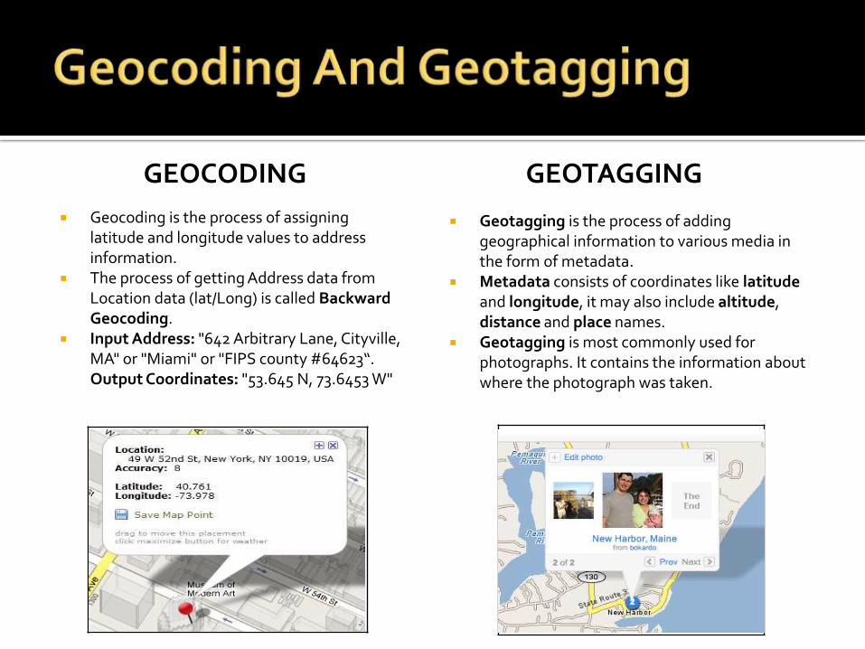
GEOTAGGING
Geocoding is the process of assigning latitude and longitude values to address information.
The process of getting Address data from Location data (lat/Long) is called Backward Geocoding.
Input Address: "642 Arbitrary Lane, Cityville, MA" or "Miami" or "FIPS county #64623“. Output Coordinates: "53.645 N, 73.6453 W"
GEOCODING
Geotagging is the process of adding geographical information to various media in the form of metadata.
Metadata consists of coordinates like latitudeand longitude, it may also include altitude, distance and place names.
Geotagging is most commonly used for photographs. It contains the information about where the photograph was taken.

Geocoding is the conversion of a human-readable location name into a machine-
processable location such as latitude and longitude.
Once a latitude and longitude coordinates is assigned the geocoded address can be
displayed on a map or used in geographic search.
Reverse Geocoding is the ability to find an associated textual location , like a street
address or business name from latitude and longitude coordinates.
Output:4383 Apple Ct Boulder CO 80301-1745-105.248599, 40.054337
Input:4383 Apple Boulder CO 80303
Geocoding
Reverse Geocoding

Geocoding allow operational spatial decisions to be made:
Where is the Customer? Nearest to which Cell Tower?
What is this point inside/close to?
What is the value/Risk/Danger?
Delivers Answers to Critical Business needs.
Facebook Check In:
Facebook Can use reverse geocoding to auto populate place address field during Check In.
Pictures, Status updates and other timeline events have location tags available.
Spatial ProcessingGeocodingBusiness Decision

An address is a collection of information that describes the location of buildings, apartment,
plot or other structure.
Address are two types:
Relative Address: Such As Across the Street, behind the landmark etc.
Absolute Address: Actual address that contain house no, street name, locality, town, state
and other address Components.
Components of address are house number/ Apartment number, Apartment Name, Street
number, Street Name, Zip Code and political boundary.
There is no globally applicable address format exist that works internationally.

Australia:[FLOOR] [/] [APARTMENT] HOUSE_NUMBER STREET_NAME STREET_TYPELOCALITY PROVINCE_ABBREVIATION POSTAL_CODEAUSTRALIA
Canada:[UNIT_NUMBER]-CIVIC_NUMBER [STREET_NUMBER] [STREET_TYPE] STREET_NAME [STREET_DIRECTION]LOCALITY PROVINCE_ABBREVIATION POSTAL_CODECANADA
Cameroon:STREET_NAME [HOUSE_NUMBER]LOCALITYCAMEROON
China:[BUILDING] [APARTMENT][HOUSE_NUMBER STREET,] [DOUBLE_DEPENDENT_LOCALITY,] [DEPENDENT_LOCALITY,] [LOCALITY]POSTAL_CODE PROVINCE
India:
[HOUSE_NUMBER] [STREET_NAME][DEPENDENT_LOCALITY] [, DOUBLE_DEPENDENT_LOCALITY]LOCALITY - POSTAL_CODEINDIA
United States:HOUSE_NUMBER STREET_NAME [STREET_TYPE] [STREET_DIRECTION] [BUILDING] [FLOOR] [APARTMENT]LOCALITY PROVINCE_ABBREVIATION POSTAL_CODEUNITED STATES
United Kingdom:[FLOOR] [APARTMENT][BUILDING][HOUSE_NUMBER] STREET_NAME [DEPENDENT_LOCALITY]LOCALITYPOSTAL_CODEUNITED KINGDOM
France:[APARTMENT] [BUILDING]HOUSE_NUMBER [STREET_TYPE] STREET_NAME [DEPENDENT_LOCALITY]POSTAL_CODE LOCALITYFRANCE
Turkey:STREET_NAME STREET TYPE [DEPENDENT_STREET STREET_TYPE] [BUILDING] [[No.] HOUSE_NUMBER [/APARTMENT]POSTAL_CODE [ADMINISTRATIVE_DISTRICT /] LOCALITY / PROVINCETURKEY

Google Maps
Yahoo Maps
Bing Maps
ArcGIS
Geocoder.us
MapMarker
Global Locator
Address Doctor
LOQATE

Zip Code Area
Street level Geocoding
----------------------------------------------------------------------
Point level Geocoding Address Point Interpolation
Zip+4 level Geocoding(6+4 Digits)
Zip Level Geocoding(6 Digits)Zip+4 Area

Point level geocoding:
• Address is matched to the location of the
Building Rooftop
GPS front Door
Parcel Centroid
• Point level geocoding is more accurate than Street level Geocoding.
Street Level Geocoding:
• Address is matched against a street segment address range.
Zip Code Level Geocoding:
• Zip code level geocoding returns the centroid of the passed Zip code area.
Zip+4 Code Level Geocoding:
• Zip+4 is the sub division of zip code.

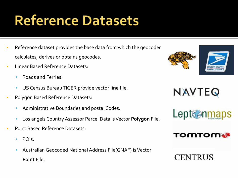
Reference dataset provides the base data from which the geocoder
calculates, derives or obtains geocodes.
Linear Based Reference Datasets:
Roads and Ferries.
US Census Bureau TIGER provide vector line file.
Polygon Based Reference Datasets:
Administrative Boundaries and postal Codes.
Los angels Country Assessor Parcel Data is Vector Polygon File.
Point Based Reference Datasets:
POIs.
Australian Geocoded National Address File(GNAF) is Vector
Point File.
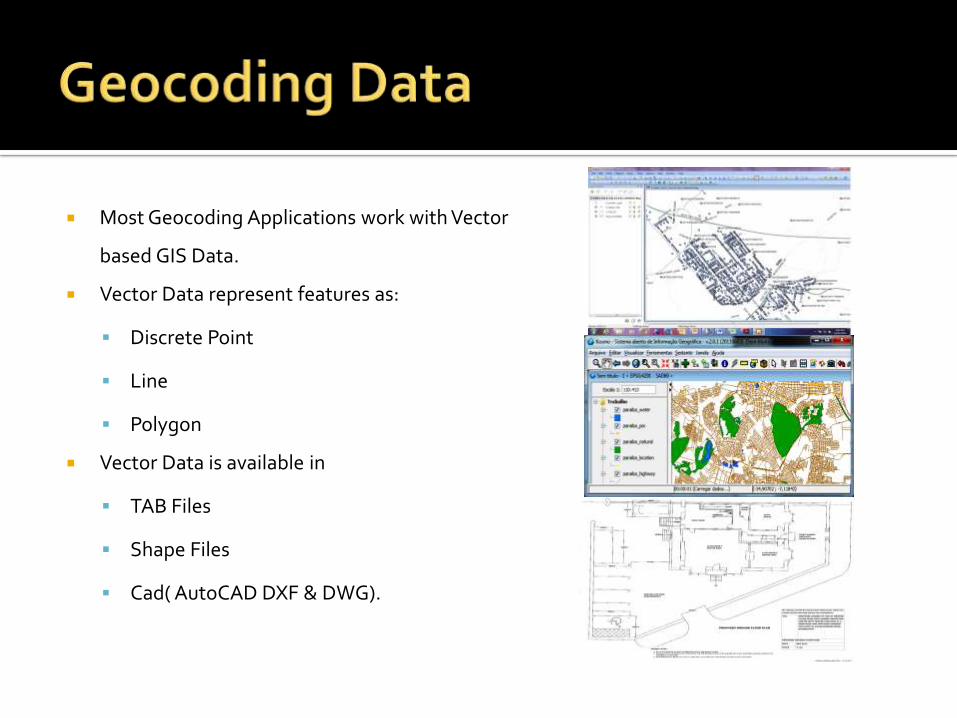
Most Geocoding Applications work with Vector
based GIS Data.
Vector Data represent features as:
Discrete Point
Line
Polygon
Vector Data is available in
TAB Files
Shape Files
Cad( AutoCAD DXF & DWG).

A database system that is used to store and query spatial objects:
Point: a hotel, a car
Line: a road segment
Polygon: landmarks
Spatial databases can perform a wide variety of spatial operations.

Optimizing spatial databases means
optimizing the queries, which requires less
time spent by running the queries before
receiving an answer.
Spatial Indexing is used to decrease the
number of searches.
Appropriate Indexes can reduce the Response
time.
Oracle Spatial uses two types of indexing: R-
Tree and Quad Tree.

R-Tree
Quad Tree
K-D Trees
K-D-B Trees
Grid Index
Z-order
Octree
UB-Tree
M-Tree
HTM
Geohashes

Objects(Point, Line and Polygon) are
grouped using the MBR(Minimum
Bounding Rectangle).
Objects are added to an MBR with an
INDEX .It index geometries in two or
more dimensions.
R-tree are more suitable for nearest
neighbor search.
Basic Spatial Operations are performed
much faster using an R-Tree indexing
types.
R1 R2
R3 R4 R5 R6 R7
R8 R9 R10 R11 R12 R13 R14 R15 R16 R17
R7
R6
R2
R1
R17
R16
R14
R15
R8 R1
0
R3
R9
R4
R5
R12
R13
R11
Desired Region

0 1
2 3
10 11
12 13132
Desired Region
133
130 131
It divides rectangular 2D regions into
quadrants until we reach at a desired
granularity.
Quad Tree Indexes are preferable when there
is heavy updates activity to the Spatial
Column.
It can easily integrate into traditional
database.
Quad Tree has its advantages in terms of
more complex type of Queries.

Spatial Data Layer
Primary Filter: Spatial Index
Data SelectionSecondary
Filter: Spatial Functions
Result
Optional Filter

Geocoding Accuracy: To correctly identify a
location.
International Geocoding :
Address formats vary
order of the address is often different
Use of Native languages.
Use of Multiple Data Sets.
Sequential Processing
Inconsistent use of base maps and geocoding
services.


