Georeferencing with Paper Maps Map Basics
How to Georeference with Paper Maps Latitude and Longitude
Mathematically Error Calculator
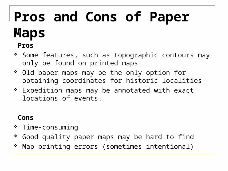
Pros and Cons of Paper Maps Pros Some features, such as topographic contours may only
be found on printed maps. Old paper maps may be the only option for obtaining
coordinates for historic localities Expedition maps may be annotated with exact locations
of events.
Cons Time-consuming Good quality paper maps may be hard to find Map printing errors (sometimes intentional)
Map of Canada’s Wonderland, N of Toronto, Canada

Map Basics
Projection (See Geographic Concepts)
Map Anatomy: Scale Grid Datum
Citing Map as Georeferencing Source
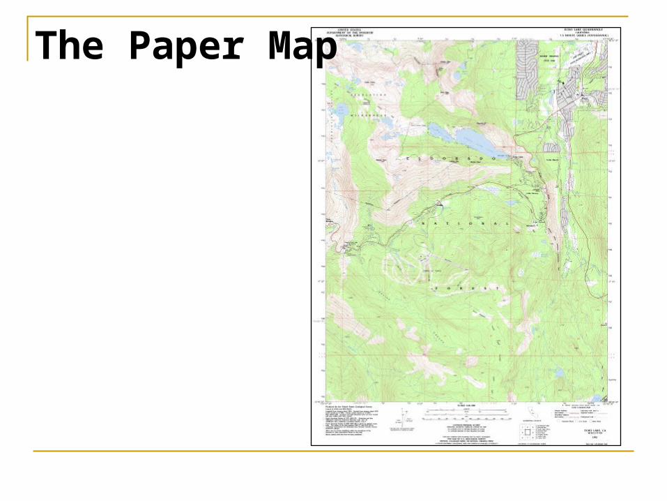
The Paper Map
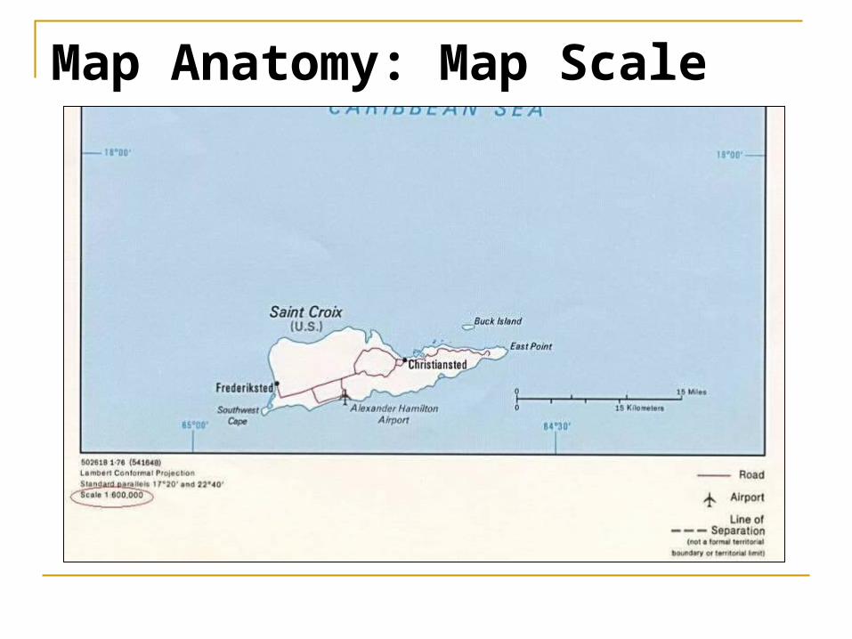
Map Anatomy: Map Scale
Map Anatomy: Map Scale
Usually recorded as a ratio, such as 1:100000, or a fraction, such as 1/100000
Large scale maps, such as 1/10000, show finer detail, less area
Small scale maps, such as 1/500000, show less detail, greater area
Think of large and small scale as how big the fraction is. Example 1/10000 > 1/500000
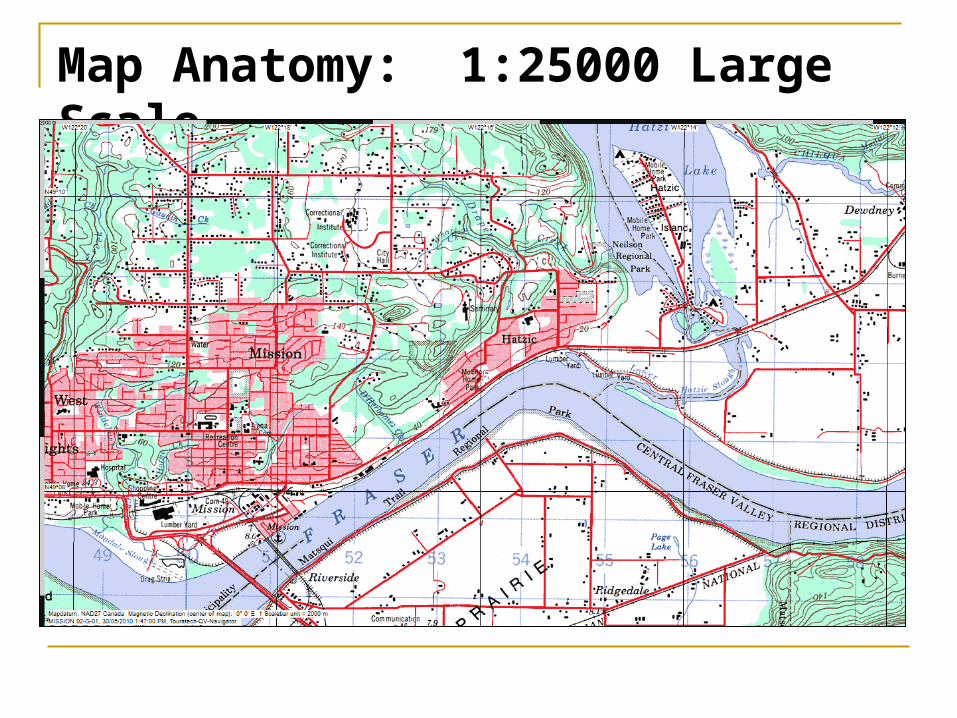
Map Anatomy: 1:25000 Large Scale
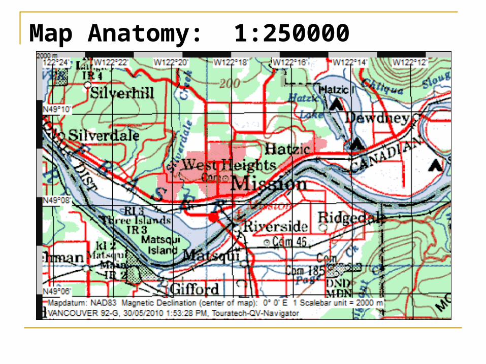
Map Anatomy: 1:250000
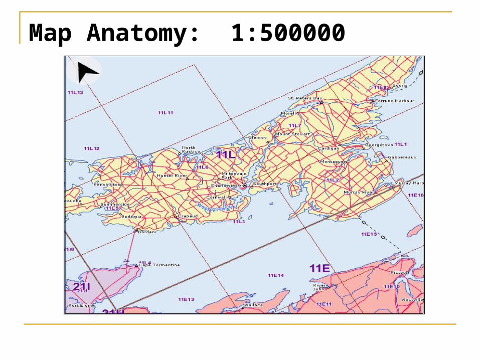
Map Anatomy: 1:500000
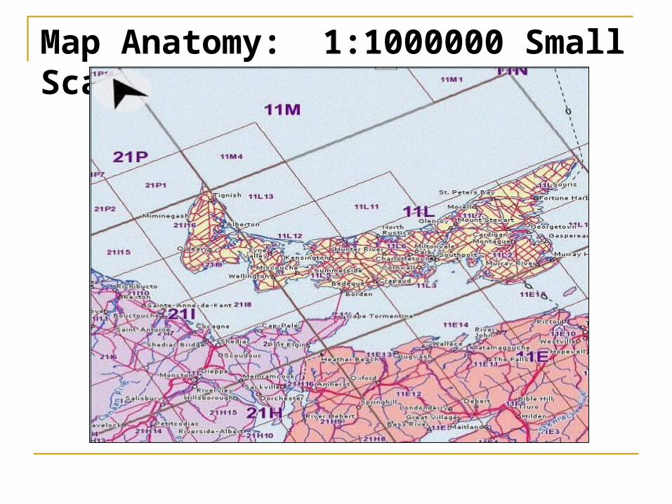
Map Anatomy: 1:1000000 Small Scale
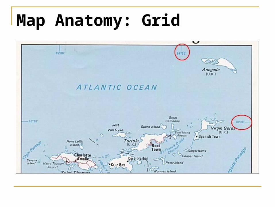
Map Anatomy: Grid
Map Anatomy: Grid
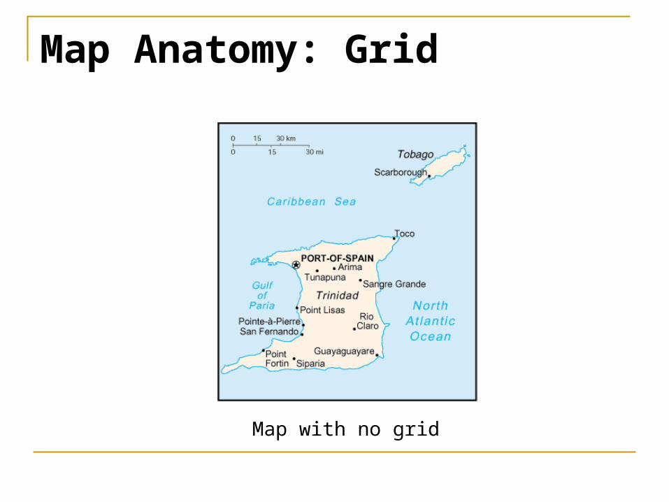
Map with no grid
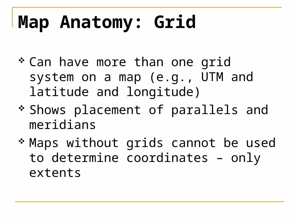
Map Anatomy: Grid
Can have more than one grid system on a map (e.g., UTM and latitude and longitude)
Shows placement of parallels and meridians
Maps without grids cannot be used to determine coordinates – only extents
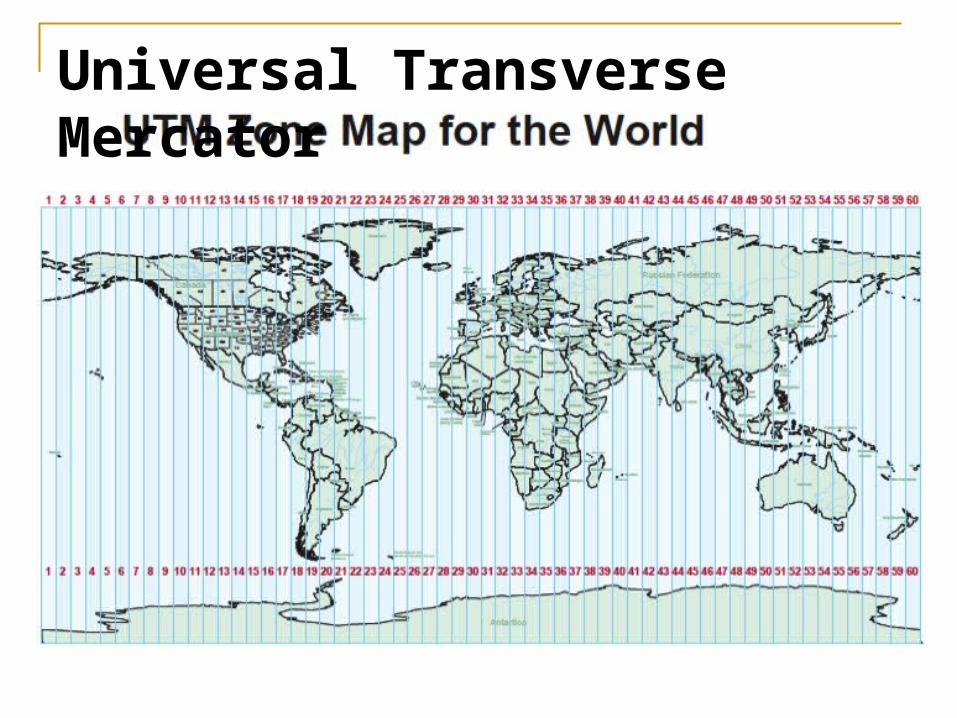
Universal Transverse Mercator
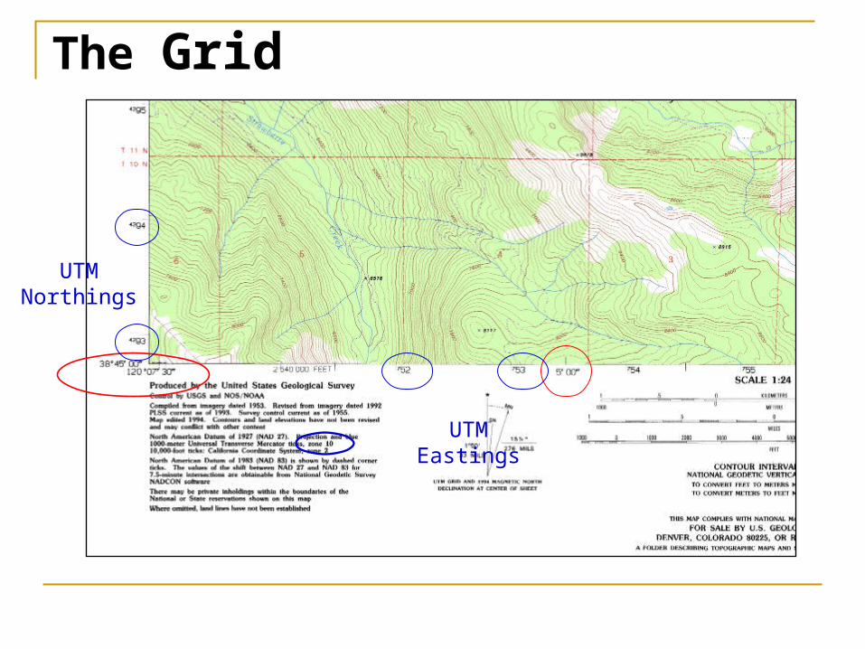
The Grid
UTMNorthings
UTMEastings
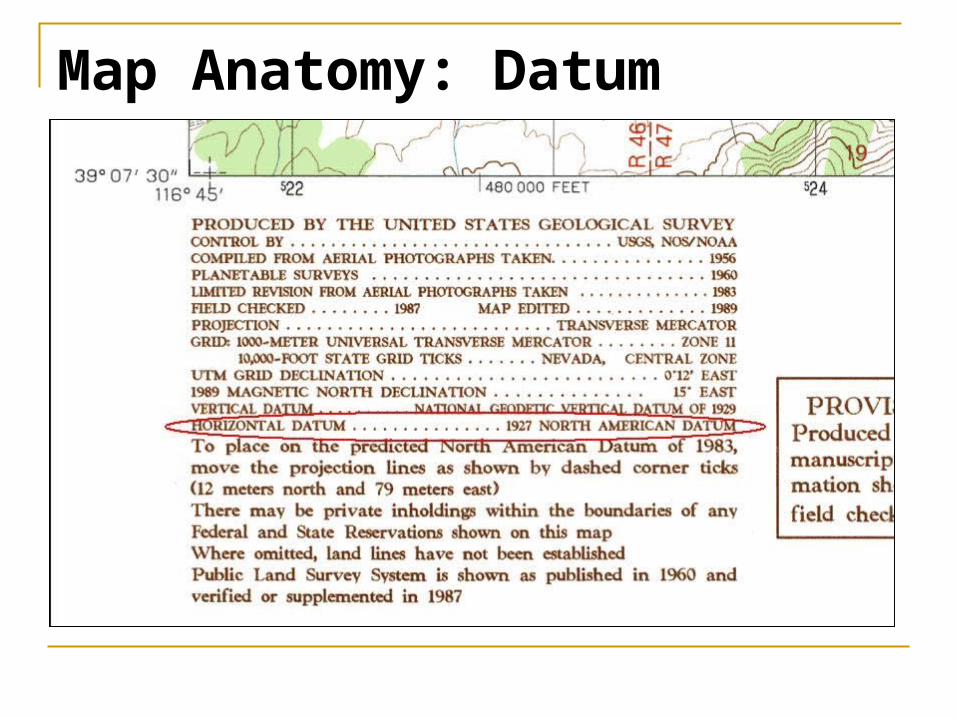
Map Anatomy: Datum
Map with no grid labeled

Map Anatomy: Datum
Usually found near the map scale or publisher’s name
Use Horizontal Datum, not Vertical Datum
If ellipsoid is given instead of a datum then one can choose a comparable datum using the pdf document found at http://earth-info.nga.mil/GandG/publications/tr8350.2/wgs84fin.pdf (Use Appendix B)
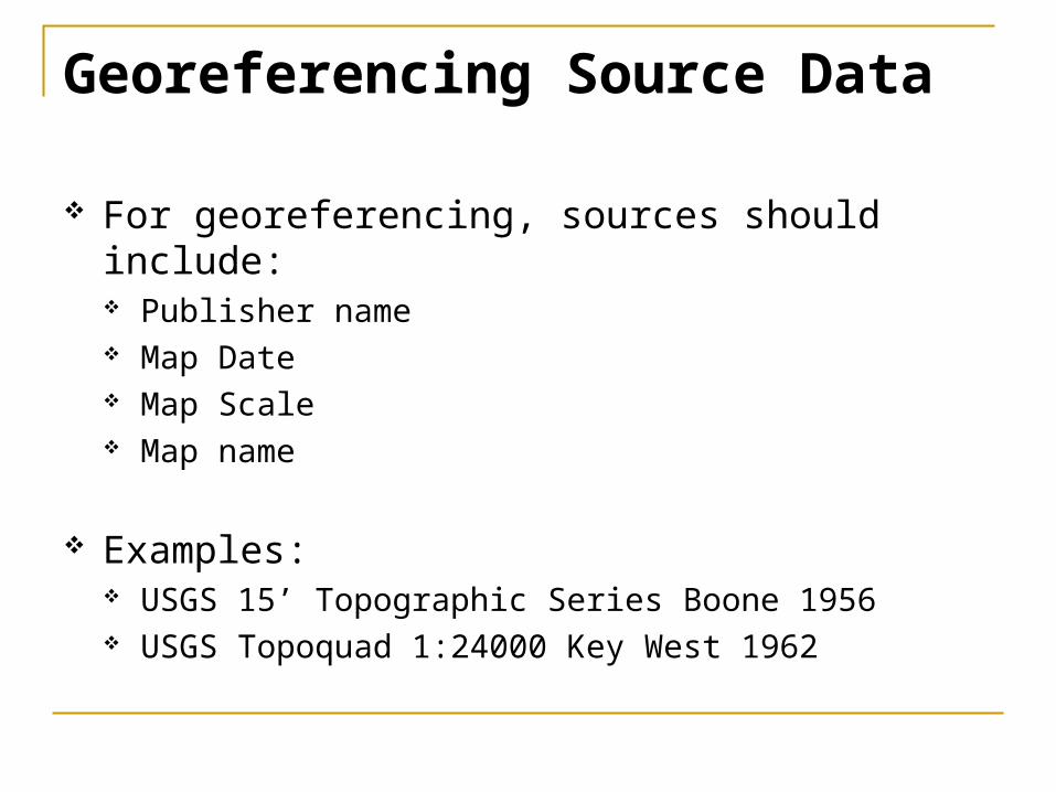
Georeferencing Source Data
For georeferencing, sources should include: Publisher name Map Date Map Scale Map name
Examples: USGS 15’ Topographic Series Boone 1956 USGS Topoquad 1:24000 Key West 1962
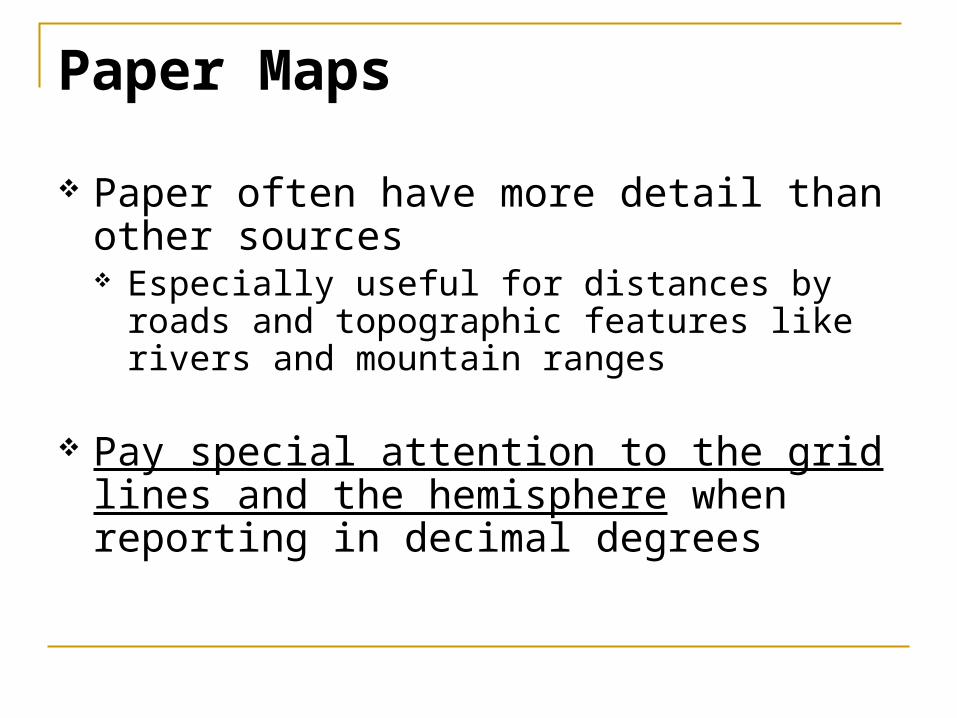
Paper Maps
Paper often have more detail than other sources Especially useful for distances by roads and
topographic features like rivers and mountain ranges
Pay special attention to the grid lines and the hemisphere when reporting in decimal degrees
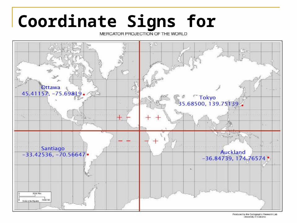
Coordinate Signs for Hemispheres
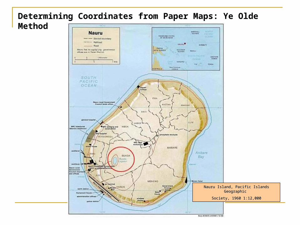
Determining Coordinates from Paper Maps: Ye Olde Method
Nauru Island, Pacific Islands Geographic Nauru Island, Pacific Islands Geographic
Society, 1960 1:12,000Society, 1960 1:12,000
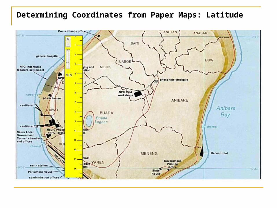
Determining Coordinates from Paper Maps: Latitude
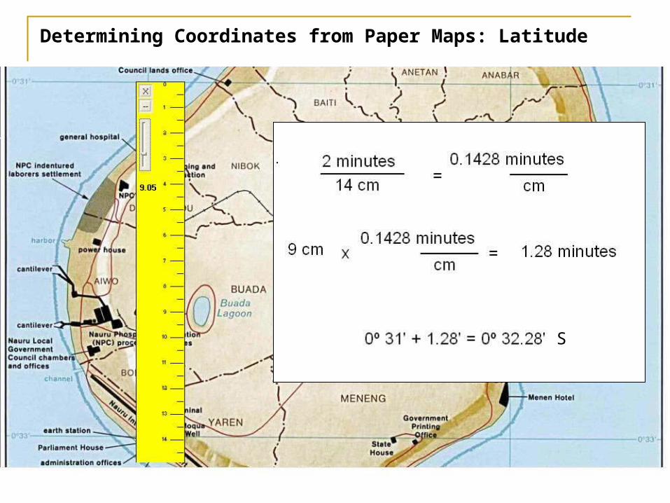
Determining Coordinates from Paper Maps: Latitude
S
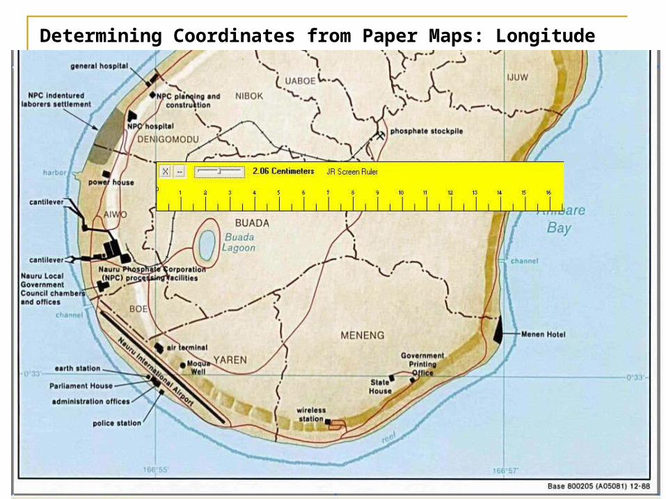
Determining Coordinates from Paper Maps: Longitude
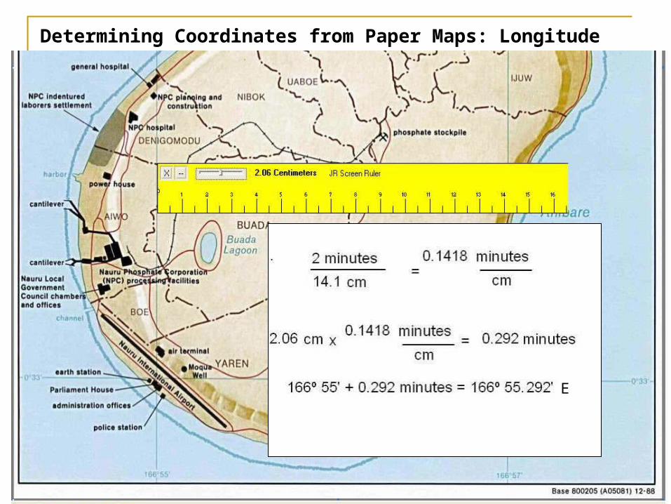
Determining Coordinates from Paper Maps: Longitude
E
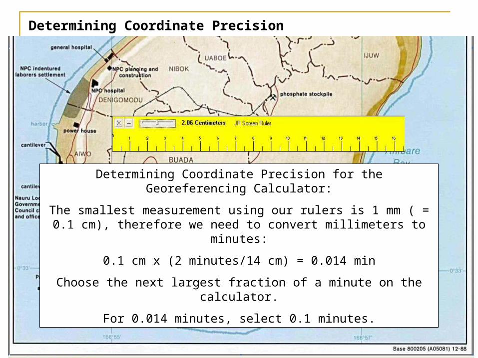
Determining Coordinate Precision
Determining Coordinate Precision for the Georeferencing Calculator:
The smallest measurement using our rulers is 1 mm ( = 0.1 cm), therefore we need to convert millimeters to minutes:
0.1 cm x (2 minutes/14 cm) = 0.014 min
Choose the next largest fraction of a minute on the calculator.
For 0.014 minutes, select 0.1 minutes.
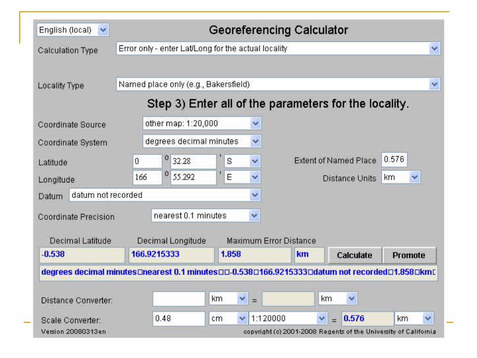
Determining Coordinates from Paper Maps: Error Calculation
Determining Coordinates from Paper Maps: The Georeferencing Calculator Method
Locality Description: Bebedero
We need:One set of known coordinatesMeasuring tool
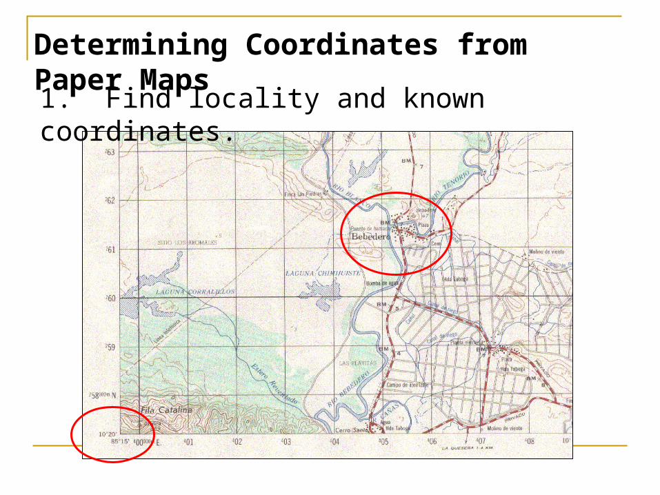
Determining Coordinates from Paper Maps1. Find locality and known coordinates.
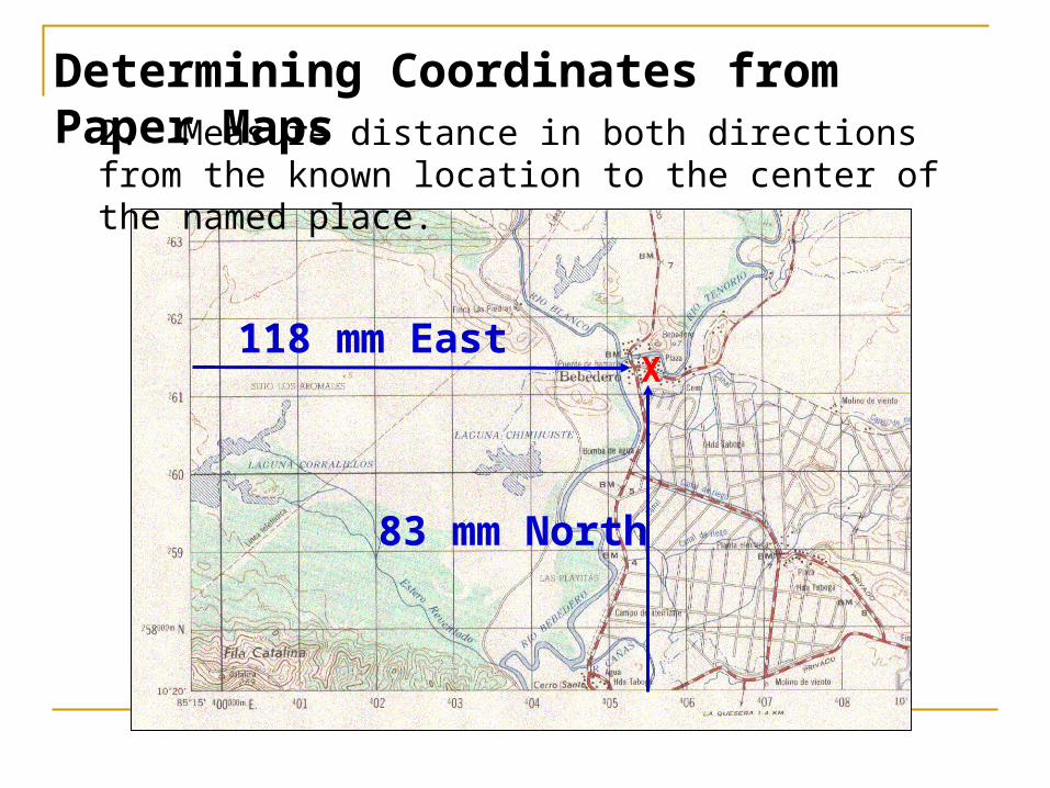
Determining Coordinates from Paper Maps2. Measure distance in both directions from the
known location to the center of the named place.
X118 mm East
83 mm North
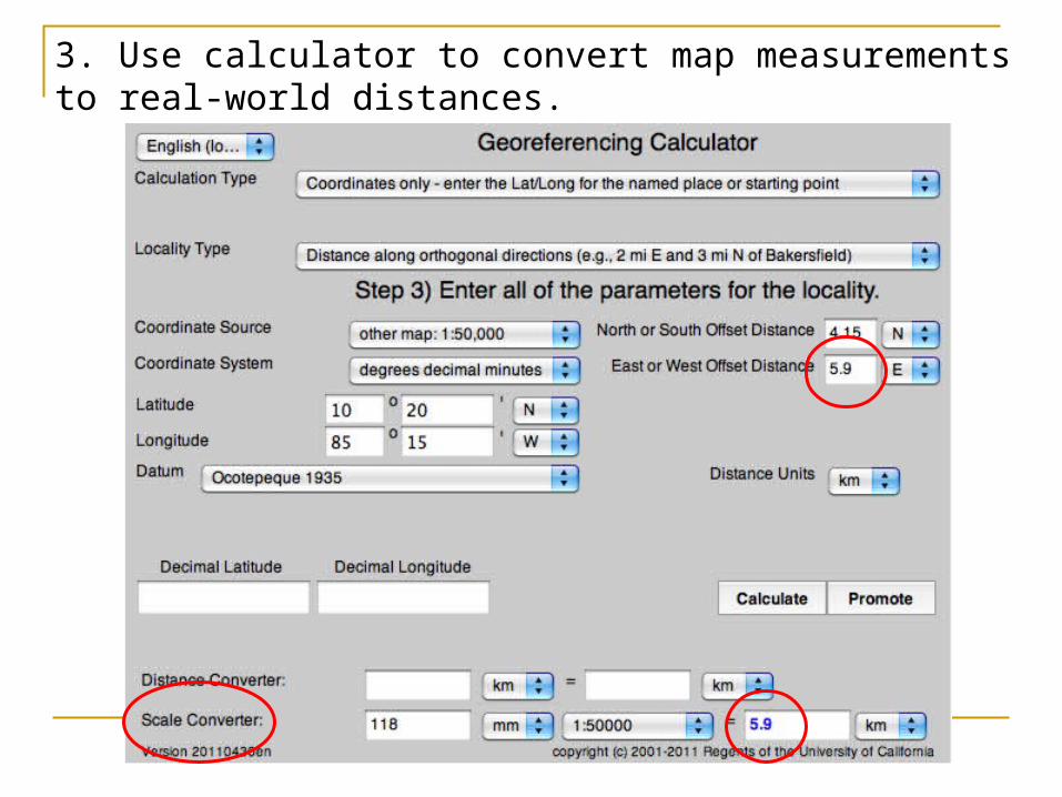
3. Use calculator to convert map measurements to real-world distances.
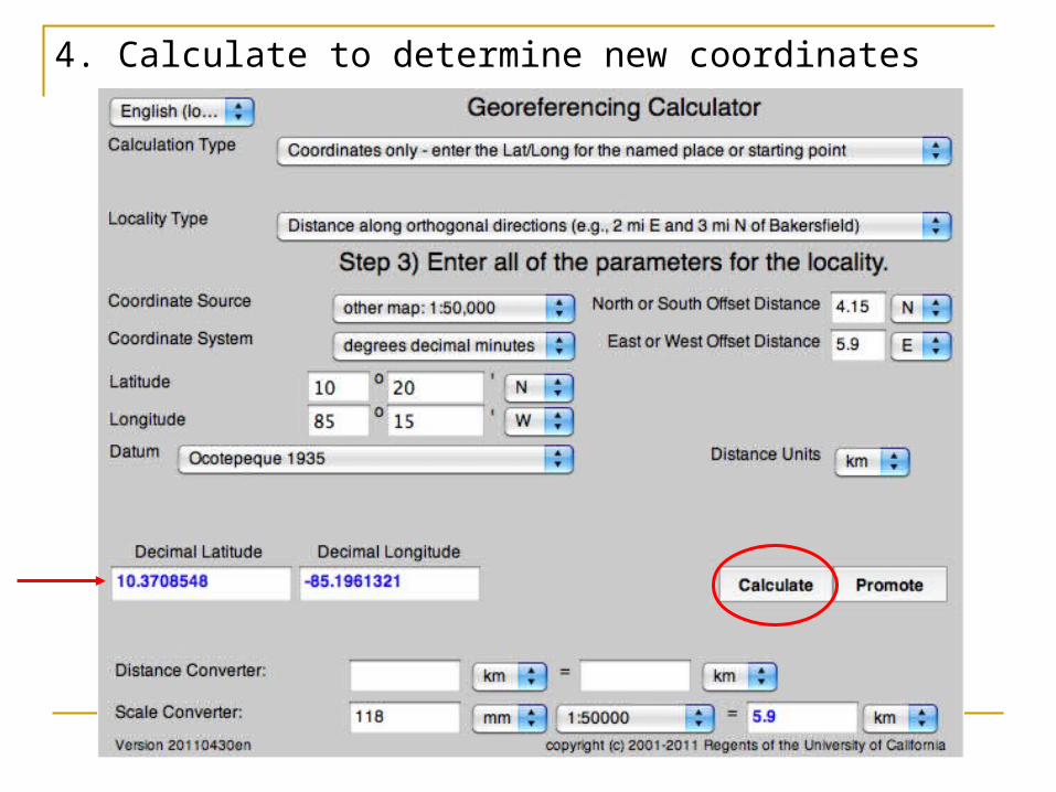
4. Calculate to determine new coordinates
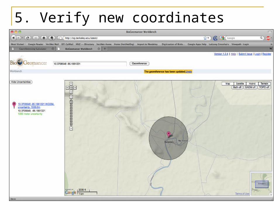
5. Verify new coordinates
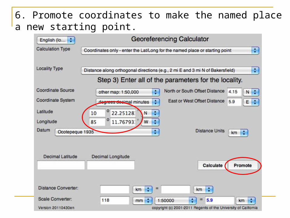
6. Promote coordinates to make the named place a new starting point.
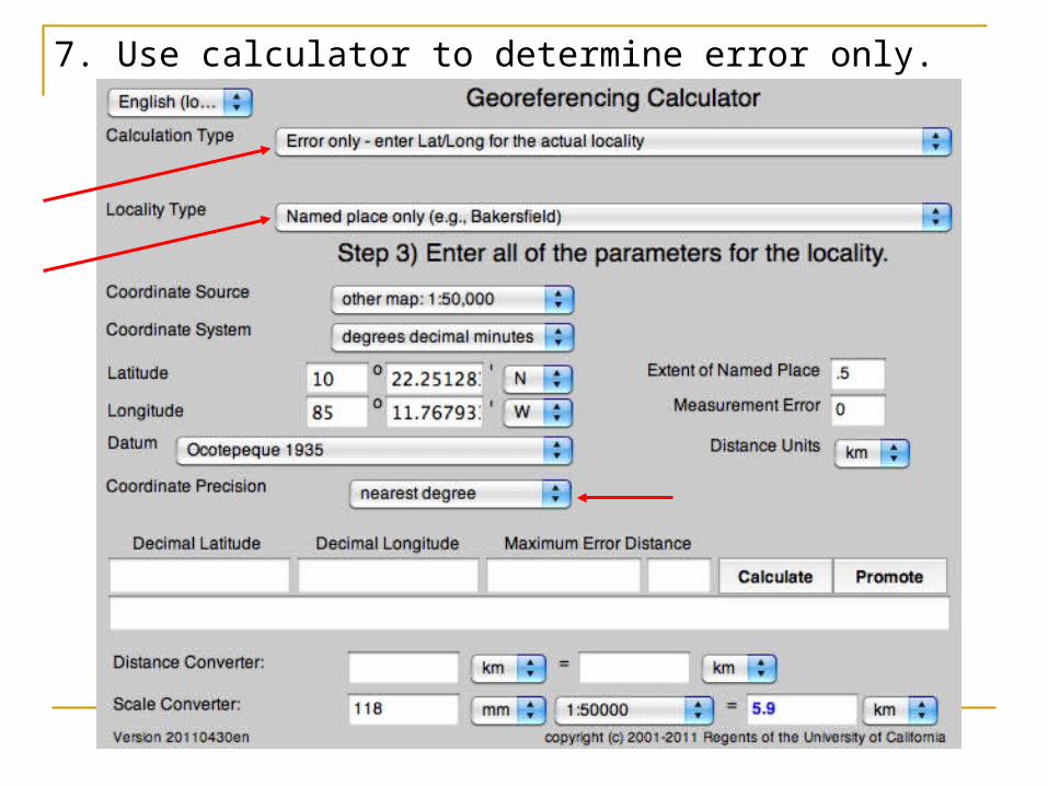
7. Use calculator to determine error only.
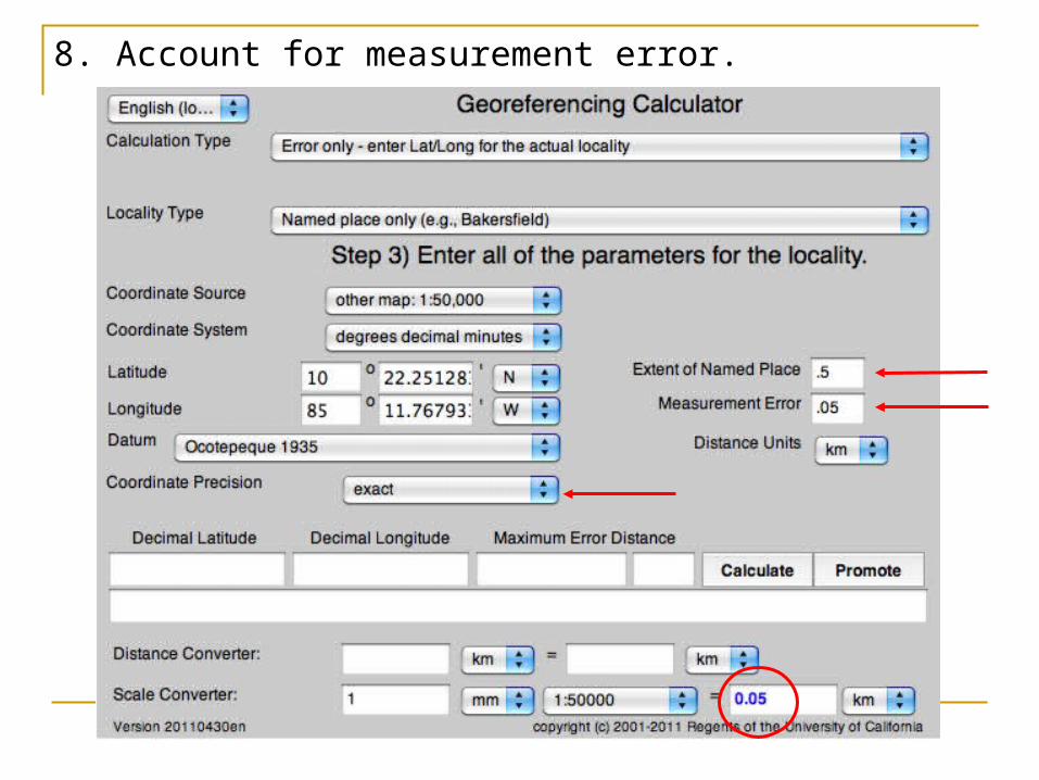
8. Account for measurement error.
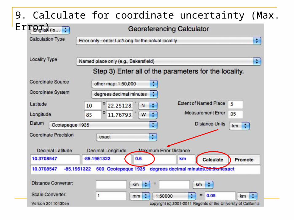
9. Calculate for coordinate uncertainty (Max. Error).
In ConclusionPay attention to cardinal directions and
hemispheresMeasure from the center to the edge of
the feature to get the extentPlot your coordinates to double check
your workExplain any decisions you had to make
in the georeferenceRemarks fieldExplain any errors in the locality
description in the locality errors field
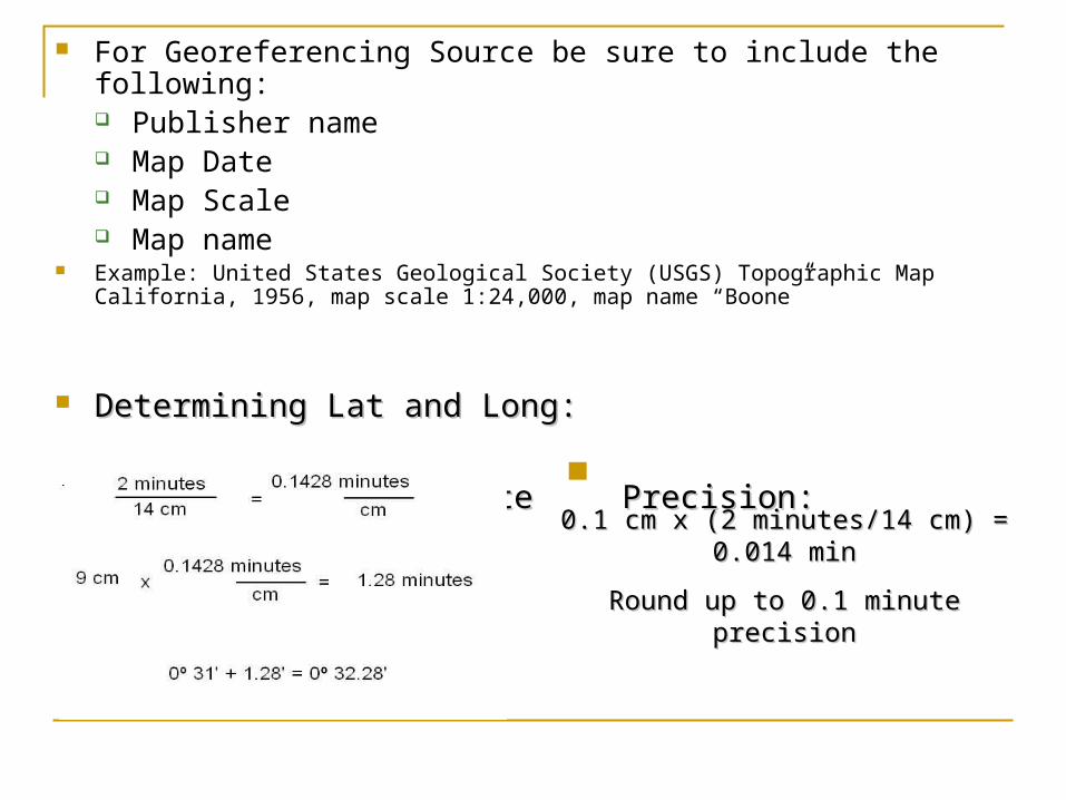
For Georeferencing Source be sure to include the following: Publisher name Map Date Map Scale Map name
Example: United States Geological Society (USGS) Topographic Map California, 1956, map scale 1:24,000, map name “Boone”
Determining Lat and Long:Determining Lat and Long:
Determining Coordinate Determining Coordinate Precision:Precision:
0.1 cm x (2 minutes/14 cm) = 0.014 min0.1 cm x (2 minutes/14 cm) = 0.014 min
Round up to 0.1 minute precisionRound up to 0.1 minute precision


