®®
Copyright Copyright ©© 2013 Open Geospatial Consortium 2013 Open Geospatial Consortium
Geospatial Standards & Interoperability:Geospatial Standards & Interoperability:
A necessary foundation for better understanding A necessary foundation for better understanding of climate change and risk reductionof climate change and risk reduction
Nadine Alameh, Ph.D.Open Geospatial Consortium (OGC)
Executive Director, OGC Interoperability [email protected]
August 21, 2013
OGC®
OutlineOutline
• Value of location information
• Value of interoperability in a heterogeneous world
• OGC for geospatial standards development and promotion
• Examples of how geospatial standards can help
• Concluding remarks
Copyright © 2013Open Geospatial Consortium
OGC®
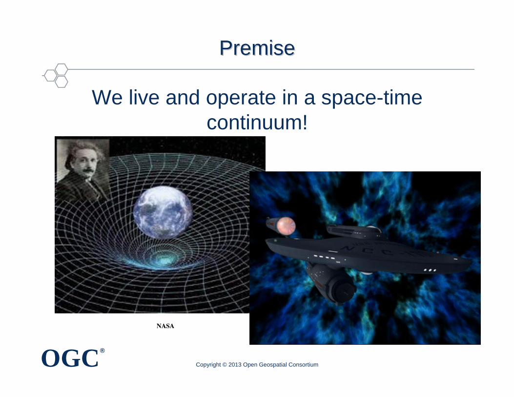
PremisePremise
We live and operate in a space-time continuum!
Copyright © 2013 Open Geospatial Consortium
NASA
OGC®
PremisePremise
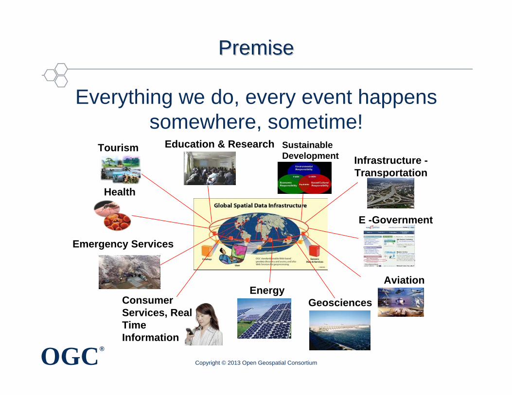
Everything we do, every event happens somewhere, sometime!
Copyright © 2013 Open Geospatial Consortium
Health
Education & Research Sustainable Development
EnergyConsumer Services, Real Time Information
Geosciences
E -Government
Infrastructure -Transportation
Aviation
Tourism
Emergency Services
OGC®
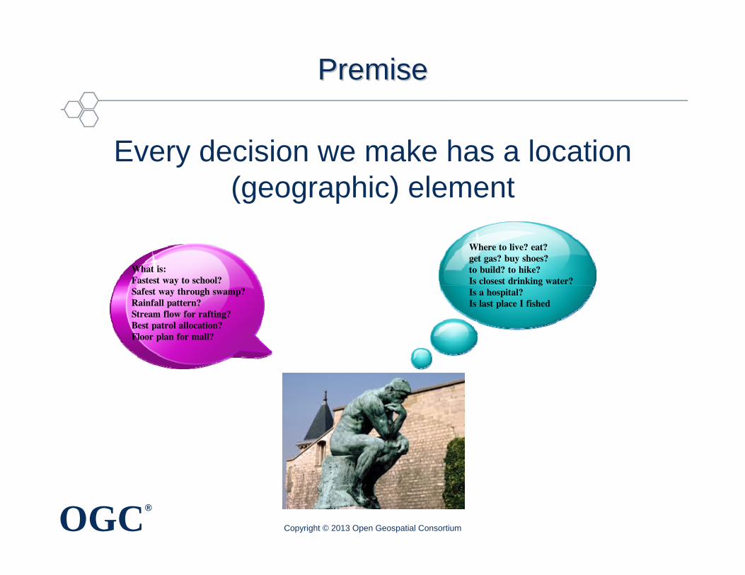
PremisePremise
Every decision we make has a location (geographic) element
Copyright © 2013 Open Geospatial Consortium
Where to live? eat?get gas? buy shoes? to build? to hike? Is closest drinking water?Is a hospital? Is last place I fished
What is:Fastest way to school?Safest way through swamp?Rainfall pattern?Stream flow for rafting?Best patrol allocation?Floor plan for mall?
OGC®
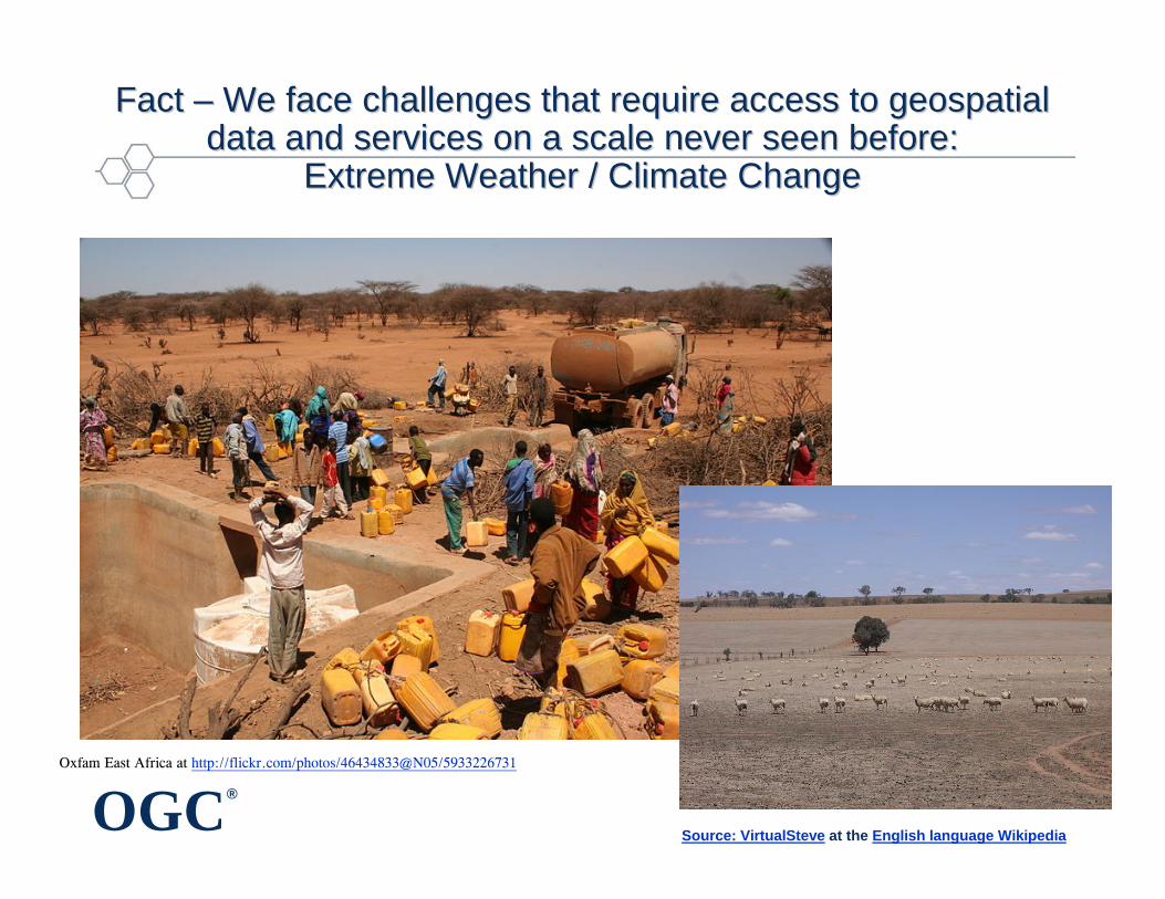
Fact Fact –– We face challenges that require access to geospatial We face challenges that require access to geospatial data and services on a scale never seen before:data and services on a scale never seen before:
Extreme Weather / Climate ChangeExtreme Weather / Climate Change
Source: VirtualSteve at the English language Wikipedia
Oxfam East Africa at http://flickr.com/photos/46434833@N05/5933226731
OGC®
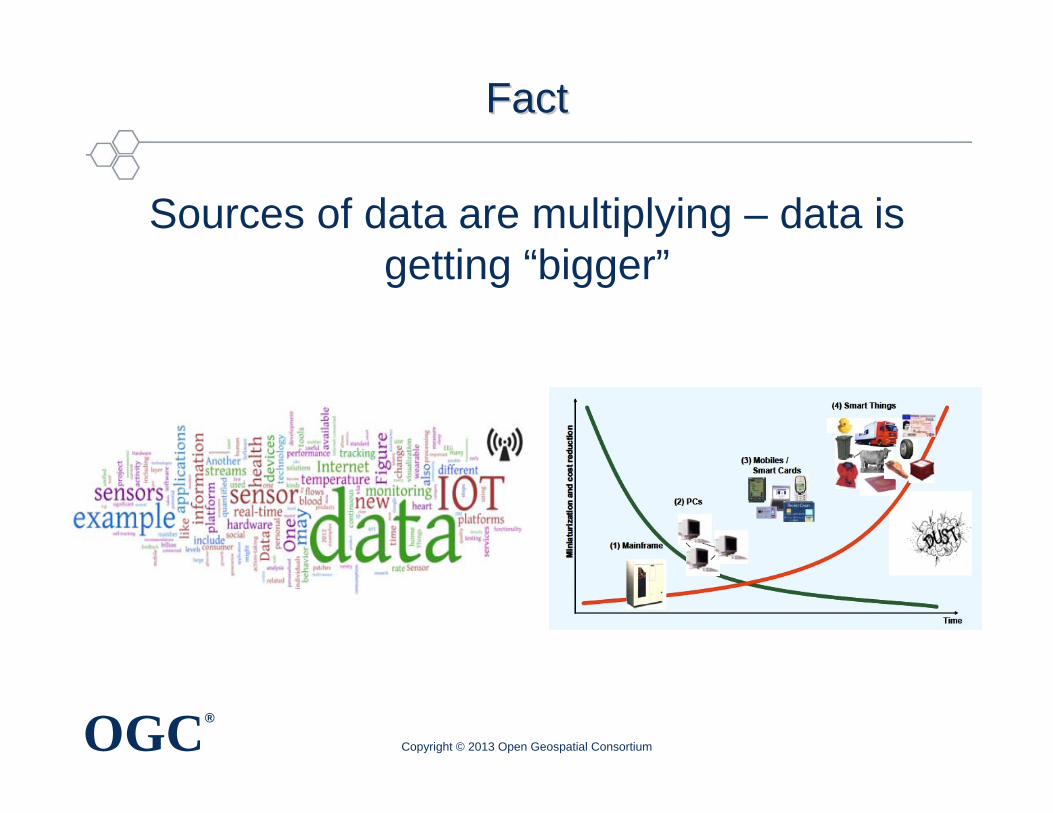
FactFact
Sources of data are multiplying – data is getting “bigger”
Copyright © 2013 Open Geospatial Consortium
OGC®
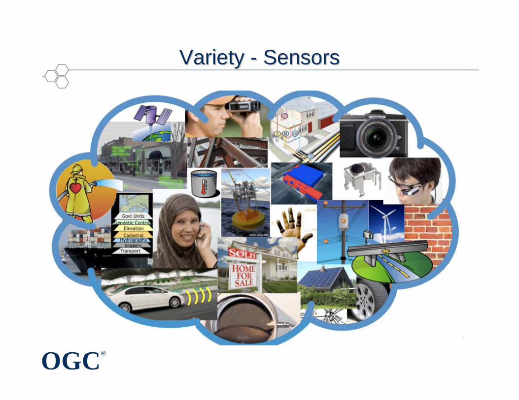
Variety Variety -- SensorsSensors
OGC®
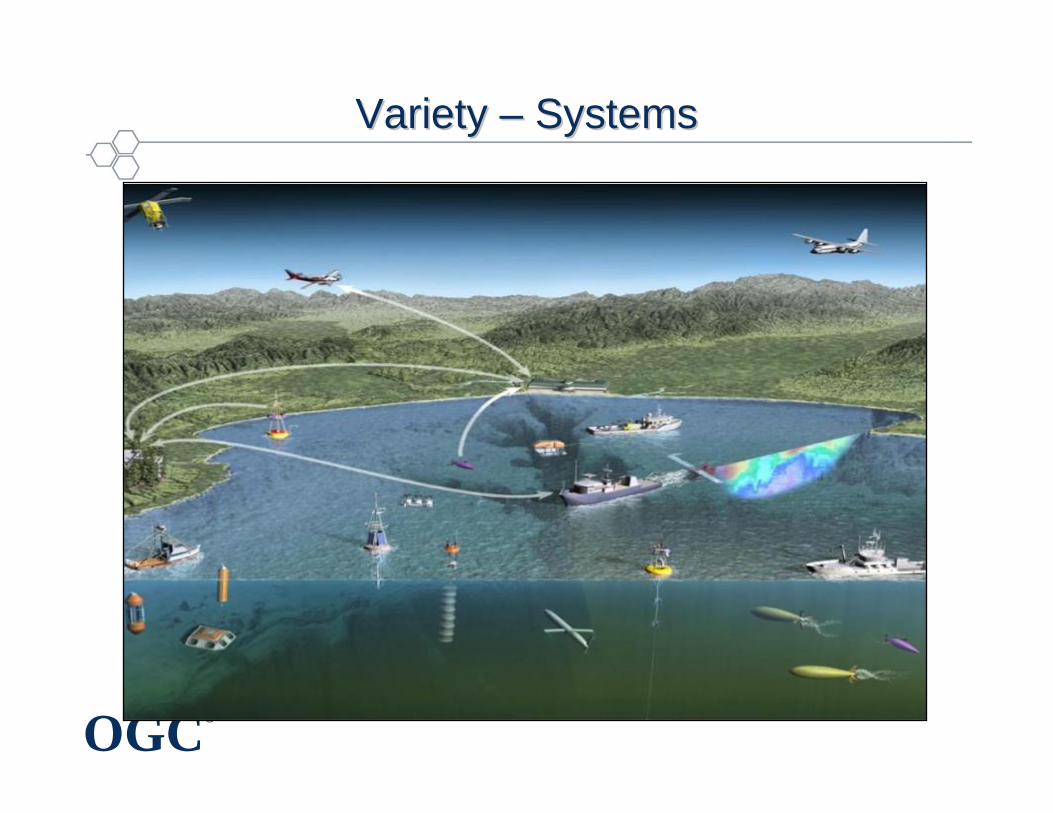
Variety Variety –– SystemsSystems
OGC®
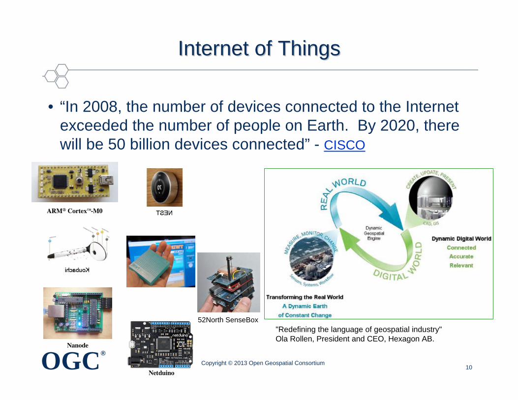
Internet of ThingsInternet of Things
• “In 2008, the number of devices connected to the Internet exceeded the number of people on Earth. By 2020, there will be 50 billion devices connected” - CISCO
10
"Redefining the language of geospatial industry"Ola Rollen, President and CEO, Hexagon AB.
ARM® Cortex™-M0
Nanode
Netduino
52North SenseBox
Copyright © 2013 Open Geospatial Consortium
OGC®
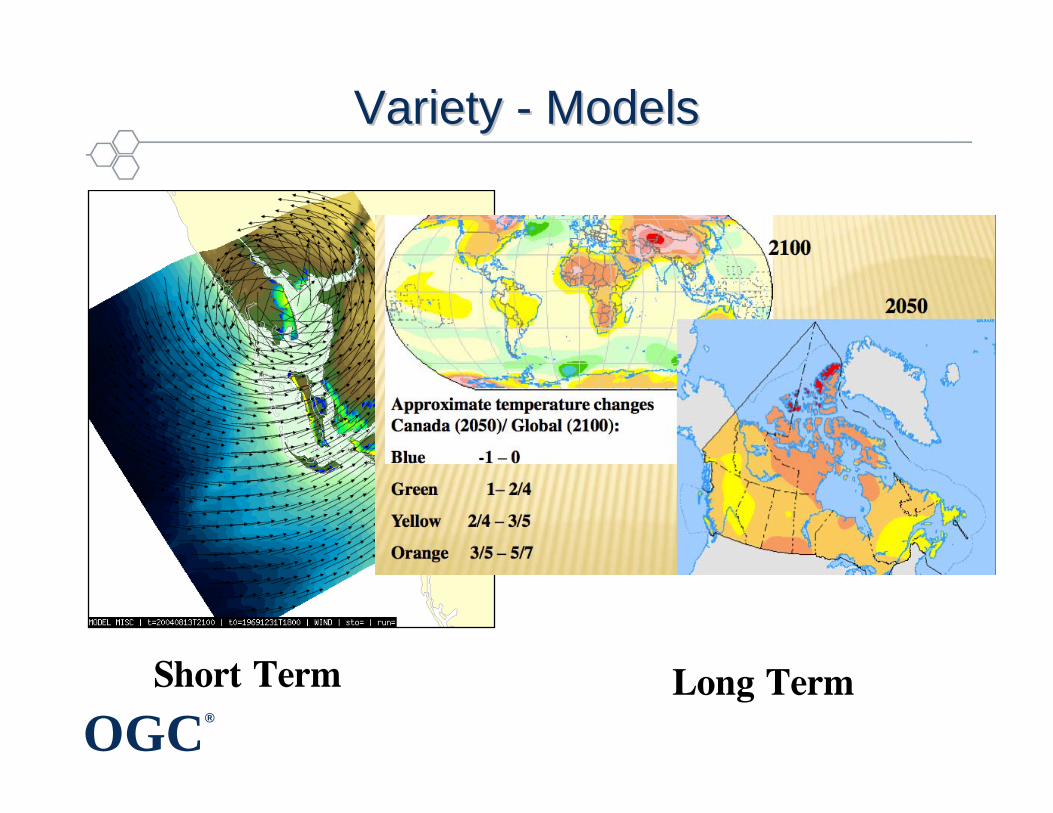
Variety Variety -- ModelsModels
Short Term Long Term
OGC®
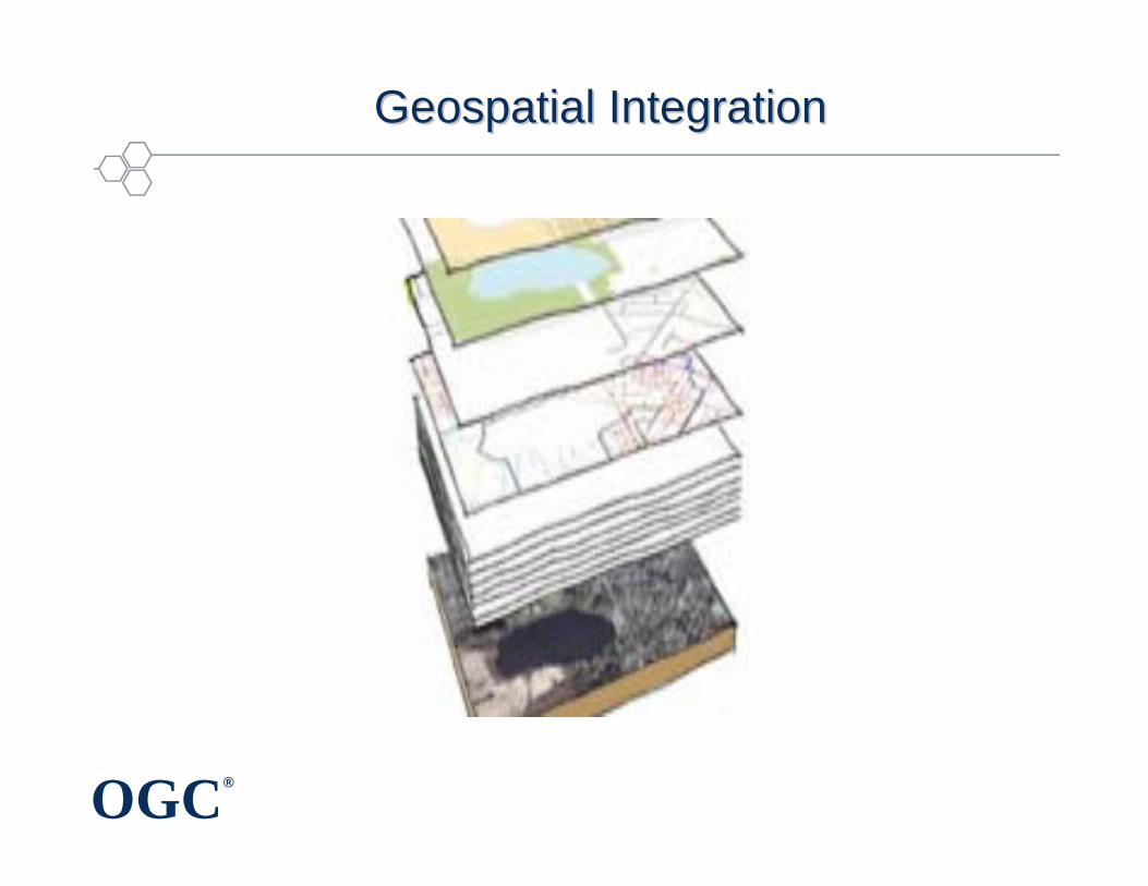
Geospatial IntegrationGeospatial Integration
OGC®
OutlineOutline
• Value of location information
• Value of interoperability in a heterogeneous world
• OGC for geospatial standards development and promotion
• Examples of how geospatial standards can help
• Concluding remarks
Copyright © 2013Open Geospatial Consortium
OGC®
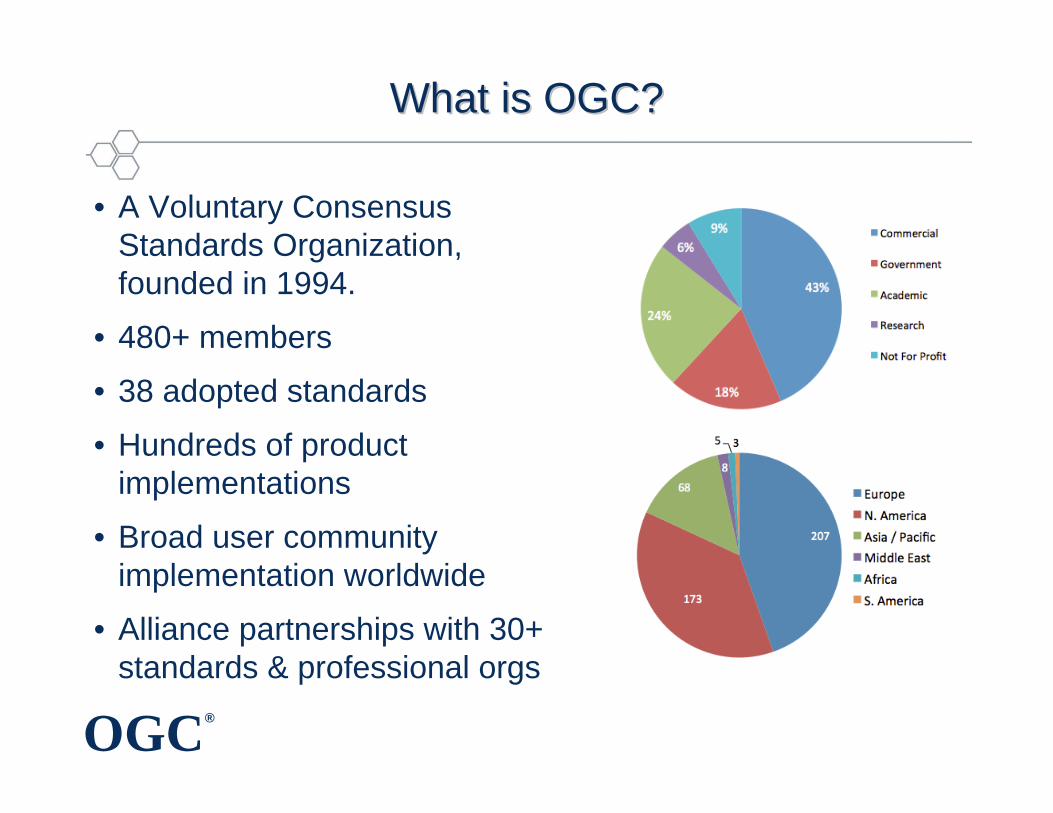
What is OGC? What is OGC?
• A Voluntary Consensus Standards Organization, founded in 1994.
• 480+ members
• 38 adopted standards
• Hundreds of product implementations
• Broad user community implementation worldwide
• Alliance partnerships with 30+ standards & professional orgs
OGC®
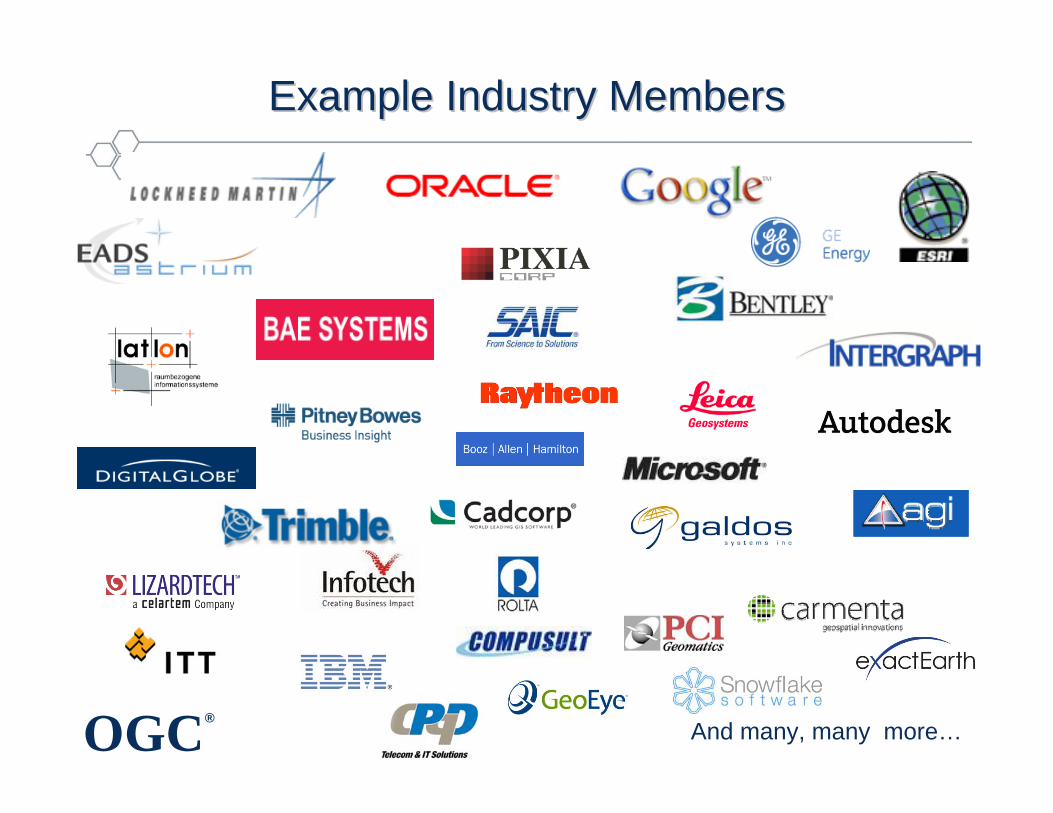
Example Industry MembersExample Industry Members
And many, many more…
OGC®
Example Government OrganizationsExample Government Organizations
• Arizona Geological Survey• US DHS• US EPA• US FAA• US NASA• USGS / FGDC• US NGA• US NOAA• Dept. of Land Conservation and Development
(Oregon, USA)• City of Vienna (Austria)• Oakridge National Lab• Natural Resources Canada• Quebec Dept. of Natural Resources (Canada)• Dept. Science & Technology (India)• Landgate (Western Australia) • Dept of Environment & Resource Mgt
(Queensland, Australia)• Wupperverband (NRW, Germany)
• DOD Australia• Geoscience Australia• Eurocontrol• European Environment Agency• European Satellite Centre• European Space Agency• EU Joint Research Centre• UK MOD• UK MET• METEO France• BRGM (France)• Ordnance Survey (UK)• State Land Agencies (Germany)• Ministry of Land Transport & Maritime Affairs
(MLTM)• GIS Center for Security (Abu Dhabi, UAE)
Abu Dhabi Systems & Info. Center• Dubai Municipality
OGC®
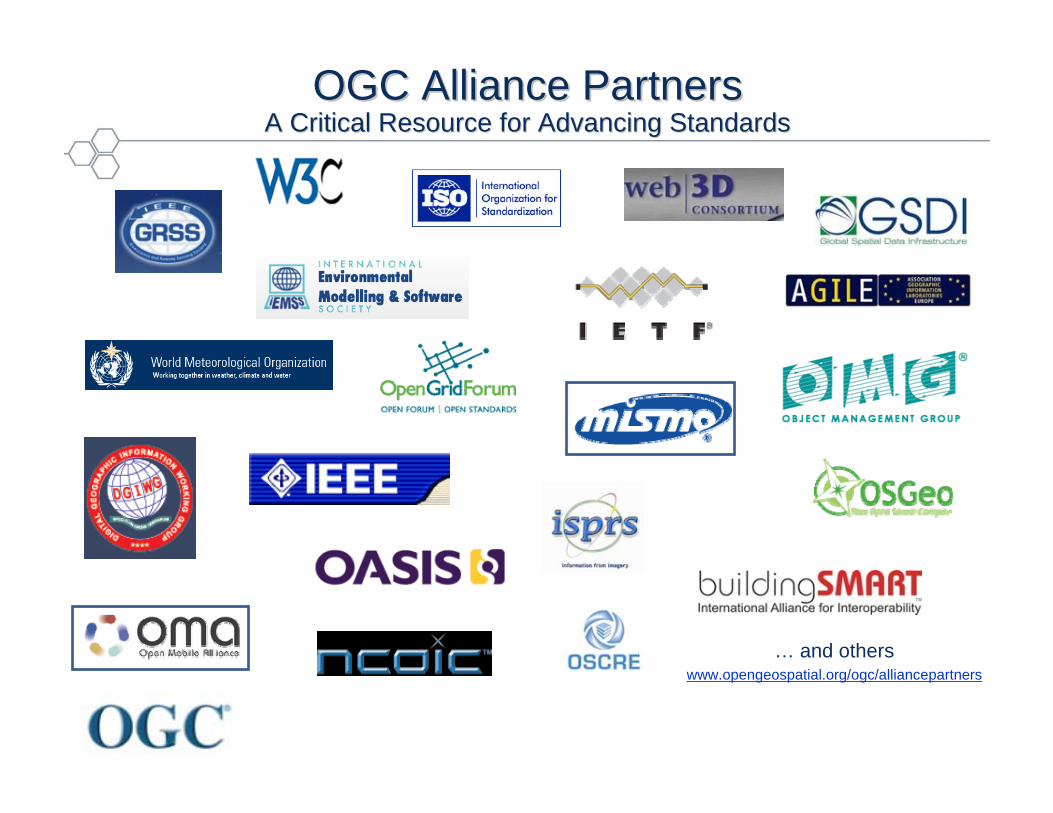
OGC Alliance Partners OGC Alliance Partners A Critical Resource for Advancing StandardsA Critical Resource for Advancing Standards
… and otherswww.opengeospatial.org/ogc/alliancepartners
OGC®
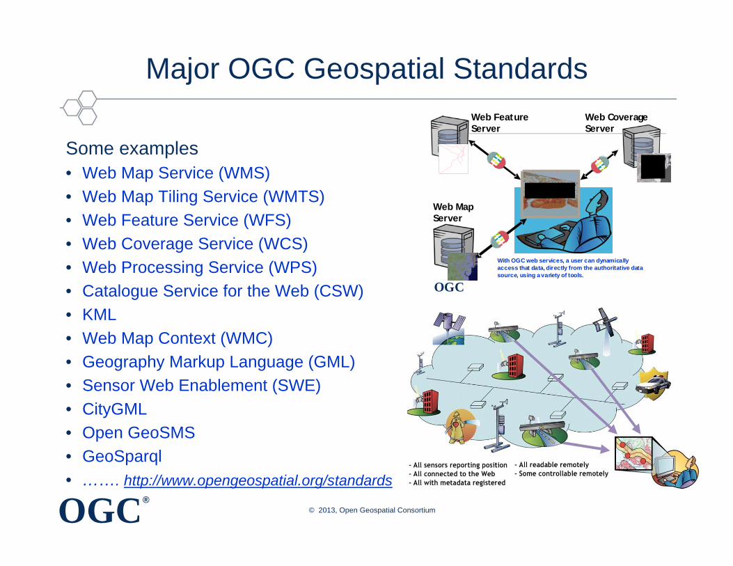
Major OGC Geospatial Standards
Some examples• Web Map Service (WMS)• Web Map Tiling Service (WMTS)• Web Feature Service (WFS)• Web Coverage Service (WCS)• Web Processing Service (WPS) • Catalogue Service for the Web (CSW)• KML• Web Map Context (WMC)• Geography Markup Language (GML)• Sensor Web Enablement (SWE)• CityGML• Open GeoSMS• GeoSparql• ……. http://www.opengeospatial.org/standards
OGC
Web MapServer
Web CoverageServer
Web FeatureServer
With OGC web services, a user can dynamically access that data, directly from the authoritative data source, using a variety of tools.
© 2013, Open Geospatial Consortium
OGC®
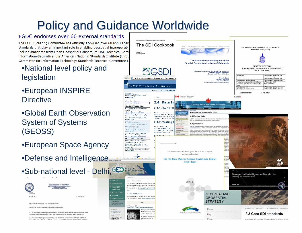
Policy and Guidance WorldwidePolicy and Guidance Worldwide
•National level policy and legislation
•European INSPIRE Directive
•Global Earth Observation System of Systems (GEOSS)
•European Space Agency
•Defense and Intelligence
•Sub-national level - Delhi, Abu Dhabi, Western Australia
© 2012, Open Geospatial Consortium
OGC®
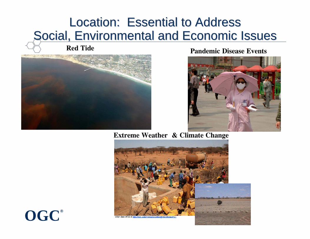
Location: Essential to AddressLocation: Essential to AddressSocial, Environmental and Economic IssuesSocial, Environmental and Economic Issues
Red Tide Pandemic Disease Events
Extreme Weather & Climate Change
OGC®
OutlineOutline
• Value of location information
• Value of interoperability in a heterogeneous world
• OGC for geospatial standards development and promotion
• Examples of how geospatial standards can help
• Concluding remarks
Copyright © 2013Open Geospatial Consortium

OGC®
Billions of sensorsBillions of sensors
© 2012, Open Geospatial Consortium
OGC®
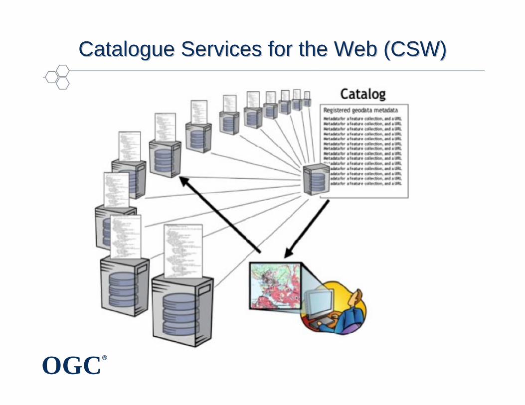
Catalogue Services for the Web (CSW)Catalogue Services for the Web (CSW)
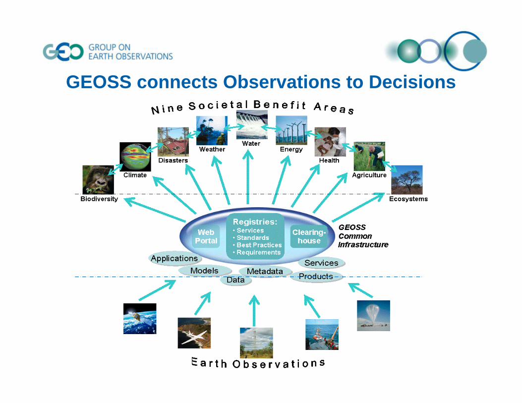
GEOSS connects Observations to Decisions
OGC®
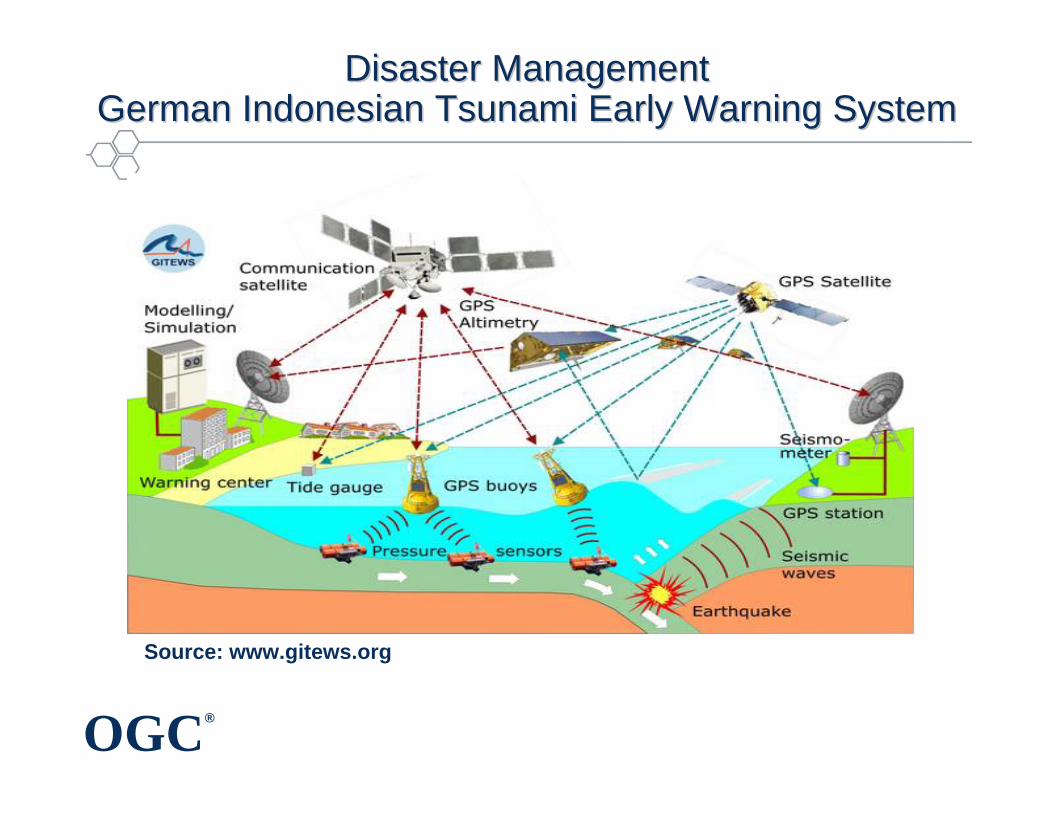
Disaster Management Disaster Management German Indonesian Tsunami Early Warning SystemGerman Indonesian Tsunami Early Warning System
Source: www.gitews.org
OGC®
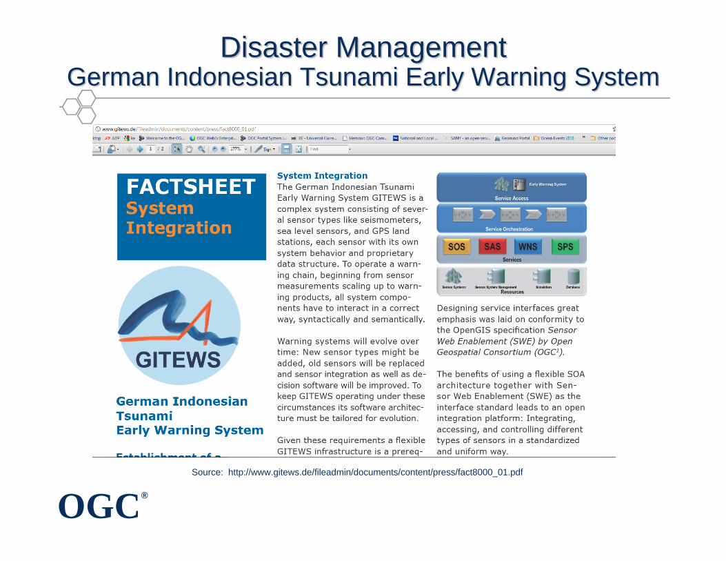
Disaster Management Disaster Management German Indonesian Tsunami Early Warning SystemGerman Indonesian Tsunami Early Warning System
Source: http://www.gitews.de/fileadmin/documents/content/press/fact8000_01.pdf
OGC®
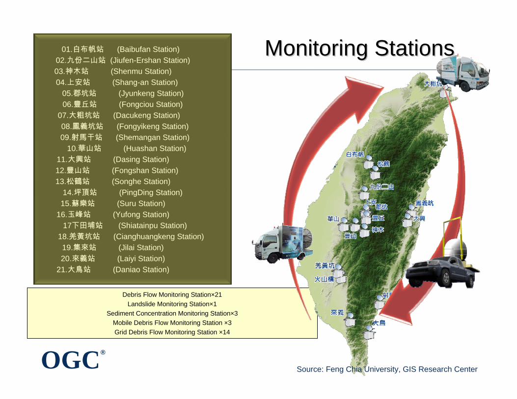
Monitoring StationsMonitoring Stations
Debris Flow Monitoring Station×21Landslide Monitoring Station×1
Sediment Concentration Monitoring Station×3Mobile Debris Flow Monitoring Station ×3Grid Debris Flow Monitoring Station ×14
01.白布帆站 (Baibufan Station)02.九份二山站 (Jiufen-Ershan Station)03.神木站 (Shenmu Station)04.上安站 (Shang-an Station)
05.郡坑站 (Jyunkeng Station)06.豐丘站 (Fongciou Station)
07.大粗坑站 (Dacukeng Station)08.鳳義坑站 (Fongyikeng Station)09.射馬干站 (Shemangan Station)
10.華山站 (Huashan Station)11.大興站 (Dasing Station)12.豐山站 (Fongshan Station)13.松鶴站 (Songhe Station)
14.坪頂站 (PingDing Station)15.蘇樂站 (Suru Station)
16.玉峰站 (Yufong Station)17下田埔站 (Shiatainpu Station)
18.羌黃坑站 (Cianghuangkeng Station)19.集來站 (Jilai Station)20.來義站 (Laiyi Station)
21.大鳥站 (Daniao Station)
Source: Feng Chia University, GIS Research Center
OGC®
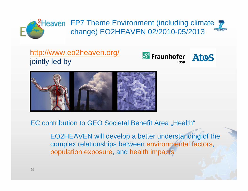
FP7 Theme Environment (including climate change) EO2HEAVEN 02/2010-05/2013
29
EO2HEAVEN will develop a better understanding of the complex relationships between environmental factors, population exposure, and health impacts
EC contribution to GEO Societal Benefit Area „Health“
http://www.eo2heaven.org/jointly led by
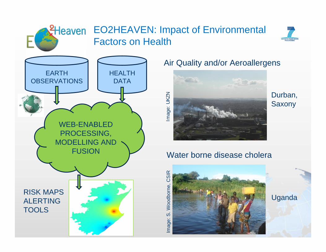
EO2HEAVEN: Impact of Environmental Factors on Health
Water borne disease choleraIm
age:
S. W
oodb
orne
, CS
IR
Air Quality and/or Aeroallergens
Imag
e: U
KZN Durban,
Saxony
Uganda
HEALTH DATA
EARTH OBSERVATIONS
WEB-ENABLED PROCESSING,
MODELLING AND FUSION
RISK MAPSALERTING TOOLS
OGC®
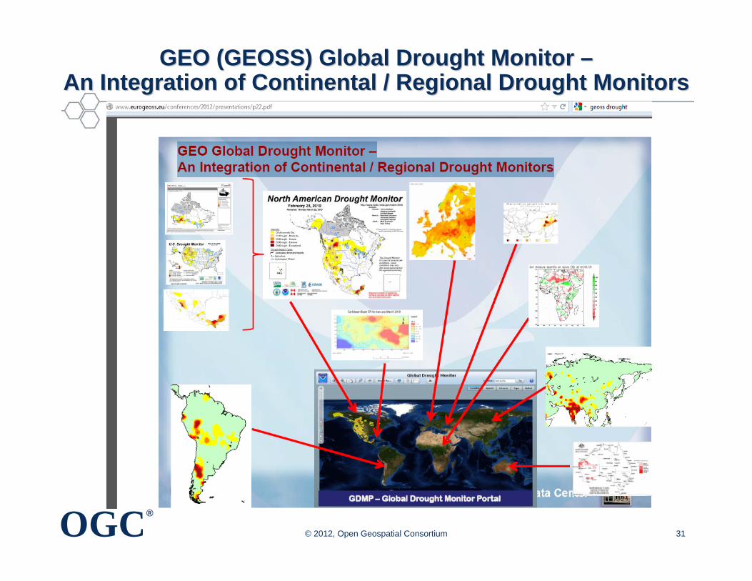
GEO (GEOSS) Global Drought Monitor GEO (GEOSS) Global Drought Monitor ––An Integration of Continental / Regional Drought MonitorsAn Integration of Continental / Regional Drought Monitors
© 2012, Open Geospatial Consortium 31
OGC®
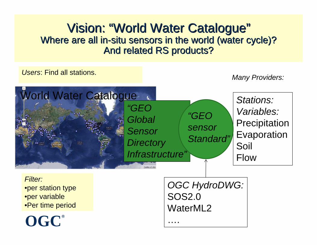
“GEO GlobalSensor DirectoryInfrastructure”
Vision: Vision: ““World Water CatalogueWorld Water Catalogue””Where are all inWhere are all in--situ sensors in the world (water cycle)?situ sensors in the world (water cycle)?
And related RS products?And related RS products?
Stations:Variables:PrecipitationEvaporationSoilFlow
Many Providers:Users: Find all stations.
“GEOsensor Standard”
Filter:•per station type•per variable•Per time period
OGC HydroDWG:SOS2.0WaterML2….
World Water Catalogue

OGC®
OutlineOutline
• Value of location information
• Value of interoperability in a heterogeneous world
• OGC for geospatial standards development and promotion
• Examples of how geospatial standards can help
• Concluding remarks
Copyright © 2013Open Geospatial Consortium
OGC®
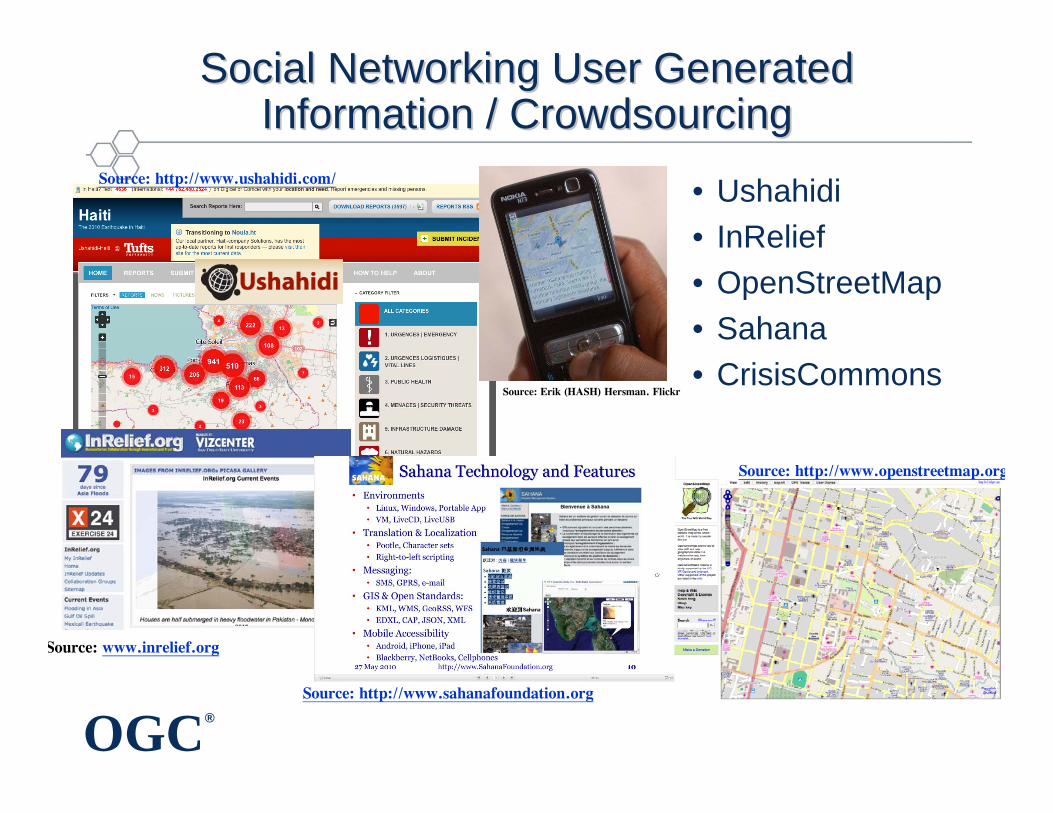
Social Networking User Generated Social Networking User Generated Information / CrowdsourcingInformation / Crowdsourcing
• Ushahidi• InRelief• OpenStreetMap• Sahana• CrisisCommons
Source: http://www.sahanafoundation.org
Source: www.inrelief.org
Source: http://www.ushahidi.com/
Source: http://www.openstreetmap.org
Source: Erik (HASH) Hersman. Flickr
OGC®
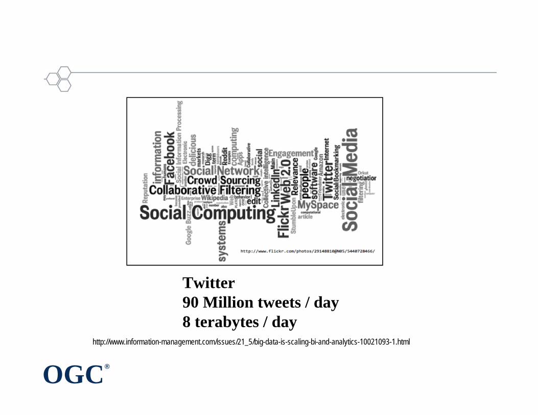
http://www.information-management.com/issues/21_5/big-data-is-scaling-bi-and-analytics-10021093-1.html
Twitter 90 Million tweets / day8 terabytes / day
OGC®
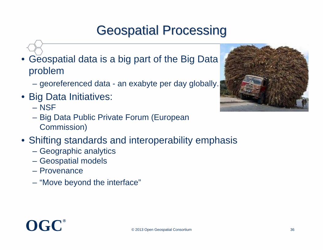
Geospatial ProcessingGeospatial Processing
• Geospatial data is a big part of the Big Data problem– georeferenced data - an exabyte per day globally.
• Big Data Initiatives: – NSF– Big Data Public Private Forum (European
Commission)
• Shifting standards and interoperability emphasis– Geographic analytics– Geospatial models– Provenance– “Move beyond the interface”
© 2013 Open Geospatial Consortium 36
OGC®
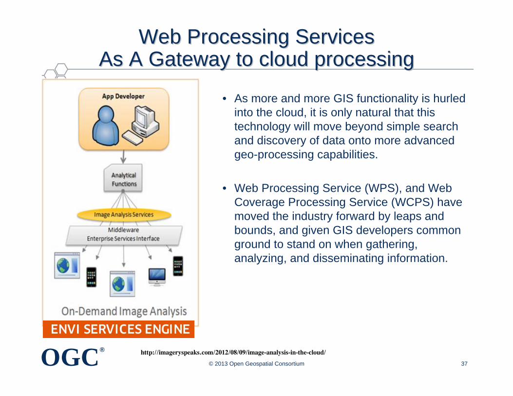
Web Processing Services Web Processing Services As A Gateway to cloud processingAs A Gateway to cloud processing
• As more and more GIS functionality is hurled into the cloud, it is only natural that this technology will move beyond simple search and discovery of data onto more advanced geo-processing capabilities.
• Web Processing Service (WPS), and Web Coverage Processing Service (WCPS) have moved the industry forward by leaps and bounds, and given GIS developers common ground to stand on when gathering, analyzing, and disseminating information.
© 2013 Open Geospatial Consortium 37
http://imageryspeaks.com/2012/08/09/image-analysis-in-the-cloud/
OGC®
Exploring Standards for CrossExploring Standards for Cross--Community InteroperabilityCommunity Interoperability
OGC®
©© 2013 Open Geospatial Consortium 2013 Open Geospatial Consortium 39
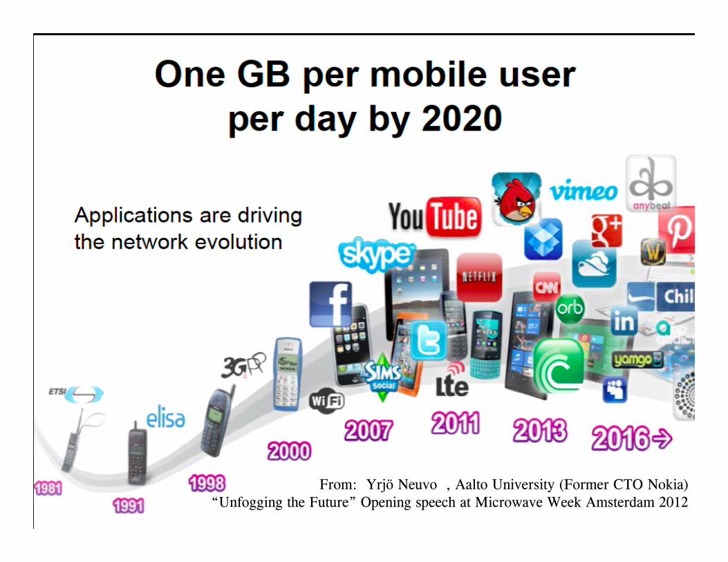
From: Yrjö Neuvo , Aalto University (Former CTO Nokia)“Unfogging the Future” Opening speech at Microwave Week Amsterdam 2012
OGC®
Exploring Standards for the Mobile Environment
42
OGC®
OutlineOutline
• Value of location information
• Value of interoperability in a heterogeneous world
• OGC for geospatial standards development and promotion
• Examples of how geospatial standards can help
• Concluding remarks
Copyright © 2013Open Geospatial Consortium
OGC®
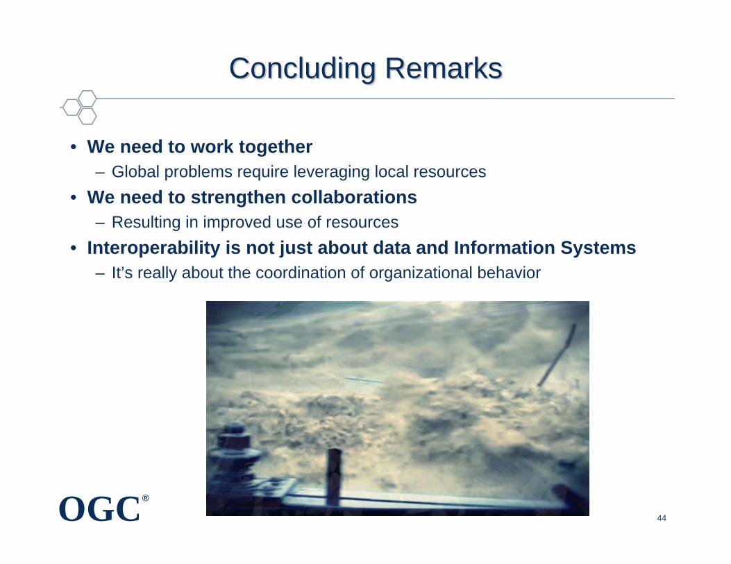
Concluding RemarksConcluding Remarks
44
• We need to work together– Global problems require leveraging local resources
• We need to strengthen collaborations– Resulting in improved use of resources
• Interoperability is not just about data and Information Systems– It’s really about the coordination of organizational behavior
OGC®
Questions?Questions?
• More informationhttp://www.opengeospatial.org
• Contact InformationNadine Alameh, Ph.D.Executive Director, OGC Interoperability [email protected]://www.linkedin.com/in/nadinealameh
Copyright © 2013 Open Geospatial Consortium


