Download - High-Tech Hide & Seek: Geocaching
t was an ordinary Saturday morning at Five RiversEnvironmental Education Center in Delmar. A few
families perused exhibits in the display room, severalretirees kept watch over the bird feeders through alarge picture window, and the more intrepid visitorswalked the nature trails under cloudy skies.
As an intern at Five Rivers I am familiar with thevariations in the daily rhythm of activity, but on thisparticularly gloomy morning I had arrived to partici-pate in a pursuit quite beyond the normal routine. Mycompanion and I stood in the parking lot under gath-ering clouds, preparing to search for hidden treasure.Using a small device, signals from space, and our ownsharp wits we would spend the next half hour makingour way through the forests and fields of Five Riverssearching for our cleverly hidden quarry.
New Outdoor ActivityMy morning activities might have seemed somewhat
odd to the uninitiated passerby, but they were hardlyas absurd as they might have appeared. I was beingintroduced to geocaching (pronounced “geo-cashing”),the Global Positioning System (GPS) adventure gamethat has won legions of enthusiasts since its inceptionfive years ago. Five Rivers recently became one of agrowing number of public properties playing host toone or more of the caches—or hidden containers—sought by the game’s participants. Many officialsresponsible for these public lands are still grapplingwith how this new recreational activity fits into
existing management plans, butmost agree that geocaching has
about the same impact on theenvironment as hiking.
My initiation into this game ofhigh-tech hide-and-seek was
graciously facilitated by the individual responsible forthe Five Rivers cache. Chet King, a Delmar residentwho has been visiting Five Rivers for more than 40years, was already an avid outdoorsman when helearned of the game just over a year ago.
Intrigued, he quickly joined the thousands of devotees who spend some of their free time seeking
the more than 90,000 caches now hidden in nearly 200countries around the world.
Birth of a PastimeGeocaching was born on May 3, 2000, just two days
after the Clinton administration unscrambled GPSsatellite signals that were previously reserved for mili-tary use. A few adventure lovers in Portland, Oregonquickly realized that, in addition to its usefulness forcivilian navigation, the new access could also be usedto create a game for those who love both technologyand the great outdoors. The sport has grown rapidly;geocaches can now be found in every state in theunion, with more than 2,300 tucked away into thenooks and crannies of New York State alone.
10
Geocaching 101:Basic Vocabulary
Cache: A hidden container holding a log book,pencil, and a few “treasures.”
Global Positioning System (GPS): A series ofsatellites that can help you determine your location.
Virtual Cache: A geocache for which the coordi-nates describe a noteworthy location rather than ahidden container. Some land managers use virtualcaches in areas where actual caches are forbidden.
Way Point: A set of named longitude and latitudecoordinates that describes a location. Way points,such as the location of a cache or a trailhead, canbe stored in a GPS unit for future reference.
By Lauren PidotPhotos by Sue Shafer/DEC

The heart of this technology-driven adventure game is, appro-priately enough, a website. By vis-iting www.geocaching.com, playerscan obtain coordinates of cacheslocated in their region. With a freemembership, enthusiasts can alsoregister the coordinates of theirown caches, log their finds, anddiscuss all things geocache withthose similarly enthralled.
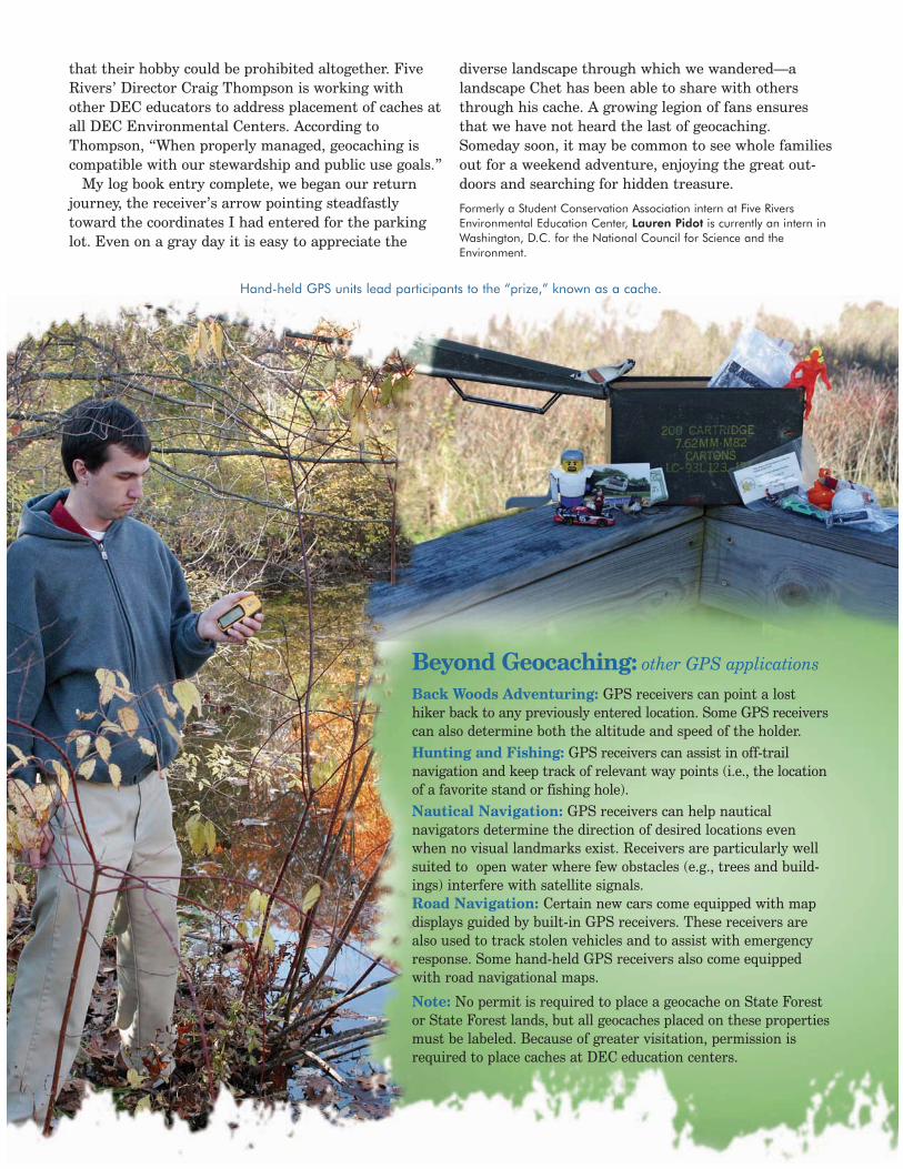
Though I had scanned the web-site the day before, I required acrash course in GPS technologybefore I could embark on my hunt.Chet guided me through the functions of his GPS receiver,which runs on AA batteries and is the approximatesize and shape of a cell phone. While waiting for thereceiver to lock on to the satellite signals, Chet showedme how to enter coordinates and make an arrowappear to point me in their direction. The device alsoreported my distance from the target, although itoffered no clues to navigating obstacles I might meeton the way.
During this orientation, Chet mentioned that he hadfound purchasing this small device more challengingthan buying a car. A portable GPS unit can runbetween $100 and $1,000, with the price depending onthe features and precision desired by the buyer.Receivers can be customized for road navigation, hunt-ing, and even golf! Units must be able to pick up thesignals from at least three of the two dozen GPS satel-lites currently in orbit in order to determine, with anyaccuracy, the distance and direction of a desired desti-nation. The better the unit, the more easily signals arepicked up, and the more precise the reading.
Treasure FoundAfter 20 minutes of following the receiver’s arrow
while attempting to stay on the Five Rivers’ designat-ed paths, the distance reading dwindled to 50 and then 20 feet. As we neared his cache, Chet admitted that hisfixation on the technology has occasionally proved ahandicap when it comes to actually finding the “treas-ure.” While his eyes tend to remain on the receiver, hiswife, who is his frequent companion in the game, willwatch the scenery, and is very often the first person tolocate the cache. A GPS unit will bring you accuratelywithin a few feet of your goal, but from there you mustdo the rest. According to convention, caches may notbe buried, but may be concealed in numerous otherways. The actual cache can also vary from an old army
ammunition box to a tiny film can-ister.
When I finally located thecache’s devilishly clever hidingspot, I pried open the lid to find aneclectic array of trinkets and, mostimportantly, a well-used log book.The “treasures” are available on atake-something, leave-somethingbasis, with the initial trove sup-plied by the creator. While notevery cache is stuffed with prizes,all contain a notebook or sheet onwhich a triumphant player canrecord his or her success.
I flipped through the 20 or soprevious entries in the log book,
before settling on a blank page to scrawl my own dec-laration of victory. While several writers described FiveRivers as a lifelong favorite natural space, many notedthat geocaching had brought them to the grounds forthe first time or for the first time in many years.Geocachers consistently expressed an appreciation forthe scenery as much as for the cleverness of the cache.The thrill of the game may be the hunt, but all seemto agree that one of its greatest benefits is the oppor-tunity to discover new places of natural beauty.
Preventing ConflictsAs the number of caches on public lands increases,
many property managers are attempting to balanceresource protection while accomodating a new audience.While most geocachers seem to understand land man-agers’ responsibility to protect both sensitive naturalareas and public safety,they are concerned
New York State Conservationist, February 2005 11
A log book entry left for future geocachers.
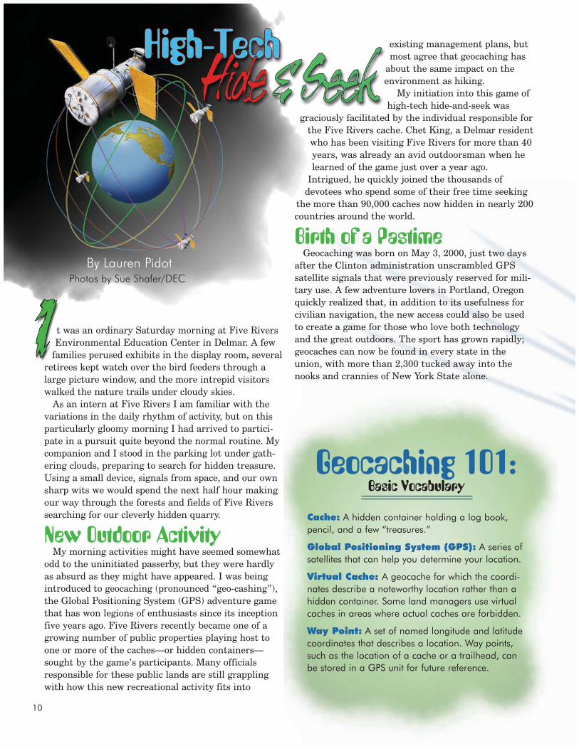
Just like satellite dishes,hand-held GPS unitsreceive satellite signalsfrom space.
that their hobby could be prohibited altogether. FiveRivers’ Director Craig Thompson is working withother DEC educators to address placement of caches atall DEC Environmental Centers. According toThompson, “When properly managed, geocaching iscompatible with our stewardship and public use goals.”
My log book entry complete, we began our returnjourney, the receiver’s arrow pointing steadfastlytoward the coordinates I had entered for the parkinglot. Even on a gray day it is easy to appreciate the
diverse landscape through which we wandered—alandscape Chet has been able to share with othersthrough his cache. A growing legion of fans ensuresthat we have not heard the last of geocaching.Someday soon, it may be common to see whole familiesout for a weekend adventure, enjoying the great out-doors and searching for hidden treasure.
Formerly a Student Conservation Association intern at Five RiversEnvironmental Education Center, Lauren Pidot is currently an intern inWashington, D.C. for the National Council for Science and theEnvironment.
12
Beyond Geocaching: other GPS applications
Back Woods Adventuring: GPS receivers can point a losthiker back to any previously entered location. Some GPS receiverscan also determine both the altitude and speed of the holder.Hunting and Fishing: GPS receivers can assist in off-trail navigation and keep track of relevant way points (i.e., the locationof a favorite stand or fishing hole).Nautical Navigation: GPS receivers can help nautical navigators determine the direction of desired locations evenwhen no visual landmarks exist. Receivers are particularly wellsuited to open water where few obstacles (e.g., trees and build-ings) interfere with satellite signals.Road Navigation: Certain new cars come equipped with mapdisplays guided by built-in GPS receivers. These receivers arealso used to track stolen vehicles and to assist with emergencyresponse. Some hand-held GPS receivers also come equippedwith road navigational maps.
Note: No permit is required to place a geocache on State Forestor State Forest lands, but all geocaches placed on these propertiesmust be labeled. Because of greater visitation, permission isrequired to place caches at DEC education centers.
Hand-held GPS units lead participants to the “prize,” known as a cache.


