July 2, 2019
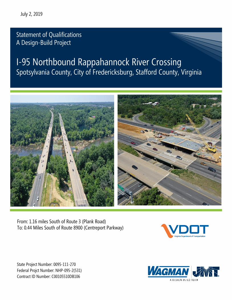
From: 1.16 miles South of Route 3 (Plank Road) To: 0.44 Miles South of Route 8900 (Centreport Parkway)
State Project Number: 0095-111-270
Federal Projct Number: NHP-095-2(531)
Contract ID Number: C00105510DB106
Statement of Qualifications A Design-Build Project
I-95 Northbound Rappahannock River Crossing Spotsylvania County, City of Fredericksburg, Stafford County, Virginia

Section 3.2
Letter of Submittal


Section 3.3
Offeror’s Team Structure


Businesses, educational institutions, EMS,
Fredericksburg Area Metropolitan Planning Organization
(FAMPO), Regional Transit Organizations, Commuter
Services, Friends of the Rappahannock, Fredericksburg
Trail Alliance, Fredericksburg City and Stafford County
Public Schools, National Park Service, Virginia Railway
Express, Departments of Parks and Recreation and other
Recreational groups , DMV, DEQ, Army Corps of
Engineers, Traveling Public, Police, Fire and Rescue,
Property Owners and Utility Companies
Third Party Stakeholders
Extension of I-95 Express Lanes to Route 17 (FREDEX)
I-95 Southbound CD Lanes
Other VDOT Projects in Area
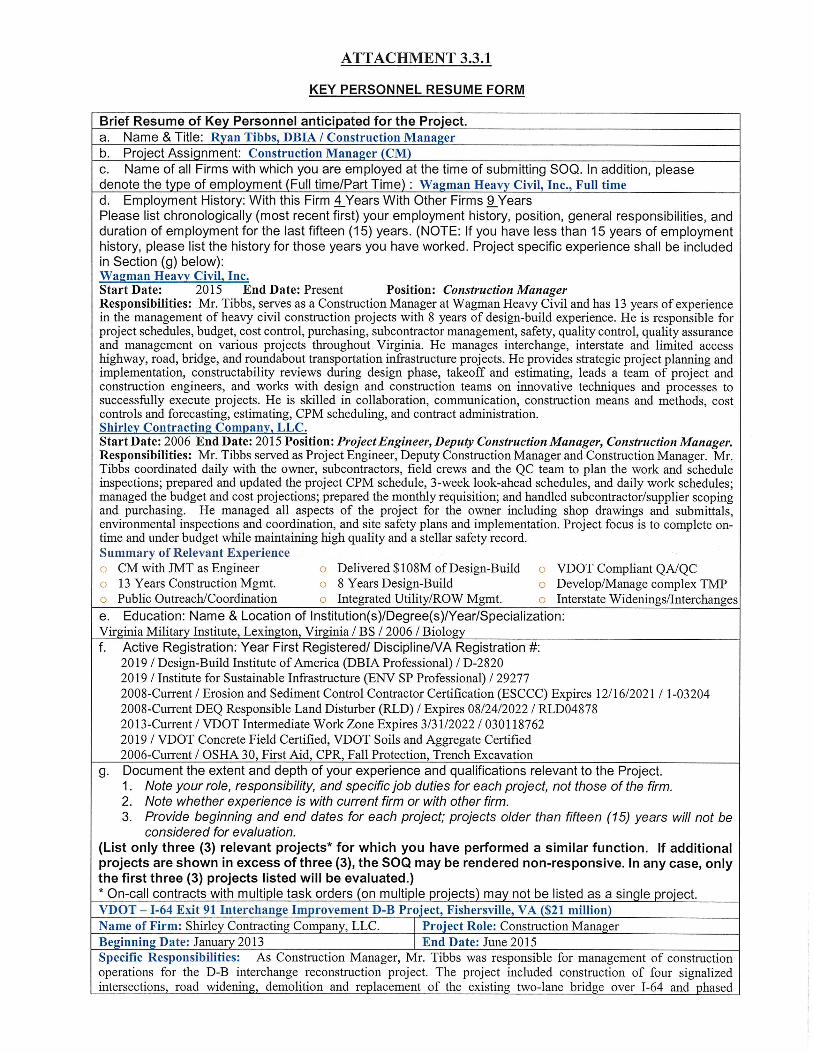
Ryan Tibbs, DBIA⚫
Construction Manager
Brian Blankenship
Highway Superintendent
Berkley Hawkins ⚫
Project Engineer
Glen Mays, DBIA⚫
DB Project Manager
Robert Reed, PE
Design QA Manager
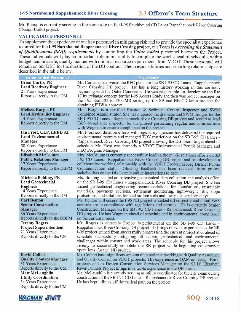
Brian Curtis, PE
Roadway Design
Stephen Hanes, PE
Structural Engineer
Melissa Burgh, PE
Drainage/SWM/ESC
Randy Boice, PE
Traffic Engineering/MOT/ITS
Dave Malinoski, PE
Utility Coordination/Design
Walter Kulis, PE
Christopher Bajdek (HMMH)
Noise Analysis
Michael Zmuda, LS, PE
Survey/SUE
Gerald Krebs, SR/WA
Right-of-Way
Scott Shropshire, PE, CCM (Q)
QA Manager
Mike Dugan
Structures Superintendent
David Colbert (CES)
QC Manager
Michael Leffler, PE
Michelle Bolding, PE❖(S)
Ed Drahos, PE (S)
Geotechnical Engineer
LEGEND
= Direct Report Line
= Line of Communication
⚫ = RLD =ESCCC = VDOT Intermediate Work Zone
❖ = Geotechnical Engineer of Record
Wagman Heavy Civil, Inc.
Johnson, Mirmiran & Thompson, Inc.
Harris Miller Miller & Hanson, Inc. (HMMH)*
Schnabel Engineering, LLC (S)
CES Consulting, LLC (CES)*
Hassan Water Resources, LLC (HWR)*
Three Oaks Engineering *
Quinn Consulting Services Incorporated (Q)**DBE and/or SWaM firm
Fredericksburg District
Project Manager
Greg Andricos, PE
Robert Gallagher, PE
Project Resources Group
Supporting QC Inspectors
AMRL/CCRL Lab. Testing
Specialized
Engineering
Elisabeth McCullum
Public Involvement/Relations
Manager
CONSTRUCTIONDESIGN
INDEP. QA/QC
Ian Frost, CEP, AICP, LEED AP
Three Oaks (Mussel Survey)
Environmental Permitting
Brad McClung ⚫
Construction MOT Mgr.
Matt McLaughlin, CCM (CES)
Utility Coordination/Constr.
Independent Reviewers
Design QC Manager
Jeremy Rogers⚫
Project Superintendent
Supporting
QA Inspectors
= Value Added Personnel
Rodney Hayzlett, PE
Design Manager
Ian Westbrook ⚫
E & S Superintendent
Pilar McClelland, PE
Gamal Hassan, PE (HWR)
Hydrologic and
Hydraulic Analysis
Jerry Whitlock, PE, DBIA ⚫
Entrusted Engineer in Charge
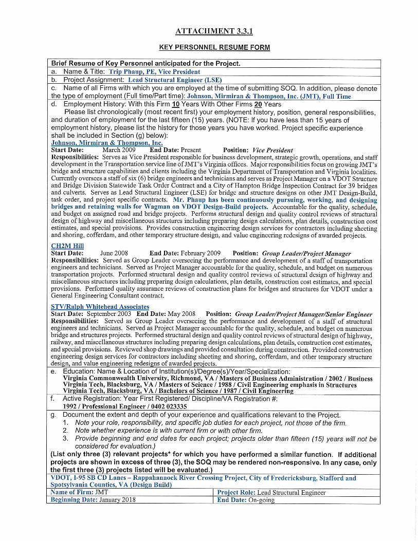
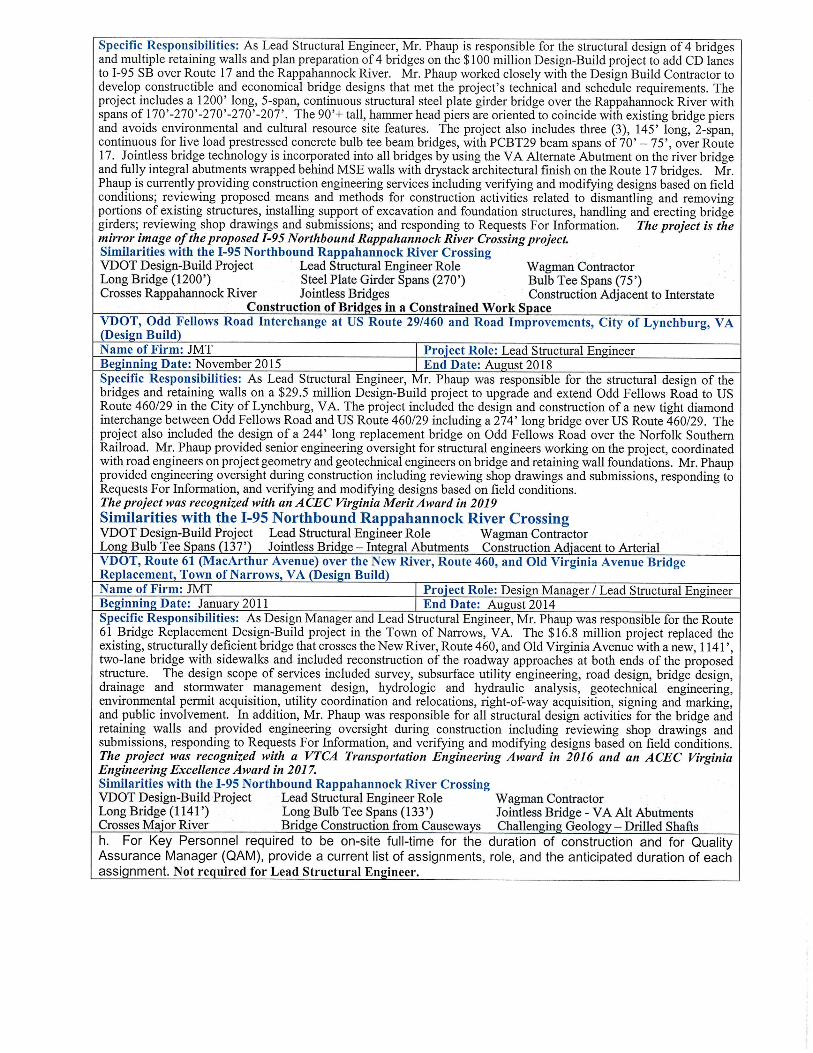
Trip Phaup, PE
Lead Structural Engineer
Lead Bridge QC Inspector
Ried Jaff (CES)
TBD
Subcontractors
= Key Personnel
I-95 Northbound CD Lanes – Rappahannock River Crossing 3.3 Offeror’s Team Structure
SOQ │ 6 of 15
Chris Goss(Q)
Lead Bridge QA
Insp.
Noah Pate(Q)
Lead Roadway QA
Insp.
Lead Roadway QC Inspector
Patrick Pritt (CES)
Carl Benton
Senior Construction Manager
Joe Goss ⚫
Safety Manager
Adam Staples
Survey Manager
Section 3.4
Experience of Offerors Team

Section 3.5
Project Risks

3.5 Project Risks
SOQ │ 7 of 15
I-95 Northbound Rappahannock River Crossing
The first step in managing risk is to identify the risks. The Wagman Team conducted a Risk Workshop modeled on the system utilized by VDOT to assess and assign risks. Although all viewpoints of risk were considered, the Wagman Team concentrated more on risks affecting the team’s ability to deliver the project on-time and within budget. The Risk Workshop identified over 50 individual risks. These risks were evaluated by degree of impact (1 to 3) and probability of occurrence (1 to 3). A risk factor was calculated for each risk; (risk factor = degree of impact multiplied by probability of occurrence) and ranged from 1 to 9. Of the over 50 individual risks, 14 received a risk factor of 6 or higher. These are shown with score in the table to the right: From our risk evaluation process, the following three risks were determined to be the most critical to the success of the I-95 NB Rappahannock River Crossing Project from the viewpoint of the Wagman Team as they all scored a 9 and will be discussed in detail:
1) Constructing Rappahannock River Bridge in a Constrained Workspace
2) Maintenance of Traffic at Route 17 Interchange
3) Meeting Stormwater Management Requirements within Project Footprint
While these top 3 risks are generally similar to the
risks that our existing DB Team is successfully
mitigating on the current SB I-95 CD Lanes D-B Project, we believe these risks become amplified with regards
to the I-95 NB Project as the I-95 corridor becomes further constrained as the SB I-95 and FredEx projects are
constructed. Although the coordination of these projects also scored a 9 on our risk register, the DBT has already
established a good working relationship with the FredEx Project Team and is uniquely positioned to expedite the
permitting and construction of I-95 NB project by supplementing our existing DBT. As such, the coordination
of existing projects did not necessitate designation as a top 3 risk. Additionally, our DB Team is prepared to
implement best management practices to mitigate the risks per the attached table as well as others as they are
identified. However, when responding to the RFP, the Wagman Team will develop a risk management plan for the project that will include a risk register which includes all the risks identified during our workshop with a risk factor of 6 or higher. This plan will include strategies to respond to each of those risks, and the party or individual best responsible for managing the risk. This will allow the Wagman Team to create mitigation plans, build contingencies into the project or adjust the project schedule to manage the risk. During delivery of the project, the Wagman Team’s DBPM will be responsible for managing the risk on the project. The diagram above left shows the steps Mr. Mays will follow throughout the length of the project to manage the risk. Risks will be
reviewed and re-evaluated by the Wagman Team monthly until they have been mitigated or are no longer considered a risk. Mitigation strategies will be modified as necessary and new risks will be added to the register and tracked as they are identified.
Identified Risk Risk
Factor Constructing Rappahannock River bridge in a constrained workspace
9
Maintenance of traffic at Route 17 Interchange 9
Meeting SWM requirements within project footprint 9
Coordination with adjacent projects (FredEx and I-95 SB CD Lanes)
9
Large number of parcels with potential for acquisition including relocation of businesses near Route 17 including potential Title 6 issues
6
Encountering highly plastic materials not suitable to 2:1 cut slopes
6
Presence of Acid-sulfate and high plasticity soils 6
Ability to reuse existing pipes and culverts - original system is 50+ years old
6
Providing proposed typical section at existing bridge overpasses, Rte. 3, Cowan, Fall Hill, and Truslow Rd
6
Changing water conditions at Rappahannock River 6
Pedestrians along Route 17 through the work zone 6
Coordinating with 3rd party stakeholders - businesses, Friends of Rappahannock, Fredericksburg Trail Alliance, residents, commuters, first responders, EMS, City of Fredericksburg, Spotsylvania, and Stafford
6
Availability of labor and materials with other ongoing VDOT advertisements > $3 B
6
Designing Option 1 flyover to VDOT standards without DW/DE 6
Identify Risk (Initial or
New)
Implement Risk
Strategies
Track Risk
Evaluate Effect of
Strategies
Modify Strategies
as necessary

3.5 Project Risks
SOQ │ 8 of 15
I-95 Northbound Rappahannock River Crossing
Risk No. 1 | CONSTRUCTING RAPPAHANNOCK RIVER BRIDGE IN A CONSTRAINED WORK SPACE
Risk Identification: As part of the I-95 NB Rappahannock River Crossing project, the Wagman Team will be responsible for designing and constructing a new, fourth bridge over the Rappahannock River between the new SBL bridge that the DBT is currently constructing and the existing NBL bridge. Working in the physically constrained space between the existing bridges is critical to the success of the project and presents risk associated with schedule, budget, environmental restrictions, and construction activities. The constrained work space includes physical constraints and time related constraints including limited available work space, potentially numerous and overlapping Time of Year (TOY) restrictions, challenging site access due to frequent high river flows, and existing environmental conditions and cultural resources present at the site. All work must be performed in a sequenced manner in order to temporarily address SWM during all activities including: constructing a causeway, abutments, and piers; erecting girders and pouring a concrete deck over 100 feet above the river, removing the causeway, and converting to permanent SWM facilities on abutment slopes. Specific challenges related to this risk include: • A very constrained and narrow work space – there is 90’
+- clear from edge of deck of the new SBL bridge to edge of deck of the existing NBL bridge.
• The new SBL bridge temporary causeway is in place and occupies over half of the available work space.
• It will be challenging for two separate contractors to safely and effectively work at the same time in the same constrained area.
• Questions to answer in addressing this risk include – - How to fit two (2) potential causeways between the
new SBL bridge and existing NBL bridge while maintaining river access to users?
- How to construct the abutments while maintaining traffic on I-95 including support of excavation, etc.
- How to construct the piers including support of excavation on steep slopes and cofferdams within the river.
- How to erect girders when there is only 15’ +- clear between new SBL and new NBL bridge and 12’ +- clear between new NBL bridge and existing NBL bridge with little to no room for crane boom movement.
- How to place deck concrete – from below or from
the adjacent bridge.
Wagman’s Completed
Major River Crossings
Length
Route 340 over Shenandoah
River
1,910-ft
Route 61 over New River 1,141-ft
Chesterfield Power Bridge
over Proctors Creek
1,389-ft
Route 360 over Dan River 2 @ 2,144-ft
Franklin Turnpike Ext over
Fall Creek
2 @ 640-ft
US 58 over Nottoway River 1,200-ft
I-95 over Meherrin River 2 @ 540-ft
US 15 over Rivanna River 464-ft
US 1 over Nottoway River 481-ft & 321-ft
US 1 over Meherrin River 563-ft & 259-ft
US 22 over Lehigh River 2@640-ft
I-83 over Susquehanna River 2 @ 3,315-ft
Choptank River Bridge 8,650-ft
Sunbury Bridge over
Susquehanna River
2,844-ft
I-78 over Lehigh River 1,250-ft
SR 7 over Christian River 682-ft
Shickshinny Bridge over
Susquehanna River
877-ft
I-695 over Bear Creek 3,870-ft
I95/395 Interchange over
Patapsco River
2 @ 8,000-ft
2 @ 4,000-ft
Route 1 Spur over Puncheon
Run
2 @ 650-ft
Route 15 over Hammond Lake 1,510-ft
I-80 over Susquehanna River 1,151-ft
Route 50 over Wicomico
River
2 @ 456-ft
Harvey Taylor Bridge over
Susquehanna River
4,817-ft
Route 54 Causeway over Bay 6,627-ft
Youghioghenny River
Crossing
1,545-ft
Susquehanna River Bridge 2 @ 5,600-ft
Route 52 Causeway over IC
Waterway
2 @ 2,570-ft
2 @ 2,460-ft
NJTA GSP SB Bridge over
Great Egg Harbor
3,840-ft
770-ft
ICC A over Rock Creek 2 @ 460-ft
2 @ 300-ft
ICC B over Paint Branch 6 @ 580-895-ft
2 @ 1,140-ft
2 @ 1,280-ft
3.5 Project Risks
SOQ │ 9 of 15
I-95 Northbound Rappahannock River Crossing
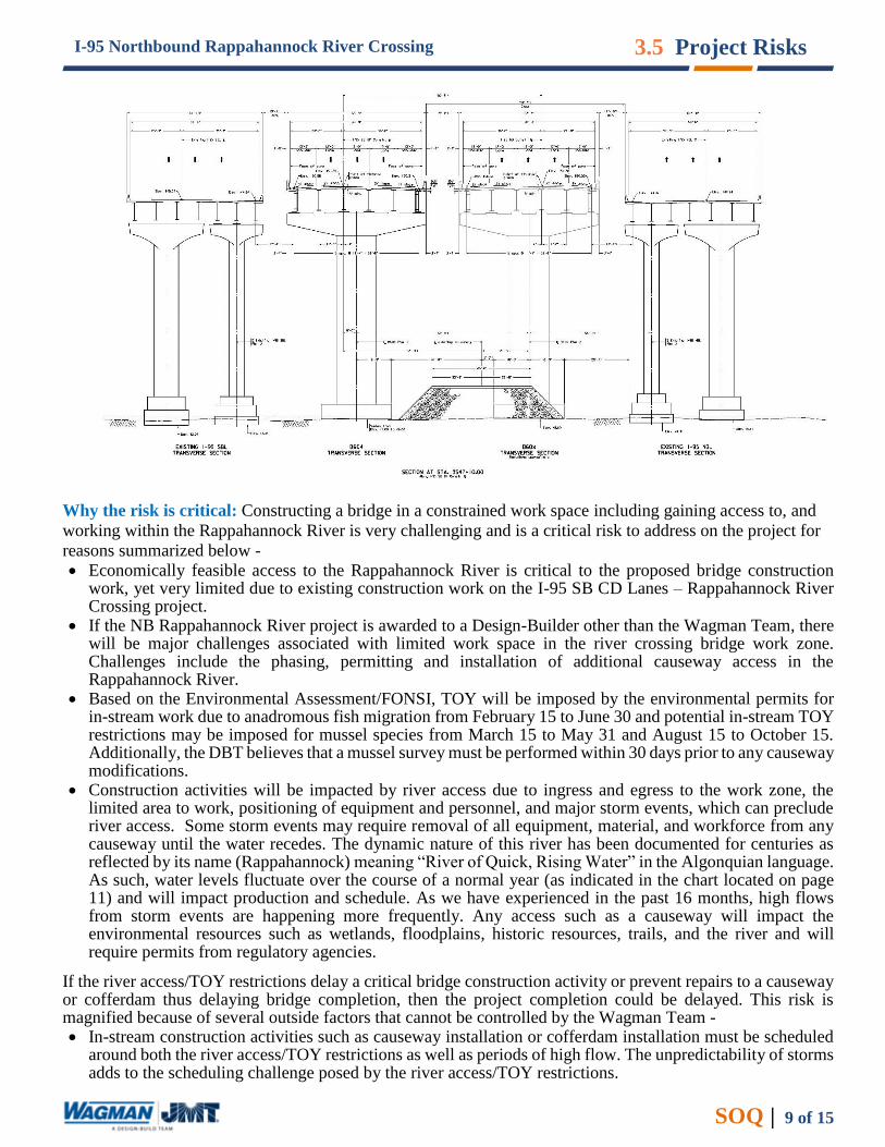
Why the risk is critical: Constructing a bridge in a constrained work space including gaining access to, and
working within the Rappahannock River is very challenging and is a critical risk to address on the project for
reasons summarized below -
• Economically feasible access to the Rappahannock River is critical to the proposed bridge construction work, yet very limited due to existing construction work on the I-95 SB CD Lanes – Rappahannock River Crossing project.
• If the NB Rappahannock River project is awarded to a Design-Builder other than the Wagman Team, there will be major challenges associated with limited work space in the river crossing bridge work zone. Challenges include the phasing, permitting and installation of additional causeway access in the Rappahannock River.
• Based on the Environmental Assessment/FONSI, TOY will be imposed by the environmental permits for in-stream work due to anadromous fish migration from February 15 to June 30 and potential in-stream TOY restrictions may be imposed for mussel species from March 15 to May 31 and August 15 to October 15. Additionally, the DBT believes that a mussel survey must be performed within 30 days prior to any causeway modifications.
• Construction activities will be impacted by river access due to ingress and egress to the work zone, the limited area to work, positioning of equipment and personnel, and major storm events, which can preclude river access. Some storm events may require removal of all equipment, material, and workforce from any causeway until the water recedes. The dynamic nature of this river has been documented for centuries as reflected by its name (Rappahannock) meaning “River of Quick, Rising Water” in the Algonquian language. As such, water levels fluctuate over the course of a normal year (as indicated in the chart located on page 11) and will impact production and schedule. As we have experienced in the past 16 months, high flows from storm events are happening more frequently. Any access such as a causeway will impact the environmental resources such as wetlands, floodplains, historic resources, trails, and the river and will require permits from regulatory agencies.
If the river access/TOY restrictions delay a critical bridge construction activity or prevent repairs to a causeway or cofferdam thus delaying bridge completion, then the project completion could be delayed. This risk is magnified because of several outside factors that cannot be controlled by the Wagman Team - • In-stream construction activities such as causeway installation or cofferdam installation must be scheduled
around both the river access/TOY restrictions as well as periods of high flow. The unpredictability of storms adds to the scheduling challenge posed by the river access/TOY restrictions.

3.5 Project Risks
SOQ │ 10 of 15
I-95 Northbound Rappahannock River Crossing
• The Wagman Team expects that the causeways and cofferdams could be damaged from high flows and may need repair at some time during the construction. These repairs may require in-stream work and that may need to be completed during the river TOY restrictions. Without relief from the permitting agencies, the in-stream repairs may not be allowed during the TOY restrictions.
Wagman is fully aware of the challenges of working in the constrained area for the construction of the NB Bridge over the Rappahannock River. Construction of the SB Bridge will be ongoing from the causeway for that structure while work on the NB bridge is progressing. Wagman is exploring the same innovative methods for erection of the girders which will help to mitigate environmental, safety and schedule concerns. Because Wagman holds the approved permit to work in this location through May 2022, our DBT can streamline the regulatory approvals because the existing causeway only requires minor modifications to realign the existing causeway to facilitate construction of the NB bridge. Therefore, we are confident that Wagman can expedite delivery of the project. Furthermore, the DBT intends to accelerate the removal of all temporary access (including causeway) thereby eliminating all temporary impacts to the river well in advance of the contractual project completion date. This provides a great benefit to the environment, native species, trail and river users. Risk Impact on the Project: One of the significant risks for the project is the constrained work space and limited feasible access to the Rappahannock River, and the potential for schedule delays because of multiple contractors working in a tight work zone and river access challenges from the expected time of year restrictions for in-stream work and the potential for high flows in the river precluding access to the Rappahannock River for the bridge construction. Risk Mitigation Strategy: With the Wagman Team’s substantial experience with similar large bridge projects, and its current position as the Design-Builder on the I-95 SB CD Lanes – Rappahannock River Crossing project, Wagman is in a unique position to employ proven strategies to mitigate the risks associated with a constrained work space and river access, including the following - 1. As the current Design-Builder on the I-95 SB CD Lanes – Rappahannock River Crossing project, Wagman
has already established an exclusive license agreement with the City of Fredericksburg to improve, operate and maintain the existing access road to the Rappahannock River that will also facilitate the construction of the NB bridge.
2. As the Design Builder for both the SB and NB projects, Wagman will be able to completely eliminate the substantial challenges associated with the coordination of work activities between two different contractors working in a very limited work area.
3. Wagman has already studied the river patterns and the water elevation history in the Rappahannock River to determine the optimum causeway height to minimize impacts to the work zone during rain events. Wagman has also used this strategy on several other projects including the I-95 Bridges over Meherrin River, Susquehanna River Bridge, Chesterfield Power Plant Bridge over Proctors Creek, and Route 61 over New River Bridge Replacement.
4. Wagman has already established a proven effective relationship with the permitting agencies with jurisdiction over the work in and around the Rappahannock River.
5. The Wagman Team has a good understanding of the foundation conditions in the area of the proposed NBL bridge based on experience in constructing the SBL bridge. With in-house foundation engineers and specialty foundation construction knowledge, Wagman has the ability to evaluate types of foundations that can be constructed with minimal impact to the river and with minimal or no need for cofferdams. For example, Wagman and JMT selected drilled shafts on the Route 61 Narrows Bridge Replacement project in order to avoid constructing cofferdams subject to overtopping and minimize temporary impacts.
6. Wagman’s design for the SB project causeway has already been approved by the regulatory agencies and has performed well hydraulically since its installation. The Wagman design is one of the first causeways approved in Virginia that consumes more than 50 percent of the stream width. Because, the footprint is larger than normally allowed, we can expedite the bridge construction and minimize disturbance of the river that normally occurs from the normal flip flopping of the causeway from side to side.
7. Use temporary bridges within the causeway to allow increased water flow as Wagman did on the current I-95 SB CD Lanes – Rappahannock River Crossing Project.
8. Transfer the causeway during low flow and outside of the TOY restrictions within the river working 24 hours a day, 7 days a week until the work is complete. Wagman relocated a 2500-ft long stone causeway within the banks of a river in 5 days using this approach.

3.5 Project Risks
SOQ │ 11 of 15
I-95 Northbound Rappahannock River Crossing
9. Create a comprehensive access plan to allow the flow of equipment, material and people. The Wagman Team will create a plan illustrating the access, causeway, new piers, existing piers, crane locations, cofferdams material storage and environmental resources.
10. Store material outside of the flood plain and prefabricate and transport items such as rebar cages to the work area on the causeway mitigating a crowded work area. Wagman used this technique successfully on causeway projects such as the Route 61 over New River Bridge Replacement, Susquehanna River Bridge, Chesterfield Power Plant Bridge over Proctors Creek, and is currently using this technique on the I-95 SB CD Lanes – Rappahannock River Crossing project.
11. Develop a detailed schedule for all in-stream activities that avoids the TOY restrictions and provides some schedule flexibility for lack of river access due to high flows.
12. Conduct mussel surveys (for the dwarf wedge mussel and possibly green floater using a certified individual) early in the project to determine if any protected mussel species are present in the river. This will be particularly important for the NB project because the regulatory agencies have indicated their intent to increase the length of the mussel survey from what was required for the SB project. If protected mussels are absent, we will request an exemption from the mussel TOY restriction. If they are present, then we would re-locate the individuals to a suitable location that will not be affected by the construction activities and request a waiver from the TOY restrictions.
13. If necessary due to conflicts with critical repairs or in-stream activities, coordinate with the agencies (DGIF, DCR, and NMFS and the permitting agencies) to secure relief from the TOY restrictions such as:
- shaving time off the front end or back end of time of the anadromous fish TOY depending on the actual schedule of the fish migration for that particular year. We have already been successful in securing this relief on the SB project from the agencies.
- securing an exemption for in-stream activities for short construction activities. Typically, this type of relief requires water quality monitoring to ensure that sedimentation and turbidity levels do not pose an adverse impact to anadromous fish or mussels
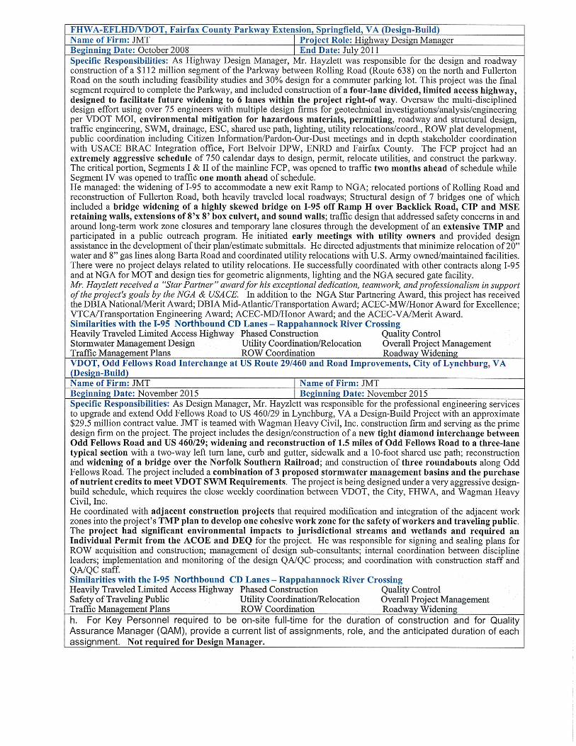
Role of VDOT and other Agencies: The DBT is fully committed to assuming full responsibility for this risk. We anticipate a similar role for VDOT and anticipate “partnering with the regulatory agencies” especially DEQ, USACE, and VMRC throughout the permitting as we have done on the SB project. VDOT could help with agency coordination with DEQ, USACE, VMRC, DGIF, DCR, and NMFS to expedite their review of requests for temporary relief from TOY restrictions, should that be necessary. Risk No. 2 | MAINTENANCE OF TRAFFIC AT ROUTE 17 INTERCHANGE Risk Identification: A critical risk for this project is the successful maintenance of traffic (MOT) during the construction of the interchange modifications at I-95 and Route 17. In addition to high volumes of traffic on the general-purpose lanes, the temporary traffic control plan must maintain high volumes of traffic on the interchange ramps and adjacent NB CD road while the NB CD road bridge is replaced. The geometry for the bid option that converts the NB I-95 off-ramp to NB Route 17 into a flyover and shifts the alignment of NB Route 17 further north complicates the construction sequencing. Why This Risk Is Critical: The interchange at I-95 and Route 17 serves as a critical connection providing a vital alternative route to the west of the heavily congested Northern Virginia region. The interchange also serves as the key access point to developed areas of Stafford County. Any disruption to this important interchange could have severe repercussions to first responders, the travelling public and commerce throughout the region. The proposed interchange will require reconstruction of busy ramps within a tightly constrained physical area. Separate components of the interchange are tightly and closely intertwined with each other: • NB CD lanes: The NB CD lanes bridge over Route 17 carries the NB on and off ramps to Route 17.
Maintaining traffic on and under the bridge while replacing the bridge and maintaining access to the Route 17 ramps will be a challenge as the bridge needs to be raised in elevation of approximately 2’.
Data for River Flow Versus Time of Year
Used to Select Causeway Elevation
I-95 SB CD Lanes over Rappahannock River
3.5 Project Risks
SOQ │ 12 of 15
I-95 Northbound Rappahannock River Crossing
• Bid Option – Flyover Ramp for NB I-95 to NB Route 17 movement: Construction of this ramp requires the removal of the existing NB I-95 to NB Route 17 ramp and shifting the alignment of the NB Route 17 lanes to the north. Sequencing of these changes will be a challenge. Temporary ramp connections to enter NB I-95 must be positioned to avoid the new bridge during construction. Utilities will need to be relocated prior to improvements beginning. Construction of the flyover ramp could be delayed until utility relocations and ROW acquisition are completed.
• Unknowns: The southern terminus for the FredEx HOT lanes occurs in the Rt. 17 interchange location and tie into connector ramps from the NB I-95 Rappahannock River Crossing. Timing of completion or delays with the FredEx project could impact the schedule of critical construction activities on the project.
Multiple short-term phases may be needed to move traffic through the construction zone. Each shift in traffic will require detailed design, planning, implementation, and monitoring and public notice.
Critical construction activities in the interchange areas will include earthwork movement, aggregate placement, drainage box culverts, SWM facilities, noise barriers, concrete barriers, retaining walls, bridge construction, and asphalt paving. All these activities involve heavy machinery and trucks, making safe ingress and egress extremely critical. Hence, construction vehicles entering and exiting the work zones on the interstate will add to the risk to the traveling public.
Impacts: From a shared viewpoint safety, public convenience, and disruptions to travel and commerce in this highly congested area are at risk. From the DBT viewpoint, disruptions to material delivery and work operations not only impact safety and public opinion, but also affect the schedule. The impact of inadequately planning and communicating construction activities with the traveling public could have severe consequences as identified below:
• travel delays • public dissatisfaction with the Project • amplified safety hazards for both the contractor and the traveling public • increased response time for emergency vehicles
Risk Mitigation Strategy: The Wagman Team has implemented successful
strategies, as identified below, to safely maintain traffic through work areas and
keep safety and mobility the top priorities. We will strategize and mitigate the risk
in the following stages:
Design Phase: An effective Transportation Management Plan (TMP) and strategies to minimize disruption to the traffic flow will be imperative to ensure that public perception of this important project remain positive and supportive. Several of our team members are already certified in ATTSA Advanced MOT design or VDOT Intermediate Work Zone Control for field implementation of MOT. The Wagman Team will be responsible for developing efficient construction phasing, determining safe and effective work zone strategies (i.e. temporary traffic control plans), and ensuring proper traffic operations management in accordance with a detailed and approved TMP. Our Team has successfully delivered an integrated TMP (over 180,000 ADT) on the Woodrow Wilson Bridge (WWB); JMT developed the TMP and Wagman executed the TMP for rebuilding two interchanges and creating local access roads. The DBT has also successfully managed traffic at the Route 17 Interchange during construction of the new I-95 GP lanes bridge over Route 17 on the I-95 SB CD lanes project and prepared a TMP approved by VDOT for the whole project.
During design, the entire team will have an essential role in defining construction sequences, locating detours, and addressing public safety and the safety of our workers. Based on our detailed understanding of the Virginia Work Area Protection Manual and the Manual on Uniform Traffic Control Devices, all MOT strategies will be designed incorporating appropriate temporary traffic control, lighting, and adequate vehicle acceleration and deceleration lengths. Most work zones will be separated physically by temporary concrete barrier.
Experienced construction personnel will be involved with the design team to ensure constructability, as Wagman and JMT have done on the new Odd Fellows Interchange in Lynchburg, VA and currently on the I-95 SB CD Lanes project. Multi-phased construction sequencing must be detailed to a high level of precision to avoid design
Wagman completed a high-
profile project on I-95
(200,000 adt) that had 47
separate construction phases
impacting I-95 mainline and
adjacent interchanges. The
project won both MdQI
awards for Partnering and
overall project.
Wagman was nationally
recognized as the
winner of the 2016
ARTBA-National
Safety Award. Public
Safety will remain a
priority for the duration
of the project.
3.5 Project Risks
SOQ │ 13 of 15
I-95 Northbound Rappahannock River Crossing
and operational conflicts. A basic tenet will be to separate work zones from the traveling public and allow safe and clear access to the construction zones. Concepts could include relocating ramp movements, shoulder widening to shift lanes, constructing extra width on bridges for shifted traffic. Work areas that do not require ROW acquisition or utility relocation can be started early in the construction sequence. Temporary ramp connections and acceleration lanes would be located to allow safe construction of the NB CD lane bridge. The DBT is committed to develop and install barrier protected enhanced construction entrances allowing construction vehicles to accelerate and decelerate separate from through traffic where practical. These enhanced entrances have improved safety on the I-95 SB CD Lanes project.
Construction Phase: Wagman has extensive experience working along the I-95 corridor (I-95 SB CD Lanes, I-95 Ashland, I-95 Meherrin, Woodrow Wilson Bridge, I-95/I-695 Interchange, I-95/I-495 HOT lanes, I-95/I-395 Latex) and the following practices and resources helped our team execute a safe and timely project and will be implemented on the I-95 NB Rappahannock River Crossing Project.
• MOT Manager with ATTSA and VDOT Intermediate Work Control • Daily coordination meeting to discuss traffic switches, detours, lane closures, and other MOT issues. • Four Week look-ahead schedule (updated weekly) • Strategically plan deliveries of materials at off peak hours • Develop emergency pull off areas for the traffic in our work zone, giving motorists a safe area for
emergencies with minimal impact to traffic. • Daily inspection of the work zone for MOT compliance
The DBT is committed to supporting public outreach efforts to notify the public concerning MOT issues and provide communication with Project Stakeholders and the traveling public. In addition to aiding VDOT with development of content for public distribution documents and various news media, we will use additional message boards for traveler’s guidance, broadcast on the message boards major traffic switches or changes to the traffic pattern. We will limit hauling activities on local non-residential streets wherever possible, and schedule multiple “Pardon our Dust” meetings to provide construction and traffic shift updates. We will plan our major activities around the local school calendars, major events in Fredericksburg, etc. Wagman recently completed a very complex project on I-95 in Baltimore, with 47 unique traffic phases, where we coordinated with the Inner Harbor and both sports stadiums. We won the MdQI Gold Partnering award for this effort!
The DBT public communications efforts led by Elisabeth McCollum on the I-95 SB CD Lanes project has been publicly acknowledged as effective. The DBT has developed user friendly graphics to relay changes in traffic patterns to the general public and emergency responders. The project has required significant public engagement with many stakeholders including recreational users of the river. The Fredericksburg Trails Alliance has reported publicly on their website. “We met the … Team back on May 21, 2018 at the jobsite… they have exceeded our expectations and have really done an amazing job by doing everything that they said they would do and more.” The project team has turned what was considered a risk to the project during procurement to a project benefit through building strong stakeholder relationships.
Incident Management Plan (IMP): The Wagman Team will prepare for unexpected and unplanned events such as disabled vehicles, accidents, emergencies, and other special occasions. We will develop incident management plan to provide the following:
• On-call towing service to quickly respond to disabled vehicles
• Law enforcement, fire and ambulance access to work zone during incidents
• Coordination with first responders and TOC • 24/7 contacts for emergency notification of an
incident
• Coordinated Emergency Management Plan inclusive of signage
• Agency/Stakeholder responsivity matrix • Pre-staged detour equipment and material needs • Pre-planned messages for various types of
incidents • Kick-off meeting with first responders in the area
Role of VDOT and other Agencies: We anticipate VDOT’s role to be associated with review and approval of the Temporary Traffic Control Plans and TMP (including IMP). We understand that the lane closure times and restrictions will be identified in the RFP documents. The DBT will be coordinating all design and traffic plans with other adjacent projects being managed by VDOT such as FredEx and the I-95 SB CD Lanes project. We expect VDOT will coordinate all lane closures among the projects including giving priority when needed. We

3.5 Project Risks
SOQ │ 14 of 15
I-95 Northbound Rappahannock River Crossing
also anticipate VDOT will remain closely involved in the public information and outreach process during design and construction, updating the Improve 95 website and releasing press releases. During construction, we anticipate VDOT will coordinate with VA State Police, will remain active on site, and will coordinate with our DBT to ensure a safe work site for motorists and construction personnel.
Risk No. 3 | STORMWATER MANAGEMENT REQUIREMENTS WITHIN PROJECT FOOTPRINT
Risk Identification: As part of the Project, the DBT is responsible for collecting, storing, treating, and releasing stormwater within the project limits in accordance with VDOT’s stormwater management (SWM) requirements and VDOT’s Drainage Manual. To successfully accomplish this task in a cost-effective manner, the Wagman Team will design a storm water system that relies on utilizing all or a majority of the existing storm sewer systems and culverts along and under I-95 to convey the stormwater runoff into and out of the proposed SWM facilities. This project will not be grandfathered and therefore will be required to meet Part II B Technical Criteria of the VDOT SWM requirements. This includes using the energy balance method to compute the maximum discharge to natural stream channels from the project site. A majority of the outfalls for this project discharge to natural channels. The energy balance method, with the utilization of the improvement factor, often results in detaining the post development discharge. The current plans have identified SWM facilities throughout the corridor within the existing ROW limited access limits as well as some locations with requiring proposed additional right-of-way and limited access. Additionally, a number of the identified facilities are shown within the drainage area of stormwater facilities for the I-95 SB CD Lanes project. The ability to meet SWM requirements for the project within the existing and proposed ROW and limited access is considered a risk on this Project.
Why the Risk is Critical: The preliminary design identifies multiple locations of stormwater facilities that are long and narrow with many centered along high berms adjacent to existing ditches. This will require significant grading to be utilized as a BMP to treat roadway drainage. Most stormwater facilities are meant to have rather flat sloped bottoms, additional grading to achieve the storage capacity and preferred geometric configuration could pose a risk of additional ROW. A number of these locations are also set back away from the roadway, where maintenance access could be an issue. This results in concerns as to whether the current conceptual SWM layout provides adequate treatment for the proposed improvements, and whether or not the layout accounts for maintenance access and the associated grading required for plan approval and long-term operations of the facilities. Additionally, there are concerns about the limitation of the type of facilities based on the location of the water table at these locations. The vetting process for the stormwater facilities proposed in the I-95 SB CD Lanes project resulted in a number of the locations being eliminated due to the depth to water table. Given that ideal locations for attenuating flow is close to the outfall and given that these outfalls are located in low-lying areas, the depth to water table will be a factor in determining the type of facility chosen.
In addition, it needs to be confirmed that the proposed SWM pond locations are adequate to receive the project’s requirements for impervious runoff from the existing and proposed roadway accounting for the profile and superelevation criteria. Proposed drainage patterns will need to be confirmed to be adequate in meeting the SWM regulations. Another consideration with this risk is if the proposed SWM locations will adequately attenuate the runoff flows given the more stringent requirements of the Part II B design criteria.
Risk Impact on the Project: If the current proposed SWM ponds are determined to be inadequate or deficient for meeting the project requirements for technical criteria part II-B of VDOT’s SWM Regulations, the following impacts could be introduced to the project:
• Need to Acquire ROW or Easements: In the concept plan, the proposed SWM ponds are within the limits of existing and proposed ROW/limited access. However, if the conceptual SWM plan is found to be deficient, additional ROW or easements may be necessary to add additional SWM ponds or increase the size of the currently proposed ponds. Acquisition of ROW or easements could impact the project cost due to the addition of appraisals, ROW oversight and negotiations, and property values.
• Additional Environmental Impacts: It is our understanding that VDOT is currently finalizing the environmental document for the impacts identified on the RFQ plans. There could be additional environmental impacts that are not accounted for in the environmental document because of adding additional SWM ponds or increasing the size of the current proposed ponds. This could require additional coordination with the agencies and revision to the document to address the unaccounted-for impacts as well as avoidance and minimization measures; thereby potentially delaying construction.
3.5 Project Risks
SOQ │ 15 of 15
I-95 Northbound Rappahannock River Crossing
• Schedule Impacts: Installation of additional SWM ponds or increasing the size of the current ponds will slow down the earth moving activities thereby affecting the scheduling of construction activities and potentially delaying the project completion. Additional submittals will also need to be approved. If additional ROW or easements are required, the overall project schedule could be impacted to account for the proper environmental coordination and ROW process.
• Increased Construction Costs: Installation of additional SWM ponds or increasing the size of the current ponds will be costlier for design and construction items including additional ROW and environmental efforts. One alternative to acquisition of additional ROW, would be to use retaining walls or gabion walls to limit the grading for the stormwater BMP and stay within the existing ROW; however, this alternative would add unaccounted-for project costs.
• Maintenance of Traffic: Additional MOT could be required for the additional SWM ponds, especially in the areas of the roadway where currently no construction activities are anticipated.
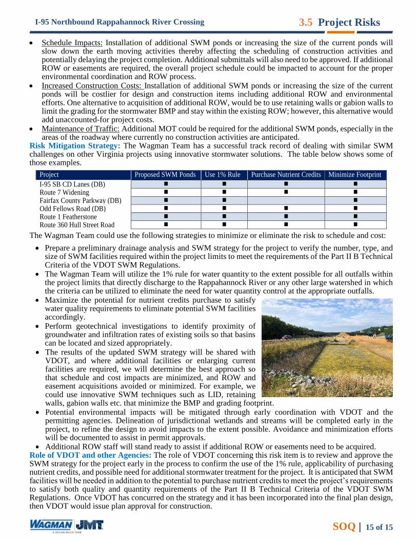
Risk Mitigation Strategy: The Wagman Team has a successful track record of dealing with similar SWM challenges on other Virginia projects using innovative stormwater solutions. The table below shows some of those examples.
Project Proposed SWM Ponds Use 1% Rule Purchase Nutrient Credits Minimize Footprint
I-95 SB CD Lanes (DB) Route 7 Widening Fairfax County Parkway (DB) Odd Fellows Road (DB) Route 1 Featherstone Route 360 Hull Street Road
The Wagman Team could use the following strategies to minimize or eliminate the risk to schedule and cost:
• Prepare a preliminary drainage analysis and SWM strategy for the project to verify the number, type, and size of SWM facilities required within the project limits to meet the requirements of the Part II B Technical Criteria of the VDOT SWM Regulations.
• The Wagman Team will utilize the 1% rule for water quantity to the extent possible for all outfalls within the project limits that directly discharge to the Rappahannock River or any other large watershed in which the criteria can be utilized to eliminate the need for water quantity control at the appropriate outfalls.
• Maximize the potential for nutrient credits purchase to satisfy water quality requirements to eliminate potential SWM facilities accordingly.
• Perform geotechnical investigations to identify proximity of groundwater and infiltration rates of existing soils so that basins can be located and sized appropriately.
• The results of the updated SWM strategy will be shared with VDOT, and where additional facilities or enlarging current facilities are required, we will determine the best approach so that schedule and cost impacts are minimized, and ROW and easement acquisitions avoided or minimized. For example, we could use innovative SWM techniques such as LID, retaining walls, gabion walls etc. that minimize the BMP and grading footprint.
• Potential environmental impacts will be mitigated through early coordination with VDOT and the permitting agencies. Delineation of jurisdictional wetlands and streams will be completed early in the project, to refine the design to avoid impacts to the extent possible. Avoidance and minimization efforts will be documented to assist in permit approvals.
• Additional ROW staff will stand ready to assist if additional ROW or easements need to be acquired. Role of VDOT and other Agencies: The role of VDOT concerning this risk item is to review and approve the SWM strategy for the project early in the process to confirm the use of the 1% rule, applicability of purchasing nutrient credits, and possible need for additional stormwater treatment for the project. It is anticipated that SWM facilities will be needed in addition to the potential to purchase nutrient credits to meet the project’s requirements to satisfy both quality and quantity requirements of the Part II B Technical Criteria of the VDOT SWM Regulations. Once VDOT has concurred on the strategy and it has been incorporated into the final plan design, then VDOT would issue plan approval for construction.
AppendixAppendix


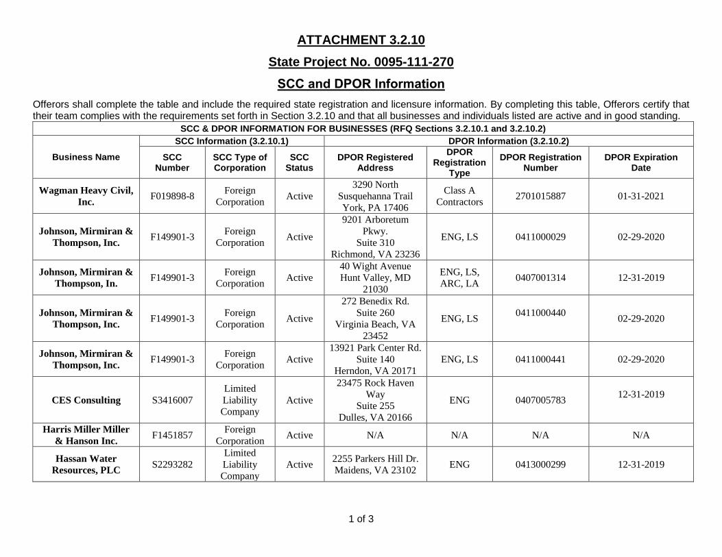
ATTACHMENT 3.2.10
State Project No. 0095-111-270
SCC and DPOR Information
1 of 3
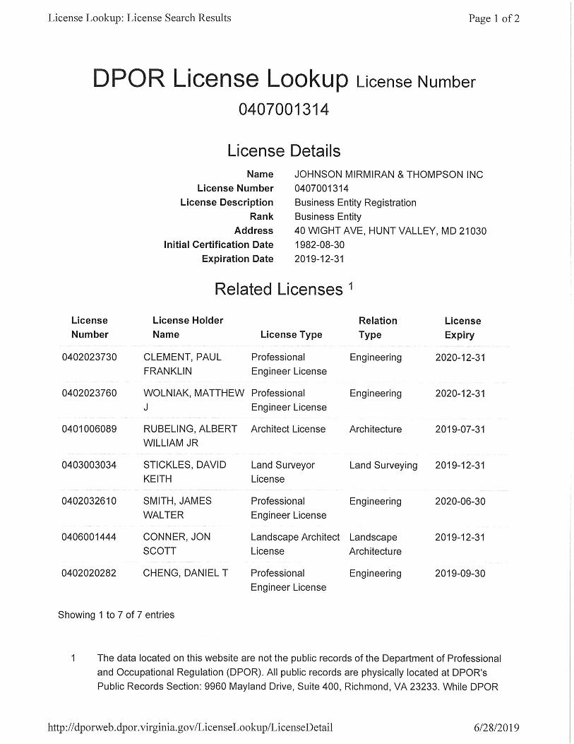
Offerors shall complete the table and include the required state registration and licensure information. By completing this table, Offerors certify that their team complies with the requirements set forth in Section 3.2.10 and that all businesses and individuals listed are active and in good standing.
SCC & DPOR INFORMATION FOR BUSINESSES (RFQ Sections 3.2.10.1 and 3.2.10.2)
Business Name
SCC Information (3.2.10.1) DPOR Information (3.2.10.2)
SCC Number
SCC Type of Corporation
SCC Status
DPOR Registered Address
DPOR Registration
Type
DPOR Registration Number
DPOR Expiration Date
Wagman Heavy Civil,
Inc. F019898-8
Foreign
Corporation Active
3290 North
Susquehanna Trail
York, PA 17406
Class A
Contractors 2701015887 01-31-2021
Johnson, Mirmiran &
Thompson, Inc. F149901-3
Foreign
Corporation Active
9201 Arboretum
Pkwy.
Suite 310
Richmond, VA 23236
ENG, LS 0411000029 02-29-2020
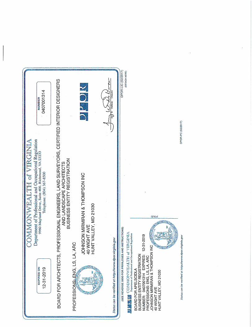
Johnson, Mirmiran &
Thompson, In. F149901-3
Foreign
Corporation Active
40 Wight Avenue
Hunt Valley, MD
21030
ENG, LS,
ARC, LA 0407001314 12-31-2019
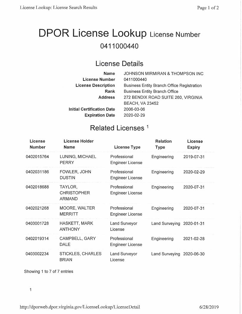
Johnson, Mirmiran &
Thompson, Inc. F149901-3
Foreign
Corporation Active
272 Benedix Rd.
Suite 260
Virginia Beach, VA
23452
ENG, LS 0411000440
02-29-2020
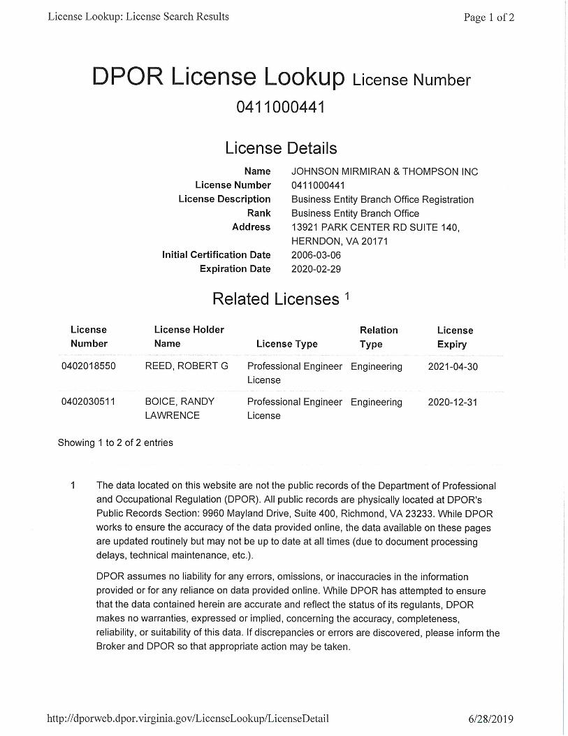
Johnson, Mirmiran &
Thompson, Inc. F149901-3
Foreign
Corporation Active
13921 Park Center Rd.
Suite 140
Herndon, VA 20171
ENG, LS 0411000441 02-29-2020
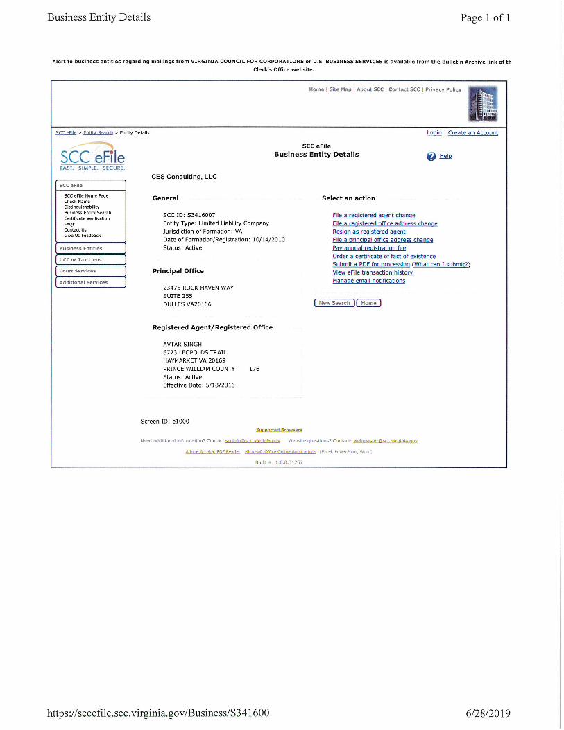
CES Consulting S3416007
Limited
Liability
Company
Active
23475 Rock Haven
Way
Suite 255
Dulles, VA 20166
ENG 0407005783 12-31-2019
Harris Miller Miller
& Hanson Inc. F1451857
Foreign
Corporation Active N/A N/A N/A N/A
Hassan Water
Resources, PLC S2293282
Limited
Liability
Company
Active 2255 Parkers Hill Dr.
Maidens, VA 23102 ENG 0413000299 12-31-2019
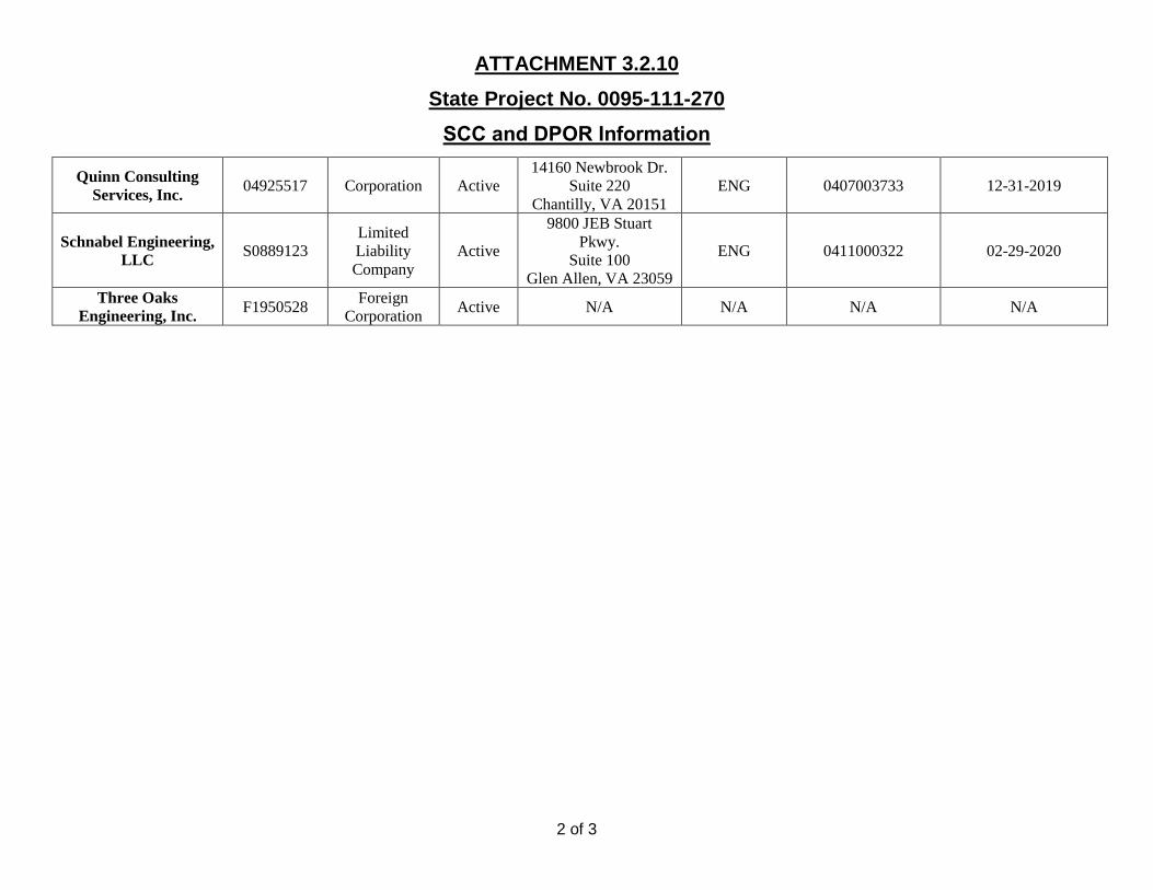
ATTACHMENT 3.2.10
State Project No. 0095-111-270
SCC and DPOR Information
2 of 3
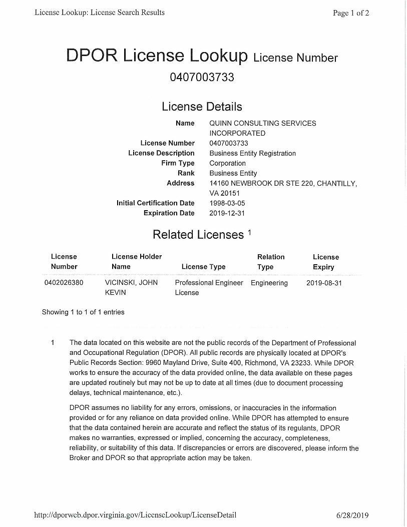
Quinn Consulting
Services, Inc. 04925517 Corporation Active
14160 Newbrook Dr.
Suite 220
Chantilly, VA 20151
ENG 0407003733 12-31-2019
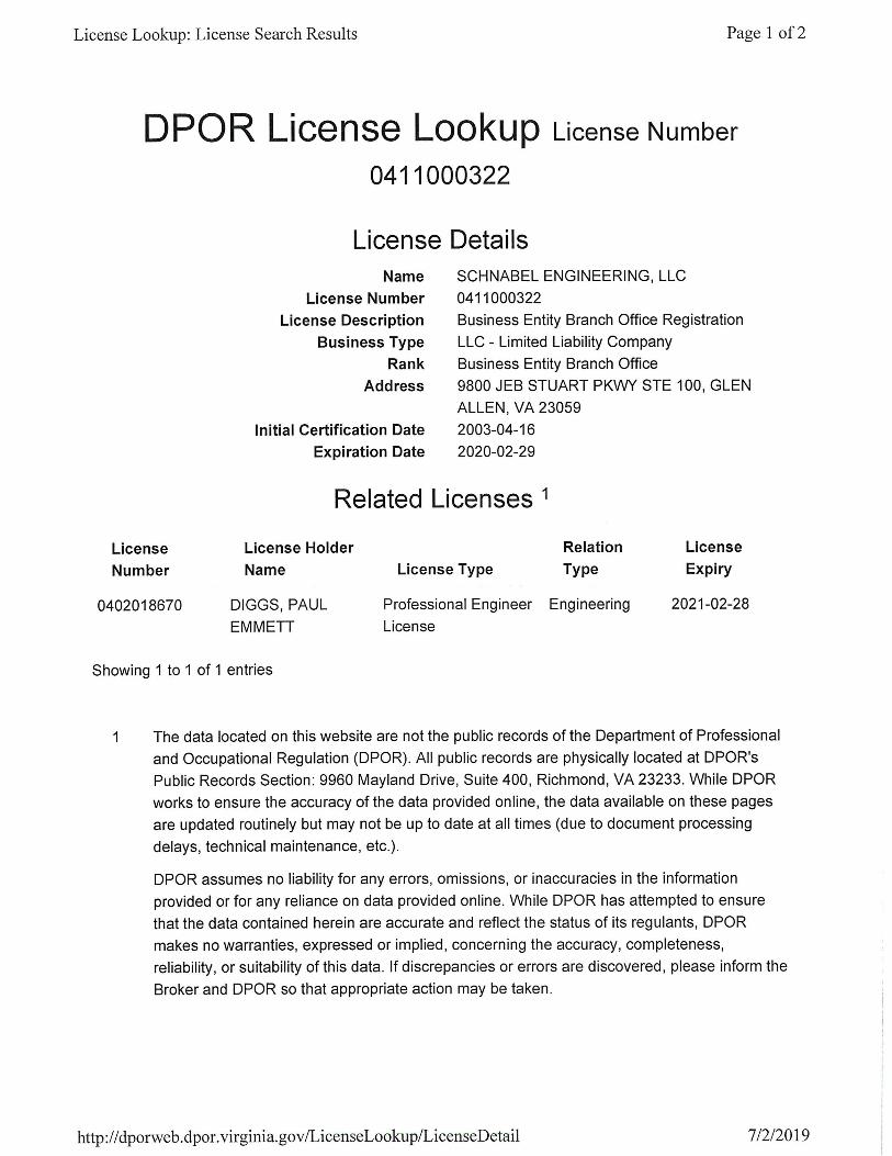
Schnabel Engineering,
LLC S0889123
Limited
Liability
Company
Active
9800 JEB Stuart
Pkwy.
Suite 100
Glen Allen, VA 23059
ENG 0411000322 02-29-2020
Three Oaks
Engineering, Inc. F1950528
Foreign
Corporation Active N/A N/A N/A N/A
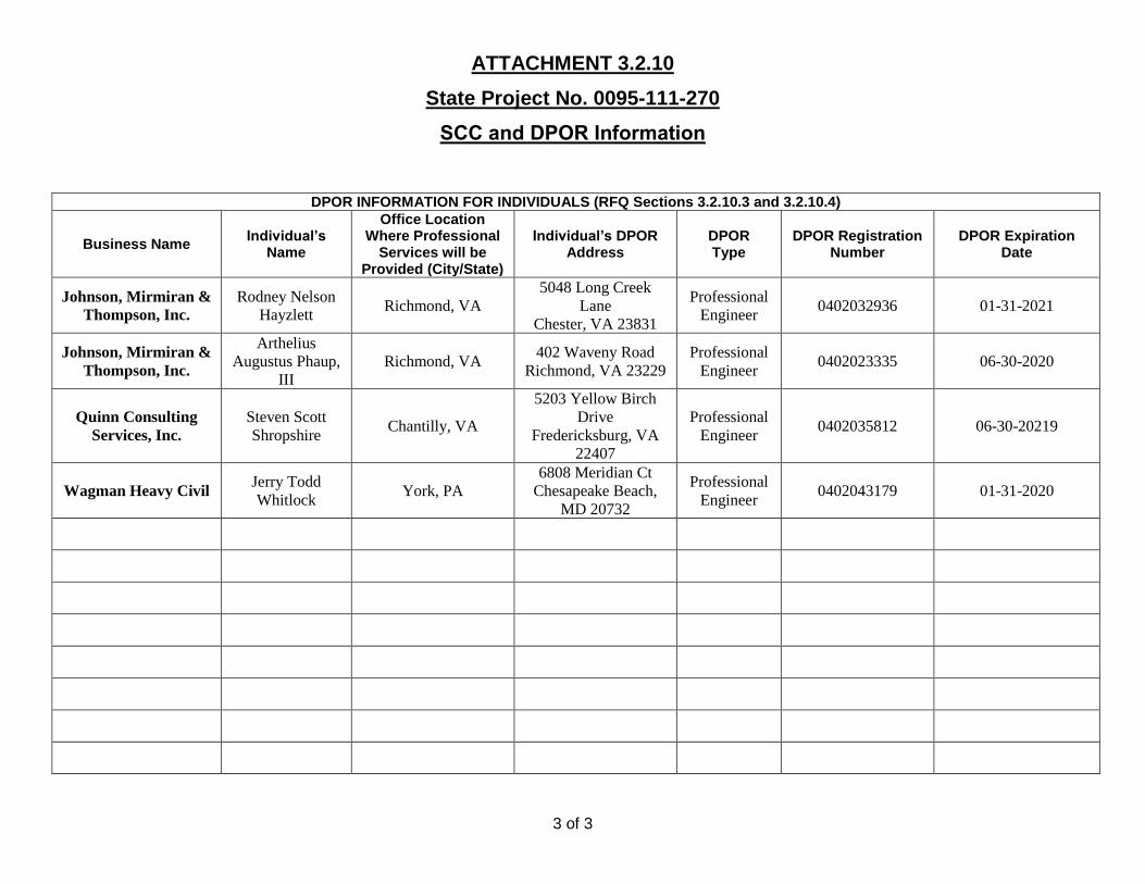
ATTACHMENT 3.2.10
State Project No. 0095-111-270
SCC and DPOR Information
3 of 3
DPOR INFORMATION FOR INDIVIDUALS (RFQ Sections 3.2.10.3 and 3.2.10.4)
Business Name Individual’s
Name
Office Location Where Professional
Services will be Provided (City/State)
Individual’s DPOR Address
DPOR Type
DPOR Registration Number
DPOR Expiration Date
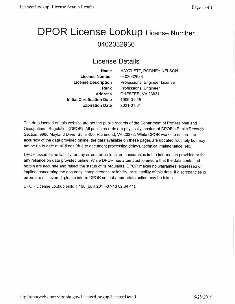
Johnson, Mirmiran &
Thompson, Inc.
Rodney Nelson
Hayzlett Richmond, VA
5048 Long Creek
Lane
Chester, VA 23831
Professional
Engineer 0402032936 01-31-2021
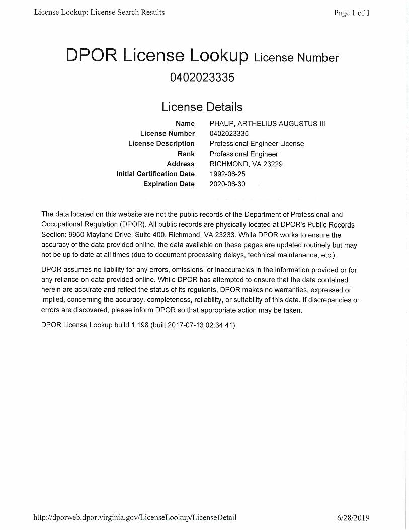
Johnson, Mirmiran &
Thompson, Inc.
Arthelius
Augustus Phaup,
III
Richmond, VA 402 Waveny Road
Richmond, VA 23229
Professional
Engineer 0402023335 06-30-2020
Quinn Consulting
Services, Inc.
Steven Scott
Shropshire Chantilly, VA
5203 Yellow Birch
Drive
Fredericksburg, VA
22407
Professional
Engineer 0402035812 06-30-20219
Wagman Heavy Civil Jerry Todd
Whitlock York, PA
6808 Meridian Ct
Chesapeake Beach,
MD 20732
Professional
Engineer 0402043179 01-31-2020


Attachment 3.4.1(a) Lead Contractor Work History Form
ATTACHMENT 3.4.1(a)
LEAD CONTRACTOR - WORK HISTORY FORM
(LIMIT 1 PAGE PER PROJECT)
a. Project Name &
Location
b. Name of the prime
design consulting firm
responsible for the overall
project design.
c. Contact information of
the Client or Owner and
their Project Manager who
can verify Firm’s
responsibilities.
d. Contract Completion
Date (Original)
e. Contract Completion
Date (Actual or
Estimated)
f. Contract Value (in thousands) g. Dollar Value of Work
Performed by the Firm
identified as the Lead
Contractor for this
procurement.(in thousands)
Original Contract Value Final or Estimated
Contract Value
Name: Intercounty
Connector, Contract B (DB)
SINGLE CONTRACT
Location: Montgomery &
Prince George’s Counties,
MD
Name: Parsons
Transportation Group
Additional Designer:
Coordinated with JMT
on adjacent DB Project.
Schnabel Engineering
was the geotechnical
engineer of record.
Name of Client/ Owner: Maryland State Highway
Administration
Phone: 410-545-8863
Project Manager: Sean
Campion, Head of MDOT
SHA Alternative Delivery
Phone: 410-545-8863
Email: [email protected]
11/2011 11/2011 (Actual)
$545,092 $578,000 (Final - Due to Owner-Approved
Change Orders)
Wagman was a 20% equity
partner in the Intercounty
Constructors Joint Venture
entity that was contractually
responsible for the delivery of
this $578,000 Design-Build
Project. Proposed Lead
Contractor Wagman’s Fee was
$115,600.
h. Narrative describing the Work Performed by the Firm identified as the Lead Contractor for this procurement. If the Offeror chooses to submit work completed by an affiliated or subsidiary company of the Lead Contractor, identify the full
legal name of the affiliate or subsidiary and the role they will have on this Project, so the relevancy of that work can be considered accordingly. The Work History Form shall include only one singular project. Projects/contracts with multiple
phases, segments, elements (projects), and/or contracts shall not be considered a single project. Projects/contracts with multiple phases, segments, elements (projects), and/or contracts shall not be claimed as a single project on this form. If
the Offeror chooses to submit work performed as a Joint Venture or Partnership, identify how the Joint Venture or Partnership was structured and provide a description of the portion of the work performed only by the Offeror’s firm.
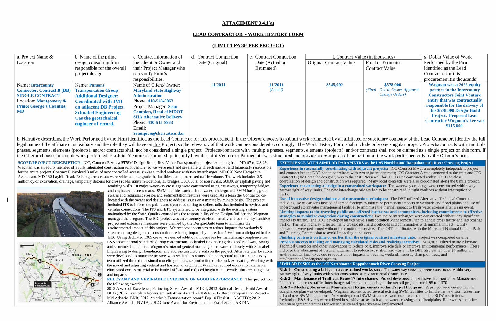
SCOPE/PROJECT DESCRIPTION | ICC, Contract B was a $578M Design-Build, Best Value Transportation project extending from MD 97 to US 29.
Wagman was an equity member of a fully integrated construction joint venture, so we were joint and severable with each partner and financially responsible
for the entire project. Contract B involved 8 miles of new controlled access, six-lane, tolled roadway with two interchanges; MD 650 New Hampshire
Avenue and MD 182 Layhill Road. Existing cross roads were widened to upgrade the facilities due to increased traffic volume. The work included 2.5
million cy of excavation, drainage, temporary detours for cross roads, utility relocations, 13 bridges, 300,000 sf of noisewalls, 500,00 sy asphalt paving and
retaining walls. 10 major waterway crossings were constructed using causeways, temporary bridges
and engineered access roads. SWM facilities such as bio-swales, underground SWM basins, grass
swales and redundant erosion and sedimentation features were used. As a team the Contractor co-
located with the owner and designers to address issues on a minute by minute basis. The project
included ITS to inform the public and open road tolling to collect tolls that included hardwired and
cellular connections. The ITS and ETC system had to be integrated with the existing system
maintained by the State. Quality control was the responsibility of the Design-Builder and Wagman
managed the program. The ICC project was an extremely environmentally and community sensitive
project and extensive measures were planned by the Design-Build team to minimize the
environmental impact of this project. We received incentives to reduce impacts for wetlands &
streams during design and construction; reducing impacts by more than 10% from anticipated in the
EIS. Using dedicated E&S crews, we earned additional incentives for maintaining compliance for
E&S above normal standards during construction. Schnabel Engineering designed roadway, paving
and structure foundations. Wagman’s internal geotechnical engineers worked closely with Schnabel
Engineering to design foundations and address unsuitable soils on the project. Alternate pier locations
were developed to minimize impacts with wetlands, streams and underground utilities. Our survey
team utilized three dimensional modeling to increase production of the bulk excavating. Working with
the model and adjusting vertical and horizontal alignment, Wagman reduced excavation elements,
eliminated excess material to be hauled off site and reduced height of noisewalls; thus reducing cost
and impacts.
RELEVANT AND VERIFIABLE EVIDENCE OF GOOD PERFORMANCE | This project won
the following awards:
2013 Award of Excellence, Partnering Silver Award – MDQI; 2012 National Design-Build Award –
DBIA; 2012 Exemplary Ecosystem Initiatives Award - FHWA; 2012 Best Transportation Project –
Mid Atlantic- ENR; 2012 America’s Transportation Award Top 10 Finalist – AASHTO; 2012
Alliance Award - NVTA; 2012 Globe Award for Environmental Excellence – ARTBA
EXPERIENCE WITH SIMILAR PARAMETRS as the I-95 Northbound Rappahannock River Crossing Project
Experience in successfully coordinating with adjacent projects: ICC Contract B was a completely independent project and contract but the DBT had to coordinate with two adjacent contracts; ICC Contract A was connected to the west and ICC Contract C (JMT was the designer) was to the east. Noisewall for ICC B was constructed within ICC C so close coordination of design and construction was required. Many local contracts were also coordinated along the 8 mile project. Experience constructing a bridge in a constrained workspace: The waterway crossings were constructed within very narrow right of way limits. The new interchange bridges had to be constructed in tight confines without interruption to traffic. Use of innovative design solutions and construction techniques: The DBT utilized Alternative Technical Concepts including use of caissons instead of spread footings to minimize permanent impacts to wetlands and flood plains and use of underground stormwater management facilities to minimize the thermal impact to fresh water streams after a rain event. Limiting impacts to the traveling public and affected businesses and communities, including commitments to effective strategies to minimize congestion during construction: Two major interchanges were constructed without any significant impacts to traffic. The DBT developed an extensive Transportation Management Plan to handle cross traffic and interchange traffic. The new highway bisected many crossroads, neighborhoods and communities with minimal impact. Utility relocations were performed without interruption to service. The DBT coordinated with the Maryland-National Capital Park and Planning Commission to avoid impacting park users. Finishing contracts on time or earlier than the original contract milestone date: Project was completed on time. Previous success in taking and managing calculated risks and realizing incentives: Wagman utilized many Alternate Technical Concepts and other innovations to reduce cost, improve schedule or improve environmental performance. These included the adjustment of vertical alignment to reduce excavation and waste. The DBT also earned over $6 million in environmental incentives due to reduction of impacts to streams, wetlands, forests, champion trees, and rate/threatened/endangered species.
SIMILAR RISKS as the I-95 Northbound Rappahannock River Crossing Project
Risk 1 – Constructing a bridge in a constrained workspace: Ten waterway crossings were constructed within very narrow right of way limits with strict constraints on environmental disturbance. Risk 2 – Maintenance of Traffic at Route 17 Interchange: Project developed an extensive Transportation Management Plan to handle cross traffic, interchange traffic and the opening of the overall project from I-95 to I-370. Risk 3 – Meeting Stormwater Management Requirements within Project Footprint: A project wide environmental compliance plan was developed. Wagman reconstructed several existing SWM facilities to handle the new stormwater run-off and new SWM regulations. New underground SWM structures were used to accommodate ROW restrictions. Redundant E&S devices were utilized in sensitive areas such as the water crossings and floodplains Bio-swales and other best management practices for water quality and quantity were implemented.
ATTACHMENT 3.4.1(a)
LEAD CONTRACTOR - WORK HISTORY FORM
(LIMIT 1 PAGE PER PROJECT)
a. Project Name &
Location
b. Name of the prime
design consulting firm
responsible for the overall
project design.
c. Contact information of
the Client or Owner and
their Project Manager who
can verify Firm’s
responsibilities.
d. Contract Completion
Date (Original)
e. Contract Completion
Date (Actual or
Estimated)
f. Contract Value (in thousands) g. Dollar Value of Work
Performed by the Firm
identified as the Lead
Contractor for this
procurement.(in thousands)
Original Contract Value Final or Estimated
Contract Value
Name: MD 404 – US 50 to
East of Holly Road Design-
Build
Location: Caroline, Queen
Anne’s and Talbot
Counties, MD
Name: WM/JMT/RK&K,
Joint Venture, a joint
venture composed of
Wallace Montgomery &
Associates, LLP, Johnson
Mirmiran & Thompson,
Inc., and Rummel, Klepper
& Kahl, LLP
Name of Client/ Owner: Maryland State Highway
Administration
Phone: 443-956-8386
Project Manager: Fred
Valente
Phone: 443-956-8386
Email: [email protected]
09/2018 12/2018 (Due to Owner-Approved
Change Orders)
$104,998 $111,815 (Due to Owner-Approved
Change Orders and receipt of
$362K in environmental
incentives)
$24,622
(Based on JV %)
h. Narrative describing the Work Performed by the Firm identified as the Lead Contractor for this procurement. If the Offeror chooses to submit work completed by an affiliated or subsidiary company of the Lead Contractor, identify the full
legal name of the affiliate or subsidiary and the role they will have on this Project, so the relevancy of that work can be considered accordingly. The Work History Form shall include only one singular project. Projects/contracts with multiple
phases, segments, elements (projects), and/or contracts shall not be considered a single project. Projects/contracts with multiple phases, segments, elements (projects), and/or contracts shall not be claimed as a single project on this form. If
the Offeror chooses to submit work performed as a Joint Venture or Partnership, identify how the Joint Venture or Partnership was structured and provide a description of the portion of the work performed only by the Offeror’s firm.
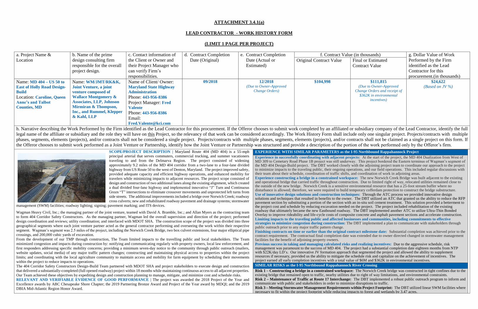
SCOPE/PROJECT DESCRIPTION | Maryland Route 404 (MD 404) is a 55-mph
principal arterial that serves commuters, commercial trucking, and summer vacationers
traveling to and from the Delmarva Region. The project consisted of widening
approximately 9.2 miles of the MD 404 corridor from a two-lane to a four-lane divided
highway from US Route 50 to the west of Denton, Maryland. The project improved safety,
provided adequate capacity and efficient highway operations, and enhanced mobility for
travelers while minimizing impacts to adjacent resources. The project scope consisted of
design and construction of two additional lanes along the existing alignment, which created
a dual divided four-lane highway and implemented innovative “J” Turn and Continuous
Green “T” intersections to eliminate crossover movements and unprotected left turns from
side streets. The additional improvements included a bridge over Norwich Creek; roadway
cross culverts; new and rehabilitated roadway pavement and drainage systems; stormwater
management (SWM) facilities; roadway lighting; signing; pavement marking; and ITS devices.
Wagman Heavy Civil, Inc.; the managing partner of the joint venture, teamed with David A. Bramble, Inc.; and Allan Myers as the contracting team
to form 404 Corridor Safety Constructors. As the managing partner, Wagman led the overall supervision and direction of the project; performed
design coordination and reviews; utility coordination; and interfaced with MDOT SHA. The construction scope of the project was divided into three
geographical segments where each joint venture partner acted as the general contractor performing and overseeing the work within their respective
segment. Wagman’s segment was 2.5 miles of the project, including the Norwich Creek Bridge, two box culvert extensions, four major elliptical pipe
crossings, and 200,000 cubic yards of excavation.
From the development of our TMP through construction, The Team limited impacts to the travelling public and local stakeholders. The Team
minimized congestion and impacts during construction by: notifying and communicating regularly with property owners, local law enforcement, and
first responders addressing specific mobility concerns; providing a minimum seven-day notice to the community through public outreach (mailers,
website updates, social media) of any major traffic pattern changes; constructing and maintaining physical access to properties within the project
limits; and coordinating with the local agriculture community to maintain access and mobility for farm equipment by scheduling their movements
within the project to reduce impacts to operations.
The 404 Corridor Safety Constructors Design-Build Team partnered with MDOT SHA and project stakeholders to execute design and construction
that delivered a substantially-completed (full opened roadway) project within 18 months while maintaining continuous access to all adjacent properties.
Our Team achieved these objectives by expediting design and construction planning to manage, mitigate, and minimize cost and schedule risks.
RELEVANT AND VERIFIABLE EVIDENCE OF GOOD PERFORMANCE | The project was awarded the 2018 Project of the Year and
Excellence awards by ABC Chesapeake Shore Chapter; the 2019 Partnering Bronze Award and Project of the Year award by MDQI; and the 2019
DBIA Mid-Atlantic Region Honor Award.
EXPERIENCE WITH SIMILAR PARAMETERS as the I-95 Northbound Rappahannock Project
Experience in successfully coordinating with adjacent projects: At the start of the project, the MD 404 Dualization from West of MD 309 to Cemetary Road Phase 1B project was still underway. This project bordered the Eastern terminus of Wagman’s segment of the MD 404 Design-Build project. The DBT worked closely with the adjoining project team to coordinate our approach to the project to minimize impacts to the traveling public, their ongoing operations, and our field operations. This included regular discussions with their team about their schedule, coordination of traffic shifts, and coordination of work in adjoining areas. Experience constructing a bridge in a constrained workspace: The new Norwich Creek Bridge was built adjacent to the existing and operational bridge that carried traffic throughout construction. Due to limited right of way, relocated utilities remained close to the outside of the new bridge. Norwich Creek is a sensitive environmental resource that has a 25-foot stream buffer where no disturbance is allowed; therefore, we were required to build temporary cofferdam protection to construct the bridge substructure. Use of innovative design solutions and construction techniques: Through the ATC process we provided innovative design solutions and techniques that resulted in benefits to the owner. The DBT utilized an ATC that granted us the ability to reduce the RFP pavement section by substituting a portion of the section with an in-situ soil cement treatment. This solution provided a betterment to the project cost and schedule by reducing excavation needed on the project. The project included rehabilitation of the existing roadway that ultimately became the new Eastbound roadway. The DBT implemented another ATC to utilize Ultra-Thin Bonded Overlay to improve rideability and life-cycle costs of composite concrete and asphalt pavement sections and accelerate construction. Limiting impacts to the traveling public and affected businesses and communities, including commitments to effective strategies to minimize congestion during construction: The DBT implemented a plan to communicate with stakeholders through public outreach prior to any major traffic pattern change. Finishing contracts on time or earlier than the original contract milestone date: Substantial completion was achieved prior to the contract requirement. The contractual final completion date was extended due to owner directed changed in stormwater management facilities for the benefit of adjoining property owners. Previous success in taking and managing calculated risks and realizing incentives: Due to the aggressive schedule, risk management was paramount to the success of MD 404. The project had a substantial completion date eighteen months from NTP with $22K/day LD’s. Our innovative JV formation approach that segmented the project and allowed the ability to supplement resources if necessary, provided us the ability to mitigate the schedule risk and capitalize on the achievement of incentives. The project earned all early completion incentives with a total value of $6M and $362K in environmental incentives.
SIMILAR RISKS as the I-95 Northbound Rappahannock River Crossing
Risk 1 – Constructing a bridge in a constrained workspace: The Norwich Creek bridge was constructed in tight confines due to the existing bridge that remained open to traffic, nearby utilities due to right of way limitations, and environmental constraints. Risk 2 – Maintenance of Traffic at Route 17 Interchange: The DBT implemented a robust public outreach program to inform and communicate with public and stakeholders in order to minimize disruptions to traffic. Risk 3 – Meeting Stormwater Management Requirements within Project Footprint: The DBT utilized linear SWM facilities where necessary to fit within the project footprint while reducing impacts to forest and wetlands by 3.47 acres.

ATTACHMENT 3.4.1(a)
LEAD CONTRACTOR - WORK HISTORY FORM
(LIMIT 1 PAGE PER PROJECT)
a. Project Name &
Location
b. Name of the prime
design consulting firm
responsible for the overall
project design.
c. Contact information of
the Client or Owner and
their Project Manager who
can verify Firm’s
responsibilities.
d. Contract Completion
Date (Original)
e. Contract Completion
Date (Actual or
Estimated)
f. Contract Value (in thousands) g. Dollar Value of Work
Performed by the Firm
identified as the Lead
Contractor for this
procurement.(in thousands)
Original Contract Value Final or Estimated
Contract Value
Name: Route 7 Widening
and Bridge Rehabilitation
over the Dulles Toll Road
and Dulles International
Airport Access Highway
(DB)
Location: Tyson’s Corner,
VA
Name: Rinker Design
Associates (Lead Design &
Civil)
Additional Designers: WRA
(Structural)
Wagman Heavy Civil, Inc.
(Specialty Foundations)
(JMT performed
preliminary design for
VDOT)
Name of Client/ Owner: Virginia Department of
Transportation
Phone: 703-259-1940
Project Manager: Arif
Rahman
Phone: 703-259-1940
Email: [email protected].
gov
05/2018 05/2018 (Actual – Projected was
completed 5 days early)
$39,887 $42,200 (Final - Due to Owner-Approved
Change Orders)
$42,200
h. Narrative describing the Work Performed by the Firm identified as the Lead Contractor for this procurement. If the Offeror chooses to submit work completed by an affiliated or subsidiary company of the Lead Contractor, identify the full
legal name of the affiliate or subsidiary and the role they will have on this Project, so the relevancy of that work can be considered accordingly. The Work History Form shall include only one singular project. Projects/contracts with multiple
phases, segments, elements (projects), and/or contracts shall not be considered a single project. Projects/contracts with multiple phases, segments, elements (projects), and/or contracts shall not be claimed as a single project on this form. If
the Offeror chooses to submit work performed as a Joint Venture or Partnership, identify how the Joint Venture or Partnership was structured and provide a description of the portion of the work performed only by the Offeror’s firm.
SCOPE/PROJECT DESCRIPTION | This $42.2M design-build project for the Virginia Department of Transportation reconstructed and widened the structurally deficient Route 7 bridge over Dulles Toll Road and the Dulles International Airport Access Highway from four lanes to six lanes. Limited clearances within Metropolitan Washington Airports Authority’s (Airports Authority) right-of-way required the design and installation of permanent foundations using micropiles to widen the existing bridge piers between Dulles Toll Road and the Dulles Access Highway. The project also included a 10’ wide shared-use path for pedestrians and bikes to travel in each direction. This path incorporates grade separated crossings, including two pedestrian bridges and three pedestrian tunnels.
Over 80% of this project was constructed on the Airports Authority’s property through agreements with VDOT. Design and construction of this project involved close coordination with the Airports Authority to ensure that the project limits were within the Airports Authority’s approved property limits and that portions of the
final construction that become Airports Authority property, exceeded their construction standards. Airports Authority facilities that were designed and constructed as part of this project include roadway lighting, bridge protection barrier, bridge substructure, grading for future CD lanes, and overhead sign structures.
This project included an extremely aggressive schedule for both design and construction that was mitigated using the “rolling Design-Build” method for all structures work on the project. An effective QA/QC program was essential to the success of the project and helped avoid delays due to rework. Daily communication between all members of the QA/QC team was maintained throughout construction to ensure that work met or exceeded quality requirements. Weekly QA/QC meetings were held to discuss and resolve any issues. Two-week look-ahead schedules were used to monitor and adjust QA/QC resources as needed based on workloads and work shifts.
Use of micropile foundations minimized impacts to the adjacent pavement during construction of the bridge substructure. Other innovative design efforts led to a joint elimination over a pier in one of the pedestrian overpasses, which improves the long-term maintenance concerns.
RELEVANT AND VERIFIABLE EVIDENCE OF GOOD PERFORMANCE | The most notable enhancement included by the Design Build Team (DBT) in the low-price proposal was the mitigation of potential utility delays and compression of the project schedule. The construction phasing of the bridge replacement was reduced from seven phases to four phases by adjusting the bridge alignment and constructing the northern widening in the first phase concurrent with the interior widening. This also allowed the DBT to provide a corridor for the utilities to relocate eight months ahead of the RFP documents. The DBT also self-performed construction of the new utility duct bank to mitigate potential schedule impacts by utility construction crews.
Due to overall excellence in quality of craftsmanship, technical challenges, difficulty of execution, and aesthetics, the Heavy Construction Contractors Association awarded the DBT the 2018 Award for Excellence in Infrastructure.
EXPERIENCE WITH SIMILAR PARAMETERS as the I-95 Northbound Rappahannock River Crossing Project
Experience in successfully coordinating with adjacent projects: Daily coordination was required with the Silver Line project and Airport Authority’s noise wall projects to ensure smooth and efficient operation of both the Dulles Toll Road and the Dulles International Airport Access Highway. Experience constructing a bridge in a constrained workspace: The new bridge had to be constructed within the narrow median of the Dulles Toll Road and Dulles International Airport Access Highway. Use of innovative design solutions and construction techniques: Specialty geotechnical foundations were designed and constructed to deal with the workspace constraints. These foundations included drilled shafts, top down tieback walls, and micropiles. These innovative design and construction techniques minimized lane shifts and helped reduce the number of construction phases further reducing impacts to the travelling public. Limiting impacts to the traveling public and affected businesses and communities, including commitments to effective strategies to minimize congestion during construction: Route 7 has an annual average daily traffic volume (AADT) of 60,000 per day while the Dulles Toll Road has a AADT of 65,000 per day. Additionally, Route 7 is an important bicycle and pedestrian link across the Dulles Toll Road. This project required a complex Traffic Management Plan and coordination with Fairfax County Department of Transportation to safely manage these high traffic volumes and accommodate pedestrian traffic. Multiple shifts of Route 7 were required in order to construct the new bridge in phases without reducing lanes. Lanes were temporarily closed only during off-peak periods. Finishing contracts on time or earlier than the original contract milestone date: Project was completed and accepted five days earlier than the contract date. Previous success in taking and managing calculated risks and realizing incentives: The DBT adjusted the bridge alignment in order to reduce construction phasing of the bridge from seven phases to four phases.
SIMILAR RISKS as the I-95 Northbound Rappahannock River Crossing
Risk 1 – Constructing a bridge in a constrained workspace: Innovative solutions and several specialty pieces of equipment were used to self-perform the geotechnical work within the tight confines of the medians on the Dulles Toll Road and Dulles International Airport Access Highway, including a compact drilling rig and custom discharge assembly for offsite disposal of drill cuttings. Risk 2 – Maintenance of Traffic at Route 17 Interchange: Project required a complex Traffic Management Plan which required multiple phases and traffic shifts. Very high AADT within project limits. Lanes were temporarily closed only during off-peak periods. Phasing was reduced from seven phases to four phases. Bridge and ramps were opened to traffic six months before the project end date. Risk 3 – Meeting Stormwater Management Requirements within Project Footprint: The DBT utilized nutrient credits for quality and adjusted drainage design to meet existing quantity requirements. Redesigned drainage in order to eliminate a major open SWM pond on MWAA right of way. Developed a matrix and tracked temporary and permanent impacts to ensure permit compliance.

Attachment 3.4.1(b) Lead Designer Work History Form
ATTACHMENT 3.4.1(b)
LEAD DESIGNER - WORK HISTORY FORM
(LIMIT 1 PAGE PER PROJECT)
a. Project Name & Location b. Name of the prime/ general
contractor responsible for overall construction of the project.
c. Contact information of the Client and their Project Manager who can verify Firm’s responsibilities.
d. Construction Contract Start
Date
e. Contract Completion Date (Actual or Estimated)
f. Contract Value (in thousands) g. Design Fee for the Work Performed by the Firm identified as the Lead Designer for this procurement.(in thousands)
Construction Contract Value (Original)
Construction Contract Value (Actual or Estimated)
Name: I-95 Southbound CD Lanes Rappahannock River Crossing (Design-Build) Location: Stafford, VA
Name: Wagman Heavy Civil, Inc.
Name of Client/ Owner: Virginia Department of Transportation Phone:540-372-3549 Project Manager: Robert Ridgell, PE Phone: 540-372-3549 Email:[email protected]
2/2018 5/2022 (Estimated)
$101,600 (Original)
$101,600 (Estimated)
$9,600 JMT Design Fee
h. Narrative describing the Work Performed by the Firm identified as the Lead Designer for this procurement. Include the office location(s) where the design work was performed and whether the firm was the prime designer or a subconsultant. The Work History Form shall include only one singular project. Projects with multiple phases, segments, elements, and/or contracts shall not be considered a single project. If a project listed includes multiple phases, segments, elements, and/or contracts, the SOQ may be rendered non-responsive. In any case, only the first phase, segment, elements, and/or contract listed will be evaluated.
(LEAD/PRIME DESIGNER – JMT / OFFICE LOCATIONS INVOLVED IN DESIGN: RICHMOND, VA; HERNDON, VA; VIRGINIA BEACH, VA; AND HUNT VALLEY, MD)
Release for Construction (RFC) plans were submitted on June 10, 2019 for approval to commence construction. PROJECT DESCRIPTION JMT is the lead designer for this $101.6M DB project to add six miles of three new southbound general-purpose lanes in a notoriously congested area of Northern Virginia. The lanes will be added to the existing median of I-95, and the existing southbound lanes will be converted to a collector-distributor road between Route 3 and Route 17. The project includes four bridges; a new 1,200-foot-long, 100-foot-high bridge over the Rappahannock River for the new general-purpose lanes in the median, a new bridge over Route 17 for the general-purpose lanes, and two replacement bridges for the existing I-95 crossings of Route 17. The project will connect with the planned southern extension of the Express Toll Lanes from Northern Virginia.
JMT was responsible for managing a multi-discipline team consisting of roadway design, bridge design, drainage design, stormwater management design, environmental permitting, traffic and ITS design, geotechnical investigation and testing, public involvement, surveying, utility designation, and noise wall analysis and design. JMT was also responsible for securing all environmental permits and right of way for the project. During construction, JMT will provide engineering oversight, and is responsible for addressing request for information from the contractor and perform shop drawing reviews. The DBT is embracing VDOT’s use of PlanGrid for document control, using it for plan submittals, RFIs and tracking and addressing issues in the field. The project has required coordination with the following agencies, FHWA, VDOT, EPA, Department
of Environmental Quality, US Army Corps of Engineers, Virginia Marine Resources Commission, Virginia Department of Game and Inland Fisheries, City of Fredericksburg, Stafford County, and Spotsylvania County. The project also involves extensive coordination with three other major construction projects that overlap construction limits with this project. JMT along with VDOT is conducting an active public involvement campaign for the project. The public involvement includes a series of Pardon Our Dust public meetings that occur at each major switch in traffic during construction to inform citizens what to expect and how to navigate the construction work zones. Stakeholders coordinated with to date, include local emergency responders from the region, homeowners concerned about noise walls, environmental groups such as Friends of the Rappahannock, river and trail user groups and utility companies. Other activities include monthly newsletters, project website, and social media notifications. RELEVANT AND VERIFIABLE EVIDENCE OF GOOD PERFORMANCE The project has required significant public engagement with many stakeholders including recreational users of the river. The Fredericksburg Trails Alliance has reported publicly on their website. “We met the … Team back on May 21, 2018 at the jobsite… they have exceeded our expectations and have really done an amazing job by doing everything that they said they would do and more.” The project team has turned what was considered a risk to the project during procurement to a project benefit through building strong stakeholder relationships.
EXPERIENCE WITH SIMILAR PARAMETERS as the I-95 Northbound Rappahannock River Crossing Project Experience in successfully coordinating with adjacent projects: The DBT successfully coordinated with VDOT and the Route 3 Safety Improvement Project contractor to have ITS conduit runs adjusted so they would not require relocation as part of the I-95 SB CD Lanes project. Currently, the DBT is coordinating with the FredEx Team on design and field activities. Experience constructing a bridge in a constrained workspace: The new Rappahannock River bridge is being constructed between the existing NB and SB I-95 Bridges and between steep river banks adjacent to cultural resources (historic canal) and recreation trails. The new I-95 SB GP lanes bridge over Route 17 is being constructed between existing NB and SB I-95 bridges while maintaining traffic along Route 17. Use of innovative design solutions and construction techniques: The project team redesigned the southern terminus of the project to achieve 1200’ longer acceleration and merge distances and set up the project for a better tie-in to a future widening project. The design team incorporated a number of details into the bridge designs to reduce the need for future inspection and maintenance including: 1) Using a continuous for live load bridge superstructure 2) Using low permeability, low shrinkage concrete in all superstructure elements; 3) Providing corrosion resistant reinforcing steel 4) Designing a jointless bridge using VDOT’s fully integral abutments; 5) Using prestressed concrete bulb-T beams without the need to paint; and 6) Using approach slabs with sleeper pads to reduce the “bump” at the end of the bridge. Limiting impacts to the traveling public and affected businesses and communities, including commitments to effective strategies to minimize congestion during construction: To reduce construction vehicles on NB and SB I-95 during peak congestion times, the DBT has performed most of the moving of earthwork from areas south of the river to north of the river at night. Finishing contracts on time or earlier than the original contract milestone date: Design of the project started in February 2018, and through the development of an early work plan set, construction begin early in August 2018 while the remainder of the project continued under design. RFC plans were submitted on June 10, 2019 and construction is on or ahead of scheduled to be completed prior to May 2022. Previous success in taking and managing calculated risks and realizing incentives: The DBT took calculated risk in designing the bridge prior to getting geotechnical boring data in the river. This allowed the construction of the Rappahannock River Bridge to begin early and increased the DBT’s chances to realize the early completion project incentives. SIMILAR RISKS as the I-95 Northbound Rappahannock River Crossing Project The I-95 SB CD Lanes project shares the following risks with the I-95 Northbound Rappahannock River Crossing Project providing the Wagman Team with relevant experience to successfully manage these risks. Risk 1 – Constructing a bridge in a constrained workspace: The new Rappahannock River bridge is being constructed between the existing NB and SB I-95 Bridges over the Rappahannock River Bridge and between steep River banks adjacent to cultural resources (historic canal) and recreation trails. Risk 2 – Maintenance of Traffic at Route 17 Interchange: The design includes complex MOT plans to maintain traffic during construction involving major detours of both southbound and northbound I-95 traffic. The proposed scheme uses a temporary traffic signal to control ramp movements at the Route 17 interchange. Risk 3 – Meeting Stormwater Management Requirements within Project Footprint: Through the use of purchasing nutrient credits, water quality swales, and the efficient conveyance of runoff to adequate outfalls, the stormwater management design eliminated fourteen bioretention facilities from the RFP design reducing the long-term maintenance costs and reducing environmental impacts.
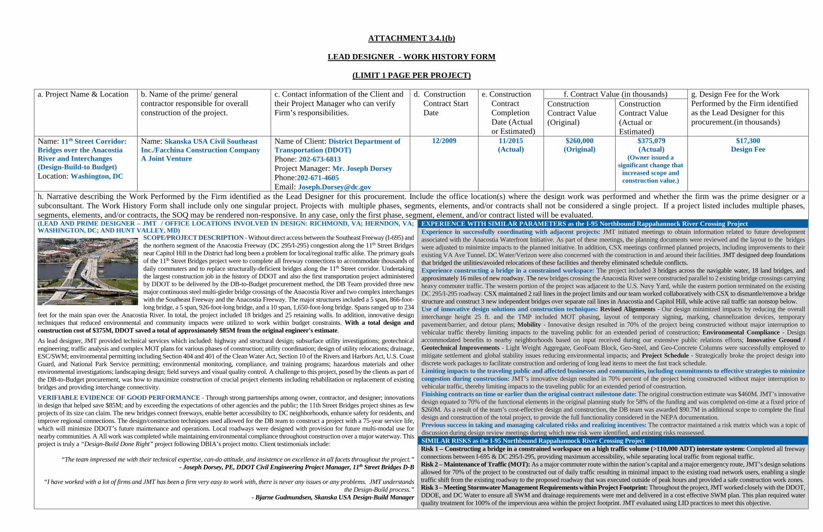
ATTACHMENT 3.4.1(b)
LEAD DESIGNER - WORK HISTORY FORM
(LIMIT 1 PAGE PER PROJECT)
a. Project Name & Location b. Name of the prime/ general
contractor responsible for overall construction of the project.
c. Contact information of the Client and their Project Manager who can verify Firm’s responsibilities.
d. Construction Contract Start Date
e. Construction Contract Completion Date (Actual or Estimated)
f. Contract Value (in thousands) g. Design Fee for the Work Performed by the Firm identified as the Lead Designer for this procurement.(in thousands)
Construction Contract Value (Original)
Construction Contract Value (Actual or Estimated)
Name: 11th Street Corridor: Bridges over the Anacostia River and Interchanges (Design-Build-to Budget) Location: Washington, DC
Name: Skanska USA Civil Southeast Inc./Facchina Construction Company A Joint Venture
Name of Client: District Department of Transportation (DDOT) Phone: 202-673-6813 Project Manager: Mr. Joseph Dorsey Phone:202-671-4605 Email: [email protected]
12/2009 11/2015 (Actual)
$260,000 (Original)
$375,079 (Actual)
(Owner issued a significant change that
increased scope and construction value.)
$17,300 Design Fee
h. Narrative describing the Work Performed by the Firm identified as the Lead Designer for this procurement. Include the office location(s) where the design work was performed and whether the firm was the prime designer or a subconsultant. The Work History Form shall include only one singular project. Projects with multiple phases, segments, elements, and/or contracts shall not be considered a single project. If a project listed includes multiple phases, segments, elements, and/or contracts, the SOQ may be rendered non-responsive. In any case, only the first phase, segment, element, and/or contract listed will be evaluated. (LEAD AND PRIME DESIGNER – JMT / OFFICE LOCATIONS INVOLVED IN DESIGN: RICHMOND, VA; HERNDON, VA; WASHINGTON, DC; AND HUNT VALLEY, MD)
SCOPE/PROJECT DESCRIPTION - Without direct access between the Southeast Freeway (I-695) and the northern segment of the Anacostia Freeway (DC 295/I-295) congestion along the 11th Street Bridges near Capitol Hill in the District had long been a problem for local/regional traffic alike. The primary goals of the 11th Street Bridges project were to complete all freeway connections to accommodate thousands of daily commuters and to replace structurally-deficient bridges along the 11th Street corridor. Undertaking the largest construction job in the history of DDOT and also the first transportation project administered by DDOT to be delivered by the DB-to-Budget procurement method, the DB Team provided three new major continuous steel multi-girder bridge crossings of the Anacostia River and two complex interchanges with the Southeast Freeway and the Anacostia Freeway. The major structures included a 5 span, 866-foot-long bridge, a 5 span, 926-foot-long bridge, and a 10 span, 1,650-foot-long bridge. Spans ranged up to 234
feet for the main span over the Anacostia River. In total, the project included 18 bridges and 25 retaining walls. In addition, innovative design techniques that reduced environmental and community impacts were utilized to work within budget constraints. With a total design and construction cost of $375M, DDOT saved a total of approximately $85M from the original engineer's estimate. As lead designer, JMT provided technical services which included: highway and structural design; subsurface utility investigations; geotechnical engineering; traffic analysis and complex MOT plans for various phases of construction; utility coordination; design of utility relocations; drainage, ESC/SWM; environmental permitting including Section 404 and 401 of the Clean Water Act, Section 10 of the Rivers and Harbors Act, U.S. Coast Guard, and National Park Service permitting; environmental monitoring, compliance, and training programs; hazardous materials and other environmental investigations; landscaping design; field surveys and visual quality control. A challenge to this project, posed by the clients as part of the DB-to-Budget procurement, was how to maximize construction of crucial project elements including rehabilitation or replacement of existing bridges and providing interchange connectivity. VERIFIABLE EVIDENCE OF GOOD PERFORMANCE - Through strong partnerships among owner, contractor, and designer; innovations in design that helped save $85M; and by exceeding the expectations of other agencies and the public; the 11th Street Bridges project shines as few projects of its size can claim. The new bridges connect freeways, enable better accessibility to DC neighborhoods, enhance safety for residents, and improve regional connections. The design/construction techniques used allowed for the DB team to construct a project with a 75-year service life, which will minimize DDOT’s future maintenance and operations. Local roadways were designed with provision for future multi-modal use for nearby communities. A All work was completed while maintaining environmental compliance throughout construction over a major waterway. This project is truly a “Design-Build Done Right” project following DBIA’s project motto. Client testimonials include:
“The team impressed me with their technical expertise, can-do attitude, and insistence on excellence in all facets throughout the project.”
- Joseph Dorsey, PE, DDOT Civil Engineering Project Manager, 11th Street Bridges D-B
“I have worked with a lot of firms and JMT has been a firm very easy to work with, there is never any issues or any problems. JMT understands the Design-Build process.”
- Bjarne Gudmundsen, Skanska USA Design-Build Manager
EXPERIENCE WITH SIMILAR PARAMETERS as the I-95 Northbound Rappahannock River Crossing Project Experience in successfully coordinating with adjacent projects: JMT initiated meetings to obtain information related to future development associated with the Anacostia Waterfront Initiative. As part of these meetings, the planning documents were reviewed and the layout to the bridges were adjusted to minimize impacts to the planned initiative. In addition, CSX meetings confirmed planned projects, including improvements to their existing VA Ave Tunnel. DC Water/Verizon were also concerned with the construction in and around their facilities. JMT designed deep foundations that bridged the utilities/avoided relocations of these facilities and thereby eliminated schedule conflicts. Experience constructing a bridge in a constrained workspace: The project included 3 bridges across the navigable water, 18 land bridges, and approximately 16 miles of new roadway. The new bridges crossing the Anacostia River were constructed parallel to 2 existing bridge crossings carrying heavy commuter traffic. The western portion of the project was adjacent to the U.S. Navy Yard, while the eastern portion terminated on the existing DC 295/I-295 roadway. CSX maintained 2 rail lines in the project limits and our team worked collaboratively with CSX to dismantle/remove a bridge structure and construct 3 new independent bridges over separate rail lines in Anacostia and Capitol Hill, while active rail traffic ran nonstop below. Use of innovative design solutions and construction techniques: Revised Alignments - Our design minimized impacts by reducing the overall interchange height 25 ft. and the TMP included MOT phasing, layout of temporary signing, marking, channelization devices, temporary pavement/barrier, and detour plans; Mobility - Innovative design resulted in 70% of the project being constructed without major interruption to vehicular traffic thereby limiting impacts to the traveling public for an extended period of construction; Environmental Compliance - Design accommodated benefits to nearby neighborhoods based on input received during our extensive public relations efforts; Innovative Ground / Geotechnical Improvements - Light Weight Aggregate, GeoFoam Block, Geo-Steel, and Geo-Concrete Columns were successfully employed to mitigate settlement and global stability issues reducing environmental impacts; and Project Schedule - Strategically broke the project design into discrete work packages to facilitate construction and ordering of long lead items to meet the fast track schedule. Limiting impacts to the traveling public and affected businesses and communities, including commitments to effective strategies to minimize congestion during construction: JMT’s innovative design resulted in 70% percent of the project being constructed without major interruption to vehicular traffic, thereby limiting impacts to the traveling public for an extended period of construction. Finishing contracts on time or earlier than the original contract milestone date: The original construction estimate was $460M. JMT’s innovative design equated to 70% of the functional elements in the original planning study for 58% of the funding and was completed on-time at a fixed price of $260M. As a result of the team’s cost-effective design and construction, the DB team was awarded $90.7M in additional scope to complete the final design and construction of the total project, to provide the full functionality considered in the NEPA documentation. Previous success in taking and managing calculated risks and realizing incentives: The contractor maintained a risk matrix which was a topic of discussion during design review meetings during which new risk were identified, and existing risks reassessed. SIMILAR RISKS as the I-95 Northbound Rappahannock River Crossing Project Risk 1 – Constructing a bridge in a constrained workspace on a high traffic volume (>110,000 ADT) interstate system: Completed all freeway connections between I-695 & DC 295/I-295, providing maximum accessibility, while separating local traffic from regional traffic. Risk 2 – Maintenance of Traffic (MOT): As a major commuter route within the nation’s capital and a major emergency route, JMT’s design solutions allowed for 70% of the project to be constructed out of daily traffic resulting in minimal impact to the existing road network users, enabling a single traffic shift from the existing roadway to the proposed roadway that was executed outside of peak hours and provided a safe construction work zones. Risk 3 – Meeting Stormwater Management Requirements within Project Footprint: Throughout the project, JMT worked closely with the DDOT, DDOE, and DC Water to ensure all SWM and drainage requirements were met and delivered in a cost effective SWM plan. This plan required water quality treatment for 100% of the impervious area within the project footprint. JMT evaluated using LID practices to meet this objective.
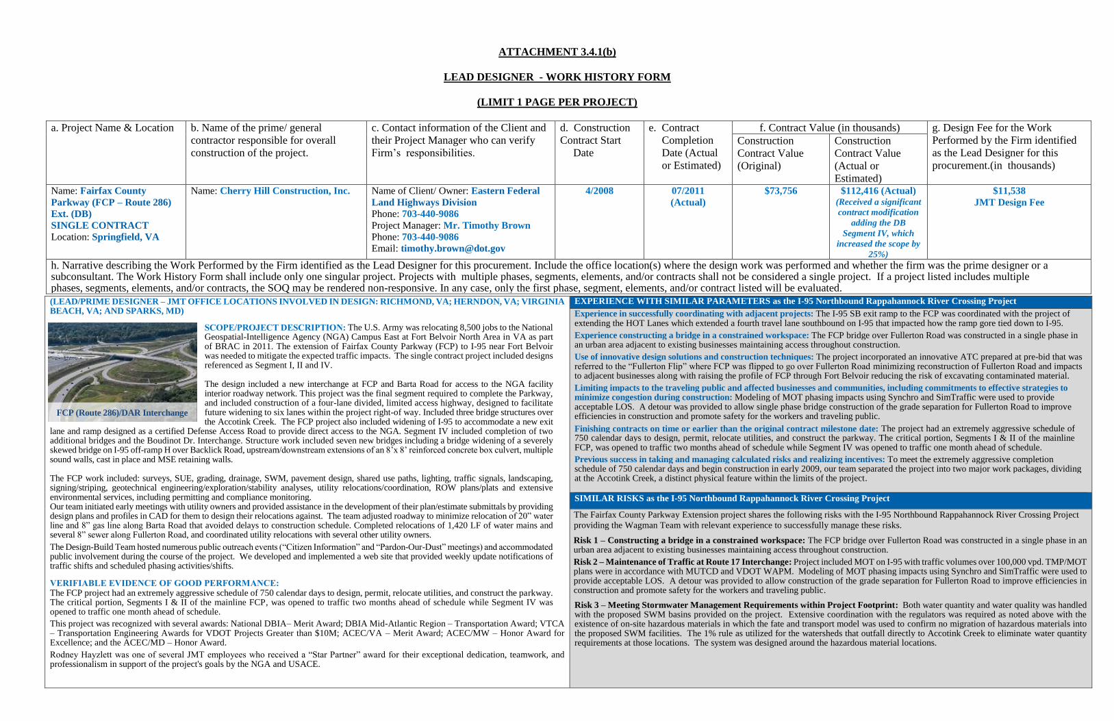
ATTACHMENT 3.4.1(b)
LEAD DESIGNER - WORK HISTORY FORM
(LIMIT 1 PAGE PER PROJECT)
a. Project Name & Location b. Name of the prime/ general
contractor responsible for overall
construction of the project.
c. Contact information of the Client and
their Project Manager who can verify
Firm’s responsibilities.
d. Construction
Contract Start
Date
e. Contract
Completion
Date (Actual
or Estimated)
f. Contract Value (in thousands) g. Design Fee for the Work
Performed by the Firm identified
as the Lead Designer for this
procurement.(in thousands)
Construction
Contract Value
(Original)
Construction
Contract Value
(Actual or
Estimated) Name: Fairfax County
Parkway (FCP – Route 286)
Ext. (DB)
SINGLE CONTRACT
Location: Springfield, VA
Name: Cherry Hill Construction, Inc.
Name of Client/ Owner: Eastern Federal
Land Highways Division
Phone: 703-440-9086
Project Manager: Mr. Timothy Brown
Phone: 703-440-9086
Email: [email protected]
4/2008 07/2011
(Actual)
$73,756
$112,416 (Actual) (Received a significant
contract modification
adding the DB
Segment IV, which
increased the scope by
25%)
$11,538
JMT Design Fee
h. Narrative describing the Work Performed by the Firm identified as the Lead Designer for this procurement. Include the office location(s) where the design work was performed and whether the firm was the prime designer or a subconsultant. The Work History Form shall include only one singular project. Projects with multiple phases, segments, elements, and/or contracts shall not be considered a single project. If a project listed includes multiple phases, segments, elements, and/or contracts, the SOQ may be rendered non-responsive. In any case, only the first phase, segment, elements, and/or contract listed will be evaluated.
(LEAD/PRIME DESIGNER – JMT OFFICE LOCATIONS INVOLVED IN DESIGN: RICHMOND, VA; HERNDON, VA; VIRGINIA BEACH, VA; AND SPARKS, MD)
SCOPE/PROJECT DESCRIPTION: The U.S. Army was relocating 8,500 jobs to the National Geospatial-Intelligence Agency (NGA) Campus East at Fort Belvoir North Area in VA as part of BRAC in 2011. The extension of Fairfax County Parkway (FCP) to I-95 near Fort Belvoir was needed to mitigate the expected traffic impacts. The single contract project included designs referenced as Segment I, II and IV. The design included a new interchange at FCP and Barta Road for access to the NGA facility interior roadway network. This project was the final segment required to complete the Parkway, and included construction of a four-lane divided, limited access highway, designed to facilitate future widening to six lanes within the project right-of way. Included three bridge structures over the Accotink Creek. The FCP project also included widening of I-95 to accommodate a new exit
lane and ramp designed as a certified Defense Access Road to provide direct access to the NGA. Segment IV included completion of two additional bridges and the Boudinot Dr. Interchange. Structure work included seven new bridges including a bridge widening of a severely skewed bridge on I-95 off-ramp H over Backlick Road, upstream/downstream extensions of an 8’x 8’ reinforced concrete box culvert, multiple sound walls, cast in place and MSE retaining walls. The FCP work included: surveys, SUE, grading, drainage, SWM, pavement design, shared use paths, lighting, traffic signals, landscaping, signing/striping, geotechnical engineering/exploration/stability analyses, utility relocations/coordination, ROW plans/plats and extensive environmental services, including permitting and compliance monitoring. Our team initiated early meetings with utility owners and provided assistance in the development of their plan/estimate submittals by providing design plans and profiles in CAD for them to design their relocations against. The team adjusted roadway to minimize relocation of 20” water line and 8” gas line along Barta Road that avoided delays to construction schedule. Completed relocations of 1,420 LF of water mains and several 8” sewer along Fullerton Road, and coordinated utility relocations with several other utility owners. The Design-Build Team hosted numerous public outreach events (“Citizen Information” and “Pardon-Our-Dust” meetings) and accommodated public involvement during the course of the project. We developed and implemented a web site that provided weekly update notifications of traffic shifts and scheduled phasing activities/shifts.
VERIFIABLE EVIDENCE OF GOOD PERFORMANCE: The FCP project had an extremely aggressive schedule of 750 calendar days to design, permit, relocate utilities, and construct the parkway. The critical portion, Segments I & II of the mainline FCP, was opened to traffic two months ahead of schedule while Segment IV was opened to traffic one month ahead of schedule. This project was recognized with several awards: National DBIA– Merit Award; DBIA Mid-Atlantic Region – Transportation Award; VTCA – Transportation Engineering Awards for VDOT Projects Greater than $10M; ACEC/VA – Merit Award; ACEC/MW – Honor Award for Excellence; and the ACEC/MD – Honor Award. Rodney Hayzlett was one of several JMT employees who received a “Star Partner” award for their exceptional dedication, teamwork, and professionalism in support of the project's goals by the NGA and USACE.
EXPERIENCE WITH SIMILAR PARAMETERS as the I-95 Northbound Rappahannock River Crossing Project
Experience in successfully coordinating with adjacent projects: The I-95 SB exit ramp to the FCP was coordinated with the project of extending the HOT Lanes which extended a fourth travel lane southbound on I-95 that impacted how the ramp gore tied down to I-95.
Experience constructing a bridge in a constrained workspace: The FCP bridge over Fullerton Road was constructed in a single phase in an urban area adjacent to existing businesses maintaining access throughout construction.
Use of innovative design solutions and construction techniques: The project incorporated an innovative ATC prepared at pre-bid that was referred to the “Fullerton Flip” where FCP was flipped to go over Fullerton Road minimizing reconstruction of Fullerton Road and impacts to adjacent businesses along with raising the profile of FCP through Fort Belvoir reducing the risk of excavating contaminated material.
Limiting impacts to the traveling public and affected businesses and communities, including commitments to effective strategies to minimize congestion during construction: Modeling of MOT phasing impacts using Synchro and SimTraffic were used to provide acceptable LOS. A detour was provided to allow single phase bridge construction of the grade separation for Fullerton Road to improve efficiencies in construction and promote safety for the workers and traveling public.
Finishing contracts on time or earlier than the original contract milestone date: The project had an extremely aggressive schedule of 750 calendar days to design, permit, relocate utilities, and construct the parkway. The critical portion, Segments I & II of the mainline FCP, was opened to traffic two months ahead of schedule while Segment IV was opened to traffic one month ahead of schedule.
Previous success in taking and managing calculated risks and realizing incentives: To meet the extremely aggressive completion schedule of 750 calendar days and begin construction in early 2009, our team separated the project into two major work packages, dividing at the Accotink Creek, a distinct physical feature within the limits of the project.
SIMILAR RISKS as the I-95 Northbound Rappahannock River Crossing Project
The Fairfax County Parkway Extension project shares the following risks with the I-95 Northbound Rappahannock River Crossing Project
providing the Wagman Team with relevant experience to successfully manage these risks.
Risk 1 – Constructing a bridge in a constrained workspace: The FCP bridge over Fullerton Road was constructed in a single phase in an urban area adjacent to existing businesses maintaining access throughout construction.
Risk 2 – Maintenance of Traffic at Route 17 Interchange: Project included MOT on I-95 with traffic volumes over 100,000 vpd. TMP/MOT plans were in accordance with MUTCD and VDOT WAPM. Modeling of MOT phasing impacts using Synchro and SimTraffic were used to provide acceptable LOS. A detour was provided to allow construction of the grade separation for Fullerton Road to improve efficiencies in construction and promote safety for the workers and traveling public.
Risk 3 – Meeting Stormwater Management Requirements within Project Footprint: Both water quantity and water quality was handled with the proposed SWM basins provided on the project. Extensive coordination with the regulators was required as noted above with the existence of on-site hazardous materials in which the fate and transport model was used to confirm no migration of hazardous materials into the proposed SWM facilities. The 1% rule as utilized for the watersheds that outfall directly to Accotink Creek to eliminate water quantity requirements at those locations. The system was designed around the hazardous material locations.
FCP (Route 286)/DAR Interchange