1500, the Maori used the track to reach the Dart Riverdrainage and its treasure of jade—the precious greenstone,or pounamu.
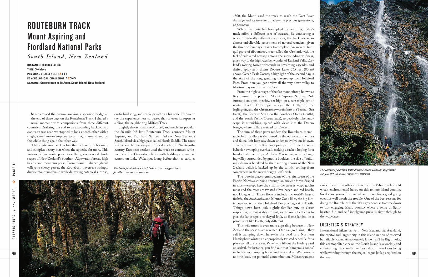
While the route has been plied for centuries, today’strack offers a different sort of treasure. By connecting a series of radically different eco-zones, the track covers an almost unbelievable assortment of natural wonders, giventhe three or four days it takes to complete. An ancient, tran-quil grove of ribbonwood trees called the Orchard, with thefeel of cultivated acreage among the surrounding wildness,gives way to the high-decibel wonder of Earland Falls. Ear-land’s roaring torrent descends in streaming cascades anddrifted spray as it drains Roberts Lake, 265 feet (80 m)above. Ocean Peak Corner, a highlight of the second day, isthe start of the long grinding traverse up the HollyfordFace. From here you get a view all the way down valley toMartin’s Bay on the Tasman Sea.
From the high vantage of the flat mountaintop known asKey Summit, the peaks of Mount Aspiring National Parksurround an open meadow set high on a rare triple conti-nental divide. Three epic valleys—the Hollyford, theEglington, and the Greenstone—drain into the Tasman Sea(west), the Foveaux Strait on the Southern Ocean (south),and the South Pacific Ocean (east), respectively. The land-scape is astonishing, spiced with views into the DarranRange, where Hillary trained for Everest.
The sum of these parts renders the Routeburn memo-rable, but the allure is sharpened by the oddness of the floraand fauna, left here way down under to evolve on its own.This is home to the Kea, an alpine parrot prone to comic behavior, swooping overhead, making a racket, hoping for ahandout at lunch stops. At Lake Mackenzie, set in a hang-ing valley surrounded by granite boulders the size of build-ings, dawn is heralded by the haunting chorus of the NewZealand bellbird, backed up by the tomtit, coming fromsomewhere in the weird dragon-leaf shrub.
The route in places reminded me of the rain forests of thePacific Northwest, rising through an ancient forest drapedin moss—except here the stuff in the trees is wispy goblinmoss and the trees are twisted silver beech and red beech,not Douglas fir. Those flowers include the world’s largestfuchsia, the kotukutuku, and Mount Cook lilies, the big but-tercups you see on the Hollyford Face, the biggest on Earth.Things down here look slightly familiar but, on closer inspection, unmistakably are not, so the overall effect is togive the landscape a cockeyed look, as if one landed on aplanet a lot like Earth, only different.
This wilderness is even more appealing because in NewZealand the seasons are reversed. One can go hiking—theycall it tramping down here—in the dead of a NorthernHemisphere winter, an appropriately twisted schedule for aplace so full of surprises. When you fill out the landing cardon arrival, for instance, you find out that “dangerous goods”include your tramping boots and tent stakes. Weaponry isnot the issue, but potential contamination. Microorganisms
carried here from other continents on a Vibram sole couldwreak environmental havoc on this remote island country.So declare yourself on arrival and brace for a good goingover. It’s well worth the trouble. One of the best reasons fordoing the Routeburn is that it’s a great excuse to come downto this engaging island country where a sense of light-hearted fun and self-indulgence prevails right through tothe wilderness.
L O G I S T I C S & S T R A T E G YInternational hikers arrive in New Zealand via Auckland,the capitol and largest city in this island nation of reservedbut affable Kiwis. Affectionately known as The Big Smoke,this cosmopolitan city on the North Island is a worldly andentertaining place, well suited for a day or two of easy livingwhile working through the major-league jet lag acquired onthe way.
205204
ROUTEBURN TRACKMount Aspiring and
Fiordland National ParksS o u t h I s l a n d , N e w Z e a l a n dDISTANCE: 28 miles (45 km)TIME: 3–4 daysPHYSICAL CHALLENGE: 1 2 3 4 5PSYCHOLOGICAL CHALLENGE: 1 2 3 4 5 STAGING: Queenstown or Te Anau, South Island, New Zealand
As we crossed the narrow, swaying suspension bridge atthe end of three days on the Routeburn Track, I shared anovel moment with companions from three different
countries. Realizing the end to an astounding backcountryexcursion was near, we stopped to look at each other with asingle, simultaneous impulse: to turn right around and dothe whole thing again the other way.
The Routeburn Track is like that, a hike of rich varietyand complex beauty that whets the appetite for more. Thishistoric alpine route penetrates the glacier-carved land-scapes of New Zealand’s Southern Alps—rain forests, highbasins, and mountain peaks. From classic U-shaped glacialvalleys to snowy passes, the Routeburn traverses strikinglydiverse mountain terrain while delivering botanical surprise,
exotic bird song, and scenic payoff on a big scale. I’d have tosay the experience here surpasses that of even its superstarsibling, the neighboring Milford Track.
Slightly shorter than the Milford, and much less popular,the 28-mile (45 km) Routeburn Track connects MountAspiring and Fiordland National Parks on New Zealand’sSouth Island via a high pass called Harris Saddle. The routeis a venerable one steeped in local tradition. Nineteenth-century European settlers used the track to connect settle-ments on the Greenstone River with budding commercialcenters on Lake Wakatipu. Long before that, as early as
The beech forest below Lake Mackenzie is a magical place for hikers. P H O T O B Y P E T E R P O T T E R F I E L D .
The cascade of Earland Falls drains Roberts Lake, an impressive265 feet (81 m) above. P H O T O B Y P E T E R P O T T E R F I E L D .
CL
AS
SIC
HIK
ES
of
the
WO
RL
DE
PA
CIF
IC


