Download - To: The South Australian Hedtage Committee
To:
From:
Subject:
Date:
Summary
The South Australian Hedtage Committee
Senior Historical Architect
REGISTER NOMINATION REPORT - ST. MARY'S CHURCH, CEMETERY AND TIMBER GATES SOUTH ROAD, ST. MARYS.
21 June 1982
This report is prepared as part of the Heritage Conservation Branch 1 s programme of evaluating National Estate Items for possible inclusion on the Register of State Heritage Items.
Historically, St. Mary 1 s Church, cemetery and gates are a significant part of the establishment of the Anglican Church in Mitcham and South Australia.
Architecturally, the Church is an interesting example of Early Victorian Gothic displaying some fine stone detailing and overall mas?ing.
Environmentally, the complex is a well-known visual and historical landmark. It is, however, in stark contrast with the hustle and bustle of South Road.
The Integrity of the complex is good. The church is in good condition and progressive additions have been sympathetically executed. Many of the first grave sites remain.
St. Mary 1 s Church is on the Classified List of the National Trust and is on the Register of the National Estate.
Recommendation
It is recommended that St. Mary 1 s Church, the cemetery and timber gates be placed on the Register of State Heritage Items and that it be categorized A3, H2.
~~-Barry G. Rowney ( LB:JD
... •
co 0
N ........ ("\
Cl ........ . (.f)
UJ
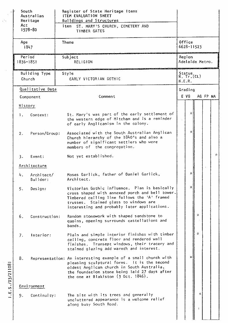
South Australian Heritage Act 1978-80
Age 1847
Period 1836-1851
Building Type Church
Qua 1 i tat i ve Data
Component
Hi story
1. Context:
2. Person/Group:
3. Event:
Architecture
4.
5.
6.
7.
Architect/ Builder:
Design:
Construction:
Interior:
Register of State Heritage Items ITEM EVALUATION SHEET Buildinqs and Structures Item ST. MARY'S CHURCH, CEMETERY AND
TIMBER GATES
Theme
Subject RELIGION
Style EARLY VICTORIAN GOTHIC
Comment
St. Mary's was part of the early settlement of the western edge of Mitcham and fs a reminder of early Anglicanism in the colony.
Associated with the South Australian Anglican Church hierarchy of the 1840's and also a number of significant settlers who were members of the congregation.
Not yet established.
Moses Garlick, father of Daniel Garlick, Architect.
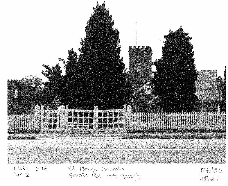
Victorian Gothic influence. Plan is basically cross shaped with annexed porch and bell tower. Timbered ceiling line follows the 'A' framed trusses. Stained glass to windows are interesting and probably later applications.
Random stonework with shaped sandstone to quoins, opening surrounds castellations and bands.
Plain and simple interior finishes with timber ceiling, concrete floor and rendered wall finishes. Transept windows, their tracery and stained glazing add warmth and interest.
8. Representation: An interesting example of a small church with pleasing sculptural forms. It is the second oldest Anglican church in South Australia, the foundation stone being laid 27 days after the one at Blakiston (3 Oct. 1846) .
Environment
9. Continuity: The site with its trees and generally uncluttered appearance is a welcome relief along busy South Road.
Office 6628-11523
Region Adelaide Metro.
Status N. Tr.(CL) N.E.R.
Grading
E VG AG FP NA
*
*
:0 0
n .LI
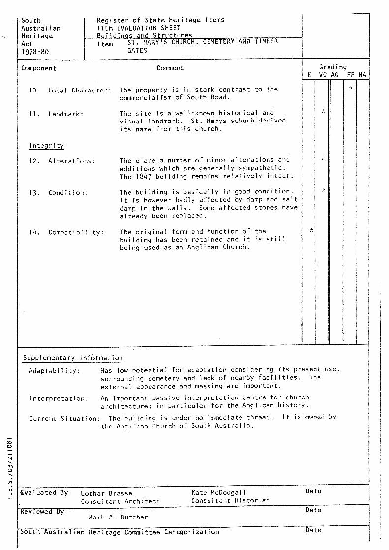
... South Australian Heritage Act 1978-80
Component
Register of State Heritage Items ITEM EVALUATION SHEET Buildinas and Structures f tern ST. MARY 1 S CHURCH, CEMEI t:RY AND TIMBER
GATES
Comment
10. Local Character: The property is in stark contrast to the commercialism of South Road.
11. Landmark: The site is a well-known historical and visual landmark. St. Marys suburb derived its name from this church.
Integrity
12. Alterations:
13. Condition:
14. Compa ti bi l i ty:
There are a number of minor alterations and additions which are generally sympathetic. The 1847 building remains relatively intact.
The building is basically in good condition. It is however badly affected by damp and salt damp in the walls. Some affected stones have already been replaced.
The original form and function of the building has been retained and it is still being used as an Anglican Church.
Supplementary Information
Grading E VG AG FP NA
*
..,':
Adaptability: Has low potential for adaptation considering its present use, surrounding cemetery and lack of nearby facilities. The
Interpretation:
external appearance and massing are important.
An important passive interpretation centre for church architecture; in particular for the Anglican history.
Current Situation: The building is under no immediate threat. It is owned by
ivaluated By
Kev1ewed By
the Anglican Church of South Australia.
Letha r B rasse Consultant Architect
Mark A. Butcher
Kate McDouga 1 I Consultant Historian
:>outh Austral 1an Heritage Committee Categorization
Date
Date
Date
HISTORICAL RESEARCH: ST. MARY 1 S ANGLICAN CHURCH, MITCHAM
St. Mary's Anglican Church is the oldest church rema1n1ng in the Mitcham distrfct and the second oldest Anglican Church still in use in the State. The oldest church is St. James, Blakiston, which had its foundation stone laid only three weeks before St. Mary 1 s.
The Mitcham district was available for selection after May 1838, as it was part of Light 1 s first rural survey. Pockets of settlement grew up throughout the surveyed area, such as the Mitcham village, Unley village, Goodwood and along the South Road. This South Road settlement was centred around the Sturt River, four hotels and St. Mary's Church.
The first building used by Anglican settlers as a church was constructed of stringy bark and pise in 1841. During 1846 and 1847 the stone church was erected a short distance south, apparently to a simple rectangular plan, to which were added in 1849 the transepts, chancel and vestry, completing the traditional cruciform shape. The original square tower was 18 feet (6 metres) high. The designer and builder of St. Mary's was Moses Garlick, whose son Daniel Garlick became a significant architect in Adelaide. The stone for the church· is purported to have come from Ayl iff's quarry nearby.
The District around the church became known as St. Mary's and more intensive settlement developed after the South Road route was formalized and s·ealed with stone in 1850. St. Mary's remained the main Anglican church for the eastern section of Mitcham, and St. Michael 1 s, consecrated in 1852, served the same function for the western section.
In 1870, a further 18 feet was added to the bell tower of St. Mary 1s and it reached its present height of 36 feet (12 metres). Very few external alterations have occurred and those internal rearrangements which have been made are in a reasonably sympathetic manner.
An important element of the church is the surrounding graveyard which contains the graves of a number of local and state figures. Significant ones include Sir James Penn Boucaut, Premier during the mid 1870's, judge and governor, who died in 1911. Earlier settlers include the Laffer family, Benjamin Herschell Babbage and Captain William O'Halloran who were involved in the beginnings of the wine industry when the district was being developed agriculturally. This graveyard, with its iron railing grave fences and slate gravestones, needs a large amount of maintenance as it is in fairly bad cond i ti on.
Sources:
Lothar Brasse and Alexandra Marsden, City of Mitcham Heritage Survey (Adel., Dec. 1979}. ----------------
C.T. Burgess, Cyclopaedia of S.A., Vol. W.A. Norman, History of City of Mitcham S .A. I. T. Dept. of Architecture- student
Kate Mc Douga 11 Register Historian
1 (Adelaide, 1907). (Adelaide, 1953). survey of St. Mary's Church.
MITCHAM HERITAGE SURVEY
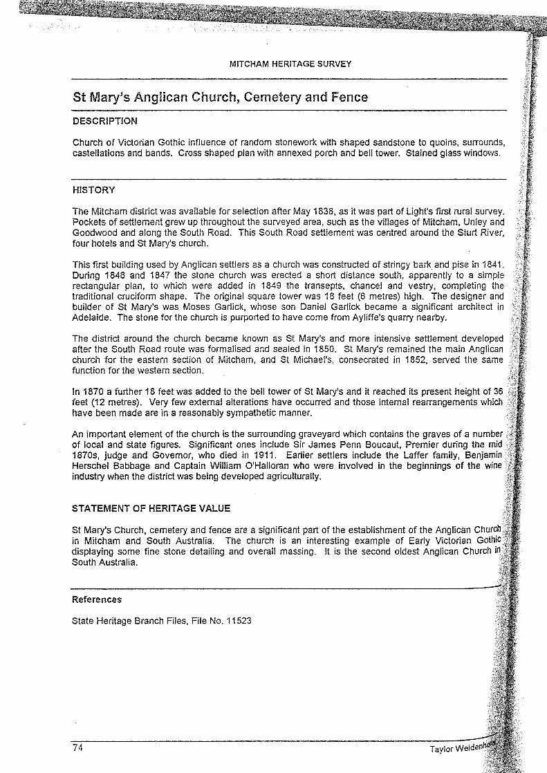
St Mary's Anglican Church, Cemetery and Fence
DESCRIPTION
Church of Victorian Gothic influence of random stonework with shaped sandstone to quoins, surrounds, castellations and bands. Cross shaped plan with annexed porch and bell tower. Stained glass windows.
HISTORY
The Mitcham district was available for selection after May 1838, as it was part of Light's first rural survey. Pockets of settlement grew up throughout the surveyed area, such as the villages of Mitcham, Unley and Goodwood and along the South Road. This South Road settlement was centred around the Sturt River, four hotels and St Mary's church.
This first building used by Anglican settlers as a church was constructed of stringy bark. and pise in 1841. During 1846 and 1847 the stone church was erected a short distance south, apparently to a simple rectangular plan, to which were added in 1849 the transepts, chancel and vestry, completing the traditional cruciform shape. The original square tower was 18 feet (6 metres) high. The designer and builder of St Mary's was Moses Garlick, whose son Daniel Garlick became a significant architect in Adelaide. The stone for the church is purported to have come from Ayliffe's quarry nearby.
The district around the church became known as St Mary's and more intensive settlement developed after the South Road route was formalised and sealed in 1850. St Mary's remained the main Anglican church for the eastern section of Mitcham, and St Michael's, consecrated in 1852, served the same function for the western section.
In 1870 a further 18 feet was added to the bell tower of St Mary's and it reached its present height of 36 feet (12 metres). Very few external alterations have occurred and those internal rearrangements which have been made are in a reasonably sympathetic manner.
An important element of the church is the surrounding graveyard which contains the graves of a number of local and state figures. Significant ones include Sir James Penn Boucaut, Premier during the mid 1870s, judge and Governor, who died in 1911. Earlier settlers include the Laffer family, Benjamin Herschel Babbage and Captain William O'Ha!loran who were involved in the beginnings of the wine industry when the district was being developed agriculturally.
STATEMENT OF HERITAGE VALUE
St Mary's Church, cemetery and fence are a significant part of the establishment of the Anglican Church in Mitcham and South Australia. The church is an interesting example of Early Victorian Gothic displaying some fine stone detailing and overall massing. It is the second oldest Anglican Church in South Australia.
References
State Heritage Branch Files, File No. 11523
74

MITCHAM HERITAGE SURVEY
St Mary's Anglican Church, Cemetery and Fence
LOCATION
1163-1165 South Road ST MARYS
STM:004
Address Suburb Owners Synod of the Church of England in the Diocese of Adelaide Inc, 18 King William Road,
Allotment No Section CT Hundred
North Adelaide SA 5006 86 41 2131/37 Adelaide
State Heritage Status Registered, 14 August 1986 Other Assessments National Trust of South Australia
Register of the National Estate
Film/Neg No
Taylor Weidenhofer
SHR No 6628-11523
73

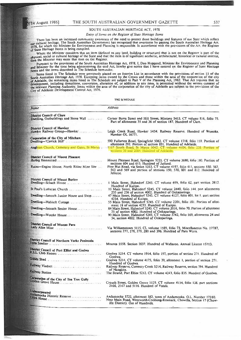
THE SOUTH AUSTRALIAN GOVERNMENT GAZETTE 537
SOUTH AUSTRALIAN HERITAGE ACT, 1978
Enrry o.f Items on the Register of State Heritage Items
Ttiere has been an increased community awareness of the need to protect 1hosc buildings and features of our State which reflect ur cultural heritage. The South Australian Government has recognised tha1 awareness by passing the South Aus1ralian Heritage Act. ~97g for which the Minister for Environment and Planning is responsible. f n accordance wi1h the provisions of the Ace the Register of sLJite Heritage Items is being compiled.
Where the Minister considers that an item (defi ned as any land, building or structure) that is not on the Register is pan of the .j>hysical, social or cultural heritage of the State and that the item is of significant aesthetic, architectural , historical or cultural interest, then ttie Minister may enter that item on the Register.
Pursuant to the provisions of the South Australian Heritage Act, 1978, r. Don Hopgood, Minister for Environment and Planning and Minister for the time being administering the said Act, hereby give notice that I have entered on the Register of State Heritage Items and the items described in The Schedule hereunder.
Items listed in The Schedule were previously placed on an Interim Lisi in accordance with the provisions of section 15 of the South Australian Heritage Act, 1978. Excepting items owned by the Crown and those within the area of the corporation of the city of Adelaide, t~e rem.aining itei:n~ listed in T!1e Schedul~ are subject t?. Pan V of t.he Pl~nning ~ct, 19~2. That Act ~cquires that no ~evelopment, mcl1:1dmg dem<?llllon. conv.e~1on, allcra11on of, or. add1~1on to any .11em,i 1s pei:i111tted wit~out the wrn1ei:i ~onsent of · 'lThe relevant Planning Authonty. Items wi thin the area of the corporauon of the clly 01 Adelaide are sub1ect to the prov1s1ons of the
City of Adelaide Development Control Act, 1976.
~ct Council of Clare Dwelling, Outbuildings and Stone Wall
District Council of Hawker Hawker Railway Group-Hawker . . . . . ... .. ... .
-Corporation of the City of Mitcham Dwelling- 'Carrick Hill' .
,,....,....,'\.lllUJ·can Church, Cemetery and Gates, St Marys
District Council of Mount Pleasant Herbig Homestead . . . . . . .... .. .. . . ... .
Ruins-Engine House, North Rhine Mine Site
St Paul's Lutheran Church
. Dwclling-Jaensch Junior House and Shop .
Dwelling-Habisch Cottage . .. . .
, tioo of the City of Tea Tree Gully Grove House . . . . . .. . ... .. .. .. .. .
THE SCHEDULE
Address
Comer Burra Street and Hill Street, Mintaro 54 15. CT volume 816, folio 75. Pan of allotments 35 and 36 of section 187. Hundred of Oare.
Leigh Creek Road, Hawker 5434. Railway Reserve. Hundred of Wonoka. Hawker OL 16771.
590 Fullarton Road, Springfield 5062. CT volume 1718, folio 159. Portion of allotment 292. Portion of section 891. Hundred of Adelaide.
1167 South Road, St Marys 5042. CT volume- 4104, folio 2.28. Portion of sections 36 and 2084. Hundred of Adelaide.
Mount Pleasant Road, Springton 5235. CT volume 3680, folio 180. Portion of sections 604 and 615. Hundred of Jutland.
Pine Hut Road, via Sedan 5353. CT volume 4 I 97, folio 411 , sections 550. 562, 563 and 569 and portion of sections I 50, 5 70, 80 I and 812. Hundred of Jcllicoe.
1 Main Street, Hahndorf 5245. CT volume 699, folio 62, pan section 3812. Hundred of Kui tp0.
JO Main Street, Hahndorf 5245. CT volume 2440. folio 144. part allotments 235 and 236 of section 4002. Hundred of Onkaparinga.
47 Main Street, Hahndorf 5245. CT volume 4127, folio 601, lot I part section 4234. Hundred of Kuitpo.
55 Main Street, Hahndorf 5245. CT volume 220 I, folio 18J. Portion of allotment 18 of section 4233. Hundred of Kuitpo.
84 Main Street, Hahndorf 5245. er volume 2016, folio 70. Pon ion of allotment 25 of section 4002. Hundred of Onkaparinga.
90 Main Street, Hahndorf 5245. er volume 3742, folio 169, allotments 24 and 34, section 4002. Hundred of Onkaparinga.
Via Williamstown 5115. CL volume I 589, folio 73, Miscellaneous No. 17787, sections 277, 278, 279, 280 and 396. Hundred of Para Wirra.
Moonta 5558. Section 2037. Hundred of Wallaroo. Annual Licence l 5713.
Goolwa 5214. CT volume 1914, folio 197, portion ofsectioff271. Hundred of Goolwa.
Goolwa 5214. CT volume 4175, folio 39, allotment I, portion of section 271. Hundred of Goolwa.
Railway Reserve, Currency Creek 5214, Railway Reserve, section 394. Hundred of Nangkita. ·
The Strand, Port Elliot 52 I 2. CT volume 4243. folio 835. Hundred of Goolwa.
Crouch Street, Golden Grove 5125. CT volume 4154, folio 138. pan sections 2166, 2167 and 5116. Hundred of Yatala.
Andamooka 5722, allotment 582, town of Andamooka. O.L. Number 17160. Near Main Road, Wentwonh-Cooltong-Rcnmark, Chowilla, Section 17 {Chow
il!a District). Out of Hundreds.
538 THE SOUTH AUSTRALIAN GOVERNMENT GAZETTE { 14 August 1986
THE SCHEDUJ..E
Name Address
District Council or Victor Harbor DweJling-'Mount Breckan' . .. ... .. . . . Renown Avenue, Victor Harbor 521 l. CT volume 4145. folio 402. lot 56, !>art
section 17. Hundred of Encounter Bay.
Corporation of the Town of Wallaroo Methodist Church ... . .. . .. . . . .
District Council of Warooka lnneston Gypsum Complex
Dated at Adelaide, 14 August 1986.
Stirling Road, WaUaroo 5556. CT volume 4003, folio 886, portion of allotment -80. Hundred of Wallaroo.
lnneston 5577, portion of sections 125, IOI and 131, Innes National Park. Hundred of Warrenben.
D. J . HoP<lOOO, Minister for Environment and Planning
MJNING ACT, 1971, AS AMENDED
Department of Mines and Energy, 14 August 1986 NOTICE is hereby given that I propose to grant a mining lease over the undennentioned area. Any objections lo this proposal must be lodged in writing at the office of the Depanment of Mines and Energy, 191 Greenhill Road, Parkside, on or before I I September 1986.
Applicant
Roben Malcolm Patterson
Location
Mineral lea~
In section 154, hundred of Haines
R. G. P..VNE. Minister of Mmes and Energy
Tenn
7 years
Area in ha
12.00
Ref. D.M.E.
T851 Special conditions are proposed for the above tenement details of which are available from the Mining Registrar.
MINING ACT, 1971, AS AMENDED
Department of Mines and Energy, 14 August 1986
NOTICE is hereby given that I propose to grant an exploration licence over the undermentioned area. Any objections to this proposal mu5t be lodged in writing at the office of the Depanment of Mines and Energy, 191 Greenhill Road, Parkside, on or before 1 I September 1986
Applicant
Stockdale Prospecting Limited
R G. PAYNE. Minister of Mines and Eneriy
Location
Mount Bosanquet area-approximately 25 km south of Kimba, bounded as follows: commencing at a point being the intersection of latitude33°20'S and longitude 1 36" l S'E, thence east to Jongitudel36"29'E, south to latitude 33°25'5, west to the eastern boundary of Carap~ Hill Conservation Park, thence generally northwesterly and southerly along the boundaries of the said park 10 longitude 136° I S'S and north to the point of commencement. All the within latitudes and longitudes are geodetic and expressed in tenns of the Australian Geodetic Datum as defined on p. 4984 of Commonwealth Gazette number 84 dated 6 October 1966.
Term
I year
Area in km2
195
Ref. D.M.E.
134/1986


