

Unit Objectives
Describe the types of hazards to which your community is vulnerable.
Describe the functions of CERTs. Identify preparedness steps.

Preparing for a Disaster
CERTs should prepare by: Identifying potential hazards in their homes and
workplaces. Reducing hazards, where possible. Developing a disaster supply kit.

Responding To a Disaster
CERTs should respond by: Locating and turning off utilities, if safe. Extinguishing small fires. Treating injuries. Conducting light search and rescue. Helping to relieve survivor stress.
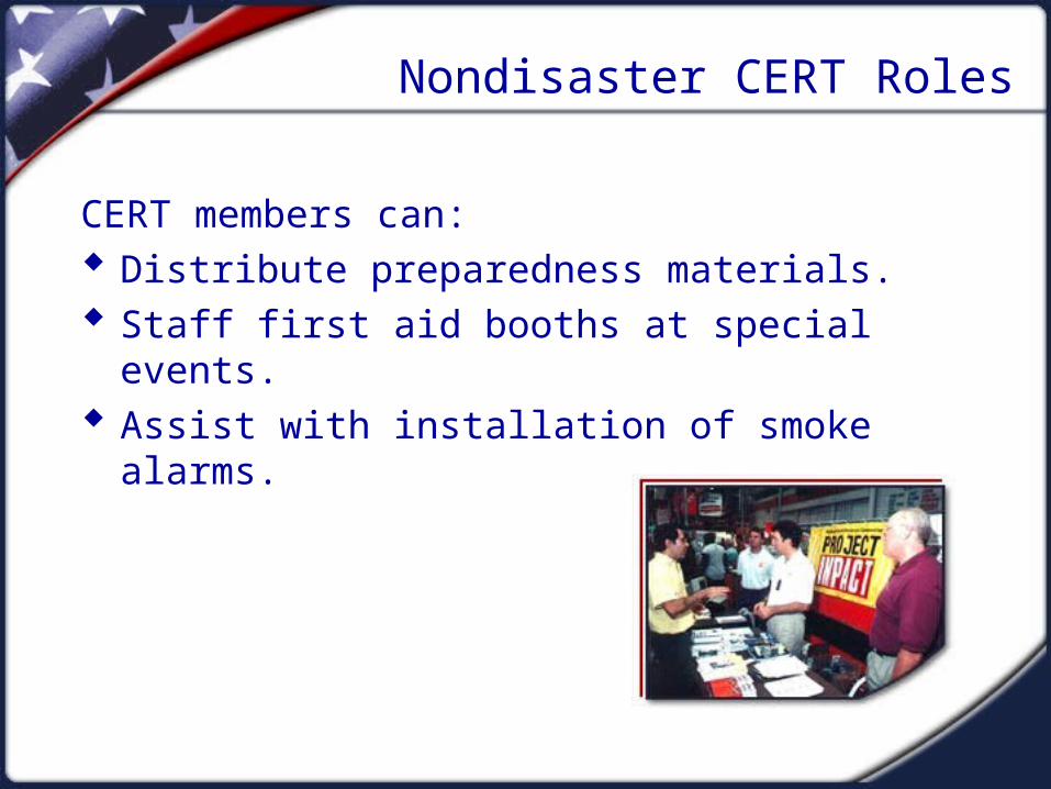
Nondisaster CERT Roles
CERT members can: Distribute preparedness materials. Staff first aid booths at special events. Assist with installation of smoke alarms.

Citizen Corps
The President has encouraged Americans to volunteer to improve and safeguard the nation.
Areas of emphasis for volunteer efforts: Crime Natural Disasters Terrorism

Additional CERT Training Opportunities
Shelter management Community relations Donations management Special needs concerns Debris removal Utilities control Advanced first aid Automated External Defibrillator use CPR Skills

Course Preview
The scope of this course includes: Fire safety. Disaster medical operations. Light search and rescue. CERT organization. Disaster psychology. CERTs and terrorism.

Types of Disasters
Natural Manmade Technological
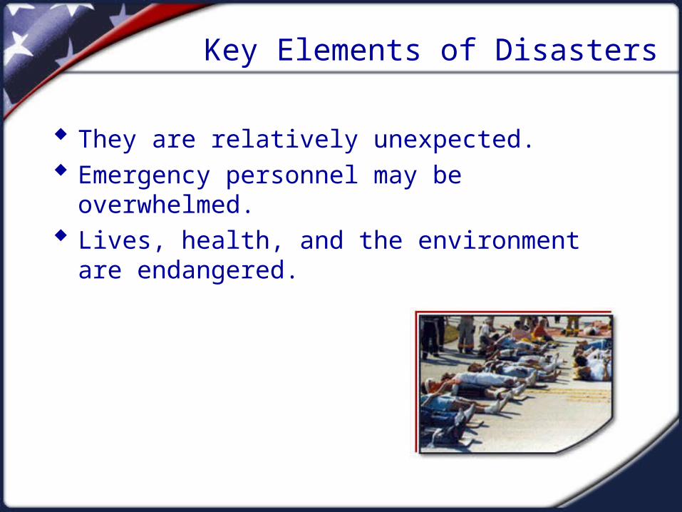
Key Elements of Disasters
They are relatively unexpected. Emergency personnel may be overwhelmed. Lives, health, and the environment are
endangered.

Visual 1.11
An Earthquake Is . . .
A sudden slipping or movement of a portion of the Earth’s crust, caused by a sudden release of stresses, usually less than 25 miles below the
surface.

Visual 1.12
Damage Caused by Earthquakes
Collapsed buildings Damage to utilities, structures, and roads Fires and explosions Structural instability

Visual 1.13
Likelihood of an Earthquake
The greatest likelihood of a major earthquake is in: The Western United States. The New Madrid Fault Zone in Missouri. A few pockets on the east coast.

Visual 1.14
Earthquake Statistics
15% of the population lives in zones of potential major disaster.
Residents of California face the highest risk. Four million people along the New Madrid Fault
Zone are at great risk. Residents of Massachusetts, North Carolina, and
South Carolina are also at risk.

Visual 1.15
Richter Scale
Small: 5.0 to 5.9 Moderate: 6.0 to 6.9 Major: 7.0 to 7.9 Great: 8.0 or greater

Visual 1.16
Earthquake Preparedness
Develop a home earthquake plan. Conduct earthquake drills. Develop a plan for reuniting family members. Identify an out-of-state family contact. Keep supplies on hand.

Visual 1.17
Earthquake Preparedness
Store heavy and breakable objects on low shelves.
Secure bookshelves and water heaters. Install flexible pipe. Move beds away from windows. Move or secure hanging objects over beds,
sofas, or chairs. Keep shoes and a flashlight under the bed.

Visual 1.18
During an Earthquake
Drop, cover, and hold. If indoors, stay there! If outdoors, find a spot away from buildings, trees,
streetlights and power lines, and overpasses. If in a vehicle, drive to a clear spot and stop.

Visual 1.19
After an Earthquake
Extinguish small fires. Clean up spills. Inspect home for damage. Help neighbors. Tune to Emergency Alert System (EAS). Expect aftershocks.

Visual 1.20
Dangers of Fire
Asphyxiation Heat Smoke

Visual 1.21
Developing a Family Fire Plan
Install smoke alarms. Identify escape routes. Practice the escape plan. Practice alerting family members. Learn the fire department’s emergency number.

Visual 1.22
If a Fire Starts
Get out quickly. Go to the meeting place. Call the fire department.

Visual 1.23
If You Can’t Escape
Stuff wet cloth around doors and vents. Call the fire department. Stay low and by a window. Open windows at top and bottom. Wave a bright-colored cloth at the window.

Visual 1.24
Preventing Fires
Conduct a home hazard hunt. Inspect wood stoves and chimneys annually. Purchase only “laboratory-tested” heaters. Keep matches and lighters away from children. Check electrical wiring. Keep combustibles away from the stove.

Visual 1.25
A flood occurs . . .
Any time a body of water rises to cover what is usually dry land.

Visual 1.26
Causes of Floods
Heavy rain Spring snowmelt Dam and levee failure Low absorption or no soil percolation

Visual 1.27
Factors Contributing to Flooding
Rainfall intensity Rainfall duration Topography Soil conditions Ground cover

Visual 1.28
Flood Hazards
Heavy rainfall exacerbates problems with runoff, absorption, and flood-control measures.
Riverine flooding can potentially inundate a city or downstream areas when protection fails.
In rocky areas, lack of absorption can cause flash flooding.

Visual 1.29
Flood Risks
4,000 communities and 100 million people are at risk.
Damage increases with development in: Coastal areas. Floodplains.

Visual 1.30
Flood Preparations
Know the flood risk for the area. Prepare a flood evacuation plan. Obtain flood insurance. Keep documents in a water-proof box. Check a portable radio for current information.

Visual 1.31
Protecting Property From Flooding
Elevate furnace, water heater, and electric panel. Move furniture and other items to a higher level. Install check valves. Waterproof basements and walls.

Visual 1.32
If You Must Evacuate
Do not walk, swim, or drive through flood waters. Stay off bridges over fast-moving water. Heed barricades. Keep away from waterways. Avoid storm drains and irrigation ditches.

Visual 1.33
After a Flood
Stay out of flooded areas. Reserve the telephone for emergencies. Avoid driving, except in emergencies.

Visual 1.34
A Heat Wave Is . . .
A prolonged period of excessive heat, often combined with excessive humidity.

Visual 1.35
Risks Associated With a Heat Wave
Heat cramps Heat exhaustion Heat/Sun stroke

Visual 1.36
Actions to Take During a Heat Wave
Seek air conditioning. Avoid strenuous activities during the heat of the
day. Wear lightweight, light-colored clothing. Check on family members and neighbors. Drink plenty of fluids.

Visual 1.37
Preparing the Home
Install additional insulation. Protect windows. Use attic fans.

Visual 1.38
A Hurricane Is . . .
A violent area of low pressure forming in the tropical Atlantic Ocean from June to November.

Visual 1.39
Risks Posed by Hurricane and Coastal Storms
Intense winds and rain can: Damage or destroy structures. Lift and move unstable structures and objects. Damage utility lines. Be accompanied by tornadoes. Cause coastal erosion. Cause floods. Threaten lives.
Visual 1.40
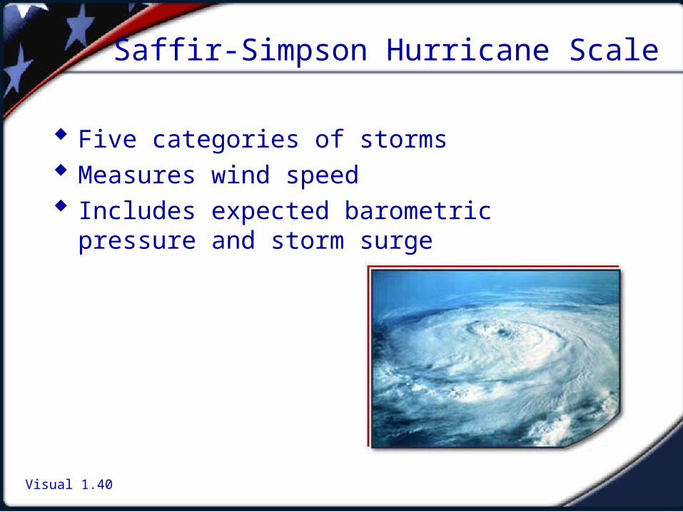
Saffir-Simpson Hurricane Scale
Five categories of storms Measures wind speed Includes expected barometric pressure and storm
surge

Visual 1.41
Hurricane Statistics
Nearly 100 million Americans are at risk: 14 million live in the zone where winds over 125
mph have been recorded. More than 6 million live in storm surge areas.

Visual 1.42
Preparing for a Hurricane/Coastal Storm
Know your risk and evacuation routes. Develop a plan. Secure needed supplies. Floodproof property. Secure mobile homes and outdoor items.

Visual 1.43
Before a Hurricane
Board up all windows and glass doors. Check batteries. Stock up on nonperishable food. Listen to EAS.

Visual 1.44
During a Hurricane
If not advised to evacuate, stay indoors. Be aware of the “eye.” Be alert for tornadoes.

Visual 1.45
After a Hurricane or Coastal Storm
Do not reenter the area until it is safe. Use a flashlight to inspect for damage. Stay away from downed power lines. Turn off utilities, if necessary. Reserve telephones for emergencies. Listen to EAS.

Visual 1.46
A Severe Thunderstorm Is . . .
One that produces hail at least three-quarters of an inch in diameter, has winds of 58 miles per hour
or higher, or produces a tornado.

Visual 1.47
Risks Posed by Thunderstorms
Lightning Hail Downbursts and straight-line winds Flash floods Tornadoes

Visual 1.48
Thunderstorm Preparedness
Understand the risk. Learn to make a small target. Pay attention to warnings.

Visual 1.49
During a Thunderstorm
Avoid: Water sources. The telephone. The outdoors.

Visual 1.50
If You Are Outdoors . . .
Get away from water sources. Seek shelter in a substantial building. If necessary:
Take shelter in a car or. Go to low-lying area and make a small target.
Avoid natural lightning rods.

Visual 1.51
A Tornado Is . . .
A powerful, circular windstorm that may be accompanied by winds in excess of 250 miles per
hour.

Visual 1.52
Risks Posed by Tornadoes
Tornadoes can: Rip trees apart. Destroy buildings. Uproot structures and objects. Send debris and glass flying. Overturn cars and mobile homes.

Visual 1.53
Fujita Wind-Damage Scale
Measures tornado strength Six levels:
F0: Light damage F1: Moderate damage F2: Considerable damage F3: Severe damage F4: Devastating damage F5: Incredible damage

Visual 1.54
Tornado Preparedness
Know the risk. Identify a “safe” room. Learn the community’s warning system. Conduct family tornado drills.

Visual 1.55
Tornado Clues
High winds Very large hail

Visual 1.56
During a Tornado . . .
Keep windows and doors closed. Go to the “safe” room. Listen to EAS or NOAA Weather Radio.

Visual 1.57
A Winter Storm . . .
Can range from a moderate snow over a few hours to blizzard conditions with blinding wind-driven
snow that lasts several days.

Visual 1.58
Winter Storm Risk
Automobile/other transportation accidents Exhaustion and heart attacks Hypothermia/Asphyxiation House fires

Visual 1.59
Elements of Winter Storms
Heavy snow Ice Winter flooding Cold

Visual 1.60
Types of Snow
Blizzard Blowing snow Snow squalls Snow showers

Visual 1.61
Types of Ice
Sleet Freezing rain Ice storm

Visual 1.62
Winter Flooding Includes . . .
Coastal storms Ice jams Snowmelt

Visual 1.63
Effects of Cold
Wind chill Frostbite Hypothermia

Visual 1.64
Winter Storm Preparedness
Understand the risk. Prepare your home. Service snow-removal equipment. Fill your car’s gas tank. Pay attention to warnings.

Visual 1.65
During a Winter Storm . . .
Stay indoors and dress warmly. Eat and drink regularly. Conserve fuel. If outside, protect yourself from hazards.

Visual 1.66
Hazardous Materials Are . . .
Substances that because of their chemical nature, pose a potential risk to life, health, or property if
they are released or used improperly.

Visual 1.67
Sources of Hazardous Materials
Chemical plants Service stations Hospitals Hazardous materials waste sites Transport vehicles

Visual 1.68
Hazardous Materials Incident Preparedness
Find out what could happen. Address the hazards in your family emergency
plan. Practice and maintain your plan. Learn the warning and information system for
your community.

Visual 1.69
During a Hazardous Materials Incident
Leave the area! Report the incident. If hearing a warning, listen for instructions.

Visual 1.70
During a Hazardous Materials Incident
Stay away from the incident site. If outside, stay upstream, uphill, and upwind. If in a motor vehicle, stop and find shelter. If asked to evacuate, do so immediately. If requested, stay indoors—shelter in place.

Visual 1.71
If Asked to Shelter in Place
Get household members and pets inside. Close and lock exterior doors and windows. Turn off air conditioners and ventilation systems. Go to the pre-selected safe room.

Visual 1.72
Post-incident Actions
Do not return home until instructed. Open windows and vents and turn on fans. Follow decontamination procedures. Learn how to clean up land and property. Report any lingering hazards.
Visual 1.73
What is Influenza?
Viral respiratory illness that occurs usually during the winter months
Spread by droplets from coughing or sneezing, then touching eyes, nose or mouth
Symptoms fever, chills, cough, sore throat, muscle aches begin about 1-4 days after exposure
May lead to pneumonia or respiratory distress elderly young weakened immune systems

Visual 1.74
Influenza Viruses
Type A Infects humans and animals (such as birds and pigs) Capable of major genetic changes resulting in new
virus subtypes Most severe illness
Type B Infects only humans Less severe illness Minor genetic changes

Visual 1.75
What is a Pandemic?
Pandemic = worldwide epidemic
Occurs randomly, but usually decades apart
Most or all of the world’s population lack preexisting immunity to pandemic virus
Spread of infection and severity of illness would likely be much greater than during the annual influenza season
Unlike typical influenza every winter, pandemic influenza is not seasonal

Visual 1.76
Recipe for a Pandemic
Starts with a new virus subtype H5N1 avian (bird) flu virus in Europe, Asia, Africa
Causes severe infection Infection is severe and can be fatal
Efficiently transmits from human to human Not yet observed

Visual 1.77
Impact of Pandemic Influenza
Spreads rapidly throughout the world
High morbidity
Excess mortality
Significant burden on medical system
Social and economic disruption

Visual 1.78
1918-1919 Pandemic
1918 “Spanish Flu” first and worst in twentieth century (H1N1)
US deaths: 500,000
Worldwide deaths: 40 million from the flu 8.5 million from WWI

Visual 1.79

Visual 1.80

Visual 1.81

Visual 1.82

Visual 1.83

Visual 1.84
Other Pandemics
1957-58 Asian Flu (H2N2) US deaths: 60,000 Global deaths: 1 million
1968-69 Hong Kong Flu (H3N2) US deaths: 40,000 Some immunity from 57-58
All three pandemics had a huge social and economic impact

Visual 1.85
Current Situation: H5N1
Reservoir in water birds (ducks, geese, swans)
Highly lethal in poultry ~ 100% death rate within 48 hours
December 23, 2003—February 27, 2006 169 confirmed human cases, 91 deaths 54% death rate among known cases virtually all cases related to contact with infected poultry suspected but not proven human-to-human
transmission

Visual 1.86
Nations With Confirmed Cases H5N1 Avian Influenza (May 12, 2006)

Visual 1.87
Confirmed Human Cases

Visual 1.88
Contact With Poultry In Eurasia
Farming practices much different than in U.S. Poultry housed in same areas as humans Allowed to roam freely, exposure to infected wild birds
Consumption of sick, dead birds
Ill birds marketed in crowded marketplaces and sold/transported, often illegally
H5N1 not yet found in U.S. Federal/state agencies testing wild birds for H5N1 Poultry industry testing every lot of poultry for slaughter

Visual 1.89
Impact Estimates for U.S. Pandemic
Deaths 89-200 thousand 0.03-0.07%
Hospitalizations 314-733 thousand
0.1-0.3%
Outpatient care 18-42 million 6-15%
Total infected 43-100 million 15-35%

Visual 1.90
Medical Management
Vaccine – will require 6-8 months to develop against a pandemic strain
Antivirals – some may be effective against a pandemic strain but supply likely limited

Visual 1.91
Trigger
The trigger to enact preparedness
plans is sustained human-to-human
transmission anywhere in the world

Visual 1.92
Challenges
Widespread: pandemic will likely occur everywhere almost simultaneously
Long-term: successive waves may last a year or more
Essential services will have to be maintained with as much as 1/3 of the workforce out sick at any one time

Visual 1.93
Take Home Message
Local response will be critical: not much state or federal support available
Need to partner and plan NOW

Effects on Infrastructure
Damage to transportation: Inability to assess damage accurately Ambulances prevented from reaching victims Police prevented from reaching areas of civil
unrest Fire departments prevented from getting to fires Interruption to the flow of needed supplies
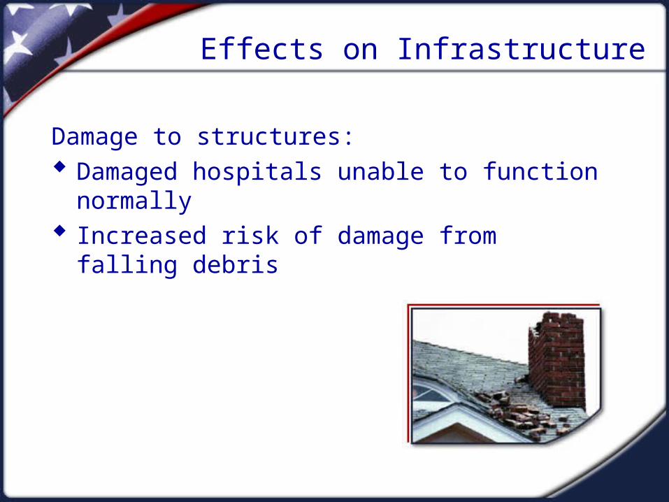
Effects on Infrastructure
Damage to structures: Damaged hospitals unable to function normally Increased risk of damage from falling debris

Effects on Infrastructure
Disrupted communication: Victims unable to call for help Coordination of services hampered

Effects on Infrastructure
Damage to utilities: Loss of utilities Increased risk of fire or electrical shock Loss of contact between victims and service
providers Inadequate water supply Increased risk to public health

Effects on Infrastructure
Damage to fuel supplies: Increased risk of fire or explosion from fuel line
rupture Risk of asphyxiation

Hazards From Home Fixtures
Gas line ruptures from displaced water heaters or ranges
Damage from falling books, dishes, and other cabinet contents
Electric shock from displaced appliances Fire from faulty wiring, overloaded plugs, or
frayed electric cords

Personal Safety
Personal safety measures vary depending on: The type of event. The amount of warning available. Location during the event (i.e., inside, outside,
driving).

Home/Workplace Preparedness
Structural and nonstructural hazard mitigation Individual preparedness:
Assemble disaster supplies. Develop a disaster plan. Develop a safe room.

Sample Structural Hazard Mitigation
Bolt older houses to the foundations. Strap propane tanks. Raise utilities. Strap mobile homes to their slabs. Ask a professional to check foundation, roof
connectors, chimney, etc.

Sample Nonstructural Hazard Mitigation
Anchor heavy furniture. Secure appliances and office equipment. Secure cabinet doors with childproof fasteners. Locate and label gas, electricity, and water
shutoffs. Secure water heaters and have flexible gas lines
installed.

The EOP
Assigns responsibility to organizations and individuals
Sets forth lines of authority Describes how people and property will be
protected Identifies personnel, equipment, facilities,
supplies, and other resources

CERTs in a Disaster Setting
Assist first responders when requested Initially assume many of the same functions as
response personnel when necessary until help arrives: Fire safety Light search and rescue Disaster medical operations

Unit Summary
CERTs are among a variety of agencies and personnel who cooperate to provide assistance in the aftermath of a disaster.
CERTs have proven themselves invaluable in the areas in which they were tested.
CERTs have become a key component of the Citizen Corps program.


