
U.S. Department of the InteriorU.S. Geological Survey
GFLGFL
Monitoring our Dynamic PlanetThe Global Fiducials Program
Bruce F. Molnia
July 25, 2012
ARCTIC SEA ICE
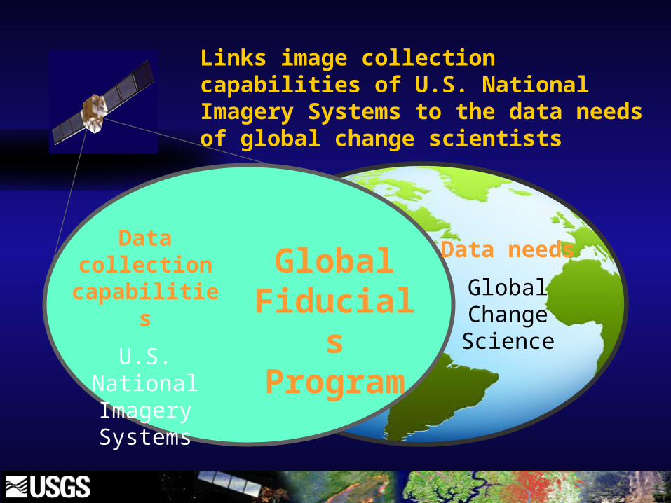
Data collection
capabilities
U.S. National Imagery Systems
Data needs
Global Change Science
Global Fiducials Program
Links image collection capabilities of U.S. National Imagery Systems to the data needs of global change scientists

Create an archive of U.S. National Imagery Systems data
Long-term record of environmentally pertinent sites
Look toward the day when data are declassified
Global Fiducials Program

Create an archive of U.S. National Imagery Systems data
Long-term record of environmentally pertinent sites
Look toward the day when data are declassified
Global Fiducials Program

Create an archive of U.S. National Imagery Systems data
Long-term record of environmentally pertinent sites
Look toward the day when data are declassified
Global Fiducials Program

GFL Website – About Page

GFL Website – FAQ Page

8
SHEBA
1998-1999
Surface Heat Budget of the Arctic Experiment
Resulted in the public release of approximately 60 sea ice images

GFL Sites in the Arctic

Poster - 2009
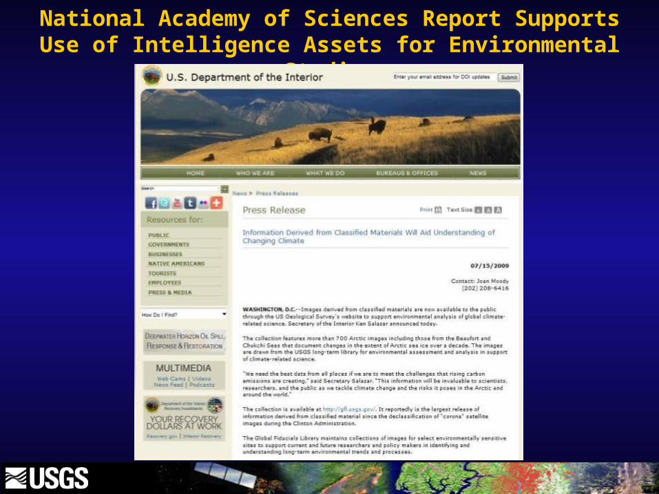
National Academy of Sciences Report Supports Use of Intelligence Assets for Environmental Studies


Greenland Buoy TrackingFrom Website

Greenland Buoy Tracking
Eight months of bouy drift
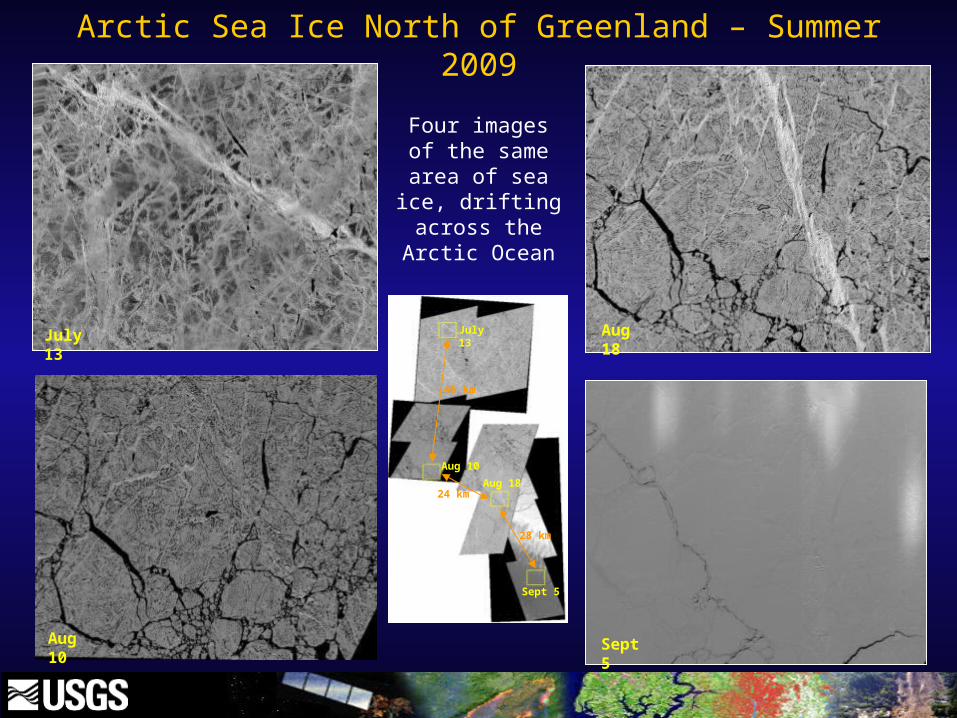
Aug 18July 13
Sept 5
46 km
28 km
July 13
Aug 18
Sept 5
Aug 10
24 km
Aug 10
Arctic Sea Ice North of Greenland – Summer 2009
Four images of the same area of sea ice, drifting
across the Arctic Ocean

July 7, 2009 July 8, 2009
Shifting of Arctic Sea Ice North of Greenland

July 7, 2009 July 8, 2009
Shifting of Arctic Sea Ice North of Greenland

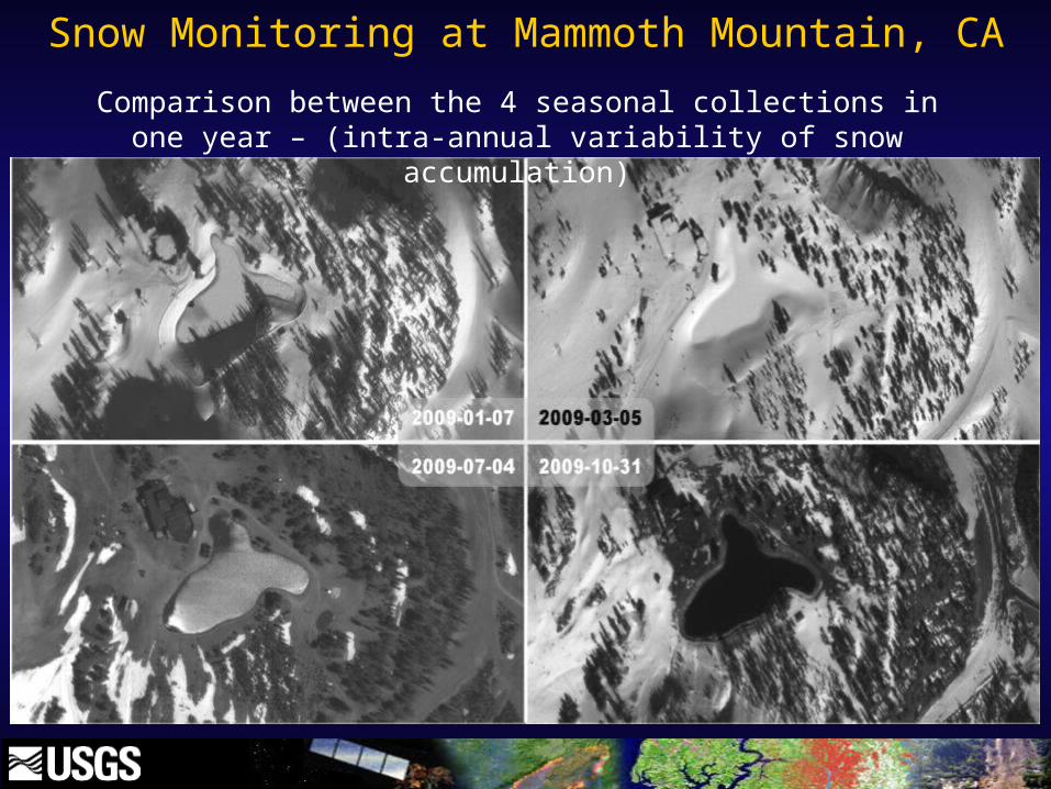
Snow Monitoring at Mammoth Mountain, CA
The Mountain is a NASA snow surface energy exchange study supersite. Scientists are studying the snow-water equivalency, capacity, timing of runoff for reservoir management, and prevention of flooding in times of excessive precipitation.
Snow Monitoring at Mammoth Mountain, CA
Comparison between the 4 seasonal collections in one year – (intra-annual variability of snow accumulation)


