downloadable reproducible ebooks - social studies … and 28 accompanying blackline student pages....
TRANSCRIPT

Downloadable Reproducible eBooks
Sample Pages
These sample pages from this eBook are provided for evaluation purposes. The entire eBook is available for purchase at www.socialstudies.com or www.writingco.com.
To browse more eBook titles, visit http://www.socialstudies.com/ebooks.html To learn more about eBooks, visit our help page at http://www.socialstudies.com/ebookshelp.html For questions, please e-mail [email protected]
To learn about new eBook and print titles, professional development resources, and catalogs in the mail, sign up for our monthly e-mail newsletter at http://socialstudies.com/newsletter/
Copyright notice: Copying of the book or its parts for resale is prohibited. Additional restrictions may be set by the publisher.

MapSkills
MILLIKEN PUBLISHING COMPANY
EMP4752GRADES 7-9
MapSkills
MA
P SKILLS/A
SIAM
P4752M
ILL
IKE
NMapSkillsMap Skills explores the varied features of the world through 16 detailed, full-color transparencies and 28 accompanying blackline student pages. Students will learn about elevations, vegetation, climates, products, populations, and people of the world. Blackline pages will challenge students to combine maps and additionalresources in order to answer questions and make judgements.
MP4751 Africa
MP4752 Asia
MP4753 United States
MP4754 The World
MP4755 Europe
MP4756 Latin America© Milliken Publishing Co. All rights reserved. 4 United States
PHY
SIC
AL
MA
P U
SA
MILLIKEN PUBLISHING COMPANYa Lorenz companyP.O. Box 802Dayton, OH 45401-0802
www.LorenzEducationalPress.com
ISBN 978-1-4291-1578-0
Alignedwith
NationalStandards!
16
Full-Color
Overheads
AsiaAsiaRevised and Updated
for 2009!
Congratulations on the purchase of this electronic eBook. This eBook purchase includes extra media files. When the text in this eBook references a CD track or transparency page, please refer to the extra media file provided as a second link on your original download. Media file File provided
CD audio tracks mp3 files Clip art images jpeg images Transparency pages PowerPoint presentation (ppt)
This eBook contains “reproducible pages” that entitle the individual purchaser to reproduce copies needed for single classroom or home use. The reproduction of any part of this eBook for commercial resale or for use by an entire school or school district is strictly prohibited. Permission is granted to backup and store the audio tracks on a CD disk. Thank you for all you do to bring the love of learning into the lives of your students and for allowing us to play a small part in that endeavor! The Lorenz Educational Press Team

ARTISTPat Biggs
DESIGNMeridian Integrated Media, Ltd.
COVERDan Dreyfus Photography
EDITORCarole Garrett
Copyright © 1993, Revised 2007Milliken Publishing Companya Lorenz companyP.O. Box 802Dayton, OH 45401-0802All rights reserved.www.LorenzEducationalPress.com
Map SkillsAsiaby R. Scott Houseand Patti M. HouseExplore the varied features of the Asian continent while reinforcing basic map reading skills. Sixteen student pages and accompanying blackline and full–color maps coordinate to provide a relational study of the elevations, vegetation, climates, products, populations, and peoples of Asia. Student pages challenge students to combine maps and additional resources in order to answer questions and make judgments.
Question topics follow the Five Themes of Geography as outlined by the National Geographic Society: finding absolute and relative locations on a map, relating physical and human characteristics to an area, understanding human relationships to the environment, tracing movement of peoples and goods throughout an area, and organizing countries and continents into regions for detailed study.
Permission to reproduce pages extends only to teacher-purchaser for individual classroom use, not to exceed in any event more than one copy per pupil in a course.
The reproduction of any part for an entire school or school system or for commercial use is strictly prohibited.
Map SkillsGrades 7, 8, 9
© Milliken Publishing Company i Map Skills–Asia
Teaching GuideThis book has been designed to strengthen map readingand analyzing skills and to familiarize students with thefeatures of different regions of Asia. Each section containsa student page and an accompanying map that is used tocomplete the student page. Each page builds upon previouspages and students should have access to all previouslycompleted maps. Encourage students to use latitude andlongitude markings when comparing features betweenmaps. Students may use related resources to assist them incompleting the student pages. Accept all reasonable an-swers that can be logically supported. Color transparen-cies, located in the back of the book, will assist you in yourclassroom presentation.
Map 1: Asia in the WorldThis Robinson projection map provides a continuous mapwith relatively little distortion of shapes and sizes. It is acompromise between rectangular projections such as theMercator or Peters and more accurate interrupted projec-tions. The student page offers directional activities and aworld overview.Extension Activities:
1. Note that Asia is the world’s largest continent andcompare its size to other more familiar areas. Compare thelatitudes that Asia covers and discuss the effect of latitudeon climate.
2. Use this map to discuss the European exploration ofthe world. Have students trace the routes of Dias, DaGama, and Magellan.
3. Discuss non-European exploration and trade routes.Have students trace routes of Arabic, Indian, and Chinesetraders.
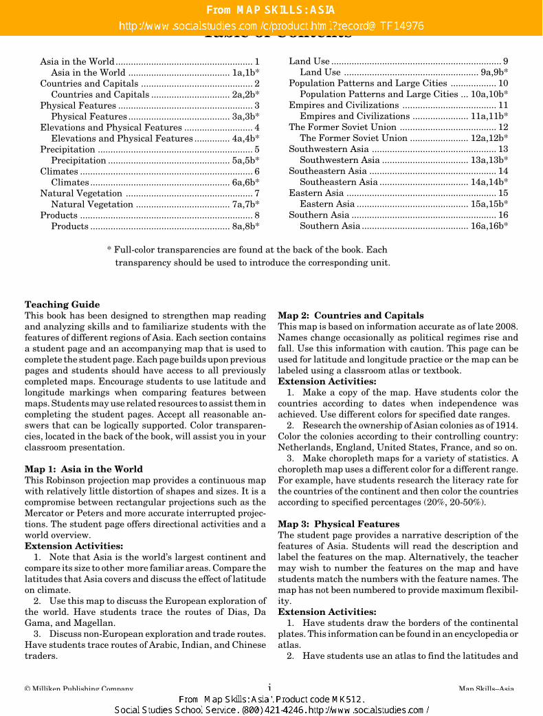
* Full-color transparencies are found at the back of the book. Eachtransparency should be used to introduce the corresponding unit.
Asia in the World...................................................... 1Asia in the World ........................................ 1a,1b*
Countries and Capitals ............................................ 2Countries and Capitals ............................... 2a,2b*
Physical Features ..................................................... 3Physical Features ........................................ 3a,3b*
Elevations and Physical Features ........................... 4Elevations and Physical Features .............. 4a,4b*
Precipitation ............................................................. 5Precipitation ................................................ 5a,5b*
Climates .................................................................... 6Climates ....................................................... 6a,6b*
Natural Vegetation .................................................. 7Natural Vegetation ..................................... 7a,7b*
Products .................................................................... 8Products ....................................................... 8a,8b*
Land Use ................................................................... 9Land Use ..................................................... 9a,9b*
Population Patterns and Large Cities .................. 10Population Patterns and Large Cities ... 10a,10b*
Empires and Civilizations ..................................... 11Empires and Civilizations ...................... 11a,11b*
The Former Soviet Union ...................................... 12The Former Soviet Union ....................... 12a,12b*
Southwestern Asia ................................................. 13Southwestern Asia .................................. 13a,13b*
Southeastern Asia .................................................. 14Southeastern Asia ................................... 14a,14b*
Eastern Asia ........................................................... 15Eastern Asia ............................................ 15a,15b*
Southern Asia ......................................................... 16Southern Asia .......................................... 16a,16b*
Table of Contents
Map 2: Countries and CapitalsThis map is based on information accurate as of late 2008.Names change occasionally as political regimes rise andfall. Use this information with caution. This page can beused for latitude and longitude practice or the map can belabeled using a classroom atlas or textbook.Extension Activities:
1. Make a copy of the map. Have students color thecountries according to dates when independence wasachieved. Use different colors for specified date ranges.
2. Research the ownership of Asian colonies as of 1914.Color the colonies according to their controlling country:Netherlands, England, United States, France, and so on.
3. Make choropleth maps for a variety of statistics. Achoropleth map uses a different color for a different range.For example, have students research the literacy rate forthe countries of the continent and then color the countriesaccording to specified percentages (20%, 20-50%).
Map 3: Physical FeaturesThe student page provides a narrative description of thefeatures of Asia. Students will read the description andlabel the features on the map. Alternatively, the teachermay wish to number the features on the map and havestudents match the numbers with the feature names. Themap has not been numbered to provide maximum flexibil-ity.Extension Activities:
1. Have students draw the borders of the continentalplates. This information can be found in an encyclopedia oratlas.
2. Have students use an atlas to find the latitudes and
© Milliken Publishing Company 1 Map Skills—Asia
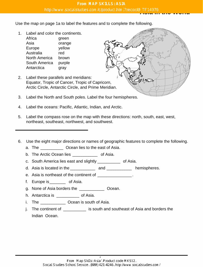
Asia in the World
Use the map on page 1a to label the features and to complete the following.
1. Label and color the continents.Africa greenAsia orangeEurope yellowAustralia redNorth America brownSouth America purpleAntarctica gray
2. Label these parallels and meridians:Equator, Tropic of Cancer, Tropic of Capricorn,Arctic Circle, Antarctic Circle, and Prime Meridian.
3. Label the North and South poles. Label the four hemispheres.
4. Label the oceans: Pacific, Atlantic, Indian, and Arctic.
5. Label the compass rose on the map with these directions: north, south, east, west,northeast, southeast, northwest, and southwest.
6. Use the eight major directions or names of geographic features to complete the following.
a. The __________ Ocean lies to the east of Asia.
b. The Arctic Ocean lies ___________ of Asia.
c. South America lies east and slightly __________ of Asia.
d. Asia is located in the ___________ and ___________ hemispheres.
e. Asia is northeast of the continent of _______________ .
f. Europe is_______ of Asia.
g. None of Asia borders the ___________ Ocean.
h. Antarctica is __________ of Asia.
i. The ___________ Ocean is south of Asia.
j. The continent of __________ is south and southeast of Asia and borders the
Indian Ocean.