draft technical memorandum - · pdf fileresolution copper mining, llc from: mark cross and...
TRANSCRIPT

DRAFT TECHNICAL MEMORANDUM
DATE: October 23, 2012 PROJECT: 605.741
TO:
Sergio Gonzalez and Greg Ghidotti RESOLUTION COPPER MINING, LLC
FROM:
Mark Cross and Janis Blainer-Fleming MONTGOMERY & ASSOCIATES
cc: Howard Plewes KLOHN CRIPPEN BERGER
SUBJECT:
HYDROGEOLOGIC DATA SUBMITTAL, TAILINGS PREFEASIBILITY STUDY, WHITFORD, SILVER KING, AND HAPPY CAMP SITES
In accordance with arrangements with Mr. Sergio Gonzalez, Resolution Copper Mining, LLC (RCM), this draft technical memorandum has been prepared to summarize hydrogeologic data and provide an assessment of hydrogeologic conditions and water uses in the vicinity of the Whitford, Silver King, and Happy Camp sites (Near West area) for the RCM Tailings Prefeasibility Study (PFS). The Near West study area and locations for the three potential tailings storage locations are shown on Figure 1.
SUMMARY 1. Methods and Data Sources: Well and hydrogeologic data were compiled for a study area encompassing approximately 270 square kilometers in the vicinity of the Whitford, Silver King, and Happy Camp sites. The principal sources of well data were the Arizona Department of Water Resources (ADWR) 35-Well Registry, 55-Well Registry, and Groundwater Site Inventory (GWSI) databases. Available drillers’ logs for wells in the study area were retrieved from the ADWR imaged well records within the study area. Additional geologic logs were provided by RCM for mineral exploration boreholes drilled by others. Geologic maps were obtained from Arizona Geological Survey and U.S. Geological Survey

DRAFT
2
(USGS). Additional information was obtained from previously published reports prepared for RCM, a field reconnaissance visit to the Whitford, Silver King, and Happy Camp sites August 9-10, 2012, and a groundwater level monitoring round in the region conducted by RCM in August 2012. Well and spring locations are shown on Figure 1, regional hydrogeologic features are shown on Figure 2, hydrogeologic sections A-A’ and B-B’ through the Silver King and Happy Camp sites are shown on Figures 3 and 4, and August 2012 groundwater level elevations are shown on Figure 5. 2. Hydrogeologic Units: The potential tailings storage sites are underlain by the following principal hydrogeologic units, in order of increasing age:
• Quaternary alluvial deposits on the canyon floors and localized landslide deposits; hydraulic conductivity is estimated to be moderate to high.
• Tertiary sedimentary rocks composed of conglomerate (Gila Conglomerate) and sandstone; hydraulic conductivity is estimated to be low except where enhanced along bedding planes and fracture zones.
• Tertiary volcanic rocks composed of tuff and basalt flows; hydraulic conductivity is estimated to be low to moderate except where enhanced along interflow zones and fracture zones.
• Tertiary and Cretaceous crystalline igneous rocks; hydraulic conductivity is estimated to be low.
• Paleozoic sedimentary rocks consisting of limestone, dolomite, siltstone, shale, and quartzite; hydraulic conductivity is estimated to be low except where enhanced along bedding planes and fracture zones.
• Younger Precambrian sedimentary and igneous rocks consisting of quartzite, shale, limestone, and diabase; hydraulic conductivity is estimated to be low except where enhanced along bedding planes and fracture zones.
• Older Precambrian rocks consisting of crystalline igneous and metamorphic rocks; hydraulic conductivity is estimated to be low.
For the Whitford site, the principal mapped hydrogeologic units include Quaternary landslide deposits on the west side of Reavis Trail Canyon, a Tertiary granitoid stock in the central part of the site, and older Precambrian schist on the eastern, western, and southern edges of the site. A Precambrian granite outcrop occurs at the northwest limb of the proposed site in Reavis Trail Canyon.

DRAFT
3
For the Silver King site, the principal mapped hydrogeologic units include Quaternary alluvial deposits on the canyon floor along the axis of the canyon, a Tertiary basalt flow unit near the southwest edge of the site, Cretaceous quartz diorite in the northeast part of the site, Paleozoic units in the southeast part of the site, younger Precambrian sedimentary and volcanic rocks on the southeast flank of Silver King Canyon, and Precambrian schist on the northwest flank of Silver King Canyon. For the Happy Camp site, the principal mapped hydrogeologic units include Quaternary alluvial deposits on the floor of Silver King Canyon near the southeast edge of the site, Tertiary conglomerate across most of the site, Tertiary tuff in Happy Camp Canyon in the north part of the site, Tertiary basalt on the south edge of the site, and younger Precambrian sedimentary rocks in the northwest part of the site. 3. Occurrence and Movement of Groundwater: Groundwater level measurements for the study area were obtained from ADWR databases, including the GWSI database, and the 35-Well and 55-Well Registries. Water level measurements were obtained at selected wells during the field reconnaissance August 9-10, and RCM conducted a groundwater level monitoring round in the region in August 2012. These data were used to assess the occurrence and movement of groundwater for this report. Groundwater in the vicinity of the Whitford, Silver King, and Happy Camp sites moves generally from northeast to southwest (Figure 5). One registered well occurs in the Whitford watershed (Cottonwood well), which was visited on August 9, 2012. Depth to water level was 10.9 meters below land surface (bls). One spring is reported to occur within the Whitford watershed. The spring, designated Black Spring on the USGS 7.5 minute topographic map (2004 version), is located just south of the drainage divide near the head of Reavis Trail Canyon (northwest quarter of Section 29, Township 1 North, Range 12 East), at an elevation of about 1,345 meters above mean sea level (amsl). The spring was not visited during the reconnaissance visit in August 2012. The Google Earth images for the area show a stand of vegetation that may mark the location for the spring. Five registered wells occur in the Silver King, Happy Camp, and Rice Water Canyon watersheds; reported groundwater levels range from 7.6 to 39.6 meters bls. The Silver King #1 well (Figure 5) was visited on August 10, 2012, and depth to water level was measured at 9.3 meters bls. A windmill at the site is operational and supplies a trough and stockpond. Water quality parameters were measured: temperature of the discharge water was 26.4 degrees Celsius (oC), pH was 7.04, and specific conductance was 1,214 microSiemens per centimeter (µS/cm). The Rice Well is located in the southwest part of the Happy Camp site (Figure 5), and was included in the RCM August 2012 water level monitoring round; depth to groundwater level was 16.7 meters bls. Four springs are reported to occur within the Silver King and Happy Camp watersheds and were visited on August 9, 2012. Happy Camp Spring occurs on the floor of Happy Camp

DRAFT
4
Canyon; flow from the spring was estimated at 0.3 liters per second (L/s). There is a spring zone in the Conley Spring drainage in the Silver King area, and although the spring was dry on the day of the field visit, there are travertine-cemented cobbles in the channel and riparian vegetation in the vicinity of the spring. Bitter Spring is located in Fortuna Wash, and I-Berry Spring is located in Peachville Wash. Elevations at Happy Camp and Bitter Springs are consistent with groundwater level elevations for the regional aquifer system, but groundwater supplying I-Berry Spring appears to be a part of a local perched aquifer system dependent on local rainfall and is not believed to be part of the regional aquifer system. The presence of Happy Camp and Bitter Springs and the relatively shallow water levels (about 10 meters bls) in the Cottonwood and Silver King wells indicate that groundwater occurs at small depths beneath the canyon floors, and is likely part of the regional groundwater flow system. 4. Groundwater Uses: The two registered wells in the Whitford and Bear Tank Canyon watersheds are stock wells. Of the five registered wells in the Silver King, Happy Camp, and Rice Water Canyon watersheds, two are registered as stock wells, two are registered as commercial or industrial wells, and is registered as a domestic well. The nearest reported groundwater withdrawals to the Silver King site are for wells (D-1-13) 17dcb, (D-1-12)36bbc, and (D-1-13)32bbd (Figure 1). Wells 36bbc and 32bbd are RCM dewatering locations at Shafts No. 3 and 9, and the other is an Integrity Land & Cattle, LLC well (Table 1). Reported annual withdrawals from the RCM wells have ranged from 0 to 1,047 acre-feet. Well 17dcb has not been pumped since 2002. The nearest reported groundwater withdrawals to the Happy Camp site are for wells (D-2-11) 01cdc, (D-2-11)01dcd, (D-2-12)07aba, (D-2-12)08daa, and (D-2-12)10ba (Figure 1). Reported owners of these wells include Frank Herron, Boyce Thompson Southwest Arboretum (2 wells), Harborlite Corporation dewatering location, and Harry and Helen Smith Trustees, respectively (Table 1). Of these five wells, the largest volumes of groundwater withdrawals have been from the Harborlite dewatering location; reported annual withdrawals for this well have ranged from 76.1 to 273.8 acre-feet.
5. Assessment of Potential for Migration of Tailings Water: For the Whitford site, migration of tailings water would be very limited in the Tertiary intrusive or older Precambrian rocks. While the Quaternary landslide deposits are likely highly permeable, they are underlain by the older Precambrian crystalline rocks which are generally unfractured and of very small hydraulic conductivity.
For the Silver King site, the highest potential for migration of tailings water occurs in the Quaternary alluvium along the floor of the canyon. The alluvium is underlain by younger Precambrian rocks, which would have small hydraulic conductivity except along fracture zones where hydraulic conductivity would be enhanced. During the later stages of tailings deposition in the Silver King site, substantial seepage could also occur along the eastern edge

DRAFT
5
of the Silver King site, where tailings would directly overlie Paleozoic sedimentary rocks that may locally have enhanced hydraulic conductivity along bedding planes, and along possible fractures and solution features.
For the Happy Camp site, potential for migration of tailings water in the Gila Conglomerate, which underlies most of the site, is likely to be very small. The greatest potential for migration of tailings water is in the volcanic rocks in the north and south parts of the Happy Camp main site and in the north part of the Happy Camp cleaner tailings site. METHODS
Well records and hydrogeologic data were compiled for a study area encompassing
approximately 270 square kilometers, shown on Figure 1. Data were compiled from public sources, previous investigations conducted for RCM, and field reconnaissance visits to the Whitford Canyon, Silver King Canyon, and Happy Camp sites. The principal sources of public data were published reports and databases of ADWR, Arizona Geological Survey, and USGS.
An inventory of wells was prepared using the ADWR well registry and GWSI
databases. Information related to groundwater levels, groundwater uses, and reported annual groundwater withdrawals were also obtained from the ADWR databases. Well and spring locations in the study area are shown on Figure 1. Annual groundwater withdrawals from wells in the study area are summarized in Table 1. The well numbering system used in this report is given in Appendix A. Information from the 35-Well Registry, 55-Well Registry, and GWSI listings for the study area are provided in Appendices B, C, and D, respectively. The well inventories from the individual databases were not combined into a single well inventory; therefore duplicate or inconsistent information likely occurs between the databases.
Regional hydrogeologic features are shown on Figure 2, along with local geologic
features for the area of the Whitford Canyon and Silver King Canyon watersheds. Surface geology shown on Figure 2 is based on the geologic map by Spencer and others (1998), but was modified within the Whitford and Silver King Canyon watershed boundaries to reflect additional structural features shown on geologic maps by Peterson (1969) and Spencer and Richard (1995). Detailed descriptions of geologic units shown on the geologic map are given in Appendix E.
Available drillers’ logs for wells in the study area were retrieved from the ADWR
imaged well records within a 4-kilometer distance around the Whitford and Silver King Canyon watersheds and are provided in Appendix F. Drillers’ logs are available for 49 wells in the study area. In addition, geologic logs and records were provided by RCM for exploration boreholes drilled by others, and are given in Table 2 and Appendix F, respectively. Locations of these exploration boreholes are shown on Figure 2.

DRAFT
6
Field reconnaissance visits to Whitford, Silver King, and Happy Camp sites were conducted August 9-10, 2012. Field activities included inspection of geologic units, structural features, wells, and surface water features; and measurements of pH, temperature, and specific conductance of groundwater from springs and pumping wells.
HYDROGEOLOGIC FRAMEWORK The study area occurs within the Transition Zone physiographic province of central
Arizona. The Transition Zone is characterized by deeply incised drainages and rugged topography. The Whitford site is located within the Whitford Canyon watershed and the Silver King site is located with the Silver King Canyon watershed. The Happy Camp main site is located mostly in the Happy Camp Canyon watershed and partly in the Rice Water Canyon watershed to the west. The Happy Camp cleaner tailings site is located within the lower part of the Whitford Canyon watershed (Potts Canyon) to the east, and the Bear Tank Canyon watershed to the west, and the Benson Spring Canyon watershed to the south.
The Whitford Canyon watershed is oriented north-northeast to south-southwest.
Whitford Canyon begins at the confluence of Reavis Trail and Wood Camp Canyons. The Whitford Canyon drainage heads south from the confluence then heads southwest through Barnett Camp and into Potts Canyon. All of the drainages are ephemeral. The Whitford Canyon watershed begins about 13 kilometers north of Queen Creek near the head of Reavis Trail and Wood Camp Canyons at an elevation of about 1,550 meters amsl and ends about 5 kilometers west of Superior at the confluence of Potts Canyon and Queen Creek at an elevation of 730 meters amsl. The watershed drains an area of approximately 47 square kilometers. The Bear Tank Canyon watershed is located west of the Whitford Canyon watershed and drains an area of approximately 13 square kilometers.
The principal geologic units at the Whitford Canyon site, in order of increasing age,
include Quaternary or Tertiary landslide deposits on the west side of Reavis Trail Canyon, Tertiary intrusive rocks north of the confluence of Reavis Trail and Wood Camp Canyons, and Precambrian igneous and metamorphic rocks surrounding the Tertiary intrusive (Figure 2). Detailed descriptions of geologic units shown on Figure 2 are given in Appendix E. There are no major structural features within the Whitford Canyon site.

DRAFT
7
Photograph A. Whitford Canyon looking north
Photograph B. Whitford Canyon looking south The Silver King Canyon watershed is oriented northeast to southwest. The watershed
comprises Silver King Wash and several smaller tributary washes, all of which are ephemeral. Silver King Canyon watershed begins about 10 kilometers northeast of Queen Creek at an elevation of about 1,525 meters amsl at the heads of Peachville, Fortuna, Silverado, Yellowjack, Comstock, and Conley Spring Washes. The tributaries drain into Silver King Wash which heads southwest to its confluence with Queen Creek. The watershed ends about 3 kilometers west of Superior at the confluence with Queen Creek at an elevation of 756 meters amsl. The watershed drains an area of approximately 16.6 square kilometers.
The principal geologic units at the Silver King Canyon site, in order of increasing
age, include Quaternary alluvial deposits on the floor of Silver King Wash, Tertiary volcanic and sedimentary rocks, Cretaceous intrusive igneous rocks, Paleozoic sedimentary rocks, and Precambrian igneous, sedimentary, and metamorphic rocks.
The Happy Camp Canyon watershed is oriented northeast to southwest. The
watershed begins about 8.3 kilometers northeast of Queen Creek at an elevation of about

DRAFT
8
1,362 meters amsl, and ends about 2.5 kilometers west of Superior at the confluence with Queen Creek at an elevation of about 732 meters amsl. The watershed drains an area of approximately 11.5 square kilometers.
The principal geologic units at the Happy Camp site, in order of increasing age,
include Quaternary alluvial deposits on the floor of Silver King Wash, Tertiary volcanic and sedimentary rocks, and Precambrian igneous and sedimentary rocks (Figure 2). Detailed descriptions of geologic units shown on Figure 2 are given in Appendix E. Hydrogeologic cross sections of the Happy Camp and Silver King sites are shown on Figures 3 and 4.
The major structural features in the study area are the Concentrator, Main, and
Conley Spring Faults (Figure 2), located in the southwest part of the Silver King site. These are normal faults down-thrown on the west side (Peterson, 1969; Spencer and others, 1998) (Figure 3).
Photograph C. Silver King Canyon looking northwest. Peachville Mountain in the background Quaternary Alluvial Deposits
Mapped Quaternary alluvial deposits occur chiefly along Silver King Wash and
Queen Creek, but also include landslide deposits on the steep western slopes of Reavis Trail Canyon in the Whitford Canyon watershed. The alluvial deposits within Silver King Canyon comprise a veneer of poorly sorted gravel and sand originating from the surrounding highlands, and extend from the central part of the Silver King site, along the east edge of the Happy Camp site, to Queen Creek. Unmapped Quaternary alluvium also occurs in some areas along canyon floors in the Whitford Canyon and Happy Camp Canyon, and where present would have very small thickness. The alluvial deposits likely have moderate to high hydraulic conductivity.
Geologic units that are classified within the Quaternary alluvial deposits include:
Qy – Low Terrace and Alluvial Fan Deposits (Holocene) o Exposed in the channel of Silver King Wash o Alluvial deposits that have incipient soil development comprising sand to
boulders

DRAFT
9
Photograph D. Alluvial deposits (Qy) in Silver King Wash
• Ql – Moderately Dissected Alluvial Fan and Terrace Deposits (Late Pleistocene) o Exposed on the west side of Silver King Wash, along the southeast edge of the
Happy Camp site o Alluvial deposits that have moderate soil development comprising sand to
boulders
• Qm – Dissected Alluvial Fan and Terrace Deposits (Middle Pleistocene) o Exposed on the east side of Silver King Wash, southeast of the Happy Camp
site o Alluvial deposits that have strong soil development comprising sand to
boulders
• Qml – Middle Alluvium, Undifferentiated (Late to Middle Pleistocene) o Composite unit that contains Ql and Qm exposed between the Happy Camp
site and Queen Creek o Alluvial deposits that have moderately to strongly developed soils
• Qo – Deeply Dissected Alluvial Fan Remnants (Early Pleistocene)
o Exposed in the Whitford Canyon watershed, between the Silver King and Whitford Canyon sites, near the junction of the Concentrator and Conley Spring Faults
o Undifferentiated surficial deposits
• QTl – Landslide Deposits (Holocene or Pliocene) o Exposed on the west slopes of Reavis Trail Canyon in the Whitford Canyon
site o Poorly consolidated to unconsolidated deposits comprising mud to large
boulders

DRAFT
10
Tertiary Sedimentary and Volcanic Rocks
The Tertiary sedimentary and volcanic rocks occur chiefly in the Happy Camp site, and extend south to Queen Creek and east to the Concentrator Fault (Figure 2). These rocks likely have small hydraulic conductivity, except along bedding plans and steeply-dipping structural features where hydraulic conductivity may be substantially larger. Geologic units exposed at the Happy Camp site that are classified within the Tertiary sedimentary and volcanic rocks include:
• Tcu – Conglomerate (Miocene)
o Exposed throughout most of the Happy Camp main and cleaner tailings sites o Moderately to well indurated conglomerate (Gila Conglomerate), consisting
of sub-rounded to sub-angular cobbles to boulders; grades downward into Tsu
Photograph E. Joint in Tertiary Gila Conglomerate (Tcu) in Happy Camp Canyon
• Tsu – Sandstone (Miocene)
o Exposed southeast and southwest of Happy Camp main site o Medium to fine-grained sandstone; grades upward into Tcu; overlies Tb
• Tt – Poorly Welded Tuff (Miocene)
o Exposed in Happy Camp Canyon north of Happy Camp Spring o Non-welded to poorly welded tuff of uncertain affinity

DRAFT
11
Photograph F. Tuffaceous volcanics (Tt) north of Happy Camp
• Tfp – Felsic Lava Flows (Middle to Early Miocene) o Exposed in north part of Happy Camp cleaner tailings site o Quartz latite and rhyolite lava flows of the Picketpost Mountain volcanics
Photographs G and H. Felsic volcanics (Tfp) (left) and water pocket (right) Barnett Camp area

DRAFT
12
• Tb – Basaltic Rocks (Middle to Early Miocene) o Exposed in south part of Happy Camp main site, in areas south of Happy
Camp main and cleaner tailings sites, and along the Concentrator Fault in the Silver King site
o Basalt lava flows and flow breccias
• Tal – Apache Leap Tuff (Early Miocene) o Exposed near the northeast margin of Silver King Canyon site o Crystal-rich, ash-flow tuff, unwelded to densely welded
• Tev – Volcanic Rocks (Early Miocene)
o Exposed near the northeast margin of Silver King Canyon site and the northeast margin of Whitford Canyon site
o Lava flows of rhyolite and perlitic obsidian
• Tsl – Pre-Volcanic Sedimentary Rocks (Miocene to Late Oligocene) o Exposed near the northeast margin of Silver King Canyon site o Pre-volcanic clastic rocks (Whitetail Conglomerate) consisting of massive
conglomerate, mudstone, evaporite, and sandstone
Tertiary and Cretaceous Intrusive Rocks
A Tertiary granitoid stock occurs in the central part of the Whitford Canyon site, a Tertiary-Cretaceous porphyry intrusive occurs near the northeast edge of the Whitford Canyon site, and a Cretaceous quartz diorite stock occurs in the northeast part of the Silver King Canyon site (Figure 2). These rocks likely have small hydraulic conductivity. Geologic units exposed within Whitford Canyon and Silver King Canyon sites (Figure 2) that are classified within the Tertiary and Cretaceous intrusive rocks include:
• Tg2 – Granitoid Stock of Wood Camp Canyon (Miocene)
o Exposed in the center of the Whitford Canyon site o Fine-grained aplitic to granophyric granite
• TKpg – Porphyry of Government Hill (Late Cretaceous or Paleocene)
o Exposed near the northeast edge of the Whitford Canyon site o Quartz monzonite porphyry
• Kqd – Quartz Diorite of Peachville Wash (Late Cretaceous)
o Exposed across the northeast part the Silver King Canyon site o Medium to fine-grained quartz diorite, intrudes Pinal Schist, Apache Group
and Paleozoic strata

DRAFT
13
Photograph I. Quartz diorite of Peachville Wash (Kqd)
Paleozoic Sedimentary Rocks Paleozoic sedimentary rocks are exposed along the northeast margin of the Silver King Canyon site. The units are fractured and, thus, likely have small to moderate secondary hydraulic conductivity. The beds dip moderately to the east and southeast (Figure 2 and 3). Rocks exposed within the Silver King Canyon site that are classified within this group include:
Pn – Naco Formation (Pennsylvanian) o Exposed along the east edge of the Silver King Canyon site adjacent to the
Conley Spring Fault o Fossiliferous fine-grained limestone interbedded with marl and shale
MCs – Undifferentiated Escabrosa Limestone, Martin Formation, and Bolsa
Quartzite (Mississippian, Devonian, and Cambrian) o Exposed along the east edge of Silver King Canyon site o Consists of the following units: Escabrosa Limestone, Martin Formation, and
Bolsa Quartzite; these units dip moderately to the east and southeast Younger Precambrian (Middle Proterozoic) Sedimentary and Igneous Rocks The younger Precambrian rocks are exposed in the northwest part of the Happy Camp main site and in the northeast and southeast parts of the Silver King site. The igneous unit likely has low hydraulic conductivity, whereas the sedimentary units are highly fractured

DRAFT
14
and, thus, likely have small to moderate secondary hydraulic conductivity. The beds dip moderately to the east and southeast (Figure 2). Rocks exposed within the Happy Camp and Silver King sites that are classified within this group include:
• Yd – Diabase (Middle Proterozoic) o Exposed in the northwest part of the Happy Camp main site, and along the
east part of Silver King Canyon site o Dark gray dikes with typical sub-ophitic, diabasic texture; major sills intrude
Dripping Spring Quartzite, Mescal Limestone, Pioneer Shale, and Troy Quartzite
• Yad – Apache Group, Troy Quartzite, and Diabase (Middle Proterozic):
o Exposed in the northwest part of the Happy Camp main site o Consists of the following units: Diabase, Troy Quartzite, Mescal Limestone,
Dripping Spring Quartzite, and Pioneer Shale; these units dip moderately to the east and southeast
• Ya – Apache Group (Middle Proterozic):
o Exposed between the Whitford and Happy Camp sites, and along the east part of Silver King Canyon watershed
o Consists of the following units: Mescal Limestone, Dripping Spring Quartzite, and Pioneer Shale; these units dip moderately to the east and southeast
Photograph J. Contacts between Precambrian diabase (left), Apache Group (center), and Paleozoic units (right)

DRAFT
15
Older Precambrian (Early Proterozic) Igneous and Metamorphic Rocks The older Precambrian rocks are exposed throughout the Whitford site and in the west
part of the Silver King site. The hydraulic conductivity of these rocks is likely very small and mainly controlled through secondary structural features (Figure 2). Rocks that are classified within this group include:
• Xgd – Granodiorite to Granite (Early Proterozoic)
o Exposed in the northwestern part of the Whitford Canyon site
• Xp – Pinal Schist (Early Proterozoic) o Exposed in most of the Whitford Canyon site and in the west part of the Silver
King Canyon site o Generally consists of fine-grained quartz-muscovite-chlorite ± biotite semi-
schist to phyllite
• Xpc – Pinal Schist Calc-silicate and Amphibolite Facies (Early Proterozoic): o Exposed in a small area in the south part of the Whitford Canyon site o Consists of interlayered amphibolite, marble, and psammite
• Xpp – Pinal Schist Phyllite Facies (Early Proterozoic):
o Exposed near Queen Creek south of the Happy Camp cleaner tailings site o Consists of massive, platy, slightly schistose phyllite
Photograph K. Pinal Schist (Xp)

DRAFT
16
HYDRAULIC CONDUCTIVITY OF PRINCIPAL GEOLOGIC UNITS Hydraulic conductivity for geologic units in the project area has been estimated from hydrologic tests at wells in the study area; estimated hydraulic conductivity values are summarized in Table 3.
Hydraulic conductivity for the Gila Conglomerate (Tcu) was has been estimated based on 14 hydrologic tests conducted at monitor wells in the West Plant area. Estimates of hydraulic conductivity of the conglomerate (excluding one test for a mudstone unit within the conglomerate), range from 1.1 x 10⁻⁷ to 6 x 10⁻⁹ centimeters per second (cm/sec); arithmetic mean is 3.0 x 10⁻⁶ cm/sec and geometric mean is 4.8 x 10⁻⁷ cm/sec. Estimated hydraulic conductivity of the mudstone unit (one test) within the Gila Conglomerate is 1.3 x 10⁻⁹ cm/sec.
Hydraulic conductivity for the mid- to early-Miocene Tertiary Picketpost Mountain
volcanic units was estimated to be 1 x 10⁻⁵ cm/sec based on a constant-rate pumping test at well DHRES-04. Hydraulic conductivity for the Apache Leap Tuff (Tal) has been estimated based on 22 hydrologic tests at the HRES series of wells. Estimated hydraulic conductivity ranges from 2 x 10⁻⁷ to 6 x 10⁻³ cm/sec; arithmetic mean is 5 x 10⁻⁴ cm/sec and geometric mean is 5 x 10⁻⁵ cm/sec. Hydraulic conductivity for younger Precambrian sedimentary rocks and diabase (Yad) was estimated to be 4 x 10⁻⁶ cm/sec based on a constant-rate pumping test at well DHRES-09. A pumping test at well DHRES-13, which penetrates the same rock units and also Pinal Schist (Xpc), indicated a similar hydraulic conductivity of 1 x 10⁻⁶ cm/sec. OCCURRENCE AND MOVEMENT OF GROUNDWATER
Groundwater level measurements for the study area were obtained from ADWR
databases, including the GWSI database, and the 55 and 35 well registries. Measurements from the GWSI are obtained by ADWR for index wells, and are considered reliable. Measurements from the 55 and 35 well registries are often reported by the driller or pump contractor at the time of drilling or equipping of the well, are considered less reliable than measurements from the GWSI, and also may not be representative of current or recent groundwater conditions. A groundwater level monitoring round was conducted by RCM personnel in August 2012 as part of the Superior basin and Queen Creek corridor study. These groundwater level measurements are shown on Figure 5. Figure 5 shows groundwater level elevation contours based on the best available data for shallow groundwater system in the Superior basin. Inspection of Figure 5 indicates that groundwater beneath the Silver King and Happy Camp areas moves generally from northeast to southwest. Average hydraulic gradient is in the magnitude of 20 meters per kilometer.

DRAFT
17
There is one registered well in the Whitford Canyon watershed and one registered well in the Bear Tank Canyon watershed. During the site visit on August 10, 2012, the Cottonwood Well [(D-1-12)16db] in Whitford Canyon watershed was inspected (Photograph L) (Figure 2). Groundwater level was measured at 10.9 meters bls; temperature of the groundwater was 34.0 degrees Celsius (oC), pH was 7.68, and specific conductance was 2,211 µS/cm. The Noble Well [(D-1-12) 19cb] in Bear Tank Canyon watershed was not visited.
Photograph L. Cottonwood Well and tank
During the August 10, 2012 site visit, an unregistered well was located near the head of Wood Camp Canyon adjacent to a stone cabin (Photograph M). The well is a former windmill well, that was 5 feet in diameter and about 15 feet deep. It is located in Township 1 North, Range 12 East, in the SE ¼, of the SE ¼, of the NW ¼ of Section33. The presence of drill cuttings on the ground suggests that the well was recently deepened. An 8-inch casing is installed in the well.
Photograph M. Stone cabin and well

DRAFT
18
Within the Whitford Canyon watershed, there is one reported spring. Black Spring is reported to be located just south of the drainage divide near the head of Reavis Trail Canyon in the NW 1/4 of Section 29, Township 1 North, Range 12 East, at an elevation of about 1,347 meters amsl. While the spring was not visited in August 2012, Google Earth images for the area show a stand of vegetation that may mark the location for the spring. The groundwater supplying this reported spring may be part of local perched aquifer system dependent on recent local rainfall and is not believed to be part of the regional aquifer system. Perlite Spring is located north of the Happy Camp cleaner tailings site (Figure 1). There are two reported springs in the Bear Tank Canyon watershed, Perlite Spring and an unnamed spring. The springs in Bear Tank Canyon watershed were not visited during the August 2012 field reconnaissance. There are five registered wells in the Silver King, Happy Camp, and Rice Water Canyon watersheds. Construction details are available for one domestic well, two industrial wells, and one stock well. Reported depths for these wells range from 12 to 122 meters bls, and reported groundwater levels range from 7.6 to 39.6 meters bls (Appendix C). The Silver King Well [(D-1-12)27aad] was inspected on August 10, 2012. The windmill is operational and supplies a trough and stock pond (Photograph N). Depth to groundwater level was measured at 9.3 meters bls; temperature of the groundwater was 26.4oC, pH was 7.04, and specific conductance was 1,214 µS/cm. The Rice Well [(D-1-12)31dd] is reportedly located in Rice Water Canyon but was not visited during the August 2012 reconnaissance. RCM personnel report a depth to groundwater level of 16.7 m, and a groundwater level elevation of 739.4 meters amsl, at the Rice Well (August 2012).

DRAFT
19
Photograph N. Silver King Well and stock pond
Within the Silver King and Happy Camp watersheds, there are four reported spring locations. The springs include Happy Camp Spring, Bitter Spring, I-Berry Spring, and Conley Spring. Happy Camp Spring is located on the floor of Happy Camp Canyon, within the Gila Conglomerate (Tcu) (Figure 2). During the site visit on August 10, 2012, the spring area consisted of a dammed section of a stream channel with sediment built up behind the dam (Photograph O). A discharge pipe extends from behind the dam to a stock pond located downstream. Discharge to the pond was estimated to be about 0.3 liters per second; temperature was 27.5oC, pH was 6.73, and specific conductance was 790 µS/cm.
Photograph O. Dam in wash at Happy Camp Spring

DRAFT
20
Bitter Spring is an improved spring located in the Fortuna Wash drainage, within the Kqd about 30 meters downstream from the contact between the Kqd and Xp (Figure 2). The site was visited on August 9, 2012. The spring is developed with a spring box, a solar powered submersible electric pump, storage tank, and cattle trough (Photograph P). Depth to groundwater level at the spring box was 2.7 meters bls. Water quality parameters were measured from the cattle trough; temperature was 31.3oC, pH was 8.32, and specific conductance was 1,327 µS/cm.
Photograph P. Bitter Spring In Conley Spring Wash, a spring zone was observed. Within the spring zone there
were travertine-cemented cobbles of Apache Leap Tuff, limestone, diabase, basalt, and quartzite. The spring was dry, but the presence of riparian vegetation including cattails, tobacco tree, pentstemon, hackberry, and a small dead cottonwood tree suggests that at times there is flow or seepage in the zone (Photograph Q).

DRAFT
21
Photograph Q. Conley Spring with riparian vegetation (left) and travertine cemented cobbles in spring zone (right)
I-Berry Spring is an improved spring located in the Peachville Wash drainage within
the Kqd. RCM personnel reported a depth to groundwater level of 5.3 meters bls in August 2012. The groundwater supplying this reported spring may be part of local perched aquifer system dependent on recent local rainfall and is not believed to be part of the regional aquifer system.
The presence of Happy Camp, Bitter, and I-Berry Springs and the shallow water
levels (about 10 meters bls) in Cottonwood and Silver King Wells indicate that groundwater level occurs at small depths beneath the canyon floor, and possibly at depths of several tens of meters beneath the canyon sides. The Paleozoic and younger Precambrian sedimentary rocks likely contain a persistent but highly compartmentalized groundwater system due to the faulting and juxtaposition of sedimentary rocks, diabase and schist. Regional direction of groundwater movement for this system is believed to be generally from northeast to southwest (Figure 5).
Groundwater level data and results of calibration of the RCM integrated groundwater
flow model suggest that the Concentrator Fault acts as a barrier to groundwater movement. Comparison of water level elevations in deep wells east of the Concentrator Fault to water level elevations in wells completed to similar depths west of the fault suggests the fault acts as a barrier to groundwater movement. To calibrate the RCM integrated groundwater flow model, horizontal hydraulic conductivity assigned to rock units along the Concentrator Fault were reduced by two orders of magnitude compared to conductivities assigned to the same rock units outside the fault zone (Schlumberger Water Services, 2010). Vertical hydraulic conductivity was not reduced in the flow model.

DRAFT
22
The deep groundwater system is believed to highly compartmentalized. Due to dewatering operations, water levels in the mine workings within the RCM graben are about 500 meters bmsl. Water levels in wells outside the RCM graben are several thousand meters higher.
GROUNDWATER USES
Information on groundwater uses in the study area was obtained from the ADWR GWSI database and 55-Well Registry. The majority of groundwater uses are reported to be stock uses for most wells in the region surrounding Whitford Canyon and Silver King Canyon watersheds. Monitoring, industrial, or domestic uses are reported for a smaller percentage of wells in the study area (Figure 1; Appendices B through D).
Most of the wells in the study area are classified as “exempt” wells, which are equipped to pump less than 35 gallons per minute, and are exempt from the requirement to report groundwater withdrawals to ADWR. There are no reported groundwater withdrawals within Whitford Canyon, Silver King Canyon, or Bear Tank Canyon watersheds. Reported groundwater withdrawals for non-exempt wells in the wider study area are summarized in Table 1 for the period 1993 through 2010. The reported groundwater withdrawals and well owners include:
• (D-1-12)36bbc Resolution Copper Mining LLC Shaft No. 3 • (D-1-13)17dcb Integrity Land & Cattle, LLC • (D-1-13)32bbd Resolution Copper Mining LLC Shaft No. 9 • (D-2-11)01cdc Frank Herron • (D-2-11)01dcd Boyce Thompson Southwest Arboretum • (D-2-12) 07aba Boyce Thompson Southwest Arboretum • (D-2-12)08daa Harborlite Corporation • (D-2-12)10ba Harry & Helen Smith Trustees
The largest volumes of groundwater withdrawals have been from the wells owned RCM and Integrity Land & Cattle, LLC. The RCM withdrawals are for dewatering at Shaft No. 3 and Shaft No. 9. The well owned by Integrity Land & Cattle, LLC has not been pumped since 2002.
ASSESSMENT OF POTENTIAL FOR MIGRATION OF TAILINGS WATER Hydrogeologic data compiled for the present investigation were used to assess the potential for migration of tailings water in geologic units beneath potential tailings impoundments. The potential for migration will be controlled by hydraulic conductivity of the underlying rock units and by hydraulic gradients that will act as the driving force to move tailings water into and through geologic units

DRAFT
23
The only geologic units in the study area with large hydraulic conductivity are the Quaternary alluvial and colluvial deposits. For all other geologic units, hydraulic conductivity is related chiefly to degree and interconnection of fractures associated with structural features. For the volcanic rocks in the north and south parts of the Happy Camp main site and the north part of the Happy Camp cleaner tailings site, hydraulic conductivity may also be related to the nature and spacing of bedding planes between volcanic units.
Hydraulic gradients will depend partly on depth to groundwater level, which ranges
from a few meters or less in the topographically low areas to several tens of meters beneath the sides of the canyons. Vertical hydraulic gradients acting to move tailings water downward into underlying geologic units would be smaller beneath the floors of canyons than beneath the sides of canyons.
The largest potential for migration of tailings water is along the canyon floor at the
south end of the Silver King site, where tailings would directly overlie Quaternary alluvium. Substantial seepage could also occur in Tertiary volcanic rocks in the north and south parts of the Happy Camp main site and in the northeast part of the Happy Camp cleaner tailings site. These rocks may contain bedding planes and structural features that would correspond to zones of enhanced hydraulic conductivity. During the later stages of tailings deposition in the Silver King site, substantial seepage could also occur along the eastern edge of the Silver King Canyon site, where tailings would directly overlie Paleozoic sedimentary rocks that may locally have enhanced hydraulic conductivity along bedding planes, and along possible fractures and solution features.
Moderate potential for migration of tailings water is associated with the younger
Precambrian sedimentary rocks in the north part of the Happy Camp site and south part of the Silver King site, where fracture zones may occur resulting in locally enhanced hydraulic conductivity. Although the Concentrator Fault appears to act as a barrier to groundwater movement in the deeper flow system in the vicinity of Superior, it is possible that this fault and the Main and Conley Spring Faults, which pass through the south part of the Silver King site, may have resulted in local zones of fracturing and enhanced hydraulic conductivity.

DRAFT
24
REFERENCES CITED Golder Associates, 2008, Groundwater model of West Plant Site, Superior, Arizona:
Amended report submitted to Resolution Copper Mining, LLC, December 18, 2008. Montgomery & Associates, 2005, Results of preliminary hydrogeologic characterization
for Apache Leap Tuff aquifer system in Devils Canyon and Upper Queen Creek watersheds, Pinal and Gila Counties, Arizona: draft report prepared for Resolution Copper Company, June 3, 2005 (revised May 2006).
_____, 2008, Hydrogeologic characterization well HRES-4: Results of long-term
aquifer test, Resolution Copper Mining, LLC, Pinal County, Arizona: report prepared for Resolution Copper Mining, LLC, Superior, Arizona, May 23, 2008.
_____, 2010, Results and analysis of long-term pumping test at well HRES-07,
Resolution Copper Mining, Pinal County, Arizona: Technical memorandum prepared for Resolution Copper Mining, LLC, Superior, Arizona, April 21, 2010
_____, 2011a, Results of drilling, construction, equipping, and testing at hydrologic test
wells HRES-10 and HRES-11, Resolution Copper Mining, Pinal County, Arizona: Technical memorandum prepared for Resolution Copper Mining, LLC, May 13, 2011.
_____, 2011b, Results of drilling, construction, and testing at hydrologic test wells
DHRES-03, DHRES-04, DHRES-05, and DHRES-05B, Resolution Copper Mining, Pinal County, Arizona: Technical memorandum prepared for Resolution Copper Mining, LLC, June 17, 2011.
_____, 2011c, Results of drilling, construction, and testing at hydrologic test wells
HRES-09 and DHRES-07, Resolution Copper Mining, Pinal County, Arizona: Technical memorandum prepared for Resolution Copper Mining, LLC, November 30, 2011.
_____, 2011d, Results of drilling, construction, and testing at hydrologic test well
DHRES-09, Resolution Copper Mining, Pinal County, Arizona: Technical memorandum prepared for Resolution Copper Mining, LLC, December 8, 2011.
_____, 2011e, Results of drilling, construction, and testing at hydrologic test wells
DHRES-12 and DHRES-13, Resolution Copper Mining, Pinal County, Arizona: Technical memorandum prepared for Resolution Copper Mining, LLC, December 22, 2011.

DRAFT
25
_____, 2012a, Results of drilling, construction, and testing at hydrologic test well HRES-13, Resolution Copper Mining, Pinal County, Arizona: Technical memorandum prepared for Resolution Copper Mining, LLC, January 5, 2012.
______, 2012b, Summary of hydrogeologic investigations conducted during the period
2006 through 2010, Resolution Copper Mining, Pinal County, Arizona: report prepared for Resolution Copper Mining, LLC, July 6, 2012.
Peterson, D.W., 1969, Geologic map of the Superior quadrangle, Pinal County, Arizona:
United States Geological Survey, Map GQ 818. Schlumberger Water Services, 2010, Phase II RCM Integrated Flow Model Calibration
Results: Technical memorandum prepared for Resolution Copper Mining, LLC, November 4, 2010.
Spencer, J.E., and Richard, S.M., 1995, Geologic map of the Picketpost Mountain and the
southern part of the Iron Mountain 7-1/2’ Quadrangles, Pinal County, Arizona: Arizona Geological Survey Open-File Report 95-15, 12 p., 1 sheet, scale 1:24,000.
Spencer, J.E., Richard, S.M., and Pearthree, P.A., 1998, Geologic map of the Mesa 30' x 60'
quadrangle, east-central Arizona: Arizona Geological Survey, DI-11, version 1.0, September 1998, 15 p.

TABLE 1. SUMMARY OF GROUNDWATER WITHDRAWALS NEAR WEST TAILINGS PREFEASIBILITY STUDY
RESOLUTION COPPER MINING, PINAL COUNTY, ARIZONA
1993 1994 1995 1996 1997 1998 1999 2000 2001 2002 2003 2004 2005 2006 2007 2008 2009 2010
(D-01-12) 36bbc 525311 Resolution Copper Mining LLC 374 228.5 116.2 213 4.1 435.81 --- --- --- --- --- --- --- --- --- --- 878.8 1047 Shaft No. 3
(D-01-13) 17dcb 609674 Integrity Land & Cattle, LLC 2084.58 1433.71 1119.96 1604.2 1193 1208.7 1304 1479 1259 1791 --- --- --- --- --- --- --- ---
(D-01-13) 32bbd 525312 Resolution Copper Mining LLC 781 569.7 863.3 590.8 713.4 --- 29.72 50.73 20.46 41.22 16.92 25.9 0 50.15 58.58 64.13 883.2 1040 Shaft No. 9
(D-02-11) 01cdc 627522 Frank Herron 3 6.5 1.3 3.9 6.96 6.22 1.9 2.5 11 --- --- --- --- --- --- 6.04 9.71 8.915
(D-02-11) 01dcd 560518 Boyce Thompson Southwest Arboretum --- --- --- --- --- 31 17.6 40.2 21.7 41 31.3 28.3 30 12.8 16.9 30.8 53 31.8
(D-02-12) 07aba 624605 Boyce Thompson Southwest Arboretum --- 43.1 44.5 47 56.5 37.19 48.7 34.77 37 24.3 37.3 30.5 40 46.4 29.7 36.6 34.8 23
(D-02-12) 08daa 588114 Harborlite Corporation --- --- --- --- --- --- --- --- 103.4 --- 76.1 --- --- --- 91.4 116.2 95.7 273.8
(D-02-12) 10ba 602821 Harry & Helen Smith Trustees 12 11 10 11 12 14 15 17 19 18 12 14 13 14 24 7 6 9.9
--- = No groundwater withdrawals reported
CADASTRALLOCATION
55 WELLREGISTRYNUMBER OWNER/COMPANY
……….…….……......ANNUAL GROUNDWATER WITHDRAWALS (acre-feet)………………………..
605/741/Tbl1_Recent_GW_Withdrawals.xlsx/18Oct2012 DRAFT

TABLE 2. SUMMARY OF BOREHOLE LITHOLOGIC LOGS NEAR WEST TAILINGS PREFEASIBILITY STUDY
RESOLUTION COPPER MINING, PINAL COUNTY, ARIZONA
TOP (m, bls)a
BOTTOM (m, bls)
0.0 264.3 Tertiary Volcanic Rocks264.3 290.2 Tertiary Apache Leap Tuff290.2 364.2 Tertiary Whitetail Conglomerate364.2 373.7 Precambrian Diabase373.7 375.8 Precambrian Quartzite375.8 398.7 Precambrian Diabase398.7 406.3 Precambrian Quartzite406.3 408.4 Tertiary Volcanic Rocks / Dike (?)408.4 470.9 Precambrian Diabase
0.0 540.7 Tertiary Volcanic Rocks540.7 670.6 Tertiary Apache Leap Tuff670.6 831.2 Tertiary Whitetail Conglomerate831.2 929.3 Precambrian Sedimentary Rocks929.3 988.5 Precambrian Quartzite
0.0 341.7 Quaternary-Tertiary Alluvial Sediments and Volcanic Rocks341.7 396.2 Tertiary Apache Leap Tuff396.2 484.8 Tertiary Whitetail Conglomerate484.8 691.3 Precambrian Diabase
0.0 500.5 Quaternary-Tertiary Alluvial Sediments, Gila Conglomerate, and Volcanic Rocks500.5 648.6 Tertiary Apache Leap Tuff648.6 666.0 Tertiary Whitetail Conglomerate666.0 671.2 Precambrian Troy Quartzite and Diabase671.2 681.5 Precambrian Diabase681.5 821.1 Precambrian Sedimentary Rocks821.1 902.2 Precambrian Quartzite902.2 916.8 Precambrian Diabase916.8 921.4 Precambrian Quartzite921.4 931.0 Precambrian Diabase931.0 980.9 Precambrian Quartzite980.9 996.7 Precambrian Diabase996.7 1012.2 Precambrian Quartzite
1012.2 1048.8 Precambrian Diabase1048.8 1068.3 Precambrian Quartzite1068.3 1074.4 Breccia1074.4 1079.9 Precambrian Quartzite1079.9 1092.7 Breccia1092.7 1124.4 Precambrian Quartzite1124.4 1130.8 Breccia1130.8 1188.7 Precambrian Quartzite1188.7 1211.6 Precambrian Diabase1211.6 1214.6 Breccia1214.6 1225.6 Precambrian Diabase
DRILLER NOTES FROM ADWR IMAGED WELL
RECORDS
AC-1
GEOLOGIC DATA FROM KENNECOTT
BOREHOLE IDENTIFIER
CADASTRAL LOCATION
55 WELL REGISTRY NUMBER
(D-02-12)08bca 546429
Minor water at 20 meters below land surface
Artesian flow at 384 meters
INTERVAL
GEOLOGIC AGE ………………… GEOLOGIC UNIT …………………
AC-3 (D-02-12)05cda
Minor water at 67 meters below land surface
Depth to water at 24 meters below land surface
(D-02-12)08dddAC-2
Artesian flow at 854 meters
546429
553490
552443AC-4 (D-02-12)08aaa
605/741/Tbl2_Resolution_Boreholes.xlsx/18Oct2012DRAFT
Page 1 of 2

TABLE 2. SUMMARY OF BOREHOLE LITHOLOGIC LOGS NEAR WEST TAILINGS PREFEASIBILITY STUDY
RESOLUTION COPPER MINING, PINAL COUNTY, ARIZONA
TOP (m, bls)a
BOTTOM (m, bls)
DRILLER NOTES FROM ADWR IMAGED WELL
RECORDS
GEOLOGIC DATA FROM KENNECOTT
BOREHOLE IDENTIFIER
CADASTRAL LOCATION
55 WELL REGISTRY NUMBER
INTERVAL
GEOLOGIC AGE ………………… GEOLOGIC UNIT …………………0.0 409.7 Tertiary Volcanic Rocks
409.7 524.0 Precambrian Diabase524.0 604.4 Precambrian Quartzite604.4 784.3 Precambrian Diabase
0.0 428.2 Quaternary-Tertiary Alluvial Sediments, Gila Conglomerate, and Volcanic Rocks428.2 531.0 Precambrian Sedimentary Rocks531.0 554.4 Cretaceous (Tertiary?) Quartz Eye Porphyry554.4 621.8 Precambrian Diabase
0.00 438.91 Tertiary Gila Conglomerate with Interbedded Sandstone and Volcanic Rocks438.91 632.46 Tertiary Apache Leap Tuff632.46 765.05 Tertiary Whitetail Conglomerate765.05 798.58 Precambrian Dripping Spring Quartzite798.58 1005.84 Precambrian Diabase
1005.84 1072.90 Precambrian Dripping Spring Quartzite1072.90 1434.69 Precambrian Diabase
0.00 932.69 Tertiary Gila Conglomerate with Interbedded Volcanic Rocks932.69 1216.15 Tertiary Apache Leap Tuff
1216.15 1224.08 Tertiary Whitetail Conglomerate1224.08 1258.82 Devonian Martin Formation1258.82 1295.40 Cambrian Bolsa Quartzite1295.40 1344.17 Precambrian Troy Quartzite1344.17 1447.80 Precambrian Mescal Limestone1447.80 1493.52 Precambrian Dripping Spring Quartzite1493.52 1508.76 Laramide Quartz eye porphyry1508.76 1514.86 Precambrian Dripping Spring Quartzite1514.86 1682.50 Precambrian Diabase1682.50 1700.78 Precambrian Dripping Spring Quartzite1700.78 1810.51 Precambrian Diabase
0.0 188.1 Tertiary Volcanic Rocks188.1 257.9 Tertiary Apache Leap Tuff257.9 323.4 Tertiary Whitetail Conglomerate323.4 473.1 Precambrian Diabase473.1 498.4 Precambrian Dripping Spring Quartzite498.4 520.0 Precambrian Diabase520.0 611.1 Precambrian Dripping Spring Quartzite
0.00 559.61 Tertiary Gila Conglomerate with Interbedded Volcanic Rocks559.61 822.66 Tertiary Apache Leap Tuff822.66 947.01 Precambrian Diabase947.01 971.70 Precambrian Basalt971.70 1089.66 Precambrian Mescal Limestone
1089.66 1171.35 Precambrian Dripping Spring Quartzite1171.35 1249.98 Precambrian Diabase
a m, bls = meters below land surface--- = not available
Depth to water at 30 meters below land surface
Depth to water at 24 meters below land surface
552444
552442AC-6
(D-02-12)06daa
B-7 (D-01-12)33d
AC-5
(D-02-12)05abc
---
B-1 (D-01-12)33 ---
B-2 (D-01-12)34b ---
---B-6 (D-02-12)06abd
605/741/Tbl2_Resolution_Boreholes.xlsx/18Oct2012DRAFT
Page 2 of 2

TABLE 3. SUMMARY OF REPORTED HYDRAULIC CONDUCTIVITY VALUES FOR GEOLOGIC UNITS NEAR WEST TAILINGS PREFEASIBILITY STUDY
RESOLUTION COPPER MINING, PINAL COUNTY, ARIZONA
WELL(S)
HYDRAULICCONDUCTIVITY
(cm/sec)a TEST TYPEGEOLOGIC
UNIT TESTED SOURCE(S)Smelter Pond POC 3.4 x 10⁻⁵ Alluvium Golder & Assoc., 2008MCC-1 3.8 x 10⁻⁷ Gila Conglomerate (Tcu) Golder & Assoc., 2008MCC-2 1.1 x 10⁻⁷ Gila Conglomerate (Tcu) Golder & Assoc., 2008MCC-3B 1.3 x 10⁻⁹ Mudstone Golder & Assoc., 2008MCC-3C 6.2 x 10⁻⁷ Gila Conglomerate (Tcu) Golder & Assoc., 2008MCC-4 2.2 x 10⁻⁷ Gila Conglomerate (Tcu) Golder & Assoc., 2008MCC-6A 1.7 x 10⁻⁷ Gila Conglomerate (Tcu) Golder & Assoc., 2008MCC-6B 9.9 x 10⁻⁸ Gila Conglomerate (Tcu) Golder & Assoc., 2008MCC-6C 7.1 x 10⁻⁷ Gila Conglomerate (Tcu) Golder & Assoc., 2008MCC-9 1.1 x 10⁻⁵ Gila Conglomerate (Tcu) Golder & Assoc., 2008GAI-02-01 1.4 x 10⁻⁶ Gila Conglomerate (Tcu) Golder & Assoc., 2008GAI-02-02 2.3 x 10⁻⁵ Gila Conglomerate (Tcu) Golder & Assoc., 2008Settling Ponds 1, 2 1.1 x 10⁻⁶ Gila Conglomerate (Tcu) Golder & Assoc., 2008Tailings Pond 5 POC 4.5 x 10⁻⁷ Gila Conglomerate (Tcu) Golder & Assoc., 2008DHRES-05 6 x 10⁻⁹ Falling-head slug Gila Conglomerate (Tcu) M&A, 2011aDHRES-04 1 x 10⁻⁵ Constant-rate pumping Tertiary Picketpost Mountain volcanic units M&A, 2011a
HRES seriesb Range: 2 x 10⁻⁷ to 6 x 10⁻³
Arithmetic Mean: 5 x 10⁻⁴
Geometric Mean: 5 x 10⁻⁵
Constant-rate pumping tests (18), falling-head slug tests (2), and airlift tests (2)
Apache Leap Tuff (Tal) M&A, 2005, 2008, 2010, 2011a, 2011b, 2011c, 2012a, 2012b
DHRES-09 4 x 10⁻⁶ Constant-rate pumping Younger Precambrian sedimentary rocks and diabase (Yad)
M&A, 2011d
DHRES-13 1 x 10⁻⁶ Constant-rate pumping Younger Precambrian sedimentary rocks and diabase (Yad),and Older Precambrian Pinal Schist (Xpc)
M&A, 2011e
a cm/sec = centimeters per secondb HRES Series: HRES-01 through HRES-07, HRES-09 through HRES-13, Oak Flat well, and wells A-06 and MJ-11
605/741/Tbl3_Hydraulic_Properties.xlsx/18Oct2012 DRAFT

#*
")
Silver King Canyon SiteWhitford Canyon SiteHappy Camp Site
GIS-TUC\605\605.741\WellLoc.mxd\23Oct2012
0 1,000 2,000
Meters0 2,000 4,000 6,000 8,000
Feet
DRAFT
WELL AND SPRINGLOCATIONS
#*
Stream! ! ! ! ! ! ! ! !
Watershed Boundary
Stock TankSpringE
H
EXPLANATION
Arizona Trail
RecreationDomesticCommercial or IndustrialIrrigation or StockMonitoring, Test, or Remediation
Production
Water Uses (by symbol)
GF
ADWR GWSI DatabaseADWR 55 Well Registry
Source of Well Data (by color)
ADWR 35 Well Registry
!( Well Location and Identifier10aac
!(
!(
!(
!(
")
Mineral ExplorationGF
!D Undetermined or Unused FIGURE 1
!.!.
!.
!.
!.
!.
!. !.
!.
!.
!.
!D(
!D(
!D(
!D(!D(
!D(
!D(
!D(!D(!D(
!D(
!D(
!D(!D(!D(!D( !D(
!D(!D(!D(!D(!D(
!D(
!D(!D(!D(
!D(
!D(!D(
!D(
!D( !D(
!D(!D( !D(
!D(
!D(!D(!D(!D(!D(!D(
!D(
!D(
!D(
!D(
!D(
!D(
#*
GFGF GFGF GF
GFGF
GFGFGFGF
GF
GFGF
GF
GFGF
GF
GFGFGF
GFGF
GF GFGF
GF
GF
GF
GF
GFGFGFGFGF
GFGFGFGFGFGFGFGF
GFGFGFGFGFGF GF
GFGFGFGF
GFGFGFGFGFGFGF
GF
GFGF
GF
GF
GFGFGFGFGF GFGF
GF
GF
GFGFGFGFGFGF
GFGFGFGFGFGF
GFGFGFGFGFGF
GFGFGF
GF
GFGF
GFGFGFGFGFGFGF
GF
GF
GF
GF
GF GF
GF
GF
")
")
")
")
")
")
")
")
")
")
")
")
")")
")
")
")
")
")
")
")")
")
")")
")
")
")
")
")
")
")
")
")
") ")
")
")
")
#*
#*
#*
#*
#*
#*#*
#*
#*
#* #*#*
#*
#*#*#*#*
#*
#*
#*
#*
#*#*#*#*
#*
#*#*#*
#*#*#*
#*#*#*
#*#*#*
#*
#*
#*
#*#*
#*#*#*
#*#*
#*
#*
#*#*#*
#*#*
#*!(
!?
!H
!H
!H
!H
!H
!H
!H
!H
!H
!H
!H
!H
!H!H
!H
!H
E
E
E
E
E
E
E
EE
E
E
EE
E
E
E
E
E
EE
E
E
E
E
E
EE
E E
E
E
EE
£¤60
¬«177
Qal
Tvu
Tal
pCy
Queen Creek
Devils Canyon
pCy
Arnett Creek
Whitlow RanchFlood Control Basin
I-BerrySpring
BitterSpring
ConleySpring
Bear Tank C
anyon
Rice Wate
r Cany
on
Wood Ca
mp Cany
on
Reav
is Tra
il Can
yon
Potts Cany
on
Whitford C
anyon
Happ
y Cam
p Can
yon
CleanerTailings
Site
BoyceThompsonArboretum
06
0908
04 03 01
32
19
18 17
363534
25
24
13
06d
03a
35c
10ba
03cd
03ab
11da
02dd 01cd
31db
07dd
07da
35dc31dd
19cb
16db
13ba
01ba
36ca
07aaa07aba
03cdd
11dab
08ccc
08cbb
08bab07bab
07abb
06ddb06dac
06cba
06bdb06bcd06bca
06bbb 06bba06bac
05ccb
05bbb
11cbb
10bab09bad
08daa08add
07aba
06ddd
06dac06daa
05cbc
04ddc
04bda04bad
04add04adb04aca
04aab04aaa
03dbd03cdb
03bac03add
02caa
12bbb
03aaa
02dbb
01dcd01cdd
01cda
33ccd32dcd32dca
32dbb32bdd
32bca32bac 32aac
29cdd
21cbc
21abc
17dcb
17bbd07ddc
36bbc
35dbd35dbc
35dab
35cdb35ccd
35cba35add
35adb35aac1,2
34dbc
34add34adb1,234aac
27aad
26cdc
26acc
13aab
35ddc
06dab06daa
06acc
05cca
05cbd05cba
05cac
03dbc 03dbb 03daa
03cdd03cdc
03cca
03bdc03bcd
03bbc
03bba03bab03baa
03acb03abc
03aad03aaa
01cdc
32dbd32cab
32caa
32bbd
35cdc
35cac 35cab
35bdd35bcd
34dda
34adc1,2
01cdc2
32dcd
03bcb
33
32
33dda
Spring
SpringSpring
Spring
Spring
SpringSpring
QC 22.6 E
Pope Spring
Black Spring
BoulderHole
BoredSpring
BensonSpring
Sherry Spring
Spencer Spring
PerliteSpring
KennedySpring
MesquiteSpring
TonyRanchSpring
HappyCampSpring
PumpStationSpring
Tank
Tank
Tank
Tank
Tank
Tank
DunganTank
MidwayTank
AboretumTank
RESPW-01
482,500
482,500
485,000
485,000
487,500
487,500
490,000
490,000
492,500
492,500
495,000
495,000
3,68
0,00
0
3,68
0,00
0
3,68
2,50
0
3,68
2,50
0
3,68
5,00
0
3,68
5,00
0
3,68
7,50
0
3,68
7,50
0
3,69
0,00
0
3,69
0,00
0
3,69
2,50
0
3,69
2,50
0
3,69
5,00
0
3,69
5,00
0
3,69
7,50
0
3,69
7,50
0
T. 1 N.
T. 1 S.
T. 2 S.
T. 1 N.
T. 1 S.
T. 2 S.
R. 11 E.
R. 11 E.
R. 12 E.
R. 12 E.
R. 13 E.
R. 13 E.
Unregistered Well LocatedDuring Field Reconnaissance!?
Resolution Claims
Historic/Current Point ofGroundwater Withdrawal!.

I
I
Fault; dashed where approxi-mately located; dotted whereconcealed. Bar and Ball onDownthrown Side.
E
Historic/Current Point ofGroundwater Withdrawal!.
Arizona Trail
Silver King Canyon Site
Whitford Canyon Site
Happy Camp Site
!(
!(
!(
!(
!(
!(
!(I
I
II
!.!.
!.
!.
!.
!.
!. !.
!.
!.
!.
GFGF
GF
GF
GF
GF GFGFGF
GF
GFGFGFGFGF
GF
GF
GF
GF
GF
"H
"H
"H
"H
"H
"H
"H
"H
"H
"H
"H
"H
"H"H
"H
"H
E
E
E
E
E
E
E
EE
E
E
EE
E
E
E
E
E
EE
E
E
E
E
E
EE
E E
E
E
EE
") ")!.
!.
!.
!.
!.
!.
!.
!.
!.
!.
!.
!.
!.
!.
!.
!.
!.!.
!.
!.
!.
!.
!.
!.
!.
!.!.
!.
!.
%2
%2
%2
%2
%2
%2
%2%2
%2
%2
%2
%2 %2
%2
%2
%2%2
%2
%2
%2
%2
%2
%2
%2
%2
%2
%2%2%2
%2
%2
%2
%2
%2
%2
%2
%2%2
%2
%2%2
%2
%2
%2
%2%2%2
%2%2%2
%2%2%2
%2
%2%2%2
%2%2
%2
%2%2
%2%2
%2 %2
%2
%2
%2
%2
%2
%2
%2%2
%2
%2%2%2%2%2%2%2%2%2%2
%2
%2
%2%2
%2%2
%2
%2
%2
%2
%2%2
ooo
oooo o
oo o
oo
o
o
o
o o
oo
oo
o
¹
¹
¹¹
¹ ¹ ¹ooo o
o
¹
¹¹
¹¹ ¹
¹
¹¹
¹ ooo
oo
¹¹
o
o
oo
o
o
¦
o
o
o
o
o oo
£¤60
¬«177
Qal
Tvu
Tal
pCy
Town ofSuperior
Queen Creek
Devils Canyon
pCy
pCgu
Arnett Creek
Whitlow RanchFlood Control Basin
Whitlow Ranch DamMine Workings
Conley Spring Fault
DHRES-07MB-19HRES-09
MB-12MB-12BMB-16MB-16A
RES-03MB-21,-21ARES-05HRES-04
DHRES-01RES-02MB-10A,-10B,-10C
RES-09HRES-02
MB-18RES-01MB-20,-20A
DHRES-02RES-04RES-07MB-14DHRES-04DHRES-03
AC-1AC-1W
B'
A'
Concentrator Fault
Main Fault
BoyceThompsonArboretum
CleanerTailings
Site
Shaft No. 3
A-06
MJ-11
Middle
HRES-15
HRES-14
HRES-13
HRES-12
HRES-08
HRES-07
HRES-06
HRES-05
HRES-03
HRES-01
DHRES-14
DHRES-13
DHRES-11
DHRES-10
DHRES-09
DHRES-08
DHRES-06
Oak Flat
DHRES-05
Corral
B-7
B-6
B-2
B-1
QC-4
QC-3QC-2
QC-1
OF-1
AC-6AC-5
AC-4AC-3
AC-2
A-05
MB-17
MB-13
MB-04
MB-03
MB-02MB-01
MB-06A
ShaftNo9ShaftNo6
Belmont-4
Belmont-3 Belmont-2Belmont-1
S27AS27E-IS26A,B
S22A,B
MB-15
MB-11,-11A,-11B
MB-09
Xp
TalTcu
Tal
Xp
Yg2
Tev
Tev
Xgd
Tfp
Ya
Yd
Tg2
M§s
Tfpt
M§s
Xp
Tcu
Yd
Kqd
Ya
Xp
?n
Ya
Ql
Qy
Qo
Tsu
Tfp
QTl
Yad
Ql
Qy
Tb
TKpg
Yd
M§s M§s
Yd
Yd
Tev
Xpc
Qm
Xgd
Qml
Qml
QTl
Yad
Xp
d
Tt
Yd
Tcu
Tb
Tcu
Ya
Yad
Tb
Ya
Yg2
Qyc
QTl
Qm
Ya
Yd
Qm
Yd
Qml
Qo
Yd
Ya
Yd
Ql
Tev
Trdt
Ya
Tfpt
Ya
M§s
Yd
Tfpt
Xp
Tt
TbXp Ql
Tsu
Qo
Tsu
Tsl
Tb
Xpc
Qy
Tg2
Yd
Yd
TfptQs
M§s
Ya
Yd
Qy
Ya
Tsl
Tcu
Ya
Tcu
Yd
Ya
M§s
?n
Tcu
Yd
Tsl
Qm
Ya
Xp
Ya
Yd
M§s
Tal
d
Ya
Yad
Yd
Qml
?n
?n
Qtc
Ya
Qs
Ya
Kqd
Cb
Yd
Yd
Ya
?n
Ya
Yad
Yd
M§s
Yd
Yd
Yd
Yd
Yd
Ya
Tcu
Ya
Xgd
Qml
M§sCb
Yd
Xpp
Tsl
Tsl
Yd
Tcu
Yd
Ya
Xp
Qs
Tb
Xp
Kqd
Xp
Ya
Yd
Tcu
Ya
Tsl
Yd
Tcu
Yd
Tcu
Qal
Ya
M§s
Tb
Yd
Tsl
Qtc
Tev
Xp
Xp
Trdu
M§s
Xpp
M§s
Kqd
M§s
Yd
Tfp
Qal
Qtc
Tfp
TcuTcu
Xp
Xp
Xp
Xp
Yd
Ya
Qal
Qal
Ya
M§s
?n
Qal
Qy
Qy
Yd
Qal
Ya
Xp
Xgd
Tev
Tal
M§s
Yg2
Xp
Xp
Tcu
6
7
20
4428
64
40
40
45
20
10
11
75
50
30
55
40
40
35 40
35
50
4040
45
4045
50
30
50
40
35
4535
35
40
4040
40
35
65
45
60
1030
15
10
10
3040
35
45
35
2525
40
4030
35
35
40
35
40
40
3830
A
B
MCC-9
MCC-8
MCC-4
MCC-2
MCC-1
MCC-6CMCC-6B
MCC-5B
MCC-3CMCC-3B
MCC-6AMCC-5A
MCC-3A
17dcb
RESPW-01
03cd01cd
10ba
32bbd36bbc
08daa
01cdc 07aba31abc
36
11
31 33
11
32 35
08
11
35
26
12
28
21
16 13
24
30
12
32
09
36
28
1714
29
10
29
08
3435
25
29
34
36
29
09
19
30
07
08
2320 20
17
25
32
1518
33
12
27
27
26
31
26
04
22
13
10
0103
25
0502
24
02
32
12
0106
07
050203 010406 05
2319 21
01
20 2024 2223
07
09
21
28
16
33
06
04
36
25
24
08
1314 14151617 13
05
18
30
31
18
11
19
07
19
30
1814
35
23
26
06
31
02
28
33
17
21
10
03
34
27
22
15
482,500
482,500
485,000
485,000
487,500
487,500
490,000
490,000
492,500
492,500
495,000
495,000
3,68
0,00
0
3,68
0,00
0
3,68
2,50
0
3,68
2,50
0
3,68
5,00
0
3,68
5,00
0
3,68
7,50
0
3,68
7,50
0
3,69
0,00
0
3,69
0,00
0
3,69
2,50
0
3,69
2,50
0
3,69
5,00
0
3,69
5,00
0
3,69
7,50
0
3,69
7,50
0
T. 1 N.
T. 1 S.
T. 2 S.
T. 1 N.
T. 1 S.
T. 2 S.
R. 11 E.
R. 11 E.
R. 12 E.
R. 12 E.
R. 13 E.
R. 13 E.
GIS-TUC\605\605.741\Geology2012_extended area.mxd\23Oct2012
0 1,000 2,000
Meters0 2,000 4,000 6,000 8,000
Feet
DRAFTEXPLANATION
Apache Leap Tuff AquiferMonitor WellDeep Groundwater SystemMonitor Well
Shaft
!.
!.
")
Geologic Units
Exploration Borehole%2
(Geology from Spencer and others, 1998;Faults from Peterson, 1969, and Spencerand Richard, 1995)
?n-Naco Formation
Cb-Bolsa Quartzite
Kqd-Late Cretaceous Quartz Diorite of Peachville Wash
M§s-Mississipian/Devonian/Cambrian Undifferentiated Escabrosa, Martin & Bolsa
QTl-Holocene or Pliocene Landslide Deposits
Ql-Late Pleistocene Moderately Dissected Alluvial Fan & Terrace Deposits
Qm-Mid Pleistocene Dissected Alluvial Fan & Terrace Deposits
Qml-Late Pleistocene to Middle Pleistocene Alluvium Undifferentiated
Qo-Early Pleistocene Deeply Dissected Alluvium Undifferentiated
Qal-Quaternary Alluvium
Qtc-Holocene & Pleistocene Tallus & Colluvium
Qy-Holocene Low Terrace & Alluvial Fan Deposits
Qyc- Holocene Active Alluvium
TKpg-Late Cretaceous or Paleocene Porphyry of Government HIll
Tal-Early Miocene Apache Leap Tuff
Tb-Mid Miocene to Early Miocene Basalt Picket Post Mountain
Tcu-Miocene Conglomerate
Tev-Early Miocene Volcanic Rocks
Tfp-Mid Miocene to Early Miocene Felsic Lava Flows Picketpost Mountain
Tfpt-Mid Miocene to Early Miocene Tuffs Picketpost Mountain
Tg2-Miocene Granitoid Stock of Wood Camp Canyon
Trdt-Early Miocene Undifferentiated Felsic Tuffs
Tsl-Miocene to Late Oligocene Clastic Rocks
Tsu-Miocene Sandstone
Tt-Miocene Tuff (poorly welded)Xgd-Early Proterozoic Granodiorite to Granite
Xp-Early Proterozoic Pinal Schist
Xpc-Pinal Schist Calc - Silicate & Amphibolite Facies
Ya-Mid Proterozoic Apache Group
Yad-Mid Proterozoic Apache Group, Troy Quartzite & Diabase
Yd-Mid Proterozoic Diabase
Yg2-Mid Proterozoic Porphyritic Biotite Granite
d-Holocene Disturbed Surficial Deposits
Qtc-Holocene & PleistoceneTalus & Colluvium
Qs-Quaternary Surficial Deposits
Trdu-Middle Miocene Undifferentiated Felsic Lava
Xpp-Pinal Schist - Phyllite FaciesFIGURE 2
Spring
West Plant Monitor Well
!(
Geologic Structural Features
o¦¹ Strike and Dip of Beds
Strike and Dip ofMetamorphic FoliationStrike and Dip of IgneousFoliation
40
30
15 Location of Hydrogeologic Section
REGIONALHYDROGEOLOGIC
FEATURES
Watershed Boundary
A A'
Resolution Claims
GF


Silver King Canyon Site
Whitford Canyon Site
Happy Camp Site
GIS-TUC\605\605.741\WL_Elevations_working.mxd\23Oct2012
0 1,000 2,000
Meters0 2,000 4,000 6,000 8,000
Feet
DRAFT
Stream!!! !!! !!!
Watershed Boundary
Spring and IdentifierE
EXPLANATION
Arizona Trail
!( Well Location and IdentifierRanch House Well
FIGURE 5
!(!(
!(
E
!(
!(
!(
!(
!(
!(
!(
!(
!(
!(
!(
!( !(
!(
!(!(
!(
!(
!(
!(
E
E
E
!(
!(
!(
E
!(!(
E
E
£¤60
¬«177
Tvu
Tal
pCy
Queen Creek
Devils Canyon
pCy
Arnett Creek
Whitlow RanchFlood Control Basin
HB Lira, Jr.830
CleanerTailings
Site
BoyceThompsonArboretum
MCC-9839
Byros Spring780
I-Berry Spring1101
MCC-3A843
MCC-4792
MCC-2849
MCC-1855
MCC-6C842
88 Well730
FS Smith796Well # 1
704
Frank Flores798
John Tameron804Manuel Ruiz
761
Angel Gomez792
Robles Well703
Walker Springs0
Bored Spring878
500 Yard POC874
Reymert Well829 Hidden Spring
927
Valles #2 well839
Silver King #1831
Bitter Springs929
Cottonwood Well847
George Martinez787
Rice Water Well739
Irrigation Well706Ranch House Well
707
T. U. Ranch Well838
Happy Camp Spring807
Arnett Creek Lower782
J Lucke/Joy Eveland835
Telegraph Canyon Upper815
GAI-02-01864
Joe M. Urquijo811
820840
800
780760
860
740
720
880 900
700
920
860
482,500
482,500
485,000
485,000
487,500
487,500
490,000
490,000
492,500
492,500
495,000
495,000
3,68
0,00
0
3,68
0,00
0
3,68
2,50
0
3,68
2,50
0
3,68
5,00
0
3,68
5,00
0
3,68
7,50
0
3,68
7,50
0
3,69
0,00
0
3,69
0,00
0
3,69
2,50
0
3,69
2,50
0
3,69
5,00
0
3,69
5,00
0
3,69
7,50
0
3,69
7,50
0
T. 1 N.
T. 1 S.
T. 2 S.
T. 1 N.
T. 1 S.
T. 2 S.
R. 11 E.
R. 11 E.
R. 12 E.
R. 12 E.
R. 13 E.
R. 13 E.
WATER LEVEL ELEVATIONSAUGUST 2012
707
Water Level Elevation,in meters above mean sea level
Water Level Elevation Contour,in meters above mean sea level
General Direction of GroundwaterMovement
Bored Spring
Resolution Claims
900

APPENDIX A
WELL NUMBERING SYSTEM

WELL NUMBERING SYSTEM
The well numbers used in this study are in accordance with the Bureau of Land
Management's system of land subdivision. The land survey in Arizona is based on the Gila
and Salt River meridian and base line, which divide the State into four quadrants. These
quadrants are designated, counter-clockwise, by the capital letters A, B, C, and D. All land
north and east of the point of origin is in quadrant A; all land north and west of the point of
origin is in quadrant B; all land south and west is in quadrant C; and land all land south and
east is in quadrant D. The first digit of a well number indicates the township, the second
digit the range, the third digit the section in which the well is located. The lowercase letters
a, b, c, and d after the section number indicate the well location within the section. The first
letter denotes the 160-acre tract or quarter section; the second 40-acre tract or quarter-quarter
section; the third letter denotes the 10-acre tract or quarter-quarter-quarter section. These
letters are also assigned in a counter-clockwise direction, beginning in the northeast quarter.
As Figure A-1 shows, well number (D-01-12) 27aad designates the well as being in the
Southeast 1/4 of the Northeast 1/4 of the Northeast 1/4, Section 27, Township 1 South,
Range 12 East. Where more than one well is within a 10-acre tract, consecutive numbers,
beginning with "1" are added as suffixes.
605/741/AppA/WellNumberSystem_AppA.docx/15Oct2012


APPENDIX B
SUMMARY OF WELL RECORDS FROM ADWR 35-WELL REGISTRY

TABLE B-1. SUMMARY OF WELL RECORDS FROM ADWR 35-WELL REGISTRYNEAR WEST TAILINGS PREFEASIBILITY STUDY
RESOLUTION COPPER MINING, PINAL COUNTY, ARIZONA
DIAMETER(inches)
DEPTH(feet) MATERIALb
PERFORATEDINTERVAL
(ft, bls)DEPTH(ft, bls)
DEPTH
(m, bls)dDATE
MEASUREDALTITUDE
(ft, msl)
(D-01-11) 35abc 67972 MARTIN, W H 1/1/1950 110 8 0-110 Z --- --- 40 12.2 1/1/1950 --- 15 D D ---
(D-02-12) 03aad 74432 VINDIOLA, JOE M 3/20/1979 117 4 0-117 B 100-117 --- --- --- --- --- --- D D ---
(D-02-12) 05cbc 78468 AZ BRD OF REGENTS 11/1/1963 120 86
0-8787-120
P --- --- 45 13.7 11/1/1963 --- 21 I D ---
a ft, bls = feet below land surface c ft, msl = feet above mean sea level f Water Use: g Logs:b Casing Material: d m, bls = meters below land surface D = Domestic D = Driller's B = Plastic or PVC e gpm = gallons per minute I = Irrigation P = Steel --- = no available data Z = Other
REMARKSCADASTRAL
LOCATION
ADWR WELLREGISTRYNUMBER OWNER
DATECOMPLETED
DEPTHDRILLED
(ft, bls)a
……….…….……......CASING………………………..ALTITUDEOF LANDSURFACE
(ft, msl)c
…..NON-PUMPING WATER LEVEL…..
PUMPINGRATE
(gpm)eWATER
USEf LOGSg
605/741/AppB/TblB-1_35WellRegistry.xlsx/15Oct2012

APPENDIX C
SUMMARY OF WELL RECORDS FROM ADWR 55-WELL REGISTRY

TABLE C-1. SUMMARY OF WELL RECORDS FROM ADWR 55-WELL REGISTRYNEAR WEST TAILINGS PREFEASIBILITY STUDY
RESOLUTION COPPER MINING, PINAL COUNTY, ARIZONA
…..NON-PUMPING WATER LEVEL…..
DIAMETER(inches)
DEPTH(feet)
DEPTH(ft, bls)
DEPTH
(m, bls)cDATE
MEASUREDALTITUDE
(ft, msl)
(A-01-11) 36ca 600826 TONTO NATL FOREST 1/1/1956 --- --- --- --- --- --- --- --- --- S --- Cottonwood Windmill 48-115(A-01-12) 36bac 907314 CARLOTA COPPER COMPANY --- --- --- --- --- --- --- --- --- --- NONE --- not on map; wrong location; should be A-1-13(A-01-13) 19bbd 542238 BHP COPPER INC, --- --- --- --- --- --- --- --- --- --- MON --- not on map; wrong location and canceled(A-01-13) 19bbd 542239 BHP COPPER INC, --- --- --- --- --- --- --- --- --- --- MON --- not on map; wrong location and canceled(A-01-13) 19bbd 542240 BHP COPPER INC, --- --- --- --- --- --- --- --- --- --- MON --- not on map; wrong location and canceled(A-01-13) 19bbd 542241 BHP COPPER INC --- --- --- --- --- --- --- --- --- --- MON --- not on map; wrong location and canceled(A-01-13) 31 218084 CARLOTA COPPER COMPANY,
SUBSIDIARY OF QUADRA MINING, LTD.--- --- --- --- --- --- --- --- --- --- T --- not on map; geotechnical borings RH001 through RH003; wrong location--
actually in Cactus-Carlota pit; duplicate of 909429(A-01-13) 31 909429 CARLOTA COPPER COMPANY,
SUBSIDIARY OF QUADRA MINING, LTD.--- --- --- --- --- --- --- --- --- --- NONE --- not on map; geotechnical borings RH001 through RH003; wrong location--
actually in Cactus-Carlota pit; duplicate of 218084(A-01-13) 31cbc 533259 CARLOTA COPPER COMPANY 2/4/1992 200 6 200 --- 140 42.7 2/4/1992 --- --- MON D not on map; MW-7; wrong location, should be A-1-14(D-01-11) 01ba 600800 TONTO NATL FOREST 1/1/1956 --- --- --- --- --- --- --- --- --- S --- Valles Well #2 48-025(D-01-11) 11ca 600799 TONTO NATL FOREST 1/1/1966 --- --- --- --- --- --- --- --- --- S --- Byous Windmill 48-035; outside boundary(D-01-11) 13ba 600828 TONTO NATL FOREST 1/1/1956 --- --- --- --- --- --- --- --- --- S --- Preston Windmill 48-045(D-01-11) 35ddc 514505 BERRY, GENE 6/10/1986 100 5 100 --- 60 18.3 6/10/1986 --- --- D D(D-01-12) 02caa 218637 RESOLUTION COPPER MINING LLC --- --- --- --- --- --- --- --- --- --- MON --- not on map; DHRES-E; wrong location; drilled as DHRES-13 in D-2-12(D-01-12) 02ccc 550994 GOMEZ, JESUS, 9/1/1995 760 8 760 --- 125 38.1 9/1/1995 --- --- D D not on map; wrong location; should be in Tucson(D-01-12) 03baa 906344 RESOLUTION COPPER MINING, LLC 1/30/2007 12 2 12 --- 5 1.5 1/30/2007 --- --- MON D not on map; wrong location; later drilled as DHRES-13 in D-2-12(D-01-12) 03bdb 631205 PADILLA,F N --- --- --- --- --- --- --- --- --- --- I,D --- not on map; wrong location; should be D-2-12(D-01-12) 03bdb 631206 PADILLA,F N --- --- --- --- --- --- --- --- --- --- I,D --- not on map; wrong location; should be D-2-12(D-01-12) 13 801491 PETTIJOHN,C E 1/1/1900 80 6 50 --- 130 39.6 1/1/1900 --- 150 IND,MIN ---(D-01-12) 13aab 562908 CHARLES E PETTIJOHN 6/3/1998 400 2 20 --- --- --- --- --- --- D D(D-01-12) 13aab 581594 JOHN H DALTON SR --- --- --- --- --- --- --- --- --- --- --- --- not on map; denied permission to drill(D-01-12) 16db 600935 TONTO NATL FOREST 1/1/1956 --- --- --- --- --- --- --- --- --- S --- Cottonwood Well 48-125(D-01-12) 19cb 600827 TONTO NATL FOREST 6/30/1956 --- --- --- --- --- --- --- --- --- S --- Noble Windmill 48-135(D-01-12) 24 801492 PETTIJOHN,C E 1/1/1900 80 6 50 --- 30 9.1 1/1/1900 --- 150 IND,MIN ---(D-01-12) 24 909919 OMYA ARIZONA INC. --- --- --- --- --- --- --- --- --- --- NONE --- 3 mineral exploration wells; no wells installed(D-01-12) 25 519696 BHP COPPER INC, 12/11/1987 397 --- --- --- --- --- --- --- --- NONE D 2 HOLES; mineral exploration well; hole 15 abandoned(D-01-12) 26acc 912289 RESOLUTION 8/7/2010 2130 4 2130 --- 100 30.5 8/7/2010 --- MON D DHRES-09; wrong location in 55-registry; better location in monitor well
table(D-01-12) 26cdc 558204 BHP COPPER 8/26/1996 430 --- --- --- --- --- --- --- --- MON D monitor well MCC-7(D-01-12) 27aad 501253 TONTO NATL FOREST 10/21/1981 40 6 40 --- 25 7.6 10/21/1981 --- 2 S D Silver King Well(D-01-12) 31dd 600883 TONTO NATL FOREST 1/1/1956 --- --- --- --- --- --- --- --- --- S --- Rice Well 48-155(D-01-12) 32 914002 FREEPORT MCMORAN COPPER & GOLD-
SUPERIOR--- --- --- --- --- --- --- --- --- --- NONE --- First part of boreholes drilled by Layne Christensen Co. #7, boreholes
completed by National EWP, Inc. #823; better location per M&A field reconnaissance
(D-01-12) 33 914003 FREEPORT MCMORAN COPPER & GOLD - SUPERIOR
--- --- --- --- --- --- --- --- --- --- NONE --- better location per M&A field reconnaissance
(D-01-12) 34 594161 BHP COPPER INC --- --- --- --- --- --- --- --- --- --- OME --- mineral exploration(D-01-12) 34 594163 BHP COPPER INC --- --- --- --- --- --- --- --- --- --- OME --- mineral exploration(D-01-12) 34aac 522271 SOUTHWEST GAS CORP, 12/2/1988 120 --- --- --- --- --- --- --- --- NONE D cathodic protection(D-01-12) 34adb 548184 RESOLUTION COPPER MINING LLC 3/26/1995 93 4 35 --- 42 12.8 3/26/1995 --- --- MON D monitor well MCC-3(D-01-12) 34adb 550412 RESOLUTION COPPER MINING LLC --- --- --- --- --- --- --- --- --- --- MON --- monitor well MCC-1B(D-01-12) 34adc 594157 BHP COPPER INC --- --- --- --- --- --- --- --- --- --- MON ---(D-01-12) 34adc 594159 BHP COPPER INC --- --- --- --- --- --- --- --- --- --- MON ---(D-01-12) 34add 591860 BHP BILLITON --- 440 --- 200 --- 187 57.0 --- --- --- T D North Well(D-01-12) 34dbc 218677 RESOLUTION COPPER MINING LLC 3/7/2009 3018 5 3021 --- --- --- --- --- --- MON D DHRES-05 before modification(D-01-12) 34dbc 550404 RESOLUTION COPPER MINING LLC --- --- --- --- --- --- --- --- --- --- MON --- monitor well MCC-6D(D-01-12) 34dbc 550405 RESOLUTION COPPER MINING LLC --- --- --- --- --- --- --- --- --- --- MON --- not on map; monitor well MCC-6B duplicate(D-01-12) 34dbc 550406 RESOLUTION COPPER MINING LLC --- --- --- --- --- --- --- --- --- --- MON --- not on map; monitor well MCC-6C duplicate(D-01-12) 34dbc 558205 RESOLUTION COPPER MINING LLC 7/16/1996 600 5 580 --- 42 12.8 7/16/1996 --- --- MON D monitor well MCC-6B(D-01-12) 34dbc 558206 RESOLUTION COPPER MINING LLC 7/24/1996 225 5 220 --- 48 14.6 7/24/1996 --- --- MON D monitor well MCC-6A(D-01-12) 34dbc 563621 RESOLUTION COPPER MINING LLC 8/19/1997 55 --- 30 --- 30 9.1 8/19/1997 --- --- MON D monitor well MCC-6C(D-01-12) 34dbc 912420 RESOLUTION COPPER 8/28/2010 4018 4 4018 --- 270 82.3 8/28/2010 --- --- MON D DHRES-05 after 2010 modification(D-01-12) 34dda 550410 RESOLUTION COPPER MINING LLC --- --- --- --- --- --- --- --- --- --- MON --- monitor well MCC-2B(D-01-12) 34dda 550411 RESOLUTION COPPER MINING LLC --- --- --- --- --- --- --- --- --- --- MON --- monitor well MCC-2D
WATER
USEe LOGSf WELL COMMENTS
DEPTHDRILLED
(ft, bls)a
ALTITUDEOF LANDSURFACE
(ft, msl)b
….……......CASING……………
CADASTRALLOCATION
ADWR WELLREGISTRYNUMBER OWNER
DATECOMPLETED
PUMPINGRATE
(gpm)d
605/741/AppC/TblC-1_55wells.xls/15Oct2012 Page 1 of 6

TABLE C-1. SUMMARY OF WELL RECORDS FROM ADWR 55-WELL REGISTRYNEAR WEST TAILINGS PREFEASIBILITY STUDY
RESOLUTION COPPER MINING, PINAL COUNTY, ARIZONA
…..NON-PUMPING WATER LEVEL…..
DIAMETER(inches)
DEPTH(feet)
DEPTH(ft, bls)
DEPTH
(m, bls)cDATE
MEASUREDALTITUDE
(ft, msl)WATER
USEe LOGSf WELL COMMENTS
DEPTHDRILLED
(ft, bls)a
ALTITUDEOF LANDSURFACE
(ft, msl)b
….……......CASING……………
CADASTRALLOCATION
ADWR WELLREGISTRYNUMBER OWNER
DATECOMPLETED
PUMPINGRATE
(gpm)d
(D-01-12) 34dda 558209 RESOLUTION COPPER MINING LLC 8/21/1996 225 --- --- --- 145 44.2 8/21/1996 --- 0 NONE D not on map; 1 geotechnical HOLE/ABND-8-21-96; canceled(D-01-12) 35 519005 RESOLUTION COPPER MINING LLC 9/21/1987 --- --- --- --- --- --- --- --- --- NONE D 9 HOLES: mineral exploration; all abandoned(D-01-12) 35 594162 BHP COPPER INC --- --- --- --- --- --- --- --- --- --- OME --- mineral exploration(D-01-12) 35 594164 BHP COPPER INC --- --- --- --- --- --- --- --- --- --- OME --- mineral exploration(D-01-12) 35 621501 VAUGHAN,B G 1/1/1935 100 10 100 --- 25 7.6 1/1/1935 --- 45 S ---(D-01-12) 35 633593 URQUIJO, JOE M and IRMA V 11/21/1996 300 6 300 --- 240 73.2 11/21/1996 --- 10 I,D --- deepend 11/21/96; previously 75 ft (D-01-12) 35 906297 RESOLUTION COPPER MINING, LLC 2/2/2007 20 --- --- --- 15 4.6 2/2/2007 --- --- NONE D geotch boring; abandoned(D-01-12) 35aaa 218766 RESOLUTION COPPER MINING, LLC --- --- --- --- --- --- --- --- --- --- OME --- not on map; Shaft No. 8 production well--not drilled; 912941 completed
3/22/2012(D-01-12) 35aac 912484 RESOLUTION COPPER MINING LLC 11/28/2010 4233 4 4233 --- 2466 751.6 11/28/2010 --- --- MON D DHRES-10(D-01-12) 35aac 912941 RESOLUTION COPPER MINING 3/22/2012 4012 32 4012 3156.75 3154 961.3 2/22/2012 2.75 --- MON D RESPW-01 (Shaft No. 8 production well)(D-01-12) 35adb 558203 RESOLUTION COPPER COMPANY 8/7/1996 121 5 120 --- 50 15.2 8/7/1996 --- --- MON D MCC-8(D-01-12) 35add 907034 RESOLUTION COPPER COMPANY 5/24/2007 190 10 185 --- 60 18.3 5/24/2007 --- --- MON --- Settling pond 1 & 2 alert well(D-01-12) 35bbc 914375 RESOLUTION COPPER MINING LLC --- --- --- --- --- --- --- --- --- --- MON --- NOI only, no completion report(D-01-12) 35bcc 200644 BHP SUPERIOR OPERATIONS --- --- --- --- --- --- --- --- --- --- NONE --- NOI to drill and abandon 10 geotech borings(D-01-12) 35bcd 218676 RESOLUTION COPPER MINING LLC 2/28/2009 2340 5 2340 --- --- --- 2/28/2009 --- --- MON D DHRES-04(D-01-12) 35bcd 910437 RESOLUTION COPPER MINING LLC. 2/16/2009 1962 3 1940 --- 0.0 2/16/2009 --- --- MON D DHRES-03; 218637?(D-01-12) 35bdd 910699 RESOLUTIN COPPER MINING LLC 5/12/2009 88 5 81 --- 67 20.4 5/12/2009 --- --- MON D WELL CAPPED(D-01-12) 35c 561537 RESOLUTION COPPER MINING LLC --- --- --- --- --- --- --- --- --- --- NONE --- mineral exploration(D-01-12) 35cab 550403 RESOLUTION COPPER MINING LLC --- --- --- --- --- --- --- --- --- --- MON --- monitor well MCC-5D(D-01-12) 35cab 550407 RESOLUTION COPPER MINING LLC --- --- --- --- --- --- --- --- --- --- MON --- monitor well MCC-5B(D-01-12) 35cab 558207 RESOLUTION COPPER MINING LLC 7/29/1996 100 5 92 --- 48 14.6 7/29/1996 --- --- MON D monitor well MCC-5B(D-01-12) 35cac 560980 SHACKELFORD, LEROY,H 4/15/1997 240 4 240 --- --- --- --- --- 7 D D(D-01-12) 35cba 907036 RESOLUTION COPPER COMPANY 5/29/2007 130 10 125 --- 120 36.6 5/29/2007 --- --- MON D Tailing pond 5(D-01-12) 35cba 910698 RESOLUTION COPPER MINING LLC 5/12/2009 180 10 21 --- 110 33.5 5/12/2009 --- --- MON D The 7/23/09 modification was after the fact, driller realized mistake and
came forward to correct it voluntarily. No drilling authority actually went out as the procedure was already completed. Drill log for initial and modified drilling submitted on 7/23/2009. LC; TP-5
(D-01-12) 35cbb 548188 RESOLUTION COPPER MINING LLC 3/29/1995 325 4 233 --- 59 18.0 3/29/1995 --- --- MON D MCC-5A; abandoned 11/28/2006(D-01-12) 35ccd 906303 RESOLUTION COPPER MINING, LLC 1/29/2007 17 2 17 --- 8 2.4 1/29/2007 --- --- MON D WELL CAPPED(D-01-12) 35cdb 550409 RESOLUTION COPPER MINING LLC --- --- --- --- --- --- --- --- --- --- MON --- monitor well MCC-3D(D-01-12) 35cdb 550413 RESOLUTION COPPER MINING LLC --- --- --- --- --- --- --- --- --- --- MON --- monitor well MCC-3B(D-01-12) 35cdb 550414 RESOLUTION COPPER MINING LLC --- --- --- --- --- --- --- --- --- --- MON --- monitor well MCC-3A(D-01-12) 35cdb 558208 RESOLUTION COPPER MINING LLC 7/27/1996 390 5 380 --- 8 2.4 7/27/1996 --- --- MON D monitor well MCC-3B(D-01-12) 35cdc 548186 RESOLUTION COPPER MINING LLC 3/23/1995 500 4 500 --- 0 0.0 3/23/1995 --- --- MON D monitor well MCC-3(D-01-12) 35cdc 563622 RESOLUTION COPPER MINING LLC 8/20/1997 122 4 82 --- 44 13.4 8/20/1997 --- --- MON D monitor well MCC-3C(D-01-12) 35cdc 906298 RESOLUTION COPPER MINING, LLC 1/25/2007 27 2 27 --- 17 5.2 1/25/2007 --- --- MON D WELL CAPPED; LSP-6(D-01-12) 35dab 907035 RESOLUTION COPPER COMPANY 6/4/2007 140 10 140 --- --- --- --- --- --- MON D 500 yd well(D-01-12) 35dba 914372 RESOLUTION COPPER MINING LLC --- --- --- --- --- --- --- --- --- --- MON --- NOI only, no completion report(D-01-12) 35dba 914374 RESOLUTION COPPER MINING LLC --- --- --- --- --- --- --- --- --- --- MON --- NOI only, no completion report(D-01-12) 35dbc 807409 WALKER, GLADYS,M 1/10/1997 265 6 --- --- 200 61.0 1/10/1997 --- 15 D --- DEEPEN. ORIGINAL LEGAL WAS ENTERED INTO WELLS 55
INCORRECTLY.RL(D-01-12) 35dbc 914373 RESOLUTION COPPER MINING, LLC --- --- --- --- --- --- --- --- --- --- MON --- NOI only, no completion report(D-01-12) 35dbd 803944 NADER, GERTRUDE L 4/14/1968 125 8 125 --- 10 3.0 4/14/1986 --- 30 D ---(D-01-12) 35dc 650993 GUERRA,G E --- 42 --- 4 --- 36 11.0 --- --- 25 I ---(D-01-12) 36 519007 RESOLUTION COPPER MINING LLC 10/24/1987 --- --- --- --- --- --- --- --- --- NONE D 6 HOLES: 5 mineral exploration holes drilled and abandoned(D-01-12) 36bbc 525311 RESOLUTION COPPER MINING LLC --- --- --- --- --- --- --- --- --- --- MIN --- Shaft No. 3(D-01-13) 07ccc 86780 AUTSON,R --- --- --- --- --- --- --- --- --- --- D --- canceled(D-01-13) 07da 600812 TONTO NATL FOREST 12/31/1980 --- --- --- --- --- --- --- --- --- S --- Upper Queen Horizontal well 48-175(D-01-13) 07dd 600813 TONTO NATL FOREST 1/1/1980 --- --- --- --- --- --- --- --- --- S --- Queen Horizontal well 48-165(D-01-13) 07ddc 609689 INTEGRITY LAND AND CATTLE, LLC --- 180 2 180 --- 5 1.5 --- --- 35 S --- JI RANCH(D-01-13) 17 907478 OMYA ARIZONA INC. 9/10/2007 --- --- --- --- --- --- --- --- --- NONE --- 14 mineral exploration holes(D-01-13) 17 909920 OMYA ARIZONA INC. 11/30/2008 --- --- --- --- --- --- --- --- --- NONE --- 2 mineral exploration holes(D-01-13) 17bbd 609683 INTEGRITY LAND AND CATTLE, LLC --- 180 2 180 --- --- --- --- --- 10 S --- JI RANCH(D-01-13) 17dcb 609674 INTEGRITY LAND AND CATTLE, LLC --- 30 60 30 --- 15 4.6 --- --- 45 S --- Pump Station well and Pump Station Spring (J. C. Gibson)
605/741/AppC/TblC-1_55wells.xls/15Oct2012 Page 2 of 6

TABLE C-1. SUMMARY OF WELL RECORDS FROM ADWR 55-WELL REGISTRYNEAR WEST TAILINGS PREFEASIBILITY STUDY
RESOLUTION COPPER MINING, PINAL COUNTY, ARIZONA
…..NON-PUMPING WATER LEVEL…..
DIAMETER(inches)
DEPTH(feet)
DEPTH(ft, bls)
DEPTH
(m, bls)cDATE
MEASUREDALTITUDE
(ft, msl)WATER
USEe LOGSf WELL COMMENTS
DEPTHDRILLED
(ft, bls)a
ALTITUDEOF LANDSURFACE
(ft, msl)b
….……......CASING……………
CADASTRALLOCATION
ADWR WELLREGISTRYNUMBER OWNER
DATECOMPLETED
PUMPINGRATE
(gpm)d
(D-01-13) 18 909921 OMYA ARIZONA INC. 12/5/2008 --- --- --- --- --- --- --- --- --- NONE --- 1 mineral exploration hole(D-01-13) 19 909922 OMYA ARIZONA INC. 11/26/2008 --- --- --- --- --- --- --- --- --- NONE --- 1 mineral exploration hole(D-01-13) 21abc 609682 INTEGRITY LAND AND CATTLE, LLC 11/1/1964 1200 6 --- --- 360 109.7 11/1/1964 --- 35 S --- JI RANCH(D-01-13) 21cbc 912601 RESOLUTION COPPER 3/3/2011 6724 --- 6700 --- 1010 307.8 3/3/2011 --- --- MON D DHRES-11(D-01-13) 21cbc 912917 RESOLUTION COPPER MINING LLC 2/18/2011 2140 5 1987 --- 206.21 62.9 3/2/2011 --- --- MON D HRES-12(D-01-13) 29cdd 609673 INTEGRITY LAND AND CATTLE, LLC 8/9/1924 18 48 18 --- 6 1.8 8/9/1924 --- 80 S,D --- JI RANCH Gibson well(D-01-13) 31db 600804 TONTO NATL FOREST 1/1/1956 --- --- --- --- --- --- --- --- --- S --- Arnett Well 48-265(D-01-13) 32 206156 RESOLUTION COPPER MINING LLC --- --- --- --- --- --- --- --- --- --- OME --- mineral exploration: NOI for 3 holes; 32bdd, 32dbd, and 32dca(D-01-13) 32 526327 MAGMA COPPER CO, --- --- --- --- --- --- --- --- --- --- NONE --- canceled(D-01-13) 32 557633 BHP COPPER INC, --- --- --- --- --- --- --- --- --- --- NONE --- 2 HOLES/NOT DRILLED; canceled(D-01-13) 32aac 912634 RESOLUTION COPPER MINING LLC --- 6735 4 3802 --- --- --- --- --- --- OME --- RES-22(D-01-13) 32bac 912625 RESOLUTION COPPER MINING LLC --- 7310 4 3609 --- --- --- --- --- --- OME --- RES-23(D-01-13) 32bbd 525312 RESOLUTION COPPER MINING LLC --- --- --- --- --- --- --- --- --- --- MIN --- Shaft No. 9(D-01-13) 32bca 201852 RESOLUTION COPPER MINING LLC 2/13/2004 1600 5 1600 --- --- --- --- --- --- MON D HRES-01(D-01-13) 32bdd 213994 RESOLUTION COPPER MINING LLC --- 7634 4 3327 --- --- --- --- --- --- OME --- RES-6(D-01-13) 32bdd 512401 U OF A HYDR/WTR RESOUR 10/1/1985 --- --- --- --- --- --- --- --- --- NONE D 3 WELLS: 60, 107, and 153 feet(D-01-13) 32bdd 516107 UNIV OF AZ 11/10/1986 146 4 5 --- --- --- --- --- --- NONE D HYDROLOGY 6 WELLS:(D-01-13) 32caa 217417 RESOLUTION COPPER MINING, LLC --- 6485 10 6485 --- 300 91.4 --- --- --- MON --- RES #18(D-01-13) 32cab 217418 RESOLUTION COPPER MINING, LLC --- --- --- --- --- --- --- --- --- --- OME --- RES #19(D-01-13) 32cab 218877 RESOLUTION COPPER MINING, LLC --- 1535 6 1535 --- --- --- --- --- --- OME --- RES 19(D-01-13) 32cab 536975 UNIVERSITY OF ARIZONA/DEPT OF
HYDROLOGY1/6/1993 662 6 --- --- 634 193.2 1/6/1993 --- --- NONE D 1 HOLE: abandoned 1/28/2000
(D-01-13) 32cab 546847 UNIVERSITY OF ARIZON,A 12/16/1994 560 8 560 --- 555 169.2 12/16/1994 --- --- NONE D geotechnical hole(D-01-13) 32cab 911951 RESOLUTION COPPER MINING LLC --- --- --- --- --- --- --- --- --- --- OME --- mineral exploration(D-01-13) 32dbb 914053 RESOLUTION COPPER MINING --- --- --- --- --- --- --- --- --- --- NONE --- mineral exploration(D-01-13) 32dbd 206873 RESOLUTION COPPER MINING LLC --- --- --- --- --- --- --- --- --- --- NONE --- THREE HOLES: RES-6, RES-7, & RES-8
RES-8 WAS COMPLETED ON 8/3/2005 AS 55-206873. RES-6 WILL BE DEEPENED AND ASSIGNED TO NEW WELL REGISTRATION NUMBER 55-213994.RES-7 WILL BE MODIFIED TO A MONITOR WELL AND WILL BE ASSIGNED TO NEW WELL REGISTRATION NUMBER
(D-01-13) 32dbd 213993 RESOLUTION COPPER MINING LLC --- --- --- --- --- --- --- --- --- --- MON --- RES-7THIS WELL WAS ORIGINALLY DRILLED AS AN EXPLORATION WELL UNDER 55-206873 (1 OF 3 HOLES). OWNER WANTS TO MODIFY ONE HOLE TO BE A MONITOR WELL.
(D-01-13) 32dbd 217407 RESOLUTION COPPER MINING LLC 9/11/2008 6713 5 65555 --- 1935 589.8 9/11/2008 --- --- MON D DHRES-02(D-01-13) 32dbd 551745 RESOLUTION COPPER MINING LLC 2/13/1996 --- --- --- --- --- --- --- --- --- NONE D 2 mineral exploration HOLES; abandoned(D-01-13) 32dbd 590833 RESOLUTION COPPER MINING LLC 1/30/2003 --- 4 3789 --- --- --- --- --- --- NONE D RES-04(D-01-13) 32dbd 913244 RESOLUTION COPPER MINING LLC --- 7477 4 3369 --- --- --- --- --- --- OME --- RES-09(D-01-13) 32dca 201850 RESOLUTION COPPER MINING LLC 2/19/2004 1310 5 1310 --- 295 89.9 3/26/2004 --- --- MON D HRES-02(D-01-13) 32dca 599453 RESOLUTION COPPER MINING LLC --- --- --- --- --- --- --- --- --- --- --- --- RES-6(D-01-13) 32dcd 532680 MAGMA COPPER CO, --- --- --- --- --- --- --- --- --- --- NONE --- 1 WELL; canceled(D-01-13) 32dcd 562940 BHP COPPER INC 2/4/1998 2945 4 2945 --- 5354 1631.9 2/4/1998 --- --- NONE --- 3 HOLES. Disregard action code 815 on 10/8/98 Capped(D-01-13) 32dcd 587213 RESOLUTION COPPER MINING LLC --- --- 4 5820 --- --- --- --- --- --- T D RES-3(D-01-13) 33ccd 201849 RESOLUTION COPPER MINING LLC 3/5/2004 1440 5 1440 --- 401 122.2 3/26/2004 --- --- MON D HRES-04(D-01-13) 33ccd 217151 RESOLUTION COPPER MINING, LLC 4/15/2008 6872 14 36872 --- --- --- --- --- --- OME D RES-015(D-01-13) 33ccd 217406 RESOLUTION COPPER MINING LLC 6/23/2008 6002 7 6002 --- 1916 584.0 6/23/2008 --- --- T D DHRES-01(D-01-13) 33ccd 592574 RESOLUTION COPPER MINING LLC 1/19/2003 7563 4 4767 --- 2400 731.5 1/19/2003 --- --- OME D RES-5(D-02-11) 01cd 627523 HERRON,J C 1/1/1920 60 8 60 --- 40 12.2 1/1/1920 --- 40 D,S ---(D-02-11) 01cda 215463 FRANCIS PHYLLIS HERRON --- --- --- --- --- --- --- --- --- --- I ---(D-02-11) 01cda 908053 FRANK HERRON 10/28/2007 400 5 400 --- 68 20.7 10/28/2007 --- 35 D D PUMP INSTALLED(D-02-11) 01cdc 582656 JAMES & PHYLLIS HERRON --- --- --- --- --- --- --- --- --- --- I ---(D-02-11) 01cdc 582657 FRANK HERRON --- 150 5 150 --- --- --- --- --- 25 D D(D-02-11) 01cdc 627522 FRANK HERRON --- 60 8 60 --- 40 12.2 --- --- 500 I --- This well was never abandoned per letter from owners. dlt 12/24/2008
(D-02-11) 01cdc 627524 FRANK HERRON 1/1/1946 60 8 60 --- 40 12.2 1/1/1946 --- 10 D,S --- this well was never abandoned per owner. dlt 4/1/2009
605/741/AppC/TblC-1_55wells.xls/15Oct2012 Page 3 of 6

TABLE C-1. SUMMARY OF WELL RECORDS FROM ADWR 55-WELL REGISTRYNEAR WEST TAILINGS PREFEASIBILITY STUDY
RESOLUTION COPPER MINING, PINAL COUNTY, ARIZONA
…..NON-PUMPING WATER LEVEL…..
DIAMETER(inches)
DEPTH(feet)
DEPTH(ft, bls)
DEPTH
(m, bls)cDATE
MEASUREDALTITUDE
(ft, msl)WATER
USEe LOGSf WELL COMMENTS
DEPTHDRILLED
(ft, bls)a
ALTITUDEOF LANDSURFACE
(ft, msl)b
….……......CASING……………
CADASTRALLOCATION
ADWR WELLREGISTRYNUMBER OWNER
DATECOMPLETED
PUMPINGRATE
(gpm)d
(D-02-11) 01cdd 904495 ADOT, ATTN: NORM WETZ 3/22/2006 60 2 60 --- 36 11.0 --- --- --- MON D(D-02-11) 01dcd 560518 BOYCE THOMPSON SW AR, --- --- --- --- --- --- --- --- --- 300 R --- 58-108812.0004. Well inspection conducted on 7/24/02 by Mike Ball & Al
Ramsey of ADWR. Well location found to be off by approximately one mile. Inspection confirmed the existance of a 3" thick cement grout surface seal to a depth of 15 inches below grade. Legal description corrected in WELLS 55. Citation to be sent to driller for failing to submit log (A.R.S. ? 45-600.A). File update conducted on 7/26/02. mib
(D-02-11) 02dbb 519775 KAREN & NEIL BLINDAUER 1/27/1988 100 6 100 --- 30 9.1 1/27/1988 --- 20 D D(D-02-11) 02dd 600868 TONTO NATL FOREST, 1/1/1932 --- --- --- --- --- --- --- --- 9 D,I ---(D-02-11) 03aaa 504943 HAMRICK,D C 3/9/1983 104 8 100 --- 44 13.4 3/9/1983 --- 15 D D(D-02-11) 11da 600808 TONTO NATL FOREST, 9/16/1940 --- --- --- --- --- --- --- --- --- S ---(D-02-11) 12bbb 570829 SHAWN & BITSY WILSON 5/8/1999 240 4 240 --- 200 61.0 5/8/1999 --- --- D D(D-02-12) 01 912847 RESOLUTION COPPER MINING LLC --- 4223 --- --- --- --- --- --- --- --- OME --- RES-24(D-02-12) 02caa 912725 RESOLUTION COPPER MINING LLC --- 629 10 20 --- --- --- --- --- --- MON --- DHRES-12; abandoned(D-02-12) 02caa 912770 RESOLUTION COPPER MINING LLC 2/16/2011 3571 7 3550 --- 664 202.4 2/16/2011 --- --- MON D DHRES-13(D-02-12) 03 621753 BRYANT,P T 1/1/1973 128 6 128 --- 30 9.1 1/1/1973 --- 5 NONE ---(D-02-12) 03 634028 TAMERON,F O --- 30 --- --- --- --- --- --- --- --- NONE ---(D-02-12) 03 634259 LIRA JR,H B 1/1/1937 28 2 20 --- 7 2.1 1/1/1937 --- 10 D ---(D-02-12) 03 636294 ZAVALA,S V 3/15/1969 60 3 --- --- 10 3.0 3/15/1969 --- 20 D ---(D-02-12) 03 640302 MARTINEZ,G --- 54 --- --- --- 40 12.2 --- --- 12 D ---(D-02-12) 03 804528 PINO, DIEGO R, 6/22/1978 160 6 160 --- 85 25.9 6/22/1978 --- 25 D,I ---(D-02-12) 03 906296 RESOLUTION COPPER MINING, LLC 2/1/2007 51 8 --- --- 15 4.6 2/1/2007 --- --- NONE D geotechnical holes(D-02-12) 03a 635650 MENDOZA,H M 1/1/1962 70 60 5 --- 50 15.2 1/1/1962 --- 1 D ---(D-02-12) 03aaa 529320 SOUTHWEST GAS CORP, 11/13/1990 160 --- --- --- --- --- --- --- --- NONE D 1 WELL CAP-11-26-90:(D-02-12) 03aaa 529358 TAMERON, RICHARD, --- --- --- --- --- --- --- --- --- --- D --- canceled(D-02-12) 03aaa 639388 MARTINEZ,M R 1/1/1924 35 4 --- --- 25 7.6 1/1/1924 --- --- D ---(D-02-12) 03aaa 643719 SMITH,H 1/1/1958 236 8 236 --- 30 9.1 1/1/1958 --- 20 D ---(D-02-12) 03aad 575547 TREJO OIL COMPANY 9/30/1999 30 5 30 --- 26 7.9 9/30/1999 --- --- T D mw-2(D-02-12) 03aad 575548 TREJO OIL COMPANY 6/15/1999 30 5 14 --- --- --- --- --- --- MON D MW-1 @ Tiger Mart #115, 805 West Highway 60, Superior, AZ. mib
(D-02-12) 03aad 635958 LUCKE J & JOY EVELAND 1/1/1979 117 4 117 --- --- --- --- --- --- D ---(D-02-12) 03ab 639051 CARTER,H W --- 48 8 48 --- 20 6.1 --- --- 35 D ---(D-02-12) 03abc 643720 LAYNE,G D 1/1/1907 30 36 30 --- 15 4.6 1/1/1907 --- --- D ---(D-02-12) 03abd 528212 D-C ENTERPRISES, --- --- --- --- --- --- --- --- --- --- D --- canceled(D-02-12) 03acb 213949 TREJO INVESTMENT 1/4/2007 33 3 33 --- 28 8.5 1/4/2007 --- --- REM D AIR SPARGE WELL # 1; WELL CAPPED(D-02-12) 03acb 575549 TREJO OIL COMPANY 11/17/1999 20 5 20 --- 16 4.9 11/17/1999 --- --- T D mw-3(D-02-12) 03acb 586003 TREJO OIL COMPANY 5/9/2001 30 4 15 --- 12 3.7 5/9/2001 --- --- T D MW-5; abandoned(D-02-12) 03acb 590392 TREJO OIL COMPANY 4/18/2002 20 4 10 --- 16 4.9 4/18/2002 --- --- T D mw-6(D-02-12) 03acb 643721 LAYNE,S D 1/1/1907 28 36 28 --- 14 4.3 1/1/1907 --- --- D ---(D-02-12) 03add 606678 JOSEPHINE J SAWAIA --- --- --- --- --- --- --- --- --- --- --- ---(D-02-12) 03baa 906299 RESOLUTION COPPER MINING, LLC 1/26/2007 22 2 22 --- 8 2.4 1/26/2007 --- --- MON D WELL CAPPED LSP-05(D-02-12) 03baa 906300 RESOLUTION COPPER MINING, LLC 1/31/2007 17 2 17 --- 4 1.2 1/31/2007 --- --- MON D WELL CAPPED(D-02-12) 03baa 906360 RESOLUTION COPPER MINING LLC 2/1/2007 14 2 14 --- 6 1.8 2/1/2007 --- --- MON D WELL CAPPED(D-02-12) 03bab 563620 RESOLUTION COPPER MINING LLC --- --- --- --- --- --- --- --- --- --- MON --- MCC-9(D-02-12) 03bab 906302 RESOLUTION COPPER MINING, LLC 1/23/2007 27 2 27 --- 10 3.0 1/23/2007 --- --- MON D WELL CAPPED(D-02-12) 03bac 906301 RESOLUTION COPPER MINING, LLC 1/24/2007 82 2 82 --- 8 2.4 1/24/2007 --- --- MON D WELL CAPPED(D-02-12) 03bba 907155 RESOLUTION COPPER MINING LIMITED 6/15/2007 35 3 35 --- --- --- --- --- --- MON D WELL CAPPED(D-02-12) 03bbb 594158 BHP COPPER INC --- --- --- --- --- --- --- --- --- --- MON --- slag; NOI only; no completion report(D-02-12) 03bbb 594160 BHP COPPER INC --- --- --- --- --- --- --- --- --- --- MON --- slag; NOI only; no completion report(D-02-12) 03bbc 591861 BHP BILLITON 5/3/2002 100 --- 53 --- 36 11.0 5/2/2002 --- --- T D South Well(D-02-12) 03bcb 545883 ADOT-EQUIP SERVICES, 12/13/1994 38 4 38 --- 15 4.6 12/13/1994 --- --- MON D(D-02-12) 03bcb 545884 ADOT-EQUIP SERVICES, 12/13/1994 38 4 38 --- 15 4.6 12/13/1994 --- --- MON D(D-02-12) 03bcb 545926 ADOT-EQUIP SERVICES, 12/12/1994 38 4 38 --- 15 4.6 12/12/1994 --- --- MON D(D-02-12) 03bcb 545927 ADOT-EQUIP SERVICES, 12/12/1994 38 4 38 --- 15 4.6 12/12/1994 --- --- MON D(D-02-12) 03bcd 559434 RUIZ, MANUEL JR, 8/31/1996 400 6 400 --- 110 33.5 8/31/1996 --- 20 D,I D(D-02-12) 03bdc 86423 BESICK,S 1/1/1981 320 8 320 --- 102 31.1 1/1/1981 --- --- D ---
605/741/AppC/TblC-1_55wells.xls/15Oct2012 Page 4 of 6

TABLE C-1. SUMMARY OF WELL RECORDS FROM ADWR 55-WELL REGISTRYNEAR WEST TAILINGS PREFEASIBILITY STUDY
RESOLUTION COPPER MINING, PINAL COUNTY, ARIZONA
…..NON-PUMPING WATER LEVEL…..
DIAMETER(inches)
DEPTH(feet)
DEPTH(ft, bls)
DEPTH
(m, bls)cDATE
MEASUREDALTITUDE
(ft, msl)WATER
USEe LOGSf WELL COMMENTS
DEPTHDRILLED
(ft, bls)a
ALTITUDEOF LANDSURFACE
(ft, msl)b
….……......CASING……………
CADASTRALLOCATION
ADWR WELLREGISTRYNUMBER OWNER
DATECOMPLETED
PUMPINGRATE
(gpm)d
(D-02-12) 03bdc 529316 TAMERON, JOHN,A 1/16/1991 350 7 350 --- 320 97.5 1/16/1991 --- 20 D D(D-02-12) 03cca 638029 WILLIAM OLIVER 5/15/1967 140 6 140 --- 40 12.2 5/15/1967 --- 12 D,I ---(D-02-12) 03ccd 86403 BYRD,W J --- --- --- --- --- --- --- --- --- --- D --- canceled(D-02-12) 03cd 602822 SMITH,F S 11/1/1954 300 8 270 --- 260 79.2 11/1/1954 --- 15 S ---(D-02-12) 03cdb 635076 FLOREZ,F M 1/1/1968 300 8 300 --- 270 82.3 1/1/1968 --- 10 I ---(D-02-12) 03cdc 528516 GOMEZ, ANGEL, 8/4/1990 360 7 360 --- 320 97.5 8/4/1990 --- 10 D D(D-02-12) 03cdd 506271 AXA VASQUEZ 9/20/1983 320 8 320 --- 280 85.3 9/20/1983 --- 20 D D(D-02-12) 03daa 482329 TREJO OIL COMPANY --- --- --- --- --- --- --- --- --- --- REM --- SVE-3(D-02-12) 03daa 482330 TREJO OIL COMPANY --- --- --- --- --- --- --- --- --- --- REM --- SVEW-2(D-02-12) 03daa 482331 TREJO OIL COMPANY --- --- --- --- --- --- --- --- --- --- REM --- SVEW-1(D-02-12) 03dbb 200978 SOUTHWEST GAS CORPORATION 12/14/2003 100 12 --- --- --- --- --- --- --- OP D WELL ADDRESS IS 1001 BELMONT AVE, SUPERIOR(D-02-12) 03dbc 613780 PADILLA,O R --- 50 --- --- --- --- --- --- --- --- D ---(D-02-12) 03dbd 643722 TOMERLIN SR,J R --- 208 6 --- --- --- --- --- --- --- I ---(D-02-12) 04 633771 HING,A O 1/1/1958 80 2 50 --- 20 6.1 1/1/1958 --- 5 D ---(D-02-12) 04aaa 541251 YBARRA, FRANCISCO,E 1/7/1994 168 10 161 --- 20 6.1 1/7/1994 --- --- D D(D-02-12) 04aab 563618 BHP COPPER, 8/16/1997 590 5 510 --- 50 15.2 8/16/1997 --- --- MON D(D-02-12) 04aab 563619 BHP COPPER, --- 713 --- --- --- --- --- --- --- --- NONE --- ABND 08/27/97; canceled(D-02-12) 04aca 550408 BHP COPPER INC, --- --- --- --- --- --- --- --- --- --- MON --- MCC-4A(D-02-12) 04aca 558210 BHP COPPER, 8/13/1996 420 --- --- --- 120 36.6 8/13/1996 --- --- NONE D 1 HOLE/ABND-8-13-96; canceled(D-02-12) 04adb 548187 BHP COPPER INC, 4/1/1995 225 4 135 --- 138 42.1 4/1/1995 --- --- MON D MCC-4(D-02-12) 04add 200643 BHP SUPERIOR OPERATIONS --- --- --- --- --- --- --- --- --- --- NONE --- mineral exploration 10 holes(D-02-12) 04add 907037 RESOLUTION COPPER COMPANY 5/31/2007 60 5 55 --- 53 16.2 5/31/2007 --- --- MON D NOI only, no completion report(D-02-12) 04bad 508525 AZ PUBLIC SERVICE, MICHAEL TORRES 7/20/1984 150 --- --- --- --- --- --- --- --- NONE D anode(D-02-12) 04bda 553898 HARBORLITE CORP, 10/20/1996 760 6 760 --- 700 213.4 10/20/1996 --- 25 C D(D-02-12) 04dcd 571999 JOHN NORIEGA --- --- --- --- --- --- --- --- --- --- D --- NOI only, no completion report(D-02-12) 04ddc 556793 MASHAW, GREGORY, 11/21/1996 220 6 220 --- 40 12.2 11/21/1996 --- --- D,I D(D-02-12) 04ddc 592991 JOHN R & SUSAN N YBARRA 9/10/2002 200 5 200 --- 110 33.5 9/10/2002 --- 10 D D(D-02-12) 05 552442 KENNECOTT EXPLORTN, 11/28/1995 --- --- --- --- --- --- --- --- --- NONE D 2 HOLES/ABND-3-8-96; canceled(D-02-12) 05cbc 618724 AZ BOARD OF REGENTS 11/1/1963 120 8 120 --- 45 13.7 11/1/1963 --- 21 D ---(D-02-12) 05cda 553490 KENNECOTT EXPLORATN, 3/5/1996 80 --- --- --- --- --- --- --- --- NONE D 1 HOLE/ABND-3-5-96; canceled(D-02-12) 06d 635628 ARIZONA STATE PARKS 10/1/1940 130 6 20 --- 40 12.2 10/1/1940 --- 35 I,S,D ---(D-02-12) 06d 635629 ARIZONA STATE PARKS 4/10/1973 125 6 20 --- 35 10.7 4/10/1973 --- 35 I,S,D ---(D-02-12) 06daa 552444 KENNECOTT EXPLORATN, 1/25/1996 80 --- --- --- --- --- --- --- --- NONE D 1 HOLE/ABND-3-16-96; canceled(D-02-12) 06daa 635758 CHARLES P & BEVERLY M TRIMBLE 7/26/1968 96 12 25 --- 37 11.3 7/26/1968 --- --- D ---(D-02-12) 06dac 218525 RICHARD & TINA ROSE 1/16/2009 200 5 200 --- 45 13.7 1/16/2009 --- --- D D(D-02-12) 06ddd 507771 AVENDANO, DANIEL,D 4/20/1984 95 6 12 --- 50 15.2 4/20/1984 --- 10 D D(D-02-12) 07aba 624605 BOYCE THOMPSON SW AR 1/1/1925 21 4 21 --- 18 5.5 1/1/1925 --- 175 IND,D ---(D-02-12) 08 528041 HARBORLITE CORP, 5/31/1990 110 2 --- --- --- --- --- --- --- NONE D 7-11-90; canceled(D-02-12) 08 546429 KENNECOTT EXPLO, 3/22/1995 --- --- --- --- --- --- --- --- --- NONE D 2 HOLES: abandoned(D-02-12) 08add 520421 CASTLEBERRY, OLIN,E 2/8/1989 195 8 195 --- 40 12.2 2/8/1989 --- --- D D(D-02-12) 08daa 588114 HARBORLITE CORPORATION --- --- --- --- --- --- --- --- --- --- IND ---(D-02-12) 09 528040 HARBORLITE CORP, 5/31/1990 105 2 --- --- --- --- --- --- --- NONE D 7-11-90; canceled(D-02-12) 09 553393 HARBORLITE CORP, 2/4/1996 --- --- --- --- --- --- --- --- --- NONE --- 4 mineral exploration HOLES: Abandoned 2-4-96(D-02-12) 09bad 558551 MARTINEZ, GEORGE & OLGA 8/9/1996 145 6 145 --- 15 4.6 8/9/1996 --- --- D D(D-02-12) 09bbb 552443 KENNECOTT EXPLORTN, 3/1/1996 --- --- --- --- 0 0.0 3/1/1996 --- --- NONE D 1 HOLE/ABND-3-14-96; canceled(D-02-12) 10ba 602821 HARRY E. SMITH AND HELEN E. SMITH,
TRUSTEES4/10/1973 300 10 300 --- 240 73.2 4/10/1973 --- 30 I,S,D ---
(D-02-12) 10bab 86388 LIRA, D 2/13/1981 275 1 270 --- 90 27.4 2/13/1981 --- 15 D ---(D-02-12) 11cbb 624610 RESOLUTION COPPER MINING LLC 1/1/1977 74 8 74 --- 7 2.1 1/1/1977 --- 16 S ---(D-02-13) 05bbb 213991 RESOLUTION COPPER MINING, LLC 10/2/2008 7754 10 7754 --- --- --- --- --- --- OME --- RES 13(D-02-13) 05bbb 911938 RESOLUTION COPPER MINING LLC --- 6703 4 3205 --- --- --- --- --- --- OME --- RES 21(D-02-13) 05cac 913052 RESOLUTION COPPER MINING LLC 8/20/2011 1085 9 40 --- 400 121.9 --- --- --- MON D PHRES-03(D-02-13) 05cac 913053 RESOLUTION COPPER MINING LLC 8/20/2011 1145 9 40 --- 460 140.2 --- --- --- MON D PHRES-04(D-02-13) 05cba 911875 RESOLUTION COPPER MINING LLC 4/12/2010 1122 8 1122 --- 255 77.7 4/12/2010 --- --- MON D HRES-09(D-02-13) 05cba 911954 RESOLUTION COPPOER MINING LLC 10/8/2010 5207 4 5207 --- 1220 371.9 10/8/2010 --- --- MON D DHRES-07
605/741/AppC/TblC-1_55wells.xls/15Oct2012 Page 5 of 6

TABLE C-1. SUMMARY OF WELL RECORDS FROM ADWR 55-WELL REGISTRYNEAR WEST TAILINGS PREFEASIBILITY STUDY
RESOLUTION COPPER MINING, PINAL COUNTY, ARIZONA
…..NON-PUMPING WATER LEVEL…..
DIAMETER(inches)
DEPTH(feet)
DEPTH(ft, bls)
DEPTH
(m, bls)cDATE
MEASUREDALTITUDE
(ft, msl)WATER
USEe LOGSf WELL COMMENTS
DEPTHDRILLED
(ft, bls)a
ALTITUDEOF LANDSURFACE
(ft, msl)b
….……......CASING……………
CADASTRALLOCATION
ADWR WELLREGISTRYNUMBER OWNER
DATECOMPLETED
PUMPINGRATE
(gpm)d
(D-02-13) 05cbd 913051 RESOLUTION COPPER MINING LLC 8/19/2011 1100 9 60 --- 360 109.7 --- --- --- MON D PHRES-02(D-02-13) 05cca 913050 RESOLUTION COPPER 8/19/2011 1160 9 40 --- 260 79.2 --- --- --- MON D PHRES-01(D-02-13) 05ccb 201848 RESOLUTION COPPER MINING LLC 3/11/2004 1147 4 1055 --- 321 --- 3/26/2004 --- --- MON D HRES-05(D-02-13) 05ccb 615243 AZ STATE LAND DEPT, --- --- 4 --- --- --- --- --- --- --- --- ---(D-02-13) 06 212592 RESOLUTION COPPER MINING, LLC --- --- --- --- --- --- --- --- --- --- MIN --- ONE OF THESE HOLES ("RES-10") WAS MODIFIED TO A MONITOR
WELL (55-213992). SLR 10/12/06(D-02-13) 06 532681 BHP COPPER INC, 8/7/1992 --- --- --- --- --- --- --- --- --- NONE D CAP-4-22-92/11-19-91(D-02-13) 06 551163 BHP COPPER INC, 3/9/1996 --- --- --- --- --- --- --- --- --- NONE D 4 HOLES:(D-02-13) 06 552943 BHP COPPER INC, 6/6/1996 --- --- --- --- --- --- --- --- --- NONE D 2 HOLES:(D-02-13) 06 557634 BHP COPPER INC, 11/1/1996 --- --- --- --- --- --- --- --- --- NONE D 3 HOLES:(D-02-13) 06 562941 BHP COPPER INC 12/10/1997 --- --- --- --- 400 121.9 --- --- --- NONE --- 3 HOLES: abandoned(D-02-13) 06acc 912952 RESOLUTION COPPER MINING, LLC --- 7497 12 7497 --- --- --- --- --- --- NONE --- RES-25(D-02-13) 06b 591060 RESOLUTION COPPER MINING LLC --- --- --- --- --- --- --- --- --- --- NONE --- mineral exploration NOI only(D-02-13) 06bac 912873 RESOLUTION COPPER MINING --- 7497 --- --- --- --- --- --- --- NONE --- RES-25(D-02-13) 06bba 217150 RESOLUTION COPPER MINING, LLC 4/20/2008 5429 5 3369 --- --- --- --- --- --- OME D RES-016; WELL CAPPED(D-02-13) 06bba 597972 RESOLUTION COPPER MINING LLC --- 5160 5 3235 --- 2500 762.0 --- --- --- T D SLR: THIS WELL WAS ORIGINALLY DRILLED UNDER 55-587214 AS
THE SECOND MINERAL EXPLORATION HOLE. SINCE THERE WERE 2 HOLES ASSOCIATED WITH ONE REGISTRATION NUMBER, A NEW NUMBER HAS BEEN CREATED FOR THE SECOND HOLE IN ORDER TO PROCESS THE NOI TO MODIFY. THIS WELL IS NAMED RES-2
(D-02-13) 06bbb 216751 RESOLUTION COPPER MINING LLC --- 7261 10 --- --- --- --- --- --- --- OME --- RES-14; Action History shows NOIs received to abandon and Abandonment Authority Issued. However, this well has not been abandoned. Only the deepened portions of the well have been abandoned when the deepened portion/project was completed 9/6/11 - bew
(D-02-13) 06bbb 221331 RESOLUTION COPPER MINING, LLC --- --- --- --- --- --- --- --- --- --- NONE --- Res 32(D-02-13) 06bca 587214 RESOLUTION COPPER MINING LLC 9/28/2002 4 5686 --- --- --- --- --- --- T D SLR: TWO HOLES WERE ORIGINALLY DRILLED UNDER THE
EXPLORATION NOI: RES-1 AND RES-2, SITES C AND D. THE NOI TO MODIFY BOTH WELLS IS REASON TO CREATE A NEW NUMBER FOR THE SECOND HOLE. THEREFORE, RES-1 IS ASSOCIATED WITH 55-587214 AND RES-2 IS ASSOCIATED with 55-597972
(D-02-13) 06bcd 912953 RESOLUTION COPPER MINING --- 4367 4 4367 --- 320 97.5 --- --- --- NONE --- RES-28(D-02-13) 06bdb 221330 RESOLUTION COPPER MINING, LLC --- --- --- --- --- --- --- --- --- --- NONE --- RES-31(D-02-13) 06c 537526 MAGMA COPPER CO, 6/9/1993 --- --- --- --- 4667 1422.5 6/9/1993 --- --- NONE D ABAND-6-16-93; canceled(D-02-13) 06cba 221332 RESOLUTION COPPER MINING, LLC --- --- --- --- --- --- --- --- --- --- NONE --- Res 33(D-02-13) 06daa 216752 RESOLUTION COPPER MINING LLC --- --- --- --- --- --- --- --- --- --- OME --- RES-11(D-02-13) 06dab 213992 RESOLUTION COPPER MINING LLC --- --- --- --- --- --- --- --- --- --- MON --- RES-10; THIS WELL WAS ORIGINALLY DRILLED AS AN
EXPLORATION WELL UNDER 55-212592 (1 OF 10 HOLES). OWNER WANTS TO MODIFY ONE HOLE TO BE A MONITOR WELL ASSIGNED TO 55-213992.
(D-02-13) 06dac 217258 RESOLUTION COPPER MINING, LLC 4/29/2008 7842 14 7842 --- --- --- --- --- --- OME D RES-017; WELL CAPPED(D-02-13) 06ddb 912102 RESOLUTION COPPER MINING LLC 9/30/2010 6320 2 6320 --- --- --- --- --- --- MON D DHRES-8(D-02-13) 07abb 609675 INTEGRITY LAND AND CATTLE, LLC --- 1400 4 1400 --- 300 91.4 --- --- 35 S ---(D-02-13) 07bab 912967 RESOLUTION COPPER MINING LLC 3/6/2011 900 4 900 --- 471 143.6 3/6/2011 --- --- MON D HRES-13(D-02-13) 08bab 615245 AZ STATE LAND DEPT --- --- 4 --- --- --- --- --- --- --- --- ---(D-02-13) 08cbb 907946 RESOLUTION COPPER MINING LLC 11/28/2007 1455 5 1022 --- 455 138.7 11/28/2007 --- --- MON D HRES-08(D-02-13) 08ccc 911688 RESOLUTION COPPER MINING, LLC 4/29/2010 2689 5 1635 --- 797 242.9 4/29/2010 --- --- MON D DHRES-06
a ft, bls = feet below land surface e Water Use: IND = Industrial MON = Monitoring f Logs:b ft, msl = feet above mean sea level D = Domestic C = Commercial REM = Remediation D = Driller'sc m, bls = meters below land surface I = Irrigation R = Recreation OME = Other - Mineral Explored gpm = gallons per minute S = Stock NONE = None OP = Other - Production--- = no available data MIN = Mining T = Test
605/741/AppC/TblC-1_55wells.xls/15Oct2012 Page 6 of 6

APPENDIX D
SUMMARY OF WELL RECORDS FROM ADWR GROUNDWATER SITE INVENTORY (GWSI)

TABLE D-1. SUMMARY OF WELL RECORDS FROM ADWR GROUNDWATER SITE INVENTORY (GWSI)NEAR WEST TAILINGS PREFEASIBILITY STUDY
RESOLUTION COPPER MINING, PINAL COUNTY, ARIZONA
DIAMETER(inches)
DEPTH(feet)
INTERVAL(ft, bls) TYPEb
DATEMEASURED
DEPTH(ft, bls)
DEPTH
(m, bls)eALTITUDE
(ft, msl)ALTITUDE(m, msl)
(D-01-11) 35dbc 502051 ROSE, R --- 100 4 --- --- --- 2265 690.4 12/15/1997 --- --- --- --- --- --- U --- Obstructed at 38.4
(D-01-11) 35dca1 --- --- --- --- 4 --- --- --- 2040 621.8 12/4/2002 --- --- --- --- --- --- D, S --- Dry
(D-01-11) 35dca2 --- --- --- --- --- --- --- --- 2040 621.8 2/13/2009 38.7 11.8 2001.3 610.0 --- --- D --- 1982 on pad
(D-01-13) 28ddb1 526592 USFS 4/28/1990 1108 1610
0-?0-936
---410-419850-859
---PP
4076 1242.4 12/14/2006 289.9 88.4 3786.1 1154.0 --- --- U --- ---
(D-01-13) 32dcd --- MAGMA COPPER COMPANY --- --- 2.5 --- --- --- 4020 1225.3 11/18/1994 231.9 70.7 3788.1 1154.6 --- --- U --- ---
(D-02-11) 01cdc2 627524 HERRON, JAMES --- 60 4 --- --- --- 2420 737.6 2/13/2009 32.2 9.8 2387.8 727.8 --- --- I, S --- ---
(D-02-11) 11dab 600808 USFS --- --- --- --- --- --- 2405 733.0 2/13/2009 3.72 1.1 2401.28 731.9 --- --- S --- ---
(D-02-12) 03cdd --- --- --- --- 86
--- --- --- 2740 835.2 2/11/2009 124.4 37.9 2615.6 797.2 --- --- D --- ---
(D-02-12) 07aba 624605 BOYCE TRHOMPSON ARBORETUM 1/1/1925 43 120 --- --- --- 2440 743.7 12/8/2009 10.1 3.1 2429.9 740.6 --- --- I --- ---
(D-02-13) 07aaa 609675 ASARCO --- 1400 3.5 --- --- --- 4040 1231.4 11/18/1994 461.5 140.7 3578.5 1090.7 --- --- U --- ---
a ft, bls = feet below land surface c ft, msl = feet above mean sea level g Water Use:b Perforation Type: d m, msl = meters above mean sea level D = Domestic
P = Perforated or slotted e m, bls = meters below land surface I = Irrigationf gpm = gallons per minute S = Stock
--- = no available data U = Unused
….……......CASING……………
CADASTRALLOCATION
ADWR WELLREGISTRYNUMBER OWNER
DATECOMPLETED
DEPTHDRILLED
(ft, bls)aWATER
USEg LOGS REMARKS
…..PERFORATIONS….. ALTITUDEOF LANDSURFACE
(ft, msl)c
ALTITUDEOF LANDSURFACE
(m, msl)d
…..NON-PUMPING WATER LEVEL…..PUMPING
RATE
(gpm)fDATE
PUMPED
605/741/AppD/TblD1_GWSIwells.xlsx/15Oct2012

APPENDIX E
DETAILED DESCRIPTIONS OF GEOLOGIC UNITS (from Spencer and others, 1998)

APPENDIX E
DETAILED DESCRIPTIONS OF GEOLOGIC UNITS (from Spencer and others, 1998)
Quaternary Alluvial Deposits (Holocene to early Pleistocene) d: Disturbed surficial deposits (Holocene) – Gravel, broken rock and rearranged surficial deposits, generally associated with mining activity. Qal: Alluvium (Quaternary) – Undifferentiated alluvium Qs: Surficial deposits (Quaternary) – Undifferentiated surficial deposits, generally in mountain areas; includes talus, colluvium and various ages of alluvium. Qtc: Talus and colluvium (late Holocene to Middle Holocene) – Unconsolidated talus and colluvium on slopes. Consists of locally derived angular to subangular cobbles and boulders with variable amounts of sand or mud matrix. Unconformably overlies all older units. Qyc: Active alluvium (Holocene) – Very young deposits in the channels of ephemeral streams draining piedmonts, mountain areas, and basin floors are labeled Qyc. Qyc deposits are composed of minimally oxidized sand, silt, pebbles, cobbles, and boulders. Qyc deposits are typically coarse and very poorly sorted within mountain areas and on upper piedmonts, with particles ranging from silt to cobbles or boulders; in areas subject to overbank flooding, however, Qyc deposits are primarily sand and silt. Qyc deposits are typically composed of sand, silt, and pebbles on lower piedmonts, and are primarily sand on basin floors. Drainage patterns of Qyc channels are generally dendritic in the mountains and on upper piedmonts. Within the larger Qyc channels and on the lower piedmonts and basin floors distributary and anastomosing channel patterns are common. Many Qyc channels on lower piedmonts have discontinuous entrenched and unentrenched reaches. Some of the Qyc channels on piedmonts have rectilinear drainage patterns that suggest anthropogenic causes, such as railroad tracks, diversion ditches and dams, or channels that have developed out of two-track roads and cattle trails. Most Qyc channels on basin floors have been obscured or obliterated by agricultural cultivation. These former channels are identified by broad, shallow swales and young, sandy soils. Qyc alluvium is generally well-stratified and lacks any appreciable soil formation. Qyc soils are classified as Torrifluvents or Torriorthents. Most of the channel surfaces are modern in age, but vegetated bars may be several hundred years old. Vegetation tends to be concentrated along modern drainages because of the relatively greater supply of moisture. Some of the larger drainages that originate in the mountains support streamflow in the

2
mountains and upper piedmont areas during the winter and spring. These drainages may sustain relatively large and lush riparian vegetation, such as cottonwood, sycamore, desert willow and tamarisk. Most Qyc channels on piedmonts only flow during or immediately after rainfall events. These channels typically are lined with palo verde, mesquite, or ironwood. Qyc surfaces are prone to flooding unless structures have been constructed to divert water from them. Areas mapped as Qyc on lowermost piedmonts and basin floors were formerly quite flood prone, but have for the most part been protected by flood-control structures. Due to relatively frequent wetting and high permeability, areas mapped as Qyc have high potential for ground-water recharge. Qy: Low terrace and alluvial fan deposits (Holocene) – Holocene alluvial deposits that have incipient soil development are mapped as Qy. Unit Qy consists primarily of low terraces along active washes in the montane and upper piedmont areas and broad alluvial fans on lower piedmonts. Active channels are also included in unit Qy where they could not be consistently differentiated from slightly older deposits, primarily on active alluvial fans and in some montane stream reaches. In the mountains and on upper piedmonts particle sizes range from fine sand to boulders; on lower piedmonts, sand, silt, and pebbles predominate. Qy deposits typically are associated with narrow stream channels and low terraces on upper piedmonts and within the mountains. In contrast, Qy alluvial fans cover much of the middle and lower piedmonts of the Mesa Quadrangle. Drainage networks on Qy alluvial-fan surfaces on middle and lower piedmonts typically are distributary or anastomosing, with discontinuous entrenched and unentrenched reaches. In upper piedmont and intramontane areas, Qy deposits are associated with dendritic drainage networks. Qy terraces and alluvial fans typically are about 1 to 2 m above active channels. Qy soils are weakly developed and commonly primary fluvial bedforms are preserved. Pedogenesis is generally limited to surface enrichment of silt from eolian sources, slight oxidation, and weak calcium carbonate accumulation. Surface colors typically are light brown to yellowish brown (10 YR), with minimal reddening deeper in the soil profile. Surfaces have minimal or no rock varnish or desert pavement development. Qy soils contain cambic, calcic (Stage I or less; morphologic stages of calcium carbonate accumulation are after Gile and others, 1981, and Machette, 1985), and Cox horizons [Birkeland, 1984], and classify as Torrifluvents, Torriorthents, Camborthids, and Calciorthids. Based primarily on soil development, Qy surfaces are estimated to be younger than 10 ka. Unit Qy encompasses units Ya, Ya1, Ya1a, and Ya1b of Huckleberry [1992, 1993a, 1993b, 1994a, 1994b]. We correlate Qy deposits with the Q4, Q3c, and Q3b surfaces (< 8 ka) in the lower Colorado River valley (LCR) [Bull, 1991]; and with the Fillmore alluvium (< 7 ka) in southern New Mexico near Las Cruces (SNM) [Gile and others, 1981]. Qy includes many active channels too small to map at this scale, relatively low stream terraces that may be inundated during large floods, and active alluvial fans on the middle and lower piedmont. Due to relatively high permeability and the variable potential forinundation, all areas mapped as Qy should be considered as potentially flood prone unless geomorphologic / hydrologic / hydraulic analyses indicate they are not.

3
Ql: Moderately dissected alluvial fan and terrace deposits (Late Pleistocene) – Late Pleistocene alluvial fan surfaces and terraces with moderate soil development are mapped as unit Ql. These deposits are common along mountain streams and on piedmonts. Ql units are typically alluvial fans on middle and lower piedmonts and terraces on upper piedmonts and in mountain areas. Alluvial sediment sizes range from sand to cobbles and boulders, coarser in upper piedmont and mountain areas. Drainage patterns on Ql surfaces are dendritic, with surface dissection varying from about 1 to 4 m. Desert pavement and rock varnish development is quite variable, ranging from nonexistent to moderate. Subdued depositional bar-and-swale surface topography is common. Ql soils are more strongly developed than Qy soils, but their characteristics vary substantially. Ql surface colors typically are similar to or slightly redder than Qy surfaces (light brown to reddish yellow). Ql soils commonly contain argillic horizons (zones of clay accumulation) that are weakly to moderately strongly developed. These upper horizons of Ql soils are slightly (strong brown, 7.5 YR) to obviously (yellowish red, 5 YR) reddened relative to their parent material. Calcic horizon morphologies are also quite variable, ranging from Stage I-III development. Ql soils classify as Haplargids, Camborthids, and Calciorthids. Unit Ql includes deposits of several different ages, probably ranging from slightly greater than 10 ka to as much as 100 to 200 ka. Unit Ql is equivalent to unit Ma2 of Huckleberry [1992, 1993a, 1993b, 1994a, 1994b]. We correlate Ql deposits with the Q2c (12-70 ka) and Q2b (70-200 ka) surfaces of the LCR [Bull, 1991] Isaac's Ranch (8-15 ka) and Jornada II (25-125 ka) surfaces of the SNM [Gile and others, 1981]. The substantial time span covered by unit Ql helps to explain the considerable morphological variability displayed by Ql soils. All Ql soils have developed at least in part during times when the regional climate was wetter and cooler than the Holocene, but the oldest soils may be an order of magnitude older than the youngest soils. Although well developed, none of these soils have not yet reached the stage of pedogenic development when subsequent soil formation is impeded by plugged and indurated horizons. These late Pleistocene soils thus display greater morphological variability compared to older soils with strong argillic horizons or petrocalcic horizons. Ql units generally are not flood prone, except immediately adjacent to active washes. In lower piedmont areas where topographic relief is minimal, some areas mapped as Ql may be subject to inundation during extreme floods or may become subject to inundation as a result of relatively minor changes in the stream systems. Areas mapped as Ql generally have low recharge potential because their soils have generally low permeability and they are isolated from major washes. Qm: Dissected alluvial-fan and terrace deposits (Middle Pleistocene) – Dissected middle Pleistocene alluvial-fan and terrace deposits with strong soil development. Relict Qm alluvial fans cover much of the middle and upper piedmonts throughout the Mesa Quadrangle. Small Qm fans and terraces are also fairly common along streams and in small basins in mountain areas. Sediment grain sizes range from sand to boulders, fining downstream. Qm alluvial-fan surfaces typically have dendritic drainage and are heavily dissected by streams that head on

4
them. Qm surfaces typically are 2 to 10 m above modern channels, with dissection decreasing downslope as Qm surfaces converge with younger surfaces. Desert pavement and rock varnish development are typically strong on stable Qm surfaces, but may be variable or weak on surfaces that have experienced significant erosion. Qm soils typically exhibit strong soil development. Surface color range from strong brown to reddish brown. Qm soils typically contain reddened argillic horizons (strong brown to yellowish red, 7.5 YR to 5 YR) that are moderately to strongly enriched in pedogenic clay. Calcic horizon development typically is fairly strong (Stage II-IV); some Qm units have petrocalcic horizons (caliche). These soils classify as Calciorthids, Paleorthids, Haplargids, and Paleargids. Estimated age of Qm deposits is at least 250 ka, and more likely 500 to 700 ka. Unit Qm is equivalent to unit Ma1 of Huckleberry [1992, 1993a, 1993b, 1994a, 1994b]. Soils associated with the Qm unit are much more strongly developed than those associated with Ql, implying that Qm is substantially older than Ql. The Qm unit is correlated with Q2a surfaces (400-700 ka) of the LCR [Bull, 1991] the Jornada I (250-400 ka) and possibly Doña Ana (> 400 ka) surfaces of SNM [Gile and others, 1981]. Areas mapped as Qm are generally not flood prone except in and adjacent to washes. Because of their relatively impermeable argillic and petrocalcic horizons, Qm surfaces are not areas of significant ground-water recharge. Qml: Middle alluvium, undifferentiated (Late Pleistocene to Middle Pleistocene) – Composite map unit that contains both middle Pleistocene (Qm) and late Pleistocene (Ql) terrace and alluvial-fan deposits. Qml is used in montane areas that were mapped on a reconnaissance basis. In these areas, it is difficult to confidently distinguish between middle and late Pleistocene terraces without extensive field investigations and soil descriptions. Areas mapped as Qml are not prone to flooding except in and immediately adjacent to washes, and they are not areas of significant recharge. Qo: Deeply dissected alluvial-fan remnants (Early Pleistocene) – Deeply dissected remnants of very old Quaternary alluvial fans with strong soil development are mapped as Qo. These relict alluvial fans exist in some upper piedmont areas in the south-central and eastern parts of the Mesa Quadrangle. Qo surfaces commonly are deeply dissected into a series of alluvial-fan remnants that mark the highest stand of basin deposits along the upper piedmont. Qo surfaces typically are 6 to 25 m above modern channels. Older deposits underlying and downslope from preserved Qo surfaces are mapped as Tertiary basin-fill deposits (Ts). In the eastern quarter of the Mesa Quadrangle, however, basin-fill deposits exist at levels substantially higher than Qo surfaces. Qo deposits typically are coarse and very poorly sorted, with grain sizes ranging from sand to boulders. Desert pavement on Qo surfaces varies from none to moderate; rock varnish varies from none to strong.

5
Qo soils range from moderately to very strongly developed, depending on their preservation. In areas where fairly extensive Qo surfaces are preserved, Qo soils typically include reddish brown to red (5 YR to 2.5 YR), clay-rich argillic horizons and petrocalcic horizons (caliche; Stage III-V). In areas where Qo remnants are of limited extent, or on slopes below planar fan surfaces, argillic horizons may have been removed by erosion leaving a calcic or petrocalcic horizon and caliche fragments at the surface. Qo soils classify as Paleargids (well-preserved argillic horizons), Durorthids, and Paleorthids. The common presence of petrocalcic fragments on Qo surfaces indicates erosion or bioturbation of the original surface. Age of Qo alluvium is estimated to be 1 to 2 Ma. Unit Qo is generally equivalent to unit Oa of Huckleberry [1992, 1993a, 1993b, 1994a, 1994b]. However, unit Qo is somewhat more restricted than unit Oa because it includes only those areas where some remnant of the original alluvial-fan surface is preserved; if no planar fan surface is preserved, deeply dissected surficial deposits are inferred to be of Tertiary age (unit Ts). Qo correlates with the Q1 surface in the LCR [Bull, 1991] and possibly the Doña Ana surface of the middle Rio Grande Valley [Gile and others, 1981]. Both of these surfaces have open-ended age estimates (> 1.2 Ma for Q1 and > 400 ka for Dona Ana). Qo also correlates with the Martinez surface [Menges and McFadden, 1981; Morrison, 1981], a very high alluvial surface common to the basins of southeastern Arizona. Menges and McFadden [1981] estimate the age of the Martinez surface as 1-3 Ma based on very strong soil formation and magnetostratigraphy of underlying sediments. Areas mapped as Qo are not flood prone. Impermeable argillic and petrocalcic horizons and relatively steep slopes associated with unit Qo limit the amount of groundwater recharge in these areas. QTl: Landslide deposits (Holocene or Pliocene) – Poorly consolidated to unconsolidated, very poorly sorted mud to large boulders, characterized by a hummocky surface littered with boulders. Foliation in boulders of foliated rock varies greatly between outcrops. Contacts of landslide deposits range from sharp to gradational. Tertiary Sedimentary Rocks (Miocene) Tcu: Conglomerate (Miocene) – Conglomerate units overlying Miocene volcanic rocks in the Superior Quadrangle. In the Superior Basin, rocks included in this unit are moderately to well indurated conglomerate consisting of sub-rounded to subangular cobbles to boulders. Sparse planar sandy pebble to cobble conglomerate beds and, near the base of the unit, tuffaceous sandstone beds define bedding orientation. Underlies deeply (5-10 m) incised surfaces, which are littered with boulders weathered from the deposit. Largest boulders are up to about 2 m in diameter. Clasts consist of Pinal Schist, various granitoids (Yr, XYg), Apache Group, Paleozoic carbonate and clastic strata, massive white vein quartz, and Tertiary volcanic rocks.

6
Tsu: Sandstone (Miocene) – Tan to pale brown, poorly sorted and poorly bedded medium to fine grained sandstone. Overlies basalt (Tb) depositionally. Sandstone grades stratigraphically upward into conglomerate of map unit Tcu; contact placed where conglomerate constitutes greater than 50% of outcrop. Tsl: Sedimentary rocks, Clastic (Miocene to Late Oligocene) – Pre-volcanic clastic rocks in central Arizona have been previously included in the Whitetail Formation [Ransome, 1904]. In view of the fact that the namesake location is now labeled Eastwater Canyon on published maps, a type section was never defined, the original type area is now buried by dumps at the Pinto Valley Mine, and that the age and correlation of various pre-volcanic clastic units called Whitetail is uncertain, the name is not used here.The thickest and most extensive accumulation of pre-volcanic clastic rocks is preserved in a dismembered basin above the Grayback Normal fault [Richard and Spencer, 1998] in the area north and west of the Ray Mine. This sequence consists mostly of massive conglomerate, but also includes mudstone, evaporite, and sandstone. The basal part of the section is generally massive conglomerate to sedimentary breccia, composed of clasts from adjacent underlying rock units. Rock avalanche deposits are present near the base of the section in several areas (e.g. Tx units in Tsl along Mineral Creek north of the Ray Mine). West of the Ray Mine in Walnut Canyon, the base of the section is massive, angular clast conglomerate consisting of clasts of Pinal Schist. The matrix is lithic sand to mudstone, apparently composed of disaggregated Pinal schist. The conglomerate is matrix or clast supported, and weakly to moderately indurated. Blocks of schist are up to about 3 m in diameter. These deposits are interpreted to include talus,coarse alluvium and debris flow deposits. In this area, the contact with underlying Pinal Schist gradational through shattered schist and is commonly faulted. Monolithologic sedimentary breccia-type conglomerates typically grade up into massive conglomerate with more rounded clasts derived from a variety of sources. In some areas, different facies of conglomerate can be mapped based on predominant clast types. Bedding in the conglomerate is difficult to discern except in sparse sandstone lenses. Fine grained facies of this sequence have been described from the southern part of the outcrop area. Light gray to red brown laminated mudstone is interbedded with very thin beds of fine-grained sandstone and lenses of pebble to cobble conglomerate. Some conglomerate lenses consist entirely of angular clasts of Pinal Schist; others contain granite (Yg and TKtc), Pinal Schist, and carbonate or quartzite clasts from the Apache Group or Paleozoic section. Gypsum and halite(?) are very thinly interbedded with buff siltstone to mudstone. Outcrops of evaporitic mudstones are highly disrupted because ofmobility of anhydrite and salt, and original sedimentary structures have not been observed. The detailed relationship between the various facies is unknown. Tertiary Volcanics (Middle Miocene to Early Miocene) Tt: Poorly welded tuff (Miocene) – Massive to well bedded, non-welded to poorly welded tuff of uncertain affinity. Typically very light gray or white color. Crystal and lithic content variable. Tuff along northeast side of Superior Basin includes some Apache Leap Tuff.

7
Tfp: Felsic volcanic rocks (Miocene) – Felsic lava flows with associated vitrophyre, autobreccia, and tuff. Colors vary from dark gray to black for massive vitrophyre to white, light gray, or yellow in devitrified or deuterically altered parts of flows. Flow banding, amygdules, and brecciated zones are common. Rocks typically have phenocrysts of quartz, two feldspars, and sparse biotite or hornblende; tiny magnetite crystals are a common accessory. Quartz ranges from euhedral to resorbed. Phenocrysts make up to ~40% of rock in some units. Contacts with associated hypabyssal intrusions or endogeneous dome complexes are difficult to locate. Chemical analyses in Creasey et al., 1983 indicate the lavas in the western part of the map area are rhyolite. Interbedded with associated pyroclastic 37 deposits of unit Ttw, and intruded by hypabyssal rhyolite of unit Tfpi. Overlain by conglomerate (Ts). Tfpt: Tuffs (Middle Miocene to Early Miocene) – Thin to thick tuff beds, locally with interbedded conglomerate. Tuffs are generally moderately to well indurated, but non-welded. Stratigraphic sequences vary in different parts of the map area. East of South Butte the sequence of tuffs includes: (1) a crystal rich tuff bed containing <2 mm-diameter biotite, quartz, feldspar, and hornblende(?) crystals, numerous pumice fragments that weather to form 1-5 cm pits on outcrop surfaces due to preferential weathering, and moderately abundant volcanic lithic fragments with a diameter of <1 cm; and (2) a tuff containing 1% 1-2 mm-diameter biotite crystals, abundant <3 mm-diameter quartz and feldspar crystals, and 10-20%, 1 3 cm volcanic-lithic fragments. Extensive exposures of tuff 1.5 miles southeast of South Butte are mostly massive, with thin, well bedded intervals. This tuff is white, weathers orangish brown, contains sanidine, 5-10% quartz, and <1% biotite. Prominent cooling breaks are thin (2-10 cm) intervals of very thinly bedded to laminated tuff that weather to form ledges. At the southern end of the tuff outcrop area near upper Donnelly Wash, tuff contains fresh biotite, quartz, and granitoid lithic fragments. West of Box O Wash in this area, tuff contains 1-2 mm phenocrysts of quartz and biotite with sparse xenocrysts(?) of K-feldspar(?) up to 5 mm diameter. Directly south of Cochran massive, orange-weathering, volcanic lithic tuff(?) forms bold, rounded outcrops and contains abundant 2-20 cm fragments of variably flow-banded rhyolite with sparse quartz and sanidine crystals <3 mm in diameter. Biotite from tuff west of Box O Wash yielded a K-Ar date of 19.5±0.4 Ma [Damon et al., 1996]. In the area southwest of the Ray Mine, tuff included in this unit has been named tuff of White Canyon [Dickinson, 1995]. The unit consists of white to light gray, very thin- to thin-bedded tuff that contains 1-2 mm crystals of quartz, feldspar, and minor biotite and magnetite in a fine-grained ash matrix. Sparse 1-3 cm lithic fragments are present. Little or no evidence of reworking after deposition is reported. Sparse conglomerate horizons are present near the base. Tuff forms resistant mesas and ridge tops. Equivalent to older tuff (Tto) of Creasy, et al. [1983]. Tuffs generally form the base of the section of Picketpost Mountain volcanics, overlying Pinal Schist, Apache Group, Tertiary conglomerate (unit Tsm), basalt lava (Tb) or Apache Leap tuff (Tal). Basal contact on Pinal Schist is erosional unconformity with

8
significant relief; contact on Tertiary units is typically a disconformity, but locally is an angular unconformity. Tb: Basaltic rocks (Middle Miocene to Early Miocene) – Basalt lavas that are interbedded with middle Tertiary volcanic rocks. In the Teapot Mountain Quadrangle consists of dark gray basalt, basaltic or ande¬site lava flows, typically vesicular, and associated with red, scoriaceous deposits. Purplish to green¬ish gray, aphanatic to very fine-grained amygdaloidal basalt lava flows; consists of a mat of tiny (~0.015 mm) plagioclase needles, magnetite, and alteration products comprising carbonate, epidote, chlorite, clay, and hematite. Basalt lava flows and flow breccias near Queen Creek in the southern Picketpost Mountain quadrangle are dark gray and very fine-grained with 2 4% 1 mm diameter crystals of olivine (altered to iddingsite) and greenish pyroxene, in varying proportions. Flows are 1-4 m thick and locally vesicular; thin autobreccia zones are exposed at the base of some lava flows. Basalt forming Hackberry and Black mesas in the northern Superstition Mountains is very fine-grained, dark grey to black and contains 1-2 mm phenocrysts of clear plagioclase, olivine (locally altered to red iron oxides), and rare clear nepheline. In the Santan Mountains the unit consists of crystal-poor basalt lava flows, containing subhedral olivine phenocrysts up to 6 mm wide (altered to red opaques), dark green pyroxene and clear plagioclase laths up to 2-3 mm in diameter. The flows are locally brecciated and commonly vesicular. The sequence of lava flows is over 100 meters thick, and forms cliffs and steep, talus-covered hills. To the east the flows are thinner and interbedded with sedimentary rocks (Tsm). Mostly conformably overlies or interbedded with conglomerate (Tsm), overlies Apache Leap Tuff in northern Superstition Mountains. Trdu: Undifferentiated felsic lava (Middle Miocene) – Includes lavas that resemble unit of Whitlow Canyon and unit of Buzzards Roost, as well as other unclassified lavas and some pyroclastic rocks. Trdt: Tuff (Early Miocene) – Tuffs associated with undifferentiated felsic lava (Trdu). Tal: Apache Leap Tuff (Early Miocene) – In typical, well exposed sections, a basal white non-welded to partly welded tuff (0-45 m thick) grades up section with increasing welding to black vitrophyre (1.5-15m thick); Vitrophyre isoverlain by densely welded tuff; degree of welding decreases up section to poorly welded or locally non-welded at top. Tuff is crystal rich, with 35-45% phenocrysts of plagioclase (2-4 mm diameter, 24-32%), quartz (2-3 mm, 4-6%), biotite (1-3 mm, 3-5%), sanidine (2-3 mm, trace to 2%), hornblende (l mm length, 0-1 %), opaque oxide « 1 mm, trace- 2%). Accessory sphene is commonly discernible with a hand lens; zircon and apatite are also present. Plagioclase is typically subhedral, twinned and zoned, and is andesine or oligoclase. Quartz phenocrysts are rounded and deeply embayed. Biotite is euhedral to subhedral in thin books and flakes. Plagioclase decreases in abundance up section, while quartz and sanidine increase up section. Fiamme area strongly flattened, nearly invisible in the lower, strongly welded parts, and become more equant, only slightly flattened in the upper part. Fiamme are generally sparse. The lower, strongly welded parts are medium reddish brown in color, and the color lightens up section with decreasing welding.

9
Zones of vapor-phase alteration tend to be light gray in color. Overlies all older units with slight to strong angular unconformity on a surface of moderate relief. In several areas the contact is moderately to steeply tilted along faults that were apparently active during eruption. Contacts on Whitetail conglomerate are generally concordant, and appear conformable. (Richard and Spencer, 1998). Tev: Volcanic rocks (Early Miocene) – Unit consists of undiffentiated volcanic rocks that underlie the Apache Leap Tuff in the Superior and Haunted Canyon Quadrangles [Peterson, 1960; 1969]. In the Superior quadrangle, these are described as lava flows ofrhyolite and perlitic obsidian. The rhyolite is light gray, flow banded or massive, and contains 1-5% phenocrysts of plagioclase, quartz, sanidine and biotite in an aphanitic groundmass. Black or brown perlitic vitric zones are common at the top and bottom of lava flows. The unit includes some tuff and tuff breccia, and flows of andesite and trachyte. In the Haunted Canyon Quadrangle the unit consists of rhyolitic lava flowsand associated pyroclastic and epiclastic rocks that have not been described. Overlies Whitetail conglomerate conformably, overlies pre-Tertiary rock on erosional unconformity with significant relief. Overlain by Apache Leap Tuff. Tertiary and Cretaceous Intrusive Rocks (Miocene to Late Cretaceous) Tg2: Granitoid stock of Wood Camp Canyon (Miocene) – Fine grained aplitic to granophyric granite with a groundmass consisting of 40% quartz and 60% feldspar; rock contains 2-3 mm diameter quartz phenocrysts, 4 mm long blocky K-feldspar phenocrysts and 1-2 mm anhedral plagioclase grains altered to chalky clay or sericite. Biotite, in 1 mm diameter books, is present in tract amounts. Contact with Pinal Schist is well exposed in Reavis Trail canyon at the south end of the pluton. The contact is sharp with a few thin dikes of granite cutting the schist. Pinal Schist is converted to hornfels within about 10 m of contact. TKpg: Porphyry of Government Hill (Late Cretaceous or Paleocene) – Light brown to paleyellowish brown quartz monzonit porphyry. Phenocrysts of euhedral plagioclase, perthitic K-feldspar, and anhedral quartz are set in a very fine-grained groundmass of quartz and feldspar. Accessory minerals included biotite, epidote, magnetite, sphene, and apatite. Phenocrysts average 3-5 mm in diameter, largest are 10 mm in diameter. Quartz phenocrysts are deeply embayed, some with recrystallized grain margins. Alteration is extensive; plagioclase is albitized, biotite bleached, and secondary epidote, chlorite, and iron oxides are abundant. Miiarolitic cavities lined with epidote crystals are present, rarely these contain a single euhedral quartz crystal. Resistant to weathering, and forms steep slopes and cliffs. Intrudes Pinal schist and Apache group; overlain depositionally (and intruded?) by pre-Apache Leap Tuff felsic lavas. Kqd: Quartz diorite of Peachville Wash (Late Cretaceous) – Medium to fine-grained, generally hypidiomorphic or panidiomorphic granular quartz diorite. Consists mostly of

10
euhedral to subhedral plagioclase and variable amounts of euhedral hornblende, pyroxene, and bioitite; interstitial quartz ranges from trace to 15%. Includes two major rock types with gradational contacts. One is medium grained and contains 10-20% mafic minerals and 10-15% quartz. The other is fine-grained and ocntains 20-40% mafic minerals and trace to 10% quartz. Irregular masses of coarse grained rock containing euhedral hornblende up to 4 cm long or euhedral pyroxene up to 2 cm in diameter. Plagioclases slightly to moderately altered to sericite and clay; mafic minerals are altered to uralite, epidote, biotite and chlorite. Intrudes Pinal Schist, Apache Group and Paleozoic strata; overlain disconformably by Whitetail formation (Unit Tsl) and volcanic rocks. Paleozoic Rocks Pn: Naco Formation (Pennsylvanian) – Gray, blue-gray, tan and yellowish gray fine-grainedlimestone in 1.5-3 m-thick beds, interbedded with gray, pink and olive marl and shale. Limestone forms prominent, ledgy outcrop. Shaly units form swales between limestone ledges. Some beds are quite fossiliferous with a variety of brachiopods, corals, and bryozoan. Ms: Sedimentary rocks (Mississippian, Devonian, and Cambrian) – Undifferentiated Bolsa Quartzite, Martin Formation and Escabrosa Limestone.
Bolsa Quartzite: Maroon-gray feldspathic sandstone. Grit and pebble conglomerate at the base grade up into medium- to fine-grained sandstone with siltstone partings up section. Planar tabular cross beds are common in quartzite beds in the lower part. Brick-red to light gray, fine- to medium-grained, well sorted and bedded sandstone. Abundant iron oxide gives rock red color. Commonly preserved in channels cut into underlying rock units. Lithologic distinction from Troy quartzite is cryptic; depositional contact on top of diabase is only sure way to distinguish units. Contact with Martin formation is abrupt transition to carbonate deposition. Martin Formation: Brown, gray and tan dolomite and dolomitic limestone; chocolate brown sandy dolomite at the base; one or two coarse poorly-sorted sandstone beds are present; carbonate beds are laminated, massive and mottled. Gray carbonate units commonly have a petroliferous smell on fresh surfaces. Keith [1983] describes three units in the Martin Formation of the Teapot Mountains area, consistent with the measured section in Creasey et al. [1983]. The upper unit is a slope-forming thin- to medium-bedded fine-grained orange-tan silty dolomite with interbedded siltsone and shale; contains scattered hematite concretions and some corals. The middle unit consists of 30-50 feet of ledge-forming, fossiliferous, dark gray thin- to medium-bedded sandy limestone with corals, bryozoa, and abundant brachiopods and crinoid columnals. The sandy limestone overlies about 200 feet of slope-forming light gray to yellow gray thin bedded aphanitic dolomite and limestone. The lower unit consists of 20-35 feet of dark gray, medium-bedded, laminated, fetid dolomite. A basal sandstone, 0-40 feet thick,

11
correlated with the Becker's Butte Member of the Martin Formation is locally present. This sandstone is friable, well sorted, medium- to coarse-grained quartz arenite. Escabrosa Limestone: Gray to blue-gray massive crystalline limestone in beds up to 3 m thick. Crinoid columnals abundant; corals abundant in some beds. Forms prominent, cliffy outcrops. Some parts contain abundant chert. Black chert bands prominent near base of formation. Minor interbedded silty or marly limestone. Top is variably developed karst zone with clasts of limestone in a red-brown clay matrix. Keith [1983] describes an upper unit he named the Eskiminzin formation that overlies karsted horizon at the top of the Escabrosa Limestone; this unit (0-110 feet thick) consists of pink to yellowish orange unfossiliferous fine-grained to aphanitic dolomite. Disconformably overlies Precambrian rocks, typically on a deeply weathered zone. Unconformably on Proterozoic diabase (Ydb) or Troy Quartzite. Upper contact with Naco formation is subtle change to more ledgy outcrop; when well exposed, a basal chert-pebble breccia is reported to be present at the base of the Naco Formation.
Cb: Bolsa Quartzite (Middle Cambrian) – Maroon-gray feldspathic sandstone. Grit and pebble conglomerate at the base grade up into medium- to fine-grained sandstone with siltstone partings up section. Planar tabular cross beds are common in quartzite beds in the lower part. Brick-red to light gray, fine- to medium-grained, well sorted and bedded sandstone. Abundant iron oxide gives rock red color. Commonly preserved in channels cut into underlying rock units. Lithologic distinction from Troy quartzite is cryptic; depositional contact on top of diabase is only sure way to distinguish units. Contact with Martin formation is abrupt transition to carbonate deposition. Middle Proterozic Rocks Yad: Apache Group, Troy Quartzite and Diabase (Middle Proterozoic) – Undifferentiated Apache Group, Troy Quartzite, and intrusive diabase (Yd). Yd: Diabase (Middle Proterozoic) – Dark grey dikes with typical sub-ophitic, diabasic texture. 35-45% 1-3mm plagioclase lathes in black groundmass of pyroxene; accessory magnetite(?) is common. Locally crude layering is defined by variation in ratio of plagioclase to groundmass and in size of plagioclase crystals. Intrudes Proterozoic granitoid, Pinal Schist, Apache Group, and Troy Quartzite. Ya: Apache Group (Middle Proterozoic) – Undifferentiated Mescal Limestone, Dripping Spring Quartzite, Pioneer Formation, and basalt of Apache Group. May include minor amounts of Proterozoic Diabase (Unit Yd). Non-conformably overlies Pinal Schist (Xp), and Early or Middle Proterozoic granitic rocks.
Mescal Limestone (Middle Proterozoic) – Mescal Limestone (Middle Proterozoic) – Medium-bedded, tan to white dolomite or limestone, locally very cherty. Basal units of

12
poorly sorted quartz sand in argillaceous or dolomitic matrix; sedimentary breccia deposits related to solution of evaporite minerals present in many areas. This is overlain by thin- to thick-bedded dolomite or limestone, with variable amounts of chert as bedding parallel stringers, and calcareous shale partings. Dolomite is tan, limestone light gray to white. These strata are ordinarily 150-200 feet 45 thick, and form most of the formation. A middle member of massive dolomite or limestone with structural features attributed to the growth of algal colonies during deposition is present in well preserved sections. An upper member of chert, feldspathic siltstone, and thin limestone is preserved in some areas. Light-gray, yellowish-gray and white medium to coarse-grained crystalline dolomite, some limestone in upper part of section; well, bedded, with beds 0.3 to 0.6 m thick. Chert is found in lenses, irregular globs and laminations. Rock with laminated chert weathers to form ribbed outcrops. Commonly intrudednby diabase sills (Y db). Conformably overlies Dripping Spring Quartzite; conformably or disconformably overlain by basalt (Yb) or Troy Quartzite. Dripping Spring Quartzite (Middle Proterozoic) – Upper unit (Middle Proterozoic) – Reddish brown to brownish red, thin bedded to laminated siltstone and very fine grained sandstone that readily parts along bedding planes. Locally the middle part is a black, laminated argillite. Some red-brown units contain 1-2cm diameter light tan or gray reduction spots, similar to those in the Pioneer Formation, but in the upper Dripping Spring, the spots tend to be larger in diameter and less abundant than in the Pioneer. Lower unit (Middle Proterozoic) – Tan to pink, medium to thin bedded feldspathic quartz arenite or feldspathic quartzite. Low- to moderate-angle trough cross beds are common. Ranges from coarse- to fine-grained, forming a fining upward sequence. In western exposures (west of Hewett Canyon) basal 5-10 meters consists of pale orange, medium to coarse grained, well bedded, partially cross bedded (10-40 cm thick cross bedded beds) quartzose sandstone with sparse, typically isolated quartzite pebbles and cobbles up to 5 cm diameter. Local pebble beds contain subrounded to rounded clasts of bull quartz, tan to brown quartzite, red jasper(?), and, possibly, brown silicic metavolcanic rocks. Prominent bluffs form top of this unit in Whitford Canyon. Barnes conglomerate; typically shattered in Millsite-Hewett canyon area. Pioneer Formation (Middle Proterozoic) – Reddish brown to dusky purple sandstone, siltstone and minor shale; light gray to white reduction spots are characteristic. In this area, 10-20% of unit is red-brown arkosic fine-grained sandstone. Uppermost part is gray on fresh surface, brown weathering fine- to very fine-grained, almost porcelaneous sandstone. Most of formation is slope-forming. Overlain disconformably by Barnes Conglomerate of Dripping Spring Quartzite; contact is sharp. Non-conformably overlies Madera diorite or Pinal Schist.
Yg2: Porphyritic biotite granite (Middle Proterozoic) – This granite is probably equivalent to the type Ruin Granite exposed at the northeastern corner of the map area. The massive granite in upper Horrel Creek (Haunted Canyon 7.5' quadrangle) is described as consisting of euhedral pink K-feldspar phenocrysts 2-8 cm in diameter in a coarse-grained,

13
hypidiomorphic-granular groundmass of sodic plagioclase, microcline, quartz, and biotite, with accessory sphene, magnetite, apatite, and zircon. This granite locally grades to fine-grained, non-porphyritic quartz monzonite. Scattered pods of aplite and graphic granite are present [Peterson, 1960]. Depositionally overlain by Apache Group in northeastern part of outcrop area. Intrusive contacts with older rocks are not well described. Early Proterozic Rocks Xgd: Granodiorite to granite (Early Proterozoic) – This unit consists of compositionally variable, generally equigranular and fine- to medium-grained quartz diorite, monzodiorite, granodiorite and granite. Granitoids in this unit have concordant to sub-concordant contacts with Pinal Schist, and range from massive to strongly foliated. Foliation commonly best developed near contacts with Pinal Schist, and all foliation is typcially concordant to that in associated Pinal Schist. In the northern San Tan Mountains consists of medium-grained equigranular granodiorite, granite, and quartz monzodiorite that contains abundant unaltered plagioclase, 5 15% biotite and rare hornblende. Characteristally contains numerous preferentially oriented, elongate enclaves (1's to 10's of meters) of Pinal Schist, and east-northeast trending epidotized, thin mylonite zones. Foliation becomes pervasive in the northeasternmost exposures. Small irregular bodies of diorite and monzodiorite are present, and are interpreted to be phases of the granodiorite [Ferguson and Skotnicki, 1996]. The mafic phases form dark, rounded hills with crumbly rock exposures, commonly on the low flanks of large hills underlain by granodiorite. In the east-central part of the Mesa 30 by 60' quadrangle the unit consists of equigranular, unfoliated, medium- to fine-grained granite to granodiorite with local marginal aplitic zones. The rock generally contains 7-10% mica, including both biotite and muscovite, but their relative abundance varies greatly. More muscovite-rich granite, appears to have assimilated more Pinal Schist and is generally associated with gradational assimilation zones and broader contact aureoles. Rocks included in this unit have been mapped as Madera Diorite by Peterson (Superstion Wilderness), Creasey et al. [1983], and S. B. Keith [1983]. Intrusive contacts with Pinal Schist range from sharp contact with few screens of schist near the contact, and no apparent contact metamorphic aureole to heterogeneous mixed zones several 10's of m wide. In many places, the granitic rocks are foliated near contacts. Xp: Pinal Schist (Early Proterozoic) – Several lithofacies are recognized, including: (1) pelitic facies consisting mostly of fine to very fine grained muscovite-biotite-chlorite-quartz-feldspar schist and phylllite; (2) psammitic facies, consisting mostly of fine-grainedquartz-feldspar granofels and gneiss, with sparse mica; (3) calc-silicate gneiss, consisting of hornblende-epidote-calcite-quartz-feldspar gneiss and grano¬fels, ranging from massive amphibolite to marble; and (4) quartzite, consisting of massive gray to black quartzite,commonly ferruginous. The pelitic and psammitic facies are the dominante

14
lithofacies. Metamorphic grade appears to be middle to lower greenschist facies. Metamorphic muscovite and biotite are abundant, but garnet, staurolite(?) and aluminosilicate (?) minerals have only been observed in contact aureoles near large Middle Proterozoic (?) plutons. The schist becomes medium-fine to fine grained in contact aureoles around concordant to slightly discordant plutons of granite to hornblendite (Xgd, Xd, Xh). Intruded by Early (?) Proterozoic and younger plutons; overlain non-conformably by Middle Proterozoic Apache Group and younger strata. The Pinal Schist is the oldest rock recognized in central Arizona. Xpc: Calc-silicate and amphibolite facies (Early Proterozoic) – Consists of interlayered amphibolite, marble, and psammite. Amphibolite is dark greenish gray, fine-grained amphibole-plagioclase rock. Marble iswhite, pinkish or tan, and occurs as discontinuous layers and irregular lenses in amphibolite or psammite. Unit is >50% amphibolite and marble. Grades into psammitic or pelitic Pinal Schist. Xpp: Phyllite facies (Early Proterozoic) – Massive, platy, gray to silvery gray, slightly schistose phyllite forms concordant band across outcrops of more psammitic schist northeast from Gonzales Pass to Queen Creek. Sparse calc-silicate granofels consisting of fine-grained calcite-epidote-mica is associated with the phyllite.

APPENDIX F
WELL RECORDS


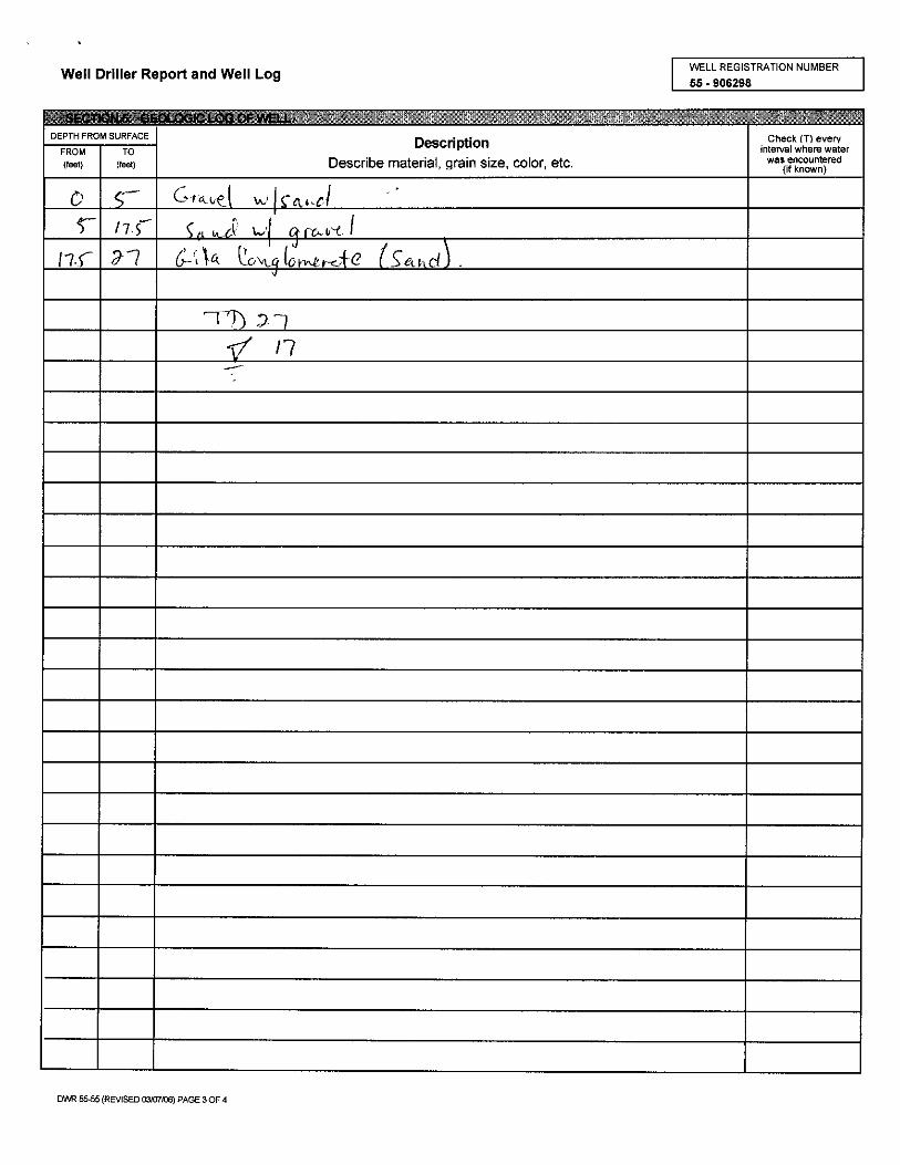


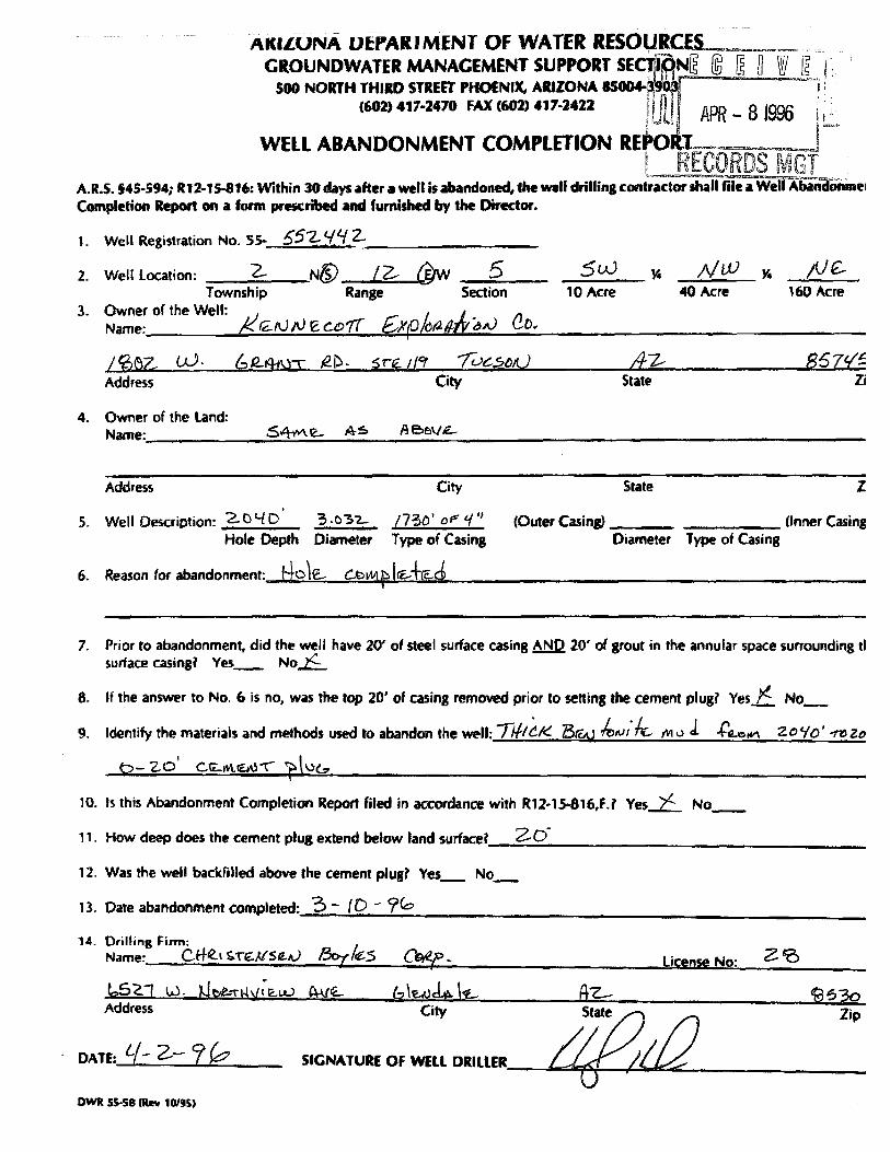


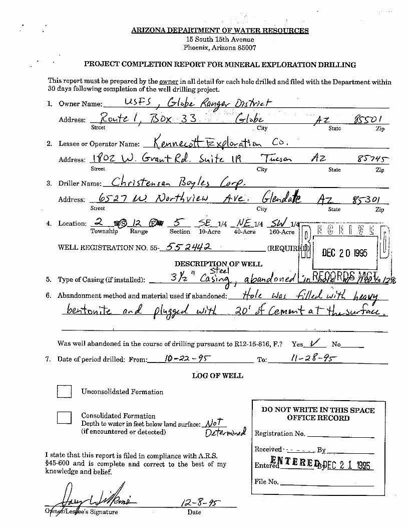


*


*


*


*


