drones and imagery in the arcgis platform (pro in early 2017) workflow for drone imagery based on...
TRANSCRIPT

Drones and Imagery in
the ArcGIS Platform
Cody A. Benkelman
Technical Product Manager - Imagery
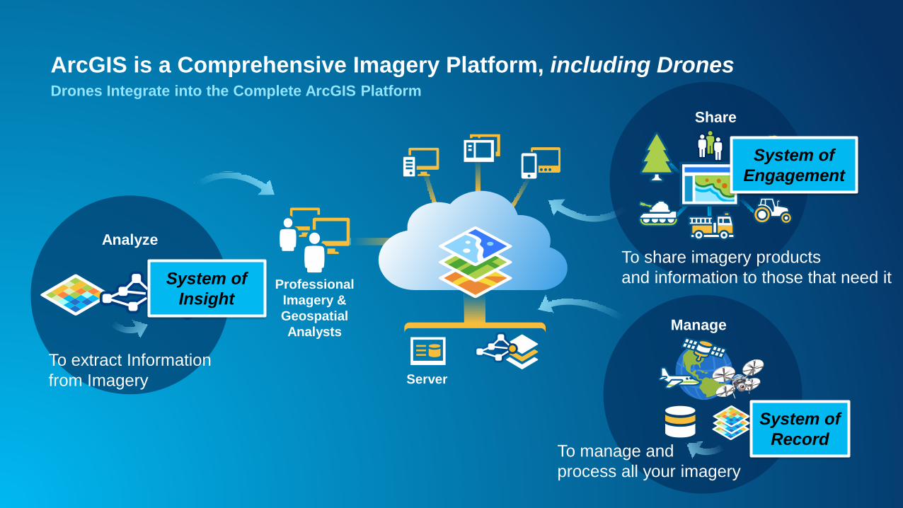
Professional
Imagery &
Geospatial
Analysts
Server
ArcGIS is a Comprehensive Imagery Platform, including DronesDrones Integrate into the Complete ArcGIS Platform
Share
Analyze
To extract Information
from Imagery
To share imagery products
and information to those that need it
Manage
To manage and
process all your imagery
System of
Engagement
System of
Record
System of
Insight
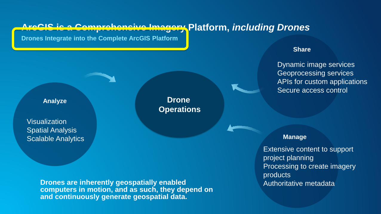
ArcGIS is a Comprehensive Imagery Platform, including DronesDrones Integrate into the Complete ArcGIS Platform
Share
Analyze
Manage
Drone
Operations
Extensive content to support
project planning
Processing to create imagery
products
Authoritative metadata
Visualization
Spatial Analysis
Scalable Analytics
Dynamic image services
Geoprocessing services
APIs for custom applications
Secure access control
Drones are inherently geospatially enabled computers in motion, and as such, they depend on and continuously generate geospatial data.

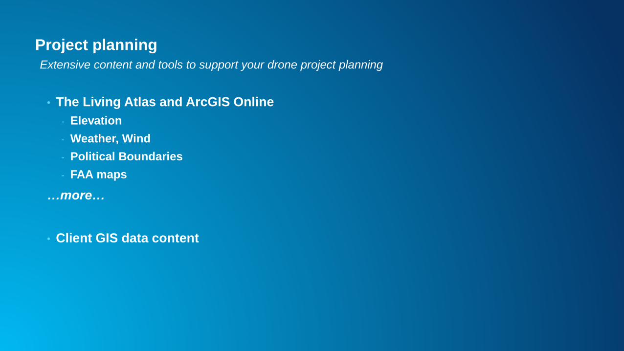
Project planning in GIS

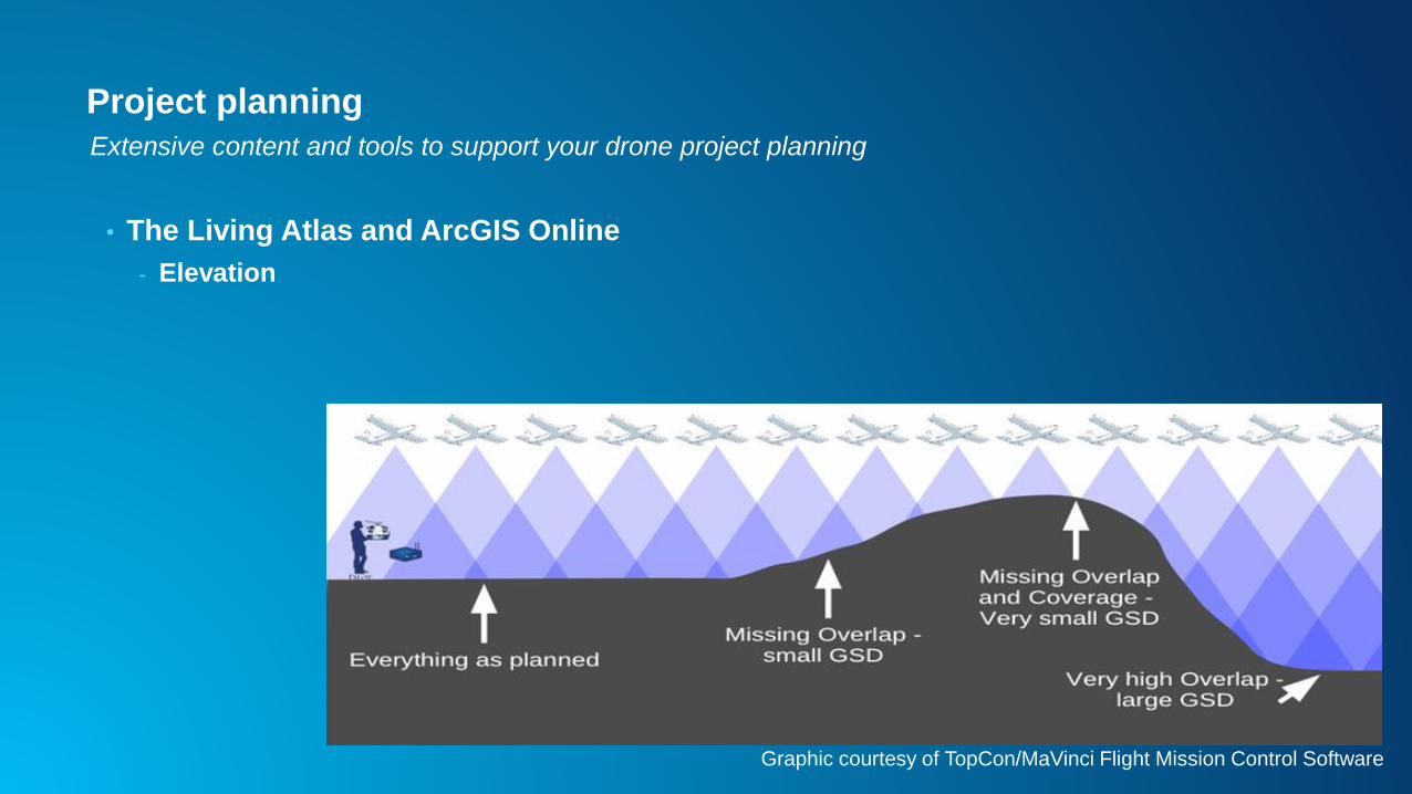
Project planning
• The Living Atlas and ArcGIS Online
- Elevation
Extensive content and tools to support your drone project planning
• The Living Atlas and ArcGIS Online
- Elevation
Project planning
Graphic courtesy of TopCon/MaVinci Flight Mission Control Software
Extensive content and tools to support your drone project planning
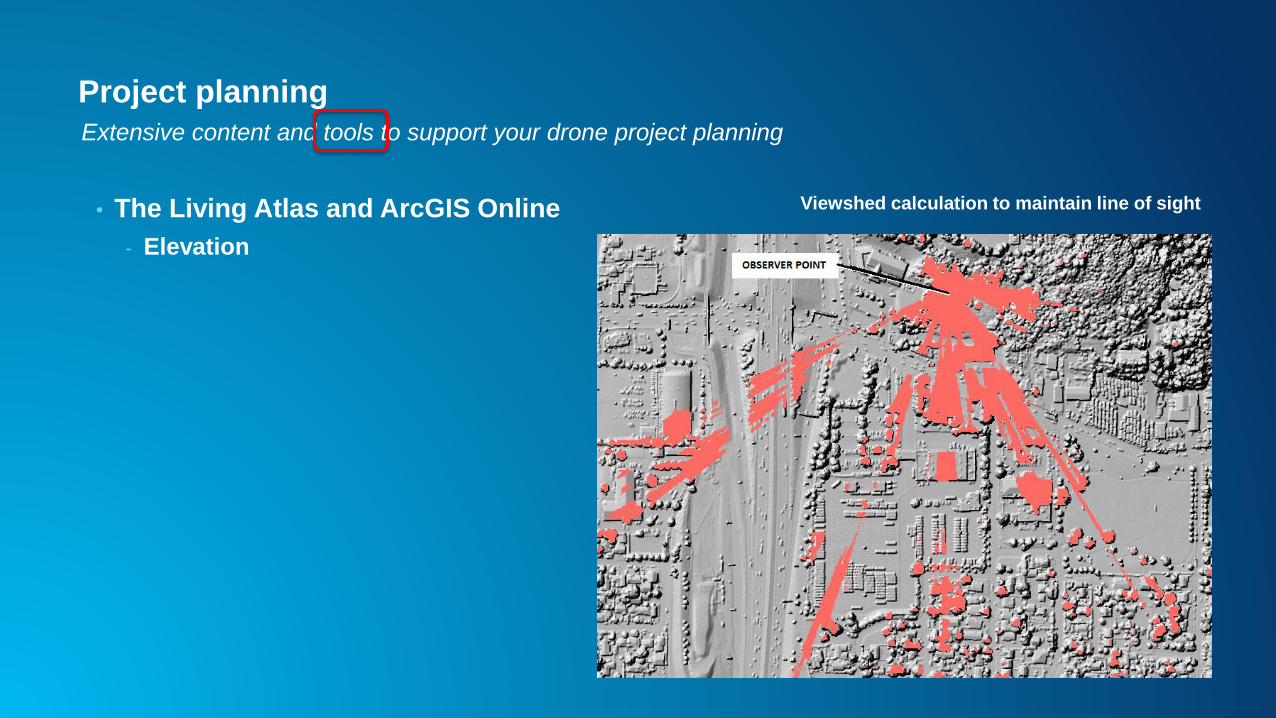
Project planning
• The Living Atlas and ArcGIS Online
- Elevation
Extensive content and tools to support your drone project planning
Viewshed calculation to maintain line of sight
Project planning
• The Living Atlas and ArcGIS Online
- Elevation
- Weather, Wind
- Political Boundaries
- FAA maps
…more…
• Client GIS data content
Extensive content and tools to support your drone project planning

Drone2Map, FMV
Drone data ingestion & processing
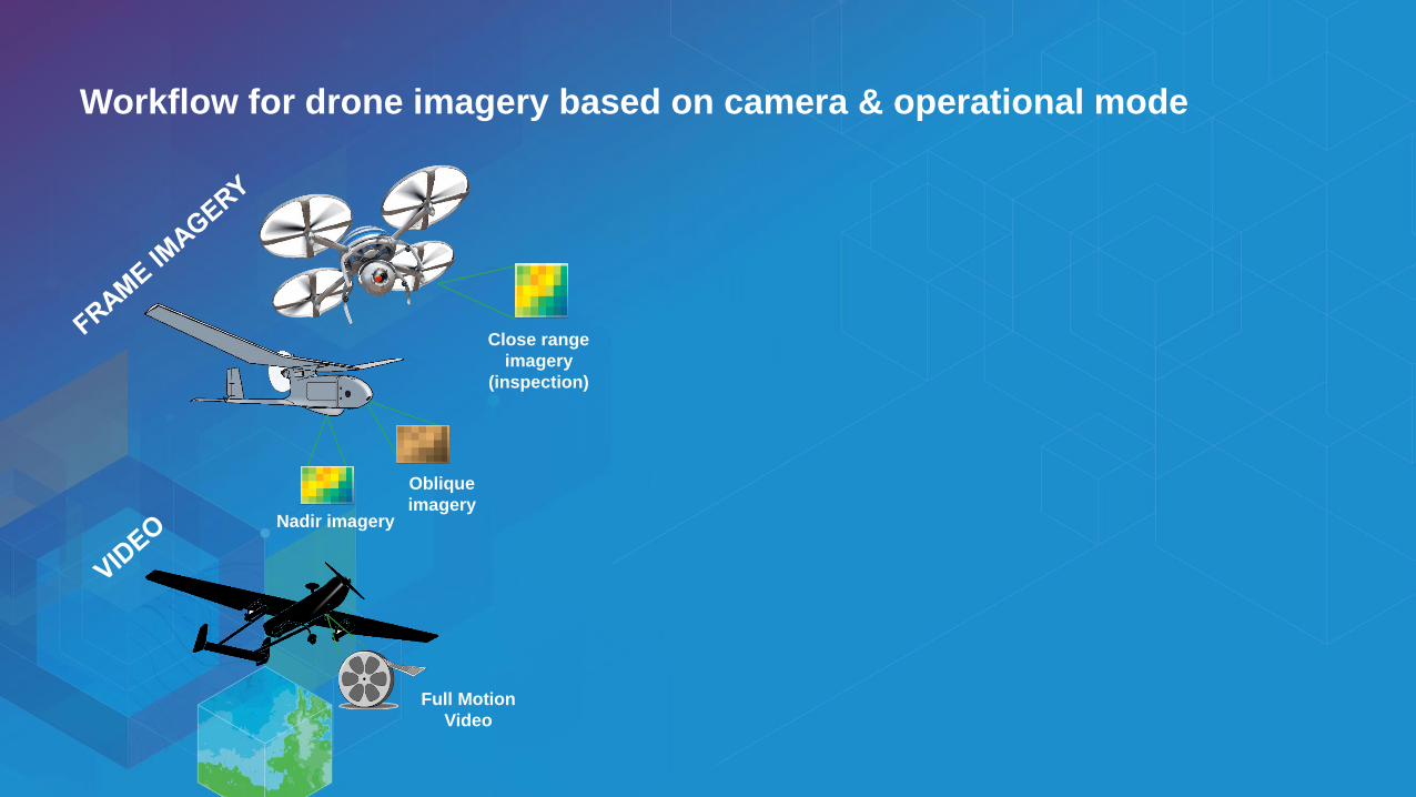
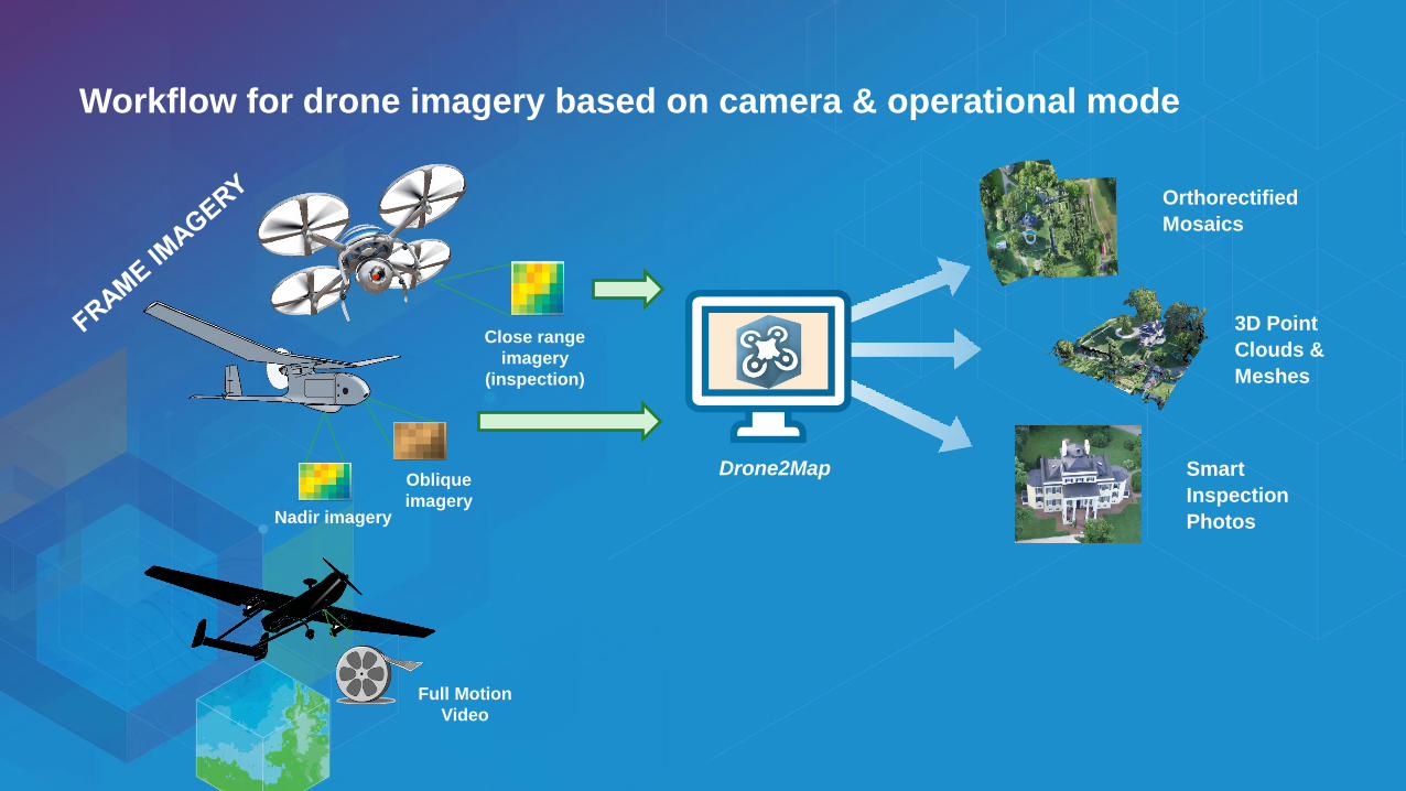
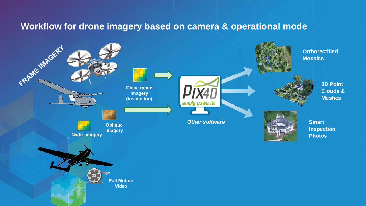
Workflow for drone imagery based on camera & operational mode
Close range
imagery
(inspection)
Nadir imagery
Oblique
imagery
Full Motion
Video
Workflow for drone imagery based on camera & operational mode
Close range
imagery
(inspection)
Nadir imagery
Oblique
imagery
Full Motion
Video
Orthorectified
Mosaics
3D Point
Clouds &
Meshes
Smart
Inspection
Photos
Drone2Map
Workflow for drone imagery based on camera & operational mode
Close range
imagery
(inspection)
Nadir imagery
Oblique
imagery
Full Motion
Video
Orthorectified
Mosaics
3D Point
Clouds &
Meshes
Smart
Inspection
Photos
Other software
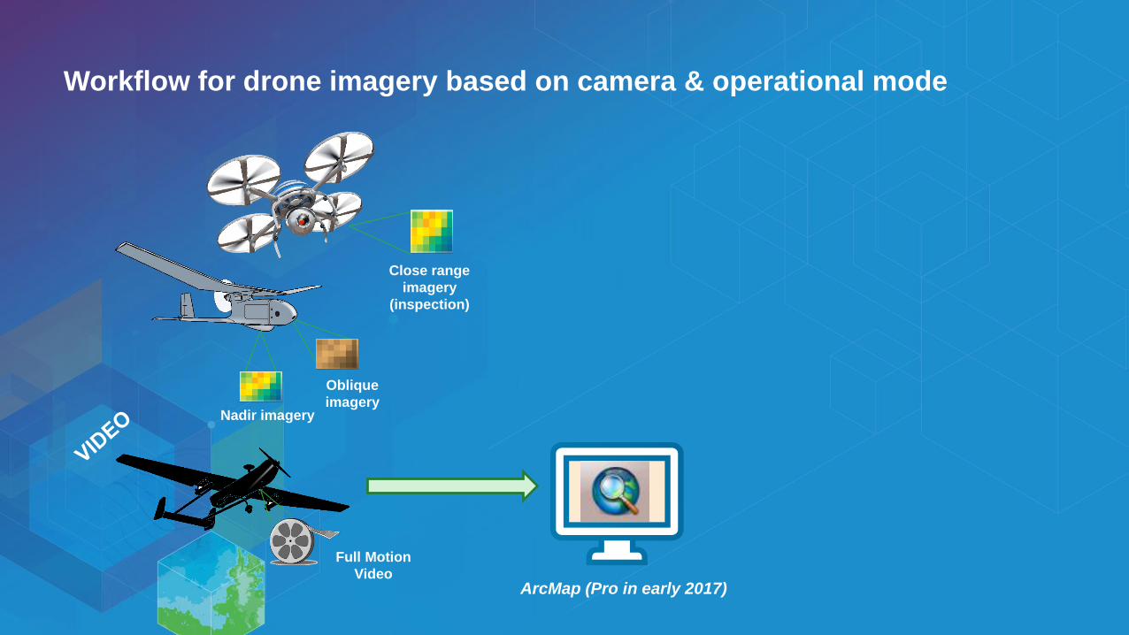
Workflow for drone imagery based on camera & operational mode
Close range
imagery
(inspection)
Nadir imagery
Oblique
imagery
Full Motion
VideoArcMap (Pro in early 2017)
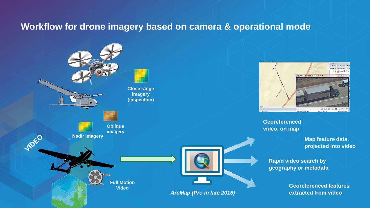
Workflow for drone imagery based on camera & operational mode
Close range
imagery
(inspection)
Nadir imagery
Oblique
imagery
Full Motion
Video
Georeferenced
video, on map
Map feature data,
projected into video
Rapid video search by
geography or metadata
Georeferenced features
extracted from videoArcMap (Pro in late 2016)

Mosaic Dataset & Automation
Drone data management
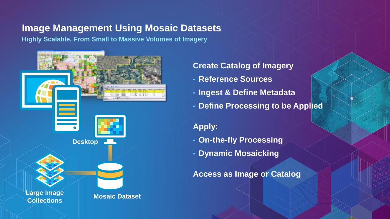
Image Management Using Mosaic DatasetsHighly Scalable, From Small to Massive Volumes of Imagery
Create Catalog of Imagery
• Reference Sources
• Ingest & Define Metadata
• Define Processing to be Applied
Apply:
• On-the-fly Processing
• Dynamic Mosaicking
Access as Image or Catalog
Mosaic DatasetLarge Image
Collections
Desktop
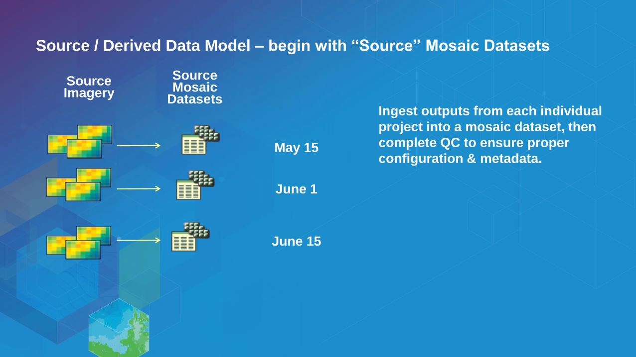
Source Imagery
SourceMosaic
Datasets
Source / Derived Data Model – begin with “Source” Mosaic Datasets
June 1
May 15
June 15
Ingest outputs from each individual
project into a mosaic dataset, then
complete QC to ensure proper
configuration & metadata.
Source Imagery
SourceMosaic
Datasets
DerivedMosaic Dataset
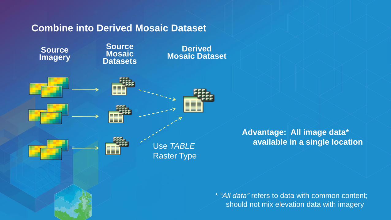
Combine into Derived Mosaic Dataset
Use TABLE
Raster Type
Advantage: All image data*
available in a single location
* “All data” refers to data with common content;
should not mix elevation data with imagery
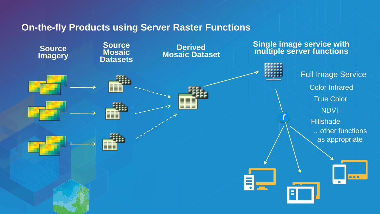
Source Imagery
SourceMosaic
Datasets
DerivedMosaic Dataset
Full Image Service
f
Single image service with multiple server functions
On-the-fly Products using Server Raster Functions
True Color
NDVI
Color Infrared
…other functions
as appropriate
Hillshade
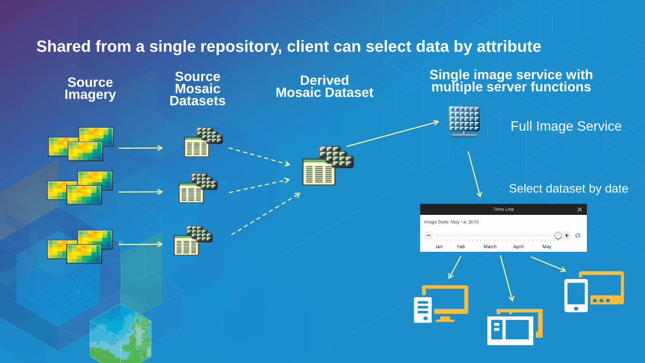
Source Imagery
SourceMosaic
Datasets
DerivedMosaic Dataset
Full Image Service
Single image service with multiple server functions
Shared from a single repository, client can select data by attribute
Select dataset by date
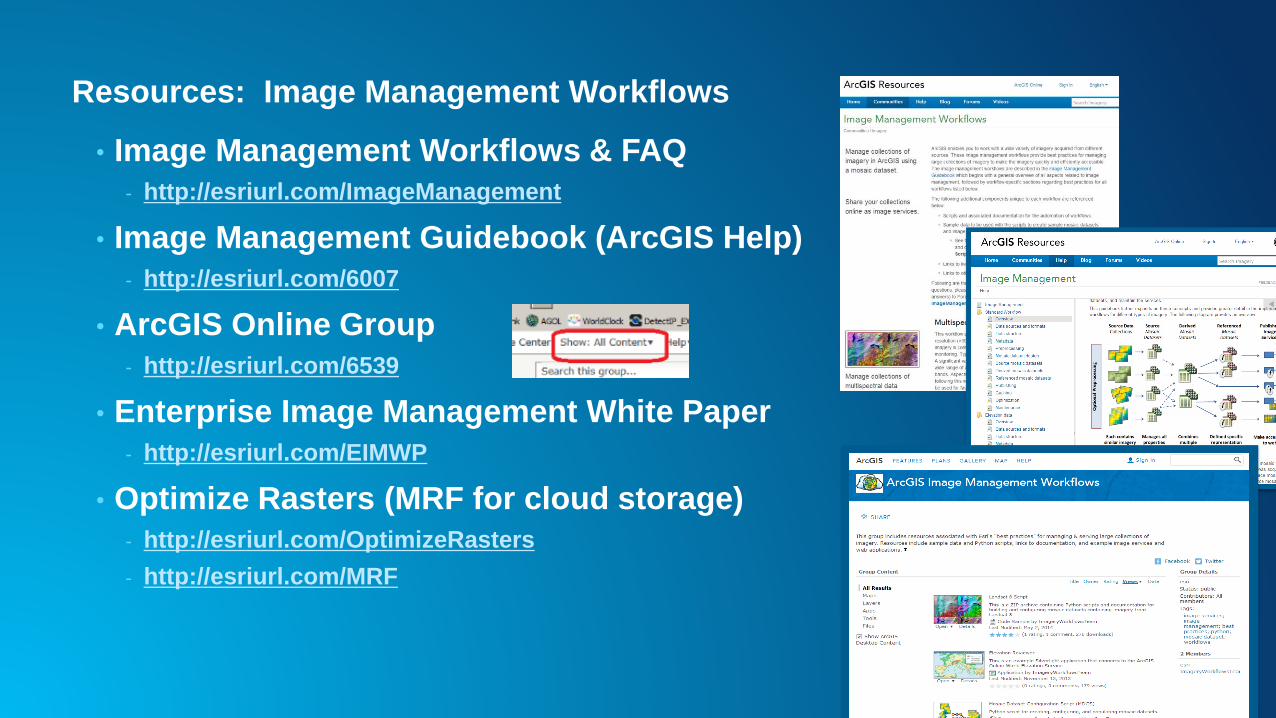
Resources: Image Management Workflows
• Image Management Workflows & FAQ
- http://esriurl.com/ImageManagement
• Image Management Guidebook (ArcGIS Help)
- http://esriurl.com/6007
• ArcGIS Online Group
- http://esriurl.com/6539
• Enterprise Image Management White Paper
- http://esriurl.com/EIMWP
• Optimize Rasters (MRF for cloud storage)
- http://esriurl.com/OptimizeRasters
- http://esriurl.com/MRF

Terrain Hydrology
Forestry Agriculture
Utilities …many more
Analysis…

ArcGIS Online, ArcGIS Server
Sharing/Dissemination
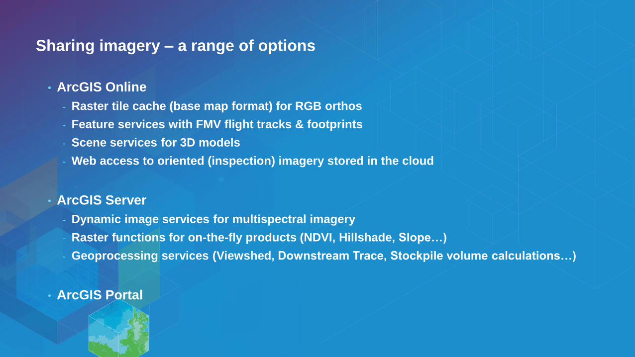
Sharing imagery – a range of options
• ArcGIS Online
- Raster tile cache (base map format) for RGB orthos
- Feature services with FMV flight tracks & footprints
- Scene services for 3D models
- Web access to oriented (inspection) imagery stored in the cloud
• ArcGIS Server
- Dynamic image services for multispectral imagery
- Raster functions for on-the-fly products (NDVI, Hillshade, Slope…)
- Geoprocessing services (Viewshed, Downstream Trace, Stockpile volume calculations…)
• ArcGIS Portal
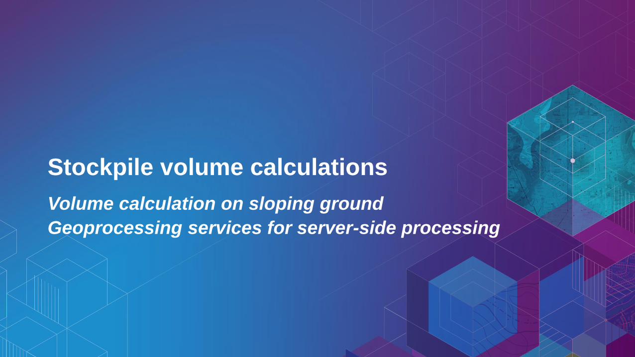
Stockpile volume calculations
Volume calculation on sloping ground
Geoprocessing services for server-side processing