dwr nr g 01 stream mitigation guidelines - tn.gov · dwr–nr–g–01–stream mitigation...
TRANSCRIPT

DWR–NR–G–01–Stream Mitigation Guidelines–11072018
2018 Draft TN Stream Mitigation Guidelines Page 1
DISCLAIMER: This document is guidance only and does not create legal rights or obligations.
Agency decisions in any particular case will be made applying applicable laws and regulations to
the specific facts. Mention of trade names or commercial products does not constitute an
endorsement or recommendation for use.
EFFECTIVE DATE: XX XX XXXX
SIGNATURES:
________________________________________
Jennifer Dodd
Director, Division of Water Resources
________________________________________
Drafter: Jimmy Smith
Manager, Natural Resources Unit
________________________________________
Reviewer: Stephanie Durman
Assistant General Counsel
________________________________________
Reviewer: Patrick Parker
Senior Counsel

DWR–NR–G–01–Stream Mitigation Guidelines–11072018
2018 Draft TN Stream Mitigation Guidelines Page 2
TENNESSEE DEPARTMENT OF ENVIRONMENT AND CONSERVATION
DIVISION OF WATER RESOURCES
NATURAL RESOURCES UNIT
2018

DWR–NR–G–01–Stream Mitigation Guidelines–11072018
2018 Draft TN Stream Mitigation Guidelines Page 3
Statutes, Regulations, Polices and Guidelines
Compensatory mitigation is subject to one or more of the following statutes, regulations,
policies, and guidelines:
Federal Regulations and Guidance
a. Clean Water Act (33 U.S.C. §§ 1251, et seq.)
b. Memorandum of Agreement (MOA) Between the Department of the Army and the
Environmental Protection Agency: The Determination of Mitigation Under the Clean
Water Act (“CWA”) Section 404(b)(1) Guidelines (February 6, 1990)
c. Section 404(b)(1) Guidelines for Specification of Disposal Sites for Dredged or Fill
Material (40 C.F.R. Part 230)
d. Section 10 of the Rivers and Harbors Act of 1899 (33 U.S.C. § 403)
e. National Environmental Policy Act (“NEPA”) (42 U.S.C. §§ 4321, et seq.)
f. Endangered Species Act (“ESA”) (16 U.S.C. §§ 1531, et seq.)
g. Fish and Wildlife Coordination Act (16 U.S.C. §§ 661, et seq.)
h. Regulations of the U.S. Army Corps of Engineers Regulatory Program (33 C.F.R. Parts
320–332)
i. Regulatory Guidance Letter (RGL) 05-01. Guidance on the Use of Financial Assurances,
and Suggested Language for Special Conditions for Department of the Army (DA)
Permits Requiring Performance Bonds
j. RGL 08-03. Minimum Monitoring Requirements for Compensatory Mitigation Projects
Involving the Restoration, Establishment, and/or Enhancement of Aquatic Resources
State of Tennessee Regulations and Guidance
Section 401 of the Clean Water Act: 33 U.S.C § 1341
Tennessee Water Quality Control Act (TWQCA) of 1977: Tenn. Code Ann. §§ 69-3-101 to -
147
Rules of the Tennessee Board of Water Quality, Oil, and Gas:
Chapter 0400-40-07 Aquatic Resource Alteration
Chapter 0400-40-03 General Water Quality Criteria (including Rule 0400-40-03-.06,
Antidegradation Statement)
Chapter 0400-40-04 Use Classification for Surface Waters

DWR–NR–G–01–Stream Mitigation Guidelines–11072018
2018 Draft TN Stream Mitigation Guidelines Page 4
Table of Contents
Statutes, Regulations, Polices and Guidelines ................................................................................ 3
1. Introduction ..................................................................................................................................... 6
2. Resource Types and Designations ................................................................................................ 9
2.1 Wet Weather Conveyance and Stream Determinations ................................................... 9
2.2 Classified Uses and Antidegradation Designations ........................................................... 9
3. Stream Impacts Requiring Compensatory Mitigation ............................................................ 11
3.1 Cumulative Impacts ............................................................................................................ 13
3.2 Other Considerations ......................................................................................................... 14
4. Determining Resource Value Loss (Debits) .............................................................................. 15
4.1 Functional Loss Calculations .............................................................................................. 16
4.1.1 Determining Existing Condition Score .......................................................... 17
4.1.2Determine Existing and Proposed Stream Lengths ..................................... 18
4.1.3: Determine the Impact Severity Tier ............................................................. 19
4.1.4 Impact Types and Descriptions ..................................................................... 20
4.1.5: Manually Calculating the Proposed Condition Score ................................ 26
4.2 Stream Fill and Replacement or Relocations................................................................... 27
4.2.1 Submittal Guidelines for Stream Fill and Replacements: .......................... 28
4.3 Temporal Loss ...................................................................................................................... 30
4.4 Proximity of Compensatory Mitigation ............................................................................ 30
4.5 Common Encountered Scenarios /Frequently Asked Questions ................................. 31
5. Providing Resource Values and Functional Lift .................................................................... 32
5.1 Tennessee Stream Quantification Tool ............................................................................ 33
5.1.1 Uses for the TN SQT ........................................................................................ 34
5.1.2 Credits and the TN SQT ................................................................................... 35
5.2 Descriptions of Common Mitigation Practices ................................................................ 36
5.3 Components of Compensatory Mitigation ...................................................................... 40
5.3.1 Stream Mitigation Site Considerations ......................................................... 41
5.3.2 Mitigation Plan ................................................................................................. 42

DWR–NR–G–01–Stream Mitigation Guidelines–11072018
2018 Draft TN Stream Mitigation Guidelines Page 5
6. Performance Standards and Monitoring Requirements .................................................... 45
7. Monitoring Requirements .......................................................................................................... 48
7.1 Typical Monitoring Periods ................................................................................................ 48
7.2 Monitoring Report Requirements ..................................................................................... 48
References and Readings ................................................................................................................ 51
Appendix A - Definitions .................................................................................................................. 53
Appendix B ........................................................................................................................................ 60
Appendix C ........................................................................................................................................ 60
Appendix D List of Tools and Resources ....................................................................................... 60
Appendix E......................................................................................................................................... 60

DWR–NR–G–01–Stream Mitigation Guidelines–11072018
2018 Draft TN Stream Mitigation Guidelines Page 6
1. Introduction
Commercial, residential and agricultural land development, construction of linear
transportation and utility systems, and other activities requiring State and Federal permits
have the potential to impact and degrade Tennessee’s streams. These impacts often result
in loss of aquatic resource values, including stream length, hydrology, available habitat,
species composition, and other beneficial ecological and physical characteristics. Mitigation
for certain stream impacts in Tennessee have been required since the passage of the
Tennessee Water Quality Control Act by the Tennessee General Assembly in 1977. In July
2000, the Tennessee Water Quality Control Board adopted rules that more clearly specified
the requirement that permits for the alteration of streams must not result in a net loss of
water resource value, and established mitigation requirements. These Rules were further
revised by the Board in October 2018.
The U.S. Army Corps of Engineers (USACE) and Tennessee Department of Environment and
Conservation (TDEC) Division of Water Resources (Division) currently require compensatory
mitigation for certain permitted impacts to Tennessee's streams. The Division may require
compensatory mitigation to off-set unavoidable adverse impacts resulting in an
appreciable permanent loss of aquatic resource value. The Division cannot issue an
individual ARAP, with or without mitigation, unless an applicant has first demonstrated that
there are no practicable alternatives to the proposed activity that would have less adverse
impact on resource values, so long as the alternative does not have other significant
adverse environmental consequences.
Resource values are the benefits provided by the water resource that help maintain
classified uses. These benefits, including, but not limited to sufficient quality and adequate
quantity of water and habitat for fish, other aquatic life, and wildlife can be evaluated, in
part, through quantitative analysis of stream function. Stream functions are defined as the
physical, biological, and chemical processes that occur in ecosystems. Therefore resource
value losses can be quantified by measuring the chemical, physical, and biological stream
functions.
Tennessee’s ARAP rules establish the Division’s mandatory requirements for mitigation.
Rule 0400-40-07-.04(7), modified in 2018, requires mitigation sufficient to compensate for
the loss of resource values from existing conditions. The rule prioritizes mitigation methods
as follows: restoration, enhancement, preservation, creation, or other effective measures.
The rule further prioritizes mitigation as close to the impact location as practicable, but
does not express a preference for the type of mitigation provider. The rule provides that
all mitigation for impacts to jurisdictional streams must occur in Tennessee. Finally, Rule
0400-40-07-.04(7)(b) establishes the following additional performance requirements for
stream mitigation:

DWR–NR–G–01–Stream Mitigation Guidelines–11072018
2018 Draft TN Stream Mitigation Guidelines Page 7
Mitigation for impacts to streams must be developed in a scientifically
defensible manner approved by the Division that demonstrates a sufficient
increase in resource values to compensate for permitted impacts. At a
minimum, all new or relocated streams must include a vegetated riparian
zone, demonstrate lateral and vertical channel stability, and have a natural
channel bottom. All mitigation watercourses must maintain or improve flow
and classified uses after mitigation is complete.
Permit applicants are strongly encouraged, but not required, to apply these guidelines, the
Tennessee Debit Tool for streams, and the Tennessee Stream Quantification Tool (TN SQT)
for the evaluation of potential functional loss and lift associated with permitted activities.
Permit applicants must comply with all applicable legal requirements, and these
documents represent the Division’s reasoned interpretation of these requirements. Permit
applicants may apply alternative methodologies only if they demonstrate to the Division
that these methodologies are scientifically defensible and comply with all applicable legal
requirements.
Stream compensatory mitigation projects provide functional lift to offset permitted
impacts. These projects should be designed to improve the resource value and function in
streams that are currently not supporting their designated uses, or otherwise
demonstrated to be significantly degraded. Restoring a stream’s ability to support its
designated uses provides the maximum benefit and value to the citizens of Tennessee.
Stream compensatory mitigation projects should have goals to re-establish and improve
stream resource values and functions to their natural, best attainable condition. Not every
compensatory mitigation project can fully restore all resource values and functions.
However, the expected goals for mitigation project design and implementation should
target re-establishing a stream and attendant riparian area with self-sustaining productive
habitat, and improvements to water quality, biology, and overall ecosystem services where
possible. This is commonly achieved through the replacement, restoration, and/or
enhancement of degraded stream channels utilizing fluvial geomorphological principles,
natural channel design, bioengineering techniques, and other scientifically defensible
approaches based on natural stream processes. Preservation of threatened, unique, or
ecologically significant streams or rivers and their riparian area may be included as a
component of compensatory mitigation in consultation with the Interagency Review Team
(IRT), TDEC, or the USACE as applicable.
Please note that USACE may require compensatory mitigation for unavoidable impacts to
aquatic resources to ensure that an activity requiring a Section 404 permit complies with
the Section 404(b)(1) Guidelines. Compensatory mitigation may also be required to ensure
that an activity requiring authorization under Section 404 of the Clean Water Act and/or

DWR–NR–G–01–Stream Mitigation Guidelines–11072018
2018 Draft TN Stream Mitigation Guidelines Page 8
Sections 9 or 10 of the Rivers and Harbors Act of 1899 is not contrary to the public interest.
Additionally, for activities authorized by a general permit, compensatory mitigation may be
required to ensure the impacts are no more than minimal both individually and
cumulatively. Thresholds, limits, regulatory authority limits, and other factors described
above may result in different or additional USACE mitigation requirements. TDEC requires
compensatory mitigation to offset unavoidable adverse impacts that result in a permanent
net loss of aquatic resource value.
The intent of this document is to replace the 2004 Stream Mitigation Guidelines and
provide stakeholders with new guidance on determining the amount of resource value loss
associated with commonly authorized impacts and functional lift associated with
compensatory mitigation of streams: this document does not apply to loss associated with
or compensatory mitigation of wetlands. Historically, the Division employed a ratio driven
credit and debit system based on the activity or work proposed to determine stream
resource value loss and lift. The new system is a quantitative assessment method and uses
two primary tools: (1).the Tennessee Debit Tool which focuses on stream functional loss
and (2). The Tennessee Stream Quantification Tool which focuses on stream functional lift
of stream restoration projects. These quantitative assessment methodologies calculate loss
and lift of stream function, and therefore resource value, in terms of functional feet.
Therefore, credits and debits are described as an amount of functional foot lift (credits) or
functional foot loss (debits). It is the intent of the Division to use the same quantitative
methodology to calculate functional lift and loss (debits and credits) to ensure impacts to
water resource values are sufficiently offset by compensatory mitigation.
In addition, this document provides guidance for preparing compensatory mitigation and
monitoring plans and includes references to federal and state regulations and policies, and
definitions of terms pertinent to, or utilized within, this document.
This guidance was prepared by the Division in collaboration with the IRT. The IRT is
composed of representatives from USACE, U.S. Environmental Protection Agency (EPA), U.S.
Fish and Wildlife Service (FWS), Tennessee Valley Authority (TVA), Natural Resources
Conservation Services (NRCS), and the Tennessee Wildlife Resources Agency (TWRA). This
document reflects years of prior experience in the evaluation and oversight of mitigation
proposals, implementation, evaluation of various mitigation practices, and the current
professional judgment of these resource managers regarding aquatic resource impacts
associated with certain alterations. These guidelines are intended to be defensible,
transparent, fair, and flexible and are subject to periodic revision and update as the science
and regulations associated with stream processes, values, and functions evolve.

DWR–NR–G–01–Stream Mitigation Guidelines–11072018
2018 Draft TN Stream Mitigation Guidelines Page 9
Please note that TDEC and the USACE regulatory programs operate under different
authorities, rules, and regulations, and therefore activities that require permits and
mitigation from one agency may not require permits or mitigation from the other.
Questions about specific permitting and mitigation requirements should be directed to the
appropriate agency, and coordination with both agencies early in the development of
projects is encouraged.
2. Resource Types and Designations
In order for TDEC to determine compensatory mitigation requirements, the status of the
impacted water feature(s) will first be established. Projects that propose an impact to a
water feature may first require a Hydrologic Determination (HD). Projects proposing
activities that will result in greater than de minimis degradation to an unassessed
jurisdictional stream will require a water quality assessment to determine the
antidegradation status. The current status of assessed waterbodies in Tennessee can be
found on the Division’s online water resources data and map viewers, or by contacting the
Division.
2.1 Wet Weather Conveyance and Stream Determinations
Where the jurisdictional status of a watercourse is in question, a Hydrologic Determination
should first be performed unless the applicant chooses to treat a watercourse as a
jurisdictional stream. The identification of wet weather conveyances and jurisdictional
streams is performed using a consistent and standardized methodology as outlined in the
Act and the Board of Water Quality, Oil and Gas’s Rules and the Division’s Guidance.
Compensatory mitigation is not required by the Division for features formally determined
to be a wet weather conveyance. For more information, go to TNHDT.org, or the Division’s
water quality training webpage. However, aquatic resources determined to be federally
jurisdictional may require compensatory mitigation in accordance with federal regulations.
2.2 Classified Uses and Antidegradation Designations
Tennessee’s water quality standards establish classified uses for all streams in Rule
Chapter 0400-40-04. It is the purpose of Tennessee’s standards and the ARAP rules to fully
protect all applicable classified uses, which include:
Domestic and industrial water supply;
Propagation and maintenance of fish and other aquatic life;
Recreation in and on the waters, including the safe consumption of fish and shellfish;
Livestock watering and wildlife;
Irrigation; and
Navigation.

DWR–NR–G–01–Stream Mitigation Guidelines–11072018
2018 Draft TN Stream Mitigation Guidelines Page 10
Streams in Tennessee are determined to be supporting or not supporting their classified
uses as determined by existing water quality and promulgated water quality criteria. A
stream is determined to have available parameters if actual water quality is better than
applicable water quality criteria. If water quality is at, or fails to meet, applicable water
quality criteria, the stream has unavailable parameters. The Antidegradation Statement
specifically applies parameters for habitat to ARAPs for habitat alterations. Streams may
also be identified by the Division as Exceptional Tennessee Waters (ETWs) or by the Board
as Outstanding National Resource Waters (ONRW).
Some physical alterations may significantly degrade a stream’s ability to support its
classified uses. Such impacts would be considered pollution. Regardless of the
antidegradation category of a stream, the Division may not issue ARAPs that authorize
pollution, or an overall net loss of resource values after accounting for compensatory
mitigation. As defined in the TWQCA, pollution means alteration of the physical, chemical,
biological, bacteriological, or radiological properties of waters of the state including, but not
limited to, changes in temperature, taste, color, turbidity, or odor of the waters that will:
1. Result or will likely result in harm, potential harm or detriment of the public health,
safety, or welfare;
2. Result or will likely result in harm, potential harm or detriment to the health of animals,
birds, fish, or aquatic life;
3. Render or will likely render the waters substantially less useful for domestic, municipal,
industrial, agricultural, recreational, or other reasonable uses; or
4. Leave or likely leave the waters in such condition as to violate any standards of water
quality by the board.
For projects that propose an appreciable permanent loss of resource values to a stream
with available parameters for habitat or ETWs, the applicant must either provide
compensatory mitigation in-system to ensure no more than de minimis degradation or
demonstrate economic or social necessity and a lack of practicable alternatives for the
proposed project. For ETWs, if the proposed project (i.e., the impact and any in-system
compensatory mitigation) would result in more than de minimis degradation, then the
Division must first make a determination of economic or social necessity, which may be
challenged through a petition for declaratory order, before issuing a permit.
For projects that propose an appreciable permanent loss of resource values to a stream
with unavailable parameters for habitat, compensatory mitigation must result in no
“significant degradation.” No “significant degradation” is the minimum requirement for all
ARAPs for habitat alterations, and means that the permitted activity, including mitigation,
must result in no overall net loss of resource values. The federal Section 404(b) guidelines
similarly prohibit significant degradation. For projects that propose an appreciable

DWR–NR–G–01–Stream Mitigation Guidelines–11072018
2018 Draft TN Stream Mitigation Guidelines Page 11
permanent loss of resource values in a stream designated as ONRW, compensatory
mitigation must occur within the ONRW.
3. Stream Impacts Requiring Compensatory Mitigation
The Division has the responsibility and legal authority to ensure that impacts to surface
waters that are not wet weather conveyances do not result in a net loss of water resource
values. No individual ARAP shall be issued unless the applicant has first demonstrated
through an alternatives analysis that there is no practicable alternative to the proposed
activity that would result in less adverse impact on resource values, so long as the
alternative does not have other significant adverse environmental consequences. TDEC
achieves no net loss of resource values when permitted impacts either (1). do not cause an
appreciable permanent loss of resource values, or (2). If compensatory mitigation is
provided to fully offset any such loss of resource values.
In making a decision on any ARAP application, the Division determines the loss of resource
values from existing conditions associated with a proposed impact and the increase in
resource values of any proposed mitigation, including the following factors:
1. Direct loss of stream length, waters, or wetland area due to the proposed activity;
2. Direct loss of in-stream or wetland habitat due to the proposed activity;
3. Impairment of stream channel stability due to the proposed activity;
4. Diminishment in species composition in any stream or wetland due to the proposed
activity;
5. Direct loss of stream canopy due to the proposed activity;
6. Whether the proposed activity is reasonably likely to have cumulative or secondary
impacts to the water resource;
7. Conversion of unique or high quality waters as established in Rule 0400-40-03-.06 to
more common systems;
8. Hydrologic modifications resulting from the proposed activity;
9. The adequacy and viability of any proposed mitigation including, but not limited to,
quantity, quality, likelihood of long term protection, and the inclusion of riparian
buffers;
10. Quality of stream or wetland proposed to be impacted;
11. Whether the stream or wetland is listed on the § 303(d) list; whether the proposed
activity is located in a component of the National Wild and Scenic River System, a
State Scenic River, waters designated as Outstanding National Resource Waters, or
waters identified as high quality waters as defined in Rule 0400-40-03-.06, known as
Tier II waters; whether the activity is located in a waterway which has been identified
by the Department Division as having contaminated sediments; and whether the

DWR–NR–G–01–Stream Mitigation Guidelines–11072018
2018 Draft TN Stream Mitigation Guidelines Page 12
activity will adversely affect species formally listed in State and Federal lists of
threatened or endangered species; and
12. Any other factors relevant under the Act.
Specific activities that cumulatively or individually may result in an appreciable permanent
loss of resource values include, but are not limited to:
pipes;
culverts;
stream fill and replacements;
bank armoring;
impoundments;
loss of stream length;
significant loss of streambank vegetation and canopy
channel modifications, include deepening, straightening, widening, disconnection
with floodplains, removal of in-channel vegetation or bedload; other activities that
result in an unstable geomorphic and/or hydraulic condition (including designs to
convey flood flows in-channel); and
other changes that may alter the physical characteristics of the stream, including
but not limited to changes to the physical habitat, water quality, and/or aquatic
fauna such that the amount of degradation results in a loss of resource value.
Activities eligible for coverage under the Division’s General Permits do not cause an
appreciable permanent loss of resource values, and thus do not require compensatory
mitigation. Conversely, compensatory mitigation may not be utilized to qualify an activity
for general permit coverage. Activities that involve permanent degradation and functional
loss of water resources in excess of a general permit limit typically require compensatory
mitigation to ensure no net loss. However, the Division has not issued general permits for
every impact type, so it is possible for a proposal to require an individual permit but not
require mitigation. The nature and scale of the required mitigation is informed by the list of
considerations provided above, including existing conditions of the impacted resource, an
evaluation of cumulative and secondary effects of associated impacts, and the guidance on
debit determination provided later in this document.
USACE compensatory mitigation requirements will be implemented in accordance 33 CFR
320.4(r), 33 CFR Part 332, 40 CFR 230.70-77, 40 CFR 1508.20 and 40 CFR 1502.14. In general
terms, the objective of compensatory mitigation is to offset environmental losses resulting
from unavoidable impacts to waters of the United States authorized by Department of the
Army permits.

DWR–NR–G–01–Stream Mitigation Guidelines–11072018
2018 Draft TN Stream Mitigation Guidelines Page 13
3.1 Cumulative Impacts
TDEC regulations require the Division to evaluate “whether the proposed activity is
reasonably likely to have cumulative or secondary impacts to the water resource.”
Cumulative impacts may be broadly described as effects that result from the incremental
impact of the proposed activities when added to other past, present, and reasonably
foreseeable impacts within the same stream and/or waterbody resulting from a Common
Plan of Development (CPD). The cumulative impact from previous and proposed impacts
within a CPD may result in an appreciable permanent loss of water resource values, even
where each discreet impact does not when considered individually. Where a single impact
might only require coverage under a general permit, multiple impacts of the same scale
over time in the same waterbody may subsequently require coverage under an individual
permit and compensatory mitigation. Similarly, large scale projects often encompass
multiple impacts at once that may, collectively result in a loss of water resource values if
compensatory mitigation is not provided to offset impacts. Therefore, TDEC will review
applications from larger or ongoing activities that propose multiple impacts
comprehensively to ensure that there is no net loss of resource value from both individual
and cumulative impacts.
For activities that are considered CPDs, understanding the totality of the impacts
associated with the entire project is critical for TDEC to assess if the impacts, past and
present, represent a net loss of water resources values requiring the applicant to propose
adequate mitigation. The evaluation of cumulative impacts associated with a CPD does not
take into account other impacts in the watershed attributable to other, unassociated
activities (i.e., existing conditions), nor should an evaluation of existing conditions for any
specific new impact include degradation from previous impacts directly associated with the
same CPD.
To determine if a CPD has exceeded the threshold for requiring mitigation, the Division will
review the CPD based on two broad categories: (1) linear, public transportation projects, or
(2) non-linear projects.
For linear public transportation projects, TDEC will use the logical termini as defined by the
Federal Highway Administration (for the purpose of environmental reviews) to determine
the extent of the CPD. Logical termini for project development are defined as (1) rational
end points for a transportation improvement, and (2) rational end points for a review of the
environmental impacts. Cumulative impacts for a linear public transportation project (from
logical termini to logical termini) will be assessed by evaluating total impacts on individual
stream tributaries.

DWR–NR–G–01–Stream Mitigation Guidelines–11072018
2018 Draft TN Stream Mitigation Guidelines Page 14
For all other CPD activities, TDEC will assess cumulative impacts utilizing a Waterbody Unit
scale. The Waterbody Catalog Unit, (also referred to as a Stream Segment) is the scale the
Division utilizes in its biannual report to the EPA which evaluates overall use support of
Tennessee’s water resources (“305(b) report”).Years of detailed data evaluation at this scale
highlights these systems’ responsiveness to cumulative activities within the watershed,
which are reflected in the overall condition of that Waterbody. This is also the scale at
which TDEC reports the impairment status of water resources to the EPA (such as in the
303(d) list). Where unavoidable impacts from a CPD represent an appreciable permanent
loss of water resource values in a given Waterbody, they will require compensatory
mitigation. Locations and information about Waterbody IDs can be found on the Division’s
data and map viewers available on the Division’s website.
The amount of compensatory mitigation needed to offset cumulative resource losses
within a CPD will be calculated independently for each affected individual stream tributary
or Waterbody, as applicable to the project type. For example, if impacts from a multi-phase
residential development, including road infrastructure and all other attendant features,
result in an appreciable permanent loss of resource values in one Waterbody, but not in
another Waterbody, compensatory mitigation would be required only in the first
Waterbody.
3.2 Other Considerations
There may be specific types of impacts that cannot be offset by a typical compensatory
mitigation practice. These may include, but are not limited to: waters with exceptional or
rare ecological communities; waters supporting a specific rare, threatened, or endangered
species;1 waters that support significant recreational activities; or activities that otherwise
significantly degrade a water resource value not typically offset by standard compensatory
mitigation practices. The Division cannot authorize any such impact unless the applicant
proposes a site-specific compensatory mitigation package sufficient to ensure no overall
net loss of resource values.
1 The Division is not empowered to authorize harm to state or federally-listed threatened or endangered species, and ARAPs
do not provide protection from incidental take. If such species are present at a proposed impact site, the permit applicant
should contact TWRA and USFWS to determine what, if any, additional requirements apply. If state-listed threatened or
endangered plant species are present, the Division will coordinate with TDEC’s Division of Natural Areas to determine
appropriate conditions.

DWR–NR–G–01–Stream Mitigation Guidelines–11072018
2018 Draft TN Stream Mitigation Guidelines Page 15
4. Determining Resource Value Loss (Debits)
Stream alterations present a range of impacts, from minimal to significant loss of resource
values. Impacts also occur in water resources whose existing conditions may span a wide
range of current water resource values and functions.
The Tennessee Debit Tool (TN Debit Tool) was developed to determine the amount of
compensation that applies to these various kinds of alterations, functional losses, and
resource losses. The TN Debit Tool is a methodology developed to calculate the functional
loss (debit) of permitted impacts to stream ecosystems. The methodology compliments the
TN Stream Quantification Tool (TN SQT), which is used to calculate the functional lift (or
loss) resulting from various types of stream restoration and stream relocation projects.
The TN SQT was developed to provide an objective, consistent, and transparent method for
quantifying the functional lift (or loss) associated with stream mitigation and restoration
projects by scoring sites before and after the implementation of restoration activities.
Because the TN SQT scores an existing condition and a proposed or post project condition,
it can be used to calculate functional lift and loss if both conditions are monitored. The TN
Debit Tool operates with the same basic principles. However, the primary challenge with
measuring the functional loss caused by a permitted stream impact is long term
monitoring of a permitted stream impact condition over time. Unlike compensatory
mitigation projects, the Division will not require permittees to monitor a site before and
after the impact to determine the change in stream function. Therefore, categorical tiers
for the amount of functional loss each impact type will typically have on a stream were
developed based on project design documents, modeling, literature reviews, previous post-
project evaluations, and best professional judgment.
The TN Debit Tool contains a variety of spreadsheets that are used to assist a permit
applicant determine the debits for their proposed impact activities. Contained within the
TN Debit Tool is a Debit Calculator, which is used to estimate the proposed stream
condition resulting from an impact activity (this condition is called the Proposed Condition).
In addition the tool contains Existing Condition worksheets (similar to SQT worksheets) if
an applicant chooses to individually measure the existing site condition when determining
functional loss. The Debit Calculator uses an existing condition score coupled with an
Impact Factor (based on impact type) and a modeled proposed condition score to
determine the functional-foot loss and resulting debits. These three variables, along with
the length of the impact will determine the amount of base debits required to compensate
for aquatic resource losses.
With this method, the Division will base debits, or resource value loss due to stream
function loss, on the amount of functional foot loss projected to occur due to proposed

DWR–NR–G–01–Stream Mitigation Guidelines–11072018
2018 Draft TN Stream Mitigation Guidelines Page 16
activities. This will require applicants to either: (1). determine the existing condition of their
site with the Rapid Assessment Method in the TN SQT, (2). Estimate the site existing
condition by measuring specific metrics of the TN SQT while unmeasured metrics remain at
a standard (functioning) value, or (3). Use a standard existing condition score. These
options for establishing an existing condition score will allow an applicant flexibility to best
fit the needs of a particular project.
Existing condition scores, functional-foot calculations, and proposed condition scores in the
debit tool follow the same form of quantitative evaluation of functional change as
functional-lift determinations in the TN SQT. This provides a direct comparison of
functional loss and lift. This process helps ensure that the credits provided by mitigation
projects adequately offset functional loss (debits) caused by permitted impacts.
4.1 Functional Loss Calculations
Functional loss and lift are measured in units of functional feet (FF); where the stream
length and the stream reach condition score (CS) multiplied together equal stream
functional feet.
𝐸𝑥𝑖𝑠𝑡𝑖𝑛𝑔 𝑆𝑡𝑟𝑒𝑎𝑚 𝐹𝐹 = 𝐸𝑥𝑖𝑠𝑡𝑖𝑛𝑔 𝐶𝑆 ∗ 𝐸𝑥𝑖𝑠𝑡𝑖𝑛𝑔 𝑆𝑡𝑟𝑒𝑎𝑚 𝐿𝑒𝑛𝑔𝑡ℎ (1)
𝑃𝑟𝑜𝑝𝑜𝑠𝑒𝑑 𝑆𝑡𝑟𝑒𝑎𝑚 𝐹𝐹 = 𝑃𝑟𝑜𝑝𝑜𝑠𝑒𝑑 𝐶𝑆 ∗ 𝑃𝑟𝑜𝑝𝑜𝑠𝑒𝑑 𝑆𝑡𝑟𝑒𝑎𝑚 𝐿𝑒𝑛𝑔𝑡ℎ (2)
𝛥𝐹𝐹 = 𝑃𝑟𝑜𝑝𝑜𝑠𝑒𝑑 𝐹𝐹 − 𝐸𝑥𝑖𝑠𝑡𝑖𝑛𝑔 𝐹𝐹 (3)
Functional loss is generated when the proposed condition score is lower than the existing
condition score, yielding a negative value (a debit). Three options are provided for
determining Existing Condition Score using the TN Debit Tool (Table 1).
TN Debit
Tool Option
Existing Condition Score
(ECS)
Proposed Condition
Score (PCS)
Recommended Use
1 Applicants complete an
existing condition
assessment of all the
required parameters and
metrics.
Use Debit Calculator Permit applicants who have
the staff and expertise to
perform the assessments.
Typically used for larger
impacts.
2 Applicants estimate the
existing condition score
by assessing some, but not
all, of the required metrics
included in the
assessment.
Use Debit Calculator Permit applicants who only
want to assess a subset of
the required parameters.

DWR–NR–G–01–Stream Mitigation Guidelines–11072018
2018 Draft TN Stream Mitigation Guidelines Page 17
3 Applicants use a standard
existing condition score
(1.0 for ETWs or ONRWs
and 0.8 for other waters as
a default value)
Use Debit Calculator Permit applicants who do
not want to perform an
assessment.
Table 1: Options for determining Existing Condition Score with the TN Debit Tool.
4.1.1 Determining Existing Condition Score
Applicants may choose options 1, 2, or 3 and determine the stream reach existing
condition score
Option 1 requires the permit applicant to establish the existing condition of the proposed
impact reach and the applicant will quantitatively assess all required parameters in an
existing condition assessment within the Existing Condition spreadsheet of the Debit Tool
using the Rapid Data Collection Methods (TDEC, 2018c) or other agency-approved,
scientifically defensible method. Once the rapid assessment is completed and the data are
processed, the user will enter the data into the Existing Condition worksheet (tab). The
Existing Condition worksheet will calculate the overall existing condition score for the
reach.
Option 2 is for permit applicants that do not want to assess all of the required parameters
shown on the Existing Condition tab of the TN Debit Tool. The applicant will estimate the
existing condition by selecting the parameters and measurement methods they choose to
assess. The applicant will then follow the assessment methodology described in the Rapid
Data Collection Methods or use an alternative, agency approved and scientifically
defensible method. The applicant then enters the field values into the TN Debit Tool, in the
same as Option 1. For all required parameters where measurement methods are not
measured, the values for those measurement methods will be a default score of 0.8.
Because the metrics are not being assessed, the tool assumes these metrics are
functioning. This approach acknowledges it is possible some measurement methods can
and often score high where other values may be functioning at a lower capacity. Once the
rapid assessment is completed and the data are processed, the user will enter the data into
the Existing Condition worksheet (tab). The spreadsheet will calculate the overall existing
condition score. The Existing Conditions worksheet will calculate the overall existing
condition score for the reach. Please note if the stream is an Exceptional TN Waters (ETW)
or Outstanding National Resource Waters (ONRW), applicants will not be able to select
Option 2. The ECS for these features is entered as 1.0 on the Debit Calculator worksheet.
Option 3 allows permit applicants to use a standard existing condition score for the stream
reach. In most cases, the Division will apply a standard existing condition score of 0.80.

DWR–NR–G–01–Stream Mitigation Guidelines–11072018
2018 Draft TN Stream Mitigation Guidelines Page 18
The 0.8 value assumes that the existing stream is a functioning stream. The exception to
this is for ONRWs, or waters designated as ETWs due to exceptional ecology. In these
highest quality waters the Division will apply a standard condition score of 1.0.
The ARAP rules require that the determination of existing conditions shall ensure at least
minimal protection for all streams notwithstanding prior degradation. Therefore, any
degraded stream will not be assessed as having an existing condition score of any
less than 0.40. This lower limit recognizes that even degraded streams have values outside
of the functional quantification evaluation that must be offset if lost. Resource values are
the benefits provided by a water resource that help maintain the classified uses
established under Tennessee’s water quality standards regulations. The TN Debit Tool and
the TN Stream Quantification Tool measure functions of streams such as the physical,
chemical and biological processes that are primarily associated with ecosystem functions.
However, a stream’s current condition may provide little to no ecosystem function while
still providing other resource values that help maintain additional classified uses such as
irrigation, recreation, wildlife and livestock watering. In this regard, a permanent loss of
stream length or significant loss of resource values must be balanced by compensatory
mitigation to ensure an overall no net loss of resource values for Tennesseans.
4.1.2 Determine Existing and Proposed Stream Lengths
Existing Stream Length. Calculate the length of the stream that will be directly impacted by
the permitted activity. Stream length should be measured along the centerline of the
channel. For example, measuring the channel length of the stream before a culvert is
installed.
Proposed Stream Length. Calculate the length of stream channel after the impact has
occurred. For pipes, the proposed length is the length of the pipe at a minimum. If the
stream will be straightened by the permitted activity, the proposed length will be less than
the existing length. Proposed stream lengths should not be longer than the impact length.
Streams cannot be lengthened by pipes. Therefore, a 300 foot pipe along 275 feet of
stream will only impact 275 linear feet of stream. The debit calculator will highlight the cell
if the existing stream length is shorter than the proposed stream length.
It may be common for an impact activity to shorten a stream length. This stream length
loss has a negative impact on the function of a system and will be accounted for in debit
totals. Other impacts may be longer than the stream reaches being impacted. It is not
appropriate for stream lengths to be increased after impacts to the resource. For example,
if a project encapsulates 100 feet of stream with a 110 foot pipe, the total length of impact
to the stream would be 100 feet.

DWR–NR–G–01–Stream Mitigation Guidelines–11072018
2018 Draft TN Stream Mitigation Guidelines Page 19
4.1.3: Determine the Impact Severity Tier
Determination of an impact severity tier is needed to calculate a Proposed Condition Score.
The impact severity tier is a categorical determination of the amount of adverse impact to
stream functions, ranging from no loss to total loss from a proposed activity. Impact
Severity Tier categories were developed by comparing the habitat conditions that would
likely exist at an impact site in the altered stream versus the conditions existing in a non-
impacted stream. These factors were based on projected functional loss and grouped by
common impact activities with similar functional loss.
Impact Severity Tiers range from 0 – 6 where 0 represents no appreciable permanent loss
of stream functions and therefore would not require compensatory mitigation, while a 6
would result in significant loss requiring compensatory mitigation.
Some impact project proposals may have impacts with activities that fall into different tiers
depending on the magnitude of the impact. For example, a small bank stabilization project
may be a Tier 1 impact if only riparian vegetation and/or lateral migration parameters are
impacted. However, if the project is large enough to impact physicochemical and/or
biological functions, then the project would be at least a Tier 3 impact. Refer to the impact
type descriptions in Appendix A for more detail on common impact activities that are in
multiple tiers. Table 2: Impact severity tiers and descriptions. *Function-based parameters
being impacted are in bold.
Tier Functional Loss Description (Impacts to stream resource values)*
0 No appreciable permanent loss of stream function individually or cumulatively at
any scale.
1 Minimal loss of stream function. Impacts to reach runoff, lateral migration
and/or riparian vegetation. No appreciable impact to water quality, and
macroinvertebrate and fish communities.
2 Partial loss of stream function. Impacts to reach runoff, lateral migration, bed
form diversity, and riparian vegetation. No appreciable impact to water quality,
and macroinvertebrate and fish communities.
3 Permanent loss of some of stream function. Impacts to reach runoff, floodplain
connectivity, lateral migration, riparian vegetation, and bed form diversity.
May also include impacts to large woody debris. Minor impacts to water quality
and moderate impacts to macroinvertebrate and fish communities.

DWR–NR–G–01–Stream Mitigation Guidelines–11072018
2018 Draft TN Stream Mitigation Guidelines Page 20
4 Permanent loss of most of stream function. Impacts to reach runoff, floodplain
connectivity, lateral migration, riparian vegetation, and bed form diversity.
May also include impacts to plan form and/or large woody debris. Significant
impacts to water quality and macroinvertebrate and fish communities.
5 Permanent loss of most of stream function. Removal of all aquatic functions
except for hydrology.
6 Total and permanent loss of all stream functions. Total loss of existing and
potential function.
4.1.4 Impact Types and Descriptions
Permittees may use the following list of impact descriptions to assist in Impact Severity Tier
selection. Please be advised that impacts must individually or cumulatively result in an
appreciable permanent loss of resource values before compensatory mitigation is
required.
Tier 0 – This tier represents no appreciable permanent loss of resource value,
individually or cumulatively at any scale. Examples include, but are not limited to:
Span Bridge: These bridges are clearly outside of the floodplain of stream and span
the valley. No support structures are associated with the stream bed, bank, or 50
foot buffer zone. Some support structures may be on the floodplain. Woody and
herbaceous vegetation grows unencumbered under these structures. No riprap is
associated with these structures.
Vegetative Stabilization: Activities that reshape the bank for stabilization of the
channel with living vegetation and large woody debris, facines, live stakes, soil lifts,
brush mattresses, or toe wood. No hard armoring or weirs are used with these
practices. Extensive use of jetties, barbs, or similar in channel structures would
move the tier classification for these activities to Tier 1.
Tier 1 - Activities in this tier impact reach runoff, lateral migration, and/or riparian
vegetation without appreciable impacts to water quality and macroinvertebrate and
fish communities. Examples include, but are not limited to:
Single or Multi Span Bridge with or without piers, bents or similar: These
bridges (individually or cumulatively that exceed 200 linear feet) are clearly outside
of the floodplain of stream. No bents or piers associated with the structure are in
the stream bed. Some piers or bents may be within the 50 foot buffer zone. Woody

DWR–NR–G–01–Stream Mitigation Guidelines–11072018
2018 Draft TN Stream Mitigation Guidelines Page 21
and herbaceous vegetation can grow under these structures. Riprap maybe
associated with the piers or bents.
Half Bank Riprap with Riparian Buffer on a Single Bank: Activities, over 400 feet
in length, that propose bank reshaping to improve floodplain connectivity and limit
lateral migration and install riprap in conjunction with a buffer above the riprap.
Vegetative stabilization with in-stream structures: These activities commonly
reshape the bank for stabilization of the channel with living vegetation and large
woody debris. Other similar practices including facines, live stakes, soil lifts, brush
mattresses, toe wood can be used. Some hard armoring (<300 linear feet per 1000
feet of streambank) associated with jetties, barbs, cross vanes or weirs are
permissible. Activities that exceed 1000 linear feet total may be subject to
compensatory mitigation.
Tier 2 - Activities in this tier impact bed form diversity, lateral migration, and
riparian vegetation with minor impacts to water quality and aquatic communities.
Examples include, but are not limited to:
Single or Multi Span Bridge with or without piers, bents or similar: These
bridges (individually or cumulatively that exceed 200 linear feet) are clearly outside
of the stream channel and floodway but terminate in the floodplain. Piers or bents
may impact the bed and within the 50 foot buffer zone but not banks of the
channel. These bridges have the potential to disrupt generation of natural bed
forms. Piers or bents typically have associated riprap. Woody and herbaceous
vegetation can grow under these structures but may be managed. This activity alters
bed form diversity, riparian vegetation and has minor impacts to aquatic
communities.
Single Bank- Riprap (with or without Instream Structures), Mechanically
Stabilized Earth, Geogrids, Gabion Baskets or Turf Reinforced Mat or any
combination thereof:
These activities only affect a single stream bank and not the bed of the channel.
Bank armoring that exceeds 300 linear feet along a single bank OR is in conjunction
with a road crossing structure that cumulatively exceeds 200 linear feet falls into
this tier. Activities typically do not include bank reshaping for floodplain connectivity
but may occur for armoring placement. Intake and outfall structures, launching
ramps, and utility line crossings may be associated with this impact description.
Note that even though these activities do not directly impact bed form diversity, the

DWR–NR–G–01–Stream Mitigation Guidelines–11072018
2018 Draft TN Stream Mitigation Guidelines Page 22
effects to lateral migration, water quality, and aquatic communities are greater than
other activities in this tier and therefore, functional loss is comparable.
Gravel bar mining: Removal of accumulated gravels from the streambed, benches,
and bars of sufficient extent to significantly impact sediment transport processes
during flow events which impact the bed form diversity.
Tier 3 - Activities in this tier impact reach runoff, floodplain connectivity, lateral
migration, riparian vegetation, and bed form diversity. These activities result in
minor impacts to water quality and moderate impacts to macroinvertebrates and
fish communities. Activities may also impact the recruitment and habitat value from
large woody debris. Examples include, but are not limited to:
3-Sided Box Culvert, Arch Culvert, Single or Multi-Span Bridges with Bents
and/or Abutments: These crossings encapsulate the stream for greater than 200
linear feet either cumulatively or individually. These crossings are clearly outside of
the channel and include wingwalls and all components attached to the crossing
structure. Side wall of box, culvert, span or arch with or without abutments, bents,
or piers are outside of the channel for a distance at least the width of the channel
on the right and left bank. Structures may have riprap along abutments, bents, or
piers. These structures have footers that were dug far outside the bank/bed
interface with no disruption or disturbance of the natural channel wall during
and/or after construction. Piers or bents may impact the bed of the channel and
disrupt generation of natural bed forms. This activity may require reshaping the
channel at the crossing approach making the stream wider and potentially deeper.
This activity effects stream resource values and functions including riparian
vegetation, macroinvertebrates and fish communities, water quality, floodplain
connectivity, natural bed forms and lateral migration and diminishes hydrologic
contributions from reach runoff. Herbaceous vegetation may grow under these
structures.
3-Sided Box Culvert, Arch Culvert, Single or Multi-Span Bridges with Bents
and/or Abutments: These crossings encapsulate the stream for greater than 200
linear feet either cumulatively or individually. This includes wingwalls and all
components attached to the culvert structure. Side wall of culvert or arch, bents and
abutments are clearly outside of channel approximately 1/2 the width of the
channel on both the right and left bank. Limitations of the zone spanning the
channel will make the crossing a Tier 4. These structures have footers that were dug
outside the bank/bed interface with no disruption or disturbance of the natural
channel wall during and/or after construction. However, these structures may affect

DWR–NR–G–01–Stream Mitigation Guidelines–11072018
2018 Draft TN Stream Mitigation Guidelines Page 23
the channel at the crossing approaches when the activity requires reshaping this
zone making the stream wider and potentially deeper. This activity effects stream
resource values and functions including riparian vegetation, macroinvertebrates
and fish communities, water quality, floodplain connectivity, natural bed forms and
lateral migration and diminishes hydrologic contributions from reach runoff. Riprap
along the channel bank beneath the structure is permissible. If extensive riprap is
required, then the impact is in Tier 4.
Double Bank- Riprap, Mechanically Stabilized Earth, Geogrids, Gabion Baskets
or Turf Reinforced Mat or any combination thereof: Affects the channel for 200
linear feet or greater, OR is in conjunction with a road crossing structure that
cumulatively exceeds 200 linear feet falls into this tier. No treatments are placed in
the bed of the stream Use of bank treatment prevents growth of woody and
herbaceous vegetation stream side, often underlain by geotextile or has a very
limited amount of soil/substrate available for plant colonization. It also can modify
natural sediment transport disrupting the generation of natural bed forms. It
impacts water quality and significantly impacts macroinvertebrate and fish
communities. It often includes riparian vegetation removal often outside of channel
in the buffer zone. This activity may be in conjunction with utility line crossings or
culverts that cumulatively represent an appreciable permanent loss of resource
values.
Grade Control and Bank Armoring: Concrete weirs, sheet piling, check dams and
any other structure spanning the channel and ponding water for up to 500 feet,
maybe used in conjunction with riprap along both banks of the channel, and may
include removal of riparian vegetation outside of channel in buffer zone. The in-
channel structures do not prevent aquatic passage. This activity significantly impacts
bed form diversity and alters floodplain connectivity. It also alters and moderately
impacts aquatic communities and suppresses riparian vegetation.
Riparian Removal on Right and Left Bank: This activity includes complete removal
and suppression of woody vegetation on both banks for 400 linear feet or more.
This also affects the buffer zone. Large scale suppression of riparian vegetation can
affect the water quality and aquatic communities. It promotes excessive lateral
migration, channel erosion, alters floodplain connectivity when bank failures occur,
and has the potential to diminish natural bed forms.
Tier 4 - Activities in this tier impact reach runoff, floodplain connectivity, lateral
migration, riparian vegetation, and bed form diversity. Activities result in a
significant impact to water quality and macroinvertebrate and fish communities.

DWR–NR–G–01–Stream Mitigation Guidelines–11072018
2018 Draft TN Stream Mitigation Guidelines Page 24
Activities may also include impacts to channel plan form and/or large woody debris.
Examples include but are not limited to:
3-Sided Box Culvert, Arch Culvert, Single or Multi-Span Bridges with Bents
and/or Abutments: These crossings encapsulate the stream for greater than 200
linear feet either cumulatively or individually. Structure includes wingwalls and all
components attached to the crossing structure. These box culverts, arches, spans,
or other bridge types (including the bents, abutments or similar) affect the channel
walls, have footers that were dug into bank/bed interface, or otherwise disrupted or
disturbed the natural channel wall during and/or after construction. However, these
structures may affect the channel at the crossing approaches when the activity
requires reshaping this zone making the stream wider and potentially deeper.
Riprap (not to exceed the length of the culvert) may be placed along banks beneath
the crossing in association with these structures. Riprap along bents and abutments
(or similar) is permissible. Riprap lining the bed in conjunction with these culverts
would make the impact a Tier 5. This activity significantly impacts stream resource
values and functions including riparian vegetation, macroinvertebrates and fish
communities, water quality, floodplain connectivity, natural bed forms and lateral
migration and eliminates hydrologic contributions from reach runoff.
Grade Control: Concrete weirs, sheet piling, check dams and any other structure
spanning the channel and ponding water for up to 500 feet, maybe used in
conjunction with riprap along both banks, and may include removal of riparian
vegetation outside of channel in buffer zone and along the banks of the channel.
This activity significantly impacts bed form diversity and alters floodplain
connectivity. It also alters and moderately impacts aquatic communities and
suppresses riparian vegetation. These structures do represent barriers to
organismal passage and may impound water for a significant distance.
Bed and bank armoring: Riprap of the bed and banks for distances greater than
200 linear feet. This activity may include reshaping of banks and potentially the bed
of the stream. This activity may be in conjunction with utility line crossings or
culverts that cumulatively represent an appreciable permanent loss of resource
value. Use of bank treatment commonly prevents growth of woody and herbaceous
vegetation stream side, often underlain by geotextile or has a very limited amount
of soil/substrate available for plant colonization. It eliminates the generation of
natural bed forms, significantly impacts water quality and macroinvertebrate and
fish communities. It includes riparian vegetation removal often outside of channel in
the buffer zone.

DWR–NR–G–01–Stream Mitigation Guidelines–11072018
2018 Draft TN Stream Mitigation Guidelines Page 25
Threshold channel for Flood Control: These activities seek to contain flood flows
through re-grading and over-widening of channels. Activities significantly limit
natural channel conditions. These designs may have countersunk weirs to prevent
further bed degradation. These impacts alter floodplain connectivity, affect large
woody debris recruitment for habitat, and significantly affect macroinvertebrate and
fish communities, riparian vegetation, sediment transport, and bed form diversity.
Tier 5 – This tier represents activities that result in a significant functional loss to
most if not all stream resource values. Examples include but are not limited to:
Pipe or 4-Sided Box Culvert: These pipes encapsulate the stream for greater than
200 linear feet either cumulatively or individually. Includes wingwalls, any energy
dissipation device, u-shaped endwalls. All components attached to the pipe
structure itself. This does not include riprap. Riprap at the upstream or downstream
section of a pipe is calculated using the bed and/or bank armoring descriptions by
tier. These structures may affect the channel at the crossing approaches when the
activity requires reshaping this zone making the stream wider and potentially
deeper. This activity eliminate most stream resource values and functions including
riparian vegetation, macroinvertebrates and fish communities, water quality,
floodplain connectivity, natural bed forms and lateral migration and eliminates
hydrologic contributions from reach runoff.
Channelization or Full Channel Armoring: Affects both banks for a distance of 200
feet or greater. Channels are lined along the bed and banks with concrete, grouted
riprap, or concrete articulated mats. These streams are incised and alterations most
likely include channel bank and potentially bed reshaping. The bed material is not
suitable substrate for aquatic colonization and these channels will most likely be
maintained in their current state. Vegetation in the near buffer zone is restricted
and routinely eliminated.
Tier 6 – This tier represents 100% functional loss of a stream’s resource value.
Stream Length Loss: filled for relocation or stream length loss due to culverts, fill,
channelization, or similar.
Once the Impact Severity Tier has been selected, the Proposed Condition Score and
Proposed Functional Feet will automatically calculate in the Debit Calculator. The absolute
value of the change in Functional Feet total is equal to the debits required to offset the
proposed impacts. Multiple stream impacts can be reported on a single spreadsheet. The

DWR–NR–G–01–Stream Mitigation Guidelines–11072018
2018 Draft TN Stream Mitigation Guidelines Page 26
spreadsheet will automatically total the debit sum. In addition, an applicant can assess the
existing condition score of multiple stream reaches proposed for impact.
This process does not apply to stream relocations greater than 200 linear feet or
relocations that increase the stream length. For these activities applicants should complete
the Tennessee Stream Quantification Tool with the existing and proposed condition score
based on the end state of the channel to be filled and rebuilt. More information about
relocations can be found in the Stream Fill and Replace section of this guidance.
Please note that USACE may require compensatory mitigation for unavoidable impacts to
ensure that an activity requiring a section 404 permit complies with the Section 404(b)(1)
Guidelines. Compensatory mitigation may also be required to ensure that an activity
requiring authorization under section 404 of the Clean Water Act and/or sections 9 or 10 of
the Rivers and Harbors Act of 1899 is not contrary to the public interest. Additionally, for
activities authorized by a general permit, compensatory mitigation may be required to
ensure the impacts are no more than minimal both individually and cumulatively.
Thresholds, limits, regulatory authority limits, and other factors described above may result
in different USACE mitigation requirements.
Applicants may choose to manually calculate the debits for their project. The following
steps outline how these equations are performed.
4.1.5: Manually Calculating the Proposed Condition Score
Once the Impact Severity Tier has been selected the following equations can be used to
determine the Proposed Condition score.
Table 2: PCS Equations.
Impact Severity
Tier
PCS Equation Percent Loss
0 PCS = 1.0 * ECS 0%
1 PCS = 0.89 * ECS 11%
2 PCS = 0.80 * ECS 20%
3 PCS = 0.52 * ECS 48%
4 PCS = 0.32 * ECS 68%
5 PCS = 0.12 * ECS 88%
DWR–NR–G–01–Stream Mitigation Guidelines–11072018
2018 Draft TN Stream Mitigation Guidelines Page 27
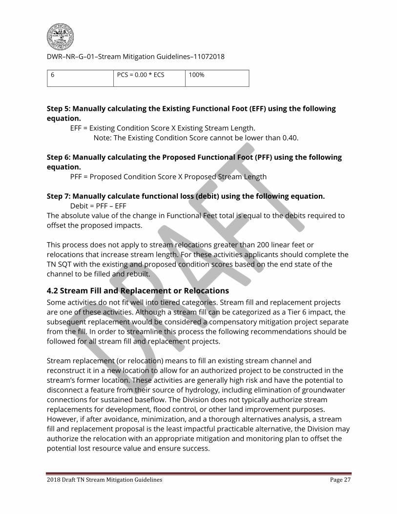
6 PCS = 0.00 * ECS 100%
Step 5: Manually calculating the Existing Functional Foot (EFF) using the following
equation.
EFF = Existing Condition Score X Existing Stream Length.
Note: The Existing Condition Score cannot be lower than 0.40.
Step 6: Manually calculating the Proposed Functional Foot (PFF) using the following
equation.
PFF = Proposed Condition Score X Proposed Stream Length
Step 7: Manually calculate functional loss (debit) using the following equation.
Debit = PFF – EFF
The absolute value of the change in Functional Feet total is equal to the debits required to
offset the proposed impacts.
This process does not apply to stream relocations greater than 200 linear feet or
relocations that increase stream length. For these activities applicants should complete the
TN SQT with the existing and proposed condition scores based on the end state of the
channel to be filled and rebuilt.
4.2 Stream Fill and Replacement or Relocations
Some activities do not fit well into tiered categories. Stream fill and replacement projects
are one of these activities. Although a stream fill can be categorized as a Tier 6 impact, the
subsequent replacement would be considered a compensatory mitigation project separate
from the fill. In order to streamline this process the following recommendations should be
followed for all stream fill and replacement projects.
Stream replacement (or relocation) means to fill an existing stream channel and
reconstruct it in a new location to allow for an authorized project to be constructed in the
stream’s former location. These activities are generally high risk and have the potential to
disconnect a feature from their source of hydrology, including elimination of groundwater
connections for sustained baseflow. The Division does not typically authorize stream
replacements for development, flood control, or other land improvement purposes.
However, if after avoidance, minimization, and a thorough alternatives analysis, a stream
fill and replacement proposal is the least impactful practicable alternative, the Division may
authorize the relocation with an appropriate mitigation and monitoring plan to offset the
potential lost resource value and ensure success.

DWR–NR–G–01–Stream Mitigation Guidelines–11072018
2018 Draft TN Stream Mitigation Guidelines Page 28
Stream fill and replacement within the limits of a project is often feasible, and if done with
proper planning and design can be an adequate replacement of the stream eliminated
during the relocation. We do not promote any specific design techniques, however, data
driven methods using aspects of a natural channel design are strongly encouraged.
Therefore, the Division requires a detailed plan that documents consideration of elements
such as watershed hydrology, channel hydraulics, sediment transport, lateral site
constraints and morphological reference conditions within the ecoregion.
Designers should consult credible sources like the Natural Resource Conservation Services
National Engineering Handbook (Part 654) Stream Restoration Design, or the Tennessee
Department of Transportation Design Division Drainage Manual, Chapter 11, Natural
Stream Design for design guidance if needed. In addition, designers may consult the
Division’s Compensatory Mitigation website for Ecoregion based stream regional curves for
reference channel dimensions. These resources can in the development of a plan. Finally,
designers should take the time to evaluate the stream itself, looking at the channel
longitudinally and noting any departures from reference conditions, bank instabilities,
channel bars, benching, and riparian vegetation. Consideration of current conditions,
potential impacts of proposed activities, and stream response to the relocation are key to a
successful project.
4.2.1 Submittal Guidelines for Stream Fill and Replacements:
In general, stream elimination and subsequent replacement varies in significance and
severity based on impact length. Therefore, the Division requires a standard 12-point
mitigation plan (33 CFR 332) (outlined in this document) that includes documenting the
stream’s existing condition, proposed condition, and monitoring requirements
commensurate with the alteration proposed. All jurisdictional streams will be required to
maintain or improve hydrology and meet the definition of a stream by state, and in some
cases, federal standards. Relocated channels will need to be vegetated, and designers
must ensure channel stability, both laterally and vertically, throughout the monitoring
period. The length of monitoring and detailed success criteria are based on the length of
the relocated stream and the pre-existing site conditions.
All replacements greater than 100 linear feet and not considered a structural transition
zone will have standard success criteria and monitoring commensurate with the impact
length.
Replacements on short stretches of stream have less inherent risk and impact to habitat.
Therefore, the Division will not require a TN SQT as part of a monitoring plan. However,
permittees will have to determine existing conditions and demonstrate no net loss of
resource values has occurred at the end of the monitoring period. Replacements less than
200 linear feet in stream length must not be unstable, either vertically or laterally, and

DWR–NR–G–01–Stream Mitigation Guidelines–11072018
2018 Draft TN Stream Mitigation Guidelines Page 29
must be revegetated. Any loss of channel length will require compensatory mitigation
commensurate with the resource values lost. Permittees will be required, at a minimum, to
monitor the channel for three years. Performance standards will include (but are not
limited to) bank stability and channel hydrology. These replacements include structural
transition zones approaching culverts. There are a few scenarios within structural
transition zones where the Division does not require monitoring or performance standards
for stream relocations. These areas are short (25 feet or less) and are located directly
upstream and downstream of culverts.
Stream relocation projects that range from 200 linear feet to 500 linear feet in length
require more oversight, design and performance standards. Therefore, the Division
recommends the use of the TN SQT or other approved quantitative assessment method.
Permittees will have to determine existing conditions and demonstrate no net loss of
resource value has occurred at the end of the three year monitoring period. Mitigation
projects may not create a proposed condition that is lower than the existing condition at
any time during the monitoring period. At a minimum, channels must have stable
configuration laterally and vertically. The channel bottom must have a natural substrate
and a riparian zone must be revegetated with species native to the specific region of
Tennessee. In-stream structures to help maintain the slope are permissible. Signage,
indicating zones of “no mowing” should be placed along the riparian corridor. Deviation
from these criteria and/or loss of hydrology could result in additional corrective action or
compensatory mitigation.
Stream relocation projects for channels greater than 500 linear feet should use the TN SQT
or other scientifically defensible and approved method to determine functional loss and lift
of the project. This information should be submitted with the mitigation plan. The plans
should provide scores for and monitor the following parameters: floodplain connectivity,
lateral migration, riparian vegetation, and bed form diversity. Projects may not create a
proposed condition that is lower than the existing condition at any time during the
monitoring period. Furthermore, parameters for floodplain connectivity and lateral
migration must be functioning at the end of the monitoring period. In-stream structures to
help maintain vertical stability are permissible. The channel bottom must have a natural
substrate and a riparian zone must be revegetated, preferably with species native to the
specific region of Tennessee. Signage, indicating zones of “no mowing” should be placed
along the riparian corridor. Five years of monitoring for hydrology, geomorphic stability,
and vegetation is required. Deviation from these criteria and/or loss of hydrology could
result in additional corrective action or compensatory mitigation.
Some stream fill and replacement activities will require these systems be placed in riprap
lined channels. For these scenarios, permittees will be assessed debits based on existing

DWR–NR–G–01–Stream Mitigation Guidelines–11072018
2018 Draft TN Stream Mitigation Guidelines Page 30
condition and be required to monitor the site for hydrology for three years. Permittees
should determine the stream existing condition using option 1, 2, or 3 outlined in the debit
section. The activity would be considered a tier 3 impact. Complete the debit calculation
process to determine the amount of functional loss. Permittees will need to report
functional loss along with the monitoring plan for hydrology in your 401/404 application.
All stream fill and replacements are considered to cause an appreciable permanent loss of
resource values until the project has been determined to be successful at the end of the
monitoring period. In addition, these activities are considered a type of on-site (and
therefore in-system) compensatory mitigation. In most cases a site-specific biological and
habitat assessment utilizing the approved TDEC SOP, or other scientifically defensible
method as approved by the Division will be required. Proposed fill and replacement
(compensatory mitigation) sites that support fish and aquatic life use designation prior to
the impact must maintain that status at the end of the monitoring period to ensure no
appreciable permanent loss of resource values. If the stream does not maintain or improve
flow and classified uses at the end of the monitoring period, the site will not be considered
successful. In this case, corrective action or additional compensatory mitigation may be
required.
4.3 Temporal Loss
TDEC rules require that to the extent practicable, compensatory mitigation shall occur
before or concurrently with authorized stream impacts, and provide that the Division will
account for temporal loss of resource values. Therefore, where compensatory mitigation is
proposed to be completed more than one year post-impact, the Division may use a
multiplier to account for temporal loss of resource values. Compensatory mitigation
occurring concurrent with impacts, or the purchase of mitigation bank credits, would not
require a temporal loss factor.
4.4 Proximity of Compensatory Mitigation
TDEC rules state that compensatory mitigation for impacts to Tennessee streams must
occur in Tennessee, and provide that the Division will use a watershed prioritization
approach to evaluate proposed mitigation sites. Mitigation should occur as close to the
impact location as practicable. The Division prioritizes project locations as follows:
projects providing an increase in resource values to degraded streams on-site or
within the immediate impact area;
projects providing an increase in resource values to degraded streams or
wetlands within the HUC-12 in which the impact is located;
projects providing an increase in resource values to degraded streams or
wetlands within the HUC-8 in which the impact is located;

DWR–NR–G–01–Stream Mitigation Guidelines–11072018
2018 Draft TN Stream Mitigation Guidelines Page 31
projects providing an increase in resource values to degraded streams or
wetlands outside the HUC-8 in which the impact is located; or
Any combination of any of the above activities.
Where appropriate the Division may use a multiplier of up to 2:1 for offsetting
compensatory mitigation projects, including credits purchased from a third party provider,
that do not occur within the same HUC-8, or within a third-party provider’s service area as
approved by the IRT.
This multiplier will be based either on an IRT-approved formula, or as follows:
One HUC-8 away = 1.25:1 multiplier
Two HUC-8’s away = 1.5:1 multiplier
Three HUC-8’s away = 2:1 multiplier
For In-Lieu Fee Service Areas that encompass multiple HUC-8 watersheds, because the
location of the future offsetting mitigation project is unknown, the proximity calculation will
be based on the most distant HUC-8.
4.5 Common Encountered Scenarios /Frequently Asked Questions
1. The Division allows for the placement of clean rock fill material within 25 linear feet
upstream and 25 liner feet downstream of existing or proposed structures. For existing
structures this can be done through a no-notification General Permit. In both cases
applicants are not required to provide compensatory mitigation if the placement of
rock fill does not exceed a cumulative total of 50 linear feet (25 feet on each end),
regardless of the structure length. If greater than this amount of armoring or rock fill is
proposed, riprap totals, in conjunction with structure length will be factored into the
total amount of cumulative resource loss potentially requiring compensatory
mitigation.
2. The Division recognizes the importance of maintaining proper hydraulics through
installed structures. The Division allows for slight realignment of stream channels within
25 linear feet upstream and 25 linear downstream of proposed structures without
requiring compensatory mitigation, as with larger scale fill and replacement projects.
Projects that propose more than 25 linear feet of stream realignment upstream or
downstream of a structure are considered stream fill and replacement.
3. Evaluation of resource loss should be based on existing conditions at the time of CPD
initiation. Impacts predating the CPD are part of existing conditions. However, even if
early activities related to the CPD result in only minimal impacts, later impacts must be
evaluated cumulatively with the earlier CPD impacts to determine whether
compensatory mitigation is required, and if so, how much. The age of the existing
impact is not a consideration for when mitigation is required, only whether the impact

DWR–NR–G–01–Stream Mitigation Guidelines–11072018
2018 Draft TN Stream Mitigation Guidelines Page 32
was part of the CPD. Thus, multiple minimal impact activities within a CPD may result in
required mitigation, even if the individual activities would not. In this case, mitigation
will be required to offset all impacts associated with the CPD.
4. The Division considers structures within 50 linear feet of each other along the same
stream channel to be contiguous. Contiguous impacts are totaled cumulatively, even
when contiguous impacts are not part of a common plan of development and are
proposed by different applicants. When contiguous impacts result in a significant loss
of aquatic resource, they require compensatory mitigation, however, in these non-CPD,
contiguous impact scenarios only the new, currently authorized impacts will require
mitigation (as opposed to cumulative impacts within a CPD).
5. The Division requires mitigation for the loss of stream length when there is an
appreciable permanent loss of resource values, thus, any relocated channel must fully
compensate for the stream fill. If additional impacts (hard armoring, culverts, etc.) are
proposed for the newly constructed channel that reduces the value and function of the
on-site mitigation below that which was lost through fill, additional mitigation will be
required to compensate for this loss.
6. Mixed impact types (e.g., culvert, stream fill and replacement, and hard armoring) that
are contiguous or within a Common Plan of Development will be totaled cumulatively. If
mixed impacts cumulatively result in an appreciable permanent loss of resource values,
compensatory mitigation will be required to offset all proposed impacts.
5. Providing Resource Values and Functional Lift
Compensatory mitigation may be achieved through the purchase of compensatory
mitigation credits from a mitigation bank or an in-lieu fee (ILF) program, or through
completion of permittee-responsible mitigation. The USACE’s preference hierarchy for
compensatory mitigation is banks, ILF programs, and then permittee-responsible (33 CFR
332.3(b)(2)-(6)). The Division does not ascribe to the federal hierarchy for compensatory
mitigation projects. Therefore, depending on the site, the Division may prefer permittee-
responsible mitigation. All in-lieu fee programs and mitigation banks provide mitigation to
applicants as a third party provider and are overseen by the IRT. Mitigation banks and in-
lieu fee programs are subject to the required components of this document and all
applicable USACE regulations, guidance, and policy and may have alternative credit release
schedules, reporting responsibilities, and performance standards established in the
mitigation bank or in-lieu fee Instrument. Applicants may choose to purchase credits from
third party providers. This shifts the legal liability to the third party service provider once
credits are purchased and the Commissioner and District Engineer (USACE) have received
documentation confirming the sponsor has accepted the responsibility for providing the
required compensatory mitigation. Permittees that purchase credits from third party
providers will provide proof of purchase to the Division within sixty (60) days of permit

DWR–NR–G–01–Stream Mitigation Guidelines–11072018
2018 Draft TN Stream Mitigation Guidelines Page 33
issuance. Where a third party provider is not an option, or permittee-responsible mitigation
is the preferred method, the legal liability for compensatory mitigation success remains
with the permittee until the mitigation is determined to be complete and successfully
offsets lost resource values and stream functions.
5.1 Tennessee Stream Quantification Tool
TDEC, along with agencies partners including the USACE, EPA, NRCS, TWRA, TVA, and the
USFWS have worked with consultants, academics, and statewide stakeholders to develop
and regionalize a tool for site evaluation and determination of compensatory mitigation
credits (functional feet). TDEC and the USACE have determined that the TN SQT is the
preferred quantitative assessment method to calculate credits (functional feet).
The primary purpose of the TN SQT and associated documents is to evaluate the functional
change between an existing and proposed stream condition. The agencies intend to use
the TN SQT as a component of the project review process and to award credits through
determination of functional lift. The TN SQT may also be used as a mechanism to
determine the suitability of a project proposal, project goals, objectives and overall project
success over time. This quantitative assessment method produces defensible, repeatable,
and predictable results. Detailed information concerning how to collect the required data,
input the information into the tool, access to the tool itself, and resources for monitoring
project success are provided in the appendix of this document and can be downloaded
from the TDEC Compensatory Mitigation webpage. While the TN SQT is a quantifiable
assessment method the state prefers to determine credits, it is not the only tool for
determining the amount of credit a project may generate.
The TN SQT is based on the original Stream Quantification Tool (SQT) developed for North
Carolina by Stream Mechanics, LLC. This tool has been regionalized for use in Tennessee.
The benefits of using the SQT for evaluating stream restoration include:
1. Establishes a calculator to determine the numerical differences between an existing
(degraded) stream condition and the proposed (restored or enhanced) stream
condition. This numerical difference is known as functional lift or uplift. It is part of the
Tennessee stream credit determination method as defined by the 2008 Federal
Mitigation Rule.2
2. Provide a method to review how restoration activities change or improve stream
functions and resource values. This is done through focusing on parameters and
2 Compensatory Mitigation for Losses of Aquatic Resources, 33 C.F.R. § 332.

DWR–NR–G–01–Stream Mitigation Guidelines–11072018
2018 Draft TN Stream Mitigation Guidelines Page 34
measurement methods that directly relate to stream functions and can easily be
assessed by stream restoration practitioners and regulators.
3. Links restoration goals to restoration potential. Encourages assessments and
monitoring that matches the restoration potential.
4. Incentivizes high-quality stream mitigation by calculating functional lift associated with
physicochemical and biological improvements.
5.1.1 Uses for the TN SQT
The TN SQT can assist in mitigation site selection, determining project specific function-
based goals and objectives, understanding the potential for functional lift at a site,
determining success criteria, and developing a monitoring plan. The primary purpose of
the TN SQT (and Debit Tool) is to calculate functional (loss and) lift associated with stream
impact and restoration projects. This tool may also be useful when developing Total
Maximum Daily Load (TMDL) models or organizing volunteer restoration activities. The
potential uses of the TN SQT are described below:
1. Restoration Potential – The tool can assist in determining the level of restoration a
project can achieve through evaluation of site constraints, watershed stressors, and
selection of reach-based parameters for functional lift. However, the TN SQT is not a
prescriptive design tool.
2. Watershed Stressors – The Watershed Assessment form can be used to determine
factors that limit the potential stream functional lift that can be achieved by a
restoration project, including for the purpose of compensatory mitigation.
3. Site Selection – The tool can help determine if a site can benefit from a restoration
project and if the site has significant limitations that would inhibit a project from being
successful. Site selection is critical to determine whether a proposed stream restoration
project can achieve enough functional lift to meet project goals and objectives. Rapid
field assessment methods coupled with the Watershed Assessment form can be used
to assess and select a site at the development phase of a project.
4. Function-Based Goals and Objectives – The tool can be used to describe project goals
that match the restoration potential of a site. Quantifiable objectives and performance
criteria can be developed that link restoration activities to measurable changes in
stream functional categories and function-based parameters assessed by the tool.
5. Functional Lift – The tool can quantify functional lift from a proposed or active stream
restoration project. Lift is estimated during the proposal, design or mitigation plan
phase and is calculated for each post-construction monitoring event.
6. Functional Loss – Functional loss can be determined with the TN Debit Tool, a separate
workbook from the TN SQT. The debit tool workbook uses the same logic as the SQT
but predicts proposed condition scores based on existing conditions and modeled
functional loss based on the effect of typical impact activities.
7. Compensatory Mitigation – The tool can be applied to on- or off-site compensatory
mitigation projects. These include in-lieu fee mitigation, permittee responsible

DWR–NR–G–01–Stream Mitigation Guidelines–11072018
2018 Draft TN Stream Mitigation Guidelines Page 35
mitigation, and mitigation banks. The tool can help determine if the proposed
mitigation activities will provide sufficient functional lift to offset unavoidable adverse
impacts to streams. It can also be used to develop monitoring plans and gauge a
project’s success against established reference standards.
8. Stormwater Best Management Practices (BMPs) in Conjunction with Stream Restoration
The TN SQT was developed with careful consideration to how stream restoration
projects using BMPs to treat adjacent runoff could achieve lift. However, the TN SQT
should not be used for projects that only install stormwater BMPs and do not include
stream restoration (in channel) work.
5.1.2 Credits and the TN SQT
In the TN SQT, credits are calculated in functional feet and are determined by establishing
the existing site conditions and the proposed site conditions along the stream. The TN SQT
worksheet automatically calculates Functional Feet (FF) once these conditions are input into
the spreadsheet. A functional foot is produced by multiplying a condition score by the
stream length. Since the condition score must be 1.00 or less, the functional foot score is
always less than or equal to the actual stream length.
Example: A stream restoration project proposes to restore a channel to a reference
condition. The current stream is on a cattle farm, and is highly impacted and disconnected
from the floodplain. The existing condition score, on 3,000 linear feet of stream, may be a
0.27. The straightened channel has no riparian buffer, low water quality and biology, the
banks are eroding, and impaired for siltation. The proposal will reduce erosion, improve
the buffer, create in-channel habitat, and reconnect the channel to a floodplain. The
proposed condition score will be a 0.57, and the newly meandering channel will be 3,500
feet long. The credits generated will be 1,185 functional feet.
3,000 linear feet of stream (x) existing condition score of 0.27 = 810 existing
functional feet
3,500 linear feet of restored stream (x) proposed condition score of 0.57 = 1,995
proposed functional feet
Credits = proposed functional feet (1,995) – existing functional feet (810)
Total credits for project = 1,185 functional feet
This scenario does not take in to account any biological or water quality lift. If the biology,
pre-project, had a Total Macroinvertebrate Index (TMI) score of 22 and the practitioner
monitored biology for potential lift, and raised the TMI to 30, this would raise the overall
proposed condition score to 0.66. Using the same scenario, the project would yield more
credits.
3000 linear feet of stream (x) existing condition score of 0.27 = 810 existing
functional feet

DWR–NR–G–01–Stream Mitigation Guidelines–11072018
2018 Draft TN Stream Mitigation Guidelines Page 36
3,500 linear feet of restored stream (x) proposed condition score of 0.66 = 2,310
proposed functional feet
Credits = proposed functional feet (2,310) – existing functional feet (810) = 1,500
functional feet.
Total credits for project = 1,500 functional feet.
This scenario resulted in 315 additional credits for increasing biology to a
functioning at-risk condition, and nearly fully supporting condition.
Although a project may propose functional lift, the project will not be deemed to have
generated functional lift until it is demonstrated through monitoring. Actual credit
generation may vary through time based on-site performance. Permittee responsible
mitigation projects may be required to perform corrective action or additional mitigation, if
at the end of the monitoring period, the stream condition does not adequately offset the
resource value lost. This may occur if a proposal projected lift that was never
accomplished, therefore reducing the amount of actual functional feet of stream
generated. Bank and ILF projects will be awarded credits based on performance and
success determined by the USACE in conjunction with the IRT.
5.2 Descriptions of Common Mitigation Practices
All compensatory mitigation projects, at a minimum, will address floodplain connectivity,
riparian vegetation, and lateral migration. Depending on site constraints and geology some
projects may have to address bed form diversity and large woody in channel habitat. At the
end of the project monitoring period, the above parameters should be fully functioning.
Under rare circumstances, or in highly urban areas, this level of success may not be
feasible. The Division may award credits in these situations if the practitioner can provide
justification why limited success is acceptable, prove the site has reached the maximum
functional potential possible, and can demonstrate that the site is stable. Common
mitigation practices can improve stream parameters, and therefore generate credit.
However, the Division no longer awards credit based on proposed work. Instead, the
Division will award credit based on the amount of resource value and functional lift
mitigation activities will have on a stream.
Vegetated Riparian Buffer
A protected, riparian buffer, both woody (trees and shrubs) and herbaceous species,
should be a part of every compensatory mitigation proposal where the mitigation stream
does not have an established, appropriately vegetated riparian buffer, except in certain
circumstances, such as urban areas, where a full riparian buffer may not be feasible.
Projects that solely propose enhancing and/or establishing a stream buffer for credit may
not be approved if the stream is unstable, entrenched, or otherwise disconnected from the
floodplain. This includes sites that would require more extensive stream bed and/or bank

DWR–NR–G–01–Stream Mitigation Guidelines–11072018
2018 Draft TN Stream Mitigation Guidelines Page 37
restoration to achieve a self-sustaining system. Generating credits for riparian buffers in
the TN SQT is measured in two ways: 1. Improving channel hydrology by increasing
stormwater infiltration through buffer establishment, and 2. Improving channel stability in
the geomorphology parameter. The amount of credit received is based on the existing
condition of the buffer and the amount of functional lift proposed. All compensatory
mitigation projects are required to assess the riparian area and propose functional lift
where needed. However, many projects will not reach a functioning state at the end of the
monitoring period. More information on reference standards, lift of riparian areas, and
assessment methods can be found on the TDEC Mitigation website.
Performance standards for vegetated riparian buffers can be found in the Performance
Standards section of this document.
Re-establishment of Natural Channel Geomorphology
Stream mitigation projects often involve an approach designed to restore natural channel
geomorphology, which consists of returning a severely degraded, disturbed, or altered
stream, including adjacent riparian buffer and flood-prone area, to a natural stable
condition based on reference conditions or other appropriate standards. Successful
projects should result in a channel transporting water and sediment load in dynamic
equilibrium, and produce productive habitat components that are self-sustaining long-
term.
These projects may involve restoring a relocated stream channel to its former natural
location, restoring sinuosity, incorporating in-stream habitat and bed form complexity,
establishing stable channel dimensions (width/depth ratio), and/or reconnecting
abandoned side channels or meanders that were artificially cutoff, blocked, or filled where
functionally appropriate (more typical of western Tennessee). It does not include the fill
and relocation of a stream channel to accommodate a project in the stream’s former
location. Generating credits for geomorphology and floodplain connectivity in the TN SQT is
measured in two ways: 1. Improving channel hydraulics by connecting the stream to the
floodplain or a floodplain bench and reducing bed degradation, and 2. Improving channel
stability in the geomorphology parameter. The amount of credit received is based on the
existing condition of the channel geomorphology and floodplain connectivity and the
amount of functional lift proposed. All compensatory mitigation projects are required to
assess the floodplain connectivity and lateral migration parameters of a project and
propose functional lift where needed. These parameters are required to be functioning at
the end of the monitoring period. More information on reference standards, lift of these
parameters, and assessment methods can be found on the TDEC Mitigation website.
Livestock Exclusion

DWR–NR–G–01–Stream Mitigation Guidelines–11072018
2018 Draft TN Stream Mitigation Guidelines Page 38
Livestock exclusion involves removing or excluding existing livestock from the stream and
riparian buffer using fencing, or some other means. Livestock exclusion is a required
component of a compensatory mitigation projects. The stream and riparian buffer will be
protected from future livestock impacts utilizing appropriate long-term protection
measures.
The eligibility of a site proposing livestock exclusion does not apply to sites where land use
is or will soon be converted due to land development. For example, construction of a
subdivision on land formerly grazed by cattle does not generate compensatory mitigation
credit simply for livestock exclusion. Generating credits for livestock exclusion in the TN
SQT can be measured in many ways: 1. Improving water quality by reducing nutrients and
E. coli, 2. Improving channel stability in the geomorphology parameter, and potentially 3.
Improving biology once the cattle are removed. The amount of credit received is based on
the existing condition of the channel parameters and the amount of functional lift
proposed. Applicants may propose to lift water quality or biology parameters; however,
this is not a requirement of compensatory mitigation. More information on reference
standards, lift of these parameters and assessment methods can be found on the TDEC
Mitigation website.
Dam and Culvert Removal
Dam and culvert removal is another acceptable form of stream mitigation that can produce
measurable lift to stream value and function. Dams and culverts adversely affect and
fragment stream systems by altering the movement of aquatic organisms, water, sediment,
organic matter, and nutrients, thereby creating physical alterations in both tailwaters and
downstream riparian buffers and biological effects both upstream and downstream of the
dam. Dam or culvert removal, if done properly, can improve natural stream functions
provided that other functions such as riparian buffers, bed form diversity, and geomorphic
equilibrium are taken into account in conjunction with the removal. Without sufficient
evaluation, dam or culvert removal may result in bed and bank instability, upstream
migration of headcuts, and increased sediment loads.
Vegetative Bank Stabilization
Streams with severely degraded stream banks may provide opportunities as compensatory
mitigation projects. Severely degraded stream banks are the result of unstable
geomorphic or hydrologic conditions, have an accelerated rate of erosion well beyond
natural rates, and typically have little or no woody riparian vegetation. Vegetative bank
stabilization may incorporate bioengineering techniques to slow erosive near-bank
velocities and protect easily erodible soils, and may also require bank re-sloping or other
geomorphic and riparian zone restoration. Armoring banks with riprap or other hard
artificial structures will not produce an overall lift in stream value or function eligible for

DWR–NR–G–01–Stream Mitigation Guidelines–11072018
2018 Draft TN Stream Mitigation Guidelines Page 39
mitigation credit. Any proposal incorporating vegetative bank stabilization should address
the overall condition of the stream reach. If the stream is disconnected from the floodplain
and experiencing lateral or vertical degradation the project may not be approved since
localized repairs in an unstable system will not likely succeed long term.
Other Mitigation Activities
In consultation with the other resource and regulatory agencies, the Division will determine
the net benefit of any mitigation actions that produce quantifiable improvements to stream
value and function. These may include, but are not limited to, actions such as retrofitting
storm water detention facilities; restoration of stream flow where flow has been captured
by sewer lines, construction of off-channel storm water detention facilities in areas where
runoff is accelerating stream bank erosion, and other watershed protection practices. Any
mitigation proposal should include elements that go beyond existing regulatory
requirements such as existing local storm water requirements.
Urban Projects
Other factors that may have a positive effect on the credits generated include projects
concentrated in urban areas. Urban areas, for the purpose of this document, are defined
as MS4 Phase I communities. Urban stream restoration projects may receive an additional
increase in overall generated credits of up to 15%. This percentage increase is only
authorized on projects where TDEC alone has required compensatory mitigation. To be
eligible for this credit increase, the applicant must develop a publicly accessible
environmental education and outreach component of the project. It is recommended that
applicants coordinate with their local MS4 program, TDEC, and environmental educators
for development of these materials.
Preservation
Preservation of a threatened, unique, or ecologically significant aquatic resource may serve
as compensatory mitigation, but only in conjunction with, or as a component of, a larger,
more comprehensive project that is producing quantifiable lift to existing resource
functions in other parts of the project, for which the preservation of adjacent hydrologic
resources will provide additional benefit to the restored reaches. As with all compensatory
mitigation, preservation components of a project require long-term protection that
restricts alterations to the watercourse and land use within the riparian buffer. Where site
protection is required to protect other aspects of mitigation treatments (such as riparian
buffers), those areas of preservation do not qualify for additional mitigation credit.
Preservation may be used to provide compensatory mitigation for Section 404 permits and
Section 401 certifications when all of the following criteria are met:

DWR–NR–G–01–Stream Mitigation Guidelines–11072018
2018 Draft TN Stream Mitigation Guidelines Page 40
1. The existing condition of the resource should be high. When using the TN SQT this
should be, at minimum, a 0.6 overall existing condition score.
2. The length of stream for preservation can generate credits equal to 10% of the
functional foot score of the resource existing condition.
3. The preserved features shall be in conjunction with a larger restoration and/or
enhancement project.
4. The resources to be preserved provide important physical, chemical, or biological
functions for the watershed.
5. The resources to be preserved contribute significantly to the ecological
sustainability of the watershed.
6. Preservation is determined by the permitting agencies to be appropriate and
practicable.
7. The resources are under threat of destruction or adverse modifications; and that
threat is not under the control of the applicant.
8. The preserved site will be permanently protected through an appropriate real estate
or other legal instrument (e.g., easement, title transfer to state resource agency or
land trust).
5.3 Components of Compensatory Mitigation
It is the responsibility of the applicant or third-party mitigation provider to identify suitable
mitigation sites, establish appropriate performance standards, and develop a
compensatory mitigation plan that will adequately offset proposed or authorized impacts.
It is expected, that after the successful achievement of performance standards, a project be
inherently self-sustaining long-term. In most cases this requires project designs that result
in a channel that maintains dynamic, natural equilibrium and supports a healthy riparian
corridor, provides diverse in-stream habitat, allows for lateral migration without excessive
erosion and instability, and maintains floodplain connectivity. The proposed mitigation
plan should, at a minimum, be consistent with the guidance for project proposal,
quantitative evaluation methods, and monitoring requirements set forth in this document.
Some projects, due to their size and complexity, will require additional information as part
of the performance standards and mitigation plan. These projects, where both the USACE
and TDEC require compensatory mitigation, should follow joint guidance issued by TDEC
and the USACE. It is provided as an appendix in this document and on the TDEC Mitigation
website, or through the USACE. All mitigation plans and methods must be reviewed and
approved by state and federal regulatory agencies prior to permit issuance and mitigation
implementation.

DWR–NR–G–01–Stream Mitigation Guidelines–11072018
2018 Draft TN Stream Mitigation Guidelines Page 41
5.3.1 Stream Mitigation Site Considerations
Stream compensatory mitigation may be accomplished through the restoration, re-
establishment, enhancement, or preservation (in conjunction with other mitigation
activities) of the water resource values, functions, and designated uses of currently
degraded streams. The Division Rules outline a preference for mitigation to occur as close
to the impacts as is feasible. Tennessee statute and the Division’s overarching mission to
abate existing pollution and restore polluted waters, establish priority should be given to
significantly degraded stream reaches near the impact site and within Waterbodies
assessed as impaired by TDEC (i.e. “303(d)-listed”). This provides a means to alleviate the
causes or sources of water quality and/or habitat impairment.
The impaired or degraded condition of stream segments not currently assessed or listed by
the Division should be professionally documented as in need of improvement to be eligible
as a compensatory mitigation project. In most cases this will require the completion of a
TN SQT assessment workbook, including a site-specific biological and habitat assessment
utilizing the approved TDEC SOP, or other scientifically defensible method as approved by
the regulatory agencies. Proposed mitigation sites that are documented to be currently
meeting their designated use for Fish and Aquatic Life will have to maintain that status at
the end of the monitoring period to receive any credit as a compensatory mitigation
project. Stream segments that currently exhibit a level of biologic integrity well above the
minimum use support level in most cases will not be approved as a compensatory
mitigation site.
Common mitigation activities that may accomplish the goal of functional lift include re-
establishment of natural channel morphology of previously channelized streams, removal
of existing culverts, vegetative rehabilitation of excessively eroding banks, re-establishment
of riparian buffers, establishment of natural in-stream habitat, livestock exclusion,
significant removal of non-point source pollutants especially in urbanized areas, reversal of
adverse hydrological modifications, and any combination thereof. Minimization of
conflicting site constraints, long-term protection of mitigation projects, watershed
connectivity, and achieving inherently self-sustaining natural functions are vital
considerations in selecting viable mitigation site which result in a lift in stream function
sufficient to compensate for any net losses.
The amount of compensatory offset (or “credit”) generated by a mitigation project depends
on the hydrologic, hydraulic, geomorphic, water quality and biological lift that results from
a mitigation project, as shown through post-project monitoring. Credit for stream
mitigation will only be awarded when the stream mitigation project successfully achieves
all stated performance standards and long-term protection has been secured. Mitigation
projects that lengthen stream channels in ways inconsistent with natural channel functions

DWR–NR–G–01–Stream Mitigation Guidelines–11072018
2018 Draft TN Stream Mitigation Guidelines Page 42
will usually not be considered suitable mitigation projects. Stream mitigation should be
designed to achieve the maximum level of improvement feasible in a given reach or, in
other words, to lift stream function as far as possible towards its most probable natural
state, given the individual constraints of the project location and watershed conditions.
While site-specific constraints may reduce the restoration potential of mitigation sites (and
correspondingly decrease the mitigative potential), mitigation aims to establish the
maximum biological, chemical, and physical integrity possible in the current environment.
Where appropriate and practicable, compensatory mitigation decisions should also be
made from a watershed perspective in which the type and location of compensatory
mitigation follows from an analytically-based watershed assessment to assure that the
proposed compensation furthers watershed goals. This assessment may take the form of a
watershed plan, which typically involves an intensive regional planning effort involving
many stakeholders. It may also be a less formal watershed approach involving the analysis
of available data concerning regional environmental issues, efforts to inventory historic
trends in aquatic resource condition, and the prioritization of aquatic resource restoration
opportunities.
Both the USACE and the Division have regulatory mitigation preferences, but also recognize
that departure from this preference can be environmentally preferable where the
improvement in the resource values and function of wetlands, streams, and other aquatic
resources are designed and situated to address specific regional environmental issues, and
to bring the maximum ecological benefit to the watershed.
In some cases, the evaluation of the compensatory mitigation proposal may reveal the
proposed activities are not practical, constructible, sustainable, provide adequate
functional lift or benefit to resource values, or are otherwise ecologically undesirable,
therefore, all determinations involving projects requiring stream mitigation will be made on
a case-by-case basis at the discretion of the reviewing agencies.
5.3.2 Mitigation Plan
All mitigation projects, either through PRM or a third party service provider, must provide a
mitigation plan commensurate with the scale and complexity of the project. Mitigation
plans are intended to fully illustrate the measures proposed to create, restore, enhance, or
preserve a stream. The following components should be included in any final mitigation
plan:
1. Objectives: A description of the resource type(s) and amount(s) that will be provided,
the method of compensation (restoration, establishment, preservation, etc.), and how
the anticipated functions of the mitigation project will address watershed needs.

DWR–NR–G–01–Stream Mitigation Guidelines–11072018
2018 Draft TN Stream Mitigation Guidelines Page 43
2. Site selection: A description of the factors considered during the site selection
process. This should include consideration of watershed needs, onsite alternatives
where applicable, and practicability of accomplishing ecologically self-sustaining
aquatic resource restoration, establishment, enhancement, and/or preservation at the
mitigation project site.
3. Site protection instrument: A description of the legal arrangements and instrument,
including site ownership that will be used to ensure the long-term protection of the
mitigation project site. Details on acceptable site protection instruments can be found
in the Performance Standards and Monitoring section of this document. Approved
templates can be found in appendix E.
4. Existing condition information: a description of the ecological characteristics of the
proposed mitigation site, in the case of an application for a 404/401 permit, the impact
site. This may include descriptions of historic and existing plant communities, historic
and existing hydrology, soil conditions, a map showing the location of the impact and
mitigation site(s) or the geographic coordinates for those site(s), and other
characteristics appropriate to the type of resource proposed as compensation. The
existing condition information should include a delineation of waters of the United
States/State on the proposed mitigation site. For stream projects, the existing site
conditions can be captured using the TN SQT. Manuals and guidance on how to
perform this assessment method is provided in appendix C of this document.
5. Determination of Credits: a description of the number of credits to be provided
including a brief explanation of the rationale for this determination.
For permittee responsible mitigation, this should include an explanation of
how the mitigation project will provide the required compensation for
unavoidable impacts to aquatic resources resulting from the permitted
activity.
When using the TN SQT, the tool will calculate the change in Functional
Feet from an existing to a proposed condition. This total is potentially equal
to the amount of credits generated and available to offset proposed
impacts. Projects will be required to demonstrate and sustain the
proposed site conditions to maintain the projected credit generation.
Deviations from the change in functional feet (or credits) generated will be
subject to an increase or reduction based on the final monitored condition
of the site.
6. Mitigation work plan: detailed written specifications and work descriptions for the
mitigation project, including: geographic boundaries of the project; construction

DWR–NR–G–01–Stream Mitigation Guidelines–11072018
2018 Draft TN Stream Mitigation Guidelines Page 44
methods, timing, and sequence; source(s) of water; methods for establishing the
desired plant community; plans to control invasive plant species; proposed grading
plan; soil management; and erosion control measures. For stream mitigation
projects, the mitigation work plan may also include other relevant information, such
as planform geometry, channel form (e.g., typical channel cross-sections), watershed
size, design discharge, and riparian buffer plantings.
7. Maintenance Plan: a description and schedule of the maintenance requirements to
ensure the continued viability of the resource once initial construction is completed.
8. Performance standards: ecologically-based standards that will be used to determine
whether the mitigation project is achieving its objectives. Details on performance
standards can be found in the Performance Standards and Monitoring section of this
document.
9. Monitoring requirements: a description of parameters monitored to determine
whether the mitigation project is on track to meeting performance standards and if
adaptive management is needed. A schedule for monitoring and reporting
monitoring results will be included in the applicable permits. Spreadsheets and
additional reporting requirements, including yearly tracking and monitoring success
by parameter, is provided in the TN SQT.
10. Long-term management plan: a description of how the mitigation project will be
managed after performance standards have been achieved to ensure the long-term
sustainability of the resource, including long-term financing mechanisms and the
party responsible for long-term management.
11. Adaptive management plan: a management strategy to address unforeseen
changes in site conditions or other components of the mitigation project, including
the party or parties responsible for implementing adaptive management measures.
12. Financial assurances: a description of financial assurances that will be provided and
how they are sufficient to ensure a high level of confidence that the mitigation
project will be successfully completed, in accordance with its performance standards.
Other information: additional information may be required as necessary to determine the
appropriateness, feasibility, and practicability of the mitigation project.

DWR–NR–G–01–Stream Mitigation Guidelines–11072018
2018 Draft TN Stream Mitigation Guidelines Page 45
6. Performance Standards and Monitoring Requirements
Performance standards are a part of every compensatory mitigation project from a small
scale PRM site to a large scale stream mitigation bank. The standards will vary and are site
dependent. The following section provides details concerning common performance
standards for a variety of project types.
Quantitative assessment methods - Projects that use the TN SQT or other
quantitative assessment method to establish existing and proposed conditions for
improvement will incorporate the metrics proposed for improvement as
performance standards, along with pre-project existing conditions, to document the
stream function improvements that will occur as a result of the proposed project.
Typically, stream restoration and enhancement projects will focus on hydraulic and
geomorphic functional lift. If project sponsors propose restoration and/or
enhancement activities that will improve physiochemical and/or biological functions
and are seeking credits for the functional lift, monitoring of the parameters
associated with these functions will be required. Alternative performance standards
may be proposed by the permittee or third party sponsor. If alternative
performance standards are proposed, the Division will review the proposed
standards and determine their applicability.
Resource values and functional lift - compensatory mitigation projects, at a
minimum, should address and lift floodplain connectivity, riparian vegetation,
woody in channel habitat, and lateral migration if these parameters are not
functioning. Depending on site constraints and geology some projects may have to
address bed form diversity. At the end of the project monitoring period, the above
parameters should be fully functioning. Under rare circumstances, or in highly
urban areas, this level of success may not be feasible. The Division may consider
and approve projects in these situations if the practitioner can provide justification
why limited success is acceptable, prove the site has reached the maximum
functional potential possible, and can demonstrate that the site is stable and will not
worsen conditions upstream or downstream.
As-built surveys - Post-construction surveys will be submitted for mitigation
projects immediately following construction to document post-construction
conditions. Projects with in-channel modifications or a high level of complexity and
scale will provide as-built surveys that include the following: photo documentation
at all cross sections and structures, a plan view survey, a longitudinal profile, and
vegetation information (type, number and location of species planted). Also,
documentation of compliance with any special permit condition relating to signage
or deed restriction shall be submitted. These projects will also provide location data

DWR–NR–G–01–Stream Mitigation Guidelines–11072018
2018 Draft TN Stream Mitigation Guidelines Page 46
including the upstream and downstream coordinates of the project along with the
buffer width. As-built reports will be submitted within 60 days of project
construction. As-built surveys are not required for preservation.
Hydrology - Unless otherwise approved by the IRT, all compensatory mitigation
watercourses must maintain or increase the functional value of their flow regime
(including the duration, volume, and frequency of flows) by the end of the
monitoring period. For any jurisdictional streams that have been replaced or
relocated, a Tennessee Hydrologic Determination will be completed, at a minimum,
in year one and three, between February and April 15th, during the monitoring
period. The relocated streams must maintain status as a jurisdictional stream
throughout the monitoring period. Failure of the feature to rank as a jurisdictional
stream will require corrective action and/or mitigation on the part of the permittee.
Visual Inspection - A visual inspection will be conducted throughout the site
including the stream banks during each monitoring event by traversing the entire
mitigation site to identify and document areas of low stem density or poor plant
vigor, exotic invasive species, beaver activity, herbivory, encroachments, indicators
of livestock access, stream instability, or other areas of concern. A brief narrative of
the results of the visual assessments will be included in the Annual Monitoring
Report. Visual monitoring of the channel is intended to identify potential problems
and allow them to be tracked and addressed, if necessary. Any areas of concern
shall be annotated on a plan view of the site with GPS coordinates provided in
decimal degrees, with photographs, and with the written narrative describing the
features and issues of concern. Once a feature of concern has been identified, that
same feature shall be reassessed on all subsequent visual assessments. Depending
on the nature of the concern, field measurements may be warranted to track
conditions as they improve, or decline over time. Photographs should be taken from
the same location year to year to document the current condition of the area of
concern. In general, repairs will be required when stream stability issues are
identified that continue to worsen, pose a threat to other portions of the stream
(headcuts, etc.), or are symptomatic of more serious issues with the design and/or
construction of the project. If problems continue to persist, repairs may be
discontinued and mitigation credits will be adjusted accordingly.
Buffers - Projects requiring buffers as part of the project will adhere to the following
conditions to qualify as a component of a compensatory mitigation project:
Revegetation should be native, both woody (trees and shrubs) and herbaceous
species. Stem densities and specific plant communities will be determined on a
project by project basis

DWR–NR–G–01–Stream Mitigation Guidelines–11072018
2018 Draft TN Stream Mitigation Guidelines Page 47
The resultant mitigation plant communities should contain less than 5% areal
coverage of species identified on the Tennessee Invasive Exotic Plant List
(www.tneppc.org.) throughout the monitoring period. No contiguous areas
greater than 200 square feet should be vegetated with more than 50% relative
areal coverage of invasive species at the end of the monitoring period.
(Implementation of invasive species control measures should be conducted in
accordance with the Adaptive Management Plan, and may be required on a
case‐by‐case basis as determined by TDEC.
Minimum buffer widths are 50 feet from top of bank on either side of the
stream. Variations in buffer width are accepted on a case-by-case basis. More
credit may be awarded for projects where buffer widths can exceed 100 feet in
width.
No species may comprise more than 30% of the total planted trees.
Planted seedlings/trees must be guaranteed at a 75% survivorship for the
duration of the required monitoring period.
Where livestock are present, riparian buffers must be physically protected from
livestock. A fence must be erected and maintained at all times where livestock is
present and necessary managed stream crossings and livestock watering
facilities should be installed. Livestock watering facilities must be installed
outside waters.
Biology - for large scale projects, including stream replacements and relocations, a
site-specific biological and habitat assessment utilizing the approved TDEC SOP, or
other scientifically defensible method as approved by the Division will be required.
Proposed fill and replacement (mitigation) sites or full stream restoration sites that
are documented to be currently meeting their designated use for Fish and Aquatic
Life will have to maintain that status at the end of the monitoring period to ensure
no appreciable permanent loss of resource values. If the system does not maintain
or improve flow and classified uses at the end of the monitoring period, the site will
not be considered successful. Corrective action or additional compensatory
mitigation may be required.
Signage - All permittee responsible mitigation should have signs, Carsonite or
similar material, placed approximately every 100 feet, on either side of the stream
buffer zone, clearly indicating that the area is a Protected Stream and that no
mowing or other disturbance is permitted.
Perpetual Site Protection - Because mitigation is only required for permanent
impacts to aquatic resources, and as required by the ARAP rules, all mitigation shall
include a permanent restriction on the use of the mitigation site in a form approved

DWR–NR–G–01–Stream Mitigation Guidelines–11072018
2018 Draft TN Stream Mitigation Guidelines Page 48
by the Division and/or the USACE, including but not be limited to a recorded notice
of land use restrictions, conservation easement, or other equivalent mechanism.
When a long-term management plan is required, it should include a description of
the long-term management needs, annual cost estimates for these needs, and
identify the funding mechanism that will be used to meet those needs. Templates
and examples of acceptable legal instruments can be found in the appendix of this
document, and on the TDEC Mitigation website.
7. Monitoring Requirements
Monitoring is required for all stream mitigation projects. The objective of monitoring is to
document and quantify the success of a mitigation project. The success of such projects
needs to be documented in annual monitoring reports for a period of three to seven years
after completion of the project. Successful mitigation projects result in stream segments
that are laterally and vertically stable, have healthy in-stream habitat, do not lower use
support, flow, or water quality, and establish a healthy riparian buffer. The size and
complexity of a mitigation project will determine the type and length of monitoring
required. Specific monitoring requirements and length of the required monitoring will be
detailed in the permit and/or mitigation plan.
7.1 Typical Monitoring Periods
Small scale projects, less than 500 linear feet, should not have a reporting period longer
than three years unless otherwise deemed necessary by the Division.
Large scale projects, 500 linear feet or greater, should have a reporting period of at least
five years and up to seven years, unless otherwise deemed necessary by the Division, for
example, low risk enhancement projects that will not affect flow or biology may have a
reduced reporting period. Site monitoring for all federal stream compensatory mitigation
projects shall occur for a minimum of seven years post-construction.
7.2 Monitoring Report Requirements
As-built Report
a. Submitted within six months of channel improvements.
b. As-built surveys or other information demonstrating the work was completed for
functional lift towards the proposed stream functional condition score.
c. Real property protection to be recorded on the project site. Evidence that these
restrictions have been placed on the property and filed with the county should be
submitted as soon as possible, but no later than with the as-built report. Projects that
fail to secure real property protections, as indicated in this document, will be deemed
unsuccessful and corrective action will be required.

DWR–NR–G–01–Stream Mitigation Guidelines–11072018
2018 Draft TN Stream Mitigation Guidelines Page 49
d. A narrative description and photos accurately depicting the stream and riparian
condition.
e. Information on any addition performance standards deemed necessary for the report
to the Division.
Annual Condition Assessments
a. Detailed information about the pre- and post-project stream condition. This can be
demonstrated through the use of TN SQT. Workbooks and manuals can be found on
the TDEC website, through the USACE, and in the Appendix of this document.
b. Yearly monitoring of all performance standards, parameters and measurement
methods reported and used to demonstrate existing and proposed stream conditions.
It is important, when using the TN SQT or any other method, that pre, proposed, and
post project condition assessment use the same parameters and measurement
methods to determine success. Diverging from this requirement prevents the Division
from a proper comparison of stream condition over time.
c. A narrative description and photos accurately depicting the stream and riparian
condition.
d. Annual riparian vegetation surveys documenting the survivorship of planted riparian
species for all mitigation projects that include a riparian restoration component.
Additional reporting requirements
a. Projects approved between May and October will have a monitoring report due by
October 31st of the year following channel improvements.
b. Projects approved between November and April will have a monitoring report due by
April 30th of the year following channel improvements.
c. Copies of the monitoring report should be submitted to the permit writer, the local
TDEC Environmental Field Office, and the USACE (if applicable).
Monitoring reports are an effective means to demonstrate project success year after year
in a consistent manner. The TN SQT is designed to aid in that effort. Monitoring data
worksheets, data summary tables, trackers for functional feet scores over time, and
comparisons by reach of proposed conditions vs. as-builts, vs. monitored years are
provided for users. This information can aid in determining if a stream project is reaching
stated goals and objectives or identify areas of potential issues. These sheets can be
provided with monitoring reports as proof of stream condition and confirmation of
functional lift. Please note, stream compensatory mitigation projects will often have
additional success criteria or other reporting requirements to submit as part of a
monitoring report. Information on additional monitoring requirements can be found on
the TDEC and USACE websites. Monitoring data worksheets are not used for debit projects
unless there is a large-scale stream relocation associated with it. In these instances, the

DWR–NR–G–01–Stream Mitigation Guidelines–11072018
2018 Draft TN Stream Mitigation Guidelines Page 50
stream fill and replacement (relocation) is considered an independent, permittee
responsible, compensatory mitigation project.

DWR–NR–G–01–Stream Mitigation Guidelines–11072018
2018 Draft TN Stream Mitigation Guidelines Page 51
References and Readings
Allen, J.A., B.D. Keeland, J.A. Stanturf, and H. E. Kennedy, Jr. 2001. A Guide to Bottomland
Hardwood Restoration. U.S. Geological Survey, Reston, VA.
Arnwine, Deborah H. and Gregory M. Denton. 2001. Habitat Quality of Least Impacted
Streams in Tennessee. Tennessee Department of Environment and Conservation, Nashville,
TN.
Barbour, M.T., J. Gerritsen, B.D. Snyder, and J.B. Stribling. 1999. Rapid Bioassessment
Protocols for Use in Wadeable Streams and Rivers: Periphyton, Benthic Macroinvertabrates and
Fish, Second Edition. U.S. EPA, Office of Water, Washington D.C.
Brookes, Andrew. 1990. Channelized Rivers. John Wiley & Sons Ltd., New York.
Buckley, G.P. ed. 1989. Biological Habitat Reconstruction. Belhaven Press, New York.
Gore, James A. ed. 1985. The Restoration of Rivers and Streams. Butterworth Publishers,
Boston.
Gray, Donald H. and Andrew Leiser. 1982. Biotechnical Slope Protection and Erosion
Control. Van Nostrand Reinhold Company, New York.
Harman, W., R. Starr, M. Carter, K. Tweedy, M. Clemmons, K. Suggs, C. Miller. 2012, A
Function-Based Framework for Stream Assessment and Restoration Projects. US
Environmental Protection Agency, Office of Wetlands, Oceans, and Watersheds,
Washington, DC EPA 843-K-12-006.
Harman, W.A. and C.J. Jones. 2017. North Carolina Stream Quantification Tool: Spreadsheet
User Manual, NC SQT v3.0. Environmental Defense Fund, Raleigh, NC.
Hoffman, Jennifer T., Don L. Green, and Dan C. Eagar. 1998. Riparian Restoration and
Streamside Erosion Control Handbook. Tennessee Department of Agriculture, Nashville, TN.
NRCS. 2007. National Engineering Handbook part 654, Stream Restoration Design. U.S.
Department of Agriculture NRCS. Washington D.C.
Skidmore, P.B., C.R. Thorne, B.L. Cluer, G.R. Pess, J.M. Castro, T.J. Beechie, and C.C. Shea.
2011. Science base and tools for evaluating stream engineering, management, and
restoration proposals. U.S. Dept. Commerce, NOAA Tech. Memo. NMFS-NWFSC-112, 255 p.

DWR–NR–G–01–Stream Mitigation Guidelines–11072018
2018 Draft TN Stream Mitigation Guidelines Page 52
Stoddard, J.L., D.P. Larsen, C.P. Hawkins, R.K. Johnson, and R.H. Norris, 2006. Setting
Expectation for the Ecological Condition of Streams: The Concept of Reference Condition.
Ecological Applications, 16(4): 1267-1276.
Reid, George K. and Wood, Richard D. 1976. Ecology of Inland Waters and Estuaries.
Second Edition. D. Van Nostrand Company, New York.
Rosgen, Dave. 1996. Applied River Morphology. Wildland Hydrology, Pagosa Springs, CO.

DWR–NR–G–01–Stream Mitigation Guidelines–11072018
2018 Draft TN Stream Mitigation Guidelines Page 53
Appendix A - Definitions
Appreciable permanent loss of resource values - a reduction in resource values that is
expected to continue without fundamental change and is large enough to be observed and
measured as resulting in more than minimal adverse effects.
Bankfull- corresponds to the discharge (typically 1.5 yr), at which channel maintenance is
most effective, that is, the discharge at which moving sediment, forming or removing bars,
forming or changing bends and meanders, and generally doing work that results in the
average geomorphic characteristics of channels.
Bankfull Flow - channel forming flow; flow that is most effective at transporting sediment,
forming or removing bars, forming or changing bends and meanders, working towards
average morphological characteristics of channels (Dunne and Leopold 1978). Bankfull
flow is the point at which flooding may begin to escape the stream channel and enter the
floodplain. Bankfull flows occur with sufficient regularity and force to establish and
maintain a stream’s morphology.
Bioengineering Techniques - techniques that combines structural, biological, and
ecological concepts to repair and reconstruct stable vegetated stream channels that
mimic natural habitat in both composition and structure for erosion prevention and
sediment control. It is intended to compliment a natural stream's ability to dissipate
energy and provide a stable and productive habitat. It includes methods that facilitate
the stream bank recovery process by retaining or re-establishing native plant
communities and re establishing naturally stable bank morphology.
Buffer Zones or Riparian Area - strip of dense undisturbed perennial, native vegetation,
either original or reestablished, that borders streams and rivers, ponds, lakes, wetlands,
and seeps. This vegetated area along aquatic resources provides canopy, bank
stabilization, pollution buffering, and wildlife habitat.
Channelization - the alteration of stream channels including but not limited to
straightening, deepening, widening, or enlarging.
Channel Morphology - The study of the channel pattern and the channel geometry at
several points along a river channel, including the network of tributaries within the
drainage basin

DWR–NR–G–01–Stream Mitigation Guidelines–11072018
2018 Draft TN Stream Mitigation Guidelines Page 54
Common Plan of Development - a site where multiple separate and distinct construction
activities may be taking place at different times on different schedules, but still under a
single plan. A single plan is broadly defined as any announcement or piece of
documentation (including a sign, public notice or hearing, sales pitch, advertisement,
drawing, permit application, zoning request, computer design, etc.) or physical
demarcation (including boundary signs, lot stakes, surveyor markings, etc.) indicating
construction activities may occur on a specific plot.
Examples include:
1) Phased projects with multiple filings or lots, even if the separate phases or
filings/lots will be constructed under separate contract or by separate owners (e.g.,
subdivision). For example, if a developer buys a 20-acre lot and builds roads, installs
pipes, and runs electricity with the intention of constructing homes or selling lots to
other builders (per the site plan), this would be considered a common plan of
development or sale.
2) A development plan that is phased over multiple years, but is still under a consistent
plan for long-term development (e.g., phased condo development).
3) Neighboring lots being built according to a plat application showing an intention to
build homes (or otherwise disturb more than an acre).
4) Projects in a contiguous area that may be unrelated but still under the same
contract, such as construction of a building extension and a new parking lot at the
same facility.
Compensatory Mitigation - refers to the restoration (re-establishment or rehabilitation),
establishment (creation), enhancement, and/or in certain circumstances preservation of
streams for the purpose of offsetting unavoidable adverse impacts that remain after all
appropriate and practicable avoidance and minimization has been achieved.
Credit - a unit of measure (e.g., a functional or areal measure or other suitable metric)
representing the accrual or attainment of aquatic functions at a compensatory mitigation
site. The measure of aquatic functions is based on the resources restored, established,
enhanced, or preserved.
Cumulative Impacts - the impact on resource values which results from the incremental
impact of the action when added to other past, present, and reasonably foreseeable future
actions.

DWR–NR–G–01–Stream Mitigation Guidelines–11072018
2018 Draft TN Stream Mitigation Guidelines Page 55
Dam – a barrier built across a watercourse to impound or divert water. A barrier that
obstructs, directs, retards, collects, confines, or stores the flow of water. A structure built
to hold back a flow of water.
De minimis Degradation of Habitat - Habitat alterations authorized by an Aquatic Resource
Alteration Permit (ARAP) are de minimis if the Division finds that the impacts, individually
and cumulatively, are offset by impact minimization and/or in-system mitigation, provided
however, in ONRWs the mitigation must occur within the ONRW.
Degradation - The alteration of the properties of waters by the addition of pollutants,
withdrawal of water, or removal of habitat, except those alterations of a short duration.
Dynamic Equilibrium - a condition in which a stream and its floodplain maintain their
natural dimension pattern and profile over time, neither aggrading nor degrading
(eroding).
Ecoregion - An area defined by similarity of climate, landform, soil, potential natural
vegetation, hydrology, or other ecologically relevant variables.
Enhancement - the improvement to one or more of the structural or functional attributes
of a stream.
Establishment (creation) - the manipulation of the physical, chemical, or biological
characteristics present to develop an aquatic resource that did not previously exist at an
upland site. Establishment results in the gain in aquatic resource area and functions.
Existing Conditions - the biological, chemical, bacteriological, radiological, and physical
condition of a stream or wetland.
Existing Condition Score - the biological, chemical, bacteriological, radiological, and physical
conditions of a stream or wetland at the time the project is proposed as measured by a
quantitative assessment tool or other defensible scientific method as approved or
determined by the Division.
Fill - material placed in waters of the U.S. where the material has the effect of either
replacing any portion of a water of the U.S. with dry land or changing the bottom elevation
of any portion of water
Fluvial Geomorphology- the study of landforms associated with river or stream channels
and the processes that form them.

DWR–NR–G–01–Stream Mitigation Guidelines–11072018
2018 Draft TN Stream Mitigation Guidelines Page 56
Functional Feet – The product of a condition score and stream length.
Existing FF = Existing Functional Feet. Calculated by measuring the existing
stream length and multiplying it by the existing condition score.
Proposed FF = Proposed Functional Feet. Calculated by measuring the proposed
stream length and multiplying it by the proposed condition score.
Functions - the physical, chemical, and biological processes that occur in ecosystems.
General Permit - a permit issued under the Tennessee Water Quality Control Act of 1977
and Rule Chapter 0400-40-07 authorizing an alteration to state waters within the state for a
specified category of activities that are substantially similar in nature.
Hydrologic determination - The decision based on site specific information of whether a
particular watercourse is a stream or a wet weather conveyance. It is synonymous with
“stream determination” and “wet weather conveyance determination.”
Hydrologic Unit Code (HUC) - the hydrologic unit code assigned by the United States
Geological Survey.
Impact Factor a multiplier used to predict the amount of functional loss an activity will have
on a stream with a given existing condition. The factors were, developed through
evaluation and modeling of functional loss based on impact types on a range of stream
conditions.
Impact Severity Tier- a categorical determination of the amount of adverse impact to
stream functions, ranging from no loss to total loss from a proposed activity
Impoundment - a reservoir formed by confining flowing water upstream of a dam or other
barrier.
Individual Permit - a permit issued by the Division to a specified person to conduct
specified activities at a specified location. This type of permit does not authorize an activity
by a class of persons or the public in general.
In-Lieu Fee Program- In-lieu fee programs involve the restoration, establishment,
enhancement, and/or preservation of aquatic resources through funds paid to a
governmental or non-profit natural resources management entity to satisfy
compensatory mitigation requirements for 404/401 permits. Similar to a mitigation bank,
an ILF program sells compensatory mitigation credits to permittees whose obligation to
provide compensatory mitigation is then transferred to the in-lieu program sponsor.

DWR–NR–G–01–Stream Mitigation Guidelines–11072018
2018 Draft TN Stream Mitigation Guidelines Page 57
In-stream Habitat- natural structures or structures constructed using natural materials
within stream channels that provide habitat for aquatic life.
In-system Mitigation - mitigation for habitat alterations sufficient to result in no overall net
loss of resource values, if provided in the same eight-digit hydrologic unit code as the
alteration, or in another area proximate to the alteration as approved by the Division to
offset the loss of resource values in the area. In system mitigation may not occur within a
different major river drainage basin as the alteration (i.e., Tennessee River, Cumberland
River, Mississippi River).
Interagency Review Team (IRT) - an interagency group of federal, tribal, state, and/or local
regulatory and resource agency representatives that reviews documentation for, and
advises the district engineer (DE) on, the establishment and management of a mitigation
bank or an in-lieu fee (ILF) program.
Mitigation - the restoration, creation, enhancement, and/or preservation of aquatic
resources to compensate for unavoidable impacts as provided by paragraph (7) of Rule
0400-40-07-.04.
Mitigation Bank- A mitigation bank is a site, or suite of sites, where resources such as
streams are restored, established, enhanced, and/or preserved for the purpose of
providing compensatory mitigation for impacts authorized by 404/401 permits. In
general, a mitigation bank sells compensatory mitigation credits to permittees whose
obligation to provide compensatory mitigation is then transferred to the mitigation
bank sponsor.
Mitigation Banking Instrument- means the legal document for the establishment,
operation, and use of a mitigation bank.
Natural Channel Design - a methodology that addresses the entire stream system based on
principles of fluvial geomorphology to achieve a channel configuration that is in dynamic
equilibrium, neither aggrading nor degrading.
Performance Standards - observable or measurable physical (including hydrological),
chemical and/or biological attributes that are used to determine if a compensatory
mitigation project meets its objectives.
Permittee Responsible Mitigation- Compensatory mitigation provided by the permittee
subject to the terms of an individual permit. The permittee retains responsibility for the
implementation and success of the mitigation project.

DWR–NR–G–01–Stream Mitigation Guidelines–11072018
2018 Draft TN Stream Mitigation Guidelines Page 58
Preservation - the removal of a threat to, or preventing the decline of, aquatic resources by
an action in or near those aquatic resources. This term includes activities commonly
associated with the protection and maintenance of aquatic resources through the
implementation of appropriate legal and physical mechanisms. Preservation does not
result in a gain of aquatic resource area or functions.
Re-establishment - the manipulation of the physical, chemical, or biological characteristics
of a site with the goal of returning natural/historic functions to a former aquatic resource.
Re- establishment results in rebuilding a former aquatic resource and results in a gain in
aquatic resource area and functions.
Reference Conditions – streams with functioning conditions based on ecomorphological
reference sites that represent a least disturbed, stable, functioning state.
Reference Reach - A stable stream reach generally located in the same physiographic
ecoregion, climatic region, and valley type as the project that serves as the blueprint for the
dimension, pattern, and profile of the channel to be restored.
Regional Curve – a regression of the relations among drainage area, selected cross-
sectional parameters, and streamflow.
Rehabilitation - the manipulation of the physical, chemical, or biological characteristics of a
site with the goal of repairing natural/historic function to a degraded aquatic resource.
Rehabilitation results in a gain in aquatic resource function, but does not result in a gain in
aquatic resource area.
Resource Values - are the physical, chemical, and biological properties of the water
resource that help maintain classified uses. These properties may include, but are not
limited to, the ability of the water resource to:
(a) filter, settle and/or eliminate pollutants;
(b) prevent the entry of pollutants into downstream waters;
(c) assist in flood prevention;
(d) provide habitat for fish, aquatic life, and wildlife;
(e) provide drinking water for wildlife and livestock;
(f) provide and support recreational and navigational uses; and
(g) provide both safe quality and adequate quantity of water for domestic water
supply and other applicable classified uses.
Restoration- the manipulation of the physical, chemical, or biological characteristics of a
significantly degraded, disturbed, or totally altered stream, including adjacent riparian zone

DWR–NR–G–01–Stream Mitigation Guidelines–11072018
2018 Draft TN Stream Mitigation Guidelines Page 59
and flood-prone area, to a natural stable condition based on reference conditions with the
goal of returning the natural/historic functions to the aquatic resource. Restoration will
typically include rebuilding the appropriate channel pattern, profile, dimensions, and
riparian zone to the extent that watershed conditions will allow.
Standard Condition Score - The overall score reflective of a standard, functioning stream.
Using the TN SQT, this score is a 0.8.
Stream Function - The physical, chemical, and biological processes that occur in (stream)
ecosystems. (see 33 CFR 332.2)
Tennessee Stream Quantification Tool - The Tennessee Stream Quantification Tool (TN
SQT) and associated documents are used to evaluate the functional change between an
existing and proposed stream condition. One of the goals of the TNSQT is to produce
objective, verifiable and repeatable results by consolidating well-defined procedures for
objective and quantitative measures of defined stream functions.
Waters With Unavailable Parameters - streams in which water quality is at, or fails to
meet, the levels specific in water quality criteria in Rule 0400-40-03-.03, even if caused
by natural conditions.
Watershed - a land area that drains to a common waterway, such as a stream, lake, estuary,
wetland, or ultimately the ocean.
Watershed approach - an analytical process for making compensatory mitigation
decisions that support the sustainability or improvement of aquatic resources in a
watershed.
Watershed plan - a plan developed by federal, tribal, state, and/or local government
agencies in consultation with relevant stakeholders, for the specific goal of aquatic
resource restoration, establishment, enhancement, and preservation. A watershed plan
addresses aquatic resource conditions in the watershed, multiple stakeholder interests,
and land uses, and may also identify priority sites for aquatic resource restoration and
protection.

DWR–NR–G–01–Stream Mitigation Guidelines–11072018
2018 Draft TN Stream Mitigation Guidelines Page 60
Appendix B
TN Debit Tool
Appendix C
TN SQT – Microsoft Excel workbook
TN Rapid Methods manual – Outline of the rapid assessment method and data
collection sheets for the TN SQT and the TN Debit Tool TN Data Collection and Analysis manual - Describes how to collect data and calculate
input for the TN SQT
Tennessee Stream Quantification User manual - Describes the TN SQT and all
calculations performed by the workbook
Appendix D List of Tools and Resources
TN SQT List of Metrics - A comprehensive list of Function-Based Parameters with
measurement methods, reference standards, stratification methods, and references.
TN Regional Curves - reference information and tools stakeholders can use to evaluate
streams proposed for impact and/or mitigation.
Permittee Responsible Mitigation Checklist -a joint US Army Corps and TDEC
document developed to cover all information an applicant needs to develop a
mitigation plan for large scale compensatory mitigation projects.
TN SQT and Debit Tool Examples - Populated versions of the TN SQT and Debit Tool
provided as examples
Appendix E
Real Property Protection -List of documents that cover property type, ownership, and
minimum requirements for perpetual protection or real property
Real property protection is often required as part of a compensatory mitigation project.
This includes on-site, in-system mitigation and stream relocations. TDEC and the USACE
attorneys have developed a list of approved templates applicants can use for
compensatory mitigation projects. The type of property protection, easement holders, and
restrictions should be finalized in the mitigation plan. The following list of templates can be
found on the TDEC Compensatory Mitigation website or through the USACE.
Property Disclosure for State-Owned Properties
Conservation Easement Deed
Property Assessment and Warranty – provides summary and explanation of each
recorded or unrecorded lien, encumbrance, or interest in the protected property.
Land Use Restriction
o State-owned property
o Private property

DWR–NR–G–01–Stream Mitigation Guidelines–11072018
2018 Draft TN Stream Mitigation Guidelines Page 61
REVISION HISTORY TABLE
Revision Number Date Brief Summary of Change
0 --/--/-- Draft