earth conservancy south valley corridor lands, - … conservancy south valley corridor lands,...
TRANSCRIPT


Earth Conservancy South Valley Corridor Lands, Luzerne County, Pennsylvania DRAFT FINAL REUSE ANALYSIS AND SUSTAINABLE REDEVELOPMENT FRAMEWORK
EXECUTIVE SUMMARY
Through support provided by the U.S. Environmental Protection Agency (EPA), the SRA Team (SRA International, Inc. and Vita Nuova) conducted several research tasks to develop a regional analysis to support potential development of Earth Conservancy property. The SRA Team conducted a regional analysis to identify opportunities and constraints and to present a regional framework which would support redevelopment of the South Valley Corridor lands owned by Earth Conservancy. In addition, the SRA Team developed preliminary draft development concepts to showcase redevelopment opportunities which are supported by the regional market as well as the site location and opportunities.
This analysis is one component of a comprehensive project to understand the economic history and trends of the region, market competition and potential for the area, and physical opportunities and constraints of the site. This analysis will 1) help the Earth Conservancy Board of Directors make informed decisions regarding the implementation of the 1999 Master Plan and the phasing of development and 2) provide the preliminary data and analysis from which developers/investors will make decisions.
The following analysis reviews the greater Scranton/Wilkes-Barre/Hazleton, PA Metropolitan Statistical Area (MSA) region for economic history and trends and market competition. The market potential focuses on the viability of developing the South Valley Corridor lands in the Wyoming Valley. This information was collected through qualitative (regional visit, interviews) and quantitative (data searches) approaches.
PROJECT LOCATION/STUDY AREA AND PRINCIPLESThe area considered in the reuse planning framework includes areas of the City of Nanticoke, Hanover Township, and Newport Township of the Wyoming Valley, which runs northeast to southwest in eastern Pennsylvania and which includes the cities of Scranton and Wilkes-Barre.
The intention of the study is to provide general analysis of factors that impact the area as a whole and provide an overall framework for the future development of the Earth Conservancy lands. A systemic overview helps to inform more defined goals and design guidelines for various areas of the Land Use pattern. Each location within an overall plan plays a specific role in the future vision of the Valley; however, larger systems of man-made and natural infrastructure need to be identified and evaluated asthey inform specific areas of the EC lands.
The general goals of any sustainable urban design should be sustainable on three levels: Ecological; Economic; and Cultural. Those values should reinforce rather than contradict each other. Current thinkingin sustainable planning supports these principles in order to produce a flexible and viable, long-term set of values and principles that guide the master plan. To help achieve the goals of sustainable design, general and planning principles have been identified to help during the development of site concepts as well assite decision making.
The task in reassessing the 1999 Master Plan should be to support economically and ecologically sustainable growth in the Valley. Specific Smart Growth Principles such as Low Carbon Development (LCD) and Transit Oriented Development (TOD) are highlighted as strategies for mixed scales of development and greater planning flexibility vital to any long range development.
MARKET ANALYSISThe SRA Team conducted a thorough review of available economic data in addition to qualitative reviews. Several market segments were analyzed for this report. This report relied significantly on reportsalready compiled by the Joint Urban Studies Center of Wilkes University. The data, information, and analysis have identified a number of trends that present opportunities for the redevelopment of South Valley Corridor lands and other mine-scarred lands. Some of the preliminary conclusions from the reportinclude:
� The greater Wilkes Barre market is a dynamic growing real estate market that is likely to continue. National and international organizations continue to be attracted to the region for its quality of life, affordable real estate and abundant workforce.
December 2008 i

Earth Conservancy South Valley Corridor Lands, Luzerne County, Pennsylvania DRAFT FINAL REUSE ANALYSIS AND SUSTAINABLE REDEVELOPMENT FRAMEWORK
� There is a demand for housing of every type to meet the growing population, rising householdincome levels, and migration from eastern counties and states. The market is demanding more modern homes in both the rental and owner-occupied markets.
� The creation of new and expanded village centers and the upgrade of urban cores can help meet the demand for modern low to midrange housing. This may require public investment in infrastructure in some locations to ensure housing costs remain within market demand.
� Distribution, commercial, and large retail development will likely continue along the interstate corridor. At the same time, growing village centers will demand convenience retail and professional office products to serve the local populations.
The location and size of the South Valley Corridor lands suggests the need for a mixed-use development project that incorporates components of residential, convenience retail and service segments. A mixed-use development would diversify the development risk, meet the demand for a variety of housing stock, and build upon the existing fabric of the South Valley while connecting neighborhoods through pedestrian and transportation routes.
LAND USEThe development of a general Land Use Plan for the South Valley Corridor lands and surrounding areas would help to achieve goals and objectives set forth by the development committee for Earth Conservancy as well as provide a tool for marketing the availability of the site to future developers and investors. The land use plan also should attract and encourage diverse development opportunities for multiple stakeholders in the region. This would include a number of alternative housing, commercial, and public land use options that work together to support the future needs of the Valley.
The concept considerations highlight the framework used in drafting the development concepts and viewing the Earth Conservancy property. The concept considerations specifically include circulation and transit networks, ecology, and energy. The circulation and transit networks are reviewed and consideredto understand regional road networks, inter-valley road connections, local roads, parking, rail, and bus transit connections. In addition, to maintain the Smart Growth Principles, the concept considerations include maximizing and enhancing the current trails, rivers, and ecology in the valley. Finally, the concept provides prospective on energy use and production within the study area.
Two potential reuse scenarios are designed within the report – focusing around a Thinkbelt and a Village Center theme. Development phasing is considered with development initiating in the South Valley Corridor land area or along Ridge Road.
OTHER STUDIESA number of previous studies also informed the recommendations of this report. These include the ecological studies done by Wilkes University/Joint Urban Studies Center and the Army Corps of Engineers and planning initiatives and visions commissioned by the Wilkes–Barre Chamber of Commerce.
� Wilkes University/Joint Urban Studies Center � Wilkes-Barre Chamber of Commerce � 2007 Lackawanna and Luzerne County Indicators and Regional Forum Follow-Up Report by the
Joint Urban Studies Center of Wilkes-Barre � 2008 Lackawanna and Luzerne County Indicators Report by the Joint Urban Studies Center of
Wilkes-Barre � The Rise of Luzerne County: An Examination of the Origin and Future Effects of Recent
Population Shifts by Joint Urban Studies Center, 2007 � 2005-03 Nanticoke Creek Ecosystem Restoration by Army Corp of Engineers � Nanticoke Creek Watershed Study by USACE Baltimore District
December 2008 ii

Earth Conservancy South Valley Corridor Lands, Luzerne County, Pennsylvania DRAFT FINAL REUSE ANALYSIS AND SUSTAINABLE REDEVELOPMENT FRAMEWORK
TABLE OF CONTENTSEXECUTIVE SUMMARY ........................................................................................................................................................................................... iSECTION 1. INTRODUCTION ................................................................................................................................................................................ 1SECTION 2. PROJECT LOCATION / STUDY AREA............................................................................................................................................. 2SECTION 3. GENERAL PRINCIPLES GUIDING THE DRAFT FINAL REUSE ANALYSIS AND SUSTAINABLE REDEVELOPMENT
FRAMEWORK.................................................................................................................................................................................... 4GENERAL REDEVELOPMENT PRINCIPLES.................................................................................................................................................................. 4SUSTAINABLE PLANNING PRINCIPLES....................................................................................................................................................................... 4SMART GROWTH PRINCIPLES.................................................................................................................................................................................. 5
SECTION 4. REVIEW OF THE 1999 EARTH CONSERVANCY ROUTE 29 MIXED-USE DEVELOPMENT MASTER PLAN............................. 7OVERVIEW OF THE 1999 PLAN................................................................................................................................................................................ 7
Primary Areas Targeted for Redevelopment................................................................................................................................................. 7SECTION 5. MARKET ANALYSIS AND FINDINGS .............................................................................................................................................. 9
REGIONAL ANALYSIS .............................................................................................................................................................................................. 9Demographics ............................................................................................................................................................................................... 9Economy and Business............................................................................................................................................................................... 11Healthcare ................................................................................................................................................................................................... 12
MARKET DRIVERS................................................................................................................................................................................................ 12Transportation ............................................................................................................................................................................................. 12Westward Migration..................................................................................................................................................................................... 13Luzerne County Community College .......................................................................................................................................................... 14Tourism and Recreation .............................................................................................................................................................................. 15Rail Access.................................................................................................................................................................................................. 15Urban Centers and Mixed-Use Development ............................................................................................................................................. 16
REAL ESTATE MARKET......................................................................................................................................................................................... 17Commercial / Industrial Real Estate............................................................................................................................................................ 17Residential Real Estate ............................................................................................................................................................................... 23
SUMMARY OF MARKET TRENDS AND OPPORTUNITIES.............................................................................................................................................. 26RECOMMENDED MARKET APPROACH..................................................................................................................................................................... 27
SECTION 6. LAND USE ANALYSIS AND FINDINGS ......................................................................................................................................... 28CIRCULATION AND TRANSIT NETWORKS................................................................................................................................................................. 28
Regional Road Network .............................................................................................................................................................................. 28Inter Valley Road Network........................................................................................................................................................................... 29Local Roads ................................................................................................................................................................................................ 29Parking ........................................................................................................................................................................................................ 29Rail .............................................................................................................................................................................................................. 29Trolley and Bus Lines.................................................................................................................................................................................. 30
GREEN NETWORK................................................................................................................................................................................................ 31Trail Network ............................................................................................................................................................................................... 32
BLUE NETWORK................................................................................................................................................................................................... 32Ecology........................................................................................................................................................................................................ 33Water ........................................................................................................................................................................................................... 33Land Remediation ....................................................................................................................................................................................... 34Habitat Protection, Restoration, and Connectivity....................................................................................................................................... 34Biophilic Design and Ecosystem Services .................................................................................................................................................. 34
ENERGY.............................................................................................................................................................................................................. 34Coal ............................................................................................................................................................................................................. 34Natural Gas ................................................................................................................................................................................................. 35Alternative Energy ....................................................................................................................................................................................... 35Energy Efficiency......................................................................................................................................................................................... 36
SECTION 7. PROPOSED REDEVELOPMENT COMPONENTS ......................................................................................................................... 37VILLAGE CENTERS ............................................................................................................................................................................................... 37
Residential Areas ........................................................................................................................................................................................ 38Commercial Areas....................................................................................................................................................................................... 40Place Making............................................................................................................................................................................................... 41New Town Centers Attractions.................................................................................................................................................................... 42Areas Proposed to be Targeted for Village Center Development............................................................................................................... 43
THINKBELT .......................................................................................................................................................................................................... 45SECTION 8. CONSIDERATIONS FOR PHASING: SUSTAINABLE REDEVELOPMENT FRAMEWORK FOR EARTH CONSERVANCY ..... 48SECTION 9. CONCLUSION.................................................................................................................................................................................. 53APPENDIX A .......................................................................................................................................................................................................... 54
December 2008 iii

Earth Conservancy South Valley Corridor Lands, Luzerne County, Pennsylvania DRAFT FINAL REUSE ANALYSIS AND SUSTAINABLE REDEVELOPMENT FRAMEWORK
LIST OF FIGURES
The study area is located in Luzerne County in northeastern PA. This area is part of the Scranton/Wilkes-Barre, PA, Metropolitan Statistical Area (MSA). ..................................................................................................................................................................................... 2
The study area is located in the South Wyoming Valley northwest of Interstate 81................................................................................................. 2 EC parcels in the South Wyoming Valley. ................................................................................................................................................................ 3 Development area with Earth Conservancy land overlay. ........................................................................................................................................ 3 Luzerne County Population Chart from 2000-2006 .................................................................................................................................................. 9 Luzerne County Birth and Death Rates, 1991-2005............................................................................................................................................... 10 Map Identifying Hazleton, Wilkes-Barre, and Scranton Markets ............................................................................................................................ 18 Hanover Crossings and Hanover Industrial Estates in Wilkes-Barre Region ......................................................................................................... 19 Greater Wilkes-Barre Chamber of Business and Industry Industrial Parks Location ............................................................................................. 21 Pennsylvania County Housing Affordability Index Comparison.............................................................................................................................. 23 Wyoming Valley and Earth Conservancy Lands with Proposed Transportation Networks .................................................................................... 28 Luzerne County Transportation Authority Bus Schedule........................................................................................................................................ 31 Wyoming Valley and Earth Conservancy property – Greenways and Trail Networks............................................................................................ 31 Wyoming Valley and Earth Conservancy property – Blue Network........................................................................................................................ 33 DOE NREL Pennsylvania Wind Resource Map ..................................................................................................................................................... 35 Solar Resource Potential for Collectors.................................................................................................................................................................. 36 Depiction of Potential Village Centers in the Study Area........................................................................................................................................ 38 Example of Courtyard Housing. .............................................................................................................................................................................. 38 Example of sustainable design housing – Bedzed. ................................................................................................................................................ 39 Example of Townhouse design style. ..................................................................................................................................................................... 39 Depiction of Commercial Development in the Target Area..................................................................................................................................... 41 Historic Photo of City Park, Nanticoke, Pennsylvania ............................................................................................................................................ 41 Nanticoke, Pennsylvania, today.............................................................................................................................................................................. 42 Town Center – Potential development for Penobscot Point ................................................................................................................................... 44 Comparison of Penobscot Point and Nanticoke Center. ........................................................................................................................................ 44 Thinkbelt – Earth Conservancy development opportunities ................................................................................................................................... 46 Thinkbelt – Potential development.......................................................................................................................................................................... 46 Illustration of traditional office development (left) versus sustainable design principle office development (right). ............................................... 47 Example of sustainable design principles incorporated at office complex in the Thinkbelt. ................................................................................... 47 Mapping of potential alternative energy development in the Thinkbelt................................................................................................................... 47 Total development potential after completed development phasing ...................................................................................................................... 48 Ridge Road – Alternative scenario for development .............................................................................................................................................. 48 Potential Development Identified with Political Boundaries .................................................................................................................................... 49 Thinkbelt Development Phasing Structures............................................................................................................................................................ 49 Thinkbelt Development – Phasing Structure and Development Plans ................................................................................................................... 49 Thinkbelt Development – Initial Phasing................................................................................................................................................................. 49 Thinkbelt Development – Further Phasing for Additional Parcels .......................................................................................................................... 49 South Valley Corridor – Initial Phasing Thinkbelt.................................................................................................................................................... 49 South Valley Corridor Opportunities ....................................................................................................................................................................... 50 South Valley Corridor – Initial Phasing Penobscot Point ........................................................................................................................................ 50 South Valley Corridor – Second Phasing Thinkbelt................................................................................................................................................ 50 South Valley Corridor – Third Phasing Newport Township..................................................................................................................................... 50 South Valley Corridor – Third Phasing Penobscot Growth..................................................................................................................................... 50 South Valley Corridor – Third Phasing Warrior Run ............................................................................................................................................... 50 Ridge Road Development Scenario – Initial Phasing Thinkbelt ............................................................................................................................. 51Ridge Road Development....................................................................................................................................................................................... 51 Ridge Road Development Scenario – Sugar Notch Properties .............................................................................................................................. 51 Ridge Road Development Scenario – Additional Sugar Notch Properties ............................................................................................................. 51 Ridge Road Development Scenario – Warrior Run ................................................................................................................................................ 51 Ridge Road Development Scenario – Penobscot Point ......................................................................................................................................... 51 Ridge Road Development Scenario – Additional Penobscot Point Properties....................................................................................................... 52 Ridge Road Development Scenario – Newport Township Properties .................................................................................................................... 52 Ridge Road Development Scenario – Thinkbelt Properties ................................................................................................................................... 52
December 2008 iv

Earth Conservancy South Valley Corridor Lands, Luzerne County, Pennsylvania DRAFT FINAL REUSE ANALYSIS AND SUSTAINABLE REDEVELOPMENT FRAMEWORK
SECTION 1. INTRODUCTION
The Environmental Protection Agency (EPA) Office of Brownfields and Land Revitalization (OBLR) seeks to build off past successful mine-scarred lands projects by providing targeted technical assistance to organizations to help further redevelopment efforts on these properties. In 2007, OBLR requested that its ten regional offices recommend candidate projects for technical assistance in support of local mine-scarred lands revitalization goals. EPA Region 3 successfully nominated a project associated with Earth Conservancy (EC), a non-profit, 501(c)(3) corporation created in 1992. EC is dedicated to the reclamation and reutilization of former coal mining lands in Luzerne County, Pennsylvania, through partnerships with governmental agencies, educational institutions, area businesses, residents and other conservation organizations.
The EC project selected for EPA-sponsored technical assistance targets lands located in the City of Nanticoke, Newport and Hanover Townships, all within in the Wyoming Valley of Luzerne County. This report summarizes the regional analysis conducted by EPA with support from SRA International, Inc., and Vita Nuova (SRA Team) for the EC lands in the Wilkes-Barre region, with the purpose of helping EC better understand development trends, opportunities, and constraints to promote reuse planning for its mine-scarred lands. Section 2 of this report provides information specific to the project location and the study area for the proposed redevelopment analysis and sustainable framework. Section 3 provides the general principles guiding the redevelopment analysis and sustainable framework. Section 4 is an overview of the Earth Conservancy 1999 Route 29 Mixed-Use Development Master Plan. Section 5 provides the findings of a regional market analysis for the Scranton/Wilkes-Barre Metro Statistical Area (MSA) and Scranton/Wilkes-Barre/Hazleton Metropolitan Listing Service. Section 6 presents the results of the background information and planning information to present specific findings for the region. Section 7 outlines the specific proposed development components for the redevelopment scenarios. Finally, Section 8 outlines specific considerations for phasing the redevelopment scenarios.
Based on the market analysis results, regional development trends, historic trends of the region, two development components are proposed for EC’s targeted development area: Village Centers and the Thinkbelt. Section 7 describes these development components in detail, and how they could be combined to promote redevelopment of EC’s South Valley Corridor lands. In addition, considerations for phasing and other design features are described in Section 7. Additionally, Section 8 presents an alternative scenario for initiating development around Ridge Road and building out back toward the Thinkbelt targeted area.
The development of this framework for the EC lands in the South Valley Corridor and surrounding areas will help to achieve goals and objectives set forth by the development committee for EC as well as provide a tool for marketing the availability of the site to future developers and investors.
December 2008 1

Earth Conservancy South Valley Corridor Lands, Luzerne County, Pennsylvania DRAFT FINAL REUSE ANALYSIS AND SUSTAINABLE REDEVELOPMENT FRAMEWORK
SECTION 2. PROJECT LOCATION / STUDY AREA
This Draft Final Reuse Analysis and Sustainable Redevelopment Framework considers redevelopment options for EC land located in Luzerne County in northeastern, PA. The EC parcels are located in the City of Nanticoke, Newport, and Hanover Townships, within the Wyoming Valley.
The study area is located in Luzerne County in northeastern PA. This area is part of the Scranton/Wilkes-Barre, PA, Metropolitan Statistical Area (MSA).
The Wyoming Valley runs in a northeast to southwest direction along the Susquehanna River, through Wilkes-Barre City to the City of Nanticoke. The Valley is characterized by hills and valleys characteristic of Pennsylvania’s anthracite beds and the Valley has historically been linked economically to mining. In addition to the smaller scale hills and valleys, the Valley is bordered by larger ranges that form an elongated crescent that defines the areas of historic development. The Susquehanna River is another significant natural feature in the area. Its watershed extends from Central Pennsylvania to the Chesapeake Bay.
The study area is located in the South Wyoming Valley northwest of Interstate 81.
December 2008 2

Earth Conservancy South Valley Corridor Lands, Luzerne County, Pennsylvania DRAFT FINAL REUSE ANALYSIS AND SUSTAINABLE REDEVELOPMENT FRAMEWORK
The study area is accessed via Interstate 81, which parallels the Valley to the south, and Route 29, a regional parkway that bisects the valley, connecting Interstate 81 with State Route 11, north of the Susquehanna River. The area targeted for redevelopment under this effort includes four EC Parcels ranging in size from 240 acres to 574 acres with a total acreage of 1,534 acres. Of this total, 350 acres are under development, 190 acres are available for development, and 994 acres will be available beginning in 2010. In order to connect the four separate parcels and enhance the redevelopment potential of the property, this report proposes redevelopment options for the general area including and surrounding the four parcels.
EC parcels in the South Wyoming Valley.
Development area with Earth Conservancy land overlay.
December 2008 3

Earth Conservancy South Valley Corridor Lands, Luzerne County, Pennsylvania DRAFT FINAL REUSE ANALYSIS AND SUSTAINABLE REDEVELOPMENT FRAMEWORK
SECTION 3. GENERAL PRINCIPLES GUIDING THE DRAFT FINAL REUSE ANALYSIS AND SUSTAINABLE REDEVELOPMENT FRAMEWORK
The general goals of any sustainable urban design should be sustainable on three levels: ecological; economic; and cultural. Those values should reinforce rather than contradict each other. Current thinkingin sustainable planning supports these principles in order to produce a flexible and viable, long-term set of values and principles that guide the master plan. To develop this Draft Final Reuse Analysis and Sustainable Redevelopment Framework, we relied on the following general redevelopment, sustainable planning, and Smart Growth principles to provide a framework for decision making, discussion, and development for individual parcels.
GENERAL REDEVELOPMENT PRINCIPLES1. Make Existing Neighborhoods Complete. All new development should reinforce, improve, and
strengthen qualities and opportunities for local residents and businesses.
2. Work in Harmony with Natural Systems. Plans should employ sustainable, green technologies and land-use practices so that the development is recognized as a model for environmental planning. These opportunities might include improvements to regional wetland, watercourse and stormwater systems, and cultivation of wildlife corridors and patches in the region.
3. Raise the Value of Existing Properties. Any stigma attached to the area should be modified byredevelopment opportunities to make sure residents share in the equity generated by redevelopment.
4. Honor the Spirit of the Community. The plan should reinforce the positive values of the existing community while making those values more intelligent and sustainable responses to the current economic, cultural, and environmental situation rather than images of a nostalgic past.
5. Recognize that Everyone has a Voice. The plan should reinforce the desires and needs of the public and private participants in the process.
6. Meet the Housing Needs of the Community. The plan should include new housing opportunitiesfor families, the elderly, and a variety of income levels to foster a more diverse and therefore sustainable economic solution to current housing opportunities.
7. Reduce Reliance on Carbon-Based Systems. For example:
a. Provide alternatives to the car. Plans must recognize that the automobile is a necessity for the mobility of members of the community but alternatives including mass transit, bike paths, and walkable town centers are desirable.
b. Seek to implement passive and active solar, wind, and alternative energy technologies, and other alternatives for individual and community-based energy systems. Steps have already been taken in the region to achieve this mission.
SUSTAINABLE PLANNING PRINCIPLES1. Rely on a networked systems of roads, watercourses, greenways, and other circulation systems
to provide multiple alternatives and flexibility in the ultimate realization of the plan. The current plan continues to isolate its areas by single axis roadways.
2. Provide diversified transportation options such as bikeways, bus lines, and future locations for mass transit corridors beyond the car. The current plan addresses these issues but in a limited context.
3. Consider roadway and parking options that do not function solely as circulation corridors but allow for development as town streets that support multiple scales of commercial and residential development.
December 2008 4

Earth Conservancy South Valley Corridor Lands, Luzerne County, Pennsylvania DRAFT FINAL REUSE ANALYSIS AND SUSTAINABLE REDEVELOPMENT FRAMEWORK
4. Promote diverse development opportunities for multiple stakeholders in the future of the valley. The valley is sustained on global, regional, and local economies. Suggestions for future uses should address this range of opportunities.
5. Include alternative housing options in the plan so that multiple scales of development, multiple users, and diverse economic classes have a stake in the plan.
6. Use flexible planning approaches in which the temporal aspect of plans is recognized. Plans should be conceived so that they may be realized in specific phases and scales but are conceptually whole at any given scale of development rather than partial aspects of a total plan. Fragmented and isolated patch solutions to a much larger master plan are not desirable nor are they necessarily economically feasible as uses and programs reinforce each other. Economies of scale are critical in developing a regional strategy.
7. Respect the strength of the existing settlement pattern of the valley while recognizing that the historic economic circumstances that produced this pattern are outdated. The plan should provide opportunities for cultural and social services that can bolster communities, suggesting opportunities for upgrading existing housing stock, public institutional land use, and ecologies at a diverse level of physical and economic scales.
8. Recognize the work and input of regional constituents that continue to develop the region’s future visions. The plan must offer ideas that will not only reinforce the goals previously established but improve upon them moving forward.
SMART GROWTH PRINCIPLES 1. Integrate Low Carbon Development (LCD) strategies, which focus on minimizing the
environmental impact of development. LCD strategies are supported by a number of analytical models and goals that differ from country to country. The LCD strategies outlined below are from the BedZED standards used in Great Britain and serve as a reference for developing goals for LCD in the Wyoming Valley. The standards below are provided to give background information to help inform future decisions which may be made by EC and future stakeholders. Incorporating all these standards into a concept design could become expensive and difficult to market; however, understanding the opportunity to capitalize on low carbon development activities could also provide further cost savings in the future as the current energy situation shifts.
Energy & Material Sources Embodied Energy - Photovoltaics - Reuse existing materials - Bio-fuelled combined heat and power - Onsite recycling program during construction - Heat recovery wind cowls - Locally sourced heavy materials - Rain recovery system - Certified new materials certified (i.e. FSC - Waste treatment and water recovery system
certified wood) - Locally grown foods
HVAC/Lighting & Other Power or Resource Usage Transportation - Extensive use of passive heating and cooling - Public transportation easily accessible - Wind driven ventilation and heat recovery - Development provides a large number of - Native species landscaping live/work spaces - Super-insulated building envelopes (+R-40) - Bicycle friendly planning - Very low air infiltration - Ubiquitous broadband access - Low flush WC - Established car sharing and carpooling - EnergyStar appliances programs - Low voltage and fluorescent lighting
Consumption & Disposal of Goods - Aggressive recycling programs with local
processing center - Incentives for locally grown food sources
2. Prioritize Transit Oriented Development (TOD). TOD is another principle of smart growth whi ch is primarily concerned with “place making” – a term its practitioners use to describe small pedestrian
December 2008 5

Earth Conservancy South Valley Corridor Lands, Luzerne County, Pennsylvania DRAFT FINAL REUSE ANALYSIS AND SUSTAINABLE REDEVELOPMENT FRAMEWORK
December 2008 7
based urban centers with active public spaces organized around a core train or bus depot. Key factors include:
- A train or bus station centrally located in the downtown - High level of - Gradually decreasing density moving away from the cen- All components of the TOD are
station for easy pedestrian access
TOD plans distinguish between Urban Cor
services. Each planning type is broken into a center core and general development densities and types.
Hamlet Village Center Urban Core
mixed use zoning tral station
organized within a one quarter mile radius of the central
e or Downtown Development, Neighborhood or Village Centers, and Hamlets as three distinct transects with associated densities, building types, and
- Core (CT4) of roughly 4.5 lling units/acre, up to
in
is3.5
en
- Core (CT 5) up to 12
es and
5
6.5
- Core (CT 6) up to 18
lling units/acre in
le-
8 re in
dwe12 dwelling units/acre for townhouses and apartments and up to 18 dwelling units/acremixed-use setting.
- General density (CT3)defined as between dwelling units/acre.
- Edge density (CT 2) are very low residential dno greater than 1 unit/20 acres
dwelling units/acre for townhousapartments and up to 1dwelling units/acre in mixed-use setting.
- General density (CT 4) is defined as between 4.dwelling units/acre.
-4.5 - Edge density (CT 3) is 3.5-4.5 dwelling units/acre. (dwelling units/acre if
sity accessory apartments added for 50% of the residential stock.)
dwelling units/acre; up to 36 dwe
8 mixed-use setting. - General density (CT 5) is
defined as up to 12 dwelling units/acre; up to 18 dwelling units/acre in a mixed-use setting.
- Edge density (CT 4) 4.5 dwelling units/acre single-family dwelling; singfamily apartment; and duplexes; up to 12 density/acre for townhouses and apartments; up to 1dwelling units/acmixed-use setting.

Earth Conservancy South Valley Corridor Lands, Luzerne County, Pennsylvania DRAFT FINAL REUSE ANALYSIS AND SUSTAINABLE REDEVELOPMENT FRAMEWORK
SECTION 4. REVIEW OF THE 1999 EARTH CONSERVANCY ROUTE 29 MIXED-USE DEVELOPMENT MASTER PLAN
In 1999, EC commissioned a study completed by Legg Mason Real Estate Services titled, Earth Conservancy Route 29 Mixed-Use Development Master Plan (1999 Master Plan). This study was reviewed in order to better understand the development framework currently guiding the development of EC’s land and to inform the development of this Draft Final Reuse Analysis and Sustainable DevelopmentFramework. The study analyzed the economic opportunities in the Valley and presented a plan to guide development of 6,100 acres of the more than 16,300 acres of property owned by the EC. The remaining 10,200 acres was addressed in EC’s Open Space Master Plan.
OVERVIEW OF THE 1999 PLANEC Property Area: 16,300 acres Projected Outcomes
Commercial and Industrial 8,500,000 SF Retail/Entertainment 1,000,000 SF Institutional/R & D 600,000 SF Residential 2,150 units
Primary Areas Targeted for Redevelopment South Valley Corridor: Hanover 7B (213 acres; developed by 2009) & Hanover 9 (402 acres)
Commercial Industrial 6,000,000 SF Retail/Entertainment 150,000 SF Institutional/R & D 400,000 SF Open space 500 acres
Hanover 7B is currently in the works with Caremark facility realized (156,000 SF on approximately 30 acres) and 148.22 acres available (50 acre parcel for retail included) and an additional 151 acres available in 2009.
Penobscot Point Hanover 13A (301 acres) & Hanover 12D (273 acres) Commercial Industrial 1,800,000 SF Retail/Entertainment (village center) 850,000 SF Institutional/R & D 200,000 SF Residential 1,495 units Open Space 550 acres
Wyoming Valley Village: Hanover 13B (419 acres), Hanover 10 (68 acres), & Hanover 12 (40 acres) Commercial Industrial 0 SF Retail/Entertainment 0 SF Institutional/R & D 0 SF Residential 655 units Open Space 110 acres
In order to ensure this document is consistent with the 1999 Master Plan, and to adhere to the general redevelopment and sustainable planning principles outlined by the SRA Team, the 1999 Master Plan was evaluated against current market conditions and technological advancements. There were two major findings from this evaluation: 1) existing development must be considered in new redevelopment plans, and 2) the current master plan should be evaluated to ensure linkages between transportation, development and ecosystems are maintained.
Existing Development: It is important that any future development on Earth Conservancy property or in the Valley in general, does not isolate current development. This region has a longstanding history of industry, with many residents tied to the area. Any development by Earth Conservancy should embrace the surrounding communities and help improve their current social, economic, and environmental conditions. Examples of these communities include the City of
December 2008 7

Earth Conservancy South Valley Corridor Lands, Luzerne County, Pennsylvania DRAFT FINAL REUSE ANALYSIS AND SUSTAINABLE REDEVELOPMENT FRAMEWORK
Nanticoke and sections Newport Township, which can be tied to future development to ensure that these communities and the residents thrive with the redevelopment projects. Future redevelopment projects should connect villages rather than isolate these areas.
Current Master Plan: Being mindful of the current political and environmental views, the current Master Plan should be evaluated to ensure that connections between use and space are made. In addition, as stated above, an evaluation of planned space in relation to the current market will need to be evaluated to ensure that the market can support additional development in specific segments (e.g., commercial, residential, industrial).
Current thinking in sustainable urbanism tends to favor the development of village centers, with greater degrees of density than the 1999 Master Plan shows. These centers should be linked by mass transit systems. This strategy allows for greater future flexibility and a potential diversity of uses and constituents vital to any long range development.
December 2008 8

Earth Conservancy South Valley Corridor Lands, Luzerne County, Pennsylvania DRAFT FINAL REUSE ANALYSIS AND SUSTAINABLE REDEVELOPMENT FRAMEWORK
December 2008 9
SECTION 5. MARKET ANALYSIS AND FINDINGS
REGIONAL ANALYSISA reuse analysis generally begins with an economic and demographic assessment of the region. Since the Joint Urban Studies Center of Wilkes-Barre University (JUSC) has completed extensive research on the region, much of the data and trends included in a typical economic and demographic analysis have been compiled in the 2008 Lackawanna and Luzerne County Indicators Report. In addition, the 2007 Joint Urban Studies Center report entitled The Rise of Luzerne County: An Examination of the Origin and Future Effects of Recent Population Shifts includes additional demographic information. These reports were reviewed and analyzed and the following information represents highlights from these two reports.
Demographics According to the U.S Census Bureau1, the total population of Luzerne County in 2000 was 319,250. The U.S. Census Bureau estimates the 2006 population at 313,200, a two percent decrease since 2000.2
Approximately 20 percent of the population in 2006 is estimated to be less than 18 years of age, while 18.5% is estimated to be over the ageof 65. Compared to the StPennsylvania, a large percentage of Luzerne County’s population is over the age of 65 and a smaller percentage is under the age of 18. Also according to the U.S. CensusBureau, Luzerne County has a smaller representation of minority and ethnic groups as a percentage of its total population than Pennsylvania.
Luzerne County Population Chart from 2000-2006
1 Source: U.S. Census Bureau, Summary File 1 (SF 1) and Summary File 3 (SF 3), 2 http://quickfacts.census.gov/qfd/states/42/42079.html, QuickFacts: Luzerne County PA, August 2008.
ate of

Earth Conservancy South Valley Corridor Lands, Luzerne County, Pennsylvania DRAFT FINAL REUSE ANALYSIS AND SUSTAINABLE REDEVELOPMENT FRAMEWORK
December 2008 10
3 The 2008 Lackawanna and Luzerne County Indicators Report, Joint Urban Studies Center, 2008
Although Census data shows a population decrease between 2000 and 2006, according to the 2007 JUSC Report, Luzerne County experienced a slight population increase between 2004 and 2006. While the increase was slight, this increase is of significant note as it followed decades of population decline. In addition, according to the 2007 JUSC Report, the rise in population in the last two years may partially be attributed to the differential between birth and death rates. Between 1991 and 2005, the death rate has been fairly constant. As the chart below shows, the birth rate was generally declining until 2002. The last several years shows the birth rate experiencing a slight increase and the death rate a slight decrease.
Luzerne County Birth and Death Rates, 1991-2005
According to the 2000 Census, the median age was 40.8 years, which is substantially older than the U.S. median age of 35.3 years. Reportedly, 19.7% of the population was over 65 years of age compared to the national average of 12.4%. The 2008 Indicators Report identified the number of elderly living alone in Luzerne County decreased between 2000 and 2006 to 19,312.
According to the Indicators Report, Luzerne County has a ratio of 0.9 children to 1 elderly person, meaning there are more elderly in the county than children. The other surrounding counties have more children than elderly, suggesting thriving, growing communities.
Households in Luzerne County earning $50,000 - $75,000 annual represented 19.1% of the households, an increase of 1.5% since 2000. Approximately 9.7% of the households earned less than $10,000 per year, while 9.2% of the households earned over $100,000 per year. Luzerne County has a smaller percentage of households earning above $100,000 than surrounding counties. 3
From 1990 to 2000, Luzerne County experienced an increase in median household income that was $1,700 less than the national average. From 2000 to 2005, however, the county narrowed that margin to $500. A similar pattern occurred in per capita income. From 1990 to 2000, Luzerne County’s per capita income increase was more than $950 less than the national average. From 2000 to 2005, that differential decreased to $500.
December 2007 Luzerne County *Wilkes-Barre/ Scranton/Hazleton MSA
Civilian Labor Force 159,500 281,100 Employed 150,900 266,100 Unemployed 8,700 15,000 Rate 5.4% 5.3 %

Earth Conservancy South Valley Corridor Lands, Luzerne County, Pennsylvania DRAFT FINAL REUSE ANALYSIS AND SUSTAINABLE REDEVELOPMENT FRAMEWORK
December 2008 11
4 “The Rise of Luzerne County: An Examination of the Origin and Future Effects of Recent Population Shifts, Joint Urban Studies Center, 2007
Economy and Business Luzerne County has a reported 7,847 business establishments, which varies year to year. For the past four years, Luzerne County has increased the number of jobs in the county. The number of retail establishments in the county decreased between 2001 and 2008. However, the number of employees in the retail trade increased during this same period.
According to the 2007 JUSC Report, Luzerne County saw employment increases in ten out of nineteen industry sectors. The greatest increases from 2005 to 2006 occurred in healthcare, construction, and arts, entertainment and recreation. Manufacturing jobs continued to decrease. Between 2006 and 2007, total employment in the County decreased by 0.9%.4
The mean travel time to work for Luzerne County was 21.2 minutes – less than the state average of 25 minutes. For workers in the area, 81% commute to work alone, 11.5% car pool, and 1.9% work at home.
In 2008, Luzerne County had 905 non-profit organizations, the highest number of organizations reported in the surrounding counties. The 197 organizations that filed Form 990 reported total annual revenues of $99 million dollars. In addition, the county reported 67 private foundations and 653 public charities in 2008.
According to the Wilkes-Barre Chamber, the top 50 employers in Luzerne County, excluding government and educational institutions are:
Company Name Description No. EmployedWyoming Valley Health Care System Hospitals 3,500 Procter & Gamble Paper Products Co. Paper Products 2,450 Keystone Automotive Operations, Inc. Automotive Parts/Supplies 1,425 Commonwealth Telephone Company Telecommunications Services 1,350 Transcontinental Refrigerated Lines Trucking/Distribution 1,269 Pride Mobility Products Corporation Manufacturer - Home Medical Equipment 1,200 Berwick Offray LLC Ribbons & Bows 1,100 Geisinger-Wyoming Valley Medical Center Hospitals 1,100 Bank of America Financial Info/Service 1,050 PPL Susquehanna LLC Electricity 1,000 Department of Veteran Affairs Medical Center Hospitals 994 RCN Corporation Telecomm Services 900 Sears Logistics Services Warehouse/Distribution 900 The Mercy Hospital of Wilkes-Barre Hospitals 890 Blue Cross of Northeastern Pennsylvania Insurance – Health 875 TJ Maxx Distribution Center Warehousing/Distribution 840 Benco Dental Supply Company Dental Equip/Supplies 804 Offset Paperback Manufacturers, Inc. Printers 790 Caremark Pharmaceutical 750 Verizon Telecommunications 725 Sallie Mae, Inc. Loan Servicing Centers 703 Bemis Company, Inc. Manufacturer - Bags 660 InterMetro Industries Corporation Storage/Transport/Productivity Systems 660 Wal Mart Stores Department Stores 650 UNI Marts LLC Convenience Stores – Quick Marts 645 May Department Stores Company Warehousing/Distribution 600 Altria Corporate Services, Inc. (Nabsico) Data Center/On Line Sales & Customer Service 500 Schott Glass Technologies Flat, Optical, and Ophthalmic Glass 500

Earth Conservancy South Valley Corridor Lands, Luzerne County, Pennsylvania DRAFT FINAL REUSE ANALYSIS AND SUSTAINABLE REDEVELOPMENT FRAMEWORK
December 2008 12
Company Name Description No. EmployedU.S. Postal Service Postal 500 John Heinz Institute of Rehabilitation Medicine Rehabilitation Services 498 Fairchild Semiconductor Electronic Parts 470 Klein Candy Company, L.P. Candy Dist-Wholesale 460 PG Energy Utilities – Gas 440 Travelocity.com Travel 425 Motorworld Automotive Group, Inc. Auto Dealers 400 Telerx Marketing, Inc. Telemarketing 400 Caradon Mideast Aluminum Extruded Aluminum 380 Trion Industries, Inc. Store Fixtures 360 Certainteed Corporation Fiberglass Insulation 350 XO Communications Telecomm Services 350 Mideast Aluminum Metal Extrusion 325 Wachovia Arena/SMG Entertainment 322 Creditek, LLC Financial Info/Services 300 Times Leader Newspapers 295 GUARD Insurance Group Insurance 288 ALLTEL Information Services, Inc. Information Services 286 American Asphalt Paving Co. Asphalt Mixtures 285 Bridon American Corporation Wire Rope/Cable 285 Penguin Group (USA) Inc. Publishers 275 Smiths Aerospace Jet Engine Rings 267
Healthcare Luzerne County reported higher cancer and heart disease rates than the state average and higher than most of the surrounding counties. At the same time, Luzerne County has the lowest number of nursing beds per 1,000 residents of the three surrounding counties. It also has one of the lowest ratios of hospital beds in the region.
MARKET DRIVERS
Transportation As previously stated, the region is heavily influenced by the Interstate system of roads. The Scranton/Wilkes Barre/Hazleton area has gained recognition over the last decade as a strategic, affordable pathway to the economic centers of the United States and Canada. The convergence of Interstates 81, 80, 84 as well as Pennsylvania 476 and nearby I-78 create direct access to major cities in the United States.
In addition, existing railways provide additional linkages to major economic centers. Significant money has been spent over the past several years upgrading freight lines for expansion of commercial development and specific end users.
The existence of and access to quality roadways has been a significant driver in the selection of development sites over the past few years. New development has occurred on sites with direct or nearly direct access to existing roadways. This suggests that investment in core roadways, bridges, and rail lines is key to improving a property’s marketability.

Earth Conservancy South Valley Corridor Lands, Luzerne County, Pennsylvania DRAFT FINAL REUSE ANALYSIS AND SUSTAINABLE REDEVELOPMENT FRAMEWORK
December 2008 13
5 The Rise of Luzerne County: An Examination of the Origin and Future Effects of Recent Population Shifts, Joint Urban Studies Center, November 2007.
Westward Migration5
The Joint Urban Studies Center completed an analysis of the population shift in Luzerne County in 2007. The following information is gleaned from the document entitled: The Rise of Luzerne County: An Examination of the Origin and Future Effects of Recent Population Shifts, November 2007.
Lackawanna and Luzerne Counties experienced a population growth in 2005 and 2006 for the first time since the 1930s and 1940s. Luzerne County experienced slight population increases from 2004 to 2005 and again from 2005 to 2006.
According to the 2007 JUSC Report, nine specific counties were the source of Luzerne County’s demographic shift, including: Lackawanna and Monroe Counties in Pennsylvania; Essex, Hudson, and Passaic Counties; and Bronx, Kings, New York, and Queens Counties in New York.
Luzerne County In-Migration 1990 to 2006 2000 to 2006
Rank County Total Rank County Total 1 Lackawanna 17,141 1 Lackawanna 7,362 2 Monroe 4,512 2 Monroe 2,362 3 Kings 2,783 3 Kings 1,967 4 Queens 2,062 4 Queens 1,191 5 New York 1,195 5 Bronx 994 6 Passaic 1,138 6 Passaic 737 7 Bronx 1,092 7 New York 679 8 Hudson 1,030 8 Hudson 628 9 Essex 1,013 9 Essex 593
The 2007 JUSC Report determined that housing is at the forefront of the population and demographic shift. People generally move in search of affordable and lower priced housing. As a population increases,demand on the housing market also increases, eventually causing housing prices to rise and shifts to occur once again. This is the pattern that has been occurring in the greater New York, New Jersey metropolitan markets.
Monroe County, which ranked second as a source of in-migration, ranked well above the national average in terms of change in housing units. In fact, during each time period, the county ranked highest among the nine counties examined. From 1990 to 2000, Monroe County’s total number of housing units grew by 23.3 percent, compared with 13.3 and 11.3 percent in the U.S. and Bronx County, respectively.
Total Housing Units
Location 1990 2000 Change 90-00 2005 Change 00-05 Bronx 440,955 490,659 11.3% 506,396 3.2%Essex 298,710 301,011 0.8% 308,707 2.6%Hudson 229,682 240,618 4.8% 251,211 4.4%Kings 873,671 930,866 6.5% 954,382 2.5%Lackawanna 91,707 93,362 4.0% 96,899 1.6%Luzerne 138,724 144,686 4.3% 147,321 1.8%Monroe 54,823 67,581 23.3% 77,182 14.2% New York 785,127 798,144 1.7% 840,443 5.3%Passaic 162,512 170,048 4.6% 171,539 0.9%Queens 752,690 817,250 8.6% 832,545 1.9%United States 102,263,678 115,904,641 13.3% 126,311,823 9.0%
Earth Conservancy South Valley Corridor Lands, Luzerne County, Pennsylvania DRAFT FINAL REUSE ANALYSIS AND SUSTAINABLE REDEVELOPMENT FRAMEWORK
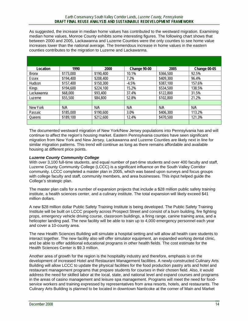
As suggested, the increase in median home values has contributed to the westward migration. Examining median home values, Monroe County exhibits some interesting figures. The following chart shows that between 2000 and 2005, Lackawanna and Luzerne Counties were the only counties to see home value increases lower than the national average. The tremendous increase in home values in the eastern counties contributes to the migration to Luzerne and Lackawanna.
County Median Home Value
Location 1990 2000 Change 90-00 2005 Change 00-05 Bronx $173,000 $190,400 10.1% $366,500 92.5%Essex $194,400 $208,400 7.2% $409,300 96.4%Hudson $157,400 $150,300 -4.5% $387,100 157.6%Kings $194,600 $224,100 15.2% $534,500 138.5%Lackawanna $68,000 $93,400 37.4% $122,800 31.5%Luzerne $55,500 $84,800 52.8% $102,800 21.2%Monroe $116,900 $125,200 7.1% $202,100 61.4% New York N/A N/A N/A N/A N/A Passaic $185,000 $190,600 3.0% $406,300 113.2%Queens $189,100 $212,600 12.4% $470,500 121.3%United States $78,500 $119,600 52.4% $185,200 54.8%
The documented westward migration of New York/New Jersey populations into Pennsylvania has and will continue to affect the region’s housing market. Eastern Pennsylvania counties have seen significant migration from New York and New Jersey. Lackawanna and Luzerne Counties are likely next in line for similar migration patterns. This trend will continue as long as there remains affordable and available housing at different price points.
Luzerne County Community College With over 3,100 full-time students, and equal number of part-time students and over 400 faculty and staff, Luzerne County Community College (LCCC) is a significant influence on the South Valley Corridor community. LCCC completed a master plan in 2005, which was based upon surveys and focus groups with college faculty and staff, community members, and area businesses. This input helped guide the College’s strategic plan.
The master plan calls for a number of expansion projects that include a $28 million public safety training institute, a health sciences center, and a culinary institute. The total expansion will likely exceed $41 million dollars.
A new $28 million dollar Public Safety Training Institute is being developed. The Public Safety Training Institute will be built on LCCC property across Prospect Street and consist of a burn building, fire fighting props, emergency vehicle driving course, classroom buildings, a firing range, canine training area, and a helicopter landing pad. The new facility will be able to train up to 4,000 emergency personnel each year and cover a 10-county area.
The new Health Sciences Building will simulate a hospital setting and will allow all health care students to interact together. The new facility also will offer simulator equipment, an expanded working dental clinic, and be able to offer additional educational programs in other health fields. The cost estimate for the Health Sciences Center is $9.3 million.
Another area of growth for the region is the hospitality industry and therefore, emphasis is on the development of increased Hotel and Restaurant Management facilities. A newly-constructed Culinary Arts Building will allow LCCC to update the physical facilities for the food production pastry arts and hotel and restaurant management programs that prepare students for courses in their chosen field. Also, it would address the need for skilled labor at the local, state, and national level and expand courses and programs in the areas of casino management and leisure spa management. Programs will meet the need for food-service workers and training expressed by representatives from area resorts, hotels, and restaurants. The Culinary Arts Building is planned to be located in downtown Nanticoke at the corner of Main and Market
December 2008 14

Earth Conservancy South Valley Corridor Lands, Luzerne County, Pennsylvania DRAFT FINAL REUSE ANALYSIS AND SUSTAINABLE REDEVELOPMENT FRAMEWORK
December 2008 15
6 Telephone interviews with greater Wilkes Barre realtors June-August 2008. 7 http://wilkesbarre.org/ed/, August 11, 2008 8 http://www.pennsnortheast.com/c_community_data/luzerne.shtm, August 12, 20089 Telephone interview with Robert Mericle, July 30, 2008, 2:00 pm. 10 http://www.pennsnortheast.com/c_community_data/luzerne.shtm, August 12, 200811 http://www.dot.state.pa.us/penndot/Districts/district4.nsf/MPO.htm?OpenForm, August 2008 12 The 2003-2025 Long Range Transportation Plan for the Lackawanna/Luzerne MPO, 2006 Update, Pennsylvania Department of Transportation.
Streets. A private developer, 406 North Washington Avenue, LLC, bought the property on July 8, 2008 from the City of Nanticoke for $250,000.
Tourism and Recreation The greater Wilkes-Barre area has a wide range of entertainment and recreational facilities. According to area real estate professionals6, the variety of cultural and recreational amenities in the region have attracted corporate and industrial businesses to the region. Currently the region is home to an AHL hockey team, a Triple A baseball team, an arena football team, and the nearby Pocono International raceway which hosts NASCAR, SCCA, and IMSA racing.
Active recreation is a changing market. The 17 golf courses7 in the immediate area and 42 courses8 in the region are struggling to attract members and book tee times.9 At the same time, Wyoming Valley Sports Dome, an indoor soccer, golf, softball, field hockey, flag football and skate park, just celebrasuccessful refinancing as a family-owned organization.
Mohegan Sun at Pocono Downs was Pennsylvania's first casino, located northeast of Wilkes-Barre. The casino began with 1,203 slot machines in a remodeled portion of the clubhouse at the Pocono Downs racetrack. On July 17, 2008, Project Sunrise, the $208 million Phase II gaming and entertainment complex opened. This 300,000 square-foot complex features 2,500 slot machines and electronic virtual table games, restaurants, a food court and night club. Total employment exceeds 1,600 people.
This new attraction is expected by many to be an economic benefit to the region. Between 2007 and 2008, Luzerne County experienced an increase of four hotels, some of which may be related to the tourism market. However, the casino’s role as an economic driver remains to be seen. Five other racetrack gaming properties are in some phase of development in Pennsylvania at this time. In addition, Mount Airy Casino Resort in the nearby Pocono Mountains opened in 2008. Nationally, gaming and slot revenues have been decreasing over the last few years.
Furthermore, the County experienced a major decrease in visitor spending between 2004 and 2005. A majority of this decrease was in transportation spending, including air, car, and other modes oftransportation.
Rail AccessWhen Conrail sold its lines to CSX, CSX chose to abandon the lines in Luzerne County. The County established the Luzerne County Rail Authority to operate feeder service to Class I railroads operated by Norfolk Southern and Canadian Pacific. 10
According to the 2006 update to the 2003-2025 Long Range Transportation Plan for the Lackawanna/ Luzerne MPO, the Luzerne Rail Corporation (LCRC) operates 56 miles of freight-only line and services atotal of 25 shippers.11 The Luzerne and Susquehanna Rail Line splits into four branches - the Westside Branch, the Hanover Industrial Park Branch, the Avoca Branch, and the Mountain Branch. LRCR purchased the line in 1996. Over the last several years, a number of economic development activities have advanced related to freight rail:12
� The Commonwealth of Pennsylvania awarded a $500,000 grant to the Redevelopment Authority of Luzerne County in April 2008 to help refurbish the Susquehanna River Bridge on the Luzerne & Susquehanna Railroad's West Pittston Branch. This improvement will support Diamond Manufacturing's expansion and allow the company to shift 100 million pounds of steel coil shipments from truck to rail.
ted its

Earth Conservancy South Valley Corridor Lands, Luzerne County, Pennsylvania DRAFT FINAL REUSE ANALYSIS AND SUSTAINABLE REDEVELOPMENT FRAMEWORK
December 2008 16
13 The 2003-2025 Long Range Transportation Plan for the Lackawanna/Luzerne MPO, 2006 Update, Pennsylvania Department of Transportation. 14 Kellly, Juliane; “Making Mixed-Use Work, CIRE Magazine, June 2000. 15 Garbarine, Rachelle, “Commercial Property/New Jersey; Turning a Factory Site into Mixed use Development,” The New York Times, December 26, 1999. 16 Hudgins, Matt, “Mixed-use Matures”, CIRE Magazine, June 2008. 17 Hardin, Jason, “Trend of mixed-use developments Grows,” News-Record, August 10, 2008. 18 Gopal, Prashant, “The Unraveling of the Suburban Fringe”, BusinessWeek, July 12, 2008. 19 Rahs, Michelle Cater, “Blended: Mixed-use projects a growing trend in the Triad,” The Business Journal of the Greater Triad Area, August 29, 2008
� Last year, the Redevelopment Authority of Luzerne County received $243,250 to rehabilitate the track and improve rail operations from Spring Brooks Bridge to Wilkes-Barre, which services a number of businesses in the Grimes Industrial Park.
� The LCRC is in the process of restoring the Suscon Branch in Pittston Township to service a new development by Mericle, one of the largest commercial developers in the area.
� The LCRC moved 2,125 cars in 2005 and has expended $4 million in rehabilitation, repairs, and new construction over the last four years.
� Approximately 4 acres of the Ashley Yards has been developed by Petro Gas and a second developer is seeking an additional 4 acres within the Yards for development.
A passenger-rail study has been completed and the line will be utilized from Market Street Square in downtown Wilkes-Barre to the interchange with CP rail at Hudson Yards for a distance of approximately 3.8 miles. The CP Rail will be used to connect to Scranton. 13
Rail is and continues to be a key driver in the region. There is a current proposal to restore high-speed passenger and freight rail lines connecting Luzerne County, Scranton, Monroe County, and New York City. Both Pennsylvania and New Jersey politicians are pressing federal transportation agencies to move the plans forward; completion is still at least six years away.
Urban Centers and Mixed-Use Development Over the past decade, mixed-use developments have been a growing trend in downtown redevelopment projects and land revitalization programs. Mixed use development programs can benefit developers by dispersing the intensity and risk of any single use. Mixed-use is often considered a less risky investment.14 At the same time, the mixed use approach helps municipalities diversify their tax base while improving quality of life in the community.15
More recently, a renewed interest in urban living, spurred by rising energy costs and an increasing awareness of the environment, has strengthened the interest in mixed-use development. There is a growing demand for mixed-use, higher densities and transit oriented lifestyles that enable people to work, shop and be entertained close to home.16 According to The Congress for New Urbanism, home sales in walkable mixed-use areas are faring better in the current downturn than houses in traditional suburban sprawl communities.17
According to Christopher Leinberger, a visiting fellow at the Brookings Institution who also runs the University of Michigan's graduate real estate program, there is pent-up demand across the country for walkable places. "We've got a structural change taking place in this country. Gas prices are just accelerating the trend," according to Leinberger.18
Mixed use is currently attractive to homeowners without children, generally young professionals and baby boomers. Demand could rise as households with children decrease. Some studies suggest that up to 80% of households nationwide will be childless in the next 20 years.19
Examples of recent mixed use and transit-oriented developments include the following:
New Town Design Standards, Washington Township, New Jersey� Establishes design standards for a 400-acre development. � All homes will be within walking distance of the commercial main street

Earth Conservancy South Valley Corridor Lands, Luzerne County, Pennsylvania DRAFT FINAL REUSE ANALYSIS AND SUSTAINABLE REDEVELOPMENT FRAMEWORK
� 300,000 square foot mixed-use commercial sector � Plan integrates the town with its surrounding greenbelt edge agrarian environment � The plan calls for a minimum of 1,000 housing units, though more could be built� The town will have a broad range of house types, including apartments, townhouses, duplexes,
and single-family detached homes, with a variety of sizes within each type. � The center will also be integrated into the region through a series of interconnected pedestrian
paths, greenbelts, and pedestrian- and bicycle-compatible roadways. � The town will have a network of connected streets within 1,500 feet of the commercial core.
Wesmont Station, Woodbridge, NJ � 140 acre development � a complete neighborhood with a transit station at its core � The station and the surrounding mixed-use district will be within walking distance of residents � 737 residential units:
- 217 single-family homes, - 135 rental apartments, - 131 condos, - 77 age-restricted condo units, - 166 townhouses, - 11 live-work spaces for artists and small entrepreneurs.
� 130,000 sf retail � a new train station � mixed-use town center
The Commons at Holmdel, Holmdel, New Jersey � Two office buildings, totaling approximately 80,000 square feet, � A 130 bed nursing home and an assisted living facility with 110 units. � 235,000-square-foot retail shopping center, � 155 single-family homes for residents who are 55 and over.
Highlands at Morristown Station, New Jersey� 219 Luxury Rental Apartments � 740 Car Parking Garage, � 8,000 sq. ft .Morristown Transit Village Retail � Connection to train station
REAL ESTATE MARKETNortheastern Pennsylvania is generally defined as the area of the state north of I-80 extending from Stroudsburg on the east to Williamsport on the west. The Wilkes-Barre/Scranton/Hazleton region is centrally located at the intersection of Interstates 80, 81 and 476. The real estate market in the region isdivided into three Multiple Listing Service (MLS) regions: Scranton, Wilkes-Barre and Hazleton. Scranton and Hazleton have been the most active development markets; however significant development has occurred around Wilkes-Barre as well.
Commercial / Industrial Real Estate The Scranton/Wilkes-Barre/Hazleton market has not only been recognized for its strong transportation links and active recreation, but also its affordable real estate and abundant workforce. The combination of these characteristics has attracted local, regional, national, and international firms to the market within the past 10 years. Over 30 million square feet of commercial and industrial space has been developed
December 2008 17

Earth Conservancy South Valley Corridor Lands, Luzerne County, Pennsylvania DRAFT FINAL REUSE ANALYSIS AND SUSTAINABLE REDEVELOPMENT FRAMEWORK
December 2008 18
Map Identifying Hazleton, Wilkes-Barre, and Scranton Markets
20 Telephone interview between Elaine Richardson and Robert Mericle, July 30, 2008.21 Telphone interview between Elaine Richardson and Carolyn Mertz, NAI Mertz, July 24, 2008. 22 Telephone interviews with area commercial realtors June – August, 2008. 23 Wilkes Barre TimesLeader, July 22, 2008. 24 “Tractor Supply CompanyOpens First Luzerne Country Store”, TimesLeader.com, August 3, 2008.
between Hazleton and Scranton in the past five years alone.20 Despite this significant amount ofdevelopment, there continues to be ample land and available product on the market.
A majority of the development in the past decade has been warehouse distribution. Selective office developments have also been completed. Along with warehouse distribution, large big box retail and super community shopping centers have also been developed throughout the corridor. Virtually all of this has been developed directly adjacent to I-81 near the Scranton, Wilkes-Barre and Hazleton hubs.21
According to local commercial realtors, the retail market in the region has been driven by the investment community.22 Development has occurred in anticipation of residential population growth rather than in response to existing demand. Some sectors have expanded too far ahead of the market. For example, Ruby Tuesday and Uno Pizzeria both closed within the past 30 days.23 At the same time, additional stores continue to open, most recently a Tractor Supply Company store in Hanover.24
Within the Wilkes-Barre MLS, Mericle Commercial Real Estate Services and the Greater Wilkes-Barre Chamber of Business and Industry are the two largest land holders of commercial and industrial properties. Additionally, Earth Conservancy is a large land owner, which prepares land for development and sells parcels to developers for construction and reuse.
Mericle develops and owns commercial, industrial, and office buildings. Generally the company builds onspec or for suit, retaining ownership and leasing the properties.

Earth Conservancy South Valley Corridor Lands, Luzerne County, Pennsylvania DRAFT FINAL REUSE ANALYSIS AND SUSTAINABLE REDEVELOPMENT FRAMEWORK
� In the spring of 2008, Mericle began construction of 400,000 square feet of commercial space in the greater Wilkes-Barre market.
� 83 buildings developed/constructed/renovated since 1989 � 12.5 million square feet developed/constructed/renovated � 10.5 million square feet currently owned and managed � 9.5 million square feet developed/constructed since January 1, 2000 � 120 tenants in Mericle portfolio
The Greater Wilkes-Barre Chamber of Business and Industry owns five industrial parks, including:
Hanover Industrial Estates is located in Hanover Township, less than one mile from Interstate 81 via State Route 29, a limited-access highway. The industrial park is zoned manufacturing and contains 962 acres. The park includes:
- 25 Total Acres Available - 5,727 Total Employees - 62 Total Companies
Hanover Crossings is located in Hanover Township, and includes 304 acres zoned manufacturing. The park includes:
- 109.1 Total Acres Available - 400 Total Employees - 1 Company (Caremark RX, a mail-order pharmaceutical company)
Hanover Crossings and Hanover Industrial Estates in Wilkes-Barre Region
Crestwood Industrial Park is located in Mountain Top, seven miles north of Interstate 80 along PA Route 309 and 4.5 miles from Interstate 81. This 1,050-acre park is home to food production facilities, distribution centers, plastics, and electronic companies. The park is zoned industrial and has rail service. The park includes:
Hanover Crossings
Hanover Industrial Estates
December 2008 19

Earth Conservancy South Valley Corridor Lands, Luzerne County, Pennsylvania DRAFT FINAL REUSE ANALYSIS AND SUSTAINABLE REDEVELOPMENT FRAMEWORK
- 242 Total Acres Available - 2,696 Total Employees - 25 Total Companies
Corporate Park at East Mountain in Plains Township, is a campus-like park with 225 acres. It is zoned highway commercial and promoted as office, research, and development. The park includes:
- 62 Total Acres Available - 2,764 Total Employees - 19 Total Companies
Corporate owners and tenants include:
- Penn State Geisinger Wyoming Valley Medical Center - U.S. Social Security Administration - PPL East Mountain Business Center- Cross Valley Federal Credit Union - Mericle Commercial Real Estate Services - State Farm Insurance - Merrill Lynch - Pennsylvania Governor's Northeast Regional Office - Citadel Communications - US Foodservice, Inc. - Borton-Lawson Engineering - Howell Benefit Services, Inc. - Productivity Point - The Luzerne Foundation
Highland Park Boulevard in Wilkes-Barre Township is a prime retail and business location. Located off Interstate 81, Highland Park is home to numerous commercial organizations including Bennigan's, a Wal-Mart Super Center, the Hilton Garden Inn, Cracker Barrel, Target, and the Lord and Taylor Distribution Center. The park includes:
- 52.58 Total Acres Available - 1,197 Total Full-Time Employees - 1,709 Total Part-Time Employees
December 2008 20
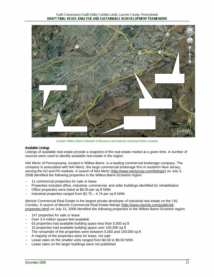
Earth Conservancy South Valley Corridor Lands, Luzerne County, Pennsylvania DRAFT FINAL REUSE ANALYSIS AND SUSTAINABLE REDEVELOPMENT FRAMEWORK
Greater Wilkes-Barre Chamber of Business and Industry Industrial Parks Location
Available Listings Listings of available real estate provide a snapshot of the real estate market at a given time. A number of sources were used to identify available real estate in the region.
NAI Mertz of Pennsylvania, located in Wilkes-Barre, is a leading commercial brokerage company. The company is associated with NAI Mertz, the large commercial brokerage firm in southern New Jersey, serving the NJ and PA markets. A search of NAI Mertz (http://www.mertzcorp.com/listings/) on July 3, 2008 identified the following properties in the Wilkes-Barre-Scranton region:
- 11 commercial properties for sale or lease - Properties included office, industrial, commercial, and older buildings identified for rehabilitation - Office properties were listed at $8.00 per sq ft NNN - Industrial properties ranged from $2.75 – 4.74 per sq ft NNN
Mericle Commercial Real Estate is the largest private developer of industrial real estate on the I-81 Corridor. A search of Mericle Commercial Real Estate listings (http://www.mericle.com/public/all-properties.html) on July 15, 2008 identified the following properties in the Wilkes-Barre-Scranton region:
- 147 properties for sale or lease - Over 3.4 million square feet available - 63 properties had available building space less than 5,000 sq ft - 10 properties had available building space over 100,000 sq ft - The remainder of the properties were between 5,000 and 100,000 sq ft - A majority of the properties were for lease, not sale - Lease rates on the smaller units ranged from $4.50 to $9.50 NNN - Lease rates on the larger buildings were not published
Hanover Industrial Estates
Corporate Park atEast Mountain
Hanover Crossings
Highland ParkRetail/Commercial
Crestwood industrial Park, 5 miles south of I-81
December 2008 21

Earth Conservancy South Valley Corridor Lands, Luzerne County, Pennsylvania DRAFT FINAL REUSE ANALYSIS AND SUSTAINABLE REDEVELOPMENT FRAMEWORK
December 2008 22
25 Wilkes-Barre/Scranton/Hazleton, Pennsylvania Market, NAI Mertz Corporation of Pennsylvania, July 2008. 26 Telephone interview between Elaine Richardson and Carolyn Mertz, July 24, 2008.
The Greater Wilkes-Barre Chamber of Business and Industry web site (http://wilkesbarre.org/ed/index.php?a=1) includes a listing of available properties. This listing includesproperties owned and managed by the organization and other entities. Some properties overlap parcelsfound on other web sites. A search on July 15, 2008 found the following properties:
- 200 commercial properties for sale or lease - 13 properties with rail access - Properties included office, industrial, and retail buildings
In addition to available commercial buildings, a number of vacant properties were listed for commercial and industrial development:
A search of NAI Mertz (http://www.mertzcorp.com/listings/) on July 3, 2008 identified the following properties :
- 3 vacant parcels for sale - Land was selling from $25,000 - $50,000 per acre
A search of Mericle Commercial Real Estate listings (http://www.mericle.com/public/all-properties.html) on July 15, 2008 identified the following land parcels in the Wilkes-Barre-Scranton region:
- 31 vacant parcels for sale - Properties in Wilkes-Barre and Mountain Top commanded the highest prices, averaging
$650,000 per acre - Land in outlying townships without utilities was listed for $2,500 to $14,000 per acre
The Greater Wilkes-Barre Chamber of Business and Industry web site (http://wilkesbarre.org/ed/index.php?a=1) includes a listing of available properties. This listing includes properties owned and managed by the organization and other entities. Some properties overlap parcels found on other web sites. A Search on July 15, 2008 found the following vacantparcels:
- 95 parcels for sale or lease- 33 parcels with rail access - Parcels ranged from 0.3 acres to 202 acres in size
Current Commercial Rates NAI Mertz Corporation publishes data on the Wilkes-Barre/Scranton/Hazleton commercial market.25 The following information was provided by Carolyn Mertz26:
Downtown Office Avg Rate/sf VacancyClass A (prime) $25 10% Class B (secondary) $15 18%
Suburban Office Avg Rate/sf VacancyClass A (prime) $19 15% Class B (secondary) $18 5%
Industrial Avg Rate/sf VacancyBulk Warehouse $4 10% Manufacturing $3.25 30%
Retail Avg Rate/sf VacancyDowntown $18 15% Neighborhood Service $15 15% Community Power Center $17 2% Regional Malls $26 2%

Earth Conservancy South Valley Corridor Lands, Luzerne County, Pennsylvania DRAFT FINAL REUSE ANALYSIS AND SUSTAINABLE REDEVELOPMENT FRAMEWORK
December 2008 23
27 http://lchousing.com/, Luzerne County Housing Symposium 28 Phone Interview between Elaine Richardson and Rhea Simms, August 12, 2008 29 County Housing Authority makes do, TimesLeader; Steve Mocarsky, July 14, 2008
Development Land Price RangeOffice in CBD $ 7 - $17/buildable sf Land in Office Parks $60,000 - $275,000 / acre Land in Industrial Parks $25,000 - $100,000 / acre Office / Industrial Land $20,000 - $180,000 / acre Residential $15,000 - $125,000 / acre
Residential Real Estate The residential market in the region has been changing over the past several years. According to the Luzerne County web site, significant new construction has occurred throughout the county. New construction has included planned residential developments, senior communities, groups of homes on one to three acre lots, and estate homes on properties as large as ten or twenty acres.
New construction and higher priced homes have been built in every community. Newer homes in excess of $300,000 have been built east of Nanticoke center and northeast of the Luzerne County Community College.
Higher priced homes exist around Nuangola Lake south of the subject area, as well as in the towns of Alden, Mountain Top, Bear Creek, Shaverton, and others. The Town of Mountain Top has homes ranging from $25,000 to $800,000. The highest priced homes are located south of the subject area on the southeastern side of I-81.
The new construction is attractive to the changing population while older homes are more difficult to sell. According to the 2006 Housing Symposium, the average selling price of a property in 2006 varied substantially by township and product. Homes in Mountain Top were averaging $223,177; Back Mountain, $210,000; while Wilkes-Barre averaged $58,000. The average time period a property was on the market in 2006 was 48 days in Mountain Top; 63 days in Back Mountain; and 77 days in Wilkes-Barre.27
According to local realtors, there is a demand for new single family homes in the range of $175,000 to 200,000. A majority of the new housing units in this price range have been townhouse style condominiums. Rising construction costs have driven housing developers into higher price units in excess of $285,000.28
There continues to be demand for affordable and subsidized housing for the elderly and lower income population. According to Dave Fagula, Executive Director of the Luzerne County Housing Authority, there is a huge demand for public and subsidized housing. There are over 440 people on a waiting list and the housing authority is no longer taking applications.29
Recent Residential Sales DataAccording to the 2007 JUSC Report, the Median Home Value in Luzerne County in 2006 was $102,800.
Housing Affordability Index Comparison County 2006 Median Household
Income2006 Median Home
Value Minimum Yearly Income
Required 2006 Housing
Affordability Index Cumberland $56,426 $163,000 $53,742 105.0 Lackawanna $28,915 $122,800 $45,708 85.1 Lehigh $48,469 $185,100 $58,159 83.3 Luzerne $39,687 $102,800 $41,711 95.1
Pennsylvania County Housing Affordability Index Comparison
Between July 2007 and June 2008, 2,063 houses sold in the region. This was a decrease over the same period the previous year when 2,362 houses sold. Between July 2006 and June 2007, 55.8% of the homes sold had a sale price greater than $100,000. Over 13% of the homes sold for more than $250,000.

Earth Conservancy South Valley Corridor Lands, Luzerne County, Pennsylvania DRAFT FINAL REUSE ANALYSIS AND SUSTAINABLE REDEVELOPMENT FRAMEWORK
December 2008 24
30 Residential statistics provided by Lewith & Freeman Realtors, August 2008. 31 The 2008 Lackawanna and Luzerne County Indicators Report, Joint Urban Studies Center, 2008
Between July 2007 and June 2008, 53% of the homes sold had a sale price greater than $100,000. Over 12% of the homes sold for more than $250,000. 30
Home sales in the Ashley/Nanticoke/Hanover (ANH) Township area between July 2007 and June 2008 accounted for 10.66% of the housing sales in the region. The average sale price was $73,148, averaging94.34% of list price. Homes averaged 71 days on the market. This area had the lowest average home sale price in the region, with the exception of the City of Wilkes-Barre. Mountain Top had the highest average homes sale price at $249,266. The City of Wilkes-Barre had the highest number of homes sold, representing 16.17% of the market.
Home sales in the Ashley/Nanticoke/Hanover Township area between July 2006 and June 2007 accounted for 9.95% of the housing sales in the region. The average sale price was $74,290, averaging 94.52% of list price. Homes averaged 76 days on the market. This area had the lowest average home sale price in the region, with the exception of the City of Wilkes-Barre. Mountain Top had the highest average homes sale price at $249,266. The City of Wilkes-Barre had the highest number of homes sold, representing 16.17% of the market.
Area % Market Avg. Sale Price Median Sale Price Avg. DOM 06-07 07-08 06-07 07-08 06-07 07-08 06-07 07-08
ANH 9.95 10.66 74,290 73,148 69,000 69,950 76 71 W-BC 16.17 18.53 66,864 63,602 58,696 49,500 96 98 MNTP 10.8 9.5 249,266 235,907 215,000 205,750 69 98 Region 100 100 142,440 134,860 124,294 117,320 79 90
Residential Product and Inventory The 2007 Joint Urban Studies Center migration study found that from 1990 to 2000 and from 2000 to 2005, Luzerne County posted below average percentage increases in total housing units.
Luzerne County Total Housing Unit Average Percentage Location 1990 2000 Change 90 to 00 2005 Change 00 to 05
Luzerne 138,724 144,686 4.3% 147,321 1.8%United States 102,263,678 115,904,641 13.3% 126,311,823 9.0%
According to the 2007 Indicators Report, Luzerne County had 130,034 occupied housing units in 2006.
From 2000 to 2006, 5,170 new homes were constructed in Luzerne County, accounting for 3.5% of the total housing units in the County. This percentage is significantly lower than Cumberland County (9.4%) and Lehigh County (7.5%) but higher than Lackawanna County (2.8%).
The 2007 Indicators Report included a number of important statistics: 31
- Total housing units increased between 2005 and 2006 from 146,911 to 147,321.- In 2006, Luzerne County had 130,034 occupied housing units. - The County’s 2006 vacancy rate of 11.7% was an increase over 2005’s rate of 10.6%. - While the number of occupied units decreased, the percentage of owner occupied units increased
from 69.9% to 72.9%.
The above statistics suggest that construction of new housing units within the last five years has replacedolder housing units, rather than adding substantially to the inventory. The market has seen an increase in home ownership, rather than rental. Older less desirable rental units likely account for the vacancy rates.
Home Values From 1990 to 2000, median home values in Luzerne County increased at a rate slightly higher than national median home values; however the actual median home value in Luzerne County was still well below national averages.

Earth Conservancy South Valley Corridor Lands, Luzerne County, Pennsylvania DRAFT FINAL REUSE ANALYSIS AND SUSTAINABLE REDEVELOPMENT FRAMEWORK
December 2008 25
32 The 2008 Lackawanna and Luzerne County Indicators Report, Joint Urban Studies Center, 2008 33 http://www.lewith-freeman.com/property_search.php?loc=propsrch
In 2000, Luzerne County’s median home value of $84,000 was well below the U.S. average of $119,600. From 2000 – 2005, Luzerne County’s median home value incurred a minimal increase of 21.2%significantly lower than the national average increase during the same time period.
Luzerne County Median Home value Location 1990 2000 Change 90 to 00 2005 Change 00 to 05
Luzerne $55,500 $84,800 52.8% $102,800 21.2%United States $78,500 $119,600 52.4% $102,800 54.8%Median Home Value Surrounding counties and markets have higher median home values. For 2005, Lackawanna recorded median home values of $122,800.32 The National Home Builders Association estimated the 2007 mediannew home price for the Scranton/Wilkes-Barre MSA is $242,217. The 2007 median new home price in the New York-Northern New Jersey-Long Island MSA is $471,222 – $225,000 more than the Scranton/Wilkes-Barre MSA.
The median sale price in the Wilkes-Barre MLS region for the past two years was above the reported 2006 median home value for Luzerne County. Like much of the United States, housing prices decreased between 2007 and 2008.
Available Residential PropertiesThe residential market in Luzerne County is divided into two Multiple Listing Service areas: the Wilkes-Barre MLS and Hazleton MLS. A search of the Wilkes-Barre MLS on July 17, 2008 provides a snapshot of the residential real estate market in the area.33
498 single family properties were identified for sale in the Wilkes-Barre MLS. A significant majority of these homes were between 1,000 and 1,500 square feet. Very few homes in excess of 3,000 sf were listed.
< 1000 sf = 30 properties 1000 – 1500 = 152 properties1500 – 2000 = 102 properties2000 – 2500 = 64 properties 2500 – 3000 = 31 properties 3000 – 3500 = 15 properties 3500 – 4000 = 14 properties 4000 – 5000 = 8 properties 5000 – 6000 = 9 properties 6000 + = 1 property
The asking price of single family homes ranged from $25,000 for a 1,000 sq ft two bedroom older home inGlen Lyon to $750,000 for a 5,600 sq ft four bedroom home on five acres in Mountain Top.
There are 128 residential properties available in the Nanticoke-Ashley-Hanover MLS sub-district. The asking price of single family homes ranged from $5,000 for a 910 sq ft trailer style 3 bedroom older home to $350,000 for a 3,560 sq ft four bedroom home on 0.5 acres of land.
- A number of newly constructed homes and development lots are available in the Lynnwood section north of the Wyoming Valley Country Club.
- The newly constructed homes are priced around $250,000 - Six (6) condos/duplexes were included in this listing. They ranged from $118,000 - $236,000 and
appeared to be relatively new construction.
There are 42 residential properties available in Nanticoke. The asking price of single family homes ranged from $25,000 for a 1,400 sq ft two bedroom older home to $350,000 for a 3,560 sq ft four bedroom home on 0.5 acres of land.
- 2 homes were listed above $300,000 (Lawrence Street and Meade Street).

Earth Conservancy South Valley Corridor Lands, Luzerne County, Pennsylvania DRAFT FINAL REUSE ANALYSIS AND SUSTAINABLE REDEVELOPMENT FRAMEWORK
December 2008 26
34 U.S. Census Bureau, Profile of Housing Characteristics, Nanticoke city, Pennsylvania, 2000 35 The 2008 Lackawanna and Luzerne County Indicators Report, Joint Urban Studies Center, 2008 36 Phone Interview between Elaine Richardson and Rhea Simms, August 12, 2008 37 http://www.forrent.com/apartment-community-profile/1000000295.php, August 12, 2008
- 8 homes were listed between $120,000 and $175,000.- The remainder (32) was below $120,000.
The residential market has declined slightly over the last year. While prices have not declined significantly, homes are taking longer to sell.
Residential Rental PropertiesThe residential market in the greater Wilkes-Barre area, and specifically in Nanticoke, includes a large rental market. According to the 2000 Census, 54% of the housing in Nanticoke is single unit detachedhomes. According to the same census, over 61% of the housing stock was built prior to 1940.34
According to the 2007 Indicators Report, the total number of occupied housing units decreased between 2005 and 2006. At the same time, the owner occupancy rate increased from 60.0% to 72.9%. This suggests that the increase in vacancies is attributable to new construction combined with an increase in home ownership. 35 Additionally, the report states that 27.1% of the housing units in Luzerne County were renter occupied in 2006. This was a decrease from 30.1% in 2005. The median monthly rent in LuzerneCounty was $546 in 2006. This represents the lower median rental rate of the four counties analyzed in the Indicators Report.
According to local realtors, there is a demand for newer garden style apartment complexes.36 This is likely due to the migration from New York and New Jersey where such complexes are common. Green Acres in Kingston is an example of a garden style apartment. Units in this complex are currently advertised 37
Green Acres Unit Rental Prices (Kingston) Name Price
1 Bedroom Studio $720 One Bedroom $740 - 775 Two Bedroom One Bath $820-$875 Two Bedroom Two Bath $935-$990 Three Bedroom Two Bath $1,100-$1,125 Townhome (3 Bedroom 2.5 Bath) $1,250
SUMMARY OF MARKET TRENDS AND OPPORTUNITIESThe above data, information and analysis have identified a number of trends that present opportunities for the redevelopment of the South Valley Corridor lands and other mine-scarred lands.
- The greater Wilkes Barre market is a dynamic growing real estate market that is likely to continue. While the current economic downturn may slow growth, the positive trends are likely to continue. National and international organizations continue to be attracted to the region for its quality of life, affordable real estate and abundant workforce.
- There is a demand for housing of every type to meet the growing population, rising household income levels, and migration from eastern counties and states.
- As companies continue to expand and locate in the region, demand for housing will continue to be a major issue. If passenger rail is extended from New York to Scranton, the residential population will grow even faster.
- A large portion of the existing residential properties is pre-1940, while the market is demanding more modern homes in both the rental and owner-occupied markets.
- A majority of the new residential construction in recent years has been larger homes in excess of $300,000. There are relatively few large tracts of land near urban cores resulting in the need for significant infrastructure for new developments. This issue, combined with rapidly rising constructioncosts, has made smaller midrange homes unattractive to residential developers.
as follows:

Earth Conservancy South Valley Corridor Lands, Luzerne County, Pennsylvania DRAFT FINAL REUSE ANALYSIS AND SUSTAINABLE REDEVELOPMENT FRAMEWORK
- Creation of new and expanded village centers and the upgrade of urban cores can help meet the demand for modern low to midrange housing. This may require public investment in infrastructure in some locations to ensure housing costs remain within market demand.
- Distribution, commercial, and large retail development will likely continue along the interstate corridor. At the same time, growing village centers will demand convenience retail and professional office products to serve the local populations.
RECOMMENDED MARKET APPROACHThe location and size of the South Valley Corridor lands suggests the need for a mixed-use development project that incorporates components of residential, convenience retail, and service segments. A mixed-use development would diversify the development risk, meet the demand for a variety of housing stock, and build upon the existing fabric of the South Valley while connecting neighborhoods through pedestrian and transportation routes.
A mixed-use development requires a developer to strategize the proper placement, timing, and mix of market segments. Mixed-use developments are characterized by three or more significant revenue-producing uses, significant physical and functional integration, and development in conformance with a coherent plan. A mixed-use development of housing, retail, and office would help meet the current and future needs of the market.
December 2008 27

Earth Conservancy South Valley Corridor Lands, Luzerne County, Pennsylvania DRAFT FINAL REUSE ANALYSIS AND SUSTAINABLE REDEVELOPMENT FRAMEWORK
SECTION 6. LAND USE ANALYSIS AND FINDINGS The intention of this study is to provide a general analysis of factors that will impact redevelopment in the larger geographic area and provide a framework for the potential development of EC’s land. A systemicoverview helps to inform more defined goals and design guidelines for various areas of the Land Use pattern. Each location within an overall plan plays a specific role in the future vision of the Valley; however, larger systems of man-made and natural infrastructure need to be identified and evaluated asthey impact specific areas of the EC lands.
CIRCULATION AND TRANSIT NETWORKS
Wyoming Valley and Earth Conservancy Lands with Proposed Transportation Networks
Regional Road Network The main highways that service the Wilkes-Barre area are:
Interstate 81 – north to Binghamton, New York and Ontario and south to Harrisburg, Pennsylvania and Tennessee; Interstate 84 – east to Milford and New England; Interstate 380 – south to Mount Pocono and Interstate 80 – east to New York City; Interstate 476/Pennsylvania Turnpike Northeast Extension – south to Allentown and Philadelphia; U.S. Route 6 – east to Carbondale and parallel to I-84 to New England and west to Erie; and U.S. Route 11 – parallel to I-81.
Distance to major metropolitan areas: New York 2.5 hours Philadelphia 2.0 hours Boston 5.5 hours Washington, DC 4.0 hours Chicago 11.0 hours Montreal 7.0 hours
December 2008 28

Earth Conservancy South Valley Corridor Lands, Luzerne County, Pennsylvania DRAFT FINAL REUSE ANALYSIS AND SUSTAINABLE REDEVELOPMENT FRAMEWORK
Analysis: Northeast Pennsylvania is the central location for international distribution servicing retail markets in New England, New York, Washington DC, and Chicago. One third of the U.S. population is within 500 miles of the area. This has made the region a viable growth area for these industries as well as provided access to major metropolitan centers.
Inter Valley Road Network Access from Interstate 81 is serviced by Route 29 which runs across the Valley and connects to Route 11 on the northern side of the Susquehanna River. Major inter-valley connections to Wilkes-Barre/Scranton parallel the major ridge lines and the river. Those roads, moving north to south across the study area, include the Sans Souci Parkway to the northeast, Middle Road/South Main Street which runs central to the Valley, and Hanover/Main Street which is the southernmost road and directly feeds off the Interstate.
Major town streets that connect across the Valley include Ashley Street adjacent to the Wyoming Valley Country Club, Dundee Road and Kosciuszko Street east of the Community College, and Prospect Street running through the center of Nanticoke.
Analysis and Recommendations: There is limited access to properties on the south western end of the Valley. Hanover and Middle Road were once street car roads and a number of residences, built close to the street prevented any consideration of widening exiting roads. Access to valley-wide attractions like the community college or any major new commercial development is limited by these conditions.
The proposal for the South Valley Parkway is intended to facilitate access to the southwest areas of the Valley. Discussions should take place on the role and probability of the project as the project will greatly influence future development. In our assessment, the road, with limited scale, could provide a viable alternative to the limited roads that already exist. Furthermore, making a more direct access to Route 81 might also limit the necessity of a major physical barrier like Route 29 which currently divides the natural connections through the Valley.
In addition, it is advisable to improve cross-valley connections by adding local streets that might offer easier access to the Sans Souci Parkway and enable greater accessibility and alternative routes to the South Valley Corridor development parcels.
Local RoadsAnalysis and Recommendations: In keeping with smart growth principles, a number of recommendations are made for the construction of new streets within the development. Those might include integrated landscape swales to mediate ground water run-off, designated bike lanes on key streets, and “green streets’ or permeable surfaces in new developments.
Parking Parking in townships is generally parallel parking on key urban streets with surface parking lots servicing commercial and industrial properties. There is little structured parking in the region although a proposal exists for a large parking garage to support the Nanticoke Center at Prospect and Sans Souci Parkway.
Analysis and Recommendations: In keeping with smart growth principles, a number of recommendations are made for the construction of new streets within the development. These might include recommendations for permeable parking surfaces, locations of swales and rain gardens to alleviate taxing the existing and new sewer systems in order to improve water quality in the regional Blue Network.
Rail Historically the Valley was well serviced for freight line transport with internal rail servicing the mines. Most of the rail lines are no longer serviceable; however, the main trunk line that follows the Susquehanna River could conceivably be used as a commuter line. Costs associated with this type of undertaking are beyond the scope of this study.
December 2008 29

Earth Conservancy South Valley Corridor Lands, Luzerne County, Pennsylvania DRAFT FINAL REUSE ANALYSIS AND SUSTAINABLE REDEVELOPMENT FRAMEWORK
Discussions have taken place to consider extending commuter train service from New York in to the northern Valley in Scranton. The Valley currently lacks an integrated vision from Scranton to Newport. Currently the north Valley is connected by the County of Lackawanna Transit System (COLT) but no commuter lines run to the southern Valley.
Analysis and Recommendations: In keeping with smart growth principles, a number of recommendations are made for the construction of new streets within the development. It is recommended that the Valley framework preserve opportunitiesfor future rail connections. Logical stops along the Susquehanna River include areas on the northern end of Nanticoke and the center of Wilkes-Barre. Additions to servicing freight spurs in the central and northern areas of the South Valley Corridor would make these areas more valuable for commercial real estate.
Trolley and Bus Lines The Wyoming Valley was once serviced by an extensive trolley network that enabled mine workers to move easily throughout the Valley. Middle Road and Hanover Streets most likely were designed for trolley service, connecting to the civic center of Wilkes-Barre. This would account for the narrow dimensions of the streets and the narrow setback of buildings to the street.
Buses from the Wilkes-Barre area are available and are available to connect to larger metropolitan areas. The Luzerne County Transportation Authority runs service between Glen Lyon and Wilkes-Barre with stops at Nanticoke town green and at the intersection of the Sans Souci parkway and Willow Street.
December 2008 30

Earth Conservancy South Valley Corridor Lands, Luzerne County, Pennsylvania DRAFT FINAL REUSE ANALYSIS AND SUSTAINABLE REDEVELOPMENT FRAMEWORK
Luzerne County Transportation Authority Bus Schedule
Analysis and Recommendations: In keeping with smart growth principles, it is suggested that a Valley wide system linking the various Urban and Village Centers would minimize the carbon footprint for the region and also improve access for a large portion of the population that may have limited ability to move throughout the Valley region. In addition an intelligent mass transit system enhances capacity for growth in the area. Although a more extensive study would be outside the scope of this report, some recommendations are included in the plan. Additional stops along current service lines are effective and require little cost.
GREEN NETWORK
Wyoming Valley and Earth Conservancy property – Greenways and Trail Networks
December 2008 31

Earth Conservancy South Valley Corridor Lands, Luzerne County, Pennsylvania DRAFT FINAL REUSE ANALYSIS AND SUSTAINABLE REDEVELOPMENT FRAMEWORK
The area has an extensive green network consisting of wilderness, parklands, river, creeks and streams, and a number of reservoirs. The major portion of the Earth Conservancy’s 16,300 acres is designated aspart of this larger Valley system. A number of studies precede and inform this report, notably the Lower Wyoming Valley Open Space Master Plan completed in April 1999; the Nanticoke Creek Watershedreport completed by the US Army Corps of Engineers Baltimore District in March 2005; and studies done by members of Wilkes University. These studies inform the general framework of this plan and merit further discussion among the parties toward further study and implementation of aspirations of these reports.
Trail Network There is a vast amount of formal and informal trails throughout the wild areas of the south Valley, many of which are connected along the Susquehanna River and to the southeast along the Lehigh Gorge Trail System. Though extensive in respective regions, as a network, the south valley trails are often disconnected from Village and Urban Centers. Because they were conceived as spaces for recreation, access to the trailheads is limited and often requires driving.
� Susquehanna River Trails � South Ridge Trails� River and Creek Trails� Smaller Trail Networks � Recreational Trails (designated ATV areas, etc.) � Trails Crossings
Analysis and Recommendations: These trail systems could be enhanced so as to knit into Urban Centers of the Valley while adding both ecological performance and real estate value to the Valley. By connecting urban spaces to water courses and the network of green space, the trail network will link outdoor activities. In addition, this network may also act as a shortcut through natural obstacles encouraging biking and pedestrian transportation, which would reduce the carbon footprint of the master plan and alleviate potential for future traffic.
BLUE NETWORKThe area has an extensive Blue Network (system of waterways) that feeds the Susquehanna River. Localsources include a series of reservoirs at the south ridge of the Wilkes-Barre Mountain formation that feed smaller streams and brooks that eventually empty to the Susquehanna River. These include the Witinskis Pond feeding Nanticoke Creek at Warrior Run; the Hanover Reservoir which also runs toward Nanticoke Creek but is currently impeded by the former mines; the Espy Run running south and east of Luzerne County Community College; and Fairchild Pond feeding Forge Creek to the south west of Nanticoke center.
Analysis and Recommendations: A more extensive analysis of the Blue Network is included in the Ecology section of this report. In terms of movement through the Blue Network, the brooks and stream beds are logical areas for extending and enhancing the trail network through the Valley. It is critical that any new development be integrated and respectful of these ecosystems.
Trail courses may follow corridors set aside for riparian setbacks making functional use of these conservation spaces and linking high and low points in the valley. Ecological standards recommend minimal setbacks of 100 feet from these wetland areas. This report recommends larger setbacks of up to 500 feet (see Ecology section of this report.) Like the other trail networks, these wetland areas and blue corridors will both alleviate run-off issues associated with development and be economic enhancements to properties adjacent to these areas.
December 2008 32

Earth Conservancy South Valley Corridor Lands, Luzerne County, Pennsylvania DRAFT FINAL REUSE ANALYSIS AND SUSTAINABLE REDEVELOPMENT FRAMEWORK
Wyoming Valley and Earth Conservancy property – Blue Network
Ecology The Wyoming Valley consists of numerous ridges running northeast to southwest – the sources for surface anthracite mining which supported growth in the Valley between the early 19th and early 20th
centuries. After decades of mining, those areas have become a blight on the landscape and detrimental to the overall ecology of the Valley. The EC project aims to develop and improve more than 16,000 acres,including more than 3,000 acres of major reclamation which will improve the ecological performance of the region. It is critical that any new development respect the goals of restoration as outlined in the Earth Conservancy reports and in studies conducted by other concerned groups who seek and support the revitalization of the Valley.
Sustainable development is concerned with both economic and ecological vitality, which often are mutually exclusive goals. It is the objective of this plan to consider how development and ecological restoration might support and enhance each other through consideration of funding, phasing, and interaction.
While the 1999 Plan acknowledges concerns for site ecology, it does not sufficiently capitalize on restoration projects for both habitat restoration and ecosystem services to people.
Issues that should be considered in this plan might include:
Water Recommendations:
� Complete stream restoration activities recommended by the Army Corps of Engineers in the 2005 restoration document including: Maelstrom Oxidizer Systems, expanded wetlands, rechannelization, flow restoration, stream-bed lining, and riparian buffers.
� Expand Army Corps recommended 200 feet fixed buffer to a variable 500 foot buffer with the last 300 feet reserved for low impact development. This would expand the potential for these waterways to act as habitat corridors and recreational space and increase the value of low impact properties.
� Before initiating water remediation projects, ideally they may incorporate design modifications and be coupled with long term scientific studies evaluating the effectiveness of the restoration activities. This coordination of activities is likely to lead to increased knowledge in restoration
December 2008 33
Earth Conservancy South Valley Corridor Lands, Luzerne County, Pennsylvania DRAFT FINAL REUSE ANALYSIS AND SUSTAINABLE REDEVELOPMENT FRAMEWORK
science, closer monitoring of the project, and recommendations for improving future restoration activities.
� Include onsite water retention in all new developments coupled with the isolation of contaminated throughflow for specialized treatment.
Land Remediation � Development in brownfields and restoration work of existing structures should nearly always be
prioritized over greenfield development. � Limitations on development of steep slope areas. � Land remediation effort would benefit by being coupled with long-term impact studies. Currently,
published guidelines for mine remediation have insufficient support studies to determine project effectiveness. Ecological effectiveness monitoring studies should be incorporated into the planning of the remediation.
� Current best practices for restoration activities may limit resettlement of native species. Reseeding after mine restoration should prioritize native species and encourage the dispersal of early secessional woodlands.
� Designation of substantial buffers for wetlands and streams. � Analysis of current covenants for Industrial Estates lack ecological consideration.
Habitat Protection, Restoration, and Connectivity� Intact and high quality habitat should remain intact. � Developments should in general be planned to minimize habitat fragmentation and increase
connectivity. � Restoration and development activities should be planned with ecosystem structure and function
in mind. Patches should be considered relative to the needs of the ecosystem patch mosaic whenstrategizing restoration activities.
� Connections to state reserves, parks, and greenways should be strengthened where appropriate.
Biophilic Design and Ecosystem Services � Associating ecosystem restoration activities in the South Valley with development not only
improves the quality of habitat for species, it also improves the quality of life for residents. Periurban sites like Nanticoke and Newport Townships mitigate the transition from urban to rural ecologies. These sites have tremendous potential to foster mutually beneficial relationships between nature and development.
ENERGYAn energy plan for the Valley is integral to any future planning. The issues associated with energy use are both a national and regional issue of substantial importance. As outlined in the general principles of this plan, energy evaluation is a concern for both identifying resources and for establishing quantifiable design goals for the region. The Land Use section of this report will address the physical attributes that would reduce carbon-dependent development. This section outlines resources and studies that might inform the larger Valley infrastructural framework.
Coal It is estimated that only the Newport area mines contain enough concentrated, readily available coal to make it worth reopening. Currently there are no plans to actively reopen mining areas on Earth Conservancy lands. However, there are several benefits to reopening mining including reintroducing jobsto the region, as well as sharing remediation responsibility with future coal companies. As this area is mostly full of clean burning anthracite coal, reopening mining operations in this area may become increasingly attractive.
December 2008 34

Earth Conservancy South Valley Corridor Lands, Luzerne County, Pennsylvania DRAFT FINAL REUSE ANALYSIS AND SUSTAINABLE REDEVELOPMENT FRAMEWORK
Natural GasIn addition to coal, the discovery this year of high concentrations of extractable natural gas in the Marcellus Shale has generated some speculation about properties included in the study area. Some gas companies have already purchased mineral rights on property 20 miles to the north.
Alternative Energy Alternative energy is being explored in the form of a 20-30 acre solar installation proposal in Newport Township; a wind farm on Bald Mountain in Bear Creek; and a proposal for a wind farm on Penobscot Mountain. Consideration of energy sourcing is important when designing strategic plans for a region. Building integrated strategies and strategies that consider the opportunities available in the landscape are important to include in planning documents. The U.S. Department of Energy (DOE) suggests that wind, flat panel solar, biomass, and some small scale hydro are viable options in this area. There are a large number of subsidies, financing opportunities, and support groups available to alternative energy projects. This region should expect to see a number of diverse alternative energy projects come online in the coming decades.
Wind Wind is a cost effective, efficient renewable energy that has received considerable attention in the region. The ridges of the east valley have exposures and windspeeds appropriate to windpower generation. The existing Bear Creek wind farm has 12 turbines at 24mW capacity—enough power for nearly 6,000 homes. Proposals for other wind farms on the east ridge are being considered. Wind power on the ridges has the unfortunate consequence of disturbing a landscape that has been set aside as greenspace.
DOE NREL Pennsylvania Wind Resource Map
December 2008 35

Earth Conservancy South Valley Corridor Lands, Luzerne County, Pennsylvania DRAFT FINAL REUSE ANALYSIS AND SUSTAINABLE REDEVELOPMENT FRAMEWORK
Solar In this region of the state, flat panel solar photovoltaic (PV) is a viable resource option and is anincreasingly viable financially for companies due to increased subsidies and improving performance and production efficiencies. Solar has the potential to supplement the grid during peak daytime hours. Earth Conservancy has been approached by developers to develop a 20-30 acre solar farm on EC land in Newport Township, but currently the deployment of solar is limited despite large incentives offered by the state. A number of financing alternatives are available that reduce the costs associated with solar to the tipping point of economical investment for commercial enterprises. Several renewable energy providers (CitizenRE or Helio) will lease roof space in exchange for competitive, fixed-cost solar power delivered on contract with the provider. The use of existing building structures is an efficient and economical optionsfor installing renewable energy capacity.
Many solar energy systems beyond PV exist on the market including thin cell and solar thermal. The deliverability and efficiency of these systems deserves closer examination.
Solar Resource Potential for Collectors
Micro-hydroMicro-hydro and small-scale hydro electric projects are a viable option in this area according to the Idaho National Hydroelectric prospector, but, despite plentiful streams and rivers and the historic presence of hydropower, few operational local examples exist. Small-scale hydro and micro-hydro electric are good supplemental energy sources to solar PV because flow rates are generally highest during the winter when solar PV capacity is diminished.
Biomass Biomass energy currently has a limited market in the area, though BHS Energy LLC, a local family run business is developing a mobile switchgrass pelletizer that may change the market for biomass energy. DOE identifies biomass as having high potential for expansion in Pennsylvania. EC lands offer opportunity for biomass development both as planted land for biofuels like switch grass in the meadows left from surface mine restoration and as sites for the location, management, and processing of biofuels. Of the Earth Conservancy property, 951 acres has been identified as Prime Soils.
Energy Efficiency There are a number of preexisting conditions that lend themselves to efficient urban operation. One is the compactness of development. Compact development not only allows for transportation efficiency, but also suggests that efficient centralized services such as steam heating or hot and chilled water may be viable options. Additionally, the proximity to available energy sources means losses are reduced in transmission and distribution. Wherever possible, locally produced fuel sources should be used and the number of state conversions minimized.
December 2008 36

Earth Conservancy South Valley Corridor Lands, Luzerne County, Pennsylvania DRAFT FINAL REUSE ANALYSIS AND SUSTAINABLE REDEVELOPMENT FRAMEWORK
SECTION 7. PROPOSED REDEVELOPMENT COMPONENTS Market analysis results indicate that the area has recently grown in population and has many local assets on which to build. The proximity of natural resources, numerous colleges, and a robust transportation network provide a solid framework on which mixed-use development has the potential to thrive. Based on the market and land use analysis results, regional development trends, historic trends of the region and to capitalize on existing transportation corridors, town networks, as well as smart growth features that promote linking development with multi-modal transportation options, several reuse concepts were prepared for EC’s target development area. The reuse concepts rely on two primary development components: Village Centers and a Thinkbelt.
EC land, in combination with adjacent properties, provides the opportunity to develop as many as five Village Centers, with a development density similar to that of Nanticoke. Complementing the compact Village Centers, the reuse concepts propose the development of a Thinkbelt. The Thinkbelt will operate as a regional connector and an area in which green redevelopment concepts – such as integrating emerging stormwater practices, renewable energy development, and greenspace – and economic development strategies emerging from local universities can be focused. Central to the proposed reuse concepts is Luzerne County Community College, which can serve as a physical connection between Nanticoke, the Thinkbelt, and the Village Centers developed across EC’s lands (see the image of the Ridge Road Scenario as an example).
VILLAGE CENTERSNew development will occur at the Village Center and Hamlet scale of development, while Urban Core development would operate in a larger Valley framework, representing criteria for the redevelopment of areas like downtown Wilkes-Barre. Denser core planning has distinct design and lifestyle advantage overstandard suburban sprawl densities and land use patterns. The dense core is a “both/and” solution, providing the best aspect of in-town living with easy access to regional green and blue network systems. In addition, there is a measure of built-in social equity to this land use pattern allowing for access to public and commercial services for residents who have limited mobility; specifically elderly and younger residents in the community.
In addition, denser planning cores allow for strategic land banking for future growth, easing costs associated with extended town utilities. In particular, consideration should be given to the specific political constraints on development in the Valley in order to match development areas to local school districts, community facilities like police and fire, as well as sewer, electrical, and other utilities.
Existing areas like Nanticoke center are likely within the target core densities proposed in this report. The historic community developments were laid out prior to automobile use; therefore conforming to contemporary standards for Sustainable Growth.
December 2008 37

Earth Conservancy South Valley Corridor Lands, Luzerne County, Pennsylvania DRAFT FINAL REUSE ANALYSIS AND SUSTAINABLE REDEVELOPMENT FRAMEWORK
Depiction of Potential Village Centers in the Study Area
Residential Areas As discussed previously (Smart Growth Principles), residential areas should be planned as TOD centers and can operate at any number of scales. The factors which define TOD centers, including the centrally located downtown train or bus station, mixed use zoning, will help encourage a live, work, and play environment. The Hamlet, Village Center, and Urban Core density levels (outlined in the Smart Growth Principles Section of this report) will be used for the following design concepts.
New development should occur at the Village Center and Hamlet scale of development, while Urban Coredevelopment would operate in a larger Valley framework, representing criteria for the redevelopment of areas like downtown Wilkes-Barre. Denser core planning has distinct design and lifestyle advantage overstandard suburban sprawl densities and land use patterns. The dense core is a “both/and” solution, providing the best aspect of in-town living with easy access to regional green and blue network systems. In addition, there is a measure of built-in social equity to this land use pattern allowing for access to public and commercial services for residents who have limited mobility; specifically elderly and younger residents in the community. The following photos depict different housing styles which should be considered for Village Center development.
Example of Courtyard Housing.
December 2008 38

Earth Conservancy South Valley Corridor Lands, Luzerne County, Pennsylvania DRAFT FINAL REUSE ANALYSIS AND SUSTAINABLE REDEVELOPMENT FRAMEWORK
Example of sustainable design housing – Bedzed.
Example of Townhouse design style.
In addition, denser planning cores allow for strategic land banking for future growth, easing costs associated with extended town utilities. In particular, consideration should be given to the specific political constraints on development in the Valley in order to match development areas to local school districts, community facilities like police and fire, as well as sewer, electrical, and other utilities.
Existing areas like Nanticoke center are likely within the target core densities proposed in this report. The historic “patch town” developments were laid out prior to automobile use; therefore conforming to contemporary standards for Sustainable Growth. Nanticoke center is approximately one mile square or 640 acres with a census survey from 2006 listing 10,341 residents and 5,502 dwelling units. Land area is3.51 square miles or 2,246 acres. Density for the town is 1,569 houses/condos per square mile or 2.45 dwelling units/acre. Though there is insufficient data to give exact determinations of local density at the time of this report, estimating that 80% of the dwelling units are in the core area would yield densities on the order of 6.88 dwelling units/acre corresponding to a modest Village Center core (CT5).
The areas of new development should consider adding and enhancing to these existing fabrics and infrastructures. This would supplement the need for added population and commensurate town servicesassociated with dense town cores, but also will help control further isolation of the historic districts.
The plan recognizes the need for updating existing facilities and residential neighborhoods. It is suggested that further study is required to target small-scale projects which might be achieved in the short and long term to stabilize, upgrade, and improve the quality of life for existing homeowners and residents of these neighborhoods.
December 2008 39

Earth Conservancy South Valley Corridor Lands, Luzerne County, Pennsylvania DRAFT FINAL REUSE ANALYSIS AND SUSTAINABLE REDEVELOPMENT FRAMEWORK
Target projects that are in development or should be considered as part of the framework include:
� Enhancement and development of properties surrounding Nanticoke Town Green (including support for the Luzerne County Community College Culinary Arts facilities)
� Sidewalk and street scale improvement on main town corridors like Prospect Street� Investigation of sources for storefront improvement � Pilot projects for ‘greening’ existing homes � Solar initiatives � Park improvements � Low Impact Development solutions for ground water treatment � Enhance street lighting in public areas � Designated bike lanes � Signage for historic structures � Rehabilitation or redevelopment on the site of the bowling alley
Utilities and Services Consideration should be taken for costs associated with site improvements and utility services. The 1999 Plan states that the center valley area of the plan is the easiest area to run sewer lines. This includesparcels adjoining State Route 29 in Hanover Township, parcels near Nanticoke, and Lower Asham south of Warrior Run borough. The more difficult areas for sewer service are Sugar Notch, Warrior Run, areas of Hanover Township, Newport Township. Upon additional development, new sewer lines should beseparated due to possible strains on older existing systems and limited capacity. Low Impact Development (LID) solutions like bioswales or rain gardens, are cost effective solutions that may be integrated into the plan.
Costs There is a relatively high cost of construction for much of Earth Conservancy lands due to the cost of remediation and the difficult topography. Market analysis indicates that there is a shortage of new, moderately priced homes in the area.
Commercial Areas The greater valley area is serviced by a number of commercial and retail centers. The Market Analysis outlines the development and role of these commercial projects in the area. Larger commercial centers are located in Wilkes-Barre, while existing areas in the plan consist of smaller retail strips on the Sans Souci Parkway and smaller retail in northern Nanticoke around the Nanticoke town green and scattered throughout the valley along the major valley corridors. In addition, there are numerous bars andrestaurants in town servicing the local population.
As stipulated in the Residential Area section, the framework recommends mixing commercial Village Centers into the residential fabric. There are a number of large auto-dependent shopping areas in the Valley. Considering the limited access to this area of the Valley, it is not strategic to target development for large scale regional retail in the framework plan; however, large tracts of land might be strategically located near major road access in order to leave areas for future growth in the framework.
Since the 1999 Plan was issued, the Arena and Convention Center was constructed. The 1999 Plan calls for retail spaces between 30,000 – 70,000 square feet, and a regional shopping center of 250,000 – 500,000 square feet on 200 acres of land. Current trends indicate that there is not a market for the larger project.
December 2008 40

Earth Conservancy South Valley Corridor Lands, Luzerne County, Pennsylvania DRAFT FINAL REUSE ANALYSIS AND SUSTAINABLE REDEVELOPMENT FRAMEWORK
Depiction of Commercial Development in the Target Area
Place Making Key areas of the plan should be designated as unique points of interest and targeted for specific architectural invention or place making within the framework. It is generally recommended that these would be features that define neighborhoods or attractions within towns; generally they should be frequent so as to be no more than a short walk of ¼ mile from any individual residence. Place making features can and should be at a variety of scales and relative importance within the plan. Because of the historic character of existing town development and due to proximity of desirable natural features, the South Valley corridor already contains a number of qualities and features that will help to structure the plan. In addition these places might be targeted as smaller projects for general improvements and maintenance within the comprehensive study of the South Valley.
Historic Photo of City Park, Nanticoke, Pennsylvania
December 2008 41

Earth Conservancy South Valley Corridor Lands, Luzerne County, Pennsylvania DRAFT FINAL REUSE ANALYSIS AND SUSTAINABLE REDEVELOPMENT FRAMEWORK
Nanticoke, Pennsylvania, today.
Key existing regional centers and attractions include:
- Nanticoke Town Green - Huber Breaker- The Concrete City - Ashley Planes - Hanover Reservoir - Fairchild Pond - Luzerne County Community College - Luzerne County Community College Library - Bike and Footpath Trails
Key existing local facilities and centers include:
- Historic churches - Nanticoke High School - Historic Districts
New Town Centers Attractions Transit Hubs Transit hubs correspond to locations of Village Centers. The hubs need only consist of designated areas for bus stops with small commercial facilities located nearby. The framework also makes recommendations for regional Valley-scaled transit systems linking the South Valley communities to downtown Wilkes-Barre via rail. Along with the commercial cores, transit hubs should also occur at key locations supporting the Community College, the high schools and libraries, and hospital and elderly housing communities within the framework.
Schools Location of newer communities with housing stock that is intended for families with children are best located in close proximity to existing schools and park facilities. The target growth of the 1999 Plan corresponds to an additional 2,500 school-age children over a 25 year period. In the long term, this would require additional facilities to the regions education system.
Further study will be required as to the ideal location and scale of these facilities, but in the short term the framework would hope to support a neighborhood structure that locates housing closer to existing school buildings. No analysis had been done as to the excess capacity of these existing school programs and facilities.
December 2008 42

Earth Conservancy South Valley Corridor Lands, Luzerne County, Pennsylvania DRAFT FINAL REUSE ANALYSIS AND SUSTAINABLE REDEVELOPMENT FRAMEWORK
It is recommended that the EC properties and the area within the immediate context be considered as five target development areas or Village Centers. In keeping with the nomenclature of previous reports, the SRA Team identifies these areas by both their place names and the parcel designation in previous EC sponsored reports. The SRA Team hopes to productively link each of these five areas through consideration of the Valley infrastructure, while attempting to have each Village Center retain its identity and ensure the networking of these Centers will benefit from the revitalization of its neighboring territories.
Areas Proposed to be Targeted for Village Center Development The suggested target design areas are outlined below. Included are examples of the criteria that might be developed for each area. Upon request of EC and EPA, the most detail is provided for Penobscot Point.
Penobscot Point (Hanover 13A, 13D, 13C) The 1999 Plan target development identifies 1,800,000 SF commercial/industrial; 850,000 SF retail/entertainment; 200,000 SF institutional/research and development; 1,495 residential units, and 550 acres of open space. The revised program for Penobscot Point calls for the creation of a new village center building on the fabric and framework of Nanticoke and the South Valley.
� Suggest limiting development to reclaimed land � Code requirements for sustainable building � Strong links to recreation areas and trails� Mixed use of housing opportunities � Supportive public amenities� Suggested housing mix:
- Garden style, two-story rental apartment units within defined complexes - Owner-occupied single story elderly condominium duplexes - Owner-occupied townhouse condominiums - Zero lot line single family detached dwellings; 1,800 square feet - Single family units on 0.30 to 0.50 acre lots - Single family units on 1 acre lots
� Potential convenience retail: - 15,000 square foot stand alone pharmacy - Neighborhood grocery 15,000 -18,000 SF
� Mixed-use buildings: - First floor retail (i.e. coffee shop, video store other local retail) - Second floor professional office - Third floor residential rental units
December 2008 43

Earth Conservancy South Valley Corridor Lands, Luzerne County, Pennsylvania DRAFT FINAL REUSE ANALYSIS AND SUSTAINABLE REDEVELOPMENT FRAMEWORK
Town Center – Potential development for Penobscot Point
Comparison of Penobscot Point and Nanticoke Center.
December 2008 44

Earth Conservancy South Valley Corridor Lands, Luzerne County, Pennsylvania DRAFT FINAL REUSE ANALYSIS AND SUSTAINABLE REDEVELOPMENT FRAMEWORK
South Valley Economic Corridor East or Hanover Mixed Use Development (Hanover 9) - Small-scale flex buildings, suitable for tech start ups, and small commercial uses- Flexible mid-size distribution and front office setups compactly planned to allow employees to walk to
lunch or retail space - Retirement and apartment housing in a well landscaped center - Nursery school/day care center - Link to Wilkes-Barre with public transit - Larger wooded lots lining Nanticoke and Espy Creeks - Preserve steep wooded ridge with trails- Roadways into community college and eastern Nanticoke - Knit the scale of the historic town with the scale of development in the Hanover Industrial Park - Small retail and food service within walking distance- Bike/walk links to Espy and Nanticoke Creek Trails
South Valley Economic Corridor West or Hanover Business Park (Hanover 7B) - Evaluation and improvement to Sans Souci retail center - Revised covenants on business park, including on-site runoff retention, shade tree planting, and other
green development practices - Consider requirements for solar or green roofs - Nursery school/day care center for employees – market the region for families - Ties to Susquehanna River trails - Walkable connections to existing shopping area
Luzerne County Community College (partial impact on EC lands) - Link to Wilkes-Barre with public transit - Propose expansion of the facilities
Wyoming Valley Village (Hanover 6, 10, 12, 13B) - Suggest limiting development to reclaimed land - Code requirements for sustainable building - Strong links to recreation areas and trails- Mixed use of housing opportunities - Supportive public amenities
Nanticoke Center (outside EC site limits) - Improvement around the town green - Facade improvements - Build additional facilities for the region’s elderly population which capitalize on the compactness of
downtown Nanticoke - Encourage energy upgrade pilot projects- Target development for old bowling alley site - Greening/landscape projects in town – shade tree avenue planting- Additional backing for local small-scale commercial enterprises- Targeted investment in schools K-12 nursery and day care - Link to Wilkes-Barre with public transit
THINKBELTComplementing the compact Village Centers, the reuse concepts propose the development of a Thinkbelt. The Thinkbelt will operate as a regional connector and an area in which green redevelopment concepts – such as integrating emerging stormwater practices, renewable energy development, and greenspace – and economic development strategies emerging from local universities can be focused.
December 2008 45

Earth Conservancy South Valley Corridor Lands, Luzerne County, Pennsylvania DRAFT FINAL REUSE ANALYSIS AND SUSTAINABLE REDEVELOPMENT FRAMEWORK
Thinkbelt – Earth Conservancy development opportunities
Thinkbelt – Potential development
The properties running from the Wyoming Valley Country Club to the Luzerne County Community Collegeare at the scale equal to New York’s Central Park. This is not only a useful scale comparison but also a theme for development of this portion of the plan. Central Park is an aesthetic enhancement, but it also functions as a utility for the city with its reservoirs, public spaces, and institutions. Development of the “thinkbelt” might be considered as an alternative or a parallel development concept.
As shown above development would be encouraged at the edge of the area but also within. Current design covenants might be enhanced so that new commercial and residential areas are governed by inventive land use policies. Programmatically this area functions as the employment core of the Valley. Centrally located it is easy access to the surrounding old and new communities. The Community College anchors the “Thinkbelt” and ties academic programs to local businesses and research institutions that the Colleges program supports.
Design covenants might further guide development in the Thinkbelt’s research corridor tying the image of the building and its performance to the landscape. This area might function as both a corporate centeroffice park and a regional and cultural landscape attraction.
December 2008 46

Earth Conservancy South Valley Corridor Lands, Luzerne County, Pennsylvania DRAFT FINAL REUSE ANALYSIS AND SUSTAINABLE REDEVELOPMENT FRAMEWORK
Illustration of traditional office development (left) versus sustainable design principle office development (right).
Example of sustainable design principles incorporated at office complex in the Thinkbelt.
Mapping of potential alternative energy development in the Thinkbelt.
December 2008 47

Earth Conservancy South Valley Corridor Lands, Luzerne County, Pennsylvania DRAFT FINAL REUSE ANALYSIS AND SUSTAINABLE REDEVELOPMENT FRAMEWORK
SECTION 8. CONSIDERATIONS FOR PHASING: SUSTAINABLE REDEVELOPMENT FRAMEWORK FOR EARTH CONSERVANCY
Specific focus is given to mixed-use development and residential and commercial areas. All aspects of the framework strive to create a sense of place which would encourage development and use of the locations. The development of this framework for the EC lands in the South Valley Corridor and surrounding areas will help to achieve goals and objectives set forth by the development committee for EC as well as provide a tool for marketing the availability of the site to future developers and investors.
Total development potential after completed development phasing
Alternatively to developing along the Middle Road corridor, development could be phased to initiate along Ridge Road. Development initiating here would create market demand for additional development and infrastructure toward Middle Road.
Ridge Road – Alternative scenario for development
The following development scenarios are for the Thinkbelt development, development around the South Valley Corridor, and a final scenario with development initiating at Ridge Road. The development images are presented to demonstrate possible phasing options for initiating the development.
December 2008 48

Earth Conservancy South Valley Corridor Lands, Luzerne County, Pennsylvania DRAFT FINAL REUSE ANALYSIS AND SUSTAINABLE REDEVELOPMENT FRAMEWORK
Potential Development Identified with Political Boundaries
Thinkbelt Development Phasing Structures
Thinkbelt Development – Phasing Structure and Development Plans
Thinkbelt Development – Initial Phasing
Thinkbelt Development – Further Phasing for Additional Parcels
South Valley Corridor – Initial Phasing Thinkbelt
December 2008 49

Earth Conservancy South Valley Corridor Lands, Luzerne County, Pennsylvania DRAFT FINAL REUSE ANALYSIS AND SUSTAINABLE REDEVELOPMENT FRAMEWORK
South Valley Corridor Opportunities
South Valley Corridor – Initial Phasing Penobscot Point
South Valley Corridor – Second Phasing Thinkbelt
South Valley Corridor – Third Phasing Newport Township
South Valley Corridor – Third Phasing Penobscot Growth
South Valley Corridor – Third Phasing Warrior Run
December 2008 50

Earth Conservancy South Valley Corridor Lands, Luzerne County, Pennsylvania DRAFT FINAL REUSE ANALYSIS AND SUSTAINABLE REDEVELOPMENT FRAMEWORK
Ridge Road Development Scenario – Initial Phasing Thinkbelt Ridge Road Development Scenario – Additional Sugar Notch Properties
Image from Slide 61 of PPT Presentation
Ridge Road Development Ridge Road Development Scenario – Warrior Run
Ridge Road Development Scenario – Sugar Notch Properties
Ridge Road Development Scenario – Penobscot Point
December 2008 51

Earth Conservancy South Valley Corridor Lands, Luzerne County, Pennsylvania DRAFT FINAL REUSE ANALYSIS AND SUSTAINABLE REDEVELOPMENT FRAMEWORK
Ridge Road Development Scenario – Additional Penobscot Point Properties
Ridge Road Development Scenario – Newport Township Properties
Ridge Road Development Scenario – Thinkbelt Properties
December 2008 52

Earth Conservancy South Valley Corridor Lands, Luzerne County, Pennsylvania DRAFT FINAL REUSE ANALYSIS AND SUSTAINABLE REDEVELOPMENT FRAMEWORK
SECTION 9. CONCLUSION The development of a general Land Use Plan for the South Valley Corridor and surrounding areas would help to achieve goals and objectives set forth by the development committee for Earth Conservancy as well as provide a tool for marketing the availability of the site to future developers and investors. Best practices in land use planning would enhance smart growth principles in this report including Low CarbonDevelopment (LCD) and Transit Oriented Development (TOD). The Land Use Plan should be supported and substantiated by the Market Analysis in order to target and identify potential developers who will support and enhance the goals of the plan. The challenge with developing a land use plan is capturing the balance of the current market situation, as demonstrated through the Market Analysis, against the long-term potential growth patterns of a region. The land use plan also should attract and encourage diverse development opportunities for multiple stakeholders in the region. This would include a number of alternative housing, commercial, and public land use options that work together to support the future needs of the Valley.
The Land Use Plan will need to address potential conflicts and contradictions between community desiresand reasonable market supported development so that differences can be reasonably negotiated and developed for both immediate and long term sustainability. For example, contradictions may exist between rehabilitation of pre-existing communities in Wilkes-Barre, Nanticoke, and other smaller townships in the region and new developments. Aspirations for density that addresses sustainable development may differ from market demands for larger residential parcels.
December 2008 53

Earth Conservancy South Valley Corridor Lands, Luzerne County, Pennsylvania DRAFT FINAL REUSE ANALYSIS AND SUSTAINABLE REDEVELOPMENT FRAMEWORK
APPENDIX A
December 2008 54

Earth Conservancy South Valley Corridor Lands, Luzerne County, Pennsylvania DRAFT FINAL REUSE ANALYSIS AND SUSTAINABLE REDEVELOPMENT FRAMEWORK
December 2008 55

Earth Conservancy South Valley Corridor Lands, Luzerne County, Pennsylvania DRAFT FINAL REUSE ANALYSIS AND SUSTAINABLE REDEVELOPMENT FRAMEWORK
December 2008 56

Earth Conservancy South Valley Corridor Lands, Luzerne County, Pennsylvania DRAFT FINAL REUSE ANALYSIS AND SUSTAINABLE REDEVELOPMENT FRAMEWORK
December 2008 57

Earth Conservancy South Valley Corridor Lands, Luzerne County, Pennsylvania DRAFT FINAL REUSE ANALYSIS AND SUSTAINABLE REDEVELOPMENT FRAMEWORK
December 2008 58

Earth Conservancy South Valley Corridor Lands, Luzerne County, Pennsylvania DRAFT FINAL REUSE ANALYSIS AND SUSTAINABLE REDEVELOPMENT FRAMEWORK
December 2008 59

Earth Conservancy South Valley Corridor Lands, Luzerne County, Pennsylvania DRAFT FINAL REUSE ANALYSIS AND SUSTAINABLE REDEVELOPMENT FRAMEWORK
December 2008 60

Earth Conservancy South Valley Corridor Lands, Luzerne County, Pennsylvania DRAFT FINAL REUSE ANALYSIS AND SUSTAINABLE REDEVELOPMENT FRAMEWORK
December 2008 61

Earth Conservancy South Valley Corridor Lands, Luzerne County, Pennsylvania DRAFT FINAL REUSE ANALYSIS AND SUSTAINABLE REDEVELOPMENT FRAMEWORK
December 2008 62

Earth Conservancy South Valley Corridor Lands, Luzerne County, Pennsylvania DRAFT FINAL REUSE ANALYSIS AND SUSTAINABLE REDEVELOPMENT FRAMEWORK
December 2008 63

Earth Conservancy South Valley Corridor Lands, Luzerne County, Pennsylvania DRAFT FINAL REUSE ANALYSIS AND SUSTAINABLE REDEVELOPMENT FRAMEWORK
December 2008 64

Earth Conservancy South Valley Corridor Lands, Luzerne County, Pennsylvania DRAFT FINAL REUSE ANALYSIS AND SUSTAINABLE REDEVELOPMENT FRAMEWORK
December 2008 65

Earth Conservancy South Valley Corridor Lands, Luzerne County, Pennsylvania DRAFT FINAL REUSE ANALYSIS AND SUSTAINABLE REDEVELOPMENT FRAMEWORK
December 2008 66

Earth Conservancy South Valley Corridor Lands, Luzerne County, Pennsylvania DRAFT FINAL REUSE ANALYSIS AND SUSTAINABLE REDEVELOPMENT FRAMEWORK
December 2008 67

Earth Conservancy South Valley Corridor Lands, Luzerne County, Pennsylvania DRAFT FINAL REUSE ANALYSIS AND SUSTAINABLE REDEVELOPMENT FRAMEWORK
December 2008 68

Earth Conservancy South Valley Corridor Lands, Luzerne County, Pennsylvania DRAFT FINAL REUSE ANALYSIS AND SUSTAINABLE REDEVELOPMENT FRAMEWORK
December 2008 69

Earth Conservancy South Valley Corridor Lands, Luzerne County, Pennsylvania DRAFT FINAL REUSE ANALYSIS AND SUSTAINABLE REDEVELOPMENT FRAMEWORK
December 2008 70

Earth Conservancy South Valley Corridor Lands, Luzerne County, Pennsylvania DRAFT FINAL REUSE ANALYSIS AND SUSTAINABLE REDEVELOPMENT FRAMEWORK
December 2008 71

Earth Conservancy South Valley Corridor Lands, Luzerne County, Pennsylvania DRAFT FINAL REUSE ANALYSIS AND SUSTAINABLE REDEVELOPMENT FRAMEWORK
December 2008 72

Earth Conservancy South Valley Corridor Lands, Luzerne County, Pennsylvania DRAFT FINAL REUSE ANALYSIS AND SUSTAINABLE REDEVELOPMENT FRAMEWORK
December 2008 73

Earth Conservancy South Valley Corridor Lands, Luzerne County, Pennsylvania DRAFT FINAL REUSE ANALYSIS AND SUSTAINABLE REDEVELOPMENT FRAMEWORK
December 2008 74

Earth Conservancy South Valley Corridor Lands, Luzerne County, Pennsylvania DRAFT FINAL REUSE ANALYSIS AND SUSTAINABLE REDEVELOPMENT FRAMEWORK
December 2008 75

Earth Conservancy South Valley Corridor Lands, Luzerne County, Pennsylvania DRAFT FINAL REUSE ANALYSIS AND SUSTAINABLE REDEVELOPMENT FRAMEWORK
December 2008 76
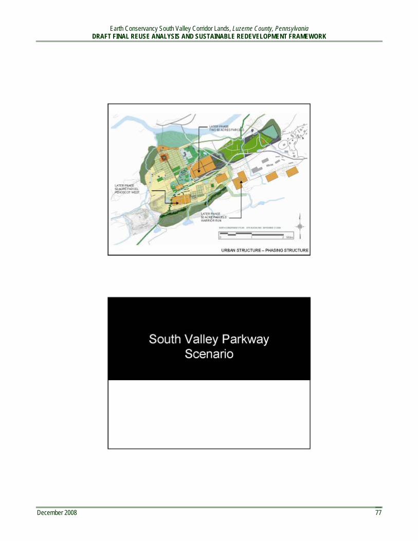
Earth Conservancy South Valley Corridor Lands, Luzerne County, Pennsylvania DRAFT FINAL REUSE ANALYSIS AND SUSTAINABLE REDEVELOPMENT FRAMEWORK
December 2008 77

Earth Conservancy South Valley Corridor Lands, Luzerne County, Pennsylvania DRAFT FINAL REUSE ANALYSIS AND SUSTAINABLE REDEVELOPMENT FRAMEWORK
December 2008 78

Earth Conservancy South Valley Corridor Lands, Luzerne County, Pennsylvania DRAFT FINAL REUSE ANALYSIS AND SUSTAINABLE REDEVELOPMENT FRAMEWORK
December 2008 79

Earth Conservancy South Valley Corridor Lands, Luzerne County, Pennsylvania DRAFT FINAL REUSE ANALYSIS AND SUSTAINABLE REDEVELOPMENT FRAMEWORK
December 2008 80

Earth Conservancy South Valley Corridor Lands, Luzerne County, Pennsylvania DRAFT FINAL REUSE ANALYSIS AND SUSTAINABLE REDEVELOPMENT FRAMEWORK
December 2008 81

Earth Conservancy South Valley Corridor Lands, Luzerne County, Pennsylvania DRAFT FINAL REUSE ANALYSIS AND SUSTAINABLE REDEVELOPMENT FRAMEWORK
December 2008 82

Earth Conservancy South Valley Corridor Lands, Luzerne County, Pennsylvania DRAFT FINAL REUSE ANALYSIS AND SUSTAINABLE REDEVELOPMENT FRAMEWORK
December 2008 83

Earth Conservancy South Valley Corridor Lands, Luzerne County, Pennsylvania DRAFT FINAL REUSE ANALYSIS AND SUSTAINABLE REDEVELOPMENT FRAMEWORK
December 2008 84

Earth Conservancy South Valley Corridor Lands, Luzerne County, Pennsylvania DRAFT FINAL REUSE ANALYSIS AND SUSTAINABLE REDEVELOPMENT FRAMEWORK
December 2008 85

Earth Conservancy South Valley Corridor Lands, Luzerne County, Pennsylvania DRAFT FINAL REUSE ANALYSIS AND SUSTAINABLE REDEVELOPMENT FRAMEWORK
December 2008 86

Earth Conservancy South Valley Corridor Lands, Luzerne County, Pennsylvania DRAFT FINAL REUSE ANALYSIS AND SUSTAINABLE REDEVELOPMENT FRAMEWORK
December 2008 87