earth’s topography earth’s topography. although our planet is called earth, much of it is...
TRANSCRIPT

Earth’s Earth’s TopographyTopography

Although our planet is called Although our planet is called Earth, much of it is covered with Earth, much of it is covered with waterwater► All the land on Earth is surrounded by All the land on Earth is surrounded by
oceansoceans► How much of the Earth’s surface is How much of the Earth’s surface is
covered with water?covered with water?► 25%25%► 50%50%► 70%70%► 90%90%

Way to go! Way to go! You’re on your way to becoming You’re on your way to becoming
a topographya topography wiz wiz
Click the image to continueClick the image to continue

Major Land DivisionsMajor Land Divisions
All the land on Earth can be categorized All the land on Earth can be categorized as as
being one of the following:being one of the following:
LandmassesLandmasses ContinentsContinents IslandsIslands
LandmassesLandmasses
► LandmassesLandmasses are areas of land are areas of land consisting of one or more continentsconsisting of one or more continents
► There are only four major landmassesThere are only four major landmasses1.1. Asia, Africa and EuropeAsia, Africa and Europe
2.2. North, South and Central AmericaNorth, South and Central America
3.3. AntarcticaAntarctica
4.4. AustraliaAustralia

ContinentsContinents
► ContinentsContinents are landmasses that measure are landmasses that measure millions of square kilometers and rise a millions of square kilometers and rise a considerable distance above sea levelconsiderable distance above sea level
► There are seven continentsThere are seven continents1.1. AfricaAfrica
2.2. AntarcticaAntarctica
3.3. AsiaAsia
4.4. AustraliaAustralia
5.5. EuropeEurope
6.6. South AmericaSouth America
7.7. North AmericaNorth America

IslandsIslands
► IslandsIslands are small landmasses which are small landmasses which are completely surrounded by waterare completely surrounded by water
►Which of the following continents is Which of the following continents is also an island?also an island?
Africa Australia South America

Way to go! Way to go! You know your continentsYou know your continents
Click the image to continueClick the image to continue

Sorry, your answer was Sorry, your answer was incorrectincorrect
Click the image to go back and try againClick the image to go back and try again
TopographyTopography
►TopographyTopography refers to the shape of the refers to the shape of the Earth’s surfaceEarth’s surface
►The surface of the Earth is changed byThe surface of the Earth is changed by►Weather conditionsWeather conditions►Running waterRunning water►Earthquakes and volcanoesEarthquakes and volcanoes►PeoplePeople
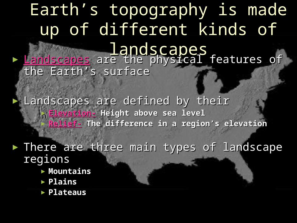
Earth’s topography is made up Earth’s topography is made up of different kinds of landscapesof different kinds of landscapes
► LandscapesLandscapes are the physical features of the are the physical features of the Earth’s surfaceEarth’s surface
► Landscapes are defined by theirLandscapes are defined by their►Elevation-Elevation- Height above sea level Height above sea level►Relief-Relief- The difference in a region’s elevationThe difference in a region’s elevation
► There are three main types of landscape There are three main types of landscape regionsregions
►MountainsMountains►PlainsPlains►PlateausPlateaus

North American Landforms

MountainsMountains
►Natural landforms that reach high Natural landforms that reach high elevationselevations
►Rise at least 600 meters above the Rise at least 600 meters above the surrounding landsurrounding land
►Have narrow summits, steep slopes, Have narrow summits, steep slopes, and high reliefand high relief
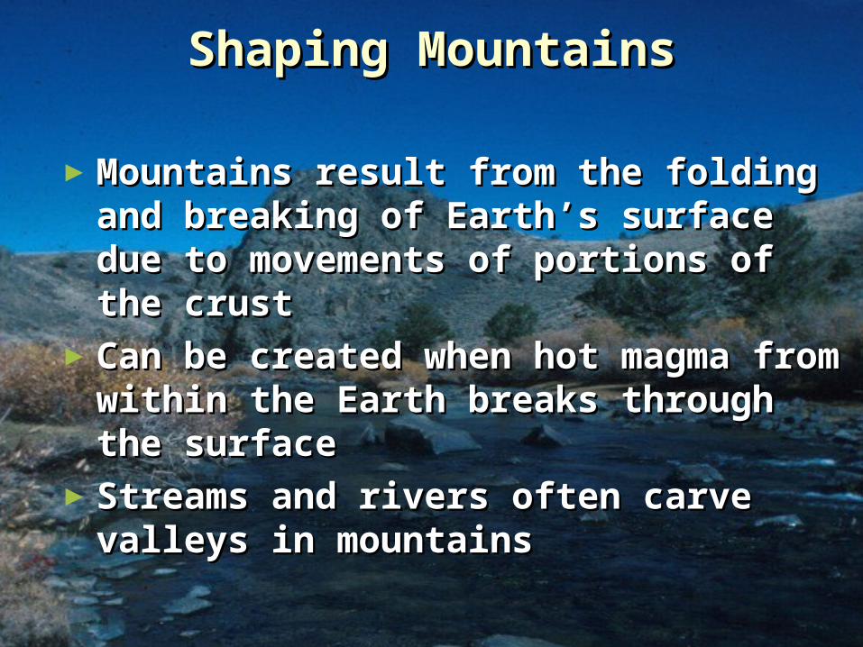
Shaping MountainsShaping Mountains
►Mountains result from the folding Mountains result from the folding and breaking of Earth’s surface and breaking of Earth’s surface due to movements of portions of due to movements of portions of the crustthe crust
►Can be created when hot magma Can be created when hot magma from within the Earth breaks from within the Earth breaks through the surfacethrough the surface
►Streams and rivers often carve Streams and rivers often carve valleys in mountainsvalleys in mountains

Groups of MountainsGroups of Mountains
►Mountain range-Mountain range- A roughly parallel A roughly parallel series of mountains that have the series of mountains that have the same general shape and structuresame general shape and structure
►Mountain system-Mountain system- A group of mountain A group of mountain ranges in an arearanges in an area
►Mountain belt-Mountain belt- A large group of A large group of mountains which includes mountain mountains which includes mountain ranges and mountain systemsranges and mountain systems

PlainsPlains
►Plains are flat areas that have Plains are flat areas that have very small differences in elevationvery small differences in elevation
►Areas of low reliefAreas of low relief►Characterized by broad rivers and Characterized by broad rivers and
streamsstreams

Coastal PlainsCoastal Plains
►Coastal plainsCoastal plains are low, flat areas are low, flat areas located along a coastlocated along a coast
►Formed when soil and silt were Formed when soil and silt were deposited on the edge of a deposited on the edge of a continentcontinent
►The fertile soil makes farming a The fertile soil makes farming a major activitymajor activity
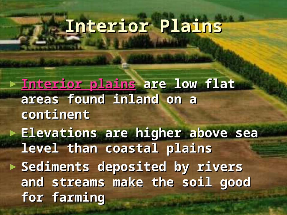
Interior PlainsInterior Plains
►Interior plainsInterior plains are low flat areas are low flat areas found inland on a continentfound inland on a continent
►Elevations are higher above sea Elevations are higher above sea level than coastal plainslevel than coastal plains
►Sediments deposited by rivers and Sediments deposited by rivers and streams make the soil good for streams make the soil good for farmingfarming

PlateausPlateaus
►PlateausPlateaus are broad, flat areas of land are broad, flat areas of land that rise more than 600 meters above that rise more than 600 meters above sea levelsea level Surfaces are fairly flatSurfaces are fairly flat Have low reliefHave low relief
►Most plateaus are located inlandMost plateaus are located inland►Often have the same landscape for Often have the same landscape for
thousands of kilometersthousands of kilometers►Many plateaus of the world are dry, Many plateaus of the world are dry,
nearly desert likenearly desert like

Introduction to MapsIntroduction to Maps► Map-Map- A drawing of the A drawing of the
Earth, or part of the Earth, or part of the Earth, on a flat surfaceEarth, on a flat surface
► Globe-Globe- A spherical, or A spherical, or round, model of the Earthround, model of the Earth The most accurateThe most accurate representation of the representation of the
entire surface of the entire surface of the EarthEarth
Shows the shapes, Shows the shapes, sizes, and locations of sizes, and locations of all the Earth’s all the Earth’s landmasses landmasses
and bodies of waterand bodies of water

Map ScalesMap Scales
►Both maps and globes are drawn to Both maps and globes are drawn to scalescale
►The scale compares distances on a The scale compares distances on a map or globe to actual distances on map or globe to actual distances on the earth’s surfacethe earth’s surface
►The more closely the map approaches The more closely the map approaches the land in size, the larger the scale the land in size, the larger the scale will bewill be
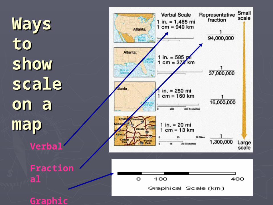
WaysWaysto to show show scale scale on a on a mapmap
Verbal
Fractional
Graphic
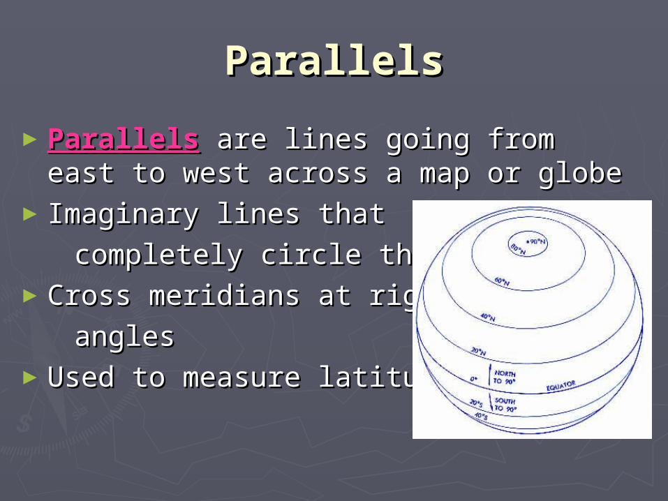
ParallelsParallels
►ParallelsParallels are lines going from east to are lines going from east to west across a map or globewest across a map or globe
► Imaginary lines that Imaginary lines that
completely circle the Earthcompletely circle the Earth►Cross meridians at rightCross meridians at right
anglesangles►Used to measure latitudeUsed to measure latitude

LatitudeLatitude► Latitude-Latitude- Measure of distance north and Measure of distance north and
south of the equatorsouth of the equator► Lines are numbered in degrees from 0Lines are numbered in degrees from 0° at ° at
the equator to 90° at the polesthe equator to 90° at the poles► Latitudes must be labeled asLatitudes must be labeled as
being either north or south being either north or south
of the equatorof the equator►One degree of latitude is equal One degree of latitude is equal
to approximately 69 land milesto approximately 69 land miles

MeridiansMeridians►Meridians-Meridians- Lines that run between the Lines that run between the
geographic North and South poles of the geographic North and South poles of the EarthEarth
►Each meridian represents half of an Each meridian represents half of an imaginary circle around the Earthimaginary circle around the Earth
►Prime Meridian-Prime Meridian- The meridian The meridian
running through Greenwich, running through Greenwich,
England (0England (0° longitude)° longitude)►Used to measure longitudeUsed to measure longitude

LongitudeLongitude► Longitude-Longitude- Measure of distance east and Measure of distance east and
west of the prime meridianwest of the prime meridian► Lines are numbered in degrees from 0Lines are numbered in degrees from 0° at ° at
the prime meridian to 180° at the the prime meridian to 180° at the international date lineinternational date line
► Longitudes must be designated as being Longitudes must be designated as being either east or west of the prime meridianeither east or west of the prime meridian
► Unlike lines of latitude, meridiansUnlike lines of latitude, meridians are not parallel (farthest apart at are not parallel (farthest apart at the equator and get closer as they the equator and get closer as they near the poles)near the poles)
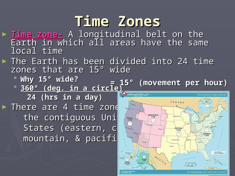
Time ZonesTime Zones► Time zone-Time zone- A longitudinal belt on the Earth A longitudinal belt on the Earth
in which all areas have the same local timein which all areas have the same local time► The Earth has been divided into 24 time The Earth has been divided into 24 time
zones that are 15zones that are 15° wide ° wide Why 15° wide?Why 15° wide? 360° (deg. in a circle)360° (deg. in a circle) 24 (hrs in a day)24 (hrs in a day)
► There are 4 time zones in There are 4 time zones in the contiguous Unitedthe contiguous United States (eastern, central,States (eastern, central, mountain, & pacific)mountain, & pacific)
= 15° (movement per hour)= 15° (movement per hour)

Determining Local TimeDetermining Local Time
►When you cross from one When you cross from one timetime zone to another, the local time zone to another, the local time changes by one hourchanges by one hour► Traveling east-Traveling east- you add one you add one hour for each time zonehour for each time zone you crossyou cross► Traveling west-Traveling west- you subtract you subtract one hour for each time zone one hour for each time zone you crossyou cross

Crossing the International Date Crossing the International Date LineLine
►The international date line is a special The international date line is a special meridian (180meridian (180° E or ° E or 180180° W)° W)
►Not only do you change the time when Not only do you change the time when you cross it, you also change the dayyou cross it, you also change the day Traveling east-Traveling east- add one hour, but subtract add one hour, but subtract
a daya day Traveling west-Traveling west- subtract one hour, subtract one hour,
but add a daybut add a day

MapsMaps►Maps show locations and distancesMaps show locations and distances► Since the Earth is not flat, all maps have Since the Earth is not flat, all maps have
some distortionsome distortion Causes changes in the shapes and sizes Causes changes in the shapes and sizes
of landmasses and of landmasses and oceansoceans The smaller theThe smaller the area mapped, area mapped, the less distortionthe less distortion
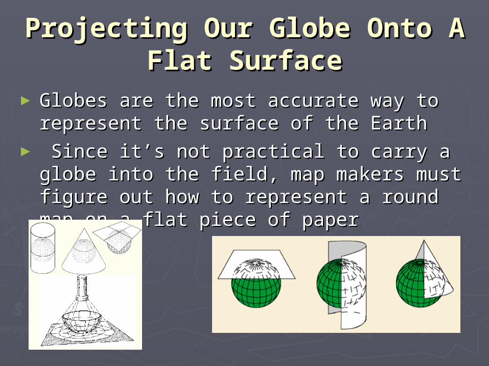
Projecting Our Globe Onto A Projecting Our Globe Onto A Flat SurfaceFlat Surface
►Globes are the most accurate way to Globes are the most accurate way to represent the surface of the Earthrepresent the surface of the Earth
► Since it’s not practical to carry a globe into Since it’s not practical to carry a globe into the field, map makers must figure out how the field, map makers must figure out how to represent a round map on a flat piece of to represent a round map on a flat piece of paperpaper

Mercator or Cylindrical Map Mercator or Cylindrical Map ProjectionsProjections
► A Mercator or cylindrical projection map is A Mercator or cylindrical projection map is the most common type of map that we seethe most common type of map that we see
► It’s like projecting an image of the globe on It’s like projecting an image of the globe on a movie screen that’s been wrapped around a movie screen that’s been wrapped around it it
► Areas close to the equator Areas close to the equator have very little distortionhave very little distortion► The closer to the poles that The closer to the poles that one travels the more distortedone travels the more distorted the map becomesthe map becomes► Used for navigationUsed for navigation
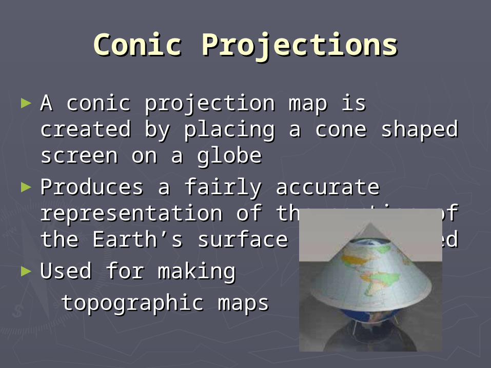
Conic ProjectionsConic Projections
►A conic projection map is created by A conic projection map is created by placing a cone shaped screen on a placing a cone shaped screen on a globeglobe
►Produces a fairly accurate Produces a fairly accurate representation of the portion of the representation of the portion of the Earth’s surface being mappedEarth’s surface being mapped
►Used for making Used for making
topographic mapstopographic maps
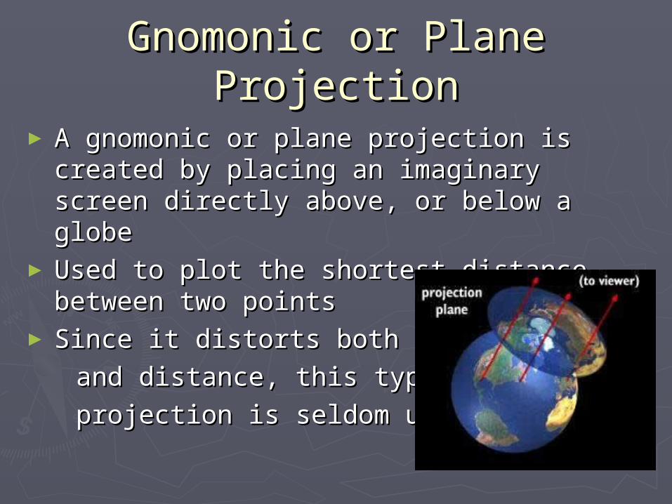
Gnomonic or Plane ProjectionGnomonic or Plane Projection
► A gnomonic or plane projection is created by A gnomonic or plane projection is created by placing an imaginary screen directly above, placing an imaginary screen directly above, or below a globeor below a globe
► Used to plot the shortest distance between Used to plot the shortest distance between two pointstwo points
► Since it distorts both directionSince it distorts both direction
and distance, this type of mapand distance, this type of map
projection is seldom usedprojection is seldom used

Interrupted ProjectionInterrupted Projection
► There are many different types of There are many different types of interruptedinterrupted
projection mapsprojection maps►Depict the continents as accurately as Depict the continents as accurately as
possible by leaving blank space in the less possible by leaving blank space in the less important areas of the map, such as in the important areas of the map, such as in the oceansoceans

Equal-Area ProjectionEqual-Area Projection
►For equal-area projections the meridians For equal-area projections the meridians and parallels are placed on the map so and parallels are placed on the map so that every part of the Earth is the same that every part of the Earth is the same size on the map as it is on the globesize on the map as it is on the globe
►Correctly shows the Correctly shows the
amount of area aamount of area a
landmass covers, landmass covers,
but distorts its shapebut distorts its shape

Topographical MapsTopographical MapsTopographic mapsTopographic maps show the different show the different shapes and sizes shapes and sizes of land surfacesof land surfaces Show small Show small
details of the details of the topography of topography of an areaan area
Shows the Shows the location of location of landscape and landscape and cultural featurescultural features
ShowShow thethe reliefrelief, , or elevation or elevation change, of the change, of the landland
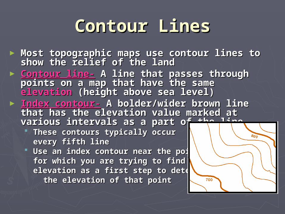
Contour LinesContour Lines► Most topographic maps use contour lines to Most topographic maps use contour lines to
show the relief of the landshow the relief of the land► Contour line-Contour line- A line that passes through A line that passes through
points on a map that have the same points on a map that have the same elevation elevation (height above sea level)(height above sea level)
► Index contour-Index contour- A bolder/wider brown line that A bolder/wider brown line that has the elevation value marked at various has the elevation value marked at various intervals as a part of the lineintervals as a part of the line These contours typically occur These contours typically occur
every fifth lineevery fifth line Use an index contour near the point Use an index contour near the point
for which you are trying to find the for which you are trying to find the elevation as a first step to determining elevation as a first step to determining
the elevation of that pointthe elevation of that point

Contour IntervalContour Interval► Contour interval-Contour interval- The difference in elevation The difference in elevation
from one contour line to the nextfrom one contour line to the next The size of the interval depends on the The size of the interval depends on the
relief of the land (mountains will need a relief of the land (mountains will need a bigger interval than a plain)bigger interval than a plain)
► To calculate the contour interval, determine To calculate the contour interval, determine the distance between two successive index the distance between two successive index contours and then divide that number by 5contours and then divide that number by 5
Step 1: 800 ft – 700 ft = 100 ft
Step 2: 100 ft ÷ 5 = 20 ft
The contour interval would be 20 ft

Rules for using contour Rules for using contour lineslines
1.1. Contour lines never cross or intersectContour lines never cross or intersect2.2. Closely spaced lines represent a steep slopeClosely spaced lines represent a steep slope3.3. Contours spaced far apart represent a gentle Contours spaced far apart represent a gentle
slopeslope4.4. Contour lines that cross a valley are V-shapedContour lines that cross a valley are V-shaped5.5. Contour lines form V’s that point upstream, Contour lines form V’s that point upstream,
or in a direction opposite the flow of the or in a direction opposite the flow of the streamstream
6.6. Contours form closed loops around hilltops or Contours form closed loops around hilltops or depressionsdepressions
7.7. Short dashes called Short dashes called hachureshachures are used to are used to indicate a depressionindicate a depression
8.8. All contour lines either close or extend to the All contour lines either close or extend to the edge of a mapedge of a map
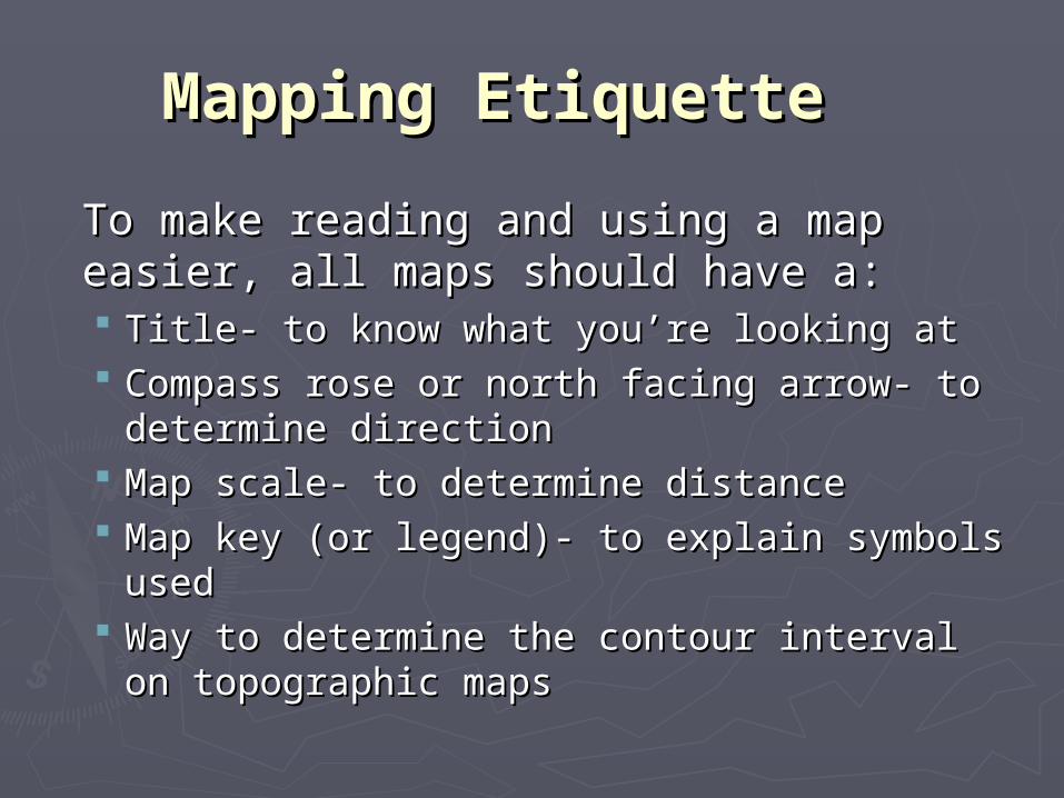
Mapping EtiquetteMapping Etiquette
To make reading and using a map easier, To make reading and using a map easier, all maps should have a:all maps should have a: Title- to know what you’re looking atTitle- to know what you’re looking at Compass rose or north facing arrow- to Compass rose or north facing arrow- to
determine directiondetermine direction Map scale- to determine distanceMap scale- to determine distance Map key (or legend)- to explain symbols usedMap key (or legend)- to explain symbols used Way to determine the contour interval on Way to determine the contour interval on
topographic maps topographic maps

Bel IsleBel Isle
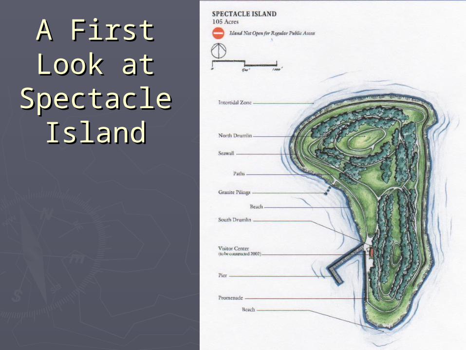
A First Look A First Look at Spectacle at Spectacle
IslandIsland
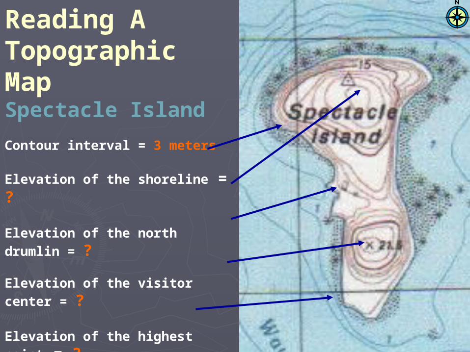
Reading A Topographic MapSpectacle Island
Contour interval = 3 meters
Elevation of the shoreline = ?
Elevation of the north drumlin = ?
Elevation of the visitor center = ?
Elevation of the highest point = ?
How deep is the ocean off thesouthwest tip of the island ?