ecological evaluation of the potential lake creek research natural
TRANSCRIPT

ECOLOGICAL EVALUATION OF
THE POTENTIAL LAKE CREEK RESEARCH NATURAL AREA
WITHIN THE SHOSHONE NATIONAL FOREST,
PARK COUNTY, WYOMING
Prepared for the
Shoshone National Forest,
USDA Forest Service
By
George P. Jones
Walter Fertig
Wyoming Natural Diversity Database
University of Wyoming
3381 University Station
Laramie, Wyoming 82071-3381
June 21, 1999

TABLE OF CONTENTS
INTRODUCTION................................................... 1
Land Management Planning ..................................... 1
OBJECTIVES..................................................... 1
PRINCIPAL DISTINGUISHING FEATURES.............................. 2
LOCATION....................................................... 2
Boundary ..................................................... 2
Area ......................................................... 2
Elevation .................................................... 2
Access ....................................................... 2
Ecoregion .................................................... 3
Maps ......................................................... 3
VEGETATION..................................................... 3
Description .................................................. 3
Area by Type ................................................. 5
PHYSICAL AND CLIMATIC CONDITIONS............................... 6
Physical Setting ............................................. 6
Geology ...................................................... 6
DESCRIPTION OF VALUES.......................................... 7
Vegetation Types ............................................. 7
Flora ........................................................ 7
Threatened, Endangered, and Sensitive Plant Species......... 7
Plant Species List......................................... 10
Fauna ....................................................... 13
Threatened, Endangered, and Sensitive Vertebrates.......... 13
Animal Species List........................................ 13
Lands ....................................................... 13
SUITABILITY FOR RESEARCH NATURAL AREA SELECTION............... 14
Quality ..................................................... 14
Condition ................................................... 14
Viability ................................................... 15
Defensibility ............................................... 16
Degree to Which the Potential RNA Meets Criteria ............ 16
IMPACTS AND POSSIBLE CONFLICTS................................ 16
Mineral Resources ........................................... 16
Grazing ..................................................... 17
Timber ...................................................... 17
Watershed Values ............................................ 17
Recreation Values ........................................... 17
Wildlife and Plant Values ................................... 17
Transportation Values ....................................... 17
MANAGEMENT CONCERNS........................................... 17
REFERENCES.................................................... 18
APPENDIXES.................................................... 21
Appendix 1. Maps of the potential Lake Creek Research Natural
Area ........................................................ 22
Appendix 2. Photographs from the potential Lake Creek RNA .. 25
Appendix 3. Canopy cover of plants in plots and at locations
of vegetation descriptions in the potential Lake Creek Research
Natural Area ................................................ 26

Appendix 4. Explanations of ranks used by the Wyoming Natural
Diversity Database .......................................... 38
Appendix 5. Plant community types in the potential Lake Creek
Research Natural Area. ...................................... 40
Appendix 6. Element Occurrence Records for Plant Species of
Special Concern in the potential Lake Creek RNA. ............ 43

1
ECOLOGICAL EVALUATION OF
THE POTENTIAL LAKE CREEK RESEARCH NATURAL AREA
WITHIN THE SHOSHONE NATIONAL FOREST,
PARK COUNTY, WYOMING
INTRODUCTION
The potential Lake Creek Research Natural Area (RNA) is
located on the Beartooth Plateau in northwestern Wyoming. The
area includes subalpine forest and wetlands on a rolling terrain
of glaciated granitic bedrock. The potential RNA is in the
Shoshone National Forest and is used primarily for recreation,
watershed protection, and wildlife habitat.
In 1997, The Nature Conservancy entered a contract with the
USDA Forest Service, Shoshone National Forest, to prepare
ecological evaluations of areas in the Forest for use by the
Forest Service in examining the suitability of the areas as
research natural areas. The evaluation of the Lake Creek area
was done by the Wyoming Natural Diversity Database. This report
presents the results of that evaluation.
LAND MANAGEMENT PLANNING
In 1997, Lake Creek was selected by USDA Forest Service
staff as a potential RNA for possible analysis during revision of
the Land and Resource Management Plan. This ecological
evaluation is intended to aid the Forest Service staff in that
analysis.
OBJECTIVES
One of the primary objectives of research natural areas is
to "...preserve a wide spectrum of pristine representative areas
that typify important forest, shrubland, grassland, alpine,
aquatic, geologic and similar natural situations..." (Forest
Service Manual 4063.02).
The objectives of a Lake Creek RNA would be to 1) maintain a
reference area for (a) monitoring effects of resource management
techniques and practices applied to similar ecosystems, (b)
comparing results from manipulative research, and (c) determining
the range of natural variability; 2) protect elements of
biological diversity; 3) provide a site for non-manipulative
scientific research; and 4) provide on-site and extension
educational opportunities.

2
PRINCIPAL DISTINGUISHING FEATURES
The principal distinguishing features of the potential Lake
Creek RNA are (1) a subalpine forest of lodgepole pine, subalpine
fir, and Engelmann spruce growing on a rolling surface of
glaciated granitic bedrock, (2) fens and willow carrs (and a
small area of Sphagnum-dominated wetland) around ponds and along
streams, and (3) one vascular plant species (Agoseris
lackschewitzii) on the Forest Service Region 2 Sensitive Species
List.
LOCATION
The potential Lake Creek RNA is located within the Shoshone
National Forest in northwestern Wyoming. The approximate center
of the potential RNA is at latitude 44o57'50" N and longitude
109o41'05" W.
The potential RNA includes all or parts of the following
sections (all on the 6th Principal Meridian): T57N, R107W, Sec 3,
4, 5, 6, 8, 9, 10; T58N, R107W, Sec 27, 28, 29, 30, 31, 32, 33,
34.
BOUNDARY
(See Figure 1).
The proposed boundary of the potential RNA follows an
administrative boundary, cultural featues, and landscape
features. The eastern boundary follows National Forest Trail 568
and a ridgeline west of Muddy Creek. The northern boundary runs
between a series of hilltops as it crosses Lake Creek, then lies
on the divide between the drainages of Lake Creek to the
southeast and Gilbert Creek to the northwest. The boundary on
the southwest and the south follows the southern boundary of the
Absaroka - Beartooth Wilderness Area.
AREA
The total area of the potential Lake Creek RNA, as measured
on the 1:24,000-scale map with a digital planimeter, is
approximately 5,801 acres (2349 ha).
ELEVATION
The elevation of the potential Lake Creek RNA ranges from
approximately 7,710 feet (2,255 m) on Lake Creek on the
southwestern boundary to 8,920 feet (2,721 m) in the north-
central part.
ACCESS
The potential Lake Creek RNA may be reached via foot and
horseback travel from public roads and trails. The western and
northwestern portions are accessible from National Forest Roads
130 and 189 and National Fores Trail 617. The eastern and

3
northeastern portions of the area are accessible from National
Forest Road 136 and National Forest Trails 568 and 612
ECOREGION
The potential Lake Creek RNA lies within the Southern Rocky
Mountain Steppe-Open Woodland-Coniferous Forest-Alpine Meadow
Province, Yellowstone Highlands Section (M331A) of the ecoregion
classification of Bailey et al. (1994) (Freeouf 1996).
MAPS
USDA Forest Service 1/2 inch = 1 mile scale map of the
Shoshone National Forest.
USDI Geological Survey 7.5-minute topographic Quadrangle Map:
Muddy Creek, Wyoming.
VEGETATION
DESCRIPTION
Field work in 1996 and 1998 revealed the presence of the
following plant associations (Anderson et al. 1998) in the
potential Lake Creek RNA: Calamagrostis canadensis Western
Herbaceous Vegetation, Carex aquatilis Herbaceous Vegetation,
Carex rostrata Herbaceous Vegetation, Salix planifolia/Carex
aquatilis Shrubland, Salix wolfii/Carex aquatilis Shrubland,
Abies lasiocarpa/Vaccinium scoparium Forest, Picea engelmannii/
Linaea borealis Forest, and Pinus contorta/Vaccinium scoparium
Forest. Synonyms for these names are shown in Appendix 5.
Vegetation dominated by Sphagnum sp. on floating mats that
apparently does not fit into a recognized plant association also
is present. Data from sample plots and descriptions of
vegetation at various locations are given in Appendix 3.
Upland vegetation
The upland vegetation in the potential RNA consists of
subalpine forest with small openings of herbaceous vegetation or
rock outcrop, most < 30 acres (12 ha) and lying in the southern
half of the area. The 1998 field work suggests that in most
places, the overstory of the subalpine forest is clearly
dominated by lodgepole pine and the undergrowth by grouse
whortleberry, and the vegetation belongs to the Pinus
contorta/Vaccinium scoparium Forest vegetation type (Anderson et
al. 1998). Within this matrix lodgepole pine forest, three minor
forest or woodland types occupy limited areas. Engelmann spruce
grows in the overstory on lower slopes, especially those with a
northerly aspect, and the Picea engelmannii/Linnaea borealis
Forest type is a minor component of the subalpine forest.
Another minor type is the Abies lasiocarpa/Vaccinium scoparium
Forest type, which occurs primarily on north-facing slopes.
Steep, rocky, south-facing slopes in the southern part of the
potential RNA support small stands of woodland in which Douglas-
fir dominates the overstory and lodgepole pine is present. The

4
open undergrowth in these stands consists mainly of elk sedge,
Idaho fescue, several other graminoids and forbs, little clubmoss
(Selaginella densa), and true moss. This vegetation appears to
be a transition between the Douglas-fir woodlands typical of
lower elevations and the subalpine lodgepole pine forest common
over much of the region at higher elevations (Steele et al.
1983). Although stands of all four of these vegetation types can
be identified in the area, they merge with one another, and
drawing boundaries between them is difficult.
The non-forest upland vegetation appears to consist of
sparse cover of vascular species (up to ca. 25% canopy cover) and
at least as much cover of little clubmoss. Unvegetated rock is
common in these openings in the subalpine forest.
Riparian and wetland vegetation
Wetland vegetation is found in a large wet meadow stretching
for ca. 1.5 miles (2.4 km) along the eastern side of the
potential RNA and in numerous smaller potholes and meadows
scattered throughout the area. Most of these smaller wetlands
cover less than 40 acres (16 ha), and many of them are mapped on
the 7.5-minute topographic quadrangle as lakes. Color aerial
photographs, though, show many of those lakes to be partly or
completely filled with sediments or organic deposits.
Field work in 1996 and 1998 suggests that most of the
wetland vegetation is beaked sedge (Carex rostrata)Herbaceous
Vegetation and Wolf willow/water sedge (Salix wolfii/Carex
aquatilis) Shrubland Vegetation. The former occupies the lowest,
wettest sites, and the latter grows on slightly higher sites, but
the two types are mixed in the large wetland on the eastern side
of the area. Planeleaf willow/water sedge (Salix planifolia/
Carex aquatilis) Shrubland also grows in wetlands in the area.
Bluejoint reedgrass (Calamagrostis canadensis) Herbaceous
Vegetation is common in the smaller wetlands of potholes and
draws, where grows mixed with or next to the beaked sedge type.
The bluejoint reedgrass vegetation grows on hummocks or the
higher margins of the wetlands, and the beaked sedge type in the
lower parts. Mosses are common in these wetland types.
A wetland dominated by sphagnum moss was sampled in NE 1/4
Sec 5 in the southwestern part of the potential RNA (plots 053
and 054). Part of this wetland consists of a floating mat around
the margin of a kettle pond. No other sphagnum wetlands were
observed during field work, but on a 1981 color aerial
photograph, a wetland in the SE1/4 Sec 29 in the northern part of
the area has the same color as the sphagnum wetland, and it may
also be dominated by sphagnum. This wetland in Sec 29 is mapped
as a lake on the 7.5-minute topographic quad.

5
AREA BY TYPE
The sole Kuchler vegetation type, western spruce-fir forest
(Kuchler 1966), was mapped on 1:24,000-scale topographic map
using aerial photographs and field reconnaissance. The area of
that type was calculated by subtracting an estimate of the
unforested area from an estimate of the area of the potential
RNA. Those estimates were derived by measuring the potential RNA
and the unforested areas on the 1:24,000-scale map with a digital
planimeter. The remainder of the potential RNA (that is, the
part not in western spruce-fir forest) apparently does not
correspond to Kuchler's vegetation types.
Areas of complexes of plant community types (Table 2) were
estimated by mapping each complex on the 1:24,000-scale map,
using information from true-color aerial photographs (taken in
1981) and field survey, and measuring each complex with a digital
planimeter. Areas of the individual plant communities were not
estimated because the proportion of each community in each
complex was unknown, given the difficulty of distinguishing
closely-related plant communities from aerial photos and the
limited extent of the field survey. Table 2 does, though,
indicate which community type is thought to be a major
constituent of each complex, based on information gathered during
field survey.
Table 1. Area of the Kuchler Type (Kuchler 1966) in the
potential Lake Creek RNA See Figure 1.
Cover Type Acres Hectares
Western spruce-fir forest (14) 5167 2093
Other (meadows, open water) 634 257
_______________________________
Table 2. Area of the SAF cover type (Eyre 1980) in the potential
Lake Creek RNA See Figure 1.
Cover Type Acres Hectares
Engelmann spruce-subalpine fir (206) 5167 2093
Other (meadows, open water) 634 257
_______________________________

6
Table 3. Areas of complexes of plant community types in the
potential Lake Creek RNA. Major communities in each complex are
indicated by "(M)" following the names, and minor communities by
"(m)". Appendix 5 contains synonyms.
Complex Acres Hectares
Pinus contorta/Vaccinium scoparium Forest(M)
+ Abies lasiocarpa/Vaccinium scoparium Forest(m) 5167 2093
+ Picea engelmannii/Linnaea borealis Forest(m)
Carex rostrata Herbaceous Vegetation(M)
+ Salix wolfii/Carex aquatilis Shrubland (M)
+ Calamagrostis canadensis Western Herbaceous 370 150
Vegetation (m) +
Salix planifolia/Carex aquatilis Shrubland (m)
+ Sphagnum sp. Herbaceous Vegetation (m)
Upland herbaceous (M) + Spikemoss-herbaceous (M) 182 74
+ Upland non-vegetated (m)
Open water 82 33
_______________________________
PHYSICAL AND CLIMATIC CONDITIONS
PHYSICAL SETTING
The potential Lake Creek RNA is located at the southern edge
of the Beartooth Plateau. The terrain of the area consists of
rounded, glaciated hills with local relief up to 500 feet
(approx. 150 m). Most of the potential RNA lies within the
drainage basin of Lake Creek, a high-gradient, perennial stream
flowing southward through the middle of the area. The eastern
edge of the area lies within the drainage basin of Muddy Creek, a
southward-flowing, perennial stream with a gentler gradient.
Throughout the potential RNA, low-gradient, first- and second-
order streams form wetlands between the hills, and Muddy Creek
forms a large wetland along the eastern boundary.
GEOLOGY
The bedrock in the proposed RNA is mainly Precambrian
granitic rock (chiefly granitic gniess and granite). Quaternary
moraine deposits and Quaternary alluvium occur along the eastern
boundary in the valley of Muddy Creek and in small areas
(primarily wetlands) within the area (Pierce and Nelson 1971).

7
DESCRIPTION OF VALUES
VEGETATION TYPES
See Table 1 for a list of the Kuchler (1966) vegetation
types present in the area and the estimated acreage of each, and
Table 2 for a list of the plant associations present.
FLORA
Threatened, Endangered, and Sensitive Plant Species
No federally listed Threatened or Endangered plant species
are known from the Lake Creek Bogs potential RNA. Agoseris
lackschewitzii is the only USFS Region 2 Sensitive plant species
known from the area (Estill 1993; Fertig and Beauvais 1999).
Seven WYNDD plant species of special concern are known from the
potential RNA, and habitat may exist for four others (Fertig
1998; Fertig and Beauvais 1999). The status of each of these
species is briefly summarized below. Complete Element Occurrence
Records and location maps for each population are included in
Appendix A.
Agoseris lackschewitzii (Pink agoseris)
Heritage Rank: G4Q/S3 (WYNDD Watch List).
Federal Status: USFS Region 2 Sensitive; USFS Region 4
Sensitive.
Geographic Range: Regional endemic of east-central Idaho,
southwest Montana, and northern Wyoming (Fertig et al. 1994). In
Wyoming, known from the Beartooth, Wind River, Gros Ventre, and
Bighorn Ranges and Yellowstone Plateau in Big Horn, Fremont,
Johnson, Park, Sheridan, Sublette, Teton, and Washakie Counties.
Habitat: Wet montane and subalpine meadows.
Comments: Stephanie Mills discovered a small population of pink
agoseris along Muddy Creek within the potential Lake Creek RNA in
1995 (Mills and Fertig 1996). This species is known from 9 other
records on the Shoshone National Forest and nearly 40 sites
statewide (at least 10 of which are protected in national park or
wilderness areas). WYNDD recently dropped this species to its
“watch list” due to its new-found abundance and wide distribution
in the state. A change in its Sensitive status may be justified
in the near future (Fertig 1997).
Carex diandra (Lesser panicled sedge)
Heritage Rank: G5/S1S2
Federal Status: None.
Geographic Range: Circumpolar; in North America it occurs from
Newfoundland to Yukon south to New Jersey, Indiana, Colorado, and
California. In Wyoming, lesser panicled sedge is found in the

8
Absaroka, Beartooth, and Medicine Bow Ranges, Yellowstone
Plateau, and Jackson Hole in Albany, Park, and Teton Counties.
Habitat: Wet, calcareous meadows and wetlands. Occurs on
floating mats of Sphagnum at the edge of small wetlands in the
potential Lake Creek RNA.
Comments: A new population of this species was discovered in
the potential RNA along the banks of two unnamed ponds about 0.7
miles northeast of Lily Lake by Fertig and Mellmann-Brown in 1996
(Fertig 1997). Approximately 10 other small populations are
known in Wyoming, only three of which are currently protected
(Fertig 1998).
Carex leptalea (Bristly-stalk sedge)
Heritage Rank: G5/S1
Federal Status: None.
Geographic Range: Labrador to Alaska south to Florida, Texas,
Colorado, and northern California. In Wyoming, known from the
Absaroka, Beartooth, and Teton Ranges, Jackson Hole, and the
Yellowstone Plateau in Park and Teton Counties.
Habitat: Meadows and wetlands. Plants in the Lake Creek area
are found mostly on thick tussocks on the drier margins of
wetlands.
Comments: Fertig and Mellmann-Brown discovered a new population
of bristly-stalk sedge in the potential RNA in 1996 (Fertig
1997). This species is known from 12 sites in Wyoming, most of
which are very small and restricted to specialized microhabitats
(Fertig 1998). At least nine populations are currently protected
in national parks, wilderness areas, and the Swamp Lake Special
Botanical Area.
Carex limosa (Mud sedge)
Heritage Rank: G5/S2.
Federal Status: None.
Geographic Range: Circumboreal; south in North America to the
Great Lakes, Iowa, Wyoming, Utah, and California. In Wyoming, it
occurs in the Bighorn, Absaroka, Wind River, and Beartooth
Ranges, the Sierra Madre, and the Yellowstone Plateau in Big
Horn, Carbon, Park, Sublette, and Teton Counties.
Habitat: Sphagnum bogs, wet meadows, and calcareous fens.
Populations in the Lake Creek area occur on floating mats of
Sphagnum and in wet meadows of Carex aquatilis and C. buxbaumii.
Comments: A large colony of several thousand plants was
discovered in the potential RNA along the unnamed ponds ca. 0.7
mile northeast of Lily Lake by Fertig and Mellmann-Brown in 1996
(Fertig 1997). Approximately 10 other populations occur in the
state, including five in wilderness, national park, and other
protected areas.

9
Drosera anglica (English sundew)
Heritage Rank: G5/S2.
Federal Status: None.
Geographic Range: Eurasia and Alaska to California, east to
northwest Wyoming, Montana, and the Great Lakes. In Wyoming,
known from the Yellowstone Plateau, Jackson Hole, and Beartooth
Mountains in Park and Teton counties.
Habitat: Wetlands with saturated soils. At the Lake Creek site,
English sundew occurs on floating Sphagnum mats with Carex
diandra, C. limosa, and Potentilla palustris.
Comments: Fertig and Mellmann-Brown observed 5000-7000 plants at
a new population in the potential RNA approx. 0.7 mile northeast
of Lily Lake in 1996 (Fertig 1997). This species and its habitat
are extremely sensitive to overharvest and trampling damage. Six
other populations occur in Wyoming, 5 of which are in national
park or wilderness areas (Fertig 1998).
Epilobium palustre var. palustre (Swamp willow-herb)
Heritage Rank: G5/S1S2.
Federal Status: None.
Geographic Range: Circumboreal, south in North America to
Washington, Idaho, Colorado, Wisconsin, and Pennsylvania. In
Wyoming, it is known from the Yellowstone Plateau, Sweetwater
River Valley, and Laramie, Beartooth, Wind River, and Absaroka
Ranges in Albany, Fremont, Park, Sublette, and Teton Counties.
Habitat: Occurs in saturated, often calcareous, soils.
Comments: A small colony of 10 plants was observed in the
potential RNA near the wetland ca. 0.7 mile northeast of Lily
Lake by Fertig and Mellmann-Brown in 1996 (Fertig 1997). This
population is atypical in having slightly hairy leaf surfaces,
suggesting some affinity with var. gracile. Nine populations are
known in Wyoming, of which 6 are found in national parks,
wilderness areas, or other special management sites (Fertig
1998). This species is probably more widespread in Wyoming than
currently known, but is usually restricted to specialized
microhabitats.
Equisetum fluviatile (Water horsetail)
Heritage Rank: G5/S1.
Federal Status: None.
Geographic Range: Labrador to Alaska south to Virginia,
Illinois, northwest Wyoming, northern Idaho, and Washington. In
Wyoming, it is known from Jackson Hole, the Yellowstone Plateau,
and Beartooth Range in Park and Teton Counties.
Habitat: Shallow water and muddy shores of small ponds. The
potential Lake Creek RNA colony is found in dried ponds within an
extensive sedge meadow dominated by Carex rostrata and C.
aquatilis.
Comments: Fertig, Mellmann-Brown, and Houston discovered a small
colony in the potential RNA along dried ponds bordering Muddy

10
Creek in 1996 (Fertig 1997). This species is known from only 2
extant and one historical population in Wyoming (Fertig 1998).
Eriophorum gracile (Slender cotton-grass)
Heritage Rank: G5/S1
Federal Status: None.
Geographic Range: Circumboreal; south in North America to
Pennsylvania, Iowa, Colorado, and California. In Wyoming, known
from the Beartooth Range and Jackson Hole in Park and Teton
Counties.
Habitat: Saturated or flooded soils of sedge meadows and floating
mats.
Comments: Fertig and Mellmann-Brown discovered a new colony of
this species within the potential RNA in 1996 (Fertig 1997).
Four or five other populations are known in Wyoming, three of
which occur in national parks and wilderness areas (Fertig 1998).
Potential habitat may occur for four other species of
special concern: Potamogeton amplifolius, P. praelongus, Salix
candida, and S. farriae. Each of these species is found in
wetlands near Lily Lake and Little Moose Lake, just outside the
boundaries of the potential Lake Creek RNA (Mills and Fertig
1996; Fertig 1997). Habitat also exists for Carex buxbaumii and
Potentilla palustris in the potential RNA, two taxa that were
recently dropped as species of concern by WYNDD (Fertig and
Beauvais 1999).
Plant Species List
The following species checklist is based on field surveys
conducted by the authors in late August 1996 and early September
1998. For more information on the vascular flora of the
Beartooth Range, consult Lesica (1993). Nomenclature follows
Dorn (1992) for scientific names and Hitchcock and Cronquist
(1973) and Welsh et al. (1993) for common names. Family acronyms
are based on Weber (1982).
Scientific Name Common Name Family
Trees
Abies lasiocarpa Subalpine fir PIN
Picea engelmannii Engelmann spruce PIN
Picea glauca White spruce PIN
Pinus contorta var. Lodgepole pine PIN
latifolia

11
Shrubs
Alnus incana Mountain alder BET
var. occidentalis
Betula glandulosa Bog birch BET
Juniperus communis Common juniper CUP
var. depressa
Ledum glandulosum Trapper’s tea ERI
Linnaea borealis Western twinflower CPR
Lonicera involucrata Bearberry honeysuckle CPR
Rosa sayi Prickly rose ROS
Salix boothii Booth willow SAL
Salix geyeriana Geyer willow SAL
Salix planifolia Planeleaf willow SAL
Salix wolfii Wolf willow SAL
Shepherdia canadensis Canada buffaloberry ELE
Vaccinium membranaceum Thin-leaved blueberry ERI
Vaccinium scoparium Grouse whortleberry ERI
Forbs
Agoseris lackschewitzii Pink agoseris AST
Allium brevistylum Short-style onion LIL
Angelica sp Angelica sp. API
Antennaria anaphaloides Tall pussytoes AST
Aster foliaceus Leafybract aster AST
Drosera anglica English sundew DRS
Epilobium angustifolium Fireweed ONA
Epilobium palustre Swamp willow-herb ONA
var. palustre
Fragaria virginiana Virginia strawberry ROS
Galium trifidum Small bedstraw RUB
Gentianella detonsa Smaller fringed-gentian GEN
var. elegans
[Gentianopsis detonsa var. elegans]
Geranium richardsonii White geranium GER
Geum macrophyllum Large-leaved avens ROS
var. perincisum
Habenaria dilatata White bog-orchid ORC
Habenaria obtusata Blunt-leaf rein-orchid ORC
Listera borealis Northern twayblade ORC
Maianthemum stellatum Starry false Solomon’s LIL
-seal
Mentha arvensis Field mint LAM
var. canadensis
Menyanthes trifoliata Buckbean MNY
Mitella sp. Mitrewort sp. SAX
Moneses uniflora Woodnymph ERI

12
Nuphar polysepalum Spatterdock NYM
Parnassia fimbriata Fringed grass-of- SAX
Parnassus
Pedicularis groenlandica Elephant’s-head SCR
Potentilla gracilis Slender cinquefoil ROS
Potentilla palustris Marsh cinquefoil ROS
Pyrola asarifolia Pink wintergreen ERI
Senecio cymbalarioides Alpine meadow groundsel AST
Spiranthes romanzoffiana Hooded ladies’-tresses ORC
Stellaria longipes Longstalk starwort CRY
Streptopus amplexifolius Clasping-leaved twisted- LIL
-stalk
Thalictrum sp. Meadow-rue RAN
Trollius laxus American globe-flower RAN
Utricularia sp. Bladderwort sp. LNT
Viola sp. Violet sp. VIO
Graminoids
Bromus ciliatus Fringed brome POA
Calamagrostis canadensis Bluejoint wheatgrass POA
Carex aquatilis Water sedge CYP
Carex aurea Golden sedge CYP
Carex buxbaumii Buxbaum’s sedge CYP
Carex canescens Gray sedge CYP
Carex diandra Lesser panicled sedge CYP
Carex disperma Soft-leaved sedge CYP
Carex gynocrates Yellow bog sedge CYP
Carex interior Inland sedge CYP
Carex lasiocarpa Slender sedge CYP
Carex leptalea Bristly-stalk sedge CYP
Carex limosa Mud sedge CYP
Carex praegracilis Clustered field sedge CYP
Carex rostrata Beaked sedge CYP
[Carex utriculata]
Carex saxatilis Russet sedge CYP
Deschampsia cespitosa Tufted hairgrass POA
Eleocharis sp. Spikerush sp. CYP
Eriophorum gracile Slender cotton-grass CYP
Eriophorum polystachion Many-spiked cotton- CYP
grass
Glyceria borealis Northern mannagrass POA
Glyceria striata Fowl mannagrass POA
Juncus mertensianus Mertens’ rush JUN
Juncus tracyi Tracy’s rush JUN
Luzula parviflora Small-flowered woodrush JUN
Phleum alpinum Alpine timothy POA
Poa palustris Fowl mannagrass POA

13
Ferns and Fern Allies
Equisetum arvense Common horsetail EQU
Equisetum fluviatile Water horsetail EQU
Equisetum hyemale Common scouring-rush EQU
var. affine
Equisetum laevigatum Smooth scouring-rush EQU
Lycopodium annotinum Stiff clubmoss LYC
Selaginella dense Spikemoss SEL
_______________________________
FAUNA
Threatened, Endangered, and Sensitive Vertebrates
As of May 1999, WYNDD files contain no extant occurrences of
Federally threatened or endangered species from this site.
However, it is likely that Canada lynx (Lynx canadensis) will be
soon listed as threatened under the U. S. Endangered Species Act,
and lynx, a USDA Forest Service Region 2 Sensitive Species, and
the presence of lynx was documented in the vicinity by the
Wyoming Game and Fish Department in 1985. The montane and
subalpine forest on the site has the potential to support lynx
activity. Also, this area is well within the current range of
the Yellowstone grizzly bear (Ursus arctos) population, a
federally listed threatened species, and may support some grizzly
bear activity.
Muddy Creek, on the eastern edge of the site, supports one
of the few genetically pure populations of Yellowstone cutthroat
trout (Onchorhynchus clarki bouveri), a USDA Forest Service
Region 2 Sensitive Species, in the region. An element occurrence
record for this population can be found in Appendix 6. Although
this area is within the historic range of Yellowstone cutthroat
trout, the origin (endemic or stocked) of this population is
unknown. Also, the numerous wetlands and ponds on the site have
very high potential to support populations of several rare and
sensitive amphibians (e.g., Bufo boreas boreas, Rana
luteiventris, Rana pipiens).
Animal Species List
The field work in the potential Lake Creek RNA did not
include identification of the animal species present.
LANDS
The potential Lake Creek RNA is National Forest System land
and is surrounded by National Forest System land of the Clark's
Fork Ranger District of the Shoshone National Forest. The

14
potential RNA lies entirely within the Absaroka - Beartooth
Wilderness Area.
SUITABILITY FOR RESEARCH NATURAL AREA SELECTION
An area is suitable for designation as a research natural
area according to how well it meets four criteria: quality,
condition, viability, and defensibility (USDA Forest Service
1993). Each criterion is briefly defined below, and the
information collected during field work that is pertinent to each
criterion is described.
QUALITY
The degree to which the potential RNA represents the range
in variability within the ecosystem types that it contains.
Two major ecosystem types, upland subalpine forest and
subalpine wetlands, occur in the potential Lake Creek RNA. Most
of the upland subalpine forest grows on Abies lasiocarpa habitat
types, which are widespread and common in the region (Pfister et
al. 1977, Steele et al. 1983). Subalpine forests on A.
lasiocarpa habitat types often are mixtures of Pinus contorta,
Picea engelmannii, and Abies lasiocarpa, with P. contorta
dominating (Pfister et al. 1977, Steele et al. 1983). These
mixed overstories are common in Rocky Mountain subalpine forests
in general (Eyre 1980 [Lodgepole pine cover type], Knight 1994),
not just on A. lasiocarpa habitat types. The subalpine forest of
the potential Lake Creek RNA, dominated for the most part by
Pinus contorta but with various amounts of Picea engelmannii and
Abies lasiocarpa, and containing stands where the latter two
trees dominate, appears to represent the subalpine forest typical
of much of the Rocky Mountains.
The subalpine wetlands appear to be represented mainly by
sedge meadows and willow/sedge wetlands. Sedge wetlands
dominated by Carex rostrata, and willow/sedge wetlands with Salix
wolfii, S. planifolia, Carex rostrata, and C. aquatilis, all are
common throughout montane and subalpine zones of the Rocky
Mountains (Windell et al. 1986, Walford et al. 1997). The
potential RNA contains wetlands of a variety of sizes, from
depressions of several acres to the meadow on Muddy Creek that
extends for approximately 1.5 miles (2.4 km) along the area's
eastern boundary.
CONDITION
The degree to which the potential RNA has been altered from pre-
settlement conditions.
- Exotic Plants
Two exotic plant species, Kentucky bluegrass (Poa pratensis)
and common dandelion (Taraxacum officinale), were observed in the

15
potential RNA, but neither species was noted to contribute more
than a trace of canopy cover to the vegetation. Exotic species
apparently play a minor ecological role in the area.
- Structures
No buildings, roads, trails, or other human structures were
observed in the potential RNA, and none are shown on the
1:24,000-scale topographic quad or on the Shoshone National
Forest map as occurring in the area.
VIABILITY
The prospect for long-term maintenance of the ecosystem types in
the area and the survival of their constituent species.
The long-term maintenance of the ecosystem types in the
potential RNA depends in large part on maintenance of the
ecological processes that shaped those ecosystems. In Rocky
Mountain subalpine forests, fire has been a major ecological
force (Peet 1988). The role of fire in the potential Lake Creek
RNA can only be known from research in the area, but some aspects
of fire's role can be inferred from research elsewhere. The
subalpine forest in the potential Lake Creek RNA apparently
belongs to fire group 7 or fire group 8 described by Fischer and
Clayton (1983) for Montana. In fire group 7 (cool habitat types
usually dominated by Pinus contorta) above approximately 7,500
feet (2,287 m) elevation in eastern Montana, fire intervals were
on the order of 150 years to several hundred years, and fires
generally were small. Fire suppression may have little effect in
vegetation with such long fire intervals. Fire group 8 includes
the lower-elevation, dry subalpine forest habitat types, and the
role of fire is uncertain.
Field survey suggests that the major ecological process
operating in the wetlands is the primary succession generally
thought to operate in wetlands: the ponds fill with sediment and
become wet meadows (often with an intervening floating vegetation
mat stage), and wet meadows become either dry meadows (as the
ground surface is raised by vegetation growth) or forested
wetlands. No signs of beaver were noted, and the potential RNA
appears to contain little of the aspen and willows that beaver
typically depend on for food, so beaver apparently are
unimportant in the area. The review by Windell et al. (1986)
indicates that the rate at which this succession proceeds, and
the pathways that it follows, differ from one site to another.
Details of the change in the wetlands of the potential Lake Creek
RNA can only be learned by research in the area, but no signs
were noted during field survey to suggest that management has a
major role.

16
DEFENSIBILITY
The extent to which the area can be protected from extrinsic,
anthropogenic factors that might worsen the condition of the area
or threaten the viability of the ecosystems present.
The potential Lake Creek RNA contains no formally
established trails or roads, no unofficial trails or roads were
noted during field survey, and outstanding attractions such as
fishing lakes apparently are absent from the area. Furthermore,
the area is not particularly rugged. Consequently, although the
area is readily accessible to hikers and horseback riders, there
is little in the area to attract people. Because the potential
RNA is within the Absaroka - Beartooth Wilderness Area, the area
is unlikely to change in ways that attract people.
DEGREE TO WHICH THE POTENTIAL RNA MEETS CRITERIA
Field survey and review of maps and aerial photographs
suggest that the potential Lake Creek RNA meets the criteria
established by the Forest Service for RNA designation. The area
represents the composition and structure typical of subalpine
forests and of several herbaceous and shrub wetland types of the
Rocky Mountains. The mix of forest and wetlands apparently
represents a landscape typical of glaciated granitic bedrock.
The condition of the ecosystems in the potential RNA appears to
have been unaltered by roads, trails, or structures, and exotic
plants are present only in trace amounts and therefore probably
have little effect on the area. No major threats to the
viability of the ecosystems, either through alteration of
important ecological processes or introduction of novel
ecological processes, were noted during field survey. Location
of the potential RNA within a wilderness area, and the lack of
established travel routes and of obvious attractions, suggest
that defense against extrinsic, anthropogenic disturbances will
not be particularly difficult. Introduction of exotic plants
along the trail on the eastern boundary of the area may present a
problem.
IMPACTS AND POSSIBLE CONFLICTS
This section is limited to the conflicts obvious from field
survey and from conversations with USDA Forest Service staff.
MINERAL RESOURCES
No signs were noted of past exploration for or development
of mineral resources. No claim stakes or other signs of active
mineral exploration were noted. The area is withdrawn from
mineral entry because of its status as a wilderness area.

17
GRAZING
No livestock or signs of grazing were observed during the
1998 field survey of the area, although cattle were present along
Muddy Creek east of the southeastern corner of the potential RNA.
The undergrowth in the subalpine forest appears to offer little
forage for livestock, and the herbaceous wetlands are generally
so small and scattered that they probably offer little attraction
to livestock. The possible exception is the large wetland on
Muddy Creek along the eastern boundary. Because the vegetation
in this wetland had been sampled in 1996, the wetland was not
surveyed in 1998.
TIMBER
The potential RNA is within a wilderness area and so is
closed to timber harvest.
WATERSHED VALUES
No watershed structures were noted that might conflict with RNA designation.
RECREATION VALUES
Recreational use apparently is limited to hunting in the fall and incidental use by hikers and horseback riders. No evidence was observed during field survey of recreational use that would conflict with RNA designation.
WILDLIFE AND PLANT VALUES
The potential RNA contains a population of one vascular plant species on the Forest Service Region 2 Sensitive Species list. This species appear to require no management that would conflict with RNA designation.
TRANSPORTATION VALUES
The potential RNA contains no established roads or trails,
and no unofficial travel routes were noted during field survey.
National Forest Trail 568 runs along the eastern boundary of the
area, but is outside the potential RNA.
MANAGEMENT CONCERNS
No management concerns were identified durin the 1998 field
work.

18
REFERENCES
Anderson, M., P. Bourgeron, M.T. Bryer, R. Crawford, L.
Engelking, D. Faber-Langendoen, M. Gallyoun, K. Goodin, D.H.
Grossman, S. Landaal, K. Metzler, K.D. Patterson, M. Pyne,
M. Reid, L. Sneddon, and A.S. Weakley. 1998. International
classification of ecological communities: terrestrial
vegetation of the United States. Volume II: the national
vegetation classification system: list of types. The Nature
Conservancy, Arlington VA, USA.
Bailey, R. G. et al. 1994. Ecoregions and subregions of the
United States. 1:7,500,000-scale map. USDA Forest Service.
Dorn, R. D. 1992. Vascular Plants of Wyoming, second edition.
Mountain West Publishing, Cheyenne, WY. 340 pp.
Estill, E. 1993. Interim directive 2600-93-1. USDA Forest Service
Region 2, Denver, CO. (Interim directive establishing
Sensitive species in Region 2).
Eyre, F.H. (editor). 1980. Forest cover types of the United
States and Canada. Society of American Foresters, Washington
DC. 148 pp.
Federal Geographic Data Committee. 1997. National vegetation
classification standard. FGDC-STD-005. Vegetation
subcommittee, June 1997.
Fertig, W. 1997b. Plant species of special concern on Shoshone
National Forest: 1996 survey results. Unpublished report
prepared by the Wyoming Natural Diversity Database, Laramie,
WY.
Fertig, W. 1998. The status of rare plants on Shoshone National
Forest: 1995-97 survey results. Report prepared by the
Wyoming Natural Diversity Database, Laramie, WY.
Fertig, W. and G. Beauvais. 1999. Wyoming Plant and Animal
Species of Special Concern. Wyoming Natural Diversity
Database, Laramie, WY.
Fertig, W., C. Refsdal, and J. Whipple. 1994. Wyoming Rare
Plant Field Guide. Wyoming Rare Plant Technical Committee,
Cheyenne, WY. No pagination.

19
Fischer, William C. and Bruce D. Clayton. 1983. Fire ecology of
Montana forest habitat types east of the Continental Divide.
USDA Forest Service General Technical Report INT-141.
Intermountain Forest and Range Experiment Station, Ogden UT.
83 pp.
Freeouf, Jerry A. (editor). 1996. Ecoregions and subregions of
Region 2 - subsections, State of Wyoming. 1:1,000,000-scale
map prepared by USDA Forest Service, Natural Resource
Information Team. Revised May 1996.
Hitchcock, C. L. and A. Cronquist. 1973. Flora of the Pacific
Northwest. University of Washington Press, Seattle, WA.
730 pp.
Johnston, B.C. 1987. Plant Associations of Region Two. Edition 4.
USDA Forest Service Rocky Mountain Region. R2-ECOL-87-2.
Lakewood CO. 429 pp.
Knight, Dennis H. 1994. Mountains and plains: the ecology of
Wyoming landscapes. Yale University Press, New Haven and
London. 338 pp.
Kuchler, A. W. 1966. Potential natural vegetation. Pp. 90-91 in:
Gerlach, A. D. (ed.). 1970. The national atlas of the United
States of America. USDI Geological Survey, Washington, DC.
Lesica, P. 1993. Vegetation and flora of the Line Creek Plateau
area, Carbon County, Montana. Report prepared for USDA
Forest Service Region 1 by the Montana Natural Heritage
Program, Helena, MT.
Mills, S. and W. Fertig. 1996. Field guide to rare and
sensitive plants of the Shoshone National Forest.
Unpublished report prepared by the Wyoming Natural Diversity
Database, Laramie, WY. No pagination.
Peet, Robert K. 1988. Forests of the Rocky Mountains. Chapter 3
in: Barbour, Michael G. and William Dwight Billings
(editors). 1988. North American terrestrial vegetation.
Cambridge University Press. 434 pp.
Pfister, Robert D., Bernard L. Kovalchik, Stephen F. Arno, and
Richard C. Presby. 1977. Forest habitat types of Montana.
USDA Forest Service General Technical Report INT-34. 2nd
printing - May 1983. Montana Forest and Conservation
Experiment Station, University of Montana, Missoula MT. 174
pp.

20
Pierce, William G. and Willis H. Nelson. 1971. Geologic map of
the Beartooth Butte Quadrangle, Park County, Wyoming. USDI
Geological Survey map GQ-935. 1:62,500 scale.
Steele, Robert, Stephen V. Cooper, David M. Ondov, David W.
Roberts, and Robert D. Pfister. 1983. Forest habitat types
of eastern Idaho - western Wyoming. USDA Forest Service
General Technical Report INT-144. Intermountain Forest and
Range Experiment Station, Ogden UT. 122 pp.
Tweit, Susan J. and Kent E. Houston. 1980. Grassland and
shrubland habitat types of the Shoshone National Forest.
USDA Forest Service, Shoshone National Forest, Cody WY. 143
pp.
USDA Forest Service Region 2. 1993. Fesearch natural area guide
for the Rocky Mountain Region, USDA Forest Service. Review
draft. Rocky Mountain Region, Lakewood CO. 38 pp.
Walford, Gillian, George Jones, Walt Fertig, and Kent Houston.
1997. Riparian and wetland plant community types of the
Shoshone National Forest. Shoshone National Forest, Cody WY.
227 pp. Unpublished.
Weber, W. A. 1982. Mnemonic three-letter acronyms for the
families of vascular plants: a device for more effective
herbarium curation. Taxon 31 (1): 74-88.
Welsh, S. L., N. D. Atwood, S. Goodrich, and L. C. Higgins.
1993. A Utah Flora, second edition, revised. Brigham Young
University, Provo, UT. 986 pp.
Windell, John T., Beatrice E. Willard, David J. Cooper, Susan Q.
Foster, Christopher F. Knud-Hansen, Lauranne P. Rink and
George N. Kiladis. 1986. An ecological characterization of
Rocky Mountain montane and subalpine wetlands. USDI Fish and
Wildlife Service Biological Report 86(11). 299 pp.

21
APPENDIXES

22
APPENDIX 1. MAPS OF THE POTENTIAL LAKE CREEK RESEARCH NATURAL
AREA

23
Figure 1. Contour map showing complexes of Kuchler (1966)
vegetation types and SAF cover type (Eyre 1980) in the potential
Lake Creek RNA.
Map Kuchler/SAF Types Symbol
Kuchler: Western spruce-fir forest (14) SAF: Engelmann spruce-subalpine fir (206)
Other
Sample plots Locations of vegetation descriptions
#
#

24
Figure 2. Contour map showing complexes of plant communities in
the potential Lake Creek RNA. Synonyms for community names are
listed in Appendix 5.
Map Communities Symbol
Pinus contorta/Vaccinium scoparium Forest(M)
+ Abies lasiocarpa/Vaccinium scoparium Forest(m)
+ Picea engelmannii/Linnaea borealis Forest(m)
Carex rostrata Herbaceous Vegetation(M)
+ Salix wolfii/Carex aquatilis Shrubland (M)
+ Calamagrostis canadensis Western Herbaceous
Vegetation (m) + Salix planifolia/
Carex aquatilis Shrubland (m)
+ Sphagnum sp. Herbaceous Vegetation (m) Upland herbaceous (M) + Spikemoss-herbaceous (M) + Upland non-vegetated (m) Open water Sample plots Locations of vegetation descriptions
#
#

25
APPENDIX 2. PHOTOGRAPHS FROM THE POTENTIAL LAKE CREEK RNA
All photographs are by G. Jones
Photo 97GJ5.32
View northwest over area from Clay Butte to the southeast.
August 23, 1997.
Photo 98GJ4.23
Engelmann spruce forest, representing vegetation of much of
the area. September 9, 1998.
Photo 98GJ4.22
Carex rostrata (C. utriculata) herbaceous vegetation,
present in most wetlands in the area. September 9, 1998.

26
APPENDIX 3. CANOPY COVER OF PLANTS IN PLOTS AND AT LOCATIONS OF
VEGETATION DESCRIPTIONS IN THE POTENTIAL LAKE CREEK RESEARCH
NATURAL AREA

27
Estimates of canopy cover from sample plots are shown in
tables. The cover values for species are midpoints of the
following cover classes:
Cover Value Range of Canopy Cover
1 <1%
3 1% - 5%
10 5% - 15%
20 15% - 25%
30 25% - 35%
40 35% - 45%
50 45% - 55%
60 55% - 65%
70 65% - 75%
80 75% - 85%
90 85% - 95%
97 95% - 100%
The vegetation descriptions are for parts of stands and were
not made for formal sample plots. At each location, the species
in each stratum of the vegetation are listed approximately in
order from those with the most canopy cover to those with the
least.
Locations of sample plots and of vegetation descriptions are
shown on Figure 2.

28
Table 3-1. Canopy cover (and height, for trees)of plants in the
forest sample plots in the potential Lake Creek RNA. Single
numbers in cells are canopy cover values; for trees, numerators
are canopy cover values and denominators are height in meters.
Piceng/ Abilas/
Pincon/Vacsco Linbor Vascso
Plot 70.05
Plot 70.01
Plot 70.04
Plot 70.03
Species
TREES
Abies lasiocarpa 10/5 3/30 40/30
Picea engelmannii 40/30 20/30
Pinus contorta var. latifolia 50/20 50/30 10/30 3/30
SHRUBS
Abies lasiocarpa (sapling) 1 1 10
Amelanchier alnifolia 1
Juniperus communis var. depressa
1 1 1
Picea engelmannii (sapling) 1 1 1
Pinus flexilis (sapling) 1 1
Shepherdia canadensis 1 1 1
Spiraea betulifolia 1 1
Vaccinium globulare 1 1
GRAMINOIDS
Agrostis scabra
Bromus ciliatus 1
Calamagrostis canadensis 1
Carex diandra
Carex lasiocarpa
Carex rossii 3 3
Festuca idahoensis 1
Poa nervosa var. wheeleri 10 1
Trisetum spicatum 1 1 1
FORBS
Antennaria racemosa 10 20 3
Antennaria umbrinella 1
Arnica cordifolia 3 3
Aster perelegans 1 1 1
Epilobium angustifolium 1 1 1
Heuchera cylindrica 1
Hieracium albiflorum 1
Linnaea borealis var. longiflora
40 1
Lupinus argenteus 1 1
Penstemon fruticosus 1
Potentilla sp. 1
Pyrola chlorantha 1 1 1
Saxifraga bronchialis var. austrom
1
Solidaga missouriensis var. misso
1
Thalictrum occidentale 1 1 3
Vaccinium scoparium 40 30 60
Valeriana sp. 1

29
Table 3-1 (continued).
Piceng/ Abilas/
Pincon/Vacsco Linbor Vascso
Plot 70.05
Plot 70.01
Plot 70.04
Plot 70.03
TOTAL VEG COVER 60 70 85 80
GROUND COVER (%)
Soil 1 1
Rock 30 1 1
Bedrock
Litter 62 88 84 83
Wood 3 5 7 7
Basal Veg 3 4 4 4
Lichen & Moss 1 1 3 6
LANDSCAPE
Slope (degrees) 25 1 1 1
Aspect (degrees) 215 235 355 110
NOTES:
70.01: Plot 25m x 25 m. P. contorta overstory with patchy
understory of A. lasiocarpa saplings. J. communis cover
greatest beneath trees; C. rossii and grass cover greatest
beneath canopy openings. Fallen trees (P. contorta) common.
Elevation 8300 feet.
70.03: Plot 10 m x 25 m. Canopy of P. engelmannii and A.
lasiocarpa of intermediate density, above patchy sub-canopy
of A. lasiocarpa. Herbaceous undergrowth dense. Fallen
logs common. Elevation 8300 feet.
70.04: Plot 25 m x 25 m, representing mesic, middle and lower,
north-facing slope. Merges downslope with Calamagrostis
canadensis wetland, and upslope into P. contorta/Vaccinium
scoparium woodland. Elevation 8300 feet.
70.05: Plot 10 m x 30 m, representing dry, west-facing, upper
slope with benches. Elevation 8400 feet.
ACRONYMS
Abilas = Abies lasiocarpa
Linbor = Linaea borealis
Piceng = Picea engelmannii
Pincon = Pinus contorta
Vacsco = Vaccinium scoparium
---------------------------------------


31
Table 3-2. Canopy cover (and height, for trees)of plants in the herbaceous and shrub
sample plots in the potential Lake Creek RNA. Single numbers in cells are canopy cover
values; for trees, numerators are canopy cover values and denominators are height in
meters
Salpla/
Sphagnum Calcan Carros Caraqu Salwol/Caraqu
Species Plot 053
Plot 054
Plot 70.06
Plot 058
Plot 059
Plot 70.02
Plot 060
TREES 1
Picea engelmannii 1/1
Pinus contorta 1/1.5
SHRUBS 20 25 70
Betula glandulosa 3
Salix planifolia var. planifolia 3 20
Salix wolfii 1 30 70
GRAMINOIDS 40 80 80 20
Agrostis scabra 1 1
Bromus ciliatus 1
Calamagrostis canadensis 10 1 80 3 10 3
Carex aquatilis 10 1 30 60 10
Carex buxbaumii 10
Carex canescens 10
Carex diandra 1
Carex disperma 1
Carex lasiocarpa 3 1
Carex limosa 3 1
Carex microptera 1
Carex nebrascensis 1
Carex norvegica var. stevenii 1
Carex rostrata 1 40 20 40 1
Carex vesicaria 1 3
Danthonia intermedia 1
Eleocharis sp. 3
Elymus lanceolatus var. riparius 3
Equisetum fluviatile 3 1
Eriophorum polystachion 1
Juncus parryi 1
Phleum alpinum 1 1
Poa pratensis* 1

32
Table 3-2 (continued).
Salpla/
Sphagnum Calcan Carros Caraqu Salwol/Caraqu
Species Plot 053
Plot 054
Plot 70.06
Plot 058
Plot 059
Plot 70.02
Plot 060
FORBS 1 1 20
Achillea millefolium 1
Aster foliaceus var. parryi 1 1 20
Cirsium scariosum 1
Drosera anglica 3
Epilobium ciliatum 1
Erigeron lonchophyllus 1
Fragaria virginiana 1 3
Galium trifidum 1
Gentianella detonsa var. elegans 1 1
Geranium viscosissimum 3 1
Geum macrophyllum 1 1
Menyanthes trifoliata 3
Pedicularis groenlandica 1 1 1 1
Potentilla gracilis 1
Potentilla palustris 3 3
Rorippa curvipes 1
Senecio cymbalarioides 3
Seneio pseudaureus 1
Senecio triangularis 1
Spiranthes romanzoffiana 1
Stellaria longipes 1
Taraxacum ceratophorum 1
Taraxacum officinale* 1
Thalictrum occidentale 3
Trollius laxus 1
Valeriana occidentalis 1
Viola sp. 1 1
Sphagnum sp. 60 70

33
Table 3-2 (continued).
Salpla/
Sphagnum Calcan Carros Caraqu Salwol/Caraqu
Species Plot 053 Plot 054
Plot 70.06
Plot 058
Plot 059
Plot 70.02
Plot 060
TOTAL VEG COVER 90 90 80
GROUND COVER (%)
Soil 10 80 10 1
Gravel
Rock
Bedrock
Litter 80 5 80 50
Wood
Basal Veg 5
Lichen & Moss 20 20 20 30
LANDSCAPE
Slope (degrees) 0 <1 0 3
Aspect (degrees) - 225 - 240
NOTES
Plot 053: Represents floating moss mat (Sphagnum sp.) mat along edge of pothole pond;
continuous along south shore of pond but patchy on north shore. Calamagrostis is
main vascular species on mat. Band of mineral soil on landward edge of mat dominated
by Carex lasiocarpa. Elevation ca. 8000 feet.
Plot 054: Represents Sphagnum sp. with sedges on hummocky mineral soil, between floating
mat in pond (plot 053) and C. lasiocarpa-C. rostrata zone farther from pond. Soil
moist, rich in organic matter (histic?). Elevation ca. 8000 feet.
Plot 70.08: Plot 10 m x 25m, representing wetland patch ca. 10 m x 70 m in shallow swale,
very small channel present, without water; soil moist. Picea engelmannii trees grow
along edge. Merges on north with Carex rostrata wetland (plot 70.02). Elevation ca.
8250 feet.
Plot 058: Plot 37 ft. radius (4300 sq ft), representing sedge vegetation in ephemeral
ponds and dry stream meanders in wet meadow. Elevation ca. 8080 feet.
70.02: Plot 25 m x 25 m, in treeless depression (pothole) ca. 100 m x 100 m. Soil
saturated. C. rostrata mostly near channel; other species throughout.
Plot 059: Plot 37 ft. radius (4300 sq ft) representing willow patches along edge of wet
meadow. Willows grow on low hummocks. Elevation ca. 8080 feet.

34
Table 3-2 (continued).
Plot 060: Plot 37 ft. radius (4300 sq. ft) representing dry end of moisture gradient in
wet meadow. Vegetation < 2 feet tall. Adjoins C. rostrata-C. aquatilis wet meadow
downslope (plot 059), Picea engelmannii woodland upslope. Elevation 8080 feet.
ACRONYMS
Calcan = Calamagrostis canadensis
Caraqu = Carex aquatilis
Carros = Carex rostrata
Salwol = Salix wolfii
Salpla = Salix planifolia
Sphagnum = Sphagnum sp.
_______________________________

35
VEGETATION DESCRIPTIONS
Numbers following species names indicate canopy cover
classes shown on page .
LOCATION 1. Slopes on eastern boundary of area.
ELEVATION: 8200-8600 feet (2500-2621 meters).
1a. Pinus contorta/Vaccinium scoparium Forest
ASPECT: Various
TOPOGRAPHIC POSITION: Upper, middle, and lower slopes
DESCRIPTION: Tree canopy cover is ca. 60%. Lodgepole pine
dominates overall. Picea engelmannii is common on lower
slopes, especially those with northerly aspects, and is
present on all but upper west- and south-facing slopes.
Abies lasiocarpa also is present on north-facing slopes.
Pseudotsuga menziesii is present on south-facing slopes.
Shepherdia canadensis and Juniperus communis are widespread
but contribute <5% cover. Vaccinium scoparium is the most
common undergrowth species; other species in the undergrowth
are Linnaea borealis, Senecio streptanthifolius, and Arnica
cordifolia.
Trees: Pinus contorta dominates overall; Picea engelmannii common
on lower, north-facing slopes; Abies lasiocarpa present on
north-facing slopes; Pseudotsuga menziesii present on upper
south-facing slopes.
Dwarf Shrubs: Shepherdia canadensis, Juniperus communis (< 2%
cover)
Graminoids & Forbs: Vaccinium scoparium, Senecio
streptanthifolia, Arnic cordifolia, Linnaea borealis
NOTES: This appears to be the matrix vegetation in the southern
part of the potential RNA.
1b. Carex rostrata wetland
ASPECT: Flat
TOPOGRAPHIC POSITION: Depressions and kettle ponds between
granite outcrops.
DESCRIPTION: Carex rostrata dominates in the lowest, wettest
parts and often is the only species present. Calamagrostis
canadensis grows on hummocks and around the margins of
kettles. Moss forms a dense carpet in wet areas. Picea
engelmannii grows around the margin of the wetland.
Trees: Picea engelmannii, around the margin
Shrubs:
Dwarf Shrubs:
Graminoids & Forbs: Carex rostrata in lowest, wettest part;
Calamagrostis canadensis on hummocks and around margin.
NOTES: These wetlands are small patches (up to ca. 1000 sq.
meters) in the matrix of Pinus contorta forest.

36
LOCATION 2. Granite outcrops in southern part of area
ELEVATION: 8200-8300 feet (2500-2530 meters).
2a. Rock Outcrop
ASPECT: East
TOPOGRAPHIC POSITION: Upper slope
DESCRIPTION: Spikemoss and moss (ca. 60% cover) with patchy
vascular plant cover (<20% cover) on rock outcrops.
Trees:
Shrubs:
Dwarf Shrubs: Juniperus communis (cover <1%)
Graminoids & Forbs: Agrostis scabra, Penstemon fruticosus,
Potentilla sp., Erigeron compositus, Elymus elymoides, Poa
secunda
Non-vascular: Selaginella densa, moss
NOTES: This type forms patches in the matrix Pinus contorta
forest.
2b. Pseudotsuga meniziesii/Festuca idahoensis woodland?
ASPECT: South
TOPOGRAPHIC POSITION: Upper and middle slope
DESCRIPTION: Woodland with tree canopy cover ca. 40%, above
scattered low shrubs (1% cover), a herbaceous undergrowth
with ca. 30% cover, and a non-vascular (clubmoss) layer of
ca. 30%. Bare rock accounts for ca. 50% cover.
Trees: Pseudotsuga menziesii 30%, Pinus contorta 20%
Shrubs:
Dwarf Shrubs: Shepherdia canadensis, Juniperus communis (cover
<1%)
Graminoids & Forbs: Carex geyeri, Festuca idahoensis, Poa
nervosa, Agrostis scabra are the main species; also present
are Carex rossii, Antennaria umbrinella, Penstemon
fruticosus.
Non-vascular: Selaginella densa ca. 40%
NOTES: This woodland apparently grows on upper, south-facing
slopes at the lower elevations along the southern part of
the potential RNA, in the matrix of Pinus contorta forest.
Location 7. Southeastern part of area
ASPECT: Flat
TOPOGRAPHIC POSITION: Depressions and kettle ponds between
granite outcrops.
DESCRIPTION: Carex rostrata dominates in the lowest, wettest
parts and often is the only species present. Calamagrostis
canadensis grows on hummocks and around the margins of
kettles. Moss forms a dense carpet in wet areas. Picea
engelmannii grows around the margin of the wetland.
Trees: Picea engelmannii, around the margin

37
Shrubs:
Dwarf Shrubs:
Graminoids & Forbs: Carex rostrata in lowest, wettest part;
Calamagrostis canadensis on hummocks and around margin.
NOTES: These wetlands are small patches (up to ca. 1000 sq.
meters) in the matrix of Pinus contorta forest.
LOCATION 7.
VEGETATION TYPE: Pinus contorta/Vaccinium scoparium forest
ELEVATION: 8400 feet (2560 meters). ASPECT: West
TOPOGRAPHIC POSITION: Upper and middle slope
DESCRIPTION: Lodgepole pine forms the tree overstory with ca. 50%
canopy cover. Subalpine fir saplings grow in patches and
contribute little cover. Shrubs are present but contribute <5%
canopy cover. The herbaceous undergrowth is patchy and strongly
dominated by grouse whortleberry.
Trees: Pinus contorta 50
Shrubs: Abies lasiocarpa saplings 3
Dwarf Shrubs: Shepherdia canadensis 3, Juniperus communis 1,
Vaccinium globulare 1
Graminoids & Forbs: Vaccinium scoparium 30, Linnaea borealis 20,
Antennaria racemosa 10, Poa nervosa var. wheeleri 3, Carex
rossii 1
NOTES: This is the matrix vegetation in the southern part of the
area.
38
APPENDIX 4. EXPLANATIONS OF RANKS USED BY THE WYOMING NATURAL
DIVERSITY DATABASE
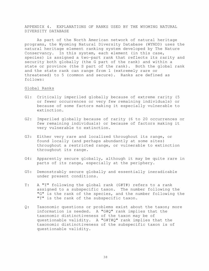
As part of the North American network of natural heritage
programs, the Wyoming Natural Diversity Database (WYNDD) uses the
natural heritage element ranking system developed by The Nature
Conservancy. In this system, each element (in this case,
species) is assigned a two-part rank that reflects its rarity and
security both globally (the G part of the rank) and within a
state or province (the S part of the rank). Both the global rank
and the state rank can range from 1 (extremely rare or
threatened) to 5 (common and secure). Ranks are defined as
follows:
Global Ranks
G1: Critically imperiled globally because of extreme rarity (5
or fewer occurrences or very few remaining individuals) or
because of some factors making it especially vulnerable to
extinction.
G2: Imperiled globally because of rarity (6 to 20 occurrences or
few remaining individuals) or because of factors making it
very vulnerable to extinction.
G3: Either very rare and localized throughout its range, or
found locally (and perhaps abundantly at some sites)
throughout a restricted range, or vulnerable to extinction
throughout its range.
G4: Apparently secure globally, although it may be quite rare in
parts of its range, especially at the periphery.
G5: Demonstrably secure globally and essentially ineradicable
under present conditions.
T: A "T" following the global rank (G#T#) refers to a rank
assigned to a subspecific taxon. The number following the
"G" is the rank of the species, and the number following the
"T" is the rank of the subspecific taxon.
Q: Taxonomic questions or problems exist about the taxon; more
information is needed. A "G#Q" rank implies that the
taxonomic distinctiveness of the taxon may be of
questionable validity. A "G#T#Q" rank implies that the
taxonomic distinctiveness of the subspecific taxon is of
questionable validity.

39
State Ranks
S1: Critically imperiled in the state or province because of
extreme rarity (5 or fewer occurrences or very few remaining
individuals) or because of some factors making it especially
vulnerable to extinction.
S2: Imperiled in the state or province because of rarity (6 to
20 occurrences or few remaining individuals) or because of
factors making it very vulnerable to extinction.
S3: Rare or uncommon in the state (on the order of 21 to 100
occurrences).
S4: Apparently secure in the state or province, with many
occurrences.
G5: Demonstrably secure in the state or province and essentially
ineradicable under present conditions.
SU: Possibly imperiled in the state but status is uncertain;
more information needed before a numerical rank can be
assigned.
S?: Status uncertain due to lack of information. The "?" is
usually combined with any of the numerical ranks, as in
"S3?".
Migratory Ranks
B: A "B" following a rank (e.g., S3B) indicates that the rank
refers to the breeding status of the species within the
state. B ranks are usually assigned to birds.
N: An "N" following a rank (e.g., S3N) indicates that the
preceding rank refers to the non-breeding status of the
species in the state. N ranks are usually assigned to
birds.
A state rank of S2BS5N indicates that the species is rare in
the state as a breeder, but abundant as a non-breeder.
40
APPENDIX 5. PLANT COMMUNITY TYPES IN THE POTENTIAL LAKE CREEK
RESEARCH NATURAL AREA.
The vegetation types are listed by the names used for them
in the national vegetation classification (Anderson et al. 1998).
The code in parentheses following the name is the last four
digits of the element code from the national classification.
Citations refer to these sources:
-- Johnston (1987): equivalent plant association from the list
for USDA Forest Service Region 2;
-- Steele et al. (1983): equivalent forest habitat type (if any);
-- Federal Geographic Data Committee (1997): type in the
hierarchy of the National Vegetation Classification Standard to
which the association belongs;
-- Kuchler (1966): Kuchler vegetation type to which the
association belongs;
-- Eyre (1980): Society of American Foresters forest cover type
to which the association belongs (if any).
Calamagrostis canadensis Western Herbaceous Vegetation (1559)
-- Johnston (1987): Unknown
-- Steele et al. (1983): None
-- Federal Geographic Data Committee (1997): V.A.5.N.k.;
Seasonally flooded, temperate or subpolar grassland
-- Kuchler (1966): None
-- Eyre (1980): None
Carex rostrata Herbaceous Vegetation (1562)
-- Johnston (1987): Carex aquatilis/Carex utriculata plant
association
-- Steele et al. (1983): None
-- Federal Geographic Data Committee (1997): V.A.5.N.k.;
seasonally flooded, temperate or subpolar grassland
-- Kuchler (1966): None
-- Eyre (1980): None
Spikemoss and Herbaceous (code unknown)
-- Johnston (1987): none
-- Steele et al. (1983): none
-- Federal Geographic Data Committee (1997): V.B.2; Temperate or
subpolar perennial forb vegetation?
-- Kuchler (1966): none
-- Eyre (1980): none
Sphagnum sp. (code unknown)
-- Johnston (1987): none
-- Steele et al. (1983): none

41
-- Federal Geographic Data Committee (1997): VI.A.1.; Temperate
or subpolar bryophyte vegetation OR VI.A.1.N.c.; Temperate or
subpolar, saturated bryophyte vegetation.
-- Kuchler (1966): none
-- Eyre (1980): none
SHRUBLANDS
Salix planifolia/Carex aquatilis Shrubland (1227)
-- Johnston (1987): Salix phylicifolia var. planifolia/Carex
aquatilis Plant Association
-- Steele et al. (1983): None
-- Federal Geographic Data Committee (1997): III.B.2.N.e.;
Seasonally flooded, cold deciduous shrubland
-- Kuchler (1966): None
-- Eyre (1980): None
Salix wolfii/Carex aquatilis Shrubland (1234)
-- Johnston (1987): Salix wolfii/Carex aquatilis Plant
Association
-- Steele et al. (1983): None
-- Federal Geographic Data Committee (1997): III.B.2.N.e.;
Seasonally flooded, cold deciduous shrubland
-- Kuchler (1966): None
-- Eyre (1980): None
FORESTS
Abies lasiocarpa/Vaccinium scoparium Forest (344)
-- Johnston (1987): Abies lasiocarpa-Picea engelmannii/Vaccinium
scoparium Plant Association
-- Steele et al. (1983): Abies lasiocarpa/Vaccinium scoparium
Habitat Type
-- Federal Geographic Data Committee (1997): I.A.8.N.d.;
Cylindrical crowned, temperate or subpolar, needle-leaved,
evergreen forest
-- Kuchler (1966): Western spruce-fir forest (14)
-- Eyre (1980): Engelmann spruce-subalpine fir (206)
Picea engelmannii/Linaea borealis Forest (370)
-- Johnston (1987): Picea engelmannii/Linnaea borealis Plant
Association
-- Steele et al. (1983): Picea engelmannii/Linnaea borealis
Habitat Type
-- Federal Geographic Data Committee (1997): I.A.8.N.c.; Conical
crowned, temperate or subpolar, needle-leaved, evergreen forest
-- Kuchler (1966): Western spruce-fir forest (14)
-- Eyre (1980): Engelmann spruce-subalpine fir (206)
Pinus contorta/Vaccinium scoparium Forest (172)

42
-- Johnston (1987): Pinus contorta/Vaccinium scoparium Plant
Association
-- Steele et al. (1983): Abies lasiocarpa/Vaccinium scoparium
Habitat Type
-- Federal Geographic Data Committee (1997): I.A.8.N.b.; Rounded
crowned, temperate or subpolar, needle-leaved, evergreen forest
-- Kuchler (1966): Western spruce-fir forest (14)
-- Eyre (1980): Lodgepole pine (206)
Pseudotsuga menziesii/Festuca idahoensis Woodland? (0900?)
-- Johnston (1987): Pseudotsuga menziesii/Festuca idahoensis
Plant Association
-- Steele et al. (1983): Pseudotsuga menziesii/Festuca idahoensis
Habitat Type
-- Federal Geographic Data Committee (1997): II.A.4.N.b.; Conical
crowned, temperate or subpolar, needle-leaved, evergreen woodland
-- Kuchler (1966): Western spruce-fir forest(14)?
-- Eyre (1980): Interior Douglas-fir (210)

43
APPENDIX 6. ELEMENT OCCURRENCE RECORDS FOR PLANT SPECIES OF
SPECIAL CONCERN IN THE POTENTIAL LAKE CREEK RNA.