ecology - west virginia university
TRANSCRIPT

1
FOREST ECOLOGY
WHAT IS IT???
ECOLOGY
‘OIKOS’ (Gr.) household, home, place to live
‘LOGIA’ knowledge
ECOLOGY – the study of organisms and their environment – and the interrelationships between the two.
TYPES OF ECOLOGICAL STUDY
Plant ecologyAnimal EcologyPopulation EcologyBehavioral EcologyEcophysiologyEvolutionary Ecology
These and other approaches are fragmentary and too compartmentalized.
ECOSYSTEM ECOLOGY
a holistic and integrated ecological concept that combines living organisms and their physical environment into a system called an ecosystem. (A.G.Tansley, 1935)
DIVISION OF STUDY
HOLISTIC - ecosystem study viewing the entire system as greater than the sum of its parts
REDUCTIONIST - study the ecosystem parts (communities and processes) separately assuming the whole is the sum of its parts.
DIVISION OF STUDY
VERTICAL – Study a small area from ground through atmosphereHORIZONTAL – Study a broad landscape with its spatial variation

2
ECOSYSTEM ECOLOGYTYPES OF ECOSYSTEMS
GRASSLAND/STEPPES
TUNDRA
TYPES OF ECOSYSTEMS
DESERTS
Global Grasslands and Deserts
TYPES OF ECOSYSTEMS
SHRUBLANDS
Chaparral = shrubby evergreen oaks
Northern desert shrub = sagebrush
TYPES OF ECOSYSTEMS
SAVANNAS –Occur on plains with low nutrient soil. Cannot support a forest. Well developed grasses with scattered patches of trees
3
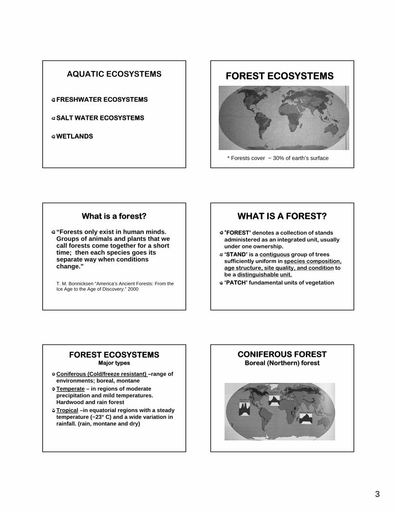
AQUATIC ECOSYSTEMS
FRESHWATER ECOSYSTEMS
SALT WATER ECOSYSTEMS
WETLANDS
FOREST ECOSYSTEMS
* Forests cover ~ 30% of earth’s surface
What is a forest?
“Forests only exist in human minds. Groups of animals and plants that we call forests come together for a short time; then each species goes its separate way when conditions change.”
T. M. Bonnicksen “America’s Ancient Forests: From the Ice Age to the Age of Discovery.” 2000
WHAT IS A FOREST?
‘FOREST’ denotes a collection of stands administered as an integrated unit, usually under one ownership.‘STAND’ is a contiguous group of trees sufficiently uniform in species composition, age structure, site quality, and condition to be a distinguishable unit.‘PATCH’ fundamental units of vegetation
FOREST ECOSYSTEMSMajor types
Coniferous (Cold/freeze resistant) –range of environments; boreal, montaneTemperate – in regions of moderate precipitation and mild temperatures. Hardwood and rain forestTropical –in equatorial regions with a steady temperature (~23° C) and a wide variation in rainfall. (rain, montane and dry)
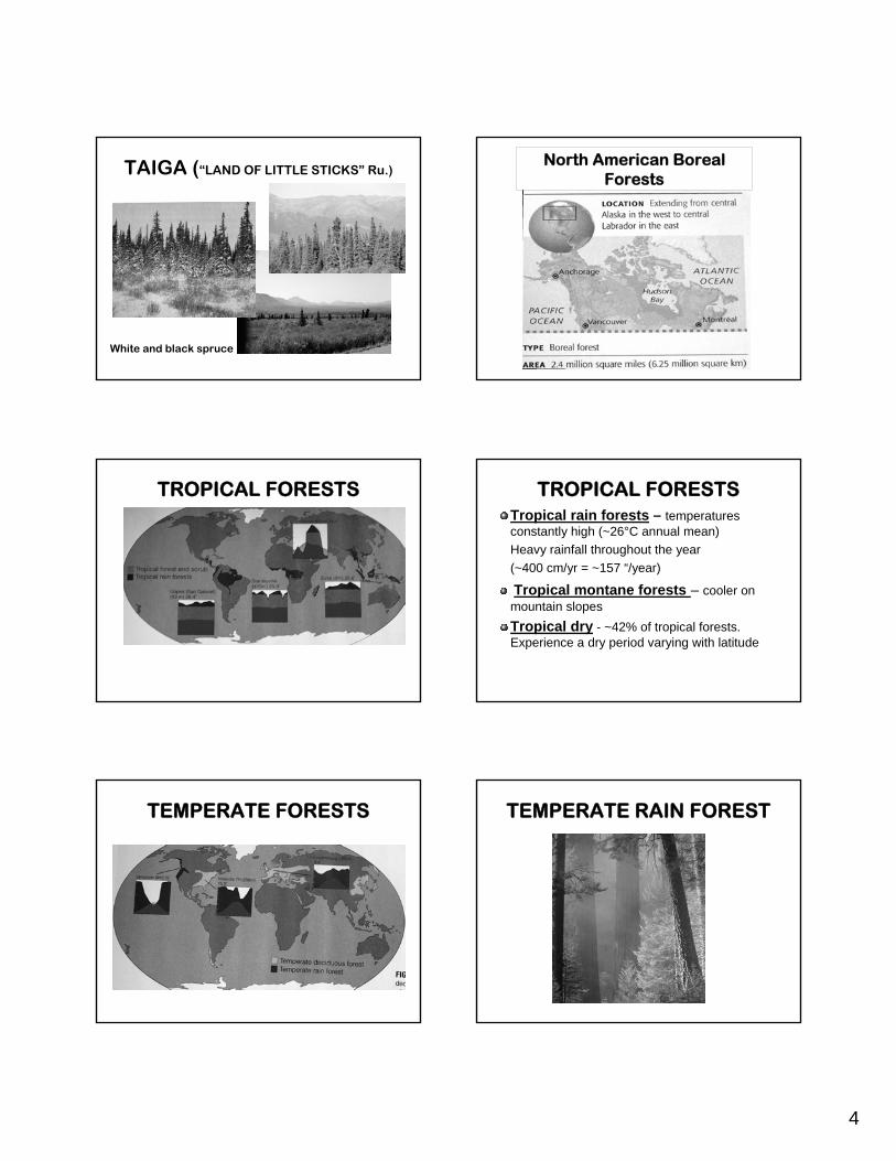
CONIFEROUS FORESTBoreal (Northern) forest
4
TAIGA (“LAND OF LITTLE STICKS” Ru.)
White and black spruce
North American Boreal Forests
TROPICAL FORESTS TROPICAL FORESTSTropical rain forests – temperatures constantly high (~26°C annual mean)Heavy rainfall throughout the year (~400 cm/yr = ~157 “/year)
Tropical montane forests – cooler on mountain slopesTropical dry - ~42% of tropical forests. Experience a dry period varying with latitude
TEMPERATE FORESTS TEMPERATE RAIN FOREST

5
TEMPERATE HARDWOOD FORESTS
CENTRAL HARDWOOD FOREST
CENTRAL HARDWOOD FOREST
TEMPERATE HARDWOOD FORESTS UNITED STATES FORESTS(From USDA FS web site)
NA91.4525.33%41.8-13.8
Inland WestID,CO,UT,AZ,MT,NM,WY
72,214219,28743.16%51.4 -34.9
Pacific WestWA,OR,HI,CA,AK
85,85793,10359%90%-30%
EasternME,NH,VT,WV,MA,NY,CT,PA,RI,NJ,MD,DE,OH
Timberlandacres(x1000)
Total forest acres(x1000)
% coverrange
Location
SUMMARY
Ecology – the study of organisms and their environmentEcosystem – the combination of living organisms and their environment Climate common denominator of each ecosystem
SUMMARY
Types of ecosystems:Grasslands, deserts, forests, wetlands, etc
Forest and stand definitionsForest ecosystems:
Coniferous (freeze resistant)Temperate –hardwood and rainTropical – dry, montane and rain

1
BIOGEOGRAPHY
ASIA
AFRICA
AUSTRALIA
BIOGEOGRAPHY
►Similarity in vegetation led to correlation of vegetation to climate, 19th century
►Earth divided into blocks of similar vegetation (deserts, grasslands, Etc,)
►Divisions called FORMATIONS
BIOGEOGRAPHY OF ECOSYSTEMS
►The study of distributions of organisms, both past and present. ►Goal: to describe and understand the many patterns of distribution of species
VEGETATION ZONATION
Climate-induced patterns of vegetation influenced by:
►Latitude►Location of regions within a landmass
(continents) affecting moisture►Altitude [1000’ (300m) = 100 miles (160
km) of latitude]
►Northern: broad west to east belts of vegetation are temperature dependent
►South of these belts vegetation zones lie north/south influenced by physiography of land
►Physiography = physical geography; study of earth's physical features
VEGETATION ZONATIONNorth America
Vegetation zones – North America

2
ECOREGIONS(R.G. Bailey – USDA-FS)
►Ecosphere: entire globe ►Megascale: continental►Macroscale: climate oriented,
latitude, elevation, subcontinental►Mesoscale: land form units
(landscape) scale of 10-100’s of square miles
►Microscale: Local site factors
LANDSCAPE ECOLOGY
The study of ecosystems and their relationship to one another, considering the spatial nature of ecosystems, focusing on their spatial patterns and functional relationships.
ECOREGIONS SITE
► Represents the sum total of all environmental factors that affect the functioning of a community in a given locale
NICHE
►Species adaptations occur at smaller scale than ‘Microscale’.
►Allow species to adapt to a very specific niche
►Factors relating to role and adaptability:
Ecological requirementsEcological toleranceEcological efficiency
BIOMES►Considers broad plant formations and
their associated animal life as a biotic unit.
►Introduced 1939 (Clements & Shelford)►Biome characterized by a uniform life
form of vegetation (desert, grassland, etc.)
►Boundaries indistinct as one type blends into another

3
BIOMES
1970
LIFE ZONES*(Merriman -1884)
►Emphasizes the importance of temperature:Law #1: the northward distribution of terrestrial plants and animals is governed by the sum of the positive temperatures as an influence for the entire growing season
Law #2: The southward distribution is governed by the mean temperature of a brief period during the hottest part of the year.*Used in temperature hardiness planting guides
HOLDRIDGE LIFE ZONE SYSTEM(1947- 1971)
Three levels of classification:Climatically defined life zones
Associations, subdivisions based on local environment
Further local subdivisions based on actual cover or land use
HOLDRIDGE LIFE ZONE SYSTEMAssumptions
1. Interaction between temperature and rainfall determine vegetations patterns
2. Geographic boundaries correspond closely to boundaries between climate zones
3. Mature stable vegetational types represent discrete vegetation units recognizable throughout the world.
HOLDRIDGE LIFE ZONE SYSTEMECOREGIONS
(R.G. Bailey – USDA-FS, 1983-1996)
►ECOREGIONS: major ecosystems that result from predictable patterns of climate as influenced by latitude, global position and altitude (Bailey, Ecosystem Geography, 1996)
► Each ecoregion is a continuous geographical area across which the interactions of climate, soil and topography are sufficiently uniform to permit the development of similar types/ forms of vegetation
Hierarchical classification
4
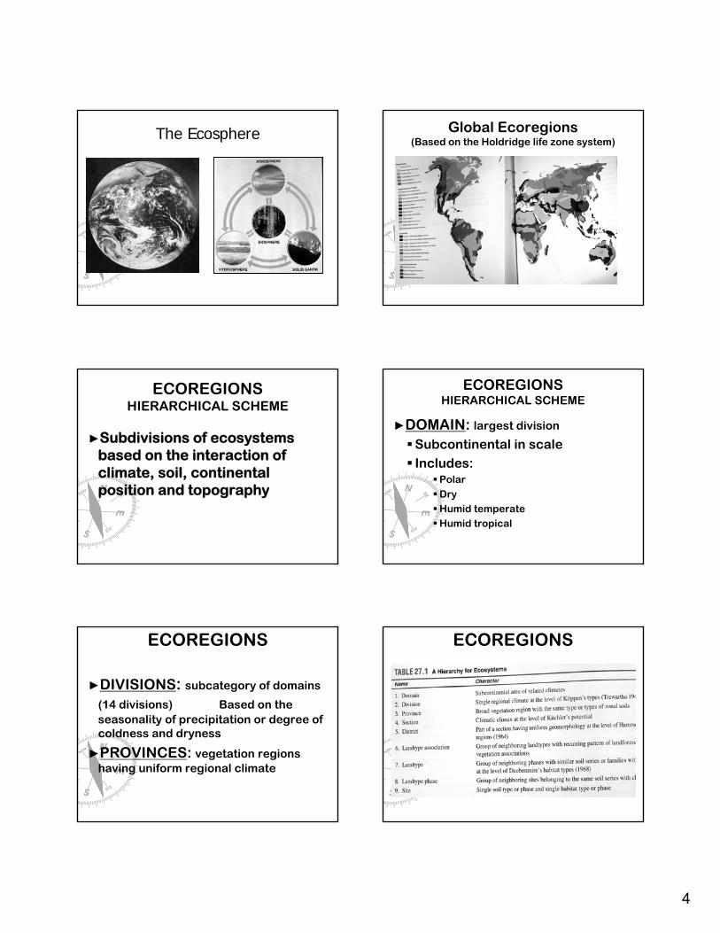
The Ecosphere Global Ecoregions(Based on the Holdridge life zone system)
ECOREGIONSHIERARCHICAL SCHEME
►Subdivisions of ecosystems based on the interaction of climate, soil, continental position and topography
ECOREGIONSHIERARCHICAL SCHEME
►DOMAIN: largest division
Subcontinental in scaleIncludes:
PolarDryHumid temperateHumid tropical
ECOREGIONS
►DIVISIONS: subcategory of domains
(14 divisions) Based on the seasonality of precipitation or degree of coldness and dryness
►PROVINCES: vegetation regions having uniform regional climate
ECOREGIONS

5
Ecoregions of North America
From: Bailey, R.W., 1978
Polar Domain
Humid Temperate Domain
Humid Tropical Domain
Dry Domain
ECOREGIONS
►Polar
►Humid Temperate
► Tundra► Subarctic
► Warm continental► Hot Continental► Subtropical► Marine► Prairie► Mediterranean
Domain DivisionEcoregions of North America
From: Bailey, R.W., 1978
Polar Domain
Humid Temperate Domain
Humid Tropical Domain
Dry Domain
ECOREGIONS
►Dry
►Humid Tropical
► Steppe
► Desert
► Savanna
► Rain Forest
Domain DivisionEcoregions of North America
From: Bailey, R.W., 1978
Polar Domain
Humid Temperate Domain
Humid Tropical Domain
Dry Domain

6
Humid Temperate DomainEastern United States
SUMMARY►Climate has a pronounced influence on
the latitudinal and altitudinal distribution of vegetation
►Latitudinal changes result in continental zonation as in N. America and Africa
►Altitudinal changes in patterns of vegetation mimic latitudinal changes
SUMMARY
► ECOLOGICAL CLASSIFICATION: an attempt to group sites with similar ecological characteristics
► BIOMES: Blocks of similar vegetation (and animals) corresponding to similar blocks of climate – may have widely different species and indistinct boundaries. [Macroscale]
► HOLDRIDGE LIFE ZONE SYSTEM: refines into zones defined by mean annual temperature and rainfall
SUMMARY
►Ecoregion scheme: refines biomes into hierarchies- applies to both terrestrial and ocean ecosystems
Domain, Division, etc. classification of Ecoregions
► Scale of ecological studyMegascale -continentalMacroscale – regionMesoscale – landscape; landformsMicroscale – local site

1
THEPHYSICAL
ENVIRONMENT
‘Direct’ factors necessary for autotrophs
(‘autotrophs’ = plants that create their own food source
• HEAT
• LIGHT
• WATER
• OXYGEN
• CARBON DIOXIDE
• MINERAL NUTRIENTS
Solar Radiation:The KEY to
climate
Surface temperature ~ 5,800° C
THE SUN
FATE OF SOLAR RADIATION
• Travels unimpeded to earth’s atmosphere• 100% strikes outer atmosphere
– Solar constant: the amount of radiation reaching outer atmosphere = 2cal./cm2/min
Fluctuations in solar constant due to variations in output of sun
FATE OF SOLAR RADIATION
• 50% absorbed by or reflected by atmosphere• 5% reflected by earth’s surface
– Albedo : solar radiation reflected back from earth’s surface (amount depends on reflecting surface)
• 45% absorbed by surface as short wave radiation
• 29% radiated back as long wave radiation

2
FATE OF SOLAR RADIATION
Solar energy reaching earth’s surface
FATE OF SOLAR RADIATION
Greenhouse Effect
ALBEDO• Low for water: ~ 2% when rays are
perpendicular• Very high for low angle rays• Snow & ice ~ 45 – 90%• Forests and grasslands 5-30%• Albedo varies region to region and
seasonally• High in polar regions, low at equator
ROTATIONAL EFFECTS
Equinox Solstice
Declination of earth = 23 ½ °
ROTATIONAL EFFECTS
TILT
ROTATIONAL EFFECTS
ORBITAL ECCENTRICITY
WOBBLE
Fluctuations in earth’s orbit and rotation are reflected by cyclical climate changes

3
ROTATIONAL EFFECTS
Milankovitch Cycle
ROTATIONAL EFFECTS
• Average global temperature is rising ~ 1.7° C/100years
• Not evenly distributed –some places are colder
• Causes:– Enhanced greenhouse effect– Earth emerging from Little Ice Age (15th-mid-
19th centuries)– Solar output varies
Movement of Air Masses
• Air is constantly moving• Air masses are huge bodies of air with
gradual temperature and humidity changes
• Temperature and humidity based on surface over which they formed
Movement of Air Masses
• INTERTROPICAL CONVERGENCE ZONE: Heated, low pressure equatorial air rises high (15-20 KM) into the atmosphere and moves poleward – ITCZ shifts with season– Equatorial low pressure area very rainy
• Air cools at high altitudes and due to frictional drag sinks toward the surface at ~30° latitude forming a subtropical high pressure area– Clear skies, sun and dry
Movement of Air Masses
• Zone of rising air around 60° forms another low pressure area– Great variability in weather
• This air flows toward poles and equator• The air aloft descends in the polar region where it
cools– polar air sinking and high pressure
• This dense mass of cold air flows toward the equator
ROTATIONAL EFFECTS ON AIR MOVEMENT
•Coriolis Force –deflection of moving air masses by earth’s rotational force

4
ROTATIONAL EFFECTS
Prevailing winds – North America (named by direction from which they come)
Global Movement of Air Masses
Global Movement of Air Masses
• Hadley cells: circulation cell near the equator
• Ferrel cell: mid-latitude cells
• Polar cell: air circuit at the poles
OCEAN CURRENTS
• Surface waters of the oceans in constant motion
• Transport enormous quantities of water• A mechanism for transport of heat from
equator to arctic areas• Movements of currents influenced by
prevailing winds and the Coriolis Effect
OCEAN CURRENTSGulf Stream
Japanese (Kuroshio)
Current
California Current
Reds arrow = warm Blue arrow = cold
OCEAN CURRENTS
• Climate determined by:– Sea surface
temperatures– Ocean currents– atmosphere
GLOBAL PRECIPITATION

5
WATER (HYDROLOGIC) CYCLE
All the rivers run into the sea;Yet the sea is not full; unto the place from whence the rivers
come,thither they return again.(Ecclesiastes 1:7)This unending circulation of earth’s waters is
the hydrologic cycle
WATER CYCLE
WATER CYCLE• Solar energy evaporates:
– 320,000 km3 from ocean– 60,000 km3 from land
• 88% falls back in oceans as rain• 96,000 km3 falls on land• 2/3 evaporates; 1/3 runs off to sea
WATER CYCLE
• Precipitation on land moves back to the ocean by:– Infiltration– Runoff– Evapotranspiration
HUMIDITY & WATER VAPOR
• Water vapor (water in gaseous state) results from evaporation
• Water acts in air as an independent gas• Pressure is proportional to temperature x density• Vapor pressure : the amount of pressure exerted
by water vapor independent of dry air• Amount of water vapor in air is a function of
temperature
HUMIDITY & WATER VAPOR• Saturation vapor pressure (SVP):
The pressure water exerts when the air is saturated
• Relative humidity (RH): amount of water vapor as a % of SVP (At SVP RH = 100%)
• Dew point: The temperature at which SVP is achieved (Condensation occurs)

6
HUMIDITY & WATER VAPOR
(MP = megapascals)
*
Condensation occurs below DP
THE ADIABATIC PROCESS
• Adiabatic Process: a volume of air compresses and warms or expands and cools with no interchange of energy with surroundings
THE ADIABATIC PROCESS
Altitude v. pressure
THE ADIABATIC PROCESS
• Lapse rate: rate at which air temperature changes with height in an air column
• Environmental lapse rate: decrease in surrounding temperature as air rises
• Dry adiabatic lapse rate: unsaturated air changes 10° C for every 1000 meters of altitude change
• RH increases as air rises – if saturation occurs as air cools – clouds form
THE ADIABATIC PROCESS
Dry adiabatic process
THE ADIABATIC PROCESS
• Moist adiabatic process: Saturated air cools more slowly because conversion of vapor to liquid releases latent heat slowing the cooling process.
• Moist adiabatic rate = ~ 6° C /1000 m.

7
THE ADIABATIC PROCESS
Moist adiabatic process
SUMMARY
• Direct factors for autotrophs:– Heat, light, water, CO2, oxygen, nutrients
• Fate of solar radiation: ~45% absorbed by earth’s surface
• Greenhouse effect• Albedo: sunlight reflected back by
surface• Solar constant: 2cal/cm2/min
SUMMARY
• Rotational effects:Tilt, wobble, elliptical orbit
• Seasonal changes• Movement of air masses• Coriolis Effect• Ocean currents
SUMMARY
• Water cycle• Water vapor• Relative Humidity• Pressure proportional to
temperature times density• The adiabatic process
THE PHYSICAL ENVIRONMENT
LIGHT &
HEAT
PROPERTIES OF LIGHT
• Wavelengths of visible light – 400 – 740 nanometers (microns)
• Light > 740 nm is infrared (IR)• Light < 400 nm is ultraviolet (UV)
• Illuminance = measure of radiation

8
PROPERTIES OF LIGHT
Photon = unit of light
UV absorbed by ozone layer
FUNCTIONS OF LIGHT
• Energy for photosynthesis– Green plant chloroplast reaction
center contains two chlorophyll molecules
– Photon excites molecules – low to high energy state
– Split water molecule to oxygen
FUNCTIONS OF LIGHT
–Photoregulation•Provides signals enabling plants to respond and adapt to environmental changes
•Photosensory systems process information about the properties of light
PROPERTIES OF LIGHT
• Photosynthetically active radiation (PAR): wavelengths used in photosynthesis
• PAR: measure of total number of photons within the visible spectrum striking a surface
• Used to study effects of radiant energy on plants
PROPERTIES OF LIGHT
• Intensity: how much
• Duration: how long
• Directionality: what direction
PROPERTIES OF LIGHT
• Intensity –varies daily and seasonally; influenced by angle of incidence
Amount of direct sunlight seasonally at 0°, 40° and 80° at outer edge of atmosphere

9
PROPERTIES OF LIGHT
• Angle of incidence: the angle at which radiation strikes a surface
• The greater the angle the greater the area covered and the less the intensity at any given point
• Lanbert’s cosine law: irradiation of a surface varies with the cosine of the angle of incidence
PROPERTIES OF LIGHT
• Duration – seasonal ; function of latitude
12 hr
24 hr
~17 hr @ 40°
EQUINOX SOLSTICE
PROPERTIES OF LIGHT
• Directionality – Changes daily and seasonally– Nearly overhead in summer; nearer the
horizon in winter.
PROPERTIES OF LIGHTPhysiography
• North and south facing slopes– South-facing slopes receive the
most solar energy (N. hemisphere)
– North-facing slopes receive the least
• Microclimate different based on aspect
PROPERTIES OF LIGHTPhysiography FATE OF LIGHT
• Absorbed, reflected or transmitted

10
FATE OF LIGHTPlant foliage absorption• High absorptivity in visible and
ultraviolet range – reflect 6-12 % visible light
• Very low absorption in far-infrared range -~70% reflected
• Leaves use red & blue photons – thus reflect and appear green
• ~4-5 % of gross solar energy absorbed• ~1-2 % total solar energy used in
photosynthesis
FATE OF LIGHT
• Remaining light is transmitted through leaves depending on thickness and structure of foliage
• Amount of light at any depth in canopy is function of the number of leaves above that point
FATE OF LIGHT
• Relative illumination (RI) within forest– Leafless deciduous trees – 50-80 %– Even-aged pine - 10-15 %– Temperate hardwood - <1-5 %– Tropical rain forest - 0.1-2.0 %
FATE OF LIGHT
LEAF AREA• Foliage density - leaf area best means
to quantify differences in productivity among forest ecosystems
• Leaf area is a direct measure of the photosynthetically-active surface area converting light to energy
• LEAF AREA INDEX (LAI)– LAI = leaf area m² /ground area m²
• LAI of 3 means there are three square meters of leaves for every square meter of ground
• (average 5; range 1-23)
LEAF AREA INDEX
11
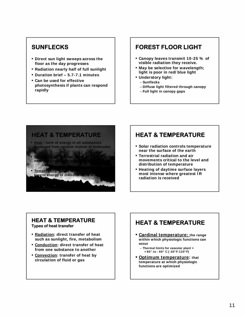
SUNFLECKS
• Direct sun light sweeps across the floor as the day progresses
• Radiation nearly half of full sunlight• Duration brief – 5.7-7.1 minutes• Can be used for effective
photosynthesis if plants can respond rapidly
FOREST FLOOR LIGHT
• Canopy leaves transmit 10-25 % of visible radiation they receive.
• May be selective for wavelength; light is poor in red/blue light
• Understory light:– Sunflecks– Diffuse light filtered through canopy– Full light in canopy gaps
HEAT & TEMPERATURE• Heat : form of energy in all substances
produced from random motion of molecules
• Specific Heat: The number of calories necessary to raise 1 gram of a substance 1°C
• Temperature: direct measure of average kinetic energy of molecules of a substance
HEAT & TEMPERATURE
• Solar radiation controls temperature near the surface of the earth
• Terrestrial radiation and air movements critical to the level and distribution of temperature
• Heating of daytime surface layers most intense where greatest IR radiation is received
HEAT & TEMPERATURETypes of heat transfer
• Radiation: direct transfer of heat such as sunlight, fire, metabolism
• Conduction: direct transfer of heat from one substance to another
• Convection: transfer of heat by circulation of fluid or gas
HEAT & TEMPERATURE
• Cardinal temperature: the range within which physiologic functions can occur– Thermal limits for vascular plant =
+60° to - 60° C (-30°F-120°F)
• Optimum temperature: that temperature at which physiologic functions are optimized

12
HEAT & TEMPERATURE
Thermal energy gained
= thermal energy lost
• Moist material dissipates heat via evaporation
•Water vapor decreases incoming solar energy
•Mineral and organic soil poor heat conductors
HEAT & TEMPERATURE
• By day solar energy heats earth’s surface and the air above it
• Heat gains exceed heat losses
• Evaporation results in cooling
HEAT & TEMPERATURE• At night the surface air
loses more radiant energy than it receives.
• Layer of cooler surface air deepens resulting in nighttime inversion
• Net cooling at night
Thermoperiod: difference between day and night temperatures
HEAT & TEMPERATURE
• Amount of vegetation and litter• Color: black absorbs best • Moisture: dissipates heat via
evaporation• Wind speed : most important in
dissipation of heat
Surface temperature dependent upon
HEAT & TEMPERATURE
• Temperature at surface dependent upon:– Topography– Aspect– Altitude
TEMPERATURE EXTREMES
• HEAT INJURY– Heat kill: Temperatures to 45°C
(140°F), disrupts cell metabolism– Sun scald: In thin barked trees when
suddenly exposed to high temperatures, necrosis of the bark
– Water stress: Dehydration due to water loss in response to heat

13
TEMPERATURE EXTREMES
• COLD INJURY– Freezing:
• rapid freezing forms ice crystals within protoplasm of cells
• Rapid thawing causes disruption of cell membranes
• Slow freezing may also kill some plants• Intercellular water freezes causing
dehydration– Winter drought:
TEMPERATURE EXTREMES
• COLD INJURY– Frost crack/frost
ribAsymmetrical
contraction , upon freezing plant tissues contract
SUMMARY - LIGHT
• Light is essential to most life and is the only thing the forester can manipulate– Photosynthesis, Photoregulation
• Light can be reflected, absorbed or transmitted
• Properties of light– Intensity– Duration – Direction
SUMMARY - LIGHT
• Photosynthetically Active Radiation (PAR)
• Fate of light through forest canopy• Leaf Area Index• Understory Light
– Sunflecks– Diffuse light
SUMMARY
• All organisms live in a thermal environment characterized by heat and temperature
• Heat is a form of energy• Temperature is a measure of a
material’s tendency to give up heat• Heat gains equal heat losses
SUMMARY
• Types of heat transfer– Radiation – given off directly– Convection – moved with air
currents– Conduction – transfers through
adjacent material

14
SUMMARY
• Factors controlling surface temperature– Color– Soil– Vegetation– Moisture – Air movement– Aspect
• Extremes of temperature– Heat injury– Cold injury
SUMMARY
CLIMATE &
WEATHER
CLIMATE & WEATHER
• CLIMATE: characteristic patterns, means, and extremes of weather evaluated over many years
• CLIMATE: is a product of weather, which is air in motion driven by uneven heating
CLIMATE & WEATHER
• Atmosphere and oceans combine to produce climate
• Water warms and cools more slowly than land thus moderating temperatures
• Ocean currents transport heat• North Pole warmer than South Pole
CLIMATE CHANGE
• World’s climates are constantly changing– Orbital variation– Emergence from Little Ice Age (15th – mid
19th centuries)– Natural oscillations - natural variations
between pressure areas– Changes in solar output– Enhanced greenhouse effect

15
CLIMATE & WEATHER
• MACROCLIMATE: Massive circulation patterns of atmosphere and ocean currents as well as major land forms determine climate pattern of large regions
• MESOCLIMATE: physiography influences regional climate
• MICROCLIMATE: The distinctive climate of a particular place. Microclimate influences the spatial patterning of local ecosystems and their species composition
CLIMATE AND PHYSIOGRAPHYPhysiography with its relatively stable landforms
controls climatic regimes at all levels
CLIMATE AND PHYSIOGRAPHY
• Maritime or oceanic climates – air masses arise over oceans
• Continental climates - air masses that formed over continents or lost their moisture over mountains
CLIMATE AND PHYSIOGRAPHY
CLIMATE AND PHYSIOGRAPHYRain shadow or Orographic rain
CLIMATE AND PHYSIOGRAPHYRain shadow or Orographic rain

16
WEATHER
• WEATHER: constantly changing atmospheric conditions prevailing at a particular place and time
• WEATHER: a result of the physical interactions between sunlight, air and water and local physiography
WEATHER
• Front: boundary between different air masses named for the air behind it
• Warm air masses (rising)– low-pressure systems (cyclone)
• Cool air masses (sinking) – high pressure systems (anticyclone)
WEATHER
• Pressure gradient: difference between the pressure at the center of a system and the air outside the system
• Air flows along this gradient• The steeper the gradient the
stronger the winds
WEATHER
Low-pressure spiralHigh and low pressure
systems
WEATHER
• Air masses meet:– Do not merge because they are at
different temperatures and densities– Denser air moves beneath the less
dense air– Winds in warm front / low pressure
system stronger
WEATHER

17
WEATHER
• JET STREAMNarrow ribbons of fast moving air that circle the earth west to east
Produced by difference in temperature between air masses
PRECIPITATION
Modes of precipitation– Convection – warm updrafts form
clouds– Orographic – air forced over
topographic features– Cyclonic – frontal storms, the most
common in the temperate area
PRECIPITATION
• Rising air warmer than surrounding air
• Clouds form at dew point
• Latent heat given off as water molecules merge
• Water droplets fall as rain when large enough
Cloud formation
PRECIPITATION
• Hail: begins as a raindrop, rises and freezes, grows by collecting supercooled water that freezes onto it. Sizes dependent on number of circuits in the cloud
• Hail defoliates
PRECIPITATION
• FOG is a cloud at ground level– Radiation fog –night time when surface radiation
cools the surface and air layer above it. Fog forms if air is moisture laden. (Valley fog)
– Advection fog – warm air moves over cold water– Fog a valuable part of total water for vegetation
• DEW nighttime condensation as earth surface cools
PRECIPITATION
• SNOW: ice crystals adhere to one another, 6 - sided– Snow fall is distinct from rain.– Frozen water is unavailable to plants– Snow can be protective, can be damaging
• ICE and SLEET: rain or melted snow flakes that freeze between the cloud and ground, limb breakage
• FROST: dew-point below freezing, kills plants

18
WEATHER
• WIND: The movement of air away from areas of high pressure to areas of low pressure
• WIND SPEED: proportional to the pressure gradient
• Air spirals into a low pressure center
WEATHER
• Ocean Winds – always stronger than wind over land; less friction– Strongest winds in the Antarctic Ocean
where they circle the earth unimpeded.
• Seasonal Winds– Sirocco – spring time from Africa to
Europe– Bora – winter from Russia to
Mediterranean
WEATHER
• Daily Winds– Most common
are land – sea breezes
• Drainage wind – cool air settles
WEATHERExtreme Events
• HURRICANE: Tropical cyclone - a low pressure system generated at sea when water temperature >80° F– Occurs in late summer– Coriolis Effect makes the winds spiral– Eye is a calm area of warm sinking air in
the center– Cause tremendous wind and flood
damage
WEATHERExtreme Events• TORNADOES:
speeds up to 300 mph
• Can occur anywhere
• Funnel cloud until it touches down
WEATHERExtreme Events• Lightning
– Thunder the audible result
– Large amounts of water/ ice reach temps of -30° C
– Cloud becomes bipolar – strikes when charge is high enough
– Discharge can be extremely strong
+++
- - -+++

19
WEATHERExtreme Events• Direct Effects of
Lightning– Death or serious
injury to trees– Strips (Blows) bark
away– Cambial damage
may not be visible– Amount of damage
related to strength of charge
WEATHERExtreme Events
• Indirect Effects of Lightning– Fire – especially in
dry climates– Nitrogen fixation
5lbs/ac/yr– Predisposes tree to
insect damage
SUMMARY
• CLIMATE: Patterns of weather evaluated over time
• Atmosphere, oceans and topography combine to produce climate
• Causes of changing climate– Orbital variation, greenhouse effect, changes in
solar output, natural oscillations,
SUMMARY
• Classification:– Macro- (continental), – meso (physiography), – micro- (local factors)
• Oceanic/ Maritime climates• Continental climates
SUMMARY
• Weather – constantly changing atmospheric conditions prevailing at a particular place and time
• Front – boundary between air masses
• Warm fronts – low pressure• Cold fronts – high pressure• Air masses do not merge
SUMMARY
• Precipitation:– Convection – warm updrafts– Orographic – air forced over
topographic features– Cyclonic – frontal storms, most
common in this area

20
SUMMARY
• Forms of precipitation:– Rain– Hail– Fog/ Dew– Snow– Ice /Sleet
• Effects of each on vegetation
SUMMARY
• Wind: movement of air from areas of high pressure to areas of low pressure– Ocean winds– Seasonal winds– Daily winds (land-sea breezes)– Drainage wind
SUMMARY
• Extreme weather events– Hurricane– Tornado– Lightning
• Direct effects of lightning• Indirect effects of lightning