economic benefits of global positioning system (gps ...€¦ · management, geographic information...
TRANSCRIPT
1
Economic Benefits of Global Positioning System (GPS) technology in
developing countries for Land Management, Geographic Information
and AgricultureKeith Hofgartner
Trimble Navigation LimitedJuly 2008
Opening Statement
Major cost-efficiency can be achieved with use of GPS(GNSS) technology
• GPS(GNSS) Infrastructure is crucial for managing cadastral systems
• GPS(GNSS) Infrastructure is an enabling technology
From Measurement to Management..

2
GPS (GNSS) – Civil Use
Power Grid InterfacesPower Grid Interfaces
Aviation Aviation Personal NavigationPersonal Navigation
CommunicationsCommunications
RailroadsRailroads
RecreationRecreationTrucking & ShippingTrucking & Shipping
Surveying & MappingSurveying & Mapping
Offshore Drilling
Police Police EnforcementEnforcement
UtilitiesUtilities
How accurate is GPS(GNSS)?Mapping Grade Receiver
Survey Grade GPS
Autonomous Navigation Receiver
Military GPS receivers

3
Geo II
Geo III
0
1
2
3
1996 1998 2000 2002 2004 2006 2008
Acc
urac
y (m
)Evolution of GPS accuracy
Trimble GeoExplorer
Geo XT GeoXH
2008GeoXH2005
RTK
What is a GPS (GNSS) Infrastructure?
GPS (GNSS) Infrastructure:– GPS (GNSS) Receivers– Enterprise Class Servers– Communications Links– Enterprise data processing software
GNSS Infrastructure is the positioning backbone to enable high accuracy surveying and any positioning related application

4
Components of Infrastructure
Monumentation Hardware
SoftwareCommunications
GNSS Networks

5
Scalable Infrastructure
VRS Infrastructure
Connections of CORS to Control Centre

6
Connections of CORS to Control Centre
NMEA
VRS Solution is established
VRS
VRS Infrastructure
VRS
RTCM
VRS Infrastructure

7
GPS Infrastructure ……an enabling technology
Enables you to reduce costs for Cadastre and Land Reform Projects
Cadastre
Infrastructure
GIS
Disaster Prevention & Management
Precision Agriculture
Economic Benefits….Cadastre Management and Land Reform
Precision GPS: Traditional Monumentation vs. Active MonumentationCadastre
Infrastructure
GIS
Disaster Prevention & Management
Precision Agriculture
•Spacing–~50-60kms
•Cost–5 reference stations @ $40K = $ 200K
Active Monumentation
•Spacing–~10km grid for base station setup and coverage
•Cost–100 monuments @ $15K = $ 1.5m
Traditional Monumentation
RequirementsMethod

8
Economic Benefits….Cadastre Management and Land Reform
Precision GPS: Traditional Monumentation vs. Active Monumentation
• Moving to an Active Control System–Replacement of traditional monumentation and associated costs of maintaining
Quality Control and Integrity Monitoring
• Maintain consistent spatial Coordinate System
–GIS tend to use a countrywide coordinate system–Survey tend to use Local Coordinate systems that do not necessarily relate
Single Coordinate framework
BenefitFeatureCadastre
Infrastructure
GIS
Disaster Prevention & Management
Precision Agriculture
GPS Infrastructure ……an enabling technology
Enables you to reduce costs for capital improvement projects
Now and in the future
Cadastre
Infrastructure
GIS
Disaster Prevention & Management
Precision Agriculture

9
Enables adoption of stakelessconstruction with machine
control systems
GPS Infrastructure ……an enabling technology
Cadastre
Infrastructure
GIS
Disaster Prevention & Management
Precision Agriculture
Supports asset inventory and management
• Moving – fleets, boats, containers
• Fixed – Utility hardware, building inventories
GPS Infrastructure ……an enabling technology
Cadastre
Infrastructure
Asset Management
GIS
Disaster Prevention & Management
Precision Agriculture

10
Geographic Information Collection
Enables smaller entities to adopt positioning technology
GPS Infrastructure ……an enabling technology
Cadastre
Infrastructure
Asset Management
GIS
Disaster Prevention & Management
Precision Agriculture
Cadastre
Infrastructure
Asset Management
GIS
Disaster Prevention & Management
Precision Agriculture
Economic Benefits….Geographic Information Collection
• Use same coordinate system to relocate ‘lost’ assets
•Relocate
• Common Coordinate system• Easy to use
•GNSS Positioning
• Use the accuracy required for the task
•GNSS Precisions
• Automatic verification of time of measurements
•Time stamp
BenefitsFeatures

11
Disaster Prevention and Management
Monitoring of natural hazards, (volcanoes, plate tectonic boundaries)
and manmade structures (dams, slopes)
GPS Infrastructure ……an enabling technology
Cadastre
Infrastructure
Asset Management
GIS
Disaster Prevention & Management
Precision Agriculture
Disaster Prevention and ManagementImproves disaster response
in accuracy and time• Natural, Non-natural,
Accident/Crime Scene, Homeland Security
Sri Lanka Tsunami Relief
2005
GPS Infrastructure ……an enabling technology
Cadastre
Infrastructure
Asset Management
GIS
Disaster Prevention & Management
Precision Agriculture

12
Augment Lasers to GPS for Land Leveling• Improve crop yield by 20% -30% over conventional leveling
technology• Improve crop yield by 50% on new fields• Conserve water• fields can be leveled to within +/-1cm• Reduce surveying costs or give surveying• Improved topsoil management• Reduces chemical runoff• 24 operation
GPS Infrastructure ……an enabling technology
Cadastre
Infrastructure
Asset Management
GIS
Disaster Prevention & Management
Precision Agriculture
Land Administration Projectsutilising Trimble Solutions
Two recent examples– Benin
• Access to Land Project (MCC)
– Ghana• Pilot Project (MCC)• Land Administration Project (WB)• Clinton Global Initiative Project

13
Benin GNSS Applications
• Used for Cadastral, GIS, Engineering Survey applications
• Potential for Control Surveys, Earthquake / Deformation Studies and Precision Farming
Benin GNSS Applications
• Surveying Using Local RTK Base stations and surveying land parcels
• Post Processing of the survey data into National Grid using the CORS Station data centrally stored in Cotonou
14
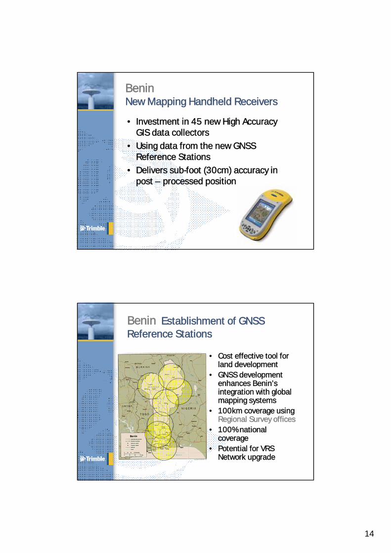
BeninNew Mapping Handheld Receivers
• Investment in 45 new High Accuracy GIS data collectors
• Using data from the new GNSS Reference Stations
• Delivers sub-foot (30cm) accuracy in post – processed position
Benin Establishment of GNSS Reference Stations
• Cost effective tool for land development
• GNSS development enhances Benin’s integration with global mapping systems
• 100km coverage using Regional Survey offices
• 100% national coverage
• Potential for VRS Network upgrade

15
• Supported by – Millennium Challenge Corporation– World Bank– Private funding (Opportunity International)
GhanaLand Administration Projects
GhanaState of Survey Infrastructure
• A sparse network of triangulation beacons – Unable to basis for accurate cadastre
• Different co-ordinate systems– War Office– Clark Modified 1880 Ellipsoid.– The lack of a homogenous co-ordinate system has led
to multiple sale of land and the high of cost of access to land for development.

16
• Initial Pilot project• Further densification of
network• Cost effective tool for
land development• GNSS development
enhances Ghana’s integration with global mapping systems
• 7km range Real time coverage using Regional Survey offices
GhanaSpatial Distribution of GNSS COR
GhanaMillennium Challenge – Pilot Project
• Local offices with GNSS Reference Stations storing Raw Data for Post Processing
• Additional 35W Radios transmit Real Time corrections to users in field (7-10k range), or set up local base station and Post Process to National Coordinate system for remote sites
• Latest GNSS RTK rovers for cm precision• Robotic Optical Total Stations for in-fill in
built-up areas, (no GNSS coverage)• High Accuracy GIS data collectors
– Delivers sub-foot (30cm) accuracy in post – processed position
• Potential to utilise Reference Stations as part of a National Network with potential for a deliverable VRS solution

17
GhanaPilot for Opportunity International
• First American – the US’s leading provider of business information relating to real estate transactions
• Opportunity International - delivering tailored microfinance products to the world’s poor
• ESRI – the global leader in GIS technology
• Trimble - leading provider of advanced positioning solutions
• International Land Systems - develops sustainable land recording and registration systems and consulting worldwide
• Sambus – one of Ghana’s leading ICT companies
GhanaNew Mapping Handheld Receivers
• Investment in over 50 new High Accuracy GIS data collectors
• Delivers sub-foot (30cm) accuracy in post – processed position
• Investment in many lower accuracy units for Parcel Identification only
• All using data from the new GNSS Reference Stations

18
• Opportunity International is well established
• Use of existing infrastructure is critical
• Existing clients first in line
• Government support is strong
GhanaPilot for Opportunity International
GhanaElements of approach
• Start with Opportunity International clients – schools first.
• Use private sector resources to document de facto ownership as basis for paralegal title.
• Rely on paralegal title to grant micro mortgages.
• Use paralegal title and economic validation to incentivize formalization of title.
• Develop low cost registry solution (< $1000) based on ESRI/ILS software; data model to adhere to GLTN standards.
• Build a public/private partnership for long-term success.
36

19
GhanaResults so far..
• School Loan offering developed by Opportunity International.
• Forms and procedures under review for approval by government.
• First schools in loan program surveyed using GPS.
• Determination of rights being made in the field.
GhanaConclusion
• GNSS infrastructure will underpin the intended efficiency in the land administration through increased security in tenure.
• It will provide the basis for the capture and utilization of the so called critical GIS spatial dataset coherent in nature country for more effect spatially correct to improve the efficiency of Industry.
• Ghana is poised to be an example of an emerging country that has leverage GNSS technology for sustainable development

20
African Reference Station FrameAFREF
• A unified geodetic reference frame for Africa
• Fundamental basis for the national and regional three-dimensionalreference networks
• Goal: Continuous permanent GPS stations allowing free user access of GPS Data anywhere in Africa
Continuous Operation Reference Stations
Countries with:South Africa, Egypt,Morocco, Namibia,Kenya, Zambia,Cameroon, Senegal,Uganda and IvoryCoast, Benin
Countries in Progress:Tanzania, Botswana,Malawi, Ghana, Nigeria, Namibia, Ethiopia, Swaziland
21
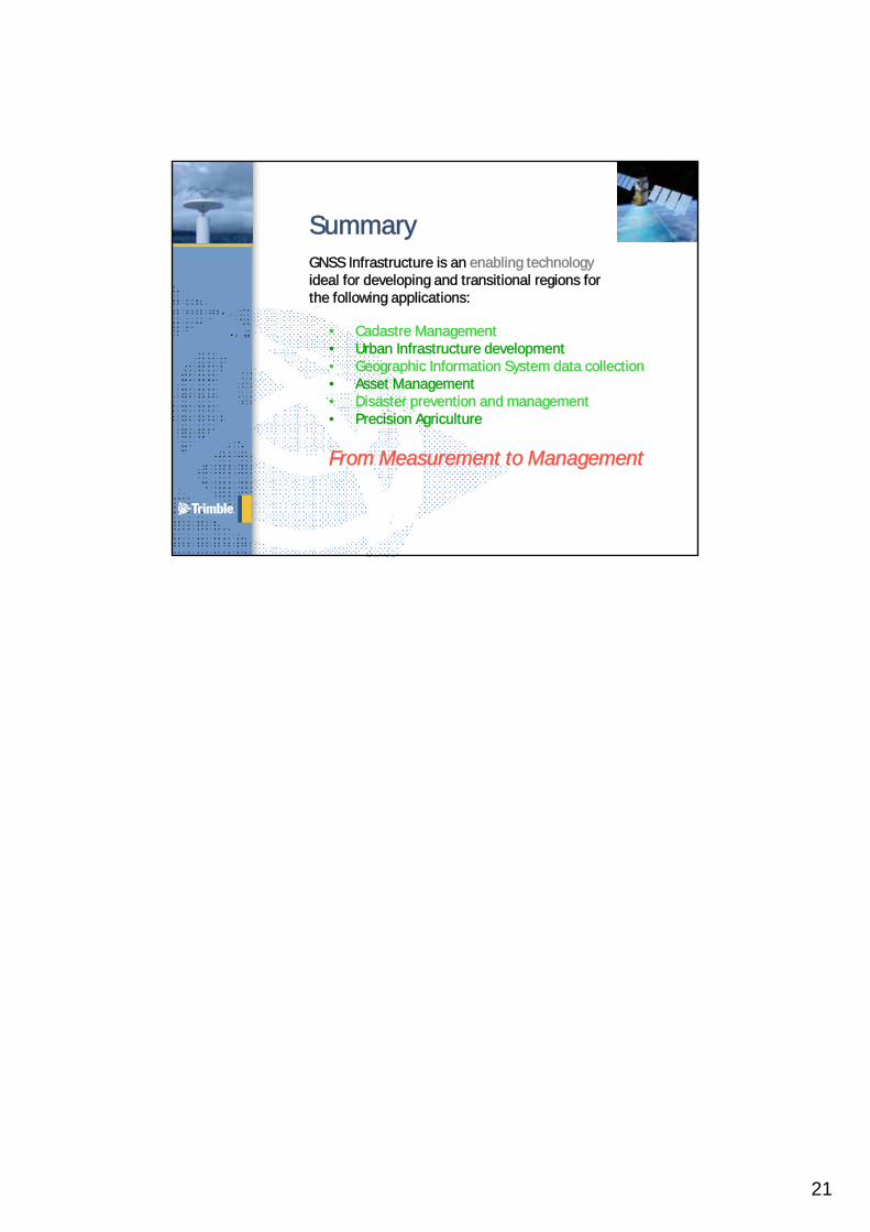
SummaryGNSS Infrastructure is an enabling technologyideal for developing and transitional regions forthe following applications:
• Cadastre Management• Urban Infrastructure development• Geographic Information System data collection• Asset Management• Disaster prevention and management• Precision Agriculture
From Measurement to Management