el valle de arroyo seco community planning
TRANSCRIPT

El Valle de Arroyo Seco Highway Corridor Plan
Adopted by the Santa Fe County Board of County Commissioners
via Resolution 2003-4 on January 14, 2003
Prepared by the El Valle de Arroyo Seco Community Planning Committee

El Valle de Arroyo Seco Highway Corridor Plan
Adopted via Resolution 2003-4 – 14 January 2003
TABLE OF CONTENTS
TABLE OF CONTENTS ………………………………………………………………………2
ACKNOWLEDGEMENTS …………………………………………………………………….3
I. INTRODUCTION……………………………………………………………………..4
II. VISION, GOALS & PLAN PRINCIPLES ……………………………………………7
III. BRIEF HISTORY OF EL VALLE DE ARROYO SECO……………………………..9
IV. EXISTING CONDITIONS AND LAND USES………………………………………10
V. HIGHWAY CORRIDOR ZONING AND LAND USE……………………………….13
VI. HIGHWAY CORRIDOR DESIGN STANDARDS……………………………………16
VII. FUTURE PLANNING ISSUES………………………………………………………..21
VIII. MAPS
1. HIGHWAY CORRIDOR.…………………………………………………….23
2. COMMUNITY PLANNING BOUNDARIES…………………………………24
IX. DEFINITIONS………………………………………………………………………….25
2
El Valle de Arroyo Seco Highway Corridor Plan
Adopted via Resolution 2003-4 – 14 January 2003
ACKNOWLEDGEMENTS: El Valle de Arroyo Seco Highway Corridor community planning Committee Members and Participants:
Dana Allison Katie Allison Mike Boring Pat Boring Fred Bowling Charles Brownrigg
Paul Chavez Connie Chavez Katherine Chavez John Francisco Joe Garcia Lupe Garcia Ted Griffith Mike Herrera Elberta Honstein Myra Horton Teresa Johnson Rosebella Lineberry
Rochelle Lineberry David Marusa Jim Meyer Marilyn Meyer Joe Montoya John Montoya Loyola Montoya Juan Montoya Carla Montoya
Ben Moya Dr. Jack Paule M. June Paule Harry Plannerer Dennis Quintana Orlando Rodriguez Ken Salazar Nancy Salazar George Theragood
Danny Urquhart Judy Urquhart Bennie Velasquez Nancy Williams Barbara Zavada
Santa Fe County
Commissioner Harry Montoya, District 1 Commissioner Paul Duran, District 2 (Chairman) Commissioner Mike Anaya, District 3 Commissioner Paul Campos, District 4 Commissioner Jack Sullivan, District 5 Estévan Lopez – County Manager Roman Abeyta – Land Use Administrator Jack Kolkmeyer – Planning Division Director Alina Bokde-Planner Ken Pin-Planner Paul M. Olafson – Open Space and Trails Manager (Co-Lead Planner) Robert Griego – Community Planner (Co-Lead Planner) Beth Mills – GIS Planner
3
El Valle de Arroyo Seco Highway Corridor Plan
Adopted via Resolution 2003-4 – 14 January 2003
I. INTRODUCTION
PURPOSE OF PLAN: El Valle de Arroyo Highway Corridor Plan addresses the concerns of residents and outlines how community members would like to direct future changes in the area. Upon adoption by the Board of County Commissioners, the Plan will become an amendment to the Growth Management Plan and future developments within Highway Corridor Boundary will adhere to the adopted policies. Proposed programs and projects will be considered for funding through County programs such as the Infrastructure Capital Improvements Program (ICIP). Following adoption, ordinances will be designed to implement the Plan’s goals and objectives.
EL VALLE DE ARROYO SECO HIGHWAY CORRIDOR PLANNING EFFORT What is Planning? Planning is based upon a vision for a community’s future. Formal community planning occurs when a community comes up with a common set of concerns and issues, and then develops goals and policies to address those concerns. The planning process incorporates community members’ opinions and must reflect the character and be appropriate to the community in which it is done. The US 84/285 Highway Corridor Plan for El Valle de Arroyo Seco is a part of the Community Planning process. It is a way for the community to develop land use and service policies and programs that are tailored to the area’s unique needs and conditions. County Planning staff have been working with the community in creating a plan that fits El Valle de Arroyo Seco. The community is able to develop a Community Plan with policies and programs designed by residents, business owners and property owners in the area. If adopted by the Board of County Commissioners, the Highway Corridor Plan will be an amendment to the County Growth Management Plan and will direct future development along US 84/285. History of El Valle de Arroyo Seco’s Community Planning Effort The El Valle de Arroyo Seco planning process was started by community members, property owners and business owners in 1998. The current Highway Corridor Plan effort along Highway 84/285 began from the community planning process in 2000. The entire community was informed of the planning effort through community-wide mailings and a survey, which included a survey concerning future development along Highway 285/84. Additionally, community day events were held at the Arroyo Seco Sub-station of the La Puebla Fire District which included informational booths regarding community planning for El Valle de Arroyo Seco. County staff and the community planning committee informed the community of the planning effort through newspaper advertisements, letters, fliers, posters and through word-of-mouth.
4

El Valle de Arroyo Seco Highway Corridor Plan
Adopted via Resolution 2003-4 – 14 January 2003 The planning meetings have been held regularly, on both a monthly and bi-monthly basis. All planning meetings have been open to the public and meetings have encouraged open discussion and participation by all attendees. Decisions have been made on a consensus basis. Community members have identified problems and possible solutions to issues related to growth and development along the highway corridor. Discussions have included:
The type of businesses and services that should be allowed along the corridor; • • •
The types of activities that are not appropriate for the community; and Design standards for future commercial and residential development along the corridor.
COMMUNITY SURVEYS Methodology In June and again in August-September of 2000, two Community Surveys were conducted in El Valle de Arroyo Seco. The surveys were designed to provide the Planning Committee with a general idea of community attitudes and to provide direction on the issues that should be addressed in the plan. The survey results, together with community input at community meetings, formed the basis for the policies developed in this plan.
Summary of issues identified in two surveys of El Valle de Arroyo Seco community members conducted in June and August-September of 2000: • Safety, heavy traffic, and speeding along Highway 285/84 are a major problem.
• Deceleration lanes, acceleration lanes, turning lanes and frontage roads were noted as potential solutions to traffic problems.
• Commercial development in the area should fit the rural, small community atmosphere:
• Home occupation businesses, small-scale grocery stores and services needed by residents like banking or child care along with farmer sales on roadsides.
• Large-scale commercial development, including large chain stores and large industries were not supported.
• Survey respondents supported maintaining the rural character of the area along with design
elements for new development including: • new buildings situated farther back from the highway • limiting height of new buildings to 24 feet, • limiting the square footage of new buildings, • limiting the size and style of signs • landscaping on medians and roadsides
• Protection of open space areas including:
• development of trails and parks in the community • Working with public agencies to develop trails and open space.
5

El Valle de Arroyo Seco Highway Corridor Plan
Adopted via Resolution 2003-4 – 14 January 2003 • The El Valle de Arroyo Seco area needs a community center. • Protection of the rich diversity of the many different cultural backgrounds found in the
community and cultural sites. • Protection of the environment and water resources:
• Emphasis was placed on protecting drinking water sources through water conservation measures and stronger regulations to prevent water source contamination.
Additional Issues Identified Through Surveys and Community Meetings:
1. lack of drainage 2. speeding on roads 3. too much traffic 4. no process access on and off roads 5. too many access roads 6. no turning lanes 7. no controlled access 8. dangerous road 9. no designated school bus stops with
shelters
10. lack of signage 11. lack of lighting 12. accidents along highway 13. Jake brake usage by semi-trucks is a
problem 14. difficult to see the road/marks on
the road during the winter 15. safety concerns resulting from
highway vendors/ non-permitted highway vendors
6

El Valle de Arroyo Seco Highway Corridor Plan Adopted via Resolution 2003-4 – 14 January 2003
II. VISION, GOALS & PRINCIPLES EL VALLE DE ARROYO SECO COMMUNITY VISION STATEMENT The following Vision Statement serves as the basis for the goals and policies of the El Valle de Arroyo Seco Highway Corridor Plan. We the citizens of El Valle de Arroyo Seco will strive to improve safety, cleanliness, and beauty of the Highway Corridor, to create a pleasant, safe, quiet, and livable community environment
while maintaining the cultural heritage that makes our community a unique place. HIGHWAY CORRIDOR PLAN GOALS The following goal statements have been developed for the Highway Corridor Plan: Goal 1: Protect those who may live or work near the highway corridor from excessive noise,
visual blight, noxious odors, and other environmental hazards.
• Establish greater separation between the highway and adjacent land development than required along other roadways.
• Landscape the edge of roadways to soften and mitigate road noise and buffer existing uses along the highways.
Goal 2: Protect the scenic vistas and natural landscape of the area as viewed from the highways.
• Establish standards that minimize the visual distractions of buildings and signs along the highways, while assuring an attractive built environment with adequate opportunities for economic development in the corridors.
• Prevent additional strip commercial development along the highway by locating commercial development in appropriate areas.
7

El Valle de Arroyo Seco Highway Corridor Plan Adopted via Resolution 2003-4 – 14 January 2003
MAIN PRINCIPLES OF ARROYO SECO HIGHWAY CORRIDOR PLAN
•
•
•
• Improve safety along the highway corridor for Arroyo Seco residents and their families as well as people passing through the community on the highway
• Protect those who live and work along the highway from excessive noise, visual blight, noxious odors and other environmental hazards
• Allow for commercial, small business and home businesses in Arroyo Seco that: a) Provide services to the community b) Are supportive of the local economy and business development c) Are small scale to fit the traditional community character d) Are not large-scale industry or warehouse store type development
Create flexible design standards that:
a) Allow for individuality and respect personal tastes b) Fit the traditional, rural character of the area c) Encourage attractive development that enhance the area’s scenic quality
Protect open space areas and visual resources / view sheds Protect the environment and water resources
8

El Valle de Arroyo Seco Highway Corridor Plan Adopted via Resolution 2003-4 – 14 January 2003
III. A BRIEF HISTORY OF EL VALLE DE ARROYO SECO The area’s original Spanish name is “El Ojito” so named because there were springs identified on this seemingly desert terrain. The area was homesteaded by Procipio Herrera Roybal in the early part of the 1900’s. Roybal acquired a large property in the area and eventually ran cattle and grew dry-land beans to sustain and support his family’s lifestyle as farmers and ranchers.
• 1927 – Procopio Roybal homesteaded
• Most homesteading began in the 1940’s and 1950’s - used to be federal land – BLM
• Lots created for homesteads were generally 5 acre parcels (330 feet x 660 feet) and could be as large as 40 acres (1305 feet x 1305 feet) per family
• In order to homestead, individuals were required to make improvements to the land
within a year in order to maintain homestead claim
• El Valle de Arroyo Seco is designated as a Traditional Community by Santa Fe County
9

El Valle de Arroyo Seco Highway Corridor Plan Adopted via Resolution 2003-4 – 14 January 2003
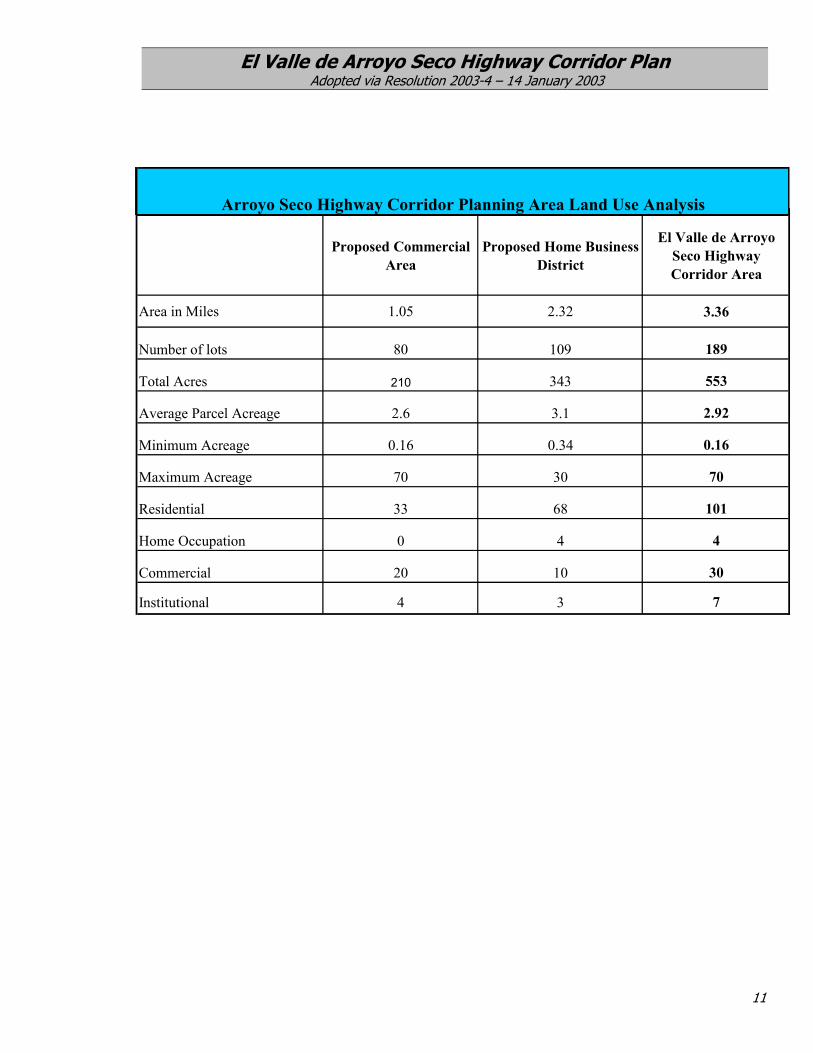
IV. EXISTING CONDITIONS AND LAND USES El Valle de Arroyo Seco Highway Corridor Area: The El Valle de Arroyo Seco Highway Corridor runs from the northern border of Pojoaque Pueblo to the eastern boundary of Santa Clara Pueblo, just southeast of the Sombrillo intersection with New Mexico State Road 106. The El Valle de Arroyo Seco Highway Corridor is defined as an area roughly 300 feet wide on each side of the right-of-way of the US Highway 84/285. The total area for the corridor is 3.36 miles. The corridor is approximately 3 miles long and includes an area roughly 300 feet wide on each side of the right-of-way of the US Highway 84/285. The corridor intentionally follows property boundaries in order to not divide individual parcels. The intent of the corridor is to include all properties that are directly adjacent to US 84/285 along with other properties that are close enough to the roadway as to be physically and visually linked to the roadway. The following summary displays some basic elements of the Highway Corridor.
The El Valle de Arroyo Seco Highway Corridor: 3.36 miles long 681 acres roughly 300 feet from right of way on each side of the highway
Right-of-Way based on property boundaries 190 total lots average lot size is 3 acres 30 commercial uses 101 residential uses Institutional Uses
An analysis of the corridor reveals that the majority of commercial and non-residential activity occurs in the northern section of the corridor. The northern sector abuts the Espanola City limits, where additional commercial development is occurring or planned, including the Dream Catcher Theater and a proposed truck dealership. This sector currently consists of approximately 20 businesses including law offices, real estate, a tire shop and a truck center, sand and gravel mining and two gas stations. Institutional uses include the Arroyo Seco substation of the La Puebla Fire station, places of worship, and several schools, including a Montessori school. The Highway Corridor South of the La Puebla intersection includes the majority of residential uses, with approximately 68 residences. The commercial uses in the area south of the intersection include 10 businesses and 4 home occupations. Other uses include a head start and a Fraternal organization’s facility. This southern sector also includes the majority of the vacant lots in the Highway Corridor.
10
El Valle de Arroyo Seco Highway Corridor Plan Adopted via Resolution 2003-4 – 14 January 2003
Proposed Commercial Area
Proposed Home Business District
El Valle de Arroyo Seco Highway Corridor Area
Area in Miles 1.05 2.32 3.36
Number of lots 80 109 189
Total Acres 210 343 553
Average Parcel Acreage 2.6 3.1 2.92
Minimum Acreage 0.16 0.34 0.16
Maximum Acreage 70 30 70
Residential 33 68 101
Home Occupation 0 4 4
Commercial 20 10 30
Institutional 4 3 7
Arroyo Seco Highway Corridor Planning Area Land Use Analysis
11

El Valle de Arroyo Seco Highway Corridor Plan Adopted via Resolution 2003-4 – 14 January 2003
LIST OF EXISTING LAND USES AND BUSINESS TYPES IN EL VALLE DE ARROYO SECO This list includes many businesses in the community planning area for El Valle de Arroyo Seco but is not limited to the Highway Corridor area. The list includes both full commercial entities and home businesses and is not intended as a list of all businesses or of commercial zoning. The list is presented as an informational piece to help describe the types of business activity currently in the community. Retail sales
• Artist gallery • Casket sales • Communications services • Gas station
• Gift shop • Mobile home sales • Trailer sales • Used car sales
Office and Services
• Attorney office • Auto repair • Electrical contractor • Building contractor • Chiropractor • Cabinet shop • Fire extinguisher refills • Horse boarding/breeding
• Mobile home repair • Realtors • Road assistance and towing service • Upholstery • Tire shop • Transport and trucking • TV/VCR Repair • Veterinary
Manufacturing and retail sales
• Jewelry manufacture and sales • Steel fabrication and sales
• Truck topper manufacture and sales • Winery
Industrial and Mining
• Gravel mine and sorting and sales • Auto salvage
Community
• Community service organization - 2 • Church - 4 • Day care/headstart • Private schools - 4
• Firehouse • Fraternal organization • Teen center
12

El Valle de Arroyo Seco Highway Corridor Plan Adopted via Resolution 2003-4 – 14 January 2003
V. HIGHWAY CORRIDOR ZONING AND LAND USE El Valle de Arroyo Seco is designated as a Traditional Community zoning district in the Santa Fe County Code. The Traditional Community zoning designation permits a minimum lot size of three quarters of an acre (3/4 ac). The traditional community zoning designation was created in response to existing development patterns and densities defining the community. According to the existing land use in the Highway Corridor, the current density could potentially be increased from the current 190 lots to 908 lots at the minimum ¾ acre lot size on the 681 acres in the highway corridor. Highway Corridor zoning standards: Residential - Residential development is permitted in the entire Highway Corridor with a
maximum density of one dwelling unit per ¾ acre.
Home Occupations – appropriate throughout the Highway Corridor with a maximum density of one dwelling unit per ¾ acre. This is an existing county designation – examples are a home office, a bed and breakfast, a small day care, etc. Some of the conditions are: • a maximum of 3 employees aside from residents at the house • the principal use of the dwelling and structures are residential in nature and use for
business purposes is clearly subordinate and incidental to the residential use • 50% or less of the square footage of the residence and any accessory structures used
for business purposes • sign may only be 1 square foot in size and no lit signs • 1 parking space per employee and one per every 400 sq ft of structure used for
business. • Applications are administratively reviewed by the Land Use Administrator
Home business - appropriate throughout the Highway Corridor. Minimum lot size for home
businesses is 1.5 acres or greater. This would be a new category that allows for more intensive businesses than home occupations but less intense than full scale commercial. Requirements for a home business include the following: • Minimum acreage of a home business is 1.5 acres per dwelling unit. • Must have a residence in use on property to have home business. • Proprietor of business must reside on site. • Must be located on property that is contiguous to 84/285 right-of-way. • Maximum of 2000 square feet used for business purposes. • Space used for business can be part of house or accessory structure(s) but the area
used for business purposes is limited to 2000 sq ft. • Business operations only allowed from 6 am to 9 pm daily • Maximum of 6 employees aside from residents. • Limited signage - one sign of 35 sq ft max (either building mounted or pedestal). • No illuminated signs. • Reflective signs are permitted. • Any new construction associated with the home business must meet the lighting,
setback and screening standards for commercial development as outlined in this plan.
13

El Valle de Arroyo Seco Highway Corridor Plan Adopted via Resolution 2003-4 – 14 January 2003
• Home Business applications will be administratively reviewed by the Land Use Administrator.
• Outdoor storage areas not to exceed one half of total business square footage, not to exceed 1,000 square feet total.
• All outdoor storage areas must be screened (for screening requirements, see the commercial screening requirements outlined in this plan).
Appropriate New Home Business Land Uses in the Highway Corridor:
Retail sales • Arts and crafts • TV/VCR/Computer sales and service • Bookstore
• Grocery • Greenhouse and nursery
Office and Services • Automotive repair – small scale • Restaurant/dinner/café • Electrical repair • Bed and breakfast • Professional services – lawyer, CPA,
realtor, etc. • Medical, dental office • Veterinary office • Daycare / adult daycare
• Animal care, breeding and boarding – limit 6 large animals (horse, cow, etc.) or 6 small animals (dogs, other pets) under care at the business site overnight.
Light Manufacturing
• Metal, woodwork • Furniture making
• Craft and artisan material production
Additional criteria: 1. Any new development must meet all requirements of the County Land Development Code. 2. Home businesses must provide trash management plans to demonstrate that all solid waste
generated from the operation will be properly managed and disposed. 3. All home businesses will limit water consumption to .25 acre feet of water per year for
business related uses if the property is using a private well to supply water. Wells must be metered. If the business is connected to a community water system, the water restriction will not apply.
Commercial Uses - appropriate in the northern end of the Highway Corridor, from the
intersection of County Road 88 (La Puebla Road) running north to the end of the Highway Corridor. Minimum lot size for commercial development in the Highway Corridor is 2 acres or greater. This is the existing county zoning designation for commercial uses and includes most uses larger than a home occupation. Examples in Arroyo Seco include the Mustang gas station, Dave’s Cabinets and Garcia Tires. Commercial development is only permitted in designated commercial areas along the Highway Corridor and requires a public hearing process for approval.
14

El Valle de Arroyo Seco Highway Corridor Plan Adopted via Resolution 2003-4 – 14 January 2003
Appropriate New Commercial Land Uses in the Highway Corridor:
Commercial - Retail • Restaurant • Small Grocery • Greenhouse nursery • Book store/Coffee shop • Open market/farmers market • Roadside stands
Commercial - Services • Bank • Dental • Small scale auto repair • Fitness facility • Bed and breakfast
Community Facilities • Library/literacy • Adult day care • Meeting place • Business incubator Small-scale/Light Industrial and Manufacturing • Woodwork • Iron and metal work
Additional criteria: 1. Commercial developments must provide trash management plans to demonstrate that
all solid waste generated from the operation will be managed and properly disposed of. 2. No commercial development shall be permitted that will generate excessive trash, use
excessive water, produce or use hazardous materials or produce noxious odors. Inappropriate New Land Uses in the Highway Corridor:
• Bars/Nightclubs • Noisy or Odorous Businesses • Gravel Pit - mining • Truck Stop • Hotel/Motel • Gas/Butane/Oil - storage and
distribution • Hazardous materials-storage and
distribution • Dump/Transfer Station • Liquor sales
• Large automotive services/ repair shops
• Pornographic sales • Cell Towers in residential areas • Large-scale manufacturing • Large-scale retail • Retail Center • Golf Course • High Water Use businesses
15

El Valle de Arroyo Seco Highway Corridor Plan Adopted via Resolution 2003-4 – 14 January 2003
VI. Highway Corridor Design Standards The following design standards are intended for new non-residential development along the highway corridor planning area. Existing residential and non-residential development will not be required to meet these standards, unless there is a change in use or intensity. All development standards and regulations outlined in the County Land Development Code not specifically outlined below shall still be applied to new non-residential development. 1. Building Height
The maximum building height for non-residential development will be 24 feet. •
•
•
•
•
The plan supports traditional Northern New Mexican building styles with pitched roofs and encourages traditional style buildings which are designed in creative manners, such as sunken floors or lower ceilings, in order to not exceed the maximum height requirements as per the County Code.
2. Lot Coverage
The total maximum lot coverage for non-residential development will be 20% of the lot. The 20% lot coverage restriction includes the primary and any accessory structure(s) but does not include parking and storage areas. For example, on a 2 acre parcel, 17,424 square feet would be the maximum building area.
No individual structure may cover more than 25,000 square feet. Buildings larger than 10,000 square feet must include architectural offsets.
Buildings with more than one tenant, up to a total of three tenants, shall be permitted.
50 foot fron
25 foot sid21,014Approx
3. Setbacks A)
• A) Buildings with side or rear parking, building must be setback 50 feet from right-of-way
• B) Buildings with front parking must be setback 75 feet from right-of-way. Parking is permitted within 25 feet of the building in the front setback area.
Figure 1: Setbacks for Non-residential Development
t setback 75 foot front setback
e and back setback 25 foot side and back setback17,064 sq.foot available
Approx. 39% lot coverage sq. foot available. 48% lot coverage
B)
Possible parking area 25’
16

El Valle de Arroyo Seco Highway Corridor Plan Adopted via Resolution 2003-4 – 14 January 2003
17
•
•
• Non-residential buildings must be setback at least 100 feet from residential structures on adjoining property.
• If over 100 feet exists between the property line of a non-residential parcel and an existing residential structure, new non-residential buildings and related development will be setback 25 feet from the property line (see Figure 2).
Figure 2: Non-residential Front Setback Requirement Minimum 100’ from residence and 25’ setback from property line
Non-residential property Residential property
25 feet 25 foot
required setback for Non-residential buildings
120 feet Home
Property line
*Drawing not to scale – for illustrative purposes only
4. Lighting
New non-residential development shall incorporate the following lighting standards.
1. All lights, including any perimeter lights, shall be shielded to direct light downward and designed so that illumination areas do not cross the property boundary.
5. Signs
The Plan proposes the following signage standards along the Highway Corridor:
1. No new billboards will be permitted. No signs will be permitted on mobile objects such as truck trailers, shipping containers or mobile homes.
2. One free standing sign and one building mounted sign will be permitted per non-residential lot.
3. All signs shall be set back a minimum of 7 feet from the property line or any existing road Right-Of-Way (ROW) and shall be setback a minimum of 25 feet from contiguous property lines.
El Valle de Arroyo Seco Highway Corridor Plan Adopted via Resolution 2003-4 – 14 January 2003
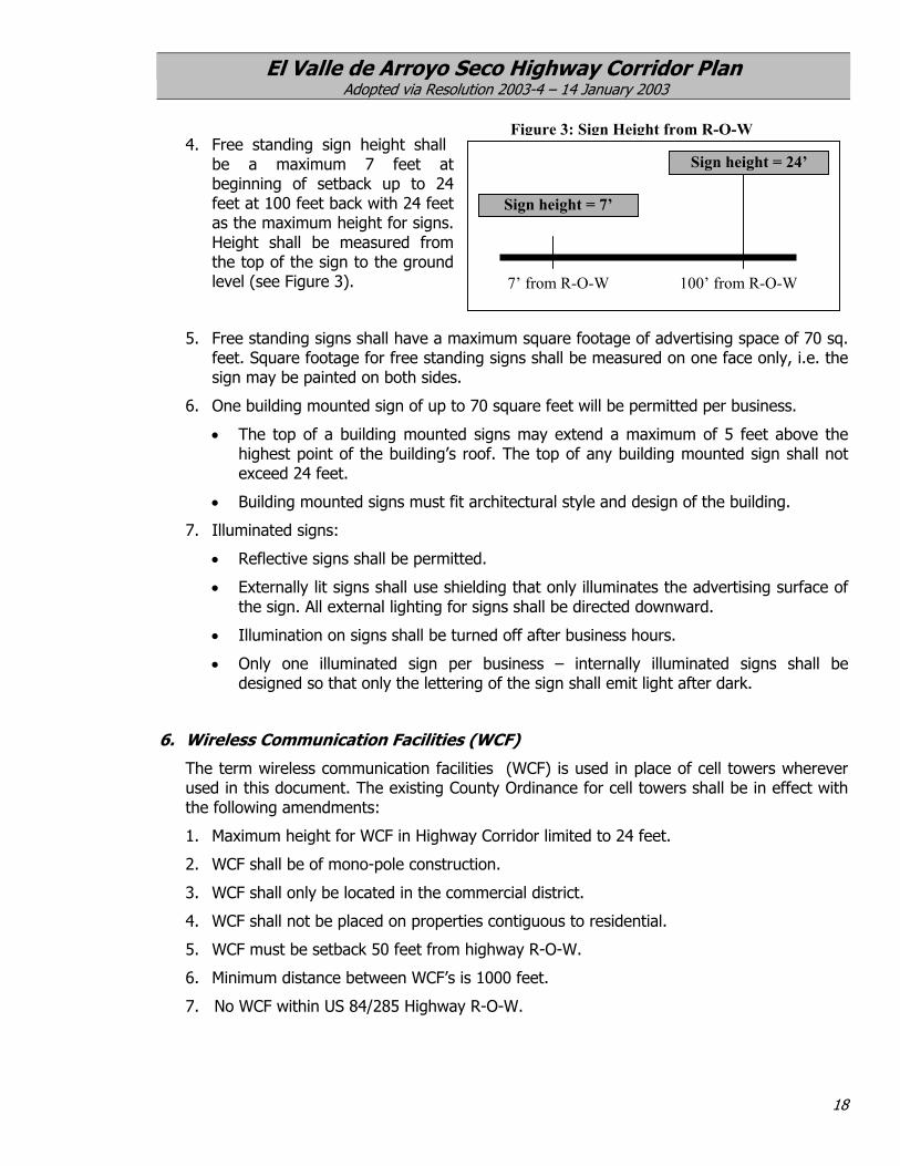
4. Free standing sign height shall be a maximum 7 feet at beginning of setback up to 24 feet at 100 feet back with 24 feet as the maximum height for signs. Height shall be measured from the top of the sign to the ground level (see Figure 3).
5. Free standing signs shall have a maximufeet. Square footage for free standing sisign may be painted on both sides.
6. One building mounted sign of up to 70 sq
The top of a building mounted signhighest point of the building’s roof. exceed 24 feet.
•
• Building mounted signs must fit archi
7. Illuminated signs:
• Reflective signs shall be permitted.
• Externally lit signs shall use shieldingthe sign. All external lighting for sign
• Illumination on signs shall be turned
• Only one illuminated sign per budesigned so that only the lettering of
6. Wireless Communication Facilities (WC
The term wireless communication facilities used in this document. The existing County the following amendments:
1. Maximum height for WCF in Highway Cor
2. WCF shall be of mono-pole construction.
3. WCF shall only be located in the commer
4. WCF shall not be placed on properties co
5. WCF must be setback 50 feet from highw
6. Minimum distance between WCF’s is 100
7. No WCF within US 84/285 Highway R-O-
Figure 3: Sign Height from R-O-W
18
Sign height = 24’
Sign height = 7’
7’ from R-O-W 100’ from R-O-W
m square footage of advertising space of 70 sq. gns shall be measured on one face only, i.e. the
uare feet will be permitted per business.
s may extend a maximum of 5 feet above the The top of any building mounted sign shall not
tectural style and design of the building.
that only illuminates the advertising surface of s shall be directed downward.
off after business hours.
siness – internally illuminated signs shall be the sign shall emit light after dark.
F)
(WCF) is used in place of cell towers wherever Ordinance for cell towers shall be in effect with
ridor limited to 24 feet.
cial district.
ntiguous to residential.
ay R-O-W.
0 feet.
W.
El Valle de Arroyo Seco Highway Corridor Plan Adopted via Resolution 2003-4 – 14 January 2003
19
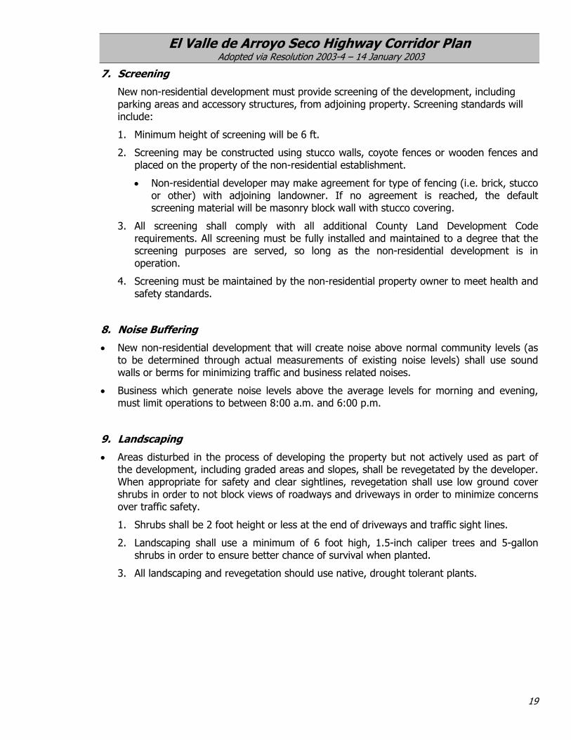
7. Screening
New non-residential development must provide screening of the development, including parking areas and accessory structures, from adjoining property. Screening standards will include:
1. Minimum height of screening will be 6 ft.
2. Screening may be constructed using stucco walls, coyote fences or wooden fences and placed on the property of the non-residential establishment.
• Non-residential developer may make agreement for type of fencing (i.e. brick, stucco or other) with adjoining landowner. If no agreement is reached, the default screening material will be masonry block wall with stucco covering.
3. All screening shall comply with all additional County Land Development Code requirements. All screening must be fully installed and maintained to a degree that the screening purposes are served, so long as the non-residential development is in operation.
4. Screening must be maintained by the non-residential property owner to meet health and safety standards.
8. Noise Buffering
• New non-residential development that will create noise above normal community levels (as to be determined through actual measurements of existing noise levels) shall use sound walls or berms for minimizing traffic and business related noises.
• Business which generate noise levels above the average levels for morning and evening, must limit operations to between 8:00 a.m. and 6:00 p.m.
9. Landscaping
• Areas disturbed in the process of developing the property but not actively used as part of the development, including graded areas and slopes, shall be revegetated by the developer. When appropriate for safety and clear sightlines, revegetation shall use low ground cover shrubs in order to not block views of roadways and driveways in order to minimize concerns over traffic safety.
1. Shrubs shall be 2 foot height or less at the end of driveways and traffic sight lines.
2. Landscaping shall use a minimum of 6 foot high, 1.5-inch caliper trees and 5-gallon shrubs in order to ensure better chance of survival when planted.
3. All landscaping and revegetation should use native, drought tolerant plants.
El Valle de Arroyo Seco Highway Corridor Plan Adopted via Resolution 2003-4 – 14 January 2003
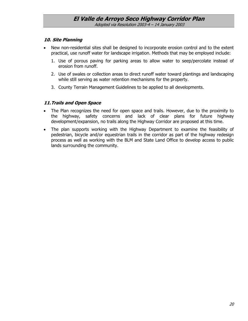
10. Site Planning
New non-residential sites shall be designed to incorporate erosion control and to the extent practical, use runoff water for landscape irrigation. Methods that may be employed include:
•
•
•
1. Use of porous paving for parking areas to allow water to seep/percolate instead of erosion from runoff.
2. Use of swales or collection areas to direct runoff water toward plantings and landscaping while still serving as water retention mechanisms for the property.
3. County Terrain Management Guidelines to be applied to all developments.
11. Trails and Open Space
The Plan recognizes the need for open space and trails. However, due to the proximity to the highway, safety concerns and lack of clear plans for future highway development/expansion, no trails along the Highway Corridor are proposed at this time.
The plan supports working with the Highway Department to examine the feasibility of pedestrian, bicycle and/or equestrian trails in the corridor as part of the highway redesign process as well as working with the BLM and State Land Office to develop access to public lands surrounding the community.
20

El Valle de Arroyo Seco Highway Corridor Plan Adopted via Resolution 2003-4 – 14 January 2003
VII. FUTURE PLANNING ISSUES FOR US 84/285 The New Mexico State Highway and Transportation Department (NMSHTD) has initiated a planning process to redesign US 84/285 from Pojoaque to Espanola, including the section of roadway that bisects the community of El Valle de Arroyo Seco. The planning was initiated in 2001 and the Phase B Report: Detailed Evaluation of Alternatives has been completed. The study has been delayed pending funding. The final phase of the study, environmental documentation, has not been completed. However, initial traffic studies and planning indicate an eventual redesign may need to include closure of multiple access points along the road and the creation of a two-way frontage road system along both sides of US 84/285. The preliminary plans also include creating two main access points, possibly by building overpasses at the north and south ends of the community while possibly closing off the existing intersection at the La Puebla Road/County Road 88. The initial plans indicate these steps may be necessary for safety reasons as well as to ensure efficient functioning of the highway into the future as the main North-South artery between North Central New Mexico and the City of Santa Fe as well as the southern part of the state. While community members appreciate the safety and traffic issues along US 84/285, many residents are concerned that the proposed frontage system and closure of access points will divide the community into east and west sides while effectively closing El Valle de Arroyo Seco businesses off from patrons using the highway. Currently, patrons are able to access these community businesses very easily but a division created by a new highway alignment would greatly diminish local business accessibility. Community members feel that there is a real need to provide for safe highway conditions but feel that the preliminary proposals need to be refined to more effectively balance safety concerns with future development possibilities for the community. Members of the planning committee have participated in the Citizens Advisory Committee (CAC) for the highway. Additionally, the planning committee and community members submit this “wish list” for the future development and/or redesign of the highway. The list is divided into short-term concerns and concerns for the possible future construction of frontage roads and intersections that will limit access to the community. While the “wish list” elements cannot be enacted through this highway corridor plan, community members feel it is important to document needs and concerns for the highway as it develops in both the short-term and the long-term. Short-term Issues to be addressed in the interim before highway is upgraded:
• Improved signage and traffic control measures for the following access points on US 84/285 such as near the Animal Hospital, County Road 86, and Boneyard Road.
• Barriers or other measures to limit traffic across medians. Clearly determine highway crossing areas
and eliminate the current uninhibited crossings throughout the corridor. Clearly define and segregate parallel roads to eliminate potential cross overs.
• Consistent and regular enforcement of traffic speed limits. Possibly locating a Sheriff’s sub-station at the existing fire station.
21

El Valle de Arroyo Seco Highway Corridor Plan Adopted via Resolution 2003-4 – 14 January 2003
• Erosion control at arroyo crossings
• Safety issues
• Institutional uses
• Provide for clear marked access points to areas along the road and eliminate multiple access points where possible.
• Street lighting for main intersections and access roads.
• Light pollution
• Safety lanes including on and off lanes
• Clear and visible signage for main roads, intersections and areas of high traffic such as schools. Use
appropriately large sized reflective signs.
• Bus routes with stops off of the highway and safe areas for turning on and off the highway.
• Speed—traffic-calming techniques such as painting the speed limit directly on the roadway and/or mobile radar signs that let drivers know their vehicle’s speed and the posted speed.
Issues to be addressed if and when highway is upgraded with frontage roads:
• Road signs to advertise local businesses – same as the blue signs outside of many towns that note the exit number and advertise food lodging and other businesses.
• Barriers and dividers along highway and frontage roads that are attractive – not just the plain concrete “jersey barriers” – work with the Highway department to use natural colors and texturing to make highway corridor less like an interstate and blend into surrounding scenery and landscape.
• Safe and convenient access for community and business – strong support for signal intersection at County Road 88.
• Landscaping along the highway and in median areas when space and safety allow
• Safety of pedestrians and bicyclists.
• create opportunities for trails and park(s).
• Protect residents living along the corridor from excessive noise, visual blight, noxious odors and other environmental hazards associated with the highway.
• Institute median and roadside area adoption/maintenance programs.
22

El Valle de Arroyo Seco Highway Corridor Plan Adopted via Resolution 2003-4 – 14 January 2003
VIII.Map
MAPS
23
1: El Valle de Arroyo Seco Highway Corridor

El Valle de Arroyo Seco Highway Corridor Plan Adopted via Resolution 2003-4 – 14 January 2003
24
Map 2: El Valle de Arroyo Seco Community Boundary

El Valle de Arroyo Seco Highway Corridor Plan Adopted via Resolution 2003-4 – 14 January 2003
IX. DEFINITIONS 1. Big Box Building means any single retail or wholesale space with a building footprint
equal to or greater than 75,000 square feet.
2. Distribution Facility means and refers to an establishment engaged in the receipt, storage, and distribution of goods, products, cargo and materials.
3. Heavy industry means enterprises engaged in the basic processing and manufacturing or storage of material or products predominately from extracted or raw materials, or large scale production through use of an assembly line or similar process, or material or products involving potentially hazardous conditions or outcomes. Such uses as foundries, lumber mills and uses involving storage or use of explosives or toxics are examples of heavy industry.
4. Indoor Recreational Center means indoor recreational uses and structures including but not limited to game rooms, bowling alleys, pool rooms, or skating rinks.
5. Large automotive services/ repair shops means the use of a site for:
• general repair, rebuilding, or reconditioning of engines, motor vehicles or trailers, including body work, framework, welding, and major painting service; and/or
• all repair or replacement of parts for commercial vehicles, including buses, trucks and all vehicles in excess of 7,000 pounds gross weight.
6. Light Industry means enterprises engaged in the processing, manufacturing, compounding, assembly, packaging, treatment or fabrication of materials and products from processed or previously manufactured materials and may include retail sales on site of such products. Such uses are capable of operating in a manner to control the external effects of the manufacturing process. Crafts manufacture such as furniture or ceramics, and appliance or tool assembly are examples of light industry.
7. Mixed-use means and refers to a land use pattern which provides for the integration of appropriate residential and non-residential uses as defined in this plan.
8. Odor/ Odorous Matter means any material that produces an olfactory response in a human being.
9. Noise- means any undesired audible sound that is usually defined in terms of a maximum decibel level by frequency range.
10. Outdoor Market:
Permanent Outdoor Market means an open-air location with semi-closed or outdoor stalls, stands or spaces where sellers rent or buy space for the purpose of display and sale, exchange or barter of merchandise.
Temporary Outdoor Market means an occasional or periodic exhibition and sales event held in an open area such as a plaza or sidewalk. Such uses can be held up to 2 times per week, by profit or non-profit organizations, and serve the purpose of energizing community centers and providing a focus for community interaction. Such events require a temporary business license from the County.
11. Outdoor Storage means the keeping, in an unroofed area of any goods, junk, material, merchandise, or vehicles in the same place for more than twenty-four hours.
25

El Valle de Arroyo Seco Highway Corridor Plan Adopted via Resolution 2003-4 – 14 January 2003
12. Personal Services means establishments primarily engaged in providing services involving the care of a person or his or her personal goods or apparel. They include but are not limited to uses such as barber shops, beauty shops, dry cleaning, shoe repair shops, tanning salons, linen supply, diaper service, funeral services and domestic services.
13. Retail Center means a building or buildings planned and managed as a total entity with a total floor area of 30,000 square feet or larger with at least 80% of the floor area dedicated to combined individual retail sales uses.
14. Small automotive services/ repair shops means the use of a site for repair and replacement of parts for passenger vehicles and trucks not in excess of 7,000 pounds gross weight, not including welding, framework, major painting service, rebuilding or reconditioning of engines. Such establishments generally have no more than 2 service bays and are 15,000 sq. ft. or smaller.
15. Traditional Communities- means historic settlements in Santa Fe County, which satisfy the following criteria:
(1) 75 or more years of continuous settlement;
(2) an historic pattern of land use or development;
(3) historic structures; and
(4) existence of village center or centers.
16. Wireless Communications Facilities refers to cell towers and is used in place of cell towers in this document.
26