enlargement of the cotter reservoir
TRANSCRIPT

Development application – Impact track assessmentBlocks 12, 13, and 18 District Cotter River Blocks 29, 34, 35 and 39 District Coree Blocks 80, 178, 179, 200, 213, 283, 284, 322 and 323 District Paddy’s River
July 2009
Enlargement of the Cotter Reservoir and associated works

ContentsEXECUTIVE SUMMARY 1
1 INTRODUCTION 3 1.1 Purpose and structure of this report 3 1.2 Background and need 3 1.3 The proponent 3
2 LOCATION AND SITE CONTEXT 4 2.2 The status of the land 5
3 SCOPE OF WORKS FOR THE DEVELOPMENT APPLICATION 6 3.1 ECD DA proposal 6 3.2 Detailed description of DA proposal 9 3.3 Project timeline 13
4 DOCUMENT LIST 14
5 SUBSEQUENT APPROVALS ASSOCIATED WITH THIS DEVELOPMENT PROPOSAL 15
6 STATEMENT AGAINST TERRITORY PLAN REQUIREMENTS 16 6.1 Introduction 16 6.2 Land use zone objectives 16 6.3 Controls relating to assessment and design of proposals 19
7 OTHER TERRITORY PLAN CODES 29 7.1 Parking and vehicular access 29 7.2 Signs 29 7.3 Planning for bushfire risk mitigation 30 7.4 Water use and catchment 30
8 OTHER GOVERNMENT PLANS 37 8.1 Management plans 37
9 STATEMENT OF ENVIRONMENTAL EFFECTS 38 9.1 Introduction 38 9.2 Assessment of environmental effects 38 9.3 Impacts of development on traffic 38 9.4 Impacts on surrounding lands and land uses 39 9.5 Impacts on role and character of hill and ridges as visual backdrop 42 9.6 Impacts on rural character 42 9.7 Provision of landscaping 42 9.8 Impacts on water supply catchments 42 9.9 Impacts of earthworks or rehabilitation works on soil stability and quality 42
List of tables Table 2.1 Blocks of land that may be affected by the project 5 Table 3.1 Summary of DA works requiring approval 7 Table 3.2 ECD construction masterplan and DAs timetable 8 Table 5.1 Update on approvals 15 Table 6.1 Land use zone objectives – NUZ4: River corridor 16 Table 6.2 Land use zone objectives – NUZ5: Mountain and bushland zones. 17 Table 7.1 Signs General Code 29
List of figures Figure 2.1 Location of Cotter Dam 4 Figure 2.2 Comparison of Cotter Reservoir and Enlarged Cotter Dam inundation areas 5 Figure 3.1 Delivery of roller compacted concrete to the dam via conveyor 10 Figure 3.2 Proposed project timeline 13 Figure 9.1 View from Camp Cottermouth, five years post construction 39 Figure 9.2 View from Moore’s Hill, five years post construction 40

ENLARGEMENT OF THE COTTER DAM AND ASSOCIATED WORKS
DEVELOPMENT APPLICATION - IMPACT TRACK ASSESSMENT 1
Executive summary Overview The Enlarged Cotter Dam (ECD) project is a key part of ACTEW Corporation’s Water Security Major Projects program that was approved by the ACT Government in October 2007. The enlargement of the Cotter Dam from its current four gigalitres (GL) capacity to around 80GL will raise the ACT’s overall potable water storage capacity by a third. The water security projects (which include the ECD project) were chosen from a range of alternatives based on the economic and socio-environmental benefits to the community. The major benefit includes an increase in the improved reliability of water supply for Canberra which can be delivered with relatively low environmental impacts.
ACTEW is committed to the provision of a safe, secure and sustainable water supply for the ACT and region. Securing supply for an inland city in the driest continent on earth is a big challenge, especially with recent climate change predictions indicating that droughts will get longer, drier and more frequent.
This report has been prepared for ACTEW in accordance with the requirement of the Planning and Development Act 2007 for lodgement of a Development Application (DA) to the ACT Planning and Land Authority (ACTPLA). In developing this report the relevant codes and statutory considerations have been addressed, key referral entities consulted and site inspections undertaken. This application responds to intensive design and master planning to evaluate the optimum design requirement.
Short history of the ECD proposal Preparation of the planning approval documentation commenced in November 2007 and the formal lodgement of the Request for Scoping of an EIS for the Enlarged Cotter Dam was lodged with ACTPLA immediately after the commencement of the new Planning and Development Act (P&D Act) in March 2007.
The draft environmental impact statement (EIS) was lodged with ACTPLA in September 2008 and was publicly notified from 11 October 2008 to 10 November 2008. The final EIS was lodged with ACTPLA in February 2009. ACTPLA triggered a request for further information on the EIS in May 2009, which was provided shortly thereafter.
The ACT Planning and Land Authority (ACTPLA) completed their assessment of the final ECD EIS in early June 2009 and provided a recommendation to the Minister for Planning. The minister, in accordance with Section 209 of the P&D Act, provided ACTPLA with a notice of ‘No Action on the ECD EIS required on 21 June 2009’. This signalled the completion of the EIS and provides the proponent (ACTEW) with the opportunity to lodge the DA for assessment with ACTPLA. This submission is the development application of the ECD that is lodged with ACTPLA for assessment under Chapter 7 of the P&D Act.

2 WATER SECURITY – MAJOR PROJECTS
JULY 2009
Project description The existing Cotter Dam is located on the Cotter River in the Lower Cotter Catchment, approximately 18km due west of Canberra. It is located approximately four kilometres upstream of the confluence of the Cotter, Paddy’s and Murrumbidgee rivers. This area is colloquially known as ‘The Cotter’ and includes the recreational precinct comprising Cotter Avenue, Cotter Campground, Casuarina Sands and the Cotter Pumping Station.
The ECD will be constructed approximately 125m downstream of the existing dam. The project consists of a main dam with two adjacent saddle dams. The new dam will be approximately 80m high and the adjacent saddle dams will be built to an approximate height of 12m and 16m. The full supply level (FSL) is designed to be approximately RL550.
In order to construct the ECD, land will be temporarily cleared/impacted upon for construction and ancillary works and will be rehabilitated progressively during the construction and operation of the dam.
Most of the land surrounding the Cotter Dam is of low environmental value and is already impacted by the existing reservoir, previous forestry plantations and severe bushfires in 2003. The impacts of this project on these areas were considered in detail in the completed ECD EIS included in this submission.
All land within the project area is unleased Territory Land under the custodianship of TaMS1 (Parks, Conservation and Lands or Department of Forestry). Subject to approval, construction of the dam is planned to commence in the last quarter of 2009 and is expected to be completed in 2011.
Project justification and need As described in Chapter 1 of the completed ECD EIS this proposal is the outcome of an investigation into Canberra’s long-term water supply requirements and water security. The proposal started ACT Government’s Think Water Act Water strategy that was published in 2004.
ACTEW’s Future Water Options project (as reviewed and updated between 2005 and 2007) investigated the ECD proposal along with a range of other water source proposals. The outcome of the Future Water Options project (as updated and reviewed) was ACTEW’s 2007 recommendation to the ACT Government in relation to Canberra and the region’s water security needs. The ECD proposal is part of the suite of water security projects that the ACT Government approved in October 2007.
1 Territory and Municipal Services

ENLARGEMENT OF THE COTTER DAM AND ASSOCIATED WORKS
DEVELOPMENT APPLICATION - IMPACT TRACK ASSESSMENT 3
1 Introduction 1.1 Purpose and structure of this report This report has been prepared in support of the DA to enlarge the Cotter Dam Reservoir in accordance to the requirements of the P&D Act and the Territory Plan 2008.
This report:
• Provides an overview of the site and its context (Chapter 2);
• Describes the scope of works for this DA and project description (Chapter 3);
• Provides a list of DA documents (Chapter 4);
• Provides an overview of subsequent approvals (Chapter 5);
• Considers the proposed development in terms of the applicable rules and criteria as set out in the Territory Plan (‘Statement Against Relevant Criteria’) (Chapter 6 and 7);
• Considers the proposed development in terms of the relevant management plans (Chapter 8); and
• Describes the assessment of environmental effects for the proposal (Chapter 9).
As per the requirement of Section 127 of the P&D Act 2007 (and the DA form) this application includes a ‘Completed2 Environmental Impact Statement’ (accepted by the Minister for Planning on 21 June 2009). The EIS identified and evaluated potential adverse and beneficial impacts of the proposal and made recommendations on appropriate management, monitoring, planning and other measures to avoid, minimise, mitigate or offset any environmental impacts of the proposal. The EIS addressed numerous matters of interest for the assessment of the DA and throughout this report reference to the EIS is included in relation to issues relevant to the assessment of this DA (as applicable).
1.2 Background and need The proposal to enlarge the Cotter Dam is one of a number of new initiatives developed by ACTEW as part of a range of water security projects currently being undertaken. The project was announced by the ACT Government in October 2007, recognising the necessity to expand existing water supply infrastructure to withstand the effects of ongoing drought conditions and associated low inflows into ACT reservoirs.
The enlargement of the Cotter Reservoir is one of the preferred options for delivering improvements to the security of Canberra’s water supply. The ECD was chosen as a high priority option because of its relative economic benefits to the community, reliability of water supply and low environmental impacts. The need for and process of selecting the ECD project is described in detail in the ECD EIS (as accepted by the Minister for Planning on 21 June 2009).
For further details refer to Chapter 1 of the completed EIS and the 224 Notice Submission (included with this submission) which includes an appraisal of water supply and government water policy and research pertaining to the need for and selection of this project.
2The completion of an EIS is described in section 209A of the Planning and Development Act, 2007
1.3 The proponent ACTEW Corporation Ltd (ACTEW), a government owned company with assets is the proponent.
ACTEW Corporation Limited (ACTEW) is a government owned company with assets and investments in water, wastewater, electricity, gas and communications. ACTEW owns the water and wastewater assets and business in the ACT, is a 50 per cent owner, with Singapore Power International and AGL Energy Limited, of ActewAGL and holds an 18 per cent investment in TransACT Communications Pty Limited.
ACTEW was corporatised on 1 July 1995 and has reporting and compliance obligations under the Corporations Act 2001 and other legislation. It has three wholly owned subsidiary companies:
• ACTEW Distribution Limited;
• ACTEW Retail Limited; and
• ACTEW China Pty Limited.
ACTEW Distribution and ACTEW Retail are ACTEW’s partnership companies in the ActewAGL Distribution and Retail Partnerships. ACTEW Distribution Limited is also a joint owner of Ecowise Environmental Pty Limited, Australia’s largest single provider of integrated environmental analytical, monitoring and consulting services. ACTEW China holds business investments in the People’s Republic of China.
ACTEW strives to optimise its water and wastewater utility services, and in doing so maintain a leadership role of a multi-utility operating in the public-private partnership model. ACTEW aims to manage its assets and business sustainably to provide quality service to its customers while building value for its owners.
4 WATER SECURITY – MAJOR PROJECTS
JULY 2009
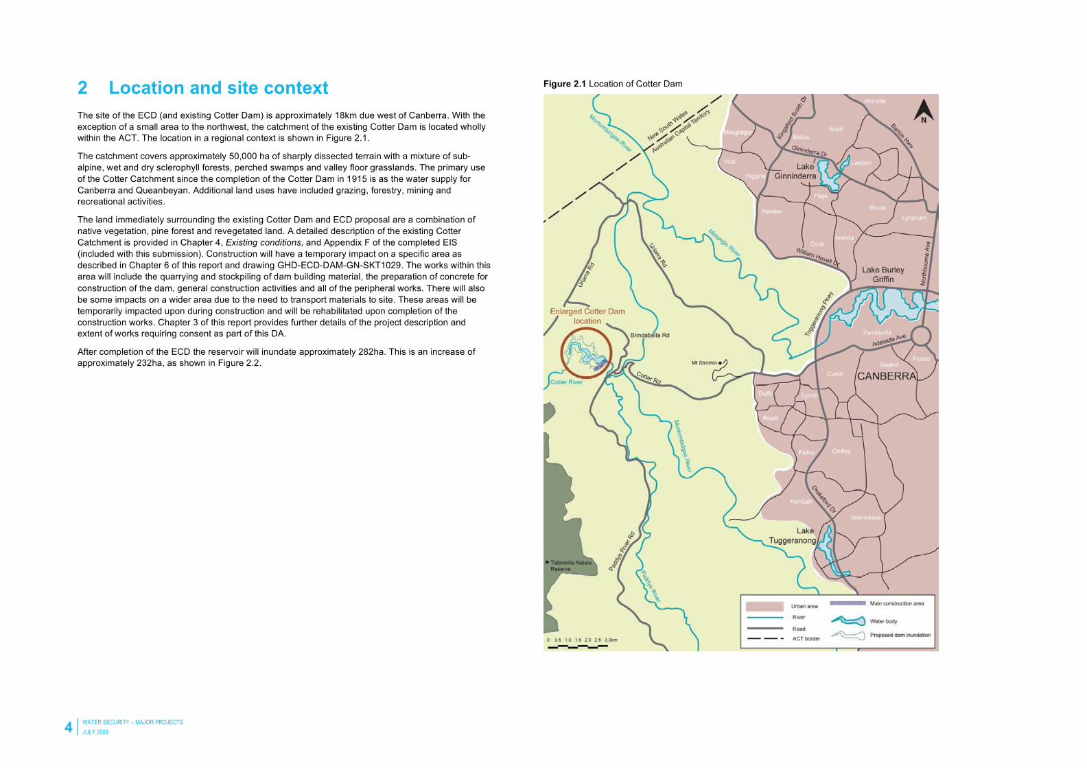
2 Location and site context The site of the ECD (and existing Cotter Dam) is approximately 18km due west of Canberra. With the exception of a small area to the northwest, the catchment of the existing Cotter Dam is located wholly within the ACT. The location in a regional context is shown in Figure 2.1.
The catchment covers approximately 50,000 ha of sharply dissected terrain with a mixture of sub-alpine, wet and dry sclerophyll forests, perched swamps and valley floor grasslands. The primary use of the Cotter Catchment since the completion of the Cotter Dam in 1915 is as the water supply for Canberra and Queanbeyan. Additional land uses have included grazing, forestry, mining and recreational activities.
The land immediately surrounding the existing Cotter Dam and ECD proposal are a combination of native vegetation, pine forest and revegetated land. A detailed description of the existing Cotter Catchment is provided in Chapter 4, Existing conditions, and Appendix F of the completed EIS (included with this submission). Construction will have a temporary impact on a specific area as described in Chapter 6 of this report and drawing GHD-ECD-DAM-GN-SKT1029. The works within this area will include the quarrying and stockpiling of dam building material, the preparation of concrete for construction of the dam, general construction activities and all of the peripheral works. There will also be some impacts on a wider area due to the need to transport materials to site. These areas will be temporarily impacted upon during construction and will be rehabilitated upon completion of the construction works. Chapter 3 of this report provides further details of the project description and extent of works requiring consent as part of this DA.
After completion of the ECD the reservoir will inundate approximately 282ha. This is an increase of approximately 232ha, as shown in Figure 2.2.
Figure 2.1 Location of Cotter Dam

ENLARGEMENT OF THE COTTER DAM AND ASSOCIATED WORKS
DEVELOPMENT APPLICATION - IMPACT TRACK ASSESSMENT 5
Figure 2.2 Comparison of Cotter Reservoir and Enlarged Cotter Dam inundation areas
2.2 The status of the land All land within the project area is unleased land owned by the ACT Government under the custodianship of TaMS (PCL and Dept. Forests). Land use in the area is consistent with the Territory Plan land use zones as discussed in chapters 6 and 7 of this report.
The following blocks of land, as described in Table 2.1, are likely to be directly impacted upon by the construction of the ECD project:
Table 2.1 Blocks of land that may be affected by the project
District Block Land status Lessee/custodian
Coree 29 Unleased/public/gazetted park TaMS – Environment
Coree 34 Unleased/public land TaMS – Environment
Coree 210 (35) Unleased/other assets TaMS – Forests
Paddy’s River 284 Unleased/public land TaMS – Environment
Paddy’s River 200 Unleased/public land TaMS – Environment
Paddy’s River 283 Unleased/public land TaMS – Environment
Paddy’s River 178 Unleased/public land TaMS – Environment
Paddy’s River 80 Unleased/public land TaMS – Environment
Paddy’s River 179 Unleased/public land TaMS – Environment
Paddy’s River 213 Unleased/other assets TaMS – Forests
Paddy’s River 323 Unleased/public land TaMS – Forests
Paddy’s River 322 Unleased/part public land TaMS – Forests/environment
Coree 39 Unleased/public land TaMS – Environment
Cotter River 13 Unleased/public land TaMS – Environment
Cotter River 12 Unleased/other assets TaMS – Forests
Cotter River 18 Unleased/public land TaMS – Forests
A detailed report regarding the status of the land is presented in the KMR Land Status Report (Appendix E of the completed EIS, included with this submission).
6 WATER SECURITY – MAJOR PROJECTS
JULY 2009
3 Scope of works for the development application
3.1 ECD DA proposal Section 7 of the P&D Act defines the ‘development’ in relation to land as:
a) Building, altering or demolishing a building or structure on the land;
b) Carrying out earthworks or other construction work on or under the land;
c) Carrying out work that would affect the landscape of the land;
d) Using the land, or a building or structure on the land;
e) Subdividing or consolidating the land;
f) Varying a lease relating to the land;
g) Putting up, attaching or displaying a sign or advertising material otherwise than in accordance with a license issues under this Act or permit under the Roads and Public Places Act 1937.
Note: (our bold) – Development in the context of the ECD proposal;
The ECD EIS sets out the scope and scale associated with the construction of the ECD as a concept to enable the assessment of the likely significant (and non-significant) environmental impacts associated with the proposal. This DA details the works proposed to be built to establish the new dam.
Given the complexity of a proposal such as this, the proponent proposes a multi-stage development approvals process. This will include concurrent and parallel DAs to be considered by ACTPLA for the delivery of the ECD and other commitments included in the ECD EIS. The construction time for the ECD project is planned to commence in the second half of 2009 for completion by early 2011. ACTEW has prepared a masterplan that explains the main activities expected to occur during the construction of the ECD project that is directly and indirectly related to this project. The masterplan is included in this development application to provide clarity of the matters that will be presented for DA consideration.
This DA relates primarily to the design and siting of the proposed enlargement of the Cotter Dam. The proposal includes the construction of the main dam and associated engineering infrastructure, two saddle dams and works associated with site establishment/gaining of on-site materials (including a number of construction works and materials stockpile pads and set-out areas as well as a quarry for rock extraction). The remainder of the works defined in the completed EIS (included with this submission) will form the basis of separate DAs (refer to section 3.2.1 and Table 3.2 of this report for further details).
A summary of the works included in this DA that relates to aspects of the proposal requiring development approval is provided in Table 3.13 and a detailed description of these works are included in section 2.1.1 of this report.
3 This relates to those aspects of the proposal that require approval under the Planning and Development Act 2007 and Planning and Development Regulations 2008.

ENLARGEMENT OF THE COTTER DAM AND ASSOCIATED WORKS
DEVELOPMENT APPLICATION - IMPACT TRACK ASSESSMENT 7
Table 3.1 Summary of DA works requiring approval
DA component Description Drawing reference Territory plan definition
Main dam A roller compacted concrete (RCC) dam, about 125m downstream from the existing Cotter dam. The dam will be approx. 80m high and will provide a full supply level (FSL) for the new reservoir of approx. 550m AHD and associated engineering infrastructure including intake tower, dam pipework, stilling basin, abutment return channel
• GHD-ECD-DAM-GN-SKT-1002 • GHD-ECD-DAM-GN-SKT-1003 • GHD-ECD-DAM-GN-SKT-1004 • GHD-ECD-DAM-GN-SKT-1005 • GHD-ECD-DAM-GN-SKT-1006 • GHD-ECD-DAM-GN-SKT-1007
• GHD-ECD-DAM-GN-SKT-1008 • GHD-ECD-DAM-GN-SKT-1009 • GHD-ECD-DAM-GN-SKT-1013 • GHD-ECD-DAM-GN-SKT-1014 • GHD-ECD-DAM-GN-SKT-1027 • GHD-ECD-DAM-GN-SKT-1029
Water storage dam and ancillary use to water storage dam/temporary
Saddle dams Two saddle dams will be located on the right hand side of the main dam wall. These will be about 12 and 16m high with crest lengths of about 330m.
• GHD-ECD-DAM-GN-SKT-1002 • GHD-ECD-DAM-GN-SKT-1015 • GHD-ECD-DAM-GN-SKT-101 • GHD-ECD-DAM-GN-SKT-1017
• GHD-ECD-DAM-GN-SKT-1019 • GHD-ECD-DAM-GN-SKT-1020 • GHD-ECD-DAM-GN-SKT-1027 • GHD-ECD-DAM-GN-SKT-1029
Ancillary use to water storage dam
Quarry The rock quarry will be developed to extract approx. 800,000 tonnes of rock. The location of the quarry is southwest of the right abutment.
• GHD-ECD-DAM-GN-SKT-1002 • GHD-ECD-DAM-GN-SKT-1025
• GHD-ECD-DAM-GN-SKT-1029 Ancillary use to water storage dam/temporary
Clay borrow areas Three clay borrow areas (located predominantly under the FSL of the ECD) will be used to win onsite materials for construction of the main dam and saddle dams.
• GHD-ECD-DAM-GN-SKT-1026, • GHD-ECD-DAM-GN-SKT-1029 Ancillary use to water storage dam/temporary
Earthworks Main construction areas for dam and saddle dams as well as construction set out pads. • GHD-ECD-DAM-GN-SKT-1002 • GHD-ECD-DAM-GN-SKT-1023 • GHD-ECD-DAM-GN-SKT-1024
• GHD-ECD-DAM-GN-SKT-1028 • GHD-ECD-DAM-GN-SKT-1029
Ancillary use to water storage dam/temporary
Haul/access roads Permanent (including roads upgrades). • GHD-ECD-DAM-GN-SKT-1002 • GHD-ECD-DAM-GN-SKT-1029 Ancillary to water storage dam
Road intersection upgrades
• Brindabella Road. • Paddy’s Road.
• GHD-ECD-DAM-GN-SKT-1030 • GHD-ECD-DAM-GN-SKT-1031 Ancillary use to water storage dam
Signage Erection of temporary construction signs (fence and information signs) will be displayed across the site.
• GHD-ECD-DAM-GN-SKT-1021, • GHD-ECD-DAM-GN-SKT-1022 Signs
Lighting Installation of temporary lighting during the construction period. • GHD-ECD-DAM-GN-SKT-1032 Lighting
Fencing Permanent and temporary (construction) fencing, including access control measures. • GHD-ECD-DAM-GN-SKT-1010, GHD-ECD-DAM-GN-SKT-1011,
• GHD-ECD-DAM-GN-SKT-1012 Fences
Rehabilitation works
Rehabilitation concept proposed on areas impacted upon by construction. • GHD-ECD-DAM-GN-SKT-1033, • GHD-ECD-DAM-GN-SKT-1034 Ancillary to water storage dam
Electricity Supply Permanent electrical supply to ECD, including dam infrastructure and de-stratification units(mixers).
• GHD-ECD-DAM-GN-SKT-1002, • GHD-ECD-DAM-GN-SKT-1018 Ancillary to water storage dam

8 WATER SECURITY – MAJOR PROJECTS
JULY 2009
Table 3.2 ECD construction masterplan and DAs timetable
Proposed works Timing
This DA (impact track)
Main dam and associated engineering infrastructure required for operating the future enlarged reservoir (including the intake tower and pipework).
July 2009
Construction of two saddle dams.
Quarry.
Bulk earthworks relating to the stripping of the abutments in preparation of the main wall construction, creation of construction and stockpile pads to house materials, aggregate stockpiles and construction equipment and the establishment of main haul roads to the abutment excavations and between the main works areas and the construction site.
Upgrades to the intersections of Settlement Road and Look-out Road with Paddy’s River and Brindabella Roads
Installation of temporary lighting for the construction area and RCC placement
Temporary construction signage and fencing proposed to be used in conjunction with the ECD construction project.
Rehabilitation works.
Permanent electricity supply to the ECD.
Concurrent DAs (merit track) flowing from ECD EIS commitments (not DA time-dependent)
DAs required as a consequence of the Fish Management Plan (e.g. construction of artificial fish habitat).
Sept 2009 and later as required
DA including any activities associated with undertaking vegetation offset works that require DA approval.
July 2009
Construction of a Viewing Platform at Moore’s Hill. July 2009
Works associated with the upgrading of Casuarina Sands Recreational Area.
DA required for the establishment of an optic data network. July 2009
Subsequent DAs (merit track) following the approval of the main engineering works DA
Installation of permanent signs. Late ‘09/Early ‘10
Minor DA applications for work at Cotter Reserve or other works not included in the above DAs.
Late 2009/as required
The proponent seeks approval for:
• The masterplan that sets out a roadmap for obtaining development approval for the various aspects of the ECD project (and related works) in the most appropriate timeframes;
• The main dam and associated engineering infrastructure required for operating the future enlarged reservoir (including the intake tower and pipework);
• Two saddle dams located on the right abutment;
• A rock quarry to be located on the ridge to the west of the proposed dam;
• Bulk earthworks relating to the stripping of the abutments in preparation of the main wall construction, creation of permanent construction and stockpile pads (constructed from spoil material gained on site) to accommodate materials, aggregate stockpiles and construction equipment and the establishment of main haul roads to the abutment excavations and between the main works areas and the construction site;
• Upgrades to the intersections of Settlement Road and Look-out Road with Paddy’s River and Brindabella Roads to allow construction traffic to safely access these roads from the public road infrastructure;
• Temporary construction fencing and signage proposed to be used in conjunction with the ECD construction project;
• Installation of permanent and temporary fencing;
• Installation of temporary lighting;
• Rehabilitation proposed on areas impacted by the construction of the ECD; and
• Permanent electricity supply to the ECD.
The proposed construction site layout is included in drawings GHD-ECD-DAM-GN-SKT-1002 and
GHD-ECD-DAM-GN-SKT-1029. This provides an insight into the planned operation of construction activities during the construction of the dam and associated works.
The establishment of the construction area and decommissioning upon completion of dam construction will be managed and controlled in accordance with a Construction Environmental Management Plan (CEMP). The CEMP will be developed for approval by the Environmental Protection Agency under the Environmental Protection Act 1997. A draft CEMP is included with this submission.
Development approval under the P&D Act is not required for the temporary construction works.

ENLARGEMENT OF THE COTTER DAM AND ASSOCIATED WORKS
DEVELOPMENT APPLICATION - IMPACT TRACK ASSESSMENT 9
3.2 Detailed description of DA proposal 3.2.1 Enlarged Cotter Dam masterplan The proponent has prepared an overarching masterplan to communicate the range of activities that are associated with the delivery of the ECD proposal. The masterplan communicates the intention to deliver the ECD proposal via a number of concurrent and subsequent DAs.
The main themes of the masterplan group proposed development applications as follows:
• Those directly related to the construction of the main engineering Infrastructure
– This DA including site establishment, bulk earthworks and engineering infrastructure and rehabilitation;
– Any additional approval amendments related to the main engineering infrastructure not already approved as required (e.g. permanent signage to the reservoir).
• Those proposed as a consequence of the commitments made in the completed ECD EIS that do not specifically relate to the main engineering infrastructure such as:
– The Fish Management Plan (e.g. construction of artificial fish habitat);
– Any activities associated with undertaking vegetation offset works that require DA approval;
– Construction of a viewing platform to allow public viewing of the construction site; and
– Works associated with the upgrading of recreational areas.
• Any other DAs that may be required but not included in the above.
The structure of the masterplan is communicated in drawing GHD-ECD-DAM-GN-SKT-1044 and Table 3.2 and includes information on the DAs; works anticipated and associated timing for applications graphically.
This DA application constitutes the first in a series of concurrent DAs relating to the construction of the ECD and associated engineering infrastructure. Other DA proposals are planned to be submitted in parallel or concurrent to this proposal before and while the main construction works are being conducted to ensure that the required approvals are obtained in time to complete all works prior to the final commissioning of the dam and completion of the ECD project.
The masterplan is aimed to ensure that no development is undertaken without the appropriate planning approval and that the timing for obtaining these approvals are managed to ensure approvals are in place before the required construction work commences.
3.2.2 Main dam, saddle dams and associated engineering infrastructure The ECD project consists of the construction of a main dam located on the Cotter River in the Lower Cotter Catchment, with two saddle dams to the right abutment facing downstream.
The main dam will be a roller compacted concrete (RCC) dam that will be located about 125m downstream from the existing Cotter dam. The crest of the dam will be on three levels with the central 70m forming the primary spillway and the remainder will be constructed as a secondary spillway. At each abutment non over flow sections will be located. These will be reinforced concrete walls about five metres high.
The downstream face of the dam will have a batter formed by a series of steps 1.2m high. These steps will extend horizontally across the complete width of the dam (refer to drawing GHD-ECD-DAM-GN-SKT-1003). Along each groyne of the dam will be the secondary spillway return channel, which will consist of 1.2m high steps corresponding with the steps in the face of the dam and a seven metre high wall on the downstream edge. These channels will return the flow over the secondary spillway back to the river channel.

10 WATER SECURITY – MAJOR PROJECTS
JULY 2009
The dam is approximately 80m high and will provide a full supply level (FSL) for the new reservoir of approximately 550m AHD (refer to drawings GHD-ECD-DAM-GN-SKT-1004 and GHD-ECD-DAM-GN-SKT-1005).
The design of the main dam, saddle dam and associated infrastructure has evolved as a result of a thorough understanding of the proponent’s/Canberra’s water supply requirements, environmental conditions (as documented in the completed ECD EIS), key planning issues related to the characteristics of the local area and its uses, technical matters such as geology, soils, onsite materials availability, and the future/ongoing operational requirements associated with the management and operation of the reservoir by ACTEW/ActewAGL.
The ECD construction technique will primarily utilise RCC construction techniques which allow very high rates of concrete placement over a relatively short duration. Concrete on the main dam wall will be placed in the dam at rates approaching 100,000m3 per month with an estimated timeframe of approximately seven months. The process requires a concrete placement sequence as outlined in Figure 3.1.
Figure 3.1 Delivery of roller compacted concrete to the dam via conveyor
A stilling basin is located at the toe of the dam in the river channel (refer to drawing GHD-ECD-DAM-GN-SKT-1003 and GHD-ECD-DAM-GN-SKT-1013). This is a rectangular concrete structure approximately 50m wide, 30m long and nine metres deep, consisting of a series of one-metre high ‘teeth’ within the floor. The function of this structure is to slow down high velocity flows coming over the dam during a flood and return the water to the river at a slower velocity to minimise erosion that would otherwise occur. This provides an important protection measure ensuring the integrity of the lower Cotter River during overtopping events.
The design of the dam structure and outlet works has taken into account the appearance of the dam and its integration into the local Cotter recreational area and surrounding landscapes. The main dam is a continuous face of grey concrete of which there will be some variation in the presentation of the dam associated with shading of the concrete due to age and different aggregates used at different construction phases. The stepped face and spillway design will assist in breaking-up the visual mass of the dam wall – especially during different times of the day as shadows move with the progression of the sun across the sky (refer to drawing GHD-ECD-DAM-GN-SKT-1027 submitted with this application).
Two saddle dams are located south of the right abutment (facing downstream). These are approximately 12 and 16m high with crest lengths of about 300–330m (refer to drawing GHD-ECD-DAM-GN-SKT-1015). The saddle dams will be constructed using a rock/earth fill structure with a clay core.
Materials and finishes of the saddle dams is predominantly rockfill (refer to drawing GHD-ECD-DAM-GN-SKT-1027). The colour of the rockfill used is dependent on the depth and location of source rock extracted from various segments of the quarry and/or abutment stripping material. Generally it will consist of either ‘blue/grey’ (fresh rock) or a ‘red’ (weathered rock) dependant on final raw materials used.
The dam outlet works (intake tower and associated control mechanisms, pipe work, valves and the like) incorporates provision for drawing water from multiple depths within the reservoir. The ECD will also include valving and piping arrangements to allow for a variety of water extraction arrangements to respond to changing operational and environmental requirements.
The existing dam structure will remain in place and will be inundated upon filling of the ECD. Decommissioning works will be required to ensure that the existing dam is not a water holding structure. A Decommissioning Plan will be prepared to address the process by which the existing Cotter Dam is to be taken out of service. The Decommissioning Plan is a requirement of the ACT Dam Regulator and will be submitted for approval prior to any water being impounded in the ECD. Section 2.6 (page 67) of the completed EIS and Attachment 3 of the 224 Notice Submission provide further details on decommissioning on the existing Cotter Dam.
The connection of the ECD to the existing water network requires modifications to existing pipework, augmentation and upgrading of existing pumping facilities at the Cotter pumping station to enable the following:
• A blend of Cotter Reservoir and Murrumbidgee River water to be treated at Mount Stromlo Water Treatment Plant;
• One hundred per cent of Cotter Reservoir water to be treated at Mount Stromlo Water Treatment Plant;
• One hundred per cent of Murrumbidgee River water to be treated at Mount Stromlo Water Treatment Plant;
• Murrumbidgee River water to be used for Cotter River environmental flow via recirculation pipework; and
• Cotter Reservoir to be used for Cotter River environmental flow.

ENLARGEMENT OF THE COTTER DAM AND ASSOCIATED WORKS
DEVELOPMENT APPLICATION - IMPACT TRACK ASSESSMENT 11
The augmentation works required on the existing water mains infrastructure of the Cotter pumping station are beyond the scope of this proposal. Any requirement for additional works will be included as part of a separate DA application for consideration by ACTPLA.
The ECD project will be constructed in three distinct stages:
• Stage 1 – Establishment and start up;
• Stage 2 – Saddle dams/excavation/quarry;
• Stage 3 – Main dam construction; and
• Stage 4 – Completion works.
Given the complexity of the project and engineering requirements, certain activities will need to be conducted 24 hours per day; seven days a week (see section 2.4.2 of the EIS, page 55 and Attachments 1 and 4 of the 224 Notice Submission). It is proposed to undertake Stage 2 activities including batching and placement of roller compacted concrete (RCC) and conventional concrete in the construction of the main dam and associated infrastructure. As noted above the placement of RCC in the dam is a specialist activity and will require a continuous 24-hour operation for a period of approximately seven months.
3.2.3 Associated works and onsite materials Works associated with construction activities for the establishment of the main engineering works, as described above, constitute the following:
• Establishment of a rock quarry for the winning of sand and aggregates for use in construction of the dam, saddle dams and other associated works;
• Establishment of materials borrow areas (primarily clay);
• Bulk Earthworks for the construction of pads for construction lay down areas, permanent materials stockpiles on both northern and southern abutments, batching, crushing operations and preparation of the construction site for placement of the RCC (main) dam and associated infrastructure; and
• Upgrades of the intersections of Settlement Road and Paddy’s River Road as well as Brindabella Road and Look-out Road.
Rock quarry and materials borrow areas In considering the materials required for constructing the main engineering infrastructure and the logistics associated with the delivery of these materials to the construction site, ACTEW investigated opportunities to source and use onsite sources of rock, sand and clay. ACTEW expressed its commitment in the EIS to minimise the impacts of constructing the ECD proposal on the environment and the Cotter recreational area. The use of on-site materials (where possible) is considered an important strategy in achieving this goal. ACTEW has investigated and identified the location of a rock quarry and three clay borrow areas (located predominantly under the FSL of the ECD) to be used to win onsite materials for construction of the main dam and saddle dams. The location of the quarry sites and clay borrow areas are shown in drawings GHD-ECD-DAM-GN-SKT-1002, GHD-ECD-DAM-GN-SKT-1025, GHD-ECD-DAM-GN-SKT-1026 and GHD-ECD-DAM-GN-SKT-1029.
The rock quarry will be developed to extract approximately 800,000 tonnes of rock for use in concrete and pavement materials. The location of the quarry is on the southern side of the left abutment, below saddle dam 2 (refer to drawings GHD-ECD-DAM-GN-SKT-1002, GHD-ECD-DAM-GN-SKT-1025 and GHD-ECD-DAM-GN-SKT-1029 for details).
Rock will be extracted from the quarry using conventional quarrying methods (including blasting). Rock from the quarry will be crushed, graded and stockpiled within the construction area for use in batching operations and other construction uses as indicated on drawing GHD-ECD-DAM-GN-SKT-1002 and GHD-ECD-DAM-GN-SKT-1029. The design and form of the quarry is included in drawings GHD-ECD-DAM-GN-SKT-1002 and GHD-ECD-DAM-GN-SKT-1025. The location of the rock quarry has been chosen given physical and chemical testing of the rock in this location as identified through extensive

12 WATER SECURITY – MAJOR PROJECTS
JULY 2009
geotechnical investigations (refer to section 4.3, pages 97–98 and Appendix F of the completed EIS and Attachments 1 and 9 of the 224 Notice Submission for details). The design will ensure that the quarry will be generally below the FSL of the ECD – effectively mitigating the visual impact of this permanent feature upon filling of the ECD.
In order to produce the RCC and conventional concrete, sand will be imported on site to supplement material manufactured on site. Section 5.1 (page 128) of the completed EIS provides an assessment of the impact on traffic conditions.
In construction of the saddle dams, material is required to create a waterproof core of approximately 50,000m3 of clay. Three materials borrow areas have been identified as depicted in drawing GHD-ECD-DAM-GN-SKT-1026. Early investigations suggest these locations will yield suitable clay for creating the cores.
Sourcing clay from these areas will involve excavation activities utilising a selection of machinery including scrapers, excavators and dozers. Useful material will be carted to the construction site primarily by trucks along existing forestry access tracks (upgraded as required) with a possible need to use short sections of Brindabella Road or Bullock Paddock Road (depending on actual materials volumes available). Settlement Road and Lookout Road will be upgraded and widened to allow for the increased use and ensure that no adverse impacts are created from sediment run-off into the catchment (refer to drawings GHD-ECD-DAM-GN-SKT-1030 and GHD-ECD-DAM-GN-SKT-1031). It is anticipated that no upgrading of local roads (Brindabella Road and Bullock Paddock Road) will be required.
Clay and other useful materials gained will be stockpiled within the construction area (adjacent to the proposed saddle dams) and treated/processed prior to being placed in the saddle dams. Treatment of clay material may involve drying out gained material and addition of a benign material such as lime or bentonite to improve the impermeability of the materials.
Bulk earthworks – construction site preparation (construction pads and haul roads) Stripping of the overburden at the main dam and saddle dam sites, quarry and main haul roads is estimated to produce approximately 500,000m3 of spoil. The different types and grades of material obtained from the stripping activities will be used for various applications within the construction site. Beneficial reuse options include the reuse of materials as aggregates in the construction of the engineering infrastructure (still being investigated), creation of construction pads to house construction activities, sediment/erosion protection structures and the like. All material resulting from construction activities will be managed and used on-site, refer to drawings GHD-ECD-DAM-GN-SKT-1023, GHD-ECD-DAM-GN-SKT-1024 and GHD-ECD-DAM-GN-SKT-1028 which provide details of the cut and fill within the construction site area.
In order to protect the ranger’s house and parts of Paddy’s River Road from rockfall from the main road a permanent rockfall catch ditch/bund will be installed as shown on drawing GHD-ECD-DAM-GN-SKT-1010. This works is outside the main construction area.
Road intersection upgrades The main access point to the construction area and right (southern) dam abutment shall be from Paddy’s River Road via Settlement Road. A secondary access point to provide access to the left (northern) abutment will be from Brindabella Road via Look-out Road (refer to drawing GHD-ECD-DAM-GN-SKT-1029 for details). Both Settlement Road and Paddy’s River Road will be upgraded.
These intersections will be used by a wide range of vehicle types during the construction period, including light vehicles, delivery vehicles and trucks (up to B-double trucks). A full traffic assessment has been prepared and included within the completed EIS (sections 5.1.1 – 5.1.6, pages 125–137, and Appendix U) for assessment and describes the likely traffic generation associated with the proposal.
The proposed upgrades constitute the construction of turning lanes to the site and are described in drawings GHD-ECD-DAM-GN-SKT-1030 and GHD-ECD-DAM-GN-SKT-1031. These intersections
shall be constructed in accordance to the relevant Australian Standards and to the satisfaction of the Territory.
3.2.4 Signage During construction of the ECD, a number of temporary construction signs will be displayed. The functions of these signs include:
• Information purposes – project and construction team name boards;
• Safety purposes – construction fence signage, general safety signage; and
• Directional purposes –signage to the site and other signs to guide construction and delivery staff in a safe manner throughout the site, and to provide traffic information (e.g. detours / closures).
The types and location of the proposed construction signage are shown on drawings GHD-ECD-DAM-GN-SKT-1021 and GHD-ECD-DAM-GN-SKT-1022.
• Type 1 signs – construction fence signage (0.5m x 0.5m) displaying ‘no entry’, are located the length of the perimeter fencing of the site;
• Type 2, 2A and 2B signs – two 1.5m construction information sign, displaying traffic delay information and site office location, displayed at locked gate on the Settlement Road intersection;
• Type 3 signs – two 1m gate entry signs (information signs) displaying gate entry and safety information will be located at the locked gates off Brindabella Road and Kiosk Road;
• Type 4 signs – two 1.5m construction information signs, displaying ‘no site construction access’, will be located at the entrance to Cotter Dam Road;
• Type 5 signs – a single 1m construction information sign, displaying details of the site office location, will be located on the intersection between Paddy’s River Road and Cotter Dam Road; and
• Type 6 signs – a single 1m construction information sign, displaying details of the site office location, will be located on Settlement Road.
All signage relates directly to the construction activities, will not be illuminated and will be removed once the dam has been commissioned.
Permanent signage for the future Cotter Reservoir is still being investigated and details there-of will be included in one of the future DAs as outlined in the proposed masterplan.
3.2.5 Rehabilitation works The ECD project contains numerous construction activities (refer to drawings GHD-ECD-DAM-GN-SKT-1002 and GHD-ECD-DAM-GN-SKT-1029). These activities are described in sections 3.2.2 and 3.2.3 of this report. All areas disturbed by activities during the building of the dam will be rehabilitated progressively during the construction and operation of the dam.
A draft Landscape Rehabilitation Management Plan (LRMP) included with this submission, has been prepared to describe the rehabilitation management, objectives and activities necessary to successfully rehabilitate areas impacted by construction works. This management plan is currently being finalised in conjunction with PCL. The rehabilitation works are shown in drawings GHD-ECD-DAM-GN-SKT-1032 and GHD-ECD-DAM-GN-SKT-1034.
Rehabilitation works that may be adopted for the ECD project include:
• Seeding of exposed areas;
• Weed management;
• Relocation of hollow bearing limbs to a designated stockpile location and subsequent placement within the construction footprint and within offset areas;
• Relocation/translocation of threatened or significant plant species (if found);

ENLARGEMENT OF THE COTTER DAM AND ASSOCIATED WORKS
DEVELOPMENT APPLICATION - IMPACT TRACK ASSESSMENT 13
• Collection of native seed for revegetation purposes;
• Propagation of seed/cuttings/divisions to establish nursery grown tubestock;
• Direct seeding of exposed areas with locally occurring native species;
• Planting and maintenance of specifically selected landscape planting areas;
• Where applicable, installation of rock fall protection measures (rock, bolting, shot-crete) on proposed access tracks and haul roads; and
• Maintenance of rehabilitation activities undertaken within the construction footprint.
3.2.6 Fencing Permanent and temporary (construction) fencing will be installed throughout the site as described in drawings GHD-ECD-DAM-GN-SKT-1010, GHD-ECD-DAM-GN-SKT-1011 and GHD-ECD-DAM-GN-SKT-1012. This will include the following type of fencing:
Permanent • Security fencing;
• Boom gates; and
• Double gates.
Temporary • Rockfall protection fencing; and
• Perimeter fencing.
The temporary rockfall protection fencing is located outside the site are as shown on drawings GHD-ECD-DAM-GN-SKT-1010 and GHD-ECD-DAM-GN-SKT-1011. This is to ensure protection measures associated with safety.
3.2.7 Lighting Temporary lighting will be installed during the construction of the dam (refer to drawing GHD-ECD-DAM-GN-SKT-1032). Lighting will be limited to construction areas to be used in 24-hour construction activities. The main areas where lighting will be installed include:
• Site office compound, workshop and access/entry areas – for site security and personnel safety accessing their vehicles;
• Batch plant and concrete conveyor belts – required during placement of RCC;
• Dam footprint and active construction areas including abutments, valley floor and RCC working face.
All lighting will be provided in accordance to AS 3012 Electrical Installations – Construction and Demolition Sites and AS 4282 – Control of Obtrusive Effects of Outdoor Lighting.
3.2.8 Permanent electricity supply The permanent electrical connection for the ECD comprises the construction of a new overhead line to the closest feasible connection point. This overhead line will terminate at a new pole mounted transformer located next to the dam wall on the left abutment from which the entire power for operation of mechanical valves and reservoir mixers will be supplied (see drawing GHD-ECD-DAM-GN- SKT-1018).
3.3 Project timeline A new dam of this size is a significant engineering and construction undertaking. Preliminary work on the detailed planning and associated environmental and social studies for the ECD commenced in 2004; construction is expected to be completed in 2011.
Figure 3.2 sets out the anticipated project timeline. The final project timeline is subject to obtaining the various approvals for the ECD.
The proposed project timeline can be broken into broad areas including the EIS and other approvals; detailed engineering and design work; pre-construction works such as upgrades to the roads and establishment of site offices; an intense construction period; commissioning and site restoration and project completion.
Figure 3.2 Proposed project timeline

14 WATER SECURITY – MAJOR PROJECTS
JULY 2009
4 Document list This submission constitutes the following list of documents:
• Development application form (Form 1D);
• Statement against Territory Plan (this document);
• Statement of Environmental Effects (this document);
• Engineering drawings:
– GHD-ECD-DAM-GN-SKT-1001: Drawing Schedule for Development Approval;
– GHD-ECD-DAM-GN-SKT-1002: Main Dam and Saddle Dams General Arrangement Site Plan;
– GHD-ECD-DAM-GN-SKT-1003: Main Dam General Arrangement Main Dam Wall Details;
– GHD-ECD-DAM-GN-SKT-1004: Main Dam General Arrangement Upstream Elevation;
– GHD-ECD-DAM-GN-SKT-1005: Main Dam General Arrangement Downstream Elevation;
– GHD-ECD-DAM-GN-SKT-1006: Main Dam and Stilling Basin General Arrangement Primary Spillway Typical Cross Section;
– GHD-ECD-DAM-GN-SKT-1007: Main Dam General Arrangement Secondary Spillway Typical Cross Section;
– GHD-ECD-DAM-GN-SKT-1008: Main Dam General Arrangement Longitudinal Section – 30m Offset from Dam Axis;
– GHD-ECD-DAM-GN-SKT-1009: Main Dam General Arrangement Longitudinal Section – 60m Offset from Dam Axis;
– GHD-ECD-DAM-GN-SKT-1010: Main Dam and Saddle Dams Temporary and Permanent Security Fences and Rockfall Protection Structures Plan;
– GHD-ECD-DAM-GN-SKT-1011: Main Dam and Saddle Dams Permanent Security Fencing Details;
– GHD-ECD-DAM-GN-SKT-1012: Main Dam and Saddle Dams Permanent Security Fencing Boom Gate Detail;
– GHD-ECD-DAM-GN-SKT-1013: Spillway Stilling Basin General Arrangement Plan and Section;
– GHD-ECD-DAM-GN-SKT-1014: Spillway Secondary Spillway Abutment Return Channel General Arrangement;
– GHD-ECD-DAM-GN-SKT-1015: Saddle Dams 1 & 2 General Arrangement Typical Cross Section;
– GHD-ECD-DAM-GN-SKT-1016: Saddle Dams General Arrangement Saddle Dam 1 Plan;
– GHD-ECD-DAM-GN-SKT-1017: Saddle Dam 1 General Arrangement Foundation Stripping Plan and Longitudinal Section;
– GHD-ECD-DAM-GN-SKT-1018: Main Dam Electricity Supply General Arrangement Plan;
– GHD-ECD-DAM-GN-SKT-1019: Saddle Dams Saddle Dam 2 General Arrangement Plan;
– GHD-ECD-DAM-GN-SKT-1020: Saddle Dam 2 Foundation Stripping Plan and Longitudinal Section;
– GHD-ECD-DAM-GN-SKT-1021: General Site Works Temporary Construction Site Signage General Arrangement Plan;
– GHD-ECD-DAM-GN-SKT-1022: General Site Works Construction Site Public Signage Details;
– GHD-ECD-DAM-GN-SKT-1023: Construction Site Cut and Fill Areas Sections Sheet 1;
– GHD-ECD-DAM-GN-SKT-1024: Construction Site Cut and Fill Areas Sections Sheet 2;
– GHD-ECD-DAM-GN-SKT-1025: Quarry General Arrangement Sections;
– GHD-ECD-DAM-GN-SKT-1026: Earth Fill Borrow Areas Site Plan;
– GHD-ECD-DAM-GN-SKT-1027: Main Dam and Saddle Dams Colour Schedule;
– GHD-ECD-DAM-GN-SKT-1028: Construction Pad on Left Abutment Cross Sections;
– GHD-ECD-DAM-GN-SKT-1029: Construction Site Concept Layout Plan;
– GHD-ECD-DAM-GN-SKT-1030: Paddy’s River Rd Via Settlement Rd Intersection Setout Plan;
– GHD-ECD-DAM-GN-SKT-1031: Brindabella Rd via Look-out Rd Intersection Setout Plan;
– GHD-ECD-DAM-GN-SKT-1032: Main Dam Construction Temporary Lighting Plan;
– GHD-ECD-DAM-GN-SKT-1033: Post Construction Site Rehabilitation Plan;
– GHD-ECD-DAM-GN-SKT-1034: Construction Site Rehabilitation Staging Plan;
– GHD-ECD-DAM-GN-SKT-1035: Cotter Avenue Landscape Management and Protection Plan Cover Sheet;
– GHD-ECD-DAM-GN-SKT-1036: Cotter Avenue Landscape Management and Protection Plan Key Plan;
– GHD-ECD-DAM-GN-SKT-1037: Cotter Avenue Landscape Management and Protection Plan Layout 1;
– GHD-ECD-DAM-GN-SKT-1038: Cotter Avenue Landscape Management and Protection Plan Layout 2;
– GHD-ECD-DAM-GN-SKT-1039: Cotter Avenue Landscape Management and Protection Plan Layout 3;
– GHD-ECD-DAM-GN-SKT-1040: Cotter Avenue Landscape Management and Protection Plan Layout 4;
– GHD-ECD-DAM-GN-SKT-1041: Cotter Avenue Landscape Management and Protection Plan Layout 5;
– GHD-ECD-DAM-GN-SKT-1042: Cotter Avenue Landscape Management and Protection Plan Layout 6;
– GHD-ECD-DAM-GN-SKT-1043: Cotter Avenue Landscape Management and Protection Plan General Notes; and
– GHD-ECD-DAM-GN-SKT-1044: Enlarged Cotter Dam Masterplan.
• Other supporting drawings:
– 06105.13: Signed Detailed Survey Plan;
– BWA-ECD-EN-ESP-001-0: Progressive Erosion and Sediment Control Plan and Construction notes on sediment and erosion control plan; and
– 115-GHD-ECD-GS-MAP-115-A-0: Utilities Plan.
• Supporting documents (included as attachments in this document);
– Draft Construction Environmental Management Plan (CEMP);
– Waste Management Plan;
– Draft Soil and Water Quality Management Plan;
– Draft Bush Fire Management Plan;
– Draft Waste Avoidance and Resource Recovery Management Plan;
– Draft Noise Management Plan;
– Draft Landscape Rehabilitation Management Plan; and
– Tree Assessment.
• Completed ECD Environmental Impact Statement (EIS) and 224 Notice Submission.

ENLARGEMENT OF THE COTTER DAM AND ASSOCIATED WORKS
DEVELOPMENT APPLICATION - IMPACT TRACK ASSESSMENT 15
5 Subsequent approvals associated with this development proposal
As described in section 3.2.3 (page 78) of the completed EIS the approval of this DA will set in train a number of other subsequent statutory and non-statutory approvals that must be obtained prior to construction commencing, during and/or after construction ceases on site and/or the project demobilises. These approvals can take the form of approval certificates, licences and/or permits that are required to undertake various tasks associated with the construction of the proposal.
The requirement for these approvals, although mostly statutory in nature (and thus required in their own right) are commonly included as conditions to the approval of the DA. Table 3.1 (page 79) of the completed EIS, sets out the list of key approvals required to deliver the ECD project. These approval requirements were highlighted to ensure that information is collected, applications made and the appropriate approvals obtained at the most appropriate times to ensure the most effective delivery of the project at all times.
The completion of the EIS and DA approval does not remove the requirement to obtain the required subsequent approvals. ACTEW has progressed most of the required approvals and Table 5.1 provides an overview of the subsequent approvals required and their current status. This is provided to give a holistic overview of the suite of matters that require approval and the matters under consideration in the context of this application.
Table 5.1 Update on approvals
Approval Legislation Authority Progress
EIS and DA ACT Planning and Development Act, 2007
ACTPLA EIS completed, 21 June 2009 This report encompasses the DA submission
EPBC referral/approval for controlled action
Commonwealth Environmental Protection and Biodiversity Conservation (EPBC) Act 1999
Department of Environment, Water, Heritage and the Arts
The pre draft copy of the Public Environment Report was submitted to DEWHA on 20 June 2009. Resubmission of PER is imminent.
Land and easement acquisition
ACT Planning and Development Act, 2007
ACTPLA TaMS, ACT Parks, Conservation and Lands
Under investigation and will be subject to further discussions with ACTPLA at a later date. No impediment on the progression of this progress.
Exemption for license to take water (for construction)
ACT Water Resource Act, 2007
DECCEW (Water Resource Unit)
To be submitted to DECCEW (Water Resource Unit) early July.
Heritage approvals ACT Heritage Act, 2004
ACT Heritage Council
CMP currently under review by the Heritage Unit. Approval expected imminently.
Waterway works license ACT Water Resource Act, 2007
DECCEW, (Water Resource Unit)
To be submitted with the Water Exemption License early July.
Environmental authorisation
ACT Environment Protection Act, 1997
DECCEW, Environmental Protection Authority(EPA)
Currently liaising with DECCEW and the EPA regarding submission (approval is expected early August)
CEMP approval ACT Water Resource Act, 2007
DECCEW, EPA Currently liaising with DECCEW EPA regarding submission. Approval estimated October 2009.

16 WATER SECURITY – MAJOR PROJECTS
JULY 2009
6 Statement against Territory Plan requirements
6.1 Introduction This statement has been prepared in accordance with the requirements as set out in the Planning and Development Act (2007) and Territory Plan 2008.
The land proposed for use to construct the ECD and the future inundation area is unleased Territory land. This land is zoned in the Territory Plan as NUZ4 – River Corridor and NUZ5 – Mountain and Bushlands Zones, with overlays for plantation forestry, public open spaces and parklands and the protection of water supply.
The construction of a water storage dam for the purposes of providing a water supply source is consistent with the Territory Plan definition for ‘major utility installation’.
The non-urban zones (NUZ4 and NUZ5) allow for major utility installation subject to merit track assessment. In accordance with Schedule 4, Part 4.2 of the P&D Act 2007, the ECD proposal triggered a requirement for assessment in the ‘impact track’. (This requirement is described in detail in section 3.2 of the completed ECD EIS.
6.2 Land use zone objectives The land use zone tables in the Territory Plan includes a number of general objectives that applies to and needs to be considered for all development proposals that may occur on land within the zone. The relevant land use zone objectives applicable to the ECD proposal are described below along with ACTEW’s statement of compliance/impact on these objectives.
Table 6.1 Land use zone objectives – NUZ4: River corridor
NUZ 4 – River corridor zone ACTEW response
a) Conserve the ecological and cultural values of the ACT’s major river corridors.
Impacts on the ecological and cultural values associated with the ECD proposal were assessed in detail in the ECD EIS (as accepted). Where applicable a range of mitigation and/or offset measures were accepted and considered to effectively mitigate the likely impacts associated with this proposal. The proposal, implemented in the context of the proposed mitigation measures will conserve the ecological and cultural values of the Murrumbidgee River Corridor. The concise list of EIS commitments can be found at Chapter 8 of the ECD EIS, pages 279–298 (included in this submission).
b) Protect stream flow, water quality and flood plains from adverse impacts.
ECD EIS acknowledges the requirements for e-flows and water quality (refer to Chapter 5, pages 138–158 of the completed EIS). The new dam includes design features that will allow better management of water quality when compared to the existing Cotter Dam. The on-going management of the Lower Cotter Catchment by PCL under the strategic management plan will result in continuous improvements in water quality into the future.
c) Ensure that the type and intensity of development is sustainable.
The ECD proposal was chosen through a rigorous government and ACTEW investigation into the future options for water supply in Canberra (see Chapter 1 of the completed EIS and Attachment 11 of the 224 Response). After examining a number of options, ACTEW chose the ECD as a high priority for a number of reasons including its ability to provide additional water security to Canberra in a sustainable way. The selection process and considerations are detailed in sections 1.5 and 1.6 of the completed EIS.
d) Provide opportunities for a range of ecologically sensitive water and land based recreational activities.
No water based recreation is permitted on the existing Cotter Dam. This will be enforced for the new dam as required by the Lower Cotter Catchment Strategic Management Plan (LCCSMP). ACTEW is investigating opportunities for land based recreation enhancements as described in the ECD masterplan above. Opportunities to return public land as soon as possible upon completion of construction and rehabilitation works are being investigated. These investigations, although part of the ECD EIS commitments, are outside the scope of DA application.

ENLARGEMENT OF THE COTTER DAM AND ASSOCIATED WORKS
DEVELOPMENT APPLICATION - IMPACT TRACK ASSESSMENT 17
NUZ 4 – River corridor zone ACTEW response
e) Ensure compatibility between land uses, water uses and the general character of the rivers.
The proposal is consistent with the land, water and general character and uses for the non-urban areas impacted upon. Statements of consistency against the major planning and land management plans including the National Capital Plan and Territory Plan are included in the completed EIS (section 4.7, pages 106 and 112–114).
f) Provide opportunities for appropriate environmental education and scientific research activities.
The ECD proposal includes on-going research into fish management (sections 6.4 and 6.8, pages 220–240 of the completed EIS), as well as development of educational opportunities. This proposal is described in Chapter 7 of the completed EIS.
g) Prevent development that would significantly increase fire hazard.
The increase of bushfire risk resulting from the ECD is negligible. Details with regard to bushfire management are included in section 5.12.4, pages 184–185 of the completed EIS.
Table 6.2 Land use zone objectives – NUZ5: Mountain and bushland zones.
NUZ 5 – Mountain and bushland zone ACTEW response
a) Protect existing and future water supply. The ECD proposal is part of ACTEW’s ongoing management of Canberra’s water supply and part of a suite of projects aimed at providing a secure water supply for Canberra, the ACT and regions into the future. The existing reservoir will remain in-service for the duration of the construction period. The existing water supply extraction pipeline will be protected and then diverted through various construction phases.
b) Protect ecological resources by conserving vegetation communities in a relatively undisturbed state, maintaining a diversity of plant and animal habitats and assuring the maintenance of ecological functions with land and aquatic habitats.
The proposal for construction of the ECD is consistent with the management objectives for the Lower Cotter Catchment being a source of water supply. The impacts associated with the construction and operation of the dam has been fully assessed in the completed EIS (section 4.8.14, pages 117−118). The proposed mitigation measures have been found to, when applied, reduce the associated risks of construction and operation to acceptable levels.
c) Maintain the mountains and bushlands area as an important visual background to Canberra.
The visual impact of the ECD proposal has been assessed in the completed EIS. Mitigation measures including rehabilitation have been accepted as adequate to mitigate construction impacts. Details of the likely visual impact and measures to be adopted to mitigate these impacts are detailed at section 5.3.2 of the completed EIS (pages 147–152).

18 WATER SECURITY – MAJOR PROJECTS
JULY 2009
NUZ 5 – Mountain and bushland zone ACTEW response
D) Provide opportunities for appropriate recreational use.
No water based recreation is permitted on the existing Cotter Dam. This will be enforced for the new dam as required by the Lower Cotter Catchment Strategic Management Plan. ACTEW is investigating opportunities for land based recreation enhancements as described in the ECD masterplan above. These investigations, although part of the ECD EIS commitments are outside the scope of this proposal.
e) Protect and conserve the significant cultural and natural heritage resources and their landscape context.
Matters associated with likely impacts on cultural and natural heritage have been assessed in detail in the completed EIS at sections 6.3 to 6.9 (pages 199–256). Mitigation measures proposed have been accepted and will be adopted during the construction and operation of the reservoir to ensure the impacts are mitigated. Natural values will be mitigated primarily through the provision of offsets and cultural heritage impacts will be managed in accordance with the approved CMP as adopted by the Heritage Council for the management of indigenous and non-indigenous heritage matters.
f) Provide and manage access to Namadgi National Park and related areas for recreation and essential management purposes consistent with the objectives.
This proposal does not constitute any changes to the current access arrangements to Namadgi National Park and related areas. There will be temporary impact on some of the access roads to these areas associated with increased construction traffic. The impact and mitigation measures are described in the SEE in Chapter 9 of this report.
g) Ensure that the area may be used for appropriate environmental education, research and scientific study.
The ECD proposal allows for continuing research to inform the management strategy for endangered fish in the enlarged reservoir (section 6.5, pages 225–236 of the EIS). The proposal does not diminish any opportunities to conduct environmental research and scientific study in the Lower Cotter Catchment.
h) Ensure compatibility between land uses, water and water catchment uses and the natural character of the mountain and bushland areas.
The proposal is consistent with the land, water, water catchment and natural character and uses for the non-urban areas impacted upon. Statements of consistency against the major planning and land management plans including the National Capital Plan and Territory Plan are included in the completed EIS (sections 4.7 pages 105–124).
i) Maintain and enhance the scenic and landscape character of the mountains and bushlands and associated areas and to ensure that any development is unobtrusive and compatible with its surrounding and the intrinsic landscape qualities of the mountains and bushlands.
The visual impact of the ECD has been assessed in the completed ECD EIS (section 5.3.2, pages 147–152). Impacts in relation to the main wall and saddle dams will be mitigated where possible through design and material use. Impacts on the natural environment including vegetation clearing (permanent and temporary) has been assessed and mitigation measures proposed in the EIS at chapters 5 and 6 (sections 5.6, 5.8, 6.3 and 6.9).
ENLARGEMENT OF THE COTTER DAM AND ASSOCIATED WORKS
DEVELOPMENT APPLICATION - IMPACT TRACK ASSESSMENT 19
6.3 Controls relating to assessment and design of proposals Any proposal for development of the site is required to be assessed against the land use and development controls applicable to the site, as set out in the development and general codes of the Territory Plan. The land that is likely to be impacted upon is all Non-urban zones. The Non Urban Zones Development Code is the primary development code that applies to the site. Below follows an assessment of the proposal’s performance against the rules and criteria included in the code as required by the P&D Act 2007.
6.3.1 Part A: Zone specific controls
Rules/criteria Design response
Element 1: Restrictions on use
C1–15 There are no relevant site specific controls relating to the use for Major Utilities Infrastructure in Part A (4) – NUZ4 – River corridor zones and Part A (5) – NUZ5 – Mountains and bushland. The development of a water storage dam is permitted in non-urban zones.
6.3.2 Part B: General development controls
Rules/criteria Design response
Element 1: Restrictions on use
C16 Adjunct uses • Criterion 16 is not relevant to this application.
C17 Assessment of environmental effects
• The assessment of environmental effects is addressed separately in Chapter 9 of this report in accordance with section 120(f) of the Planning and Development Act 2007.
C18 Plans of management • The Murrumbidgee River Corridor Management Plan (MRCMP) (1998) and Lower Cotter Catchment Strategic Management Plan (LCCSMP) (2007) are relevant to the proposed site for the ECD and have been considered in detail in section 4.8 (pages 177−118) of the completed ECD EIS. This application does not raise any matters that conflict with the provisions of the MRCMP and LCCSMP (see Chapter 8 of this report).
Element 2: Building and site controls
C19 Demolition • No demolition is proposed as part of the development. This criterion is not relevant to this proposal.
R20 Subdivision • Not applicable – no subdivision of lands are proposed as part of this development application.
20 WATER SECURITY – MAJOR PROJECTS
JULY 2009
Rules/criteria Design response
C21 National Capital Plan
• Section 4.7.1 (page 106) of the completed ECD EIS includes a comprehensive overview of the proposal’s compliance position in relation to the National Capital Plan (NCP). The proposal to enlarge the Cotter Dam does not include any works within designated areas identified in the NCP.
• The NCP identifies land use categories and policies for all land within the Territory. The relevant land use policies for the Cotter Dam proposal are the river corridors and mountains and bushlands policies, both of which are subsets of the National Capital Open Space System (NCOSS) policy. The NCP specifically refers to the Cotter Reservoir as domestic water supply for Canberra in appendices F and G. The proposal for enlargement of the dam is consistent with the NCOSS policy of the NCP (see section 4.7 (page 106) of the completed EIS included with this submission for further details).
• The location of ECD is within Murrumbidgee River Corridor which is a ‘special rules’ area under the NCP. Developments within this corridor must be in accordance to general and specific policies set out in Appendix F of the NCP.
• The proposal to enlarge the Cotter Dam is not ‘inconsistent with the Special Requirements’ of the NCP. The proponent has had direct discussions with the National Capital Authority during the preparation of the ECD EIS and received their support for the proposal (refer to section 4.7.1 and Appendix N of the ECD EIS and the Section 224 document included in this submission).
Element 3: Built form
C22 Sympathetic placement of buildings
• Choosing the location and form for the construction of a large dam (such as the ECD) is dependant on a wide range of matters that need to be considered including: – Geological and topographical opportunities and
constraints; – Catchment yield and rainfall; – Engineering requirements for construction and operation
of the dam; – Meeting regulatory safety standards/accreditation for the
new dam; – Environmental impacts that may occur as a result of the
construction of this proposal; – Visual and cultural values associated with the landscape
to be impacted upon; and – Social impacts and/or benefit associated with the
establishment of the dam.

ENLARGEMENT OF THE COTTER DAM AND ASSOCIATED WORKS
DEVELOPMENT APPLICATION - IMPACT TRACK ASSESSMENT 21
Rules/criteria Design response
• The proposed location has to comply with safety requirements to minimise the risks to downstream areas. The design process and concept has been accepted by the Technical Regulator and will ultimately accredit the dam upon completion of construction, subject to appropriate safety ratings being achieved;
• Further important considerations revolve around the environmental impacts (including visual and social) associated with the construction and operation of the dam. The impact of the dam on the visual amenity of the surrounding landscape was considered in the completed ECD EIS (section 5.3.2, pages 147–152, as well as in the Appendix G, Visual impact report);
• The Cotter Dam and its catchment lies within a landscape that provides contrasting visual experiences, from the mountains of the Brindabella Range to the west, the fire-affected forestry area in the lower catchment, the Cotter, Paddy’s and Murrumbidgee rivers below the dam, and the recreation areas characterised by large established avenue trees;
• The ECD will have an impact on the landscape character of the Lower Cotter Catchment as it will result in the inundation of six times the area of the existing Cotter Reservoir and will be visible from many vantage points. The visual impact of the dam and saddle dams will be mitigated by structural design elements in its presentation (stepped profile and primary/secondary spillway – refer to drawings GHD-ECD-DAM-GN-SKT-1013 and GHD-ECD-DAM-GN-SKT-1014) that minimises the bulk of the structure and provide interest in and into the operation thereof. A further consideration is visual mitigation associated with distance to vantage points from the proposed works as well as by existing and restored/rehabilitated vegetation areas. Saddle dams will be constructed primarily from natural materials to further minimise the impact on the surrounds, refer to GHD-ECD-DAM-GN-SKT-1016, GHD-ECD-DAM-GN-SKT-1017, GHD-ECD-DAM-GN-SKT-1019 and GHD-ECD-DAM-GN-SKT-1020. A detailed landscape analysis and visual impact assessment have been presented in Appendix F and G respectively and section 5.3.2 (pages 147–152), in the completed EIS (included with this submission);
• The EIS (included with this submission) includes a number of mitigation measures to reduce visual and landscape impact associated with the construction of the ECD. These include: – All land disturbed by construction activities located above
the new inundation zone will be rehabilitated. Rehabilitation works will include re-profiling the surface to provide visual interest and undertaking revegetation works (refer to drawings GHD-ECD-DAM-GN-SKT-1033 and GHD-ECD-DAM-GN-SKT-1034 and the Draft Landscape Rehabilitation Management Plan included with this submission). The management plan is currently being finalised in conjunction with PCL;

22 WATER SECURITY – MAJOR PROJECTS
JULY 2009
Rules/criteria Design response
– Design and construction will be undertaken to minimise earthworks and hence impact on the landscape;
– Abutments will be treated to minimise the visual prominence of excavation work required for dam wall construction;
– While some vegetation within the inundation zone will be left in situ to provide fish habitat, some trees may be felled to avoid the visual impact of stands of dead trees. Clearance activities may also be required to remove loose debris from the future inundation area to minimise the risk of interference with the new engineering infrastructure after filling;
– Selective felling of trees in the inundation area may be required to permit navigation of reservoir for catchment water quality inspections;
C23 Materials and finishes earth tones
C23 is met as described in drawing GHD-ECD-DAM-GN-SKT-1027 included with this DA submission. Materials and finishes are chosen to be functional, durable and practicable in the context of the proposal while incorporating (where possible) natural materials and earth tones with low reflectivity. Due to stability requirements the bulk of structures will be constructed of concrete and rockfill.
C24 Crime prevention through environmental design
• Not relevant to this proposal (see Table 1 of the CPTED General Code). Although this criterion is not relevant the following measures have been incorporated into the design of the ECD to address CPTED considerations: – Approaches to site and open space areas within the
secure area are designed to allow for surveillance; – Rehabilitation works (including plantings) will be
designed to ensure adequate surveillance opportunities for future maintenance personnel working at the site with the secure area;
– Entrances have been prominently placed with clear sightlines through the main access and circulation areas to the engineering infrastructure to allow surveillance upon approach to and leaving of works areas; and
– The dam operations area will be fenced and access controlled. No public access will be permitted at any time to ensure safety requirements are met.
C25 Access and mobility • Not relevant to this proposal – refer to Table 1 of the Access and Mobility General Code.
ENLARGEMENT OF THE COTTER DAM AND ASSOCIATED WORKS
DEVELOPMENT APPLICATION - IMPACT TRACK ASSESSMENT 23
Rules/criteria Design response
Element 4: Parking and access
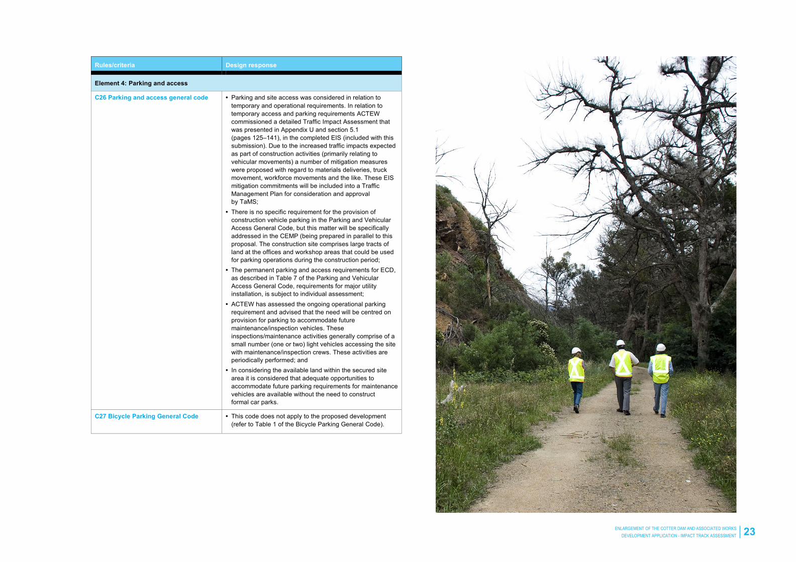
C26 Parking and access general code
• Parking and site access was considered in relation to temporary and operational requirements. In relation to temporary access and parking requirements ACTEW commissioned a detailed Traffic Impact Assessment that was presented in Appendix U and section 5.1 (pages 125–141), in the completed EIS (included with this submission). Due to the increased traffic impacts expected as part of construction activities (primarily relating to vehicular movements) a number of mitigation measures were proposed with regard to materials deliveries, truck movement, workforce movements and the like. These EIS mitigation commitments will be included into a Traffic Management Plan for consideration and approval by TaMS;
• There is no specific requirement for the provision of construction vehicle parking in the Parking and Vehicular Access General Code, but this matter will be specifically addressed in the CEMP (being prepared in parallel to this proposal. The construction site comprises large tracts of land at the offices and workshop areas that could be used for parking operations during the construction period;
• The permanent parking and access requirements for ECD, as described in Table 7 of the Parking and Vehicular Access General Code, requirements for major utility installation, is subject to individual assessment;
• ACTEW has assessed the ongoing operational parking requirement and advised that the need will be centred on provision for parking to accommodate future maintenance/inspection vehicles. These inspections/maintenance activities generally comprise of a small number (one or two) light vehicles accessing the site with maintenance/inspection crews. These activities are periodically performed; and
• In considering the available land within the secured site area it is considered that adequate opportunities to accommodate future parking requirements for maintenance vehicles are available without the need to construct formal car parks.
C27 Bicycle Parking General Code • This code does not apply to the proposed development (refer to Table 1 of the Bicycle Parking General Code).
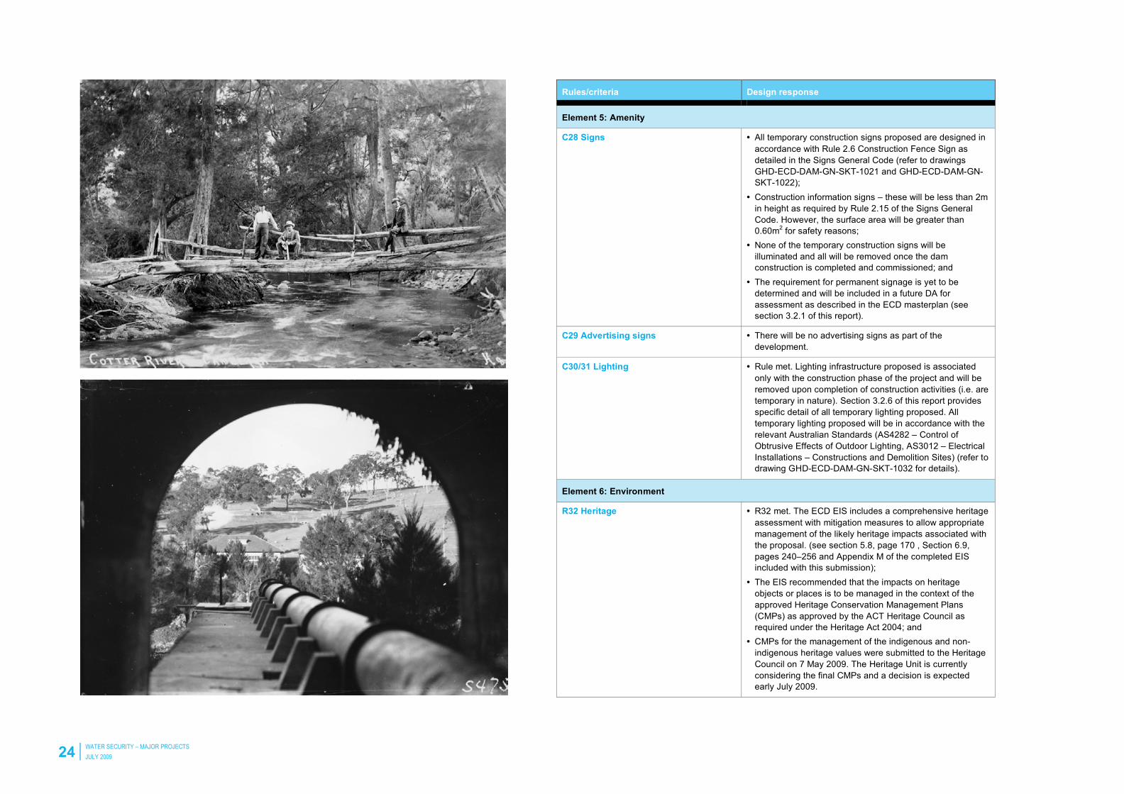
24 WATER SECURITY – MAJOR PROJECTS
JULY 2009
Rules/criteria Design response
Element 5: Amenity
C28 Signs
• All temporary construction signs proposed are designed in accordance with Rule 2.6 Construction Fence Sign as detailed in the Signs General Code (refer to drawings GHD-ECD-DAM-GN-SKT-1021 and GHD-ECD-DAM-GN-SKT-1022);
• Construction information signs – these will be less than 2m in height as required by Rule 2.15 of the Signs General Code. However, the surface area will be greater than 0.60m2 for safety reasons;
• None of the temporary construction signs will be illuminated and all will be removed once the dam construction is completed and commissioned; and
• The requirement for permanent signage is yet to be determined and will be included in a future DA for assessment as described in the ECD masterplan (see section 3.2.1 of this report).
C29 Advertising signs • There will be no advertising signs as part of the development.
C30/31 Lighting • Rule met. Lighting infrastructure proposed is associated only with the construction phase of the project and will be removed upon completion of construction activities (i.e. are temporary in nature). Section 3.2.6 of this report provides specific detail of all temporary lighting proposed. All temporary lighting proposed will be in accordance with the relevant Australian Standards (AS4282 – Control of Obtrusive Effects of Outdoor Lighting, AS3012 – Electrical Installations – Constructions and Demolition Sites) (refer to drawing GHD-ECD-DAM-GN-SKT-1032 for details).
Element 6: Environment
R32 Heritage
• R32 met. The ECD EIS includes a comprehensive heritage assessment with mitigation measures to allow appropriate management of the likely heritage impacts associated with the proposal. (see section 5.8, page 170 , Section 6.9, pages 240–256 and Appendix M of the completed EIS included with this submission);
• The EIS recommended that the impacts on heritage objects or places is to be managed in the context of the approved Heritage Conservation Management Plans (CMPs) as approved by the ACT Heritage Council as required under the Heritage Act 2004; and
• CMPs for the management of the indigenous and non-indigenous heritage values were submitted to the Heritage Council on 7 May 2009. The Heritage Unit is currently considering the final CMPs and a decision is expected early July 2009.
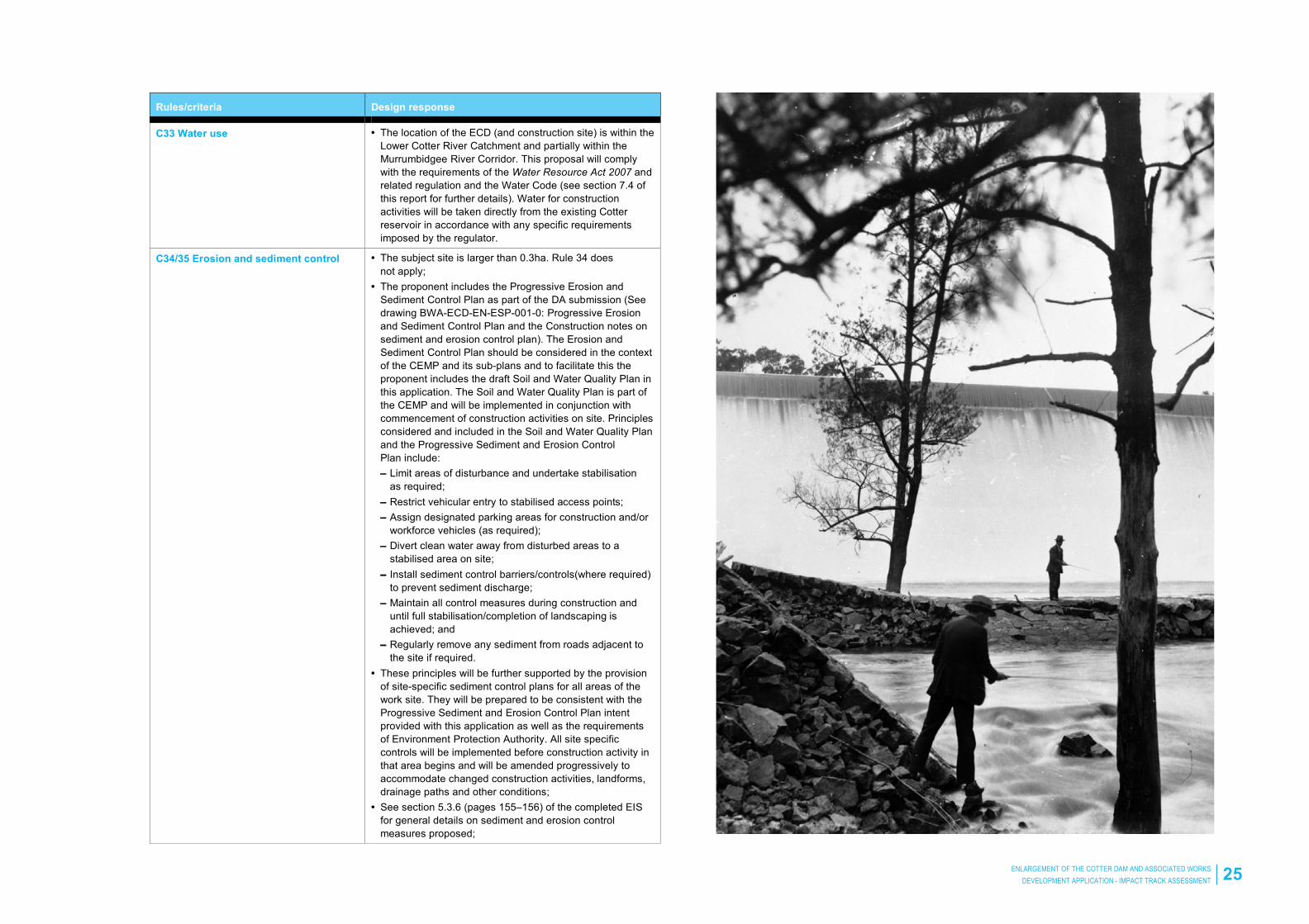
ENLARGEMENT OF THE COTTER DAM AND ASSOCIATED WORKS
DEVELOPMENT APPLICATION - IMPACT TRACK ASSESSMENT 25
Rules/criteria Design response
C33 Water use
• The location of the ECD (and construction site) is within the Lower Cotter River Catchment and partially within the Murrumbidgee River Corridor. This proposal will comply with the requirements of the Water Resource Act 2007 and related regulation and the Water Code (see section 7.4 of this report for further details). Water for construction activities will be taken directly from the existing Cotter reservoir in accordance with any specific requirements imposed by the regulator.
C34/35 Erosion and sediment control
• The subject site is larger than 0.3ha. Rule 34 does not apply;
• The proponent includes the Progressive Erosion and Sediment Control Plan as part of the DA submission (See drawing BWA-ECD-EN-ESP-001-0: Progressive Erosion and Sediment Control Plan and the Construction notes on sediment and erosion control plan). The Erosion and Sediment Control Plan should be considered in the context of the CEMP and its sub-plans and to facilitate this the proponent includes the draft Soil and Water Quality Plan in this application. The Soil and Water Quality Plan is part of the CEMP and will be implemented in conjunction with commencement of construction activities on site. Principles considered and included in the Soil and Water Quality Plan and the Progressive Sediment and Erosion Control Plan include: – Limit areas of disturbance and undertake stabilisation
as required; – Restrict vehicular entry to stabilised access points; – Assign designated parking areas for construction and/or
workforce vehicles (as required); – Divert clean water away from disturbed areas to a
stabilised area on site; – Install sediment control barriers/controls(where required)
to prevent sediment discharge; – Maintain all control measures during construction and
until full stabilisation/completion of landscaping is achieved; and
– Regularly remove any sediment from roads adjacent to the site if required.
• These principles will be further supported by the provision of site-specific sediment control plans for all areas of the work site. They will be prepared to be consistent with the Progressive Sediment and Erosion Control Plan intent provided with this application as well as the requirements of Environment Protection Authority. All site specific controls will be implemented before construction activity in that area begins and will be amended progressively to accommodate changed construction activities, landforms, drainage paths and other conditions;
• See section 5.3.6 (pages 155–156) of the completed EIS for general details on sediment and erosion control measures proposed;

26 WATER SECURITY – MAJOR PROJECTS
JULY 2009
Rules/criteria Design response
• The proposal will be conducted in accordance with best practice and sediment control management practices and in accordance with any specific requirements as negotiated with the Environment Protection Authority/other agencies before and during construction activities; and
• Control measures will be implemented progressively as the construction site and thus the need for sediment and erosion control develops.
C36 Contamination
• The location of the ECD is not listed as a contaminated site on the register of contaminated sites in the ACT. Should any contamination be discovered during construction of the proposed works the matter will be handled in accordance with the relevant statutory and other Agency requirements.
C37 Hazardous materials
• Construction of the dam requires the removal of the existing booster statement. Prior to this structure being demolished a Hazardous Materials Audit will be undertaken. Should any hazardous materials be identified their removal will be managed in accordance with EPA – Hazardous Materials Environmental Protection Policy 2000, the Environmental Protection Regulations 2005, best practice and in consultation with the EPA.
• In section 5.2.2 (page 142) of the completed EIS the proponent identified that potentially hazardous materials may be used during the construction of the ECD. As per section 5.2.5 (page 144) of the completed EIS material (hazardous and non-hazardous) will be stored, bunded (as required) and utilised in accordance with the manufacturers recommendations and the Australian Standards and Best Practice guidelines, ACT’s Hazardous Materials Environmental Protection Policy, ACT Environmental Protection Agency guidelines and the provisions of the Environment Protection Act 1997.
• Hazardous materials will be located and stored on site in accordance with the ACT’s Hazardous Materials Environment Protection Policy;
• The construction site layout was designed to ensure construction elements such as the workshop facility are located outside the existing Cotter Dam catchment; and
• The proponent will further prepare a site specific Environmental Emergency Response Management Plan (part of CEMP) to manage events and impacts associated with spills of or other hazardous material incidents on site.