environmental impact of hurricane katrina on lake ... · environmental impact of hurricane katrina...
TRANSCRIPT

Environmental Impact of Hurricane Katrina on Lake Pontchartrain
By P. Thomas Heitmuller and Brian C. Perez
the primary dumping ground for
the flood waters that lingered throughout New Orleans during the
3-week period following Katrina.New Orleans and the
surrounding area are situated in a bowllike depression
that lies typically 4–12 ft (1.3–3.7 m) below sea level. A network of levees and seawalls protect the city from nominal flooding, and an intricate system of large pumps evacuates accumulated rainfall from even normal storm events. The
protective levees held during the initial
landfall of Katrina; however, after 12–24
hours of continuous stress from the elevated water level,
breaches occurred at several locations, most dramatically at
the Metairie Outfall Canal (popularly known as the 17th Street Canal) and the
Inner Harbor Navigation Canal (popularly known as the Industrial Canal). The storm-driven
water rapidly poured through the breaches, filling the natural basin of Orleans Parish and adjacent St. Bernard Parish with resultant flood waters that reached heights of 4–12 ft (1.2–3.7 m) (fig. 2). While the pumping system was being
Hurricane Katrina slammed the Louisiana-Mississippi Gulf Coast with 135-mi/hour (217-km/hour) winds and up to a 30-ft (9-m) storm surge. Lake Pontchartrain was further subjected to environmental threat by way of the millions of gallons of contaminated flood water that were pumped daily from the city of New Orleans into the lake.
IntroductionLake Pontchartrain (fig.
1) is a 630-mi2 (1,632-km2) shallow, brackish lagoon with New Orleans, La., located along its southern shore. The lake suffered dual assaults from devastating Hurricane Katrina, a category 3 storm that roared in from the Gulf of Mexico on August 29, 2005, with the eyewall passing along the eastern edge of the lake. Not only was Lake Pontchartrain’s delicate ecosystem subjected to nature’s fury—Katrina packed 135-mi/hour (217-km/hour) winds and a 20–30-ft
(6–9-m) storm surge—the lake also faced an additional
challenge by becoming

232 Science and the Storms: the USGS Response to the Hurricanes of 2005
repaired, these areas remained flooded for up to 2 weeks. The city’s sewage, stores of industrial and agricultural chemicals, petrochemicals, medical wastes, pharmaceuticals, food stocks, and even the remains of humans and domestic pets were all enveloped in the stagnant water, creating a cesspool of biological and chemical contaminants.
When the pumps were finally reactivated, the bulk of contaminated water from the city was jettisoned for many days directly into the southern portion of Lake Pontchartrain with a discharge estimated at 2–3 percent of the volume of the lake, or approximately 30–50 billion gallons (100–200 billion liters) (fig. 3).
The focus of this study was to assess the environmental impacts of Katrina to Lake Pontchartrain; however, it should be noted that a second category 3 storm, Hurricane Rita, struck the Louisiana-Texas coast, approximately 250 mi (402 km) west of Lake Pontchartrain, just over 3 weeks following the landfall of Katrina. Relative to the fury of Katrina, the effects from Rita were considered marginal in the New Orleans area: parts of the city were reflooded because of above-normal tides, and gale-force winds whipped the waters of the lake, remixing the water column. In our judgment, however, Rita contributed no further impact to the environmental conditions of Lake Pontchartrain stated above, which are attributed to Katrina.
What disruptive effects did Katrina have upon Lake Pontchartrain? How did the huge injection of toxics from New Orleans affect environmental conditions in Lake Pontchartrain and the nearby Mississippi Sound? To help answer these questions, the U.S. Geological Survey (USGS) joined with the U.S. Environmental Protection Agency (EPA) and the National Oceanic and Atmospheric Administration (NOAA) to develop an environmental monitoring and assessment project to assess the ecological conditions in coastal waters impacted by Hurricane Katrina. Personnel with the USGS National Wetlands Research Center assumed responsibility for monitoring conditions in Lake Pontchartrain, while the EPA and NOAA focused their efforts on monitoring conditions in the Mississippi Sound and the neighboring coastal shelf just off of the Mississippi River Delta.
Study DesignFor the last decade, multiple resource
agencies have partnered in a Federal program,
Figure 2. Neighborhoods in New Orleans, La., inundated following levee breaches after Hurricane Katrina in 2005.
Figure 3. Plume from New Orleans, La., floodwater effluent pumped into Lake Pontchartrain, La., as a result of the flooding of the city by Hurricane Katrina.
Figure 1. Lake Pontchartrain and Greater New Orleans, La. Gray-shaded area denotes areas of New Orleans that flooded because of the effects of Hurricane Katrina in 2005.
Gulf of Mexico
Lake Pontchartrain
Lake Maurepas
Lake Borgne
Louisiana
Mississippi

Environmental Impact of Hurricane Katrina on Lake Pontchartrain 233
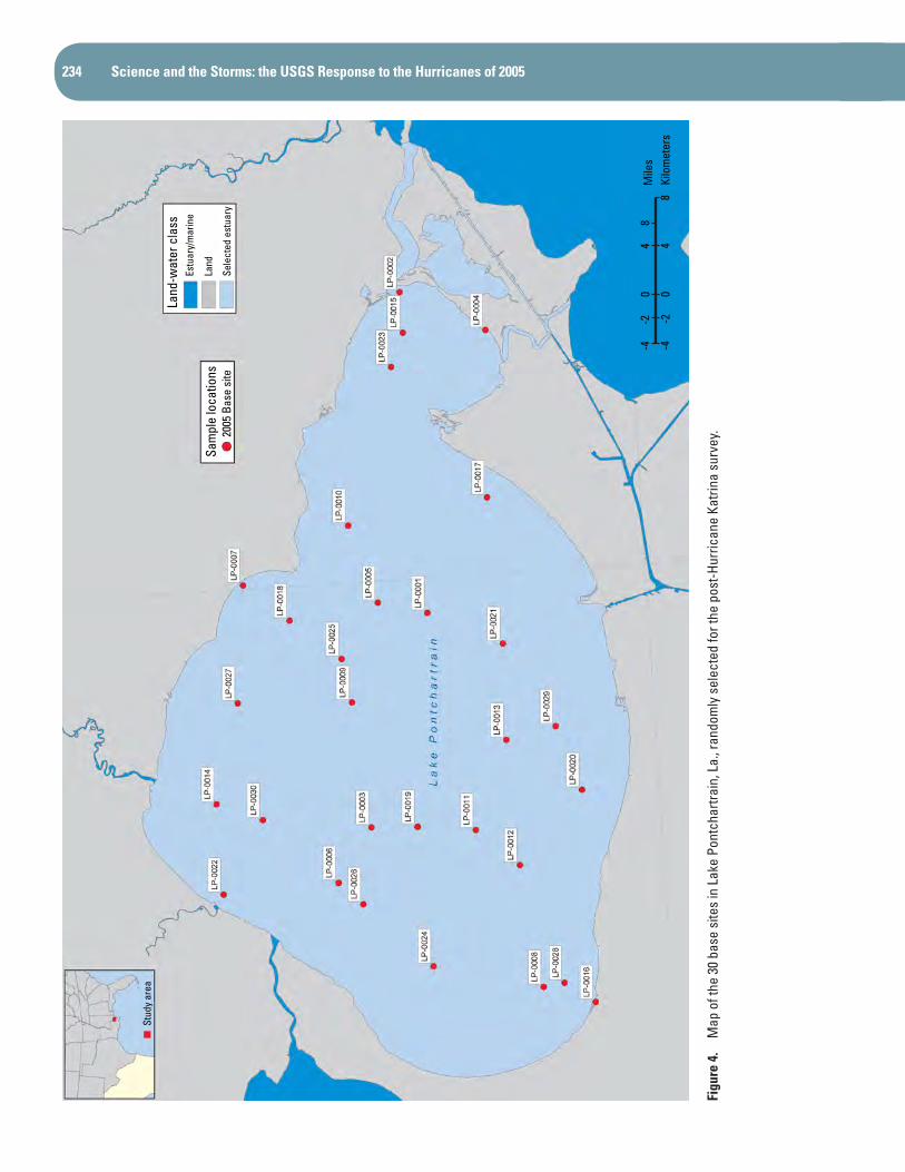
the Environmental Monitoring and Assessment Program’s National Coastal Assessment (EMAP-NCA), to collect extensive ecological data from most of the Nation’s estuaries, including Lake Pontchartrain and the Mississippi Sound. The existing, comprehensive EMAP-NCA database compiled for the Louisiana-Mississippi coastal region from 2000 to 2004 provides a good reference (baseline) of the ecological conditions for the region during the 5 years prior to Katrina; therefore, the design of the post-Katrina assessment was based on indicators and protocols similar to those used by EMAP-NCA. The target window for NCA sampling was July through September. These factors provided the needed uniformity between the two studies to allow for direct comparisons of environmental conditions in Lake Pontchartrain on a pre- and post-Katrina basis. Thirty probability-based sampling sites were selected for the Lake Pontchartrain survey by using a geographic information system (GIS) assisted computer program to randomly generate coordinates of latitude and longitude for each sampling site (fig. 4). Similar sampling designs were formulated for the complementary Mississippi Sound survey and gulf/delta survey.
The field sampling was conducted October 11–14, 2005, by a three-person team working from a 19-ft (5.8-m) Boston Whaler® (fig.5). A set of standardized environmental data and samples (table 1), previously designated as indicators of environmental conditions, was collected at each sampling station. Protocol required that microbial samples be processed within 6 hours of collection (see Demcheck and others, this volume); therefore, samples collected during morning hours were returned to a field-based mobile laboratory at midday, and afternoon samples were submitted by 6 p.m. All other samples were temporarily held on ice while awaiting transfer to laboratory-based sample storage facilities. Most of the field samples were analyzed through an EPA-approved contract laboratory.
Results of SurveyEven though (just several weeks prior to the survey)
Lake Pontchartrain had experienced natural forces of such magnitude that the Interstate 10 Twin Span Bridge connecting Slidell, La., to New Orleans was severely fractured (fig. 6) and that an estimated 40 billion gallons (151.4 billion liters) (equivalency of approximately one million backyard swimming pools) of flood water were pumped from the New Orleans area directly into the lake, no immediate signs of ecological damage, other than floating debris, were evident to the field crew at the time of sampling (mid-October 2005). The lake water had a green, translucent appearance and was fairly clear as indicated by Secchi depth readings (fig. 7), typically about 3 ft (1 m).
The mean dissolved oxygen (DO) concentration at near-bottom depth was 7.4 parts per million (ppm) (range, 4.9–8.8 ppm), which was equal to or greater than 92 percent of saturation and indicative of a healthy condition. The mean, near-bottom salinity of 7.0 parts per thousand (ppt) with a range of 4.1–8.4 ppt was elevated compared to the mean, pre-Katrina level of 3.9 ppt (range of 1.6–11.1 ppt). The post-Katrina salinity levels, however, remained within a range well tolerated by a number of recreationally and commercially valuable fish and shellfish normally found in the lake (e.g., Atlantic croaker (Micropogon undulates), brown shrimp (Penaeus aztecus), blue crab (Callinectes sapidus), and eastern oysters (Crassostera virginica)). Mean near-bottom temperature was 75.6ºF, ranging from 74.3°F to 77.2ºF (24.2ºC, ranging from 23.5°C to 25.1ºC). The water column was homogenous, or well mixed, from surface to bottom; this was not surprising, based on the relatively shallow depths, typically 12–14 ft (3.7–4.3 m), and high winds that had been recently experienced.
Table 1. Indicators of environmental conditions for the Lake Pontchartrain, La., survey by the U.S. Geological Survey’s National Wetlands Research Center.
[DOC, dissolved organic carbon; PCBs, polychlorinated biphenyls; PAHs, polycyclic aromatic hydrocarbons; TOC, total organic carbon]
Water-quality indicators Basic water quality Dissolved oxygen, salinity, water clarity
Eutrophication Dissolved and total nutrients, DOC, chlorophyll a
Chemical contaminants Pesticides, PCBs, PAHs, petrochemicals, heavy metals, mercury
Sediment-quality indicators Sediment contaminants Pesticides, PCBs, PAHs, heavy metals, mercury
Sediment characterization Grain size, TOC
Biological indicators Macroinvertebrates Benthic invertebrates (≤0.02 inch (0.05 cm))
Microbial activity Enterococci, fecal coliform
234 Science and the Storms: the USGS Response to the Hurricanes of 2005
-44
8-2
0Ki
lom
eter
s
Sam
ple
loca
tions
2005
Bas
e si
te
Land
-wat
er c
lass
Estu
ary/
mar
ine
Land
Sele
cted
est
uary
Stud
y ar
ea
-4-2
04
8M
iles
Figu
re 4
. M
ap o
f the
30
base
site
s in
Lak
e Po
ntch
artra
in, L
a., r
ando
mly
sel
ecte
d fo
r the
pos
t-Hur
rican
e Ka
trina
sur
vey.

Environmental Impact of Hurricane Katrina on Lake Pontchartrain 235
Figure 5. A U.S. Geological Survey field team prepares to launch a boat prior to a day of environmental sampling during the Lake Pontchartrain, La., survey.
Figure 6. Sections of the Interstate 10 Twin Span Bridge, La., displaced by Hurricane Katrina’s storm surge.
Figure 7. A Secchi disk is deployed to determine Secchi depth, an indicator of water clarity. The 8-inch (20.5-cm) disk is lowered through the water column to the point where it disappears from sight; it is then slowly retrieved to the point at which it just reappears to mark the Secchi depth.

236 Science and the Storms: the USGS Response to the Hurricanes of 2005
Based on outward appearances, the condition of the lake looked good; however, a more rigorous review of ecological indicators, including those that cannot be seen (e.g., chemical contaminants or waterborne pathogens), is required to accurately document and assess the impact of Katrina on the environmental condition of the lake. Table 2 lists the results of data analyses performed with the key indicators measured during the pre- and post-Katrina surveys. The results are expressed in terms of the percent area of the lake evaluated to be in good, fair, or poor condition for the specific indicator or index. These criteria were developed by EMAP-NCA to provide the grading basis for a “national report card” on the environmental condition of the Nation’s coastal resources (U.S. Environmental Protection Agency, 2004). Defining the criteria for each of the indicators requires too lengthy of a discussion to present here (see U.S. Environmental Protection Agency, 2004, for detailed definitions); may it suffice to
Table 2. Comparison of key indicators of environmental condition measured in Lake Pontchartrain before and after Hurricane Katrina as surveyed by the U.S. Geological Survey and the U.S. Environmental Protection Agency (as part of the Federal Environmental Monitoring and Assessment Program’s National Coastal Assessment); results are expressed as percent area of the lake.
[TOC, total organic carbon]
Indicator Environmental condition
Good Fair Poor MissingOverall assessment
Pre-Katrina (2000–2004) (% area of lake)
Dissolved oxygen 49 36 15 0 Fair
Chlorophyll 62 36 0 3 Good
Water clarity 80 5 0 15 Good
Phosphorus 23 51 26 0 Poor
Nitrogen 85 15 0 0 Good
Water-quality index 15 67 17 1 Fair
Sediment TOC 90 5 0 5 Good
Sediment contaminants 92 0 3 5 Good
Benthic index 31 31 33 5 Poor
Post-Katrina (2005)
Dissolved oxygen 97 3 0 0 Good
Chlorophyll 10 90 0 0 Fair
Water clarity 43 37 3 17 Good
Phosphorus 7 93 0 0 Fair
Nitrogen 96 3 0 0 Good
Sediment TOC 100 0 0 0 Good
Water-quality index 13 87 0 0 Fair
Sediment contaminants 93 3 3 0 Good
Benthic index 20 37 33 10 Poor
state that these criteria for good, fair, or poor condition were based on consensus opinion of knowledgeable environmental scientists from multiple Federal and State agencies and are widely accepted as reasonable assessment levels for the selected indicator types.
The Bottom Line
The impact of Katrina on the ecological health of Lake Pontchartrain (specifically, the estuarine portions) was surprising low. The resilient lake bore the brunt of the storm surge; after the high water receded, most of the environmental indicators returned to near pre-Katrina conditions (fig. 8). In a sense, the recovery emulated the lake’s typical response following strong summer thunderstorms. While some physical

Environmental Impact of Hurricane Katrina on Lake Pontchartrain 237
parameters (e.g., salinity) remained temporarily skewed from baseline values, after a month, the basic ecological components had coalesced to form a pattern of indicators very similar to those prior to the hurricane.
The threatened poisoning of Lake Pontchartrain from the toxic “infectious soup” of New Orleans just did not materialize as some anticipated. The loads of waterborne contaminants and potentially hazardous microorganisms that were pumped into the lake diminished rapidly, in most part because of dilution and subsequent flushing through the narrows at The Rigolets and Chef Menteur Pass. In addition, elevated salinity levels in the lake are thought to have reduced the numbers of fecal coliform bacteria, as they are sensitive to moderate-to-high saline conditions (fig. 9). Enterococcus, another bacterial indicator, not as sensitive to higher salinities, was also measured at below-normal background levels (see Demcheck and others, this volume), dilution and die-off being the most probable factors. No significant spikes of chemical contaminants (e.g., pesticides, heavy metals, and petrochemicals) were noted for post-Katrina sediment samples; the overall ranking of condition based on chemical contaminants in sediments analyzed from both pre- and post-Katrina surveys was evaluated as good (table 2).
ConclusionA comparison of the pre- and post-Katrina environmental
surveys conducted for Lake Pontchartrain indicated that Katrina did not have an appreciable negative impact on the ecological health of the lake. In fact, most of the indicators demonstrated slight improvement in the post-Katrina survey. Dissolved oxygen condition was upgraded from fair to good, and dissolved phosphorous was upgraded from poor to fair. It should be noted, however, that the benthic index (factors related to conditions observed in the bottom sediments) for
Figure 8. Tranquility on the north shore of Lake Pontchartrain, La., 1 month following landfall of Hurricane Katrina in 2005.
Figure 9. Microbial activity in water samples collected during the Lake Pontchartrain, La., survey was very low. Note the lack of colonies for fecal colifoms in cultures from a lake water sample (left row) compared to those for a fecal coliform positive control sample (right row).

238 Science and the Storms: the USGS Response to the Hurricanes of 2005
both pre- and post-Katrina surveys rated poor. The poor ratings were based primarily on the lack of diversity (i.e., low number of species) and, for several sites, a complete void of benthic organisms. With the exception of the benthic index, the remaining environmental indicators for the post-Katrina survey were assessed as fair to good. Improved environmental management practices initiated by local agencies over the past 10 years had put Lake Pontchartrain on track toward a gradual environmental comeback; however, additional studies and assessments should be conducted to monitor the continued recovery of the lake.
Reference
U.S. Environmental Protection Agency, 2004, National coastal condition report II: Washington, D.C., U.S. Environmental Protection Agency, Office of Research and Development, Office of Water, EPA-620/R-03/002, http://www.epa.gov/owow/oceans/nccr2/.
Contact InformationP. Thomas Heitmuller, Chemist ([email protected])U.S. Department of the InteriorU.S. Geological SurveyNational Wetlands Research CenterGulf Breeze Project Office1 Sabine Island Dr.Gulf Breeze, FL 32561
Brian C. Perez, Wetlands Ecologist ([email protected])U.S. Department of the InteriorU.S. Geological SurveyNational Wetlands Research CenterCoastal Restoration Field Station/LSUP.O. Box 75098Baton Rouge, LA 70894