environmental ngo forumassets.hs2.org.uk/sites/default/files/inserts/ngo forum... · hs2 phase one...
TRANSCRIPT

Environmental NGO Forum Meeting Number 4 11th June 2013
1
2
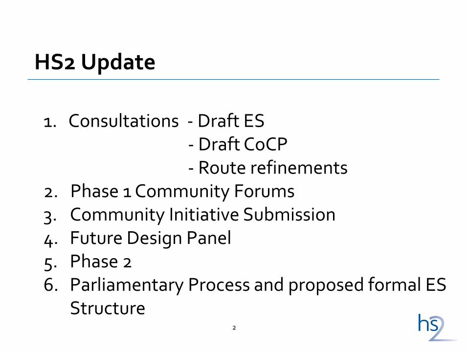
HS2 Update
1. Consultations - Draft ES - Draft CoCP - Route refinements 2. Phase 1 Community Forums 3. Community Initiative Submission 4. Future Design Panel 5. Phase 2 6. Parliamentary Process and proposed formal ES
Structure
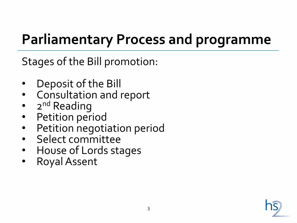
Parliamentary Process and programme
3
Stages of the Bill promotion: • Deposit of the Bill • Consultation and report • 2nd Reading • Petition period • Petition negotiation period • Select committee • House of Lords stages • Royal Assent
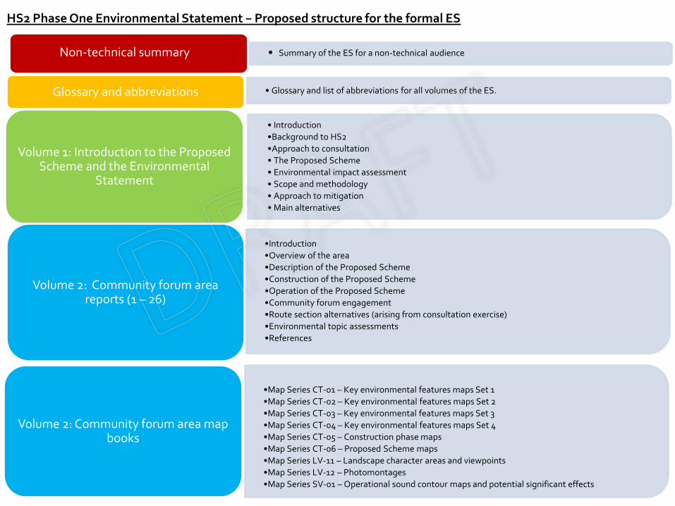
HS2 Phase One Environmental Statement – Proposed structure for the formal ES
• Summary of the ES for a non-technical audience Non-technical summary
• Glossary and list of abbreviations for all volumes of the ES. Glossary and abbreviations
• Introduction
•Background to HS2
•Approach to consultation
• The Proposed Scheme
• Environmental impact assessment
• Scope and methodology
• Approach to mitigation
• Main alternatives
Volume 1: Introduction to the Proposed Scheme and the Environmental
Statement
•Introduction
•Overview of the area
•Description of the Proposed Scheme
•Construction of the Proposed Scheme
•Operation of the Proposed Scheme
•Community forum engagement
•Route section alternatives (arising from consultation exercise)
•Environmental topic assessments
•References
Volume 2: Community forum area reports (1 – 26)
•Map Series CT-01 – Key environmental features maps Set 1
•Map Series CT-02 – Key environmental features maps Set 2
•Map Series CT-03 – Key environmental features maps Set 3
•Map Series CT-04 – Key environmental features maps Set 4
•Map Series CT-05 – Construction phase maps
•Map Series CT-06 – Proposed Scheme maps
•Map Series LV-11 – Landscape character areas and viewpoints
•Map Series LV-12 – Photomontages
•Map Series SV-01 – Operational sound contour maps and potential significant effects
Volume 2: Community forum area map books
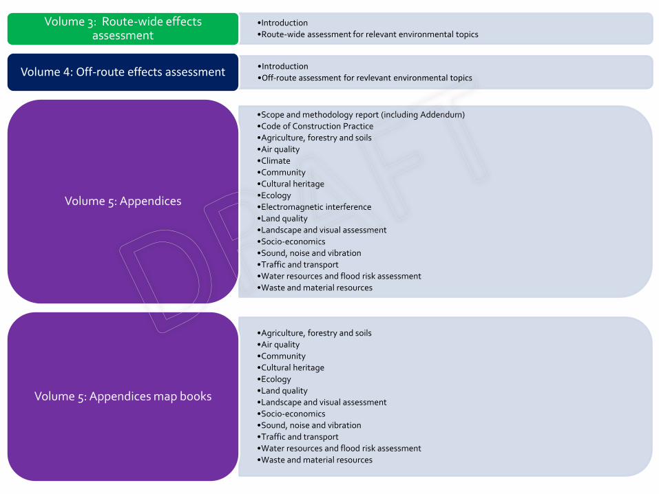
•Introduction
•Route-wide assessment for relevant environmental topics
Volume 3: Route-wide effects assessment
•Introduction
•Off-route assessment for revlevant environmental topics Volume 4: Off-route effects assessment
•Scope and methodology report (including Addendum)
•Code of Construction Practice
•Agriculture, forestry and soils
•Air quality
•Climate
•Community
•Cultural heritage
•Ecology
•Electromagnetic interference
•Land quality
•Landscape and visual assessment
•Socio-economics
•Sound, noise and vibration
•Traffic and transport
•Water resources and flood risk assessment
•Waste and material resources
Volume 5: Appendices
•Agriculture, forestry and soils
•Air quality
•Community
•Cultural heritage
•Ecology
•Land quality
•Landscape and visual assessment
•Socio-economics
•Sound, noise and vibration
•Traffic and transport
•Water resources and flood risk assessment
•Waste and material resources
Volume 5: Appendices map books
Principles and Practice
6
1. Mitigation Cultural Heritage: Challenges and Opportunities - Helen Glass, Archaeology and Heritage Advisor
Title goes here
Cultural Heritage: Challenges & Opportunities
26/07/2013 Welcome to HS2 8
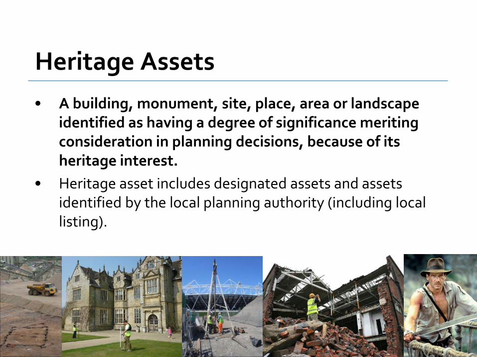
Heritage Assets
• A building, monument, site, place, area or landscape identified as having a degree of significance meriting consideration in planning decisions, because of its heritage interest.
• Heritage asset includes designated assets and assets identified by the local planning authority (including local listing).
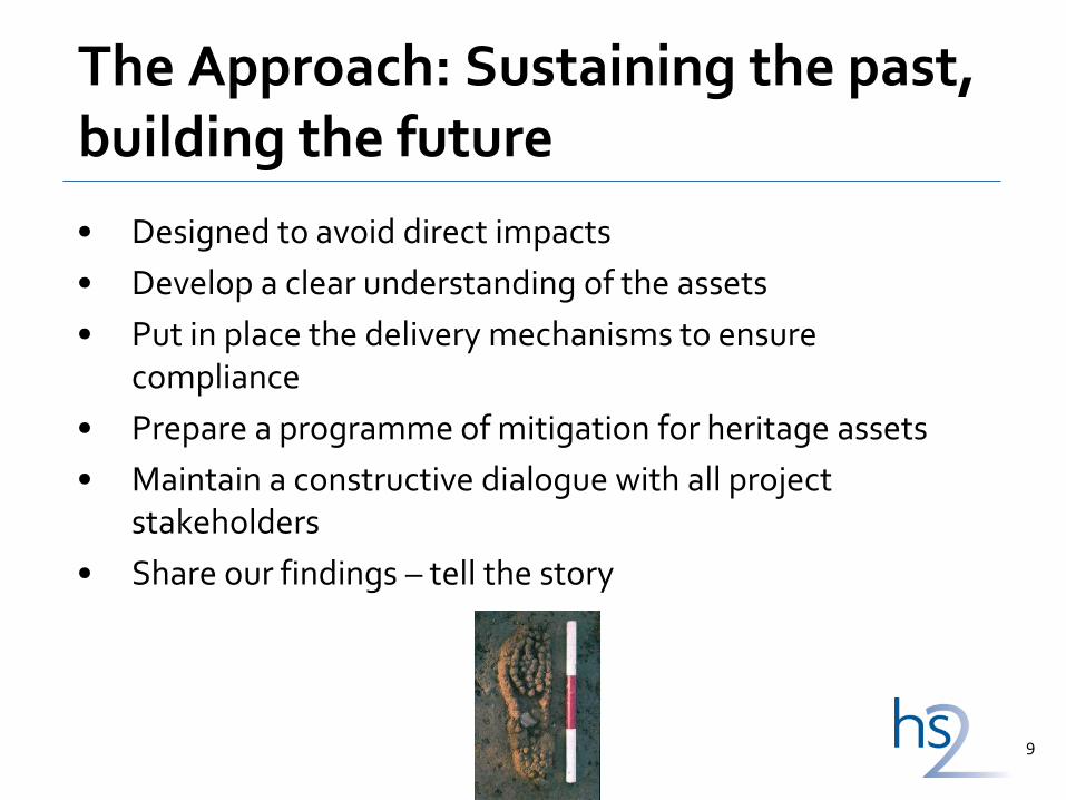
The Approach: Sustaining the past, building the future
• Designed to avoid direct impacts
• Develop a clear understanding of the assets
• Put in place the delivery mechanisms to ensure compliance
• Prepare a programme of mitigation for heritage assets
• Maintain a constructive dialogue with all project stakeholders
• Share our findings – tell the story
9
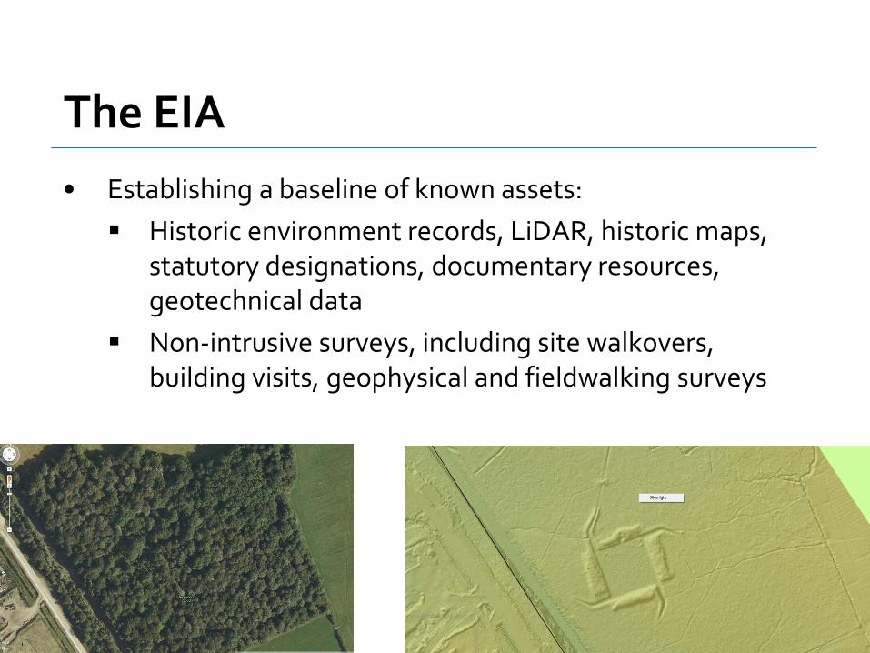
The EIA
• Establishing a baseline of known assets:
Historic environment records, LiDAR, historic maps, statutory designations, documentary resources, geotechnical data
Non-intrusive surveys, including site walkovers, building visits, geophysical and fieldwalking surveys
10

Impacts of HS2
• Enabling works, e.g. demolition, utility diversion
• Construction activities, e.g. earthworks, piling, foundations, borrow pits, compounds, road works, grouting, shafts, cuttings….
• Settlement
• Sound and vibration
• Landscape & ecological mitigation works
26/07/2013 11
Project documentation
• Hybrid Bill
Disapplication of Listed Building & Scheduled Monument legislation
Disapplication of Burial Ground legislation
Development of alternative regimes/procedures
• Heritage Memorandum
Routewide approach to heritage assets including non-designated
• Code of Construction Practice
Route-wide principles, control measures & standards to be implemented as a minimum
12
Heritage Agreements
• The hybrid Bill will disapply the need for listed building or scheduled monument consents
• In place of the normal consenting regime, the project will negotiate Heritage Agreements with English Heritage and the LPAs
• HA essentially an outline method statement committing to a given programme of works.
13
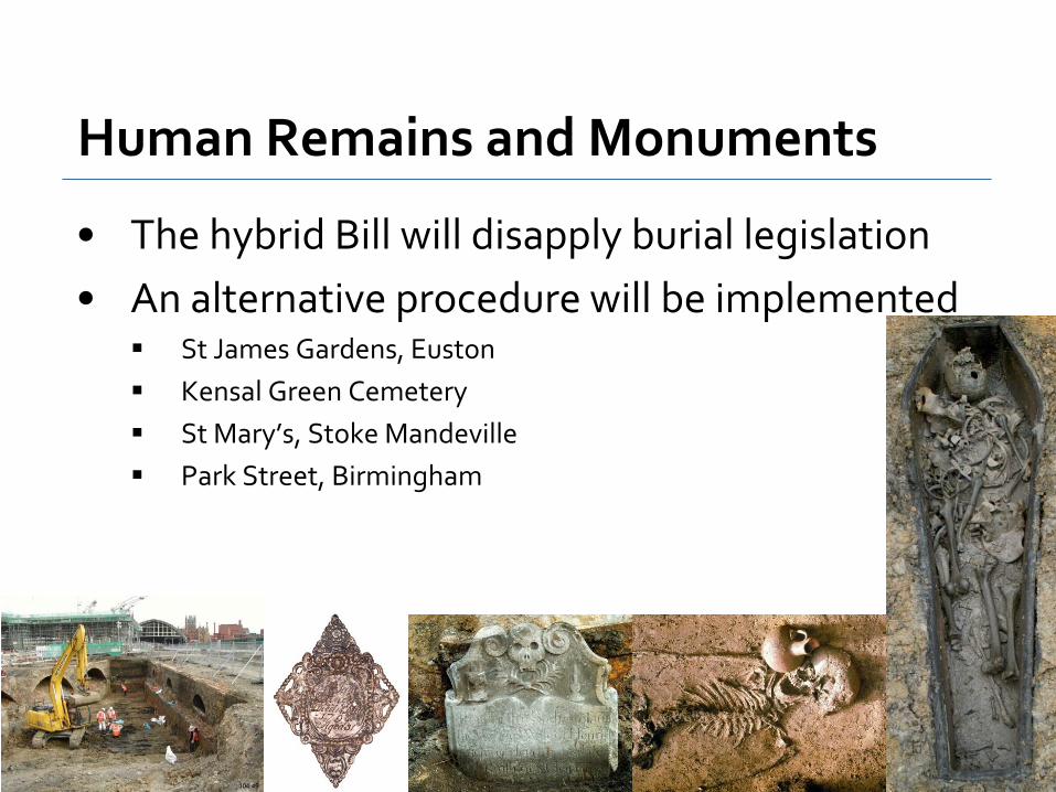
Human Remains and Monuments
• The hybrid Bill will disapply burial legislation
• An alternative procedure will be implemented St James Gardens, Euston
Kensal Green Cemetery
St Mary’s, Stoke Mandeville
Park Street, Birmingham
14

After the Hybrid Bill: what happens next?
• Input to design development
• Programme of archaeological and built heritage works
• Develop detailed mitigation strategies, policies and procedures
15

Archaeological Mitigation
• Preservation in situ
• Set piece excavation
• Earthwork survey
• Geoarchaeological borehole survey
• Targeted watching briefs
• Analysis, reporting, dissemination and archiving
Welcome to HS2 16

Built Heritage Mitigation
• Protection measures
• Noise and landscape works
• Incorporation into design; design cues
• Set piece building recording
• Salvage
• Analysis, reporting, dissemination and archiving
17

Dissemination
18
Input to the 2008 CIRIA Archaeology Guide: Managing archaeological risk in construction
Academic publication
Web-based archive information
Popular publication

Opportunities: Education & Outreach
• Community projects
• Skills & training
• Lectures & talks
• Digital media & web site
• Popular & academic publications
• Awareness raising
• Professional development
19
Questions?
The voyage of discovery is not seeking new landscapes but in having new eyes.
Marcel Proust
Truly sustainable developments recognise the opportunities presented by our cultural heritage, and are able to achieve the fine balance between protecting the past and enhancing the future.
20
21
Ralph Smyth - demonstrating CPRE’s new mapping system and the importance of open data
Campaign to Protect Rural England
High Speed 2, open data and better mapping
11 June 2013 HS2 NGO Environment Forum

Overview
• Open data policy & practice
• Problems with maps
• Where next
HS2 & open data
High Speed Rail
Open data overview
• 1 year since Open Data White Paper (June 2012) • ‘Data is the 21st century’s new raw material’
• Transparency empowers citizens, fosters innovation and drives
improvements in public sector • New FoI right to datasets via Protection of Freedoms Act 2012
• Commencement of right delayed from April 2013, draft code of practice
already available
High Speed Rail
Open data – what is it
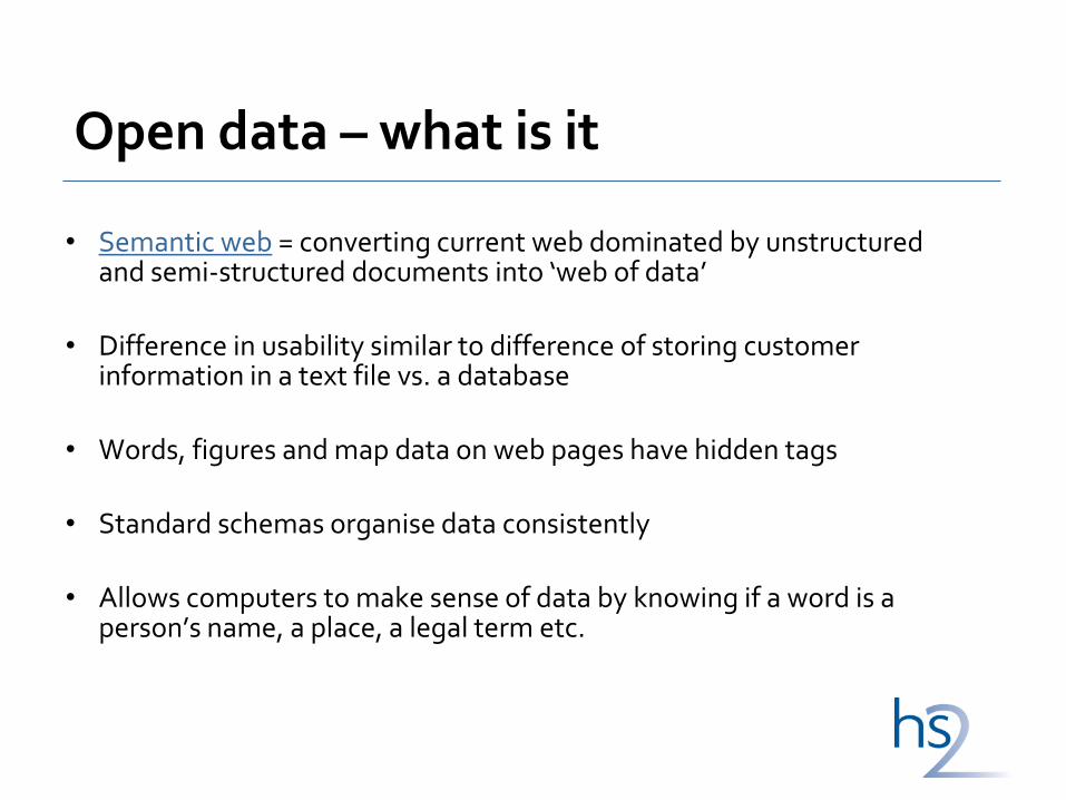
• Semantic web = converting current web dominated by unstructured and semi-structured documents into ‘web of data’
• Difference in usability similar to difference of storing customer
information in a text file vs. a database • Words, figures and map data on web pages have hidden tags
• Standard schemas organise data consistently
• Allows computers to make sense of data by knowing if a word is a
person’s name, a place, a legal term etc.
Public Data Principles
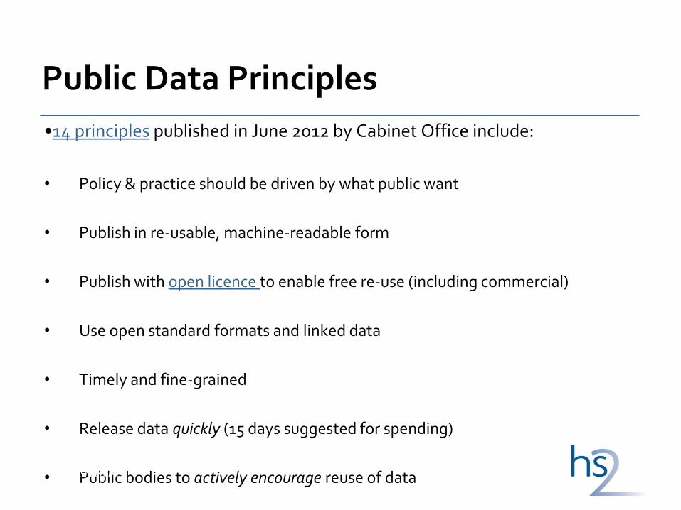
•14 principles published in June 2012 by Cabinet Office include:
• Policy & practice should be driven by what public want
• Publish in re-usable, machine-readable form
• Publish with open licence to enable free re-use (including commercial)
• Use open standard formats and linked data
• Timely and fine-grained
• Release data quickly (15 days suggested for spending)
• Public bodies to actively encourage reuse of data
High Speed Rail
HS2 & open data
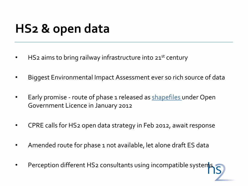
• HS2 aims to bring railway infrastructure into 21st century
• Biggest Environmental Impact Assessment ever so rich source of data
• Early promise - route of phase 1 released as shapefiles under Open Government Licence in January 2012
• CPRE calls for HS2 open data strategy in Feb 2012, await response
• Amended route for phase 1 not available, let alone draft ES data
• Perception different HS2 consultants using incompatible systems
High Speed Rail

Scale of formal Environmental Statement
• From draft to formal Environmental Statement – 5,000 to 55,000 pages?
• Private Bill Standing Orders 2005 to be updated to allow electronic deposit of documents
• In return, to facilitate public (indeed professionals’) use of formal ES, new approach needed: linked data
• In short, a commitment to making ES five star data (as defined by Tim Berners-Lee)
• HS2 Ltd needs to take action now if this is to happen High Speed Rail
HS2 mapping
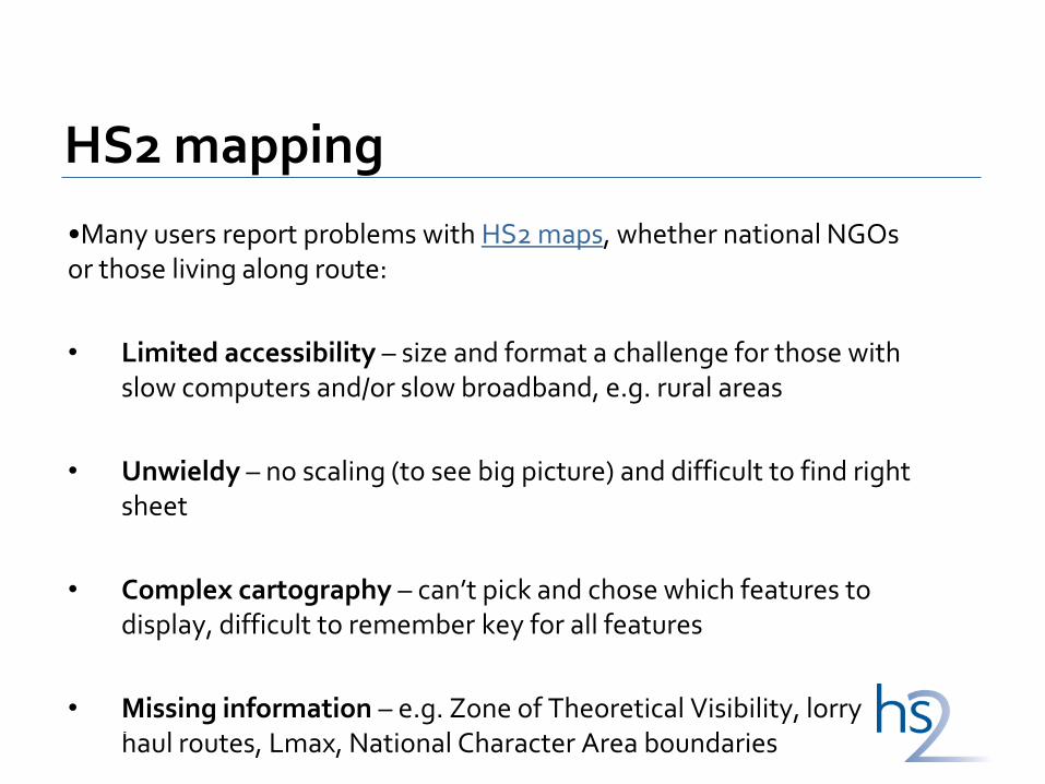
•Many users report problems with HS2 maps, whether national NGOs or those living along route:
• Limited accessibility – size and format a challenge for those with slow computers and/or slow broadband, e.g. rural areas
• Unwieldy – no scaling (to see big picture) and difficult to find right sheet
• Complex cartography – can’t pick and chose which features to display, difficult to remember key for all features
• Missing information – e.g. Zone of Theoretical Visibility, lorry haul routes, Lmax, National Character Area boundaries
High Speed Rail
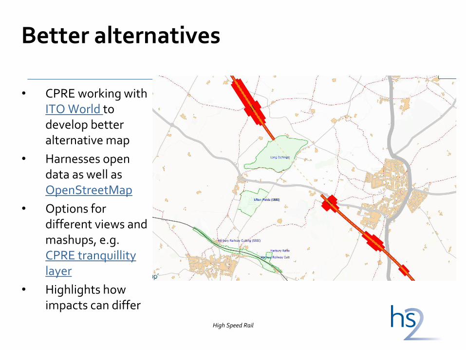
Better alternatives
• CPRE working with ITO World to develop better alternative map
• Harnesses open data as well as OpenStreetMap
• Options for different views and mashups, e.g. CPRE tranquillity layer
• Highlights how impacts can differ
High Speed Rail

21st century cartography
•Skill of map-making is not just accurate recording of geographical information. It’s about selecting what to show and how.
•Camera dial analogy for map viewing modes:
• Auto/point & shoot: just centre & zoom
• Feature modes: canned views of map tiles
- Construction impacts: e.g. construction boundary, haul routes
- Operational impacts: e.g. ZTV and noise contours
- Landform impacts: e.g. earthworks, autotransformers, (off-site?) planting
• Manual mode: full choice of which datasets to display, requires rendering on each view

Conclusions
• Global race on ICT not just infrastructure – opportunity for UK plc
• Economic value of open data for £33bn project is enormous
• Open data can assist public participation and understanding, so help focus development consent process on key issues
• 21st century infrastructure should not be stuck with 20th century approach to data
High Speed Rail

Draft ES Discussion
• Opportunity to raise any immediate questions / queries about the draft ES and CoCP consultations.
33
Questions / discussion points:
The Ramblers:
It would be useful to know:
• whether the finalised proposals to be contained in the hybrid Bill concerning the stopping up and diversion of public rights of way and other highways will be made known in advance of the publication of the Bill, and if so (approximately) how long in advance
• how long a period of time will be allowed from the publication of the Bill for the submission of petitions in regard to the individual proposals contained in it
34

Questions / discussion points Wildlife Trusts • When will GIS files for the Proposed Scheme be available to the public?
• How exactly does the HS2 version of the ‘biodiversity offsetting metric’ differ from that published by Defra in March 2012 at the start of the Biodiversity Offsetting Pilot?
• For what proportion of the Phase 1 route will full ecological baseline data as set out in Section 9.2 of the EIA Scope & Methodology Report (revised version, September 2012) be available and incorporated into the formal ES at the time the hybrid Bill is introduced into Parliament?
• What measures will be included in the hybrid Bill to ensure that the policy objective that developments should deliver a ‘net gain for nature’ expressed in the Natural Environment White Paper will be achieved?
• At recent Community Forum meetings participants are apparently being advised that the formal ES will be open to consultation in advance of the hybrid Bill being debated. If this is the case, it will be a very useful opportunity to comment on the accuracy and completeness of the ecological baseline and measures proposed to deliver a net gain to nature. Elaboration on how this consultation will be achieved given the proposed timetable would be helpful.
35

Questions / discussion points CPRE: • What is currently envisaged that will be added to the draft ES to make it the formal ES? It would be useful to
have this information in a living document.
• Consideration of the impact on patterns of development of HS2, given the scale of the project and the likelihood of secondary effects. For example, it might lead to greater development of brownfield sites and at greater densities but also to sprawl in Green Belt, e.g. around the Birmingham Interchange station. This should be considered route-wide as well at specific CFA areas but isn’t in relation to that station.
• Potential of Conservation Covenants, the introduction of which the Law Commission is running a consultation about until 21 June, to ensure that biodiversity offsetting etc negotiated as part of HS2 is maintained.
• A gallery of photomontage images on www.hs2.org.uk – this would make it much easier to browse through images of what HS2 could look like rather than having to download and delve into 26 CFA reports;
• Request of information in shapefiles, and details of what formats you hold the information requested by CPRE if not in shapefiles
• HS2 Ltd open data strategy
36