environmental questionnaire for mining...
TRANSCRIPT
Environmental Questionnaire for Mining Projects
Environment Clearance for Sand Minor Mineral Mines/Quarries of Sonepat
Unit-3, Sonepat District, Haryana Project Proponent: M/s VNS Infrastructure Private Limited
1
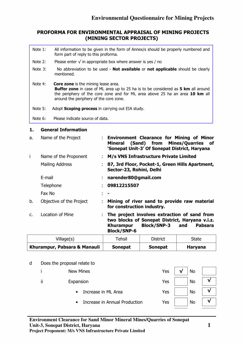
PROFORMA FOR ENVIRONMENTAL APPRAISAL OF MINING PROJECTS (MINING SECTOR PROJECTS)
1. General Information
a. Name of the Project : Environment Clearance for Mining of Minor Mineral (Sand) from Mines/Quarries of ‘Sonepat Unit-3’ Of Sonepat District, Haryana
i Name of the Proponent : M/s VNS Infrastructure Private Limited
Mailing Address : 87, 3rd Floor, Pocket-1, Green Hills Apartment, Sector-23, Rohini, Delhi
E-mail : [email protected]
Telephone : 09812215507
Fax No : -
b. Objective of the Project : Mining of river sand to provide raw material for construction industry.
c. Location of Mine : The project involves extraction of sand from two blocks of Sonepat District, Haryana v.i.z. Khurampur Block/SNP-3 and Pabsara Block/SNP-6
Village(s) Tehsil District State
Khurampur, Pabsara & Manauli Sonepat Sonepat Haryana
d Does the proposal relate to
i New Mines Yes √ No
ii Expansion Yes No √
• Increase in ML Area Yes No √
• Increase in Annual Production Yes No √
Note 1: All information to be given in the form of Annex/s should be properly numbered and form part of reply to this proforma.
Note 2: Please enter √ in appropriate box where answer is yes / no
Note 3: No abbreviation to be used - Not available or not applicable should be clearly mentioned.
Note 4: Core zone is the mining lease area. Buffer zone in case of ML area up to 25 ha is to be considered as 5 km all around
the periphery of the core zone and for ML area above 25 ha an area 10 km all around the periphery of the core zone.
Note 5: Adopt Scoping process in carrying out EIA study. Note 6: Please indicate source of data.
Environmental Questionnaire for Mining Projects
Environment Clearance for Sand Minor Mineral Mines/Quarries of Sonepat
Unit-3, Sonepat District, Haryana Project Proponent: M/s VNS Infrastructure Private Limited
2
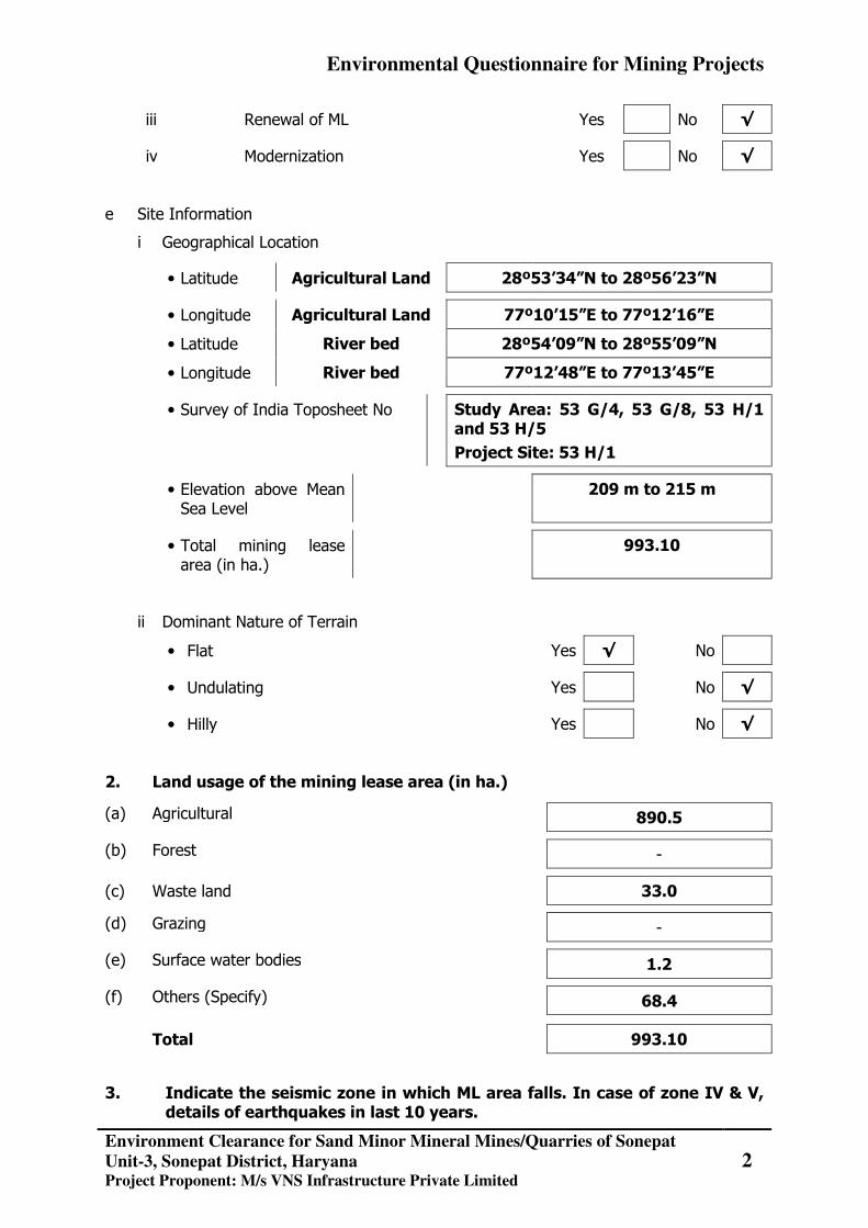
iii Renewal of ML Yes No √
iv Modernization Yes No √
e Site Information
i Geographical Location
• Latitude Agricultural Land 28º53’34”N to 28º56’23”N
• Longitude Agricultural Land 77º10’15”E to 77º12’16”E
• Latitude River bed 28º54’09”N to 28º55’09”N
• Longitude River bed 77º12’48”E to 77º13’45”E
• Survey of India Toposheet No Study Area: 53 G/4, 53 G/8, 53 H/1 and 53 H/5
Project Site: 53 H/1
• Elevation above Mean Sea Level
209 m to 215 m
• Total mining lease area (in ha.)
993.10
ii Dominant Nature of Terrain
• Flat Yes √ No
• Undulating Yes No √
• Hilly Yes No √
2. Land usage of the mining lease area (in ha.)
(a) Agricultural 890.5
(b) Forest -
(c) Waste land 33.0
(d) Grazing -
(e) Surface water bodies 1.2
(f) Others (Specify) 68.4
Total 993.10
3. Indicate the seismic zone in which ML area falls. In case of zone IV & V, details of earthquakes in last 10 years.
Environmental Questionnaire for Mining Projects
Environment Clearance for Sand Minor Mineral Mines/Quarries of Sonepat
Unit-3, Sonepat District, Haryana Project Proponent: M/s VNS Infrastructure Private Limited
3
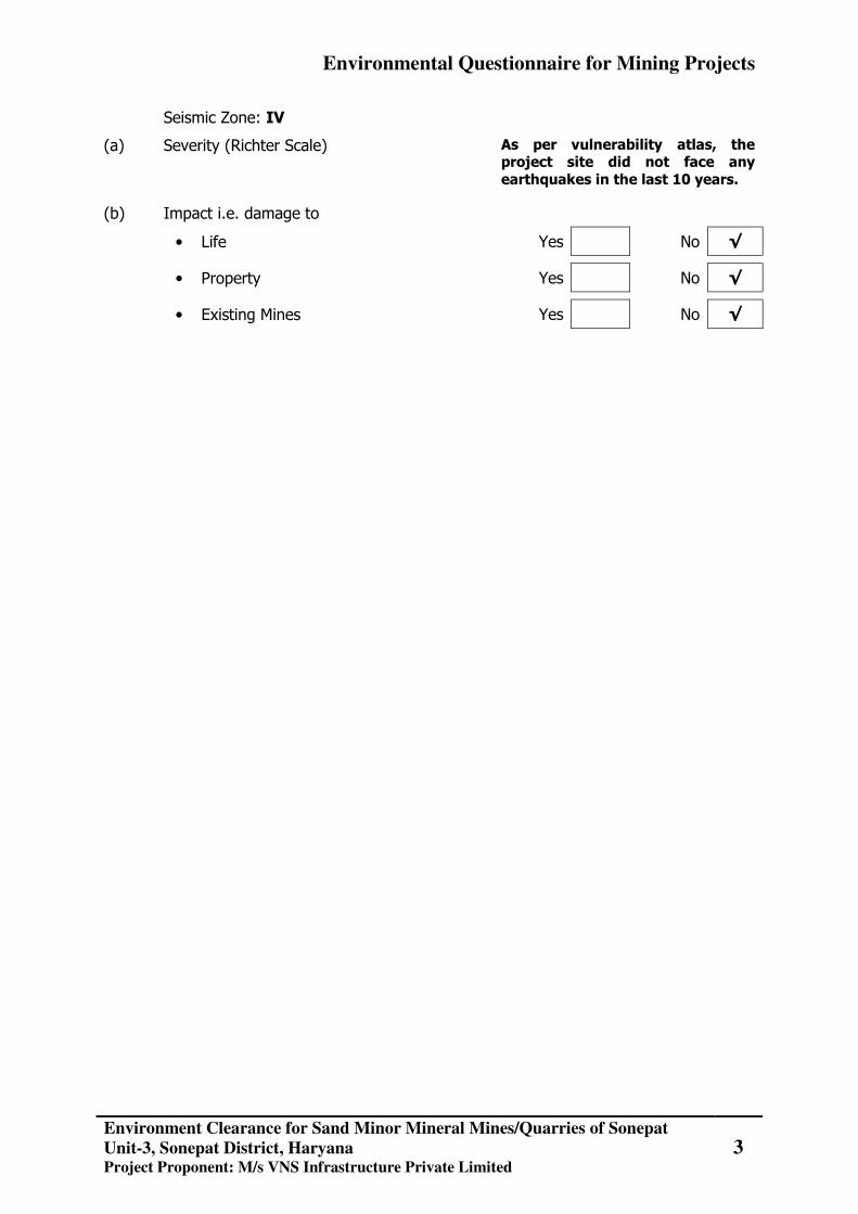
Seismic Zone: IV
(a) Severity (Richter Scale) As per vulnerability atlas, the project site did not face any earthquakes in the last 10 years.
(b) Impact i.e. damage to
• Life Yes No √
• Property Yes No √
• Existing Mines Yes No √
Environmental Questionnaire for Mining Projects
Environment Clearance for Sand Minor Mineral Mines/Quarries of Sonepat
Unit-3, Sonepat District, Haryana Project Proponent: M/s VNS Infrastructure Private Limited
4
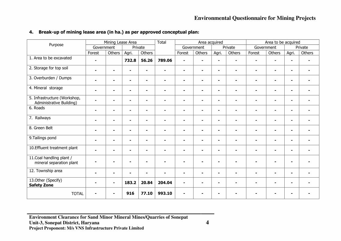
4. Break-up of mining lease area (in ha.) as per approved conceptual plan:
Purpose Mining Lease Area Total Area acquired Area to be acquired
Government Private Government Private Government Private
Forest Others Agri. Others Forest Others Agri. Others Forest Others Agri. Others 1. Area to be excavated
- 732.8 56.26 789.06 - - - - - - - -
2. Storage for top soil
- - - - - - - - - - - - -
3. Overburden / Dumps
- - - - - - - - - - - - -
4. Mineral storage
- - - - - - - - - - - - -
5. Infrastructure (Workshop, Administrative Building)
- - - - - - - - - - - - -
6. Roads
- - - - - - - - - - - - -
7. Railways
- - - - - - - - - - - - -
8. Green Belt
- - - - - - - - - - - - -
9.Tailings pond
- - - - - - - - - - - - -
10.Effluent treatment plant
- - - - - - - - - - - - -
11.Coal handling plant / mineral separation plant
- - - - - - - - - - - - -
12. Township area
- - - - - - - - - - - - -
13.Other (Specify) Safety Zone
- - 183.2 20.84 204.04 - - - - - - - -
TOTAL
- - 916 77.10 993.10 - - - - - - - -
Environmental Questionnaire for Mining Projects
Environment Clearance for Sand Minor Mineral Mines/Quarries of Sonepat
Unit-3, Sonepat District, Haryana Project Proponent: M/s VNS Infrastructure Private Limited
5
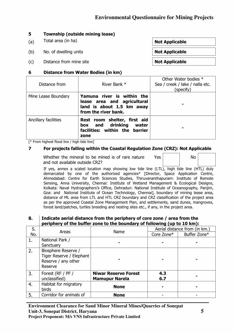
5 Township (outside mining lease)
(a) Total area (in ha) Not Applicable
(b) No. of dwelling units Not Applicable
(c) Distance from mine site Not Applicable
6 Distance from Water Bodies (in km)
Distance from River Bank * Other Water bodies *
Sea / creek / lake / nalla etc. (specify)
Mine Lease Boundary Yamuna river is within the lease area and agricultural land is about 1.5 km away from the river bank.
-
Ancillary facilities Rest room shelter, first aid box and drinking water facilities: within the barrier zone
-
[* From highest flood line / high tide line]
7 For projects falling within the Coastal Regulation Zone (CRZ): Not Applicable
Whether the mineral to be mined is of rare nature and not available outside CRZ?
Yes No
If yes, annex a scaled location map showing low tide line (LTL), high tide line (HTL) duly demarcated by one of the authorized agencies* [Director, Space Application Centre, Ahmedabad: Centre for Earth Sciences Studies, Thiruvananthapuram: Institute of Remote Sensing, Anna University, Chennai: Institute of Wetland Management & Ecological Designs, Kolkata: Naval Hydrographers’s Office, Dehradun: National Institute of Oceanography, Panjim, Goa: and National Institute of Ocean Technology, Chennai], boundary of mining lease area, distance of ML area from LTL and HTL CRZ boundary and CRZ classification of the project area as per the approved Coastal Zone Management Plan, and settlements, sand dunes, mangroves, forest land/patches, turtles breeding and nesting sites etc., if any, in the project area.
8. Indicate aerial distance from the periphery of core zone / area from the
periphery of the buffer zone to the boundary of following (up to 10 km): S. No.
Areas Name Aerial distance from (in km.)
Core Zone* Buffer Zone* 1. National Park /
Sanctuary - - -
2. Biosphere Reserve / Tiger Reserve / Elephant Reserve / any other Reserve
- - -
3. Forest (RF / PF / unclassified)
Niwar Reserve Forest Mamupur Narela
4.3 6.7 -
4. Habitat for migratory birds
None - -
5. Corridor for animals of None - -
Environmental Questionnaire for Mining Projects
Environment Clearance for Sand Minor Mineral Mines/Quarries of Sonepat
Unit-3, Sonepat District, Haryana Project Proponent: M/s VNS Infrastructure Private Limited
6
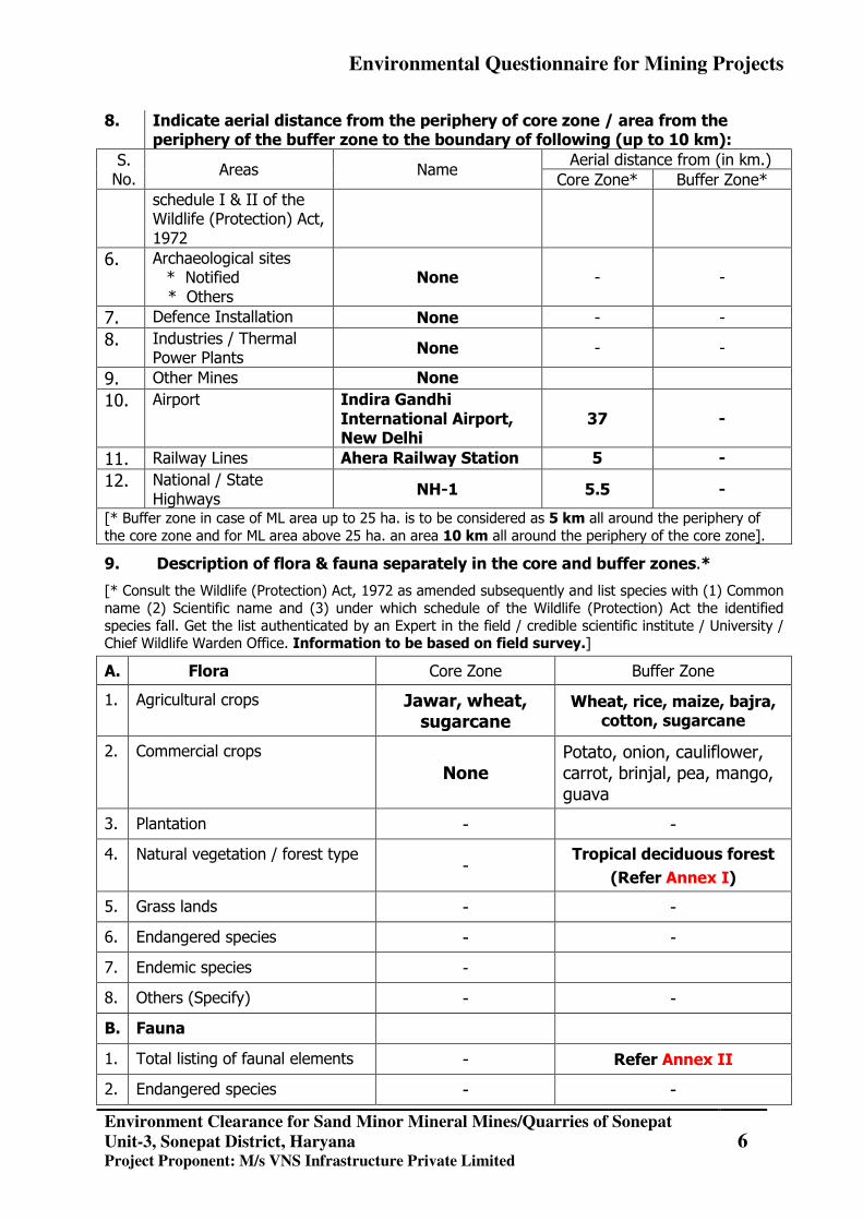
8. Indicate aerial distance from the periphery of core zone / area from the periphery of the buffer zone to the boundary of following (up to 10 km):
S. No.
Areas Name Aerial distance from (in km.)
Core Zone* Buffer Zone* schedule I & II of the Wildlife (Protection) Act, 1972
6. Archaeological sites * Notified
* Others None - -
7. Defence Installation None - - 8. Industries / Thermal
Power Plants None - -
9. Other Mines None 10. Airport Indira Gandhi
International Airport, New Delhi
37 -
11. Railway Lines Ahera Railway Station 5 - 12. National / State
Highways NH-1 5.5 -
[* Buffer zone in case of ML area up to 25 ha. is to be considered as 5 km all around the periphery of the core zone and for ML area above 25 ha. an area 10 km all around the periphery of the core zone].
9. Description of flora & fauna separately in the core and buffer zones.*
[* Consult the Wildlife (Protection) Act, 1972 as amended subsequently and list species with (1) Common name (2) Scientific name and (3) under which schedule of the Wildlife (Protection) Act the identified species fall. Get the list authenticated by an Expert in the field / credible scientific institute / University / Chief Wildlife Warden Office. Information to be based on field survey.]
A. Flora Core Zone Buffer Zone
1. Agricultural crops Jawar, wheat, sugarcane
Wheat, rice, maize, bajra, cotton, sugarcane
2. Commercial crops None
Potato, onion, cauliflower, carrot, brinjal, pea, mango, guava
3. Plantation - -
4. Natural vegetation / forest type -
Tropical deciduous forest (Refer Annex I)
5. Grass lands - -
6. Endangered species - -
7. Endemic species -
8. Others (Specify) - -
B. Fauna
1. Total listing of faunal elements - Refer Annex II
2. Endangered species - -
Environmental Questionnaire for Mining Projects
Environment Clearance for Sand Minor Mineral Mines/Quarries of Sonepat
Unit-3, Sonepat District, Haryana Project Proponent: M/s VNS Infrastructure Private Limited
7
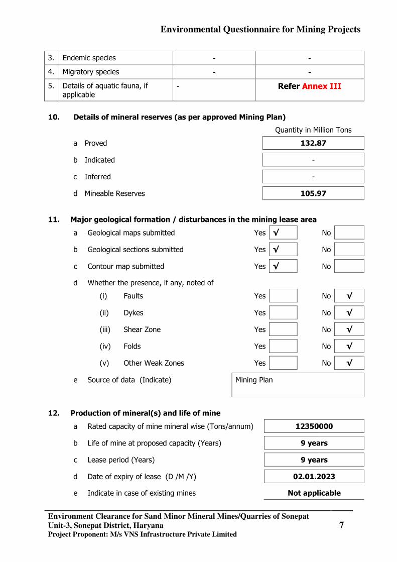
3. Endemic species - -
4. Migratory species - -
5. Details of aquatic fauna, if applicable
- Refer Annex III
10. Details of mineral reserves (as per approved Mining Plan)
Quantity in Million Tons
a Proved 132.87
b Indicated -
c Inferred -
d Mineable Reserves 105.97
11. Major geological formation / disturbances in the mining lease area
a Geological maps submitted Yes √ No
b Geological sections submitted Yes √ No
c Contour map submitted Yes √ No
d Whether the presence, if any, noted of
(i) Faults Yes No √
(ii) Dykes Yes No √
(iii) Shear Zone Yes No √
(iv) Folds Yes No √
(v) Other Weak Zones Yes No √
e Source of data (Indicate)
Mining Plan
12. Production of mineral(s) and life of mine
a Rated capacity of mine mineral wise (Tons/annum) 12350000
b Life of mine at proposed capacity (Years) 9 years
c Lease period (Years) 9 years
d Date of expiry of lease (D /M /Y) 02.01.2023
e Indicate in case of existing mines Not applicable
Environmental Questionnaire for Mining Projects
Environment Clearance for Sand Minor Mineral Mines/Quarries of Sonepat
Unit-3, Sonepat District, Haryana Project Proponent: M/s VNS Infrastructure Private Limited
8
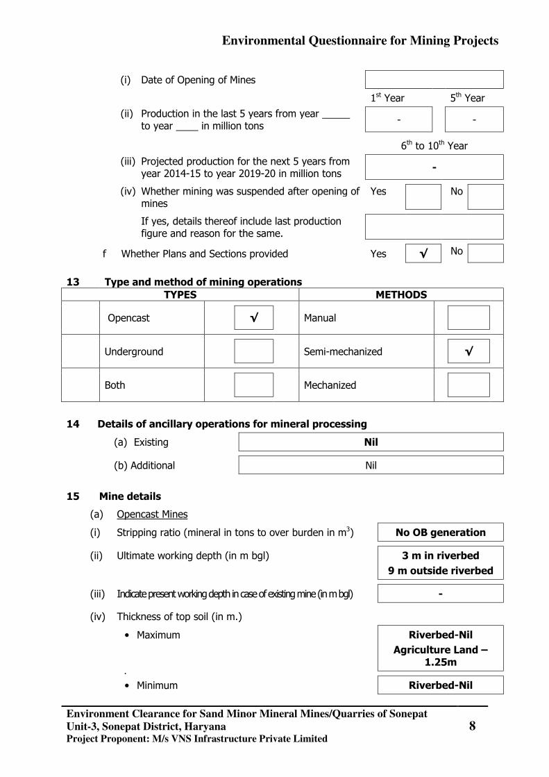
(i) Date of Opening of Mines
1st Year 5th Year
(ii) Production in the last 5 years from year _____ to year ____ in million tons
- -
6th to 10th Year
(iii) Projected production for the next 5 years from year 2014-15 to year 2019-20 in million tons
-
(iv) Whether mining was suspended after opening of mines
Yes No
If yes, details thereof include last production figure and reason for the same.
f Whether Plans and Sections provided Yes √ No
13 Type and method of mining operations
TYPES METHODS
Opencast
Manual
√
Underground
Semi-mechanized
√
Both
Mechanized
14 Details of ancillary operations for mineral processing
(a) Existing Nil
(b) Additional Nil
15 Mine details
(a) Opencast Mines
(i) Stripping ratio (mineral in tons to over burden in m3) No OB generation
(ii) Ultimate working depth (in m bgl) 3 m in riverbed
9 m outside riverbed
(iii) Indicate present working depth in case of existing mine (in m bgl) -
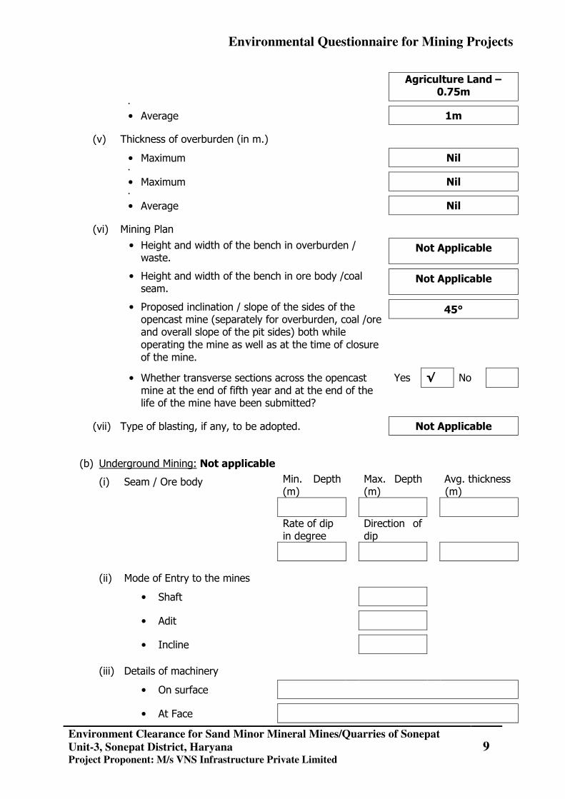
(iv) Thickness of top soil (in m.)
• Maximum Riverbed-Nil
Agriculture Land – 1.25m
•
• Minimum Riverbed-Nil
Environmental Questionnaire for Mining Projects
Environment Clearance for Sand Minor Mineral Mines/Quarries of Sonepat
Unit-3, Sonepat District, Haryana Project Proponent: M/s VNS Infrastructure Private Limited
9
Agriculture Land – 0.75m
•
• Average 1m
(v) Thickness of overburden (in m.)
• Maximum Nil •
• Maximum Nil •
• Average Nil
(vi) Mining Plan
• Height and width of the bench in overburden / waste.
Not Applicable
• Height and width of the bench in ore body /coal seam.
Not Applicable
• Proposed inclination / slope of the sides of the opencast mine (separately for overburden, coal /ore and overall slope of the pit sides) both while operating the mine as well as at the time of closure of the mine.
45°
• Whether transverse sections across the opencast mine at the end of fifth year and at the end of the life of the mine have been submitted?
Yes √ No
(vii) Type of blasting, if any, to be adopted. Not Applicable
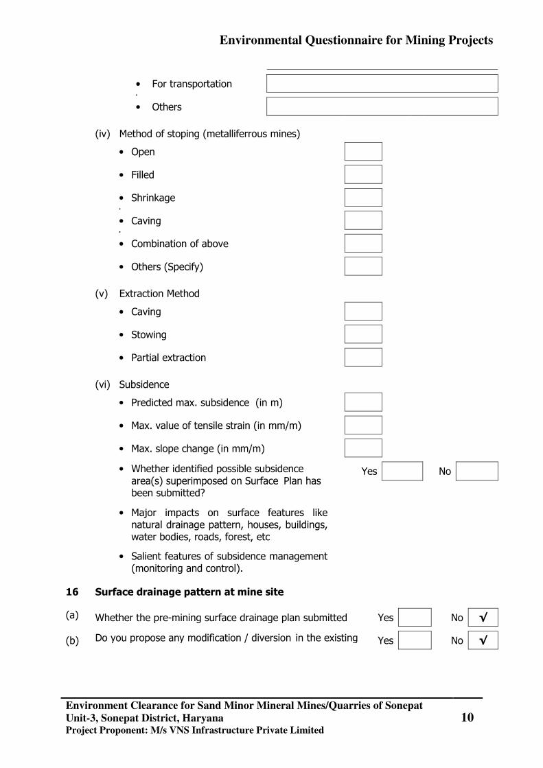
(b) Underground Mining: Not applicable
(i) Seam / Ore body Min. Depth (m)
Max. Depth (m)
Avg. thickness (m)
Rate of dip in degree
Direction of dip
(ii) Mode of Entry to the mines
• Shaft
• Adit
• Incline
(iii) Details of machinery
• On surface
• At Face
Environmental Questionnaire for Mining Projects
Environment Clearance for Sand Minor Mineral Mines/Quarries of Sonepat
Unit-3, Sonepat District, Haryana Project Proponent: M/s VNS Infrastructure Private Limited
10
• For transportation •
• Others
(iv) Method of stoping (metalliferrous mines)
• Open
• Filled
• Shrinkage •
• Caving •
• Combination of above
• Others (Specify)
(v) Extraction Method
• Caving
• Stowing
• Partial extraction
(vi) Subsidence
• Predicted max. subsidence (in m)
• Max. value of tensile strain (in mm/m)
• Max. slope change (in mm/m)
• Whether identified possible subsidence area(s) superimposed on Surface Plan has been submitted?
Yes No
• Major impacts on surface features like natural drainage pattern, houses, buildings, water bodies, roads, forest, etc
• Salient features of subsidence management (monitoring and control).
16 Surface drainage pattern at mine site
(a) Whether the pre-mining surface drainage plan submitted Yes No √
(b) Do you propose any modification / diversion in the existing Yes No √
Environmental Questionnaire for Mining Projects
Environment Clearance for Sand Minor Mineral Mines/Quarries of Sonepat
Unit-3, Sonepat District, Haryana Project Proponent: M/s VNS Infrastructure Private Limited
11
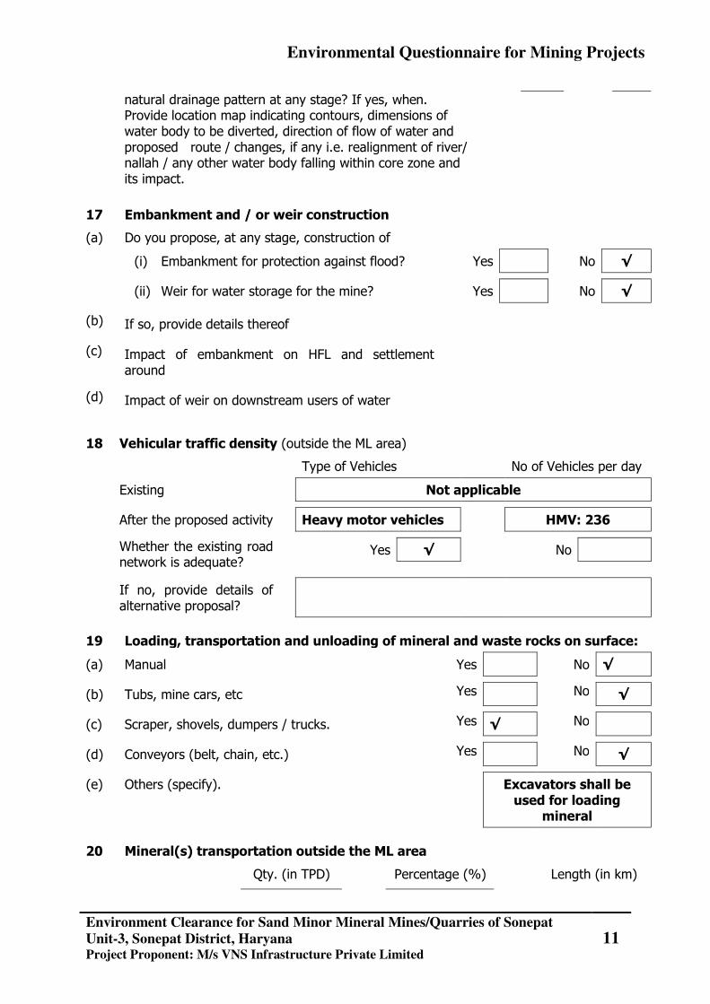
natural drainage pattern at any stage? If yes, when. Provide location map indicating contours, dimensions of water body to be diverted, direction of flow of water and proposed route / changes, if any i.e. realignment of river/ nallah / any other water body falling within core zone and its impact.
17 Embankment and / or weir construction
(a) Do you propose, at any stage, construction of
(i) Embankment for protection against flood? Yes No √
(ii) Weir for water storage for the mine? Yes No √
(b) If so, provide details thereof
(c) Impact of embankment on HFL and settlement around
(d) Impact of weir on downstream users of water
18 Vehicular traffic density (outside the ML area)
Type of Vehicles No of Vehicles per day
Existing Not applicable
After the proposed activity Heavy motor vehicles HMV: 236
Whether the existing road network is adequate?
Yes √ No
If no, provide details of alternative proposal?
19 Loading, transportation and unloading of mineral and waste rocks on surface:
(a) Manual Yes No √
(b) Tubs, mine cars, etc Yes No √
(c) Scraper, shovels, dumpers / trucks. Yes √ No
(d) Conveyors (belt, chain, etc.) Yes No √
(e) Others (specify). Excavators shall be used for loading
mineral
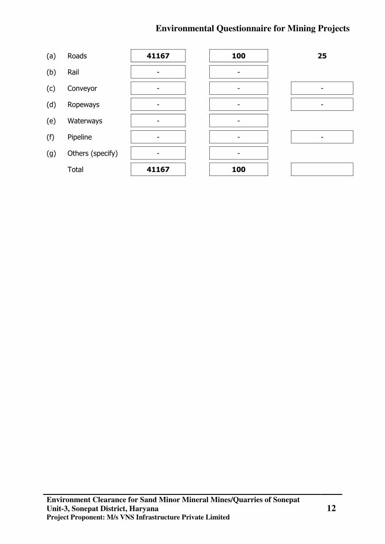
20 Mineral(s) transportation outside the ML area
Qty. (in TPD) Percentage (%) Length (in km)
Environmental Questionnaire for Mining Projects
Environment Clearance for Sand Minor Mineral Mines/Quarries of Sonepat
Unit-3, Sonepat District, Haryana Project Proponent: M/s VNS Infrastructure Private Limited
12
(a) Roads 41167 100 25
(b) Rail - -
(c) Conveyor - - -
(d) Ropeways - - -
(e) Waterways - -
(f) Pipeline - - -
(g) Others (specify) - -
Total 41167 100
Environmental Questionnaire for Mining Projects
Environment Clearance for Sand Minor Mineral Mines/Quarries of Sonepat
Unit-3, Sonepat District, Haryana Project Proponent: M/s VNS Infrastructure Private Limited
13
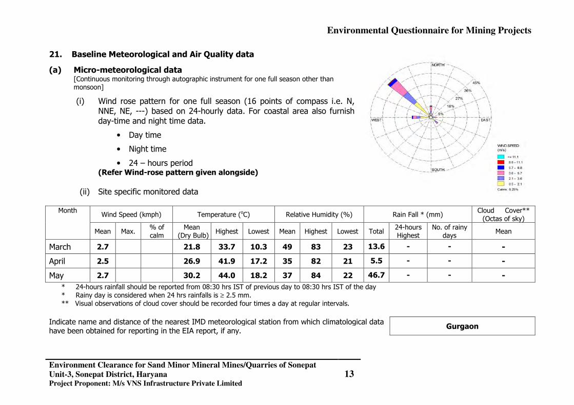
21. Baseline Meteorological and Air Quality data
(a) Micro-meteorological data [Continuous monitoring through autographic instrument for one full season other than monsoon]
(i) Wind rose pattern for one full season (16 points of compass i.e. N, NNE, NE, ---) based on 24-hourly data. For coastal area also furnish day-time and night time data.
• Day time
• Night time
• 24 – hours period (Refer Wind-rose pattern given alongside)
(ii) Site specific monitored data
Month Wind Speed (kmph) Temperature (oC) Relative Humidity (%) Rain Fall * (mm)
Cloud Cover** (Octas of sky)
Mean Max. % of calm
Mean (Dry Bulb)
Highest Lowest Mean Highest Lowest Total 24-hours Highest
No. of rainy days
Mean
March 2.7 21.8 33.7 10.3 49 83 23 13.6 - - -
April 2.5 26.9 41.9 17.2 35 82 21 5.5 - - -
May 2.7 30.2 44.0 18.2 37 84 22 46.7 - - - * 24-hours rainfall should be reported from 08:30 hrs IST of previous day to 08:30 hrs IST of the day * Rainy day is considered when 24 hrs rainfalls is ≥ 2.5 mm. ** Visual observations of cloud cover should be recorded four times a day at regular intervals.
Indicate name and distance of the nearest IMD meteorological station from which climatological data have been obtained for reporting in the EIA report, if any.
Gurgaon
Environmental Questionnaire for Mining Projects
Environment Clearance for Sand Minor Mineral Mines/Quarries of Sonepat
Unit-3, Sonepat District, Haryana Project Proponent: M/s VNS Infrastructure Private Limited
14
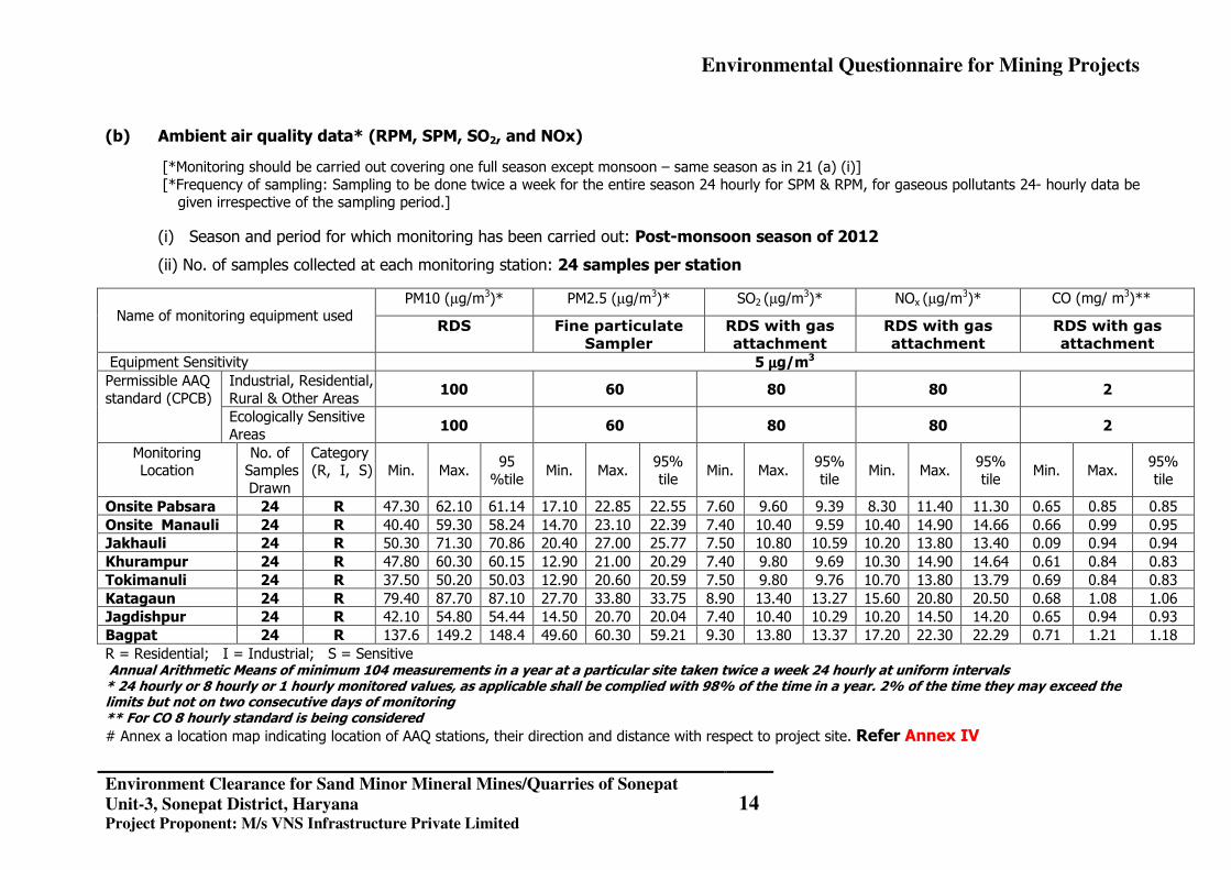
(b) Ambient air quality data* (RPM, SPM, SO2, and NOx)
[*Monitoring should be carried out covering one full season except monsoon – same season as in 21 (a) (i)] [*Frequency of sampling: Sampling to be done twice a week for the entire season 24 hourly for SPM & RPM, for gaseous pollutants 24- hourly data be
given irrespective of the sampling period.]
(i) Season and period for which monitoring has been carried out: Post-monsoon season of 2012
(ii) No. of samples collected at each monitoring station: 24 samples per station
Name of monitoring equipment used
PM10 (µg/m3)* PM2.5 (µg/m3)* SO2 (µg/m3)* NOx (µg/m
3)* CO (mg/ m3)**
RDS Fine particulate
Sampler
RDS with gas
attachment
RDS with gas
attachment
RDS with gas
attachment Equipment Sensitivity 5 µµµµg/m3 Permissible AAQ standard (CPCB)
Industrial, Residential, Rural & Other Areas
100 60 80 80 2
Ecologically Sensitive Areas
100 60 80 80 2
Monitoring Location
No. of Samples Drawn
Category (R, I, S)
Min. Max.
95 %tile
Min. Max. 95% tile
Min. Max. 95% tile
Min. Max. 95% tile
Min. Max. 95% tile
Onsite Pabsara 24 R 47.30 62.10 61.14 17.10 22.85 22.55 7.60 9.60 9.39 8.30 11.40 11.30 0.65 0.85 0.85 Onsite Manauli 24 R 40.40 59.30 58.24 14.70 23.10 22.39 7.40 10.40 9.59 10.40 14.90 14.66 0.66 0.99 0.95 Jakhauli 24 R 50.30 71.30 70.86 20.40 27.00 25.77 7.50 10.80 10.59 10.20 13.80 13.40 0.09 0.94 0.94 Khurampur 24 R 47.80 60.30 60.15 12.90 21.00 20.29 7.40 9.80 9.69 10.30 14.90 14.64 0.61 0.84 0.83 Tokimanuli 24 R 37.50 50.20 50.03 12.90 20.60 20.59 7.50 9.80 9.76 10.70 13.80 13.79 0.69 0.84 0.83 Katagaun 24 R 79.40 87.70 87.10 27.70 33.80 33.75 8.90 13.40 13.27 15.60 20.80 20.50 0.68 1.08 1.06 Jagdishpur 24 R 42.10 54.80 54.44 14.50 20.70 20.04 7.40 10.40 10.29 10.20 14.50 14.20 0.65 0.94 0.93 Bagpat 24 R 137.6 149.2 148.4 49.60 60.30 59.21 9.30 13.80 13.37 17.20 22.30 22.29 0.71 1.21 1.18 R = Residential; I = Industrial; S = Sensitive Annual Arithmetic Means of minimum 104 measurements in a year at a particular site taken twice a week 24 hourly at uniform intervals * 24 hourly or 8 hourly or 1 hourly monitored values, as applicable shall be complied with 98% of the time in a year. 2% of the time they may exceed the limits but not on two consecutive days of monitoring ** For CO 8 hourly standard is being considered # Annex a location map indicating location of AAQ stations, their direction and distance with respect to project site. Refer Annex IV
Environmental Questionnaire for Mining Projects
Environment Clearance for Sand Minor Mineral Mines/Quarries of Sonepat
Unit-3, Sonepat District, Haryana Project Proponent: M/s VNS Infrastructure Private Limited
15
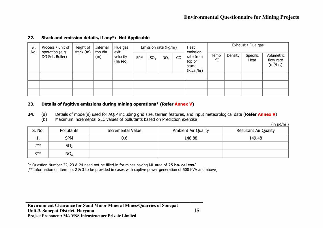
22. Stack and emission details, if any*: Not Applicable
Sl. No.
Process / unit of operation (e.g. DG Set, Boiler)
Height of stack (m)
Internal top dia. (m)
Flue gas exit velocity (m/sec)
Emission rate (kg/hr) Heat emission rate from top of stack (K.cal/hr)
Exhaust / Flue gas
SPM SO2 NOx CO Temp
OC Density Specific
Heat Volumetric flow rate (m3/hr.)
23. Details of fugitive emissions during mining operations* (Refer Annex V) 24. (a) Details of model(s) used for AQIP including grid size, terrain features, and input meteorological data (Refer Annex V)
(b) Maximum incremental GLC values of pollutants based on Prediction exercise (in µg/m3)
S. No. Pollutants Incremental Value Ambient Air Quality Resultant Air Quality
1. SPM 0.6 148.88 149.48
2** SO2
3** NOX [* Question Number 22, 23 & 24 need not be filled-in for mines having ML area of 25 ha. or less.] [**Information on item no. 2 & 3 to be provided in cases with captive power generation of 500 KVA and above]
Environmental Questionnaire for Mining Projects
Environment Clearance for Sand Minor Mineral Mines/Quarries of Sonepat
Unit-3, Sonepat District, Haryana Project Proponent: M/s VNS Infrastructure Private Limited
16
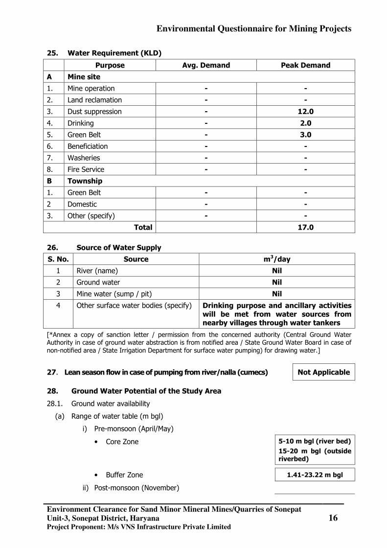
25. Water Requirement (KLD)
Purpose Avg. Demand Peak Demand
A Mine site
1. Mine operation - -
2. Land reclamation - -
3. Dust suppression - 12.0
4. Drinking - 2.0
5. Green Belt - 3.0
6. Beneficiation - -
7. Washeries - -
8. Fire Service - -
B Township
1. Green Belt - -
2 Domestic - -
3. Other (specify) - -
Total 17.0
26. Source of Water Supply
S. No. Source m3/day
1 River (name) Nil
2 Ground water Nil
3 Mine water (sump / pit) Nil
4 Other surface water bodies (specify) Drinking purpose and ancillary activities will be met from water sources from nearby villages through water tankers
[*Annex a copy of sanction letter / permission from the concerned authority (Central Ground Water Authority in case of ground water abstraction is from notified area / State Ground Water Board in case of non-notified area / State Irrigation Department for surface water pumping) for drawing water.]
27. Lean season flow in case of pumping from river/nalla (cumecs) Not Applicable
28. Ground Water Potential of the Study Area
28.1. Ground water availability
(a) Range of water table (m bgl)
i) Pre-monsoon (April/May)
• Core Zone 5-10 m bgl (river bed)
15-20 m bgl (outside riverbed)
• Buffer Zone 1.41-23.22 m bgl
ii) Post-monsoon (November)

Environmental Questionnaire for Mining Projects
Environment Clearance for Sand Minor Mineral Mines/Quarries of Sonepat
Unit-3, Sonepat District, Haryana Project Proponent: M/s VNS Infrastructure Private Limited
17
• Core Zone 5-10 m bgl (river bed)
15-20 m bgl (outside riverbed)
• Buffer Zone 0.99-24.46 m bgl
(b) Total annual replenishable recharge (million m3/ year)
• By ground water table fluctuation method 79.02
• By rainfall infiltration factor method -
(c) Annual draft excluding estimated draft through mine discharge (million m3/ year)
N.A
(d) Estimated draft through mine discharge (million m3/ year) N.A
(e) Net annual ground water availability (million m3/ year) 155.26
(f) Stage of ground water development in % 196%
28.2 Water demand - Competing users of the water source: Not Applicable
S. No. Usage Present Consumption (m3/day)
Additional proposed as per local plan
(m3/day)
Total (m3/day)
Surface Ground Surface Ground Surface Ground
1 Domestic
2 Irrigation
3 Industry
4 Mining
5 Others (specify)
Total
29. Water Quality*
(a) Annex physico -chemical analysis of water at intake point **
Refer to Annex VI for physico-chemical analysis of water at sources from villages from where water is to be taken for consumption.
(b) In case of existing mine, annex report on quality of water discharge i.e. complete physico - chemical analysis**
Not applicable
[*For non-discharging mines at least four ground water samples to be taken preferably from downstream direction of the mine in pre-monsoon and post-monsoon periods and analysed. For discharging mines six samples are to be analysed]
**All parameters as per BIS 10500. Indicate name of Methodology, Equipment used for analysis, and Detection Level (DL) for each parameter.
*** Wherever any analytical parameter is below detection level, “BDL” (Below Detection Level) should be written instead of ‘NIL’.
Environmental Questionnaire for Mining Projects
Environment Clearance for Sand Minor Mineral Mines/Quarries of Sonepat
Unit-3, Sonepat District, Haryana Project Proponent: M/s VNS Infrastructure Private Limited
18
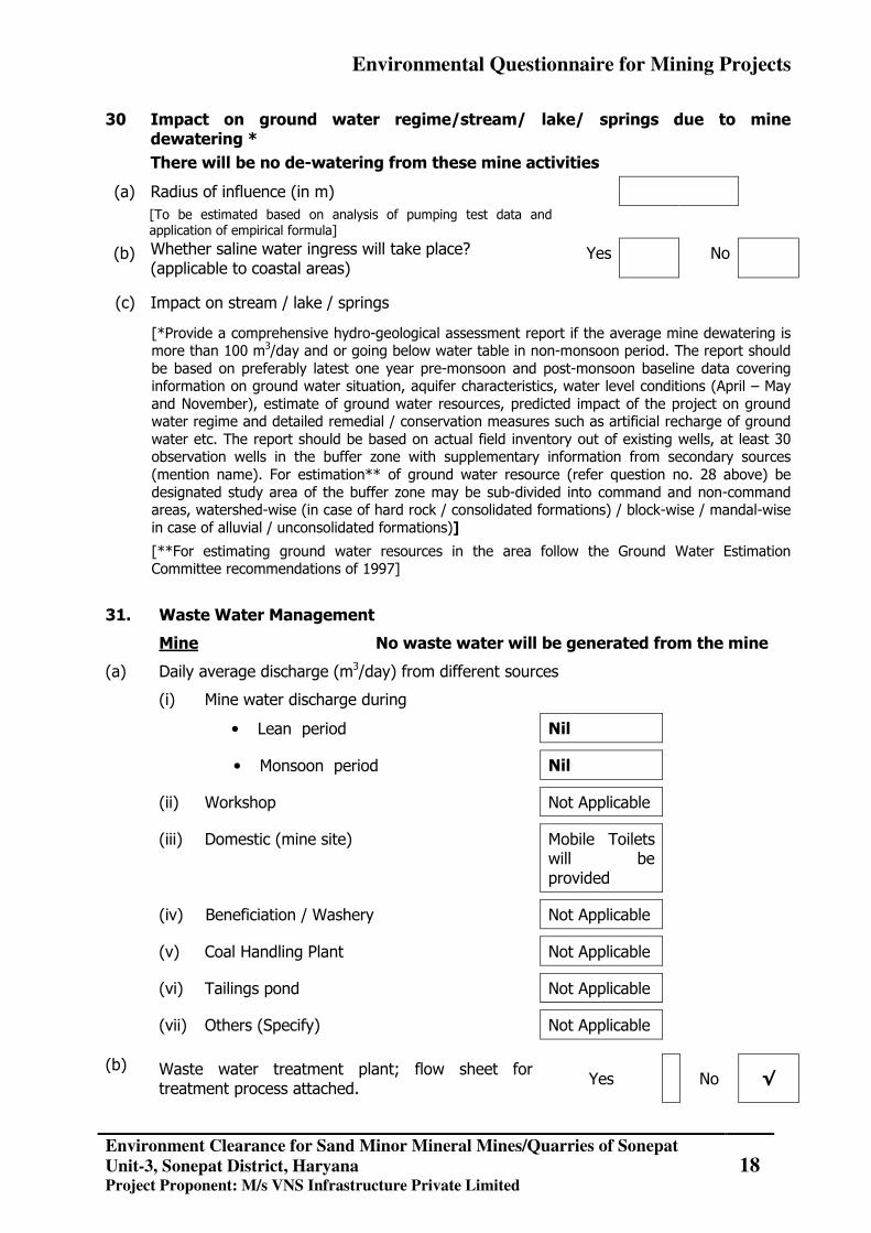
30 Impact on ground water regime/stream/ lake/ springs due to mine dewatering *
There will be no de-watering from these mine activities
(a) Radius of influence (in m)
[To be estimated based on analysis of pumping test data and application of empirical formula]
(b) Whether saline water ingress will take place? (applicable to coastal areas)
Yes No
(c) Impact on stream / lake / springs
[*Provide a comprehensive hydro-geological assessment report if the average mine dewatering is more than 100 m3/day and or going below water table in non-monsoon period. The report should be based on preferably latest one year pre-monsoon and post-monsoon baseline data covering information on ground water situation, aquifer characteristics, water level conditions (April – May and November), estimate of ground water resources, predicted impact of the project on ground water regime and detailed remedial / conservation measures such as artificial recharge of ground water etc. The report should be based on actual field inventory out of existing wells, at least 30 observation wells in the buffer zone with supplementary information from secondary sources (mention name). For estimation** of ground water resource (refer question no. 28 above) be designated study area of the buffer zone may be sub-divided into command and non-command areas, watershed-wise (in case of hard rock / consolidated formations) / block-wise / mandal-wise in case of alluvial / unconsolidated formations)]
[**For estimating ground water resources in the area follow the Ground Water Estimation Committee recommendations of 1997]
31. Waste Water Management
Mine No waste water will be generated from the mine
(a) Daily average discharge (m3/day) from different sources
(i) Mine water discharge during
• Lean period Nil
• Monsoon period Nil
(ii) Workshop Not Applicable
(iii) Domestic (mine site) Mobile Toilets will be provided
(iv) Beneficiation / Washery Not Applicable
(v) Coal Handling Plant Not Applicable
(vi) Tailings pond Not Applicable
(vii) Others (Specify) Not Applicable
(b) Waste water treatment plant; flow sheet for treatment process attached.
Yes No √
Environmental Questionnaire for Mining Projects
Environment Clearance for Sand Minor Mineral Mines/Quarries of Sonepat
Unit-3, Sonepat District, Haryana Project Proponent: M/s VNS Infrastructure Private Limited
19
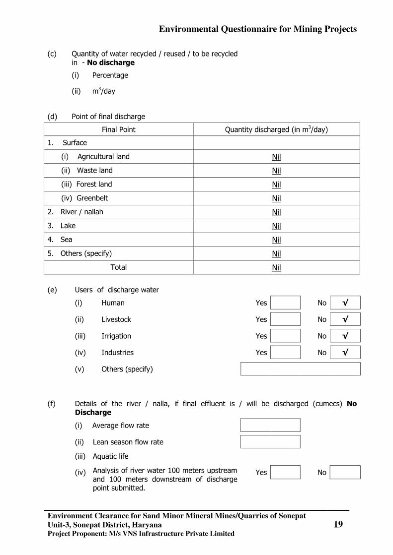
(c) Quantity of water recycled / reused / to be recycled in - No discharge
(i) Percentage
(ii) m3/day
(d) Point of final discharge
Final Point Quantity discharged (in m3/day)
1. Surface
(i) Agricultural land Nil
(ii) Waste land Nil
(iii) Forest land Nil
(iv) Greenbelt Nil
2. River / nallah Nil
3. Lake Nil
4. Sea Nil
5. Others (specify) Nil
Total Nil
(e) Users of discharge water
(i) Human Yes No √
(ii) Livestock Yes No √
(iii) Irrigation Yes No √
(iv) Industries Yes No √
(v) Others (specify)
(f) Details of the river / nalla, if final effluent is / will be discharged (cumecs) No Discharge
(i) Average flow rate
(ii) Lean season flow rate
(iii) Aquatic life
(iv) Analysis of river water 100 meters upstream and 100 meters downstream of discharge point submitted.
Yes No
Environmental Questionnaire for Mining Projects
Environment Clearance for Sand Minor Mineral Mines/Quarries of Sonepat
Unit-3, Sonepat District, Haryana Project Proponent: M/s VNS Infrastructure Private Limited
20
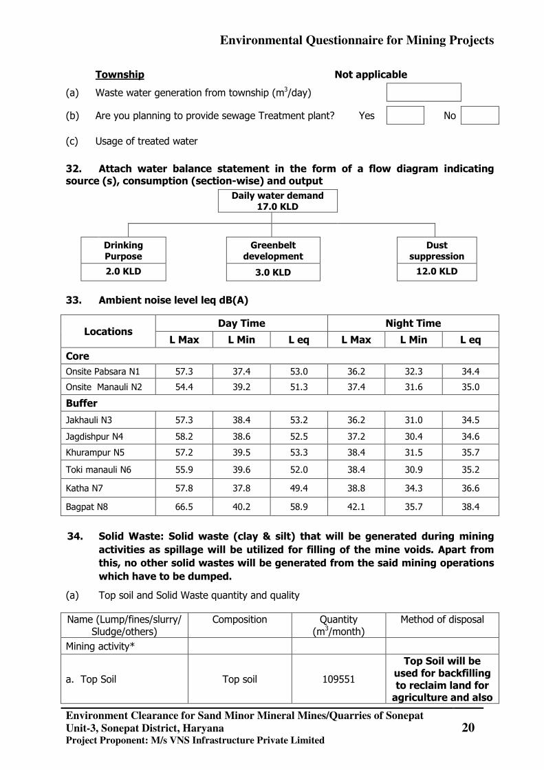
Township Not applicable
(a) Waste water generation from township (m3/day)
(b) Are you planning to provide sewage Treatment plant? Yes No
(c) Usage of treated water
32. Attach water balance statement in the form of a flow diagram indicating source (s), consumption (section-wise) and output
Daily water demand 17.0 KLD
Drinking Purpose
Greenbelt development
Dust suppression
2.0 KLD 3.0 KLD 12.0 KLD
33. Ambient noise level leq dB(A)
Locations Day Time Night Time
L Max L Min L eq L Max L Min L eq
Core Onsite Pabsara N1 57.3 37.4 53.0 36.2 32.3 34.4
Onsite Manauli N2 54.4 39.2 51.3 37.4 31.6 35.0
Buffer
Jakhauli N3 57.3 38.4 53.2 36.2 31.0 34.5
Jagdishpur N4 58.2 38.6 52.5 37.2 30.4 34.6
Khurampur N5 57.2 39.5 53.3 38.4 31.5 35.7
Toki manauli N6 55.9 39.6 52.0 38.4 30.9 35.2
Katha N7 57.8 37.8 49.4 38.8 34.3 36.6
Bagpat N8 66.5 40.2 58.9 42.1 35.7 38.4
34. Solid Waste: Solid waste (clay & silt) that will be generated during mining activities as spillage will be utilized for filling of the mine voids. Apart from this, no other solid wastes will be generated from the said mining operations which have to be dumped.
(a) Top soil and Solid Waste quantity and quality
Name (Lump/fines/slurry/ Sludge/others)
Composition Quantity (m3/month)
Method of disposal
Mining activity*
a. Top Soil Top soil 109551
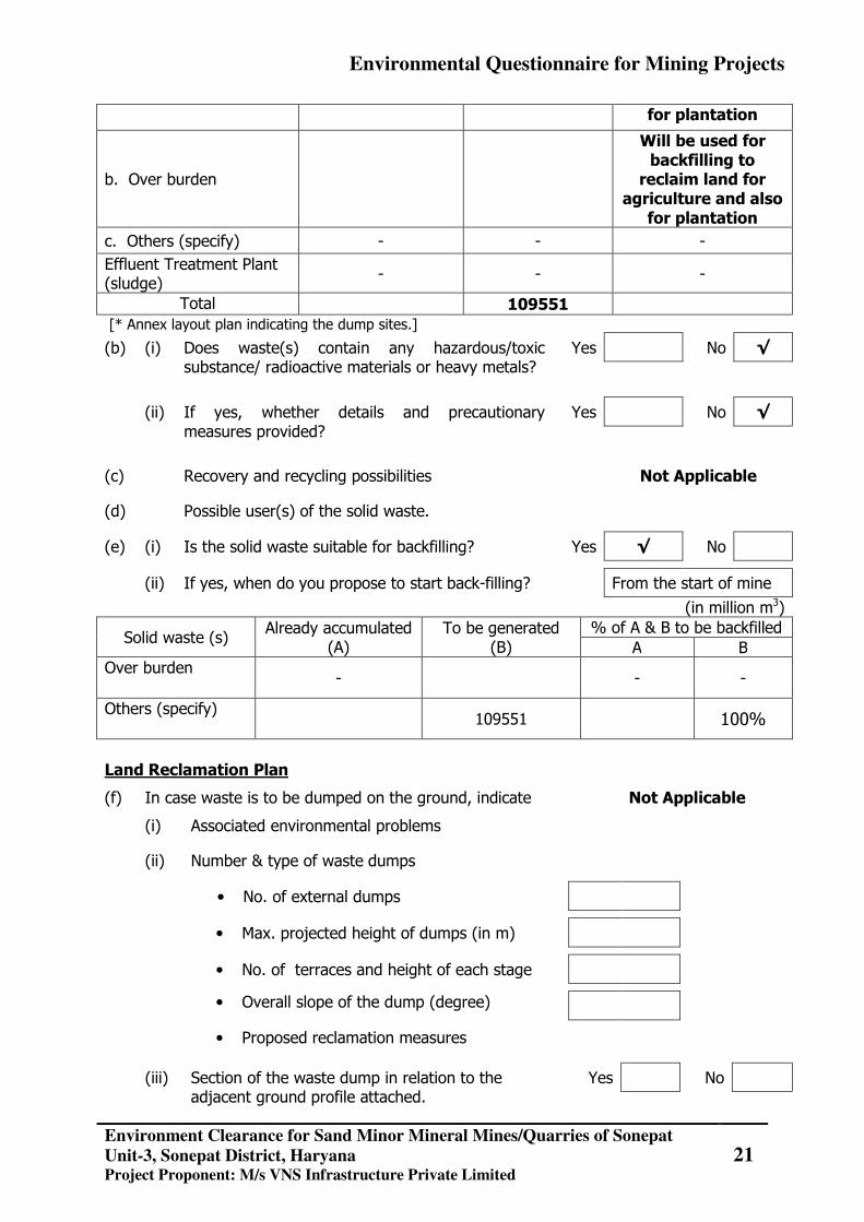
Top Soil will be used for backfilling to reclaim land for agriculture and also
Environmental Questionnaire for Mining Projects
Environment Clearance for Sand Minor Mineral Mines/Quarries of Sonepat
Unit-3, Sonepat District, Haryana Project Proponent: M/s VNS Infrastructure Private Limited
21
for plantation
b. Over burden
Will be used for backfilling to
reclaim land for agriculture and also
for plantation c. Others (specify) - - - Effluent Treatment Plant (sludge)
- - -
Total 109551 [* Annex layout plan indicating the dump sites.]
(b) (i) Does waste(s) contain any hazardous/toxic substance/ radioactive materials or heavy metals?
Yes No √
(ii) If yes, whether details and precautionary measures provided?
Yes No √
(c) Recovery and recycling possibilities Not Applicable
(d) Possible user(s) of the solid waste.
(e) (i) Is the solid waste suitable for backfilling? Yes √ No
(ii) If yes, when do you propose to start back-filling? From the start of mine
(in million m3)
Solid waste (s) Already accumulated
(A) To be generated
(B) % of A & B to be backfilled
A B Over burden
- - -
Others (specify)
109551 100%
Land Reclamation Plan
(f) In case waste is to be dumped on the ground, indicate Not Applicable
(i) Associated environmental problems
(ii) Number & type of waste dumps
• No. of external dumps
• Max. projected height of dumps (in m)
• No. of terraces and height of each stage
• Overall slope of the dump (degree)
• Proposed reclamation measures
(iii) Section of the waste dump in relation to the adjacent ground profile attached.
Yes No
Environmental Questionnaire for Mining Projects
Environment Clearance for Sand Minor Mineral Mines/Quarries of Sonepat
Unit-3, Sonepat District, Haryana Project Proponent: M/s VNS Infrastructure Private Limited
22
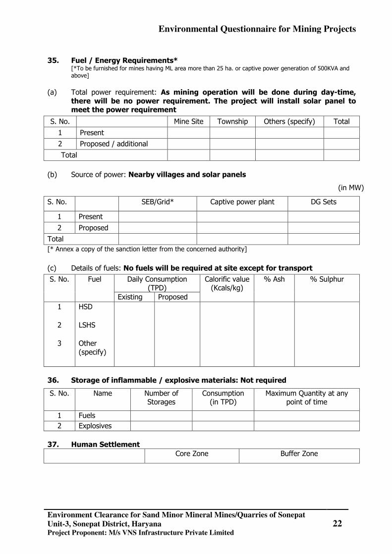
35. Fuel / Energy Requirements*
[*To be furnished for mines having ML area more than 25 ha. or captive power generation of 500KVA and above]
(a) Total power requirement: As mining operation will be done during day-time,
there will be no power requirement. The project will install solar panel to meet the power requirement
S. No. Mine Site Township Others (specify) Total
1 Present 2 Proposed / additional
Total
(b) Source of power: Nearby villages and solar panels
(in MW)
S. No. SEB/Grid* Captive power plant DG Sets
1 Present 2 Proposed
Total [* Annex a copy of the sanction letter from the concerned authority]
(c) Details of fuels: No fuels will be required at site except for transport
S. No. Fuel Daily Consumption (TPD)
Calorific value (Kcals/kg)
% Ash % Sulphur
Existing Proposed 1
2
3
HSD LSHS Other (specify)
36. Storage of inflammable / explosive materials: Not required
S. No. Name Number of Storages
Consumption (in TPD)
Maximum Quantity at any point of time
1 Fuels 2 Explosives
37. Human Settlement
Core Zone Buffer Zone
Environmental Questionnaire for Mining Projects
Environment Clearance for Sand Minor Mineral Mines/Quarries of Sonepat
Unit-3, Sonepat District, Haryana Project Proponent: M/s VNS Infrastructure Private Limited
23
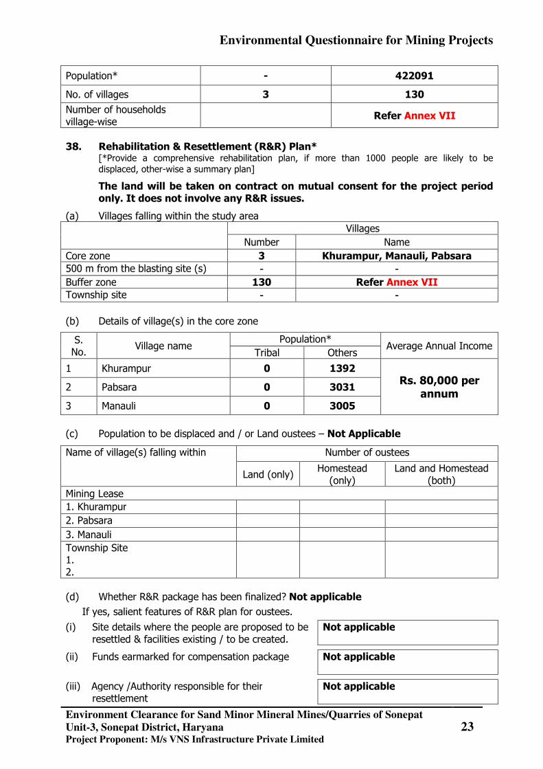
Population* - 422091
No. of villages 3 130
Number of households village-wise Refer Annex VII
38. Rehabilitation & Resettlement (R&R) Plan*
[*Provide a comprehensive rehabilitation plan, if more than 1000 people are likely to be displaced, other-wise a summary plan]
The land will be taken on contract on mutual consent for the project period only. It does not involve any R&R issues.
(a) Villages falling within the study area Villages
Number Name Core zone 3 Khurampur, Manauli, Pabsara 500 m from the blasting site (s) - - Buffer zone 130 Refer Annex VII Township site - -
(b) Details of village(s) in the core zone
S. No.
Village name Population*
Average Annual Income Tribal Others
1 Khurampur 0 1392 Rs. 80,000 per
annum 2 Pabsara 0 3031
3 Manauli 0 3005
(c) Population to be displaced and / or Land oustees – Not Applicable
Name of village(s) falling within Number of oustees
Land (only) Homestead
(only) Land and Homestead
(both) Mining Lease 1. Khurampur 2. Pabsara 3. Manauli Township Site 1. 2.
(d) Whether R&R package has been finalized? Not applicable
If yes, salient features of R&R plan for oustees.
(i) Site details where the people are proposed to be resettled & facilities existing / to be created.
Not applicable
(ii) Funds earmarked for compensation package
Not applicable
(iii) Agency /Authority responsible for their resettlement
Not applicable
Environmental Questionnaire for Mining Projects
Environment Clearance for Sand Minor Mineral Mines/Quarries of Sonepat
Unit-3, Sonepat District, Haryana Project Proponent: M/s VNS Infrastructure Private Limited
24
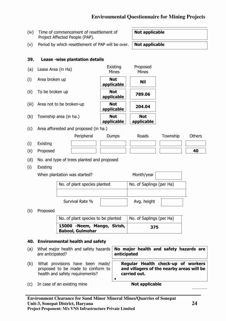
(iv) Time of commencement of resettlement of Project Affected People (PAP).
Not applicable
(v) Period by which resettlement of PAP will be over. Not applicable
39. Lease -wise plantation details
(a) Lease Area (in Ha) Existing
Mines Proposed
Mines
(i) Area broken up Not applicable
Nil
(ii) To be broken up Not applicable
789.06
(iii) Area not to be broken-up Not applicable
204.04
(b) Township area (in ha.) Not applicable
Not
applicable
(c) Area afforested and proposed (in ha.)
Peripheral Dumps Roads Township Others
(i) Existing
(ii) Proposed 40
(d) No. and type of trees planted and proposed
(i) Existing
When plantation was started? Month/year
No. of plant species planted No. of Saplings (per Ha)
Survival Rate % Avg. height
(ii) Proposed
No. of plant species to be planted No. of Saplings (per Ha)
15000 -Neem, Mango, Sirish, Babool, Gulmohar
375
40. Environmental health and safety
(a) What major health and safety hazards are anticipated?
No major health and safety hazards are anticipated
(b) What provisions have been made/ proposed to be made to conform to health and safety requirements?
Regular Health check-up of workers and villagers of the nearby areas will be carried out.
• (c) In case of an existing mine Not applicable
Environmental Questionnaire for Mining Projects
Environment Clearance for Sand Minor Mineral Mines/Quarries of Sonepat
Unit-3, Sonepat District, Haryana Project Proponent: M/s VNS Infrastructure Private Limited
25
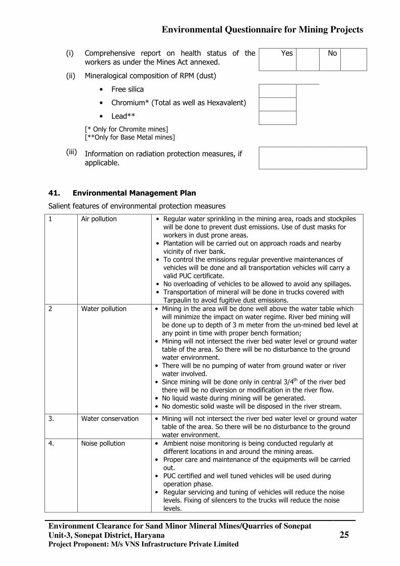
(i) Comprehensive report on health status of the workers as under the Mines Act annexed.
Yes No
(ii) Mineralogical composition of RPM (dust)
• Free silica
• Chromium* (Total as well as Hexavalent)
• Lead**
[* Only for Chromite mines] [**Only for Base Metal mines]
(iii) Information on radiation protection measures, if applicable.
41. Environmental Management Plan
Salient features of environmental protection measures
1 Air pollution • Regular water sprinkling in the mining area, roads and stockpiles will be done to prevent dust emissions. Use of dust masks for workers in dust prone areas.
• Plantation will be carried out on approach roads and nearby vicinity of river bank.
• To control the emissions regular preventive maintenances of vehicles will be done and all transportation vehicles will carry a valid PUC certificate.
• No overloading of vehicles to be allowed to avoid any spillages. • Transportation of mineral will be done in trucks covered with
Tarpaulin to avoid fugitive dust emissions. 2 Water pollution • Mining in the area will be done well above the water table which
will minimize the impact on water regime. River bed mining will be done up to depth of 3 m meter from the un-mined bed level at any point in time with proper bench formation;
• Mining will not intersect the river bed water level or ground water table of the area. So there will be no disturbance to the ground water environment.
• There will be no pumping of water from ground water or river water involved.
• Since mining will be done only in central 3/4th of the river bed there will be no diversion or modification in the river flow.
• No liquid waste during mining will be generated. • No domestic solid waste will be disposed in the river stream.
3. Water conservation • Mining will not intersect the river bed water level or ground water table of the area. So there will be no disturbance to the ground water environment.
4. Noise pollution • Ambient noise monitoring is being conducted regularly at different locations in and around the mining areas.
• Proper care and maintenance of the equipments will be carried out.
• PUC certified and well tuned vehicles will be used during operation phase.
• Regular servicing and tuning of vehicles will reduce the noise levels. Fixing of silencers to the trucks will reduce the noise levels.
Environmental Questionnaire for Mining Projects
Environment Clearance for Sand Minor Mineral Mines/Quarries of Sonepat
Unit-3, Sonepat District, Haryana Project Proponent: M/s VNS Infrastructure Private Limited
26
• Plantation will be taken up along the approach roads and vicinity of river bank. The plantation minimizes propagation of noise and also arrests dust.
• Speaking at low voices enough for communication reduces the excess noise levels.
• Efficient traffic management will be done with speed limits on vehicles. Drivers will be educated to minimize us of horns.
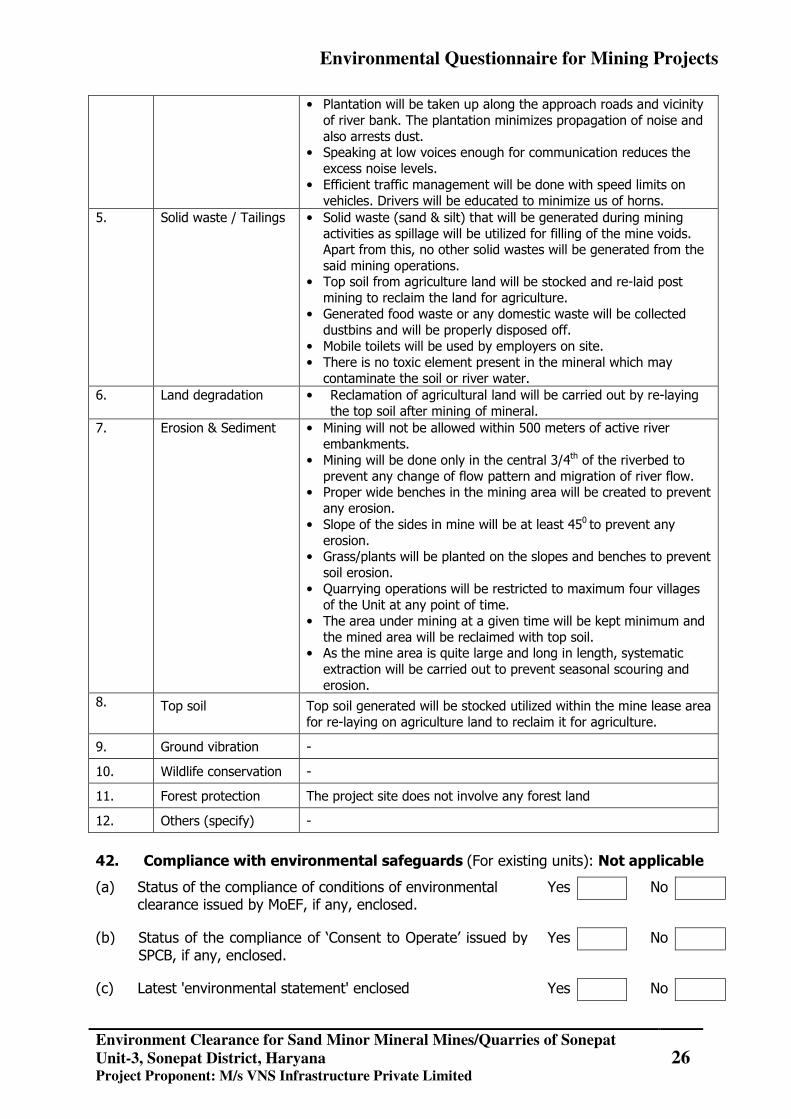
5. Solid waste / Tailings • Solid waste (sand & silt) that will be generated during mining activities as spillage will be utilized for filling of the mine voids. Apart from this, no other solid wastes will be generated from the said mining operations.
• Top soil from agriculture land will be stocked and re-laid post mining to reclaim the land for agriculture.
• Generated food waste or any domestic waste will be collected dustbins and will be properly disposed off.
• Mobile toilets will be used by employers on site. • There is no toxic element present in the mineral which may
contaminate the soil or river water. 6. Land degradation • Reclamation of agricultural land will be carried out by re-laying
the top soil after mining of mineral. 7. Erosion & Sediment • Mining will not be allowed within 500 meters of active river
embankments. • Mining will be done only in the central 3/4th of the riverbed to
prevent any change of flow pattern and migration of river flow. • Proper wide benches in the mining area will be created to prevent
any erosion. • Slope of the sides in mine will be at least 450 to prevent any
erosion. • Grass/plants will be planted on the slopes and benches to prevent
soil erosion. • Quarrying operations will be restricted to maximum four villages
of the Unit at any point of time. • The area under mining at a given time will be kept minimum and
the mined area will be reclaimed with top soil. • As the mine area is quite large and long in length, systematic
extraction will be carried out to prevent seasonal scouring and erosion.
8. Top soil Top soil generated will be stocked utilized within the mine lease area for re-laying on agriculture land to reclaim it for agriculture.
9. Ground vibration -
10. Wildlife conservation -
11. Forest protection The project site does not involve any forest land
12. Others (specify) -
42. Compliance with environmental safeguards (For existing units): Not applicable
(a) Status of the compliance of conditions of environmental clearance issued by MoEF, if any, enclosed.
Yes No
(b) Status of the compliance of ‘Consent to Operate’ issued by SPCB, if any, enclosed.
Yes No
(c) Latest 'environmental statement' enclosed Yes No
Environmental Questionnaire for Mining Projects
Environment Clearance for Sand Minor Mineral Mines/Quarries of Sonepat
Unit-3, Sonepat District, Haryana Project Proponent: M/s VNS Infrastructure Private Limited
27
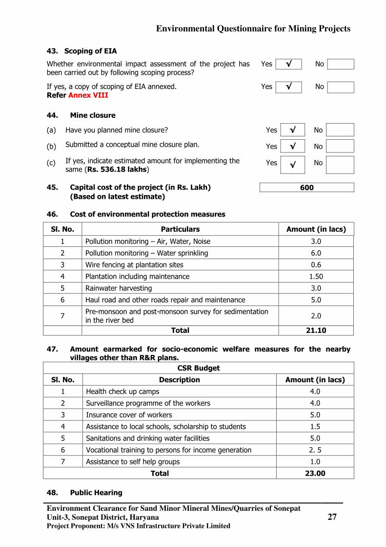
43. Scoping of EIA
Whether environmental impact assessment of the project has been carried out by following scoping process?
Yes √ No
If yes, a copy of scoping of EIA annexed. Refer Annex VIII
Yes √ No
44. Mine closure
(a) Have you planned mine closure? Yes √ No
(b) Submitted a conceptual mine closure plan. Yes √ No
(c) If yes, indicate estimated amount for implementing the same (Rs. 536.18 lakhs)
Yes √ No
45. Capital cost of the project (in Rs. Lakh) (Based on latest estimate) 46. Cost of environmental protection measures
Sl. No. Particulars Amount (in lacs)
1 Pollution monitoring – Air, Water, Noise 3.0
2 Pollution monitoring – Water sprinkling 6.0
3 Wire fencing at plantation sites 0.6
4 Plantation including maintenance 1.50
5 Rainwater harvesting 3.0
6 Haul road and other roads repair and maintenance 5.0
7 Pre-monsoon and post-monsoon survey for sedimentation in the river bed
2.0
Total 21.10 47. Amount earmarked for socio-economic welfare measures for the nearby
villages other than R&R plans.
CSR Budget
Sl. No. Description Amount (in lacs)
1 Health check up camps 4.0
2 Surveillance programme of the workers 4.0
3 Insurance cover of workers 5.0
4 Assistance to local schools, scholarship to students 1.5
5 Sanitations and drinking water facilities 5.0
6 Vocational training to persons for income generation 2. 5
7 Assistance to self help groups 1.0
Total 23.00 48. Public Hearing
600
Environmental Questionnaire for Mining Projects
Environment Clearance for Sand Minor Mineral Mines/Quarries of Sonepat
Unit-3, Sonepat District, Haryana Project Proponent: M/s VNS Infrastructure Private Limited
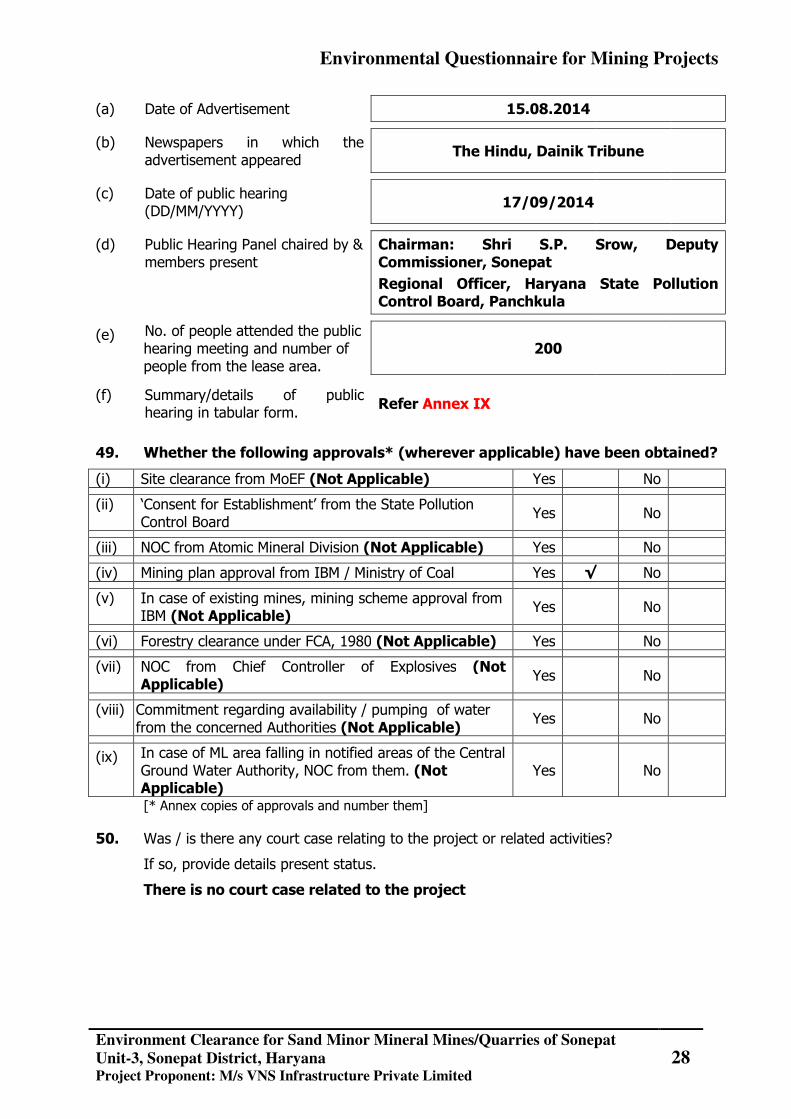
28
(a) Date of Advertisement 15.08.2014
(b) Newspapers in which the advertisement appeared
The Hindu, Dainik Tribune
(c) Date of public hearing (DD/MM/YYYY)
17/09/2014
(d) Public Hearing Panel chaired by & members present
Chairman: Shri S.P. Srow, Deputy Commissioner, Sonepat
Regional Officer, Haryana State Pollution Control Board, Panchkula
(e) No. of people attended the public hearing meeting and number of people from the lease area.
200
(f) Summary/details of public hearing in tabular form.
Refer Annex IX
49. Whether the following approvals* (wherever applicable) have been obtained?
(i) Site clearance from MoEF (Not Applicable) Yes No
(ii) ‘Consent for Establishment’ from the State Pollution Control Board
Yes No
(iii) NOC from Atomic Mineral Division (Not Applicable) Yes No
(iv) Mining plan approval from IBM / Ministry of Coal Yes √ No
(v) In case of existing mines, mining scheme approval from IBM (Not Applicable)
Yes No
(vi) Forestry clearance under FCA, 1980 (Not Applicable) Yes No
(vii) NOC from Chief Controller of Explosives (Not Applicable)
Yes No
(viii) Commitment regarding availability / pumping of water from the concerned Authorities (Not Applicable)
Yes No
(ix) In case of ML area falling in notified areas of the Central Ground Water Authority, NOC from them. (Not Applicable)
Yes No
[* Annex copies of approvals and number them]
50. Was / is there any court case relating to the project or related activities?
If so, provide details present status.
There is no court case related to the project
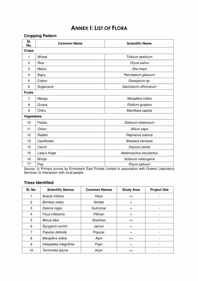
ANNEX I: LIST OF FLORA
Cropping Pattern
Sl. No.
Common Name Scientific Name
Crops
1 Wheat Triticum aestivum
2 Rice Oryza sativa
3 Maize Zea mays
4 Bajra Pennisetum glaucum
5 Cotton Gossypium sp.
6 Sugarcane Saccharum officinarum
Fruits
7 Mango Mangifera indica
8 Guava Psidium guajava
9 Chiku Manilkara zapota
Vegetables
10 Potato Solanum tuberosum
11 Onion Allium cepa
12 Radish Raphanus sativus
13 Cauliflower Brassica oleracea
14 Carrot Daucus carota
15 Lady’s finger Abelmoschus esculentus
16 Brinjal Solanum melongena
17 Pea Pisum sativum
Source: (i) Primary survey by Envirotech East Private Limited in association with Greenc Laboratory Services (ii) Interaction with local people
Trees Identified
Sl. No. Scientific Names Common Names Study Area Project Site
1 Acacia nilotica Kikar ++ -
2 Bombax ceiba Simble + -
3 Delonix regia Gulmohar + -
4 Ficus infectoria Pilkhan + -
5 Morus alba Shahtoot ++ -
6 Syzygium cumini Jamun + -
7 Populus deltoids Popular + -
8 Mangifera indica Aam ++ -
9 Holoptelea integrifolia Papri + -
10 Terminalia arjuna Arjun ++ -
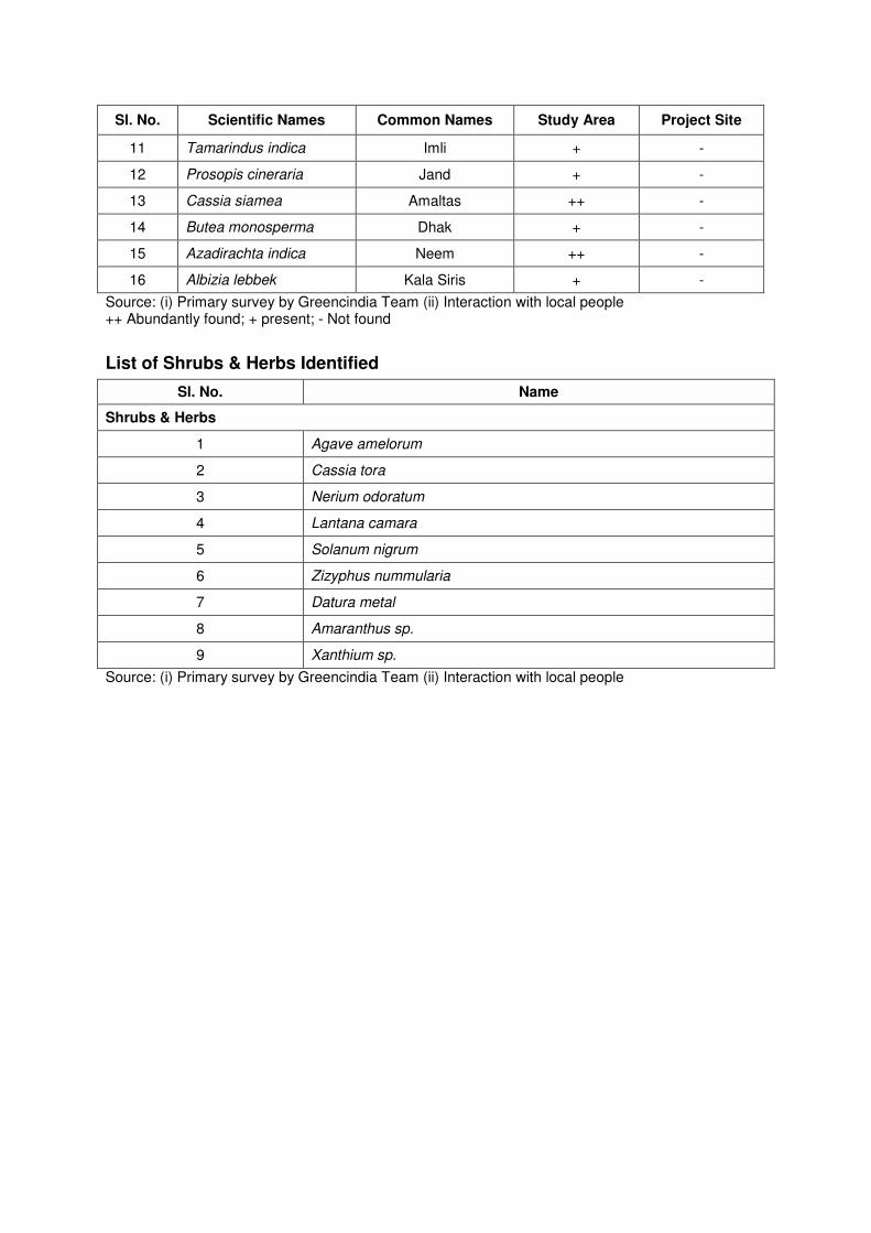
Sl. No. Scientific Names Common Names Study Area Project Site
11 Tamarindus indica Imli + -
12 Prosopis cineraria Jand + -
13 Cassia siamea Amaltas ++ -
14 Butea monosperma Dhak + -
15 Azadirachta indica Neem ++ -
16 Albizia lebbek Kala Siris + -
Source: (i) Primary survey by Greencindia Team (ii) Interaction with local people ++ Abundantly found; + present; - Not found
List of Shrubs & Herbs Identified
Sl. No. Name
Shrubs & Herbs
1 Agave amelorum
2 Cassia tora
3 Nerium odoratum
4 Lantana camara
5 Solanum nigrum
6 Zizyphus nummularia
7 Datura metal
8 Amaranthus sp.
9 Xanthium sp.
Source: (i) Primary survey by Greencindia Team (ii) Interaction with local people
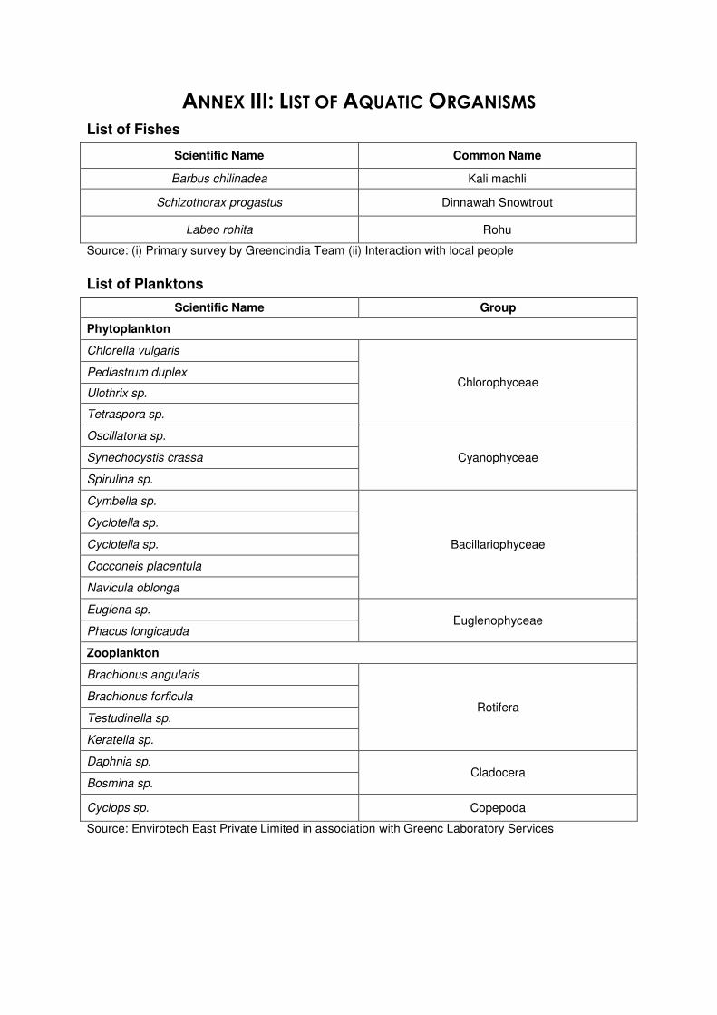
ANNEX III: LIST OF AQUATIC ORGANISMS
List of Fishes
Scientific Name Common Name
Barbus chilinadea Kali machli
Schizothorax progastus Dinnawah Snowtrout
Labeo rohita Rohu
Source: (i) Primary survey by Greencindia Team (ii) Interaction with local people
List of Planktons
Scientific Name Group
Phytoplankton
Chlorella vulgaris
Chlorophyceae Pediastrum duplex
Ulothrix sp.
Tetraspora sp.
Oscillatoria sp.
Cyanophyceae Synechocystis crassa
Spirulina sp.
Cymbella sp.
Bacillariophyceae
Cyclotella sp.
Cyclotella sp.
Cocconeis placentula
Navicula oblonga
Euglena sp. Euglenophyceae
Phacus longicauda
Zooplankton
Brachionus angularis
Rotifera Brachionus forficula
Testudinella sp.
Keratella sp.
Daphnia sp. Cladocera
Bosmina sp.
Cyclops sp. Copepoda
Source: Envirotech East Private Limited in association with Greenc Laboratory Services
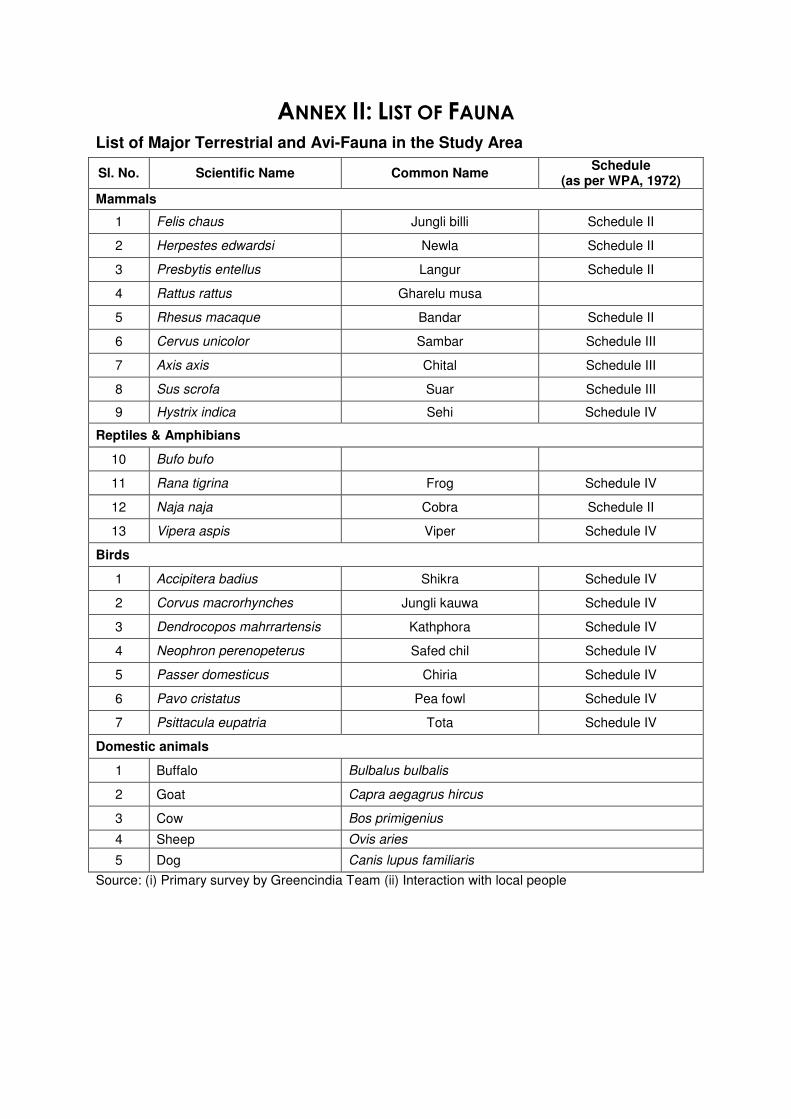
ANNEX II: LIST OF FAUNA
List of Major Terrestrial and Avi-Fauna in the Study Area
Sl. No. Scientific Name Common Name Schedule
(as per WPA, 1972)
Mammals
1 Felis chaus Jungli billi Schedule II
2 Herpestes edwardsi Newla Schedule II
3 Presbytis entellus Langur Schedule II
4 Rattus rattus Gharelu musa
5 Rhesus macaque Bandar Schedule II
6 Cervus unicolor Sambar Schedule III
7 Axis axis Chital Schedule III
8 Sus scrofa Suar Schedule III
9 Hystrix indica Sehi Schedule IV
Reptiles & Amphibians
10 Bufo bufo
11 Rana tigrina Frog Schedule IV
12 Naja naja Cobra Schedule II
13 Vipera aspis Viper Schedule IV
Birds
1 Accipitera badius Shikra Schedule IV
2 Corvus macrorhynches Jungli kauwa Schedule IV
3 Dendrocopos mahrrartensis Kathphora Schedule IV
4 Neophron perenopeterus Safed chil Schedule IV
5 Passer domesticus Chiria Schedule IV
6 Pavo cristatus Pea fowl Schedule IV
7 Psittacula eupatria Tota Schedule IV
Domestic animals
1 Buffalo Bulbalus bulbalis
2 Goat Capra aegagrus hircus
3 Cow Bos primigenius
4 Sheep Ovis aries
5 Dog Canis lupus familiaris
Source: (i) Primary survey by Greencindia Team (ii) Interaction with local people

© GREENCINDIA Consulting Private Limited, 2013
Key Map of Haryana
Scale: Not to ScaleSource:http://www.msmedikarnal.gov.in/images/map_haryana.gif
Project Site!P
!C
!C
!C
!C
!C
!C
!C
!C
!C
!C
!C
!C
!C
!C
!C!C
AAQ8AAQ7
AAQ6AAQ5
AAQ4
AAQ3
AAQ2
AAQ1Yamuna River
Yamuna River
Rai
Khekhra
Tatri
Mitli
Kundli
Baghpat
Besi
Bali
Kuldli
Jakhauli
Aterna
Kheora
Katha
Sotam Colony Narela
Rai
Sisana
Barauli
Sersa
Sector 9 Narela
Bakhtawarpur
Rasoi
Baghu
Sunera
Pali
Nibali
Dilpalpur
Sankaraudh
Ahera
Nangal Kalan
Seoli
Palla
Baoipur
Ferozpur Khadar
Tikri Khurd
Nurpur
Palra
Niwara
Janti Kalan Dahisha
Dayanand Bagh
Shafiabad
Khatta PahladpurPabla Begmawar
Manauli
Gauripur
Jateri
Mawi Kalan
Singhu
Katkar
Muqimpur
Nathupur
Pitampura
Badh Malak
Mamupur
GauripurMirakpur
Kundli
Tajpur Kalan
Pabsara
Singola
Ashwarpur Baghpat
Sector 10 Narela
Bandpur
Manu
Hamidpur
Naurozpur Gujal
Alipur
Dayanand Bagh
Firozpur Khadar
Ladhwari
Bazidpur Sabauli
Palri Khurd
Badh Khalsa
Faizpur Ninanah
Jhundpur
Akbarpur Majra
Taggipur
Noraspur
Bahalgarh
Sungarpur
Faizullahpur
Chauhalo
Lawan
Mohammad Shahpur
Khampur
Palri Kalan
Subhanpur
Basa Tikri
Pitampura
Mehrampur
Lawanspur
Nayagaon
Jhangola
Joshi Chauhan
Tanda Kalan
Khampur
Rathdhana
Lawanspur
Gauripur
Janti Khurd
Khurrampur
Joshi jat
Pyau Maniyari
Jagdishpur
Salabhatpur Kheri
Aurangabad
Triveni Colony
Surat Nagar
Basandhi
Harchandpur
Nangal kalan
Pothi Brahman
Saidpur Kalan
Kashmabad
Abdulpur
Jawahirpur Mawla
Tohki Jalal
Nagla Bahlolpur
Bankoli
Jahangirpur DundaheraNurpur Khalsa
Kishora
Kashmabad
Hasamabad
Toki Manauli
Manauli
Garhi Bakhtawarpur
Mamupur Narela Protected Forest
Niwar Reserve Forest
1 L Minor
Mitli
Distr
ibutor
y
Aheral Minor
NH-1
SH-57
SH-11
SH-14
77°20'0"E
77°20'0"E
77°18'0"E
77°18'0"E
77°16'0"E
77°16'0"E
77°14'0"E
77°14'0"E
77°12'0"E
77°12'0"E
77°10'0"E
77°10'0"E
77°8'0"E
77°8'0"E
77°6'0"E
77°6'0"E
77°4'0"E
77°4'0"E
29°2
'0"N
29°0
'0"N
29°0
'0"N
28°5
8'0"N
28°5
8'0"N
28°5
6'0"N
28°5
6'0"N
28°5
4'0"N
28°5
4'0"N
28°5
2'0"N
28°5
2'0"N
28°5
0'0"N
28°5
0'0"N
Legend!C Air Monitoring Location
State BoundaryMajor RoadRailway LineCanalMinor RoadProject SiteStudy AreaWater bodyForestBuilt-upSandy area
¯
±
Graphic Scale:
GREENCINDIA Consulting Private LimitedEnvironment Consultant:
1. Survey of India Toposheet No. 53 G/4, 53 G/8, 53 H/1, 53 H/52. Project Layout Plan, VNSIPL3. Data Provided by FAE (AP & AQ)
Drafted By: Approved By:
Mr. Ankur AgarwalMr. AP Singh &
Mr. Saurabh Garg
Checked By:
Mr. Rahul SinghDateRevision
15/07/201402
(An ISO:9001 QMS, ISO: 14001 EMS & OHSAS: 18001 H&S MS Certified by BSI)QCI-NABET Accrediate Environment Consultant Certificate No. NABET/EIA/1013/034
Path: D:\Projects\Mining Projects\Riverbed Mining\Haryana\Sonepat\Shp\4.13 Air.mxd
(Formerly known as GIS Enabled Environment & Neo-graphic Centre)
Software Used:1. ArcGIS 10.1, 2. AutoCAD 2012, 3. ER Mapper 7, 4. Erdas Imagine 10
Source:
0 1,900 3,800 5,700 7,600950 m
Project:
Project Proponent:M/s. VNS Infrastructure and Private Limited
Air Monitoring Location Map
Sand Miner Mineral Mines/ Queries of Sonepat Unit-3
Figure 4.13:
Village: Khurrampur, Baqipur, Pabsara & Manauli,Tehsil & District: Sonepat, Haryana
Uttar PradeshHaryana
Delhi
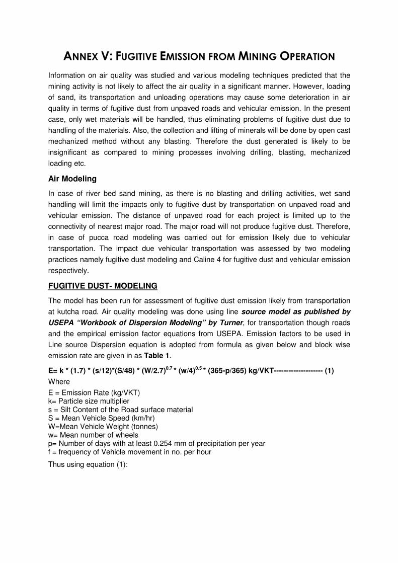
ANNEX V: FUGITIVE EMISSION FROM MINING OPERATION
Information on air quality was studied and various modeling techniques predicted that the
mining activity is not likely to affect the air quality in a significant manner. However, loading
of sand, its transportation and unloading operations may cause some deterioration in air
quality in terms of fugitive dust from unpaved roads and vehicular emission. In the present
case, only wet materials will be handled, thus eliminating problems of fugitive dust due to
handling of the materials. Also, the collection and lifting of minerals will be done by open cast
mechanized method without any blasting. Therefore the dust generated is likely to be
insignificant as compared to mining processes involving drilling, blasting, mechanized
loading etc.
Air Modeling
In case of river bed sand mining, as there is no blasting and drilling activities, wet sand
handling will limit the impacts only to fugitive dust by transportation on unpaved road and
vehicular emission. The distance of unpaved road for each project is limited up to the
connectivity of nearest major road. The major road will not produce fugitive dust. Therefore,
in case of pucca road modeling was carried out for emission likely due to vehicular
transportation. The impact due vehicular transportation was assessed by two modeling
practices namely fugitive dust modeling and Caline 4 for fugitive dust and vehicular emission
respectively.
FUGITIVE DUST- MODELING
The model has been run for assessment of fugitive dust emission likely from transportation
at kutcha road. Air quality modeling was done using line source model as published by
USEPA “Workbook of Dispersion Modeling” by Turner, for transportation though roads
and the empirical emission factor equations from USEPA. Emission factors to be used in
Line source Dispersion equation is adopted from formula as given below and block wise
emission rate are given in as Table 1.
E= k * (1.7) * (s/12)*(S/48) * (W/2.7)0.7 * (w/4)0.5 * (365-p/365) kg/VKT-------------------- (1)
Where
E = Emission Rate (kg/VKT) k= Particle size multiplier s = Silt Content of the Road surface material S = Mean Vehicle Speed (km/hr) W=Mean Vehicle Weight (tonnes) w= Mean number of wheels p= Number of days with at least 0.254 mm of precipitation per year f = frequency of Vehicle movement in no. per hour
Thus using equation (1):
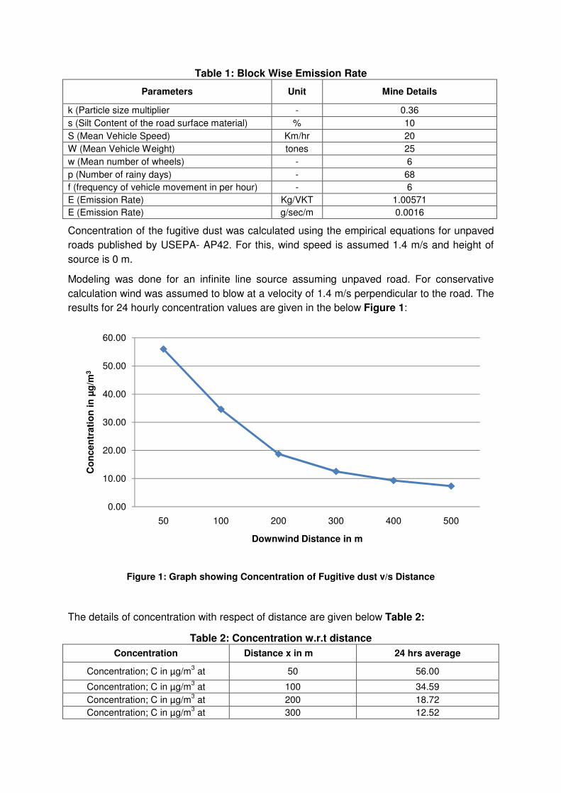
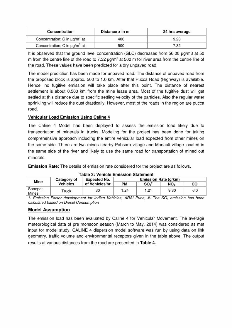
Table 1: Block Wise Emission Rate
Parameters Unit Mine Details
k (Particle size multiplier - 0.36
s (Silt Content of the road surface material) % 10
S (Mean Vehicle Speed) Km/hr 20
W (Mean Vehicle Weight) tones 25
w (Mean number of wheels) - 6
p (Number of rainy days) - 68
f (frequency of vehicle movement in per hour) - 6
E (Emission Rate) Kg/VKT 1.00571
E (Emission Rate) g/sec/m 0.0016
Concentration of the fugitive dust was calculated using the empirical equations for unpaved
roads published by USEPA- AP42. For this, wind speed is assumed 1.4 m/s and height of
source is 0 m.
Modeling was done for an infinite line source assuming unpaved road. For conservative
calculation wind was assumed to blow at a velocity of 1.4 m/s perpendicular to the road. The
results for 24 hourly concentration values are given in the below Figure 1:
Figure 1: Graph showing Concentration of Fugitive dust v/s Distance
The details of concentration with respect of distance are given below Table 2:
Table 2: Concentration w.r.t distance
Concentration Distance x in m 24 hrs average
Concentration; C in µg/m3 at 50 56.00
Concentration; C in µg/m3 at 100 34.59
Concentration; C in µg/m3 at 200 18.72
Concentration; C in µg/m3 at 300 12.52
0.00
10.00
20.00
30.00
40.00
50.00
60.00
50 100 200 300 400 500
Co
ncen
trati
on
in
µg
/m3
Downwind Distance in m
Concentration Distance x in m 24 hrs average
Concentration; C in µg/m3 at 400 9.28
Concentration; C in µg/m3 at 500 7.32
It is observed that the ground level concentration (GLC) decreases from 56.00 µg/m3 at 50
m from the centre line of the road to 7.32 µg/m3 at 500 m for river area from the centre line of
the road. These values have been predicted for a dry unpaved road.
The model prediction has been made for unpaved road. The distance of unpaved road from
the proposed block is approx. 500 to 1.0 km. After that Pucca Road (Highway) is available.
Hence, no fugitive emission will take place after this point. The distance of nearest
settlement is about 0.500 km from the mine lease area. Most of the fugitive dust will get
settled at this distance due to specific settling velocity of the particles. Also the regular water
sprinkling will reduce the dust drastically. However, most of the roads in the region are pucca
road.
Vehicular Load Emission Using Caline 4
The Caline 4 Model has been deployed to assess the emission load likely due to
transportation of minerals in trucks. Modeling for the project has been done for taking
comprehensive approach including the entire vehicular load expected from other mines on
the same side. There are two mines nearby Pabsara village and Manauli village located in
the same side of the river and likely to use the same road for transportation of mined out
minerals.
Emission Rate: The details of emission rate considered for the project are as follows.
Table 3: Vehicle Emission Statement
Mine Category of
Vehicles Expected No. of Vehicles/hr
Emission Rate (g/km) PM
* SO2
# NOX
* CO
*
Sonepat Mines
Truck 30 1.24 1.21 9.30 6.0
*- Emission Factor development for Indian Vehicles, ARAI Pune, #- The SO2 emission has been calculated based on Diesel Consumption
Model Assumption
The emission load has been evaluated by Caline 4 for Vehicular Movement. The average
meteorological data of pre monsoon season (March to May, 2014) was considered as met
input for model study. CALINE 4 dispersion model software was run by using data on link
geometry, traffic volume and environmental receptors given in the table above. The output
results at various distances from the road are presented in Table 4.
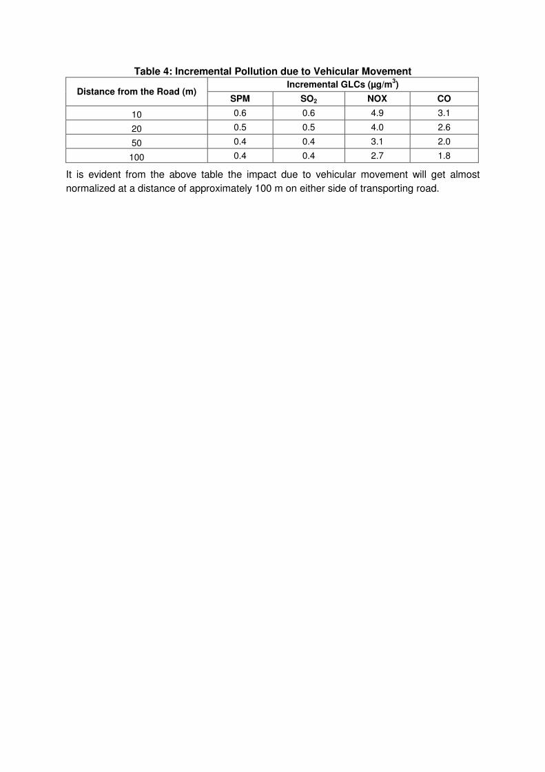
Table 4: Incremental Pollution due to Vehicular Movement
Distance from the Road (m) Incremental GLCs (µg/m
3)
SPM SO2 NOX CO
10 0.6 0.6 4.9 3.1
20 0.5 0.5 4.0 2.6
50 0.4 0.4 3.1 2.0
100 0.4 0.4 2.7 1.8
It is evident from the above table the impact due to vehicular movement will get almost
normalized at a distance of approximately 100 m on either side of transporting road.
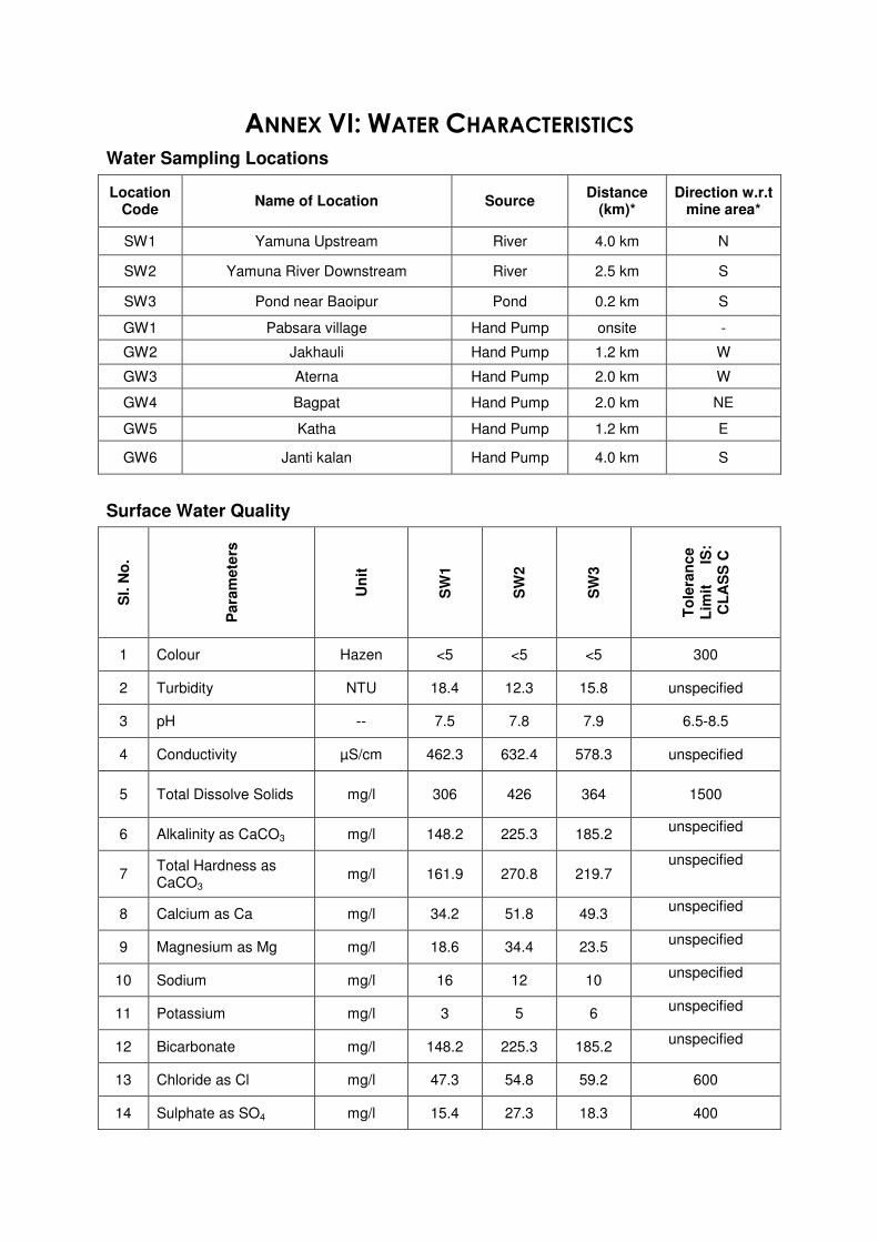
ANNEX VI: WATER CHARACTERISTICS
Water Sampling Locations
Location Code
Name of Location Source Distance
(km)* Direction w.r.t
mine area*
SW1 Yamuna Upstream River 4.0 km N
SW2 Yamuna River Downstream River 2.5 km S
SW3 Pond near Baoipur Pond 0.2 km S
GW1 Pabsara village Hand Pump onsite -
GW2 Jakhauli Hand Pump 1.2 km W
GW3 Aterna Hand Pump 2.0 km W
GW4 Bagpat Hand Pump 2.0 km NE
GW5 Katha Hand Pump 1.2 km E
GW6 Janti kalan Hand Pump 4.0 km S
Surface Water Quality
Sl. N
o.
Para
mete
rs
Un
it
SW
1
SW
2
SW
3
To
lera
nc
e
Lim
it I
S:
CL
AS
S C
1 Colour Hazen <5 <5 <5 300
2 Turbidity NTU 18.4 12.3 15.8 unspecified
3 pH -- 7.5 7.8 7.9 6.5-8.5
4 Conductivity µS/cm 462.3 632.4 578.3 unspecified
5 Total Dissolve Solids mg/l 306 426 364 1500
6 Alkalinity as CaCO3 mg/l 148.2 225.3 185.2 unspecified
7 Total Hardness as CaCO3
mg/l 161.9 270.8 219.7 unspecified
8 Calcium as Ca mg/l 34.2 51.8 49.3 unspecified
9 Magnesium as Mg mg/l 18.6 34.4 23.5 unspecified
10 Sodium mg/l 16 12 10 unspecified
11 Potassium mg/l 3 5 6 unspecified
12 Bicarbonate mg/l 148.2 225.3 185.2 unspecified
13 Chloride as Cl mg/l 47.3 54.8 59.2 600
14 Sulphate as SO4 mg/l 15.4 27.3 18.3 400
Sl. N
o.
Para
mete
rs
Un
it
SW
1
SW
2
SW
3
To
lera
nc
e
Lim
it I
S:
CL
AS
S C
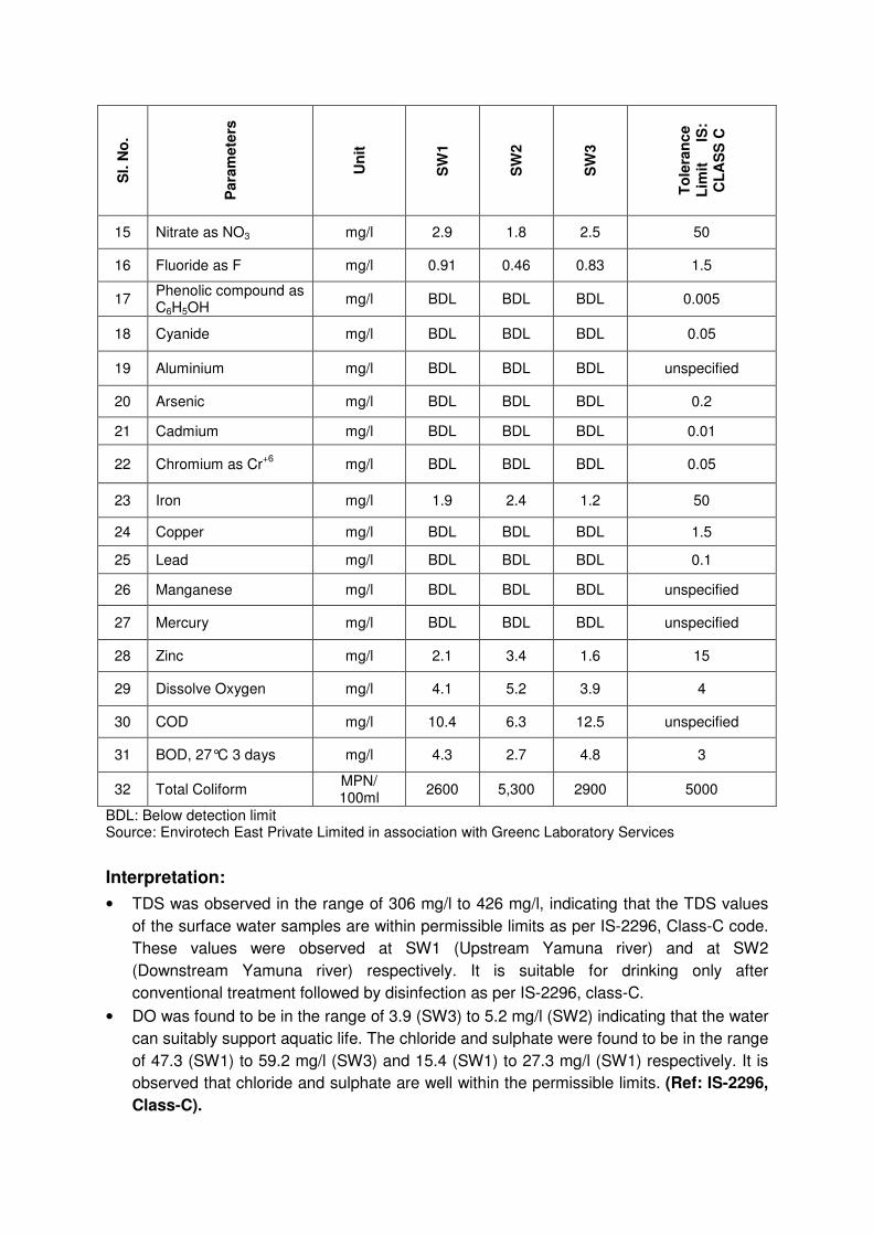
15 Nitrate as NO3 mg/l 2.9 1.8 2.5 50
16 Fluoride as F mg/l 0.91 0.46 0.83 1.5
17 Phenolic compound as C6H5OH
mg/l BDL BDL BDL 0.005
18 Cyanide mg/l BDL BDL BDL 0.05
19 Aluminium mg/l BDL BDL BDL unspecified
20 Arsenic mg/l BDL BDL BDL 0.2
21 Cadmium mg/l BDL BDL BDL 0.01
22 Chromium as Cr+6
mg/l BDL BDL BDL 0.05
23 Iron mg/l 1.9 2.4 1.2 50
24 Copper mg/l BDL BDL BDL 1.5
25 Lead mg/l BDL BDL BDL 0.1
26 Manganese mg/l BDL BDL BDL unspecified
27 Mercury mg/l BDL BDL BDL unspecified
28 Zinc mg/l 2.1 3.4 1.6 15
29 Dissolve Oxygen mg/l 4.1 5.2 3.9 4
30 COD mg/l 10.4 6.3 12.5 unspecified
31 BOD, 27°C 3 days mg/l 4.3 2.7 4.8 3
32 Total Coliform MPN/ 100ml
2600 5,300 2900 5000
BDL: Below detection limit Source: Envirotech East Private Limited in association with Greenc Laboratory Services
Interpretation:
• TDS was observed in the range of 306 mg/l to 426 mg/l, indicating that the TDS values
of the surface water samples are within permissible limits as per IS-2296, Class-C code.
These values were observed at SW1 (Upstream Yamuna river) and at SW2
(Downstream Yamuna river) respectively. It is suitable for drinking only after
conventional treatment followed by disinfection as per IS-2296, class-C.
• DO was found to be in the range of 3.9 (SW3) to 5.2 mg/l (SW2) indicating that the water
can suitably support aquatic life. The chloride and sulphate were found to be in the range
of 47.3 (SW1) to 59.2 mg/l (SW3) and 15.4 (SW1) to 27.3 mg/l (SW1) respectively. It is
observed that chloride and sulphate are well within the permissible limits. (Ref: IS-2296,
Class-C).

• The BOD levels in the water samples procured from SW1 and SW3 are little higher
compared to the specified standard with 4.8 mg/l observed at SW3 (Pond near Baqipur)
and 4.3 mg/l observed at SW1 (Yamuna river upstream). This is mainly due to discharge
of sewerage, bathing of human and cattle in these water bodies. As per IS:2296, the
surface water quality meets the criteria for Class C and Class-E (for DO & BOD)
therefore can be used for irrigation purpose.
Ground Water Quality
Sl. N
o.
Para
mete
rs
Un
it
GW
1
GW
2
GW
3
GW
4
GW
5
GW
6
Accep
tab
le
lim
its a
s p
er
IS 1
050
0
:2012
Perm
issib
le
lim
its a
s p
er
IS 1
050
0
:2012
1 Color Hazen <5 <5 <5 <5 <5 <5 5 15
2 Turbidity NTU <1 <1 <1 <1 <1 <1 1 5
3 pH -- 7.2 7.5 7.9 7.8 7.9 7.4 6.5-8.5 No
Relaxation
4 Conductivity µS/cm 690.4 875.4 643.8 632.3 727.9 683.4 $ $
5 Total Dissolve Solids
mg/l 410 532 446 395 428 410 500 2000
6 Alkalinity as CaCO3
mg/l 142.8 239.4 227.3 174.8 194.5 183.4 200 600
7 Total Hardness as CaCO3
mg/l 225.5 281.3 266.2 238.8 213.5 236.0 300 600
8 Calcium as Ca
mg/l 73.4 84.2 69.4 72.3 65.3 67.2 75 200
9 Magnesium as Mg
mg/l 10.3 17.3 22.6 14.2 12.3 16.6 30 100
10 Sodium mg/l 13 23 10 14 21 18 $ $
11 Potassium mg/l 8 10 6 4 5 3 $ $
12 Bicarbonate mg/l 142.8 239.4 227.3 174.8 194.5 183.4 $ $
13 Chloride as Cl
mg/l 68.3 85.3 59.2 64.8 53.3 68.6 250 1000
14 Sulphate as SO4
mg/l 38.2 35.4 31.5 37.4 29.6 35.7 200 400
15 Nitrate as NO3
mg/l 5.1 4.9 4.2 2.7 4.6 3.3 45 No
Relaxation
16 Fluoride as F mg/l 1.1 0.95 0.89 0.78 0.65 0.73 1.00 1.5
17 Phenolic compound as C6H5OH
mg/l BDL BDL BDL BDL BDL BDL 0.001 0.002
18 Cyanide mg/l BDL BDL BDL BDL BDL BDL 0.05 No
Relaxation
19 Aluminum mg/l BDL BDL BDL BDL BDL BDL 0.03 0.2
20 Arsenic mg/l BDL BDL BDL BDL BDL BDL 0.01 0.05
Sl. N
o.
Para
mete
rs
Un
it
GW
1
GW
2
GW
3
GW
4
GW
5
GW
6
Accep
tab
le
lim
its a
s p
er
IS 1
050
0
:2012
Perm
issib
le
lim
its a
s p
er
IS 1
050
0
:2012
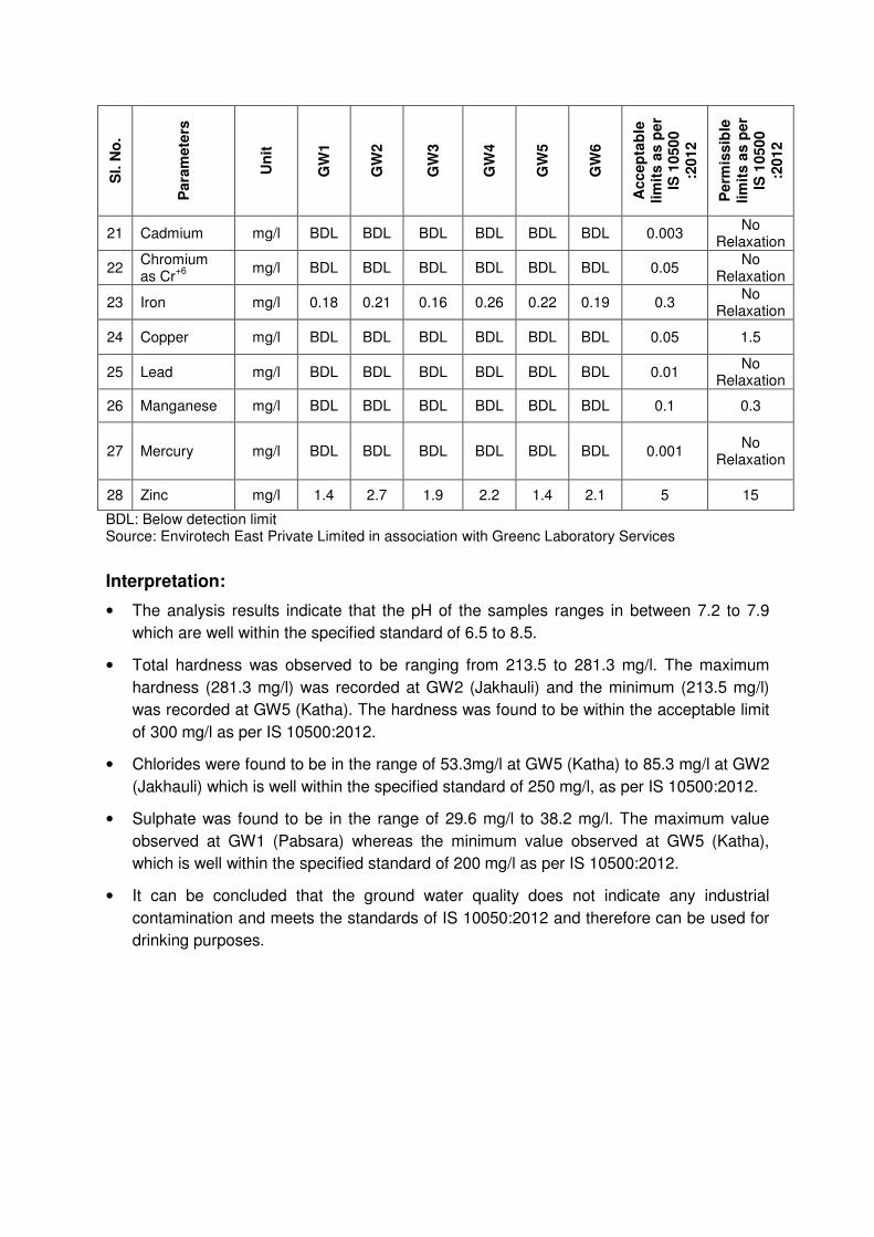
21 Cadmium mg/l BDL BDL BDL BDL BDL BDL 0.003 No
Relaxation
22 Chromium as Cr
+6
mg/l BDL BDL BDL BDL BDL BDL 0.05 No
Relaxation
23 Iron mg/l 0.18 0.21 0.16 0.26 0.22 0.19 0.3 No
Relaxation
24 Copper mg/l BDL BDL BDL BDL BDL BDL 0.05 1.5
25 Lead mg/l BDL BDL BDL BDL BDL BDL 0.01 No
Relaxation
26 Manganese mg/l BDL BDL BDL BDL BDL BDL 0.1 0.3
27 Mercury mg/l BDL BDL BDL BDL BDL BDL 0.001 No
Relaxation
28 Zinc mg/l 1.4 2.7 1.9 2.2 1.4 2.1 5 15
BDL: Below detection limit Source: Envirotech East Private Limited in association with Greenc Laboratory Services
Interpretation:
• The analysis results indicate that the pH of the samples ranges in between 7.2 to 7.9
which are well within the specified standard of 6.5 to 8.5.
• Total hardness was observed to be ranging from 213.5 to 281.3 mg/l. The maximum
hardness (281.3 mg/l) was recorded at GW2 (Jakhauli) and the minimum (213.5 mg/l)
was recorded at GW5 (Katha). The hardness was found to be within the acceptable limit
of 300 mg/l as per IS 10500:2012.
• Chlorides were found to be in the range of 53.3mg/l at GW5 (Katha) to 85.3 mg/l at GW2
(Jakhauli) which is well within the specified standard of 250 mg/l, as per IS 10500:2012.
• Sulphate was found to be in the range of 29.6 mg/l to 38.2 mg/l. The maximum value
observed at GW1 (Pabsara) whereas the minimum value observed at GW5 (Katha),
which is well within the specified standard of 200 mg/l as per IS 10500:2012.
• It can be concluded that the ground water quality does not indicate any industrial
contamination and meets the standards of IS 10050:2012 and therefore can be used for
drinking purposes.

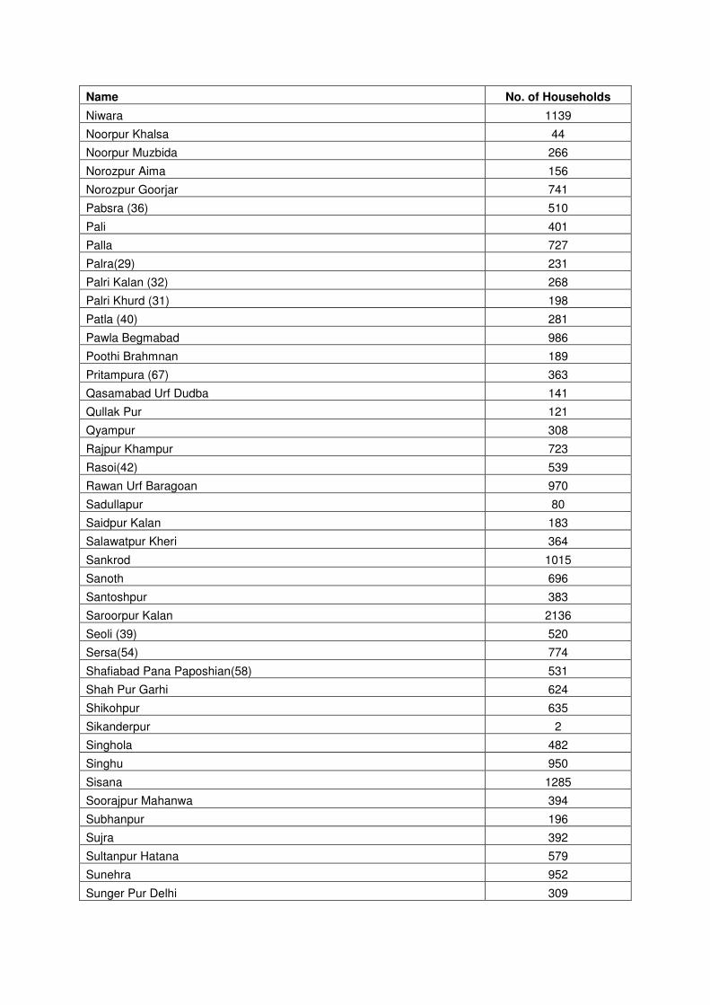
ANNEX VII: VILLAGE-WISE HOUSEHOLDS
List of Villages and respective Number of Households
Name No. of Households
Abdullapur 56
Ahamadpur Gathina 241
Ahamadshahpur Padra 308
Ahera 651
Akbar Pur Majra 565
Akbarpur Barota (62) 1092
Anandpur Urf Bandpur 315
Asawarpur (71) 543
Aterna (44) 887
Aurangabad (38) 286
Badh Khalsa (41) 529
Baghpat (Rural) Hamedabad Mill 603
Baghu 346
Bahalgarh(73) 953
Bali 734
Baqipur(47) 609
Basaud 1114
Basetikri 253
Basi 1146
Bazidpur Saboli(57) 734
Bichpari 239
Biharipur 319
Chopra Maheshpur 249
Choulhada 327
Dahesra(51) 453
Daula 2047
Faizpur Ninana 890
Faizullapur 210
Fakharpur Mohammad Shahpur 863
Fateh Pur Jat 33
Ferozepur Khadar (70) 18
Firozpur 354
Gauripur 218
Goripur Jawahar Nagar 778
Gyasri Urf Gadhi 658
Habibpur Majra 7
Hamid Pur 644
Harchandpur 365
Hasamabad(85) 106
Hasanpur Masoori 338

Name No. of Households
Hazipur Viran 139
Jafarabad Nangla 195
Jahangirpur Urf Dunda Hera 126
Jajjal (33) 431
Jakhauli (37) 1460
Janti Kalan(52) 875
Janti Khurd(53) 125
Jatheri (66) 741
Jawaharpur Mewla 93
Jhangola 557
Jhundpur (34) 1225
Joshi Chohan (86) 511
Joshi Jat(75) 190
Karam Alipur 190
Katha 1400
Khaila 286
Kham Pur 358
Khandwari 308
Khatkar(46) 350
Khatta Prahladpur 1422
Khekhra Rural 16
Kherae Islampur 607
Kheriki 473
Khewara (72) 1667
Khurrampur(48) 260
Kureni 498
Ladhwari 587
Lawanspur(74) 866
Levan(65) 270
Maharampur 149
Mamoor Pur 3808
Manoli (35) 569
Mavikala 958
Meetli 1384
Mirakpur(30) 289
Mohd. Pur Ramzan Pur 312
Mubarikpur 488
Munirpur (59) 56
Nagla Bahlolpur 166
Nangal Kalan (43) 1183
Nathupur(56) 577
Nethla 887
Niwali 388
Name No. of Households
Niwara 1139
Noorpur Khalsa 44
Noorpur Muzbida 266
Norozpur Aima 156
Norozpur Goorjar 741
Pabsra (36) 510
Pali 401
Palla 727
Palra(29) 231
Palri Kalan (32) 268
Palri Khurd (31) 198
Patla (40) 281
Pawla Begmabad 986
Poothi Brahmnan 189
Pritampura (67) 363
Qasamabad Urf Dudba 141
Qullak Pur 121
Qyampur 308
Rajpur Khampur 723
Rasoi(42) 539
Rawan Urf Baragoan 970
Sadullapur 80
Saidpur Kalan 183
Salawatpur Kheri 364
Sankrod 1015
Sanoth 696
Santoshpur 383
Saroorpur Kalan 2136
Seoli (39) 520
Sersa(54) 774
Shafiabad Pana Paposhian(58) 531
Shah Pur Garhi 624
Shikohpur 635
Sikanderpur 2
Singhola 482
Singhu 950
Sisana 1285
Soorajpur Mahanwa 394
Subhanpur 196
Sujra 392
Sultanpur Hatana 579
Sunehra 952
Sunger Pur Delhi 309

Name No. of Households
Taj Pur Kalan 604
Tatiri (Rural) 25
Tigi Pur 365
Tyodhi 749
Total 73048


Public Hearing held on 17-09-2014 of Mining of minerals (Sand) from Mines/Quarries
of Sonepat Unit-3, Villages Khurampur, Pabsara & Manauli,Tehsil Rai, and Distt.
Sonepat, of M/s VNS Infrastructures Private Limited.
Area 993.10 hect. Proposed Production 12.35MTPA
Reply in respect of verbal, written suggestions, comments and objections raised by villagers
during public hearing
Sl. No.
Applicant Name / Designation and
address
Important points of the applications
received/questions raised by the villagers during
public hearing
Reply by Mines Proponents/Concern
Persons and Suggestions
1 Shri Multan Singh, Vill. Manauli
Due to mining of Minerals land of village will go into River Yamuna & our crops will get damaged. Our land has gone to UP side due to change in course of river.
Proponent Reply:- Scientific Mining will be carried out adhering to the Haryana Mining Rules 2012. a. No mining will be carried
out in an area up to a width of 500 meters from the active edges of the embankments.
b. Mining activities will be carried out only in the central 3/4th portion of the river and will be restricted to 3m depth only with proper bench formation.
Reply by:- Sh. S.P. Srow, IAS, Deputy Commissioner, Sonepat told that a case regarding this matter is already in process and the court has decided that a team of officers of Revenue Department of both the States will measure the lands & hand it over to their actual owners after marking/ judgement. District Revenue Officer Sh. Dalip Singh replied that meetings are already underway with UP officials and border land disputes will be resolved soon.
2 Shri Sanjay Kumar, Vill. Manauli
Brackets (Thokar) from the Irrigation Department are
Sh. SP Srow, IAS, DC, Sonepat Reply:-
Sl. No.
Applicant Name / Designation and
address
Important points of the applications
received/questions raised by the villagers during
public hearing
Reply by Mines Proponents/Concern
Persons and Suggestions
small due to which water comes into fields & damage the crops in rainy season.
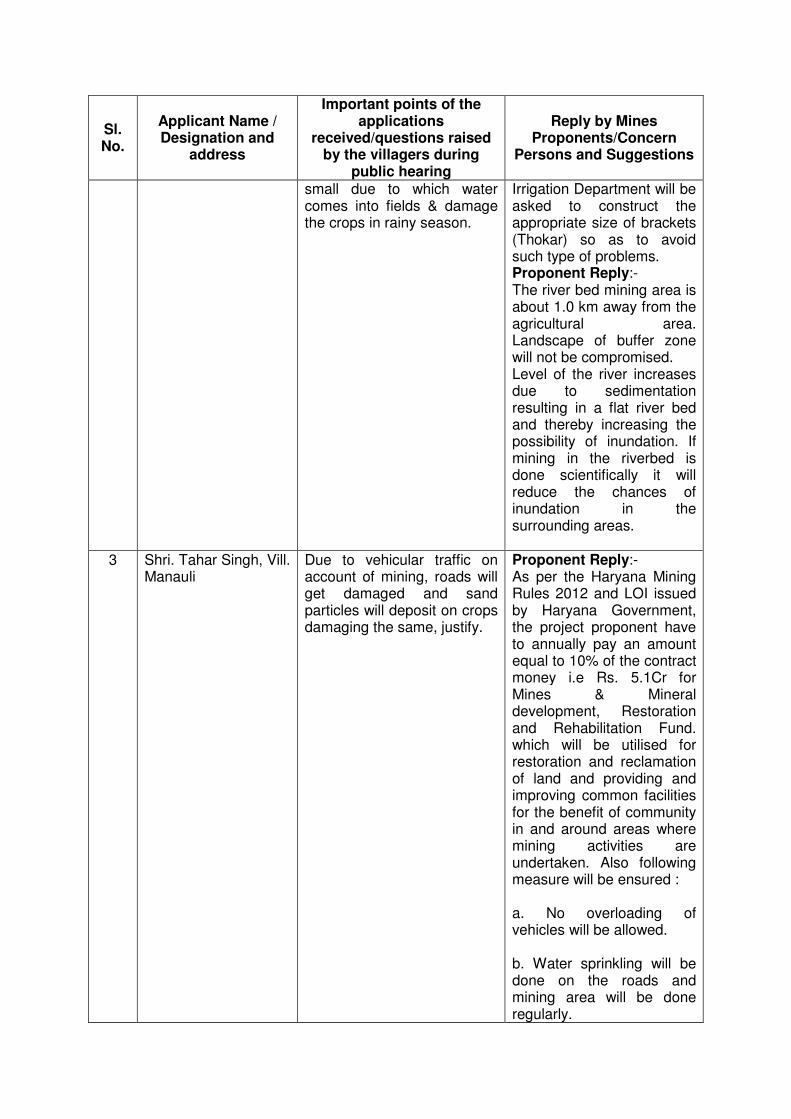
Irrigation Department will be asked to construct the appropriate size of brackets (Thokar) so as to avoid such type of problems. Proponent Reply:- The river bed mining area is about 1.0 km away from the agricultural area. Landscape of buffer zone will not be compromised. Level of the river increases due to sedimentation resulting in a flat river bed and thereby increasing the possibility of inundation. If mining in the riverbed is done scientifically it will reduce the chances of inundation in the surrounding areas.
3 Shri. Tahar Singh, Vill. Manauli
Due to vehicular traffic on account of mining, roads will get damaged and sand particles will deposit on crops damaging the same, justify.
Proponent Reply:- As per the Haryana Mining Rules 2012 and LOI issued by Haryana Government, the project proponent have to annually pay an amount equal to 10% of the contract money i.e Rs. 5.1Cr for Mines & Mineral development, Restoration and Rehabilitation Fund. which will be utilised for restoration and reclamation of land and providing and improving common facilities for the benefit of community in and around areas where mining activities are undertaken. Also following measure will be ensured : a. No overloading of vehicles will be allowed. b. Water sprinkling will be done on the roads and mining area will be done regularly.
Sl. No.
Applicant Name / Designation and
address
Important points of the applications
received/questions raised by the villagers during
public hearing
Reply by Mines Proponents/Concern
Persons and Suggestions
c. Care will be taken to prevent spillage by covering the carrying vehicles with tarpaulin and sprinkling of water, if dry. d. Plantation of trees along road sides as part of social forestry to help reduce the impact of dust in the nearby villages. e. Fortnightly scraping of road in order to keep the roads almost levelled. This will ensure smooth flow of vehicles and also prevent spillage. f. Specific routes will be identified to spread out the traffic with ingress and egress routes. g. Speed breakers will be made at critical points to govern speed. h. Only PUC certified vehicles shall be deployed for the project.
4 Sh. Surender, Vill. Khewra
Suggested that due to mining, we will get employment and there is shortage of sand and our pending construction work of houses can be completed and Government will also get revenue. Hence, mining should be permitted.
5 Shri Arun Kumar, Vill. Manauli
There was no proper information regarding this public hearing to them. Further, 70% of our area is in Yamuna river bed & due to mining, it will be damaged.
Reply by HSPCB:- Thirty days notice period in local and national newpaper was given. Information about the Public Hearing was disseminated to the Panchayats of project area through the office of District Development and Panchayat Officer, Sonepat. In addition, a special drive through the villages of project area was undertaken to widely
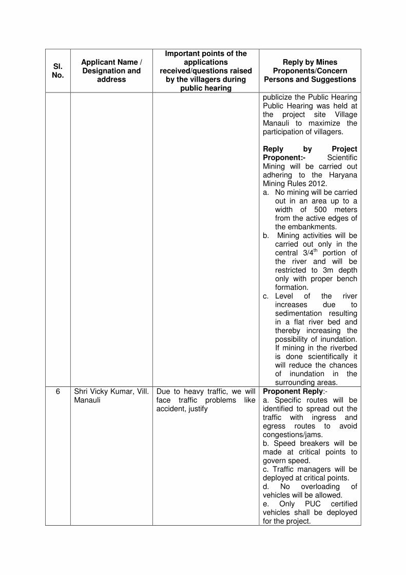
Sl. No.
Applicant Name / Designation and
address
Important points of the applications
received/questions raised by the villagers during
public hearing
Reply by Mines Proponents/Concern
Persons and Suggestions
publicize the Public Hearing Public Hearing was held at the project site Village Manauli to maximize the participation of villagers. Reply by Project Proponent:- Scientific Mining will be carried out adhering to the Haryana Mining Rules 2012. a. No mining will be carried
out in an area up to a width of 500 meters from the active edges of the embankments.
b. Mining activities will be carried out only in the central 3/4th portion of the river and will be restricted to 3m depth only with proper bench formation.
c. Level of the river increases due to sedimentation resulting in a flat river bed and thereby increasing the possibility of inundation. If mining in the riverbed is done scientifically it will reduce the chances of inundation in the surrounding areas.
6 Shri Vicky Kumar, Vill. Manauli
Due to heavy traffic, we will face traffic problems like accident, justify
Proponent Reply:- a. Specific routes will be identified to spread out the traffic with ingress and egress routes to avoid congestions/jams. b. Speed breakers will be made at critical points to govern speed. c. Traffic managers will be deployed at critical points. d. No overloading of vehicles will be allowed. e. Only PUC certified vehicles shall be deployed for the project.

Sl. No.
Applicant Name / Designation and
address
Important points of the applications
received/questions raised by the villagers during
public hearing
Reply by Mines Proponents/Concern
Persons and Suggestions
f. Care will be taken to prevent spillage by covering the carrying vehicles with tarpaulin and sprinkling of water, if dry. g. Fortnightly scraping of road in order to keep the roads almost levelled. This will ensure smooth flow of vehicles and also prevent spillage. h. Development of infrastructure facilities for orderly growth of the mining operations and allied activities will be proposed to Government under the Mines & Mineral Development, Restoration and Rehabilitation Fund.
7 Shri Sunil, Vill. Khewra
We require minor sand to build our houses so mining should be done to meet our requirements.
8 Shri Yogender, Vill. Khewra
Some people are indulging in illegal mining in the area and people have to pay very high prices for minor sand due to its shortage, so mining should be carried out so that we can meet our requirements at reasonable cost.
9 Shri Ramesh, Vill. Deepalpur
Manauli and nearby villagers are indulging in illegal sand mining and sell it to us at higher prices
10 Shri Pawan Kumar, Vill. Manauli
Our village practices protected agriculture in the area. If the mining work is carried out then pollution will increase and fertility of the agricultural land will be affected. He also asked to provide the record of the persons who have been found involved in the illegal
Sh. SP Srow, IAS, DC, Sonepat Reply:- Assistant Mining Engineer Sonepat, Sh. R.S Thakran informed every one that appropriate measures are being undertaken to check illegal mining and that in the preceding night a JCB and a truck indulging in illegal
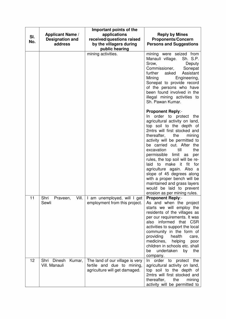
Sl. No.
Applicant Name / Designation and
address
Important points of the applications
received/questions raised by the villagers during
public hearing
Reply by Mines Proponents/Concern
Persons and Suggestions
mining activities. mining were seized from Manauli village. Sh. S.P. Srow, Deputy Commissioner, Sonepat further asked Assistant Mining Engineering, Sonepat to provide record of the persons who have been found involved in the illegal mining activities to Sh. Pawan Kumar. Proponent Reply:- In order to protect the agricultural activity on land, top soil to the depth of 2mtrs will first stocked and thereafter, the mining activity will be permitted to be carried out. After the excavation till the permissible limit as per rules, the top soil will be re-laid to make it fit for agriculture again. Also a slope of 45 degrees along with a proper bench will be maintained and grass layers would be laid to prevent erosion as per mining rules.
11 Shri Praveen, Vill. Sewli
I am unemployed, will I get employment from this project.
Proponent Reply:- As and when the project starts we will employ the residents of the villages as per our requirements. It was also informed that CSR activities to support the local community in the form of providing health care, medicines, helping poor children in schools etc. shall be undertaken by the company.
12 Shri Dinesh Kumar, Vill. Manauli
The land of our village is very fertile and due to mining, agriculture will get damaged.
In order to protect the agricultural activity on land, top soil to the depth of 2mtrs will first stocked and thereafter, the mining activity will be permitted to
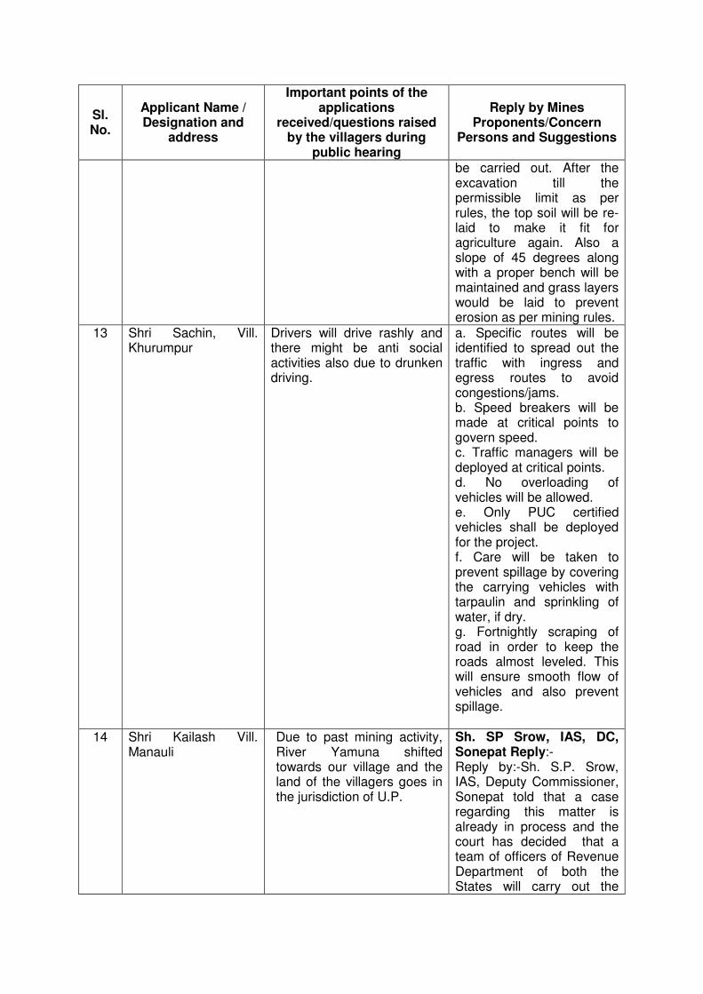
Sl. No.
Applicant Name / Designation and
address
Important points of the applications
received/questions raised by the villagers during
public hearing
Reply by Mines Proponents/Concern
Persons and Suggestions
be carried out. After the excavation till the permissible limit as per rules, the top soil will be re-laid to make it fit for agriculture again. Also a slope of 45 degrees along with a proper bench will be maintained and grass layers would be laid to prevent erosion as per mining rules.
13 Shri Sachin, Vill. Khurumpur
Drivers will drive rashly and there might be anti social activities also due to drunken driving.
a. Specific routes will be identified to spread out the traffic with ingress and egress routes to avoid congestions/jams. b. Speed breakers will be made at critical points to govern speed. c. Traffic managers will be deployed at critical points. d. No overloading of vehicles will be allowed. e. Only PUC certified vehicles shall be deployed for the project. f. Care will be taken to prevent spillage by covering the carrying vehicles with tarpaulin and sprinkling of water, if dry. g. Fortnightly scraping of road in order to keep the roads almost leveled. This will ensure smooth flow of vehicles and also prevent spillage.
14 Shri Kailash Vill. Manauli
Due to past mining activity, River Yamuna shifted towards our village and the land of the villagers goes in the jurisdiction of U.P.
Sh. SP Srow, IAS, DC, Sonepat Reply:- Reply by:-Sh. S.P. Srow, IAS, Deputy Commissioner, Sonepat told that a case regarding this matter is already in process and the court has decided that a team of officers of Revenue Department of both the States will carry out the
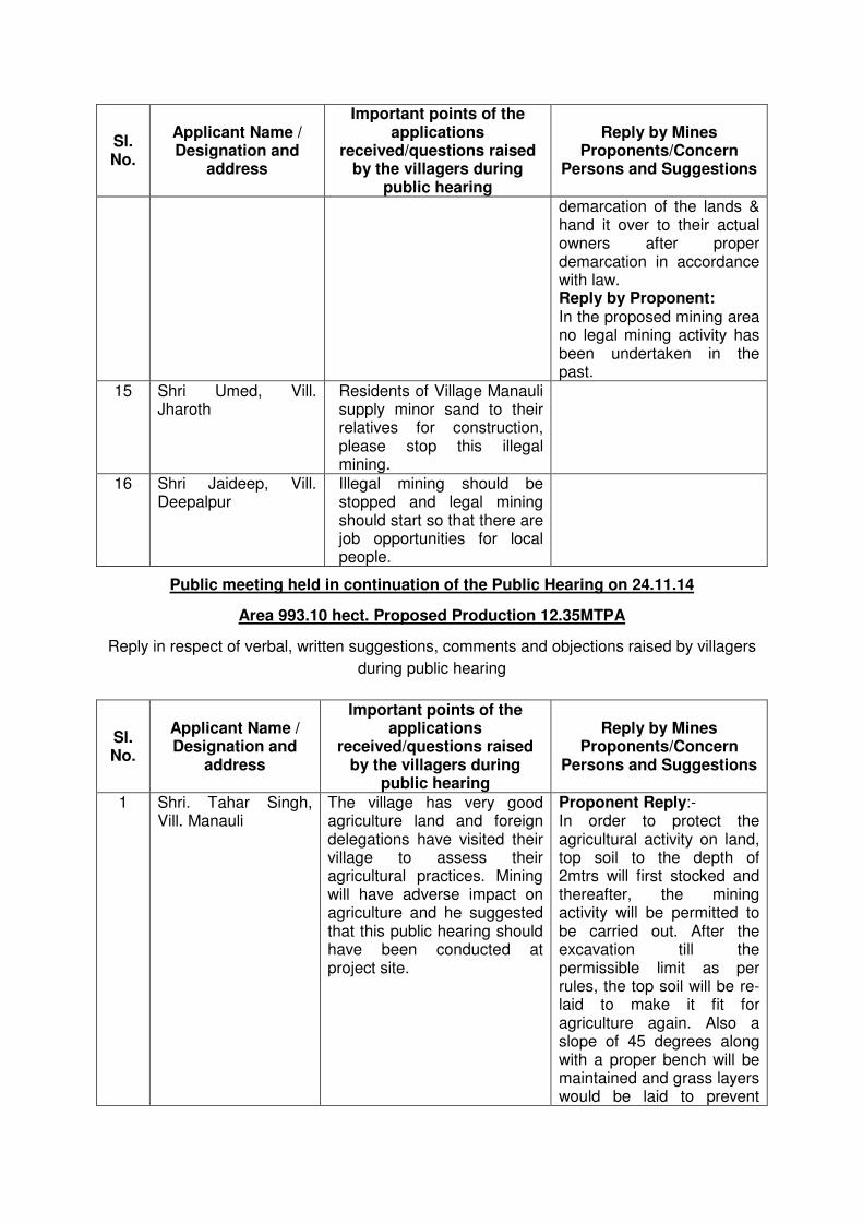
Sl. No.
Applicant Name / Designation and
address
Important points of the applications
received/questions raised by the villagers during
public hearing
Reply by Mines Proponents/Concern
Persons and Suggestions
demarcation of the lands & hand it over to their actual owners after proper demarcation in accordance with law. Reply by Proponent: In the proposed mining area no legal mining activity has been undertaken in the past.
15 Shri Umed, Vill. Jharoth
Residents of Village Manauli supply minor sand to their relatives for construction, please stop this illegal mining.
16 Shri Jaideep, Vill. Deepalpur
Illegal mining should be stopped and legal mining should start so that there are job opportunities for local people.
Public meeting held in continuation of the Public Hearing on 24.11.14
Area 993.10 hect. Proposed Production 12.35MTPA
Reply in respect of verbal, written suggestions, comments and objections raised by villagers
during public hearing
Sl. No.
Applicant Name / Designation and
address
Important points of the applications
received/questions raised by the villagers during
public hearing
Reply by Mines Proponents/Concern
Persons and Suggestions
1 Shri. Tahar Singh, Vill. Manauli
The village has very good agriculture land and foreign delegations have visited their village to assess their agricultural practices. Mining will have adverse impact on agriculture and he suggested that this public hearing should have been conducted at project site.
Proponent Reply:- In order to protect the agricultural activity on land, top soil to the depth of 2mtrs will first stocked and thereafter, the mining activity will be permitted to be carried out. After the excavation till the permissible limit as per rules, the top soil will be re-laid to make it fit for agriculture again. Also a slope of 45 degrees along with a proper bench will be maintained and grass layers would be laid to prevent
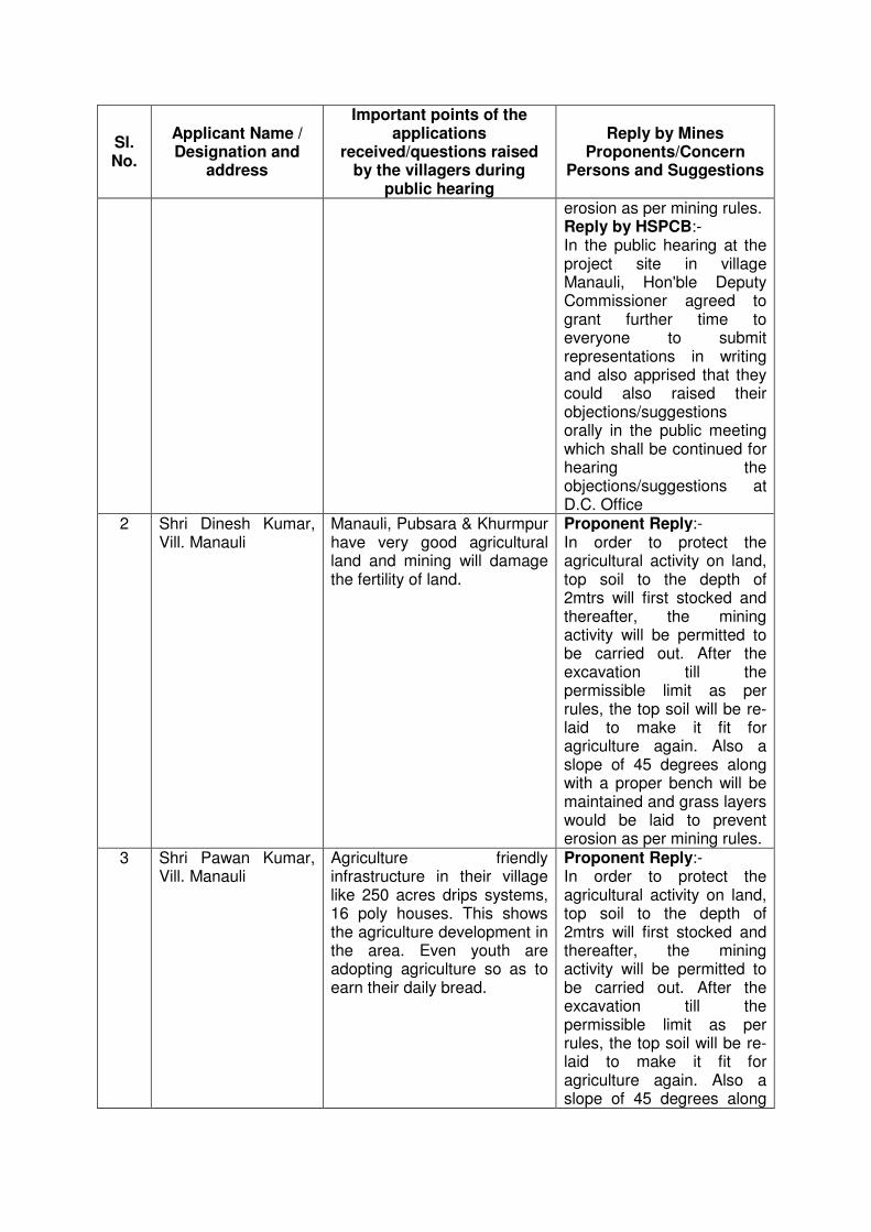
Sl. No.
Applicant Name / Designation and
address
Important points of the applications
received/questions raised by the villagers during
public hearing
Reply by Mines Proponents/Concern
Persons and Suggestions
erosion as per mining rules. Reply by HSPCB:- In the public hearing at the project site in village Manauli, Hon'ble Deputy Commissioner agreed to grant further time to everyone to submit representations in writing and also apprised that they could also raised their objections/suggestions orally in the public meeting which shall be continued for hearing the objections/suggestions at D.C. Office
2 Shri Dinesh Kumar, Vill. Manauli
Manauli, Pubsara & Khurmpur have very good agricultural land and mining will damage the fertility of land.
Proponent Reply:- In order to protect the agricultural activity on land, top soil to the depth of 2mtrs will first stocked and thereafter, the mining activity will be permitted to be carried out. After the excavation till the permissible limit as per rules, the top soil will be re-laid to make it fit for agriculture again. Also a slope of 45 degrees along with a proper bench will be maintained and grass layers would be laid to prevent erosion as per mining rules.
3 Shri Pawan Kumar, Vill. Manauli
Agriculture friendly infrastructure in their village like 250 acres drips systems, 16 poly houses. This shows the agriculture development in the area. Even youth are adopting agriculture so as to earn their daily bread.
Proponent Reply:- In order to protect the agricultural activity on land, top soil to the depth of 2mtrs will first stocked and thereafter, the mining activity will be permitted to be carried out. After the excavation till the permissible limit as per rules, the top soil will be re-laid to make it fit for agriculture again. Also a slope of 45 degrees along
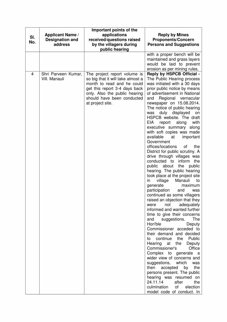
Sl. No.
Applicant Name / Designation and
address
Important points of the applications
received/questions raised by the villagers during
public hearing
Reply by Mines Proponents/Concern
Persons and Suggestions
with a proper bench will be maintained and grass layers would be laid to prevent erosion as per mining rules.
4 Shri Parveen Kumar, Vill. Manauli
The project report volume is so big that it will take almost a month to read and he could get this report 3-4 days back only. Also the public hearing should have been conducted at project site.
Reply by HSPCB Official - The Public Hearing process was initiated with a 30 days prior public notice by means of advertisement in National and Regional vernacular newspaper on 15.08.2014. The notice of public hearing was duly displayed on HSPCB website. The draft EIA report along with executive summary along with soft copies was made available at important Government offices/locations of the District for public scrutiny. A drive through villages was conducted to inform the public about the public hearing. The public hearing took place at the project site in village Manauli to generate maximum participation and was continued as some villagers raised an objection that they were not adequately informed and wanted further time to give their concerns and suggestions. The Hon'ble Deputy Commissioner acceded to their demand and decided to continue the Public Hearing at the Deputy Commissioner's Office Complex to generate a wider view of concerns and suggestions, which was then accepted by the persons present. The public hearing was resumed on 24.11.14 after the culmination of election model code of conduct. In
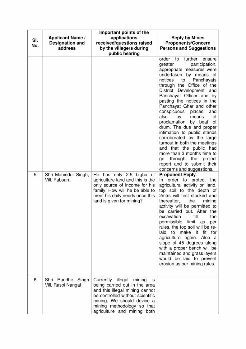
Sl. No.
Applicant Name / Designation and
address
Important points of the applications
received/questions raised by the villagers during
public hearing
Reply by Mines Proponents/Concern
Persons and Suggestions
order to further ensure greater participation, appropriate measures were undertaken by means of notices to Panchayats through the Office of the District Development and Panchayat Officer and by pasting the notices in the Panchayat Ghar and other conspicuous places and also by means of proclamation by beat of drum. The due and proper intimation to public stands corroborated by the large turnout in both the meetings and that the public had more than 3 months time to go through the project report and to submit their concerns and suggestions.
5 Shri Mahinder Singh, Vill. Pabsara
He has only 2.5 bigha of agriculture land and this is the only source of income for his family. How will he be able to meet his daily needs once this land is given for mining?
Proponent Reply:- In order to protect the agricultural activity on land, top soil to the depth of 2mtrs will first stocked and thereafter, the mining activity will be permitted to be carried out. After the excavation till the permissible limit as per rules, the top soil will be re-laid to make it fit for agriculture again. Also a slope of 45 degrees along with a proper bench will be maintained and grass layers would be laid to prevent erosion as per mining rules.
6 Shri Randhir Singh Vill. Rasoi Nangal
Currently illegal mining is being carried out in the area and this illegal mining cannot be controlled without scientific mining. We should device a mining methodology so that agriculture and mining both
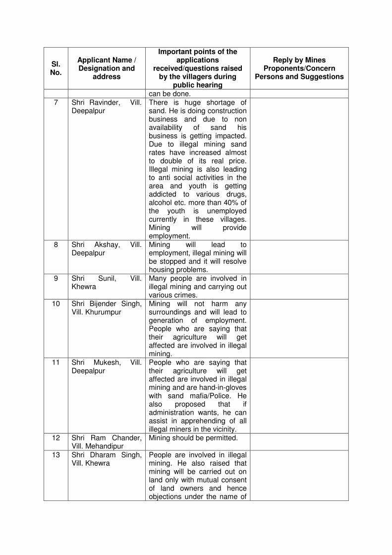
Sl. No.
Applicant Name / Designation and
address
Important points of the applications
received/questions raised by the villagers during
public hearing
Reply by Mines Proponents/Concern
Persons and Suggestions
can be done. 7 Shri Ravinder, Vill.
Deepalpur There is huge shortage of sand. He is doing construction business and due to non availability of sand his business is getting impacted. Due to illegal mining sand rates have increased almost to double of its real price. Illegal mining is also leading to anti social activities in the area and youth is getting addicted to various drugs, alcohol etc. more than 40% of the youth is unemployed currently in these villages. Mining will provide employment.
8 Shri Akshay, Vill. Deepalpur
Mining will lead to employment, illegal mining will be stopped and it will resolve housing problems.
9 Shri Sunil, Vill. Khewra
Many people are involved in illegal mining and carrying out various crimes.
10 Shri Bijender Singh, Vill. Khurumpur
Mining will not harm any surroundings and will lead to generation of employment. People who are saying that their agriculture will get affected are involved in illegal mining.
11 Shri Mukesh, Vill. Deepalpur
People who are saying that their agriculture will get affected are involved in illegal mining and are hand-in-gloves with sand mafia/Police. He also proposed that if administration wants, he can assist in apprehending of all illegal miners in the vicinity.
12 Shri Ram Chander, Vill. Mehandipur
Mining should be permitted.
13 Shri Dharam Singh, Vill. Khewra
People are involved in illegal mining. He also raised that mining will be carried out on land only with mutual consent of land owners and hence objections under the name of
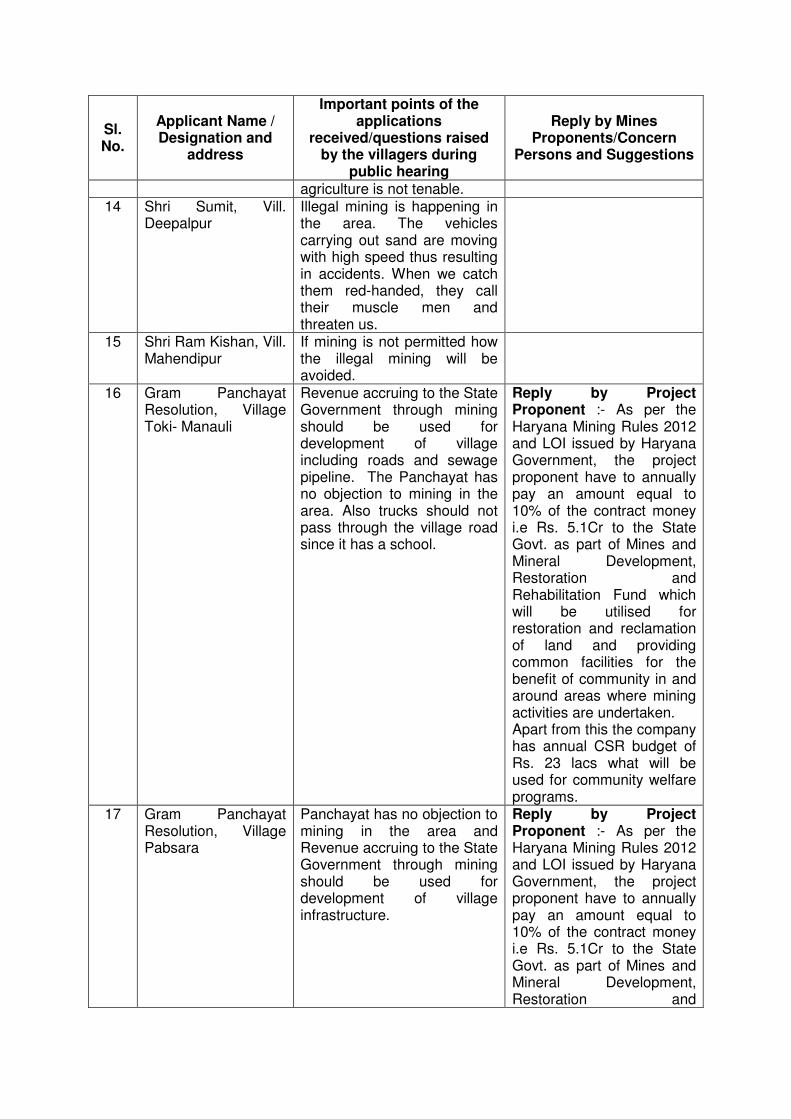
Sl. No.
Applicant Name / Designation and
address
Important points of the applications
received/questions raised by the villagers during
public hearing
Reply by Mines Proponents/Concern
Persons and Suggestions
agriculture is not tenable. 14 Shri Sumit, Vill.
Deepalpur Illegal mining is happening in the area. The vehicles carrying out sand are moving with high speed thus resulting in accidents. When we catch them red-handed, they call their muscle men and threaten us.
15 Shri Ram Kishan, Vill. Mahendipur
If mining is not permitted how the illegal mining will be avoided.
16 Gram Panchayat Resolution, Village Toki- Manauli
Revenue accruing to the State Government through mining should be used for development of village including roads and sewage pipeline. The Panchayat has no objection to mining in the area. Also trucks should not pass through the village road since it has a school.
Reply by Project Proponent :- As per the Haryana Mining Rules 2012 and LOI issued by Haryana Government, the project proponent have to annually pay an amount equal to 10% of the contract money i.e Rs. 5.1Cr to the State Govt. as part of Mines and Mineral Development, Restoration and Rehabilitation Fund which will be utilised for restoration and reclamation of land and providing common facilities for the benefit of community in and around areas where mining activities are undertaken. Apart from this the company has annual CSR budget of Rs. 23 lacs what will be used for community welfare programs.
17 Gram Panchayat Resolution, Village Pabsara
Panchayat has no objection to mining in the area and Revenue accruing to the State Government through mining should be used for development of village infrastructure.
Reply by Project Proponent :- As per the Haryana Mining Rules 2012 and LOI issued by Haryana Government, the project proponent have to annually pay an amount equal to 10% of the contract money i.e Rs. 5.1Cr to the State Govt. as part of Mines and Mineral Development, Restoration and
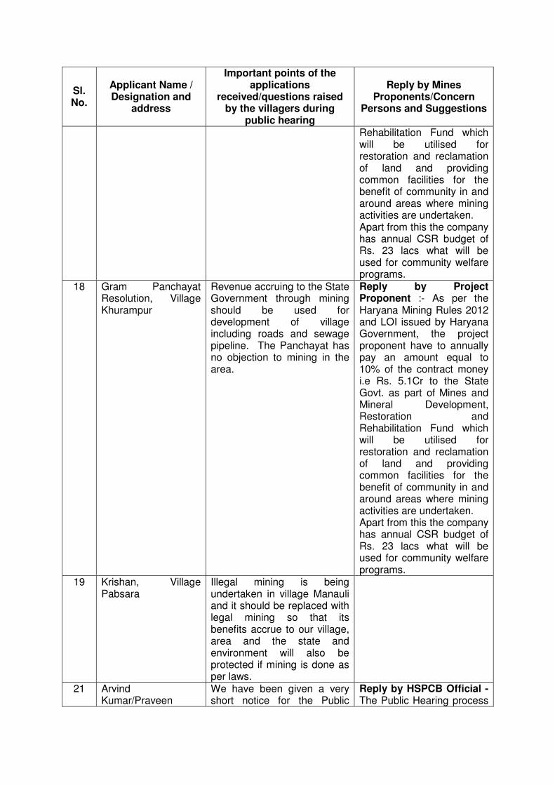
Sl. No.
Applicant Name / Designation and
address
Important points of the applications
received/questions raised by the villagers during
public hearing
Reply by Mines Proponents/Concern
Persons and Suggestions
Rehabilitation Fund which will be utilised for restoration and reclamation of land and providing common facilities for the benefit of community in and around areas where mining activities are undertaken. Apart from this the company has annual CSR budget of Rs. 23 lacs what will be used for community welfare programs.
18 Gram Panchayat Resolution, Village Khurampur
Revenue accruing to the State Government through mining should be used for development of village including roads and sewage pipeline. The Panchayat has no objection to mining in the area.
Reply by Project Proponent :- As per the Haryana Mining Rules 2012 and LOI issued by Haryana Government, the project proponent have to annually pay an amount equal to 10% of the contract money i.e Rs. 5.1Cr to the State Govt. as part of Mines and Mineral Development, Restoration and Rehabilitation Fund which will be utilised for restoration and reclamation of land and providing common facilities for the benefit of community in and around areas where mining activities are undertaken. Apart from this the company has annual CSR budget of Rs. 23 lacs what will be used for community welfare programs.
19 Krishan, Village Pabsara
Illegal mining is being undertaken in village Manauli and it should be replaced with legal mining so that its benefits accrue to our village, area and the state and environment will also be protected if mining is done as per laws.
21 Arvind Kumar/Praveen
We have been given a very short notice for the Public
Reply by HSPCB Official - The Public Hearing process
Sl. No.
Applicant Name / Designation and
address
Important points of the applications
received/questions raised by the villagers during
public hearing
Reply by Mines Proponents/Concern
Persons and Suggestions
Hearing. was initiated with a 30 days prior public notice by means of advertisement in National and Regional vernacular newspaper on 15.08.2014. The notice of public hearing was duly displayed on HSPCB website. The draft EIA report along with executive summary along with soft copies was made available at important Government offices/locations of the District for public scrutiny. A drive through villages was conducted to inform the public about the public hearing. The public hearing took place at the project site in village Manauli to generate maximum participation and was continued as some villagers raised an objection that they were not adequately informed and wanted further time to give their concerns and suggestions. The Hon'ble Deputy Commissioner acceded to their demand and decided to continue the Public Hearing at the Deputy Commissioner's Office Complex to generate a wider view of concerns and suggestions, which was then accepted by the persons present. The public hearing was resumed on 24.11.14 after the culmination of election model code of conduct. In order to further ensure greater participation, appropriate measures were undertaken by means of notices to Panchayats through the Office of the
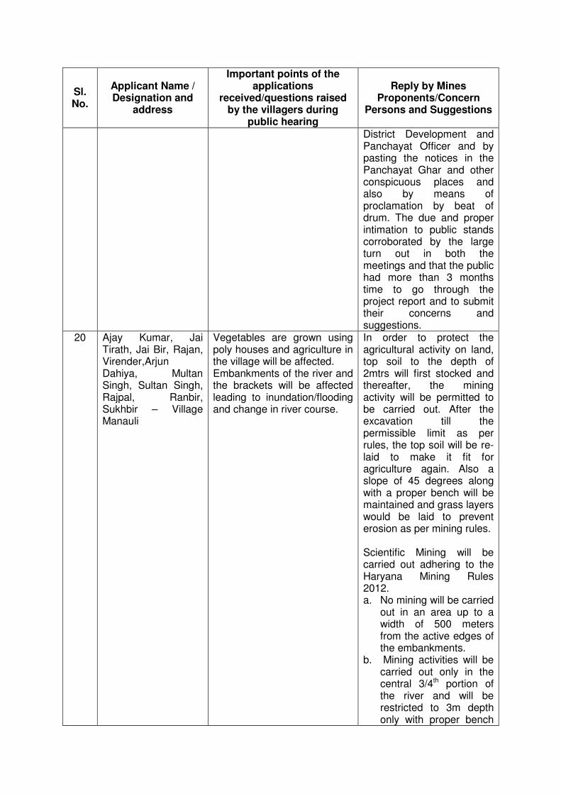
Sl. No.
Applicant Name / Designation and
address
Important points of the applications
received/questions raised by the villagers during
public hearing
Reply by Mines Proponents/Concern
Persons and Suggestions
District Development and Panchayat Officer and by pasting the notices in the Panchayat Ghar and other conspicuous places and also by means of proclamation by beat of drum. The due and proper intimation to public stands corroborated by the large turn out in both the meetings and that the public had more than 3 months time to go through the project report and to submit their concerns and suggestions.
20 Ajay Kumar, Jai Tirath, Jai Bir, Rajan, Virender,Arjun Dahiya, Multan Singh, Sultan Singh, Rajpal, Ranbir, Sukhbir – Village Manauli
Vegetables are grown using poly houses and agriculture in the village will be affected. Embankments of the river and the brackets will be affected leading to inundation/flooding and change in river course.
In order to protect the agricultural activity on land, top soil to the depth of 2mtrs will first stocked and thereafter, the mining activity will be permitted to be carried out. After the excavation till the permissible limit as per rules, the top soil will be re-laid to make it fit for agriculture again. Also a slope of 45 degrees along with a proper bench will be maintained and grass layers would be laid to prevent erosion as per mining rules. Scientific Mining will be carried out adhering to the Haryana Mining Rules 2012. a. No mining will be carried
out in an area up to a width of 500 meters from the active edges of the embankments.
b. Mining activities will be carried out only in the central 3/4th portion of the river and will be restricted to 3m depth only with proper bench
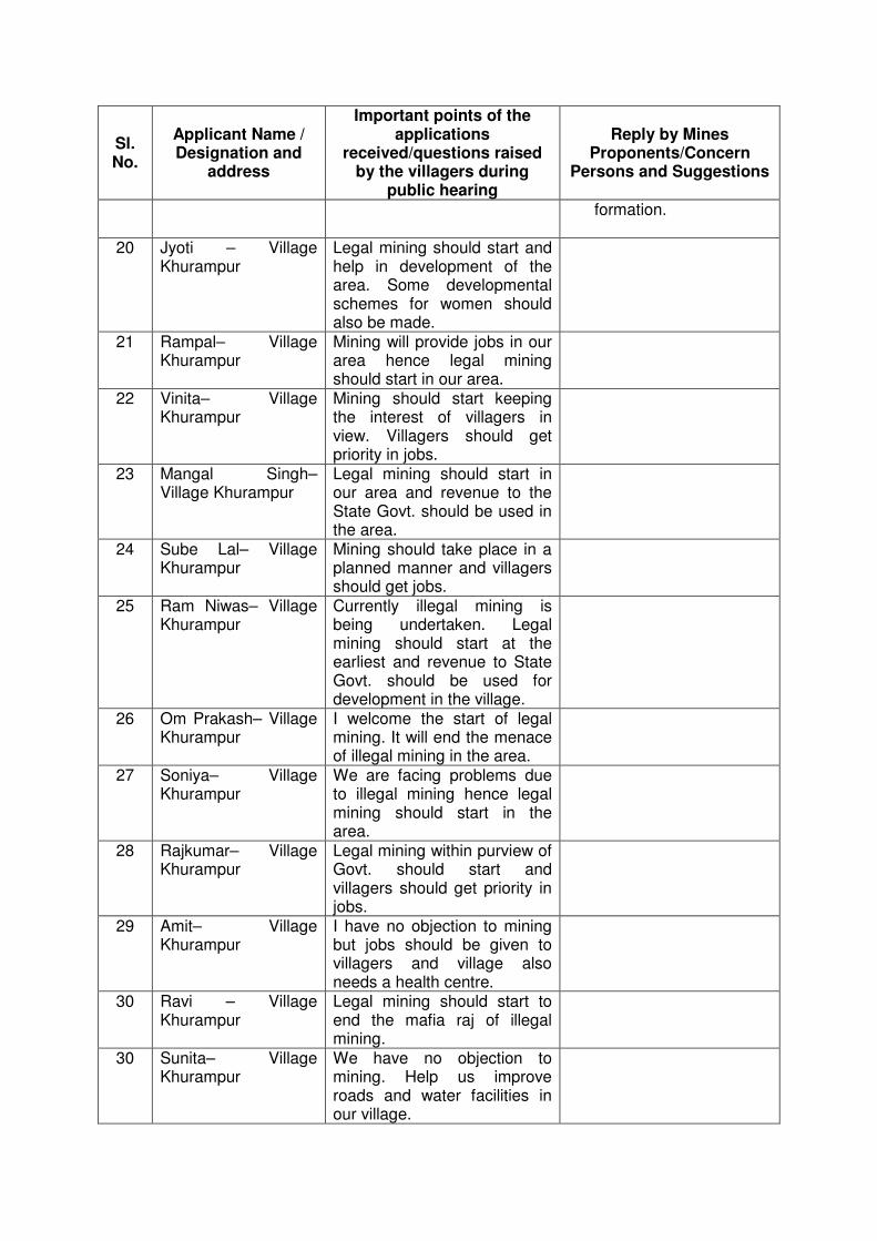
Sl. No.
Applicant Name / Designation and
address
Important points of the applications
received/questions raised by the villagers during
public hearing
Reply by Mines Proponents/Concern
Persons and Suggestions
formation.
20 Jyoti – Village Khurampur
Legal mining should start and help in development of the area. Some developmental schemes for women should also be made.
21 Rampal– Village Khurampur
Mining will provide jobs in our area hence legal mining should start in our area.
22 Vinita– Village Khurampur
Mining should start keeping the interest of villagers in view. Villagers should get priority in jobs.
23 Mangal Singh– Village Khurampur
Legal mining should start in our area and revenue to the State Govt. should be used in the area.
24 Sube Lal– Village Khurampur
Mining should take place in a planned manner and villagers should get jobs.
25 Ram Niwas– Village Khurampur
Currently illegal mining is being undertaken. Legal mining should start at the earliest and revenue to State Govt. should be used for development in the village.
26 Om Prakash– Village Khurampur
I welcome the start of legal mining. It will end the menace of illegal mining in the area.
27 Soniya– Village Khurampur
We are facing problems due to illegal mining hence legal mining should start in the area.
28 Rajkumar– Village Khurampur
Legal mining within purview of Govt. should start and villagers should get priority in jobs.
29 Amit– Village Khurampur
I have no objection to mining but jobs should be given to villagers and village also needs a health centre.
30 Ravi – Village Khurampur
Legal mining should start to end the mafia raj of illegal mining.
30 Sunita– Village Khurampur
We have no objection to mining. Help us improve roads and water facilities in our village.
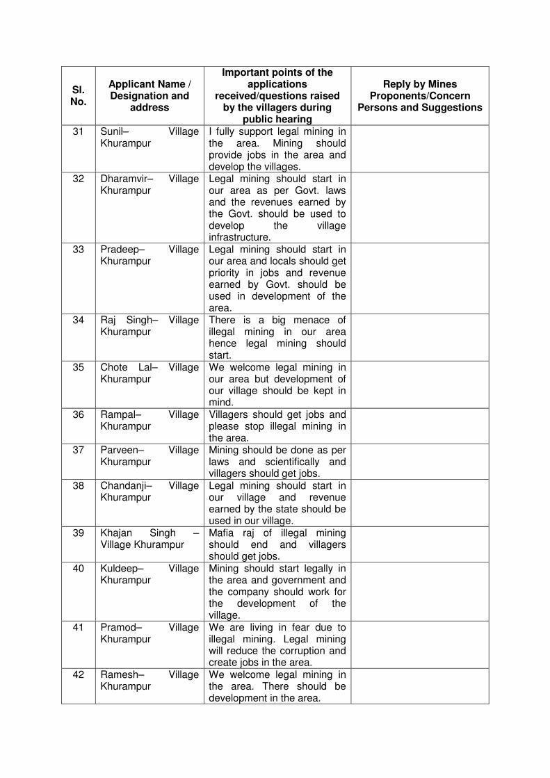
Sl. No.
Applicant Name / Designation and
address
Important points of the applications
received/questions raised by the villagers during
public hearing
Reply by Mines Proponents/Concern
Persons and Suggestions
31 Sunil– Village Khurampur
I fully support legal mining in the area. Mining should provide jobs in the area and develop the villages.
32 Dharamvir– Village Khurampur
Legal mining should start in our area as per Govt. laws and the revenues earned by the Govt. should be used to develop the village infrastructure.
33 Pradeep– Village Khurampur
Legal mining should start in our area and locals should get priority in jobs and revenue earned by Govt. should be used in development of the area.
34 Raj Singh– Village Khurampur
There is a big menace of illegal mining in our area hence legal mining should start.
35 Chote Lal– Village Khurampur
We welcome legal mining in our area but development of our village should be kept in mind.
36 Rampal– Village Khurampur
Villagers should get jobs and please stop illegal mining in the area.
37 Parveen– Village Khurampur
Mining should be done as per laws and scientifically and villagers should get jobs.
38 Chandanji– Village Khurampur
Legal mining should start in our village and revenue earned by the state should be used in our village.
39 Khajan Singh – Village Khurampur
Mafia raj of illegal mining should end and villagers should get jobs.
40 Kuldeep– Village Khurampur
Mining should start legally in the area and government and the company should work for the development of the village.
41 Pramod– Village Khurampur
We are living in fear due to illegal mining. Legal mining will reduce the corruption and create jobs in the area.
42 Ramesh– Village Khurampur
We welcome legal mining in the area. There should be development in the area.
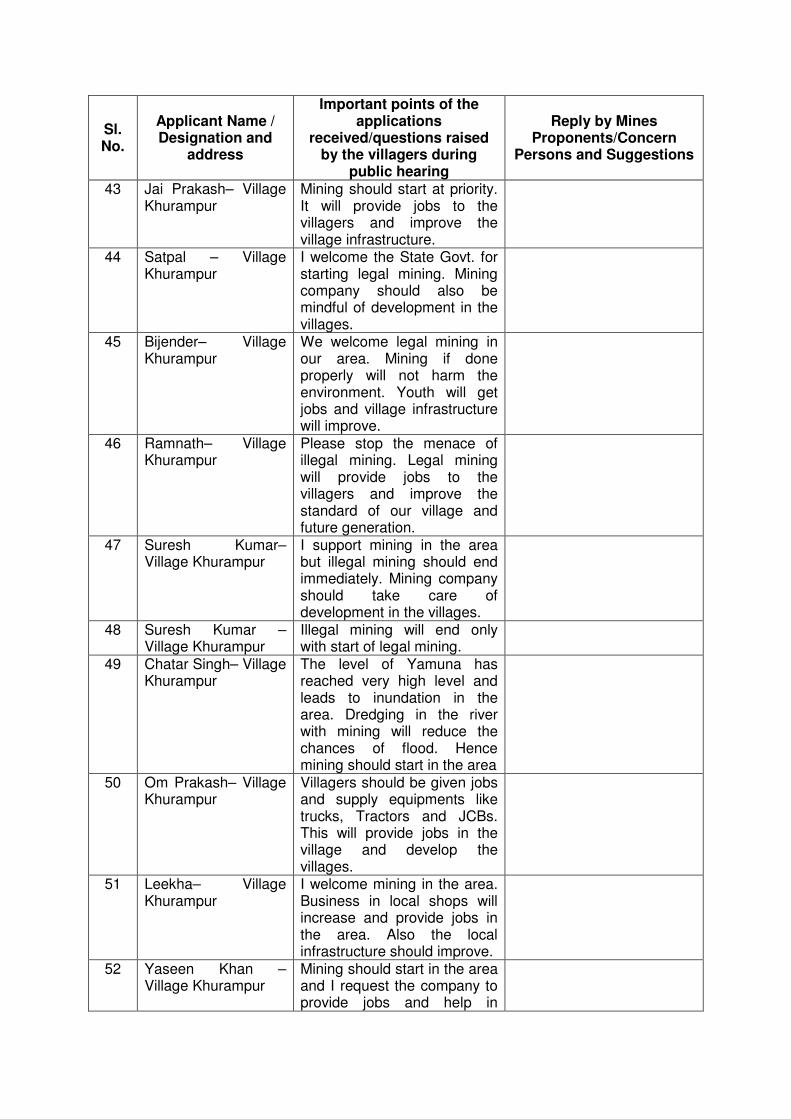
Sl. No.
Applicant Name / Designation and
address
Important points of the applications
received/questions raised by the villagers during
public hearing
Reply by Mines Proponents/Concern
Persons and Suggestions
43 Jai Prakash– Village Khurampur
Mining should start at priority. It will provide jobs to the villagers and improve the village infrastructure.
44 Satpal – Village Khurampur
I welcome the State Govt. for starting legal mining. Mining company should also be mindful of development in the villages.
45 Bijender– Village Khurampur
We welcome legal mining in our area. Mining if done properly will not harm the environment. Youth will get jobs and village infrastructure will improve.
46 Ramnath– Village Khurampur
Please stop the menace of illegal mining. Legal mining will provide jobs to the villagers and improve the standard of our village and future generation.
47 Suresh Kumar– Village Khurampur
I support mining in the area but illegal mining should end immediately. Mining company should take care of development in the villages.
48 Suresh Kumar – Village Khurampur
Illegal mining will end only with start of legal mining.
49 Chatar Singh– Village Khurampur
The level of Yamuna has reached very high level and leads to inundation in the area. Dredging in the river with mining will reduce the chances of flood. Hence mining should start in the area
50 Om Prakash– Village Khurampur
Villagers should be given jobs and supply equipments like trucks, Tractors and JCBs. This will provide jobs in the village and develop the villages.
51 Leekha– Village Khurampur
I welcome mining in the area. Business in local shops will increase and provide jobs in the area. Also the local infrastructure should improve.
52 Yaseen Khan – Village Khurampur
Mining should start in the area and I request the company to provide jobs and help in
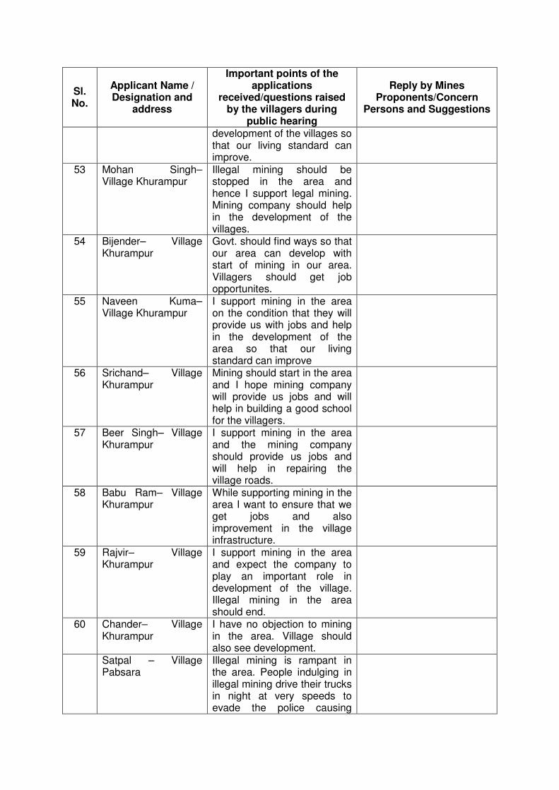
Sl. No.
Applicant Name / Designation and
address
Important points of the applications
received/questions raised by the villagers during
public hearing
Reply by Mines Proponents/Concern
Persons and Suggestions
development of the villages so that our living standard can improve.
53 Mohan Singh– Village Khurampur
Illegal mining should be stopped in the area and hence I support legal mining. Mining company should help in the development of the villages.
54 Bijender– Village Khurampur
Govt. should find ways so that our area can develop with start of mining in our area. Villagers should get job opportunites.
55 Naveen Kuma– Village Khurampur
I support mining in the area on the condition that they will provide us with jobs and help in the development of the area so that our living standard can improve
56 Srichand– Village Khurampur
Mining should start in the area and I hope mining company will provide us jobs and will help in building a good school for the villagers.
57 Beer Singh– Village Khurampur
I support mining in the area and the mining company should provide us jobs and will help in repairing the village roads.
58 Babu Ram– Village Khurampur
While supporting mining in the area I want to ensure that we get jobs and also improvement in the village infrastructure.
59 Rajvir– Village Khurampur
I support mining in the area and expect the company to play an important role in development of the village. Illegal mining in the area should end.
60 Chander– Village Khurampur
I have no objection to mining in the area. Village should also see development.
Satpal – Village Pabsara
Illegal mining is rampant in the area. People indulging in illegal mining drive their trucks in night at very speeds to evade the police causing

Sl. No.
Applicant Name / Designation and
address
Important points of the applications
received/questions raised by the villagers during
public hearing
Reply by Mines Proponents/Concern
Persons and Suggestions
noise and accidents. Legal mining in a planned manner will provide jobs to locals. Restoration fund being paid to the Govt. should be spent in villages. Hence I support mining.
Sanjay Kumar – Village Pabsara
There is danger of inundation due to rising ground level of river. Mining will help in dredging the river which will reduce chances of inundation in the area. Hence mining should be allowed. River sand will be available at reasonable rates so that we can construct our houses at lower cost.
Panchayat Village Manauli, Pabsara, ex Sarpanch Khurampur and others.
We were informed by the Regional Officer of Pollution Control Board, Sonipat about the said Public Hearing on 20th Nov, 2014. Regarding this we have following objections: 1. We were not given 30 days
notice as per the law. Therefore the information given and the public hearing both are invalid. New information should be given and the public hearing should be conducted in our village again.
2. We have come here to inform you about this wrong information and the public hearing. And also to file our objections.
3. On 17-09-2014, public hearing for the same was conducted about which the villagers were not informed. So that public hearing was also not valid. All the four villages and the villages nearby protested against mining in this area.
4. In the interim we heard that mining in the area has
Reply by HSPCB : (Points1-6) As per HSPCB Public hearing process was conducted on 17.08.214 at 11 am in Vill. Manuali in accordance with EIA Notification dated 14.09.2006 after giving 30 days prior notice in national and regional newspapers and notice displayed on HSPCB website. Information about the Public Hearing was disseminated to the Panchayats of project area through the office of District Development and Panchayat Officer, Sonepat. In addition, a special drive through the villages of project area was undertaken to widely publicize the Public Hearing. Public Hearing was held at the project site Village Manauli to maximize the participation of villagers. During the course of public hearing, some villager expressed their views that other villagers could not participate in this meeting
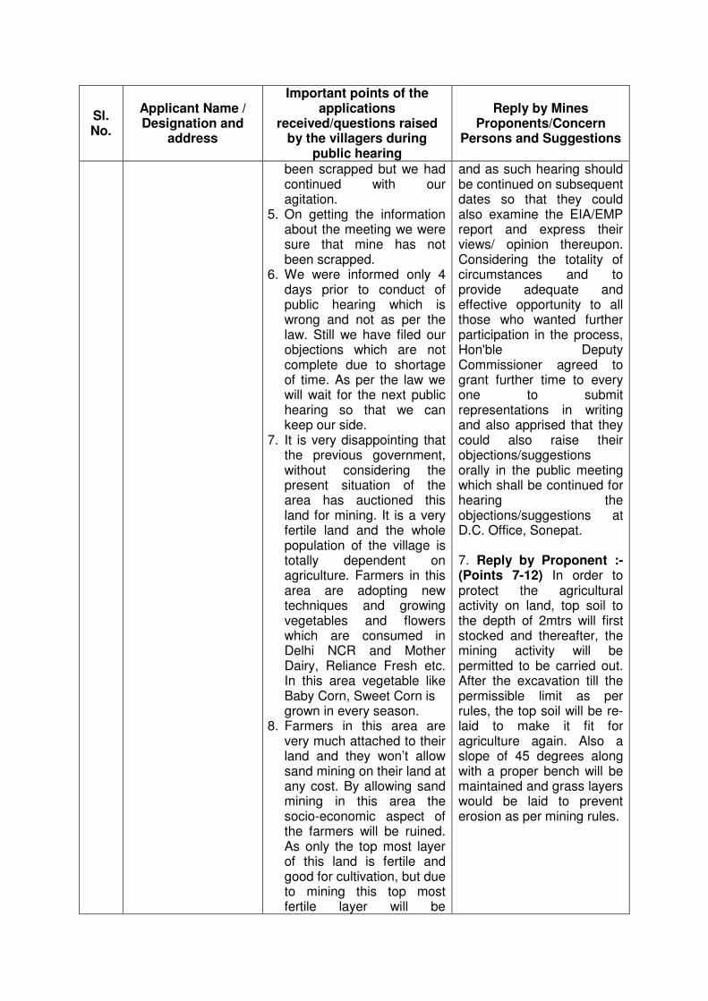
Sl. No.
Applicant Name / Designation and
address
Important points of the applications
received/questions raised by the villagers during
public hearing
Reply by Mines Proponents/Concern
Persons and Suggestions
been scrapped but we had continued with our agitation.
5. On getting the information about the meeting we were sure that mine has not been scrapped.
6. We were informed only 4 days prior to conduct of public hearing which is wrong and not as per the law. Still we have filed our objections which are not complete due to shortage of time. As per the law we will wait for the next public hearing so that we can keep our side.
7. It is very disappointing that the previous government, without considering the present situation of the area has auctioned this land for mining. It is a very fertile land and the whole population of the village is totally dependent on agriculture. Farmers in this area are adopting new techniques and growing vegetables and flowers which are consumed in Delhi NCR and Mother Dairy, Reliance Fresh etc. In this area vegetable like Baby Corn, Sweet Corn is grown in every season.
8. Farmers in this area are very much attached to their land and they won’t allow sand mining on their land at any cost. By allowing sand mining in this area the socio-economic aspect of the farmers will be ruined. As only the top most layer of this land is fertile and good for cultivation, but due to mining this top most fertile layer will be
and as such hearing should be continued on subsequent dates so that they could also examine the EIA/EMP report and express their views/ opinion thereupon. Considering the totality of circumstances and to provide adequate and effective opportunity to all those who wanted further participation in the process, Hon'ble Deputy Commissioner agreed to grant further time to every one to submit representations in writing and also apprised that they could also raise their objections/suggestions orally in the public meeting which shall be continued for hearing the objections/suggestions at D.C. Office, Sonepat. 7. Reply by Proponent :- (Points 7-12) In order to protect the agricultural activity on land, top soil to the depth of 2mtrs will first stocked and thereafter, the mining activity will be permitted to be carried out. After the excavation till the permissible limit as per rules, the top soil will be re-laid to make it fit for agriculture again. Also a slope of 45 degrees along with a proper bench will be maintained and grass layers would be laid to prevent erosion as per mining rules.

Sl. No.
Applicant Name / Designation and
address
Important points of the applications
received/questions raised by the villagers during
public hearing
Reply by Mines Proponents/Concern
Persons and Suggestions
destroyed for generations. Its fertility and high yielding capacity will be impossible to rejuvenate. Provisions suggested by the mining company are imaginary and miles away from the reality. Due to sand mining the local ecosystem will be destroyed and this leveled land will turn into a ruined, barren and dilapidated area. This will be of no use for the farmers.
9. It has to be paid attention that the decision of sand mining will destroy the life and generations of the farmers and also it will be dishonest to the step taken by the Indian Government for “Rashtriya Baghbani Mission.”
10. This whole area is very fertile and appropriate for 12 months cultivation. Wheat, Rice and all kind of vegetables are grown here. Due to presence of nearby Delhi Azadpur mandi & Narela Anaj mandi, each farmer earns Rs. 70,000 to 1,00,000 annually per acre.
11. Agriculture in this area has made these farmers independent. They are earning well, providing employment to labours and nearby people who don’t have their land. Here dairies and animals are in majority and the area remains green throughout the year. Hence cattle gets green feed whole year. If mining will be permitted, all the farmers will be unemployed and their regular income will be stopped. By digging this
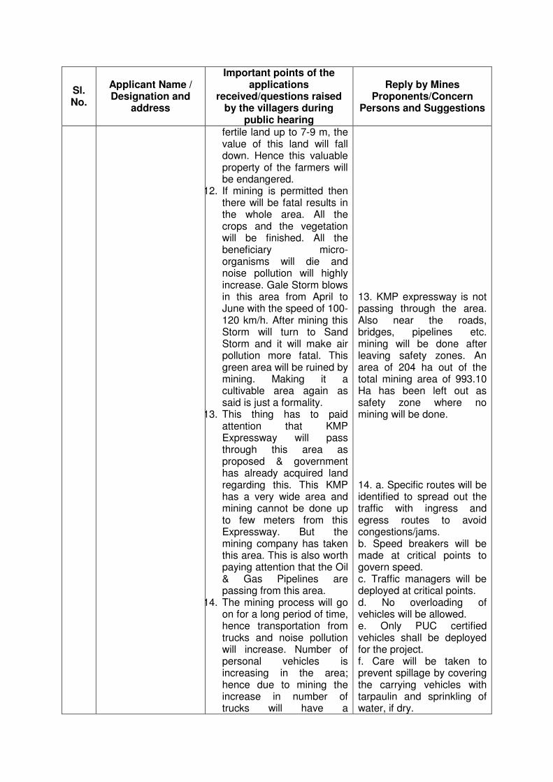
Sl. No.
Applicant Name / Designation and
address
Important points of the applications
received/questions raised by the villagers during
public hearing
Reply by Mines Proponents/Concern
Persons and Suggestions
fertile land up to 7-9 m, the value of this land will fall down. Hence this valuable property of the farmers will be endangered.
12. If mining is permitted then there will be fatal results in the whole area. All the crops and the vegetation will be finished. All the beneficiary micro-organisms will die and noise pollution will highly increase. Gale Storm blows in this area from April to June with the speed of 100-120 km/h. After mining this Storm will turn to Sand Storm and it will make air pollution more fatal. This green area will be ruined by mining. Making it a cultivable area again as said is just a formality.
13. This thing has to paid attention that KMP Expressway will pass through this area as proposed & government has already acquired land regarding this. This KMP has a very wide area and mining cannot be done up to few meters from this Expressway. But the mining company has taken this area. This is also worth paying attention that the Oil & Gas Pipelines are passing from this area.
14. The mining process will go on for a long period of time, hence transportation from trucks and noise pollution will increase. Number of personal vehicles is increasing in the area; hence due to mining the increase in number of trucks will have a
13. KMP expressway is not passing through the area. Also near the roads, bridges, pipelines etc. mining will be done after leaving safety zones. An area of 204 ha out of the total mining area of 993.10 Ha has been left out as safety zone where no mining will be done. 14. a. Specific routes will be identified to spread out the traffic with ingress and egress routes to avoid congestions/jams. b. Speed breakers will be made at critical points to govern speed. c. Traffic managers will be deployed at critical points. d. No overloading of vehicles will be allowed. e. Only PUC certified vehicles shall be deployed for the project. f. Care will be taken to prevent spillage by covering the carrying vehicles with tarpaulin and sprinkling of water, if dry.
Sl. No.
Applicant Name / Designation and
address
Important points of the applications
received/questions raised by the villagers during
public hearing
Reply by Mines Proponents/Concern
Persons and Suggestions
dangerous effect on the transportation system. Mining has never been done in this area. The roads connecting mining area to the highway passes from the densely populated area of the village. All the villages and panchayats have taken resolution that the transportation system for mining should not pass through their villages. Because schools of all the villages falls on these roads. Hence this decision will be strictly implemented.
15. Whatever the mining company has said to stop the noise, air and other pollution is totally impractical. It has no relation with the reality.
g. Fortnightly scraping of road in order to keep the roads almost levelled. This will ensure smooth flow of vehicles and also prevent spillage. 15. All compliances will be strictly enforced along with period compliance reports to MoEF.
Gram Panchayat Jakhauli
Mining trucks should not go through the village since it has a school.
Due care will be taken to provide speed breakers at critical points and also place personnel for traffic management. Plantation will also be provided along the road to reduce the noise levels.
Vijaypal Lambardar & Others
Mining contract given by Haryana Govt. to VNS Infrastructure should be cancelled.
Mining contract LoI has been allotted as per due process of the Haryana Minor Mineral Concession, Stocking, Transportation of Minerals and Prevention of Illegal Mining Rules, 2012.
Observations and Feedback of Sh. Sameer Pal Srow, IAS, Deputy Commissioner, Dist. Sonipat, Haryana
1. That rampant illegal mining is a big menace in the area and it is leading to increase in criminality and other social evils in the area. There is shortage of sand resulting in stalling the works of development. Lack of adequate supply of minor minerals is leading to these
Sl. No.
Applicant Name / Designation and
address
Important points of the applications
received/questions raised by the villagers during
public hearing
Reply by Mines Proponents/Concern
Persons and Suggestions
illegal mining activities. People indulging in illegal and unscientific mining are creating havoc on the environment. Illegal mining in the area is also leading to loss of revenue to the Government. Hence legal mining using scientific techniques as per laws should be started in the area at the earliest. 2. Illegal mining is also being undertaken on UP side of the state borders to fulfil the demand in Haryana. 3. The sand mafia, is in holding illegal transportation of the extracted sand. The vehicles are driven recklessly and that high speeds to avoid being trapped of an resulting in causing accidents and posing danger to the lives and properties of the residents. 4. It is also important to minimize any adverse effects of mining on agriculture, hence, it is imperative that mining is undertaken strictly as per the mining laws. The fertile top soil should be conserved to reclaim the agricultural land so that agriculture is not affected. 5. Land for mining should be used with mutual consent of farmers and as per the provisions of mining law. 6. CSR activities should be undertaken in villages in consultation of the village Panchayats and Gram Sabhas so that social development of the villages can be channelized in consultation with all stakeholders.