essential dates of awifs and modis data for the … · identical methodologies using erdas imagine...
TRANSCRIPT
Claire Boryan
USDA/NASS
Essential Dates of AWiFS and MODIS
Data for the Identification of Corn and
Soybean Fields in the U.S. Heartland
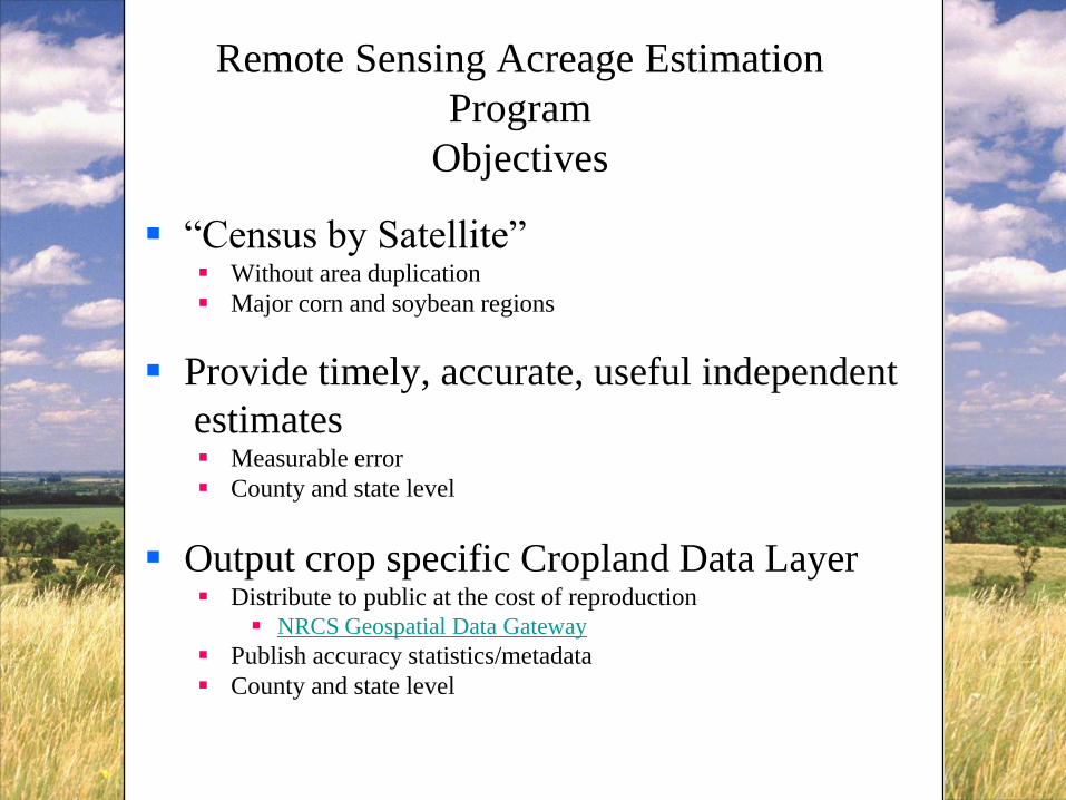
Remote Sensing Acreage Estimation
Program
Objectives
“Census by Satellite” Without area duplication
Major corn and soybean regions
Provide timely, accurate, useful independent
estimates Measurable error
County and state level
Output crop specific Cropland Data Layer Distribute to public at the cost of reproduction
NRCS Geospatial Data Gateway
Publish accuracy statistics/metadata
County and state level

Kansas 2008 CDL

’06 – ‘07
’05 & ‘07
’97-’08
‘04
’99-’08 ’00-’08
’00-’08
’04-08
’99-’08
’01-’08
’06-08
’06-’08
’01-’08
’06-‘08
’97-’08 ’06-’08
’03-’08
’06-’08‘02
‘07
’07-’08
‘07
‘07
‘08
‘08

Cropland Data Layer Program
• Inputs
– Resourcesat-1 AWiFS imagery
– Farm Service Agency – Common Land Unit
– Ancillary data
– Commercial software suite
• Outputs
– Acreage Estimates
– Cropland Data Layer

• To determine the necessary dates of AWiFS and
MODIS data for the identification of corn and soybean
fields in the U.S. Heartland.
Goals of AWiFS & MODIS Essential
Dates Assessment
Corn Soybeans

Crop Production Report
Crop Production Report
Small Grains Annual Summary
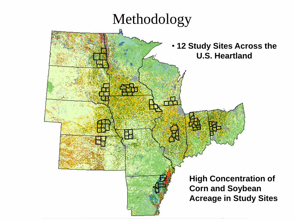
Methodology
• 12 Study Sites Across the
U.S. Heartland
High Concentration of
Corn and Soybean
Acreage in Study Sites

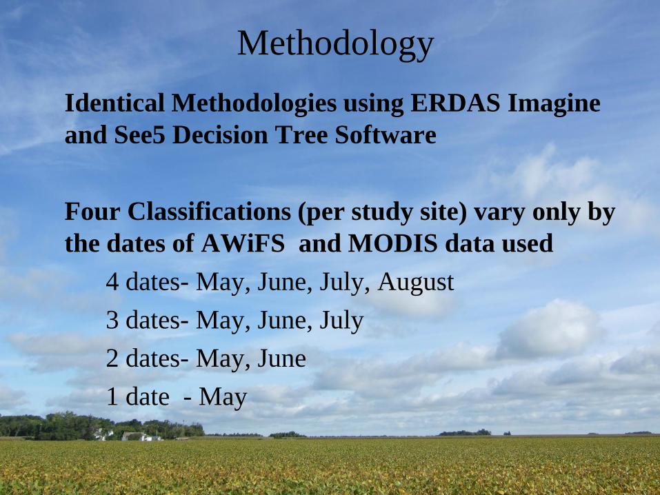
Methodology
Identical Methodologies using ERDAS Imagine
and See5 Decision Tree Software
Four Classifications (per study site) vary only by
the dates of AWiFS data used
4 dates- May, June, July, August
3 dates- May, June, July
2 dates- May, June
1 date - May

IRS Resourcesat-1 AWiFS Imagery
340 km swath per head
740 km combined
5-day revisit
4 spectral bands
B2: 0.52 - 0.59
B3: 0.62 - 0.68
B4: 0.76 – 0.86
B5: 1.55 – 1.7
56 m nadir/70 m field edges
Data provided by Arctic Slope
Regional Corporation
13 Aug 2007
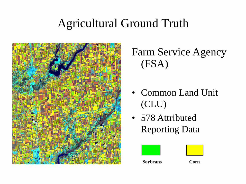
Agricultural Ground Truth
Farm Service Agency (FSA)
• Common Land Unit
(CLU)
• 578 Attributed
Reporting Data
Soybeans Corn

Non Agricultural Ground Truth
National Land Cover
Dataset from USGS,
2001
• Proportional sampling
• Improve CDL coverage
of non-agricultural
classes
Urban Water Forest Pasture No Data

AWiFS Imagery Time Series
Classification Results
Soybeans Corn Non AgricultureOther Crop

Methodology
Identical Methodologies using ERDAS Imagine
and See5 Decision Tree Software
Four Classifications (per study site) vary only by
the dates of AWiFS and MODIS data used
4 dates- May, June, July, August
3 dates- May, June, July
2 dates- May, June
1 date - May

MODIS NDVI Imagery
time
NASA MODIS Terra (16-day NDVI composite)
Time series of current growing season
Fall scenes from previous year

AWiFS and MODIS Time Series
Classification Results
Soybeans Corn Non AgricultureOther Crop


Average Change in Corn and Soybean
Accuracy - US Heartland
AWiFS only vs. AWiFS & MODIS

Corn Across the U.S. Heartland Date of 100% Emergence, 2007
Five Year Average (2002-2006)
June 17 for 100% Emergence
-Except South Dakota (6/10)
Corn crop across the
U.S. Heartland was
one week ahead of the
five year average for
100% emerged
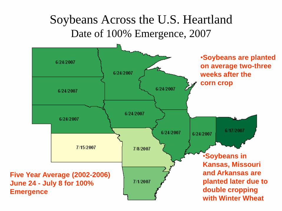
Soybeans Across the U.S. Heartland Date of 100% Emergence, 2007
Five Year Average (2002-2006)
June 24 - July 8 for 100%
Emergence
•Soybeans are planted
on average two-three
weeks after the
corn crop
•Soybeans in
Kansas, Missouri
and Arkansas are
planted later due to
double cropping
with Winter Wheat

• Without August AWiFS Data- Reductions in Accuracy
– Corn: 1.41% - 1.94%
– Soybeans: 3.93% – 4.02%
• Without July and August AWiFS Data-Reductions in Accuracy
– Corn: 11.97% - 12.38%
– Soybeans: 18.30% - 21.65%
• AWiFS collects through July are essential to produce highly accurate corn and soybean classifications.
Conclusions

Conclusions
• Most Valuable Single Date AWiFS
– Corn: July or August
– Soybeans: August
• AWiFS & MODIS Data
– MODIS data provides the greatest improvements in accuracy when AWiFS data are limited to 2 dates (May – June) or 1 date (May only). When 3 – 4 dates of AWiFS are available over a study area, the MODIS data provides only marginal improvements in accuracy.

Thank You
Claire Boryan, Mike Craig, Mary Lindsey
703-877-8000 x107
www.nass.usda.gov
datagateway.nrcs.usda.gov