extreme weather and phrases: key weather words and mapping extreme weather weather forecasts...
TRANSCRIPT
n Florida, we experience some of the wildest weather in the world. Although snowy
blizzards are very unlikely, we do encounter hurricanes, tornadoes, waterspouts, heavy rain showers and a lot of lightning strikes. Our humid, subtropical climate creates an ideal breeding ground for these extreme weather conditions.
Modern weather forecasting has helped the public prepare for severe weather like never before. Nearly all weather develops within a 5-mile atmospheric layer surrounding the earth, called the troposphere. Meteorologists, or scientists who study and predict weather, play an important role in alerting us to threatening conditions. Meteorology comes from the Greek word meteoron, which means “concerning things in the air.”
In addition to basic instruments such as thermometers, hydrographs, weather vanes, anemometers, barometers and rain gauges, meteorologists use high-powered computer systems to monitor weather patterns. High-tech tools such as satellites and Doppler radar systems are used with weather balloons, ocean buoys and other instruments. The weather updates that we receive at home on our computers, radios and TVs are
accurate and up to date because of these powerful advances in technology.
People have always been fascinated by extreme weather. Weather disasters are popular themes in movies, books and TV shows. As you learn more about extreme weather and mapping, you will realize how important it is to be a weather-wise citizen. Knowing more about extreme weather conditions may even save you or your family from harm!
I
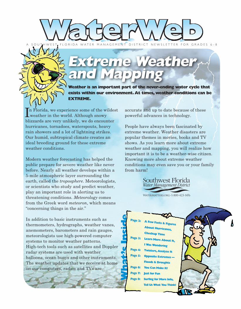
Weather is an important part of the never-ending water cycle that exists within our environment. At times, weather conditions can be EXTREME.
Extreme Weather and Mapping
A S O U T H W E S T F L O R I D A W A T E R M A N A G E M E N T D I S T R I C T N E W S L E T T E R F O R G R A D E S 6 – 8
8
The Southwest Florida Water Management District (District) does not discriminate on the basis of disability. This nondiscrimination policy involves every aspect of the District’s functions, including access to and participation in the District’s programs and activities. Anyone requiring reasonable accommodation as provided for in the Americans with Disabilities Act should contact the District’s Human Resources Bureau Chief, 2379 Broad St., Brooksville, FL 34604-6899; telephone (352) 796-7211 or 1-800-423-1476 (FL only), ext. 4702; TDD 1-800-231-6103 (FL only); or email [email protected].
COMrev-11/12
If you are interested in learning more about topics covered in this newsletter, check out these websites.
Surfing for More Info
National Oceanic and Atmospheric Administrationwww.noaa.gov
Tampa Bay Online (select weather)www.tbo.com
USA Today Weatherasp.usatoday.com/weather/weatherfront.aspx
Key Weather Wordsand Phrases:hurricanesweather mapstornadoesextreme weatherweather forecaststhunderstorms
S O U T H W E S T F L O R I D A W A T E R M A N A G E M E N T D I S T R I C T
is published by the Southwest Florida Water Management District. For a teacher’s guide or additional copies of this newsletter, please order online at WaterMatters.org/publications, or call the Communications Section of the Public Affairs Bureau at (352) 796-7211 or 1-800-423-1476 (FL only), ext. 4757.
S O U T H W E S T F L O R I D A W A T E R M A N A G E M E N T D I S T R I C T
…Hurricanes ost Floridians are familiar with the hurricane season, which runs each year
from the beginning of June until the end of November. Unlike some other weather patterns, hurricanes can last for several days or even weeks. It’s no surprise that hurricanes cause more destruction than any other type of storm on earth. But did you know that hurricanes also have a positive effect on the environment? A hurricane can provide much-needed rain to an area. It can also play an important role in transferring heat from one region to another. As a hurricane system gradually moves forward, it draws heat and energy away from the equator and pushes it toward cooler areas. Read on to learn more about one of nature’s most extreme weather conditions.
Word HistoryAlthough hurricanes aren’t really evil, the word hurricane gets its meaning from a dark and stormy past. In South and Central America, the ancient Mayan people believed in a storm god named Hunraken. In the Caribbean, the Taino people feared an evil god called Huracan, which is the Spanish word for “great wind.” Over time, these two names combined to describe the severe weather condition known as a hurricane.
The Strongest Tropical CycloneTropical cyclones are storms that spin around low air pressure systems typically formed in the tropics. Because of a force known as the
Coriolis effect, the storms spin counterclock-wise in the Northern Hemisphere and clock-wise in the Southern Hemisphere. Hurricanes are the most powerful type of tropical cyclone.
Growth of a HurricaneLike all other winds, hurricane winds are caused by differences in atmospheric pressure, which is basically the pressure caused by the weight of air molecules. Hurricanes are born over the warm tropical waters of the oceans near the equator, where moisture evaporates into the atmosphere and generates the power source for a severe storm. Thunderstorms develop as winds force warm air to rise higher into the atmosphere and begin a spinning motion. Winds continue spinning faster and faster as a hurricane grows in size and strength. A hurricane can span from 200–500 miles over a body of water.
What’s in a Name?Tropical storms and hurricanes are the only weather disasters that have names. For over 50 years, tropical storms with winds of at least 39 mph have been assigned names. A storm is a hurricane when it can sustain wind speeds of 74 mph or higher. Naming storms allows everybody to communicate informa-tion about a particular storm more easily. There are six lists of alphabetical names, which are rotated each year. Names associ-ated with deadly storms in the past, such as Katrina, Donna, Hugo and Andrew, are no longer allowed on the list.
M
2
Checkup Time Mark each of the following statements as true (T) or false (F).
__ 1. Hurricanes have had names for only the past 10 years.
__ 2. Hurricanes can cover an area of 200–500 miles over water.
__ 3. A hurricane is a type of tropical cyclone.
__ 4. Hurricanes spin in a clockwise pattern in the Northern Hemisphere.
S O U T H W E S T F L O R I D A W A T E R M A N A G E M E N T D I S T R I C T
These activities are not only for fun — they’ll help you improve your problem-solving skills too!
Lightning Puzzler We live in an area that is often called the lightning capital of the world. Lightning can trigger forest fires, destroy buildings or even kill animals and people. But lightning also helps to maintain a balance of electricity between the earth and sky. When collisions of storm clouds cause electrical charges to separate, lightning works to restore stability in the atmosphere. Lightning can also be used to estimate how far you are from an approaching storm. By counting the seconds between a lightning flash and the first clap of thunder, you can determine the approximate distance between you and the storm. Knowing how close a storm is can serve as a warning to find safe shelter immediately! Practice computing the distance of a storm. Perform the necessary computations and complete the chart. The following hints will help you. Hints: • To find out how many miles you are from a storm,
divide the time between flash and thunder by 5. • To find out the number of kilometers, divide the time
between flash and thunder by 3. • Time is given in hours: minutes: seconds.
Just for Fun
7
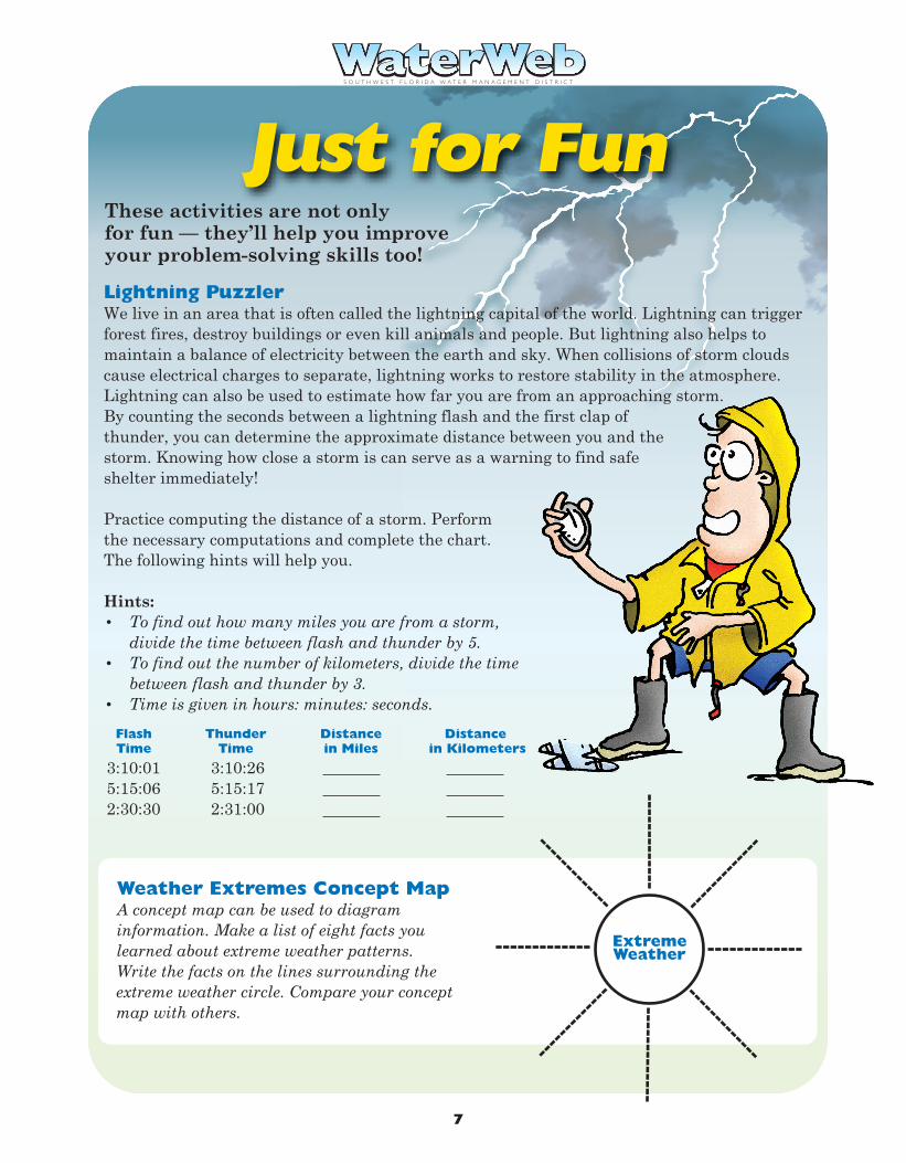
Weather Extremes Concept Map A concept map can be used to diagram information. Make a list of eight facts you learned about extreme weather patterns. Write the facts on the lines surrounding the extreme weather circle. Compare your concept map with others.
Flash Thunder Distance Distance Time Time in Miles in Kilometers
3:10:01 3:10:26 5:15:06 5:15:17 2:30:30 2:31:00
Extreme Weather
S O U T H W E S T F L O R I D A W A T E R M A N A G E M E N T D I S T R I C T S O U T H W E S T F L O R I D A W A T E R M A N A G E M E N T D I S T R I C T
Hurricane Categories You Can Make It!
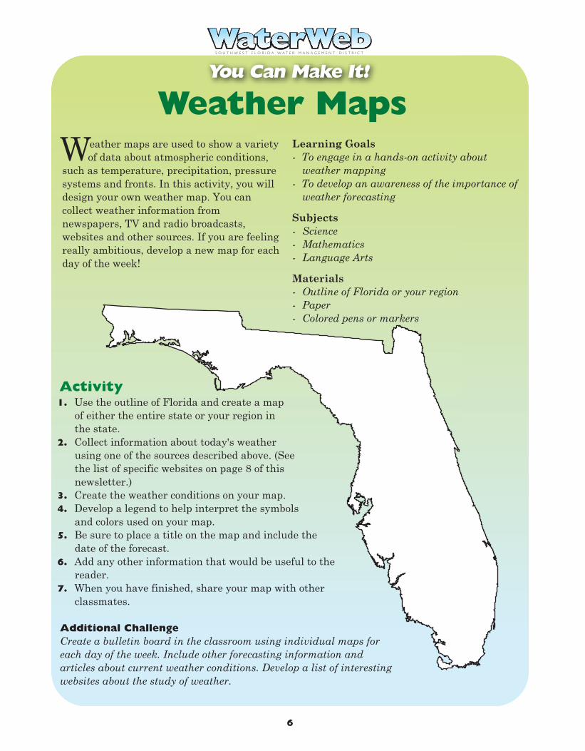
Weather Maps
eather maps are used to show a variety of data about atmospheric conditions,
such as temperature, precipitation, pressure systems and fronts. In this activity, you will design your own weather map. You can collect weather information from newspapers, TV and radio broadcasts, websites and other sources. If you are feeling really ambitious, develop a new map for each day of the week!
Learning Goals- To engage in a hands-on activity about
weather mapping- To develop an awareness of the importance of
weather forecasting
Subjects- Science- Mathematics- Language Arts
Materials- Outline of Florida or your region- Paper- Colored pens or markers
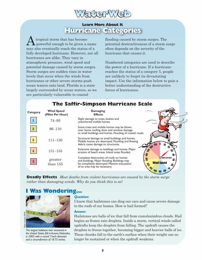
tropical storm that has become powerful enough to be given a name
may also eventually reach the status of a fully developed hurricane. However, not all hurricanes are alike. They vary in atmospheric pressure, wind speed and potential damage caused by storm surges. Storm surges are sudden rises in water levels that occur when the winds from hurricanes or other severe storms push ocean waters onto land. Florida is a state largely surrounded by ocean waters, so we are particularly vulnerable to coastal
flooding caused by storm surges. The potential destructiveness of a storm surge often depends on the severity of the hurricane that causes it.
Numbered categories are used to describe the power of a hurricane. If a hurricane reaches the status of a category 5, people are unlikely to forget its devastating impact. Use the information below to gain a better understanding of the destructive forces of hurricanes.
A
Learn More About It
W
6
1. Use the outline of Florida and create a map of either the entire state or your region in the state.
2. Collect information about today's weather using one of the sources described above. (See the list of specific websites on page 8 of this newsletter.)
3. Create the weather conditions on your map.4. Develop a legend to help interpret the symbols
and colors used on your map.5. Be sure to place a title on the map and include the
date of the forecast. 6. Add any other information that would be useful to the
reader.7. When you have finished, share your map with other
classmates.
Activity
Additional ChallengeCreate a bulletin board in the classroom using individual maps for each day of the week. Include other forecasting information and articles about current weather conditions. Develop a list of interesting websites about the study of weather.
Deadly Effects Most deaths from violent hurricanes are caused by the storm surge rather than damaging winds. Why do you think this is so?
Question: I know that hailstones can ding our cars and cause severe damage to the roofs of our homes. How is hail formed? Answer: Hailstones are balls of ice that fall from cumulonimbus clouds. Hail begins as frozen rain droplets. Inside a storm, vertical winds called updrafts keep the droplets from falling. The updraft causes the droplets to freeze together, becoming bigger and heavier balls of ice. These chunks fall to the earth’s surface when their weight can no longer be sustained or when the updraft weakens.
The largest hailstone ever recovered in the United States fell in Aurora, Nebraska, in 2003 with a record 7-inch diameter and a circumference of 18.75 inches.
Phot
o co
urte
sy N
OAA
I Was Wondering…
The Saffir-Simpson Hurricane Scale Category Wind Speed Damaging (Miles Per Hour) Effects
74–95 Slight damage to trees, bushes and unanchored mobile homes. 1
96–110 Some trees and mobile homes may be blown over. Some roofing, door and window damage to small buildings and homes. Flooding of coastal roads.
2
111–130 Structural damage to small buildings and homes. Mobile homes are destroyed. Flooding and floating debris cause damage to structures.
3
131–155 Extensive damage to buildings and homes. Majorerosion of beach areas. Inland areas flooded.4
greaterthan 155
Complete destruction of roofs on homes and buildings. Major flooding. Buildings may be completely destroyed. Massive evacuation of an area may be necessary.
5
0 170
160 15
0 14
0 13
0 12
0
110
100 90 80 70
60 50
40 30
20 10
miles per hour
Wind Speed
3
Explain why early detection and warning of a severe weather system is especially important in a heavily populated area.
T Twisters
S O U T H W E S T F L O R I D A W A T E R M A N A G E M E N T D I S T R I C T
Analyze It
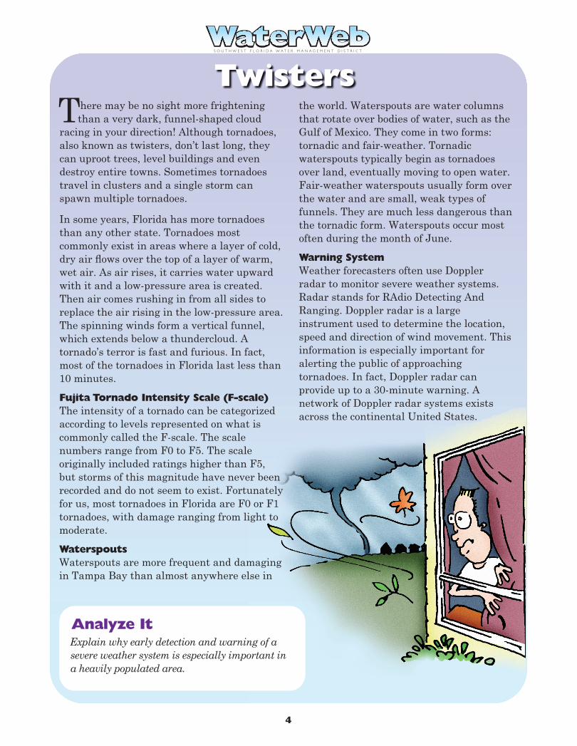
here may be no sight more frightening than a very dark, funnel-shaped cloud
racing in your direction! Although tornadoes, also known as twisters, don’t last long, they can uproot trees, level buildings and even destroy entire towns. Sometimes tornadoes travel in clusters and a single storm can spawn multiple tornadoes.
In some years, Florida has more tornadoes than any other state. Tornadoes most commonly exist in areas where a layer of cold, dry air flows over the top of a layer of warm, wet air. As air rises, it carries water upward with it and a low-pressure area is created. Then air comes rushing in from all sides to replace the air rising in the low-pressure area. The spinning winds form a vertical funnel, which extends below a thundercloud. A tornado’s terror is fast and furious. In fact, most of the tornadoes in Florida last less than 10 minutes.
Fujita Tornado Intensity Scale (F-scale)The intensity of a tornado can be categorized according to levels represented on what is commonly called the F-scale. The scale numbers range from F0 to F5. The scale originally included ratings higher than F5, but storms of this magnitude have never been recorded and do not seem to exist. Fortunately for us, most tornadoes in Florida are F0 or F1 tornadoes, with damage ranging from light to moderate.
WaterspoutsWaterspouts are more frequent and damaging in Tampa Bay than almost anywhere else in
the world. Waterspouts are water columns that rotate over bodies of water, such as the Gulf of Mexico. They come in two forms: tornadic and fair-weather. Tornadic waterspouts typically begin as tornadoes over land, eventually moving to open water. Fair-weather waterspouts usually form over the water and are small, weak types of funnels. They are much less dangerous than the tornadic form. Waterspouts occur most often during the month of June.
Warning SystemWeather forecasters often use Doppler radar to monitor severe weather systems. Radar stands for RAdio Detecting And Ranging. Doppler radar is a large instrument used to determine the location, speed and direction of wind movement. This information is especially important for alerting the public of approaching tornadoes. In fact, Doppler radar can provide up to a 30-minute warning. A network of Doppler radar systems exists across the continental United States.
5
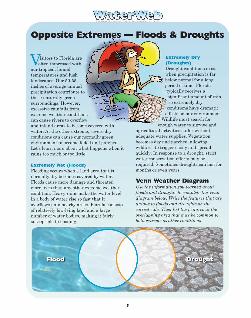
Visitors to Florida are often impressed with
our tropical, humid temperatures and lush landscapes. Our 50-55 inches of average annual precipitation contribute to these naturally green surroundings. However, excessive rainfalls from extreme weather conditions can cause rivers to overflow and inland areas to become covered with water. At the other extreme, severe dry conditions can cause our normally green environment to become faded and parched. Let’s learn more about what happens when it rains too much or too little.
Extremely Wet (Floods)Flooding occurs when a land area that is normally dry becomes covered by water. Floods cause more damage and threaten more lives than any other extreme weather condition. Heavy rains make the water level in a body of water rise so fast that it overflows onto nearby areas. Florida consists of relatively low-lying land and a large number of water bodies, making it fairly susceptible to flooding.
S O U T H W E S T F L O R I D A W A T E R M A N A G E M E N T D I S T R I C T
Extremely Dry (Droughts)Drought conditions exist when precipitation is far below normal for a long period of time. Florida typically receives a significant amount of rain, so extremely dry
conditions have dramatic effects on our environment.
Wildlife must search for enough water to survive and
agricultural activities suffer without adequate water supplies. Vegetation becomes dry and parched, allowing wildfires to trigger easily and spread quickly. In response to a drought, strict water conservation efforts may be required. Sometimes droughts can last for months or even years.
Venn Weather DiagramUse the information you learned about floods and droughts to complete the Venn diagram below. Write the features that are unique to floods and droughts on the correct side. Then list the features in the overlapping area that may be common to both extreme weather conditions.
Opposite Extremes — Floods & Droughts
Flood Drought
4
Explain why early detection and warning of a severe weather system is especially important in a heavily populated area.
T Twisters
S O U T H W E S T F L O R I D A W A T E R M A N A G E M E N T D I S T R I C T
Analyze It
here may be no sight more frightening than a very dark, funnel-shaped cloud
racing in your direction! Although tornadoes, also known as twisters, don’t last long, they can uproot trees, level buildings and even destroy entire towns. Sometimes tornadoes travel in clusters and a single storm can spawn multiple tornadoes.
In some years, Florida has more tornadoes than any other state. Tornadoes most commonly exist in areas where a layer of cold, dry air flows over the top of a layer of warm, wet air. As air rises, it carries water upward with it and a low-pressure area is created. Then air comes rushing in from all sides to replace the air rising in the low-pressure area. The spinning winds form a vertical funnel, which extends below a thundercloud. A tornado’s terror is fast and furious. In fact, most of the tornadoes in Florida last less than 10 minutes.
Fujita Tornado Intensity Scale (F-scale)The intensity of a tornado can be categorized according to levels represented on what is commonly called the F-scale. The scale numbers range from F0 to F5. The scale originally included ratings higher than F5, but storms of this magnitude have never been recorded and do not seem to exist. Fortunately for us, most tornadoes in Florida are F0 or F1 tornadoes, with damage ranging from light to moderate.
WaterspoutsWaterspouts are more frequent and damaging in Tampa Bay than almost anywhere else in
the world. Waterspouts are water columns that rotate over bodies of water, such as the Gulf of Mexico. They come in two forms: tornadic and fair-weather. Tornadic waterspouts typically begin as tornadoes over land, eventually moving to open water. Fair-weather waterspouts usually form over the water and are small, weak types of funnels. They are much less dangerous than the tornadic form. Waterspouts occur most often during the month of June.
Warning SystemWeather forecasters often use Doppler radar to monitor severe weather systems. Radar stands for RAdio Detecting And Ranging. Doppler radar is a large instrument used to determine the location, speed and direction of wind movement. This information is especially important for alerting the public of approaching tornadoes. In fact, Doppler radar can provide up to a 30-minute warning. A network of Doppler radar systems exists across the continental United States.
5
Visitors to Florida are often impressed with
our tropical, humid temperatures and lush landscapes. Our 50-55 inches of average annual precipitation contribute to these naturally green surroundings. However, excessive rainfalls from extreme weather conditions can cause rivers to overflow and inland areas to become covered with water. At the other extreme, severe dry conditions can cause our normally green environment to become faded and parched. Let’s learn more about what happens when it rains too much or too little.
Extremely Wet (Floods)Flooding occurs when a land area that is normally dry becomes covered by water. Floods cause more damage and threaten more lives than any other extreme weather condition. Heavy rains make the water level in a body of water rise so fast that it overflows onto nearby areas. Florida consists of relatively low-lying land and a large number of water bodies, making it fairly susceptible to flooding.
S O U T H W E S T F L O R I D A W A T E R M A N A G E M E N T D I S T R I C T
Extremely Dry (Droughts)Drought conditions exist when precipitation is far below normal for a long period of time. Florida typically receives a significant amount of rain, so extremely dry
conditions have dramatic effects on our environment.
Wildlife must search for enough water to survive and
agricultural activities suffer without adequate water supplies. Vegetation becomes dry and parched, allowing wildfires to trigger easily and spread quickly. In response to a drought, strict water conservation efforts may be required. Sometimes droughts can last for months or even years.
Venn Weather DiagramUse the information you learned about floods and droughts to complete the Venn diagram below. Write the features that are unique to floods and droughts on the correct side. Then list the features in the overlapping area that may be common to both extreme weather conditions.
Opposite Extremes — Floods & Droughts
Flood Drought
4
S O U T H W E S T F L O R I D A W A T E R M A N A G E M E N T D I S T R I C T S O U T H W E S T F L O R I D A W A T E R M A N A G E M E N T D I S T R I C T
Hurricane Categories You Can Make It!
Weather Maps
eather maps are used to show a variety of data about atmospheric conditions,
such as temperature, precipitation, pressure systems and fronts. In this activity, you will design your own weather map. You can collect weather information from newspapers, TV and radio broadcasts, websites and other sources. If you are feeling really ambitious, develop a new map for each day of the week!
Learning Goals- To engage in a hands-on activity about
weather mapping- To develop an awareness of the importance of
weather forecasting
Subjects- Science- Mathematics- Language Arts
Materials- Outline of Florida or your region- Paper- Colored pens or markers
tropical storm that has become powerful enough to be given a name
may also eventually reach the status of a fully developed hurricane. However, not all hurricanes are alike. They vary in atmospheric pressure, wind speed and potential damage caused by storm surges. Storm surges are sudden rises in water levels that occur when the winds from hurricanes or other severe storms push ocean waters onto land. Florida is a state largely surrounded by ocean waters, so we are particularly vulnerable to coastal
flooding caused by storm surges. The potential destructiveness of a storm surge often depends on the severity of the hurricane that causes it.
Numbered categories are used to describe the power of a hurricane. If a hurricane reaches the status of a category 5, people are unlikely to forget its devastating impact. Use the information below to gain a better understanding of the destructive forces of hurricanes.
A
Learn More About It
W
6
1. Use the outline of Florida and create a map of either the entire state or your region in the state.
2. Collect information about today's weather using one of the sources described above. (See the list of specific websites on page 8 of this newsletter.)
3. Create the weather conditions on your map.4. Develop a legend to help interpret the symbols
and colors used on your map.5. Be sure to place a title on the map and include the
date of the forecast. 6. Add any other information that would be useful to the
reader.7. When you have finished, share your map with other
classmates.
Activity
Additional ChallengeCreate a bulletin board in the classroom using individual maps for each day of the week. Include other forecasting information and articles about current weather conditions. Develop a list of interesting websites about the study of weather.
Deadly Effects Most deaths from violent hurricanes are caused by the storm surge rather than damaging winds. Why do you think this is so?
Question: I know that hailstones can ding our cars and cause severe damage to the roofs of our homes. How is hail formed? Answer: Hailstones are balls of ice that fall from cumulonimbus clouds. Hail begins as frozen rain droplets. Inside a storm, vertical winds called updrafts keep the droplets from falling. The updraft causes the droplets to freeze together, becoming bigger and heavier balls of ice. These chunks fall to the earth’s surface when their weight can no longer be sustained or when the updraft weakens.
The largest hailstone ever recovered in the United States fell in Aurora, Nebraska, in 2003 with a record 7-inch diameter and a circumference of 18.75 inches.
Phot
o co
urte
sy N
OAA
I Was Wondering…
The Saffir-Simpson Hurricane Scale Category Wind Speed Damaging (Miles Per Hour) Effects
74–95 Slight damage to trees, bushes and unanchored mobile homes. 1
96–110 Some trees and mobile homes may be blown over. Some roofing, door and window damage to small buildings and homes. Flooding of coastal roads.
2
111–130 Structural damage to small buildings and homes. Mobile homes are destroyed. Flooding and floating debris cause damage to structures.
3
131–155 Extensive damage to buildings and homes. Majorerosion of beach areas. Inland areas flooded.4
greaterthan 155
Complete destruction of roofs on homes and buildings. Major flooding. Buildings may be completely destroyed. Massive evacuation of an area may be necessary.
5
0 170
160
150
140
130
120
110
100 90 80 70
60 50
40 30
20 10
miles per hour
Wind Speed
3
S O U T H W E S T F L O R I D A W A T E R M A N A G E M E N T D I S T R I C T
…Hurricanes ost Floridians are familiar with the hurricane season, which runs each year
from the beginning of June until the end of November. Unlike some other weather patterns, hurricanes can last for several days or even weeks. It’s no surprise that hurricanes cause more destruction than any other type of storm on earth. But did you know that hurricanes also have a positive effect on the environment? A hurricane can provide much-needed rain to an area. It can also play an important role in transferring heat from one region to another. As a hurricane system gradually moves forward, it draws heat and energy away from the equator and pushes it toward cooler areas. Read on to learn more about one of nature’s most extreme weather conditions.
Word HistoryAlthough hurricanes aren’t really evil, the word hurricane gets its meaning from a dark and stormy past. In South and Central America, the ancient Mayan people believed in a storm god named Hunraken. In the Caribbean, the Taino people feared an evil god called Huracan, which is the Spanish word for “great wind.” Over time, these two names combined to describe the severe weather condition known as a hurricane.
The Strongest Tropical CycloneTropical cyclones are storms that spin around low air pressure systems typically formed in the tropics. Because of a force known as the
Coriolis effect, the storms spin counterclock-wise in the Northern Hemisphere and clock-wise in the Southern Hemisphere. Hurricanes are the most powerful type of tropical cyclone.
Growth of a HurricaneLike all other winds, hurricane winds are caused by differences in atmospheric pressure, which is basically the pressure caused by the weight of air molecules. Hurricanes are born over the warm tropical waters of the oceans near the equator, where moisture evaporates into the atmosphere and generates the power source for a severe storm. Thunderstorms develop as winds force warm air to rise higher into the atmosphere and begin a spinning motion. Winds continue spinning faster and faster as a hurricane grows in size and strength. A hurricane can span from 200–500 miles over a body of water.
What’s in a Name?Tropical storms and hurricanes are the only weather disasters that have names. For over 50 years, tropical storms with winds of at least 39 mph have been assigned names. A storm is a hurricane when it can sustain wind speeds of 74 mph or higher. Naming storms allows everybody to communicate informa-tion about a particular storm more easily. There are six lists of alphabetical names, which are rotated each year. Names associ-ated with deadly storms in the past, such as Katrina, Donna, Hugo and Andrew, are no longer allowed on the list.
M
2
Checkup Time Mark each of the following statements as true (T) or false (F).
__ 1. Hurricanes have had names for only the past 10 years.
__ 2. Hurricanes can cover an area of 200–500 miles over water.
__ 3. A hurricane is a type of tropical cyclone.
__ 4. Hurricanes spin in a clockwise pattern in the Northern Hemisphere.
S O U T H W E S T F L O R I D A W A T E R M A N A G E M E N T D I S T R I C T
These activities are not only for fun — they’ll help you improve your problem-solving skills too!
Lightning Puzzler We live in an area that is often called the lightning capital of the world. Lightning can trigger forest fires, destroy buildings or even kill animals and people. But lightning also helps to maintain a balance of electricity between the earth and sky. When collisions of storm clouds cause electrical charges to separate, lightning works to restore stability in the atmosphere. Lightning can also be used to estimate how far you are from an approaching storm. By counting the seconds between a lightning flash and the first clap of thunder, you can determine the approximate distance between you and the storm. Knowing how close a storm is can serve as a warning to find safe shelter immediately! Practice computing the distance of a storm. Perform the necessary computations and complete the chart. The following hints will help you. Hints: • To find out how many miles you are from a storm,
divide the time between flash and thunder by 5. • To find out the number of kilometers, divide the time
between flash and thunder by 3. • Time is given in hours: minutes: seconds.
Just for Fun
7
Weather Extremes Concept Map A concept map can be used to diagram information. Make a list of eight facts you learned about extreme weather patterns. Write the facts on the lines surrounding the extreme weather circle. Compare your concept map with others.
Flash Thunder Distance Distance Time Time in Miles in Kilometers
3:10:01 3:10:26 5:15:06 5:15:17 2:30:30 2:31:00
Extreme Weather
n Florida, we experience some of the wildest weather in the world. Although snowy
blizzards are very unlikely, we do encounter hurricanes, tornadoes, waterspouts, heavy rain showers and a lot of lightning strikes. Our humid, subtropical climate creates an ideal breeding ground for these extreme weather conditions.
Modern weather forecasting has helped the public prepare for severe weather like never before. Nearly all weather develops within a 5-mile atmospheric layer surrounding the earth, called the troposphere. Meteorologists, or scientists who study and predict weather, play an important role in alerting us to threatening conditions. Meteorology comes from the Greek word meteoron, which means “concerning things in the air.”
In addition to basic instruments such as thermometers, hydrographs, weather vanes, anemometers, barometers and rain gauges, meteorologists use high-powered computer systems to monitor weather patterns. High-tech tools such as satellites and Doppler radar systems are used with weather balloons, ocean buoys and other instruments. The weather updates that we receive at home on our computers, radios and TVs are
accurate and up to date because of these powerful advances in technology.
People have always been fascinated by extreme weather. Weather disasters are popular themes in movies, books and TV shows. As you learn more about extreme weather and mapping, you will realize how important it is to be a weather-wise citizen. Knowing more about extreme weather conditions may even save you or your family from harm!
I
Weather is an important part of the never-ending water cycle that exists within our environment. At times, weather conditions can be EXTREME.
Extreme Weather and Mapping
A S O U T H W E S T F L O R I D A W A T E R M A N A G E M E N T D I S T R I C T N E W S L E T T E R F O R G R A D E S 6 – 8
8
The Southwest Florida Water Management District (District) does not discriminate on the basis of disability. This nondiscrimination policy involves every aspect of the District’s functions, including access to and participation in the District’s programs and activities. Anyone requiring reasonable accommodation as provided for in the Americans with Disabilities Act should contact the District’s Human Resources Bureau Chief, 2379 Broad St., Brooksville, FL 34604-6899; telephone (352) 796-7211 or 1-800-423-1476 (FL only), ext. 4702; TDD 1-800-231-6103 (FL only); or email [email protected].
COMrev-11/12
If you are interested in learning more about topics covered in this newsletter, check out these websites.
Surfing for More Info
National Oceanic and Atmospheric Administrationwww.noaa.gov
Tampa Bay Online (select weather)www.tbo.com
USA Today Weatherasp.usatoday.com/weather/weatherfront.aspx
Key Weather Wordsand Phrases:hurricanesweather mapstornadoesextreme weatherweather forecaststhunderstorms
S O U T H W E S T F L O R I D A W A T E R M A N A G E M E N T D I S T R I C T
is published by the Southwest Florida Water Management District. For a teacher’s guide or additional copies of this newsletter, please order online at WaterMatters.org/publications, or call the Communications Section of the Public Affairs Bureau at (352) 796-7211 or 1-800-423-1476 (FL only), ext. 4757.