faa safety briefing · published six times a year, faa safety briefing, formerly faa aviation news,...
TRANSCRIPT

FAA SafetyBrieFingJuly/August 2010
Your source for general aviation news and information
Federal AviationAdministration www.faa.gov/news/safety_briefing/
Weather WisdomStrategies for Coping with Mother Nature

FeaturesTHE WHITHER AND WHETHER OF FLYING IN WEATHERFine-tuning your weather knowledge and expertise ..........................7BY SUSA N PA RSON
CLIMBING INTO THIN AIRThe dangers of density altitude .......................................................... 12BY TOM HOF F M A NN
SMART SELF BRIEFINGSMaximizing Internet resources ...........................................................17 BY MEREDIT H SA INI
DO’S AND DON’TS FOR DATALINK WEATHERGetting the big picture on cockpit weather resources ...................... 20BY MEREDIT H SA INI
DIVERSION DECISIONSWhat can ATC do for me? ................................................................... 23BY EL LEN CRUM
AND, THE WINNER IS...Annual GA Awards recognize dedicated safety advocates ............. 34
DepartmentsJumpseat .................................................................................................1
ATIS – Aviation News Roundup ...........................................................2
EAA AirVenture Oshkosh® 2010 Forum Schedule ................................4
Aeromedical Advisory ...........................................................................5
Ask Medical Certification ......................................................................6
Checklist ................................................................................................16
Nuts, Bolts, and Electrons ...................................................................27
Hot Spots ...............................................................................................30
Vertically Speaking ..............................................................................32
Flight Forum .........................................................................................38
Editor’s Runway ...................................................................................40
FAA Faces ..................................................................Inside Back Cover
ISSN: 1057-9648FAA Safety BriefingJuly/August 2010 Volume 49/Number 4
Raymond H. LaHood Secretary of TransportationJ. Randolph Babbitt AdministratorMargaret Gilligan Associate Administrator for Aviation SafetyJohn M. Allen Director, Flight Standards ServiceMel O. Cintron Manager, General Aviation and Commercial DivisionSusan Parson EditorLynn McCloud Managing EditorLouise Oertly Associate EditorTom Hoffmann Associate EditorJames R. Williams Assistant Editor / Photo EditorMeredith Saini WriterJohn Mitrione Art Director
Published six times a year, FAA Safety Briefing, formerly FAA Aviation News, promotes aviation safety by discussing current technical, regulatory, and procedural aspects affecting the safe operation and maintenance of aircraft. Although based on current FAA policy and rule interpretations, all material is advisory or informational in nature and should not be construed to have regulatory effect. Certain details of accidents described herein may have been altered to protect the privacy of those involved.
The FAA does not officially endorse any goods, services, materials, or prod-ucts of manufacturers that may be referred to in an article. All brands, product names, company names, trademarks, and service marks are the properties of their respective owners. All rights reserved.
The Office of Management and Budget has approved the use of public funds for printing FAA Safety Briefing.
CONTACT INFORMATIONThe magazine is available on the Internet at: www.faa.gov/news/safety_briefing/
Comments or questions should be directed to the staff by:
E-mailing: • [email protected]
Writing: Editor, • FAA Safety Briefing, Federal Aviation Administration, AFS-805, 800 Independence Avenue, SW, Washington, DC 20591
Calling: (202) 267-8212•
Faxing: (202) 267-9463•
SUBSCRIPTION INFORMATIONThe Superintendent of Documents, U.S. Government Printing Office, sells FAA Safety Briefing on subscription and mails up to four renewal notices.
For New Orders: Subscribe via the Internet at http://bookstore.gpo.gov, tele-phone (202) 512-1800 or toll-free 1-866-512-1800, or use the self-mailer form in the center of this magazine and send to Superintendent of Documents, U.S. Government Printing Office, Washington, DC 20402-9371.
Subscription Problems/Change of Address: Send your mailing label with your comments/request to Superintendent of Documents, U.S. Government Printing Office, Contact Center, Washington, DC 20408-9375. You can also call (202) 512-1800 or 1-866-512-1800 and ask for Customer Service, or fax your information to (202) 512-2104.
U.S. Departmentof Transportation
Federal Aviation Administration
In this issue we focus on aviation weather and its critical
effect on safe GA flying. Articles address obtaining
and interpreting weather data, developing strategies
for avoiding marginal or hazardous weather, and
what services ATC can and cannot provide in adverse
conditions.

EAA AirVenture names places and streets after long-time vol-unteers. Camp Scholler is named after volunteer Ray Scholler (above left) and his family.
July/August 2010 FAA Safety Briefing 1
I’m really looking forward to AirVenture Oshkosh®. Whenever I go to AirVenture, I always come back with my aviation passion rejuvenated. But, it’s not just about seeing airplanes, it is about being around aviation enthusiasts—and the best are the volunteers.
Last year, my strongest impression after returning from Oshkosh to FL000 here at FAA headquarters was how deep-seated the spirit of volunteerism is in the aviation community. Yes, fly-ins and air shows have sponsoring organizations, but as Tom Poberezny, Experimental Aircraft Association (EAA) president and AirVenture chairman, says, “AirVenture would not happen without volunteers; it’s as simple as that. We have nearly 5,000 volunteers and they play an extremely important role.”
Volunteers have long played a key role at AirVenture—they go back to September 1953 when a hardy handful supported Paul Poberezny
at the original fly-in at Milwaukee’s Wright-Curtiss Field. Now, volunteers come in all ages, interests, and from around the world. Many volunteers make AirVenture, or the Reno Air Races, or Sun ’n Fun, or any of the nation’s hundreds of other air shows and fly-ins, the high point of their year. Families make volunteering at an aviation event a family reunion, or sometimes
even more. As Kelly Sweeney says of his family’s long-time tradition of volunteering at pylon 8 at the Reno Air Races, “When you turn 21 in this family, you come to Reno. It’s a rite of passage.”
There’s a growing cadre of AirVenture volunteers whose service has reached the half century mark. For one, this year marks Ron Scott’s
50th year. In 1960, when Paul Poberezny learned Scott worked at the phone company, that quickly translated to recruiting Scott as communications lead. From the early days with one tent, five speakers, an old military radio, and three phones, Scott’s team of volunteers now provides the world’s longest public address system. Tents are ancient history; the communications volunteers, who now total 55, are housed in the communications building with the upstairs as the announcers’ area and downstairs for phones, amplifers, and dispatch for handheld radios. Don’t forget the forty-three 600-pound speaker stanchions, which are set up three weeks in advance. It’s a lot of work, Scott says, but he readily admits the reason he comes back every year: “It’s the people.”
Wes Schmid, too, remembers the tents. Though it was half a century ago, he recalls carrying televisions from tent to tent. He remembers chairs on the grass, rain falling, then more rain, followed by chairs in puddles and mud. Schmid, still an AirVenture regular, was chairman of the forums from the early Milwaukee days up until several years ago. Forum attendees no longer hear the noise of a 16mm projector (smile, if you remember worn sprocket holes) or struggle to see what is on the screen. In the early days, Schmid says, “We held forums in the evening so you could see the visuals.” Much has changed with technology and the growth of AirVenture, but volunteering to pull it all off is still essential.
If you get to AirVenture, the Reno Air Races, or any other aviation event, take the time to thank a volunteer. The volunteer spirit is a wonderful thing about our country; it is especially remarkable in aviation. This column is my small way to say thank you to everyone who volunteers in aviation. In my book, volunteers are the “unsung heroes” who are the lifeblood to spreading the aviation spirit.
Thank you all!
Celebrating Aviation’s Volunteer Spirit
This column is to thank everyone who volunteers in aviation.
john m. A llendir ector , flight sta nda r ds serv ice

Arlington International Fly-In
2 FAA Safety Briefing July/August 2010
FAA Addresses Cockpit DistractionsOn April 26, 2010, FAA issued guidance for
pilots that addresses the topic of cockpit distractions caused by use of personal electronic devices (PED), such as laptop computers and mobile phones. Released as an Information for Operators (InFO) advisory, the guidance stresses the importance of creating a personal safety culture to control distractions that can interfere with flight duties.
While the memo was addressed to airline pilots, its message applies across aviation since PEDs have increasingly become an everyday part of GA flying. PEDs, including the many variations of electronic flight bags (EFB) now available, can be valuable tools for pilots. Yet, interruptions, such as a cell phone ringing (or beeping) during the takeoff roll, can cause pilots to lose focus in the cockpit. FAA recommends pilots evaluate their PED practices to ensure they do not interfere with safe flight operations. Managing and mitigating distraction is both a personal responsibility and professional requirement for all pilots.
The InFO advisory can be found at: http://www.faa.gov/other_visit/aviation_industry/airline_operators/airline_safety/info/all_infos/media/2010/InFO10003.pdf
Take Me Out to the Air ShowNothing signals the air-show season (or
baseball season, for that matter) being in full swing better than the start of two of its heaviest hitters—
EAA AirVenture® in Oshkosh, Wisconsin (July 26 – August 1), and the Arlington International Fly-In in Arlington, Washington (July 7-11). The two events, recognized as the nation’s first and third largest fly-in events, respectively, expect to host more
Pho
to b
y To
m H
offm
ann
than half a million aviation enthusiasts during their combined 15-day span.
The FAASTeam will be front and center at both events manning information kiosks and hosting educational seminars. Topics to be presented include pilot decision making, runway safety, and medical certification. A full list of the FAA safety forums at AirVenture can be found on page 4 of this issue, and at http://www.arlingtonflyin.org/schedules/ for the Arlington Fly-In.
FAA Issues Alert on Piper Nose Gear On May 4, 2010, FAA issued a Special
Airworthiness Information Bulletin (SAIB) that alerts owners/operators of certain Piper Arrow and Seminole aircraft of a landing-gear failure concern. Fatigue cracks found in the nose-gear drag-link bolt (a bolt that helps keep the nose gear down and locked) were linked to an accident with a Piper Seminole where the nose gear collapsed during landing. Post-accident investigation revealed that the nose-gear drag-link bolt fractured and dislodged from the drag-link assembly causing the nose gear to collapse.
FAA recommends following Piper Service Bulletin No. 1156, which calls for periodic replacement of the nose-gear drag-link bolt. According to Piper, wear on this bolt is sometimes undetectable during routine inspection. Also, owners/operators who cycle the gear more frequently should reduce the compliance time between replacement intervals from 500 to 400 hours.
To view the SAIB, go to: http://www.faa.gov/aircraft/safety/alerts/SAIB/ and search for CE-10-30.
NOTAMs Enter Digital AgeIn April 2010, Atlantic City International
Airport (KACY) became the first in the U.S. national airspace system to deliver digital notices to airmen (NOTAM). This transition to a new digital notification system is “a major technological change,” said Nancy Kalinowski, FAA’s Vice
Photo by Jay Tolbert

July/August 2010 FAA Safety Briefing 3
President, System Operations. “Digital information management is key to aviation safety.” The new digital NOTAM system reduces human error and provides more timely and accurate distribution of information about hazards and changes in aeronautical facilities, services, and procedures.
It took three seconds to transmit the first computer-generated digital NOTAM using a Web-based software program that converts NOTAMs into a standard format for direct delivery to the U.S.
NOTAM system. Before this upgrade, the NOTAM system remained unchanged for about 30 years. FAA plans full system delivery by 2014. The new direct-entry system will be demonstrated over the next 12 months at airports in Memphis, Tennessee; Norfolk, Virginia; Richmond, Virginia; Washington DC (Reagan); Chicago (Midway and O’Hare), Illinois; Denver, Colorado; Fort Wayne, Indiana; and Fairbanks, Alaska.
You do it at the movie theater, the supermarket, as well as your favorite coffee shop on the way to work: You line up and wait. And, after September 30, 2010, you may also be asked to do it at your local towered airport.
Designed to help simplify and standardize air traffic con-trol (ATC) phraseology, as well as to comply with International Civil Aviation Organization (ICAO) standards, U.S. controllers will use the term “line up and wait” in place of “position and hold” when instructing a pilot to taxi onto a departure runway and wait for takeoff clearance. Both current and future versions of the phrase are used when takeoff clearance cannot immediately be issued, either because of traffic or other reasons.
Why “line up and wait?” The phrase has actually been in use by a majority of ICAO contracting states for many years. It has proven useful with many non-native English speakers who can sometimes confuse “position and hold” with similar-sound-ing phrases like “position and roll,” “position at hold,” or “hold position.” Misinterpretation of this instruction can have serious consequences. Using “line up and wait” helps avoid ambigu-ity and keeps the global aviation community accountable to the same standard.
Here’s an example of the phrase in use:Tower: “Cessna 1234, Runway Three Four Left, line up and wait.”Pilot: “XYZ Tower, Cessna 1234, Runway Three Four Left, line
up and wait.”
At press time, this change was expected to take effect September 30, 2010. The specific date and additional details will be communicated via updates to the Aeronautical Informational Manual (AIM) and Pilot/Controller Glossary, both located under the Air Traffic section of www.faa.gov.
Other changes have also made their way into standard ATC lexicon. Effective June 30, 2010, air traffic controllers no
longer use the term “taxi to” when authorizing an aircraft to taxi to an assigned takeoff runway. Now, controllers must issue explicit clearances to pilots crossing any runway (active/inac-tive or closed) along the taxi route. In addition, pilots crossing multiple runways must be past the first runway they are cleared to cross before controllers can issue the next runway-crossing clearance.
As you may recall, previous “taxi to” clearances autho-rized pilots to cross any runway along the assigned route. One exception to the new rule is at airports where taxi routes between runway centerlines are fewer than 1,000 feet apart. In this case, multiple runway crossings may be issued if approved by the FAA Terminal Services Director of Operations.
The elimination of the “taxi to” phrase will apply only to departing aircraft. Arriving aircraft will still hear the phrase “taxi to” when instructed to taxi to the gate or ramp. However, controllers in these situations still will be required to issue specific crossing instructions for each runway encountered on the taxi route.
Remember, if you’re unsure of any ATC instruction or clearance you’ve heard, contact ATC immediately. It’s always bet-ter to check and be certain. And, remember to “line up and wait.”
For More Information
Pilot/Controller Glossary http://www.faa.gov/air_traffic/publications/atpubs/PCG/pcg.pd
Aeronautical Informational Manual (AIM)http://www.faa.gov/air_traffic/publications/ATPubs/AIM/AIMbasic2-11-10.pd
Aeronautical Information Publication (AIP)http://www.faa.gov/air_traffic/publications/atpubs/AIP/aip.pdf
“Line Up and Wait” in Preparation for Takeoff

FAA Aviation Safety Center
eAA AirVenture oshkosh®2010 forum schedule
0830 – 0945 1000 – 1115 1130 – 1245 1300 – 1415 1430-1545 1600-1645
Monday,July 26
Hot Topics in FAA EnforcementMichael F. McKinleyFAA Legal Counsel
Corrosion Removal for the Rusty PilotDr. Jerry CockrellAOPA
Lessons Learned on Recent GA Accidents, NTSB PerspectiveJeff GuzettiNTSB
Commercial Space TransportationJames VanLaakFAA Commercial Space Transportation
Ditching and Water Survival Robert ShaferU.S. Coast Guard Auxiliary
Safety and Loss Prevention, an Insurance PerspectiveJim LauermanAvemco Insurance
Tuesday,July 27
Airplane Basics for Flying CompanionsTina HartlaubWisconsin 99s
Spatial DisorientationRogers Shaw FAA CAMI
FAASafety.gov/We listened! WINGS is Getting BetterBryan NevilleFAASTeam
Surviving Inadvertent IMCEric BasileFAASTeam Representative
Aeronautical Decision MakingRogers Shaw FAA CAMI
Perceptions and Human ErrorDr. Phillip TartaloneEastern Michigan University
Wednesday, July 28
Fly ’em, Fix ’em, or Know People That Do: Mistakes the Human MakesDr. Bill JohnsonFAA Aviation Safety
VFR Charts, Little Known FactsJohn MooreFAA NACO
IFR Charts, Little Known FactsJohn MooreFAA NACO
The Kings on Risk ManagementJohn and Martha KingKing Schools
10 Things Pilots Do WrongAndy MillerAOPA/ASF
FAA’s Design Competition for Universities Joe Ponte FAA Runway Safety Office
Thursday, July 29
Real World IFRJonathan GreenwayAOPA/ASF
Engine Failure: A Survival GuideLynnwood MinarFAASTeam Representative
Meet the FAA AdministratorFORUM CLOSEDGo to EAA Pavilion #7
Cloudy Skies, Clear JudgmentSusan ParsonFAA
Runway Incursions and What You Can Do To Be a Safer PilotJack VandeventerMaster CFI
Hot Aeromedical IssuesDr. Fred TiltonFederal Air Surgeon
Friday,July 30
Practical Tips on Flying GPS and WAAS-based ApproachesMax TrescottFAASTeam Representative
Machado’s Thinking Small to Avoid Big MistakesRod MachadoAOPA
Mastering Takeoffs and LandingsJonathan GreenwayAOPA/ASF
Surface Safety by Accident?Dan CilliFAA Runway Safety Office
Lessons Learned, Part 1Greg FeithAviationSpeakers.Com
Parts/Material Substitutions for Vintage and Out-of- Production AircraftRick Anderson FAA
Saturday, July 31
You Don’t Want to Be Intercepted by the MilitaryMichael MichaelsUSA NORTHCOM
The Lost Art of Directional ControlThomas P. TurnerFAASTeam Representative
Human Factors and Fatigue Issues Affecting GA and Commercial PilotsJames LambFAASTeam
Preparing for your CheckrideLarry BotheMaster CFI, DPE
Lessons Learned, Part 2Greg FeithAviationSpeakers.Com
Use of Unmanned AircraftAlan FrazierUniversity of North Dakota
Sunday, August 1
Aeronautical Decision MakingSafer Skies movieFAASTeam
Controlled Flight into TerrainSafer Skies movieFAASTeam
In Flight Icing Training for PilotsSafer Skies movieFAASTeam
Face to Face, Eye to Eye/Was That for Us?Runway Safety movieFAA Runway Safety Office
Be sure to register at FAASafety.gov for the Pilot Proficiency (WINGS) Program and notifications of training events in your local area.
Become a part of the FAA Safety Team. Apply to be a volunteer FAASTeam Representative at FAASafety.gov.
This schedule is subject to change.
4 FAA Safety Briefing July/August 2010

July/August 2010 FAA Safety Briefing 5
F r e de r ic k e . T i lT on, M . d.FA A F e de r A l A i r Su r g e on
Summer is prime time for flying. It is also a prime time for dehydration, given the combination of higher ambient temperatures, higher humidity, and warm winds. Certain beverages, e.g., coffee, tea, and soft drinks, can further increase the risk of dehydration. Since dehydration can produce headache, fatigue, cramps, sleepiness, and dizziness, it can put pilots at increased risk for incidents and accidents.
Four Quarts a Day Keep Dehydration at BayThe amount of water you need to drink
depends on work level, temperature, humidity, personal lifestyle, and individual physiology. The standard guideline for proper hydration, though, is to drink two to four quarts of water every 24 hours. Another way to measure your intake is the familiar eight-glasses-a-day guide: If each glass of water is eight ounces and you drink eight glasses, then you end up with 64 ounces or two quarts.
As with every other aspect of your health, the key is to be continually aware of your condition. Most people become aware of being thirsty with a 1.5-quart deficit. This level of dehydration triggers the “thirst mechanism.” The problem, however, is that the thirst mechanism does not trigger until you are already dehydrated. In addition, the body’s thirst mechanism is too easily turned off by drinking just a small amount of fluid. By the time you feel thirsty, you already have a significant fluid deficit, and if you drink only enough to make the sensation of thirst disappear, you are merely delaying the much-needed replacement of body fluid.
Stages of Heat ExhaustionDehydration alone can create insidious
hazards to your health, as well as to your safety as a pilot. There is, however, a more serious danger. If you do not remain aware of environmental conditions and your personal physiological status, you can progress to heat exhaustion, even if you maintain the necessary water intake for proper hydration.
There are three stages of heat exhaustion, and transition from one to another is not necessarily
obvious. The first, heat stress, is characterized by a body temperature from 99.5 degrees to 100 degrees F. At this level, the pilot may experience reductions in alertness, performance, dexterity, coordination, and visual capability.
In the second stage, which involves a body temperature of 101 degrees to 105 degrees F, the pilot experiences more obvious fatigue. Other effects can include nausea/vomiting, giddiness, cramps, rapid breathing, or fainting. These are not good at any time, but are especially dangerous when piloting an aircraft.
The third stage, a body temperature above 105 degrees F, is heat stroke. In this condition, the body’s heat control mechanism stops working. The pilot can experience mental confusion and disorientation and may exhibit bizarre behavior. At its worst, heat stroke can produce a coma.
Awareness and PreventionHere are a few suggestions for awareness and
prevention of dehydration and heat exhaustion:
Drink cool (40 degrees F) water.•
Don’t rely on the thirst sensation as an alarm...•stay ahead of the thirst curve.
Limit your daily intake of caffeine and alcohol.•
Be extra vigilant about hydration while •exercising.
Monitor your individual effects of aging or •illness.
If you feel lightheaded or dizzy, call it a day.•
Fly safely, and never pass up an opportunity to have a fresh glass of water!
Dr. Tilton received both an M.S. and a M.D. degree from the University of New Mexico and an M.P.H. from the University of Texas. During a 26-year career with the U.S. Air Force, Dr. Tilton logged more than 4,000 hours as a command pilot and senior flight surgeon flying a variety of aircraft. He cur-rently flies the Cessna Citation 560 XL.
Defeating Dehydration
As with every other aspect of your health, the key is to be continually aware of your condition.

6 FAA Safety Briefing July/August 2010
Dr. Warren Silberman and his staff administer the aeromedical certification program for about 600,000 holders of U.S. pilot certificates and process 450,000 applications each year.
Q: I’ve recently been diagnosed with colon cancer and am undergoing what my physicians call “adjuvant” chemotherapy. Most days, I feel fine. Will I be able to fly on those good days?
A: I am sorry about your diagnosis. Hopefully, your physicians discovered your cancer early. The FAA does not allow airmen to fly while they are undergoing any chemotherapy or radiation therapy. These treatments are not without side effects, which are adverse to the aviation environment. In addition, the patient is generally fatigued and undergoing psychological adjustment to having the condition.
Once the treatment has been completed, you need to give it some time for any side effects to occur and dissipate. After a minimum of one month’s time you need to gather up any medical records from your diagnosis (e.g., hospital admission
and discharge summaries, operative and pathology reports, and pertinent X-ray results) and your physician’s status report after your treatment
that addresses how you did, any side effects of the treatments, planned treatment, and prognosis.
Q: I have obstructive sleep apnea. What are my treatment options and will I be able to keep flying?
A: Due to recent aviation accidents where fatigue has been a contributory factor, sleep apnea has been given more visibility and priority within the FAA’s Aerospace Medical Certification Division. The FAA accepts the following treatments:
1) Various surgical procedures to correct abnormalities with a person’s upper airway. The most common of these is uvulopalatopharyngoplasty, or UPPP. This is a procedure that removes the uvula and a portion of the soft palate. The uvula is that piece of tissue that hangs in the back of your throat attached to your soft palate.
2) CPAP/BiPAP therapy. CPAP, for Continuous Positive Airway Pressure, and BiPAP, for Bi-Level Positive Airway Pressure, are portable machines that are attached to a mask that goes over the nose that blows air into the throat in order to keep an individual’s airway open. The newer machines—and the one required by the FAA—have a computer device that keeps track of the number of hours and days that you are compliant. The FAA will ask for this tracking information.
3) Dental appliance. This is a device that is designed to keep your airway open, for example, by keeping the tongue from blocking the airway.
The FAA does not accept home remedies, such as tennis balls sewn into a nightshirt or propping pillows so an individual is “forced” to lay on his/her side to keep the airway clear. While these remedies can work, the FAA will only allow them if they are an additional treatment—not the sole treatment.
The FAA may require what is known as a Maintenance of Wakefulness Test to demonstrate that the sleep apnea treatment is successful. This test is performed in a sleep laboratory for 40 minutes spread out during the day (e.g., 9:00 a.m., 11:00 a.m., 1:00 p.m., and 3:00 p.m.). The person must remain awake in a darkened room without any stimulation.
As you can see, it is possible to get a waiver for this condition. Here are some resources for more information about fatigue and sleep disorders:
Guide for Aviation Medical Examiners: http://www.faa.gov/about/office_org/headquarters_offices/avs/offices/aam/ame/guide/app_process/exam_tech/item35/amd/apnea/
FAA Obstructive Sleep Apnea brochure:http://www.faa.gov/pilots/safety/pilotsafetybrochures/media/Fatigue_AviationSleep_Apnea.pdf
“Sleep Disorders in Pilots,” Federal Air Surgeon’s Medical Bulletin (Spring 2002)http://www.faa.gov/library/reports/medical/fasmb/media/fasmb_200201.pdf
Warren Silberman, D.O., M.P.H., manager of FAA’s Aerospace Medical Certification Division, joined FAA in 1997 after a career in the U.S. Army Medical Corps. Dr. Silberman is Board Certified in Internal Medical and Preventive/Aerospace Medicine. A private pilot with instrument and multi-engine ratings, he holds a third-class medical certificate.
Send your question to SafetyBriefing@ faa.gov. We’ll forward it to Dr. Silberman without your name and publish the answer in an upcoming issue.
dr . WA r r e n S . Si l be r m A n
Ask Medical Certification

July/August 2010 FAA Safety Briefing 7
One of the oldest aviation clichés holds that a pilot certificate or rating is primarily a “license to learn.” Nowhere is that saying more appropriate than it is for the newly rated instrument pilot. Like many pilots, I was eager to exercise my new privileges by
getting the wings wet almost before the ink on my temporary certificate dried. Having passed the instrument rating practical test, I was confident of my ability to operate in the system, to shoot approaches, and even to enter and fly holding patterns. I had mastered the art of the scan and the rhythm of cross-check, interpret, and control. My knowledge of instrument flight rules (IFR) and procedures was solid.
As I quickly learned, though, my understanding of weather—specifically, how to think about weather in terms of a given flight—was as patchy as the clouds I so proudly passed through on my first IFR flight.
The Whither and Whether
of Flying in WeatherS uS A n PA r S on
Pho
to b
y H
Dea
n C
ham
berla
in

8 FAA Safety Briefing July/August 2010
The gaps in my knowledge became crystal clear on a very cloudy day a few months later when I launched into rapidly deteriorating weather that eventually forced a diversion and an instrument approach to near minimums.
I’m not proud of the “go” decision I made that day, but the experience does have a silver lining. As you might imagine, it provided powerful motivation to become a dedicated and lifelong student of aviation weather. Eventually, it also led to discovering a simple, but very effective, framework for deciding whither and whether to fly in weather of all kinds.
As Simple as 1-2-3It is important to get a detailed weather
briefing and I was always very dutiful about obtaining and printing out weather information from Flight Service (FSS) or one of the online direct user access terminal (DUAT) providers. Even more critical, however, is knowing how to pull the most important pieces of information from piles of printer paper and apply them to the flight you’re about to make.
Easier said than done. There was a time when I stared at those faithfully acquired weather printouts with the same expression of earnest
You’ve dutifully downloaded your weather briefing from DUATS, called a Flight Service briefer with a few questions, and filed a flight plan. Now what?
As described in this article, weather concerns are not limited to the weather itself: They also involve the aircraft and the pilot. But, as mentioned, there are other things that affect your decision making.
EnvironmentPersonal minimums should change depending on the
environment. If it’s your home airport, you are more likely to have less restrictive minimums because it is familiar—you know where the rocks are. Wind is a key weather factor, but that really depends on how much of a crosswind is present. A good question is this: What runways are available? In the case of a takeoff, you are limited to the runway (or runways) at the departure airport. But, you may have nearby alternatives at your destination. A 15-knot quartering tailwind on one runway could be a headwind on another.
Another question should be what approaches are avail-able. This means both at your departure point and destination, again considering alternates for the destination. If you have multiple instrument landing systems (ILS), you might be more comfortable with less-restrictive minimums than if there were just a lone nondirectional beacon (NDB) approach within 50 miles of your destination or departure.
EquipmentThe article focuses primarily on currency and profi-
ciency in dealing with low visibility and ceilings, but there is
another important factor—technology. GPS has not made it to every aircraft yet. If you don’t have GPS, you don’t have as many options. Moreover, if you don’t have a WAAS- (wide area augmentation system) capable GPS receiver, you don’t have access to all the new WAAS approaches. Another consider-ation arises from the recent loss of an Intelsat WAAS satellite, one of only two. What if WAAS isn’t available? Satellite losses are uncommon, but not impossible. With an extremely lim-ited supply of satellites and the long replacement lead time, services could be compromised. WAAS is more sensitive to this issue, but even basic GPS has only a limited number of spares in orbit. You can’t control these factors, but you should be aware of them.
The Bottom LineThis is hardly a comprehensive list of the decision-
making factors to consider; rather, it is more of a starting point. The idea is to weigh these and previously mentioned factors and balance the risks, wherever possible eliminating or mitigating as much risk as you can. Can you switch destination airports for one with more approaches or better weather? Can you find a route that has more possible diversion airports along the way than the first one your planning software produced?
Take a good look at your flight and ask: Is there any-thing I can do to make it safer? Let us know what you come up with. You can write us at [email protected].
James Williams is the FAA Safety Briefing’s assistant editor and photo editor. He is also a pilot and ground instructor.
You’ve Filed Your Flight Plan, Now What?James Williams
July/August 2010 FAA Safety Briefing 9
confusion my Cocker Spaniel displayed when I tried to explain the importance of a bath. She didn’t get that picture any more clearly than I got the flick on weather. The Spaniel never did understand the bath rationale, but the light-bulb moment for my understanding of aviation weather came courtesy of a simple concept in Robert Buck’s Weather Flying book. As Buck explains, there are just three ways that weather affects an aviator:
Weather can create wind.1.
Weather can reduce ceiling and visibility.2.
Weather can affect aircraft performance.3.
Eureka! With this framework, I began to notice that data in aviation meteorological reports (METAR) and terminal aerodrome forecasts (TAF) is structured to provide information on each of these three weather conditions. I finally had not only the tools needed to mine the most critical pieces of information from the printout, but also the foundation for evaluating a specific day’s weather in terms of both the specific pilot—me—and the specific airplane I planned to fly.
When the Wind BlowsIn both METARs and TAFs, the first item
provides information on an airport’s wind direction and velocity. A key to wise weather decision making is to consider these numbers in relation to both the pilot and the plane.
With respect to the pilot, the primary issue is proficiency and comfort with a known or forecast crosswind. If you are not comfortable with the crosswind component at the departure airport, it’s a good day to stay on the ground or, better yet, hire a qualified instructor to help scrub the rust off your crosswind takeoff, approach, and landing skills. If it is the crosswind at the destination airport that gives you pause, the next step in the windy weather decision-making process is to determine whether the winds are more favorable at alternate airports within range. When crosswind comfort is an issue at either end of the flight, it also pays to check wind at airports along your route in the event that diversion becomes necessary.
Regarding the airplane, the primary issue is its maximum demonstrated crosswind component, which is usually in the range of 12-17 knots for light
GA aircraft. Though it is not a legal limitation, a GA pilot is wise to regard this value as a personal limitation. Here’s why. Aircraft manufacturers develop aircraft performance data through rigorous flight tests. These activities are conducted by professional test pilots who are, as the phrase goes, “simulating average pilot skills.” However hard we try, non-commercial GA pilots still may not obtain the aircraft performance that a professional who is “simulating” an average pilot’s skill level can achieve.
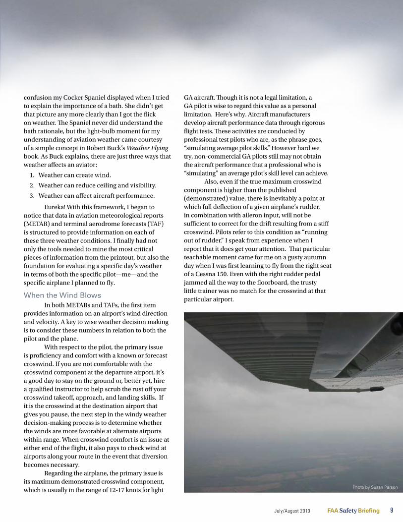
Also, even if the true maximum crosswind component is higher than the published (demonstrated) value, there is inevitably a point at which full deflection of a given airplane’s rudder, in combination with aileron input, will not be sufficient to correct for the drift resulting from a stiff crosswind. Pilots refer to this condition as “running out of rudder.” I speak from experience when I report that it does get your attention. That particular teachable moment came for me on a gusty autumn day when I was first learning to fly from the right seat of a Cessna 150. Even with the right rudder pedal jammed all the way to the floorboard, the trusty little trainer was no match for the crosswind at that particular airport.
Photo by Susan Parson
10 FAA Safety Briefing July/August 2010
Bottom line: Regardless of pilot proficiency in crosswind flying, it is also critical to consider whether the airplane is up to the challenge. A crosswind that is perfectly manageable in the beefy twin-engine Piper Aztec may well be too much for a tiny two-seat trainer.
Flying BlindThe next component of METAR and TAF
reports ceiling and visibility, conditions that are the primary reason for learning to fly by reference to instruments. For legal instrument flying, an aircraft must be properly equipped and certified for IFR. Since, regardless of equipment, the airplane itself is not affected by the presence of clouds and precipitation, weather decision making in this area most logically focuses on the pilot.
For legal operation in instrument meteorological conditions (IMC), a pilot must be both instrument rated and instrument current in accordance with Title 14 Code of Federal Regulations section 61.57. For safe operation in IMC, though, the pilot must also be proficient in basic attitude flying, instrument operating rules and procedures, course intercepts and tracking, holding, approaches, and all other aspects of instrument flying.
The existence of the IFR currency requirement bespeaks the perishable nature of instrument flying skills. As many pilots have
discovered, though, maintaining just the legal minimum requirement for currency may not be enough for proficiency and confidence. If you haven’t flown in IMC recently, or if you have any doubts about your proficiency level, it behooves you to get some practice with a safety pilot or, better yet, some dual instrument-refresher training with a qualified instrument instructor.
Let’s assume you are rated, current, and proficient. Is that enough? Another part of being proficient and safe in IMC is knowing and adhering to your individual personal minimums. One way to approach this important task is to consider—honestly—how comfortable and proficient you are in the basic weather categories for aviation. VFR, marginal VFR (MVFR), IFR, and low IFR (LIFR). Be sure to account for day versus night operations in each category. For instance, I am very comfortable flying in day MVFR in my home airspace, but night is a different story. My own personal minimums also prohibit intentional operation into LIFR conditions. The minimums I set for IFR vary according to how much recent time I have flying in IMC, and how recently I have practiced flying instrument approaches. (Note: For specific tips and techniques for developing your own personal minimums see “Getting the Maximum from Personal Minimums” in the May/June 2006 issue of FAA Aviation News.)
The Little Engine That Couldn’t The third major way that weather
affects aviators is through its impact on aircraft performance. The temperatures in METARs, TAFs, and winds and temperatures-aloft reports can give you a good indication of two weather phenomena that will undoubtedly sap your airplane’s operating capability: icing and high density altitude.
An airplane is a machine, and all machines have performance limits. Consequently, a vital part of deciding whether to fly in weather likely to include such performance-reducing elements as icing or high-density altitude is to have a rock-solid understanding of what your airplane can—and cannot—do. The best piloting skills in the world cannot overcome the airplane’s physical performance limitations. Think of it this way: Even if you are super pilot, there are hard limits on what you can expect when flying a Super Cub.
Pho
to b
y H
Dea
n C
ham
berla
in
July/August 2010 FAA Safety Briefing 11
FAA
pho
to
A word about performance calculations: If the ground school memory of doing triple interpolations to calculate a two-foot difference in takeoff distance has discouraged you from regular use of the performance charts for your aircraft, rest assured there is an easier way. Simply use the next highest numbers shown on the chart to get a “ballpark” estimate, and then add a 50–100 percent safety margin.
For the purists: Yes, precision is important, but only to a point. If you calculate a takeoff distance of 1,242 feet in high-density altitude conditions and the last two feet (or even the last 42 feet) really make a difference in whether you can operate or not, you should stop and consider whether it is wise to fly at all in those conditions. As the saying goes, there are no emergency takeoffs.
Learning after LandingA final thought: When you complete a
challenging flight in weather, you may want nothing more than to go home and unwind. The immediate post-flight period, however, is one of the best opportunities to increase the weather knowledge and understanding that will guide effective decision making. Make it a point to learn something from every weather encounter. At the end of a flight involving weather, take a few minutes to mentally review the flight you just completed and reflect on what you learned from this experience.
Still another way to develop your weather experience and judgment is simply to observe and analyze the weather every day. When you look out the window or go outside, observe the clouds. What are they doing? Why are they shaped as they are? Why is their altitude changing? This simple habit will help you develop the ability to read clouds and understand how shape, color, thickness, and
altitude can be valuable weather indicators. As your cloud-reading skill develops, start trying to correlate the temperature, dew point, humidity, and time of day to the types of clouds that have formed. Take note of the wind, and try to visualize how it wraps around a tree or whips around the corner of a building. This exercise will help you become more aware of wind at critical points in your flight.
Weather is a fact of life for pilots. Developing your weather knowledge and expertise is well worth the time and effort you put into it, because weather wisdom will help keep you—and your passengers—safe in the skies.
Susan Parson ([email protected])) is a Special Assistant in the FAA’s Flight Standards Service. She is an active general aviation pilot and flight instructor.
For More Information
General Aviation Pilot’s Weather Guide http://www.hf.faa.gov/WeatherDecisionGuide/preflight.aspx
General Aviation Pilot’s Guide to Preflight Weather Planning, Weather Self-Briefings, and Weather Decision Makinghttp://www.faa.gov/PILOTS/safety/media/ga_weather_decision_making.pdf
Best Practices for Mentoring in Flight Instructionhttp://www.faa.gov/training_testing/training/media/mentor-ing_best_practices.pdf
Getting the Maximum from Personal Minimumshttp://www.faa.gov/news/safety_briefing/2006/media/mayjun2006.pdf
If you are not comfortable with the crosswind component, hire a qualified instructor to help scrub the rust off your crosswind takeoff, approach, and landing skills.
Pho
to b
y H
Dea
n C
ham
berla
in

Climbing into Thin AirThe dangers of density altitude
T om hoF F m A n n
12 FAA Safety Briefing July/August 2010
There is a thief among us! Without warning, it can sneak into your airplane and rob you of precious lift, thrust, and power. And, if you’re not careful, it can quickly put you in a deadly spot during your next flight.
The culprit here is not something particularly obvious, nor is it something pilots who routinely fly at or near sea level are used to dealing with. but ask any high-altitude mountain flyer, and that pilot will be sure to offer firsthand accounts of the invisible danger that lurks in the long, hot days of summer—density altitude.
Consider the following report, taken from an nTSb accident narrative, which exposes the dangers of this silent, but deadly, hazard that often becomes apparent only after it’s too late:
Photo by H
Dean C
hamberlain
Photo by Jam
es William
s

On August 20, 2008, at 1028 MST, a Piper Cherokee sustained substantial damage after a collision with terrain shortly after takeoff approximately one mile north of Arizona’s Springerville Municipal Airport (KD68). The two occupants, a private pilot and passenger, were both killed.
Witnesses first reported the pilot having aborted a takeoff attempt from runway 21. The pilot then taxied back to the parking area and claimed that the airplane had a flat tire(s). Inspection of the tires revealed that they were not flat, and so the pilot taxied back for takeoff, this time on runway 03. The airplane then appeared to “porpoise” during the takeoff roll and became airborne about midfield. Another witness stated that shortly after liftoff the airplane appeared to be flying “sideways” when it suddenly rolled to the right, pitched to a nose-low attitude, and impacted terrain.
NTSB’s finding on the probable cause for the above accident was the pilot’s failure to attain and maintain an adequate airspeed during takeoff in high density-altitude conditions, which resulted in an aerodynamic stall. Using the reported temperature (24 degrees Celsius) and altimeter setting (30.25 inches Hg), the airport at the time of the accident showed a density altitude of 9,476 feet, nearly 2,500 feet higher than field elevation. The example also shows how misleading the effects of high density altitude are, given the pilot’s decision to abort the takeoff after suspecting a flat tire. The aircraft’s sluggish performance was an important clue that, had it been explored more, may have saved the pilot’s life.
The Lowdown on High Density AltitudeBy definition, density altitude is pressure
altitude corrected for nonstandard temperature. Aviation author Richard L. Collins provides an easier-to-understand definition. Collins explains density-altitude is the “only altitude understood by your airplane.” What both definitions refer to requires a clear understanding of the relationship between pressure and temperature in the earth’s atmosphere. When density altitude is high as a result of temperatures above standard at a given altitude, the air is less dense than normal. As a result, your aircraft will perform as if at a higher altitude with
degraded climb performance and acceleration. So, instead of being a measure of height, think of density altitude more as a measure of aircraft performance.
As air becomes less dense it reduces:
Lift (because the thin air exerts less force on •the airfoils)
Thrust (because a propeller is less efficient in •thin air)
Power (because the engine takes in less air)•
As you can imagine, reducing any one of these components creates the potential for disaster, especially on a short runway with 50-foot pine trees looming at the end. Add to that equation a crosswind and a gross weight close to limits and things can quickly get interesting.
The impact of density altitude underscores the need to make it part of the preflight planning process, regardless of where you fly. Even a low-elevation airport under the right conditions can be cause for a much-longer-than-anticipated takeoff roll.
High, Hot, and HumidThree key factors contribute to high density
altitude: altitude, temperature, and humidity. The more your flight conditions lean toward the higher
July/August 2010 FAA Safety Briefing 13
Pho
to b
y Ja
mes
Will
iam
s
end of each (i.e., high, hot, and humid) the greater the performance-robbing effects you’ll notice. On the flip-side, a cold dry day at a low altitude is where light planes perform best.
Keep in mind that air, as a gas, is compressed more towards the surface of the earth where it has greater density. Conversely, the farther away from the surface the less pressure is exerted, which produces air that is less dense.
When factoring temperature, a different relationship exists. Rising temperatures usually
indicate a decrease in density: The warmer the air, the less dense it is. For example, an aircraft taking off at an airport at
2,000 feet above sea level on a 90-degree F day would actually “think” it is taking off at an altitude of 4,400 feet, more than twice the actual altitude.
Although it does not have as great of an impact on performance as altitude and temperature, humidity must also be considered. Moist air is less dense than dry air. High temperatures also allow air to hold more water vapor so these two factors can work together to decrease aircraft performance. For example, at 96 degrees F, the water vapor content of the air can be eight times as great as at 42 degrees F. If your flight conditions call for operations in hot and humid areas, plan for a decrease in performance. Here’s a good Web site for calculating the effects of humidity on density altitude: http://wahiduddin.net/calc/density_altitude.htm.
Calculate Before You AviateNow that we know how damaging the effects
of density altitude can be on aircraft performance, let’s take a look at how to run the numbers. One formula to derive density altitude in feet is: OAT
(outside air temperature) – ISA (standard air temperature) x 120 + pressure altitude
in feet (determined by the altitude displayed after setting your altimeter to 29.92). Your trusty E6B can also run the calculation for you after you enter pressure altitude and OAT. Using this information in conjunction with your aircraft’s pilot operating
handbook (POH) performance charts will help you calculate your adjusted takeoff roll and climb rate.
Another way to calculate the effects of density altitude is with a Koch Chart (see Figure 1). Use a line to connect the airport temperature (on the left) with airport pressure altitude (on the right) assuming sea-level conditions for both. Where the line intersects the middle scale will indicate how much of a climb performance decrease to expect, as well as what percentage to add to your normal takeoff distance. Remember, this method will supply only generic information; you should reference your POH to calculate performance data specific to your aircraft.
Keep Your CoolOne of the easiest ways to avoid falling victim
to density altitude is to avoid takeoffs and landings at midday, when temperatures are usually at their highest. Take advantage of cooler mornings or evenings when the effects of high density altitude are not as pronounced.
Weight is another issue that can negatively affect performance, but is something over which a pilot has more control. Keeping aircraft gross weight down can afford a pilot more flexibility when dealing with a high, hot, and humid situation. That may mean taking less fuel and cargo and/or fewer passengers.
Another item often overlooked in high density-altitude situations, especially for someone used to flying at lower elevations, is to adjust the mixture control on takeoff to maximize engine power. Consult your POH for the best mixture setting given the conditions at your airport.
Finally, as with any flight, be sure to plan for performance. Study the conditions of your flight and
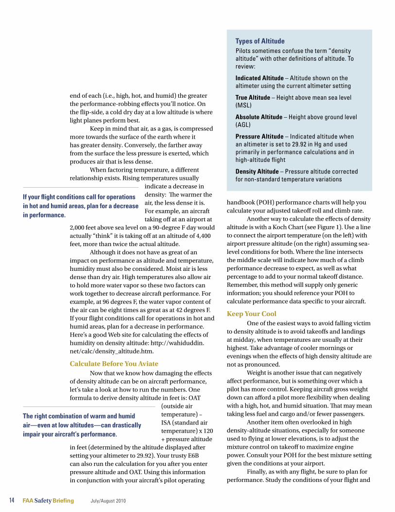
Types of AltitudePilots sometimes confuse the term “density altitude” with other definitions of altitude. To review:
Indicated Altitude – Altitude shown on the altimeter using the current altimeter setting
True Altitude – Height above mean sea level (MSL)
Absolute Altitude – Height above ground level (AGL)
Pressure Altitude – Indicated altitude when an altimeter is set to 29.92 in Hg and used primarily in performance calculations and in high-altitude flight
Density Altitude – Pressure altitude corrected for non-standard temperature variations
If your flight conditions call for operations in hot and humid areas, plan for a decrease in performance.
The right combination of warm and humid air—even at low altitudes—can drastically impair your aircraft’s performance.
14 FAA Safety Briefing July/August 2010

15 FAA Safety Briefing July/August 2010
do the math to see how much runway you’ll need for takeoff. The reduction of power and lift may require a takeoff roll longer than normal, causing some pilots to rotate too early and exacerbate an already sticky situation. Also, note how climb rates and landing distances may be affected. The NTSB accident reports include too many examples of tragedies that could have been easily avoided had pilots planned better before their flights.
“Density altitude is not just a concern for flying in the mountains,” says FAASTeam National Outreach Manager Bryan Neville. “Hot temperatures can have an affect at any altitude.” Neville, a former adjunct aviation professor and flight instructor with experience at both high-and low-elevation airports, suggests becoming familiar with the weight-and-balance and the performance and limitations sections of your POH or airplane flight manual.
While the effects of density altitude are more pronounced at higher elevations, the right combination of warm and humid air—even at low
altitudes—can drastically impair your aircraft’s performance and easily push an aircraft beyond its limits. Recognizing these limitations and keeping them a part of your preflight planning process will help keep you cool and dry, but, most importantly, safe.
Tom Hoffmann is associate editor of FAA Safety Briefing. He is a commercial pilot and holds an A&P certificate.
Figure 1 – Koch Chart
Subscribe Today!
FAA Safety Briefing is available as an annual subscription from the Government Printing Office. There are three ways to sign up today!
By Internet at: •http://bookstore.gpo.gov/actions/ GetPublication.do?stocknumber= 750-002-00000-5
By contacting GPO •toll free at: 1-866-512-1800
By using the order form in the •center of this magazine.

16 FAA Safety Briefing July/August 2010
In the best known verse of his Rime of the Ancient Mariner, the English poet Samuel Taylor Coleridge laments the paradox of “water, water, everywhere…nor any drop to drink.” A modern author, Barry Schwartz, addresses this irony of abundance in his 1994 book about The Paradox of Choice. Schwartz suggests that since the wealth of options available in everything, from a college curriculum to the corner supermarket, requires more time to make choices, we have less time to do what is most important.
The irony of abundance, that is, the notion that more is sometimes less, is very familiar to aviators trying to imbibe droplets of useful weather information from the fire hose of available data. It can be very difficult to screen out non-essential data, focus on key facts, and correctly evaluate the resulting risk.
Sipping from a GlassDirecting the fire-hose information flow into
a more manageable “drinking glass” is the goal of an FAA Web site document called the General Aviation
Pilot’s Guide to Preflight Weather Planning, Weather Self Briefings, and Weather Decision Making. Developed under the auspices of the government-industry General
Aviation Joint Steering Committee, this guide uses the FAA Safety Team’s Perceive – Process – Perform risk-management framework as a template for preflight weather planning and in-flight weather decision making.
The basic steps of the framework are:Perceive weather hazards. First, obtain
information from sources such as those described in the GA Pilot’s Guide and in the “Smart Self Briefings” article on Internet weather resources (page 17) as well as through on-board resources, such as datalink (page 20). Know the source of your weather data and understand its limitations.
Process this information. This step provides the essential connection between merely obtaining
weather information and doing the right thing with it. The key is an unflinchingly honest evaluation of what the specific pilot and the specific aircraft can do as a team in the current and forecast weather conditions. Not all combinations of pilot and plane can function safely in every type of weather.
Perform by eliminating or mitigating the risk. Once you have the information and determine its relevance, you need to execute a safe decision, even if it disappoints or inconveniences passengers and/or people waiting on the ground. Having some of these decisions made in advance through pre-developed personal minimums can be a big help. (See the May/June 2006 issue of the FAA Aviation News for more on developing personal minimums.)
Cross-Check, Interpret, ControlYou might think of these steps as the
decision-making equivalent of basic instrument- flying skills: cross-check (perceive), interpret (process), and control (perform). Just as the cross-check, interpret, and control activities are a continuous process, the tasks of perceiving weather (what can hurt me?), processing its impact (how can it hurt me?), and performing the appropriate action (how can I stay safe?) is an ongoing cycle.
Susan Parson ([email protected]) is a special assistant in the FAA’s Flight Standards Service. She is an active general aviation pilot and flight instructor.
It can be difficult to screen out non-essential data, focus on key facts, and correctly evaluate the risk resulting from a given set of weather data.
For More Information
General Aviation Pilot’s Guide to Preflight Weather Planning, Weather Self-Briefings, and Weather Decision Makinghttp://www.faa.gov/pilots/safety/media/ga_weather_decision_making.pdf
Online version of General Aviation Pilot’s Weather Guidehttps://hfskyway.faa.gov/hfskyway/weather.aspx
Risk Management Handbookhttp://www.faa.gov/library/manuals/aviation/media/FAA-H-8083-2.pdf
S uS A n PA r S on
ChecklistOvercoming the Fire-Hose Effect
July/August 2010 FAA Safety Briefing 17
Maximizing Internet Resources Smart Self Briefings
m e r e di T h S A i n i
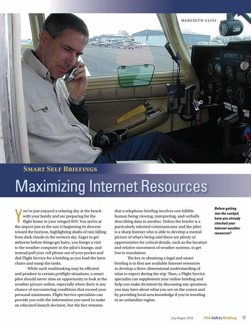
You’ve just enjoyed a relaxing day at the beach with your family and are preparing for the flight home in your winged SUV. You arrive at
the airport just as the sun is beginning its descent toward the horizon, highlighting shafts of rain falling from dark clouds in the western sky. Eager to get airborne before things get hairy, you forego a visit to the weather computer in the pilot’s lounge, and instead pull your cell phone out of your pocket and dial Flight Service for a briefing as you load the lawn chairs and sump the tanks.
While such multitasking may be efficient and prudent in certain preflight situations, a smart pilot should never miss an opportunity to look at the weather picture online, especially when there is any chance of encountering conditions that exceed your personal minimums. Flight Service specialists can provide you with the information you need to make an educated launch decision, but the fact remains
that a telephone briefing involves one fallible human being viewing, interpreting, and verbally describing data to another. Unless the briefer is a particularly talented communicator and the pilot is a sharp listener who is able to develop a mental picture of what’s being said there are plenty of opportunities for critical details, such as the location and relative movement of weather systems, to get lost in translation.
The key to obtaining a legal and smart briefing is to first use available Internet resources to develop a three-dimensional understanding of what to expect during the trip. Then, a Flight Service specialist can supplement your online briefing and help you make decisions by discussing any questions you may have about what you see on the screen and by providing local area knowledge if you’re traveling in an unfamiliar region.
Photo by Susan Parson
Before getting into the cockpit, have you already checked your Internet weather resources?

Each pilot in command shall, before beginning a flight, become familiar with all available information concerning that flight.
http://www.duat.com
18 FAA Safety Briefing July/August 2010
Briefing BasicsBefore we explore
how to get a weather briefing online, let’s review what a briefing is and what’s required of the pilot. Title 14 Code of Federal Regulations section 91.103 states, “Each pilot in command shall, before beginning a flight, become familiar with all
available information concerning that flight.” All available information, a wide swath of data, must include weather reports and forecasts for an IFR flight or any flight “not in the vicinity of the airport.” This regulation does not state specifically how the pilot should obtain this information or from what source, but the FAA’s Aeronautical Information Manual (Chapter 5, Section 1-1, Preflight Preparation) provides pilots with guidance.
FAA Order JO 7110.10U, Flight Services, describes the FAA’s responsibility for providing official weather briefings to pilots. In this context, a briefing is “the translation of weather observations and forecasts, including surface, upper air, radar, satellite, and pilot reports into a form directly usable
by the pilot or flight supervisory personnel to formulate plans and make decisions for
the safe and efficient operation of aircraft. These briefings shall also include information on NOTAM, flow control, and other items as requested.”
The FAA has established agreements with three private companies that are authorized to provide official briefings to pilots: Lockheed Martin Flight Services (AFSS, via telephone at 800-WX-BRIEF); Data Transformation Corporation, or DTC (via the Internet at www.duat.com); and Computer Sciences Corporation, or CSC (www.duats.com). The term Direct User Access Terminal Service (DUATS) refers to either the DTC or CSC product, both of which allow a pilot to access FAA data (via HTTP or Telnet) to obtain weather and aeronautical information and to file, amend, and cancel domestic IFR and VFR flight plans.
Getting Weather OnlineTo get an online weather briefing, sign up
for a free user account on either the CSC or the DTC DUATS Web site, or try them both and see which one you prefer. Because they are independent companies, their Web sites each have a unique look and feel, but they offer the same required information. There are also many commercial products and Web sites—even a few iPhone applications—that can access DUATS electronically to obtain an official weather briefing, and display the information in both text and graphical form. Some of these Web sites may charge subscription fees, but as the old saying goes, you get what you pay for—and sometimes, you may get less. The choice is yours.
The Aviation Digital Data Service (ADDS) Web site (http://adds.aviationweather.noaa.gov), maintained by the National Weather Service, does not offer an official pilot-briefing product but does provide an excellent way for pilots to view current weather conditions and forecasts, pilot reports, radar and satellite images, and icing probability graphics. The ADDS online tools serve as an excellent supplement to the textual weather information delivered by DUATS. You can, however, view “unofficial” graphical versions of each of the standard briefing required elements at http://aviationweather.gov/std_brief.
One of my favorite features of ADDS is the interactive METAR Java tool (http://aviationweather.gov/adds/metars/java). Use your mouse to draw a box around the section of the map that you’re interested in, and the page will reload with a new map based on your selection with METARs plotted for each airport. It’s a quick and easy way to see where VFR conditions exist, as well as the strength and direction of the surface winds. You can also click on the TAFs box to overlay Terminal Area Forecasts on the map.
When your briefing includes an AIRMET for icing along the route, check out the Supplementary Icing Information products on ADDS, which include the Current Icing Product (CIP) and Forecast Icing Potential (FIP) product. These color-coded maps can provide additional clues about the likelihood of encountering icing conditions at various altitudes. Pilots can use this site in concert with the upper air

temperature and dew point plots available at http://rucsoundings.noaa.gov. This Web site can seem a bit daunting if you’ve never used it before, so, if you’re a newbie to the Web site, scroll down to the bottom of the home page and click on the link for the tutorial.
Needling Through NOTAMsDepending on what sort of mood you happen
to be in at the moment, reading through the pages of NOTAMs that are included in a typical DUATS standard briefing can either be an opportunity to learn or the catalyst for a headache. Most people within the aviation industry agree that the NOTAM system is badly in need of an overhaul, and the good news is that the FAA is actively working on a better solution. Meanwhile, pilots who use DUATS to get a briefing online need a strategy for filtering out the nuggets of NOTAM that are potential deal breakers for a flight—such as NAVAID or GPS outages.
Here’s what I do. I cut and paste the entire text of my standard briefing output into a text editing document, and then do a search for the names of the airports, NAVAIDs, and airways that define my route of flight. This method reduces the likelihood that I’ll miss something in a straight visual scan of the text, and also allows me to delete NOTAMs that I determine are irrelevant. Remember that you can also limit the number of non-applicable NOTAMS by tailoring the width of the route when you request weather-briefing data.
Another way to get the same information in a more user friendly way is to visit the FAA’s NOTAM Web site, PilotWeb (https://pilotweb.nas.faa.gov/PilotWeb). PilotWeb is an official FAA Web site, but it does not provide a complete briefing including weather (though there are links to weather sites including ADDS). While the PilotWeb information may be considered reliable, the Web site does contain a disclaimer pointing pilots to Flight Service for official data.
I normally visit PilotWeb the day before I plan to depart on a cross-country flight to find out if any NAVAID or other facilities are unusable, or if any Temporary Flight Restrictions (TFR) are expected along my route. If I see something potentially problematic, it gives me extra time to develop an alternate route or, in the case of a large TFR, to modify my departure time. You can also visit the
FAA’s Graphical TFR Web site (http://tfr.faa.gov) to read the textual description of a TFR, and view its lateral limits overlaid on a sectional chart or custom map.
Bringing It All TogetherFlying was arguably
much simpler back in the days before the Internet, GPS, multifunction cockpit displays, and roaming presidential TFRs. With information comes complexity, but also choice and, if used properly, increased safety. The FAA’s increasingly broad use of the Internet to disseminate weather and other information is an indicator that the days of the teletype machine are long gone. Pilots should know how to get a weather briefing online and how to find supplementary information on trusted Web sites. Still, sometimes there is just no substitute for a one-on-one conversation with a trained and experienced human being—so make sure AFSS is programmed into your cell phone’s speed dial.
Meredith Saini is a flight instructor and active general aviation pilot in the Washington, DC, area.
With information comes complexity, but also choice and, if used properly, increased safety.
Useful Web sites
http://www.duat.com
http://www.duats.com
http://adds.aviationweather.noaa.gov
http://aviationweather.gov/std_brief
http://aviationweather.gov/adds/metars/java
http://rucsoundings.noaa.gov
https://pilotweb.nas.faa.gov/PilotWeb
http://tfr.faa.gov
http://aviationweather.gov/products/ncwf/
July/August 2010 FAA Safety Briefing 19

D atalink is an industry term that many, including pilots, aviation journalists, and manufacturers, use to describe a wide range of equipment and
services that all do one basic thing—get data into the cockpit so that the pilot can use it to make decisions. The technology is relatively new and evolving so rapidly that we can’t even agree on how to spell it or define it, let alone use it.
In the context of aviation weather information, datalink (or data link, if you prefer)
refers to a service that uses a satellite antenna mounted on the aircraft, together with avionics in the cockpit, to receive, process, and display data
such as NEXRAD radar, winds aloft, meteorological reports (METAR) and terminal aerodrome forecasts
(TAF), freezing levels, and cloud coverage. The data are available through a commercial subscription service (such as WSI or Sirius XM) or from FAA through the Automatic Dependent Surveillance-Broadcast (ADS-B) network. (See the May/June 2010 issue of FAA Safety Briefing or www.faa.gov for more information on ADS-B services.)
This graphical and textual weather information can be displayed on a panel-mounted multifunction display (MFD) or moving-map GPS, as well as on many portable GPS devices. If you’ve ever used one of these tools to obtain weather information during a flight when severe weather was a factor, you’ve likely experienced the temptation to dodge around the nasty stuff using the animated color images. The main problem with using datalink weather products for tactical weather avoidance is that, much like network television, there is a built-in delay between reality and what you are seeing on the screen. For ATC radar, there can be a three- to five-minute delay from the time precipitation is sensed until it appears on the display. Bear in mind that this delay is in addition to the data “age” value shown on the MFD.
Develop a StrategyThere I was in Hilton Head, South Carolina,
on a blistering hot afternoon last summer, sitting in the left seat of a Cirrus SR22 with the left door open and my right ear glued to my cell phone. The Flight Service briefer on the other end of the line told me about multiple areas of developing severe thunderstorms along my route of flight back to
datalink Weather
do’s and don’ts m e r e di T h S A i n i
for
20 FAA Safety Briefing July/August 2010
The main problem with using datalink for tactical weather avoidance is that there is a built-in delay between reality and what you see on the screen.
Pho
to c
ourt
esy
of G
arm
in
Pho
to c
ourt
esy
of G
arm
in

Gaithersburg, Maryland, which would take me northeast along the Atlantic Coast past Myrtle Beach and Wilmington before turning north toward Norfolk, then northwest over Baltimore.
I could see the thunderstorms on the MFD, and I let the briefer know that I had the benefit of a datalink display. My strategy for avoiding convective weather during the flight involved booting up the avionics, downloading the datalink weather, and entering my flight plan route into the GPS before ever starting the engine or calling Flight Service. This enabled me to see the weather overlaid on the MFD map display while I was talking to the briefer and know immediately if the route I intended to fly would keep me clear of storms. If not, I could file a different route, start the engine, contact ground for an IFR clearance, and modify the flight plan, if needed, all within a few minutes.
The NEXRAD picture gave me confidence that the first 150 miles or so of the trip would be clear of weather, with downloaded METARs showing scattered cumulus clouds between 4,000 and 8,000 feet. I determined from looking at the moving-map display (which was not yet moving since I was still on the ground) that the decision point for me to continue as filed or ask ATC for a reroute around the weather would likely arrive as I approached Myrtle Beach. With that strategy, I took off into the hazy sky and began looking out the window for evidence of towering cumulonimbus clouds.
There were plenty of them. Leveling off in cruise at 7,000 feet, I was above the scattered layer, but as I expected, by the time I reached Myrtle Beach the clouds had thickened and grown high around me. I was still clear of clouds and could see the tops of most of them, but it was obvious that if I continued northeast along the coast I would likely enter instrument conditions and lose visual contact with the storms. My goal was to remain in visual conditions for as long as possible, so that I could see the tops and use the MFD weather display to verify the storms’ intensity and relative movement. This would give me the information I would need to ask ATC for a different routing.
Using Data to Modify the PlanHaving used the datalink weather picture to
confirm my decision to deviate around the storms
ahead, I contacted Myrtle Beach Approach and asked for direct Fayetteville, which would put me squarely in between two clusters of thunderstorms, with about 40 miles of clearance on either side of my flight path—twice the recommended 20-mile lateral clearance. Based on my current ground speed I was confident that I could reach Fayetteville before the gap had a chance to close in because the storm track vector on the MFD weather page indicated that the cells were moving eastward relatively slowly. I knew that, if by the time I got there it looked questionable to the north, I could just land at Fayetteville and wait it out.
In preparation for a possible approach into Fayetteville, I pulled up the airport-facility information on the MFD and briefed the instrument approach plate electronically as well. Datalink weather is great on its own, but it’s even better when used in conjunction with a suite of other electronic-information products.
Fortunately for me, the storms behaved as I expected they would and, by the time I reached Fayetteville, the route to Gaithersburg was already mostly clear. As I flew north past Richmond, I could see the sheared-off anvil-head tops of recently deceased thunderstorms to the west, backlit by the setting sun. Not only was it an incredibly beautiful
An Avidyne display showing datalink weather.
July/August 2010 FAA Safety Briefing 21
While every datalink weather display uses the same NWS data, variations exist in the way weather data are sliced, diced, and displayed.
Photo by Meredith Saini

sight, but the NEXRAD on the MFD showed no activity in that direction, which confirmed what I saw out the left window and gave me confidence to continue. About 45 minutes later, I landed in Gaithersburg, successfully completing a mission that would have been considerably more challenging without the availability of datalink weather.
Interpreting the PictureWhile it’s true that every datalink
weather display uses the same set of data produced by the National Weather Service (NWS), variations exist in the way weather data are sliced, diced, and displayed by the manufacturer—and these differences are not always intuitive.
For example, on one MFD product, blue METAR flags over an airport represent VFR conditions whereas green flags represent marginal VFR conditions. When I first saw this depiction, I assumed that the green flags indicated the best weather, because the NWS uses green to represent VFR conditions in its online products. The moral of the story is that you need to learn each manufacturer’s color and symbology conventions, but it is generally the case that greens and cool colors represent non-threatening weather, while reds and warm colors represent weather that pilots should avoid.
Other datalink weather graphics that are available on many MFD brands include cloud cover and cloud tops, winds-aloft forecasts, freezing levels, and lightning strikes. The latter can be used in conjunction with a separate onboard lightning-strike detector to determine the relative position and
intensity of convective activity. Terminal and area forecasts may also be available in a raw text format.
Strategic, Not TacticalPilots must understand the limitations of any
datalink weather product before using it to make strategic in-flight decisions. For example, in addition to the inherent processing delay, the collection and delivery of NEXRAD data from ground stations can be affected by interference from buildings or terrain. Most datalink weather displays will provide some indication of the age of the data. This is especially important when using a textual METAR to determine whether a visual or an instrument approach will be required or to even make an early decision to divert to an alternate airport.
With so many datalink weather products available in the general aviation cockpit today, it’s easy for a pilot to get complacent about preflight planning. Just remember that regardless of how many full-color displays you have working for you, it’s still your responsibility to obtain a standard briefing—which includes NOTAMs and other critical information—before any flight.
Meredith Saini is a flight instructor and active general aviation pilot in the Washington, DC, area.
Different manufacturers use different color coding to depict the weather.
22 FAA Safety Briefing July/August 2010
For More Information
General Aviation Pilot’s Guide to Preflight Weather Planning, Weather Self-Briefings, and Weather Decision Makinghttp://www.faa.gov/pilots/safety/media/ga_weather_decision_making.pdf
Pilot’s Handbook of Aeronautical Knowledge, Chapter 12, Aviation Weather Serviceshttp://www.faa.gov/library/manuals/aviation/pilot_handbook/media/PHAK%20-%20Chapter%2012.pdf
NWS METAR color-coding legendhttp://aviationweather.gov/adds/metars/description_ifr.php
Avidyne Entegra’s METAR color codinghttp://www.avidyne.com/products/ex5000/datalink.asp
Cirrus Perspective Pilot’s Guide – page 297 shows NEXRAD intensity legendhttp://www8.garmin.com/manuals/CirrusPerspective_PilotsGuide_0764.06orlater_.pdf
Pho
to c
ourt
esy
of A
vidy
ne
Photo courtesy of Garmin

Diversion Decisions
What can ATC do for me?There is an expression among pilots who fly airplanes with retractable gear, and it goes something like this: “There are those who have and those who will.” It refers to landing with the gear up, and some folks believe that the chances are good that a pilot flying an airplane with retractable gear will, at some point, land with the gear up.
The same principle holds for flight into adverse weather. Unless you restrict your flying to a simulator, it is likely that, at some point, you will find yourself in weather conditions that were not forecast or expected. Having seen this situation from both sides of the microphone, as a pilot and as an air traffic controller, I can offer my fellow aviators a few observations and tips for mitigating the risk if and when it happens to you.
e l l e n C ru m
FAA Safety Briefing 23July/August 2010
Pho
to c
ourt
esy
of M
oone
y
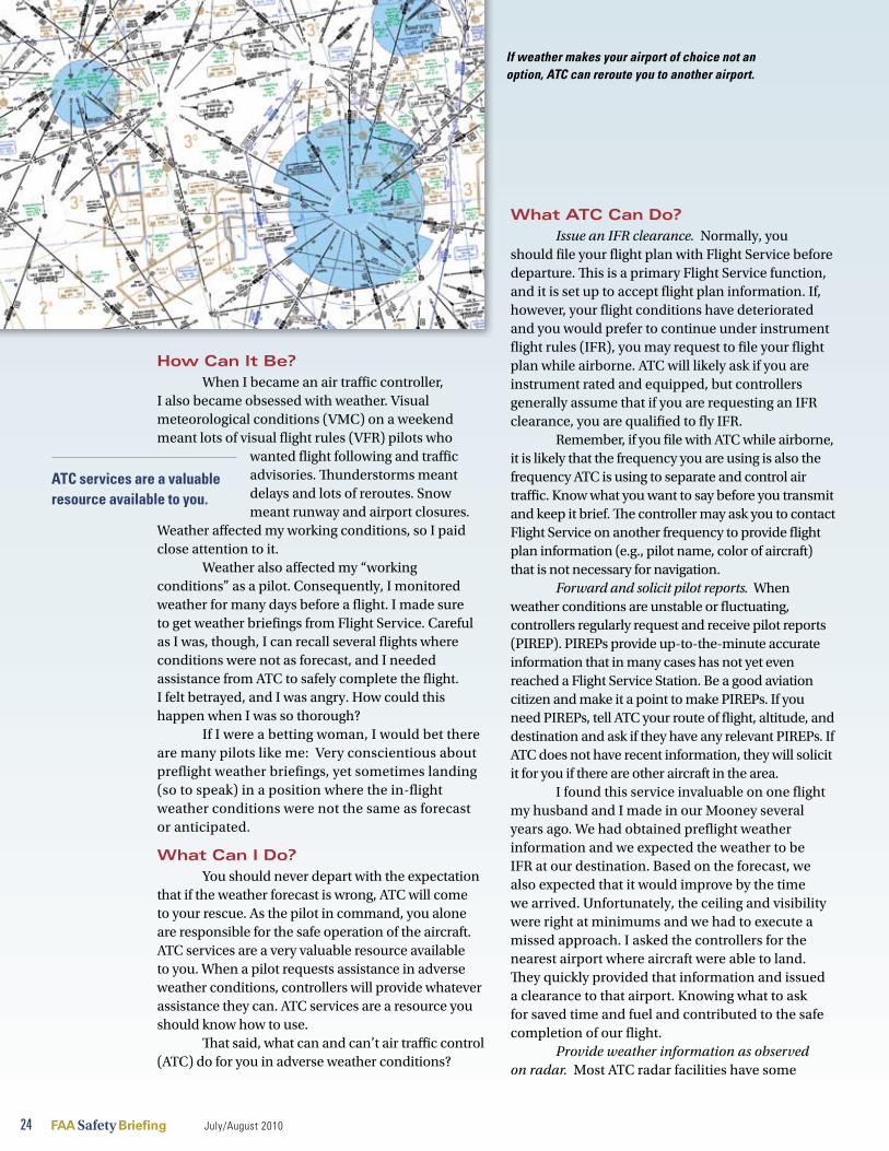
24 FAA Safety Briefing July/August 2010
How Can It Be?When I became an air traffic controller,
I also became obsessed with weather. Visual meteorological conditions (VMC) on a weekend meant lots of visual flight rules (VFR) pilots who
wanted flight following and traffic advisories. Thunderstorms meant delays and lots of reroutes. Snow meant runway and airport closures.
Weather affected my working conditions, so I paid close attention to it.
Weather also affected my “working conditions” as a pilot. Consequently, I monitored weather for many days before a flight. I made sure to get weather briefings from Flight Service. Careful as I was, though, I can recall several flights where conditions were not as forecast, and I needed assistance from ATC to safely complete the flight. I felt betrayed, and I was angry. How could this happen when I was so thorough?
If I were a betting woman, I would bet there are many pilots like me: Very conscientious about preflight weather briefings, yet sometimes landing (so to speak) in a position where the in-flight weather conditions were not the same as forecast or anticipated.
What Can I Do?You should never depart with the expectation
that if the weather forecast is wrong, ATC will come to your rescue. As the pilot in command, you alone are responsible for the safe operation of the aircraft. ATC services are a very valuable resource available to you. When a pilot requests assistance in adverse weather conditions, controllers will provide whatever assistance they can. ATC services are a resource you should know how to use.
That said, what can and can’t air traffic control (ATC) do for you in adverse weather conditions?
What ATC Can Do?Issue an IFR clearance. Normally, you
should file your flight plan with Flight Service before departure. This is a primary Flight Service function, and it is set up to accept flight plan information. If, however, your flight conditions have deteriorated and you would prefer to continue under instrument flight rules (IFR), you may request to file your flight plan while airborne. ATC will likely ask if you are instrument rated and equipped, but controllers generally assume that if you are requesting an IFR clearance, you are qualified to fly IFR.
Remember, if you file with ATC while airborne, it is likely that the frequency you are using is also the frequency ATC is using to separate and control air traffic. Know what you want to say before you transmit and keep it brief. The controller may ask you to contact Flight Service on another frequency to provide flight plan information (e.g., pilot name, color of aircraft) that is not necessary for navigation.
Forward and solicit pilot reports. When weather conditions are unstable or fluctuating, controllers regularly request and receive pilot reports (PIREP). PIREPs provide up-to-the-minute accurate information that in many cases has not yet even reached a Flight Service Station. Be a good aviation citizen and make it a point to make PIREPs. If you need PIREPs, tell ATC your route of flight, altitude, and destination and ask if they have any relevant PIREPs. If ATC does not have recent information, they will solicit it for you if there are other aircraft in the area.
I found this service invaluable on one flight my husband and I made in our Mooney several years ago. We had obtained preflight weather information and we expected the weather to be IFR at our destination. Based on the forecast, we also expected that it would improve by the time we arrived. Unfortunately, the ceiling and visibility were right at minimums and we had to execute a missed approach. I asked the controllers for the nearest airport where aircraft were able to land. They quickly provided that information and issued a clearance to that airport. Knowing what to ask for saved time and fuel and contributed to the safe completion of our flight.
Provide weather information as observed on radar. Most ATC radar facilities have some
ATC services are a valuable resource available to you.
If weather makes your airport of choice not an option, ATC can reroute you to another airport.
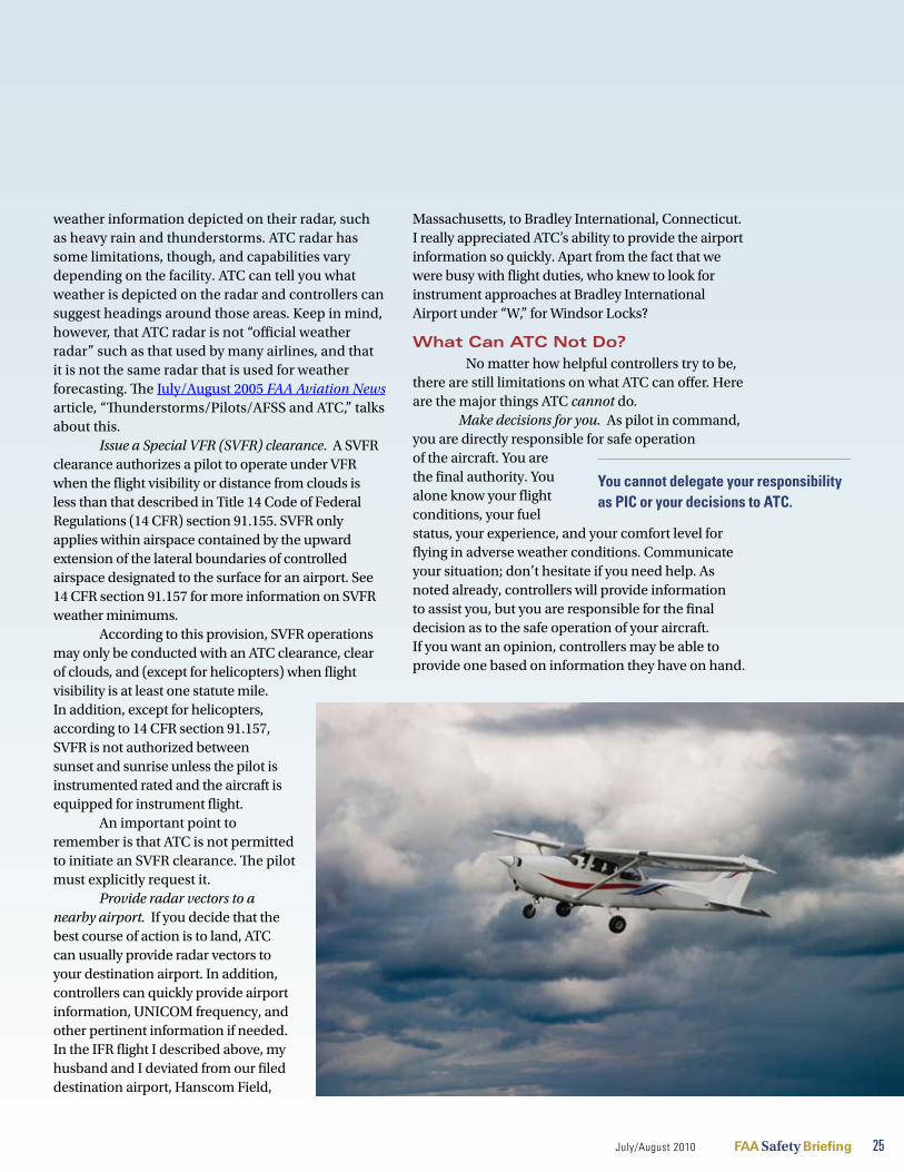
July/August 2010 FAA Safety Briefing 25
weather information depicted on their radar, such as heavy rain and thunderstorms. ATC radar has some limitations, though, and capabilities vary depending on the facility. ATC can tell you what weather is depicted on the radar and controllers can suggest headings around those areas. Keep in mind, however, that ATC radar is not “official weather radar” such as that used by many airlines, and that it is not the same radar that is used for weather forecasting. The July/August 2005 FAA Aviation News article, “Thunderstorms/Pilots/AFSS and ATC,” talks about this.
Issue a Special VFR (SVFR) clearance. A SVFR clearance authorizes a pilot to operate under VFR when the flight visibility or distance from clouds is less than that described in Title 14 Code of Federal Regulations (14 CFR) section 91.155. SVFR only applies within airspace contained by the upward extension of the lateral boundaries of controlled airspace designated to the surface for an airport. See 14 CFR section 91.157 for more information on SVFR weather minimums.
According to this provision, SVFR operations may only be conducted with an ATC clearance, clear of clouds, and (except for helicopters) when flight visibility is at least one statute mile. In addition, except for helicopters, according to 14 CFR section 91.157, SVFR is not authorized between sunset and sunrise unless the pilot is instrumented rated and the aircraft is equipped for instrument flight.
An important point to remember is that ATC is not permitted to initiate an SVFR clearance. The pilot must explicitly request it.
Provide radar vectors to a nearby airport. If you decide that the best course of action is to land, ATC can usually provide radar vectors to your destination airport. In addition, controllers can quickly provide airport information, UNICOM frequency, and other pertinent information if needed. In the IFR flight I described above, my husband and I deviated from our filed destination airport, Hanscom Field,
Massachusetts, to Bradley International, Connecticut. I really appreciated ATC’s ability to provide the airport information so quickly. Apart from the fact that we were busy with flight duties, who knew to look for instrument approaches at Bradley International Airport under “W,” for Windsor Locks?
What Can ATC Not Do? No matter how helpful controllers try to be,
there are still limitations on what ATC can offer. Here are the major things ATC cannot do.
Make decisions for you. As pilot in command, you are directly responsible for safe operation of the aircraft. You are the final authority. You alone know your flight conditions, your fuel status, your experience, and your comfort level for flying in adverse weather conditions. Communicate your situation; don’t hesitate if you need help. As noted already, controllers will provide information to assist you, but you are responsible for the final decision as to the safe operation of your aircraft. If you want an opinion, controllers may be able to provide one based on information they have on hand.
You cannot delegate your responsibility as PIC or your decisions to ATC.

26 FAA Safety Briefing July/August 2010
Nevertheless, never forget that the safe operation of the aircraft is in your hands. You cannot delegate your responsibility as PIC or your decisions to ATC.
Waive regulations. ATC cannot authorize flight in instrument meteorological conditions (IMC) for VFR-rated pilots. If you are not on an IFR flight plan, you must comply with cloud-clearance requirements as contained in 14 CFR section 91.155 on basic VFR weather minimums. If a controller issues a heading that would take you into clouds, the magic word is “unable.” Advise the controller that you are operating under VFR and that the suggested or assigned heading would take you into IMC. Unless you have requested and received an IFR clearance, you must maintain basic VFR weather minimums.
Pay special attention to this fact, because it is all too easy for an IFR-rated pilot to assume it is okay to follow a heading into the clouds. It happened to a friend of mine several years ago. He had recently earned his commercial certificate with instrument rating, and he was carrying his first paying passenger.
There were scattered storms in the area, so he requested radar vectors from ATC.
The assigned heading took him into IMC. Being an instrument-rated pilot, he confidently accepted the heading and told me later what a fine job he had done keeping the aircraft in straight and level flight. When I asked how he flew in clouds while on a VFR flight, he slowly turned beet red as he realized he had not received an IFR clearance. Remember, an assigned heading does not equate to a clearance to fly into IMC!
Initiate a SVFR clearance. This one bears repeating: Controllers are not authorized to initiate a SVFR clearance. The pilot must explicitly request it. Because SVFR operations are conducted in weather conditions that are below basic VFR weather minimums, this particular flight operation is challenging and appropriate only in limited circumstances.
Assume it is an emergency. Pilot requests for assistance due to adverse weather conditions are very common, especially during the hot hazy days of summer. It may feel urgent to you, but it is important
to understand that ATC will not handle your flight as an emergency or give priority, unless you declare an emergency or your radio transmissions lead the controller to believe you are in an emergency situation. Controllers do have the authority to declare an emergency for you if they have reason to believe conditions warrant such action.
This is important: If, as pilot in command, you conclude that an emergency exists, do not hesitate to declare an emergency with ATC. Pilots sometimes fear there is a lot of paperwork associated with declaring an emergency, which they do not want to complete. Although the FAA may request information about the incident in some cases, the benefit far outweighs the risk. Even assuming there is paperwork, which is not necessarily the case, I would rather be safe at home with my family completing a report than flying in adverse conditions with the safe outcome of the flight in question.
Speak Up!As a student pilot, I never tangled with
adverse weather. I left that until after I earned my pilot certificate. Even though I had been a controller for four years at that point, I managed to get lost on at least three different occasions. Each time I had to ask ATC for help. On one occasion, I called Flight Service to close my VFR flight plan and casually mentioned I landed at a different airport than what I had filed. The kind man asked me what I did for a living and when I told him I was an air traffic controller, he laughed and laughed. Later that day, when I had to file my return flight, I got the same gent on the phone. He noted that he would never forget me and said I had made his day. As a controller I was embarrassed to have such poor navigation skills, but a little embarrassment is a small price to pay when your safety is at stake.
In summary, remember the safest course of action is not to continue flight into adverse weather conditions in the first place. But, if you need help, admit it, and contact ATC without delay.
Ellen Crum, a former air traffic controller, works in the FAA’s Air Traffic Airspace and Rules Group. She holds a private pilot certificate with an instru-ment rating.
If, as pilot in command, you conclude that an emergency exists, do not hesitate to declare an emergency with ATC.

July/August 2010 FAA Safety Briefing 27
T om hoF F m A n n
Nuts, Bolts, and ElectronsHailstones, Hitches, and Hauling Windoh, and how to keep your aircraft right-side up
Weather damage is a bigger problem than people realize—one insurance company attributes 20 percent of its annual claims to weather-induced ground damage.
Predicting weather can be as difficult as that classic challenge: Nailing Jell-O® to the wall. And, no time of the year seems to be as unpredictable as summer. Clear blue skies and a calm breeze can morph into gale-force winds with pelting rain in mere minutes.
As airmen, we have the choice of grounding ourselves during these spurts of inclement weather, perhaps to embrace a good book (or a copy of FAA Safety Briefing) until the offending weather passes over. Yet, as we admire the forces of Mother Nature from a dry and safe place, we must consider the fate of our trusty winged steeds out there in the elements, exposed to everything from powerful gusts to golf ball-sized hail. Ask yourself: Have you done everything possible to protect your aircraft?
Batten Down the HatchesMuch like the midshipmen of days past
protecting their ships from the brutal high seas, there are numerous ways to protect your aeronautical vessel from the harmful effects of severe weather. While no part of the United States is immune to inclement weather, it’s important to be aware of the unique climate conditions common in your area. Whether it’s hurricanes in the Gulf and up the East Coast, or hail- and tornado-producing thunderstorms across parts of the Midwest, knowing your area and the weather phenomena associated with it is key to understanding how to best to protect your aviation assets.
“Weather damage is a bigger problem than people realize,” says Jim Lauerman, President of Avemco Insurance Company, which sees 20 percent of its annual claims filed due to weather-induced ground damage. “Many people don’t think about it until it’s too late, but there are many precautions an aircraft owner can take to prevent or at least minimize storm damage.”
Of course, the best way to keep your aircraft safe from something like an oncoming hurricane is to move it away from the affected area. The second
obvious choice is to store the aircraft in a hangar built to withstand storm forces. If neither of these is an option, making sure your aircraft is tied down properly and securely is the next best thing. Here are some tips to help you “batten down the hatches” when weather threatens to rattle your aircraft.
As the Wind Blows, the Airplane Will RockThe damage from winds produced by
thunderstorms, hurricanes, and tornados is of particular interest to aircraft owners, as it is among the leading factors in aircraft damage insurance claims. With this in mind, owners should heed all possible mitigation techniques.
For starters, when securing your aircraft, make sure all windows and doors are closed and locked. Wind can easily jar open an unlocked door or window. Cover any engine openings, as well as pitot-static tubes to help prevent foreign object damage. Also, clear the ramp area of any debris that can easily become a dangerous projectile.
Whenever possible, an aircraft should be “hauling wind,” or pointed into the prevailing wind when parked to minimize weathervaning. Make sure there is also adequate clearance between adjacent aircraft; planes have a tendency to twist around and change direction, even when tied down securely.
Using control locks will prevent flight controls from banging against the stops and causing damage to hinges or cables. (Remember, though, that if you use external control surface locks, make sure they have streamers or flags to remind pilots to remove them before flight.) Ailerons, rudders, and elevators should all be secured in a neutral position, except for tail-wheel aircraft, which should have elevators secured in the “up” position when facing into the wind. If equipped, set and lock the parking

28 FAA Safety Briefing July/August 2010
brake and use wheel chocks fore and aft each wheel, preferably after securing tiedown ropes or chains.
Tying It All TogetherAmong the most critical components of
keeping your aircraft on terra firma are the ropes used to secure to tiedown anchors. FAA recommends
tiedown ropes capable of resisting a pull of 3,000 pounds. Nylon or Dacron™ rope is preferred
because of its tensile strength and rot resistance. Always inspect the ropes to check for signs of chafing or fraying. Rope has a limited life span, so ask if you are in doubt of its integrity. Other tiedown options include chains and nylon straps.
Before you start tying down your aircraft, check the condition of the tiedown anchors, an item we often take for granted. Like the rope, the anchor should provide a minimum holding power of 3,000 pounds. The type of anchor will vary according to the type of parking area, whether a concrete-paved
surface, a bituminous-paved surface, or an unpaved grass area. Most importantly, don’t depend on single stake-driven tiedowns, as they are likely to loosen once the ground becomes wet. A multi-pin anchor using stakes at different angles will provide more holding power.
Finally, when tying the rope, try not to leave any slack. Any slack in the rope may allow for movement or rocking and can loosen even the best of knots. And, speaking of the best knots, a modified double half-hitch or a bowline are both tried and true. A good practice is to tie down the wings first followed by the tail and/or nosewheel, which should keep the lines taut.
Fight Water with WaterLike wind, rain can also be harmful to an
aircraft. Some airports are located in a river valley or have local low spots that flood quickly. If significant rain or flooding is expected, try to move your aircraft to a higher tiedown point. Also, check all windows, doors, and seals for any cracks or separations, which, if uncorrected, may lead to a soggy instrument
Check the condition of the tiedown anchors, each of which should provide a minimum holding power of 3,000 pounds.
Pho
to b
y Ja
mes
Will
iam
s
How secure are your tiedowns?

July/August 2010 FAA Safety Briefing 29
For More Information
FAA Advisory Circular 20-35C, Tiedown Sensehttp://www.faa.gov/regulations_policies/advisory_circulars/index.cfm/go/document.information/documentID/22573
Aviation Maintenance Technician Handbook, FAA-H-8083-30http://www.faa.gov/library/manuals/aircraft/amt_handbook/media/FAA-8083-30_FrontPages.pdf
panel. A good way to check for a proper seal is to wash your aircraft. Look for signs of interior leaking immediately after a good dousing with a hose.
Although a distant cousin of rain, hail is altogether a different entity. Beyond seeking shelter for your aircraft, there’s not much you can do to prevent hail damage. Some aircraft can be outfitted with custom wing or cockpit covers, which may offer some protection in light hail. Keep in mind that wind speed can enhance the damaging power of hail, so even pebble-size hail can have destructive consequences.
After the Storm Has PassedYou’ve done all you can do to ward off storm
damage. Now, it’s time to inspect. Follow your aircraft’s preflight checklist to make sure you cover all areas, including draining samples from the fuel sumps. Look for structural damage around control hinges, and inspect the aircraft skin for signs of dimpling or tearing. Also, inspect the landing gear in case the aircraft was lifted and dropped. Consult with a mechanic if you’re unsure of anything that you suspect may affect airworthiness.
Don’t wait until a bad storm is bearing down on your airport to learn the proper way to secure your aircraft. Take time to read through your pilot operating handbook (POH) or consult with the manufacturer for specifics on tiedown procedures. Getting into a routine of properly securing your aircraft will not only protect you on those “dark and stormy” nights in the forecast, but also when a gale-force wind or storm cell comes along without warning.
Tom Hoffmann is associate editor of FAA Safety Briefing. He is a commercial pilot and holds an A&P certificate.
AMT Code of ConductFirst released in July 2009, the Aviation
Maintenance Technician Model Code of Conduct (AMTMCC) has fast become a key reference tool in advancing safety, responsibility, and professionalism within the aviation maintenance profession. The document contains seven sections, each highlighting different core principles and recommended practices that support an overall vision of excellence for AMTs. The sections include:
AMT General Responsibilities•
Third-Party Safety•
Training and Proficiency•
Security•
Environmental Issues•
Use of Technology•
Advancement and Promotion of Aviation •Maintenance
Some examples of recommended practices in the AMTMCC that emphasize safety and responsibility are:
Maintain each aircraft as if you own it and •your family will be flying in it.
Make personal wellness and an honest self-•evaluation of your fitness a precondition of starting each work shift or task.
The Code of Conduct is a living document, periodically updated to reflect changes. To access the AMTMCC, along with similar Codes of Conduct (e.g., Aviators Model and Student Pilots Model), go to www.secureav.com.
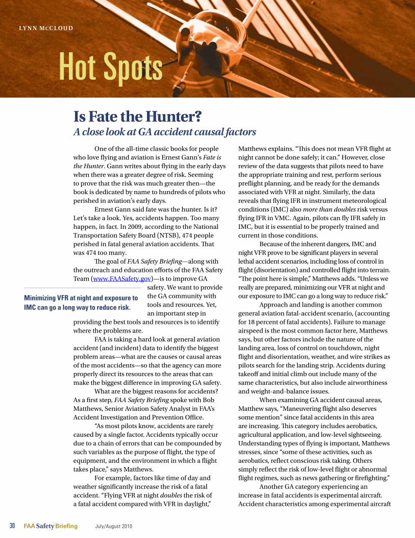
30 FAA Safety Briefing July/August 2010
One of the all-time classic books for people who love flying and aviation is Ernest Gann’s Fate is the Hunter. Gann writes about flying in the early days when there was a greater degree of risk. Seeming to prove that the risk was much greater then—the book is dedicated by name to hundreds of pilots who perished in aviation’s early days.
Ernest Gann said fate was the hunter. Is it? Let’s take a look. Yes, accidents happen. Too many happen, in fact. In 2009, according to the National Transportation Safety Board (NTSB), 474 people perished in fatal general aviation accidents. That was 474 too many.
The goal of FAA Safety Briefing—along with the outreach and education efforts of the FAA Safety Team (www.FAASafety.gov)—is to improve GA
safety. We want to provide the GA community with tools and resources. Yet, an important step in
providing the best tools and resources is to identify where the problems are.
FAA is taking a hard look at general aviation accident (and incident) data to identify the biggest problem areas—what are the causes or causal areas of the most accidents—so that the agency can more properly direct its resources to the areas that can make the biggest difference in improving GA safety.
What are the biggest reasons for accidents? As a first step, FAA Safety Briefing spoke with Bob Matthews, Senior Aviation Safety Analyst in FAA’s Accident Investigation and Prevention Office.
“As most pilots know, accidents are rarely caused by a single factor. Accidents typically occur due to a chain of errors that can be compounded by such variables as the purpose of flight, the type of equipment, and the environment in which a flight takes place,” says Matthews.
For example, factors like time of day and weather significantly increase the risk of a fatal accident. “Flying VFR at night doubles the risk of a fatal accident compared with VFR in daylight,”
Matthews explains. “This does not mean VFR flight at night cannot be done safely; it can.” However, close review of the data suggests that pilots need to have the appropriate training and rest, perform serious preflight planning, and be ready for the demands associated with VFR at night. Similarly, the data reveals that flying IFR in instrument meteorological conditions (IMC) also more than doubles risk versus flying IFR in VMC. Again, pilots can fly IFR safely in IMC, but it is essential to be properly trained and current in those conditions.
Because of the inherent dangers, IMC and night VFR prove to be significant players in several lethal accident scenarios, including loss of control in flight (disorientation) and controlled flight into terrain. “The point here is simple,” Matthews adds. “Unless we really are prepared, minimizing our VFR at night and our exposure to IMC can go a long way to reduce risk.”
Approach and landing is another common general aviation fatal-accident scenario, (accounting for 18 percent of fatal accidents). Failure to manage airspeed is the most common factor here, Matthews says, but other factors include the nature of the landing area, loss of control on touchdown, night flight and disorientation, weather, and wire strikes as pilots search for the landing strip. Accidents during takeoff and initial climb out include many of the same characteristics, but also include airworthiness and weight-and-balance issues.
When examining GA accident causal areas, Matthew says, “Maneuvering flight also deserves some mention” since fatal accidents in this area are increasing. This category includes aerobatics, agricultural application, and low-level sightseeing. Understanding types of flying is important, Matthews stresses, since “some of these activities, such as aerobatics, reflect conscious risk taking. Others simply reflect the risk of low-level flight or abnormal flight regimes, such as news gathering or firefighting.”
Another GA category experiencing an increase in fatal accidents is experimental aircraft. Accident characteristics among experimental aircraft
Hot SpotsIs Fate the Hunter?a close look at ga accident causal factors
Minimizing VFR at night and exposure to IMC can go a long way to reduce risk.
lY n n m C C l ou d

differ from those found in other components of GA, Matthews adds. “Experimental accidents involve a greater share of pilots with low time in the accident aircraft, all of which, by definition, can be unique.” Airworthiness or maintenance issues of varying degrees also are more common among experimental aircraft than in other GA accidents (16 percent versus 11 percent), and experimental-aircraft accidents involve more aerobatic flights, “which reflects the nature and even the attraction of these aircraft,” Matthews says.
There’s one small, but meaningful, GA fatal-accident category, Matthews says, that “can only be described as ‘What were they thinking?’” According to Matthews’s calculations, about 5 percent of all fatal GA accidents qualify for this not-so-flattering label, though they cross the other categories noted above. “These accidents include flights in aircraft that are obviously not airworthy (including some cases of flying aircraft that had placards clearly stating they were not to be flown), plus other airworthiness issues, including amateur-builders who knowingly chose not to follow kit manufacturers’ advice.
“More commonly, these accidents involve egregiously poor judgment,” Matthews adds, “such
as buzzing the family picnic, performing aerobatic maneuvers in non-aerobatic aircraft, choosing to fly twins with no experience or training, or other variations of the standard ‘Watch this!’”
In sum, different accident scenarios reflect different mixes of fleets, pilots, environments, and inherent safety risks, complete with different levels of experience and skills among the pilots involved. “Yet,” Matthews concludes, “a substantial number of fatal accidents could be eliminated—many lives saved—with fundamental risk assessment about flying at night or in weather, meticulous maintenance, and the maturity that prevents that obvious question of, “What were they thinking?’”
Years ago, Ernest Gann said fate was the hunter. As this initial analysis reveals, and FAA Safety Briefing will have more in-depth analysis in upcoming issues, fate has nothing to do with aviation safety. Many of the causal areas have much to do with what pilots learn in their earliest lessons: The importance of aeronautical decision making.
Lynn McCloud is managing editor of FAA Safety Briefing.
July/August 2010 FAA Safety Briefing 31
Pilots can fly IFR safely in IMC, but it is essential to be properly trained and current in those conditions.
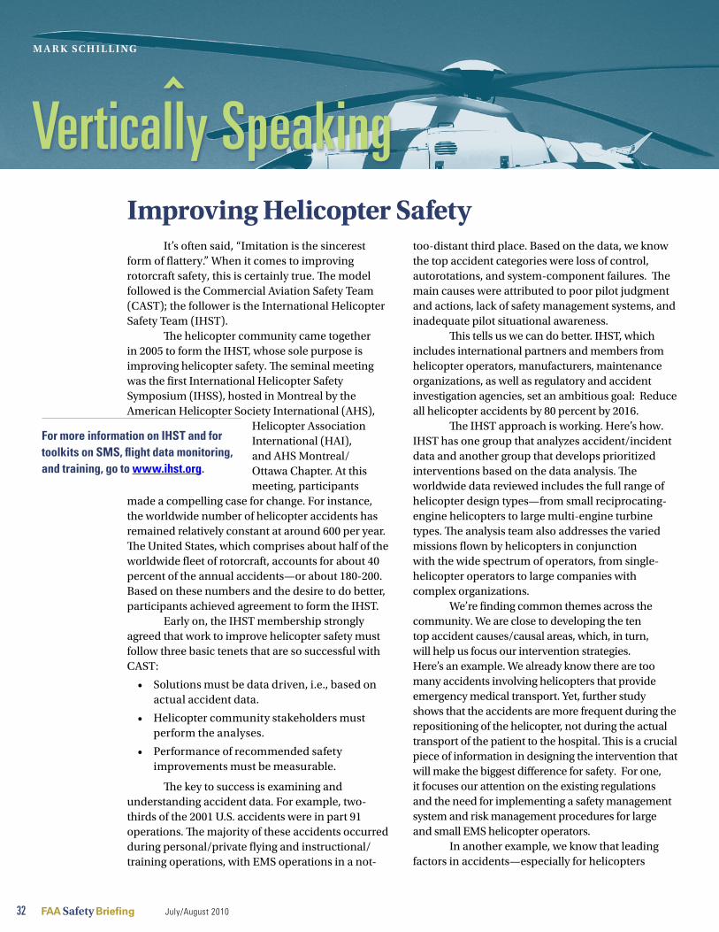
32 FAA Safety Briefing July/August 2010
Improving Helicopter Safety It’s often said, “Imitation is the sincerest
form of flattery.” When it comes to improving rotorcraft safety, this is certainly true. The model followed is the Commercial Aviation Safety Team (CAST); the follower is the International Helicopter Safety Team (IHST).
The helicopter community came together in 2005 to form the IHST, whose sole purpose is improving helicopter safety. The seminal meeting was the first International Helicopter Safety Symposium (IHSS), hosted in Montreal by the American Helicopter Society International (AHS),
Helicopter Association International (HAI), and AHS Montreal/Ottawa Chapter. At this meeting, participants
made a compelling case for change. For instance, the worldwide number of helicopter accidents has remained relatively constant at around 600 per year. The United States, which comprises about half of the worldwide fleet of rotorcraft, accounts for about 40 percent of the annual accidents—or about 180-200. Based on these numbers and the desire to do better, participants achieved agreement to form the IHST.
Early on, the IHST membership strongly agreed that work to improve helicopter safety must follow three basic tenets that are so successful with CAST:
Solutions must be data driven, i.e., based on •actual accident data.
Helicopter community stakeholders must •perform the analyses.
Performance of recommended safety •improvements must be measurable.
The key to success is examining and understanding accident data. For example, two-thirds of the 2001 U.S. accidents were in part 91 operations. The majority of these accidents occurred during personal/private flying and instructional/training operations, with EMS operations in a not-
too-distant third place. Based on the data, we know the top accident categories were loss of control, autorotations, and system-component failures. The main causes were attributed to poor pilot judgment and actions, lack of safety management systems, and inadequate pilot situational awareness.
This tells us we can do better. IHST, which includes international partners and members from helicopter operators, manufacturers, maintenance organizations, as well as regulatory and accident investigation agencies, set an ambitious goal: Reduce all helicopter accidents by 80 percent by 2016.
The IHST approach is working. Here’s how. IHST has one group that analyzes accident/incident data and another group that develops prioritized interventions based on the data analysis. The worldwide data reviewed includes the full range of helicopter design types—from small reciprocating-engine helicopters to large multi-engine turbine types. The analysis team also addresses the varied missions flown by helicopters in conjunction with the wide spectrum of operators, from single-helicopter operators to large companies with complex organizations.
We’re finding common themes across the community. We are close to developing the ten top accident causes/causal areas, which, in turn, will help us focus our intervention strategies. Here’s an example. We already know there are too many accidents involving helicopters that provide emergency medical transport. Yet, further study shows that the accidents are more frequent during the repositioning of the helicopter, not during the actual transport of the patient to the hospital. This is a crucial piece of information in designing the intervention that will make the biggest difference for safety. For one, it focuses our attention on the existing regulations and the need for implementing a safety management system and risk management procedures for large and small EMS helicopter operators.
In another example, we know that leading factors in accidents—especially for helicopters
For more information on IHST and for toolkits on SMS, flight data monitoring, and training, go to www.ihst.org.
m A r k S C h i l l i ng
Vertically Speaking

The FAA Wants You!Attention pilots, mechanics, and avionics technicians:
here is your opportunity to start a career in the exciting field of
aviation safety. The FAA’s Flight Standards Service is currently hiring
aviation safety inspectors and is seeking individuals with strong
aviation backgrounds in maintenance, operations, and avionics.
Starting salaries range from $41,563 to $78,355, plus locality pay.
benefits include federal retirement and tax-deferred retirement
accounts and health insurance.
Qualifications vary depending on discipline. For
details, please visit http://jobs.faa.gov/. under
“All opportunities” you can search by job series
1825 or title containing “inspector.”
Start your application today.
operating under part 91 in personal/private flying and in instructional/training flying—are loss of control and the inability to control the helicopter during an autorotation. This guides the workgroup as it develops interventions that could take us back to the basics: Reviewing Practical Test Standards, knowledge test questions, and advisory material. This could lead to changes to training and testing standards with a sharpened focus on autorotations and loss of control, aeronautical decision-making training, and improved access to helicopter simulators and flight-training devices.
Yes, knowledge is power. The knowledge that the IHST is gaining about the “whats” and “whys” of helicopter incidents and accidents is going a long way to inform safety professionals on how to more effectively prevent accidents and save lives.
It doesn’t get any more important than that.
Mark Schilling, acting manager of the FAA’s Rotorcraft Directorate, co-chairs the IHST with Matt Zuccaro, president of HAI.

34 FAA Safety Briefing July/August 2010
The nominations are in and the winners selected for the 2010 Aviation
Maintenance Technician (AMT), Avionics Technician, Certificated Flight Instructor (CFI), and FAA Safety Team (FAASTeam) Representative of
the year. “These awards highlight the important role played by these
individuals in promoting aviation education and flight safety,” says
JoAnn Hill, General Aviation Awards Committee chairperson. “The awards
program sponsors are pleased that these outstanding aviation professionals will receive the recognition they so richly deserve before their peers in Oshkosh.”
The winners will receive their national awards in July during a “Theater in the Woods” program at EAA AirVenture®.
The General Aviation Awards Program is a cooperative effort between FAA and more than a dozen industry sponsors. The selection process begins with local FAASTeam managers at flight standards district offices
(FSDO) and then moves on to the eight regional Flight Standards Service offices. Panels of aviation professionals from within those four fields select national winners from the pool of regional winners.
Support and sponsorship for the General Aviation Awards program is provided by FAA, Women in Aviation International (WAI), Society of Aviation and Flight Educators (SAFE), Professional Aviation Maintenance Association (PAMA), National Business Aviation Association (NBAA), National Association of State Aviation Officials (NASAO), National Air Transportation Association (NATA), National Association of Flight Instructors (NAFI), Helicopter Association International (HAI), General Aviation Manufacturers Association (GAMA), Experimental Aircraft Association (EAA), Aircraft Maintenance Technology Society (AMT Society), Aircraft Owners and Pilots Association (AOPA), Aeronautical Repair Station Association (ARSA), and Aircraft Electronics Association (AEA). Information about the General Aviation Awards Program, as well as applications for next year’s awards, is available on the Web sites of sponsoring organizations and at www.FAASafety.gov/.
Here are the 2010 national winners.
We would like to recognize all the regional winners who were nominated for the national awards.
For AmT: JoAnn Arnold (Southwest - AR), Hatton Nicholas Batson (Central - TN), Darrell Eugene
Bolduc (Great Lakes - MN), Joseph Morales (Northwest Mountain - CO), Marlin Jerome
Priest (Southern - AL), and Gerald Wayne Rose (Western Pacific - CA)
For Avionics Technician: Clayton Thomas Caessens (Southern - FL) and Patrick
Donald Ware (Western Pacific - CA)
For CFi: Michael Gary Oliver Grant (Southern - FL), Robert Vincent Meder (Central - NE), Megan Roberta Sayre (Northwest Mountain - CO), Susan Marie Tholen (Eastern - ME), Ronald Jay Timmermans (Southwest - TX), and Wanda Jean Zuege (Great Lakes - WI)
For FAASTeam representative: Javier Angel Guerra (Southwest - TX), William Victor Hill (Western Pacific - CA), Mark Edward Madden (Alaska - AK), Jon Nagi Malek (Eastern - NY), John Edward Mitchell (Northwest Mountain - CO), John Urban Rockcastle (Southern - FL), and Wanda Jean Zuege (Great Lakes - WI)
And, the Winner Is…Annual GA Awards
Recognize Dedicated Safety Advocates

July/August 2010 FAA Safety Briefing 35
2010 national Aviation maintenance Technician of the
Year Neil Nederfield of Lafayette, New Jersey, has been an airframe and powerplant (A&P) technician for 45 years and has held inspection authorization (IA) for 15 years. A four-year tour in the U.S.
Navy launched this Vietnam veteran’s aviation maintenance career. Nederfield attended schools for aviation airframe sheet metal and paint corrosion control and then served with Attack Squadron 72 (VA-72) aboard aircraft carriers working on Douglas A-4 Skyhawks. After an honorable discharge as a Petty Officer 2nd Class, he continued to work in aviation maintenance. In 1983, after ten years of employment at C & W Electronics, Nederfield became the owner and manager of C & W Aero Services at Essex County Airport, New Jersey.
Nederfield and his son, Sean, are company co-owners, while their wives share the responsibilities for office management. C & W Aero Services is a fixed-base operator and an FAA-certificated repair station specializing in aircraft modifications, painting, annual/100-hour inspections, avionics installations, and heavy sheet-metal repairs.
As a lead representative for the FAASTeam in the Teterboro area, he both hosts and presents safety programs for pilots and mechanics. He has been a member of PAMA since 1989 and has served as director and FAA liaison for the PAMA board of directors since 1992. For the past ten years, he has organized and hosted an annual IA renewal for PAMA. Nederfield also serves as an advisory board member for the Teterboro School of Aeronautics.
2010 national Avionics Technician of the Year
Kirk H. Peterson of Larimore, North Dakota, has more than 25 years of avionics maintenance and repair experience. As a U.S. Marine in the early 1980s, Peterson began his career as an avionics technician
working on A-4 Skyhawks and McDonnell Douglas attack aircraft. He received training in basic electricity, electronics, and instruments. After an honorable discharge, he attended Alexandria Technical College in Minnesota where he received his Federal Communications Commission (FCC) license. Subsequently, he worked for Republic Airlines and Avionics Incorporated. While working full time, he attended evening classes at the Minneapolis Technical Institute, where he received training in airframe and powerplant technology. In 1992, Peterson obtained his A&P certification. He currently holds an FCC license with radar endorsement, an A&P certificate with inspection authorization (IA), and a repairman certificate.
For the past 20 years, Peterson has been employed by the University of North Dakota (UND) John D. Odegard School of Aerospace Sciences. He is the avionics manager of a part 145 repair station that maintains more than 100 aircraft, ranging from Supercubs to turbine helicopters as well as turbine aircraft used by UND’s flight-training department. Peterson is also responsible for maintaining UND’s state-of-the-art avionics lab.
Peterson mentors UND student interns each semester and assists academic professors with demonstrations as well as training in avionics systems. He is never too busy to take the time to explain operational procedures or equipment operation to students and instructors.

36 FAA Safety Briefing July/August 2010
2010 national Certificated Flight instructor of the Year
Jeffrey Robert Moss of Los Angeles, California, was born in Miami, Florida. His passion for aviation began early when his family boarded a Pan Am Boeing 747, the aircraft that would take the family to Los Angeles.
Once on board, he made his way to the flight deck. Sailing past the flight engineer he proclaimed, “Hi, Mister Captain, I’m Jeffrey Moss. I’m seven years old, and I’m here to learn everything!”
At Arizona State University, aviation reentered his life. He heard about an airline offering a “pilot-for-a-day” program, where you could fly a full-motion 747 flight simulator, and he jumped at the opportunity. At the urging of airline friends he met while flying the 747 simulators, he obtained his flight instructor certificate in 2003.
When Cirrus introduced the first GA aircraft to have a full-glass Avidyne cockpit, Moss joined the Cirrus Owners and Pilots Association (COPA) and became an early member of the Cirrus Standardized Instructor Program. He was also one of the first factory-trained instructors on the Lancair Certified Columbia 350/400 (now the Cessna Corvalis) and was co-creator and chief flight instructor for the Columbia Recurrent Training Program.
Today, Moss holds five single-pilot jet-type ratings. He is an independent instructor and mentor pilot on the Cessna Citation Mustang & CJ series, Eclipse 500, Embraer Phenom 100/300, and Hawker Beechcraft Premier IA. He specializes in training piston pilots for their initial single-pilot jet-type rating. A sought-after aviation speaker, Moss works extensively as an aviation educator. His company, Flying Like the Pros, produces computer-based avionics training programs.
2010 national FAA Safety Team representative of the Year
Thomas P. Turner of Rose Hill, Kansas, became involved in aviation as a U.S. Air Force officer. He earned his initial pilot certification in 1985 and became a certificated flight instructor in 1988. He holds airline
transport pilot and flight instructor certificates.Turner is an ardent aviation safety advocate.
He now serves as a FAASTeam Lead Representative in the Wichita area where he conducts WINGS seminars and maintains aviation safety Web sites. He has also earned Basic, Advanced, and Master-level WINGS accreditation through the FAA Pilot Proficiency Program.
A student of aircraft accidents and aviation safety issues, Turner is dedicated to making GA safer. He researches and writes for several aviation publications, including a weekly e-newsletter, “Flying Lessons,” for his Mastery Flight Training business. He also serves on the permanent editorial board of the Aviator’s Model Code of Conduct where he works to encourage pilot and mechanic professionalism and safety.
Turner is the executive director of the American Bonanza Society, which represents approximately 10,000 worldwide Beech aircraft owners, mechanics, and enthusiasts. He is responsible for the day-to-day operation of the society as well as all technical and educational member support functions.
As an independent flight instructor presenting type-specific initial and recurrent training in late-model Beech Bonanzas and Barons, he travels to client locations to provide checkouts, flight reviews, and instrument proficiency training. He also lectures at aviation events and pilot gatherings in the Wichita area, at AirVenture, and more.

Fast-track Your Medical CertificateWith FAA MedXPress, you can get your medical certificate faster than ever before.
Here’s how: Before your appointment with your Aviation Medical Examiner (AME) simply go online to FAA MedXPress at https://medxpress.faa.gov/ and electronically complete FAA Form 8500-8. Information entered into MedXPress is immediately transmitted to the FAA and forwarded to your AME before your medical examination.
With this online form you can complete FAA Form 8500-8 in the privacy and comfort of your home and submit it before scheduling your appointment.
The service is free and can be found at:
https://medxpress.faa.gov/
July/August 2010 FAA Safety Briefing 37

38 FAA Safety Briefing July/August 2010
Spin TrainingYour article on maneuvering flight in the
March/April 2010 issue ignores the elephant in the living room. Dropping spin training has likely killed more people than it saved. I grew up with Colts, Cubs, Citabrias and an instructor who taught spins and also tortured me with an astonishing variety of unusual attitudes under the hood in a PA28.
Life got busy and after a 20-year hiatus and three hours into a biennial I had to beg my instructor to do a stall series in the 172 we were flying. One sharp power-off stall (in utility) it was obvious that he was terrified. I believe that if you have not learned how to spin and recover a capable airplane, you are unlikely to do the right thing in an incipient spin in an airplane that should never be spun.
Roll training for ATPs in upsets was a great idea. The stall-warning horn is nice, but bring back spin training to the rest of us and save lives. Your writer was very lucky that he didn’t use more rudder. Vigilance is good, but training a reflexive response is better.
Juris
Thanks for your feedback. There are a lot of arguments on both sides of the spin training issue, and we appreciate your thoughtful presentation of the pro-spin-training perspective.
ES LegacyMy flight school is a proud owner of one of the
“ES” airplanes . I had no idea of the history behind that special designation until reading your article (about Ed Stimpson) in the January/February 2010 magazine. I wanted to thank you for your article and let you know that we have posted a brief article on our Web site under “Spotlighting on PFC.”
Gary CirielloPremier Flight Center, LLC
PFC really did a neat thing with its use of our article paying tribute to Ed Stimpson; its Web site lists the number of pilots who earned certificates in the school’s “Echo Sierra” bird. Thanks for sharing.
Obtaining NOTAMs I read the Hot Spots article on “Avoiding
Airborne Pilot Deviations” in the March/April 2010 FAA Safety Briefing and applaud FAA Strategic Planning Program Manager Tim Wallace’s advice to pilots to stay abreast of changes in the national air space (NAS).
Safe flight demands the effective management of constant change. NOTAMs are issued specifically to alert NAS users about conditions that differ from what is published, and such change can literally occur at any time. However, Mr. Wallace’s suggestion to contact Flight Watch for this information during flight is not a good option.
Since its inception in the mid-1970s, the purpose of Flight Watch has been to provide pilots with updates to changes in weather conditions while en route. The better means of updating NOTAMs en route is to contact Flight Service using the nearest Remote Communication Outlet (RCO). These are labeled on sectional charts and should be noted as part of preflight planning. A Flight Service Station specialist can also help identify useful RCOs during a preflight briefing.
Scott TannerFAA Air Traffic Safety Inspector
Thank you, Scott, for the additional information.
Reprinting ArticlesIs it permissible to print/copy articles found
in the FAA Safety Briefing magazine? Specifically, I would like to copy the March/April 2010 article, “Maintaining Your Way to Greater Safety.” I plan to use the copies as a handout at a FAASTeam event.
FAASTeam Representative
As we frequently get requests to copy/reprint articles from the magazine, we thought it was time to repeat our reprint policy. The FAA Safety Briefing is a Federal government publication. This means that, unless an article is indicated as copyrighted, all articles appearing in the magazine are considered
Flight Forum

alling All
MechanicsKeep Informed with
FAA’s Aviation Maintenance Alerts
Aviation Maintenance Alerts (Advisory Circular 43.16A) provide a communication channel to share information on aviation service experiences. Prepared monthly, they are based on information FAA receives from people who operate and maintain civil aeronautical products.
The Alerts, which provide notice of conditions reported via a Malfunction or Defect Report or a Service Difficulty Report, help improve aeronautical product durability, reliability, and safety.
Recent Alerts cover: •Crackedbattery-mountstructureonthe
Cessna 182S
•FailedempennagestructureontheCessnaCorvalis
•Failedalternateair-controlvalveontheDiamond DA40
Check out Aviation Maintenance Alerts at: http://www.faa.gov/aircraft/safety/alerts/aviation_maintenance/
July/August 2010 FAA Safety Briefing 39
public domain and can be reprinted without prior permission. If the article is copyrighted, we will contact the article’s author regarding the request. In either case, we ask that the magazine be credited as the source of the article and, if possible, a copy of the reprinted article sent to us for our files. Thank you for your interest in aviation safety.
Paper vs PlasticI have a private pilot certificate that is
laminated and I don’t know if it is considered a paper certificate. Did I need to have this certificate replaced for the March 31 deadline?
Name withheld
Your laminated paper certificate needed to be replaced by March 31, 2010, for you continue to exercise your privileges. Laminating a paper pilot certificate does not exclude anyone from having to replace it with a new security-enhanced plastic certificate.
Biennial Flight ReviewIn your May/June 2010 Forum you referred
to the biennial flight review. There is no such thing as a “BFR” or a “Biennial” anymore. They changed the terms way back in the mid-1990s when they were considering requiring an annual review for low time pilots (a proposed rule change that didn’t happen). For over a decade, the official name has been just “Flight Review”, or more formally, “the flight review required by FAR 61.56”. The “biennial” term isn’t in the regs any more.
Demetrios Logan
While it is true that the word biennial is no longer used in Title 14 Code of Federal Regulations (CFR) section 61.56, the flight review is still required every 24 months. We used the term biennial referring to the two-year period, not the flight review as it is called in the CFRs.
FAA Safety Briefing welcomes comments. We may edit letters for style and/or length. If we have more than one letter on the same topic, we will select one representative letter to publish. Because of our publishing schedules, responses may not appear for several issues. We do not print anonymous letters, but we do withhold names or send personal replies upon request. If you have questions dealing with immediate FAA operational issues, please contact your local flight standards district office or air traffic facility. Send letters to: Editor, FAA Safety Briefing, AFS-805, 800 Independence Avenue, SW, Washington, DC 20591, or FAX them to (202) 267-9463, or e-mail [email protected]

40 FAA Safety Briefing July/August 2010
Weather Met on a Cross-Country QuestOf all the topics in my private-pilot ground-
school course years ago, weather was the one that be-deviled me the most. Being a student of languages (in-cluding a couple of “guy” dialects), I breezed through translating weather code into words. What baffled me was figuring out what those weather words actually meant to me as a pilot flying a specific airplane from one place to another.
As described in the article on page 7, I even-tually discovered a practical weather evaluation method. Last year, I had a chance to work through, or around, virtually all major meteorological conditions when I joined two friends flying from Virginia to Ari-zona and back in their Cessna 206.
Soup’s On!The importance of instrument currency and
proficiency became obvious shortly after takeoff from Leesburg (KJYO) on a warm, but overcast, spring day. IMC prevailed for the entire first leg to Lexington, Kentucky (KLEX), and ferocious headwinds extended our ETE by nearly an hour.
Planning pays off: We knew which direction to fly for better weather, and we had the fuel to reach it if necessary. Equipment helps, too: The moving-map navigator contributed to situational awareness, and the capable KAP 140 autopilot left all three pilots free to focus on fuel management and discuss diversion decisions. It also kept the pilot flying fresher for the approach.
Wind, Sand, and StormsThe second day dawned over three faces
studying the convective weather developing between Fort Leonard Wood, Missouri, and our intended fuel stop in Enid, Oklahoma. After much discussion and many questions to the Flight Service briefer, we opted to “meet” the approaching front rather than wait for it to make its way into central Missouri. With datalink, three proficient instrument pilots, dozens of airports reporting VFR and MVFR conditions, and everyone-has-a-veto policy in place, we were collectively comfortable with the decision.
Consulting with the controller and using datalink for strategic storm avoidance, we worked our way around the worst areas and emerged on the other side of the front to find … wind. Lots of it. With the Oklahoma wind sweeping around the plane, we re-viewed crosswind-landing techniques and rechecked the maximum demonstrated crosswind component.
The high-desert elevations of New Mexico pro-vided a clear lesson in density altitude. Accustomed as we are to elevations near sea level, flying out of Santa Fe meant considering the multiple impacts of high altitude and high temperature on both loading and leaning the airplane for best performance. We also dug deeply into the performance charts.
Ice Is Not NiceYou may not associate ice with flying over
the desert, but, if you fly high enough in clouds that are cold enough, it’s there. Good planning, good equipment, and constant situational awareness were key to skating clear of conditions that would have been too much for the C206 to handle. At the first sign of light rime accumulation, we sounded the alarm to ATC and requested immediate clearance to a pre-determined ice-free altitude and course.
I learned more about weather in that one trip than I ever got from books or local flights. If you have a similar opportunity, take it, but with all the planning and proficiency you need to ensure safe flights.
Happy LandingsI want to recognize Associate Editor Louise
Oertly, who retires this month after more than 38 years with FAA. Louise has been a steadfast member of the FAA Safety Briefing team. Through her many contributions, strong commitment, and high profes-sional standards, the nation’s GA community has benefited from her dedication to valuable, accurate, and well-written safety information. We will miss her greatly, but we wish Louise blue skies and tailwinds.
Susan Parson ([email protected]) is a special assistant in the FAA’s Flight Standards Service. She is an active general aviation pilot and flight instructor.
S u S A n PA r S o n

Dennis Roberts, Director of FAA’s Flight Services Program Operations, started on his path to oversee flight services at age 16 when his father arranged a ride for him in a Cessna 150. Flying over the Missouri landscape from the Excelsior Springs airport launched a lifelong passion and a career helping pilots across the nation.
“I got all my ratings to become a corporate or commercial pilot,” Roberts says. However, there were many former military pilots with lots of heavy jet time. “So, I took the air traffic controller’s test and scored high, but that field was also oversubscribed with deserving vets.”
The third try was the charm. “Fortunately, in college we had a speaker from an airport consulting firm,” Roberts explains. Right after graduation, the firm hired Roberts as an airport planner and corporate pilot. He moved to Colorado to lead aviation planning for the Denver Regional Council of Governments. That experience led to him becoming Colorado’s first Director of Aeronautics.
The next stop, at the Aircraft Owners and Pilots Association (AOPA), got him closer to his long-time goal of working for the FAA. “I wanted to be involved on the policy side from within FAA,” Roberts explains. At AOPA, Roberts worked on the technical aspects of the Alaska Capstone Project, which laid the groundwork for the nationwide deployment of Automatic Dependent Surveillance-Broadcast (ADS-B). After AOPA, he moved to Kentucky to be Deputy Airport Director of the Louisville airport and worked closely with the airport’s largest customer, UPS, on projects including ADS-B.
In 2003, Roberts became FAA’s Director of Airport Planning and Programming. Next was a two-year stint as the Northwest Mountain Region’s Regional Administrator. In 2009, Roberts was named Director of Flight Services Program Operations with responsibility for FAA Flight Service Station functions in Alaska and the Lockheed Martin FSS
contract in the lower 49 states and Guam. “While the service in the CONUS is performed by Lockheed Martin employees, FAA has principal responsibility for oversight and assuring the products are delivered safely and efficiently.”
When Lockheed Martin first took over Flight Service activities in 2005, many GA pilots complained about the transition. “It was, and has been, a challenge,” Roberts admits. Performance has improved dramatically, Roberts says, but he adds, “If pilots are having problems, we want to know.” There are three ways to provide feedback: by phone, fax, or online to FAA, Lockheed Martin, or AOPA. “Lockheed Martin is required to review every complaint, contact the complainant within 15 days, and respond within 30 days.”
Roberts wants to keep improving briefing quality. “We urge briefers to go beyond just the ordinary to the extraordinary briefing. Feedback surveys tell us that pilots want assistance in decision making, such as help with alternatives. If the briefer says ‘VFR flight is not recommended,’ ask if there are other options or routes that could work.”
Roberts envisions a future where more information is “pushed” or provided to the pilot automatically in a “real-time, need-to-know” fashion. “We want to be able to send information such as airspace restrictions and weather, right to cockpit displays. The system could patch in through your avionics.” That’s all part of the NextGen GA benefits. ‘Buck Rogers,’ maybe, but it shows that Roberts and his team are looking ahead.
It’s been a long journey for the boy from Missouri with a passion for aviation, but, as he says, “GA is in my blood.”
James Williams is the FAA Safety Briefing’s assistant editor and photo editor. He is also a pilot and ground instructor.
JA M e S W I L L I A M S
From Passenger to Pilot to Service Provider
FAA Faces Dennis Roberts

U.S. Departmentof Transportation
Federal Aviation Administration800 Independence Ave., S.W.Washington, D.C. 20591
Official BusinessPenalty for Private Use $300
Look Who’s Reading FAA Safety Briefing
“I’ve flown nearly 500 types of aircraft, but there’s always more to learn about safety.”
Paul Poberezny, FounderExperimental Aircraft Association