fault-rupture hazard zones in california publication 42 ... fault and fault zone _____ 3 ... 1999...
TRANSCRIPT
SPECIAL PUBLICATION 42Revised 1997
DEPARTMENT OF CONSERVATIONSTEVE ARTHUR
ACTING DIRECTOR
THE RESOURCES AGENCYMARY NICHOLS
SECRETARY FOR RESOURCES
DEPARTMENT OFCONSERVATION
STATE OF CALIFORNIAGRAY DAVISGOVERNOR
1 Name changed from Special Studies Zones January 1, 1994
FAULT-RUPTURE HAZARD ZONESIN CALIFORNIA
Alquist-Priolo Earthquake Fault Zoning Actwith Index to Earthquake Fault Zones1 Maps
Division ofMines and Geology
Supplements 1 and 2 added 1999
Copyright ©1999 by the California Department of Conservation,Division of Mines and Geology. All rights reserved. No part ofthis publication may be reproduced without written consent ofthe Division of Mines and Geology.
"The Department of Conservation makes no warranties as tothe suitability of this product for any particular purpose."
DIVISION OF MINES AND GEOLOGYJAMES F. DAVIS
STATE GEOLOGIST
SPECIAL PUBLICATION 42
FAULT-RUPTURE HAZARD ZONES IN CALIFORNIA
Alquist-Priolo Earthquake Fault Zoning Actwith Index to Earthquake Fault Zones Maps
by
EARL W. HART and WILLIAM A. BRYANT
Geologists
REVISED 1997Supplements 1 and 2 added 1999
California Department of ConservationDIVISION OF MINES AND GEOLOGY
801 K Street, MS 14-33Sacramento, California 95814-3532

PREFACE
The purpose of the Alquist-Priolo Earthquake Fault Zoning Act is to regulate development near activefaults so as to mitigate the hazard of surface fault rupture.
This report summarizes the various responsibilities under the Act and details the actions taken by theState Geologist and his staff to implement the Act.
This is the tenth revision of Special Publication 42, which was first issued in December 1973 as an“Index to Maps of Special Studies Zones.” A text was added in 1975 and subsequent revisions were made in1976, 1977, 1980, 1985, 1988, 1990, 1992, and 1994. The 1997 revision reflects changes in the index mapand amendments to the Act (Appendix A) and the Act’s regulations (Appendix B). Section 2621.9 of the Act(Appendix A) was amended October 7, 1997 and becomes operative March 1, 1998. Both versions ofSection 2621.9 appear in the 1997 revision. Changes and additions also have been made in the text, tabula-tions, and appendices. In response to requests from various users of Earthquake Fault Zones maps andreports, several digital products are currently being developed by Division of Mines and Geology staff,including digital versions of the Earthquake Fault Zones maps (see Appendix E).
On January 1, 1994, the name of the Alquist-Priolo Special Studies Zones Act was changed to theAlquist-Priolo Earthquake Fault Zoning Act, and the name Special Studies Zones was changed to EarthquakeFault Zones as a result of a July 25, 1993 amendment.
Information on new and revised Earthquake Fault Zones maps will be provided as supplements untilthe next revision of this report.

CONTENTS
INTRODUCTION ____________________________________________________________________ 1
PROGRAM FOR ZONING AND EVALUATING FAULTS ______________________________________ 2Requirements of the Act ___________________________________________________________ 2Initial Program for Zoning Faults _____________________________________________________ 2Definitions, Policies, Rationale ______________________________________________________ 3
Fault and Fault Zone ___________________________________________________________ 3Fault Trace __________________________________________________________________ 5Active Fault __________________________________________________________________ 5Potentially Active Fault _________________________________________________________ 5Sufficiently Active and Well-Defined _______________________________________________ 5
Delineating the Earthquake Fault Zones _______________________________________________ 6Fault Evaluation and Zoning Program _________________________________________________ 6Uses and Limitations of Earthquake Fault Zones Maps ____________________________________ 9
INDEX TO MAPS OF EARTHQUAKE FAULT ZONES ________________________________________ 9Availability of Earthquake Fault Zones Maps ____________________________________________ 9
REFERENCES __________________________________________________________________ 10
APPENDICES __________________________________________________________________ 22Appendix A. Alquist-Priolo Earthquake Fault Zoning Act __________________________________ 22Appendix B. Policies and Criteria of the State Mining and Geology Board ____________________ 25Appendix C. Guidelines for Evaluating the Hazard of Surface Fault Rupture ___________________ 27Appendix D. General Guidelines for Reviewing Geologic Reports ___________________________ 31Appendix E. Products of the Fault Evaluation and Zoning Program __________________________ 34Appendix F. Waiver Procedure for the Alquist-Priolo Act __________________________________ 38
TABLESTable 1. Summary of responsibilities and functions under the Alquist-Priolo Earthquake Fault
Zoning Act _______________________________________________________________ 1Table 2. Summary of policies and criteria adopted by the State Mining and Geology Board and
codified in California Code of Regulations ________________________________________ 2Table 3. Official Maps of Earthquake Fault Zones issued 1974 through mid-1997 ________________ 2Table 4. Cities and counties affected by Earthquake Fault Zones as of June 1, 1997 _____________ 3Table 5. Surface faulting associated with earthquakes in California, 1974-June 1997 ______________ 8
FIGURESFigure 1. Principal active faults in California zoned under the Alquist-Priolo Earthquake
Fault Zoning Act ___________________________________________________________ 4Figure 2. Geologic time scale ___________________________________________________ 5Figure 3. Example of Earthquake Fault Zones Map _______________________________________ 7Figure 4. Index to Official Maps of Earthquake Fault Zones ______________________________ 11-21
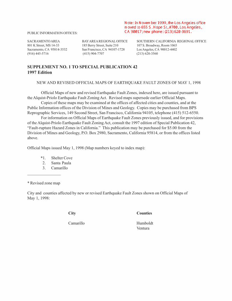
PUBLIC INFORMATION OFFICES:
SACRAMENTO AREA BAY AREA REGIONAL OFFICE SOUTHERN CALIFORNIA REGIONAL OFFICE801 K Street, MS 14-33 185 Berry Street, Suite 210 107 S. Broadway, Room 1065Sacramento, CA 95814-3532 San Francisco, CA 94107-1728 Los Angeles, CA 90012-4402(916) 445-5716 (415) 904-7707 (213) 620-3560
SUPPLEMENT NO. 1 TO SPECIAL PUBLICATION 421997 Edition
NEW AND REVISED OFFICIAL MAPS OF EARTHQUAKE FAULT ZONES OF MAY 1, 1998
Official Maps of new and revised Earthquake Fault Zones, indexed here, are issued pursuant tothe Alquist-Priolo Earthquake Fault Zoning Act. Revised maps supersede earlier Official Maps.
Copies of these maps may be examined at the offices of affected cities and counties, and at thePublic Information offices of the Division of Mines and Geology. Copies may be purchased from BPSReprographic Services, 149 Second Street, San Francisco, California 94105, telephone (415) 512-6550.
For information on Official Maps of Earthquake Fault Zones previously issued, and for provisionsof the Alquist-Priolo Earthquake Fault Zoning Act, consult the 1997 edition of Special Publication 42,“Fault-rupture Hazard Zones in California.” This publication may be purchased for $5.00 from theDivision of Mines and Geology, P.O. Box 2980, Sacramento, California 95814, or from the offices listedabove.
Official Maps issued May 1, 1998 (Map numbers keyed to index map):
*1. Shelter Cove2. Santa Paula3. Camarillo
________________
* Revised zone map
City and counties affected by new or revised Earthquake Fault Zones shown on Official Maps ofMay 1, 1998:
City Counties
Camarillo HumboldtVentura

� � � � � � � � � � � �
���� �
� � � � � � � � � � �� � � � � �
��
��
��
��
� � � � �
� � � � � � � �
� � � � � ��
��
�
� � �
� � � � �
� � � � � � �
���� ��
� � � � �
�����
��
��
� � � �
������
�
��
�
��
�
� � � � ��
��
��
��
�
��� �����
������
��
���
��
���
����� �����
��
� �
� � � � � � �
����������
�����
� � � �
� � �
��
���
��
� � � ��� � � � �
� � � � �
� � � � ��
� �
���
�
���
�
��
�
� � �
�� �
�
� �
�� �����
� � � �
� � � �
� � � � �
� � � �
� � � �
� � � � � � � �� � � � � �
� � � ��� � � � � � �
� �
� � � � � � � � � � �
� �� �
� � � �
� � � � �
� ���
� � � � �
� � � � � � � �� � � � � �
�
������������� ������������������������ ����������������������������������������������
������� �!"#��$%���"!��$&�'
������
����������
�
PUBLIC INFORMATION OFFICES:
SACRAMENTO AREA BAY AREA REGIONAL OFFICE SOUTHERN CALIFORNIA REGIONAL OFFICE801 K Street, MS 14-33 185 Berry Street, Suite 210 107 S. Broadway, Room 1065Sacramento, CA 95814-3532 San Francisco, CA 94107-1728 Los Angeles, CA 90012-4402(916) 445-5716 (415) 904-7707 (213) 620-3560
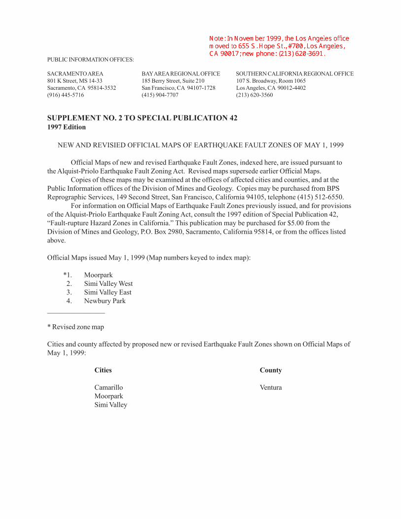
SUPPLEMENT NO. 2 TO SPECIAL PUBLICATION 421997 Edition
NEW AND REVISIED OFFICIAL MAPS OF EARTHQUAKE FAULT ZONES OF MAY 1, 1999
Official Maps of new and revised Earthquake Fault Zones, indexed here, are issued pursuant tothe Alquist-Priolo Earthquake Fault Zoning Act. Revised maps supersede earlier Official Maps.
Copies of these maps may be examined at the offices of affected cities and counties, and at thePublic Information offices of the Division of Mines and Geology. Copies may be purchased from BPSReprographic Services, 149 Second Street, San Francisco, California 94105, telephone (415) 512-6550.
For information on Official Maps of Earthquake Fault Zones previously issued, and for provisionsof the Alquist-Priolo Earthquake Fault Zoning Act, consult the 1997 edition of Special Publication 42,“Fault-rupture Hazard Zones in California.” This publication may be purchased for $5.00 from theDivision of Mines and Geology, P.O. Box 2980, Sacramento, California 95814, or from the offices listedabove.
Official Maps issued May 1, 1999 (Map numbers keyed to index map):
*1. Moorpark2. Simi Valley West3. Simi Valley East4. Newbury Park
________________
* Revised zone map
Cities and county affected by proposed new or revised Earthquake Fault Zones shown on Official Maps ofMay 1, 1999:
Cities County
Camarillo VenturaMoorparkSimi Valley

SUPPLEMENT NO. 2 INDEX MAPNEW AND REVISED OFFICIAL MAPS OF EARTHQUAKE FAULT ZONES OF MAY 1, 1999
(See List for Names of Maps)

1999 FAULT-RUPTURE HAZARD ZONES IN CALIFORNIA 1
Table 1. Summary of responsibilities and functions under the Alquist-Priolo Earthquake Fault Zoning Act (see Appendix A for full text of Act).
State Mining and Geology Board
1. Formulates policies and criteria to guide cities andcounties (Sec. 2621.5 and 2623). (See Appendix B.)
2. Serves as Appeals Board (Sec. 673).
State Geologist
1. Delineates Earthquake Fault Zones; compiles and issuesmaps to cities, counties, and state agencies (Sec. 2622).a. Preliminary Review Maps.b. Official Maps.
2. Reviews new data (Sec. 2622).a. Revises existing maps.b. Compiles new maps.
3. Approves requests for waivers initiated by cities andcounties (Sec. 2623).
Cities and Counties
1. Must adopt zoning laws, ordinances, rules, and regulations;primary responsibility for implementing Act (Sec. 2621.5).
2. Must post notices of new Earthquake Fault Zones Maps(Sec. 2621.9 and 2622).
3. Regulates specified “projects” within Earthquake FaultZones (Sec. 2623).
a. Determines need for geologic reports prior to projectdevelopment.
b. Approves geologic reports prior to issuing developmentpermits.
c. May initiate waiver procedures. (See Appendix F.)
Other
1. Seismic Safety Commission - advises State Geologist and StateMining and Geology Board (Sec. 2630).
2. State Agencies - prohibited from siting structures for humanoccupancy across active fault traces (Sec. 2621.5).
3. Disclosure - prospective buyers of any real property locatedwithin an Earthquake Fault Zone must be notified of that fact(Sec. 2621.9).
INTRODUCTION
The Alquist-Priolo Earthquake Fault Zoning Act was signedinto law December 22, 1972, and went into effect March 7, 1973.The Act, codified in the Public Resources Code as Division 2,Chapter 7.5, has been amended eleven times. A complete text ofthe Act is provided in Appendix A. The purpose of this Act is toprohibit the location of most structures for human occupancy acrossthe traces of active faults and to thereby mitigate the hazard of faultrupture (Section 2621.5).
This law initially was designated as the Alquist-PrioloGeologic Hazard Zones Act. The Act was renamed the Alquist-Priolo Special Studies Zones Act effective May 4, 1975 and theAlquist-Priolo Earthquake Fault Zoning Act effective January 1,1994. The original designation “Special Studies Zones” waschanged to “Earthquake Fault Zones” when the Act was lastrenamed.
Under the Act, the State Geologist (Chief of the Division ofMines and Geology [DMG]) is required to delineate “EarthquakeFault Zones” (EFZs) along known active faults in California.Cities and counties affected by the zones must regulate certaindevelopment “projects” within the zones. They must withholddevelopment permits for sites within the zones until geologicinvestigations demonstrate that the sites are not threatened bysurface displacement from future faulting. The State Mining andGeology Board provides additional regulations (Policies andCriteria) to guide cities and counties in their implementation of thelaw (California Code of Regulations, Title 14, Div. 2). A summaryof principal responsibilities and functions required by the Alquist-Priolo Act is given in Table 1. The Policies and Criteria aresummarized in Table 2, and the complete text is provided inAppendix B.
This publication identifies and describes (1) actions taken bythe State Geologist to delineate Earthquake Fault Zones, (2)policies used to make zoning decisions, and (3) Official Maps ofEarthquake Fault Zones issued to date. A continuing program toevaluate faults for future zoning or zone revision also issummarized. Other aspects of the Alquist-Priolo Earthquake FaultZoning Act and its implementation are discussed by Hart (1978 and1986). The effectiveness of the Act and program was evaluated byReitherman and Leeds (1990). The program is implementing manyof the recommendations in that report.
Information presented here is based on various in-housedocuments and publications of the authors and others of DMG (seeAppendix E). The assistance of Perry Wong (compilation of faultson Figure 4 and proofing), Richard R. Moar (drafting), DinahMaldonado (layout and design), and other technical and clericalDMG staff in revising this report is gratefully acknowledged.
FAULT-RUPTURE HAZARD ZONESIN CALIFORNIA
By
Earl W. Hart and William A. Bryant
2 DIVISION OF MINES AND GEOLOGY SP42
Table 2. Summary of policies and criteria adopted by the State Miningand Geology Board and codified in California Code of Regulations(see Appendix B for full text).
Policies
1. Defines active fault (equals potential hazard) as a fault that hashad surface displacement during Holocene time (last 11,000years) (Sec. 3601).
2. Defines “structure for human occupancy” and other terms(Sec. 3601).
3. Requires cities and counties to notify property owners withinproposed new and revised Earthquake Fault Zones (Sec.3602).
4. Provides opportunity for public to comment on PreliminaryReview Maps of Earthquake Fault Zones (Sec. 3602).
5. Provides for comments and recommendations to StateGeologist regarding Preliminary Review Maps (Sec. 3602).
Specific Criteria for Lead Agencies (Sec. 3603)
1. No structure for human occupancy defined as a “project” ispermitted on the trace of an active fault. Unless provenotherwise, the area within 50 feet of an active fault ispresumed to be underlain by active branches of the fault.
2. Requires disclosure of Earthquake Fault Zones to the public.
3. Requires that buildings converted to structures for humanoccupancy comply with provisions of the Act.
4. Requires geologic reports directed at the problem ofpotential surface faulting for all projects defined bythe Act.
5. Requires cities and counties to review geologic reports foradequacy.
6. Requires that geologic reports be submitted to the StateGeologist for open-file.
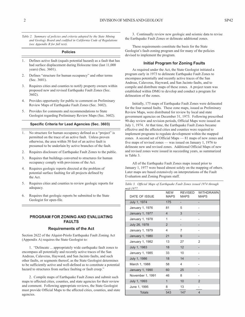
PROGRAM FOR ZONING AND EVALUATINGFAULTS
Requirements of the ActSection 2622 of the Alquist-Priolo Earthquake Fault Zoning Act(Appendix A) requires the State Geologist to:
1. “Delineate ... appropriately wide earthquake fault zones toencompass all potentially and recently active traces of the SanAndreas, Calaveras, Hayward, and San Jacinto faults, and suchother faults, or segments thereof, as the State Geologist determinesto be sufficiently active and well-defined as to constitute a potentialhazard to structures from surface faulting or fault creep.”
2. Compile maps of Earthquake Fault Zones and submit suchmaps to affected cities, counties, and state agencies for their reviewand comment. Following appropriate reviews, the State Geologistmust provide Official Maps to the affected cities, counties, and stateagencies.
3. Continually review new geologic and seismic data to revisethe Earthquake Fault Zones or delineate additional zones.
These requirements constitute the basis for the StateGeologist’s fault-zoning program and for many of the policiesdevised to implement the program.
Initial Program for Zoning FaultsAs required under the Act, the State Geologist initiated a
program early in 1973 to delineate Earthquake Fault Zones toencompass potentially and recently active traces of the SanAndreas, Calaveras, Hayward, and San Jacinto faults, and tocompile and distribute maps of these zones. A project team wasestablished within DMG to develop and conduct a program fordelineation of the zones.
Initially, 175 maps of Earthquake Fault Zones were delineatedfor the four named faults. These zone maps, issued as PreliminaryReview Maps, were distributed for review by local and stategovernment agencies on December 31, 1973. Following prescribed90-day review and revision periods, Official Maps were issued onJuly 1, 1974. At that time, the Earthquake Fault Zones becameeffective and the affected cities and counties were required toimplement programs to regulate development within the mappedzones. A second set of Official Maps — 81 maps of new zones andfive maps of revised zones — was issued on January 1, 1976 todelineate new and revised zones. Additional Official Maps of newand revised zones were issued in succeeding years, as summarizedin Table 3.
All of the Earthquake Fault Zones maps issued prior toJanuary 1, 1977 were based almost solely on the mapping of others.Later maps are based extensively on interpretations of the FaultEvaluation and Zoning Program staff.
Table 3. Official Maps of Earthquake Fault Zones issued 1974 throughmid-1977.
NEW REVISED WITHDRAWNDATE OF ISSUE MAPS MAPS MAPS
July 1, 1974 175 - -
January 1, 1976 81 5 -
January 1, 1977 4 3 -
January 1, 1978 1 - -
July 26, 1978 2 - -
January 1, 1979 4 7 -
January 1, 1980 21 9 -
January 1, 1982 13 27 2
July 1, 1983 18 12 -
January 1, 1985 33 10 -
July 1, 1986 18 14 -
March 1, 1988 58 4 -
January 1, 1990 60 25 -
November 1, 1991 46 8 -
July 1, 1993 1 10 2
June 1, 1995 8 13 -
Totals 543 147 4

1999 FAULT-RUPTURE HAZARD ZONES IN CALIFORNIA 3
Table 4. Cities and counties affected by Earthquake Fault Zones as of June 1, 1997*
CITIES (97)** COUNTIES (36)
American Canyon Hollister San Bruno Alameda StanislausArcadia Huntington Beach San Diego Alpine VenturaArcata Indio San Fernando Butte YoloBakersfield Inglewood San Jacinto Contra CostaBanning La Habra San Jose FresnoBarstow La Habra Heights San Juan Bautista HumboldtBenicia Lake Elsinore San Leandro ImperialBerkeley Livermore San Luis Obispo InyoBishop Loma Linda San Marino KernBrea Long Beach San Pablo LakeCalimesa Los Angeles San Ramon LassenCarson Malibu Santa Clarita Los AngelesCathedral City Mammoth Lakes Santa Rosa MarinCoachella Milpitas Seal Beach MendocinoColton Monrovia Signal Hill MercedCompton Moreno Valley South Pasadena ModocConcord Morgan Hill South San Francisco MonoCorona Murrieta Temecula MontereyCulver City Oakland Trinidad NapaDaly City Pacifica Twentynine Palms OrangeDanville Palmdale Union City RiversideDesert Hot Springs Palm Springs Upland San BenitoDublin Palo Alto Ventura (San Buenaventura) San BernardinoEl Cerrito Pasadena Walnut Creek San DiegoFairfield Pleasanton Whittier San Luis ObispoFontana Portola Valley Willits San MateoFortuna Rancho Cucamonga Windsor Santa BarbaraFremont Redlands Woodside Santa ClaraGardena Rialto Yorba Linda Santa CruzGlendale Richmond Yucaipa ShastaHayward Ridgecrest Yucca Valley SiskiyouHemet Rosemead SolanoHighland San Bernardino Sonoma
* To inquire about local government policies and regulations or to consult (obtain) copies of specific Earthquake Fault Zones maps, address the Planning Director of each county or city. Some jurisdictions have replotted the EFZ boundaries on large-scale parcel maps.
** Additional cities may be affected by the zones as new cities are created, city boundaries are expanded, or new zones are established.
program was underway and the surface fault-rupture process wasbetter understood, other terms were defined and some zoningpolicies were modified.
Fault and Fault Zone
A fault is defined as a fracture or zone of closely associatedfractures along which rocks on one side have been displaced withrespect to those on the other side. Most faults are the result ofrepeated displacement that may have taken place suddenly and/orby slow creep. A fault is distinguished from those fractures orshears caused by landsliding or other gravity-induced surficialfailures. A fault zone is a zone of related faults that commonly arebraided and subparallel, but may be branching and divergent. Afault zone has significant width (with respect to the scale at whichthe fault is being considered, portrayed, or investigated), rangingfrom a few feet to several miles.
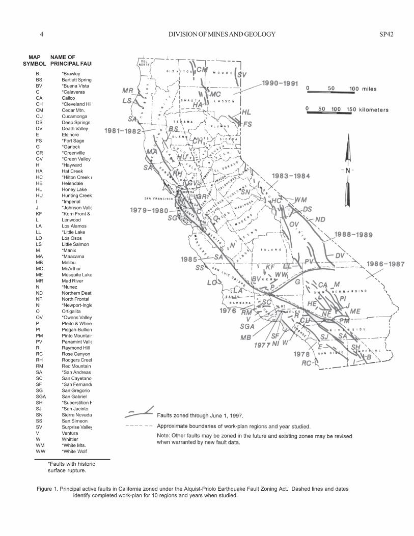
As of June 1, 1997, 543 Official Maps of Earthquake FaultZones have been issued. Of these, 147 have been revised since theirinitial issue and four have been withdrawn. The maps are identifiedby quadrangle map name and the date of issue or revision on theIndex to Official Maps of Earthquake Fault Zones (Figure 4).
The maps delineate regulatory zones for the faults generallyidentified in Figure 1. Additional faults will be zoned in the future,and some zones will be revised. Thirty-six counties and 97 cities areaffected by the existing Earthquake Fault Zones. These jurisdictionsare listed in Table 4.
Definitions, Policies, RationaleFor the State Geologist to carry out the mandate to establish
regulatory zones, certain terms identified in Section 2622 of the Acthad to be defined and policies had to be developed to provide aconsistent and reasonable approach to zoning. After the zoning
4 DIVISION OF MINES AND GEOLOGY SP42
B *BrawleyBS Bartlett SpringsBV *Buena VistaC *CalaverasCA CalicoCH *Cleveland HillCM Cedar Mtn.CU CucamongaDS Deep SpringsDV Death ValleyE ElsinoreFS *Fort SageG *GarlockGR *GreenvilleGV *Green Valley and ConcordH *HaywardHA Hat CreekHC *Hilton Creek & relatedHE HelendaleHL Honey LakeHU Hunting CreekI *ImperialJ *Johnson Valley & relatedKF *Kern Front & relatedL LenwoodLA Los AlamosLL *Little LakeLO Los OsosLS Little SalmonM *ManixMA *MaacamaMB MalibuMC McArthurME Mesquite LakeMR Mad RiverN *NunezND Northern Death ValleyNF North FrontalNI *Newport-InglewoodO OrtigalitaOV *Owens ValleyP Pleito & Wheeler RidgePI Pisgah-BullionPM Pinto MountainPV Panamint ValleyR Raymond HillRC Rose CanyonRH Rodgers Creek-HealdsburgRM Red MountainSA *San AndreasSC San CayetanoSF *San FernandoSG San GregorioSGA San GabrielSH *Superstition HillsSJ *San JacintoSN Sierra Nevada (zone)SS San SimeonSV Surprise ValleyV VenturaW WhittierWM *White Mts.WW *White Wolf
Faults zoned through June 1, 1997.
Approximate boundaries of work-plan regions and year studied.
Note: Other faults may be zoned in the future and existing zones may be revisedwhen warranted by new fault data.
MAPSYMBOL
Figure 1. Principal active faults in California zoned under the Alquist-Priolo Earthquake Fault Zoning Act. Dashed lines and datesidentify completed work-plan for 10 regions and years when studied.
NAME OFPRINCIPAL FAULT
*Faults with historicsurface rupture.

1999 FAULT-RUPTURE HAZARD ZONES IN CALIFORNIA 5
Fault TraceA fault trace is the line formed by the intersection of a fault
and the earth’s surface. It is the representation of a fault as depictedon a map, including maps of the Earthquake Fault Zones.
Active FaultFor the purposes of this Act, an active fault is defined by the
State Mining and Geology Board as one which has “had surfacedisplacement within Holocene time (about the last 11,000 years)”(see Appendix B, Section 3601). This definition does not, ofcourse, mean that faults lacking evidence for surface displacementwithin Holocene time are necessarily inactive. A fault may bepresumed to be inactive based on satisfactory geologic evidence;however, the evidence necessary to prove inactivity is sometimesdifficult to obtain and locally may not exist.
Potentially Active FaultBecause the Alquist-Priolo Act requires the State Geologist to
establish Earthquake Fault Zones to encompass all “potentially andrecently active” traces of the San Andreas, Calaveras, Hayward, andSan Jacinto faults, additional definitions were needed (Section2622). Initially, faults were defined as potentially active, and werezoned, if they showed evidence of surface displacement duringQuaternary time (last 1.6 million years, Figure 2). Exceptions weremade for certain Quaternary (i.e., Pleistocene) faults that werepresumed to be inactive based on direct geologic evidence ofinactivity during all of Holocene time or longer. The term “recentlyactive” was not defined, as it was considered to be covered by theterm “potentially active.” Beginning in 1977, evidence ofQuaternary surface displacement was no longer used as a criterionfor zoning. However, the term “potentially active” continued to beused as a descriptive term on map explanations on EFZ maps until1988.
Sufficiently Active and Well-DefinedA major objective of DMG's continuing Fault Evaluation and
Zoning Program is to evaluate the hundreds of remainingpotentially active faults in California for zoning consideration.However, it became apparent as the program progressed that thereare so many potentially active (i.e., Quaternary) faults in the state
(Jennings, 1975) that it would be meaningless to zone all of them.In late 1975, the State Geologist made a policy decision to zoneonly those potentially active faults that have a relatively highpotential for ground rupture. To facilitate this, the terms“sufficiently active” and “well-defined,” from Section 2622 of theAct, were defined for application in zoning faults other than thefour named in the Act. These two terms constitute the presentcriteria used by the State Geologist in determining if a given faultshould be zoned under the Alquist-Priolo Act.
Sufficiently active. A fault is deemed sufficiently active ifthere is evidence of Holocene surface displacement along one ormore of its segments or branches. Holocene surface displacementmay be directly observable or inferred; it need not be presenteverywhere along a fault to qualify that fault for zoning.
Well-defined. A fault is considered well-defined if its trace isclearly detectable by a trained geologist as a physical feature at orjust below the ground surface. The fault may be identified by directobservation or by indirect methods (e.g., geomorphic evidence;Appendix C). The critical consideration is that the fault, or somepart of it, can be located in the field with sufficient precision andconfidence to indicate that the required site-specific investigationswould meet with some success.
Determining if a fault is sufficiently active and well-defined isa matter of judgment. However, these definitions provide standard,workable guidelines for establishing Earthquake Fault Zones underthe Act.
The evaluation of faults for zoning purposes is done with therealization that not all active faults can be identified. Furthermore,certain faults considered to be active at depth, because of knownseismic activity, are so poorly defined at the surface that zoning isimpractical. Although the map explanation indicates that“potentially active” (i.e., Quaternary) faults are identified and zoned(with exceptions) on the Official Maps of Earthquake Fault Zonesuntil 1988, this is basically true only for those maps issued July 1,1974 and January 1, 1976. Even so, all the principal faults zoned in1974 and 1976 were active during Holocene time, if nothistorically. Beginning with the maps of January 1, 1977, all faultszoned meet the criteria of “sufficiently active and well-defined.”
11,000
1,600,000
5,000,000
YEARS BEFOREPRESENT(estimated)Period Epoch
Holocene
Historic
66,000,000
200
4,600,000,000Beginning of geologic timepre-CENOZOIC time
pre-Pliocene
Pliocene
Pleistocene
QUATERNARY
TERTIARY
GEOLOGIC AGE
CEN
OZO
IC
Figure 2. Geologic time scale.
Faults along which movement has occurred during thisinterval and defined as active by Policies and Criteria of theState Mining and Geology Board.
Faults defined as potentially active for the purpose ofevaluation for possible zonation.
6 DIVISION OF MINES AND GEOLOGY SP42
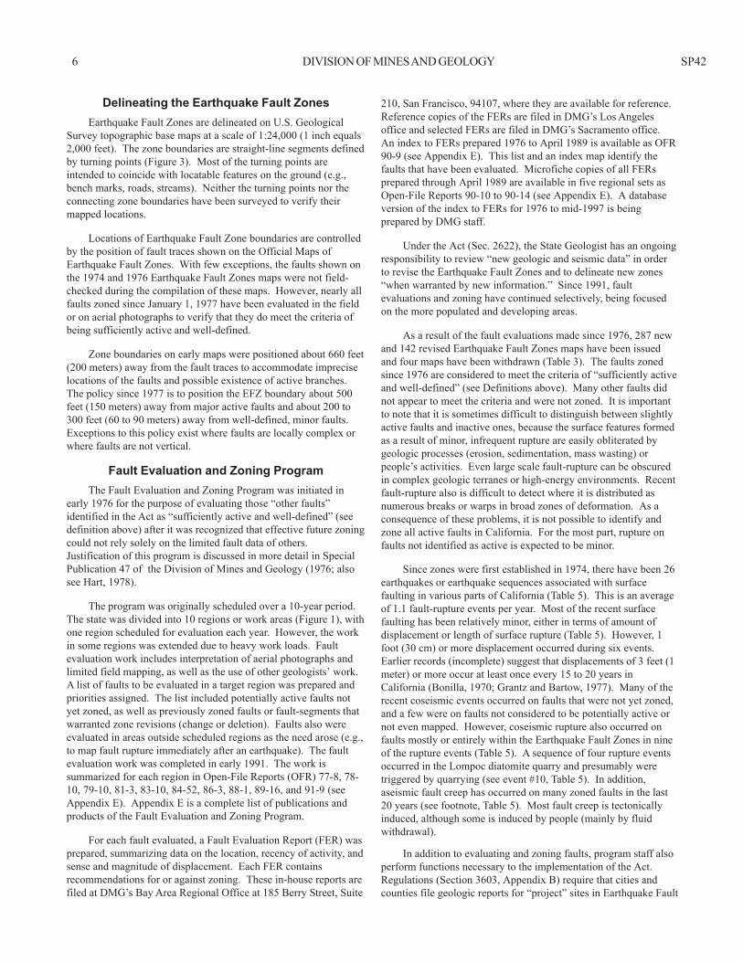
210, San Francisco, 94107, where they are available for reference.Reference copies of the FERs are filed in DMG’s Los Angelesoffice and selected FERs are filed in DMG’s Sacramento office.An index to FERs prepared 1976 to April 1989 is available as OFR90-9 (see Appendix E). This list and an index map identify thefaults that have been evaluated. Microfiche copies of all FERsprepared through April 1989 are available in five regional sets asOpen-File Reports 90-10 to 90-14 (see Appendix E). A databaseversion of the index to FERs for 1976 to mid-1997 is beingprepared by DMG staff.
Under the Act (Sec. 2622), the State Geologist has an ongoingresponsibility to review “new geologic and seismic data” in orderto revise the Earthquake Fault Zones and to delineate new zones“when warranted by new information.” Since 1991, faultevaluations and zoning have continued selectively, being focusedon the more populated and developing areas.
As a result of the fault evaluations made since 1976, 287 newand 142 revised Earthquake Fault Zones maps have been issuedand four maps have been withdrawn (Table 3). The faults zonedsince 1976 are considered to meet the criteria of “sufficiently activeand well-defined” (see Definitions above). Many other faults didnot appear to meet the criteria and were not zoned. It is importantto note that it is sometimes difficult to distinguish between slightlyactive faults and inactive ones, because the surface features formedas a result of minor, infrequent rupture are easily obliterated bygeologic processes (erosion, sedimentation, mass wasting) orpeople’s activities. Even large scale fault-rupture can be obscuredin complex geologic terranes or high-energy environments. Recentfault-rupture also is difficult to detect where it is distributed asnumerous breaks or warps in broad zones of deformation. As aconsequence of these problems, it is not possible to identify andzone all active faults in California. For the most part, rupture onfaults not identified as active is expected to be minor.
Since zones were first established in 1974, there have been 26earthquakes or earthquake sequences associated with surfacefaulting in various parts of California (Table 5). This is an averageof 1.1 fault-rupture events per year. Most of the recent surfacefaulting has been relatively minor, either in terms of amount ofdisplacement or length of surface rupture (Table 5). However, 1foot (30 cm) or more displacement occurred during six events.Earlier records (incomplete) suggest that displacements of 3 feet (1meter) or more occur at least once every 15 to 20 years inCalifornia (Bonilla, 1970; Grantz and Bartow, 1977). Many of therecent coseismic events occurred on faults that were not yet zoned,and a few were on faults not considered to be potentially active ornot even mapped. However, coseismic rupture also occurred onfaults mostly or entirely within the Earthquake Fault Zones in nineof the rupture events (Table 5). A sequence of four rupture eventsoccurred in the Lompoc diatomite quarry and presumably weretriggered by quarrying (see event #10, Table 5). In addition,aseismic fault creep has occurred on many zoned faults in the last20 years (see footnote, Table 5). Most fault creep is tectonicallyinduced, although some is induced by people (mainly by fluidwithdrawal).
In addition to evaluating and zoning faults, program staff alsoperform functions necessary to the implementation of the Act.Regulations (Section 3603, Appendix B) require that cities andcounties file geologic reports for “project” sites in Earthquake Fault
Delineating the Earthquake Fault ZonesEarthquake Fault Zones are delineated on U.S. Geological
Survey topographic base maps at a scale of 1:24,000 (1 inch equals2,000 feet). The zone boundaries are straight-line segments definedby turning points (Figure 3). Most of the turning points areintended to coincide with locatable features on the ground (e.g.,bench marks, roads, streams). Neither the turning points nor theconnecting zone boundaries have been surveyed to verify theirmapped locations.
Locations of Earthquake Fault Zone boundaries are controlledby the position of fault traces shown on the Official Maps ofEarthquake Fault Zones. With few exceptions, the faults shown onthe 1974 and 1976 Earthquake Fault Zones maps were not field-checked during the compilation of these maps. However, nearly allfaults zoned since January 1, 1977 have been evaluated in the fieldor on aerial photographs to verify that they do meet the criteria ofbeing sufficiently active and well-defined.
Zone boundaries on early maps were positioned about 660 feet(200 meters) away from the fault traces to accommodate impreciselocations of the faults and possible existence of active branches.The policy since 1977 is to position the EFZ boundary about 500feet (150 meters) away from major active faults and about 200 to300 feet (60 to 90 meters) away from well-defined, minor faults.Exceptions to this policy exist where faults are locally complex orwhere faults are not vertical.
Fault Evaluation and Zoning ProgramThe Fault Evaluation and Zoning Program was initiated in
early 1976 for the purpose of evaluating those “other faults”identified in the Act as “sufficiently active and well-defined” (seedefinition above) after it was recognized that effective future zoningcould not rely solely on the limited fault data of others.Justification of this program is discussed in more detail in SpecialPublication 47 of the Division of Mines and Geology (1976; alsosee Hart, 1978).
The program was originally scheduled over a 10-year period.The state was divided into 10 regions or work areas (Figure 1), withone region scheduled for evaluation each year. However, the workin some regions was extended due to heavy work loads. Faultevaluation work includes interpretation of aerial photographs andlimited field mapping, as well as the use of other geologists’ work.A list of faults to be evaluated in a target region was prepared andpriorities assigned. The list included potentially active faults notyet zoned, as well as previously zoned faults or fault-segments thatwarranted zone revisions (change or deletion). Faults also wereevaluated in areas outside scheduled regions as the need arose (e.g.,to map fault rupture immediately after an earthquake). The faultevaluation work was completed in early 1991. The work issummarized for each region in Open-File Reports (OFR) 77-8, 78-10, 79-10, 81-3, 83-10, 84-52, 86-3, 88-1, 89-16, and 91-9 (seeAppendix E). Appendix E is a complete list of publications andproducts of the Fault Evaluation and Zoning Program.
For each fault evaluated, a Fault Evaluation Report (FER) wasprepared, summarizing data on the location, recency of activity, andsense and magnitude of displacement. Each FER containsrecommendations for or against zoning. These in-house reports arefiled at DMG’s Bay Area Regional Office at 185 Berry Street, Suite

1999 FAULT-RUPTURE HAZARD ZONES IN CALIFORNIA 7
Figure 3. Example of Earthquake Fault Zones map and explanation of map symbols.
MAP EXPLANATION
Active FaultsFaults considered to have been active during Holocene time and to have arelatively high potential for surface rupture; solid line where accurately located,long dash where approximately located, short dash where inferred, dotted whereconcealed; query (?) indicates additional uncertainity. Evidence of historic offsetindicated by year of earthquake-associated event or C for displacement caused bycreep or possible creep.
Earthquake Fault Zone BoundariesThese are delineated as straight-line segments that connect encircled turning pointsso as to define earthquake fault zone segments.Seaward projection of zone boundary.

8 D
IVISIO
N O
F MIN
ES AN
D G
EOLO
GY
SP42
(San Bernardino)
Table 5. Surface faulting associated with earthquakes in California, 1974-June 1997. List excludes fault creep and faulting triggered by shaking or movement on a different fault1 . See Bonilla (1970), Jennings (1985), and Grantz and Bartow (1977) for earlier faulting events.
SurfaceMagnitude rupture2
of Maximum Total MainFault (County Year of associated displacement length2 sense of Commentswhere located) rupture earthquake (cm) (km) displacement3
1. Brawley 1975 4.7 20 10.4 N Also ruptured in 1940 and 1979, fault creep in part.(Imperial)
2. Galway Lake 1975 5.3 1.5 6.8 RL Fault previously unknown.(San Bernardino)
3. Cleveland Hill 1975 5.7 5 5.7 N Fault not previously known to be Holocene-active.(Butte)
4. Stephens Pass 1978 4.3 30 2+ N Fault previously unknown.(Siskiyou)
5. Homestead Valley 1979 5.2 8 3.3 RL Also minor rupture on Johnson Valley fault.(San Bernardino)
6. *Calaveras (San Benito, 1979 5.9 1 39 (?) RL Minor, discontinuous rupture mostly in creep-active segment.Santa Clara)
7. *Imperial 55 30 RL Creep triggered on San Andreas and Superstition Hills faults; also ruptured in*Brawley (Imperial) 1979 6.6 15 13 N 1940. Rico fault not previously known.Rico 10 1 N
8. Greenville 1980 5.6 3 6.5 RL Minor left-lateral slip also occurred on Las Positas fault.(Alameda)
9 . Hilton Creek-Mammoth Lakes 1980 6.0-6.5 30 20 N Rupture on many minor faults, may relate to volcanic activity. Minor ruptures(Mono) also in 1981.
10. “Lompoc quarry” 1981 2.5 25 0.6 R Flexural slip on flank of syncline triggered by quarrying; do not plan to zone.(Santa Barbara) Similar earthquake-associated ruptures occurred in 1985, 1988, and 1995.
11. Little Lake 1982 5.2 0+ 10 RL/N Fracture zones on monoclines.(Kern)
12. “Coalinga Nose” 1983 6.7 5 .005 R Secondary fault (?) associated with 43 cm of anticlinal uplift; too minor to zone.(Fresno)
13. Nunez 1983 5.2-5.9 60 3.3 R Aftershocks associated with event (12) above.(Fresno)
14. *Calaveras 1984 6.1 20 (?) 1.2 RL Questionable faulting; triggered afterslip in 15-km long creep-zone to south.(Santa Clara)
15. *Banning 1986 5.9 7 9 RL Minor slip also triggered locally on Garnet Hill and Desert Hot Springs (?) faults(Riverside) as well as more distant faults.
16. *White Mountains 1986 6.4 11 13 RL/N Also extensional cracks on faults in Volcanic Tableland in 40km x 12km area.(Mono, Inyo)
17. Elmore Ranch 1987 6.2 12 12 LL Also lesser left-lateral rupture on nearby faults.(Imperial)
18. *Superstition Hills 1987 6.6 90 28 RL Much of rupture occurred as afterslip; associated with event 17.(Imperial)
19. *San Andreas 1989 7.1 2.5 1? RL Surface rupture possibly triggered slip; slip also triggered on nearby Calaveras(Santa Cruz) and San Andreas faults outside of aftershock zone. Secondary faulting may have
occurred with ridgetop spreading fissures. 20. *Johnson Valley 1992 7.3 460-600 85 RL Most significant fault rupture since 1906; ruptures connected several separate
*Homestead Valley faults; triggered slip also occurred on at least 10 other faults.*Emerson*Camp Rock
21. ”Eureka Valley” 1993 6.1 2 5+ RL/N Two zones of left-stepping fractures along pre-existing fault scarps; incompletely(Inyo) mapped; remote area, not zoned.
22. “Stevenson Ranch” 1994 6.7 19 0.6 R Flexural slip faults on limb of fold near Newhall; related to blind thrust faulting.(Los Angeles) Minor slip also triggered on Mission Wells fault, which ruptured in 1971.
23. Airport Lake 1995 5.4-5.8 1 2.5 RL/N Discontinuous cracks along pre-existing scarp.(Kern and Inyo)
1 Tectonic (aseismic) fault-creep and triggered slip have occurred along various segments of the San Andreas, Hayward, Calaveras, Concord, Green Valley, Imperial, Superstition Hills, Maacama, Garlock, and more than 10 other faults. People-induced fault-creep has been reported on at least 12 other faults due to withdrawal of ground water or oil field fluids. See Jennings (1994) for reported locations.2 Includes some afterslip. Rupture length measured from distal ends of rupture, which often is discontinous.3 N=normal displacement; R=reverse displacement; RL=right lateral displacement; LL=left-lateral displacement.* Coseismic surface faulting occurred mostly or entirely within existing Earthquake Fault Zones during eight events.
1999 FAULT-RUPTURE HAZARD ZONES IN CALIFORNIA 9
differential settlement, liquefaction) are omitted from the map anddo not serve as a basis for zoning.
Active faults may exist outside the Earthquake Fault Zones.Therefore, fault investigations are recommended for all critical andimportant developments proposed outside the Earthquake FaultZones.
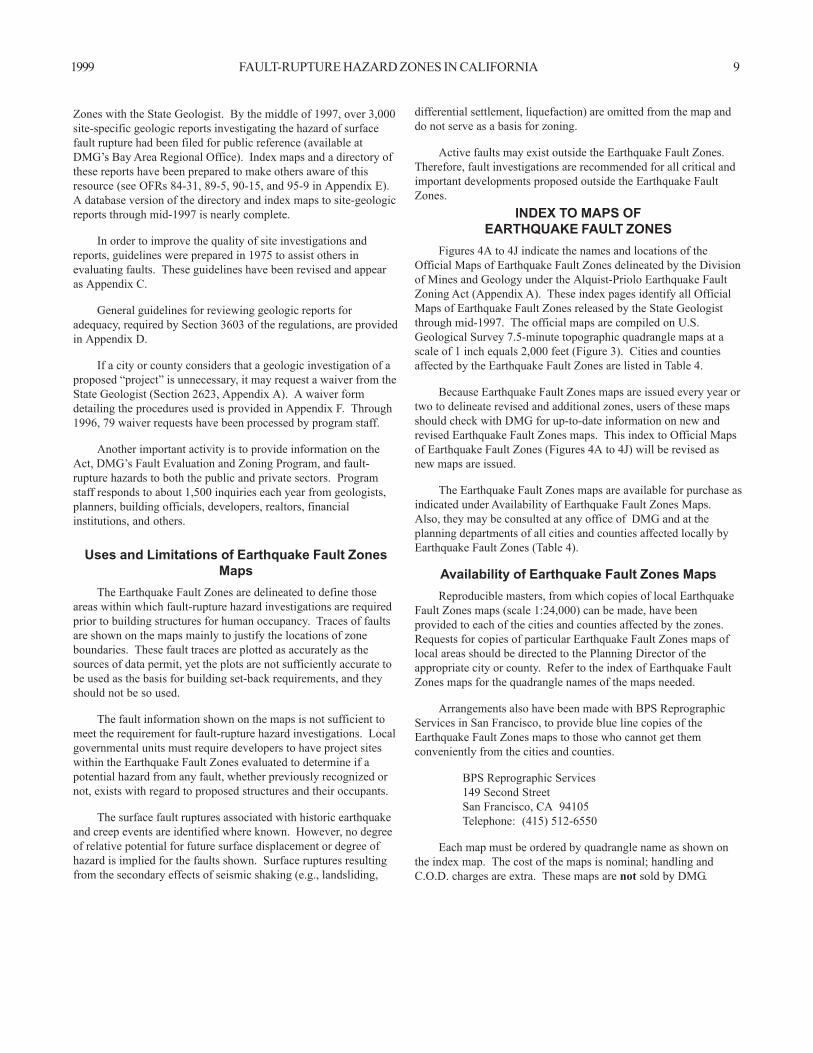
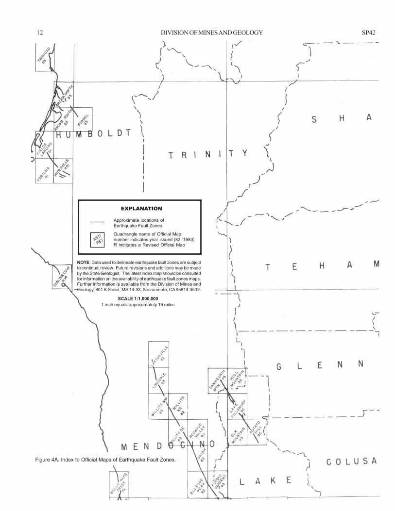
INDEX TO MAPS OFEARTHQUAKE FAULT ZONES
Figures 4A to 4J indicate the names and locations of theOfficial Maps of Earthquake Fault Zones delineated by the Divisionof Mines and Geology under the Alquist-Priolo Earthquake FaultZoning Act (Appendix A). These index pages identify all OfficialMaps of Earthquake Fault Zones released by the State Geologistthrough mid-1997. The official maps are compiled on U.S.Geological Survey 7.5-minute topographic quadrangle maps at ascale of 1 inch equals 2,000 feet (Figure 3). Cities and countiesaffected by the Earthquake Fault Zones are listed in Table 4.
Because Earthquake Fault Zones maps are issued every year ortwo to delineate revised and additional zones, users of these mapsshould check with DMG for up-to-date information on new andrevised Earthquake Fault Zones maps. This index to Official Mapsof Earthquake Fault Zones (Figures 4A to 4J) will be revised asnew maps are issued.
The Earthquake Fault Zones maps are available for purchase asindicated under Availability of Earthquake Fault Zones Maps.Also, they may be consulted at any office of DMG and at theplanning departments of all cities and counties affected locally byEarthquake Fault Zones (Table 4).
Availability of Earthquake Fault Zones MapsReproducible masters, from which copies of local Earthquake
Fault Zones maps (scale 1:24,000) can be made, have beenprovided to each of the cities and counties affected by the zones.Requests for copies of particular Earthquake Fault Zones maps oflocal areas should be directed to the Planning Director of theappropriate city or county. Refer to the index of Earthquake FaultZones maps for the quadrangle names of the maps needed.
Arrangements also have been made with BPS ReprographicServices in San Francisco, to provide blue line copies of theEarthquake Fault Zones maps to those who cannot get themconveniently from the cities and counties.
BPS Reprographic Services149 Second StreetSan Francisco, CA 94105Telephone: (415) 512-6550
Each map must be ordered by quadrangle name as shown onthe index map. The cost of the maps is nominal; handling andC.O.D. charges are extra. These maps are not sold by DMG.
Zones with the State Geologist. By the middle of 1997, over 3,000site-specific geologic reports investigating the hazard of surfacefault rupture had been filed for public reference (available atDMG’s Bay Area Regional Office). Index maps and a directory ofthese reports have been prepared to make others aware of thisresource (see OFRs 84-31, 89-5, 90-15, and 95-9 in Appendix E).A database version of the directory and index maps to site-geologicreports through mid-1997 is nearly complete.
In order to improve the quality of site investigations andreports, guidelines were prepared in 1975 to assist others inevaluating faults. These guidelines have been revised and appearas Appendix C.
General guidelines for reviewing geologic reports foradequacy, required by Section 3603 of the regulations, are providedin Appendix D.
If a city or county considers that a geologic investigation of aproposed “project” is unnecessary, it may request a waiver from theState Geologist (Section 2623, Appendix A). A waiver formdetailing the procedures used is provided in Appendix F. Through1996, 79 waiver requests have been processed by program staff.
Another important activity is to provide information on theAct, DMG’s Fault Evaluation and Zoning Program, and fault-rupture hazards to both the public and private sectors. Programstaff responds to about 1,500 inquiries each year from geologists,planners, building officials, developers, realtors, financialinstitutions, and others.
Uses and Limitations of Earthquake Fault ZonesMaps
The Earthquake Fault Zones are delineated to define thoseareas within which fault-rupture hazard investigations are requiredprior to building structures for human occupancy. Traces of faultsare shown on the maps mainly to justify the locations of zoneboundaries. These fault traces are plotted as accurately as thesources of data permit, yet the plots are not sufficiently accurate tobe used as the basis for building set-back requirements, and theyshould not be so used.
The fault information shown on the maps is not sufficient tomeet the requirement for fault-rupture hazard investigations. Localgovernmental units must require developers to have project siteswithin the Earthquake Fault Zones evaluated to determine if apotential hazard from any fault, whether previously recognized ornot, exists with regard to proposed structures and their occupants.
The surface fault ruptures associated with historic earthquakeand creep events are identified where known. However, no degreeof relative potential for future surface displacement or degree ofhazard is implied for the faults shown. Surface ruptures resultingfrom the secondary effects of seismic shaking (e.g., landsliding,

10 DIVISION OF MINES AND GEOLOGY SP42
REFERENCES(See Appendix E for Complete List of AP Products)
Jennings, C.W., 1975, Fault map of California with locations ofvolcanoes, thermal springs, and thermal wells: CaliforniaDivision of Mines and Geology Data Map No. 1, scale1:750,000.
Jennings, C.W., 1985, An explanatory text to accompany the1:750,000 scale Fault and Geologic Maps of California:Division of Mines and Geology Bulletin 201, 197 p., 2 plates.
Jennings, C.W., 1994, Fault activity map of California and adjacentareas: California Department of Conservation, Division ofMines and Geology Geologic Data Map No. 6, scale 1:750,000(appendices).
Reitherman, R., and Leeds, D.J., 1990, A study of the effectivenessof the Alquist-Priolo program: California Division of Minesand Geology Open-File Report 90-18, 131 p.
Bonilla, M.G., 1970, Surface faulting and related effects, in Wiegel,R.L, editor, Earthquake Engineering: Prentice-Hall, Inc.,Englewood Cliffs, New Jersey, p. 47-74.
California Division of Mines and Geology, 1976, Active faultmapping and evaluation program — 10-year program toimplement Alquist-Priolo Special Studies Zones Act: CaliforniaDivision of Mines and Geology Special Publication 47, 42 p.
Grantz, A., and Bartow, A., 1977, Active faults of California: U.S.Geological Survey pamphlet, 15 p.
Hart, E.W., 1978, Zoning for the hazard of surface fault rupture inCalifornia: International Conference on Microzonation, 2nd,San Francisco, 1978, Proceedings, v. 2, p. 635-646.
Hart, E.W., 1986, Zoning for the hazard of surface faulting inCalifornia, in Proceedings Conference XXXII — Workshop onfuture directions in evaluating earthquake hazards in southernCalifornia, November 12-13, 1985: U.S. Geological SurveyOpen-File Report 86-401, p. 74-83.

1999 FAULT-RUPTURE HAZARD ZONES IN CALIFORNIA 11
Figure 4. Index to Official Maps of Earthquake Fault Zones.
Data used to delineate Earthquake Fault Zones are subject to continual review. Future revisions and additions may be made bythe State Geologist. Future supplements to this report should be consulted for information on the availability of Earthquake FaultZones maps.These Earthquake Fault Zones maps are delineated in compliance with Chapter 7.5, Division 2 of the California Public ResourcesCode.
12 DIVISION OF MINES AND GEOLOGY SP42
Figure 4A. Index to Official Maps of Earthquake Fault Zones.
NOTE: Data used to delineate earthquake fault zones are subjectto continual review. Future revisions and additions may be madeby the State Geologist. The latest index map should be consultedfor information on the availability of earthquake fault zones maps.Further information is available from the Division of Mines andGeology, 801 K Street, MS 14-33, Sacramento, CA 95814-3532.
SCALE 1:1,000,0001 inch equals approximately 16 miles
ASTI
R83
EXPLANATION
Approximate locations ofEarthquake Fault Zones
Quadrangle name of Official Map;number indicates year issued (83=1983)R indicates a Revised Official Map

1999 FAULT-RUPTURE HAZARD ZONES IN CALIFORNIA 13
SCALE 1:1,000,0001 inch equals approximately 16 miles
NOTE: Data used to delineate earthquake fault zones are subjectto continual review. Future revisions and additions may be madeby the State Geologist. The latest index map should be consultedfor information on the availability of earthquake fault zones maps.Further information is available from the Division of Mines andGeology, 801 K Street, MS 14-33, Sacramento, CA 95814-3532.
Figure 4B. Index to Official Maps of Earthquake Fault Zones.
EXPLANATION
Approximate locations ofEarthquake Fault Zones
Quadrangle name of Official Map;number indicates year issued (83=1983)R indicates a Revised Official Map
ASTI
R83

14 DIVISION OF MINES AND GEOLOGY SP42
SCALE 1:1,000,0001 inch equals approximately 16 miles
NOTE: Data used to delineate earthquake fault zones are subjectto continual review. Future revisions and additions may be madeby the State Geologist. The latest index map should be consultedfor information on the availability of earthquake fault zones maps.Further information is available from the Division of Mines andGeology, 801 K Street, MS 14-33, Sacramento, CA 95814-3532.
Figure 4C. Index to Official Maps of Earthquake Fault Zones.
EXPLANATION
Approximate locations ofEarthquake Fault Zones
Quadrangle name of Official Map;number indicates year issued (83=1983)R indicates a Revised Official Map
ASTI
R83

1999 FAULT-RUPTURE HAZARD ZONES IN CALIFORNIA 15
SCALE 1:1,000,0001 inch equals approximately 16 miles
NOTE: Data used to delineate earthquake fault zones are subjectto continual review. Future revisions and additions may be madeby the State Geologist. The latest index map should be consultedfor information on the availability of earthquake fault zones maps.Further information is available from the Division of Mines andGeology, 801 K Street, MS 14-33, Sacramento, CA 95814-3532.
Figure 4D. Index to Official Maps of Earthquake Fault Zones.
EXPLANATION
Approximate locations ofEarthquake Fault Zones
Quadrangle name of Official Map;number indicates year issued (83=1983)R indicates a Revised Official Map
ASTI
R83
16 DIVISION OF MINES AND GEOLOGY SP42
NOTE: Data used to delineate earthquake fault zones are subjectto continual review. Future revisions and additions may be madeby the State Geologist. The latest index map should be consultedfor information on the availability of earthquake fault zones maps.Further information is available from the Division of Mines andGeology, 801 K Street, MS 14-33, Sacramento, CA 95814-3532.
Figure 4E. Index to Official Maps of Earthquake Fault Zones.
EXPLANATION
Approximate locations ofEarthquake Fault Zones
Quadrangle name of Official Map;number indicates year issued (83=1983)R indicates a Revised Official Map
ASTI
R83
SCALE 1:1,000,0001 inch equals approximately 16 miles

1999 FAULT-RUPTURE HAZARD ZONES IN CALIFORNIA 17
NOTE: Data used to delineate earthquake fault zones are subjectto continual review. Future revisions and additions may be madeby the State Geologist. The latest index map should be consultedfor information on the availability of earthquake fault zones maps.Further information is available from the Division of Mines andGeology, 801 K Street, MS 14-33, Sacramento, CA 95814-3532.
SCALE 1:1,000,0001 inch equals approximately 16 miles
Figure 4F. Index to Official Maps of Earthquake Fault Zones.
EXPLANATION
Approximate locations ofEarthquake Fault Zones
Quadrangle name of Official Map;number indicates year issued (83=1983)R indicates a Revised Official Map
ASTI
R83

18 DIVISION OF MINES AND GEOLOGY SP42
SCALE 1:1,000,0001 inch equals approximately 16 miles
NOTE: Data used to delineate earthquake fault zones are subjectto continual review. Future revisions and additions may be madeby the State Geologist. The latest index map should be consultedfor information on the availability of earthquake fault zones maps.Further information is available from the Division of Mines andGeology, 801 K Street, MS 14-33, Sacramento, CA 95814-3532.
EXPLANATION
Approximate locations ofEarthquake Fault Zones
Quadrangle name of Official Map;number indicates year issued (83=1983)R indicates a Revised Official Map
ASTI
R83
Figure 4G. Index to Official Maps of Earthquake Fault Zones.

1999 FAULT-RUPTURE HAZARD ZONES IN CALIFORNIA 19
SCALE 1:1,000,0001 inch equals approximately 16 miles
NOTE: Data used to delineate earthquake fault zones are subjectto continual review. Future revisions and additions may be madeby the State Geologist. The latest index map should be consultedfor information on the availability of earthquake fault zones maps.Further information is available from the Division of Mines andGeology, 801 K Street, MS 14-33, Sacramento, CA 95814-3532.
EXPLANATION
Approximate locations ofEarthquake Fault Zones
Quadrangle name of Official Map;number indicates year issued (83=1983)R indicates a Revised Official Map
ASTI
R83
Figure 4H. Index to Official Maps of Earthquake Fault Zones.

20 DIVISION OF MINES AND GEOLOGY SP42
SCALE 1:1,000,0001 inch equals approximately 16 miles
NOTE: Data used to delineate earthquake fault zones are subjectto continual review. Future revisions and additions may be madeby the State Geologist. The latest index map should be consultedfor information on the availability of earthquake fault zones maps.Further information is available from the Division of Mines andGeology, 801 K Street, MS 14-33, Sacramento, CA 95814-3532.
Figure 4I. Index to Official Maps of Earthquake Fault Zones.
EXPLANATION
Approximate locations ofEarthquake Fault Zones
Quadrangle name of Official Map;number indicates year issued (83=1983)R indicates a Revised Official Map
ASTI
R83

1999 FAULT-RUPTURE HAZARD ZONES IN CALIFORNIA 21
Figure 4J. Index to Official Maps of Earthquake Fault Zones.
SCALE 1:1,000,0001 inch equals approximately 16 miles
NOTE: Data used to delineate earthquake fault zones are subjectto continual review. Future revisions and additions may be madeby the State Geologist. The latest index map should be consultedfor information on the availability of earthquake fault zones maps.Further information is available from the Division of Mines andGeology, 801 K Street, MS 14-33, Sacramento, CA 95814-3532.
EXPLANATION
Approximate locations ofEarthquake Fault Zones
Quadrangle name of Official Map;number indicates year issued (83=1983)R indicates a Revised Official Map
ASTI
R83

22 DIVISION OF MINES AND GEOLOGY SP42
APPENDICES
Data are presented herein to provide city and county officials, property owners, developers, geologists, and others with specificinformation they may need to effectuate the Act.
Because the Act must be implemented at the local government level, it is imperative that the local entities understand its variousaspects.
Appendix AALQUIST-PRIOLO EARTHQUAKE FAULT ZONING ACT1
Excerpts from California Public Resources Code
(b) For the purposes of this chapter, a mobilehome whose bodywidth exceeds eight feet shall be considered to be a single-familywood-frame dwelling not exceeding two stories.
2621.7. This chapter, except Section 2621.9, shall not apply toany of the following:
(a) The conversion of an existing apartment complex into acondominium.
(b) Any development or structure in existence prior to May 4,1975, except for an alteration or addition to a structure that exceedsthe value limit specified in subdivision (c).
(c) An alteration or addition to any structure if the value of thealteration or addition does not exceed 50 percent of the value of thestructure.
(d) (1) Any structure located within the jurisdiction of the Cityof Berkeley or the City of Oakland which was damaged by firebetween October 20, 1991, and October 23, 1991, if granted anexemption pursuant to this subdivision.
(2) The city may apply to the State Geologist for an exemptionand the State Geologist shall grant the exemption only ifthe structure located within the earthquake fault zone is notsituated upon a trace of an active fault line, as delineated inan official earthquake fault zone map or in more recentgeologic data, as determined by the State Geologist.
(3) When requesting an exemption, the city shall submit to theState Geologist all of the following information:
(A) Maps noting the parcel numbers of proposed buildingsites that are at least 50 feet from an identified faultand a statement that there is not any more recentinformation to indicate a geologic hazard.
(B) Identification of any sites within 50 feet of anidentified fault.
(C) Proof that the property owner has been notified thatthe granting of an exemption is not any guarantee thata geologic hazard does not exist.
(4) The granting of an exemption does not relieve a seller ofreal property or an agent for the seller of the obligation todisclose to a prospective purchaser that the property islocated within a delineated earthquake fault zone, asrequired by Section 2621.9.
(e) (1) Alterations which include seismic retrofitting, as definedin Section 8894.2 of the Government Code, to any of the followinglisted types of buildings in existence prior to May 4, 1975:
DIVISION 2. Geology, Mines and MiningCHAPTER 7.5 Earthquake Fault Zones2
2621. This chapter shall be known and may be cited as theAlquist-Priolo Earthquake Fault Zoning Act1.
2621.5. (a) It is the purpose of this chapter to provide for theadoption and administration of zoning laws, ordinances, rules, andregulations by cities and counties in implementation of the generalplan that is in effect in any city or county. The Legislature declaresthat this chapter is intended to provide policies and criteria to assistcities, counties, and state agencies in the exercise of theirresponsibility to prohibit the location of developments andstructures for human occupancy across the trace of active faults.Further, it is the intent of this chapter to provide the citizens of thestate with increased safety and to minimize the loss of life duringand immediately following earthquakes by facilitating seismicretrofitting to strengthen buildings, including historical buildings,against ground shaking.
(b) This chapter is applicable to any project, as defined inSection 2621.6, which is located within a delineated earthquakefault zone, upon issuance of the official earthquake fault zonesmaps to affected local jurisdictions, except as provided in Section2621.7.
(c) The implementation of this chapter shall be pursuant topolicies and criteria established and adopted by the Board3
2621.6. (a) As used in this chapter, “project” means either ofthe following:
(1) Any subdivision of land which is subject to theSubdivision Map Act, (Division 2 (commencing withSection 66410) of Title 7 of the Government Code), andwhich contemplates the eventual construction of structuresfor human occupancy.
(2) Structures for human occupancy, with the exception ofeither of the following:
(A) Single-family wood-frame or steel-frame dwellings tobe built on parcels of land for which geologic reports
have been approved pursuant to paragraph (1).
(B) A single-family wood-frame or steel-frame dwellingnot exceeding two stories when that dwelling is notpart of a development of four or more dwellings.
1 Known as the Alquist-Priolo Special Studies Zones Act prior to January 1, 1994.2 Known as Special Studies Zones prior to January 1, 1994.3 State Mining and Geology Board.

1999 FAULT-RUPTURE HAZARD ZONES IN CALIFORNIA 23
(A) Unreinforced masonry buildings, as described insubdivision (a) of Section 8875 of the GovernmentCode.
(B) Concrete tilt-up buildings, as described in Section8893 of the Government Code.
(C) Reinforced concrete moment resisting framebuildings as described in Applied TechnologyCouncil Report 21 (FEMA Report 154).
(2) The exemption granted by paragraph (1) shall not applyunless a city or county acts in accordance with all of thefollowing:
(A) The building permit issued by the city or county forthe alterations authorizes no greater humanoccupancy load, regardless of proposed use, thanthat authorized for the existing use permitted at thetime the city or county grants the exemption. Thismay be accomplished by the city or county making ahuman occupancy load determination that is basedon, and no greater than, the existing authorized use,and including that determination on the buildingpermit application as well as a statementsubstantially as follows: “Under subparagraph (A) ofparagraph (2) of subdivision (e) of Section 2621.7 ofthe Public Resources Code, the occupancy load islimited to the occupancy load for the last lawful useauthorized or existing prior to the issuance of thisbuilding permit, as determined by the city orcounty.”
(B) The city or county requires seismic retrofitting, asdefined in Section 8894.2 of the Government Code,which is necessary to strengthen the entire structureand provide increased resistance to ground shakingfrom earthquakes.
(C) Exemptions granted pursuant to paragraph (1) arereported in writing to the State Geologist within 30days of the building permit issuance date.
(3) Any structure with human occupancy restrictions undersubparagraph (A) of paragraph (2) shall not be granted anew building permit that allows an increase in humanoccupancy unless a geologic report, prepared pursuant tosubdivision (d) of Section 3603 of Title 14 of theCalifornia Code of Regulations in effect on January 1,1994, demonstrates that the structure is not on the trace ofan active fault, or the requirement of a geologic report hasbeen waived pursuant to Section 2623.
(4) A qualified historical building within an earthquake faultzone that is exempt pursuant to this subdivision may berepaired or seismically retrofitted using the StateHistorical Building Code, except that, notwithstandingany provision of that building code and its implementingregulations, paragraph (2) shall apply.
2621.8. Notwithstanding Section 818.2 of the GovernmentCode, a city or county which knowingly issues a permit that grantsan exemption pursuant to subdivision (e) of Section 2621.7 that
does not adhere to the requirements of paragraph (2) of subdivision(e) of Section 2621.7, may be liable for earthquake-related injuriesor deaths caused by failure to so adhere.
[Note: Section 2621.9 of the Public Resources Code wasamended on October 7, 1997. The amendment will becomeoperative on March 1, 1998. Both sections are printed herein.The italicized Section 2621.9 is in effect through February 28,1998.]
2621.9. (a) A person who is acting as an agent for a seller ofreal property which is located within a delineated earthquake faultzone, or the seller if he is acting without an agent, shall disclose toany prospective purchaser the fact that the property is locatedwithin a delineated earthquake fault zone, if the maps preparedpursuant to this chapter, or the information contained in the maps,are reasonably available.
(b) For the purposes of this section, in all transactions thatare subject to Section 1102 of the Civil Code, disclosure shall beprovided by one of the following means:
(1) The real estate transfer disclosure statement set out inSection 1102.6 of the Civil Code.
(2) The local option real estate transfer disclosure statementset out in subdivision (a) of Section 1102.6 of the CivilCode.
(3) The real estate contract and receipt for deposit.
(c) For the purposes of this section:
(1) “Reasonably available” means that for any county thatincludes areas covered by a delineated earthquake faultzone map, a notice has been posted at the offices of thecounty recorder, county assessor, and county planningcommission that identifies the location of the map and theeffective date of the notice, which shall not exceed 10days beyond the date the county received the map fromthe State Geologist.
(2) “Real estate contract and receipt for deposit” means thedocument containing the offer to sell or purchase realproperty, that when accepted, becomes a bindingcontract, and that serves as an acknowledgment of adeposit if one is received.
(d) For purposes of the disclosures required by this section,the following persons shall not be deemed agents of the transferor:
(1) Persons specified in Section 1102.11 of the Civil Code.
(2) Persons acting under a power of sale regulated by Section2924 of the Civil Code.
(e) For purposes of this section, Section 1102.13 of the CivilCode shall apply.
[Note: The non-italicized Section 2621.9 will become operativeon March 1, 1998.]
2621.9. (a) A person who is acting as an agent for a seller ofreal property which is located within a delineated earthquake fault
24 DIVISION OF MINES AND GEOLOGY SP42
zone, or the seller if he or she is acting without an agent, shalldisclose to any prospective purchaser the fact that the property islocated within a delineated earthquake fault zone.
(b) In all transactions that are subject to Section 1102 of theCivil Code, disclosure required by subdivision (a) of this sectionshall be provided by either of the following means:
(1) The Local Option Real Estate Transfer DisclosureStatement as provided in Section 1102.6a of the CivilCode.
(2) The Natural Hazard Disclosure Statement as provided inSection 1102.6c of the Civil Code.
(c) Disclosure is required pursuant to this section only whenone of the following conditions is met:
(1) The seller, or the seller’s agent, has actual knowledge thatthe property is within a delineated earthquake fault zone.
(2) A map that includes the property has been provided tothe city or county pursuant to Section 2622, and a noticehas been posted at the offices of the county recorder,county assessor, and county planning agency thatidentifies the location of the map and any informationregarding changes to the map received by the county.
(d) If the map or accompanying information is not ofsufficient accuracy or scale that a reasonable person can determineif the subject real property is included in a delineated earthquakefault hazard zone, the agent shall mark “Yes” on the Natural HazardDisclosure Statement. The agent may mark “No” on the NaturalHazard Disclosure Statement if he or she attaches a report preparedpursuant to subdivision (c) of Section 1102.4 of the Civil Code thatverifies the property is not in the hazard zone. Nothing in thissubdivision is intended to limit or abridge any existing duty of theseller or the seller’s agents to exercise reasonable care in making adetermination under this subdivision.
(e) For purposes of the disclosures required by this section,the following persons shall not be deemed agents of the seller:
(1) Persons specified in Section 1102.11 of the Civil Code.
(2) Persons acting under a power of sale regulated by Section2924 of the Civil Code.
(f) For purposes of this section, Section 1102.13 of the CivilCode shall apply.
(g) The specification of items for disclosure in this sectiondoes not limit or abridge any obligation for disclosure created byany other provision of law or that may exist in order to avoid fraud,misrepresentation, or deceit in the transfer transaction.
2622. (a) In order to assist cities and counties in theirplanning, zoning, and building-regulation functions, the StateGeologist shall delineate, by December 31, 1973, appropriatelywide earthquake fault zones to encompass all potentially andrecently active traces of the San Andreas, Calaveras, Hayward, andSan Jacinto Faults, and such other faults, or segments thereof, asthe State Geologist determines to be sufficiently active and well-defined as to constitute a potential hazard to structures from surface
faulting or fault creep. The earthquake fault zones shall ordinarilybe one-quarter mile or less in width, except in circumstances whichmay require the State Geologist to designate a wider zone.
(b) Pursuant to this section, the State Geologist shall compilemaps delineating the earthquake fault zones and shall submit themaps to all affected cities, counties, and state agencies, not laterthan December 31, 1973, for review and comment. Concernedjurisdictions and agencies shall submit all comments to the StateMining and Geology Board for review and consideration within 90days. Within 90 days of such review, the State Geologist shallprovide copies of the official maps to concerned state agencies andto each city or county having jurisdiction over lands lying withinany such zone.
(c) The State Geologist shall continually review new geologicand seismic data and shall revise the earthquake fault zones ordelineate additional earthquake fault zones when warranted by newinformation. The State Geologist shall submit all revised maps andadditional maps to all affected cities, counties, and state agenciesfor their review and comment. Concerned jurisdictions andagencies shall submit all comments to the State Mining andGeology Board for review and consideration within 90 days.Within 90 days of that review, the State Geologist shall providecopies of the revised and additional official maps to concerned stateagencies and to each city or county having jurisdiction over landslying within the earthquake fault zone.
(d) In order to ensure that sellers of real property and theiragents are adequately informed, any county that receives an officialmap pursuant to this section shall post a notice within five days ofreceipt of the map at the offices of the county recorder, countyassessor, and county planning commission, identifying the locationof the map and the effective date of the notice.
2623. (a) The approval of a project by a city or county shallbe in accordance with policies and criteria established by the StateMining and Geology Board and the findings of the State Geologist.In the development of such policies and criteria, the State Miningand Geology Board shall seek the comment and advice of affectedcities, counties, and state agencies. Cities and counties shallrequire, prior to the approval of a project, a geologic report definingand delineating any hazard of surface fault rupture. If the city orcounty finds that no undue hazard of that kind exists, the geologicreport on the hazard may be waived, with the approval of the StateGeologist.
(b) After a report has been approved or a waiver granted,subsequent geologic reports shall not be required, provided thatnew geologic data warranting further investigations is not recorded.
(c) The preparation of geologic reports that are requiredpursuant to this section for multiple projects may be undertaken bya geologic hazard abatement district.
2624. Notwithstanding any provision of this chapter, citiesand counties may do any of the following:
(1) Establish policies and criteria which are stricter thanthose established by this chapter.
(2) Impose and collect fees in addition to those requiredunder this chapter.
(3) Determine not to grant exemptions authorized under thischapter.

1999 FAULT-RUPTURE HAZARD ZONES IN CALIFORNIA 25
2625. (a) Each applicant for approval of a project may becharged a reasonable fee by the city or county having jurisdictionover the project.
(b) Such fees shall be set in an amount sufficient to meet, butnot to exceed, the costs to the city or county of administering andcomplying with the provisions of this chapter.
(c) The geologic report required by Section 2623 shall be insufficient detail to meet the criteria and policies established by theState Mining and Geology Board for individual parcels of land.
2630. In carrying out the provisions of this chapter, the StateGeologist and the board shall be advised by the Seismic SafetyCommission.
SIGNED INTO LAW DECEMBER 22, 1972; AMENDED SEPTEMBER 16, 1974, MAY 4, 1975, SEPTEMBER 28, 1975,SEPTEMBER 22, 1976, SEPTEMBER 27, 1979, SEPTEMBER 21, 1990, JULY 29, 1991, AUGUST 16, 1992, JULY 25,
1993, OCTOBER 7, 1993, AND OCTOBER 7, 1997
3600. Purpose.
It is the purpose of this subchapter to set forth the policiesand criteria of the State Mining and Geology Board, hereinafterreferred to as the “Board,” governing the exercise of city, county,and state agency responsibilities to prohibit the location ofdevelopments and structures for human occupancy across the traceof active faults in accordance with the provisions of PublicResources Code Section 2621 et seq. (Alquist-Priolo EarthquakeFault Zoning Act). The policies and criteria set forth herein shallbe limited to potential hazards resulting from surface faulting orfault creep within earthquake fault zones delineated on mapsofficially issued by the State Geologist.
NOTE: Authority cited: Section 2621.5, Public Resources Code.Reference: Sections 2621-2630, Public Resources Code.
3601. Definitions.
The following definitions as used within the Act and hereinshall apply:
(a) An “active fault” is a fault that has had surface displace-ment within Holocene time (about the last 11,000 years), henceconstituting a potential hazard to structures that might be locatedacross it.
(b) A “fault trace” is that line formed by the intersection ofa fault and the earth’s surface, and is the representation of a faultas depicted on a map, including maps of earthquake fault zones.
(c) A “lead agency” is the city or county with the authorityto approve projects.
(d) “Earthquake fault zones” are areas delineated by theState Geologist, pursuant to the Alquist-Priolo Earthquake FaultZoning Act (Public Resources Code Section 2621 et seq.) and thissubchapter, which encompass the traces of active faults.
(e) A “structure for human occupancy” is any structure usedor intended for supporting or sheltering any use or occupancy, whichis expected to have a human occupancy rate of more than 2,000person-hours per year.
(f) “Story” is that portion of a building included between theupper surface of any floor and the upper surface of the floor nextabove, except that the topmost story shall be that portion of abuilding included between the upper surface of the topmost floor andthe ceiling or roof above. For the purpose of the Act and this sub-chapter, the number of stories in a building is equal to the number ofdistinct floor levels, provided that any levels that differ from eachother by less than two feet shall be considered as one distinct level.
NOTE: Authority cited: Section 2621.5, Public Resources Code.Reference: Sections 2621-2630, Public Resources Code.
3602. Review of Preliminary Maps.
(a) Within 45 days from the issuance of proposed new orrevised preliminary earthquake fault zone map(s), cities and countiesshall give notice of the Board’s announcement of a ninety (90) daypublic comment period to property owners within the area of theproposed zone. The notice shall be by publication, or other meansreasonably calculated to reach as many of the affected propertyowners as feasible. Cities and counties may also give notice toconsultants who may conduct geologic studies in fault zones. Thenotice shall state that its purpose is to provide an opportunity forpublic comment including providing to the Board geologicinformation that may have a bearing on the proposed map(s).
(b) The Board shall also give notice by mail to those CaliforniaRegistered Geologists and California Registered Geophysicists on alist provided by the State Board of Registration for Geologists andGeophysicists. The notice shall indicate the affected jurisdictionsand state that its purpose is to provide an opportunity to present
Appendix B
POLICIES AND CRITERIA OF THE STATE MINING AND GEOLOGY BOARDWith Reference to the Alquist-Priolo Earthquake Fault Zoning Act
(Excerpts from the California Code of Regulations, Title 14, Division 2)
26 DIVISION OF MINES AND GEOLOGY SP42
earthquake fault zones to the public. Such disclosure may be byreference in general plans, specific plans, property maps, or otherappropriate local maps.
(c) No change in use or character of occupancy, whichresults in the conversion of a building or structure from one notused for human occupancy to one that is so used, shall be permittedunless the building or structure complies with the provisions of theAct.
(d) Application for a development permit for any projectwithin a delineated earthquake fault zone shall be accompanied by ageologic report prepared by a geologistregistered in the State ofCalifornia, which is directed to the problem of potential surfacefault displacement through the project site, unless such report iswaived pursuant to Section 2623 of the Act. The required reportshall be based on a geologic investigation designed to identify thelocation, recency, and nature of faulting that may have affected theproject site in the past and may affect the project site in the future.The report may be combined with other geological or geotechnicalreports.
(e) A geologist registered in the State of California, within orretained by each lead agency, shall evaluate the geologic reportsrequired herein and advise the lead agency.
(f) One (1) copy of all such geologic reports shall be filedwith the State Geologist by the lead agency within thirty (30) daysfollowing the report’s acceptance. The State Geologist shall placesuch reports on open file.
NOTE: Authority cited: Section 2621.5, Public Resources Code.Reference: Sections 2621.5, 2622, 2623, and 2625(c), PublicResources Code.
written technical comments that may have a bearing on the pro-posed zone map(s) to the Board during a 90-day public commentperiod.
(c) The Board shall receive public comments during the 90-day public comment period. The Board shall conduct at least onepublic hearing on the proposed zone map(s) during the 90-daypublic comment period.
(d) Following the end of the 90-day public comment period,the Board shall forward its comments and recommendations withsupporting data received to the State Geologist for considerationprior to the release of official earthquake fault zone map(s).
NOTE: Authority cited: Section 2621.5, Public Resources Code.Reference: Section 2622, Public Resources Code.
3603. Specific Criteria.
The following specific criteria shall apply within earthquake faultzones and shall be used by affected lead agencies in complyingwith the provisions of the Act:
(a) No structure for human occupancy, identified as a projectunder Section 2621.6 of the Act, shall be permitted to be placedacross the trace of an active fault. Furthermore, as the area withinfifty (50) feet of such active faults shall be presumed to be under-lain by active branches of that fault unless proven otherwise by anappropriate geologic investigation and report prepared as specifiedin Section 3603(d) of this subchapter, no such structures shall bepermitted in this area.
(b) Affected lead agencies, upon receipt of official earth-quake fault zones maps, shall provide for disclosure of delineated
ADOPTED NOVEMBER 23, 1973; REVISED JULY 1, 1974, AND JUNE 26, 1975.CODIFIED IN CALIFORNIA CODE OF REGULATIONS JANUARY 31, 1979;
REVISED OCTOBER 18, 1984, JANUARY 5, 1996, AND APRIL 1, 1997.

1999 FAULT-RUPTURE HAZARD ZONES IN CALIFORNIA 27
Appendix C
GUIDELINES FOR EVALUATING THE HAZARDOF SURFACE FAULT RUPTURE
(These guidelines, also published as DMG Note 49 (1997), are not part of the Policies and Criteria of the StateMining and Geology Board. Similar guidelines were adopted by the Board for advisory purposes in 1996.)
These guidelines are to assist geologists who investigate faultsrelative to the hazard of surface fault rupture. Subsequent to thepassage of the Alquist-Priolo Earthquake Fault Zoning Act (1972),it became apparent that many fault investigations conducted inCalifornia were incomplete or otherwise inadequate for the purposeof evaluating the potential of surface fault rupture. It was furtherapparent that statewide standards for investigating faults would bebeneficial. These guidelines were initially prepared in 1975 asDMG Note 49 and have been revised several times since then.
The investigation of sites for the possible hazard of surfacefault rupture is a deceptively difficult geologic task. Many activefaults are complex, consisting of multiple breaks. Yet the evidencefor identifying active fault traces is generally subtle or obscure andthe distinction between recently active and long-inactive faults maybe difficult to make. It is impractical from an economic, engineering,and architectural point of view to design a structure to withstandserious damage under the stress of surface fault rupture. Once astructure is sited astride an active fault, the resulting fault-rupturehazard cannot be mitigated unless the structure is relocated, whereaswhen a structure is placed on a landslide, the potential hazard fromlandsliding often can be mitigated. Most surface faulting is confinedto a relatively narrow zone a few feet to a few tens of feet wide,making avoidance (i.e., building setbacks) the most appropriatemitigation method. However, in some cases primary fault rupture orrupture along branch faults can be distributed across zones hundredsof feet wide or manifested as broad warps, suggesting thatengineering strengthening or design may be of additional mitigativevalue (e.g., Lazarte and others, 1994).
No single investigative method will be the best, or even useful,at all sites, because of the complexity of evaluating surface and nearsurface faults and because of the infinite variety of site conditions.Nonetheless, certain investigative methods are more helpful thanothers in locating faults and evaluating the recency of activity.
The evaluation of a given site with regard to the potentialhazard of surface fault rupture is based extensively on the conceptsof recency and recurrence of faulting along existing faults. In ageneral way, the more recent the faulting the greater the probabilityfor future faulting (Allen, 1975). Stated another way, faults ofknown historic activity during the last 200 years, as a class, have agreater probability for future activity than faults classified asHolocene age (last 11,000 years) and a much greater probability offuture activity than faults classified as Quaternary age (last 1.6million years). However, it should be kept in mind that certain faultshave recurrent activity measured in tens or hundreds of yearswhereas other faults may be inactive for thousands of years beforebeing reactivated. Other faults may be characterized by creep-typerupture that is more or less ongoing. The magnitude, sense, andnature of fault rupture also vary for different faults or even alongdifferent strands of the same fault. Even so, future faulting generally
is expected to recur along pre-existing faults (Bonilla, 1970, p. 68).The development of a new fault or reactivation of a long-inactivefault is relatively uncommon and generally need not be a concern insite development.
As a practical matter, fault investigations should be directed atthe problem of locating existing faults and then attempting toevaluate the recency of their activity. Data should be obtained bothfrom the site and outside the site area. The most useful and directmethod of evaluating recency is to observe (in a trench or road cut)the youngest geologic unit faulted and the oldest unit that is notfaulted. Even so, active faults may be subtle or discontinuous andconsequently overlooked in trench exposures (Bonilla andLienkaemper, 1991). Therefore, careful logging is essential andtrenching needs to be conducted in conjunction with other methods.For example, recently active faults may also be identified by directobservation of young, fault-related geomorphic (i.e., topographic)features in the field or on aerial photographs. Other indirect andmore interpretive methods are identified in the outline below.Some of these methods are discussed in Bonilla (1982), Carver andMcCalpin (1996), Hatheway and Leighton (1979), McCalpin(1996a, b, c), National Research Council (1986), Sherard andothers (1974), Slemmons (1977), Slemmons and dePolo (1986),Taylor and Cluff (1973), the Utah Section of the Association ofEngineering Geologists (1987), Wallace (1977), Weldon and others(1996), and Yeats and others (1997). McCalpin (1996b) contains aparticularly useful discussion of various field techniques. Manyother useful references are listed in the bibliographies of thereferences cited here.
The purpose, scope, and methods of investigation for faultinvestigations will vary depending on conditions at specific sitesand the nature of the projects. Contents and scope of the investi-gation also may vary based on guidelines and review criteria ofagencies or political organizations having regulatory responsibility.However, there are topics that should be considered in allcomprehensive fault investigations and geologic reports on faults.For a given site some topics may be addressed in more detail thanat other sites because of the difference in the geologic and/ortectonic setting and/or site conditions. These investigativeconsiderations should apply to any comprehensive faultinvestigation and may be applied to any project site, large or small.Suggested topics, considerations, and guidelines for faultinvestigations and reports on faults are provided in the followingannotated outline. Fault investigations may be conducted inconjunction with other geologic and geotechnical investigations(see DMG Notes 42 and 44; also California Department ofConservation, Division of Mines and Geology, 1997). Althoughnot all investigative techniques need to be or can be employed inevaluating a given site, the outline provides a checklist forpreparing complete and well-documented reports. Most reports onfault investigations are reviewed by local or state government

28 DIVISION OF MINES AND GEOLOGY SP42
3. Surface observations, including mapping of geologicand soil units, geologic structures, geomorphicfeatures and surfaces, springs, deformation ofengineered structures due to fault creep, both onand beyond the site.
4. Subsurface investigations.
a. Trenching and other excavations to permitdetailed and direct observation of continuouslyexposed geologic units, soils, and structures;must be of adequate depth and be carefullylogged (see Taylor and Cluff, 1973; Hathewayand Leighton, 1979; McCalpin, 1996b).
b. Borings and test pits to permit collection ofdata on geologic units and ground water atspecific locations. Data points must besufficient in number and spaced adequately topermit valid correlations and interpretations.
c. Cone penetrometer testing (CPT) (Grant andothers, 1997; Edelman and others, 1996). CPTmust be done in conjunction with continuouslylogged borings to correlate CPT results withon-site materials. The number of borings andspacing of CPT soundings should be sufficientto adequately image site stratigraphy. Theexistence and location of a fault based on CPTdata are interpretative.
5. Geophysical investigations. These are indirectmethods that require a knowledge of specificgeologic conditions for reliable interpretations. Theyshould seldom, if ever, be employed alone withoutknowledge of the geology (Chase and Chapman,1976). Geophysical methods alone never prove theabsence of a fault nor do they identify the recency ofactivity. The types of equipment and techniquesused should be described and supporting datapresented (California Board of Registration forGeologists and Geophysicists, 1993).
a. High resolution seismic reflection (Stephensonand others, 1995; McCalpin, 1996b).
b. Ground penetrating radar (Cai and others, 1996).
c. Other methods include: seismic refraction, magneticprofiling, electrical resistivity, and gravity(McCalpin, 1996b).
6. Age-dating techniques are essential for determiningthe ages of geologic units, soils, and surfaces thatbracket the time(s) of faulting (Pierce, 1986;Birkeland and others, 1991; Rutter and Catto, 1995;McCalpin, 1996a).
a. Radiometric dating (especially 14C).b. Soil-profile development.c. Rock and mineral weathering.d. Landform development.
agencies. Therefore it is necessary that the reports be documentedadequately and written carefully to facilitate that review. Theimportance of the review process is emphasized here, because it isthe reviewer who must evaluate the adequacy of reports, interpret orset standards where they are unclear, and advise the governing agencyas to their acceptability (Hart and Williams, 1978; DMG Note 41;Appendix D).
The scope of the investigation is dependent not only on thecomplexity and economics of a project, but also on the level of riskacceptable for the proposed structure or development. A moredetailed investigation should be made for hospitals, high-risebuildings, and other critical or sensitive structures than for low-occupancy structures such as wood-frame dwellings that arecomparatively safe. The conclusions drawn from any given set ofdata, however, must be consistent and unbiased. Recommendationsmust be clearly separated from conclusions, because recommen-dations are not totally dependent on geologic factors. The finaldecision as to whether, or how, a given project should be developedlies in the hands of the owner and the governing body that mustreview and approve the project.
CONTENTS OF GEOLOGIC REPORTS ON FAULTSSuggested topics, considerations, and guidelines for
investigations and reports
The following topics should be considered, and addressed indetail where essential to support opinions, conclusions, andrecommendations, in any geologic report on faults. It is not expectedthat all of the topics or investigative methods would be necessary in asingle investigation. In specific cases it may be necessary to extendsome of the investigative methods well beyond the site or propertybeing investigated. Particularly helpful references are citedparenthetically below.
I. Text.
A. Purpose and scope of investigation; description ofproposed development.
B. Geologic and tectonic setting. Include seismicity andearthquake history.
C. Site description and conditions, including dates of sitevisits and observations. Include information on geologicunits, graded and filled areas, vegetation, existingstructures, and other factors that may affect the choice ofinvestigative methods and the interpretation of data.
D. Methods of investigation.
1. Review of published and unpublished literature,maps, and records concerning geologic units, faults,ground-water barriers, and other factors.
2. Stereoscopic interpretation of aerial photographs andother remotely sensed images to detect fault-relatedtopography (geomorphic features), vegetation andsoil contrasts, and other lineaments of possible faultorigin. The area interpreted usually should extendbeyond the site boundaries.
1999 FAULT-RUPTURE HAZARD ZONES IN CALIFORNIA 29
e. Stratigraphic correlation of rocks/minerals/fossils.
f. Other methods — artifacts, historical records,tephrochronology, fault scarp modeling,thermoluminescence, lichenometery, paleo-magnetism, dendrochronology, etc.
7. Other methods should be included when specialconditions permit or requirements for criticalstructures demand a more intensive investigation.
a. Aerial reconnaissance overflights.
b. Geodetic and strain measurements.
c. Microseismicity monitoring.
E. Conclusions.
1. Location and existence (or absence) of hazardousfaults on or adjacent to the site; ages of past ruptureevents.
2. Type of faults and nature of anticipated offset,including sense and magnitude of displacement,if possible.
3. Distribution of primary and secondary faulting(fault zone width) and fault-related deformation.
4. Probability of or relative potential for future surfacedisplacement. The likelihood of future groundrupture seldom can be stated mathematically, butmay be stated in semiquantitative terms such as low,moderate, or high, or in terms of slip rates deter-mined for specific fault segments.
5. Degree of confidence in and limitations of data andconclusions.
F. Recommendations.
1. Setback distances of proposed structures fromhazardous faults. The setback distance generallywill depend on the quality of data and type andcomplexity of fault(s) encountered at the site. Inorder to establish an appropriate setback distancefrom a fault located by indirect or interpretativemethods (e.g., borings or cone penetrometer testing),the area between data points also should be consid-ered underlain by a fault unless additional data areused to more precisely locate the fault. State andlocal regulations may dictate minimum distances(e.g., Sec. 3603 of California Code of Regulations,Appendix B).
2. Additional measures (e.g., strengthened foundations,engineering design, flexible utility connections) toaccommodate warping and distributive deformationassociated with faulting (Lazarte and others, 1994).
3. Risk evaluation relative to the proposed develop-ment.
4. Limitations of the investigation; need for additionalstudies.
II. References.A. Literature and records cited or reviewed; citations should
be complete.
B. Aerial photographs or images interpreted — list type,date, scale, source, and index numbers.
C. Other sources of information, including well records,personal communications, and other data sources.
III. Illustrations — these are essential to the understanding of thereport and to reduce the length of text.
A. Location map — identify site locality, significant faults,geographic features, regional geology, seismic epicenters,and other pertinent data; 1:24,000 scale is recommended.If the site investigation is done in compliance with theAlquist-Priolo Act, show site location on the appropriateOfficial Map of Earthquake Fault Zones.
B. Site development map — show site boundaries, existingand proposed structures, graded areas, streets, exploratorytrenches, borings, geophysical traverses, locations offaults, and other data; recommended scale is 1:2,400
(1 inch equals 200 feet), or larger.
C. Geologic map — show distribution of geologic units (ifmore than one), faults and other structures, geomorphicfeatures, aerial photographic lineaments, and springs; ontopographic map 1:24,000 scale or larger; can becombined with III(A) or III(B).
D. Geologic cross-sections, if needed, to provide 3-dimensional picture.
E. Logs of exploratory trenches and borings — show detailsof observed features and conditions; should not begeneralized or diagrammatic. Trench logs should showtopographic profile and geologic structure at a 1:1horizontal to vertical scale; scale should be 1:60 (1 inch =5 feet) or larger.
F. Geophysical data and geologic interpretations.
IV. Appendix: Supporting data not included above (e.g., waterwell data, photographs, aerial photographs).
V. Authentication: Investigating geologist’s signature andregistration number with expiration date.
REFERENCES
Allen, C.R., 1975, Geologic criteria for evaluating seismicity:Geological Society of America Bulletin, v. 86, p. 1041-1056.
Birkeland, P.W., Machette, M.N., and Haller, K.M., 1991, Soils asa tool for applied Quaternary geology: Utah Geological andMineral Survey Miscellaneous Publication 91-3, 63 p.
Bonilla, M.G., 1970, Surface faulting and related effects, in Wiegel,R.L., editor, Earthquake Engineering, Prentice-Hall, Inc.,Englewood Cliffs, New Jersey, p. 47-74.
30 DIVISION OF MINES AND GEOLOGY SP42
Bonilla, M.G., 1982, Evaluation of potential surface faulting andother tectonic deformation: U.S. Geological Survey Open-FileReport 82-732, 58 p.
Bonilla, M.G., and Lienkaemper, J.J., 1991, Factors affecting therecognition of faults in exploratory trenches: U.S. GeologicalSurvey Bulletin 1947, 54 p.
Cai, J., McMecham, G.A., and Fisher, M.A., 1996, Application ofground-penetrating radar to investigation of near-surface faultproperties in the San Francisco bay region: Bulletin of theSeismological Society of America, v. 86, p. 1459-1470.
California Department of Conservation, Division of Mines andGeology DMG Notes:
DMG NOTE 41 - General guidelines for reviewing geologicreports, 1997.
DMG NOTE 42 - Guidelines to geologic/seismic reports, 1986.
DMG NOTE 44 - Recommended guidelines for preparingengineering geologic reports, 1986.
DMG NOTE 49 - Guidelines for evaluating the hazard ofsurface fault rupture, 1997.
California Department of Conservation, Division of Mines andGeology, 1997, Guidelines for evaluating and mitigating seismichazards in California: Special Publication 117, 74 p.
California State Board of Registration for Geologists andGeophysicists, 1993, Guidelines for geophysical reports, 5 p.
Carver, G.A., and McCalpin, J.P., 1996, Paleoseismology ofcompressional tectonic environments, in McCalpin, J.P., editor,Paleoseismology: Academic Press, p. 183-270.
Chase, G.W., and Chapman, R.H., 1976, Black-box geology —uses and misuses of geophysics in engineering geology:California Geology, v. 29, p 8-12.
Edelman, S.H., and Holguin, A.R., 1996 (in press), ConePenetrometer Testing for characterization and sampling of soiland groundwater, in Morgan, J.H, editor, SamplingEnvironmental Media ASTM STP 1282: American Society forTesting Materials, Philadelphia, Pennsylvania.
Grant, L.B., Waggoner, J.T., Rockwell, T.K., and von Stein, C.,1997, Paleoseismicity of the North Branch of the Newport-Inglewood fault zone in Huntington Beach, California, fromcone penetrometer test data: Bulletin of the SeismologicalSociety of America, v. 87, no. 2, p. 277-293.
Hart, E.W., and Williams, J.W., 1978, Geologic review process:California Geology, v. 31, n. 10, p. 235-236.
Hatheway, A.W., and Leighton, F.B., 1979, Trenching as anexploratory tool, in Hatheway, A.W. and McClure, C.R., Jr.,editors, Geology in the siting of nuclear power plants:Geological Society of America Reviews in EngineeringGeology, v. IV, p. 169-195.
Lazarte, C.A., Bray, J.D., Johnson, A.M., and Lemmer, R.E., 1994,Surface breakage of the 1992 Landers earthquake and its effectson structures: Bulletin of the Seismological Society of America,v. 84, p. 547-561.
McCalpin, J.P. (editor), 1996a, Paleoseismology: Academic Press,588 p.
McCalpin, J.P., 1996b, Field techniques in paleoseismology, inMcCalpin, J.P., editor, Paleoseismology: Academic Press,p. 33-83.
McCalpin, J.P., 1996c, Paleoseismology in extensionalenvironments, in McCalpin, J.P., editor, Paleoseismology:Academic Press, p. 85-146.
National Research Council, 1986, Studies in geophysics — activetectonics: National Academy Press, Washington, D.C., 266 p.(Contains several articles evaluating active faulting.)
Pierce, K.L., 1986, Dating methods, in Studies in geophysics —active tectonics: National Academy Press, Washington, D.C., p.195-214.
Rutter, N.W., and Catto, N.R., 1995, Dating methods forQuaternary deposits: Geological Society of Canada, GEOTEXT2, 308 p.
Sherard, J.L., Cluff, L.S., and Allen, C.R., 1974, Potentially activefaults in dam foundations: Geotechnique, Institute of CivilEngineers, London, v. 24, n. 3, p. 367-428.
Slemmons, D.B., 1977, State-of-the-art for assessing earthquakehazards in the United States: Report 6, faults and earthquakemagnitude: U.S. Army Engineer Waterways Experiment StationMiscellaneous Paper S-73-1, 129 p. with 37 p. appendix.
Slemmons, D.B., and dePolo, C.M., 1986, Evaluation of activefaulting and associated hazards, in Studies in geophysics —active tectonics: National Academy Press, Washington, D.C., p.45-62.
Stephenson, W.J., Rockwell, T.K., Odum, J.K., Shedlock, K.M.,and Okaya, D.A., 1995, Seismic reflection and geomorphiccharacterization of the onshore Palos Verdes fault zone, LosAngeles, California: Bulletin of the Seismological Society ofAmerica, v. 85, p. 943-950.
Taylor, C.L., and Cluff, L.S., 1973, Fault activity and itssignificance assessed by exploratory excavation, in Proceedingsof the Conference on tectonic problems of the San Andreasfault system: Stanford University Publication, GeologicalSciences, v. XIII, September 1973, p. 239-247.
Utah Section of the Association of Engineering Geologists, 1987,Guidelines for evaluating surface fault rupture hazards in Utah:Utah Geological and Mineral Survey Miscellaneous PublicationN, 2 p.
Wallace, R.E., 1977, Profiles and ages of young fault scarps, north-central Nevada: Geological Society of America Bulletin, v. 88,p. 1267-1281.
Weldon, R.J., II, McCalpin, J.P., and Rockwell, T.K., 1996,Paleoseismology of strike-slip tectonic environments, inMcCalpin, J.P., editor, Paleoseismology: Academic Press,p. 271-329.
Yeats, R.S., Sieh, K.E., and Allen, C.A., 1997, Geology ofEarthquakes: Oxford University Press, New York, N.Y., 576 p.

1999 FAULT-RUPTURE HAZARD ZONES IN CALIFORNIA 31
Appendix D
GENERAL GUIDELINES FOR REVIEWING GEOLOGIC REPORTS(These guidelines are also published as DMG Note 41 (1997). Similar guidelines were adopted by
the Board for advisory purposes in 1996.)
authorized by law.” Courts have interpreted this section asproviding immunity to letters of complaint written to provide apublic agency or board, including licensing boards, withinformation that the public board or agency may want to investigate(see King v. Borges, 28 Cal. App. 3d 27 [1972]; and Brody v.Montalbano, 87 Cal. App. 3d 725 [1978]). Clearly, the reviewerneeds to have the support of his or her agency in order to carry outthese duties.
The reviewer should bear in mind that some geologic investi-gators are not accomplished writers, and almost all are workingwith restricted budgets. Also, the reviewer may by limited by his orher agency’s policies, procedures, and fee structures. Thus, while areviewer should demand that certain standards be met, he or sheshould avoid running rough-shod over the investigator. The markof a good reviewer is the ability to sort out the important from theinsignificant and to make constructive comments and recommend-ations.
A reviewer may be employed full time by the reviewingagency or part-time as a consultant. Also, one reviewing agency(such as a city) may contract with another agency (such as a county)to perform geologic reviews. The best reviews generally areperformed by experienced reviewers. Thus, the use of multiple,part-time reviewers by a given agency tends to prevent developmentof consistently high-quality and efficient reviews. One of thereasons for this is that different reviewers have different standards,which results in inconsistent treatment of development projects.The primary purpose of the review procedure should always be keptin mind — namely, to assure the adequacy of geologicinvestigations.
Other Review FunctionsAside from his or her duties as a reviewer, the reviewing
geologist also must interpret the geologic data reported to otheragency personnel who regulate development (e.g., planners,engineers, inspectors). Also, the reviewing geologist sometimes iscalled upon to make investigations for his or her own agency. Thisis common where a city or county employs only one geologist. Infact, some reviewers routinely divide their activities betweenreviewing the reports of others and performing one or several othertasks for the employing agency (such as advising other agency staffand boards on geologic matters; making public presentations) (seeLeighton, 1975).
Conflict of InterestIn cases where a reviewing geologist also must perform
geologic investigations, he or she should never be placed in theposition of reviewing his or her own report, for that is no review atall. A different type of conflict commonly exists in a jurisdictionwhere the geologic review is performed by a consulting geologistwho also is practicing commercially (performing geologic investi-gations) within the same jurisdiction. Such situations should beavoided, if at all possible.
These guidelines provide general direction for those geologistswho review geologic reports of consultants on behalf of agencieshaving approval authority over specific developments. Thesegeneral guidelines are modified from an article titled, “GeologicReview Process” by Hart and Williams (1978).
The geologic review is a critical part of the evaluation processof a proposed development. It is the responsibility of the reviewerto assure that each geologic investigation, and the resulting report,adequately addresses the geologic conditions that exist at a givensite. In addition to geologic reports for tentative tracts and sitedevelopment, a reviewer evaluates Environmental Impact Reports,Seismic Safety and Public Safety Elements of General Plans,Reclamation Plans, as-graded geologic reports, and final, as-builtgeologic maps and reports. In a sense, the geologic reviewerenforces existing laws, agency policies, and regulations to assurethat significant geologic factors (hazards, mineral and waterresources, geologic processes) are properly considered, and potentialproblems are mitigated prior to project development. Generally, thereviewer acts at the discretion or request of, and on behalf of agoverning agency — city, county, regional, state, federal — notonly to protect the government’s interest but also to protect theinterest of the community at large. Examples of the review processin a state agency are described by Stewart and others (1976).Review at the local level has been discussed by Leighton (1975),Berkland (1992), Larson (1992), and others. Grading codes,inspections, and the review process are discussed in detail byScullin (1983). Nelson and Christenson (1992) specifically discussreview guidelines for reports on surface faulting.
THE REVIEWERQualifications
In order to make appropriate evaluations of geologic reports,the reviewer should be an experienced geologist familiar with theinvestigative methods employed and the techniques available to theprofession. Even so, the reviewer must know his or her limitations,and at times ask for the opinions of others more qualified inspecialty fields (e.g., geophysics, mineral exploitation andeconomics, ground water, foundation and seismic engineering,seismology). In California, the reviewer must be licensed by theState Board of Registration for Geologists and Geophysicists inorder to practice (Wolfe, 1975). The Board also certifiesengineering geologists and hydrogeologists, and licenses geo-physicists. Local and regional agencies may have additionalrequirements.
The reviewer must have the courage of his or her convictionsand should not approve reports if an inadequate investigation hasbeen conducted. Like any review process, there is a certain “give-and-take” involved between the reviewer and investigator. If thereis clear evidence of incompetence or misrepresentation in a report,this fact should be reported to the reviewing agency or licensingboard. California Civil Code Section 47 provides an immunity forstatements made “in the initiation or course of any other proceedings

32 DIVISION OF MINES AND GEOLOGY SP42
GEOLOGIC REVIEWThe Report
The critical item in evaluating specific site investigations foradequacy is the resulting geologic report. A report that is incom-plete or poorly written cannot be evaluated and should not beapproved. As an expediency, some reviewers do accept inadequateor incomplete reports because of their personal knowledge of thesite. However, unless good reasons can be provided in writing, it isrecommended that a report not be accepted until it presents thepertinent facts correctly and completely.
The conclusions presented in the report regarding the geologichazards or problems must be separate from and supported by theinvestigative data. An indication regarding the level of confidencein the conclusions should be provided. Recommendations based onthe conclusions should be made to mitigate those geology-relatedproblems which would have an impact on the proposed develop-ment. Recommendations also should be made concerning the needfor additional geologic investigations.
Report Guidelines and StandardsAn investigating geologist may save a great deal of time (and
the client’s money), and avoid misunderstandings, if he or shecontacts the reviewing geologist at the initiation of the investiga-tion. The reviewer should not only be familiar with the localgeology and sources of information, he or she also should be able toprovide specific guidelines for investigative reports and proceduresto be followed. Guidelines and checklists for geologic or geotech-nical reports have been prepared by a number of reviewing agenciesand are available to assist the reviewer in his or her evaluation ofreports (e.g., DMG Notes 42, 44, 46, 48, and 49; CaliforniaDepartment of Conservation, Division of Mines and Geology,1997). A reviewer also may wish to prepare his or her own guide-lines or checklists for specific types of reviews.
If a reviewer has questions about an investigation, thesequestions must be communicated in writing to the investigator forresponse. After the reviewer is satisfied that the investigation andresulting conclusions are adequate, this should be clearly indicatedin writing to the reviewing agency so that the proposed develop-ment application may be processed promptly. The last and one ofthe more important responsibilities of the reviewer should beimplementation of requirements assuring report recommendationsare incorporated and appropriate consultant inspections are made.
The biggest problem the reviewer faces is the identification ofstandards. These questions must be asked: “Are the methods ofinvestigation appropriate for a given site?” and “Was the investiga-tion conducted according to existing standards of practice?”Answers to these questions lie in the report being reviewed. Forexample, a reported landslide should be portrayed on a geologicmap of the site. The conclusion that a hazard is absent, wherepreviously reported or suspected, should be documented by statingwhich investigative steps were taken and precisely what was seen.The reviewer must evaluate each investigative step according toexisting standards. It should be recognized that existing standardsof practice generally set minimum requirements (Keaton, 1993).Often the reviewer is forced to clarify the standards, or evenintroduce new ones, for a specific purpose.
Depth (Intensity) of ReviewThe depth of the review is determined primarily by the need to
assure that an investigation and resulting conclusions are adequate,but too often the depth of review is controlled by the time and fundsavailable. A report on a subdivision (e.g., for an EIR or preliminaryreport) may be simply evaluated against a checklist to make certainit is complete and well-documented. Additionally, the reviewermay wish to check cited references or other sources of data, such asaerial photographs and unpublished records.
Reviewers also may inspect the development site and examineexcavations and borehole samples. Ideally, a field visit may not benecessary if the report is complete and well-documented. However,field inspections are of value, and generally are necessary todetermine if field data are reported accurately and completely.Also, if the reviewer is not familiar with the general site conditions,a brief field visit provides perspective and a visual check on thereported conditions. Whether or not on-site reviews are made, it isimportant to note that the geologic review process is not intended toreplace routine grading inspections that may be required by thereviewing agency to assure performance according to an approveddevelopment plan.
Review RecordsFor each report and development project reviewed, a clear,
concise, and logical written record should be developed. Thisreview record may be as detailed as is necessary, depending uponthe complexity of the project, the geology, and the quality andcompleteness of the reports submitted. At a minimum, the recordshould:
1. Identify the project, permits, applicant, consultants, reports, andplans reviewed;
2. Include a clear statement of the requirements to be met by theparties involved, data required, and the plan, phase, project, orreport being considered;
3. Contain summaries of the reviewer’s field observations,associated literature and aerial photographic review, and oralcommunications with the applicant and the consultant;
4. Contain copies of any pertinent written correspondence; and
5. The reviewer’s name and license number(s), with expirationdate(s).
The report, plans, and review record should be kept inperpetuity to document that compliance with local requirementswas achieved and for reference during future development,remodeling, or rebuilding. Such records also can be a valuableresource for land-use planning and real-estate disclosure.
AppealsIn cases where the reviewer is not able to approve a geologic
report, or can accept it only on a conditional basis, the developermay wish to appeal the review decision or recommendations.However, every effort should be made to resolve problemsinformally prior to making a formal appeal. An appeal should behandled through existing local procedures (such as a hearing by a

1999 FAULT-RUPTURE HAZARD ZONES IN CALIFORNIA 33
County Board of Supervisors or a City Council) or by a speciallyappointed Technical Appeals and Review Panel comprised ofgeoscientists, engineers, and other appropriate professionals.Adequate notice should be given to allow time for both sides toprepare their cases. After an appropriate hearing, the appealsdecision should be in writing as part of the permanent record.
Another way to remedy conflicts between the investigator andthe reviewer is by means of a third party review. Such a review cantake different paths ranging from the review of existing reports toin-depth field investigations. Third party reviews are usually doneby consultants not normally associated with the reviewing/permitting agency.
REFERENCES
Berkland, J.O., 1992, Reviewing the geologic review process at thecounty level, in Stout, M.L., editor, Association of EngineeringGeologists Proceedings, 35th Annual Meeting, p. 333-336.
California Department of Conservation, Division of Mines andGeology DMG Notes:
DMG NOTE 41 - General guidelines for reviewing geologicreports, 1997.
DMG NOTE 42 - Guidelines to geologic/seismic reports, 1986.
DMG NOTE 44 - Recommended guidelines for preparingengineering geologic reports, 1986.
DMG NOTE 46 - Guidelines for geologic/seismicconsiderations in environmental impact reports, 1986.
DMG NOTE 48 - Checklists for the review of geologic/seismicreports for California public schools, hospitals and essentialservices buildings, 1986.
DMG NOTE 49 - Guidelines for evaluating the hazard ofsurface fault rupture, 1997 (see Appendix C).
California Department of Conservation, Division of Mines andGeology, 1997, Guidelines for evaluating and mitigating seismichazards in California: Special Publication 117, 74 p.
Hart, E.W., and Williams, J.W., 1978, Geologic review process:California Geology, v. 31, p. 235-236.
Keaton, J.R., 1993, Environmental and engineering geologypractice from the technical-professional society perspective:AEG News, Fall 1993, v. 36, no. 4, p. 19-21.
Larson, R.A., 1992, A philosophy of regulatory review, in Stout,M.L., editor, Association of Engineering GeologistsProceedings, 35th Annual Meeting, p. 224-226.
Leighton, F.B., 1975, Role of geotechnical consultants andreviewers for the County of San Mateo: California Geology,v. 28, p. 178-181.
Nelson, C.V., and Christenson, G.E., 1992, Establishing guidelinesfor surface fault rupture hazard investigations — Salt LakeCounty, Utah, in Stout, M.L., editor, Association of EngineeringGeologists Proceedings, 35th Annual Meeting, p. 242-249.
Rogers, J.D., and Olshansky, R.B., 1992, Science versus advocacy— the reviewers role to protect the public interest, in Stout,M.L., editor, Association of Engineering GeologistsProceedings, 35th Annual Meeting, p. 371-378.
Scullin, C.M., 1983, Excavation and grading code administration,inspection, and enforcement: Prentice-Hall, Inc., EnglewoodCliffs, New Jersey, 405 p.
Stewart, R.M., Hart, E.W., and Amimoto, P.Y., 1976, The reviewprocess and the adequacy of geologic reports: Bulletin of theInternational Association of Engineering Geology, n. 14,p. 83-88. (Reprinted in California Geology, October 1977,v. 30, p. 224-229).
Wolfe, J., 1975, More on registration: California Geology, v. 28,p. 155-156.

34 DIVISION OF MINES AND GEOLOGY SP42
Appendix E
PRODUCTS OF THE FAULT EVALUATION AND ZONING PROGRAM
Since the passage of the Alquist-Priolo Earthquake FaultZoning Act, staff of the Fault Evaluation and Zoning Program havepublished numerous reports on the Act and the surface fault rupturehazard. These, as well as unpublished files of geologic informa-tion, are listed below. A notation next to each entry is thepublication number: CG — California Geology, N — DMG Note,SP — Special Publication, SR — Special Report, o.p. — report isout of print, * — an outside publication not available from DMG.Numbers alone (e.g., 89-16) are Open-File Report numbers. Thepublications are listed chronologically by groups below.
AVAILABILITY
Reports listed here are available for reference at DMG offices inSacramento, San Francisco, and Los Angeles. Some reports arealso available for reference at county and university libraries.Copies of available DMG reports may be purchased by mail orderor over-the-counter from any office (see exceptions below):
OFFICES OF THE DIVISION OF MINES AND GEOLOGY
GEOLOGIC INFORMATION AND PUBLICATIONS801 K Street, MS 14-33Sacramento, CA 95814-3532(916) 445-5716
BAY AREA REGIONAL OFFICE185 Berry Street, Suite # 210San Francisco, CA 94107(415) 904-7707
SOUTHERN CALIFORNIA REGIONAL OFFICE665 South Hope Street, Suite 700Los Angeles, CA 90017-3211(213) 239-0878
IMPLEMENTATION OF THE ALQUIST-PRIOLO ACT
Official Maps of Earthquake Fault Zones, by Division of Minesand Geology, 1974 to mid-1997. As of June 1997, 543 new andrevised official maps have been issued. Special Publication 42provides an index to these maps and describes how they can bepurchased.
SP 42 Fault-rupture hazard zones in California, by E.W. Hartand W.A. Bryant, 1997, 38 p. Includes an index mapwhich identifies all 7.5-minute topographic maps in whichAP Earthquake Fault Zones are located. (Revisedperiodically).
CG Zoning for surface fault hazards in California — TheNew Special Studies Zones maps, by E.W. Hart, 1974:
v. 27, n. 10, p. 227-230.
SP 47 Active fault mapping and evaluation program —o.p. 10-year program to implement Alquist-Priolo Special
Studies Zones Act, 1976.
CG The review process and the adequacy of geologicreports, by R.M. Stewart, E.W. Hart, and P.Y. Amimoto,1976: Bulletin of the International Association ofEngineering Geology, n. 14, p. 83-88. (Reprinted inCalifornia Geology, v. 30, n. 10, p. 224-229).
CG Geologic review process, by E.W. Hart and J.W. Williams,1978: v. 31, n. 10, p. 235-236.
* Zoning for the hazard of surface fault rupture inCalifornia, by E.W. Hart, 1978, in Proceedings of theSecond International Conference on Microzonation, SanFrancisco, November 26-December 1, 1978: NSF SpecialPublication, p. 635-645.
CG Fault Evaluation and Zoning Program, by E.W. Hart,1980: v. 33, n. 7, p. 147-152.
* Zoning for surface-faulting in California, by E.W. Hart,1986, in Proceedings of Conference XXXII — Workshopon future directions in evaluating earthquake hazards insouthern California, November 12-13, 1985: U.S.Geological Survey Open-File Report 86-401, p. 74-83.
90-18 A study of the effectiveness of the Alquist-PrioloProgram, by R. Reitherman and D.J. Leeds, 1990.
N 41 General guidelines for reviewing geologic reports, byE.W. Hart and W.A. Bryant, 1997. (Also Appendix D inSP 42).
N 49 Guidelines for evaluating the hazard of surface faultrupture, by E.W. Hart and W.A. Bryant 1997. (AlsoAppendix C in SP 42).
POST-EARTHQUAKE INVESTIGATIONS
CG Ground rupture associated with faulting — Orovilleearthquake, August 1975, by E.W. Hart, 1975: v. 28, p.274-276.
SR 124 Ground rupture along the Cleveland Hill Fault, by E.W.Hart and J.S. Rapp, 1975, in Sherburne, R.W. and Hauge,C.J., editors, Oroville, California, Earthquake 1 August1975, p. 61-72.
* Geologic setting, historical seismicity and surface effectsof the Imperial Valley earthquake, October 15, 1979,Imperial County, California, by E. Leivas, E.W. Hart,R.D. McJunkin, and C.R. Real, 1980, in Imperial County,California, Earthquake October 15, 1979: EERIReconnaissance Report, February 1980, p. 5-19.
1999 FAULT-RUPTURE HAZARD ZONES IN CALIFORNIA 35
81-5 Preliminary map of October 1979 fault rupture,Imperial and Brawley faults, Imperial County,California, by E.W. Hart, 1981.
80-12 Preliminary map of surface rupture associated with theo.p. Mammoth Lakes earthquakes, May 25 and 27, 1980, by
W.A. Bryant, G.C. Taylor, E.W. Hart, and J.E. Kahle,1980.
SR 150 Surface rupture associated with the Mammoth Lakesearthquakes of 25 and 27 May, 1980, by G.C. Taylor andW.A. Bryant, 1980, in Sherburne, R.W., editor, MammothLakes, California earthquakes of May 1980, p. 49-67.
SR 150 Rockfalls generated by the Mammoth Lakes earth-quakes of May 25 and 27, 1980, by W.A. Bryant, 1980,in Sherburne, R.W., editor, Mammoth Lakes, Californiaearthquakes of May 1980, p. 69-73.
SR 150 Planned zoning of active faults associated with theMammoth Lakes earthquakes of May 1980, by E.W.Hart, 1980, in Sherburne, R.W., editor, Mammoth Lakes,California earthquakes of May 1980, p. 137-141.
CG Ground rupture, Coalinga earthquake of 10 June 1983,by R.D. McJunkin and E.W. Hart, 1983: v. 36, n. 8, p. 182-184.
SP 66 Surface faulting northwest of Coalinga, California,June and July 1983, by E.W. Hart and R.D. McJunkin,1983, in Bennett, J.H. and Sherburne, R.W., editors, The1983 Coalinga, California earthquakes, p. 201-219.
SP 68 Evidence for surface faulting associated with theMorgan Hill earthquake of April 24, 1984, by E.W. Hart,1984, in Bennett, J.H. and Sherburne, R.W., editors, The1984 Morgan Hill, California earthquake, p. 161-173.
CG Fault rupture associated with the July 21, 1986Chalfant Valley earthquake, Mono and Inyo counties,California, by J.E. Kahle, W.A. Bryant, and E.W. Hart,1986: v. 39, n. 11, p. 243-245.
CG Magnitude 5.9 North Palm Springs earthquake, July 8,1986, Riverside County, California: Lifeline damage, byG. Borchardt and M.W. Manson, 1986: v. 39, n. 11,
p. 248-252.
CG Preliminary report: Surface rupture, Superstition Hillsearthquakes of November 23 and 24, 1987, by J.E.Kahle, C.J. Wills, E.W. Hart, J.A. Treiman, R.B.Greenwood, and R.S. Kaumeyer, 1988: v. 41, n. 4,
p. 75-84.
CG Liquefaction at Soda Lake: Effects of the Chittendenearthquake swarm of April 18, 1990, Santa CruzCounty, California, by C.J. Wills and M.W. Manson,1990: v. 43, n. 10, p. 225-232.
* Surface fissures and the mapping of CDMG SpecialStudies Zones, by E.W. Hart, 1990, in Reid, G., editor,What we have learned from the October 17, 1989 7.1MLoma Prieta earthquake: 16th Annual Saber SocietySymposium Proceedings Volume, p. 87-99.
SP 104 The search for fault rupture and the significance ofridge-top fissures, Santa Cruz Mountains, California,by E.W. Hart, W.A. Bryant, C.J. Wills, and J.A. Treiman,1990, in McNutt, S.R. and Sydnor, R.H., editors, TheLoma Prieta Earthquake of October 17, 1989, p. 83-94.
CG The Mono Lake earthquake of October 23, 1990, byS.R. McNutt, W.A. Bryant, and R. Wilson, 1991: v. 44,
n. 2, p. 27-32.
* Eureka Peak and Burnt Mountain faults, two “new”faults in Yucca Valley, San Bernardino County,California, by J.A. Treiman, in Landers earthquake ofJune 28, 1992, San Bernardino County, California, FieldTrip Guidebook: Southern California Section ofAssociation of Engineering Geologists, 1992, p. 19-22.
CG Surface faulting associated with the June 1992 Landersearthquake, California, by E.W. Hart, W.A. Bryant, andJ.A. Treiman, 1993, v. 46, p. 10-16.
SP 116 The search for fault rupture after the Northridgeearthquake, by E.W. Hart, J.A. Treiman, and W.A. Bryant,1995, in Woods, M.C. and Seiple, W.R., editors, TheNorthridge, California, earthquake of 17 January 1994,
p. 89-101.
SP 116 Surface faulting near Santa Clarita, by J.A. Treiman,1995, in Woods, M.C. and Seiple, W.R., editors, TheNorthridge, California, earthquake of 17 January 1994,
p. 103-110.
STUDIES OF INDIVIDUAL FAULTS
FERs Fault Evaluation Reports, by Fault Evaluation andZoning Project Staff, 1976 to mid-1997, copies of theunpublished FERs are available for reference in the BayArea and Southern California regional offices of DMG.An index to FERs and copies of FERs through 1989 onmicrofiche are available as Open-File Reports 90-9 to
90-14 (see below).
81-6 Evidence of Holocene movement of the San Andreasfault zone, northern San Mateo County, California, byT.C. Smith, 1981.
81-7 Sargent, San Andreas, and Calaveras fault zones:Evidence for recency in the Watsonville East,Chittenden and San Felipe quadrangles, California, byW.A. Bryant, D.P. Smith, and E.W. Hart, 1981.
81-8 Recently active strands of the Greenville Fault,Alameda, Contra Costa and Santa Clara counties,California, by E.W. Hart, 1981.
81-9 Evidence for recent faulting, Calaveras and Pleasantonfaults, Diablo and Dublin quadrangles, California, byE.W. Hart, 1981.
SP 62 Southern Hayward fault zone, Alameda and SantaClara counties, California, by W.A. Bryant, 1982, inProceedings — Conference on earthquake hazards of theeastern San Francisco Bay area, p. 35-44.

36 DIVISION OF MINES AND GEOLOGY SP42
* Self-guided field trip No. 4 — Fault creep along theHayward Fault in the Richmond-San Pablo area, by T.C.Smith, 1982, in Conference on earthquake hazards of the[eastern] San Francisco Bay area, Field Trip Guidebook:California State University, Hayward.
84-54 Evidence of recent faulting along the Owens Valley,Round Valley, and White Mountains fault zones, Inyoand Mono counties, California, by W.A. Bryant, 1984.
84-55 Evidence of recent faulting along the Mono Lake faultzone, Mono County, California, by W.A. Bryant, 1984.
84-56 Evidence of recent faulting along the Antelope Valleyfault zone, Mono County, California, by W.A. Bryant,1984.
88-14 Recently active traces of the Newport-Inglewood faultzone, Los Angeles and Orange counties, California, byW.A. Bryant, 1988.
CG A neotectonic tour of the Death Valley fault zone, byC.J. Wills, 1989: v. 42, n. 9, p. 195-200.
CG Deep Springs Fault, Inyo County, California, anexample of the use of relative-dating techniques, byW.A. Bryant, 1989: v. 42, n. 11, p. 243-255.
* The Rose Canyon fault zone; a historical review, byJ.A. Treiman, 1989, in Seismic risk in the San Diegoregion, a workshop on the Rose Canyon fault system:Proceedings volume of a workshop sponsored by theSouthernCalifornia Earthquake Preparedness Project,
June 29-30, 1989.
90-9 Index to fault evaluation reports prepared 1976-1989under the Alquist-Priolo Special Studies Zones Act, byC.J. Wills, P. Wong, and E.W. Hart, 1990.
90-10 Microfiche copies of Fault Evaluation Reports fornorthern California, by Division of Mines and Geologystaff.
90-11 Microfiche copies of Fault Evaluation Reports for thesouthern Coast Ranges, by Division of Mines andGeology staff.
90-12 Microfiche copies of Fault Evaluation Reports for theTransverse Ranges, by Division of Mines and Geologystaff.
90-13 Microfiche copies of Fault Evaluation Reports for thePeninsular Ranges, by Division of Mines and Geologystaff.
90-14 Microfiche copies of Fault Evaluation Reports foreastern California, by Division of Mines and Geologystaff.
CG Active faults north of Lassen Volcanic National Park, byC.J. Wills, 1991, v. 44, p. 51-58.
* The Green Valley Fault, by W.A. Bryant, in Field tripguide to the geology of western Solano County: NorthernCalifornia Geological Society, 1991, p. 1-10.
SP 113 Progress in understanding the Concord Fault throughsite specific studies, by C.J. Wills and E.W. Hart, inProceedings — Conference on earthquake hazards in theeastern San Francisco Bay area, 1992, p. 311-317.
SP 113 The elusive Antioch Fault, by C.J. Wills, in Proceedings— Conference on earthquake hazards in the eastern SanFrancisco Bay area, 1992, p. 325-331.
SP 113 Pseudo-mole tracks from clay beds east of Healdsburg,by M.D. Malone, G. Borchardt, E.W. Hart, and S.R.Korbay, in Proceedings — Conference on earthquakehazards in the eastern San Francisco Bay area, 1992,
p. 419-425.
92-7 Recently active traces of the Rodgers Creek Fault,Sonoma County, California, by E.W. Hart, 1992, 14 p.
93-2 The Rose Canyon fault zone, southern California, byJ.A. Treiman, 1993, 45 p.
* Holocene slip rate and earthquake recurrence on theHoney Lake fault zone, northeastern California, by
C.J. Wills and G. Borchardt, 1993, Geology, v. 21, p. 853-856.
REGIONAL SUMMARY REPORTS77-8 Summary report — Fault evaluation program, 1976
area (western Transverse Ranges), by E.W. Hart, E.J.Bortugno, and T.C. Smith, 1977.
78-10 Summary report — Fault evaluation program, 1977area (Los Angeles Basin region), by E.W. Hart, D.P.Smith, and T.C. Smith, 1978.
79-10 Summary report — Fault evaluation program, 1978area (Peninsular Ranges-Salton Trough region), by E.W.Hart, D.P. Smith, and R.B. Saul, 1979.
81-3 Summary report — Fault evaluation program, 1979-1980 area (southern San Francisco Bay region), by E.W.Hart, W.A. Bryant, and T.C. Smith, 1981.
SP 62 California’s fault evaluation program — southern SanFrancisco Bay region, by E.W. Hart, T.C. Smith, andW.A. Bryant, 1982, in Proceedings — Conference onearthquake hazards in the eastern San Francisco Bay area,p. 395-404.
83-10 Summary report — Fault evaluation program, 1981-1982 area (northern Coast Ranges region), by E.W. Hart,W.A. Bryant, and T.C. Smith, 1983.
84-52 Summary report — Fault evaluation program, 1983area (Sierra Nevada region), by E.W. Hart, W.A. Bryant,and T.C. Smith, 1984.
86-3 Summary report — Fault evaluation program, 1984-1985, southern Coast Ranges region and other areas, byE.W. Hart, W.A. Bryant, M.W. Manson, and J.E. Kahle,1986.
88-1 Summary report — Fault evaluation program, 1986-1987, Mojave Desert region and other areas, by E.W.Hart, W.A. Bryant, J.E. Kahle, M.W. Manson, and E.J.Bortugno, 1987.

1999 FAULT-RUPTURE HAZARD ZONES IN CALIFORNIA 37
89-5 Index to geologic reports for development sites withinSpecial Studies Zones in California, July 1, 1984 toDecember 31, 1988, by P. Wong, 1989. (Update for OFR84-31).
90-15 Directory of fault investigation reports for developmentsites within Special Studies Zones in California, 1974-1988, by P. Wong, E.W. Hart, and C.J. Wills, 1990.(Listing of all AP File reports through December 1988).
95-9 Index to geologic reports for development sites withinEarthquake Fault Zones in California, January 1, 1989to December 31, 1994, by P. Wong, 1995 (Update forOFR 89-5).
DIGITAL PRODUCTS
Several digital products are currently being developed by DMGstaff. Official Maps of Earthquake Fault Zones are being digitizedand will be available as a vectorized product for use in GeographicInformation Systems and as a raster image collection available onCD-ROM. The index to geologic reports for development siteswithin Earthquake Fault Zones in California has been updatedthrough mid-1997 and will be available in database format. Indexmaps for development sites within Earthquake Fault Zones throughmid-1997 have been digitized and will be available in Map Infoformat. The index to Fault Evaluation Reports through mid-1997also will be available in database format.
89-16 Summary report — Fault evaluation program, 1987-1988, southwestern Basin and Range region andsupplemental areas, by E.W. Hart, W.A. Bryant, C.J.Wills, J.A. Treiman, and J.E. Kahle, 1989.
91-9 Summary report — Fault evaluation program, 1989-1990, northeastern California and supplemental areas,by E.W. Hart, W.A. Bryant, J.A. Treiman, C.J. Wills, andR.H. Sydnor, 1991.
CONSULTANTS REPORTSAP File, reports by consulting geologists, 1974 to mid 1997;reports for sites within Earthquake Fault Zones submitted to theDivision of Mines and Geology in compliance with the Act.Over 3,000 reports on file at Bay Area Regional Office.
C File, informal, unpublished reports by consulting geologiststhat predate the Earthquake Fault zones or are outside the Zonesat the time of the study. Over 600 reports on file at Bay AreaRegional Office.
77-6 Index to geologic reports for sites within Special Studieso.p. Zones, by W.Y.C. Lo and J.G. Moreno, 1977 (superseded
by OFR 84-31).
84-31 Index to geologic reports for sites within Special StudiesZones, by P. Wong, 1984. (Index map to the AP Filereports).
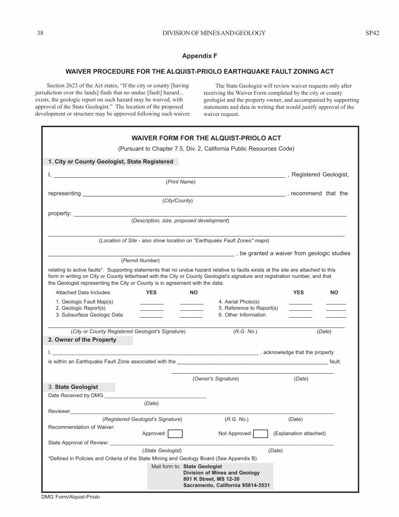
38 DIVISION OF MINES AND GEOLOGY SP42
DMG Form/Alquist-Priolo
WAIVER FORM FOR THE ALQUIST-PRIOLO ACT(Pursuant to Chapter 7.5, Div. 2, California Public Resources Code)
1. City or County Geologist, State Registered
I, _______________________________________________________________________ , Registered Geologist, (Print Name)
representing ______________________________________________________________ , recommend that the (City/County)
property: ___________________________________________________________________________________ (Description, size, proposed development)
__________________________________________________________________________________________ (Location of Site - also show location on "Earthquake Fault Zones" maps)
_________________________________________________________ , be granted a waiver from geologic studies (Permit Number)
relating to active faults*. Supporting statements that no undue hazard relative to faults exists at the site are attached to thisform in writing on City or County letterhead with the City or County Geologist's signature and registration number, and thatthe Geologist representing the City or County is in agreement with the data:
Attached Data Includes: YES NO YES NO 1. Geologic Fault Map(s) ________ ________ 4. Aerial Photo(s) ________ _______ 2. Geologic Report(s) ________ ________ 5. Reference to Report(s) ________ _______ 3. Subsurface Geologic Data ________ ________ 6. Other Information ________ _______
__________________________________________________________________________________________ (City or County Registered Geologist's Signature) (R.G. No.) (Date)
2. Owner of the Property
I, _______________________________________________________________________ , acknowledge that the property
is within an Earthquake Fault Zone associated with the ____________________________________________________ fault.
________________________________________________________ (Owner's Signature) (Date)
3. State GeologistDate Received by DMG ___________________________________
(Date)Reviewer___________________________________________________________________________________________
(Registered Geologist's Signature) (R.G. No.) (Date)Recommendation of Waiver:
Approved: Not Approved: (Explanation attached)
State Approval of Review: _____________________________________________________________________________(State Geologist) (Date)
*Defined in Policies and Criteria of the State Mining and Geology Board (See Appendix B) Mail form to: State Geologist
Division of Mines and Geology801 K Street, MS 12-30Sacramento, California 95814-3531
Appendix F
WAIVER PROCEDURE FOR THE ALQUIST-PRIOLO EARTHQUAKE FAULT ZONING ACT
The State Geologist will review waiver requests only afterreceiving the Waiver Form completed by the city or countygeologist and the property owner, and accompanied by supportingstatements and data in writing that would justify approval of thewaiver request.
Section 2623 of the Act states, “If the city or county [havingjurisdiction over the lands] finds that no undue [fault] hazard...exists, the geologic report on such hazard may be waived, withapproval of the State Geologist.” The location of the proposeddevelopment or structure may be approved following such waiver.