february 29, 2012 horry county, south carolina
TRANSCRIPT

February 29, 2012Horry County, South Carolina
Lakewood-Pirateland Swash Drainage Study
w w w . t h o m a s a n d h u t t o n . c o m1350 Farrow Parkway | Myrtle Beach, SC 29577 | 843.839.3545

DRAINAGE STUDY
FOR: LAKEWOOD PIRATELAND SWASH
HORRY COUNTY, SC
PREPARED FOR:
HORRY COUNTY STORMWATER DEPARTMENT
FEBRUARY 29, 2012
J-23453.404
Prepared by:
Savannah, GA | Charleston, SC | Myrtle Beach, SC | Brunswick, GA | Wilmington, NC

LAKEWOOD PIRATELAND SWASH J-23453.404 DRAINAGE STUDY
TABLE OF CONTENTS
Background and Introduction ............................................................................................................. Page 1
Phase 1 Hydrologic and Hydraulic Model Development ........................................................... Page 1
Data Collection ............................................................................................................................... Page 1
Field Reconnaissance ..................................................................................................................... Page 2
Surveying ........................................................................................................................................... Page 3
Existing Conditions Model Development .................................................................................... Page 3
Model Calibration ........................................................................................................................... Page 5
Findings and Recommendations ........................................................................................................ Page 6
TABLES
Weather Station Daily Rainfall Data Comparison ....................................................................................... 1
Curve Number Matrix ....................................................................................................................................... 2
FIGURES
Weather Station Location Map ...................................................................................................................... 1
Daily Rainfall Station Data Comparison........................................................................................................ 2
Hourly Rainfall: Hurricane Floyd ...................................................................................................................... 3
Hourly Rainfall: September 26-30, 2010 ......................................................................................................... 4
ICPR Model Calibration Hurricane Floyd ................................................................................................... 5
ICPR Model Calibration September 2010 .................................................................................................. 6
APPENDICES
Time of Concentration Results ....................................................................................................................... A
Maximum Water Surface Elevations .............................................................................................................. B
ICPR Model Input .............................................................................................................................................. C
Data CD ............................................................................................................................................................. D
EXHIBITS
Basin and Sub-basin Delineation .................................................................................................................... 1
Field Reconnaissance ...................................................................................................................................... 2
Land Use and Soils Map ................................................................................................................................... 3
ICPR Link-Node Schematic .............................................................................................................................. 4

LAKEWOOD PIRATELAND SWASH J-23453.404 DRAINAGE STUDY
PAGE 1
BACKGROUND AND INTRODUCTION Horry County is experiencing rapid growth and in certain places, the pace of development continues to outgrow the capacity of the existing drainage system. Flooding concerns have been voiced by many of the businesses and residents in the Lakewood-Pirateland Swash Basin (Exhibit 1). Structural flooding of several business and/or homes has been recorded on at least two occasions in the past. The Lakewood-Pirateland Basin drains 1,560 acres including the Lakewood and Pirateland Campgrounds, Long Bay Estates, and portions of the Myrtle Beach State Park, all east of US Highway 17 Business. West of US Highway 17 Business, the basin provides drainage for the Prestwick Subdivision and Country Club, Crystal Lakes Mobile Home Park, Seagate Village (formerly part of Myrtle Beach Air Force Base), and commercial properties along the highway. Drainage is conveyed through a swash to the Atlantic Ocean. The purpose of this report is to document the development of the Phase 1 Hydrologic and Hydraulic Model for the Lakewood-Pirateland Swash Drainage Basin Project. The hydrologic and hydraulic model is intended to be capable of simulating the existing conditions within the study area and to serve as the basis for the analysis alternatives conceptual design of future improvements. The Horry County Stormwater Department intends to implement a three phases approach to improving drainage in the basin including (1) the development of a hydrology and hydraulic model, (2) alternatives analysis and recommendations, and (3) implementation of the recommended improvements. Phase 1 of the Lakewood-Pirateland Swash Drainage Project included six tasks as follows:
Task 1 Data Collection Task 2 Field Reconnaissance Task 3 Surveying Task 4 Existing Conditions Model Development Task 5 Model Calibration Task 6 Phase 1 Study Findings and Report
PHASE 1- HYDROLOGIC AND HYDRAULIC MODEL DEVELOPMENT Data Collection Thomas and Hutton has collected various data to build and calibrate a hydrologic and hydraulic model to simulate existing conditions in the Lakewood-Pirateland Swash Drainage Basin. The data collected generally falls within four broad categories:
Geographic Information System (GIS) Data Construction Plans / As-built Plans / Design Reports Rainfall Data
Horry County GIS Data The Horry County Stormwater Department supplied T&H with GIS data as part of the project, and T&H utilized data previously obtained from Horry County for the project. These data include a drainage system inventory (catch basins, discharge points, inlets, junction boxes, drainage line open and closed, ponds and other hydrographic features), impervious areas, roads, property parcels, LiDAR topography, and land use / land cover.

LAKEWOOD PIRATELAND SWASH J-23453.404 DRAINAGE STUDY
PAGE 2
City of Myrtle Beach GIS Data T&H had previously obtained GIS data from the City of Myrtle Beach that was used for this project. This included a drainage system inventory (junctions, nodes, outfalls, structures, ditch lines, pipe lines, etc. Other GIS Data T&H utilized its extensive GIS data library as part of the project. Additional data used included aerial photography (historic and recent) and soils mapping (SSURGO) data. Construction Plans / As-built Plans/ Design Reports T&H collected various plans and reports for infrastructure built within the basin. This included partial plans for the initial phase of the Prestwick development, as-built plans for certain later phases of the Prestwick development, as-built plans and reports for recent developments in the Ocean Lakes Camper Storage and Village, and as-built plans for Bermuda Gardens. In addition to this, T&H accessed the SCDOT on-line plans library and downloaded plans for roads in the basin including US Hwy 17 Business, School Road (now Prestwick Club Drive, Lakeview Drive and Hwy 396) and Catherin Drive. Rainfall Data - Daily and hourly rainfall data were collected from available rain gauges for the Hurricane Floyd (September 14-16, 1999) event and the September 26-30, 2010 storm event for calibration purpose. A location map for the local rainfall gauges with available data is included as Figure 1. Table 1 summarizes the daily total rainfall amounts for both events and Figure 2 compares the daily rainfall amounts for the five gages with available September 2010 rainfall data. Hourly rainfall data was used for input in the H&H model. The hourly data used for the Hurricane Floyd event calibration was taken from the Grand Strand Airport in North Myrtle Beach, SC and the hourly data for the September 2010 event was taken from the USGS Gage 02110729 (Hwy 707) in Socastee, SC. Figures 4 and 5 illustrate the hourly rainfall data for the Hurricane Floyd and September 2010 events, respectively. Field Reconnaissance Using the collected GIS data, the basin and sub-basins were delineated, flow patterns were determined and major drainage features were identified. Exhibit 1 illustrates the basin and sub-basins developed for this study. The basin was divided into 49 sub-basins based on the digital elevation model (DEM) and drainage infrastructure. Field reconnaissance was conducted on various dates to confirm the basin and sub-basin delineation, document drainage infrastructure, assess reported flooding locations, and coordinate with stakeholders. Field reconnaissance was conducted October 27, 2011 (pre-project preparation), December 13, 2011 (in coordination with Dave Zabeck, Prestwick HOA contact; Paul Kaufman, Prestwick GC Superintendent; Dave Fuss, Horry County SW; and Eric Hasara, Horry County SW), December 21, 2011 and finally on February 9, 2012. During the field reconnaissance geo-referenced photography was taken to document the drainage infrastructure. Exhibit 2 illustrates the locations of the photo documentation and includes a selection of photographs. The field reconnaissance findings were used to refine the basin, sub-basins and ICPR model link-node connectivity. Additionally, photographs and measurements within the basin were used to determine high water mark elevations of Hurricane Floyd and September 2010 events. A local business, Camper Country, located at 5500 S Kings Highway allowed measurements to be taken for flood levels that occurred during Hurricane Floyd. Flooding occurred 13 inches above the finished floor elevation of their Sales Service building as confirmed by water stains. Additionally, the business provided photographs that revealed the high water mark for the September 2010 storm event. This information was used to determine needed survey data.

LAKEWOOD PIRATELAND SWASH J-23453.404 DRAINAGE STUDY
PAGE 3
Surveying Based on the basin / sub-basin delineation and the identification of the major drainage system, surveying was conducted to gather detailed information for input in the H&H model. Surveying was conducted on two separate occasions December 15-16, 2011 and February 16, 2012. Approximately thirty-five channel cross section and 15 structures (culvert, bridge, or outfall) were surveyed. In addition, the finished floor elevations of critical structures and a high water mark where surveyed. This data was used in building and calibrating the H&H model. Existing Conditions Model Development The data collected during Tasks 1, through 3 where used to develop the input for an H&H model of major sub-basins and major drainage system for the Lakewood-Pirateland Swash Drainage Basin. The Interconnected Channel and Pond Routing (ICPR) Model by Streamline Technologies was used to develop the H&H model. Exhibit 3 is a node-link schematic ICPR model developed. The ICPR program is capable of modeling rainfall and stormwater runoff and to perform hydraulic routing through the storm drainage system. The ICPR program is a FEMA approved model that has the ability to analyze complex interconnected drainage systems dynamically over extended time periods. The hydrologic input for ICPR consists of information for each drainage sub-basin within the project. Input variables include runoff curve number, rainfall distribution pattern, hydrograph peaking factor, contributing area, and time of concentration. The ICPR program generates runoff hydrographs for each sub-basin based on these user-specified variables. Hydrographs are generated by ICPR using the SCS Unit Hydrograph Method. Hydrologic inputs for each sub-basin include the contributing area, composite curve number and the time of concentration. The following paragraphs summarize the calculation of the hydrologic input. Composite Curve Number Composite curve numbers (CNs) were calculated using the land use/land cover grid (LULC) obtained from Horry County. This LULC grid if 4-feet by 4-feet and is comprised of approximately 20 different LULCs. Hydrologic soils group (HSG) data available from the USDA SSURGO GIS soils coverage for Horry County was overlain the 4-foot by 4-foot grid and a single HSG (A, A/D, B, B/D, C, and D) was assigned to each cell base on the majority of cell coverage. A LULC-HSG matrix was developed for the project. The matrix was developed for each potential LULC-HSG combination, and is based on literature values (i.e. TR-55), past experience and professional judgment. The LULC-HSG Matrix developed for this study is included as Table 2. Based on the LULC-HSG matrix and the unique LULC-HSG in the grid, a single CN value was assigned to each cell. The CNs of the cells falling within each sub-basin where averaged, to produce an area weighted composite CN for each sub-basin. Time of Concentration A time of concentration (Tc) value was estimated for each sub-basin. The Tc was calculated based on the NRCS, three part travel time method documented in TR-55. The three equations used are summarized below:

LAKEWOOD PIRATELAND SWASH J-23453.404 DRAINAGE STUDY
PAGE 4
Sheet Flow: (hr) Symbol Dimension Units
n Manning's n -- L Length of flow ft
P2 2 yr event
rainfall in
S Slope ft/ft
Shallow Concentrated Flow: (hr) Symbol Dimension Units
L Length of flow ft
V* Velocity ft/s *Based on TR-55 velocity-slope relationship
Pipe Flow: (hr) Symbol Dimension Units L Length of flow ft
V* Velocity ft/s *Assumed to be 2 ft/s
Time of Concentration: (hr)
The longest flow path for each sub-basin was estimated by visually inspecting the available topographic and drainage system GIS data. The longest flow paths were digitized in GIS and split into three segments representing sheet flow, shallow concentrated flow, and pipe flow. The Slope of each line segment was determined using the available elevation data. The Tc calculations are summarized in Table 3. Additional hydrologic data input in the ICPR model includes the following:
SCS Unit Hydrograph Method SCS Type III Statistical Rainfall Distribution 256 Peaking Factor Design Storm Rainfall Amounts
o 2-year, 24-hour = 4.5 inches o 10-year, 24-hour = 6.7 inches o 25-year, 24-hour = 7.6 inches o 50-year, 24-hour = 8.6 inches o 100-year, 24-hour = 9.7 inches

LAKEWOOD PIRATELAND SWASH J-23453.404 DRAINAGE STUDY
PAGE 5
The ICPR model also consists of input data for a system of nodes and links (i.e. hydraulic data). Nodes represent locations where flows enter or exit the system, pipe or channel characteristics change, or where stage/storage/time relationships are provided. Links represent traditional types of hydraulic conveyance such as pipes, channels, drop structures, weirs, etc. The sizes, inverts, lengths, and Manning n values for all links are model input. In addition to pipe information,
-storage information and the respective outfall structure information is input into the ICPR model. Input data for the hydraulic portion of the H&H model was developed from a variety of sources including GIS, survey, and as-built data. Where applicable the data source is noted in the model as a comment for the particular input. Nodes we located at strategic locations to simulate the
Surveyed cross section data was merged with LiDAR - Major lake, ponds and
other storage areas are simulated as stage-area nodes to properly account for the detention of hydrographs in the system. Road overtopping and overland flow paths were simulated as weirs in the model for the accurate simulation of flooding conditions. Exhibit 4 is the ICPR link-node schematic for the developed model, and graphically illustrates the location and alignment of various model input. The ICPR model was executed for the 2, 10, 25, 50, and 100-year storm events to initially evaluate the validity of the model results. During this evaluation, model adjustments and additional inputs were made to produce reasonable results. Model Calibration Following the development and assessment of the existing conditions H&H model, the model results were assessed under two known flooding events Hurricane Floyd (in September 1999) and an extreme rainfall event in September 2010. Refer to Table X for a summary of recorded daily rainfall totals for the two events. Figures X and X illustrate the hourly rainfall pattern for the Hurricane Floyd and September 2010 events, respectively. Hurricane Floyd The Hurricane Floyd event produced approximately 13.56 inches of rain over a 32 hour period according to the rain gauge at the Grand Strand Airport in North Myrtle Beach. This is the only available rain gauge for the Hurricane Floyd event. The gauge is relatively distant from the Lakewood-Pirateland Swash Basin, however, the widespread rainfall associated with the hurricane allows for the use of the rainfall data as representative for the Lakewood-Pirateland Swash Basin. ICPR model input was developed to simulate the rainfall of the Hurricane Floyd event as measured at the Grand Strand Airport. The model was then executed for a 72 hour simulation. The resulting maximum water surface elevations (WSEs) were extracted from the ICPR results and mapped at the appropriate node locations in the GIS system. Figure 5 illustrates the resulting maximum WSE in the lower portion of the basin near US HWY 17 Business, where flooding was reported during the actual Hurricane Floyd event. The simulated maximum WSEs where compared to the known flooding conditions during the event to determine if the model was re-producing the flooding conditions. Structural flooding
84 Strathmill Ct. and 1288 Strathmill Ct. As summarized in Figure 5, the model reproduces the reported/measured flooding

LAKEWOOD PIRATELAND SWASH J-23453.404 DRAINAGE STUDY
PAGE 6
compares favorably with the measured high water mark measured there. In addition, the simulation reproduced finished floor flooding of 1284 Strathmill Ct. and 1288 Strathmill Ct., which is consistent with flooding reported by the owners. Other structures in the area (Camper Country repair building and Port of Siam) were not simulated as flooding, which is consistent with the reports that they did not flood during the event. September 2010 The September 2010 event produced from 8.27 to 13.14 inches of rain over a 5 day period. Gauges closest to the watershed had some of the largest rainfall amounts recorded (See Table X and Figure X). The event appears to be two successive periods of heavy rainfall amounts generally on September 27, 2010 and September 29, 2010. For this purposes of this study the USGS gage at Hwy 707 was used for hourly rainfall data. ICPR model input was developed to simulate the rainfall of the September 2010 event as measured at the USGS rain gauge. Two models were developed to simulate the event. The first period of rainfall produced 8.27 inches of rain in 72 hours, which was simulated in the model first. The second period produced 4.87 inches of rain in 48 hours, which was simulated second. The results from the first period were used to define the initial conditions for the second event. Also, the curve numbers of the second periods simulation were adjusted to reflect an Antecedent Moisture Condition (AMC) III condition, accounting for the saturated soil conditions for the second event. The resulting maximum water surface elevations (WSEs) of the second simulation were extracted from the ICPR results and mapped at the appropriate node locations in the GIS system. Figure 6 illustrates the resulting maximum WSE in the lower portion of the basin near US HWY 17 Business, where flooding was reported during the actual September 2010 event. The simulated maximum WSEs where compared to the known flooding conditions during the event to determine if the model was re-producing the flooding conditions. High water was rreported at 1284 Strathmill Ct. As summarized in Figure 6, the model reproduces the reported/measured flooding conditions during the event. The simulated flooding of the Camper
addition, the simulation garage flooding at 1284 Strathmill Ct. is consistent with flooding reported by the owners. Based on the results of the above simulations, it appears as if the ICPR model constructed is capable of reproducing conditions in the basin (particularity in the area of Hwy 17 Business), and no significant adjustment of model input was needed. Refer to Appendix X for a full listing of the maximum WSEs simulated for both flood events. FINDINGS AND RECOMMENDATIONS Thomas and Hutton have developed a hydrologic and hydraulic model of the Lakewood-Pirateland Swash Basin and has confirmed the validity of model results with two historical flood events. The model results for the 2-, 10-, 25-, 50-, and 100-year design events are summarized in Appendix B. A print out of the model input is included in Appendix C, and the ICPR model and associated GIS files are included on Data Cd in Appendix D. The work documented in this report and the attached deliverables completes Phase I of the drainage study.

LAKEWOOD PIRATELAND SWASH J-23453.404 DRAINAGE STUDY
PAGE 7
The upcoming Phase 2 - Alternatives Analysis and Improvement Recommendations will include screening, selecting, and evaluating potential alternatives to improve drainage conditions in the basin. These alternatives may include additional stormwater storage, culvert and channel improvements to reduce flooding. A cost benefits analysis will be required to evaluate alternatives. Thomas & Hutton is prepared to immediately continue to work with Horry County Stormwater Department on Phase 2. Below is our proposed approach. Phase 2 Alternatives Analysis and Improvement Recommendations The second phase of the Lakewood-Pirateland Swash Basin Drainage Study will be to screen, select and evaluate potential alternatives to improve drainage conditions in the basin. Phase 2 will include the following tasks:
Task 1 Alternative Projects Screening Task 2 Alternative Projects Evaluation Task 3 Alternative Post-Improvement Conditions Model Development Task 4 Opinion of Probable Cost and Benefit Analysis Task 5 Phase 2 Study Findings and Report
The second phase of the study will be the selection and evaluation of alternatives such as additional stormwater storage, or culvert and channel improvements to reduce flooding. A cost benefit analysis will be required to evaluate the alternatives. Two meetings with County staff and two meetings with regulatory agencies are anticipated. Task 1 - Alternative Projects Screening Alternative improvement projects will be developed that will address the issues identified. The improvement projects may be independent (a specific project to address a single issue), cumulative (multiple projects may need to address a single issue), or multi-purpose (a single project may address multiple issues). A preliminary improvement map showing the location of each potential project will be generated. T&H will discuss each potential project with the County in a workshop meeting and based on the input from the County and other factors, a preferred set of proposed projects will be selected for further assessment. Task 2 Post-Improvement Conditions Model Development The preferred projects will be assessed further by incorporating the proposed improvements in a post-improvement conditions ICPR model. The model will be based on the existing conditions model and included the proposed improvements. The ICPR model input will be such that the cumulative impact of the phased projects can be assessed. The proposed improvements will be optimized and sizing and configurations will be documented. The ICPR model will be executed for the 2-, 10-, 25-, 50- and 100-year storm events. Task 3 Projects Evaluation Utilizing available mapping data (aerials, contours, utilities, etc.), each proposed project selected for further evaluation will be conceptually illustrated in plan view to further assess the feasibility and constructability of the project. Various factors such as land, right-of-way, or easement requirements, potential utility conflicts and relocations, and road impacts will be determined.

LAKEWOOD PIRATELAND SWASH J-23453.404 DRAINAGE STUDY
PAGE 8
A preliminary phased implementation plan will be developed. The phasing plan will accounting for various factors including relative cost, impact on reducing drainage/flooding issues, land acquisition needs, permitting requirements, etc. Initial coordination will be conducted with resource and permitting agencies at this time to confirm permittability and potential permit requirements.
Tasks 2 and 3 may be conducted concurrently and iteratively as modeling may prove one project more (or less) effective than anticipated and the project evaluation may determine that a project is infeasible or must be adjusted due to a constraint. Task 4 Opinion of Probable Cost and Benefit Analysis Based on the refined concept plan for each proposed project, and individual opinion of probable construction cost will be developed. The costs will be based on recent bids and contracts for similar work projects in the area. Other costs (such as addition maintenance costs, if any) will also be incorporated in the costs of the project. A benefit analysis of the proposed projects will be conducted. The benefit analysis will attempt to quantify the prevented damage costs, loss of business revenue, and other tangible benefits over the life of the proposed projects. Intangible benefits, such as providing emergency or evacuation access, elimination of nuisance flooding, and improve to water quality (if any) will also be accounted for. The costs will be compared to the benefits and the selected projects and/or the project phasing may be adjusted accordingly. Task 5 Phase 2 Study Findings and Report The tasks and findings of Phase 2 will be documented in a report. The report will include the details of each project and the phasing plan for future reference by the County as implementation funds may become available or partnering opportunities are presented. A draft of the report will be provided to the County for review and comment. A final report

���� ���� ���� � ����� ����� ��������� ����� ������������ ���� ���!� "��! # # �$�%�
��� �� ��� ��� ��� ���+�<�� >���?���@����Q�� ������� ����� ���� "��� ��[[ $��� ���� !�$�
����\�]^�[ _�^����`�� {�}}]< ��� ������������ "��" $�%! ��~� "�!" ��
%�;�< %�;�<�� %�;�= %�;�=�� %�;�! %�;�� ����������^� $! $! �� �� [� ~� ���
����� %� %� %� %� %� %� ��������� [� [� ~$ ~$ ~~ !� ���
�������?�<���? ��}� �� $� [[ %% [[ [� [[ �������Q����<���? ��}� �� $� [[ %% [[ [� [[ ���
���������?� $! $! �� �� [� ~� ������?? $! $! �� �� [� ~� ���
���������? !~ !~ !~ !~ !~ !~ ��������<���? ��}� �� $� [[ %% [[ [� [[ ���> ��������? ����}� �� $� [[ %% [[ [� [[ ���
�������� !~ !~ !~ !~ !~ !~ �������� $� [$ �~ [$ �% [$ ���
� ��� ��� !~ !~ !~ !~ !~ !~ ���+�������� [[ [[ !� !� !� !� ���
+�����������?�<���? $� [[ %% [[ [� [[ ���+��������Q����<���? $� [[ %% [[ [� [[ ���
+���������<���? $� [[ %% [[ [� [[ ���}� �� ��� ��� ��� ��� ��� ��� ���
:��)�>$�!&�8��?&"���
������!&�8��?&"����@����Q

HWY 544
HWY 707
J L Schwartz WWTF
Oceanside Village
Grand Strand Airport
Lakewood-Pirateland Swash Basin
Lakewood - PiratelandSwash Drainage Study
0 63Miles
1 inch = 3 miles °Job Number: 23453 Produced: 2/10/2012 Produced By: EAK Modified: Modified By:
Vertical Datum:File: V:\J-23453_LakewoodPiratelandDrainage\MXD\Mtg_2010_02_09\RainfallSta_Roads.mxd
Thomas & Hutton compiled the map information from the following sources:Data Source Date
DISCLAIMERWhere Thomas & Hutton is cited as the data source, the firm has created or verified the data. For all other sources cited,Thomas & Hutton used the data "as is," has made no independent investigation of the data, and makes no representationas to the accuracy or completeness of the data. Please see each source for available documentation of its respective datasets.
Copyright © 2010 by Thomas & HuttonNo part of this document may be reproduced without written permission from an officer of Thomas & Hutton.
Horry County, South Carolina
Weather Station Location Map
LegendWeather Station
Basin
BasinWeather StationAerial
T&HWeather UndergroundBing Maps
201120122011
Figure 1

�
�
�
�
�
�
�
������ ������ ������ ����� ������
�����������
��� ������������
����� ���� ��� ����������������������������������������
� �� �� ������ !� "
�������
���������
���
������������
����������!"#

�$�
�$�
�$�
�$�
�$�
�$�
�$�
�$�
�$�
�
�
�
�
�
��
��
��
� �� �� �� �� �� �� ��
#�$� �
������
����������
%$$������ &
������������
'�� �(���� &���
����� ��)��������������!�*���&������&�%������
)����$�� �����&!�� �� �� ��"+�"�!�",,,
%&'�#(#&)*+��*!&�*++
,''�(�+*)#"��*!&�*++

�$�
�$�
�$�
�$�
�$�
�$�
�$�
�$�
�$�
�
�
�
�
�
��
��
��
� �� �� �� �� ��� ���
#�$� �
������
����������
%$$������ &
������������
'�� ���
����� �+)��������������!�)�-�. .� �� �� ������ !�� "
%&'�#(#&)*+��*!&�*++
,''�(�+*)#"��*!&�*++

PW-02WSE: 15.42
PW-01WSE: 14.57
PW-05WSE: 15.13
STOR-01WSE: 14.35
STOR-02WSE: 14.38
MAIN-03WSE: 14.33
MAIN-04WSE: 14.35
MAIN-05WSE: 14.45
MAIN-07WSE: 14.52
MAIN-06WSE: 14.52
MAIN-07AWSE: 14.59
BERMGRN02WSE: 14.52
BERMGRN01WSE: 14.35
BERMGRN03WSE: 16.95
Lakewood - PiratelandSwash Drainage Study
0 150 30075Feet
1 inch = 200 feet °Job Number: 23453 Produced: 2/8/2012 Produced By: EAK Modified: 2/29/2012 Modified By: EAK
Vertical Datum:File: V:\J-23453_LakewoodPiratelandDrainage\MXD\TMExistCond\Figure5-SurveyPoints.mxd
Thomas & Hutton compiled the map information from the following sources:Data
Links, NodesAerial
Source
T&HBing Maps
Date
20112011
DISCLAIMERWhere Thomas & Hutton is cited as the data source, the firm has created or verified the data. For all other sources cited,Thomas & Hutton used the data "as is," has made no independent investigation of the data, and makes no representationas to the accuracy or completeness of the data. Please see each source for available documentation of its respective datasets.
Copyright © 2010 by Thomas & HuttonNo part of this document may be reproduced without written permission from an officer of Thomas & Hutton.
Horry County, South Carolina
ICPR Model CalibrationHurricane Floyd
LegendNode
Link
Structures
Camper CountryFF Elev: 13.31 ft
High Water Elev: 14.39 ft
1284 Strathmill Ct.FF Elev: 13.43 ft
Garage Elev: 11.47 ft
1288 Strathmill Ct.FF Elev: 13.43 ftGarage Elev: 12.04 ft
Figure 5
Storage BuildingFF Elev: 15.55 ft
Port of SiamFF Elev: 14.66 ft

PW-02WSE: 11.98 ft.
PW-01WSE: 11.81 ft.
PW-05WSE: 12.12 ft.
STOR-01WSE: 12.07 ft.
STOR-02WSE: 13.33 ft.
MAIN-03WSE: 11.31 ft.
MAIN-04WSE: 11.43 ft.
MAIN-05WSE: 11.66 ft.
MAIN-07WSE: 11.85 ft.
MAIN-06WSE: 11.76 ft.
MAIN-07AWSE: 12.04 ft.
BERMGRN02WSE: 11.76 ft.
BERMGRN01WSE: 12.63 ft.
BERMGRN03WSE: 15.04 ft.
Lakewood - PiratelandSwash Drainage Study
0 150 30075Feet
1 inch = 200 feet °Job Number: 23453 Produced: 2/8/2012 Produced By: EAK Modified: 2/29/2012 Modified By: EAK
Vertical Datum:File: V:\J-23453_LakewoodPiratelandDrainage\MXD\TMExistCond\Figure6-SurveyPoints.mxd
Thomas & Hutton compiled the map information from the following sources:Data
Links, NodesAerial
Source
T&HBing Maps
Date
20112011
DISCLAIMERWhere Thomas & Hutton is cited as the data source, the firm has created or verified the data. For all other sources cited,Thomas & Hutton used the data "as is," has made no independent investigation of the data, and makes no representationas to the accuracy or completeness of the data. Please see each source for available documentation of its respective datasets.
Copyright © 2010 by Thomas & HuttonNo part of this document may be reproduced without written permission from an officer of Thomas & Hutton.
Horry County, South Carolina
ICPR Model CalibrationSeptember 2010
LegendNode
Link
Structures
High Water Elev: 11.51 ft
Camper CountryFF Elev: 13.31 ft
1284 Strathmill Ct.FF Elev: 13.43 ft
Garage Elev: 11.47 ft
1288 Strathmill Ct.FF Elev: 13.43 ftGarage Elev: 12.04 ft
Figure 6
Port of SiamFF Elev: 14.66 ft
Storage BuildingFF Elev: 15.55 ft

:��Z���*��+
[�*��+
���#��*�����+
@�����Z\$��
��$�����*"��+
:��Z���*��+
���#��*�����+
:��)�!�8��
������]��/�*���$+
��$�����^�*"��+
:��Z���*��+
]��/�*���$+
��#�#��*"��+
�<#�" ��[�� ��� ��� ��"�� ���� %�%�" ��� ����� ��[ �$�" "�!!�! "�� "��~ [%���<#�$ �$��! ��� ��� ��"�� $$�� $�"�� ��� ����� ��[ [�~ ���~�! "�� !�� %��~�<#�� ""$�$ ��� ��� ��"�� �%!�� !�"�� ��� ���� ��$ �~�! �$�~�~ "�� ���! "�!�"�<#�� �"~�~ ��� ��� ��"�� ""�% !"��� ��� ����� ��� "%�� ���$�� "�� !�[ %[�~�<#�[ ����! ��� ��� ��"�� ���� �%"��% ��� ����� ��� ���$ $�%�$ "�� "�� ~~�$
��������� �$%�� ��� ��� ����� $�� �!��! ��� ����� ��� ~�% ## ## ## �%����������" �$%�� ��� ��� ����� "�! ����� ��� ���� ��~ ~�" ## ## ## �%����������$ [��% ��� ��� ��"�� $��� ��"�� ��� ����� ��$ "��� ## ## ## %������������ "�!�� ��� ��� ��"�� ���! ��!�! ��� ����� ��! �"�� ## ## ## [��$��������% �%��$ ��� ��� ��"�� $��" %���[ ��� ����� ��~ ���% ## ## ## ���~
�^#�" "�%�� ��� ��� ��"�� �[�~ ���[�% ��� ����� ��~ ""�~ ## ## ## [��[��\�]�^�^��� ����� ��� ��� ��"�� %��$ ��$%�� ��� ���� ��� $��� ## ## ## !���^�}��>���� "%��� ��� ��� ��"�� $��! ![!�� ��� ����� ��! �[�� ## ## ## %"�$^�}��>���" �~��" ��� ��� ��"�� $��� ![$�! ��� ����� ��% $��[ ## ## ## [��[
����#�� �%��~ ��� ��� ����� "�� �~���$ ��� ���� ��[ �$�! ## ## ## ��������#�$ !$�� ��� ��� ��"�� "��� !%%�� ��� ����� ��� ���� ## ## ## ���"����#�� ��[�[ ��� ��� ��"�� "[�$ $$"�[ ��� ����� ��� %�~ ## ## ## $$������#�� !��% ��� ��� ����� "�% %[��� ��� ����� ��! ���[ ## ## ## �%������#�� "$��~ ��� ��� ��"�� ��"�� ��%"�� ��� ����� ��! �!�~ ## ## ## ��"������#�% �[!�% ��� ��� ��"�� $%�$ �~��~ ��� ����� ��" !�~ ## ## ## �%��
����#�[� �~��~ ��� ��� ����� "�� �"["�" ��� ���� ��� "��% ## ## ## "$�"����#�[� ��%�� ��� ��� ����� "�� ""~��� ��� ����� ��% [��[ ## ## ## [$�[����#"� ""��! ��� ��� ��"�� [[�" �"���� ��� ����� ��$ �$�" ## ## ## ���������#"$ "%$�$ ��� ��� ��"�� $!�% %$��� ��� ���� ��� �%�� ��!%�� "�� !�� �$������#"% ����[ ��� ��� ����� $�[ �����~ ��� ����� ��" �"%�� �"%$�[ "�� ���� �$!�"
���^���>���� "~"�� ��� ��� ��"�� �[�� $%�$�! ��� ����� ��� ��[�! ## ## ## "�%�����^���>���" ��"�! ��� ��� ����� $�% �"!��� ��� ���� ��~ "[�% ## ## ## $������^���>���$ ����� ��� ��� ����� "�~ �$"�� ��� ����� ��� ���% ## ## ## �%��
�}#�� "���� ��� ��� ��"�� !"�$ "�$[�% ��� ����� ��~ %��� ## ## ## ��$�!�}#�" �!��[ ��� ��� ��"�� �$��[ $��"�� ��� ����� ��� ~"�� ## ## ## "�$�[�}#�$ "~��$ ��� ��� ��"�� !��$ ���$�% ��� ����� ��� "��% ## ## ## ��%�~�}#�% ��$�� ��� ��� ��"�� �~�� $���� ��� ����� ��% ��� ## ## ## %"��
�}#��� �$$�[ ��� ��� ��"�� �"%�� "[!�� ��� ����� ��$ $�� ## ## ## �"~���}#��� ["�[ ��� ��� ��"�� �$�% $���% ��� ����� ��� %�$ ## ## ## �~�~�}#�[ �%�" ��� ��� ����� ��$ ����% ��� ����� ��� [�� ## ## ## �%���}#�~ ���~ ��� ��� ��"�� ���% "���[ ��� ���� ��% "�! ## ## ## �[���}#�! "$��~ ��� ��� ��"�� �[�$ ��~[�� ��� ���� ��� �%�~ ## ## ## �$���}#�$ �~%�� ��� ��� ��"�� %��% !���[ ��� ����� ��� �%�[ ## ## ## [��"�}#�� ~��� ��� ��� ��"�� ���� "���� ��� ����� ��� ~"�� ## ## ## !"�[�}#�� "���� ��� ��� ��"�� ���% �"%�[ ��� ����� ��� !�! ## ## ## [����}#�[ !��� ��� ��� ����� ��� $%[�" ��� ���� ��$ ��% ## ## ## �%��
�}�>���� ""��" ��� ��� ��"�� "%�� "~�!�$ ��� ���� ��� ~��� ## ## ## ����"�}�>���" �!$�~ ��� ��� ��"�� $��! ���"�� ��� ����� ��� ��[�[ ## ## ## "�"���}�>���$ "���~ ��� ��� ��"�� ���� �%!~�[ ��� ����� ��� �!�� ## ## ## ��~�!�}�>���� ��[�~ ��� ��� ����� "�$ $$[�� ��� ���� ��� %�! ## ## ## �%��
�]>�#�$ ����� ��� ��� ��"�� �$�� �����$ ��� ����� ��~ "$�� ## ## ## �����]>�#�� "[$�� ��� ��� ��"�� ��$�[ $�"!�[ ��� ����� ��� ��$�[ ## ## ## "~[���]>�#�% "~��! ��� ��� ����� $�� �%!~�! ��� ����� ��% %��" ## ## ## %!�[�]>�#�[ �!"�" ��� ��� ����� $�! "����[ ��� ����� ��% [$�� ## ## ## [[��
<##��)�Q�<��"�����!��'����������]�������$���)���$&��$
��"�����!��'����������
*"��+
������(��^�]�������$ ������^�!��'������)�(��^�]�������$ [�#��(��^�]�������$=�$���?�"�


@�Q/���7� @�Q/���7����� � ����� ������ � ����� � ����� ��#�/� � �*��+ (���)�78����*��+
�<#�� �$�[" �%��� ����� ���[[ �[�$� �%�%� �%�$~�<#�" ����~ �%�[" ���%� �[��$ �[�~" �%�%! �%�[~�<#�$ ����$ �%�[$ ���%� �[��% �[�~� �%��� �%�~$�<#�� ����� �%�~% ���%� �[��~ �[�~% �%�[$ ������<#�% ����� �%�~" ����� �[��� �[�[� �%�%~ �%�~��<#�� ���$~ ����! ���~~ �[��� �[�!$ ���%[ ���~[�<#�[ ����� ���[� ���~! �[��" �[�!$ ���%~ ���~!
��������� �"�$[ �"�[" �"�~% �$��� �$�![ �"��$ ���$%��������" !�~� ���!% �"�[� �$��" ����� ���[� ���%"��������$ ����$ �%��� �%�$$ �%��� ����! �%��� ���!%��������� �%��! ����~ ���"� ����~ ���~$ �%�!! �[��$��������% ���[" �%�"� �%��� �%��" �%�~~ ���![ �%��%
���\ "��% "��% "��% "��% "��% "��% "��%�^#�� �$�"� �%��� �%�~~ ���"� �[��" ���~� �%����^#�" �$�"~ �%��� �%�!! ���"� �[�"! ���~% �%��$�^#�$ �$�"~ �%��~ �%�!% ���"$ �[�"� ���~� �%��$
��\�]�^�^��� ���~[ �%�"% �%��� �%�%! �%�~� �%�%� ���%"^�}��>���� %�$� ���� ��"! ���� ���~ ���� ���%^�}��>���" ��$� ��%! ��[� [��� [�$[ ���[ [�!"
����#�� "�[� ��"% ���% %��� %�"% ���[ %�!�����#�" $�[% ��~� %��� %�$[ %�%� ��[~ ���!����#�$ !��~ ���%" �"��� �$�$[ �$�!% ���$� ���$$����#�� !�"~ ����$ �"��[ �$��� �$�![ ����$ ���$%����#�% !��$ ���~% �"��% �$�%� ����! ����� ����%����#�� !�~� ���!% �"�[� �$��" ����� ���[� ���%"����#�[ ���"~ �"��" �"�[[ �$��$ ����[ ���~% ���%"
����#�[� ���[� �"�"� �"�!� �$�[� ���"� �"��� ���%!����#�~ ����� �"�$� �$��� �$�[~ ���"! �"��~ �����
����#�~� ���!! �"�~[ �$�$~ ����� ����� �"�[� ���[$����#�! �"��! �$��� �$�[� ����" ���~� �"�~� ���~"����#�� �"��! �$��% �$�%[ �%��� ����[ �$��" ���~~����#�� �"�~� ���$" �%��" ���[" ���"� �$��� ���~~����#�" �"�[� ����[ ���~� �%�%" �%�!" ���$� ���!$����#�$ �$�"� ���!% �%�[! �%��" �[��" ����� ���!~����#�� �"�!� ���$~ �%��~ ����~ ����% ���[[ ���!!����#�% �$�$" �%��! ����! ����� �[��� ���[� �%�������#�� �$��" ���~! �%�~~ ���!" �[��� �%��$ �%��$����#�[ �$�[� �%��� ����� ���%! �[��% �%�$$ �%�$�����#�~ �$�[% �%�%~ ���$$ ���[~ �[�%~ �%�%� �%�������#�! �$�~� �%��" ���$! ���[~ �[��� �%�%� �%��%����#"� �%��! ���"� ���!� �[��� �~�"[ ����[ ���~�����#"� �%��$ ���$% �[��� �[�%$ �~�$� ���"$ �[�������#"" �%�%! ����~ �[��� �[��� �~�$% ���$% �[��$����#"$ �%�!� ���!� �[�[~ �~�%% �!�$$ ���[% �~�������#"� ����! ���!~ �[�~" �~�%~ �!�$� ���~� �~�������#"% �[��% �!�$! �!��~ �!�~" �!�!$ �~�!� �!�[%
���^���>���� $�$� ���$ %��� %��% %�~~ %�$% �������^���>���" %�"~ ���% ��"~ ��$! ���[ ���$ ���$���^���>���$ %�$% ��%� ��~� [��! [��� ���! [���
�}��>��#�� �!��[ �!�%� �!�~� "��"% "��[! �!��" ""�"��}��>��#�" ���[� �[�~� �~�"$ �~��" �~�%� �[�~! �~��$�}��>��#�$ ����� �"��$ �$�$� �$�!$ ���$� �"��[ ����"�}��>��#�� ���%� ���[� ���[! ���~[ ���!~ ����" ����"
�}#�� !�!% ���!! �"�[~ �$��� ���"� ���~� ���%[�}#�" ����� �"��% �$��� ����[ ���[[ ���!~ �%��"�}#�$ ����[ �"�"� �$��$ ����! ���[! �"��$ �%��$�}#�% ����� �"�"! �$��% ����� ����� �"��" �%��$
�}#��� ����[ ����� �%��~ ����! �[��� ����" �~����}#��� ���"% ���[� �%�"� ���%� �[��� ���[$ �~��%�}#�[ ���"% �[��$ �[�!� �~��~ �~�[� �[�~" "���~�}#�~ ���%$ �~�[~ �!�$~ �!�~% "���� �!��$ "��~%�}#�! ���%~ �~�~� �!��� �!�~[ "���" �!��% "��~[�}#�$ �~�%~ �!�$% �!�[" "���� "��%! �!��� ""��"�}#�� "��%" "��!� ""��" ""�"! ""��% "��!� ""�$��}#�% "��[� ""��[ ""�"� ""�$� ""�%� ""��� ""�$%�}#�� "$�%$ "$�![ "���� "��"� "��$! "$�!� "���!�}#�[ "$�[~ "��$$ "��%[ "��~� "%��[ "���" "��"$
�]>�#�� ���[� �"��$ �"�[" �$��[ �$�!! �"��[ ���$%�]>�#�" �"��~ �$��% �$�~% ����! ���$� �$�$$ ���$~�]>�#�$ �"�[� �$�%! �$�!� ���"~ ���$! �$��~ ����!�]>�#�� ���~" �%��~ �%�$% �%��� �%�[~ �%�"� �%�!��]>�#�% ����! �!��� �!�[� "���� "���� �!�$~ "$�$$�]>�#�� ����% �!�"$ "���! "���� "���~ �!�$" "$�$!�]>�#�[ �~��[ �!�"% "���[ "��~! "��~" �!�%� "$���
<##��)�Q�=@�Q�"&"��������&���'��7��8�����$
��$�Z������"$���)�%�$����'���78����!����������
?�)��?�"�@�Q�"&"���7�������$�Z������"�*��+

Appendix C

�
Lakewood-Pirateland Swash Drainage BasinFebruary 29, 2012
============================================================================================== Basins ========================================================================================================================================================================
Name: AF-02 Node: AF-02 Status: Onsite Group: BASE Type: SCS Unit Hydrograph CN
Unit Hydrograph: Uh256 Peaking Factor: 256.0 Rainfall File: Storm Duration(hrs): 0.00 Rainfall Amount(in): 0.000 Time of Conc(min): 75.00 Area(ac): 69.680 Time Shift(hrs): 0.00 Curve Number: 75.47 Max Allowable Q(cfs): 999999.000 DCIA(%): 0.00
---------------------------------------------------------------------------------------------------- Name: AF-03 Node: AF-03 Status: Onsite Group: BASE Type: SCS Unit Hydrograph CN
Unit Hydrograph: Uh256 Peaking Factor: 256.0 Rainfall File: Storm Duration(hrs): 0.00 Rainfall Amount(in): 0.000 Time of Conc(min): 51.00 Area(ac): 17.810 Time Shift(hrs): 0.00 Curve Number: 77.75 Max Allowable Q(cfs): 999999.000 DCIA(%): 0.00
---------------------------------------------------------------------------------------------------- Name: AF-04 Node: AF-04 Status: Onsite Group: BASE Type: SCS Unit Hydrograph CN
Unit Hydrograph: Uh256 Peaking Factor: 256.0 Rainfall File: Storm Duration(hrs): 0.00 Rainfall Amount(in): 0.000 Time of Conc(min): 219.00 Area(ac): 58.000 Time Shift(hrs): 0.00 Curve Number: 77.59 Max Allowable Q(cfs): 999999.000 DCIA(%): 0.00
---------------------------------------------------------------------------------------------------- Name: AF-06 Node: AF-06 Status: Onsite Group: BASE Type: SCS Unit Hydrograph CN
Unit Hydrograph: Uh256 Peaking Factor: 256.0 Rainfall File: Storm Duration(hrs): 0.00 Rainfall Amount(in): 0.000 Time of Conc(min): 58.00 Area(ac): 39.190 Time Shift(hrs): 0.00 Curve Number: 70.36 Max Allowable Q(cfs): 999999.000 DCIA(%): 0.00
---------------------------------------------------------------------------------------------------- Name: AF-07 Node: AF-07 Status: Onsite Group: BASE Type: SCS Unit Hydrograph CN
Unit Hydrograph: Uh256 Peaking Factor: 256.0 Rainfall File: Storm Duration(hrs): 0.00 Rainfall Amount(in): 0.000 Time of Conc(min): 88.00 Area(ac): 31.950 Time Shift(hrs): 0.00 Curve Number: 65.69 Max Allowable Q(cfs): 999999.000 DCIA(%): 0.00
---------------------------------------------------------------------------------------------------- Name: BERMGRN01 Node: BERMGRN01 Status: Onsite Group: BASE Type: SCS Unit Hydrograph CN
Unit Hydrograph: Uh256 Peaking Factor: 256.0 Rainfall File: Storm Duration(hrs): 0.00 Rainfall Amount(in): 0.000 Time of Conc(min): 15.00 Area(ac): 3.450 Time Shift(hrs): 0.00 Curve Number: 80.36 Max Allowable Q(cfs): 999999.000 DCIA(%): 0.00
---------------------------------------------------------------------------------------------------- Name: BERMGRN02 Node: BERMGRN02 Status: Onsite Group: BASE Type: SCS Unit Hydrograph CN
Unit Hydrograph: Uh256 Peaking Factor: 256.0
��������������� ����� ���������������������������������� ���������������������� � ��� �!� ��

Lakewood-Pirateland Swash Drainage BasinFebruary 29, 2012
Rainfall File: Storm Duration(hrs): 0.00 Rainfall Amount(in): 0.000 Time of Conc(min): 15.00 Area(ac): 3.100 Time Shift(hrs): 0.00 Curve Number: 79.36 Max Allowable Q(cfs): 999999.000 DCIA(%): 0.00
---------------------------------------------------------------------------------------------------- Name: BERMGRN03 Node: BERMGRN03 Status: Onsite Group: BASE Type: SCS Unit Hydrograph CN
Unit Hydrograph: Uh256 Peaking Factor: 256.0 Rainfall File: Storm Duration(hrs): 0.00 Rainfall Amount(in): 0.000 Time of Conc(min): 56.00 Area(ac): 12.410 Time Shift(hrs): 0.00 Curve Number: 78.54 Max Allowable Q(cfs): 999999.000 DCIA(%): 0.00
---------------------------------------------------------------------------------------------------- Name: BERMGRN04 Node: BERMGRN04 Status: Onsite Group: BASE Type: SCS Unit Hydrograph CN
Unit Hydrograph: Uh256 Peaking Factor: 256.0 Rainfall File: Storm Duration(hrs): 0.00 Rainfall Amount(in): 0.000 Time of Conc(min): 74.00 Area(ac): 11.790 Time Shift(hrs): 0.00 Curve Number: 77.39 Max Allowable Q(cfs): 999999.000 DCIA(%): 0.00
---------------------------------------------------------------------------------------------------- Name: BERMGRN05 Node: BERMGRN05 Status: Onsite Group: BASE Type: SCS Unit Hydrograph CN
Unit Hydrograph: Uh256 Peaking Factor: 256.0 Rainfall File: Storm Duration(hrs): 0.00 Rainfall Amount(in): 0.000 Time of Conc(min): 42.00 Area(ac): 5.770 Time Shift(hrs): 0.00 Curve Number: 84.03 Max Allowable Q(cfs): 999999.000 DCIA(%): 0.00
---------------------------------------------------------------------------------------------------- Name: CL-02 Node: CL-02 Status: Onsite Group: BASE Type: SCS Unit Hydrograph CN
Unit Hydrograph: Uh256 Peaking Factor: 256.0 Rainfall File: Storm Duration(hrs): 0.00 Rainfall Amount(in): 0.000 Time of Conc(min): 71.00 Area(ac): 11.340 Time Shift(hrs): 0.00 Curve Number: 55.40 Max Allowable Q(cfs): 999999.000 DCIA(%): 0.00
---------------------------------------------------------------------------------------------------- Name: CRYSTAL_LAKE Node: CRYSTAL LAKE Status: Onsite Group: BASE Type: SCS Unit Hydrograph CN
Unit Hydrograph: Uh256 Peaking Factor: 256.0 Rainfall File: Storm Duration(hrs): 0.00 Rainfall Amount(in): 0.000 Time of Conc(min): 90.00 Area(ac): 92.700 Time Shift(hrs): 0.00 Curve Number: 79.64 Max Allowable Q(cfs): 999999.000 DCIA(%): 0.00
---------------------------------------------------------------------------------------------------- Name: LKWDPOND01 Node: LKWDPOND01 Status: Onsite Group: BASE Type: SCS Unit Hydrograph CN
Unit Hydrograph: Uh256 Peaking Factor: 256.0 Rainfall File: Storm Duration(hrs): 0.00 Rainfall Amount(in): 0.000 Time of Conc(min): 52.00 Area(ac): 45.110 Time Shift(hrs): 0.00 Curve Number: 75.22 Max Allowable Q(cfs): 999999.000 DCIA(%): 0.00
----------------------------------------------------------------------------------------------------
��������������� ����� ���������������������������������� ���������������������� � �����!� ��

Lakewood-Pirateland Swash Drainage BasinFebruary 29, 2012
Name: LKWDPOND02 Node: LKWDPOND02 Status: Onsite Group: BASE Type: SCS Unit Hydrograph CN
Unit Hydrograph: Uh256 Peaking Factor: 256.0 Rainfall File: Storm Duration(hrs): 0.00 Rainfall Amount(in): 0.000 Time of Conc(min): 71.00 Area(ac): 46.270 Time Shift(hrs): 0.00 Curve Number: 64.23 Max Allowable Q(cfs): 999999.000 DCIA(%): 0.00
---------------------------------------------------------------------------------------------------- Name: MAIN-01 Node: MAIN-01 Status: Onsite Group: BASE Type: SCS Unit Hydrograph CN
Unit Hydrograph: Uh256 Peaking Factor: 256.0 Rainfall File: Storm Duration(hrs): 0.00 Rainfall Amount(in): 0.000 Time of Conc(min): 46.00 Area(ac): 24.790 Time Shift(hrs): 0.00 Curve Number: 53.22 Max Allowable Q(cfs): 999999.000 DCIA(%): 0.00
---------------------------------------------------------------------------------------------------- Name: MAIN-03 Node: MAIN-03 Status: Onsite Group: BASE Type: SCS Unit Hydrograph CN
Unit Hydrograph: Uh256 Peaking Factor: 256.0 Rainfall File: Storm Duration(hrs): 0.00 Rainfall Amount(in): 0.000 Time of Conc(min): 40.00 Area(ac): 14.600 Time Shift(hrs): 0.00 Curve Number: 69.00 Max Allowable Q(cfs): 999999.000 DCIA(%): 0.00
---------------------------------------------------------------------------------------------------- Name: MAIN-06 Node: MAIN-06 Status: Onsite Group: BASE Type: SCS Unit Hydrograph CN
Unit Hydrograph: Uh256 Peaking Factor: 256.0 Rainfall File: Storm Duration(hrs): 0.00 Rainfall Amount(in): 0.000 Time of Conc(min): 33.00 Area(ac): 11.370 Time Shift(hrs): 0.00 Curve Number: 78.83 Max Allowable Q(cfs): 999999.000 DCIA(%): 0.00
---------------------------------------------------------------------------------------------------- Name: MAIN-11 Node: MAIN-11 Status: Onsite Group: BASE Type: SCS Unit Hydrograph CN
Unit Hydrograph: Uh256 Peaking Factor: 256.0 Rainfall File: Storm Duration(hrs): 0.00 Rainfall Amount(in): 0.000 Time of Conc(min): 15.00 Area(ac): 5.630 Time Shift(hrs): 0.00 Curve Number: 82.52 Max Allowable Q(cfs): 999999.000 DCIA(%): 0.00
---------------------------------------------------------------------------------------------------- Name: MAIN-14 Node: MAIN-14 Status: Onsite Group: BASE Type: SCS Unit Hydrograph CN
Unit Hydrograph: Uh256 Peaking Factor: 256.0 Rainfall File: Storm Duration(hrs): 0.00 Rainfall Amount(in): 0.000 Time of Conc(min): 162.00 Area(ac): 5.160 Time Shift(hrs): 0.00 Curve Number: 71.92 Max Allowable Q(cfs): 999999.000 DCIA(%): 0.00
---------------------------------------------------------------------------------------------------- Name: MAIN-15 Node: MAIN-15 Status: Onsite Group: BASE Type: SCS Unit Hydrograph CN
Unit Hydrograph: Uh256 Peaking Factor: 256.0 Rainfall File: Storm Duration(hrs): 0.00 Rainfall Amount(in): 0.000 Time of Conc(min): 45.00 Area(ac): 5.870 Time Shift(hrs): 0.00 Curve Number: 67.28 Max Allowable Q(cfs): 999999.000 DCIA(%): 0.00
��������������� ����� ���������������������������������� ���������������������� � ���"�!� ��

Lakewood-Pirateland Swash Drainage BasinFebruary 29, 2012
---------------------------------------------------------------------------------------------------- Name: MAIN-17A Node: MAIN-17 Status: Onsite Group: BASE Type: SCS Unit Hydrograph CN
Unit Hydrograph: Uh256 Peaking Factor: 256.0 Rainfall File: Storm Duration(hrs): 0.00 Rainfall Amount(in): 0.000 Time of Conc(min): 23.00 Area(ac): 8.840 Time Shift(hrs): 0.00 Curve Number: 68.77 Max Allowable Q(cfs): 999999.000 DCIA(%): 0.00
---------------------------------------------------------------------------------------------------- Name: MAIN-17B Node: MAIN-17 Status: Onsite Group: BASE Type: SCS Unit Hydrograph CN
Unit Hydrograph: Uh256 Peaking Factor: 256.0 Rainfall File: Storm Duration(hrs): 0.00 Rainfall Amount(in): 0.000 Time of Conc(min): 74.00 Area(ac): 15.310 Time Shift(hrs): 0.00 Curve Number: 64.16 Max Allowable Q(cfs): 999999.000 DCIA(%): 0.00
---------------------------------------------------------------------------------------------------- Name: MAIN-21 Node: MAIN-21 Status: Onsite Group: BASE Type: SCS Unit Hydrograph CN
Unit Hydrograph: Uh256 Peaking Factor: 256.0 Rainfall File: Storm Duration(hrs): 0.00 Rainfall Amount(in): 0.000 Time of Conc(min): 140.00 Area(ac): 16.440 Time Shift(hrs): 0.00 Curve Number: 67.03 Max Allowable Q(cfs): 999999.000 DCIA(%): 0.00
---------------------------------------------------------------------------------------------------- Name: MAIN-23 Node: MAIN-23 Status: Onsite Group: BASE Type: SCS Unit Hydrograph CN
Unit Hydrograph: Uh256 Peaking Factor: 256.0 Rainfall File: Storm Duration(hrs): 0.00 Rainfall Amount(in): 0.000 Time of Conc(min): 64.00 Area(ac): 38.170 Time Shift(hrs): 0.00 Curve Number: 75.40 Max Allowable Q(cfs): 999999.000 DCIA(%): 0.00
---------------------------------------------------------------------------------------------------- Name: MAIN-25 Node: MAIN-25 Status: Onsite Group: BASE Type: SCS Unit Hydrograph CN
Unit Hydrograph: Uh256 Peaking Factor: 256.0 Rainfall File: Storm Duration(hrs): 0.00 Rainfall Amount(in): 0.000 Time of Conc(min): 139.00 Area(ac): 47.050 Time Shift(hrs): 0.00 Curve Number: 76.63 Max Allowable Q(cfs): 999999.000 DCIA(%): 0.00
---------------------------------------------------------------------------------------------------- Name: PIRLNDPOND01 Node: PIRLNDPOND01 Status: Onsite Group: BASE Type: SCS Unit Hydrograph CN
Unit Hydrograph: Uh256 Peaking Factor: 256.0 Rainfall File: Storm Duration(hrs): 0.00 Rainfall Amount(in): 0.000 Time of Conc(min): 215.00 Area(ac): 299.240 Time Shift(hrs): 0.00 Curve Number: 59.79 Max Allowable Q(cfs): 999999.000 DCIA(%): 0.00
---------------------------------------------------------------------------------------------------- Name: PIRLNDPOND02 Node: PIRLNDPOND02 Status: Onsite Group: BASE Type: SCS Unit Hydrograph CN
Unit Hydrograph: Uh256 Peaking Factor: 256.0 Rainfall File: Storm Duration(hrs): 0.00
��������������� ����� ���������������������������������� ���������������������� � ���#�!� ��

Lakewood-Pirateland Swash Drainage BasinFebruary 29, 2012
Rainfall Amount(in): 0.000 Time of Conc(min): 31.00 Area(ac): 40.230 Time Shift(hrs): 0.00 Curve Number: 74.20 Max Allowable Q(cfs): 999999.000 DCIA(%): 0.00
---------------------------------------------------------------------------------------------------- Name: PIRLNDPOND03 Node: PIRLNDPOND03 Status: Onsite Group: BASE Type: SCS Unit Hydrograph CN
Unit Hydrograph: Uh256 Peaking Factor: 256.0 Rainfall File: Storm Duration(hrs): 0.00 Rainfall Amount(in): 0.000 Time of Conc(min): 15.00 Area(ac): 30.300 Time Shift(hrs): 0.00 Curve Number: 70.66 Max Allowable Q(cfs): 999999.000 DCIA(%): 0.00
---------------------------------------------------------------------------------------------------- Name: PW-01 Node: PW-01 Status: Onsite Group: BASE Type: SCS Unit Hydrograph CN
Unit Hydrograph: Uh256 Peaking Factor: 256.0 Rainfall File: Storm Duration(hrs): 0.00 Rainfall Amount(in): 0.000 Time of Conc(min): 144.00 Area(ac): 29.050 Time Shift(hrs): 0.00 Curve Number: 68.81 Max Allowable Q(cfs): 999999.000 DCIA(%): 0.00
---------------------------------------------------------------------------------------------------- Name: PW-02 Node: PW-02 Status: Onsite Group: BASE Type: SCS Unit Hydrograph CN
Unit Hydrograph: Uh256 Peaking Factor: 256.0 Rainfall File: Storm Duration(hrs): 0.00 Rainfall Amount(in): 0.000 Time of Conc(min): 214.00 Area(ac): 11.120 Time Shift(hrs): 0.00 Curve Number: 61.64 Max Allowable Q(cfs): 999999.000 DCIA(%): 0.00
---------------------------------------------------------------------------------------------------- Name: PW-03 Node: PW-03 Status: Onsite Group: BASE Type: SCS Unit Hydrograph CN
Unit Hydrograph: Uh256 Peaking Factor: 256.0 Rainfall File: Storm Duration(hrs): 0.00 Rainfall Amount(in): 0.000 Time of Conc(min): 116.00 Area(ac): 23.190 Time Shift(hrs): 0.00 Curve Number: 74.54 Max Allowable Q(cfs): 999999.000 DCIA(%): 0.00
---------------------------------------------------------------------------------------------------- Name: PW-05 Node: PW-05 Status: Onsite Group: BASE Type: SCS Unit Hydrograph CN
Unit Hydrograph: Uh256 Peaking Factor: 256.0 Rainfall File: Storm Duration(hrs): 0.00 Rainfall Amount(in): 0.000 Time of Conc(min): 52.00 Area(ac): 2.300 Time Shift(hrs): 0.00 Curve Number: 72.23 Max Allowable Q(cfs): 999999.000 DCIA(%): 0.00
---------------------------------------------------------------------------------------------------- Name: PW-06A Node: PW-06A Status: Onsite Group: BASE Type: SCS Unit Hydrograph CN
Unit Hydrograph: Uh256 Peaking Factor: 256.0 Rainfall File: Storm Duration(hrs): 0.00 Rainfall Amount(in): 0.000 Time of Conc(min): 129.00 Area(ac): 4.410 Time Shift(hrs): 0.00 Curve Number: 80.09 Max Allowable Q(cfs): 999999.000 DCIA(%): 0.00
---------------------------------------------------------------------------------------------------- Name: PW-06B Node: PW-06B Status: Onsite
��������������� ����� ���������������������������������� ���������������������� � ���$�!� ��

Lakewood-Pirateland Swash Drainage BasinFebruary 29, 2012
Group: BASE Type: SCS Unit Hydrograph CN
Unit Hydrograph: Uh256 Peaking Factor: 256.0 Rainfall File: Storm Duration(hrs): 0.00 Rainfall Amount(in): 0.000 Time of Conc(min): 19.00 Area(ac): 3.840 Time Shift(hrs): 0.00 Curve Number: 76.71 Max Allowable Q(cfs): 999999.000 DCIA(%): 0.00
---------------------------------------------------------------------------------------------------- Name: PW-07 Node: PW-07 Status: Onsite Group: BASE Type: SCS Unit Hydrograph CN
Unit Hydrograph: Uh256 Peaking Factor: 256.0 Rainfall File: Storm Duration(hrs): 0.00 Rainfall Amount(in): 0.000 Time of Conc(min): 15.00 Area(ac): 13.900 Time Shift(hrs): 0.00 Curve Number: 80.35 Max Allowable Q(cfs): 999999.000 DCIA(%): 0.00
---------------------------------------------------------------------------------------------------- Name: PW-08 Node: PW-08 Status: Onsite Group: BASE Type: SCS Unit Hydrograph CN
Unit Hydrograph: Uh256 Peaking Factor: 256.0 Rainfall File: Storm Duration(hrs): 0.00 Rainfall Amount(in): 0.000 Time of Conc(min): 17.00 Area(ac): 5.920 Time Shift(hrs): 0.00 Curve Number: 75.06 Max Allowable Q(cfs): 999999.000 DCIA(%): 0.00
---------------------------------------------------------------------------------------------------- Name: PW-09 Node: PW-09 Status: Onsite Group: BASE Type: SCS Unit Hydrograph CN
Unit Hydrograph: Uh256 Peaking Factor: 256.0 Rainfall File: Storm Duration(hrs): 0.00 Rainfall Amount(in): 0.000 Time of Conc(min): 63.00 Area(ac): 23.490 Time Shift(hrs): 0.00 Curve Number: 73.51 Max Allowable Q(cfs): 999999.000 DCIA(%): 0.00
---------------------------------------------------------------------------------------------------- Name: PW-13 Node: PW-13 Status: Onsite Group: BASE Type: SCS Unit Hydrograph CN
Unit Hydrograph: Uh256 Peaking Factor: 256.0 Rainfall File: Storm Duration(hrs): 0.00 Rainfall Amount(in): 0.000 Time of Conc(min): 70.00 Area(ac): 15.980 Time Shift(hrs): 0.00 Curve Number: 50.07 Max Allowable Q(cfs): 999999.000 DCIA(%): 0.00
---------------------------------------------------------------------------------------------------- Name: PW-14 Node: PW-14 Status: Onsite Group: BASE Type: SCS Unit Hydrograph CN
Unit Hydrograph: Uh256 Peaking Factor: 256.0 Rainfall File: Storm Duration(hrs): 0.00 Rainfall Amount(in): 0.000 Time of Conc(min): 93.00 Area(ac): 1.690 Time Shift(hrs): 0.00 Curve Number: 38.12 Max Allowable Q(cfs): 999999.000 DCIA(%): 0.00
---------------------------------------------------------------------------------------------------- Name: PW-16 Node: PW-16 Status: Onsite Group: BASE Type: SCS Unit Hydrograph CN
Unit Hydrograph: Uh256 Peaking Factor: 256.0 Rainfall File: Storm Duration(hrs): 0.00 Rainfall Amount(in): 0.000 Time of Conc(min): 71.00 Area(ac): 4.840 Time Shift(hrs): 0.00 Curve Number: 38.60 Max Allowable Q(cfs): 999999.000 DCIA(%): 0.00
��������������� ����� ���������������������������������� ���������������������� � ���%�!� ��

Lakewood-Pirateland Swash Drainage BasinFebruary 29, 2012
---------------------------------------------------------------------------------------------------- Name: PW-17 Node: PW-17 Status: Onsite Group: BASE Type: SCS Unit Hydrograph CN
Unit Hydrograph: Uh256 Peaking Factor: 256.0 Rainfall File: Storm Duration(hrs): 0.00 Rainfall Amount(in): 0.000 Time of Conc(min): 15.00 Area(ac): 4.130 Time Shift(hrs): 0.00 Curve Number: 68.87 Max Allowable Q(cfs): 999999.000 DCIA(%): 0.00
---------------------------------------------------------------------------------------------------- Name: PWPOND01 Node: PW POND-01 Status: Onsite Group: BASE Type: SCS Unit Hydrograph CN
Unit Hydrograph: Uh256 Peaking Factor: 256.0 Rainfall File: Storm Duration(hrs): 0.00 Rainfall Amount(in): 0.000 Time of Conc(min): 106.00 Area(ac): 98.030 Time Shift(hrs): 0.00 Curve Number: 61.72 Max Allowable Q(cfs): 999999.000 DCIA(%): 0.00
---------------------------------------------------------------------------------------------------- Name: PWPOND02 Node: PW POND-02 Status: Onsite Group: BASE Type: SCS Unit Hydrograph CN
Unit Hydrograph: Uh256 Peaking Factor: 256.0 Rainfall File: Storm Duration(hrs): 0.00 Rainfall Amount(in): 0.000 Time of Conc(min): 203.00 Area(ac): 139.650 Time Shift(hrs): 0.00 Curve Number: 65.08 Max Allowable Q(cfs): 999999.000 DCIA(%): 0.00
---------------------------------------------------------------------------------------------------- Name: PWPOND03 Node: PW POND-03 Status: Onsite Group: BASE Type: SCS Unit Hydrograph CN
Unit Hydrograph: Uh256 Peaking Factor: 256.0 Rainfall File: Storm Duration(hrs): 0.00 Rainfall Amount(in): 0.000 Time of Conc(min): 109.00 Area(ac): 18.690 Time Shift(hrs): 0.00 Curve Number: 80.71 Max Allowable Q(cfs): 999999.000 DCIA(%): 0.00
---------------------------------------------------------------------------------------------------- Name: PWPOND04 Node: PW POND-04 Status: Onsite Group: BASE Type: SCS Unit Hydrograph CN
Unit Hydrograph: Uh256 Peaking Factor: 256.0 Rainfall File: Storm Duration(hrs): 0.00 Rainfall Amount(in): 0.000 Time of Conc(min): 15.00 Area(ac): 10.750 Time Shift(hrs): 0.00 Curve Number: 86.90 Max Allowable Q(cfs): 999999.000 DCIA(%): 0.00
---------------------------------------------------------------------------------------------------- Name: STOR-03 Node: STOR-03 Status: Onsite Group: BASE Type: SCS Unit Hydrograph CN
Unit Hydrograph: Uh256 Peaking Factor: 256.0 Rainfall File: Storm Duration(hrs): 0.00 Rainfall Amount(in): 0.000 Time of Conc(min): 66.00 Area(ac): 31.190 Time Shift(hrs): 0.00 Curve Number: 82.04 Max Allowable Q(cfs): 999999.000 DCIA(%): 0.00
---------------------------------------------------------------------------------------------------- Name: STOR-04 Node: STOR-04 Status: Onsite Group: BASE Type: SCS Unit Hydrograph CN
Unit Hydrograph: Uh256 Peaking Factor: 256.0 Rainfall File: Storm Duration(hrs): 0.00 Rainfall Amount(in): 0.000 Time of Conc(min): 287.00
��������������� ����� ���������������������������������� ���������������������� � ���&�!� ��

Lakewood-Pirateland Swash Drainage BasinFebruary 29, 2012
Area(ac): 52.770 Time Shift(hrs): 0.00 Curve Number: 67.06 Max Allowable Q(cfs): 999999.000 DCIA(%): 0.00
---------------------------------------------------------------------------------------------------- Name: STOR-05 Node: STOR-05 Status: Onsite Group: BASE Type: SCS Unit Hydrograph CN
Unit Hydrograph: Uh256 Peaking Factor: 256.0 Rainfall File: Storm Duration(hrs): 0.00 Rainfall Amount(in): 0.000 Time of Conc(min): 60.00 Area(ac): 25.300 Time Shift(hrs): 0.00 Curve Number: 68.62 Max Allowable Q(cfs): 999999.000 DCIA(%): 0.00
---------------------------------------------------------------------------------------------------- Name: STOR-07 Node: STOR-07 Status: Onsite Group: BASE Type: SCS Unit Hydrograph CN
Unit Hydrograph: Uh256 Peaking Factor: 256.0 Rainfall File: Storm Duration(hrs): 0.00 Rainfall Amount(in): 0.000 Time of Conc(min): 77.00 Area(ac): 29.510 Time Shift(hrs): 0.00 Curve Number: 70.51 Max Allowable Q(cfs): 999999.000 DCIA(%): 0.00
============================================================================================== Nodes =========================================================================================================================================================================
Name: AF-01 Base Flow(cfs): 0.000 Init Stage(ft): 9.920 Group: AF Warn Stage(ft): 17.000 Type: Stage/Area
Stage(ft) Area(ac)--------------- ---------------
------------------------------------------------------------------------------------------ Name: AF-02 Base Flow(cfs): 0.000 Init Stage(ft): 11.270 Group: AF Warn Stage(ft): 17.000 Type: Stage/Area
Stage(ft) Area(ac)--------------- ---------------
------------------------------------------------------------------------------------------ Name: AF-03 Base Flow(cfs): 0.000 Init Stage(ft): 11.100 Group: AF Warn Stage(ft): 16.500 Type: Stage/Area
Stage(ft) Area(ac)--------------- ---------------
------------------------------------------------------------------------------------------ Name: AF-04 Base Flow(cfs): 0.000 Init Stage(ft): 13.090 Group: AF Warn Stage(ft): 19.000 Type: Stage/Area
Stage(ft) Area(ac)--------------- ---------------
------------------------------------------------------------------------------------------ Name: AF-05 Base Flow(cfs): 0.000 Init Stage(ft): 11.940 Group: AF Warn Stage(ft): 16.500 Type: Stage/Area
Stage(ft) Area(ac)--------------- ---------------
------------------------------------------------------------------------------------------ Name: AF-06 Base Flow(cfs): 0.000 Init Stage(ft): 12.000
��������������� ����� ���������������������������������� ���������������������� � ���'�!� ��

Lakewood-Pirateland Swash Drainage BasinFebruary 29, 2012
Group: AF Warn Stage(ft): 16.500 Type: Stage/Area
Stage(ft) Area(ac)--------------- ---------------
------------------------------------------------------------------------------------------ Name: AF-07 Base Flow(cfs): 0.000 Init Stage(ft): 13.660 Group: AF Warn Stage(ft): 17.500 Type: Stage/Area
Stage(ft) Area(ac)--------------- ---------------
------------------------------------------------------------------------------------------ Name: BERMGRN01 Base Flow(cfs): 0.000 Init Stage(ft): 11.800 Group: BERMGRN Warn Stage(ft): 16.000 Type: Stage/Area
Data from as-built
Stage(ft) Area(ac)--------------- --------------- 11.800 0.5700 17.000 0.5700
------------------------------------------------------------------------------------------ Name: BERMGRN02 Base Flow(cfs): 0.000 Init Stage(ft): 8.650 Group: BERMGRN Warn Stage(ft): 16.250 Type: Stage/Area
Data from as-built
Stage(ft) Area(ac)--------------- --------------- 8.650 0.3900 17.000 0.3900
------------------------------------------------------------------------------------------ Name: BERMGRN03 Base Flow(cfs): 0.000 Init Stage(ft): 13.400 Group: BERMGRN Warn Stage(ft): 18.000 Type: Stage/Area
Data from as-built
Stage(ft) Area(ac)--------------- --------------- 13.000 2.3100 20.000 2.3100
------------------------------------------------------------------------------------------ Name: BERMGRN04 Base Flow(cfs): 0.000 Init Stage(ft): 14.760 Group: BERMGRN Warn Stage(ft): 16.500 Type: Stage/Area
Invert Data from as-built, Area from LiDAR
Stage(ft) Area(ac)--------------- --------------- 14.650 0.0100 15.000 0.1200 16.000 1.7800 17.000 2.0900
------------------------------------------------------------------------------------------ Name: BERMGRN05 Base Flow(cfs): 0.000 Init Stage(ft): 13.700 Group: BERMGRN Warn Stage(ft): 18.000 Type: Stage/Area
Stage(ft) Area(ac)--------------- --------------- 13.700 0.3500 20.000 0.3500
------------------------------------------------------------------------------------------ Name: BNDY Base Flow(cfs): 0.000 Init Stage(ft): 2.050 Group: MAIN Warn Stage(ft): 4.000 Type: Time/Stage
��������������� ����� ���������������������������������� ���������������������� � ���(�!� ��

Lakewood-Pirateland Swash Drainage BasinFebruary 29, 2012
Time(hrs) Stage(ft)--------------- --------------- 0.00 2.050 72.00 2.050
------------------------------------------------------------------------------------------ Name: CL-01 Base Flow(cfs): 0.000 Init Stage(ft): 10.730 Group: CL Warn Stage(ft): 18.000 Type: Stage/Area
Stage(ft) Area(ac)--------------- ---------------
------------------------------------------------------------------------------------------ Name: CL-02 Base Flow(cfs): 0.000 Init Stage(ft): 12.620 Group: CL Warn Stage(ft): 18.000 Type: Stage/Area
Stage(ft) Area(ac)--------------- ---------------
------------------------------------------------------------------------------------------ Name: CL-03 Base Flow(cfs): 0.000 Init Stage(ft): 12.620 Group: CL Warn Stage(ft): 20.000 Type: Stage/Area
Stage(ft) Area(ac)--------------- ---------------
------------------------------------------------------------------------------------------ Name: CRYSTAL LAKE Base Flow(cfs): 0.000 Init Stage(ft): 14.390 Group: CL Warn Stage(ft): 20.000 Type: Stage/Area
Stage(ft) Area(ac)--------------- --------------- 14.390 39.4600 17.000 39.4600 20.000 41.7500
------------------------------------------------------------------------------------------ Name: LKWDPOND01 Base Flow(cfs): 0.000 Init Stage(ft): 3.000 Group: CAMP Warn Stage(ft): 5.500 Type: Stage/Area
Stage(ft) Area(ac)--------------- --------------- 0.000 2.5400 4.000 2.5400 5.000 2.6000 6.000 3.1500 10.000 3.1500
------------------------------------------------------------------------------------------ Name: LKWDPOND02 Base Flow(cfs): 0.000 Init Stage(ft): 6.000 Group: CAMP Warn Stage(ft): 9.000 Type: Stage/Area
Stage(ft) Area(ac)--------------- --------------- 0.000 5.6100 10.000 5.6100
------------------------------------------------------------------------------------------ Name: MAIN-01 Base Flow(cfs): 0.000 Init Stage(ft): 2.050 Group: MAIN Warn Stage(ft): 5.100 Type: Stage/Area
Stage(ft) Area(ac)--------------- --------------- 0.000 0.0100 10.000 0.0100
��������������� ����� ���������������������������������� ���������������������� � ��� ��!� ��

Lakewood-Pirateland Swash Drainage BasinFebruary 29, 2012
------------------------------------------------------------------------------------------ Name: MAIN-02 Base Flow(cfs): 0.000 Init Stage(ft): 2.050 Group: MAIN Warn Stage(ft): 5.500 Type: Stage/Area
Stage(ft) Area(ac)--------------- --------------- 0.000 0.0100 10.000 0.0100
------------------------------------------------------------------------------------------ Name: MAIN-03 Base Flow(cfs): 0.000 Init Stage(ft): 4.130 Group: MAIN Warn Stage(ft): 9.000 Type: Stage/Area
Stage(ft) Area(ac)--------------- --------------- 0.000 0.0100 20.000 0.0100
------------------------------------------------------------------------------------------ Name: MAIN-04 Base Flow(cfs): 0.000 Init Stage(ft): 4.130 Group: MAIN Warn Stage(ft): 11.000 Type: Stage/Area
Stage(ft) Area(ac)--------------- --------------- 4.000 0.0100 20.000 0.0100
------------------------------------------------------------------------------------------ Name: MAIN-05 Base Flow(cfs): 0.000 Init Stage(ft): 4.340 Group: MAIN Warn Stage(ft): 19.000 Type: Stage/Area
Stage(ft) Area(ac)--------------- ---------------
------------------------------------------------------------------------------------------ Name: MAIN-06 Base Flow(cfs): 0.000 Init Stage(ft): 6.460 Group: MAIN Warn Stage(ft): 13.000 Type: Stage/Area
Stage(ft) Area(ac)--------------- ---------------
------------------------------------------------------------------------------------------ Name: MAIN-07 Base Flow(cfs): 0.000 Init Stage(ft): 8.110 Group: MAIN Warn Stage(ft): 14.000 Type: Stage/Area
Stage(ft) Area(ac)--------------- ---------------
------------------------------------------------------------------------------------------ Name: MAIN-07A Base Flow(cfs): 0.000 Init Stage(ft): 8.110 Group: MAIN Warn Stage(ft): 13.000 Type: Stage/Area
Stage(ft) Area(ac)--------------- ---------------
------------------------------------------------------------------------------------------ Name: MAIN-08 Base Flow(cfs): 0.000 Init Stage(ft): 8.220 Group: MAIN Warn Stage(ft): 13.250 Type: Stage/Area
Stage(ft) Area(ac)--------------- ---------------
------------------------------------------------------------------------------------------
��������������� ����� ���������������������������������� ���������������������� � ��� �!� ��

Lakewood-Pirateland Swash Drainage BasinFebruary 29, 2012
Name: MAIN-08A Base Flow(cfs): 0.000 Init Stage(ft): 9.480 Group: MAIN Warn Stage(ft): 16.000 Type: Stage/Area
Stage(ft) Area(ac)--------------- ---------------
------------------------------------------------------------------------------------------ Name: MAIN-09 Base Flow(cfs): 0.000 Init Stage(ft): 9.480 Group: MAIN Warn Stage(ft): 17.000 Type: Stage/Area
Stage(ft) Area(ac)--------------- ---------------
------------------------------------------------------------------------------------------ Name: MAIN-10 Base Flow(cfs): 0.000 Init Stage(ft): 9.480 Group: MAIN Warn Stage(ft): 17.000 Type: Stage/Area
Stage(ft) Area(ac)--------------- ---------------
------------------------------------------------------------------------------------------ Name: MAIN-11 Base Flow(cfs): 0.000 Init Stage(ft): 9.480 Group: MAIN Warn Stage(ft): 17.000 Type: Stage/Area
Stage(ft) Area(ac)--------------- ---------------
------------------------------------------------------------------------------------------ Name: MAIN-12 Base Flow(cfs): 0.000 Init Stage(ft): 9.480 Group: MAIN Warn Stage(ft): 17.000 Type: Stage/Area
Stage(ft) Area(ac)--------------- ---------------
------------------------------------------------------------------------------------------ Name: MAIN-13 Base Flow(cfs): 0.000 Init Stage(ft): 9.480 Group: MAIN Warn Stage(ft): 18.000 Type: Stage/Area
Stage(ft) Area(ac)--------------- ---------------
------------------------------------------------------------------------------------------ Name: MAIN-14 Base Flow(cfs): 0.000 Init Stage(ft): 9.480 Group: MAIN Warn Stage(ft): 18.000 Type: Stage/Area
Stage(ft) Area(ac)--------------- ---------------
------------------------------------------------------------------------------------------ Name: MAIN-15 Base Flow(cfs): 0.000 Init Stage(ft): 9.480 Group: MAIN Warn Stage(ft): 17.000 Type: Stage/Area
Stage(ft) Area(ac)--------------- ---------------
------------------------------------------------------------------------------------------ Name: MAIN-16 Base Flow(cfs): 0.000 Init Stage(ft): 9.480 Group: MAIN Warn Stage(ft): 17.000 Type: Stage/Area
Stage(ft) Area(ac)
��������������� ����� ���������������������������������� ���������������������� � ��� ��!� ��

Lakewood-Pirateland Swash Drainage BasinFebruary 29, 2012
--------------- ---------------
------------------------------------------------------------------------------------------ Name: MAIN-17 Base Flow(cfs): 0.000 Init Stage(ft): 9.480 Group: MAIN Warn Stage(ft): 17.000 Type: Stage/Area
Stage(ft) Area(ac)--------------- ---------------
------------------------------------------------------------------------------------------ Name: MAIN-18 Base Flow(cfs): 0.000 Init Stage(ft): 10.200 Group: MAIN Warn Stage(ft): 18.000 Type: Stage/Area
Stage(ft) Area(ac)--------------- ---------------
------------------------------------------------------------------------------------------ Name: MAIN-19 Base Flow(cfs): 0.000 Init Stage(ft): 11.500 Group: MAIN Warn Stage(ft): 20.000 Type: Stage/Area
Stage(ft) Area(ac)--------------- ---------------
------------------------------------------------------------------------------------------ Name: MAIN-20 Base Flow(cfs): 0.000 Init Stage(ft): 12.380 Group: MAIN Warn Stage(ft): 22.000 Type: Stage/Area
Stage(ft) Area(ac)--------------- ---------------
------------------------------------------------------------------------------------------ Name: MAIN-21 Base Flow(cfs): 0.000 Init Stage(ft): 13.060 Group: MAIN Warn Stage(ft): 21.000 Type: Stage/Area
Stage(ft) Area(ac)--------------- ---------------
------------------------------------------------------------------------------------------ Name: MAIN-22 Base Flow(cfs): 0.000 Init Stage(ft): 13.190 Group: MAIN Warn Stage(ft): 20.000 Type: Stage/Area
Stage(ft) Area(ac)--------------- ---------------
------------------------------------------------------------------------------------------ Name: MAIN-23 Base Flow(cfs): 0.000 Init Stage(ft): 14.240 Group: MAIN Warn Stage(ft): 17.500 Type: Stage/Area
Storage simulates street flooding, estiamted from LiDAR data
Stage(ft) Area(ac)--------------- --------------- 14.240 0.0100 17.000 0.1000 18.000 0.2800 19.000 1.9500
------------------------------------------------------------------------------------------ Name: MAIN-24 Base Flow(cfs): 0.000 Init Stage(ft): 14.380 Group: MAIN Warn Stage(ft): 19.000 Type: Stage/Area
Stage(ft) Area(ac)--------------- ---------------
------------------------------------------------------------------------------------------
��������������� ����� ���������������������������������� ���������������������� � ��� "�!� ��

Lakewood-Pirateland Swash Drainage BasinFebruary 29, 2012
Name: MAIN-25 Base Flow(cfs): 0.000 Init Stage(ft): 14.600 Group: MAIN Warn Stage(ft): 19.000 Type: Stage/Area
Storage simulates upstream channel storage
Stage(ft) Area(ac)--------------- --------------- 14.600 0.0100 17.000 0.1000 18.000 0.3400 19.000 0.5600
------------------------------------------------------------------------------------------ Name: PIRLNDPOND01 Base Flow(cfs): 0.000 Init Stage(ft): 2.050 Group: CAMP Warn Stage(ft): 5.000 Type: Stage/Area
Stage(ft) Area(ac)--------------- --------------- 2.000 20.5200 5.000 24.6000 6.000 39.1200
------------------------------------------------------------------------------------------ Name: PIRLNDPOND02 Base Flow(cfs): 0.000 Init Stage(ft): 2.050 Group: MAIN Warn Stage(ft): 5.000 Type: Stage/Area
Stage(ft) Area(ac)--------------- --------------- 0.000 11.1200 2.050 11.1200 5.000 12.8500 6.000 16.7500 10.000 16.7500
------------------------------------------------------------------------------------------ Name: PIRLNDPOND03 Base Flow(cfs): 0.000 Init Stage(ft): 2.050 Group: MAIN Warn Stage(ft): 6.000 Type: Stage/Area
Stage(ft) Area(ac)--------------- --------------- 0.000 2.0900 2.050 2.0900 5.000 2.4000 6.000 2.7000 7.000 3.7200 10.000 3.7200
------------------------------------------------------------------------------------------ Name: PW POND-01 Base Flow(cfs): 0.000 Init Stage(ft): 18.500 Group: PW Warn Stage(ft): 21.000 Type: Stage/Area
Stage(ft) Area(ac)--------------- --------------- 18.000 9.0200 19.000 9.9800 20.000 11.1500 21.000 13.8200
------------------------------------------------------------------------------------------ Name: PW POND-02 Base Flow(cfs): 0.000 Init Stage(ft): 16.300 Group: PW Warn Stage(ft): 19.000 Type: Stage/Area
Estimated from LiDAR data Includes Golf Course flooding to the west
Stage(ft) Area(ac)--------------- --------------- 16.300 1.3500 17.000 1.5400 18.000 4.2000 19.000 4.2000
��������������� ����� ���������������������������������� ���������������������� � ��� #�!� ��

Lakewood-Pirateland Swash Drainage BasinFebruary 29, 2012
------------------------------------------------------------------------------------------ Name: PW POND-03 Base Flow(cfs): 0.000 Init Stage(ft): 9.410 Group: PW Warn Stage(ft): 13.500 Type: Stage/Area
Estimated from LiDAR
Stage(ft) Area(ac)--------------- --------------- 9.410 0.1000 10.000 0.1000 11.000 0.1500 12.000 0.2000 13.000 0.2500 14.000 0.6500
------------------------------------------------------------------------------------------ Name: PW POND-04 Base Flow(cfs): 0.000 Init Stage(ft): 16.000 Group: PW Warn Stage(ft): 18.500 Type: Stage/Area
Stage(ft) Area(ac)--------------- --------------- 15.000 0.6100 20.000 0.6100
------------------------------------------------------------------------------------------ Name: PW-01 Base Flow(cfs): 0.000 Init Stage(ft): 6.400 Group: PW Warn Stage(ft): 10.000 Type: Stage/Area
Stage(ft) Area(ac)--------------- --------------- 6.000 0.3500 7.000 0.7000 8.000 1.1000 9.000 1.2600 10.000 1.4300 11.000 1.6100
------------------------------------------------------------------------------------------ Name: PW-02 Base Flow(cfs): 0.000 Init Stage(ft): 7.680 Group: PW Warn Stage(ft): 12.000 Type: Stage/Area
Stage(ft) Area(ac)--------------- --------------- 5.000 0.0100 15.000 0.0100
------------------------------------------------------------------------------------------ Name: PW-03 Base Flow(cfs): 0.000 Init Stage(ft): 8.880 Group: PW Warn Stage(ft): 14.000 Type: Stage/Area
Stage(ft) Area(ac)--------------- --------------- 10.000 0.0100 20.000 0.0100
------------------------------------------------------------------------------------------ Name: PW-05 Base Flow(cfs): 0.000 Init Stage(ft): 6.470 Group: PW Warn Stage(ft): 15.000 Type: Stage/Area
Stage(ft) Area(ac)--------------- ---------------
------------------------------------------------------------------------------------------ Name: PW-06A Base Flow(cfs): 0.000 Init Stage(ft): 12.000 Group: PW Warn Stage(ft): 18.000 Type: Stage/Area
Stage(ft) Area(ac)--------------- ---------------
��������������� ����� ���������������������������������� ���������������������� � ��� $�!� ��

Lakewood-Pirateland Swash Drainage BasinFebruary 29, 2012
12.000 0.2100 20.000 0.2100
------------------------------------------------------------------------------------------ Name: PW-06B Base Flow(cfs): 0.000 Init Stage(ft): 13.200 Group: PW Warn Stage(ft): 20.000 Type: Stage/Area
Stage(ft) Area(ac)--------------- --------------- 13.000 0.2600 16.000 0.2600 20.000 1.0500 21.000 1.0500
------------------------------------------------------------------------------------------ Name: PW-07 Base Flow(cfs): 0.000 Init Stage(ft): 14.000 Group: PW Warn Stage(ft): 18.000 Type: Stage/Area
Stage(ft) Area(ac)--------------- --------------- 14.000 0.5100 20.000 0.5100
------------------------------------------------------------------------------------------ Name: PW-08 Base Flow(cfs): 0.000 Init Stage(ft): 14.000 Group: PW Warn Stage(ft): 18.000 Type: Stage/Area
Stage(ft) Area(ac)--------------- --------------- 14.000 0.4400 16.000 0.4400 18.000 1.8500
------------------------------------------------------------------------------------------ Name: PW-09 Base Flow(cfs): 0.000 Init Stage(ft): 15.000 Group: PW Warn Stage(ft): 20.000 Type: Stage/Area
Stage(ft) Area(ac)--------------- --------------- 15.000 0.4000 16.000 0.4000 18.000 0.7600 19.000 2.1600 20.000 4.0000
------------------------------------------------------------------------------------------ Name: PW-13 Base Flow(cfs): 0.000 Init Stage(ft): 18.000 Group: PW Warn Stage(ft): 22.000 Type: Stage/Area
Stage(ft) Area(ac)--------------- --------------- 18.000 0.4600 19.000 0.4600 22.000 1.3900
------------------------------------------------------------------------------------------ Name: PW-14 Base Flow(cfs): 0.000 Init Stage(ft): 21.000 Group: PW Warn Stage(ft): 26.000 Type: Stage/Area
Stage(ft) Area(ac)--------------- --------------- 21.000 0.0100 26.000 0.0100
------------------------------------------------------------------------------------------ Name: PW-15 Base Flow(cfs): 0.000 Init Stage(ft): 21.500 Group: PW Warn Stage(ft): 26.000 Type: Stage/Area
��������������� ����� ���������������������������������� ���������������������� � ��� %�!� ��

Lakewood-Pirateland Swash Drainage BasinFebruary 29, 2012
Stage(ft) Area(ac)--------------- --------------- 20.000 0.0100 27.000 0.0100
------------------------------------------------------------------------------------------ Name: PW-16 Base Flow(cfs): 0.000 Init Stage(ft): 23.000 Group: PW Warn Stage(ft): 28.000 Type: Stage/Area
Stage(ft) Area(ac)--------------- --------------- 20.000 0.0100 30.000 0.0100
------------------------------------------------------------------------------------------ Name: PW-17 Base Flow(cfs): 0.000 Init Stage(ft): 23.000 Group: PW Warn Stage(ft): 28.000 Type: Stage/Area
Stage(ft) Area(ac)--------------- --------------- 23.000 0.2000 28.000 0.2000
------------------------------------------------------------------------------------------ Name: STOR-01 Base Flow(cfs): 0.000 Init Stage(ft): 10.300 Group: STOR Warn Stage(ft): 14.500 Type: Stage/Area
estimated data
Stage(ft) Area(ac)--------------- ---------------
------------------------------------------------------------------------------------------ Name: STOR-02 Base Flow(cfs): 0.000 Init Stage(ft): 10.500 Group: STOR Warn Stage(ft): 13.000 Type: Stage/Area
Stage(ft) Area(ac)--------------- --------------- 10.000 0.0100 15.000 0.0100
------------------------------------------------------------------------------------------ Name: STOR-03 Base Flow(cfs): 0.000 Init Stage(ft): 11.000 Group: STOR Warn Stage(ft): 13.500 Type: Stage/Area
Stage(ft) Area(ac)--------------- --------------- 10.000 0.5600 20.000 0.5600
------------------------------------------------------------------------------------------ Name: STOR-04 Base Flow(cfs): 0.000 Init Stage(ft): 14.000 Group: STOR Warn Stage(ft): 17.000 Type: Stage/Area
Stage(ft) Area(ac)--------------- --------------- 14.000 1.6200 20.000 1.6200
------------------------------------------------------------------------------------------ Name: STOR-05 Base Flow(cfs): 0.000 Init Stage(ft): 15.000 Group: STOR Warn Stage(ft): 18.000 Type: Stage/Area
Stage(ft) Area(ac)--------------- --------------- 10.000 0.0100
��������������� ����� ���������������������������������� ���������������������� � ��� &�!� ��

Lakewood-Pirateland Swash Drainage BasinFebruary 29, 2012
20.000 0.0100
------------------------------------------------------------------------------------------ Name: STOR-06 Base Flow(cfs): 0.000 Init Stage(ft): 15.000 Group: STOR Warn Stage(ft): 20.000 Type: Stage/Area
Stage(ft) Area(ac)--------------- --------------- 10.000 0.0100 20.000 0.0100
------------------------------------------------------------------------------------------ Name: STOR-07 Base Flow(cfs): 0.000 Init Stage(ft): 16.500 Group: STOR Warn Stage(ft): 20.000 Type: Stage/Area
Stage(ft) Area(ac)--------------- --------------- 15.000 1.3500 16.000 1.5600 20.000 2.0500
============================================================================================== Cross Sections ================================================================================================================================================================
Name: AF LINK-01 DS Group: BASE Encroachment: No
LiDAR data only
Station(ft) Elevation(ft) Manning's N--------------- --------------- --------------- 0.000 17.570 0.060000 2.970 17.690 0.060000 5.940 17.790 0.060000 8.910 17.810 0.060000 11.880 17.830 0.060000 14.850 17.880 0.060000 17.820 17.900 0.060000 20.790 17.900 0.060000 23.760 17.900 0.060000 26.730 17.820 0.060000 29.700 17.730 0.060000 32.670 17.390 0.060000 35.630 16.560 0.060000 38.600 15.570 0.060000 41.570 14.550 0.060000 44.540 13.690 0.060000 47.510 13.050 0.035000 50.480 12.370 0.035000 53.450 11.710 0.035000 56.420 11.050 0.035000 59.390 10.310 0.035000 62.360 9.780 0.035000 65.330 9.440 0.035000 68.300 9.390 0.035000 71.270 9.440 0.035000 74.240 10.280 0.035000 77.210 11.350 0.035000 80.180 12.160 0.035000 83.150 12.620 0.035000 86.120 13.050 0.035000 89.090 13.460 0.060000 92.060 13.900 0.060000 95.030 14.470 0.060000 98.000 14.850 0.060000 100.970 15.280 0.060000 103.940 15.680 0.060000 106.900 16.050 0.060000 109.870 16.380 0.060000 112.840 16.730 0.060000 115.810 17.060 0.060000 118.780 17.340 0.060000 121.750 17.600 0.060000 124.720 17.750 0.060000
--------------------------------------------------------------------- Name: AF LINK-01 US Group: BASE Encroachment: No
LiDAR data only
��������������� ����� ���������������������������������� ���������������������� � ��� '�!� ��

Lakewood-Pirateland Swash Drainage BasinFebruary 29, 2012
Station(ft) Elevation(ft) Manning's N--------------- --------------- --------------- 0.000 17.630 0.060000 2.960 17.540 0.060000 5.920 17.450 0.060000 8.890 17.370 0.060000 11.850 17.310 0.060000 14.810 17.170 0.060000 17.770 17.040 0.060000 20.730 16.900 0.060000 23.700 16.730 0.060000 26.660 16.350 0.060000 29.620 15.740 0.060000 32.580 13.910 0.060000 35.540 12.630 0.060000 38.510 11.330 0.035000 41.470 10.710 0.035000 44.430 10.530 0.035000 47.390 10.390 0.035000 50.350 10.260 0.035000 53.320 10.050 0.035000 56.280 9.910 0.035000 59.240 9.820 0.035000 62.200 10.010 0.035000 65.160 10.110 0.035000 68.130 9.940 0.035000 71.090 10.050 0.035000 74.050 10.150 0.035000 77.010 11.070 0.035000 79.970 12.110 0.035000 82.940 13.500 0.060000 85.900 15.050 0.060000 88.860 16.230 0.060000 91.820 16.720 0.060000 94.790 17.070 0.060000 97.750 17.340 0.060000 100.710 17.620 0.060000 103.670 17.810 0.060000 106.630 17.840 0.060000 109.600 17.910 0.060000
--------------------------------------------------------------------- Name: AF LINK-03 DS Group: BASE Encroachment: No
LiDAR data only
Station(ft) Elevation(ft) Manning's N--------------- --------------- --------------- 0.000 17.660 0.060000 2.950 17.740 0.060000 5.900 17.830 0.060000 8.850 17.830 0.060000 11.800 17.780 0.060000 14.760 17.720 0.060000 17.710 17.720 0.060000 20.660 17.750 0.060000 23.610 17.790 0.060000 26.560 17.770 0.060000 29.510 17.690 0.060000 32.460 17.540 0.060000 35.410 17.270 0.060000 38.370 16.930 0.060000 41.320 16.470 0.060000 44.270 15.500 0.060000 47.220 13.890 0.060000 50.170 12.420 0.060000 53.120 11.430 0.035000 56.070 11.070 0.035000 59.020 11.020 0.035000 61.980 11.000 0.035000 64.930 11.010 0.035000 67.880 10.950 0.035000 70.830 10.890 0.035000 73.780 10.950 0.035000 76.730 10.950 0.035000 79.680 11.000 0.035000 82.630 10.970 0.035000 85.590 10.980 0.035000 88.540 11.380 0.035000 91.490 12.220 0.035000 94.440 13.320 0.060000 97.390 14.430 0.060000 100.340 15.420 0.060000 103.290 16.230 0.060000 106.240 16.690 0.060000
��������������� ����� ���������������������������������� ���������������������� � ��� (�!� ��

Lakewood-Pirateland Swash Drainage BasinFebruary 29, 2012
109.190 17.030 0.060000 112.150 17.350 0.060000 115.100 17.520 0.060000 118.050 17.600 0.060000 121.000 17.730 0.060000 123.950 17.850 0.060000 126.900 17.970 0.060000 129.850 18.050 0.060000 132.800 18.110 0.060000 135.760 18.170 0.060000 138.710 18.230 0.060000
--------------------------------------------------------------------- Name: AF LINK-03 US Group: BASE Encroachment: No
AF LINK-03 US
Station(ft) Elevation(ft) Manning's N--------------- --------------- --------------- 0.000 17.680 0.060000 2.980 17.580 0.060000 5.960 17.520 0.060000 8.940 17.460 0.060000 11.920 17.390 0.060000 14.890 17.300 0.060000 17.870 17.190 0.060000 20.850 17.070 0.060000 23.830 16.950 0.060000 26.810 16.790 0.060000 29.790 16.610 0.060000 32.770 16.390 0.060000 35.750 16.050 0.060000 38.720 15.440 0.060000 41.700 14.530 0.060000 44.680 13.290 0.035000 47.660 12.270 0.035000 50.640 11.550 0.035000 53.620 11.210 0.035000 56.600 11.100 0.035000 59.580 11.270 0.035000 62.560 11.840 0.035000 65.530 12.620 0.035000 68.510 13.600 0.035000 71.490 14.270 0.060000 74.470 14.690 0.060000 77.450 15.080 0.060000 80.430 15.610 0.060000 83.410 16.210 0.060000 86.390 16.750 0.060000 89.360 17.190 0.060000 92.340 17.560 0.060000 95.320 17.830 0.060000 98.300 18.000 0.060000 101.280 18.110 0.060000 104.260 18.220 0.060000 107.240 18.310 0.060000 110.220 18.330 0.060000
--------------------------------------------------------------------- Name: AF LINK-04 DS Group: BASE Encroachment: No
LiDAR data only
Station(ft) Elevation(ft) Manning's N--------------- --------------- --------------- 0.000 17.210 0.060000 2.990 17.200 0.060000 5.980 17.160 0.060000 8.960 17.100 0.060000 11.950 17.010 0.060000 14.940 16.900 0.060000 17.930 16.760 0.060000 20.910 16.590 0.060000 23.900 16.380 0.060000 26.890 15.990 0.060000 29.880 15.420 0.060000 32.870 14.640 0.060000 35.850 13.540 0.035000 38.840 12.500 0.035000 41.830 11.810 0.035000 44.820 11.680 0.035000 47.800 11.950 0.035000 50.790 12.470 0.035000 53.780 13.100 0.035000 56.770 13.850 0.035000
��������������� ����� ���������������������������������� ���������������������� � ������!� ��

Lakewood-Pirateland Swash Drainage BasinFebruary 29, 2012
59.760 14.540 0.035000 62.740 15.080 0.060000 65.730 15.720 0.060000 68.720 16.300 0.060000 71.710 16.800 0.060000 74.690 17.270 0.060000 77.680 17.670 0.060000 80.670 17.930 0.060000 83.660 18.050 0.060000 86.640 18.090 0.060000 89.630 18.080 0.060000 92.620 18.120 0.060000 95.610 18.120 0.060000 98.600 18.190 0.060000 101.580 18.210 0.060000 104.570 18.190 0.060000 107.560 18.150 0.060000 110.550 18.200 0.060000
--------------------------------------------------------------------- Name: AF LINK-04 US Group: BASE Encroachment: No
LiDAR data only
Station(ft) Elevation(ft) Manning's N--------------- --------------- --------------- 0.000 19.430 0.060000 2.990 19.420 0.060000 5.980 19.400 0.060000 8.970 19.320 0.060000 11.960 19.260 0.060000 14.950 19.200 0.060000 17.940 19.060 0.060000 20.930 18.930 0.060000 23.920 18.860 0.060000 26.910 18.840 0.060000 29.900 18.790 0.060000 32.900 18.700 0.060000 35.890 18.640 0.060000 38.880 18.610 0.060000 41.870 18.600 0.060000 44.860 18.540 0.060000 47.850 18.540 0.060000 50.840 18.530 0.060000 53.830 18.460 0.060000 56.820 18.350 0.060000 59.810 18.120 0.060000 62.800 17.810 0.060000 65.790 17.410 0.060000 68.780 16.970 0.060000 71.770 16.450 0.060000 74.760 15.940 0.060000 77.750 15.380 0.035000 80.740 14.480 0.035000 83.730 13.450 0.035000 86.720 13.090 0.035000 89.710 13.440 0.035000 92.700 14.120 0.035000 95.690 15.320 0.035000 98.690 16.210 0.035000 101.680 16.800 0.060000 104.670 17.270 0.060000 107.660 17.540 0.060000 110.650 17.710 0.060000 113.640 17.840 0.060000 116.630 17.930 0.060000 119.620 18.070 0.060000 122.610 18.240 0.060000 125.600 18.280 0.060000 128.590 18.400 0.060000 131.580 18.550 0.060000 134.570 18.690 0.060000 137.560 18.770 0.060000 140.550 18.820 0.060000 143.540 18.780 0.060000 146.530 18.730 0.060000 149.520 18.700 0.060000 152.510 18.720 0.060000 155.500 18.780 0.060000 158.490 18.840 0.060000 161.480 18.970 0.060000 164.480 19.100 0.060000 167.470 19.220 0.060000 170.460 19.400 0.060000 173.450 19.550 0.060000 176.440 19.580 0.060000
��������������� ����� ���������������������������������� ���������������������� � ���� �!� ��

Lakewood-Pirateland Swash Drainage BasinFebruary 29, 2012
179.430 19.560 0.060000 182.420 19.550 0.060000 185.410 19.530 0.060000
--------------------------------------------------------------------- Name: AF LINK-05 DS Group: BASE Encroachment: No
LiDAR data only
Station(ft) Elevation(ft) Manning's N--------------- --------------- --------------- 0.000 18.190 0.060000 2.990 18.110 0.060000 5.990 18.040 0.060000 8.980 17.940 0.060000 11.980 17.750 0.060000 14.970 17.530 0.060000 17.970 17.420 0.060000 20.960 17.330 0.060000 23.960 17.300 0.060000 26.950 17.190 0.060000 29.950 17.030 0.060000 32.940 16.940 0.060000 35.940 16.830 0.060000 38.930 16.470 0.060000 41.920 15.690 0.060000 44.920 14.260 0.035000 47.910 12.890 0.035000 50.910 12.170 0.035000 53.900 11.790 0.035000 56.900 11.630 0.035000 59.890 11.690 0.035000 62.890 12.360 0.035000 65.880 13.060 0.035000 68.880 14.000 0.035000 71.870 15.050 0.035000 74.860 15.570 0.060000 77.860 15.980 0.060000 80.850 16.280 0.060000 83.850 16.620 0.060000 86.840 16.820 0.060000 89.840 16.890 0.060000 92.830 16.940 0.060000 95.830 16.980 0.060000 98.820 16.940 0.060000 101.820 17.030 0.060000 104.810 17.110 0.060000 107.810 17.150 0.060000 110.800 17.170 0.060000 113.790 17.170 0.060000 116.790 17.140 0.060000
--------------------------------------------------------------------- Name: AF LINK-05 US Group: BASE Encroachment: No
LiDAR data only
Station(ft) Elevation(ft) Manning's N--------------- --------------- --------------- 0.000 17.090 0.060000 2.970 17.150 0.060000 5.950 17.180 0.060000 8.920 17.180 0.060000 11.890 17.210 0.060000 14.870 17.130 0.060000 17.840 17.040 0.060000 20.820 16.950 0.060000 23.790 16.730 0.060000 26.760 16.330 0.060000 29.740 15.360 0.060000 32.710 14.060 0.035000 35.680 12.790 0.035000 38.660 12.080 0.035000 41.630 11.940 0.035000 44.600 12.030 0.035000 47.580 12.330 0.035000 50.550 12.890 0.035000 53.530 13.710 0.035000 56.500 14.650 0.035000 59.470 15.610 0.035000 62.450 16.200 0.060000 65.420 16.530 0.060000 68.390 16.690 0.060000 71.370 16.770 0.060000
��������������� ����� ���������������������������������� ���������������������� � ������!� ��

Lakewood-Pirateland Swash Drainage BasinFebruary 29, 2012
74.340 16.790 0.060000 77.310 16.870 0.060000 80.290 16.780 0.060000 83.260 16.730 0.060000 86.240 16.720 0.060000 89.210 16.710 0.060000 92.180 16.710 0.060000 95.160 16.670 0.060000 98.130 16.730 0.060000 101.100 16.750 0.060000 104.080 16.740 0.060000 107.050 16.760 0.060000 110.020 16.770 0.060000 113.000 16.890 0.060000 115.970 17.160 0.060000 118.940 17.290 0.060000 121.920 17.270 0.060000 124.890 17.250 0.060000 127.870 17.240 0.060000 130.840 17.240 0.060000 133.810 17.240 0.060000 136.790 17.240 0.060000 139.760 17.260 0.060000
--------------------------------------------------------------------- Name: AF LINK-07 DS Group: BASE Encroachment: No
LiDAR data only
Station(ft) Elevation(ft) Manning's N--------------- --------------- --------------- 0.000 17.850 0.060000 2.990 17.730 0.060000 5.970 17.550 0.060000 8.960 17.440 0.060000 11.950 17.380 0.060000 14.930 17.330 0.060000 17.920 17.220 0.060000 20.910 17.120 0.060000 23.890 17.150 0.060000 26.880 17.100 0.060000 29.870 17.020 0.060000 32.850 16.980 0.060000 35.840 16.900 0.060000 38.830 16.900 0.060000 41.810 16.950 0.060000 44.800 16.960 0.060000 47.790 16.930 0.060000 50.770 16.920 0.060000 53.760 17.000 0.060000 56.750 17.080 0.060000 59.730 17.120 0.060000 62.720 17.180 0.060000 65.710 17.210 0.060000 68.690 17.220 0.060000 71.680 17.230 0.060000 74.670 17.220 0.060000 77.650 17.200 0.060000 80.640 17.160 0.060000 83.630 17.090 0.060000 86.610 17.040 0.060000 89.600 17.000 0.060000 92.590 16.940 0.060000 95.570 16.930 0.060000 98.560 16.910 0.060000 101.550 16.840 0.060000 104.530 16.690 0.060000 107.520 16.480 0.060000 110.510 16.280 0.060000 113.490 16.040 0.060000 116.480 15.650 0.060000 119.470 14.990 0.035000 122.450 14.160 0.035000 125.440 13.540 0.035000 128.430 13.080 0.035000 131.410 12.710 0.035000 134.400 12.570 0.035000 137.390 12.830 0.035000 140.370 13.350 0.035000 143.360 14.010 0.035000 146.350 14.580 0.035000 149.330 15.030 0.035000 152.320 15.370 0.035000 155.310 15.660 0.035000 158.290 15.860 0.035000 161.280 15.920 0.060000
��������������� ����� ���������������������������������� ���������������������� � ����"�!� ��

Lakewood-Pirateland Swash Drainage BasinFebruary 29, 2012
164.270 16.040 0.060000 167.250 16.170 0.060000 170.240 16.220 0.060000 173.230 16.320 0.060000 176.210 16.410 0.060000 179.200 16.490 0.060000 182.190 16.560 0.060000 185.170 16.770 0.060000 188.160 16.960 0.060000 191.150 17.060 0.060000 194.130 17.070 0.060000 197.120 17.050 0.060000 200.110 17.020 0.060000 203.090 16.990 0.060000 206.080 17.010 0.060000 209.070 17.020 0.060000 212.050 17.040 0.060000 215.040 17.050 0.060000 218.030 17.070 0.060000 221.010 17.080 0.060000 224.000 17.090 0.060000 226.990 17.080 0.060000 229.970 17.080 0.060000 232.960 17.090 0.060000 235.950 17.100 0.060000 238.930 17.120 0.060000 241.920 17.170 0.060000 244.900 17.210 0.060000 247.890 17.240 0.060000 250.880 17.260 0.060000 253.860 17.270 0.060000 256.850 17.290 0.060000 259.840 17.310 0.060000 262.820 17.340 0.060000 265.810 17.390 0.060000 268.800 17.410 0.060000 271.780 17.270 0.060000 274.770 17.160 0.060000 277.760 17.030 0.060000 280.740 17.160 0.060000 283.730 17.510 0.060000 286.720 17.740 0.060000 289.700 18.020 0.060000 292.690 18.230 0.060000 295.680 18.370 0.060000 298.660 18.450 0.060000 301.650 18.490 0.060000 304.640 18.510 0.060000 307.620 18.520 0.060000
--------------------------------------------------------------------- Name: AF LINK-07 US Group: BASE Encroachment: No
LiDAR data only
Station(ft) Elevation(ft) Manning's N--------------- --------------- --------------- 0.000 20.000 0.060000 2.970 19.870 0.060000 5.940 19.740 0.060000 8.910 19.670 0.060000 11.870 19.600 0.060000 14.840 19.520 0.060000 17.810 19.440 0.060000 20.780 19.360 0.060000 23.750 19.280 0.060000 26.720 19.200 0.060000 29.690 19.070 0.060000 32.660 18.990 0.060000 35.620 18.880 0.060000 38.590 18.800 0.060000 41.560 18.840 0.060000 44.530 18.850 0.060000 47.500 18.830 0.060000 50.470 18.800 0.060000 53.440 18.710 0.060000 56.410 18.550 0.060000 59.370 18.470 0.060000 62.340 18.490 0.060000 65.310 18.420 0.060000 68.280 18.390 0.060000 71.250 18.340 0.060000 74.220 18.250 0.060000 77.190 18.050 0.060000 80.160 17.790 0.060000
��������������� ����� ���������������������������������� ���������������������� � ����#�!� ��

Lakewood-Pirateland Swash Drainage BasinFebruary 29, 2012
83.120 17.390 0.060000 86.090 16.850 0.035000 89.060 16.190 0.035000 92.030 15.330 0.035000 95.000 14.510 0.035000 97.970 14.030 0.035000 100.940 13.740 0.035000 103.910 13.660 0.035000 106.870 13.670 0.035000 109.840 14.050 0.035000 112.810 14.930 0.035000 115.780 15.840 0.035000 118.750 16.520 0.035000 121.720 17.150 0.035000 124.690 17.480 0.035000 127.660 17.690 0.060000 130.620 17.850 0.060000 133.590 18.060 0.060000 136.560 18.120 0.060000 139.530 18.140 0.060000 142.500 18.180 0.060000 145.470 18.230 0.060000 148.440 18.290 0.060000 151.410 18.330 0.060000 154.370 18.350 0.060000 157.340 18.240 0.060000 160.310 18.240 0.060000 163.280 18.280 0.060000
--------------------------------------------------------------------- Name: CATH_OV Group: STOR Encroachment: No
Data from LiDAR
Station(ft) Elevation(ft) Manning's N--------------- --------------- --------------- 0.000 14.790 0.000000 2.990 14.800 0.000000 5.980 14.770 0.000000 8.970 14.790 0.000000 11.960 14.810 0.000000 14.950 14.750 0.000000 17.940 14.730 0.000000 20.940 14.710 0.000000 23.930 14.710 0.000000 26.920 14.670 0.000000 29.910 14.680 0.000000 32.900 14.680 0.000000 35.890 14.650 0.000000 38.880 14.630 0.000000 41.870 14.640 0.000000 44.860 14.560 0.000000 47.850 14.580 0.000000 50.840 14.580 0.000000 53.830 14.530 0.000000 56.830 14.530 0.000000 59.820 14.520 0.000000 62.810 14.480 0.000000 65.800 14.440 0.000000 68.790 14.450 0.000000 71.780 14.430 0.000000 74.770 14.360 0.000000 77.760 14.340 0.000000 80.750 14.320 0.000000 83.740 14.310 0.000000 86.730 14.220 0.000000 89.720 14.140 0.000000 92.710 14.130 0.000000 95.710 14.140 0.000000 98.700 14.130 0.000000 101.690 14.090 0.000000 104.680 14.090 0.000000 107.670 14.070 0.000000 110.660 14.030 0.000000 113.650 14.040 0.000000 116.640 14.070 0.000000 119.630 14.060 0.000000 122.620 14.050 0.000000 125.610 14.060 0.000000 128.600 14.100 0.000000 131.600 14.050 0.000000 134.590 14.060 0.000000 137.580 14.060 0.000000 140.570 14.010 0.000000 143.560 14.010 0.000000 146.550 14.010 0.000000
��������������� ����� ���������������������������������� ���������������������� � ����$�!� ��

Lakewood-Pirateland Swash Drainage BasinFebruary 29, 2012
149.540 14.010 0.000000 152.530 14.020 0.000000 155.520 14.040 0.000000 158.510 14.050 0.000000 161.500 14.000 0.000000 164.490 14.030 0.000000 167.480 14.080 0.000000 170.480 14.070 0.000000 173.470 14.070 0.000000 176.460 14.090 0.000000 179.450 14.130 0.000000 182.440 14.150 0.000000 185.430 14.180 0.000000 188.420 14.190 0.000000 191.410 14.180 0.000000 194.400 14.150 0.000000 197.390 14.130 0.000000 200.380 14.150 0.000000 203.370 14.170 0.000000 206.370 14.190 0.000000 209.360 14.210 0.000000 212.350 14.230 0.000000 215.340 14.240 0.000000 218.330 14.230 0.000000 221.320 14.270 0.000000 224.310 14.290 0.000000 227.300 14.330 0.000000 230.290 14.350 0.000000 233.280 14.370 0.000000 236.270 14.370 0.000000 239.260 14.360 0.000000 242.250 14.400 0.000000 245.250 14.460 0.000000 248.240 14.490 0.000000 251.230 14.490 0.000000 254.220 14.480 0.000000 257.210 14.510 0.000000 260.200 14.510 0.000000 263.190 14.540 0.000000 266.180 14.580 0.000000 269.170 14.590 0.000000 272.160 14.590 0.000000 275.150 14.590 0.000000 278.140 14.600 0.000000 281.140 14.620 0.000000 284.130 14.620 0.000000 287.120 14.620 0.000000 290.110 14.650 0.000000 293.100 14.660 0.000000 296.090 14.660 0.000000 299.080 14.690 0.000000
--------------------------------------------------------------------- Name: Channel-01 DS Group: BASE Encroachment: No
Cross section derived from LiDAR data
Station(ft) Elevation(ft) Manning's N--------------- --------------- --------------- 0.000 5.260 0.030000 2.950 5.220 0.030000 5.890 5.190 0.030000 8.840 5.180 0.030000 11.780 5.120 0.030000 14.730 5.100 0.030000 17.670 5.050 0.030000 20.620 5.050 0.030000 23.560 4.990 0.030000 26.510 4.920 0.030000 29.450 4.800 0.030000 32.400 4.770 0.030000 35.340 4.690 0.030000 38.290 4.510 0.030000 41.230 4.240 0.030000 44.180 3.890 0.030000 47.120 3.600 0.030000 50.070 3.240 0.030000 53.010 2.690 0.030000 55.960 2.050 0.030000 58.900 1.100 0.030000 61.850 0.260 0.030000 64.790 0.020 0.030000 67.740 0.110 0.030000 70.680 0.220 0.030000 73.630 0.380 0.030000 76.570 1.200 0.030000
��������������� ����� ���������������������������������� ���������������������� � ����%�!� ��

Lakewood-Pirateland Swash Drainage BasinFebruary 29, 2012
79.520 2.020 0.030000 82.460 2.840 0.030000 85.410 3.500 0.030000 88.350 3.770 0.030000 91.300 3.900 0.030000 94.240 3.980 0.030000 97.190 3.980 0.030000 100.140 4.070 0.030000 103.080 4.200 0.030000 106.030 4.270 0.030000 108.970 4.360 0.030000 111.920 4.490 0.030000 114.860 4.560 0.030000 117.810 4.690 0.030000 120.750 4.720 0.030000 123.700 4.780 0.030000 126.640 4.920 0.030000 129.590 4.960 0.030000 132.530 5.000 0.030000 135.480 5.050 0.030000 138.420 5.050 0.030000 141.370 5.160 0.030000 144.310 5.310 0.030000 147.260 5.470 0.030000 150.200 5.600 0.030000 153.150 5.700 0.030000 156.090 5.840 0.030000
--------------------------------------------------------------------- Name: Channel-01 US Group: BASE Encroachment: No
Cross section derived from LiDAR data, wetted section supplemented by survey data
Station(ft) Elevation(ft) Manning's N--------------- --------------- --------------- 0.000 12.210 0.035000 3.000 12.060 0.035000 6.000 11.900 0.035000 9.000 11.770 0.035000 12.000 11.820 0.035000 15.000 11.930 0.035000 17.990 12.070 0.035000 20.990 12.360 0.035000 23.990 12.000 0.035000 26.990 11.150 0.035000 29.990 10.670 0.035000 32.990 10.520 0.035000 35.990 10.340 0.035000 38.990 10.070 0.035000 41.990 9.260 0.035000 44.990 8.640 0.035000 47.980 8.270 0.035000 50.980 8.140 0.035000 53.980 8.160 0.035000 56.980 8.070 0.035000 59.980 7.850 0.035000 62.980 7.610 0.035000 65.980 7.300 0.035000 68.980 6.940 0.035000 71.980 6.190 0.035000 74.980 4.850 0.035000 77.980 3.180 0.035000 80.970 1.800 0.030000 83.970 1.070 0.030000 86.970 0.600 0.030000 89.970 0.420 0.030000 92.970 0.300 0.030000 95.970 0.180 0.030000 98.970 0.160 0.030000 101.970 0.130 0.030000 104.970 0.570 0.030000 107.970 1.070 0.030000 110.960 1.600 0.030000 113.960 2.170 0.030000 116.960 2.790 0.035000 119.960 3.400 0.035000 122.960 3.500 0.035000 125.960 3.770 0.035000 128.960 4.020 0.035000 131.960 4.250 0.035000 134.960 4.650 0.035000 137.960 4.970 0.035000 140.960 5.190 0.035000 143.950 5.780 0.035000 146.950 6.440 0.035000 149.950 6.820 0.035000
��������������� ����� ���������������������������������� ���������������������� � ����&�!� ��

Lakewood-Pirateland Swash Drainage BasinFebruary 29, 2012
152.950 7.020 0.035000 155.950 7.430 0.035000 158.950 8.090 0.035000 161.950 9.000 0.035000 164.950 10.010 0.035000 167.950 10.920 0.035000 170.950 11.230 0.035000 173.950 11.380 0.035000 176.940 11.470 0.035000 179.940 11.460 0.035000 182.940 11.450 0.035000 185.940 11.420 0.035000 188.940 11.320 0.035000 191.940 11.090 0.035000 194.940 11.290 0.035000
--------------------------------------------------------------------- Name: Channel-02 DS Group: BASE Encroachment: No
Cross section derived from LiDAR data, wetted section supplemented by survey data
Station(ft) Elevation(ft) Manning's N--------------- --------------- --------------- 8.990 8.150 0.030000 590.220 6.710 0.030000 593.210 6.680 0.030000 596.190 6.670 0.030000 599.180 6.650 0.030000 602.170 6.600 0.030000 605.160 6.620 0.030000 608.150 6.630 0.030000 611.130 6.630 0.030000 614.120 6.580 0.030000 617.110 6.600 0.030000 620.100 6.570 0.030000 623.080 6.520 0.030000 626.070 6.510 0.030000 629.060 6.570 0.030000 632.050 6.540 0.030000 635.040 6.560 0.030000 638.020 6.630 0.030000 641.010 6.680 0.030000 644.000 6.680 0.030000 646.990 6.740 0.030000 649.980 6.860 0.030000 652.960 6.970 0.030000 655.950 7.090 0.030000 658.940 7.100 0.030000 661.930 7.090 0.030000 664.910 7.070 0.030000 667.900 7.040 0.030000 670.890 7.030 0.030000 673.880 7.030 0.030000 676.870 7.090 0.030000 679.850 7.150 0.030000 682.840 7.180 0.030000 685.830 7.180 0.030000 688.820 7.220 0.030000 691.810 7.240 0.030000 694.790 7.360 0.030000 697.780 7.280 0.030000 700.770 7.120 0.030000 703.760 7.040 0.030000 706.740 7.120 0.030000 709.730 7.090 0.030000 712.700 6.790 0.030000 715.660 6.490 0.030000 718.620 6.430 0.030000 721.580 6.410 0.030000 724.550 6.280 0.030000 727.510 5.950 0.030000 728.200 6.210 0.035000 740.950 0.930 0.035000 764.410 0.550 0.035000 776.800 5.100 0.035000 777.870 5.470 0.035000 780.840 5.210 0.035000 783.800 4.820 0.030000 786.760 4.630 0.030000 789.720 4.450 0.030000 792.690 4.290 0.030000 795.650 4.320 0.030000 798.610 4.500 0.030000 801.580 4.710 0.030000 804.540 4.810 0.030000 807.500 4.890 0.030000
��������������� ����� ���������������������������������� ���������������������� � ����'�!� ��

Lakewood-Pirateland Swash Drainage BasinFebruary 29, 2012
810.460 4.970 0.030000 813.430 5.000 0.030000 816.390 5.020 0.030000 819.350 5.020 0.030000 822.310 5.010 0.030000 825.280 5.020 0.030000 828.240 5.070 0.030000 831.200 5.130 0.030000 834.200 5.220 0.030000 837.200 5.260 0.030000 840.200 5.340 0.030000 843.200 5.410 0.030000 846.200 5.460 0.030000 849.200 5.510 0.030000 852.200 5.520 0.030000 855.200 5.560 0.030000 858.200 5.600 0.030000 861.200 5.590 0.030000 864.200 5.610 0.030000 867.200 5.740 0.030000 870.200 5.710 0.030000 873.200 5.640 0.030000 876.200 5.570 0.030000 879.200 5.500 0.030000 882.200 5.450 0.030000 885.200 5.460 0.030000 888.200 5.330 0.030000 891.200 5.160 0.030000 894.200 5.140 0.030000 897.200 5.100 0.030000 900.200 5.130 0.030000 903.190 5.260 0.030000 906.190 5.460 0.030000 909.190 5.660 0.030000 912.190 5.810 0.030000 915.190 6.000 0.030000 918.190 6.150 0.030000 921.190 6.300 0.030000 924.190 6.450 0.030000 927.190 6.510 0.030000 930.190 6.530 0.030000 933.190 6.570 0.030000 936.190 6.580 0.030000 939.190 6.590 0.030000 942.190 6.610 0.030000 945.190 6.590 0.030000 948.190 6.560 0.030000 951.190 6.510 0.030000 954.190 6.500 0.030000 957.190 6.520 0.030000 960.190 6.600 0.030000 963.190 6.650 0.030000 966.190 6.610 0.030000 969.190 6.610 0.030000 972.190 6.640 0.030000 975.190 6.590 0.030000 978.190 6.520 0.030000 981.190 6.520 0.030000 984.190 6.510 0.030000 987.190 6.460 0.030000 990.190 6.390 0.030000 993.190 6.330 0.030000 996.190 6.300 0.030000 999.180 6.340 0.030000 1002.180 6.330 0.030000 1005.180 6.300 0.030000 1008.180 6.210 0.030000 1011.180 6.070 0.030000 1014.180 6.040 0.030000 1017.180 5.980 0.030000 1020.180 5.880 0.030000 1023.180 5.720 0.030000 1026.180 5.610 0.030000 1029.180 5.640 0.030000 1032.180 5.700 0.030000 1035.180 5.780 0.030000 1038.180 5.890 0.030000 1041.180 5.940 0.030000 1044.180 5.990 0.030000 1047.180 6.050 0.030000 1050.180 6.200 0.030000 1053.180 6.270 0.030000 1056.180 6.310 0.030000 1059.180 6.410 0.030000 1062.180 6.480 0.030000 1065.180 6.510 0.030000 1068.180 6.470 0.030000
��������������� ����� ���������������������������������� ���������������������� � ����(�!� ��

Lakewood-Pirateland Swash Drainage BasinFebruary 29, 2012
1071.180 6.380 0.030000 1074.180 6.310 0.030000 1077.180 6.330 0.030000 1080.180 6.370 0.030000 1083.180 6.400 0.030000 1086.180 6.440 0.030000 1089.180 6.460 0.030000 1092.180 6.440 0.030000 1095.180 6.410 0.030000 1098.170 6.380 0.030000 1101.170 6.320 0.030000 1104.170 6.410 0.030000 1107.170 6.540 0.030000 1110.170 6.570 0.030000 1113.170 6.590 0.030000 1116.170 6.650 0.030000 1119.170 6.700 0.030000 1122.170 6.680 0.030000 1125.170 6.620 0.030000 1128.170 6.550 0.030000 1131.170 6.520 0.030000 1134.170 6.520 0.030000 1137.170 6.500 0.030000 1140.170 6.480 0.030000 1143.170 6.480 0.030000 1146.170 6.380 0.030000 1149.170 6.350 0.030000 1152.170 6.330 0.030000 1155.170 6.300 0.030000 1158.170 6.240 0.030000 1161.170 6.140 0.030000 1164.170 6.060 0.030000 1167.170 6.000 0.030000 1170.170 5.920 0.030000 1173.170 5.930 0.030000 1176.170 6.060 0.030000 1179.170 6.200 0.030000 1182.170 6.380 0.030000 1185.170 6.380 0.030000 1188.170 6.300 0.030000 1191.170 6.220 0.030000 1194.160 6.220 0.030000 1197.160 6.190 0.030000 1200.160 6.160 0.030000 1203.160 6.240 0.030000 1206.160 6.360 0.030000 1209.160 6.480 0.030000 1212.160 6.570 0.030000 1215.160 6.650 0.030000 1218.160 6.820 0.030000 1221.160 6.960 0.030000 1224.160 6.900 0.030000 1227.160 6.780 0.030000 1230.160 6.750 0.030000 1233.160 6.640 0.030000 1236.160 6.620 0.030000 1239.160 6.630 0.030000 1242.160 6.640 0.030000 1245.160 6.660 0.030000 1248.160 6.680 0.030000 1251.160 6.710 0.030000 1254.160 6.750 0.030000 1257.160 6.700 0.030000 1260.160 6.710 0.030000 1263.160 6.710 0.030000 1266.160 6.680 0.030000 1269.160 6.650 0.030000 1272.160 6.590 0.030000 1275.160 6.590 0.030000 1278.160 6.640 0.030000 1281.160 6.610 0.030000 1284.160 6.570 0.030000 1287.160 6.680 0.030000 1290.160 6.730 0.030000 1293.150 6.660 0.030000 1296.150 6.590 0.030000 1299.150 6.330 0.030000 1302.150 6.130 0.030000 1305.150 6.040 0.030000 1308.150 5.970 0.030000 1311.150 6.010 0.030000 1314.150 6.130 0.030000 1317.150 6.290 0.030000 1320.150 6.380 0.030000 1323.150 6.420 0.030000 1326.150 6.470 0.030000 1329.150 6.530 0.030000
��������������� ����� ���������������������������������� ���������������������� � ���"��!� ��

Lakewood-Pirateland Swash Drainage BasinFebruary 29, 2012
1332.150 6.630 0.030000 1335.150 6.760 0.030000 1338.150 6.860 0.030000 1341.150 6.910 0.030000 1344.150 6.950 0.030000 1347.150 6.980 0.030000 1350.150 6.970 0.030000 1353.150 6.960 0.030000 1356.150 6.980 0.030000 1359.150 7.080 0.030000 1362.150 7.170 0.030000 1365.150 7.200 0.030000 1368.150 7.240 0.030000 1371.150 7.320 0.030000 1374.150 7.350 0.030000 1377.150 7.270 0.030000 1380.150 7.230 0.030000 1383.150 7.260 0.030000 1386.150 7.260 0.030000 1389.140 7.170 0.030000 1392.140 7.190 0.030000 1395.140 7.250 0.030000 1398.140 7.240 0.030000 1401.140 7.200 0.030000 1404.140 7.200 0.030000 1407.140 7.190 0.030000 1410.140 7.130 0.030000 1413.140 7.070 0.030000 1416.140 7.050 0.030000 1419.140 6.980 0.030000 1422.140 6.930 0.030000 1425.140 7.050 0.030000 1428.140 7.050 0.030000 1431.140 6.990 0.030000 1434.140 6.870 0.030000 1437.140 6.730 0.030000 1440.140 6.620 0.030000 1443.140 6.540 0.030000 1446.140 6.520 0.030000 1449.140 6.550 0.030000 1452.140 6.590 0.030000 1455.140 6.680 0.030000 1458.140 6.840 0.030000 1461.140 7.000 0.030000 1464.140 7.140 0.030000 1467.140 7.310 0.030000 1470.140 7.310 0.030000 1473.140 7.400 0.030000 1476.140 7.540 0.030000 1479.140 7.680 0.030000 1482.140 7.820 0.030000 1485.140 7.900 0.030000 1488.130 7.930 0.030000 1491.130 7.930 0.030000 1494.130 7.920 0.030000 1497.130 7.900 0.030000 1500.130 7.890 0.030000 1503.130 7.870 0.030000 1506.130 7.870 0.030000 1509.130 7.910 0.030000 1512.130 7.940 0.030000 1515.130 7.970 0.030000 1518.130 8.000 0.030000 1521.130 8.020 0.030000 1524.130 8.020 0.030000 1527.130 8.070 0.030000 1530.130 8.050 0.030000 1533.130 8.040 0.030000 1536.130 8.080 0.030000 1539.130 8.070 0.030000 1542.130 8.000 0.030000 1545.130 7.940 0.030000 1548.130 7.930 0.030000 1551.130 7.890 0.030000 1554.130 7.830 0.030000 1557.130 7.810 0.030000 1560.130 7.780 0.030000 1563.130 7.780 0.030000 1566.130 7.730 0.030000 1569.130 7.680 0.030000 1572.130 7.670 0.030000 1575.130 7.660 0.030000 1578.130 7.630 0.030000 1581.130 7.590 0.030000 1584.120 7.510 0.030000 1587.120 7.440 0.030000 1590.120 7.520 0.030000
��������������� ����� ���������������������������������� ���������������������� � ���" �!� ��

Lakewood-Pirateland Swash Drainage BasinFebruary 29, 2012
1593.120 7.580 0.030000 1596.120 7.690 0.030000 1599.120 7.750 0.030000 1602.120 7.790 0.030000 1605.120 7.860 0.030000 1608.120 7.910 0.030000 1611.120 8.000 0.030000 1614.120 8.020 0.030000 1617.120 7.980 0.030000 1620.120 8.000 0.030000 1623.120 8.090 0.030000 1626.120 8.120 0.030000 1629.120 8.090 0.030000 1632.120 8.090 0.030000 1635.120 8.120 0.030000 1638.120 8.140 0.030000 1641.120 8.120 0.030000 1644.120 8.180 0.030000 1647.120 8.310 0.030000 1650.120 8.310 0.030000 1653.120 8.380 0.030000 1656.120 8.370 0.030000 1659.120 8.390 0.030000 1662.120 8.340 0.030000 1665.120 8.350 0.030000 1668.120 8.380 0.030000 1671.120 8.360 0.030000 1674.120 8.270 0.030000 1677.120 8.190 0.030000 1680.120 8.170 0.030000 1683.110 8.210 0.030000 1686.110 8.210 0.030000 1689.110 8.140 0.030000 1692.110 8.090 0.030000 1695.110 8.060 0.030000 1698.110 8.150 0.030000 1701.110 8.240 0.030000 1704.110 8.310 0.030000 1707.110 8.350 0.030000 1710.110 8.330 0.030000 1713.110 8.310 0.030000 1716.110 8.300 0.030000 1719.110 8.270 0.030000 1722.110 8.260 0.030000 1725.110 8.290 0.030000 1728.110 8.360 0.030000 1731.110 8.440 0.030000 1734.110 8.470 0.030000 1737.110 8.490 0.030000 1740.110 8.490 0.030000 1743.110 8.570 0.030000 1746.110 8.610 0.030000 1749.110 8.620 0.030000 1752.110 8.620 0.030000 1755.110 8.580 0.030000 1758.110 8.550 0.030000 1761.110 8.670 0.030000 1764.110 8.770 0.030000 1767.110 8.830 0.030000 1770.110 8.900 0.030000 1773.110 8.980 0.030000 1776.110 9.050 0.030000 1779.100 9.190 0.030000 1782.100 9.310 0.030000 1785.100 9.380 0.030000 1788.100 9.430 0.030000 1791.100 9.400 0.030000 1794.100 9.510 0.030000
--------------------------------------------------------------------- Name: Channel-02 US Group: BASE Encroachment: No
Cross section derived from LiDAR data, wetted section supplemented by survey data
Station(ft) Elevation(ft) Manning's N--------------- --------------- --------------- 0.000 6.980 0.025000 2.990 7.020 0.025000 5.980 6.970 0.025000 8.970 6.950 0.025000 11.960 6.970 0.025000 14.950 6.980 0.025000 17.940 6.900 0.025000 20.930 6.680 0.025000 23.920 6.450 0.025000 26.910 6.290 0.025000
��������������� ����� ���������������������������������� ���������������������� � ���"��!� ��

Lakewood-Pirateland Swash Drainage BasinFebruary 29, 2012
29.900 6.270 0.025000 32.890 6.190 0.025000 35.880 6.140 0.025000 38.870 6.040 0.025000 41.870 6.080 0.025000 44.860 6.140 0.025000 47.850 6.180 0.025000 50.840 6.190 0.025000 53.830 6.140 0.025000 56.820 6.100 0.025000 59.810 6.110 0.025000 62.800 6.050 0.025000 65.790 6.060 0.025000 68.780 5.990 0.025000 71.770 5.970 0.025000 74.760 6.010 0.025000 77.750 6.030 0.025000 80.740 5.990 0.025000 83.730 5.940 0.025000 86.720 5.970 0.025000 89.710 6.000 0.025000 92.700 6.010 0.025000 95.690 6.020 0.025000 98.680 6.030 0.025000 101.670 6.010 0.025000 104.660 5.960 0.025000 107.650 5.910 0.025000 110.640 5.890 0.025000 113.630 5.910 0.025000 116.620 6.010 0.025000 119.610 5.850 0.025000 122.610 5.840 0.025000 125.600 5.830 0.025000 128.590 5.820 0.025000 131.580 5.810 0.025000 134.570 5.760 0.025000 137.560 5.720 0.025000 140.550 5.710 0.025000 143.540 5.700 0.025000 146.530 5.690 0.025000 149.520 5.670 0.025000 152.510 5.600 0.025000 155.500 5.600 0.025000 158.490 5.580 0.025000 161.480 5.530 0.025000 164.470 5.510 0.025000 167.460 5.470 0.025000 170.450 5.480 0.025000 173.440 5.460 0.025000 176.430 5.370 0.025000 179.420 5.290 0.025000 182.410 5.250 0.025000 185.400 5.170 0.025000 188.390 5.170 0.025000 191.380 5.190 0.025000 194.370 5.180 0.025000 197.360 5.190 0.025000 200.360 5.200 0.025000 203.350 5.140 0.025000 206.340 5.200 0.025000 209.330 5.270 0.025000 212.320 5.220 0.025000 215.310 5.220 0.025000 218.300 5.240 0.025000 221.290 5.280 0.025000 224.280 5.300 0.025000 227.270 5.290 0.025000 230.260 5.310 0.025000 233.250 5.370 0.025000 236.240 5.440 0.025000 239.230 5.550 0.025000 242.220 5.630 0.025000 245.210 5.730 0.025000 248.200 5.800 0.025000 251.190 5.820 0.025000 254.180 5.760 0.025000 257.170 5.720 0.025000 260.160 5.690 0.025000 263.150 5.650 0.025000 266.140 5.620 0.025000 269.130 5.620 0.025000 272.120 5.630 0.025000 275.110 5.620 0.025000 278.100 5.610 0.025000 281.100 5.560 0.025000 284.090 5.530 0.025000 287.080 5.480 0.025000
��������������� ����� ���������������������������������� ���������������������� � ���""�!� ��

Lakewood-Pirateland Swash Drainage BasinFebruary 29, 2012
290.070 5.470 0.025000 293.060 5.460 0.025000 296.050 5.430 0.025000 299.040 5.400 0.025000 302.030 5.410 0.025000 305.020 5.420 0.025000 308.010 5.450 0.025000 311.000 5.460 0.025000 313.990 5.400 0.025000 316.980 5.360 0.025000 319.970 5.330 0.025000 322.960 5.320 0.025000 325.950 5.300 0.025000 328.940 5.330 0.025000 331.930 5.360 0.025000 334.920 5.330 0.025000 337.910 5.330 0.025000 340.900 5.350 0.025000 343.890 5.330 0.025000 346.880 5.370 0.025000 349.870 5.400 0.025000 352.860 5.420 0.025000 355.850 5.410 0.025000 358.840 5.340 0.025000 361.840 5.320 0.025000 364.830 5.330 0.025000 367.820 5.340 0.025000 370.810 5.380 0.025000 373.800 5.390 0.025000 376.790 5.360 0.025000 379.780 5.330 0.025000 382.770 5.360 0.025000 385.760 5.440 0.025000 388.750 5.550 0.025000 391.740 5.610 0.025000 394.730 5.600 0.025000 397.720 5.610 0.025000 400.710 5.620 0.025000 403.700 5.630 0.025000 406.690 5.630 0.025000 409.680 5.640 0.025000 412.670 5.660 0.025000 415.660 5.670 0.025000 418.650 5.690 0.025000 421.640 5.710 0.025000 424.630 5.680 0.025000 427.620 5.560 0.025000 430.610 5.440 0.025000 433.600 5.420 0.025000 436.590 5.420 0.025000 439.580 5.420 0.025000 442.580 5.410 0.025000 445.570 5.410 0.025000 448.560 5.400 0.025000 451.550 5.420 0.025000 454.540 5.490 0.025000 457.530 5.590 0.025000 460.520 5.660 0.025000 463.510 5.690 0.025000 466.500 5.720 0.025000 469.490 5.730 0.025000 472.480 5.760 0.025000 475.470 5.690 0.025000 478.460 5.820 0.025000 481.450 5.910 0.025000 484.440 5.980 0.025000 487.430 6.050 0.025000 490.420 6.040 0.025000 493.410 6.030 0.025000 496.400 5.990 0.025000 499.390 5.870 0.025000 502.380 5.800 0.025000 505.370 5.730 0.025000 508.360 5.600 0.025000 511.350 5.440 0.025000 514.340 5.400 0.025000 517.330 5.440 0.025000 520.330 5.520 0.025000 523.320 5.580 0.025000 526.310 5.560 0.025000 529.300 5.530 0.025000 532.290 5.470 0.025000 535.280 5.400 0.025000 538.270 5.450 0.025000 541.260 5.470 0.025000 544.250 5.510 0.025000 547.240 5.480 0.025000
��������������� ����� ���������������������������������� ���������������������� � ���"#�!� ��

Lakewood-Pirateland Swash Drainage BasinFebruary 29, 2012
550.230 5.430 0.025000 553.220 5.520 0.025000 556.210 5.560 0.025000 559.200 5.560 0.025000 562.190 5.540 0.025000 565.180 5.610 0.025000 568.170 5.640 0.025000 571.160 5.650 0.025000 574.150 5.680 0.025000 577.140 5.750 0.025000 580.130 5.810 0.025000 583.120 5.880 0.025000 586.110 5.950 0.025000 589.100 5.950 0.025000 592.090 5.210 0.035000 609.040 4.850 0.035000 612.500 0.780 0.035000 635.650 1.140 0.035000 643.960 4.670 0.035000 656.990 5.730 0.035000 660.950 5.570 0.025000 663.950 5.620 0.025000 666.940 5.690 0.025000 669.930 5.740 0.025000 672.930 5.780 0.025000 675.920 5.780 0.025000 678.910 5.770 0.025000 681.910 5.770 0.025000 684.900 5.770 0.025000 687.900 5.810 0.025000 690.890 5.820 0.025000 693.880 5.810 0.025000 696.880 5.770 0.025000 699.870 5.710 0.025000 702.860 5.720 0.025000 705.860 5.750 0.025000 708.850 5.780 0.025000 711.850 5.810 0.025000 714.840 5.820 0.025000 717.830 5.810 0.025000 720.830 5.750 0.025000 723.820 5.620 0.025000 726.820 5.610 0.025000 729.810 5.590 0.025000 732.800 5.610 0.025000 735.800 5.650 0.025000 738.790 5.730 0.025000 741.780 5.720 0.025000 744.780 5.770 0.025000 747.770 5.840 0.025000 750.770 5.870 0.025000 753.760 5.960 0.025000 756.750 5.980 0.025000 759.750 5.950 0.025000 762.740 5.930 0.025000 765.730 5.930 0.025000 768.730 5.930 0.025000 771.720 5.930 0.025000 774.720 5.940 0.025000 777.710 5.860 0.025000 780.700 5.890 0.025000 783.700 5.930 0.025000 786.690 5.950 0.025000 789.690 5.910 0.025000 792.680 5.850 0.025000 795.670 5.860 0.025000 798.670 5.730 0.025000 801.660 5.590 0.025000 804.650 5.560 0.025000 807.650 5.520 0.025000 810.640 5.520 0.025000 813.640 5.470 0.025000 816.630 5.440 0.025000 819.620 5.460 0.025000 822.620 5.470 0.025000 825.610 5.520 0.025000 828.600 5.550 0.025000 831.600 5.460 0.025000 834.590 5.500 0.025000 837.590 5.540 0.025000 840.580 5.580 0.025000 843.570 5.650 0.025000 846.570 5.700 0.025000 849.560 5.760 0.025000 852.560 5.840 0.025000 855.550 5.840 0.025000 858.540 5.860 0.025000
��������������� ����� ���������������������������������� ���������������������� � ���"$�!� ��

Lakewood-Pirateland Swash Drainage BasinFebruary 29, 2012
861.540 5.890 0.025000 864.530 5.930 0.025000 867.520 5.930 0.025000 870.520 5.960 0.025000 873.510 6.040 0.025000 876.510 6.030 0.025000 879.500 6.010 0.025000 882.490 6.070 0.025000 885.490 6.130 0.025000 888.480 6.160 0.025000 891.470 6.220 0.025000 894.470 6.240 0.025000 897.460 6.300 0.025000 900.460 6.360 0.025000 903.450 6.380 0.025000 906.440 6.350 0.025000 909.440 6.340 0.025000 912.430 6.220 0.025000 915.420 6.210 0.025000 918.420 6.220 0.025000 921.410 6.140 0.025000 924.410 6.130 0.025000 927.400 6.020 0.025000 930.390 5.950 0.025000 933.390 5.900 0.025000 936.380 5.830 0.025000 939.380 5.760 0.025000 942.370 5.710 0.025000 945.360 5.690 0.025000 948.360 5.730 0.025000 951.350 5.830 0.025000 954.340 5.910 0.025000 957.340 5.990 0.025000 960.330 6.100 0.025000 963.330 6.160 0.025000 966.320 6.270 0.025000 969.310 6.220 0.025000 972.310 6.180 0.025000 975.300 6.250 0.025000 978.290 6.290 0.025000 981.290 6.320 0.025000 984.280 6.300 0.025000 987.280 6.300 0.025000 990.270 6.360 0.025000 993.260 6.370 0.025000 996.260 6.370 0.025000 999.250 6.420 0.025000 1002.250 6.510 0.025000 1005.240 6.470 0.025000 1008.230 6.430 0.025000 1011.230 6.420 0.025000 1014.220 6.410 0.025000 1017.210 6.430 0.025000 1020.210 6.380 0.025000 1023.200 6.400 0.025000 1026.200 6.470 0.025000 1029.190 6.510 0.025000 1032.180 6.540 0.025000 1035.180 6.620 0.025000 1038.170 6.610 0.025000 1041.160 6.540 0.025000 1044.160 6.500 0.025000 1047.150 6.440 0.025000 1050.150 6.420 0.025000 1053.140 6.410 0.025000 1056.130 6.300 0.025000 1059.130 6.210 0.025000 1062.120 6.050 0.025000 1065.120 5.950 0.025000 1068.110 5.960 0.025000 1071.100 5.910 0.025000 1074.100 5.950 0.025000 1077.090 6.060 0.025000 1080.080 6.130 0.025000 1083.080 6.160 0.025000 1086.070 6.240 0.025000 1089.070 6.300 0.025000 1092.060 6.400 0.025000 1095.050 6.450 0.025000 1098.050 6.510 0.025000 1101.040 6.550 0.025000 1104.030 6.580 0.025000 1107.030 6.540 0.025000 1110.020 6.590 0.025000 1113.020 6.660 0.025000 1116.010 6.650 0.025000 1119.000 6.660 0.025000
��������������� ����� ���������������������������������� ���������������������� � ���"%�!� ��

Lakewood-Pirateland Swash Drainage BasinFebruary 29, 2012
1122.000 6.720 0.025000 1124.990 6.760 0.025000 1127.990 6.780 0.025000 1130.980 6.750 0.025000 1133.970 6.750 0.025000 1136.970 6.740 0.025000 1139.960 6.710 0.025000 1142.950 6.660 0.025000 1145.950 6.650 0.025000 1148.940 6.640 0.025000 1151.940 6.600 0.025000 1154.930 6.560 0.025000 1157.920 6.580 0.025000 1160.920 6.600 0.025000 1163.910 6.540 0.025000 1166.900 6.480 0.025000 1169.900 6.410 0.025000 1172.890 6.380 0.025000 1175.890 6.340 0.025000 1178.880 6.280 0.025000 1181.870 6.200 0.025000 1184.870 6.160 0.025000 1187.860 6.150 0.025000 1190.850 6.010 0.025000 1193.850 5.880 0.025000 1196.840 5.760 0.025000 1199.840 5.720 0.025000 1202.830 5.790 0.025000 1205.820 5.890 0.025000 1208.820 6.010 0.025000 1211.810 6.160 0.025000 1214.810 6.330 0.025000 1217.800 6.450 0.025000 1220.790 6.500 0.025000 1223.790 6.560 0.025000 1226.780 6.630 0.025000 1229.770 6.730 0.025000 1232.770 6.780 0.025000 1235.760 6.800 0.025000 1238.760 6.850 0.025000 1241.750 6.860 0.025000 1244.740 6.890 0.025000 1247.740 6.890 0.025000 1250.730 6.900 0.025000 1253.720 6.980 0.025000 1256.720 7.070 0.025000 1259.710 7.080 0.025000 1262.710 7.060 0.025000 1265.700 7.040 0.025000 1268.690 7.020 0.025000
--------------------------------------------------------------------- Name: Channel-04 DS Group: BASE Encroachment: No
Cross section derived from LiDAR data, wetted section supplemented by survey data
Station(ft) Elevation(ft) Manning's N--------------- --------------- --------------- 0.000 16.920 0.040000 3.000 16.910 0.040000 6.000 16.660 0.040000 9.000 16.370 0.040000 12.000 16.090 0.040000 15.000 15.900 0.040000 18.000 15.710 0.040000 21.000 15.490 0.040000 24.000 15.290 0.040000 26.990 14.890 0.040000 29.990 14.510 0.040000 32.990 14.400 0.040000 35.990 14.660 0.040000 38.990 14.850 0.040000 41.990 14.830 0.040000 44.990 14.830 0.040000 47.990 14.930 0.040000 50.990 14.790 0.040000 53.990 14.760 0.040000 56.990 14.520 0.040000 59.990 14.050 0.040000 62.990 13.800 0.040000 65.990 13.740 0.040000 68.990 13.740 0.040000 71.990 13.610 0.040000 74.980 13.490 0.040000 77.980 13.530 0.040000 80.980 13.550 0.040000
��������������� ����� ���������������������������������� ���������������������� � ���"&�!� ��

Lakewood-Pirateland Swash Drainage BasinFebruary 29, 2012
83.980 13.590 0.040000 86.980 13.640 0.040000 89.980 13.640 0.040000 92.980 13.610 0.040000 95.980 13.590 0.040000 98.980 13.590 0.040000 101.980 13.570 0.040000 104.980 13.560 0.040000 107.980 13.540 0.040000 110.980 13.450 0.040000 113.980 13.390 0.040000 116.980 13.350 0.040000 119.980 13.270 0.040000 122.980 13.230 0.040000 125.970 13.100 0.040000 128.970 12.980 0.040000 131.970 12.930 0.040000 134.970 12.980 0.040000 137.970 12.960 0.040000 140.970 12.850 0.040000 143.970 12.720 0.040000 146.970 12.540 0.040000 149.970 12.280 0.040000 152.970 12.020 0.040000 155.970 11.940 0.040000 158.970 11.870 0.040000 161.970 11.840 0.040000 164.970 11.880 0.040000 167.970 11.810 0.040000 170.970 11.670 0.040000 173.970 11.600 0.040000 176.960 11.580 0.040000 179.960 11.530 0.040000 182.960 11.490 0.040000 185.960 11.410 0.040000 188.960 11.350 0.040000 191.960 11.320 0.040000 194.960 11.270 0.040000 197.960 11.200 0.040000 200.960 11.130 0.040000 203.960 11.070 0.040000 206.960 11.040 0.040000 209.960 11.040 0.040000 212.960 11.040 0.040000 215.960 11.020 0.040000 218.960 10.930 0.040000 221.960 10.840 0.040000 224.950 10.810 0.040000 227.950 10.820 0.040000 230.950 10.770 0.040000 233.950 10.700 0.040000 236.950 10.720 0.040000 239.950 10.710 0.040000 242.950 10.660 0.040000 245.950 10.620 0.040000 248.950 10.590 0.040000 251.950 10.590 0.040000 254.950 10.530 0.040000 257.950 10.480 0.040000 260.950 10.410 0.040000 263.950 10.370 0.040000 266.950 10.320 0.040000 269.950 10.250 0.040000 272.950 10.190 0.040000 275.940 10.130 0.040000 278.940 10.090 0.040000 281.940 10.050 0.040000 284.940 9.990 0.040000 287.940 10.020 0.040000 290.940 10.070 0.040000 293.940 10.080 0.040000 296.940 10.040 0.040000 299.940 10.000 0.040000 302.940 9.950 0.040000 305.940 9.940 0.040000 308.940 9.900 0.040000 311.940 9.850 0.040000 314.940 9.830 0.040000 317.940 9.880 0.040000 320.940 9.880 0.040000 323.940 9.830 0.040000 326.930 9.780 0.040000 329.930 9.740 0.040000 332.930 9.780 0.040000 335.930 9.810 0.040000 338.930 9.760 0.040000 341.930 9.770 0.040000
��������������� ����� ���������������������������������� ���������������������� � ���"'�!� ��

Lakewood-Pirateland Swash Drainage BasinFebruary 29, 2012
344.930 9.780 0.040000 347.930 9.780 0.040000 350.930 9.820 0.040000 353.930 9.830 0.040000 356.930 9.780 0.040000 359.930 9.730 0.040000 362.930 9.600 0.040000 365.930 9.450 0.040000 368.930 9.330 0.040000 371.930 9.290 0.040000 374.920 9.340 0.040000 377.920 9.090 0.040000 380.920 8.560 0.040000 383.920 7.850 0.040000 386.920 6.620 0.040000 389.920 5.460 0.040000 393.920 3.490 0.040000 398.200 3.580 0.040000 401.920 5.010 0.040000 404.920 5.620 0.040000 407.920 6.800 0.040000 410.920 8.520 0.040000 413.920 9.930 0.040000 416.920 10.780 0.040000 419.920 11.410 0.040000 422.920 11.700 0.040000 425.910 11.830 0.040000 428.910 11.850 0.040000 428.910 11.850 0.040000 431.910 11.850 0.040000 431.910 11.850 0.040000 434.910 11.820 0.040000 434.910 11.820 0.040000 437.910 11.900 0.040000 437.910 11.900 0.040000 440.910 11.970 0.040000 440.910 11.970 0.040000 443.910 12.000 0.040000 443.910 12.000 0.040000 446.910 12.050 0.040000 446.910 12.050 0.040000 449.910 12.070 0.040000 449.910 12.070 0.040000 452.910 12.050 0.040000 452.910 12.050 0.040000 455.910 12.180 0.040000 455.910 12.180 0.040000 458.910 12.240 0.040000 458.910 12.240 0.040000 461.910 12.310 0.040000 461.910 12.310 0.040000 464.910 12.420 0.040000 464.910 12.420 0.040000 467.910 12.490 0.040000 467.910 12.490 0.040000 470.910 12.580 0.040000 470.910 12.580 0.040000 473.910 12.650 0.040000 473.910 12.650 0.040000 476.900 12.670 0.040000 476.900 12.670 0.040000 479.900 12.730 0.040000 479.900 12.730 0.040000 482.900 12.810 0.040000 482.900 12.810 0.040000 485.900 12.890 0.040000 485.900 12.890 0.040000 488.900 12.990 0.040000 488.900 12.990 0.040000 491.900 13.090 0.040000 491.900 13.090 0.040000 494.900 13.300 0.040000 494.900 13.300 0.040000 497.900 13.450 0.040000 497.900 13.450 0.040000 500.900 13.590 0.040000 500.900 13.590 0.040000 503.900 13.740 0.040000 503.900 13.740 0.040000 506.900 13.790 0.040000 506.900 13.790 0.040000 509.900 13.910 0.040000 509.900 13.910 0.040000 512.900 14.080 0.040000 512.900 14.080 0.040000 515.900 14.300 0.040000 515.900 14.300 0.040000
��������������� ����� ���������������������������������� ���������������������� � ���"(�!� ��

Lakewood-Pirateland Swash Drainage BasinFebruary 29, 2012
518.900 14.490 0.040000 518.900 14.490 0.040000 521.900 14.550 0.040000 521.900 14.550 0.040000 524.890 14.640 0.040000 524.890 14.640 0.040000 527.890 14.730 0.040000 527.890 14.730 0.040000 530.890 14.770 0.040000 530.890 14.770 0.040000 533.890 14.840 0.040000 533.890 14.840 0.040000 536.890 14.860 0.040000 536.890 14.860 0.040000 539.890 14.880 0.040000 539.890 14.880 0.040000 542.890 14.910 0.040000 542.890 14.910 0.040000 545.890 14.920 0.040000 545.890 14.920 0.040000 548.890 14.940 0.040000 548.890 14.940 0.040000 551.890 14.960 0.040000 551.890 14.960 0.040000 554.890 14.980 0.040000 554.890 14.980 0.040000 557.890 15.060 0.040000 557.890 15.060 0.040000 560.890 15.120 0.040000 560.890 15.120 0.040000 563.890 15.170 0.040000 563.890 15.170 0.040000 566.890 15.200 0.040000 566.890 15.200 0.040000 569.890 15.250 0.040000 569.890 15.250 0.040000 572.890 15.280 0.040000 572.890 15.280 0.040000 575.880 15.320 0.040000 575.880 15.320 0.040000 578.880 15.350 0.040000 578.880 15.350 0.040000 581.880 15.420 0.040000 581.880 15.420 0.040000 584.880 15.480 0.040000 584.880 15.480 0.040000 587.880 15.490 0.040000 587.880 15.490 0.040000 590.880 15.540 0.040000 590.880 15.540 0.040000 593.880 15.570 0.040000 593.880 15.570 0.040000 596.880 15.610 0.040000 596.880 15.610 0.040000 599.880 15.630 0.040000 599.880 15.630 0.040000 602.880 15.640 0.040000 602.880 15.640 0.040000 605.880 15.630 0.040000 605.880 15.630 0.040000 608.880 15.670 0.040000 608.880 15.670 0.040000 611.880 15.750 0.040000 611.880 15.750 0.040000 614.880 15.780 0.040000 614.880 15.780 0.040000 617.880 15.840 0.040000 617.880 15.840 0.040000 620.880 15.870 0.040000 620.880 15.870 0.040000 623.870 15.860 0.040000 623.870 15.860 0.040000 626.870 15.910 0.040000 626.870 15.910 0.040000 629.870 15.940 0.040000 629.870 15.940 0.040000 632.870 15.970 0.040000 632.870 15.970 0.040000 635.870 16.010 0.040000 635.870 16.010 0.040000 638.870 16.070 0.040000 638.870 16.070 0.040000 641.870 16.130 0.040000 641.870 16.130 0.040000 644.870 16.130 0.040000 644.870 16.130 0.040000 647.870 16.160 0.040000
��������������� ����� ���������������������������������� ���������������������� � ���#��!� ��

Lakewood-Pirateland Swash Drainage BasinFebruary 29, 2012
647.870 16.160 0.040000 650.870 16.160 0.040000 650.870 16.160 0.040000 653.870 16.170 0.040000 653.870 16.170 0.040000 656.870 16.260 0.040000 656.870 16.260 0.040000 659.870 16.250 0.040000 659.870 16.250 0.040000 662.870 16.250 0.040000 662.870 16.250 0.040000 665.870 16.250 0.040000 665.870 16.250 0.040000 668.870 16.260 0.040000 668.870 16.260 0.040000 671.870 16.270 0.040000 671.870 16.270 0.040000 674.860 16.220 0.040000 674.860 16.220 0.040000 677.860 16.280 0.040000 677.860 16.280 0.040000 680.860 16.360 0.040000 680.860 16.360 0.040000 683.860 16.360 0.040000 683.860 16.360 0.040000 686.860 16.450 0.040000 686.860 16.450 0.040000 689.860 16.470 0.040000 689.860 16.470 0.040000 692.860 16.500 0.040000 692.860 16.500 0.040000 695.860 16.540 0.040000 695.860 16.540 0.040000 698.860 16.630 0.040000 698.860 16.630 0.040000 701.860 16.720 0.040000 701.860 16.720 0.040000 704.860 16.820 0.040000 704.860 16.820 0.040000 707.860 16.840 0.040000 707.860 16.840 0.040000 710.860 16.940 0.040000 710.860 16.940 0.040000 713.860 17.010 0.040000 713.860 17.010 0.040000 716.860 17.090 0.040000 716.860 17.090 0.040000 719.860 17.180 0.040000 719.860 17.180 0.040000 722.860 17.250 0.040000 722.860 17.250 0.040000 725.850 17.330 0.040000 725.850 17.330 0.040000 728.850 17.410 0.040000 728.850 17.410 0.040000 731.850 17.440 0.040000 731.850 17.440 0.040000 734.850 17.460 0.040000 734.850 17.460 0.040000 737.850 17.500 0.040000 737.850 17.500 0.040000 740.850 17.580 0.040000 740.850 17.580 0.040000 743.850 17.640 0.040000 743.850 17.640 0.040000 746.850 17.590 0.040000 746.850 17.590 0.040000 749.850 17.600 0.040000 749.850 17.600 0.040000 752.850 17.650 0.040000 752.850 17.650 0.040000 755.850 17.680 0.040000 755.850 17.680 0.040000 758.850 17.730 0.040000 758.850 17.730 0.040000 761.850 17.770 0.040000 761.850 17.770 0.040000 764.850 17.780 0.040000 764.850 17.780 0.040000 767.850 17.860 0.040000 767.850 17.860 0.040000 770.850 17.870 0.040000 770.850 17.870 0.040000 773.840 17.890 0.040000 773.840 17.890 0.040000 776.840 17.980 0.040000 776.840 17.980 0.040000
��������������� ����� ���������������������������������� ���������������������� � ���# �!� ��

Lakewood-Pirateland Swash Drainage BasinFebruary 29, 2012
779.840 18.000 0.040000 779.840 18.000 0.040000 782.840 18.030 0.040000 782.840 18.030 0.040000 785.840 18.080 0.040000 785.840 18.080 0.040000 788.840 18.120 0.040000 788.840 18.120 0.040000 791.840 18.140 0.040000 791.840 18.140 0.040000 794.840 18.210 0.040000 794.840 18.210 0.040000 797.840 18.280 0.040000 797.840 18.280 0.040000 800.840 18.300 0.040000
--------------------------------------------------------------------- Name: Channel-04 US Group: BASE Encroachment: No
Cross section derived from LiDAR data, wetted section supplemented by survey data
Station(ft) Elevation(ft) Manning's N--------------- --------------- --------------- 0.000 16.650 0.050000 3.000 16.590 0.050000 6.000 16.520 0.050000 8.990 16.390 0.050000 11.990 16.330 0.050000 14.990 16.210 0.050000 17.990 16.130 0.050000 20.990 16.000 0.050000 23.980 15.880 0.050000 26.980 15.760 0.050000 29.980 15.480 0.050000 32.980 14.950 0.050000 35.980 14.490 0.050000 38.980 14.170 0.050000 41.970 14.130 0.050000 44.970 13.940 0.050000 47.970 13.830 0.050000 50.970 13.700 0.050000 53.970 13.580 0.050000 56.960 13.480 0.050000 59.960 13.330 0.050000 62.960 13.130 0.050000 65.960 12.990 0.050000 68.960 12.920 0.050000 71.950 12.850 0.050000 74.950 12.750 0.050000 77.950 12.660 0.050000 80.950 12.580 0.050000 83.950 12.510 0.050000 86.940 12.350 0.050000 89.940 12.160 0.050000 92.940 12.030 0.050000 95.940 11.830 0.050000 98.940 11.600 0.050000 101.940 11.410 0.050000 104.930 11.250 0.050000 107.930 11.160 0.050000 110.930 11.210 0.050000 113.930 11.230 0.050000 116.930 11.210 0.050000 119.920 10.870 0.050000 122.920 10.030 0.050000 125.920 9.190 0.050000 128.920 8.310 0.050000 131.920 7.370 0.050000 134.910 6.910 0.050000 137.910 6.430 0.050000 141.890 4.120 0.050000 146.780 3.610 0.050000 151.750 4.080 0.050000 155.900 6.160 0.050000 158.900 6.530 0.050000 161.900 6.960 0.050000 164.900 7.740 0.050000 167.890 8.580 0.050000 170.890 9.390 0.050000 173.890 10.120 0.050000 176.890 10.480 0.050000 179.890 10.610 0.050000 182.880 10.780 0.050000 185.880 11.010 0.050000 188.880 11.240 0.050000 191.880 11.400 0.050000
��������������� ����� ���������������������������������� ���������������������� � ���#��!� ��

Lakewood-Pirateland Swash Drainage BasinFebruary 29, 2012
194.880 11.520 0.050000 197.870 11.610 0.050000 200.870 11.600 0.050000 203.870 11.570 0.050000 206.870 11.570 0.050000 209.870 11.650 0.050000 212.860 11.690 0.050000 215.860 11.700 0.050000 218.860 11.750 0.050000 221.860 11.800 0.050000 224.860 11.850 0.050000 227.860 11.890 0.050000 230.850 11.940 0.050000 233.850 11.950 0.050000 236.850 12.000 0.050000 239.850 12.040 0.050000 242.850 12.040 0.050000 245.840 12.120 0.050000 248.840 12.210 0.050000 251.840 12.210 0.050000 254.840 12.220 0.050000 257.840 12.260 0.050000 260.830 12.340 0.050000 263.830 12.410 0.050000 266.830 12.520 0.050000 269.830 12.600 0.050000 272.830 12.720 0.050000 275.820 12.810 0.050000 278.820 12.890 0.050000 281.820 12.980 0.050000 284.820 13.060 0.050000 287.820 13.140 0.050000 290.820 13.240 0.050000 293.810 13.300 0.050000 296.810 13.340 0.050000 299.810 13.370 0.050000 302.810 13.380 0.050000 305.810 13.370 0.050000 308.800 13.430 0.050000 311.800 13.570 0.050000 314.800 13.680 0.050000 317.800 13.720 0.050000 320.800 13.720 0.050000 323.790 13.740 0.050000 326.790 13.800 0.050000 329.790 13.860 0.050000 332.790 13.930 0.050000 335.790 13.870 0.050000 338.780 13.840 0.050000 341.780 13.820 0.050000 344.780 13.790 0.050000 347.780 13.770 0.050000 350.780 13.770 0.050000 353.780 13.870 0.050000 356.770 13.960 0.050000 359.770 14.070 0.050000 362.770 14.210 0.050000 365.770 14.300 0.050000 368.770 14.400 0.050000 371.760 14.530 0.050000 374.760 14.670 0.050000 377.760 14.760 0.050000 380.760 14.890 0.050000 383.760 14.970 0.050000 386.750 14.970 0.050000 389.750 14.980 0.050000 392.750 15.000 0.050000 395.750 14.950 0.050000 398.750 14.910 0.050000 401.740 14.860 0.050000 404.740 14.800 0.050000 407.740 14.730 0.050000 410.740 14.620 0.050000 413.740 14.510 0.050000 416.740 14.460 0.050000 419.730 14.400 0.050000 422.730 14.340 0.050000 425.730 14.350 0.050000 428.730 14.360 0.050000 431.730 14.340 0.050000 434.720 14.400 0.050000 437.720 14.450 0.050000 440.720 14.490 0.050000 443.720 14.560 0.050000 446.720 14.580 0.050000 449.710 14.550 0.050000 452.710 14.540 0.050000
��������������� ����� ���������������������������������� ���������������������� � ���#"�!� ��

Lakewood-Pirateland Swash Drainage BasinFebruary 29, 2012
455.710 14.500 0.050000 458.710 14.500 0.050000 461.710 14.560 0.050000 464.700 14.550 0.050000 467.700 14.520 0.050000 470.700 14.560 0.050000 473.700 14.580 0.050000 476.700 14.550 0.050000 479.700 14.570 0.050000 482.690 14.590 0.050000 485.690 14.570 0.050000 488.690 14.590 0.050000 491.690 14.600 0.050000 494.690 14.610 0.050000 497.680 14.650 0.050000 500.680 14.690 0.050000 503.680 14.690 0.050000 506.680 14.620 0.050000 509.680 14.530 0.050000 512.670 14.440 0.050000 515.670 14.340 0.050000 518.670 14.290 0.050000 521.670 14.350 0.050000 524.670 14.400 0.050000 527.660 14.400 0.050000 530.660 14.350 0.050000 533.660 14.330 0.050000 536.660 14.310 0.050000 539.660 14.300 0.050000 542.660 14.360 0.050000 545.650 14.400 0.050000 548.650 14.440 0.050000 551.650 14.480 0.050000 554.650 14.580 0.050000 557.650 14.620 0.050000 560.640 14.690 0.050000 563.640 14.750 0.050000 566.640 14.800 0.050000 569.640 15.000 0.050000 572.640 15.200 0.050000 575.630 15.420 0.050000 578.630 15.650 0.050000 581.630 15.810 0.050000 584.630 15.990 0.050000 587.630 16.120 0.050000 590.620 16.210 0.050000
--------------------------------------------------------------------- Name: Channel-05 US Group: BASE Encroachment: No
Survey data only
Station(ft) Elevation(ft) Manning's N--------------- --------------- --------------- 0.000 19.250 0.050000 31.970 17.700 0.050000 55.670 11.220 0.050000 66.570 4.340 0.050000 69.280 5.170 0.050000 74.860 5.090 0.050000 77.430 7.510 0.050000 101.430 17.280 0.050000 111.100 16.850 0.050000
--------------------------------------------------------------------- Name: Channel-06 US Group: BASE Encroachment: No
LiDAR only
Station(ft) Elevation(ft) Manning's N--------------- --------------- --------------- 0.000 17.170 0.060000 3.000 17.120 0.060000 5.990 17.050 0.060000 8.990 16.980 0.060000 11.990 16.880 0.060000 14.980 16.760 0.060000 17.980 16.710 0.060000 20.980 16.680 0.060000 23.970 16.670 0.060000 26.970 16.720 0.060000 29.960 16.800 0.060000 32.960 16.770 0.060000
��������������� ����� ���������������������������������� ���������������������� � ���##�!� ��

Lakewood-Pirateland Swash Drainage BasinFebruary 29, 2012
35.960 16.770 0.060000 38.950 16.730 0.060000 41.950 16.700 0.060000 44.950 16.630 0.060000 47.940 16.570 0.060000 50.940 16.600 0.060000 53.940 16.500 0.060000 56.930 16.490 0.060000 59.930 16.450 0.060000 62.930 16.390 0.060000 65.920 16.290 0.060000 68.920 16.190 0.060000 71.920 16.140 0.060000 74.910 16.090 0.060000 77.910 15.990 0.060000 80.910 15.890 0.060000 83.900 15.810 0.060000 86.900 15.700 0.060000 89.890 15.610 0.060000 92.890 15.550 0.060000 95.890 15.480 0.060000 98.880 15.370 0.060000 101.880 15.280 0.060000 104.880 15.210 0.060000 107.870 15.100 0.060000 110.870 15.000 0.060000 113.870 14.930 0.060000 116.860 14.930 0.060000 119.860 14.860 0.050000 122.860 14.560 0.050000 125.850 14.160 0.050000 128.850 13.680 0.050000 131.850 13.140 0.050000 134.840 12.510 0.050000 137.840 11.790 0.050000 140.840 11.100 0.050000 143.830 10.480 0.050000 146.830 9.780 0.050000 149.820 8.930 0.050000 152.820 8.160 0.050000 155.820 7.520 0.050000 158.810 6.970 0.050000 161.810 6.600 0.050000 164.810 6.620 0.050000 167.800 6.770 0.050000 170.800 6.810 0.050000 173.800 6.700 0.050000 176.790 6.600 0.050000 179.790 6.500 0.050000 182.790 6.460 0.050000 185.780 6.480 0.050000 188.780 6.500 0.050000 191.780 6.510 0.050000 194.770 6.530 0.050000 197.770 6.550 0.050000 200.760 6.710 0.050000 203.760 6.950 0.050000 206.760 7.160 0.050000 209.750 7.360 0.050000 212.750 7.560 0.050000 215.750 7.760 0.050000 218.740 7.960 0.050000 221.740 8.140 0.050000 224.740 8.280 0.050000 227.730 8.480 0.050000 230.730 8.730 0.050000 233.730 8.980 0.050000 236.720 9.250 0.050000 239.720 9.610 0.050000 242.720 9.770 0.050000 245.710 9.730 0.060000 248.710 9.400 0.060000 251.710 9.030 0.060000 254.700 9.100 0.060000 257.700 9.300 0.060000 260.690 9.520 0.060000 263.690 9.770 0.060000 266.690 10.040 0.060000 269.680 10.210 0.060000 272.680 10.310 0.060000 275.680 10.430 0.060000 278.670 10.530 0.060000 281.670 10.720 0.060000 284.670 11.020 0.060000 287.660 11.330 0.060000 290.660 11.630 0.060000 293.660 11.930 0.060000
��������������� ����� ���������������������������������� ���������������������� � ���#$�!� ��

Lakewood-Pirateland Swash Drainage BasinFebruary 29, 2012
296.650 12.160 0.060000 299.650 12.420 0.060000 302.650 12.670 0.060000 305.640 12.760 0.060000 308.640 12.790 0.060000 311.640 12.810 0.060000 314.630 12.990 0.060000 317.630 13.250 0.060000 320.620 13.490 0.060000 323.620 13.520 0.060000 326.620 13.520 0.060000 329.610 13.610 0.060000 332.610 13.710 0.060000 335.610 13.990 0.060000 338.600 14.260 0.060000 341.600 14.360 0.060000 344.600 14.460 0.060000 347.590 14.600 0.060000 350.590 14.590 0.060000 353.590 14.640 0.060000 356.580 14.650 0.060000 359.580 14.730 0.060000 362.580 14.910 0.060000
--------------------------------------------------------------------- Name: Channel-07 US Group: BASE Encroachment: No
LiDAR only
Station(ft) Elevation(ft) Manning's N--------------- --------------- --------------- 0.000 18.680 0.050000 3.000 18.670 0.050000 5.990 18.680 0.050000 8.990 18.690 0.050000 11.990 18.660 0.050000 14.980 18.630 0.050000 17.980 18.650 0.050000 20.980 18.650 0.050000 23.970 18.560 0.040000 26.970 17.700 0.040000 29.970 16.300 0.040000 32.960 14.630 0.040000 35.960 12.910 0.040000 38.960 11.420 0.040000 41.960 9.870 0.040000 44.950 8.510 0.040000 47.950 8.120 0.040000 50.950 8.110 0.040000 53.940 8.280 0.040000 56.940 8.310 0.040000 59.940 8.460 0.040000 62.930 8.860 0.040000 65.930 9.380 0.040000 68.930 9.920 0.040000 71.920 10.410 0.040000 74.920 10.830 0.040000 77.920 11.190 0.040000 80.910 11.550 0.040000 83.910 11.900 0.040000 86.910 12.170 0.040000 89.900 12.340 0.040000 92.900 12.450 0.060000 95.900 12.510 0.060000 98.890 12.550 0.060000 101.890 12.630 0.060000 104.890 12.710 0.060000 107.880 12.770 0.060000 110.880 12.840 0.060000 113.880 12.950 0.060000 116.870 13.060 0.060000 119.870 13.100 0.060000 122.870 12.960 0.060000 125.870 12.640 0.060000 128.860 12.440 0.060000 131.860 12.390 0.060000 134.860 12.400 0.060000 137.850 12.450 0.060000 140.850 12.520 0.060000 143.850 12.490 0.060000 146.840 12.430 0.060000 149.840 12.460 0.060000 152.840 12.280 0.060000 155.830 12.110 0.060000 158.830 11.920 0.060000 161.830 11.830 0.060000
��������������� ����� ���������������������������������� ���������������������� � ���#%�!� ��

Lakewood-Pirateland Swash Drainage BasinFebruary 29, 2012
164.820 11.730 0.060000 167.820 11.630 0.060000 170.820 11.580 0.060000 173.810 11.390 0.060000 176.810 11.250 0.060000 179.810 11.210 0.060000 182.800 11.170 0.060000 185.800 11.140 0.060000 188.800 11.130 0.060000 191.790 11.190 0.060000 194.790 11.290 0.060000 197.790 11.310 0.060000 200.780 11.110 0.060000 203.780 10.760 0.060000 206.780 10.580 0.060000 209.780 10.580 0.060000 212.770 10.620 0.060000 215.770 10.660 0.060000 218.770 10.630 0.060000 221.760 10.760 0.060000 224.760 10.830 0.060000 227.760 11.000 0.060000 230.750 11.010 0.060000 233.750 10.900 0.060000 236.750 10.860 0.060000 239.740 10.890 0.060000 242.740 11.080 0.060000 245.740 11.260 0.060000 248.730 11.230 0.060000 251.730 11.350 0.060000 254.730 11.560 0.060000 257.720 11.620 0.060000 260.720 11.590 0.060000 263.720 11.440 0.060000 266.710 11.390 0.060000 269.710 11.580 0.060000 272.710 11.740 0.060000 275.700 11.810 0.060000 278.700 11.770 0.060000 281.700 11.610 0.060000 284.690 11.650 0.060000 287.690 11.820 0.060000 290.690 12.070 0.060000 293.690 12.240 0.060000 296.680 12.290 0.060000 299.680 12.350 0.060000 302.680 12.430 0.060000 305.670 12.510 0.060000 308.670 12.580 0.060000 311.670 12.570 0.060000 314.660 12.620 0.060000 317.660 12.660 0.060000 320.660 12.720 0.060000 323.650 12.760 0.060000 326.650 12.820 0.060000 329.650 12.850 0.060000 332.640 12.880 0.060000 335.640 12.890 0.060000 338.640 12.870 0.060000 341.630 12.870 0.060000 344.630 12.860 0.060000 347.630 12.930 0.060000 350.620 13.020 0.060000 353.620 13.160 0.060000 356.620 13.190 0.060000 359.610 13.260 0.060000 362.610 13.320 0.060000 365.610 13.350 0.060000 368.600 13.380 0.060000 371.600 13.430 0.060000 374.600 13.500 0.060000 377.600 13.570 0.060000 380.590 13.680 0.060000 383.590 13.740 0.060000 386.590 13.770 0.060000 389.580 13.840 0.060000 392.580 13.880 0.060000 395.580 13.920 0.060000 398.570 13.940 0.060000 401.570 13.970 0.060000 404.570 14.000 0.060000 407.560 14.050 0.060000 410.560 14.080 0.060000 413.560 14.160 0.060000 416.550 14.180 0.060000 419.550 14.240 0.060000 422.550 14.340 0.060000
��������������� ����� ���������������������������������� ���������������������� � ���#&�!� ��

Lakewood-Pirateland Swash Drainage BasinFebruary 29, 2012
425.540 14.430 0.060000 428.540 14.520 0.060000 431.540 14.630 0.060000 434.530 14.720 0.060000 437.530 14.800 0.060000 440.530 14.880 0.060000
--------------------------------------------------------------------- Name: Channel-08A US Group: BASE Encroachment: No
Cross section derived from LiDAR data, wetted section supplemented by survey data
Station(ft) Elevation(ft) Manning's N--------------- --------------- --------------- 0.000 17.040 0.030000 3.000 17.110 0.030000 5.990 17.090 0.030000 8.990 17.060 0.030000 11.980 17.020 0.030000 14.980 17.010 0.030000 17.970 17.050 0.030000 20.970 17.020 0.030000 23.970 17.020 0.030000 26.960 17.040 0.030000 29.960 17.060 0.030000 32.950 17.060 0.030000 35.950 17.060 0.030000 38.940 17.030 0.030000 41.940 17.050 0.030000 44.940 16.990 0.030000 47.930 16.950 0.030000 50.930 16.900 0.030000 53.920 16.850 0.030000 67.420 17.160 0.030000 103.460 12.000 0.030000 112.670 5.440 0.035000 116.270 5.300 0.035000 120.060 5.530 0.035000 124.730 8.490 0.035000 133.240 8.320 0.035000 141.600 13.410 0.035000 143.760 13.670 0.035000 151.070 10.140 0.060000 157.920 11.200 0.060000 158.770 10.940 0.060000 161.770 10.940 0.060000 164.770 11.110 0.060000 167.760 11.270 0.060000 170.760 11.460 0.060000 173.750 11.570 0.060000 176.750 11.690 0.060000 179.740 11.810 0.060000 182.740 11.900 0.060000 185.740 12.000 0.060000 188.730 12.020 0.060000 191.730 12.070 0.060000 194.720 12.150 0.060000 197.720 12.190 0.060000 200.710 12.170 0.060000 203.710 12.130 0.060000 206.710 12.100 0.060000 209.700 12.120 0.060000 212.700 12.150 0.060000 215.690 12.230 0.060000 218.690 12.450 0.060000 221.680 12.600 0.060000 224.680 12.630 0.060000 227.680 12.740 0.060000 230.670 12.730 0.060000 233.670 12.650 0.060000 236.660 12.640 0.060000 239.660 12.610 0.060000 242.650 12.620 0.060000 245.650 12.650 0.060000 248.650 12.670 0.060000 251.640 12.610 0.060000 254.640 12.530 0.060000 257.630 12.520 0.060000 260.630 12.490 0.060000 263.620 12.420 0.060000 266.620 12.440 0.060000 269.620 12.490 0.060000 272.610 12.510 0.060000 275.610 12.510 0.060000 278.600 12.500 0.060000 281.600 12.520 0.060000
��������������� ����� ���������������������������������� ���������������������� � ���#'�!� ��

Lakewood-Pirateland Swash Drainage BasinFebruary 29, 2012
284.590 12.570 0.060000 287.590 12.610 0.060000 290.590 12.590 0.060000 293.580 12.460 0.060000 296.580 12.320 0.060000 299.570 12.280 0.060000 302.570 12.290 0.060000 305.560 12.350 0.060000 308.560 12.420 0.060000 311.560 12.420 0.060000 314.550 12.390 0.060000 317.550 12.420 0.060000 320.540 12.440 0.060000 323.540 12.450 0.060000 326.530 12.440 0.060000 329.530 12.370 0.060000 332.530 12.230 0.060000 335.520 12.080 0.060000 338.520 11.960 0.060000 341.510 11.970 0.060000 344.510 12.040 0.060000 347.500 11.970 0.060000 350.500 11.900 0.060000 353.500 11.910 0.060000 356.490 11.970 0.060000 359.490 12.090 0.060000 362.480 12.140 0.060000 365.480 12.160 0.060000 368.470 12.190 0.060000 371.470 12.240 0.060000 374.470 12.270 0.060000 377.460 12.320 0.060000 380.460 12.450 0.060000 383.450 12.720 0.060000 386.450 12.900 0.060000 389.440 13.080 0.060000 392.440 13.320 0.060000 395.440 13.560 0.060000 398.430 13.670 0.060000 401.430 13.780 0.060000 404.420 13.920 0.060000 407.420 14.080 0.060000 410.410 14.330 0.060000 413.410 14.590 0.060000 416.410 14.770 0.060000 419.400 14.920 0.060000 422.400 15.100 0.060000 425.390 15.270 0.060000 428.390 15.340 0.060000 431.390 15.400 0.060000 434.380 15.450 0.060000 437.380 15.510 0.060000 440.370 15.570 0.060000 443.370 15.630 0.060000 446.360 15.680 0.060000 449.360 15.740 0.060000 452.360 15.800 0.060000 455.350 15.850 0.060000 458.350 15.910 0.060000 461.340 15.970 0.060000 464.340 16.030 0.060000 467.330 16.080 0.060000
--------------------------------------------------------------------- Name: Channel-08B US Group: BASE Encroachment: No
LiDAR only
Station(ft) Elevation(ft) Manning's N--------------- --------------- --------------- 0.000 17.540 0.030000 2.990 17.610 0.030000 5.990 17.640 0.030000 8.980 17.650 0.030000 11.980 17.690 0.030000 14.970 17.710 0.030000 17.970 17.730 0.030000 20.960 17.710 0.030000 23.960 17.700 0.030000 26.950 17.700 0.030000 29.940 17.690 0.030000 32.940 17.620 0.030000 35.930 17.500 0.030000 38.930 17.350 0.030000 41.920 17.200 0.030000 44.920 16.950 0.030000
��������������� ����� ���������������������������������� ���������������������� � ���#(�!� ��

Lakewood-Pirateland Swash Drainage BasinFebruary 29, 2012
47.910 16.550 0.030000 50.900 16.170 0.030000 53.900 15.760 0.030000 56.890 15.560 0.030000 59.890 15.450 0.030000 62.880 15.440 0.030000 65.880 15.520 0.030000 68.870 15.610 0.030000 71.870 15.630 0.030000 74.860 15.510 0.030000 77.850 15.260 0.030000 80.850 15.100 0.030000 83.840 15.150 0.035000 86.840 14.700 0.035000 89.830 13.480 0.035000 92.830 11.790 0.035000 95.820 10.340 0.035000 98.820 8.930 0.035000 101.810 8.220 0.035000 104.800 8.560 0.035000 107.800 9.140 0.035000 110.790 9.620 0.035000 113.790 10.010 0.035000 116.780 10.600 0.035000 119.780 11.150 0.035000 122.770 11.890 0.035000 125.760 12.850 0.035000 128.760 13.770 0.035000 131.750 14.580 0.035000 134.750 14.800 0.035000 137.740 14.730 0.060000 140.740 14.510 0.060000 143.730 14.300 0.060000 146.730 14.040 0.060000 149.720 13.640 0.060000 320.400 14.570 0.060000 323.390 14.890 0.060000 326.390 14.950 0.060000 329.380 14.880 0.060000 332.380 14.820 0.060000 335.370 14.890 0.060000 338.370 15.010 0.060000 341.360 15.150 0.060000 344.360 15.240 0.060000 347.350 15.210 0.060000 350.340 15.190 0.060000 353.340 15.320 0.060000 356.330 15.470 0.060000 359.330 15.570 0.060000 362.320 15.700 0.060000 365.320 15.780 0.060000 368.310 15.820 0.060000 371.310 15.900 0.060000 374.300 16.000 0.060000 377.290 16.040 0.060000 380.290 16.070 0.060000 383.280 16.140 0.060000 386.280 16.250 0.060000 389.270 16.360 0.060000 392.270 16.470 0.060000 395.260 16.550 0.060000 398.250 16.690 0.060000 401.250 16.760 0.060000 404.240 16.850 0.060000 407.240 17.010 0.060000
--------------------------------------------------------------------- Name: Channel-09A US Group: BASE Encroachment: No
LiDAR only
Station(ft) Elevation(ft) Manning's N--------------- --------------- --------------- 0.000 17.780 0.060000 2.970 17.830 0.060000 5.950 17.810 0.060000 8.920 17.750 0.060000 11.890 17.670 0.060000 14.860 17.570 0.060000 17.840 17.570 0.060000 20.810 17.700 0.060000 23.780 17.870 0.060000 26.750 17.790 0.060000 29.730 17.660 0.060000 32.700 17.530 0.060000
��������������� ����� ���������������������������������� ���������������������� � ���$��!� ��

Lakewood-Pirateland Swash Drainage BasinFebruary 29, 2012
35.670 17.450 0.060000 38.640 17.420 0.060000 41.620 17.460 0.060000 44.590 17.580 0.060000 47.560 17.790 0.060000 50.530 17.910 0.060000 53.510 17.970 0.060000 56.480 17.840 0.060000 59.450 17.560 0.060000 62.420 17.580 0.050000 65.400 17.480 0.050000 68.370 16.920 0.050000 71.340 15.520 0.050000 74.310 13.570 0.050000 77.290 11.620 0.035000 80.260 10.170 0.035000 83.230 9.580 0.035000 86.200 9.480 0.035000 89.180 9.710 0.035000 92.150 10.190 0.035000 95.120 10.670 0.035000 98.090 11.180 0.035000 101.070 12.020 0.035000 104.040 13.420 0.050000 107.010 14.680 0.050000 109.980 15.320 0.050000 112.960 16.360 0.050000 115.930 17.130 0.050000 118.900 17.160 0.060000 121.880 17.120 0.060000 124.850 17.230 0.060000 127.820 17.360 0.060000 130.790 17.540 0.060000 133.770 17.640 0.060000 136.740 17.680 0.060000 139.710 17.730 0.060000 142.680 17.770 0.060000 145.660 17.770 0.060000 148.630 17.750 0.060000 151.600 17.730 0.060000 154.570 17.730 0.060000 157.550 17.700 0.060000 160.520 17.690 0.060000 163.490 17.630 0.060000 166.460 17.590 0.060000 169.440 17.570 0.060000 172.410 17.540 0.060000 175.380 17.510 0.060000 178.350 17.530 0.060000 181.330 17.570 0.060000 184.300 17.590 0.060000
--------------------------------------------------------------------- Name: Channel-09B US Group: BASE Encroachment: No
Survey data
Station(ft) Elevation(ft) Manning's N--------------- --------------- --------------- 0.000 18.200 0.060000 11.000 17.250 0.060000 83.900 17.320 0.060000 96.440 17.840 0.060000 106.500 6.450 0.035000 114.930 7.050 0.035000 121.620 6.010 0.035000 123.600 8.170 0.035000 137.310 18.820 0.035000 137.310 18.820 0.060000 170.360 19.000 0.060000 197.210 19.470 0.060000
--------------------------------------------------------------------- Name: Channel-10 US Group: BASE Encroachment: No
Cross section derived from LiDAR data, wetted section supplemented by survey data
Station(ft) Elevation(ft) Manning's N--------------- --------------- --------------- 0.000 18.680 0.060000 42.390 17.280 0.060000 47.490 17.290 0.060000 61.710 17.090 0.060000 67.110 14.390 0.035000 72.650 11.610 0.035000
��������������� ����� ���������������������������������� ���������������������� � ���$ �!� ��

Lakewood-Pirateland Swash Drainage BasinFebruary 29, 2012
77.200 7.750 0.035000 82.640 7.310 0.035000 86.910 7.610 0.035000 87.590 8.600 0.035000 91.520 9.320 0.035000 91.520 9.320 0.035000 97.080 12.560 0.035000 102.270 16.720 0.035000 121.540 17.110 0.060000 124.500 16.970 0.060000 127.470 16.900 0.060000 130.430 16.970 0.060000 133.400 17.000 0.060000 136.360 16.950 0.060000 139.330 16.890 0.060000 142.290 16.850 0.060000 145.260 16.850 0.060000 148.220 16.890 0.060000 151.180 16.910 0.060000 154.150 16.870 0.060000 157.110 16.810 0.060000 160.080 16.770 0.060000 163.040 16.710 0.060000 166.010 16.620 0.060000 168.970 16.520 0.060000 171.930 16.370 0.060000 174.900 16.200 0.060000 177.860 16.080 0.060000 180.830 15.920 0.060000 183.790 16.070 0.060000 186.760 16.150 0.060000 189.720 16.270 0.060000 192.690 16.530 0.060000 195.650 16.740 0.060000 198.610 16.920 0.060000 201.580 17.120 0.060000 204.540 17.320 0.060000 207.510 17.490 0.060000 210.470 17.500 0.060000 213.440 17.530 0.060000
--------------------------------------------------------------------- Name: Channel-11 DS Group: BASE Encroachment: No
Cross section derived from LiDAR data, wetted section supplemented by survey data
Station(ft) Elevation(ft) Manning's N--------------- --------------- --------------- 0.000 17.830 0.060000 58.480 17.320 0.060000 66.920 17.230 0.060000 81.810 16.640 0.060000 86.640 14.750 0.035000 91.180 10.330 0.035000 96.390 7.610 0.035000 100.990 6.730 0.035000 106.050 6.920 0.035000 111.750 9.490 0.035000 116.040 12.500 0.035000 119.640 15.700 0.035000 119.640 15.700 0.035000 122.060 16.660 0.035000 137.830 17.700 0.060000 140.830 17.590 0.060000 143.830 17.520 0.060000 146.820 17.450 0.060000 149.820 17.440 0.060000 152.810 17.460 0.060000 155.810 17.550 0.060000 158.810 17.610 0.060000 161.800 17.700 0.060000 164.800 17.780 0.060000 167.800 17.860 0.060000 170.790 17.940 0.060000 173.790 18.020 0.060000 176.790 18.100 0.060000 179.780 18.080 0.060000 182.780 18.040 0.060000 185.770 17.990 0.060000 188.770 17.960 0.060000 191.770 17.970 0.060000 194.760 17.980 0.060000 197.760 17.980 0.060000 200.760 18.050 0.060000 203.750 18.160 0.060000 206.750 18.180 0.060000
��������������� ����� ���������������������������������� ���������������������� � ���$��!� ��

Lakewood-Pirateland Swash Drainage BasinFebruary 29, 2012
209.750 18.220 0.060000 212.740 18.310 0.060000 215.740 18.440 0.060000 218.740 18.450 0.060000
--------------------------------------------------------------------- Name: Channel-11 US Group: BASE Encroachment: No
Cross section derived from LiDAR data, wetted section supplemented by survey data
Station(ft) Elevation(ft) Manning's N--------------- --------------- --------------- 17.920 18.050 0.060000 71.130 16.230 0.060000 83.990 7.910 0.035000 86.910 6.880 0.035000 90.460 6.340 0.035000 95.840 9.700 0.035000 106.230 11.760 0.035000 114.910 17.160 0.035000 126.290 18.180 0.035000 164.310 18.290 0.060000
--------------------------------------------------------------------- Name: Channel-12 US Group: BASE Encroachment: No
Survey only
Station(ft) Elevation(ft) Manning's N--------------- --------------- --------------- 94.270 20.490 0.060000 127.540 20.270 0.060000 131.970 17.710 0.035000 138.550 14.150 0.035000 146.900 8.610 0.035000 156.650 7.800 0.035000 158.800 10.530 0.035000 171.390 11.690 0.035000 187.750 19.790 0.035000
--------------------------------------------------------------------- Name: Channel-13 DS Group: BASE Encroachment: No
Survey only
Station(ft) Elevation(ft) Manning's N--------------- --------------- --------------- 0.000 20.050 0.060000 37.990 20.440 0.060000 153.350 18.870 0.060000 169.310 8.800 0.035000 173.050 8.430 0.035000 176.000 10.200 0.035000 188.870 10.420 0.035000 197.030 15.640 0.035000 206.160 18.610 0.035000 214.100 20.230 0.035000
--------------------------------------------------------------------- Name: Channel-13 US Group: BASE Encroachment: No
Survey only
Station(ft) Elevation(ft) Manning's N--------------- --------------- --------------- 0.000 17.730 0.060000 95.550 17.550 0.060000 111.830 17.180 0.060000 119.040 11.580 0.035000 128.820 8.640 0.035000 134.230 8.390 0.035000 139.180 7.650 0.035000 151.890 18.280 0.035000 178.890 19.770 0.060000
--------------------------------------------------------------------- Name: Channel-14 DS Group: BASE Encroachment: No
LiDAR data only
Station(ft) Elevation(ft) Manning's N
��������������� ����� ���������������������������������� ���������������������� � ���$"�!� ��

Lakewood-Pirateland Swash Drainage BasinFebruary 29, 2012
--------------- --------------- --------------- 0.000 17.210 0.060000 2.910 17.430 0.060000 5.820 17.660 0.060000 8.730 17.890 0.060000 11.640 18.070 0.060000 14.550 18.010 0.060000 17.460 17.720 0.060000 20.370 17.490 0.060000 23.290 16.780 0.060000 26.200 15.770 0.060000 29.110 14.660 0.035000 32.020 13.300 0.035000 34.930 11.970 0.035000 37.840 11.160 0.035000 40.750 10.740 0.035000 43.660 10.410 0.035000 46.570 10.050 0.035000 49.480 9.640 0.035000 52.390 9.400 0.035000 55.300 9.400 0.035000 58.210 9.680 0.035000 61.120 10.340 0.035000 64.030 11.350 0.035000 66.950 12.630 0.035000 69.860 13.880 0.035000 72.770 14.960 0.035000 75.680 15.800 0.060000 78.590 16.440 0.060000 81.500 16.970 0.060000 84.410 17.430 0.060000 87.320 17.640 0.060000 90.230 17.840 0.060000 93.140 18.030 0.060000
--------------------------------------------------------------------- Name: Channel-14 US Group: BASE Encroachment: No
Survey data only
Station(ft) Elevation(ft) Manning's N--------------- --------------- --------------- 20.890 17.980 0.060000 40.810 16.590 0.060000 57.970 8.690 0.035000 63.980 8.660 0.035000 69.850 8.610 0.035000 82.910 15.720 0.035000 94.610 16.940 0.060000
--------------------------------------------------------------------- Name: Channel-15 DS Group: BASE Encroachment: No
LiDAR data only
Station(ft) Elevation(ft) Manning's N--------------- --------------- --------------- 0.000 18.330 0.060000 2.970 18.230 0.060000 5.940 18.140 0.060000 8.910 18.010 0.060000 11.880 17.810 0.060000 14.850 17.730 0.060000 17.820 17.560 0.060000 20.790 17.420 0.060000 23.760 17.320 0.060000 26.720 17.200 0.060000 29.690 16.980 0.060000 32.660 16.650 0.060000 35.630 15.870 0.035000 38.600 14.860 0.035000 41.570 13.820 0.035000 44.540 12.830 0.035000 47.510 11.850 0.035000 50.480 10.900 0.035000 53.450 10.210 0.035000 56.420 10.430 0.035000 59.390 11.350 0.035000 62.360 12.850 0.035000 65.330 14.750 0.035000 68.300 16.390 0.035000 71.270 17.330 0.060000 74.230 17.680 0.060000 77.200 17.870 0.060000
��������������� ����� ���������������������������������� ���������������������� � ���$#�!� ��

Lakewood-Pirateland Swash Drainage BasinFebruary 29, 2012
80.170 18.020 0.060000 83.140 18.180 0.060000 86.110 18.340 0.060000 89.080 18.330 0.060000
--------------------------------------------------------------------- Name: Channel-15 US Group: BASE Encroachment: No
Survey Data only
Station(ft) Elevation(ft) Manning's N--------------- --------------- --------------- 0.000 19.250 0.060000 15.590 19.200 0.060000 75.880 18.640 0.060000 97.750 17.500 0.060000 114.870 12.090 0.035000 124.960 10.200 0.035000 127.720 11.440 0.035000 134.330 13.560 0.035000 145.180 19.730 0.035000 152.060 20.430 0.060000 161.680 20.570 0.060000
--------------------------------------------------------------------- Name: Channel-16 US Group: BASE Encroachment: No
Survey Data only
Station(ft) Elevation(ft) Manning's N--------------- --------------- --------------- 0.000 22.080 0.060000 33.240 20.980 0.060000 55.000 19.580 0.060000 70.310 12.280 0.035000 80.660 11.500 0.035000 87.840 12.210 0.035000 104.070 21.110 0.035000 114.130 22.410 0.060000 119.150 22.520 0.060000 124.050 22.680 0.060000
--------------------------------------------------------------------- Name: Channel-17 DS Group: BASE Encroachment: No
Survey Data only
Station(ft) Elevation(ft) Manning's N--------------- --------------- --------------- 0.000 23.140 0.060000 17.600 22.740 0.060000 41.580 21.490 0.060000 57.560 17.830 0.035000 70.180 13.600 0.035000 75.590 12.690 0.035000 77.970 12.130 0.035000 80.670 12.370 0.035000 87.150 13.840 0.035000 106.600 21.630 0.035000 108.900 22.340 0.060000 114.690 22.520 0.060000 118.750 22.650 0.060000
--------------------------------------------------------------------- Name: Channel-17 US Group: BASE Encroachment: No
Survey Data only
Station(ft) Elevation(ft) Manning's N--------------- --------------- --------------- 28.910 24.990 0.060000 35.930 24.800 0.060000 52.830 23.690 0.060000 74.890 19.250 0.060000 87.940 14.050 0.035000 87.960 14.050 0.035000 88.000 14.040 0.035000 90.180 14.660 0.035000 90.430 14.820 0.035000 91.980 13.060 0.035000 95.630 13.370 0.035000 100.640 14.860 0.035000
��������������� ����� ���������������������������������� ���������������������� � ���$$�!� ��
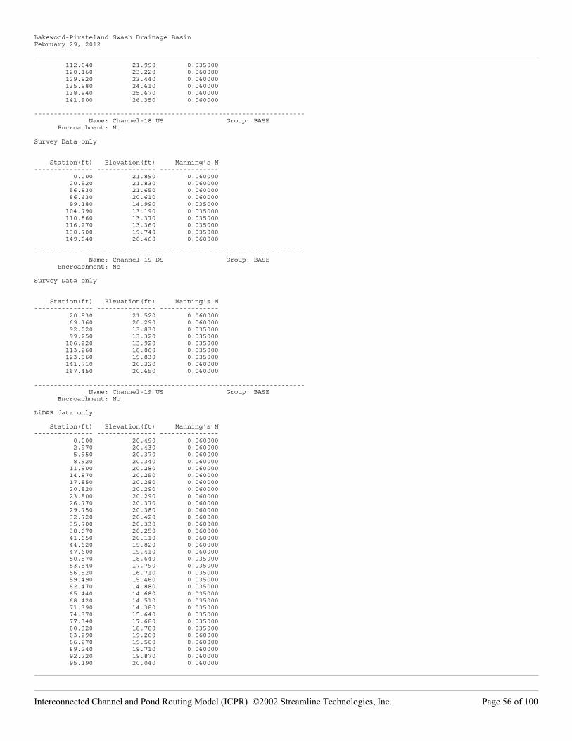
Lakewood-Pirateland Swash Drainage BasinFebruary 29, 2012
112.640 21.990 0.035000 120.160 23.220 0.060000 129.920 23.440 0.060000 135.980 24.610 0.060000 138.940 25.670 0.060000 141.900 26.350 0.060000
--------------------------------------------------------------------- Name: Channel-18 US Group: BASE Encroachment: No
Survey Data only
Station(ft) Elevation(ft) Manning's N--------------- --------------- --------------- 0.000 21.890 0.060000 20.520 21.830 0.060000 56.830 21.650 0.060000 86.630 20.610 0.060000 99.180 14.990 0.035000 104.790 13.190 0.035000 110.860 13.370 0.035000 116.270 13.360 0.035000 130.700 19.740 0.035000 149.040 20.460 0.060000
--------------------------------------------------------------------- Name: Channel-19 DS Group: BASE Encroachment: No
Survey Data only
Station(ft) Elevation(ft) Manning's N--------------- --------------- --------------- 20.930 21.520 0.060000 69.160 20.290 0.060000 92.020 13.830 0.035000 99.250 13.320 0.035000 106.220 13.920 0.035000 113.260 18.060 0.035000 123.960 19.830 0.035000 141.710 20.320 0.060000 167.450 20.650 0.060000
--------------------------------------------------------------------- Name: Channel-19 US Group: BASE Encroachment: No
LiDAR data only
Station(ft) Elevation(ft) Manning's N--------------- --------------- --------------- 0.000 20.490 0.060000 2.970 20.430 0.060000 5.950 20.370 0.060000 8.920 20.340 0.060000 11.900 20.280 0.060000 14.870 20.250 0.060000 17.850 20.280 0.060000 20.820 20.290 0.060000 23.800 20.290 0.060000 26.770 20.370 0.060000 29.750 20.380 0.060000 32.720 20.420 0.060000 35.700 20.330 0.060000 38.670 20.250 0.060000 41.650 20.110 0.060000 44.620 19.820 0.060000 47.600 19.410 0.060000 50.570 18.640 0.035000 53.540 17.790 0.035000 56.520 16.710 0.035000 59.490 15.460 0.035000 62.470 14.880 0.035000 65.440 14.680 0.035000 68.420 14.510 0.035000 71.390 14.380 0.035000 74.370 15.640 0.035000 77.340 17.680 0.035000 80.320 18.780 0.035000 83.290 19.260 0.060000 86.270 19.500 0.060000 89.240 19.710 0.060000 92.220 19.870 0.060000 95.190 20.040 0.060000
��������������� ����� ���������������������������������� ���������������������� � ���$%�!� ��

Lakewood-Pirateland Swash Drainage BasinFebruary 29, 2012
98.170 20.160 0.060000 101.140 20.340 0.060000 104.110 20.550 0.060000 107.090 20.790 0.060000 110.060 20.870 0.060000 113.040 20.790 0.060000 116.010 20.740 0.060000 118.990 20.690 0.060000 121.960 20.640 0.060000 124.940 20.600 0.060000 127.910 20.580 0.060000 130.890 20.610 0.060000 133.860 20.620 0.060000 136.840 20.590 0.060000 139.810 20.580 0.060000 142.790 20.590 0.060000 145.760 20.590 0.060000 148.740 20.610 0.060000 151.710 20.640 0.060000 154.680 20.650 0.060000 157.660 20.660 0.060000
--------------------------------------------------------------------- Name: CL LINK-01 DS Group: BASE Encroachment: No
Survey Data Only
Station(ft) Elevation(ft) Manning's N--------------- --------------- --------------- 17.490 18.510 0.060000 29.380 15.940 0.060000 48.570 11.330 0.035000 56.660 9.470 0.035000 62.010 10.360 0.035000 79.100 19.450 0.035000 85.680 19.950 0.060000
--------------------------------------------------------------------- Name: CL LINK-01 US Group: BASE Encroachment: No
Survey Data Only
Station(ft) Elevation(ft) Manning's N--------------- --------------- --------------- 0.000 18.200 0.060000 51.940 17.740 0.060000 74.930 12.370 0.035000 78.220 10.910 0.035000 82.500 11.050 0.035000 98.050 10.730 0.035000 109.050 17.490 0.035000 126.170 19.080 0.060000
--------------------------------------------------------------------- Name: CL LINK-03 DS Group: BASE Encroachment: No
Survey Data only
Station(ft) Elevation(ft) Manning's N--------------- --------------- --------------- 0.000 19.320 0.060000 3.810 19.290 0.060000 21.410 19.310 0.060000 51.440 14.090 0.035000 60.240 12.470 0.035000 66.430 12.320 0.035000 73.760 12.930 0.035000 84.730 14.360 0.035000 106.440 18.130 0.035000 108.740 18.310 0.060000 128.220 18.290 0.060000 140.680 19.020 0.060000
--------------------------------------------------------------------- Name: CL LINK-03 US Group: BASE Encroachment: No
Survey Data only
Station(ft) Elevation(ft) Manning's N--------------- --------------- --------------- 0.000 21.060 0.060000 14.900 21.030 0.060000
��������������� ����� ���������������������������������� ���������������������� � ���$&�!� ��

Lakewood-Pirateland Swash Drainage BasinFebruary 29, 2012
32.450 20.630 0.060000 74.570 13.520 0.035000 76.810 12.760 0.035000 82.020 11.990 0.035000 85.280 12.600 0.035000 113.600 16.840 0.035000 127.150 20.430 0.035000 128.970 20.470 0.060000 147.450 20.730 0.060000
--------------------------------------------------------------------- Name: HWY17_OV Group: BASE Encroachment: No
Data from LiDAR
Station(ft) Elevation(ft) Manning's N--------------- --------------- --------------- 0.000 15.200 0.000000 2.990 15.180 0.000000 5.980 15.180 0.000000 8.970 15.170 0.000000 11.960 15.150 0.000000 14.950 15.140 0.000000 17.940 15.100 0.000000 20.930 15.060 0.000000 23.920 15.060 0.000000 26.910 15.030 0.000000 29.900 15.010 0.000000 32.890 15.010 0.000000 35.880 14.970 0.000000 38.860 14.950 0.000000 41.850 14.960 0.000000 44.840 14.920 0.000000 47.830 14.910 0.000000 50.820 14.950 0.000000 53.810 14.920 0.000000 56.800 14.910 0.000000 59.790 14.900 0.000000 62.780 14.940 0.000000 65.770 14.930 0.000000 68.760 14.900 0.000000 71.750 14.920 0.000000 74.740 14.890 0.000000 77.730 14.880 0.000000 80.720 14.850 0.000000 83.710 14.820 0.000000 86.700 14.800 0.000000 89.690 14.800 0.000000 92.680 14.750 0.000000 95.670 14.700 0.000000 98.660 14.690 0.000000 101.650 14.640 0.000000 104.640 14.710 0.000000 107.630 14.730 0.000000 110.620 14.690 0.000000 113.600 14.660 0.000000 116.590 14.630 0.000000 119.580 14.610 0.000000 122.570 14.660 0.000000 125.560 14.640 0.000000 128.550 14.600 0.000000 131.540 14.590 0.000000 134.530 14.600 0.000000 137.520 14.630 0.000000 140.510 14.630 0.000000 143.500 14.610 0.000000 146.490 14.610 0.000000 149.480 14.600 0.000000 152.470 14.600 0.000000 155.460 14.610 0.000000 158.450 14.640 0.000000 161.440 14.620 0.000000 164.430 14.590 0.000000 167.420 14.660 0.000000 170.410 14.650 0.000000 173.400 14.640 0.000000 176.390 14.620 0.000000 179.380 14.530 0.000000 182.370 14.490 0.000000 185.360 14.480 0.000000 188.340 14.470 0.000000 191.330 14.540 0.000000 194.320 14.570 0.000000 197.310 14.500 0.000000 200.300 14.510 0.000000 203.290 14.510 0.000000
��������������� ����� ���������������������������������� ���������������������� � ���$'�!� ��

Lakewood-Pirateland Swash Drainage BasinFebruary 29, 2012
206.280 14.500 0.000000 209.270 14.480 0.000000 212.260 14.490 0.000000 215.250 14.480 0.000000 218.240 14.500 0.000000 221.230 14.500 0.000000 224.220 14.470 0.000000 227.210 14.450 0.000000 230.200 14.500 0.000000 233.190 14.460 0.000000 236.180 14.430 0.000000 239.170 14.390 0.000000 242.160 14.410 0.000000 245.150 14.460 0.000000 248.140 14.510 0.000000 251.130 14.460 0.000000 254.120 14.500 0.000000 257.110 14.490 0.000000 260.090 14.470 0.000000 263.080 14.510 0.000000 266.070 14.520 0.000000 269.060 14.550 0.000000 272.050 14.600 0.000000 275.040 14.630 0.000000 278.030 14.660 0.000000 281.020 14.640 0.000000 284.010 14.570 0.000000 287.000 14.600 0.000000 289.990 14.600 0.000000 292.980 14.590 0.000000 295.970 14.650 0.000000 298.960 14.600 0.000000 301.950 14.590 0.000000 304.940 14.610 0.000000 307.930 14.620 0.000000 310.920 14.640 0.000000 313.910 14.630 0.000000 316.900 14.600 0.000000 319.890 14.650 0.000000 322.880 14.710 0.000000 325.870 14.720 0.000000 328.860 14.730 0.000000 331.850 14.840 0.000000 334.830 14.830 0.000000 337.820 14.810 0.000000 340.810 14.760 0.000000 343.800 14.750 0.000000 346.790 14.770 0.000000 349.780 14.800 0.000000 352.770 14.860 0.000000 355.760 14.920 0.000000 358.750 14.930 0.000000 361.740 14.990 0.000000 364.730 15.030 0.000000 367.720 15.060 0.000000 370.710 15.120 0.000000 373.700 15.130 0.000000 376.690 15.150 0.000000 379.680 15.220 0.000000 382.670 15.310 0.000000 385.660 15.410 0.000000 388.650 15.430 0.000000 391.640 15.470 0.000000
--------------------------------------------------------------------- Name: LKWDPOND01_OV Group: BASE Encroachment: No
Data from LiDAR
Station(ft) Elevation(ft) Manning's N--------------- --------------- --------------- 0.000 6.270 0.000000 2.610 6.260 0.000000 5.230 6.250 0.000000 7.840 6.230 0.000000 10.460 6.270 0.000000 13.070 6.290 0.000000 15.680 6.250 0.000000 18.300 6.160 0.000000 21.140 6.100 0.000000 23.970 6.110 0.000000 26.810 6.120 0.000000 29.650 6.110 0.000000 32.490 6.070 0.000000 35.330 6.020 0.000000 38.290 5.970 0.000000
��������������� ����� ���������������������������������� ���������������������� � ���$(�!� ��

Lakewood-Pirateland Swash Drainage BasinFebruary 29, 2012
41.260 6.030 0.000000 44.230 5.960 0.000000 47.190 5.950 0.000000 50.160 5.920 0.000000 53.130 5.860 0.000000 56.090 5.860 0.000000 59.060 5.820 0.000000 61.900 5.800 0.000000 64.740 5.780 0.000000 67.580 5.770 0.000000 70.420 5.710 0.000000 73.260 5.630 0.000000 76.100 5.620 0.000000 78.940 5.630 0.000000 81.780 5.590 0.000000 84.620 5.530 0.000000 87.450 5.550 0.000000 90.290 5.580 0.000000 93.130 5.530 0.000000 96.050 5.520 0.000000 98.970 5.530 0.000000 101.890 5.560 0.000000 104.810 5.650 0.000000 107.730 5.720 0.000000 110.640 5.670 0.000000 113.560 5.690 0.000000 116.480 5.780 0.000000 119.400 5.890 0.000000 122.320 5.980 0.000000 125.270 6.030 0.000000 128.220 6.100 0.000000 131.170 6.130 0.000000 134.120 6.250 0.000000 137.080 6.300 0.000000 140.030 6.350 0.000000 142.640 6.380 0.000000 145.260 6.420 0.000000 147.870 6.490 0.000000 150.480 6.550 0.000000 153.100 6.580 0.000000 155.710 6.610 0.000000 158.260 6.690 0.000000 160.800 6.680 0.000000 163.350 6.730 0.000000 165.890 6.790 0.000000 168.440 6.840 0.000000 170.980 6.870 0.000000
--------------------------------------------------------------------- Name: LKWDPOND02_OV Group: BASE Encroachment: No
Data from LiDAR
Station(ft) Elevation(ft) Manning's N--------------- --------------- --------------- 0.000 9.080 0.000000 2.860 9.090 0.000000 5.710 9.100 0.000000 8.570 9.100 0.000000 11.420 9.070 0.000000 13.760 8.880 0.000000 16.090 8.820 0.000000 18.420 8.830 0.000000 21.250 8.820 0.000000 24.070 8.750 0.000000 26.420 8.740 0.000000 28.760 8.800 0.000000 30.980 8.850 0.000000 33.190 8.870 0.000000 35.410 8.870 0.000000 37.640 8.900 0.000000 39.870 8.930 0.000000 42.160 8.950 0.000000 44.460 9.020 0.000000 46.750 9.070 0.000000 49.430 9.090 0.000000 52.110 9.070 0.000000 53.820 9.050 0.000000 55.540 9.030 0.000000 57.770 8.990 0.000000 60.000 9.000 0.000000 62.240 9.050 0.000000 64.020 9.080 0.000000 65.810 9.070 0.000000 68.520 9.110 0.000000 71.410 9.170 0.000000
��������������� ����� ���������������������������������� ���������������������� � ���%��!� ��

Lakewood-Pirateland Swash Drainage BasinFebruary 29, 2012
74.290 9.230 0.000000 76.870 9.280 0.000000 79.450 9.260 0.000000 82.030 9.270 0.000000
--------------------------------------------------------------------- Name: MOCKINGBIRD_OV Group: AF Encroachment: No
Station(ft) Elevation(ft) Manning's N--------------- --------------- --------------- 0.000 17.160 0.000000 2.910 17.180 0.000000 5.810 17.160 0.000000 8.720 17.110 0.000000 11.630 17.090 0.000000 14.540 17.090 0.000000 17.440 17.090 0.000000 20.350 17.080 0.000000 23.260 17.030 0.000000 26.160 16.970 0.000000 29.070 16.970 0.000000 31.980 17.010 0.000000 34.920 17.010 0.000000 37.860 16.990 0.000000 40.800 17.030 0.000000 43.740 17.020 0.000000 46.680 16.980 0.000000 49.620 16.960 0.000000 52.550 16.960 0.000000 55.490 16.950 0.000000 58.430 16.950 0.000000 61.370 16.900 0.000000 64.310 16.940 0.000000 67.250 16.850 0.000000 70.190 16.840 0.000000 73.130 16.840 0.000000 76.070 16.820 0.000000 79.010 16.830 0.000000 81.950 16.840 0.000000 84.890 16.820 0.000000 87.830 16.770 0.000000 90.770 16.730 0.000000 93.730 16.730 0.000000 96.680 16.710 0.000000 99.640 16.730 0.000000 102.600 16.740 0.000000 105.560 16.730 0.000000 108.520 16.700 0.000000 111.480 16.660 0.000000 114.430 16.680 0.000000 117.390 16.680 0.000000 120.350 16.690 0.000000 123.310 16.740 0.000000 126.270 16.730 0.000000 129.230 16.730 0.000000 132.190 16.760 0.000000 135.140 16.740 0.000000 138.100 16.690 0.000000 141.060 16.700 0.000000 143.800 16.730 0.000000 146.550 16.710 0.000000 149.290 16.710 0.000000 152.030 16.760 0.000000 154.780 16.720 0.000000 157.520 16.710 0.000000 160.260 16.660 0.000000 163.010 16.620 0.000000 165.750 16.610 0.000000 168.490 16.620 0.000000 171.240 16.640 0.000000 174.180 16.680 0.000000 177.120 16.670 0.000000 180.070 16.630 0.000000 183.010 16.630 0.000000 185.950 16.640 0.000000 188.900 16.650 0.000000 191.840 16.650 0.000000 194.780 16.700 0.000000 197.730 16.710 0.000000 200.670 16.710 0.000000 203.610 16.720 0.000000 206.550 16.720 0.000000 209.500 16.720 0.000000 212.440 16.720 0.000000
��������������� ����� ���������������������������������� ���������������������� � ���% �!� ��

Lakewood-Pirateland Swash Drainage BasinFebruary 29, 2012
215.380 16.710 0.000000 218.330 16.760 0.000000 221.270 16.750 0.000000 224.210 16.760 0.000000 226.930 16.770 0.000000 229.650 16.700 0.000000 232.370 16.670 0.000000 235.090 16.700 0.000000 237.810 16.750 0.000000 240.530 16.720 0.000000 243.240 16.740 0.000000 245.960 16.760 0.000000 248.680 16.780 0.000000 251.400 16.770 0.000000 254.260 16.790 0.000000 257.110 16.790 0.000000 259.970 16.770 0.000000 262.830 16.770 0.000000 265.680 16.780 0.000000 268.540 16.810 0.000000 271.400 16.800 0.000000 274.250 16.790 0.000000 277.110 16.810 0.000000 279.970 16.820 0.000000 282.820 16.840 0.000000 285.680 16.840 0.000000 288.540 16.840 0.000000 291.390 16.840 0.000000 294.250 16.860 0.000000 297.100 16.860 0.000000 299.960 16.870 0.000000 302.870 16.870 0.000000 305.780 16.820 0.000000 308.680 16.890 0.000000 311.590 16.880 0.000000 314.500 16.880 0.000000 317.410 16.890 0.000000 320.320 16.860 0.000000 323.220 16.880 0.000000 326.130 16.920 0.000000 329.040 16.900 0.000000 331.950 16.940 0.000000 334.850 16.920 0.000000 337.760 16.870 0.000000 340.670 16.910 0.000000 343.580 16.920 0.000000 346.490 16.900 0.000000 349.390 16.950 0.000000 352.300 16.960 0.000000 355.210 16.960 0.000000 358.090 16.980 0.000000 360.960 16.990 0.000000 363.840 16.990 0.000000 366.720 17.010 0.000000 369.600 17.000 0.000000 372.470 17.050 0.000000 375.350 17.070 0.000000 378.230 17.030 0.000000 381.100 17.030 0.000000 383.980 17.030 0.000000 386.860 17.050 0.000000 389.740 17.060 0.000000 392.610 17.080 0.000000 395.490 17.100 0.000000 398.370 17.140 0.000000 401.250 17.140 0.000000
--------------------------------------------------------------------- Name: PIRLNDPOND01_OV Group: BASE Encroachment: No
Data from LiDAR
Station(ft) Elevation(ft) Manning's N--------------- --------------- --------------- 0.000 6.840 0.000000 2.990 6.880 0.000000 5.990 6.880 0.000000 8.980 6.810 0.000000 11.970 6.850 0.000000 14.970 6.810 0.000000 17.960 6.820 0.000000 20.960 6.720 0.000000 23.950 6.630 0.000000 26.940 6.600 0.000000 29.940 6.600 0.000000 32.930 6.520 0.000000
��������������� ����� ���������������������������������� ���������������������� � ���%��!� ��

Lakewood-Pirateland Swash Drainage BasinFebruary 29, 2012
35.920 6.410 0.000000 38.920 6.390 0.000000 41.910 6.400 0.000000 44.900 6.360 0.000000 47.900 6.320 0.000000 50.890 6.250 0.000000 53.880 6.150 0.000000 56.880 6.150 0.000000 59.870 6.110 0.000000 62.870 6.040 0.000000 65.860 6.070 0.000000 68.850 6.090 0.000000 71.850 6.030 0.000000 74.840 6.020 0.000000 77.830 6.070 0.000000 80.830 6.100 0.000000 83.820 6.070 0.000000 86.810 6.010 0.000000 89.810 5.990 0.000000 92.800 5.950 0.000000 95.800 5.970 0.000000 98.790 5.970 0.000000 101.780 5.950 0.000000 104.780 5.900 0.000000 107.770 5.880 0.000000 110.760 5.860 0.000000 113.760 5.880 0.000000 116.750 5.810 0.000000 119.740 5.820 0.000000 122.740 5.780 0.000000 125.730 5.680 0.000000 128.730 5.690 0.000000 131.720 5.720 0.000000 134.710 5.750 0.000000 137.710 5.710 0.000000 140.700 5.660 0.000000 143.690 5.630 0.000000 146.690 5.680 0.000000 149.680 5.640 0.000000 152.670 5.630 0.000000 155.670 5.620 0.000000 158.660 5.640 0.000000 161.650 5.610 0.000000 164.650 5.610 0.000000 167.640 5.610 0.000000 170.640 5.590 0.000000 173.630 5.580 0.000000 176.620 5.620 0.000000 179.620 5.600 0.000000 182.610 5.630 0.000000 185.600 5.680 0.000000 188.600 5.680 0.000000 191.590 5.670 0.000000 194.580 5.680 0.000000 197.580 5.700 0.000000 200.570 5.710 0.000000 203.570 5.730 0.000000 206.560 5.760 0.000000 209.550 5.760 0.000000 212.550 5.720 0.000000 215.540 5.740 0.000000 218.530 5.730 0.000000 221.530 5.730 0.000000 224.520 5.750 0.000000 227.510 5.750 0.000000 230.510 5.770 0.000000 233.500 5.790 0.000000 236.490 5.820 0.000000 239.490 5.800 0.000000 242.480 5.800 0.000000 245.480 5.800 0.000000 248.470 5.780 0.000000 251.460 5.780 0.000000 254.460 5.770 0.000000 257.450 5.770 0.000000 260.440 5.810 0.000000 263.440 5.830 0.000000 266.430 5.820 0.000000 269.420 5.820 0.000000 272.420 5.810 0.000000 275.410 5.850 0.000000 278.410 5.840 0.000000 281.400 5.870 0.000000 284.390 5.900 0.000000 287.390 5.880 0.000000 290.380 5.880 0.000000 293.370 5.870 0.000000
��������������� ����� ���������������������������������� ���������������������� � ���%"�!� ��

Lakewood-Pirateland Swash Drainage BasinFebruary 29, 2012
296.370 5.870 0.000000 299.360 5.870 0.000000 302.350 5.920 0.000000 305.350 5.890 0.000000 308.340 5.920 0.000000 311.340 5.840 0.000000 314.330 5.830 0.000000 317.320 5.860 0.000000 320.320 5.860 0.000000 323.310 5.860 0.000000 326.300 5.870 0.000000 329.300 5.810 0.000000 332.290 5.790 0.000000 335.280 5.760 0.000000 338.280 5.750 0.000000 341.270 5.730 0.000000 344.260 5.700 0.000000 347.260 5.720 0.000000 350.250 5.720 0.000000 353.250 5.730 0.000000 356.240 5.750 0.000000 359.230 5.730 0.000000 362.230 5.700 0.000000 365.220 5.680 0.000000 368.210 5.650 0.000000 371.210 5.720 0.000000 374.200 5.650 0.000000 377.190 5.670 0.000000 380.190 5.670 0.000000 383.180 5.660 0.000000 386.180 5.680 0.000000 389.170 5.760 0.000000 392.160 5.730 0.000000 395.160 5.790 0.000000 398.150 5.850 0.000000 401.140 5.820 0.000000 404.140 5.860 0.000000 407.130 5.900 0.000000 410.120 5.880 0.000000 413.120 5.870 0.000000 416.110 5.890 0.000000 419.100 5.910 0.000000 422.100 5.910 0.000000 425.090 5.950 0.000000 428.090 5.940 0.000000 431.080 5.910 0.000000 434.070 5.880 0.000000 437.070 5.880 0.000000 440.060 5.920 0.000000 443.050 5.960 0.000000 446.050 6.010 0.000000 449.040 6.020 0.000000 452.030 6.020 0.000000 455.030 6.040 0.000000 458.020 6.050 0.000000 461.020 6.100 0.000000 464.010 6.040 0.000000 467.000 6.060 0.000000 470.000 5.990 0.000000 472.990 6.000 0.000000 475.980 6.010 0.000000 478.980 6.020 0.000000 481.970 6.100 0.000000 484.960 6.130 0.000000 487.960 6.120 0.000000 490.900 6.140 0.000000 493.850 6.150 0.000000 496.800 6.170 0.000000 499.740 6.170 0.000000 502.690 6.180 0.000000 505.640 6.160 0.000000 508.580 6.110 0.000000 511.530 6.100 0.000000 514.480 6.090 0.000000 517.430 6.110 0.000000 520.370 6.150 0.000000 523.320 6.100 0.000000 526.270 6.070 0.000000 529.210 6.070 0.000000 532.160 6.080 0.000000 535.110 6.080 0.000000 538.050 6.120 0.000000 541.000 6.130 0.000000 543.950 6.150 0.000000 546.940 6.130 0.000000 549.930 6.100 0.000000 552.930 6.110 0.000000
��������������� ����� ���������������������������������� ���������������������� � ���%#�!� ��

Lakewood-Pirateland Swash Drainage BasinFebruary 29, 2012
555.920 6.100 0.000000 558.920 6.200 0.000000 561.910 6.060 0.000000 564.900 5.970 0.000000 567.900 6.030 0.000000 570.890 6.040 0.000000 573.880 6.050 0.000000 576.880 6.080 0.000000 579.880 6.130 0.000000 582.880 6.100 0.000000 585.880 6.140 0.000000 588.880 6.140 0.000000 591.870 6.160 0.000000 594.870 6.150 0.000000 597.870 6.110 0.000000 600.870 6.120 0.000000 603.870 6.210 0.000000 606.870 6.210 0.000000 609.870 6.240 0.000000 612.670 6.240 0.000000 615.470 6.290 0.000000 618.270 6.260 0.000000 621.070 6.250 0.000000 623.870 6.310 0.000000 626.680 6.330 0.000000 629.480 6.340 0.000000 632.280 6.350 0.000000 635.080 6.390 0.000000 637.880 6.360 0.000000 640.680 6.380 0.000000 643.480 6.450 0.000000 646.280 6.480 0.000000
--------------------------------------------------------------------- Name: PIRLNDPOND02_OV Group: MAIN Encroachment: No
Data from LiDAR
Station(ft) Elevation(ft) Manning's N--------------- --------------- --------------- 0.000 6.270 0.000000 2.890 6.330 0.000000 5.770 6.380 0.000000 8.660 6.490 0.000000 11.550 6.710 0.000000 14.430 6.710 0.000000 17.320 6.710 0.000000 20.210 6.710 0.000000 23.090 6.710 0.000000 25.980 6.710 0.000000 28.860 6.710 0.000000 31.750 6.710 0.000000 34.640 6.710 0.000000 37.520 6.710 0.000000 40.410 6.710 0.000000 43.300 6.710 0.000000 46.180 6.710 0.000000 49.070 6.710 0.000000 51.960 6.780 0.000000 54.840 6.700 0.000000 57.730 6.650 0.000000 60.620 6.850 0.000000 63.500 6.800 0.000000 66.260 6.640 0.000000 69.020 6.490 0.000000 71.780 6.370 0.000000 74.540 6.330 0.000000 77.300 6.290 0.000000 80.060 6.210 0.000000 82.810 6.130 0.000000 85.570 6.080 0.000000 88.450 5.990 0.000000 91.320 5.930 0.000000 94.200 5.860 0.000000 97.070 5.810 0.000000 99.950 5.850 0.000000 102.820 5.830 0.000000 105.750 5.800 0.000000 108.680 5.770 0.000000 111.610 5.740 0.000000 114.530 5.750 0.000000 117.460 5.800 0.000000 120.390 5.790 0.000000 123.320 5.780 0.000000 126.250 5.820 0.000000 129.170 5.840 0.000000
��������������� ����� ���������������������������������� ���������������������� � ���%$�!� ��

Lakewood-Pirateland Swash Drainage BasinFebruary 29, 2012
132.100 5.800 0.000000 135.030 5.760 0.000000 137.960 5.780 0.000000 140.890 5.800 0.000000 143.810 5.820 0.000000 146.740 5.850 0.000000 149.620 5.870 0.000000 152.500 5.890 0.000000 155.380 5.890 0.000000 158.260 5.850 0.000000 161.140 5.870 0.000000 164.020 5.910 0.000000 166.900 5.910 0.000000 169.780 5.900 0.000000 172.660 5.880 0.000000 175.540 5.850 0.000000 178.420 5.820 0.000000 181.290 5.840 0.000000 184.170 5.840 0.000000 187.050 5.760 0.000000 189.930 5.740 0.000000 192.810 5.750 0.000000 195.690 5.790 0.000000 198.570 5.770 0.000000 201.430 5.740 0.000000 204.300 5.750 0.000000 207.160 5.720 0.000000 210.020 5.700 0.000000 212.890 5.690 0.000000 215.750 5.670 0.000000 218.610 5.660 0.000000 221.480 5.650 0.000000 224.340 5.670 0.000000 227.200 5.700 0.000000 230.070 5.700 0.000000 232.930 5.700 0.000000 235.790 5.670 0.000000 238.740 5.620 0.000000 241.700 5.630 0.000000 244.650 5.900 0.000000 247.600 6.010 0.000000 250.550 6.120 0.000000 253.500 6.170 0.000000 256.450 6.150 0.000000 259.400 6.250 0.000000 262.230 6.350 0.000000 265.060 6.360 0.000000 267.890 6.380 0.000000 270.720 6.400 0.000000 273.550 6.390 0.000000 276.380 6.360 0.000000 279.210 6.330 0.000000 282.040 6.300 0.000000 284.870 6.270 0.000000 287.700 6.240 0.000000 290.530 6.200 0.000000 293.360 6.150 0.000000 296.180 6.090 0.000000 299.010 6.060 0.000000 301.840 6.060 0.000000 304.670 6.050 0.000000 307.500 6.050 0.000000 310.170 6.010 0.000000 312.840 5.970 0.000000 315.520 5.940 0.000000 318.190 5.940 0.000000 320.860 5.890 0.000000 323.530 5.820 0.000000 326.200 5.800 0.000000 328.880 5.830 0.000000 331.570 5.820 0.000000 334.250 5.880 0.000000 336.940 5.850 0.000000 339.620 5.830 0.000000 342.300 5.840 0.000000 344.990 5.850 0.000000 347.670 5.850 0.000000 350.360 5.850 0.000000 353.250 5.860 0.000000 356.140 5.890 0.000000 359.040 5.940 0.000000 361.930 5.980 0.000000 364.820 6.010 0.000000 367.720 6.010 0.000000 370.640 6.040 0.000000 373.560 6.050 0.000000 376.480 6.030 0.000000
��������������� ����� ���������������������������������� ���������������������� � ���%%�!� ��

Lakewood-Pirateland Swash Drainage BasinFebruary 29, 2012
379.400 5.990 0.000000 382.310 5.990 0.000000 385.230 6.100 0.000000 388.150 6.210 0.000000
--------------------------------------------------------------------- Name: PIRLNDPOND03_OV Group: BASE Encroachment: No
Data from LiDAR
Station(ft) Elevation(ft) Manning's N--------------- --------------- --------------- 0.000 8.250 0.000000 2.930 8.220 0.000000 5.860 8.100 0.000000 8.790 8.110 0.000000 11.720 8.090 0.000000 14.650 8.110 0.000000 17.580 8.190 0.000000 20.510 8.260 0.000000 23.440 8.260 0.000000 26.370 8.260 0.000000 29.300 8.300 0.000000 32.220 8.250 0.000000 35.150 8.220 0.000000 38.080 8.210 0.000000 41.010 8.150 0.000000 43.940 8.030 0.000000 46.870 7.940 0.000000 49.800 7.860 0.000000 52.730 7.820 0.000000 55.660 7.780 0.000000 58.590 7.680 0.000000 61.520 7.570 0.000000 64.450 7.430 0.000000 67.380 7.320 0.000000 70.160 7.230 0.000000 72.940 7.220 0.000000 75.720 7.270 0.000000 78.500 7.370 0.000000 81.280 7.430 0.000000 84.060 7.400 0.000000 86.850 7.360 0.000000 89.630 7.360 0.000000 92.410 7.360 0.000000 95.190 7.280 0.000000 97.980 7.300 0.000000 100.760 7.350 0.000000 103.550 7.240 0.000000 106.340 7.170 0.000000 109.130 7.220 0.000000 111.910 7.250 0.000000 114.700 7.170 0.000000 117.490 7.100 0.000000 120.280 7.170 0.000000 123.070 7.230 0.000000 125.850 7.230 0.000000 128.640 7.200 0.000000 131.450 7.270 0.000000 134.250 7.420 0.000000 137.060 7.440 0.000000 139.860 7.520 0.000000 142.670 7.660 0.000000 145.470 7.820 0.000000 148.280 7.910 0.000000 151.080 7.980 0.000000 153.890 8.020 0.000000 156.690 8.070 0.000000 159.500 8.240 0.000000 162.300 8.290 0.000000 165.110 8.330 0.000000 167.910 8.390 0.000000 170.720 8.450 0.000000 173.550 8.540 0.000000 176.380 8.600 0.000000 179.210 8.730 0.000000 182.040 8.840 0.000000 184.880 8.890 0.000000 187.710 8.910 0.000000 190.540 8.940 0.000000 193.370 8.910 0.000000 196.200 8.890 0.000000 199.040 8.910 0.000000 201.870 8.930 0.000000 204.700 8.990 0.000000 207.530 9.110 0.000000
��������������� ����� ���������������������������������� ���������������������� � ���%&�!� ��

Lakewood-Pirateland Swash Drainage BasinFebruary 29, 2012
210.360 9.180 0.000000
--------------------------------------------------------------------- Name: PW LINK-01 Group: BASE Encroachment: No
Data from LiDAR
Station(ft) Elevation(ft) Manning's N--------------- --------------- --------------- 0.000 11.670 0.000000 2.770 11.640 0.000000 5.540 11.640 0.000000 8.310 11.540 0.000000 11.090 11.390 0.000000 13.860 11.140 0.000000 16.630 10.880 0.000000 19.400 10.620 0.000000 22.170 10.120 0.000000 24.940 9.890 0.000000 27.710 9.740 0.000000 30.490 9.560 0.000000 32.990 9.390 0.000000 35.490 7.500 0.000000 38.000 7.500 0.000000 40.550 7.500 0.000000 43.110 9.320 0.000000 45.670 9.390 0.000000 48.450 9.470 0.000000 51.230 9.490 0.000000 53.790 9.400 0.000000 56.350 9.470 0.000000 58.910 9.690 0.000000 60.510 9.720 0.000000 62.110 9.730 0.000000 64.920 9.630 0.000000 67.730 9.480 0.000000 70.540 9.400 0.000000 73.350 9.410 0.000000 75.710 9.500 0.000000 78.070 9.880 0.000000 80.430 10.350 0.000000 82.580 10.710 0.000000 84.730 10.860 0.000000 87.070 11.010 0.000000 89.420 11.160 0.000000 91.760 11.320 0.000000 93.850 11.460 0.000000 95.930 11.580 0.000000 98.020 11.680 0.000000
--------------------------------------------------------------------- Name: PW POND-02_OV Group: BASE Encroachment: No
Station(ft) Elevation(ft) Manning's N--------------- --------------- --------------- 0.000 20.010 0.000000 2.930 19.930 0.000000 5.860 19.930 0.000000 8.790 19.930 0.000000 11.720 19.960 0.000000 14.660 19.930 0.000000 17.590 19.840 0.000000 20.520 19.830 0.000000 23.450 19.820 0.000000 26.380 19.810 0.000000 29.310 19.760 0.000000 32.240 19.760 0.000000 35.170 19.780 0.000000 38.110 19.700 0.000000 41.040 19.760 0.000000 43.970 19.740 0.000000 46.900 19.720 0.000000 49.830 19.670 0.000000 52.760 19.690 0.000000 55.690 19.700 0.000000 58.620 19.700 0.000000 61.550 19.690 0.000000 64.490 19.660 0.000000 67.420 19.650 0.000000 70.350 19.670 0.000000 73.280 19.670 0.000000 76.210 19.660 0.000000 79.140 19.630 0.000000
��������������� ����� ���������������������������������� ���������������������� � ���%'�!� ��

Lakewood-Pirateland Swash Drainage BasinFebruary 29, 2012
82.070 19.620 0.000000 84.920 19.610 0.000000 87.770 19.560 0.000000 90.620 19.550 0.000000 93.470 19.530 0.000000 96.310 19.520 0.000000 99.160 19.480 0.000000 102.010 19.430 0.000000 104.860 19.420 0.000000 107.710 19.390 0.000000 110.550 19.340 0.000000 113.400 19.320 0.000000 116.250 19.300 0.000000 119.020 19.260 0.000000 121.790 19.310 0.000000 124.560 19.280 0.000000 127.330 19.260 0.000000 130.110 19.230 0.000000 132.880 19.210 0.000000 135.650 19.210 0.000000 138.420 19.210 0.000000 141.190 19.180 0.000000 143.960 19.170 0.000000 146.730 19.180 0.000000 149.680 19.120 0.000000 152.640 19.050 0.000000 155.590 18.980 0.000000 158.540 18.900 0.000000 161.490 18.890 0.000000 164.440 18.910 0.000000 167.050 18.890 0.000000 169.660 18.820 0.000000 172.270 18.810 0.000000 174.890 18.800 0.000000 177.500 18.700 0.000000 180.110 18.530 0.000000 182.720 18.380 0.000000 185.650 18.250 0.000000 188.580 18.180 0.000000 191.510 18.150 0.000000 194.440 18.220 0.000000 197.160 18.270 0.000000 199.890 18.220 0.000000 202.620 18.180 0.000000 205.350 18.110 0.000000 208.080 18.060 0.000000 210.810 18.040 0.000000 213.530 18.020 0.000000 216.260 18.050 0.000000 219.200 18.070 0.000000 222.150 18.090 0.000000 225.090 18.090 0.000000 228.030 18.080 0.000000 230.970 18.120 0.000000 233.910 18.110 0.000000 236.850 18.160 0.000000 239.720 18.210 0.000000 242.590 18.270 0.000000 245.460 18.360 0.000000 248.330 18.460 0.000000 251.200 18.500 0.000000 254.070 18.510 0.000000 256.940 18.530 0.000000 259.810 18.530 0.000000 262.680 18.570 0.000000 265.550 18.650 0.000000 268.420 18.670 0.000000 271.290 18.760 0.000000 274.160 18.810 0.000000 277.030 18.890 0.000000 279.900 18.880 0.000000 282.750 18.830 0.000000 285.610 18.850 0.000000 288.470 18.810 0.000000 291.320 18.850 0.000000 294.180 18.940 0.000000 297.030 19.000 0.000000 299.890 19.110 0.000000 302.740 19.190 0.000000 305.600 19.170 0.000000 308.460 19.210 0.000000 311.260 19.190 0.000000 314.070 19.180 0.000000 316.880 19.210 0.000000 319.690 19.220 0.000000 322.500 19.180 0.000000 325.310 19.180 0.000000
��������������� ����� ���������������������������������� ���������������������� � ���%(�!� ��

Lakewood-Pirateland Swash Drainage BasinFebruary 29, 2012
328.120 19.230 0.000000 330.930 19.290 0.000000 333.740 19.310 0.000000 336.350 19.370 0.000000 338.970 19.430 0.000000 341.590 19.490 0.000000 344.210 19.570 0.000000 346.820 19.670 0.000000 349.590 19.660 0.000000 352.360 19.640 0.000000 355.130 19.530 0.000000 357.900 19.560 0.000000 360.670 19.580 0.000000 363.440 19.610 0.000000 366.220 19.610 0.000000 368.990 19.590 0.000000 371.760 19.560 0.000000 374.530 19.510 0.000000 377.300 19.470 0.000000 380.070 19.510 0.000000 382.840 19.490 0.000000
--------------------------------------------------------------------- Name: PW POND-03_OV Group: BASE Encroachment: No
Data from LiDAR
Station(ft) Elevation(ft) Manning's N--------------- --------------- --------------- 0.000 15.230 0.000000 2.480 15.080 0.000000 4.950 14.860 0.000000 7.430 14.670 0.000000 9.900 14.420 0.000000 12.380 14.170 0.000000 15.050 13.980 0.000000 17.720 13.780 0.000000 20.390 13.790 0.000000 23.060 13.860 0.000000 25.730 13.760 0.000000 28.400 13.650 0.000000 31.070 13.680 0.000000 33.740 13.730 0.000000 36.500 13.800 0.000000 39.270 13.880 0.000000 42.030 14.020 0.000000 44.790 13.960 0.000000 47.550 13.840 0.000000 50.320 13.870 0.000000 53.120 13.860 0.000000 55.930 13.830 0.000000 58.730 13.820 0.000000 61.070 13.800 0.000000 63.400 13.830 0.000000 65.740 13.850 0.000000 68.540 13.910 0.000000 71.350 13.910 0.000000 74.150 13.920 0.000000 76.810 14.000 0.000000 79.470 14.040 0.000000 82.120 14.070 0.000000 84.780 14.090 0.000000 87.440 14.110 0.000000 90.090 14.150 0.000000 92.750 14.190 0.000000 95.410 14.220 0.000000
--------------------------------------------------------------------- Name: PW POND-04_OV Group: BASE Encroachment: No
Data from LiDAR
Station(ft) Elevation(ft) Manning's N--------------- --------------- --------------- 0.000 18.920 0.000000 2.940 18.880 0.000000 5.880 18.850 0.000000 8.820 18.660 0.000000 11.760 18.500 0.000000 14.700 18.410 0.000000 17.640 18.350 0.000000 20.580 18.290 0.000000 23.520 18.220 0.000000 26.460 18.170 0.000000 29.400 18.110 0.000000
��������������� ����� ���������������������������������� ���������������������� � ���&��!� ��

Lakewood-Pirateland Swash Drainage BasinFebruary 29, 2012
32.340 18.140 0.000000 35.280 18.290 0.000000 38.220 18.340 0.000000 41.160 18.200 0.000000 44.100 17.970 0.000000 47.040 17.740 0.000000 49.980 17.520 0.000000 52.920 17.490 0.000000 55.860 17.450 0.000000 58.800 17.430 0.000000 61.730 17.450 0.000000 64.670 17.490 0.000000 67.610 17.570 0.000000 70.550 17.620 0.000000 73.490 17.590 0.000000 76.430 17.650 0.000000 79.370 17.600 0.000000 82.310 17.550 0.000000 85.250 17.510 0.000000 88.190 17.620 0.000000 91.130 17.830 0.000000 94.070 17.930 0.000000 97.010 17.990 0.000000 99.950 18.080 0.000000 102.890 18.010 0.000000 105.830 17.920 0.000000 108.770 17.970 0.000000 111.710 18.050 0.000000 114.650 18.120 0.000000 117.590 18.140 0.000000 120.530 18.170 0.000000 123.470 18.180 0.000000
--------------------------------------------------------------------- Name: WALNUT_OV Group: MAIN Encroachment: No
Station(ft) Elevation(ft) Manning's N--------------- --------------- --------------- 0.000 21.240 0.000000 2.940 21.220 0.000000 5.890 21.170 0.000000 8.830 21.080 0.000000 11.770 21.030 0.000000 14.710 21.010 0.000000 17.660 20.910 0.000000 20.600 20.800 0.000000 23.540 20.650 0.000000 26.490 20.460 0.000000 29.430 20.190 0.000000 32.380 19.940 0.000000 35.320 19.770 0.000000 38.270 19.670 0.000000 41.220 19.510 0.000000 44.160 19.430 0.000000 47.110 19.400 0.000000 50.060 19.280 0.000000 53.000 19.240 0.000000 55.950 19.260 0.000000 58.900 19.320 0.000000 61.840 19.320 0.000000 64.790 19.360 0.000000 67.740 19.430 0.000000 70.690 19.520 0.000000 73.630 19.600 0.000000 76.580 19.660 0.000000 79.430 19.720 0.000000 82.280 19.730 0.000000 85.120 19.710 0.000000 87.970 19.750 0.000000 90.820 19.790 0.000000 93.670 19.820 0.000000 96.520 19.840 0.000000 99.370 19.880 0.000000 102.220 19.940 0.000000 105.060 19.980 0.000000 107.910 20.000 0.000000 110.760 20.060 0.000000 113.610 20.130 0.000000 116.460 20.270 0.000000 119.310 20.310 0.000000 122.220 20.390 0.000000 125.140 20.440 0.000000 128.060 20.470 0.000000 130.970 20.580 0.000000
��������������� ����� ���������������������������������� ���������������������� � ���& �!� ��

Lakewood-Pirateland Swash Drainage BasinFebruary 29, 2012
133.890 20.700 0.000000 136.810 20.810 0.000000 139.720 20.860 0.000000 142.640 20.870 0.000000 145.560 20.860 0.000000 148.470 20.850 0.000000 151.390 20.840 0.000000 154.300 20.840 0.000000 157.220 20.840 0.000000 160.140 20.830 0.000000 163.050 20.820 0.000000 165.970 20.810 0.000000 168.890 20.790 0.000000 171.800 20.790 0.000000 174.720 20.810 0.000000 177.640 20.810 0.000000 180.550 20.820 0.000000 183.470 20.820 0.000000 186.390 20.820 0.000000 189.300 20.830 0.000000 192.220 20.840 0.000000 195.130 20.850 0.000000 198.080 20.850 0.000000 201.030 20.860 0.000000 203.980 20.870 0.000000 206.930 20.870 0.000000 209.870 20.830 0.000000 212.820 20.830 0.000000 215.770 20.830 0.000000 218.720 20.840 0.000000 221.660 20.840 0.000000 224.610 20.830 0.000000 227.560 20.850 0.000000 230.510 20.880 0.000000 233.460 20.890 0.000000 236.400 20.890 0.000000 239.350 20.870 0.000000 242.300 20.830 0.000000 245.250 20.820 0.000000 248.190 20.820 0.000000 251.140 20.780 0.000000 254.090 20.940 0.000000 257.040 21.030 0.000000 259.990 21.100 0.000000 262.930 21.180 0.000000 265.880 21.200 0.000000
============================================================================================== Operating Tables ==============================================================================================================================================================
Name: Group: BASE Type: Rating Curve Function: US Stage vs. Discharge
US Stage(ft) Discharge(cfs)--------------- ---------------
============================================================================================== Pipes =========================================================================================================================================================================
Name: AF LINK-02 From Node: AF-02 Length(ft): 72.00 Group: AF To Node: AF-01 Count: 3 Friction Equation: Automatic UPSTREAM DOWNSTREAM Solution Algorithm: Most Restrictive Geometry: Horz Ellipse Horz Ellipse Flow: Both Span(in): 68.00 68.00 Entrance Loss Coef: 0.50 Rise(in): 43.00 43.00 Exit Loss Coef: 0.50 Invert(ft): 11.270 10.780 Bend Loss Coef: 0.00 Manning's N: 0.130000 0.013000 Outlet Ctrl Spec: Use dc or tw Top Clip(in): 0.000 0.000 Inlet Ctrl Spec: Use dc Bot Clip(in): 0.000 0.000 Stabilizer Option: None
Upstream FHWA Inlet Edge Description:Horizontal Ellipse Concrete: Square edge with headwall
Downstream FHWA Inlet Edge Description:Horizontal Ellipse Concrete: Square edge with headwall
Data from Survey
----------------------------------------------------------------------------------------------------
��������������� ����� ���������������������������������� ���������������������� � ���&��!� ��

Lakewood-Pirateland Swash Drainage BasinFebruary 29, 2012
Name: AF LINK-06 From Node: AF-06 Length(ft): 70.00 Group: AF To Node: AF-05 Count: 2 Friction Equation: Automatic UPSTREAM DOWNSTREAM Solution Algorithm: Most Restrictive Geometry: Circular Circular Flow: Both Span(in): 24.00 24.00 Entrance Loss Coef: 0.50 Rise(in): 24.00 24.00 Exit Loss Coef: 0.50 Invert(ft): 12.000 11.800 Bend Loss Coef: 0.00 Manning's N: 0.013000 0.013000 Outlet Ctrl Spec: Use dc or tw Top Clip(in): 0.000 0.000 Inlet Ctrl Spec: Use dc Bot Clip(in): 0.000 0.000 Stabilizer Option: None
Upstream FHWA Inlet Edge Description:Circular Concrete: Square edge w/ headwall
Downstream FHWA Inlet Edge Description:Circular Concrete: Square edge w/ headwall
Estimated Data
---------------------------------------------------------------------------------------------------- Name: BG_0UT01 From Node: BERMGRN01 Length(ft): 31.00 Group: BERMGRN To Node: MAIN-04 Count: 1 Friction Equation: Automatic UPSTREAM DOWNSTREAM Solution Algorithm: Most Restrictive Geometry: Circular Circular Flow: Both Span(in): 24.00 24.00 Entrance Loss Coef: 0.50 Rise(in): 24.00 24.00 Exit Loss Coef: 0.00 Invert(ft): 11.800 11.750 Bend Loss Coef: 0.00 Manning's N: 0.013000 0.013000 Outlet Ctrl Spec: Use dc or tw Top Clip(in): 0.000 0.000 Inlet Ctrl Spec: Use dc Bot Clip(in): 0.000 0.000 Stabilizer Option: None
Upstream FHWA Inlet Edge Description:Circular Concrete: Groove end projecting
Downstream FHWA Inlet Edge Description:Circular Concrete: Groove end projecting
data from as-built
---------------------------------------------------------------------------------------------------- Name: BG_OUT02 From Node: BERMGRN02 Length(ft): 31.00 Group: BERMGRN To Node: MAIN-06 Count: 1 Friction Equation: Automatic UPSTREAM DOWNSTREAM Solution Algorithm: Most Restrictive Geometry: Circular Circular Flow: Both Span(in): 18.00 18.00 Entrance Loss Coef: 0.20 Rise(in): 18.00 18.00 Exit Loss Coef: 0.00 Invert(ft): 8.650 8.550 Bend Loss Coef: 0.00 Manning's N: 0.013000 0.013000 Outlet Ctrl Spec: Use dc or tw Top Clip(in): 0.000 0.000 Inlet Ctrl Spec: Use dc Bot Clip(in): 0.000 0.000 Stabilizer Option: None
Upstream FHWA Inlet Edge Description:Circular Concrete: Groove end projecting
Downstream FHWA Inlet Edge Description:Circular Concrete: Groove end projecting
Data from as built
---------------------------------------------------------------------------------------------------- Name: BG_OUT03 From Node: BERMGRN03 Length(ft): 290.00 Group: BERMGRN To Node: MAIN-07A Count: 1 Friction Equation: Automatic UPSTREAM DOWNSTREAM Solution Algorithm: Most Restrictive Geometry: Circular Circular Flow: Both Span(in): 18.00 18.00 Entrance Loss Coef: 0.50 Rise(in): 18.00 18.00 Exit Loss Coef: 0.00 Invert(ft): 13.400 12.020 Bend Loss Coef: 0.00 Manning's N: 0.013000 0.013000 Outlet Ctrl Spec: Use dc or tw Top Clip(in): 0.000 0.000 Inlet Ctrl Spec: Use dc Bot Clip(in): 0.000 0.000 Stabilizer Option: None
Upstream FHWA Inlet Edge Description:Circular Concrete: Groove end projecting
Downstream FHWA Inlet Edge Description:
��������������� ����� ���������������������������������� ���������������������� � ���&"�!� ��

Lakewood-Pirateland Swash Drainage BasinFebruary 29, 2012
Circular Concrete: Groove end projecting
Data from as built
---------------------------------------------------------------------------------------------------- Name: BG_OUT04 From Node: BERMGRN04 Length(ft): 208.00 Group: BERMGRN To Node: BERMGRN03 Count: 1 Friction Equation: Automatic UPSTREAM DOWNSTREAM Solution Algorithm: Most Restrictive Geometry: Circular Circular Flow: Both Span(in): 18.00 18.00 Entrance Loss Coef: 0.50 Rise(in): 18.00 18.00 Exit Loss Coef: 1.00 Invert(ft): 14.670 13.260 Bend Loss Coef: 0.00 Manning's N: 0.013000 0.013000 Outlet Ctrl Spec: Use dc or tw Top Clip(in): 0.000 0.000 Inlet Ctrl Spec: Use dc Bot Clip(in): 0.000 0.000 Stabilizer Option: None
Upstream FHWA Inlet Edge Description:Circular Concrete: Square edge w/ headwall
Downstream FHWA Inlet Edge Description:Circular Concrete: Square edge w/ headwall
Data from as-built
---------------------------------------------------------------------------------------------------- Name: BG_OUT05 From Node: BERMGRN05 Length(ft): 53.00 Group: BERMGRN To Node: MAIN-08A Count: 1 Friction Equation: Automatic UPSTREAM DOWNSTREAM Solution Algorithm: Most Restrictive Geometry: Circular Circular Flow: Both Span(in): 18.00 18.00 Entrance Loss Coef: 0.50 Rise(in): 18.00 18.00 Exit Loss Coef: 0.00 Invert(ft): 13.700 13.400 Bend Loss Coef: 0.00 Manning's N: 0.013000 0.013000 Outlet Ctrl Spec: Use dc or tw Top Clip(in): 0.000 0.000 Inlet Ctrl Spec: Use dc Bot Clip(in): 0.000 0.000 Stabilizer Option: None
Upstream FHWA Inlet Edge Description:Circular Concrete: Groove end projecting
Downstream FHWA Inlet Edge Description:Circular Concrete: Groove end projecting
Data from as built
---------------------------------------------------------------------------------------------------- Name: CAMP LINK-01a From Node: LKWDPOND01 Length(ft): 40.00 Group: CAMP To Node: PIRLNDPOND02 Count: 1 Friction Equation: Automatic UPSTREAM DOWNSTREAM Solution Algorithm: Most Restrictive Geometry: Circular Circular Flow: Both Span(in): 18.00 18.00 Entrance Loss Coef: 0.50 Rise(in): 18.00 18.00 Exit Loss Coef: 1.00 Invert(ft): 3.000 2.600 Bend Loss Coef: 0.00 Manning's N: 0.013000 0.013000 Outlet Ctrl Spec: Use dc or tw Top Clip(in): 0.000 0.000 Inlet Ctrl Spec: Use dc Bot Clip(in): 0.000 0.000 Stabilizer Option: None
Upstream FHWA Inlet Edge Description:Circular Concrete: Groove end projecting
Downstream FHWA Inlet Edge Description:Circular Concrete: Groove end projecting
---------------------------------------------------------------------------------------------------- Name: CAMP LINK-03 From Node: PIRLNDPOND01 Length(ft): 55.00 Group: CAMP To Node: MAIN-02 Count: 1 Friction Equation: Automatic UPSTREAM DOWNSTREAM Solution Algorithm: Most Restrictive Geometry: Circular Circular Flow: Both Span(in): 30.00 30.00 Entrance Loss Coef: 0.90 Rise(in): 30.00 30.00 Exit Loss Coef: 1.00 Invert(ft): 1.800 1.700 Bend Loss Coef: 0.00 Manning's N: 0.027000 0.027000 Outlet Ctrl Spec: Use dc or tw Top Clip(in): 0.000 0.000 Inlet Ctrl Spec: Use dc Bot Clip(in): 0.000 0.000 Stabilizer Option: None
��������������� ����� ���������������������������������� ���������������������� � ���&#�!� ��

Lakewood-Pirateland Swash Drainage BasinFebruary 29, 2012
Upstream FHWA Inlet Edge Description:Circular CMP: Projecting
Downstream FHWA Inlet Edge Description:Circular CMP: Projecting
Pipe input estimated
---------------------------------------------------------------------------------------------------- Name: CL LINK-02 From Node: CL-02 Length(ft): 98.00 Group: CL To Node: CL-01 Count: 1 Friction Equation: Automatic UPSTREAM DOWNSTREAM Solution Algorithm: Most Restrictive Geometry: Circular Circular Flow: Both Span(in): 36.00 36.00 Entrance Loss Coef: 0.50 Rise(in): 36.00 36.00 Exit Loss Coef: 0.50 Invert(ft): 12.620 11.120 Bend Loss Coef: 0.00 Manning's N: 0.013000 0.013000 Outlet Ctrl Spec: Use dc or tw Top Clip(in): 0.000 0.000 Inlet Ctrl Spec: Use dc Bot Clip(in): 0.000 0.000 Stabilizer Option: None
Upstream FHWA Inlet Edge Description:Circular Concrete: Groove end projecting
Downstream FHWA Inlet Edge Description:Circular Concrete: Groove end projecting
---------------------------------------------------------------------------------------------------- Name: CULVERT-01 From Node: PIRLNDPOND03 Length(ft): 57.00 Group: MAIN To Node: PIRLNDPOND02 Count: 4 Friction Equation: Automatic UPSTREAM DOWNSTREAM Solution Algorithm: Most Restrictive Geometry: Rectangular Rectangular Flow: Both Span(in): 60.00 60.00 Entrance Loss Coef: 0.50 Rise(in): 48.00 48.00 Exit Loss Coef: 1.00 Invert(ft): -1.140 -1.170 Bend Loss Coef: 0.00 Manning's N: 0.013000 0.013000 Outlet Ctrl Spec: Use dc or tw Top Clip(in): 0.000 0.000 Inlet Ctrl Spec: Use dc Bot Clip(in): 0.000 0.000 Stabilizer Option: None
Upstream FHWA Inlet Edge Description:Rectangular Box: 90° headwall w/ 3/4" chamfers
Downstream FHWA Inlet Edge Description:Rectangular Box: 90° headwall w/ 3/4" chamfers
Culvert data from survey
---------------------------------------------------------------------------------------------------- Name: CULVERT-02 From Node: MAIN-03 Length(ft): 105.00 Group: MAIN To Node: PIRLNDPOND03 Count: 1 Friction Equation: Automatic UPSTREAM DOWNSTREAM Solution Algorithm: Most Restrictive Geometry: Rectangular Rectangular Flow: Both Span(in): 84.00 84.00 Entrance Loss Coef: 0.50 Rise(in): 84.00 84.00 Exit Loss Coef: 1.00 Invert(ft): 4.130 3.830 Bend Loss Coef: 0.00 Manning's N: 0.013000 0.013000 Outlet Ctrl Spec: Use dc or tw Top Clip(in): 0.000 0.000 Inlet Ctrl Spec: Use dc Bot Clip(in): 0.000 0.000 Stabilizer Option: None
Upstream FHWA Inlet Edge Description:Rectangular Box: 30° to 75° wingwall flares
Downstream FHWA Inlet Edge Description:Rectangular Box: 30° to 75° wingwall flares
culvert data from survey
---------------------------------------------------------------------------------------------------- Name: CULVERT-03 From Node: MAIN-17 Length(ft): 18.00 Group: MAIN To Node: MAIN-16 Count: 2 Friction Equation: Automatic UPSTREAM DOWNSTREAM Solution Algorithm: Most Restrictive Geometry: Rectangular Rectangular Flow: Both Span(in): 96.00 96.00 Entrance Loss Coef: 0.50 Rise(in): 96.00 96.00 Exit Loss Coef: 0.00
��������������� ����� ���������������������������������� ���������������������� � ���&$�!� ��

Lakewood-Pirateland Swash Drainage BasinFebruary 29, 2012
Invert(ft): 8.300 8.350 Bend Loss Coef: 0.00 Manning's N: 0.130000 0.130000 Outlet Ctrl Spec: Use dc or tw Top Clip(in): 0.000 0.000 Inlet Ctrl Spec: Use dc Bot Clip(in): 0.000 0.000 Stabilizer Option: None
Upstream FHWA Inlet Edge Description:Rectangular Box: 0° wingwall flares
Downstream FHWA Inlet Edge Description:Rectangular Box: 0° wingwall flares
---------------------------------------------------------------------------------------------------- Name: CULVERT-04 From Node: MAIN-20 Length(ft): 81.00 Group: MAIN To Node: MAIN-19 Count: 1 Friction Equation: Automatic UPSTREAM DOWNSTREAM Solution Algorithm: Most Restrictive Geometry: Circular Circular Flow: Both Span(in): 60.00 60.00 Entrance Loss Coef: 0.50 Rise(in): 60.00 60.00 Exit Loss Coef: 1.00 Invert(ft): 12.080 12.380 Bend Loss Coef: 0.00 Manning's N: 0.027000 0.027000 Outlet Ctrl Spec: Use dc or tw Top Clip(in): 0.000 0.000 Inlet Ctrl Spec: Use dc Bot Clip(in): 0.000 0.000 Stabilizer Option: None
Upstream FHWA Inlet Edge Description:Circular CMP: Headwall
Downstream FHWA Inlet Edge Description:Circular CMP: Headwall
Data from Survey
---------------------------------------------------------------------------------------------------- Name: LINK-01 From Node: MAIN-23 Length(ft): 189.00 Group: MAIN To Node: MAIN-22 Count: 3 Friction Equation: Automatic UPSTREAM DOWNSTREAM Solution Algorithm: Most Restrictive Geometry: Circular Circular Flow: Both Span(in): 36.00 36.00 Entrance Loss Coef: 0.50 Rise(in): 36.00 36.00 Exit Loss Coef: 1.00 Invert(ft): 14.240 13.600 Bend Loss Coef: 0.00 Manning's N: 0.025000 0.025000 Outlet Ctrl Spec: Use dc or tw Top Clip(in): 0.000 0.000 Inlet Ctrl Spec: Use dc Bot Clip(in): 0.000 0.000 Stabilizer Option: None
Upstream FHWA Inlet Edge Description:Circular CMP: Headwall
Downstream FHWA Inlet Edge Description:Circular CMP: Headwall
---------------------------------------------------------------------------------------------------- Name: LINK-02 From Node: MAIN-25 Length(ft): 94.00 Group: MAIN To Node: MAIN-24 Count: 1 Friction Equation: Automatic UPSTREAM DOWNSTREAM Solution Algorithm: Most Restrictive Geometry: Circular Circular Flow: Both Span(in): 24.00 24.00 Entrance Loss Coef: 0.50 Rise(in): 24.00 24.00 Exit Loss Coef: 0.50 Invert(ft): 14.600 14.500 Bend Loss Coef: 0.00 Manning's N: 0.013000 0.013000 Outlet Ctrl Spec: Use dc or tw Top Clip(in): 0.000 0.000 Inlet Ctrl Spec: Use dc Bot Clip(in): 0.000 0.000 Stabilizer Option: None
Upstream FHWA Inlet Edge Description:Circular Concrete: Square edge w/ headwall
Downstream FHWA Inlet Edge Description:Circular Concrete: Square edge w/ headwall
Estimated Data
---------------------------------------------------------------------------------------------------- Name: POND02 OUT From Node: PIRLNDPOND02 Length(ft): 18.00 Group: MAIN To Node: MAIN-02 Count: 1
��������������� ����� ���������������������������������� ���������������������� � ���&%�!� ��

Lakewood-Pirateland Swash Drainage BasinFebruary 29, 2012
Friction Equation: Automatic UPSTREAM DOWNSTREAM Solution Algorithm: Most Restrictive Geometry: Circular Circular Flow: Both Span(in): 24.00 24.00 Entrance Loss Coef: 0.70 Rise(in): 24.00 24.00 Exit Loss Coef: 1.00 Invert(ft): 1.300 0.900 Bend Loss Coef: 0.00 Manning's N: 0.027000 0.027000 Outlet Ctrl Spec: Use dc or tw Top Clip(in): 0.000 0.000 Inlet Ctrl Spec: Use dc Bot Clip(in): 0.000 0.000 Stabilizer Option: None
Upstream FHWA Inlet Edge Description:Circular Concrete: Square edge w/ headwall
Downstream FHWA Inlet Edge Description:Circular Concrete: Square edge w/ headwall
Pipe input from survey
---------------------------------------------------------------------------------------------------- Name: PW LINK-02 From Node: PW-02 Length(ft): 70.00 Group: PW To Node: PW-01 Count: 1 Friction Equation: Automatic UPSTREAM DOWNSTREAM Solution Algorithm: Most Restrictive Geometry: Circular Circular Flow: Both Span(in): 60.00 60.00 Entrance Loss Coef: 0.50 Rise(in): 60.00 60.00 Exit Loss Coef: 1.00 Invert(ft): 7.680 7.370 Bend Loss Coef: 0.00 Manning's N: 0.013000 0.013000 Outlet Ctrl Spec: Use dc or tw Top Clip(in): 0.000 0.000 Inlet Ctrl Spec: Use dc Bot Clip(in): 0.000 0.000 Stabilizer Option: None
Upstream FHWA Inlet Edge Description:Circular Concrete: Groove end projecting
Downstream FHWA Inlet Edge Description:Circular Concrete: Groove end projecting
Data from survey
---------------------------------------------------------------------------------------------------- Name: PW LINK-05 From Node: PW-05 Length(ft): 105.00 Group: PW To Node: PW-01 Count: 1 Friction Equation: Automatic UPSTREAM DOWNSTREAM Solution Algorithm: Most Restrictive Geometry: Circular Circular Flow: Both Span(in): 48.00 48.00 Entrance Loss Coef: 0.50 Rise(in): 48.00 48.00 Exit Loss Coef: 1.00 Invert(ft): 6.470 6.320 Bend Loss Coef: 0.00 Manning's N: 0.013000 0.013000 Outlet Ctrl Spec: Use dc or tw Top Clip(in): 0.000 0.000 Inlet Ctrl Spec: Use dc Bot Clip(in): 0.000 0.000 Stabilizer Option: None
Upstream FHWA Inlet Edge Description:Circular CMP: Projecting
Downstream FHWA Inlet Edge Description:Circular CMP: Projecting
Data from survey
---------------------------------------------------------------------------------------------------- Name: PW LINK-07 From Node: PW-07 Length(ft): 160.00 Group: PW To Node: PW-06B Count: 1 Friction Equation: Automatic UPSTREAM DOWNSTREAM Solution Algorithm: Most Restrictive Geometry: Circular Circular Flow: Both Span(in): 36.00 36.00 Entrance Loss Coef: 0.50 Rise(in): 36.00 36.00 Exit Loss Coef: 1.00 Invert(ft): 14.000 13.500 Bend Loss Coef: 0.00 Manning's N: 0.013000 0.013000 Outlet Ctrl Spec: Use dc or tw Top Clip(in): 0.000 0.000 Inlet Ctrl Spec: Use dc Bot Clip(in): 0.000 0.000 Stabilizer Option: None
Upstream FHWA Inlet Edge Description:Circular Concrete: Groove end projecting
Downstream FHWA Inlet Edge Description:Circular Concrete: Groove end projecting
��������������� ����� ���������������������������������� ���������������������� � ���&&�!� ��

Lakewood-Pirateland Swash Drainage BasinFebruary 29, 2012
Estimated data
---------------------------------------------------------------------------------------------------- Name: PW LINK-08 From Node: PW-08 Length(ft): 194.00 Group: PW To Node: PW-07 Count: 1 Friction Equation: Automatic UPSTREAM DOWNSTREAM Solution Algorithm: Most Restrictive Geometry: Circular Circular Flow: Both Span(in): 36.00 36.00 Entrance Loss Coef: 0.50 Rise(in): 36.00 36.00 Exit Loss Coef: 1.00 Invert(ft): 12.500 12.000 Bend Loss Coef: 0.00 Manning's N: 0.013000 0.013000 Outlet Ctrl Spec: Use dc or tw Top Clip(in): 0.000 0.000 Inlet Ctrl Spec: Use dc Bot Clip(in): 0.000 0.000 Stabilizer Option: None
Upstream FHWA Inlet Edge Description:Circular Concrete: Groove end projecting
Downstream FHWA Inlet Edge Description:Circular Concrete: Groove end projecting
Estimated data
---------------------------------------------------------------------------------------------------- Name: PW LINK-15 From Node: PW-14 Length(ft): 123.00 Group: PW To Node: PW-13 Count: 1 Friction Equation: Automatic UPSTREAM DOWNSTREAM Solution Algorithm: Most Restrictive Geometry: Circular Circular Flow: Both Span(in): 30.00 30.00 Entrance Loss Coef: 0.50 Rise(in): 30.00 30.00 Exit Loss Coef: 1.00 Invert(ft): 21.000 19.000 Bend Loss Coef: 0.00 Manning's N: 0.013000 0.013000 Outlet Ctrl Spec: Use dc or tw Top Clip(in): 0.000 0.000 Inlet Ctrl Spec: Use dc Bot Clip(in): 0.000 0.000 Stabilizer Option: None
Upstream FHWA Inlet Edge Description:Circular Concrete: Groove end projecting
Downstream FHWA Inlet Edge Description:Circular Concrete: Groove end projecting
---------------------------------------------------------------------------------------------------- Name: PW LINK-17 From Node: PW-16 Length(ft): 50.00 Group: PW To Node: PW-15 Count: 1 Friction Equation: Automatic UPSTREAM DOWNSTREAM Solution Algorithm: Most Restrictive Geometry: Circular Circular Flow: Both Span(in): 36.00 36.00 Entrance Loss Coef: 0.50 Rise(in): 36.00 36.00 Exit Loss Coef: 1.00 Invert(ft): 23.000 22.000 Bend Loss Coef: 0.00 Manning's N: 0.013000 0.013000 Outlet Ctrl Spec: Use dc or tw Top Clip(in): 0.000 0.000 Inlet Ctrl Spec: Use dc Bot Clip(in): 0.000 0.000 Stabilizer Option: None
Upstream FHWA Inlet Edge Description:Circular Concrete: Groove end projecting
Downstream FHWA Inlet Edge Description:Circular Concrete: Groove end projecting
---------------------------------------------------------------------------------------------------- Name: PW LINK-18 From Node: PW-17 Length(ft): 40.00 Group: PW To Node: PW-16 Count: 1 Friction Equation: Automatic UPSTREAM DOWNSTREAM Solution Algorithm: Most Restrictive Geometry: Circular Circular Flow: Both Span(in): 18.00 18.00 Entrance Loss Coef: 0.00 Rise(in): 18.00 18.00 Exit Loss Coef: 1.00 Invert(ft): 23.000 22.000 Bend Loss Coef: 0.00 Manning's N: 0.013000 0.013000 Outlet Ctrl Spec: Use dc or tw Top Clip(in): 0.000 0.000 Inlet Ctrl Spec: Use dc Bot Clip(in): 0.000 0.000 Stabilizer Option: None
��������������� ����� ���������������������������������� ���������������������� � ���&'�!� ��

Lakewood-Pirateland Swash Drainage BasinFebruary 29, 2012
Upstream FHWA Inlet Edge Description:Circular Concrete: Square edge w/ headwall
Downstream FHWA Inlet Edge Description:Circular Concrete: Square edge w/ headwall
---------------------------------------------------------------------------------------------------- Name: PW LINK-19 From Node: PW POND-03 Length(ft): 41.00 Group: PW To Node: MAIN-08 Count: 1 Friction Equation: Automatic UPSTREAM DOWNSTREAM Solution Algorithm: Most Restrictive Geometry: Circular Circular Flow: Both Span(in): 24.00 24.00 Entrance Loss Coef: 0.50 Rise(in): 24.00 24.00 Exit Loss Coef: 1.00 Invert(ft): 9.410 8.080 Bend Loss Coef: 0.00 Manning's N: 0.013000 0.013000 Outlet Ctrl Spec: Use dc or tw Top Clip(in): 0.000 0.000 Inlet Ctrl Spec: Use dc Bot Clip(in): 0.000 0.000 Stabilizer Option: None
Upstream FHWA Inlet Edge Description:Circular Concrete: Square edge w/ headwall
Downstream FHWA Inlet Edge Description:Circular Concrete: Square edge w/ headwall
---------------------------------------------------------------------------------------------------- Name: STOR LINK-02 From Node: STOR-02 Length(ft): 48.00 Group: STOR To Node: STOR-01 Count: 1 Friction Equation: Automatic UPSTREAM DOWNSTREAM Solution Algorithm: Most Restrictive Geometry: Circular Circular Flow: Both Span(in): 30.00 30.00 Entrance Loss Coef: 0.50 Rise(in): 30.00 30.00 Exit Loss Coef: 0.00 Invert(ft): 10.500 10.300 Bend Loss Coef: 0.00 Manning's N: 0.013000 0.013000 Outlet Ctrl Spec: Use dc or tw Top Clip(in): 0.000 0.000 Inlet Ctrl Spec: Use dc Bot Clip(in): 0.000 0.000 Stabilizer Option: None
Upstream FHWA Inlet Edge Description:Circular Concrete: Groove end projecting
Downstream FHWA Inlet Edge Description:Circular Concrete: Groove end projecting
estimated data
---------------------------------------------------------------------------------------------------- Name: STOR LINK-05 From Node: STOR-05 Length(ft): 183.00 Group: STOR To Node: PW-09 Count: 1 Friction Equation: Automatic UPSTREAM DOWNSTREAM Solution Algorithm: Most Restrictive Geometry: Circular Circular Flow: Both Span(in): 36.00 36.00 Entrance Loss Coef: 0.50 Rise(in): 36.00 36.00 Exit Loss Coef: 1.00 Invert(ft): 13.870 12.000 Bend Loss Coef: 0.00 Manning's N: 0.025000 0.025000 Outlet Ctrl Spec: Use dc or tw Top Clip(in): 0.000 0.000 Inlet Ctrl Spec: Use dc Bot Clip(in): 0.000 0.000 Stabilizer Option: None
Upstream FHWA Inlet Edge Description:Circular CMP: Projecting
Downstream FHWA Inlet Edge Description:Circular CMP: Projecting
---------------------------------------------------------------------------------------------------- Name: STOR LINK-06 From Node: STOR-06 Length(ft): 168.00 Group: STOR To Node: STOR-05 Count: 1 Friction Equation: Automatic UPSTREAM DOWNSTREAM Solution Algorithm: Most Restrictive Geometry: Circular Circular Flow: Both Span(in): 48.00 48.00 Entrance Loss Coef: 0.50 Rise(in): 48.00 48.00 Exit Loss Coef: 0.00 Invert(ft): 14.300 14.000 Bend Loss Coef: 0.00
��������������� ����� ���������������������������������� ���������������������� � ���&(�!� ��

Lakewood-Pirateland Swash Drainage BasinFebruary 29, 2012
Manning's N: 0.013000 0.013000 Outlet Ctrl Spec: Use dc or tw Top Clip(in): 0.000 0.000 Inlet Ctrl Spec: Use dc Bot Clip(in): 0.000 0.000 Stabilizer Option: None
Upstream FHWA Inlet Edge Description:Circular Concrete: Groove end projecting
Downstream FHWA Inlet Edge Description:Circular Concrete: Square edge w/ headwall
data from DDC plan dated 1/27/2011
============================================================================================== Channels ======================================================================================================================================================================
Name: AF LINK-01 From Node: AF-01 Length(ft): 272.00 Group: AF To Node: MAIN-17 Count: 1
UPSTREAM DOWNSTREAM Friction Equation: Automatic Geometry: Irregular Irregular Solution Algorithm: Automatic Invert(ft): 9.920 9.390 Flow: Both TClpInitZ(ft): 9999.000 9999.000 Contraction Coef: 0.100 Manning's N: Expansion Coef: 0.300 Top Clip(ft): Entrance Loss Coef: 0.000 Bot Clip(ft): Exit Loss Coef: 0.000 Main XSec: AF LINK-01 DS AF LINK-01 US Outlet Ctrl Spec: Use dc or tw AuxElev1(ft): 0.000 0.000 Inlet Ctrl Spec: Use dc Aux XSec1: Stabilizer Option: None AuxElev2(ft): 0.000 0.000 Aux XSec2: Top Width(ft): Depth(ft): Bot Width(ft): LtSdSlp(h/v): RtSdSlp(h/v):
---------------------------------------------------------------------------------------------------- Name: AF LINK-03 From Node: AF-03 Length(ft): 924.00 Group: AF To Node: AF-02 Count: 1
UPSTREAM DOWNSTREAM Friction Equation: Automatic Geometry: Irregular Irregular Solution Algorithm: Automatic Invert(ft): 11.100 10.890 Flow: Both TClpInitZ(ft): 9999.000 9999.000 Contraction Coef: 0.100 Manning's N: Expansion Coef: 0.300 Top Clip(ft): Entrance Loss Coef: 0.000 Bot Clip(ft): Exit Loss Coef: 0.000 Main XSec: AF LINK-03 US AF LINK-03 DS Outlet Ctrl Spec: Use dc or tw AuxElev1(ft): 0.000 0.000 Inlet Ctrl Spec: Use dc Aux XSec1: Stabilizer Option: None AuxElev2(ft): 0.000 0.000 Aux XSec2: Top Width(ft): Depth(ft): Bot Width(ft): LtSdSlp(h/v): RtSdSlp(h/v):
---------------------------------------------------------------------------------------------------- Name: AF LINK-04 From Node: AF-04 Length(ft): 1293.00 Group: AF To Node: AF-03 Count: 1
UPSTREAM DOWNSTREAM Friction Equation: Automatic Geometry: Irregular Irregular Solution Algorithm: Automatic Invert(ft): 13.090 11.680 Flow: Both TClpInitZ(ft): 9999.000 9999.000 Contraction Coef: 0.100 Manning's N: Expansion Coef: 0.300 Top Clip(ft): Entrance Loss Coef: 0.000 Bot Clip(ft): Exit Loss Coef: 0.000 Main XSec: AF LINK-04 US AF LINK-04 DS Outlet Ctrl Spec: Use dc or tw AuxElev1(ft): 0.000 0.000 Inlet Ctrl Spec: Use dc Aux XSec1: Stabilizer Option: None AuxElev2(ft): 0.000 0.000 Aux XSec2: Top Width(ft): Depth(ft): Bot Width(ft): LtSdSlp(h/v): RtSdSlp(h/v):
��������������� ����� ���������������������������������� ���������������������� � ���'��!� ��

Lakewood-Pirateland Swash Drainage BasinFebruary 29, 2012
---------------------------------------------------------------------------------------------------- Name: AF LINK-05 From Node: AF-05 Length(ft): 156.00 Group: AF To Node: AF-03 Count: 1
UPSTREAM DOWNSTREAM Friction Equation: Automatic Geometry: Irregular Irregular Solution Algorithm: Automatic Invert(ft): 11.940 11.630 Flow: Both TClpInitZ(ft): 9999.000 9999.000 Contraction Coef: 0.100 Manning's N: Expansion Coef: 0.300 Top Clip(ft): Entrance Loss Coef: 0.000 Bot Clip(ft): Exit Loss Coef: 0.000 Main XSec: AF LINK-05 US AF LINK-05 DS Outlet Ctrl Spec: Use dc or tw AuxElev1(ft): 0.000 0.000 Inlet Ctrl Spec: Use dc Aux XSec1: Stabilizer Option: None AuxElev2(ft): 0.000 0.000 Aux XSec2: Top Width(ft): Depth(ft): Bot Width(ft): LtSdSlp(h/v): RtSdSlp(h/v):
---------------------------------------------------------------------------------------------------- Name: AF LINK-07 From Node: AF-07 Length(ft): 1325.00 Group: AF To Node: AF-06 Count: 1
UPSTREAM DOWNSTREAM Friction Equation: Automatic Geometry: Irregular Irregular Solution Algorithm: Automatic Invert(ft): 13.660 12.570 Flow: Both TClpInitZ(ft): 9999.000 9999.000 Contraction Coef: 0.100 Manning's N: Expansion Coef: 0.300 Top Clip(ft): Entrance Loss Coef: 0.000 Bot Clip(ft): Exit Loss Coef: 0.000 Main XSec: AF LINK-07 US AF LINK-07 DS Outlet Ctrl Spec: Use dc or tw AuxElev1(ft): 0.000 0.000 Inlet Ctrl Spec: Use dc Aux XSec1: Stabilizer Option: None AuxElev2(ft): 0.000 0.000 Aux XSec2: Top Width(ft): Depth(ft): Bot Width(ft): LtSdSlp(h/v): RtSdSlp(h/v):
---------------------------------------------------------------------------------------------------- Name: BRIDGE-01 From Node: MAIN-11 Length(ft): 58.00 Group: MAIN To Node: MAIN-10 Count: 1
UPSTREAM DOWNSTREAM Friction Equation: Automatic Geometry: Trapezoidal Trapezoidal Solution Algorithm: Automatic Invert(ft): 7.600 7.500 Flow: Both TClpInitZ(ft): 9999.000 9999.000 Contraction Coef: 0.100 Manning's N: 0.035000 0.035000 Expansion Coef: 0.300 Top Clip(ft): 0.000 0.000 Entrance Loss Coef: 0.000 Bot Clip(ft): 0.000 0.000 Exit Loss Coef: 0.000 Main XSec: Outlet Ctrl Spec: Use dc or tw AuxElev1(ft): Inlet Ctrl Spec: Use dc Aux XSec1: Stabilizer Option: None AuxElev2(ft): Aux XSec2: Top Width(ft): Depth(ft): Bot Width(ft): 12.000 12.000 LtSdSlp(h/v): 1.67 1.67 RtSdSlp(h/v): 1.67 1.67
Estimated from Survey Data
---------------------------------------------------------------------------------------------------- Name: BRIDGE-02 From Node: MAIN-14 Length(ft): 55.00 Group: MAIN To Node: MAIN-13 Count: 1
UPSTREAM DOWNSTREAM Friction Equation: Automatic Geometry: Trapezoidal Trapezoidal Solution Algorithm: Automatic Invert(ft): 8.300 8.000 Flow: Both TClpInitZ(ft): 9999.000 9999.000 Contraction Coef: 0.100 Manning's N: 0.050000 0.050000 Expansion Coef: 0.300 Top Clip(ft): 0.000 0.000 Entrance Loss Coef: 0.000 Bot Clip(ft): 0.000 0.000 Exit Loss Coef: 0.000 Main XSec: Outlet Ctrl Spec: Use dc or tw AuxElev1(ft): Inlet Ctrl Spec: Use dc
��������������� ����� ���������������������������������� ���������������������� � ���' �!� ��

Lakewood-Pirateland Swash Drainage BasinFebruary 29, 2012
Aux XSec1: Stabilizer Option: None AuxElev2(ft): Aux XSec2: Top Width(ft): Depth(ft): Bot Width(ft): 20.000 20.000 LtSdSlp(h/v): 1.67 1.67 RtSdSlp(h/v): 1.67 1.67
---------------------------------------------------------------------------------------------------- Name: CHANNEL-01 From Node: MAIN-01 Length(ft): 201.00 Group: MAIN To Node: BNDY Count: 1
UPSTREAM DOWNSTREAM Friction Equation: Automatic Geometry: Irregular Irregular Solution Algorithm: Automatic Invert(ft): 0.130 0.020 Flow: Both TClpInitZ(ft): 9999.000 9999.000 Contraction Coef: 0.100 Manning's N: Expansion Coef: 0.300 Top Clip(ft): Entrance Loss Coef: 0.000 Bot Clip(ft): Exit Loss Coef: 1.000 Main XSec: Channel-01 US Channel-01 DS Outlet Ctrl Spec: Use dc or tw AuxElev1(ft): 0.000 0.000 Inlet Ctrl Spec: Use dc Aux XSec1: Stabilizer Option: None AuxElev2(ft): 0.000 0.000 Aux XSec2: Top Width(ft): Depth(ft): Bot Width(ft): LtSdSlp(h/v): RtSdSlp(h/v):
---------------------------------------------------------------------------------------------------- Name: CHANNEL-02 From Node: MAIN-02 Length(ft): 643.00 Group: MAIN To Node: MAIN-01 Count: 1
UPSTREAM DOWNSTREAM Friction Equation: Automatic Geometry: Irregular Irregular Solution Algorithm: Automatic Invert(ft): 0.940 1.480 Flow: Both TClpInitZ(ft): 9999.000 9999.000 Contraction Coef: 0.100 Manning's N: Expansion Coef: 0.300 Top Clip(ft): Entrance Loss Coef: 0.000 Bot Clip(ft): Exit Loss Coef: 0.000 Main XSec: Channel-02 DS Channel-02 US Outlet Ctrl Spec: Use dc or tw AuxElev1(ft): 0.000 0.000 Inlet Ctrl Spec: Use dc Aux XSec1: Stabilizer Option: None AuxElev2(ft): 0.000 0.000 Aux XSec2: Top Width(ft): Depth(ft): Bot Width(ft): LtSdSlp(h/v): RtSdSlp(h/v):
---------------------------------------------------------------------------------------------------- Name: CHANNEL-04 From Node: MAIN-04 Length(ft): 439.00 Group: MAIN To Node: MAIN-03 Count: 1
UPSTREAM DOWNSTREAM Friction Equation: Automatic Geometry: Irregular Irregular Solution Algorithm: Automatic Invert(ft): 3.610 3.490 Flow: Both TClpInitZ(ft): 9999.000 9999.000 Contraction Coef: 0.100 Manning's N: Expansion Coef: 0.300 Top Clip(ft): Entrance Loss Coef: 0.000 Bot Clip(ft): Exit Loss Coef: 0.000 Main XSec: Channel-04 DS Channel-04 US Outlet Ctrl Spec: Use dc or tw AuxElev1(ft): 0.000 0.000 Inlet Ctrl Spec: Use dc Aux XSec1: Stabilizer Option: None AuxElev2(ft): 0.000 0.000 Aux XSec2: Top Width(ft): Depth(ft): Bot Width(ft): LtSdSlp(h/v): RtSdSlp(h/v):
---------------------------------------------------------------------------------------------------- Name: CHANNEL-05 From Node: MAIN-05 Length(ft): 451.00 Group: MAIN To Node: MAIN-04 Count: 1
��������������� ����� ���������������������������������� ���������������������� � ���'��!� ��

Lakewood-Pirateland Swash Drainage BasinFebruary 29, 2012
UPSTREAM DOWNSTREAM Friction Equation: Automatic Geometry: Irregular Irregular Solution Algorithm: Automatic Invert(ft): 4.340 3.610 Flow: Both TClpInitZ(ft): 9999.000 9999.000 Contraction Coef: 0.100 Manning's N: Expansion Coef: 0.300 Top Clip(ft): Entrance Loss Coef: 0.000 Bot Clip(ft): Exit Loss Coef: 0.000 Main XSec: Channel-05 US Channel-04 US Outlet Ctrl Spec: Use dc or tw AuxElev1(ft): 0.000 0.000 Inlet Ctrl Spec: Use dc Aux XSec1: Stabilizer Option: None AuxElev2(ft): 0.000 0.000 Aux XSec2: Top Width(ft): Depth(ft): Bot Width(ft): LtSdSlp(h/v): RtSdSlp(h/v):
---------------------------------------------------------------------------------------------------- Name: CHANNEL-06 From Node: MAIN-06 Length(ft): 351.00 Group: MAIN To Node: MAIN-05 Count: 1
UPSTREAM DOWNSTREAM Friction Equation: Automatic Geometry: Irregular Irregular Solution Algorithm: Automatic Invert(ft): 6.460 4.340 Flow: Both TClpInitZ(ft): 9999.000 9999.000 Contraction Coef: 0.100 Manning's N: Expansion Coef: 0.300 Top Clip(ft): Entrance Loss Coef: 0.000 Bot Clip(ft): Exit Loss Coef: 0.000 Main XSec: Channel-06 US Channel-05 US Outlet Ctrl Spec: Use dc or tw AuxElev1(ft): 0.000 0.000 Inlet Ctrl Spec: Use dc Aux XSec1: Stabilizer Option: None AuxElev2(ft): 0.000 0.000 Aux XSec2: Top Width(ft): Depth(ft): Bot Width(ft): LtSdSlp(h/v): RtSdSlp(h/v):
---------------------------------------------------------------------------------------------------- Name: CHANNEL-07 From Node: MAIN-07 Length(ft): 425.00 Group: MAIN To Node: MAIN-06 Count: 1
UPSTREAM DOWNSTREAM Friction Equation: Automatic Geometry: Irregular Irregular Solution Algorithm: Automatic Invert(ft): 8.110 6.460 Flow: Both TClpInitZ(ft): 9999.000 9999.000 Contraction Coef: 0.100 Manning's N: Expansion Coef: 0.300 Top Clip(ft): Entrance Loss Coef: 0.000 Bot Clip(ft): Exit Loss Coef: 0.000 Main XSec: Channel-07 US Channel-06 US Outlet Ctrl Spec: Use dc or tw AuxElev1(ft): 0.000 0.000 Inlet Ctrl Spec: Use dc Aux XSec1: Stabilizer Option: None AuxElev2(ft): 0.000 0.000 Aux XSec2: Top Width(ft): Depth(ft): Bot Width(ft): LtSdSlp(h/v): RtSdSlp(h/v):
---------------------------------------------------------------------------------------------------- Name: CHANNEL-08A From Node: MAIN-07A Length(ft): 256.00 Group: MAIN To Node: MAIN-07 Count: 1
UPSTREAM DOWNSTREAM Friction Equation: Automatic Geometry: Irregular Irregular Solution Algorithm: Automatic Invert(ft): 5.300 8.110 Flow: Both TClpInitZ(ft): 9999.000 9999.000 Contraction Coef: 0.100 Manning's N: Expansion Coef: 0.300 Top Clip(ft): Entrance Loss Coef: 0.000 Bot Clip(ft): Exit Loss Coef: 0.000 Main XSec: Channel-07 US Channel-08A US Outlet Ctrl Spec: Use dc or tw AuxElev1(ft): 0.000 0.000 Inlet Ctrl Spec: Use dc Aux XSec1: Stabilizer Option: None AuxElev2(ft): 0.000 0.000 Aux XSec2: Top Width(ft): Depth(ft): Bot Width(ft):
��������������� ����� ���������������������������������� ���������������������� � ���'"�!� ��

Lakewood-Pirateland Swash Drainage BasinFebruary 29, 2012
LtSdSlp(h/v): RtSdSlp(h/v):
---------------------------------------------------------------------------------------------------- Name: CHANNEL-08B From Node: MAIN-08 Length(ft): 313.00 Group: MAIN To Node: MAIN-07A Count: 1
UPSTREAM DOWNSTREAM Friction Equation: Automatic Geometry: Irregular Irregular Solution Algorithm: Automatic Invert(ft): 8.220 5.300 Flow: Both TClpInitZ(ft): 9999.000 9999.000 Contraction Coef: 0.100 Manning's N: Expansion Coef: 0.300 Top Clip(ft): Entrance Loss Coef: 0.000 Bot Clip(ft): Exit Loss Coef: 0.000 Main XSec: Channel-08B US Channel-08A US Outlet Ctrl Spec: Use dc or tw AuxElev1(ft): 0.000 0.000 Inlet Ctrl Spec: Use dc Aux XSec1: Stabilizer Option: None AuxElev2(ft): 0.000 0.000 Aux XSec2: Top Width(ft): Depth(ft): Bot Width(ft): LtSdSlp(h/v): RtSdSlp(h/v):
---------------------------------------------------------------------------------------------------- Name: CHANNEL-09A From Node: MAIN-08A Length(ft): 462.00 Group: MAIN To Node: MAIN-08 Count: 1
UPSTREAM DOWNSTREAM Friction Equation: Automatic Geometry: Irregular Irregular Solution Algorithm: Automatic Invert(ft): 9.480 8.220 Flow: Both TClpInitZ(ft): 9999.000 9999.000 Contraction Coef: 0.100 Manning's N: Expansion Coef: 0.300 Top Clip(ft): Entrance Loss Coef: 0.000 Bot Clip(ft): Exit Loss Coef: 0.000 Main XSec: Channel-09A US Channel-08B US Outlet Ctrl Spec: Use dc or tw AuxElev1(ft): 0.000 0.000 Inlet Ctrl Spec: Use dc Aux XSec1: Stabilizer Option: None AuxElev2(ft): 0.000 0.000 Aux XSec2: Top Width(ft): Depth(ft): Bot Width(ft): LtSdSlp(h/v): RtSdSlp(h/v):
---------------------------------------------------------------------------------------------------- Name: CHANNEL-09B From Node: MAIN-09 Length(ft): 200.00 Group: MAIN To Node: MAIN-08A Count: 1
UPSTREAM DOWNSTREAM Friction Equation: Automatic Geometry: Irregular Irregular Solution Algorithm: Automatic Invert(ft): 6.010 9.480 Flow: Both TClpInitZ(ft): 9999.000 9999.000 Contraction Coef: 0.100 Manning's N: Expansion Coef: 0.300 Top Clip(ft): Entrance Loss Coef: 0.000 Bot Clip(ft): Exit Loss Coef: 0.000 Main XSec: Channel-09B US Channel-09A US Outlet Ctrl Spec: Use dc or tw AuxElev1(ft): 0.000 0.000 Inlet Ctrl Spec: Use dc Aux XSec1: Stabilizer Option: None AuxElev2(ft): 0.000 0.000 Aux XSec2: Top Width(ft): Depth(ft): Bot Width(ft): LtSdSlp(h/v): RtSdSlp(h/v):
---------------------------------------------------------------------------------------------------- Name: CHANNEL-10 From Node: MAIN-10 Length(ft): 259.00 Group: MAIN To Node: MAIN-09 Count: 1
UPSTREAM DOWNSTREAM Friction Equation: Automatic Geometry: Irregular Irregular Solution Algorithm: Automatic Invert(ft): 6.010 7.310 Flow: Both TClpInitZ(ft): 9999.000 9999.000 Contraction Coef: 0.100 Manning's N: Expansion Coef: 0.300 Top Clip(ft): Entrance Loss Coef: 0.000
��������������� ����� ���������������������������������� ���������������������� � ���'#�!� ��

Lakewood-Pirateland Swash Drainage BasinFebruary 29, 2012
Bot Clip(ft): Exit Loss Coef: 0.000 Main XSec: Channel-10 US Channel-09B US Outlet Ctrl Spec: Use dc or tw AuxElev1(ft): 0.000 0.000 Inlet Ctrl Spec: Use dc Aux XSec1: Stabilizer Option: None AuxElev2(ft): 0.000 0.000 Aux XSec2: Top Width(ft): Depth(ft): Bot Width(ft): LtSdSlp(h/v): RtSdSlp(h/v):
---------------------------------------------------------------------------------------------------- Name: CHANNEL-11 From Node: MAIN-12 Length(ft): 204.00 Group: MAIN To Node: MAIN-11 Count: 1
UPSTREAM DOWNSTREAM Friction Equation: Automatic Geometry: Irregular Irregular Solution Algorithm: Automatic Invert(ft): 6.340 6.730 Flow: Both TClpInitZ(ft): 9999.000 9999.000 Contraction Coef: 0.100 Manning's N: Expansion Coef: 0.300 Top Clip(ft): Entrance Loss Coef: 0.000 Bot Clip(ft): Exit Loss Coef: 0.000 Main XSec: Channel-11 DS Channel-11 US Outlet Ctrl Spec: Use dc or tw AuxElev1(ft): 0.000 0.000 Inlet Ctrl Spec: Use dc Aux XSec1: Stabilizer Option: None AuxElev2(ft): 0.000 0.000 Aux XSec2: Top Width(ft): Depth(ft): Bot Width(ft): LtSdSlp(h/v): RtSdSlp(h/v):
---------------------------------------------------------------------------------------------------- Name: CHANNEL-12 From Node: MAIN-13 Length(ft): 303.00 Group: MAIN To Node: MAIN-12 Count: 1
UPSTREAM DOWNSTREAM Friction Equation: Automatic Geometry: Irregular Irregular Solution Algorithm: Automatic Invert(ft): 7.800 6.340 Flow: Both TClpInitZ(ft): 9999.000 9999.000 Contraction Coef: 0.100 Manning's N: Expansion Coef: 0.300 Top Clip(ft): Entrance Loss Coef: 0.000 Bot Clip(ft): Exit Loss Coef: 0.000 Main XSec: Channel-12 US Channel-11 US Outlet Ctrl Spec: Use dc or tw AuxElev1(ft): 0.000 0.000 Inlet Ctrl Spec: Use dc Aux XSec1: Stabilizer Option: None AuxElev2(ft): 0.000 0.000 Aux XSec2: Top Width(ft): Depth(ft): Bot Width(ft): LtSdSlp(h/v): RtSdSlp(h/v):
---------------------------------------------------------------------------------------------------- Name: CHANNEL-13 From Node: MAIN-15 Length(ft): 372.00 Group: MAIN To Node: MAIN-14 Count: 1
UPSTREAM DOWNSTREAM Friction Equation: Automatic Geometry: Irregular Irregular Solution Algorithm: Automatic Invert(ft): 7.650 8.430 Flow: Both TClpInitZ(ft): 9999.000 9999.000 Contraction Coef: 0.100 Manning's N: Expansion Coef: 0.300 Top Clip(ft): Entrance Loss Coef: 0.000 Bot Clip(ft): Exit Loss Coef: 0.000 Main XSec: Channel-13 DS Channel-13 US Outlet Ctrl Spec: Use dc or tw AuxElev1(ft): 0.000 0.000 Inlet Ctrl Spec: Use dc Aux XSec1: Stabilizer Option: None AuxElev2(ft): 0.000 0.000 Aux XSec2: Top Width(ft): Depth(ft): Bot Width(ft): LtSdSlp(h/v): RtSdSlp(h/v):
----------------------------------------------------------------------------------------------------
��������������� ����� ���������������������������������� ���������������������� � ���'$�!� ��

Lakewood-Pirateland Swash Drainage BasinFebruary 29, 2012
Name: CHANNEL-14 From Node: MAIN-16 Length(ft): 132.00 Group: MAIN To Node: MAIN-15 Count: 1
UPSTREAM DOWNSTREAM Friction Equation: Automatic Geometry: Irregular Irregular Solution Algorithm: Automatic Invert(ft): 8.610 9.400 Flow: Both TClpInitZ(ft): 9999.000 9999.000 Contraction Coef: 0.100 Manning's N: Expansion Coef: 0.300 Top Clip(ft): Entrance Loss Coef: 0.000 Bot Clip(ft): Exit Loss Coef: 0.000 Main XSec: Channel-14 US Channel-14 DS Outlet Ctrl Spec: Use dc or tw AuxElev1(ft): 0.000 0.000 Inlet Ctrl Spec: Use dc Aux XSec1: Stabilizer Option: None AuxElev2(ft): 0.000 0.000 Aux XSec2: Top Width(ft): Depth(ft): Bot Width(ft): LtSdSlp(h/v): RtSdSlp(h/v):
---------------------------------------------------------------------------------------------------- Name: CHANNEL-15 From Node: MAIN-18 Length(ft): 426.00 Group: MAIN To Node: MAIN-17 Count: 1
UPSTREAM DOWNSTREAM Friction Equation: Automatic Geometry: Irregular Irregular Solution Algorithm: Automatic Invert(ft): 10.200 10.210 Flow: Both TClpInitZ(ft): 9999.000 9999.000 Contraction Coef: 0.100 Manning's N: Expansion Coef: 0.300 Top Clip(ft): Entrance Loss Coef: 0.000 Bot Clip(ft): Exit Loss Coef: 0.000 Main XSec: Channel-15 US Channel-15 DS Outlet Ctrl Spec: Use dc or tw AuxElev1(ft): 0.000 0.000 Inlet Ctrl Spec: Use dc Aux XSec1: Stabilizer Option: None AuxElev2(ft): 0.000 0.000 Aux XSec2: Top Width(ft): Depth(ft): Bot Width(ft): LtSdSlp(h/v): RtSdSlp(h/v):
---------------------------------------------------------------------------------------------------- Name: CHANNEL-16 From Node: MAIN-19 Length(ft): 492.00 Group: MAIN To Node: MAIN-18 Count: 1
UPSTREAM DOWNSTREAM Friction Equation: Automatic Geometry: Irregular Irregular Solution Algorithm: Automatic Invert(ft): 11.500 10.200 Flow: Both TClpInitZ(ft): 9999.000 9999.000 Contraction Coef: 0.100 Manning's N: Expansion Coef: 0.300 Top Clip(ft): Entrance Loss Coef: 0.000 Bot Clip(ft): Exit Loss Coef: 0.000 Main XSec: Channel-16 US Channel-15 US Outlet Ctrl Spec: Use dc or tw AuxElev1(ft): 0.000 0.000 Inlet Ctrl Spec: Use dc Aux XSec1: Stabilizer Option: None AuxElev2(ft): 0.000 0.000 Aux XSec2: Top Width(ft): Depth(ft): Bot Width(ft): LtSdSlp(h/v): RtSdSlp(h/v):
---------------------------------------------------------------------------------------------------- Name: CHANNEL-17 From Node: MAIN-21 Length(ft): 668.00 Group: MAIN To Node: MAIN-20 Count: 1
UPSTREAM DOWNSTREAM Friction Equation: Automatic Geometry: Irregular Irregular Solution Algorithm: Automatic Invert(ft): 13.060 12.130 Flow: Both TClpInitZ(ft): 9999.000 9999.000 Contraction Coef: 0.100 Manning's N: Expansion Coef: 0.300 Top Clip(ft): Entrance Loss Coef: 0.000 Bot Clip(ft): Exit Loss Coef: 0.000 Main XSec: Channel-17 US Channel-17 DS Outlet Ctrl Spec: Use dc or tw AuxElev1(ft): 0.000 0.000 Inlet Ctrl Spec: Use dc Aux XSec1: Stabilizer Option: None AuxElev2(ft): 0.000 0.000 Aux XSec2:
��������������� ����� ���������������������������������� ���������������������� � ���'%�!� ��

Lakewood-Pirateland Swash Drainage BasinFebruary 29, 2012
Top Width(ft): Depth(ft): Bot Width(ft): LtSdSlp(h/v): RtSdSlp(h/v):
---------------------------------------------------------------------------------------------------- Name: CHANNEL-18 From Node: MAIN-22 Length(ft): 786.00 Group: MAIN To Node: MAIN-21 Count: 1
UPSTREAM DOWNSTREAM Friction Equation: Automatic Geometry: Irregular Irregular Solution Algorithm: Automatic Invert(ft): 13.190 13.060 Flow: Both TClpInitZ(ft): 9999.000 9999.000 Contraction Coef: 0.100 Manning's N: Expansion Coef: 0.300 Top Clip(ft): Entrance Loss Coef: 0.000 Bot Clip(ft): Exit Loss Coef: 0.000 Main XSec: Channel-18 US Channel-17 US Outlet Ctrl Spec: Use dc or tw AuxElev1(ft): 0.000 0.000 Inlet Ctrl Spec: Use dc Aux XSec1: Stabilizer Option: None AuxElev2(ft): 0.000 0.000 Aux XSec2: Top Width(ft): Depth(ft): Bot Width(ft): LtSdSlp(h/v): RtSdSlp(h/v):
---------------------------------------------------------------------------------------------------- Name: CHANNEL-19 From Node: MAIN-24 Length(ft): 1011.00 Group: MAIN To Node: MAIN-23 Count: 1
UPSTREAM DOWNSTREAM Friction Equation: Automatic Geometry: Irregular Irregular Solution Algorithm: Automatic Invert(ft): 14.380 13.320 Flow: Both TClpInitZ(ft): 9999.000 9999.000 Contraction Coef: 0.100 Manning's N: Expansion Coef: 0.300 Top Clip(ft): Entrance Loss Coef: 0.000 Bot Clip(ft): Exit Loss Coef: 0.000 Main XSec: Channel-19 US Channel-19 DS Outlet Ctrl Spec: Use dc or tw AuxElev1(ft): 0.000 0.000 Inlet Ctrl Spec: Use dc Aux XSec1: Stabilizer Option: None AuxElev2(ft): 0.000 0.000 Aux XSec2: Top Width(ft): Depth(ft): Bot Width(ft): LtSdSlp(h/v): RtSdSlp(h/v):
---------------------------------------------------------------------------------------------------- Name: CL LINK-01 From Node: CL-01 Length(ft): 368.00 Group: CL To Node: MAIN-15 Count: 1
UPSTREAM DOWNSTREAM Friction Equation: Automatic Geometry: Irregular Irregular Solution Algorithm: Automatic Invert(ft): 10.730 9.470 Flow: Both TClpInitZ(ft): 9999.000 9999.000 Contraction Coef: 0.100 Manning's N: Expansion Coef: 0.300 Top Clip(ft): Entrance Loss Coef: 0.000 Bot Clip(ft): Exit Loss Coef: 0.000 Main XSec: CL LINK-01 US CL LINK-01 DS Outlet Ctrl Spec: Use dc or tw AuxElev1(ft): 0.000 0.000 Inlet Ctrl Spec: Use dc Aux XSec1: Stabilizer Option: None AuxElev2(ft): 0.000 0.000 Aux XSec2: Top Width(ft): Depth(ft): Bot Width(ft): LtSdSlp(h/v): RtSdSlp(h/v):
---------------------------------------------------------------------------------------------------- Name: CL LINK-03 From Node: CL-03 Length(ft): 254.00 Group: CL To Node: CL-02 Count: 1
UPSTREAM DOWNSTREAM Friction Equation: Automatic Geometry: Irregular Irregular Solution Algorithm: Automatic Invert(ft): 11.990 12.320 Flow: Both
��������������� ����� ���������������������������������� ���������������������� � ���'&�!� ��

Lakewood-Pirateland Swash Drainage BasinFebruary 29, 2012
TClpInitZ(ft): 9999.000 9999.000 Contraction Coef: 0.100 Manning's N: Expansion Coef: 0.300 Top Clip(ft): Entrance Loss Coef: 0.000 Bot Clip(ft): Exit Loss Coef: 0.000 Main XSec: CL LINK-03 US CL LINK-03 DS Outlet Ctrl Spec: Use dc or tw AuxElev1(ft): 0.000 0.000 Inlet Ctrl Spec: Use dc Aux XSec1: Stabilizer Option: None AuxElev2(ft): 0.000 0.000 Aux XSec2: Top Width(ft): Depth(ft): Bot Width(ft): LtSdSlp(h/v): RtSdSlp(h/v):
---------------------------------------------------------------------------------------------------- Name: PW LINK-03 From Node: PW-03 Length(ft): 454.00 Group: PW To Node: PW-02 Count: 1
UPSTREAM DOWNSTREAM Friction Equation: Automatic Geometry: Trapezoidal Trapezoidal Solution Algorithm: Automatic Invert(ft): 8.880 8.000 Flow: Both TClpInitZ(ft): 9999.000 9999.000 Contraction Coef: 0.100 Manning's N: 0.040000 0.040000 Expansion Coef: 0.300 Top Clip(ft): 0.000 0.000 Entrance Loss Coef: 0.000 Bot Clip(ft): 0.000 0.000 Exit Loss Coef: 0.000 Main XSec: Outlet Ctrl Spec: Use dc or tw AuxElev1(ft): Inlet Ctrl Spec: Use dc Aux XSec1: Stabilizer Option: None AuxElev2(ft): Aux XSec2: Top Width(ft): Depth(ft): Bot Width(ft): 5.000 5.000 LtSdSlp(h/v): 4.00 4.00 RtSdSlp(h/v): 4.00 4.00
---------------------------------------------------------------------------------------------------- Name: PW LINK-16 From Node: PW-15 Length(ft): 536.00 Group: PW To Node: PW-14 Count: 1
UPSTREAM DOWNSTREAM Friction Equation: Automatic Geometry: Trapezoidal Trapezoidal Solution Algorithm: Automatic Invert(ft): 21.500 21.000 Flow: Both TClpInitZ(ft): 9999.000 9999.000 Contraction Coef: 0.100 Manning's N: 0.035000 0.035000 Expansion Coef: 0.300 Top Clip(ft): 0.000 0.000 Entrance Loss Coef: 0.000 Bot Clip(ft): 0.000 0.000 Exit Loss Coef: 0.000 Main XSec: Outlet Ctrl Spec: Use dc or tw AuxElev1(ft): Inlet Ctrl Spec: Use dc Aux XSec1: Stabilizer Option: None AuxElev2(ft): Aux XSec2: Top Width(ft): Depth(ft): Bot Width(ft): 15.000 15.000 LtSdSlp(h/v): 3.00 3.00 RtSdSlp(h/v): 3.00 3.00
---------------------------------------------------------------------------------------------------- Name: STOR LINK-01 From Node: STOR-01 Length(ft): 549.00 Group: STOR To Node: MAIN-04 Count: 1
UPSTREAM DOWNSTREAM Friction Equation: Automatic Geometry: Trapezoidal Trapezoidal Solution Algorithm: Automatic Invert(ft): 10.300 8.000 Flow: Both TClpInitZ(ft): 9999.000 9999.000 Contraction Coef: 0.100 Manning's N: 0.050000 0.050000 Expansion Coef: 0.300 Top Clip(ft): 0.000 0.000 Entrance Loss Coef: 0.000 Bot Clip(ft): 0.000 0.000 Exit Loss Coef: 0.000 Main XSec: Outlet Ctrl Spec: Use dc or tw AuxElev1(ft): Inlet Ctrl Spec: Use dc Aux XSec1: Stabilizer Option: None AuxElev2(ft): Aux XSec2: Top Width(ft): Depth(ft): Bot Width(ft): 5.000 5.000 LtSdSlp(h/v): 2.00 2.00 RtSdSlp(h/v): 2.00 2.00
��������������� ����� ���������������������������������� ���������������������� � ���''�!� ��

Lakewood-Pirateland Swash Drainage BasinFebruary 29, 2012
estimated data
---------------------------------------------------------------------------------------------------- Name: STOR LINK-03 From Node: STOR-03 Length(ft): 229.00 Group: STOR To Node: STOR-02 Count: 1
UPSTREAM DOWNSTREAM Friction Equation: Automatic Geometry: Trapezoidal Trapezoidal Solution Algorithm: Automatic Invert(ft): 11.000 10.500 Flow: Both TClpInitZ(ft): 9999.000 9999.000 Contraction Coef: 0.100 Manning's N: 0.050000 0.050000 Expansion Coef: 0.300 Top Clip(ft): 0.000 0.000 Entrance Loss Coef: 0.000 Bot Clip(ft): 0.000 0.000 Exit Loss Coef: 0.000 Main XSec: Outlet Ctrl Spec: Use dc or tw AuxElev1(ft): Inlet Ctrl Spec: Use dc Aux XSec1: Stabilizer Option: None AuxElev2(ft): Aux XSec2: Top Width(ft): Depth(ft): Bot Width(ft): 5.000 5.000 LtSdSlp(h/v): 2.00 2.00 RtSdSlp(h/v): 2.00 2.00
estimated data
---------------------------------------------------------------------------------------------------- Name: STOR LINK-04 From Node: STOR-04 Length(ft): 1100.00 Group: STOR To Node: STOR-03 Count: 1
UPSTREAM DOWNSTREAM Friction Equation: Automatic Geometry: Trapezoidal Trapezoidal Solution Algorithm: Automatic Invert(ft): 14.000 11.500 Flow: Both TClpInitZ(ft): 9999.000 9999.000 Contraction Coef: 0.100 Manning's N: 0.050000 0.050000 Expansion Coef: 0.300 Top Clip(ft): 0.000 0.000 Entrance Loss Coef: 0.000 Bot Clip(ft): 0.000 0.000 Exit Loss Coef: 0.000 Main XSec: Outlet Ctrl Spec: Use dc or tw AuxElev1(ft): Inlet Ctrl Spec: Use dc Aux XSec1: Stabilizer Option: None AuxElev2(ft): Aux XSec2: Top Width(ft): Depth(ft): Bot Width(ft): 5.000 5.000 LtSdSlp(h/v): 2.00 2.00 RtSdSlp(h/v): 2.00 2.00
estimated data
============================================================================================== Drop Structures ===============================================================================================================================================================
Name: CAMP LINK-01 From Node: LKWDPOND01 Length(ft): 45.00 Group: CAMP To Node: PIRLNDPOND02 Count: 2
UPSTREAM DOWNSTREAM Friction Equation: Automatic Geometry: Circular Circular Solution Algorithm: Most Restrictive Span(in): 36.00 36.00 Flow: Both Rise(in): 36.00 36.00 Entrance Loss Coef: 0.500 Invert(ft): 0.500 0.400 Exit Loss Coef: 1.000 Manning's N: 0.013000 0.013000 Outlet Ctrl Spec: Use dc or tw Top Clip(in): 0.000 0.000 Inlet Ctrl Spec: Use dc Bot Clip(in): 0.000 0.000 Solution Incs: 10
Upstream FHWA Inlet Edge Description:Circular Concrete: Square edge w/ headwall
Downstream FHWA Inlet Edge Description:Circular Concrete: Square edge w/ headwall
*** Weir 1 of 2 for Drop Structure CAMP LINK-01 *** TABLE Count: 1 Bottom Clip(in): 0.000 Type: Vertical: Mavis Top Clip(in): 0.000 Flow: Both Weir Disc Coef: 3.200 Geometry: Rectangular Orifice Disc Coef: 0.600
Span(in): 96.00 Invert(ft): 3.000 Rise(in): 36.00 Control Elev(ft): 3.000
*** Weir 2 of 2 for Drop Structure CAMP LINK-01 *** TABLE Count: 1 Bottom Clip(in): 0.000
��������������� ����� ���������������������������������� ���������������������� � ���'(�!� ��

Lakewood-Pirateland Swash Drainage BasinFebruary 29, 2012
Type: Horizontal Top Clip(in): 0.000 Flow: Both Weir Disc Coef: 3.200 Geometry: Rectangular Orifice Disc Coef: 0.600
Span(in): 48.00 Invert(ft): 6.000 Rise(in): 96.00 Control Elev(ft): 6.000
---------------------------------------------------------------------------------------------------- Name: CAMP LINK-02 From Node: LKWDPOND02 Length(ft): 57.00 Group: CAMP To Node: LKWDPOND01 Count: 1
UPSTREAM DOWNSTREAM Friction Equation: Automatic Geometry: Circular Circular Solution Algorithm: Most Restrictive Span(in): 36.00 36.00 Flow: Both Rise(in): 36.00 36.00 Entrance Loss Coef: 0.500 Invert(ft): 3.000 2.900 Exit Loss Coef: 1.000 Manning's N: 0.027000 0.027000 Outlet Ctrl Spec: Use dc or tw Top Clip(in): 0.000 0.000 Inlet Ctrl Spec: Use dc Bot Clip(in): 0.000 0.000 Solution Incs: 10
Upstream FHWA Inlet Edge Description:Circular CMP: Headwall
Downstream FHWA Inlet Edge Description:Circular CMP: Projecting
Stucture data estimated
*** Weir 1 of 1 for Drop Structure CAMP LINK-02 *** TABLE Count: 1 Bottom Clip(in): 0.000 Type: Horizontal Top Clip(in): 0.000 Flow: Both Weir Disc Coef: 3.200 Geometry: Rectangular Orifice Disc Coef: 0.600
Span(in): 48.00 Invert(ft): 6.000 Rise(in): 18.00 Control Elev(ft): 6.000
---------------------------------------------------------------------------------------------------- Name: CL LINK-04 From Node: CRYSTAL LAKE Length(ft): 60.00 Group: CL To Node: CL-03 Count: 1
UPSTREAM DOWNSTREAM Friction Equation: Automatic Geometry: Circular Circular Solution Algorithm: Most Restrictive Span(in): 30.00 30.00 Flow: Both Rise(in): 30.00 30.00 Entrance Loss Coef: 0.500 Invert(ft): 13.500 13.200 Exit Loss Coef: 1.000 Manning's N: 0.013000 0.013000 Outlet Ctrl Spec: Use dc or tw Top Clip(in): 0.000 0.000 Inlet Ctrl Spec: Use dc Bot Clip(in): 0.000 0.000 Solution Incs: 10
Upstream FHWA Inlet Edge Description:Circular Concrete: Square edge w/ headwall
Downstream FHWA Inlet Edge Description:Circular Concrete: Groove end projecting
*** Weir 1 of 1 for Drop Structure CL LINK-04 *** TABLE Count: 1 Bottom Clip(in): 0.000 Type: Vertical: Mavis Top Clip(in): 0.000 Flow: Both Weir Disc Coef: 3.200 Geometry: Rectangular Orifice Disc Coef: 0.600
Span(in): 48.00 Invert(ft): 17.090 Rise(in): 6.00 Control Elev(ft): 17.090
---------------------------------------------------------------------------------------------------- Name: PW LINK-04 From Node: PW POND-02 Length(ft): 516.00 Group: PW To Node: PW-03 Count: 1
UPSTREAM DOWNSTREAM Friction Equation: Automatic Geometry: Circular Circular Solution Algorithm: Most Restrictive Span(in): 48.00 48.00 Flow: Both Rise(in): 48.00 48.00 Entrance Loss Coef: 0.500 Invert(ft): 13.280 8.880 Exit Loss Coef: 0.000 Manning's N: 0.013000 0.013000 Outlet Ctrl Spec: Use dc or tw Top Clip(in): 0.000 0.000 Inlet Ctrl Spec: Use dc Bot Clip(in): 0.000 0.000 Solution Incs: 10
Upstream FHWA Inlet Edge Description:Circular Concrete: Square edge w/ headwall
��������������� ����� ���������������������������������� ���������������������� � ���(��!� ��

Lakewood-Pirateland Swash Drainage BasinFebruary 29, 2012
Downstream FHWA Inlet Edge Description:Circular Concrete: Groove end projecting
Pipe Data from DDC as builts dated 11/19/99 Weir data estiamted from field investigation
*** Weir 1 of 1 for Drop Structure PW LINK-04 *** TABLE Count: 1 Bottom Clip(in): 0.000 Type: Horizontal Top Clip(in): 0.000 Flow: Both Weir Disc Coef: 3.200 Geometry: Rectangular Orifice Disc Coef: 0.600
Span(in): 144.00 Invert(ft): 16.300 Rise(in): 6.00 Control Elev(ft): 16.300
---------------------------------------------------------------------------------------------------- Name: PW LINK-09 From Node: PW POND-01 Length(ft): 663.00 Group: PW To Node: PW-08 Count: 1
UPSTREAM DOWNSTREAM Friction Equation: Automatic Geometry: Circular Circular Solution Algorithm: Most Restrictive Span(in): 42.00 42.00 Flow: Both Rise(in): 42.00 42.00 Entrance Loss Coef: 0.500 Invert(ft): 15.000 10.000 Exit Loss Coef: 1.000 Manning's N: 0.013000 0.013000 Outlet Ctrl Spec: Use dc or tw Top Clip(in): 0.000 0.000 Inlet Ctrl Spec: Use dc Bot Clip(in): 0.000 0.000 Solution Incs: 10
Upstream FHWA Inlet Edge Description:Circular Concrete: Square edge w/ headwall
Downstream FHWA Inlet Edge Description:Circular Concrete: Groove end projecting
*** Weir 1 of 2 for Drop Structure PW LINK-09 *** TABLE Count: 1 Bottom Clip(in): 0.000 Type: Horizontal Top Clip(in): 0.000 Flow: Both Weir Disc Coef: 3.200 Geometry: Rectangular Orifice Disc Coef: 0.600
Span(in): 4.00 Invert(ft): 18.500 Rise(in): 6.00 Control Elev(ft): 18.500
*** Weir 2 of 2 for Drop Structure PW LINK-09 *** TABLE Count: 1 Bottom Clip(in): 0.000 Type: Horizontal Top Clip(in): 0.000 Flow: Both Weir Disc Coef: 3.200 Geometry: Rectangular Orifice Disc Coef: 0.600
Span(in): 48.00 Invert(ft): 19.000 Rise(in): 48.00 Control Elev(ft): 19.000
---------------------------------------------------------------------------------------------------- Name: PW LINK-20 From Node: PW POND-04 Length(ft): 162.00 Group: PW To Node: MAIN-12 Count: 1
UPSTREAM DOWNSTREAM Friction Equation: Automatic Geometry: Circular Circular Solution Algorithm: Most Restrictive Span(in): 36.00 36.00 Flow: Both Rise(in): 36.00 36.00 Entrance Loss Coef: 0.500 Invert(ft): 12.000 11.500 Exit Loss Coef: 1.000 Manning's N: 0.013000 0.013000 Outlet Ctrl Spec: Use dc or tw Top Clip(in): 0.000 0.000 Inlet Ctrl Spec: Use dc Bot Clip(in): 0.000 0.000 Solution Incs: 10
Upstream FHWA Inlet Edge Description:Circular Concrete: Square edge w/ headwall
Downstream FHWA Inlet Edge Description:Circular Concrete: Groove end projecting
Estimated data
*** Weir 1 of 1 for Drop Structure PW LINK-20 *** TABLE Count: 1 Bottom Clip(in): 0.000 Type: Horizontal Top Clip(in): 0.000 Flow: Both Weir Disc Coef: 3.200 Geometry: Rectangular Orifice Disc Coef: 0.600
��������������� ����� ���������������������������������� ���������������������� � ���( �!� ��

Lakewood-Pirateland Swash Drainage BasinFebruary 29, 2012
Span(in): 48.00 Invert(ft): 16.000 Rise(in): 48.00 Control Elev(ft): 16.000
---------------------------------------------------------------------------------------------------- Name: PW LINK06A From Node: PW-06A Length(ft): 138.00 Group: PW To Node: PW-05 Count: 1
UPSTREAM DOWNSTREAM Friction Equation: Automatic Geometry: Circular Circular Solution Algorithm: Most Restrictive Span(in): 36.00 36.00 Flow: Both Rise(in): 36.00 36.00 Entrance Loss Coef: 0.500 Invert(ft): 9.000 8.460 Exit Loss Coef: 1.000 Manning's N: 0.013000 0.013000 Outlet Ctrl Spec: Use dc or tw Top Clip(in): 0.000 0.000 Inlet Ctrl Spec: Use dc Bot Clip(in): 0.000 0.000 Solution Incs: 10
Upstream FHWA Inlet Edge Description:Circular Concrete: Square edge w/ headwall
Downstream FHWA Inlet Edge Description:Circular Concrete: Groove end projecting
Estimated data
*** Weir 1 of 2 for Drop Structure PW LINK06A *** TABLE Count: 1 Bottom Clip(in): 0.000 Type: Vertical: Mavis Top Clip(in): 0.000 Flow: Both Weir Disc Coef: 3.200 Geometry: Rectangular Orifice Disc Coef: 0.600
Span(in): 24.00 Invert(ft): 12.000 Rise(in): 24.00 Control Elev(ft): 12.000
*** Weir 2 of 2 for Drop Structure PW LINK06A *** TABLE Count: 1 Bottom Clip(in): 0.000 Type: Horizontal Top Clip(in): 0.000 Flow: Both Weir Disc Coef: 3.200 Geometry: Rectangular Orifice Disc Coef: 0.600
Span(in): 48.00 Invert(ft): 14.000 Rise(in): 24.00 Control Elev(ft): 14.000
---------------------------------------------------------------------------------------------------- Name: STOR LINK-07 From Node: STOR-07 Length(ft): 80.00 Group: STOR To Node: STOR-06 Count: 1
UPSTREAM DOWNSTREAM Friction Equation: Automatic Geometry: Circular Circular Solution Algorithm: Most Restrictive Span(in): 36.00 36.00 Flow: Both Rise(in): 36.00 36.00 Entrance Loss Coef: 0.500 Invert(ft): 15.500 15.300 Exit Loss Coef: 0.000 Manning's N: 0.013000 0.013000 Outlet Ctrl Spec: Use dc or tw Top Clip(in): 0.000 0.000 Inlet Ctrl Spec: Use dc Bot Clip(in): 0.000 0.000 Solution Incs: 10
Upstream FHWA Inlet Edge Description:Circular Concrete: Square edge w/ headwall
Downstream FHWA Inlet Edge Description:Circular Concrete: Groove end projecting
Data from DDC plans dates 1/27/2011
*** Weir 1 of 4 for Drop Structure STOR LINK-07 *** TABLE Count: 1 Bottom Clip(in): 0.000 Type: Vertical: Mavis Top Clip(in): 0.000 Flow: Both Weir Disc Coef: 3.200 Geometry: Circular Orifice Disc Coef: 0.600
Span(in): 4.00 Invert(ft): 16.500 Rise(in): 4.00 Control Elev(ft): 16.500
*** Weir 2 of 4 for Drop Structure STOR LINK-07 *** TABLE Count: 1 Bottom Clip(in): 0.000 Type: Vertical: Mavis Top Clip(in): 0.000 Flow: Both Weir Disc Coef: 3.200 Geometry: Rectangular Orifice Disc Coef: 0.600
Span(in): 18.00 Invert(ft): 17.500 Rise(in): 6.00 Control Elev(ft): 17.500
��������������� ����� ���������������������������������� ���������������������� � ���(��!� ��

Lakewood-Pirateland Swash Drainage BasinFebruary 29, 2012
*** Weir 3 of 4 for Drop Structure STOR LINK-07 *** TABLE Count: 1 Bottom Clip(in): 0.000 Type: Vertical: Mavis Top Clip(in): 0.000 Flow: Both Weir Disc Coef: 3.200 Geometry: Rectangular Orifice Disc Coef: 0.600
Span(in): 36.00 Invert(ft): 18.000 Rise(in): 12.00 Control Elev(ft): 18.000
*** Weir 4 of 4 for Drop Structure STOR LINK-07 *** TABLE Count: 1 Bottom Clip(in): 0.000 Type: Horizontal Top Clip(in): 0.000 Flow: Both Weir Disc Coef: 3.200 Geometry: Rectangular Orifice Disc Coef: 0.600
Span(in): 60.00 Invert(ft): 19.000 Rise(in): 60.00 Control Elev(ft): 19.000
============================================================================================== Weirs =========================================================================================================================================================================
Name: BG_OUT01_W From Node: BERMGRN01 Group: BERMGRN To Node: MAIN-04 Flow: Both Count: 1 Type: Vertical: Fread Geometry: Trapezoidal
Bottom Width(ft): 10.00 Left Side Slope(h/v): 10.00 Right Side Slope(h/v): 10.00 Invert(ft): 15.150 Control Elevation(ft): 15.150 Struct Opening Dim(ft): 9999.00 TABLE Bottom Clip(ft): 0.000 Top Clip(ft): 0.000 Weir Discharge Coef: 2.000 Orifice Discharge Coef: 0.600
data from as-built
---------------------------------------------------------------------------------------------------- Name: BG_OUT02_W From Node: BERMGRN02 Group: BERMGRN To Node: MAIN-06 Flow: Both Count: 1 Type: Vertical: Fread Geometry: Trapezoidal
Bottom Width(ft): 10.00 Left Side Slope(h/v): 10.00 Right Side Slope(h/v): 10.00 Invert(ft): 11.550 Control Elevation(ft): 11.550 Struct Opening Dim(ft): 9999.00 TABLE Bottom Clip(ft): 0.000 Top Clip(ft): 0.000 Weir Discharge Coef: 2.000 Orifice Discharge Coef: 0.600
Data from as-built
---------------------------------------------------------------------------------------------------- Name: CATH_OV From Node: STOR-02 Group: STOR To Node: MAIN-03 Flow: Both Count: 1 Type: Vertical: Paved Geometry: Irregular
XSec: CATH_OV Invert(ft): 14.000 Control Elevation(ft): 14.000 Struct Opening Dim(ft): 9999.00 TABLE Bottom Clip(ft): 0.000 Top Clip(ft): 0.000 Weir Discharge Coef: 2.000 Orifice Discharge Coef: 0.600
---------------------------------------------------------------------------------------------------- Name: HWY17_OV From Node: MAIN-03 Group: MAIN To Node: PIRLNDPOND03 Flow: Both Count: 1
��������������� ����� ���������������������������������� ���������������������� � ���("�!� ��

Lakewood-Pirateland Swash Drainage BasinFebruary 29, 2012
Type: Vertical: Paved Geometry: Irregular
XSec: HWY17_OV Invert(ft): 14.390 Control Elevation(ft): 14.390 Struct Opening Dim(ft): 9999.00 TABLE Bottom Clip(ft): 0.000 Top Clip(ft): 0.000 Weir Discharge Coef: 2.000 Orifice Discharge Coef: 0.600
---------------------------------------------------------------------------------------------------- Name: LKWDPOND01_OV From Node: LKWDPOND01 Group: CAMP To Node: PIRLNDPOND02 Flow: Both Count: 1 Type: Vertical: Fread Geometry: Irregular
XSec: LKWDPOND01_OV Invert(ft): 5.520 Control Elevation(ft): 5.520 Struct Opening Dim(ft): 9999.00 TABLE Bottom Clip(ft): 0.000 Top Clip(ft): 0.000 Weir Discharge Coef: 2.000 Orifice Discharge Coef: 0.600
---------------------------------------------------------------------------------------------------- Name: LKWDPOND02_OV From Node: LKWDPOND02 Group: CAMP To Node: LKWDPOND01 Flow: Both Count: 1 Type: Vertical: Fread Geometry: Irregular
XSec: LKWDPOND02_OV Invert(ft): 8.740 Control Elevation(ft): 8.740 Struct Opening Dim(ft): 9999.00 TABLE Bottom Clip(ft): 0.000 Top Clip(ft): 0.000 Weir Discharge Coef: 2.000 Orifice Discharge Coef: 0.600
---------------------------------------------------------------------------------------------------- Name: MOCKINGBIRD_OV From Node: AF-06 Group: MAIN To Node: AF-05 Flow: Both Count: 1 Type: Vertical: Fread Geometry: Irregular
XSec: MOCKINGBIRD_OV Invert(ft): 16.610 Control Elevation(ft): 16.610 Struct Opening Dim(ft): 9999.00 TABLE Bottom Clip(ft): 0.000 Top Clip(ft): 0.000 Weir Discharge Coef: 2.000 Orifice Discharge Coef: 0.600
---------------------------------------------------------------------------------------------------- Name: PIRLNDPOND01_OV From Node: PIRLNDPOND01 Group: CAMP To Node: MAIN-01 Flow: Both Count: 1 Type: Vertical: Fread Geometry: Irregular
XSec: PIRLNDPOND01_OV Invert(ft): 5.580 Control Elevation(ft): 5.580 Struct Opening Dim(ft): 9999.00 TABLE Bottom Clip(ft): 0.000 Top Clip(ft): 0.000 Weir Discharge Coef: 2.000 Orifice Discharge Coef: 0.600
----------------------------------------------------------------------------------------------------
��������������� ����� ���������������������������������� ���������������������� � ���(#�!� ��

Lakewood-Pirateland Swash Drainage BasinFebruary 29, 2012
Name: PIRLNDPOND02_OV From Node: PIRLNDPOND02 Group: MAIN To Node: MAIN-01 Flow: Both Count: 1 Type: Vertical: Fread Geometry: Irregular
XSec: PIRLNDPOND02_OV Invert(ft): 5.620 Control Elevation(ft): 5.620 Struct Opening Dim(ft): 9999.00 TABLE Bottom Clip(ft): 0.000 Top Clip(ft): 0.000 Weir Discharge Coef: 2.000 Orifice Discharge Coef: 0.600
---------------------------------------------------------------------------------------------------- Name: PIRLNDPOND02_W1 From Node: PIRLNDPOND02 Group: MAIN To Node: MAIN-02 Flow: Both Count: 1 Type: Vertical: Fread Geometry: Rectangular
Span(in): 144.00 Rise(in): 36.00 Invert(ft): 3.400 Control Elevation(ft): 3.400 TABLE Bottom Clip(in): 0.000 Top Clip(in): 0.000 Weir Discharge Coef: 2.600 Orifice Discharge Coef: 0.600
---------------------------------------------------------------------------------------------------- Name: PIRLNDPOND02_W2 From Node: PIRLNDPOND02 Group: MAIN To Node: MAIN-02 Flow: Both Count: 1 Type: Vertical: Mavis Geometry: Rectangular
Span(in): 120.00 Rise(in): 36.00 Invert(ft): 3.900 Control Elevation(ft): 3.900 TABLE Bottom Clip(in): 0.000 Top Clip(in): 0.000 Weir Discharge Coef: 2.600 Orifice Discharge Coef: 0.600
---------------------------------------------------------------------------------------------------- Name: PIRLNDPOND03_OV From Node: PIRLNDPOND03 Group: MAIN To Node: PIRLNDPOND02 Flow: Both Count: 1 Type: Vertical: Fread Geometry: Irregular
XSec: PIRLNDPOND03_OV Invert(ft): 7.100 Control Elevation(ft): 7.100 Struct Opening Dim(ft): 9999.00 TABLE Bottom Clip(ft): 0.000 Top Clip(ft): 0.000 Weir Discharge Coef: 2.000 Orifice Discharge Coef: 0.600
---------------------------------------------------------------------------------------------------- Name: PW LINK-01 From Node: PW-01 Group: PW To Node: MAIN-06 Flow: Both Count: 1 Type: Vertical: Fread Geometry: Irregular
XSec: PW LINK-01 Invert(ft): 7.500 Control Elevation(ft): 7.500 Struct Opening Dim(ft): 9999.00 TABLE Bottom Clip(ft): 0.000 Top Clip(ft): 0.000 Weir Discharge Coef: 2.000 Orifice Discharge Coef: 0.600
��������������� ����� ���������������������������������� ���������������������� � ���($�!� ��

Lakewood-Pirateland Swash Drainage BasinFebruary 29, 2012
---------------------------------------------------------------------------------------------------- Name: PW LINK-06B From Node: PW-06B Group: PW To Node: PW-06A Flow: Both Count: 1 Type: Vertical: Fread Geometry: Trapezoidal
Bottom Width(ft): 15.00 Left Side Slope(h/v): 3.00 Right Side Slope(h/v): 3.00 Invert(ft): 13.200 Control Elevation(ft): 13.200 Struct Opening Dim(ft): 9999.00 TABLE Bottom Clip(ft): 0.000 Top Clip(ft): 0.000 Weir Discharge Coef: 2.000 Orifice Discharge Coef: 0.600
Estimated data
---------------------------------------------------------------------------------------------------- Name: PW LINK-10 From Node: PW-09 Group: PW To Node: PW-08 Flow: Both Count: 1 Type: Vertical: Fread Geometry: Trapezoidal
Bottom Width(ft): 10.00 Left Side Slope(h/v): 3.00 Right Side Slope(h/v): 3.00 Invert(ft): 15.000 Control Elevation(ft): 15.000 Struct Opening Dim(ft): 9999.00 TABLE Bottom Clip(ft): 0.000 Top Clip(ft): 0.000 Weir Discharge Coef: 2.000 Orifice Discharge Coef: 0.600
Estiamted Data
---------------------------------------------------------------------------------------------------- Name: PW LINK-14 From Node: PW-13 Group: PW To Node: PW-09 Flow: Both Count: 1 Type: Vertical: Mavis Geometry: Rectangular
Span(in): 15.00 Rise(in): 9999.00 Invert(ft): 18.000 Control Elevation(ft): 18.000 TABLE Bottom Clip(in): 0.000 Top Clip(in): 0.000 Weir Discharge Coef: 3.200 Orifice Discharge Coef: 0.600
Estimaed Data
---------------------------------------------------------------------------------------------------- Name: PW POND-02_OV From Node: PW POND-02 Group: PW To Node: PW-03 Flow: Both Count: 1 Type: Vertical: Fread Geometry: Irregular
XSec: PW POND-02_OV Invert(ft): 18.020 Control Elevation(ft): 18.030 Struct Opening Dim(ft): 9999.00 TABLE Bottom Clip(ft): 0.000 Top Clip(ft): 0.000 Weir Discharge Coef: 2.000 Orifice Discharge Coef: 0.600
---------------------------------------------------------------------------------------------------- Name: PW POND-03_OV From Node: PW POND-03 Group: PW To Node: MAIN-08 Flow: Both Count: 1 Type: Vertical: Fread Geometry: Irregular
XSec: PW POND-03_OV
��������������� ����� ���������������������������������� ���������������������� � ���(%�!� ��

Lakewood-Pirateland Swash Drainage BasinFebruary 29, 2012
Invert(ft): 13.650 Control Elevation(ft): 13.650 Struct Opening Dim(ft): 9999.00 TABLE Bottom Clip(ft): 0.000 Top Clip(ft): 0.000 Weir Discharge Coef: 2.000 Orifice Discharge Coef: 0.600
---------------------------------------------------------------------------------------------------- Name: PW POND-04_OV From Node: PW POND-04 Group: PW To Node: MAIN-10 Flow: Both Count: 1 Type: Vertical: Fread Geometry: Irregular
XSec: PW POND-04_OV Invert(ft): 17.430 Control Elevation(ft): 17.430 Struct Opening Dim(ft): 9999.00 TABLE Bottom Clip(ft): 0.000 Top Clip(ft): 0.000 Weir Discharge Coef: 2.000 Orifice Discharge Coef: 0.600
---------------------------------------------------------------------------------------------------- Name: STOR-07_OV From Node: STOR-07 Group: STOR To Node: STOR-06 Flow: Both Count: 1 Type: Vertical: Fread Geometry: Trapezoidal
Bottom Width(ft): 10.00 Left Side Slope(h/v): 2.00 Right Side Slope(h/v): 2.00 Invert(ft): 19.500 Control Elevation(ft): 19.500 Struct Opening Dim(ft): 9999.00 TABLE Bottom Clip(ft): 0.000 Top Clip(ft): 0.000 Weir Discharge Coef: 2.000 Orifice Discharge Coef: 0.600
---------------------------------------------------------------------------------------------------- Name: WALNUT_OV From Node: MAIN-25 Group: MAIN To Node: MAIN-24 Flow: Both Count: 1 Type: Vertical: Fread Geometry: Irregular
XSec: WALNUT_OV Invert(ft): 19.240 Control Elevation(ft): 19.240 Struct Opening Dim(ft): 9999.00 TABLE Bottom Clip(ft): 0.000 Top Clip(ft): 0.000 Weir Discharge Coef: 2.000 Orifice Discharge Coef: 0.600
============================================================================================== Rating Curves =================================================================================================================================================================
Name: From Node: Count: 1 Group: BASE To Node: Flow: Both
TABLE ELEV ON(ft) ELEV OFF(ft) #1: 0.000 0.000 #2: 0.000 0.000 #3: 0.000 0.000 #4: 0.000 0.000
============================================================================================== Percolation Links =============================================================================================================================================================
Name: From Node: Flow: Both
��������������� ����� ���������������������������������� ���������������������� � ���(&�!� ��

Lakewood-Pirateland Swash Drainage BasinFebruary 29, 2012
Group: BASE To Node: Count: 1
Surface Area Option: Use 1st Point in Stage/Area Table Vertical Flow Termination: Horizontal Flow Algorithm Aquifer Base Elev(ft): 0.000 Perimeter 1(ft): 0.000 Water Table Elev(ft): 0.000 Perimeter 2(ft): 0.000 *****************************0.000 Perimeter 3(ft): 0.000 Horiz Conductivity(ft/day): 0.000 Distance 1 to 2(ft): 0.000 Vert Conductivity(ft/day): 0.000 Distance 2 to 3(ft): 0.000 Effective Porosity(dec): 0.000 Num Cells 1 to 2: 0 Suction Head(in): 0.000 Num Cells 2 to 3: 0 Layer Thickness(ft): 0.000
============================================================================================== Hydrology Simulations =========================================================================================================================================================
Name: 002 Filename: N:\23453\dsgn\ICPR\002.R32
Override Defaults: Yes Storm Duration(hrs): 24.00 Rainfall File: Scsiii Rainfall Amount(in): 4.50
Time(hrs) Print Inc(min) --------------- ---------------10.000 15.0024.000 5.0072.000 15.00
---------------------------------------------------------------------------------------------------- Name: 010 Filename: N:\23453\DSGN\ICPR\010.R32
Override Defaults: Yes Storm Duration(hrs): 24.00 Rainfall File: Scsiii Rainfall Amount(in): 6.70
Time(hrs) Print Inc(min) --------------- ---------------10.000 15.0024.000 5.0072.000 15.00
---------------------------------------------------------------------------------------------------- Name: 025 Filename: N:\23453\DSGN\ICPR\025.R32
Override Defaults: Yes Storm Duration(hrs): 24.00 Rainfall File: Scsiii Rainfall Amount(in): 7.60
Time(hrs) Print Inc(min) --------------- ---------------10.000 15.0024.000 5.0072.000 15.00
---------------------------------------------------------------------------------------------------- Name: 050 Filename: N:\23453\DSGN\ICPR\050.R32
Override Defaults: Yes Storm Duration(hrs): 24.00 Rainfall File: Scsiii Rainfall Amount(in): 8.60
Time(hrs) Print Inc(min) --------------- ---------------10.000 15.0024.000 5.0072.000 15.00
---------------------------------------------------------------------------------------------------- Name: 100 Filename: N:\23453\DSGN\ICPR\100.R32
Override Defaults: Yes Storm Duration(hrs): 24.00 Rainfall File: Scsiii Rainfall Amount(in): 9.70
��������������� ����� ���������������������������������� ���������������������� � ���('�!� ��

Lakewood-Pirateland Swash Drainage BasinFebruary 29, 2012
Time(hrs) Print Inc(min) --------------- ---------------10.000 15.0024.000 5.0072.000 15.00
============================================================================================== Routing Simulations ===========================================================================================================================================================
Name: 002 Hydrology Sim: 002 Filename: N:\23453\dsgn\ICPR\002.I32
Execute: Yes Restart: No Patch: No Alternative: No
Max Delta Z(ft): 1.00 Delta Z Factor: 0.00500 Time Step Optimizer: 10.000 Start Time(hrs): 0.000 End Time(hrs): 48.00 Min Calc Time(sec): 5.0000 Max Calc Time(sec): 60.0000 Boundary Stages: Boundary Flows:
Time(hrs) Print Inc(min) --------------- ---------------999.000 15.000
Group Run--------------- -----AF YesBASE YesBERMGRN YesCAMP YesCL YesMAIN YesPW YesSTOR Yes
---------------------------------------------------------------------------------------------------- Name: 010 Hydrology Sim: 010 Filename: N:\23453\dsgn\ICPR\010.I32
Execute: Yes Restart: No Patch: No Alternative: No
Max Delta Z(ft): 1.00 Delta Z Factor: 0.00500 Time Step Optimizer: 10.000 Start Time(hrs): 0.000 End Time(hrs): 48.00 Min Calc Time(sec): 5.0000 Max Calc Time(sec): 60.0000 Boundary Stages: Boundary Flows:
Time(hrs) Print Inc(min) --------------- ---------------999.000 15.000
Group Run--------------- -----AF YesBASE YesBERMGRN YesCAMP YesCL YesMAIN YesPW YesSTOR Yes
---------------------------------------------------------------------------------------------------- Name: 025 Hydrology Sim: 025 Filename: N:\23453\dsgn\ICPR\025.I32
Execute: Yes Restart: No Patch: No Alternative: No
Max Delta Z(ft): 1.00 Delta Z Factor: 0.00500 Time Step Optimizer: 10.000 Start Time(hrs): 0.000 End Time(hrs): 48.00 Min Calc Time(sec): 5.0000 Max Calc Time(sec): 60.0000 Boundary Stages: Boundary Flows:
��������������� ����� ���������������������������������� ���������������������� � ���((�!� ��

Lakewood-Pirateland Swash Drainage BasinFebruary 29, 2012
Time(hrs) Print Inc(min) --------------- ---------------999.000 15.000
Group Run--------------- -----AF YesBASE YesBERMGRN YesCAMP YesCL YesMAIN YesPW YesSTOR Yes
---------------------------------------------------------------------------------------------------- Name: 050 Hydrology Sim: 050 Filename: N:\23453\dsgn\ICPR\050.I32
Execute: Yes Restart: No Patch: No Alternative: No
Max Delta Z(ft): 1.00 Delta Z Factor: 0.00500 Time Step Optimizer: 10.000 Start Time(hrs): 0.000 End Time(hrs): 48.00 Min Calc Time(sec): 5.0000 Max Calc Time(sec): 60.0000 Boundary Stages: Boundary Flows:
Time(hrs) Print Inc(min) --------------- ---------------999.000 15.000
Group Run--------------- -----AF YesBASE YesBERMGRN YesCAMP YesCL YesMAIN YesPW YesSTOR Yes
---------------------------------------------------------------------------------------------------- Name: 100 Hydrology Sim: 100 Filename: N:\23453\dsgn\ICPR\100.I32
Execute: Yes Restart: No Patch: No Alternative: No
Max Delta Z(ft): 1.00 Delta Z Factor: 0.00500 Time Step Optimizer: 10.000 Start Time(hrs): 0.000 End Time(hrs): 48.00 Min Calc Time(sec): 5.0000 Max Calc Time(sec): 60.0000 Boundary Stages: Boundary Flows:
Time(hrs) Print Inc(min) --------------- ---------------999.000 15.000
Group Run--------------- -----AF YesBASE YesBERMGRN YesCAMP YesCL YesMAIN YesPW YesSTOR Yes
��������������� ����� ���������������������������������� ���������������������� � ��� ���!� ��