federal geographic data committee report june 2011 ngac meeting ivan deloatch, executive director...
Post on 21-Dec-2015
216 views
TRANSCRIPT

Federal Geographic Data Committee Report
June 2011 NGAC Meeting
Ivan DeLoatch, Executive Director
June 8, 2011
2
TopicsGeolocation Privacy / Federal Trade Commission ReportA-16 Supplemental Guidance Data Themes for Portfolio Management
Geospatial Line of Business and Geospatial PlatformGeospatial StandardsQuestionnaire on Agency Use of Address Data Files

3
Geolocation Privacy/FTC Report
Federal Trade Commission Staff Report: "Protecting Consumer Privacy in an Era of Rapid Change: A Proposed Framework for Businesses and Policymakers.““Precise Geolocation Data” addressed in report, but not defined.NGAC reviewed report, recommended that FGDC collaborate with FTC to seek clarification of language and avoid unintended consequences. FGDC Secretariat submitted comments to FTC, expressing concerns and transmitting NGAC recommendations: http://www.ftc.gov/os/comments/privacyreportframework/00354-57961.pdfFGDC Staff arranged meeting on 4-27-11 between FTC staff, COGO and NGAC members, and FGDC Executive Committee members. Shared information Agreed to communicate and collaborate

4
A-16 Supplemental Guidance
OMB issued on Nov 10, 2010
Portfolio managementNational Geospatial Data AssetsRoles and responsibilitiesData lifecycleInvestment evaluation strategyReference documents

5
Reference Materials
FGDC website http://www.fgdc.gov/policyandplanning/a-16 FGDC Structure and Federal Agency and Bureau
Representation Process for adjusting OMB Circular A–16 Appendix
E: NSDI Geospatial Data Theme Principles Lexicon of Geospatial Terminology Stages of the Geospatial Data Lifecycle Key Roles and Responsibilities

6
NGDA ThemesBiotaCadastreClimate and WeatherCultural & Demographic StatisticsCultural ResourcesElevationGeodetic ControlGeology
Governmental UnitsImageryLand Use – Land CoverReal PropertySoilsTransportationUtilitiesWater – InlandWater – Oceans and Coasts

7
Next Steps: June –Sept 2011
The FGDC will make final adjustments to NGDA themes
Status: Coordination Group (CG) has resolved comments to the list of Themes – ready for a CG vote.
Associate the Data sets with the Data Themes.Associate the current inventory of National Geospatial Data Assets Themes with appropriate agencies
Status: Pending finalization of the data themes/data sets list.
Prepare implementation plan to agencies on how to comply with the Supplemental Guidance
Status: Initial discussions and approach plan outlining have occurred with follow-on discussions being scheduled

8
The Geospatial PlatformDefinition
The Geospatial Platform will be a managed portfolio of common
geospatial data, services, and applications contributed and
administered by authoritative sources and hosted on a shared
infrastructure, for use by government agencies and partners to
meet their mission needs and the broader needs of the Nation
Vision
All government agencies and their partners have access to
geospatial capabilities to meet mission needs, ensure transparency
and accountability, and geo-enable the business of government

9
Modernization Roadmap
Describe strategic path forward to implement vision
Identify actionable projects and activities for short- and mid-term implementation; including operations
Respond to FY2011 President’s Budget Direction to develop a Modernization Roadmap to implement the Geospatial Platform – V4 released April 6, 2011
Roadmap Purpose:
Define geospatial platform and establish vision and purpose
Describe future state technology architecture
Identify processes and organization elements to ensure success
10
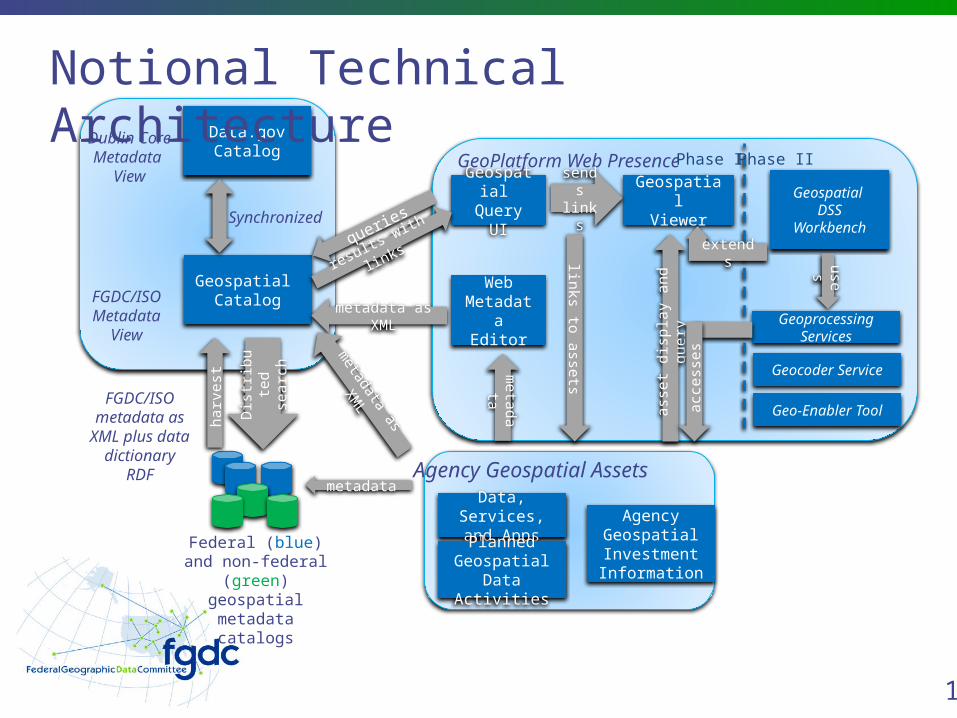
WebMetadat
aEditor
Federal (blue) and non-federal (green)
geospatial metadata catalogs
Geospatial Catalog
Data, Services, and
AppsAgency
Geospatial Investment Information
GeospatialViewer
Geospatial
Query UI
Geocoder Service
Geo-Enabler Tool
PlannedGeospatial
Data Activities
Agency Geospatial Assets
GeoPlatform Web Presence
Geoprocessing Services
Phase I Phase II
Geospatial DSS
Workbench
metadata
Data.govCatalog
Synchronized
Dublin CoreMetadata
View
FGDC/ISOMetadata
View
queries
results with
links
metadata as XML
metadata as
XML
harv
est
Dis
trib
ute
d s
earc
h
FGDC/ISO metadata as
XML plus data
dictionary RDF
meta
da
ta
links to
asse
ts
sends
links
ass
et
dis
pla
y a
nd q
uery u
ses
extends
acc
ess
es
Notional Technical Architecture

11
12
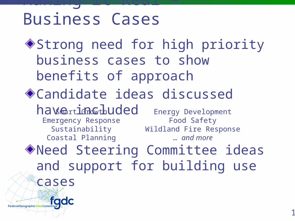
Making it Real – Business Cases
Strong need for high priority business cases to show benefits of approachCandidate ideas discussed have includedSmart Growth
Emergency ResponseSustainability
Coastal Planning
Energy DevelopmentFood Safety
Wildland Fire Response… and more
Need Steering Committee ideas and support for building use cases

13
Next Steps to Implementation
Building on work of Technical Deployment Task Team, define and finalize Platform high level architecture Develop guidance document to describe
architecture and how to leverage
GSA Team (Data.gov) poised to issue tasking to build “Version 1” of the Geospatial Platform Need FGDC technical advisory / oversight
team
FY13: PMO Support, V2 Implementation
14
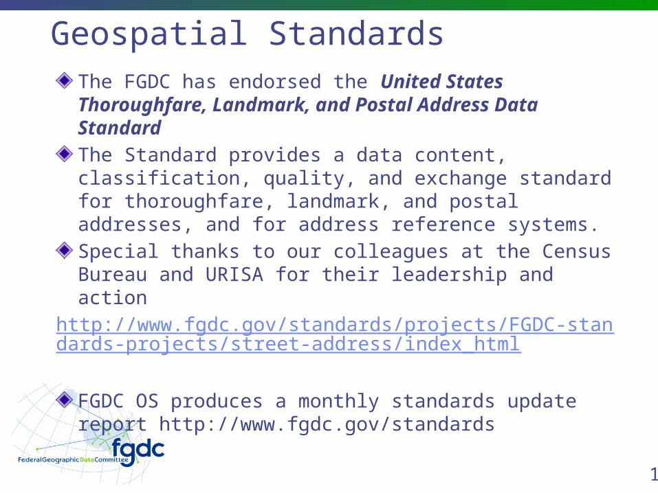
Geospatial StandardsThe FGDC has endorsed the United States Thoroughfare, Landmark, and Postal Address Data StandardThe Standard provides a data content, classification, quality, and exchange standard for thoroughfare, landmark, and postal addresses, and for address reference systems. Special thanks to our colleagues at the Census Bureau and URISA for their leadership and action
http://www.fgdc.gov/standards/projects/FGDC-standards-projects/street-address/index_html
FGDC OS produces a monthly standards update report http://www.fgdc.gov/standards

15
FGDC Standards ActivitiesStandards Working Group recommended the Federal Trails Data Standard (FTDS) for endorsement at the May 10, 2011 Coordination Group (CG) meetingDavid Duran and Jaime Schmidt of the FTDS team took an action to confer with the person who raised the concerns, which they completed. The FTDS is now ready to be put before the CG for endorsement.
http://www.fgdc.gov/standards/projects/FGDC-standards-projects/trail-data-standard/trail-data-standards

16
Questionnaire on Agency Use of Address Data Files
To better understand the extent of duplication of expenditure of funds and needs for address information at the Federal level.Rough idea of the frequency-of-need and amount of money spent to acquire and use address information.Randy Fusaro, Census, and Jon Sperling, HUD developed the questions.Feedback was solicited and received from the CG.FGDC OS will be creating an online questionnaire to enable capture of the results (next few weeks)

17
FGDC Endorsed Standards Survey
Report on FGDC member agency use of FGDC endorsed geospatial standards Identification of additional geospatial standards being used or needing to be developedProvide full results to the agencies for validationPublish some of the results and statistics in the FGDC 2011 Annual Report

18
Thank you
Questions?