field work date: 7/31/2020 revision dates
TRANSCRIPT
PR
OP
ER
TY P
ICTU
RE
GO
OG
LE M
AP
PO
INTS
OF
INTE
RE
STP
ER
FOR
ME
D B
YTH
AN
KS
TOJO
B S
PE
CIF
IC S
UR
VE
YO
RS
NO
TES
JOB NUMBERPROPERTY ADDRESS
FIELD WORK DATE: REVISION DATES:
PAGE 1 OF 2
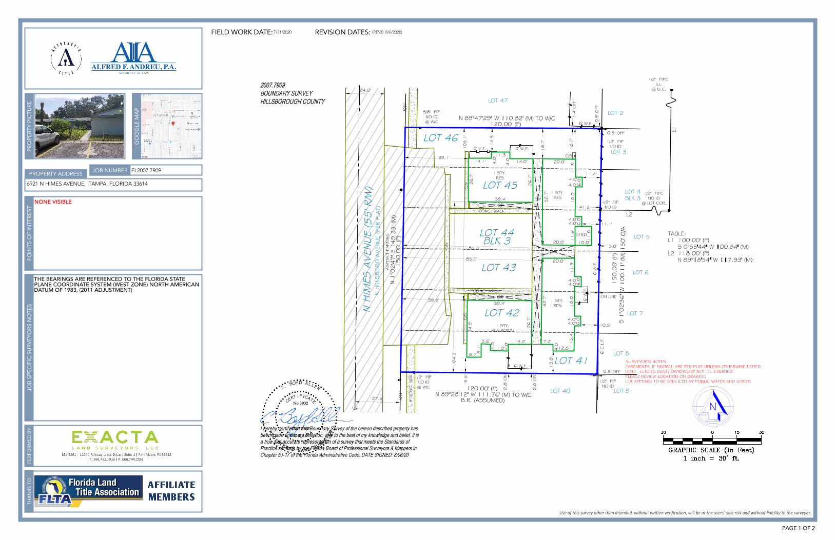
FL2007.7909
6921 N HIMES AVENUE, TAMPA, FLORIDA 33614
THE BEARINGS ARE REFERENCED TO THE FLORIDA STATEPLANE COORDINATE SYSTEM (WEST ZONE) NORTH AMERICANDATUM OF 1983, (2011 ADJUSTMENT)
7/31/2020
NONE VISIBLE
(REV.0 8/6/2020)
CLIENT ORDER NUMBER:
BUYER:
SELLER:
DATE:TR
AN
SAC
TIO
NLE
GA
L D
ESC
RIP
TIO
N
GE
NE
RA
L SU
RV
EY
OR
NO
TES
SUR
VE
YO
RS
LEG
EN
D
CERTIFIED TO:
FLO
OD
INFO
PE
RFO
RM
ED
BY
PAGEPAGE 2 OF 2
20-07-281
NIVEK EQUITY MANAGEMENT LLC
NIVEK EQUITY MANAGEMENT LLC
08/06/20
LOTS 41 - 46, BLOCK 3, HAGIN LAKE BEACH, AS RECORDED INPLAT BOOK 12, PAGE 44, OF THE PUBLIC RECORDS OFHILLSBOROUGH COUNTY, FLORIDA.
NIVEK EQUITY MANAGEMENT LLC; ATTORNEY'S TITLE & TRUSTLLC; WFG NATIONAL TITLE INSURANCE COMPANY; BENWORTHCAPITAL PARTNERS LLC
BY PERFORMING A SEARCH WITH THE LOCAL GOVERNING MUNICIPALITY OR WWW.FEMA.GOV, THE PROPERTY APPEARS TO BE LOCATED IN ZONE X. THIS PROPERTY WAS FOUNDIN HILLSBOROUGH COUNTY, COMMUNITY NUMBER 120112, PANEL NUMBER 0194 DATED 08/28/08.
1. The Legal Description used to perform this survey was supplied by others. This survey does not determine or imply ownership.
2. This survey only shows improvements found above ground. Underground footings, utilities and encroachments are not located on this survey map.
3. If there is a septic tank, or drain field shown on this survey, the location is approximate as the location was either shown to Exacta Land Surveyors, LLC. by a third party or it was estimated by metal detection, probing rods, and visual above ground inspection only. No excavation was performed in order to determine the exact and accurate location.
4. This survey is exclusively for the use of the parties to whom it is certified.5. Additions or deletions to this survey map and report by other than the signing
party or parties is prohibited without written consent of the signing party or parties.
6. Dimensions are in feet and decimals thereof.7. Due to varying construction standards, house dimensions are approximate.8. Any FEMA flood zone data contained on this survey is for informational purposes
only. Research to obtain such data was performed at www.fema.gov.9. All corners marked as set are at a minimum a ½”diameter, 18” iron rebar with a
cap stamped LB# 8291.10. If you are reading this survey in an electronic format, the information contained
on this document is only valid if this document is electronically signed as specified in Chapter 5J-17.062 (3) of the Florida Administrative Code and Florida Statute 472.025. The Electronic Signature File related to this document is prominently displayed on the invoice for this survey which is sent under separate cover. Manually signed and sealed logs of all survey signature files are kept in the office of the performing surveyor. If this document is in paper format, it is not valid without the signature and original raised seal of a Florida Licensed Surveyor.
11. Unless otherwise noted, an examination of the abstract of title was NOT performed by the signing surveyor to determine which instruments, if any, are affecting this property.
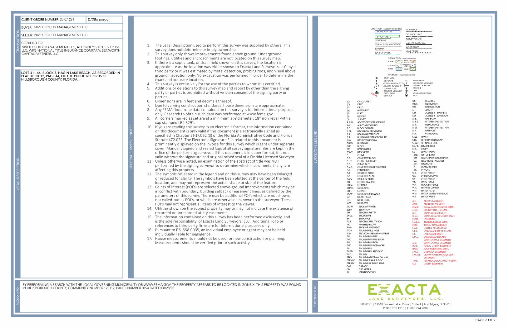
12. The symbols reflected in the legend and on this survey may have been enlarged or reduced for clarity. The symbols have been plotted at the center of the field location, and may not represent the actual shape or size of the feature.
13. Points of Interest (POI’s) are selected above-ground improvements which may be in conflict with boundary, building setback or easement lines, as defined by the parameters of this survey. There may be additional POI’s which are not shown, not called-out as POI’s, or which are otherwise unknown to the surveyor. These POI’s may not represent all items of interest to the viewer.
14. Utilities shown on the subject property may or may not indicate the existence of recorded or unrecorded utility easements.
15. The information contained on this survey has been performed exclusively, and is the sole responsibility, of Exacta Land Surveyors, LLC.. Additional logo or references to third party firms are for informational purposes only.
16. Pursuant to F.S. 558.0035, an individual employee or agent may not be held individually liable for negligence.
17. House measurements should not be used for new construction or planning. Measurements should be verified prior to such activity.