figure 1.3.1-1. site location map - minnesota pollution control … · 2012-10-04 · figure...
TRANSCRIPT

St. Louis River/Interlake Duluth Tar Superfund Site Record of Decision August 2004
Figure 1.3.1-1. Site Location Map
St. Louis River/Interlake Duluth Tar Superfund Site Record of Decision August 2004
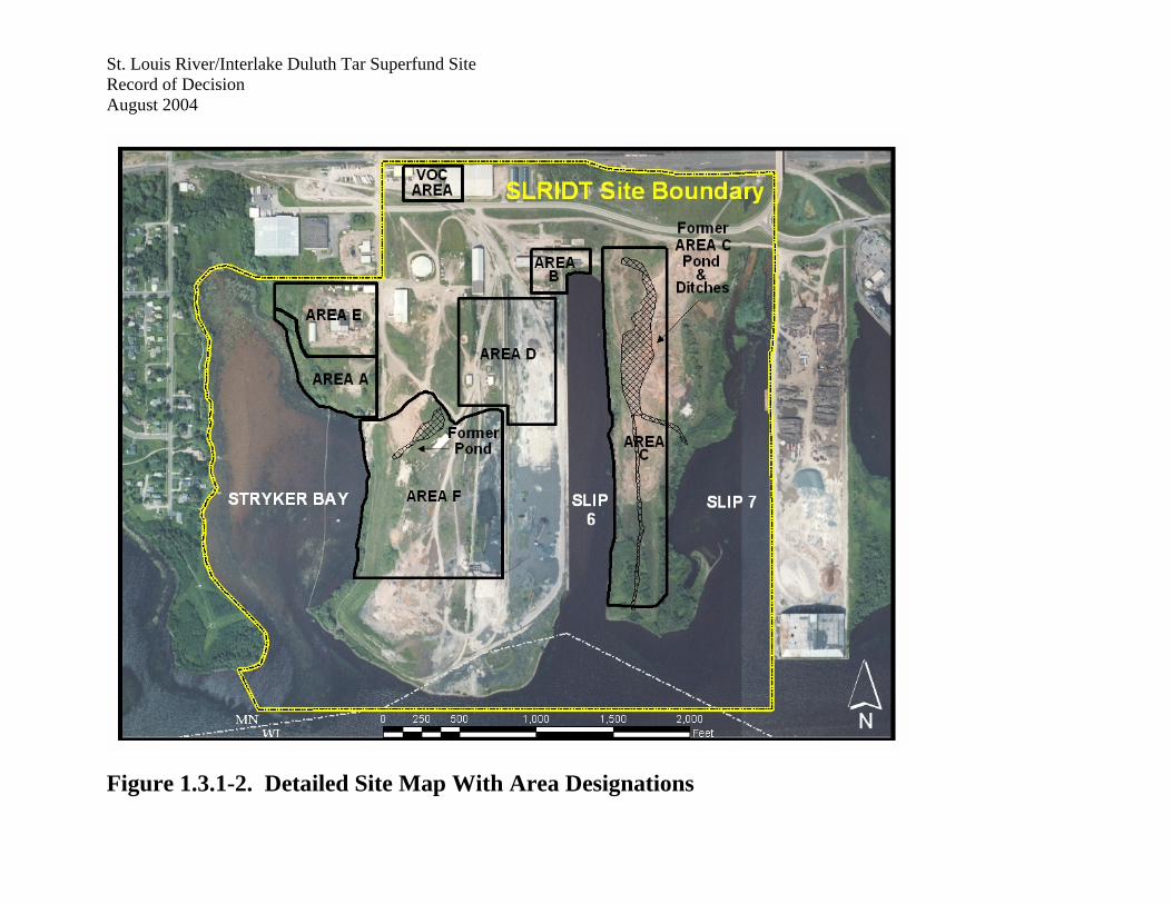
Figure 1.3.1-2. Detailed Site Map With Area Designations
St. Louis River/Interlake Duluth Tar Superfund Site Record of Decision August 2004
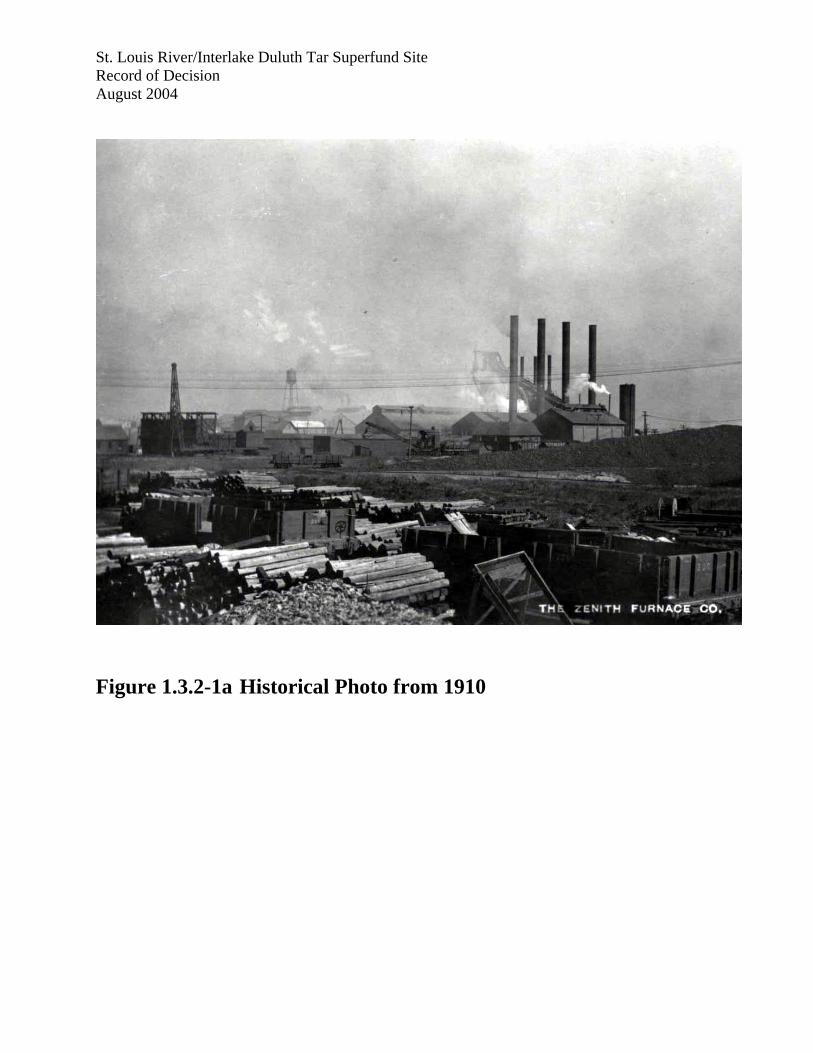
Figure 1.3.2-1a Historical Photo from 1910

St. Louis River/Interlake Duluth Tar Superfund Site Record of Decision August 2004
Figure 1.3.2-1b Historical Photo from Approximately 1939
St. Louis River/Interlake Duluth Tar Superfund Site Record of Decision August 2004
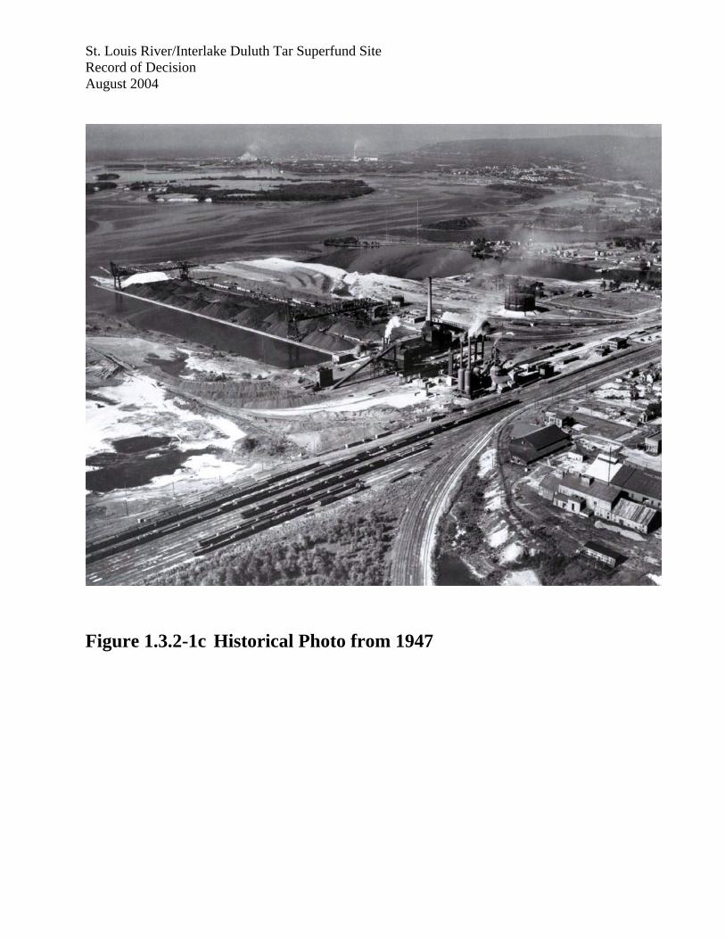
Figure 1.3.2-1c Historical Photo from 1947

St. Louis River/Interlake Duluth Tar Superfund Site Record of Decision August 2004
Figure 1.3.2-2. Historical Development of 59th and 54th Avenue Peninsulas (Source: Revised Draft Feasibility Study)
St. Louis River/Interlake Duluth Tar Superfund Site Record of Decision August 2004
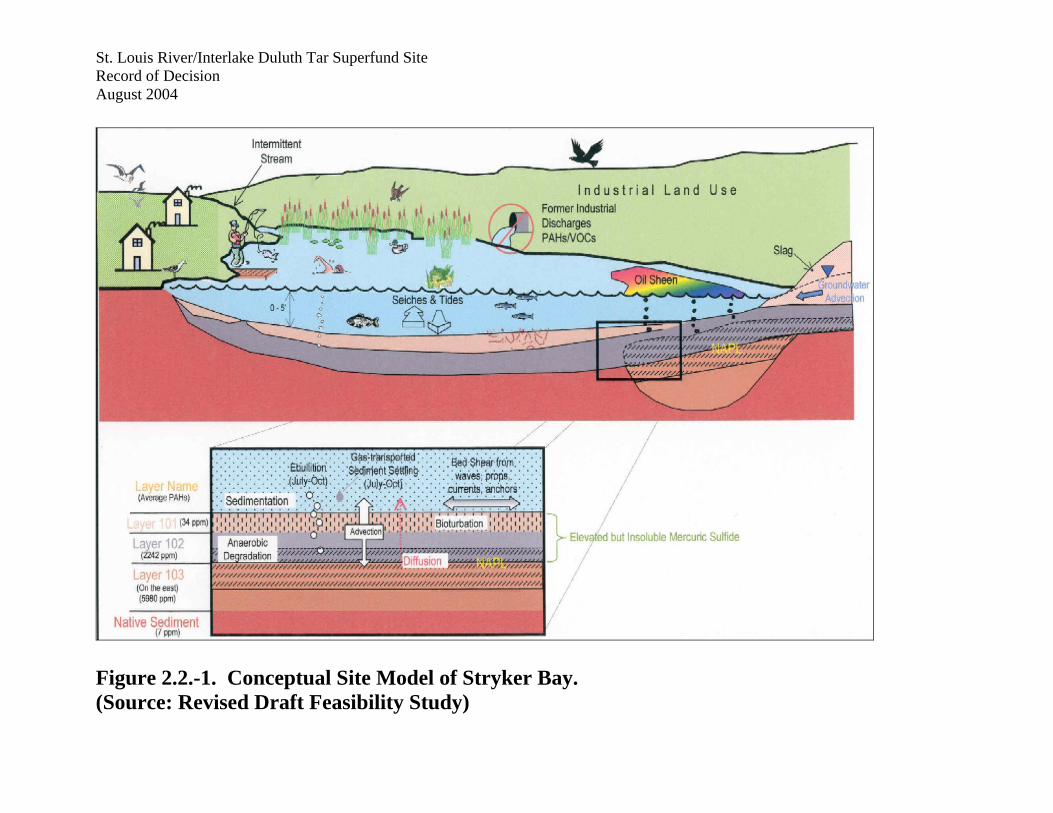
Figure 2.2.-1. Conceptual Site Model of Stryker Bay. (Source: Revised Draft Feasibility Study)
St. Louis River/Interlake Duluth Tar Superfund Site Record of Decision August 2004
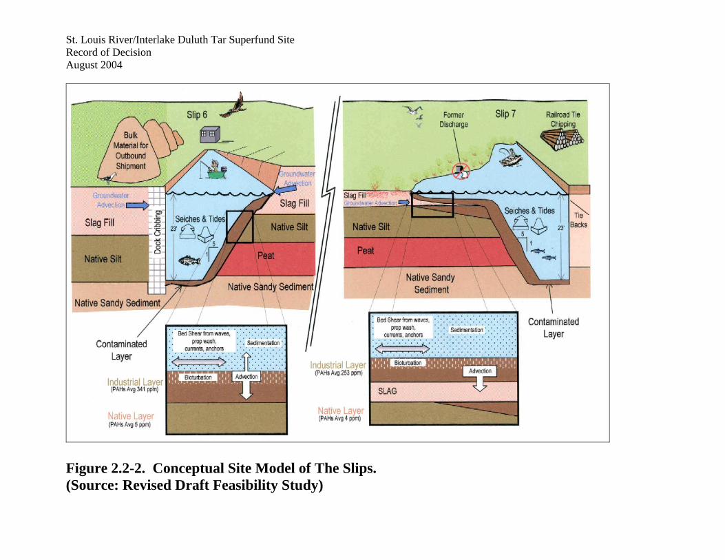
Figure 2.2-2. Conceptual Site Model of The Slips. (Source: Revised Draft Feasibility Study)

St. Louis River/Interlake Duluth Tar Superfund Site Record of Decision August 2004
Figure 2.2.-3. Conceptual Site Model of The Main Channel. (Source: Revised Draft Feasibility Study)
St. Louis River/Interlake Duluth Tar Superfund Site Record of Decision August 2004
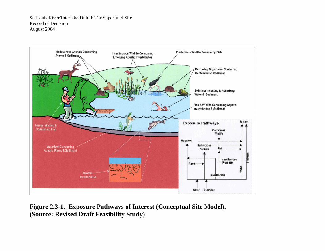
Figure 2.3-1. Exposure Pathways of Interest (Conceptual Site Model). (Source: Revised Draft Feasibility Study)
St. Louis River/Interlake Duluth Tar Superfund Site Record of Decision August 2004
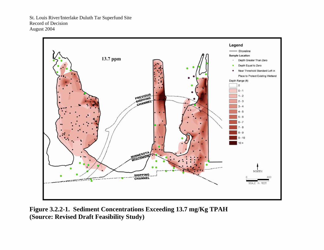
Figure 3.2.2-1. Sediment Concentrations Exceeding 13.7 mg/Kg TPAH (Source: Revised Draft Feasibility Study)
St. Louis River/Interlake Duluth Tar Superfund Site Record of Decision August 2004
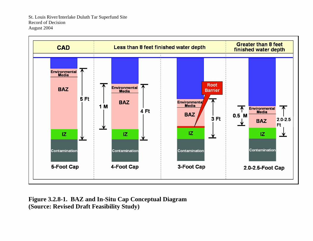
Figure 3.2.8-1. BAZ and In-Situ Cap Conceptual Diagram (Source: Revised Draft Feasibility Study)

St. Louis River/Interlake Duluth Tar Superfund Site Record of Decision August 2004
Figure 4.2.1-1. Alternative 1. No Action (Source: Revised Draft Feasibility Study)

St. Louis River/Interlake Duluth Tar Superfund Site Record of Decision August 2004
Figure 4.2.2-1. Alternative 2. In-Situ Cap (Source: Revised Draft Feasibility Study)

St. Louis River/Interlake Duluth Tar Superfund Site Record of Decision August 2004
Figure 4.2.3-1. Alternative 3: Revised Dredge/Cap Hybrid
St. Louis River/Interlake Duluth Tar Superfund Site Record of Decision August 2004
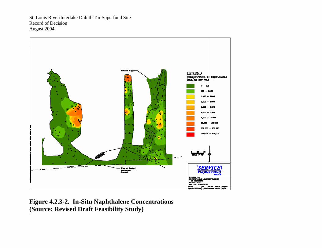
Figure 4.2.3-2. In-Situ Naphthalene Concentrations (Source: Revised Draft Feasibility Study)
St. Louis River/Interlake Duluth Tar Superfund Site Record of Decision August 2004
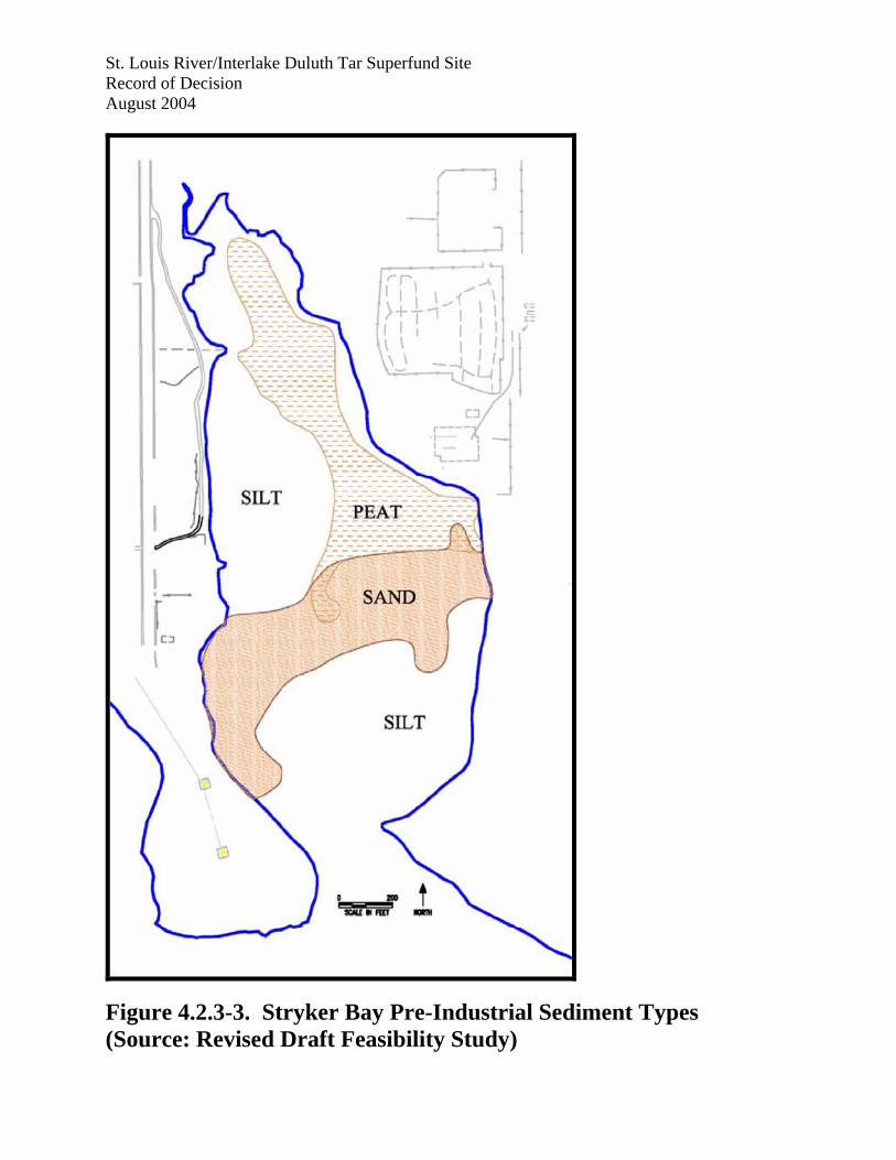
Figure 4.2.3-3. Stryker Bay Pre-Industrial Sediment Types (Source: Revised Draft Feasibility Study)

St. Louis River/Interlake Duluth Tar Superfund Site Record of Decision August 2004
Figure 4.2.4-1. Alternative 4. Dredge/Off-Site Disposal (Source: Revised Draft Feasibility Study)