final draft january 14, 2019) - city of …...(final draft – january 14, 2019) 3 introduction this...
TRANSCRIPT

(FINAL DRAFT – January 14, 2019)

(FINAL DRAFT – January 14, 2019)
City of Alexandria, Virginia
Natural Resource Management Plan
January 2019
City of Alexandria
Department of Recreation, Parks, and Cultural Activities
Natural Resources Division
Alexandria, Virginia 22314

(FINAL DRAFT – January 14, 2019)
2
Table of Contents
Page - Topic
3 - Introduction
5 - City Characteristics
8 - City Plans & Initiatives
12 - Natural Resource Management
16 - Management Plan & Recommendations
Appendices
20 - 1: Natural Communities & Habitats
25 - 2: Key to Rankings
27 - 3: Plates of Natural Areas
34 - 4: References
38 - 5: Acknowledgement
Pink Lady’s-slipper (Cypripedium acaule).
This plant was once common in Alexandria in upland Oak-Heath Forest
and successional Virginia Pine forests. Today, only a few remaining
individuals are known from very few sites in the City.
Photo by Gary P. Fleming.

(FINAL DRAFT – January 14, 2019)
3
Introduction
This Natural Resource Management Plan (NRMP) represents Alexandria’s first attempt to develop a
strategic course of action for preserving, protecting, and sustainably managing Alexandria’s natural
resources and native biodiversity. This plan aligns with other initiatives and policies adopted by the City
over the years, while expanding on them by specifically addressing natural resource conservation and
management.
Natural resources are irreplaceable features of the indigenous landscape that include topography (land
shape), geology, soils, surface and ground water, natural communities, plants, and animals. The NRMP is
based on a Citywide inventories and assessment of natural resources and habitats, initially in the areas of
flora and geology. The policy goals of No Net Loss of City owned natural lands and a Do No Harm
approach to natural lands management are the two overarching recommendations of the plan’s
recommendations and actions.
Despite its small size, Alexandria harbors a rich diversity of habitats and wildlife. This section of
Virginia, including the two neighboring counties Fairfax and Arlington, contains a broad variety of
habitats and is perhaps the most floristically diverse in the state (Simmons 2007).
Native flora and plant communities are the dominant natural resources on parkland in the eastern U.S.,
and those that remain in Alexandria are diverse and require protection and careful stewardship. Native
flora and plant communities are the foundation of biodiversity, as well as the measure of an ecosystem’s
overall health and functionality. Simply put, the preservation of biodiversity and natural heritage cannot
be achieved without the large-scale conservation of native plants and their natural habitats (MBHWG
2014).
This plan comes at a critical juncture in Alexandria’s history, with much of the City built out and infill
development and subsequent roadway and utility expansion threatening remaining natural lands. Unlike
larger counties and jurisdictions with ample opportunities for acquiring sizable parcels of natural land as a
means of conservation, such is not the case in Alexandria as opportunities for conservation via land
preservation are limited. Rather, careful stewardship of remaining City natural lands, including non-native
invasive species control, are the most important actions we can take in helping to ensure the future
sustainability and conservation of Alexandria’s natural resources.
The City of Alexandria and its Department of Recreation, Parks, and Cultural Activities (RPCA) have a
strong commitment to the stewardship and sustainability of Alexandria’s natural resources. RPCA is the
lead land management agency in Alexandria and oversees and manages over 1,000 acres of parkland and
natural area sites.
Effective implementation of the NRMP depends on the cooperation and support of all the City’s
departments, residents, and conservation partners. This plan will be updated continually as new
information, priorities and goals becomes established.
Management Conservation
Restoration Community
(FINAL DRAFT – January 14, 2019)
4
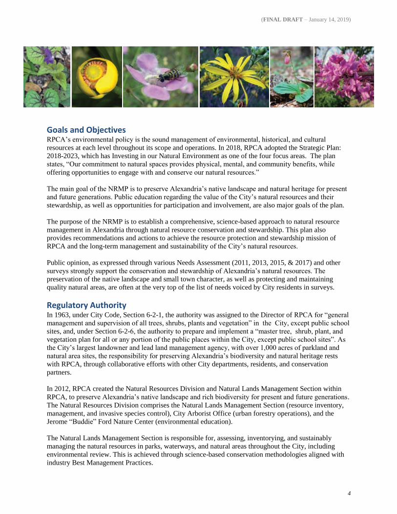
Goals and Objectives RPCA’s environmental policy is the sound management of environmental, historical, and cultural
resources at each level throughout its scope and operations. In 2018, RPCA adopted the Strategic Plan:
2018-2023, which has Investing in our Natural Environment as one of the four focus areas. The plan
states, “Our commitment to natural spaces provides physical, mental, and community benefits, while
offering opportunities to engage with and conserve our natural resources.”
The main goal of the NRMP is to preserve Alexandria’s native landscape and natural heritage for present
and future generations. Public education regarding the value of the City’s natural resources and their
stewardship, as well as opportunities for participation and involvement, are also major goals of the plan.
The purpose of the NRMP is to establish a comprehensive, science-based approach to natural resource
management in Alexandria through natural resource conservation and stewardship. This plan also
provides recommendations and actions to achieve the resource protection and stewardship mission of
RPCA and the long-term management and sustainability of the City’s natural resources.
Public opinion, as expressed through various Needs Assessment (2011, 2013, 2015, & 2017) and other
surveys strongly support the conservation and stewardship of Alexandria’s natural resources. The
preservation of the native landscape and small town character, as well as protecting and maintaining
quality natural areas, are often at the very top of the list of needs voiced by City residents in surveys.
Regulatory Authority In 1963, under City Code, Section 6-2-1, the authority was assigned to the Director of RPCA for “general
management and supervision of all trees, shrubs, plants and vegetation” in the City, except public school
sites, and, under Section 6-2-6, the authority to prepare and implement a “master tree, shrub, plant, and
vegetation plan for all or any portion of the public places within the City, except public school sites”. As
the City’s largest landowner and lead land management agency, with over 1,000 acres of parkland and
natural area sites, the responsibility for preserving Alexandria’s biodiversity and natural heritage rests
with RPCA, through collaborative efforts with other City departments, residents, and conservation
partners.
In 2012, RPCA created the Natural Resources Division and Natural Lands Management Section within
RPCA, to preserve Alexandria’s native landscape and rich biodiversity for present and future generations.
The Natural Resources Division comprises the Natural Lands Management Section (resource inventory,
management, and invasive species control), City Arborist Office (urban forestry operations), and the
Jerome “Buddie” Ford Nature Center (environmental education).
The Natural Lands Management Section is responsible for, assessing, inventorying, and sustainably
managing the natural resources in parks, waterways, and natural areas throughout the City, including
environmental review. This is achieved through science-based conservation methodologies aligned with
industry Best Management Practices.

(FINAL DRAFT – January 14, 2019)
5
City Characteristics
Alexandria is one of the oldest and historically significant cities in the eastern U.S. Situated almost
entirely within the Coastal Plain Province between the Fall Line (Zone) and the tidal Potomac River, it
was a destination point for the early explorers, beginning with Captain John Smith’s discovery of the
Potomac River in 1608. The City began in 1654 with the development of 700 acres of what is now mostly
Old Town and was officially established in 1749 and chartered as a city in 1852. It grew from a series of
tobacco warehouses in the early 1700s to become Virginia’s primary northern shipping and trade port
from the early 18th century to the mid-19th century when the railroad became important. From that time
through the mid-20th century, the City was famous as a major railroad transportation center and bustling
waterfront industry. By the 1940s, Alexandria began to grow greatly in population as people settled into
the area during the post-World War II economic boom. Home to several of our nation’s founding fathers,
the City was incorporated into Washington, D.C. in 1811 and returned to Virginia in 1847.
Alexandria was originally developed using the popular grid pattern of the 18th century (Davey Resource
Group et al. 2009). For much of its history, the City’s land area was roughly that of “Old Town”, the
lowland section along the river. However, after annexing large areas from Arlington and Fairfax counties
in 1915 and 1930 (Alexandria Public Library, Arlington County 1967) and a large upland section from
Fairfax County in 1952 (Alexandria Library), Alexandria today occupies 15.32 mi² (9,804.8 ac) and is the
most densely populated city in Virginia (VirginiaPlaces.org). In 2017, its population was approximately
160,035 with a density of 10,446 persons/sq. mile (U.S. Census Bureau 2017). The City’s proximity to
the nation’s capital, with its extensive public transportation system, makes it a highly desirable place to
live.
Environmental Inventory and Analysis The digitized Geologic Atlas of the City of Alexandria, Virginia and Vicinity is a valuable resource for
planners and engineers within City government, as well as private industry and other researchers. A brief
overview of Alexandria’s geology and natural landforms follows below.
Alexandria rises in elevation from near sea level at the Potomac River to elevations of 280 feet and higher
in western areas of the City near the Fall Zone. Most of Alexandria is underlain by deep beds of sand,
gravel, silt, and clay of the early Cretaceous Potomac Formation that were deposited by ancient river
systems carrying material from the eroding Appalachians and Piedmont (Mixon et al. 2000, Fleming
2015). The unit as a whole was gradually deposited in an eastward-thickening wedge with sediments
reaching thousands of feet deep at the continental margin. The average thickness of the unit is about 500
feet (Obermeir 1984). Locally, the unit varies irregularly in thickness from less than 20 feet to more than
100 feet near the Fall Zone and increases in depth eastward to a depth of 400 or more beneath the Old
Town waterfront (Drake and Froelich 1986; Fleming 2015).
(FINAL DRAFT – January 14, 2019)
6
The Potomac Formation sand, gravel, silt, and clay deposits vary considerably and occur as interbedded
strata or small to massive, heterogeneous lenses (Fleming 2005). Fleming (2015) divided the Potomac
Formation in Alexandria into six informal members, including from highest to lowest: Shooters Hill
gravel; Arell clay; Chinquapin Hollow fine sandy clay; Winkler sand; Lincolnia silty clay; and Cameron
Valley sand. The Potomac Formation is the main water-bearing unit in the region (Johnston 1964).
Overlying and “capping” the Potomac Formation members are four major upland terraces, including from
highest to lowest: Seminary terrace, with an average surface elevation of 265 to 275 feet; Dowden terrace,
with surface elevations of 240 to 250 feet; Chinquapin Village terrace, with a surface elevation between
185 and 205 feet; and Beverley Hills terrace, with an average surface elevation of 145 to 150 feet
(Fleming 2015).
The lowest and youngest gravel terraces in the City are the river terrace deposits of Pleistocene age that
occur between 35 and 105 feet in elevation along the Potomac River and its major tributaries – Four Mile
Run and the Eisenhower Valley complex of streams (Johnston 1964, Drake and Froelich 1986, Fleming et
al. 1994, Fleming 2005). Most of Old Town is built on Pleistocene river terraces, as well as much of
downtown Washington, D.C. (Johnston 1964, Obermeier 1984). The Old Town terrace is composed of
sand, gravel, and silty clay, with abundant organic horizons (Fleming 2015).
Quaternary alluvium underlies modern floodplains and depositional bars close to and along streams in the
City, and is as much as 20 feet thick in places (Drake and Froelich 1986). The unit is comprised of sand,
silt, gravel, and clay, generally with coarser material towards the bottom. Most of the material is derived
from Coastal Plain sediments resulting from streams draining the upland terraces and Potomac Formation.
Exposed crystalline rocks of the Piedmont and Fall Zone occur in westernmost Alexandria at the eastern
limits of the Holmes Run Gorge at Rynex Natural Area, Dora Kelley Nature Park, and Holmes Run
Scenic Easement. Bedrock outcrops consist of metamorphosed sedimentary rocks of the Indian Run
Formation, Lake Barcroft Metasandstone, and Accotink Schist intruded by early Ordovician plutons of
Falls Church Tonalite and Occoquan Granite (Fleming 2015).
For further information on Alexandria’s geology, peruse the Geologic Atlas of the City of Alexandria,
Virginia and Vicinity on the City’s website.
Vegetation Alexandria’s native vegetation is an irreplaceable natural resource. Almost all of the forests and wetlands
one sees throughout the City today are remnants of a long ago landscape when Alexandria was largely
forested and rural. Today, the majority of the remaining individual components of this landscape exist in
greatly reduced numbers and in highly fragmented, isolated conditions, typical of urban settings.
Of the 2,540 vascular plants considered native to Virginia (John Townsend, pers. comm.), remarkably
nearly a third occur in Alexandria.
For further information regarding Alexandria’s flora and natural communities, see Native Vascular Flora
of the City of Alexandria, Virginia on the City’s website.
Species of Conservation Concern As of this writing, the highly rare extant flora in Alexandria that are state-listed, three are ranked S1
(critically imperiled), including Glandular Cinnamon Fern (Osmundastrum cinnamomeum var.
glandulosum), Crested Sedge (Carex cristatella), and Pear Hawthorn (Crataegus calpodendron); River
Bulrush (Bolboschoenus fluviatilis) is ranked S2 (imperiled); and three are on the “watchlist” with S3

(FINAL DRAFT – January 14, 2019)
7
status, including Soft Fox Sedge (Carex conjuncta), Bearded Sprangletop (Diplachne fusca var.
fascicularis), and Giant Burreed (Sparganium eurycarpum) (Townsend 2015).
The total number of documented, native historical species is 116 (13.84% of the known flora of
Alexandria). Most Alexandria historical species are considered lost, with little likelihood of rediscovery.
This is largely the result of the loss of natural habitat.
Reflecting the increasing trend of urbanization throughout the City, including the conversion of natural
areas and open space from a wild condition to artificial, landscaped settings, are the 388 total species that
are ranked as very rare and critically imperiled in Alexandria (A1 and A2; see Key to City Rank in the
appendix). A further index of species rarity owing largely to loss of habitat are the 134 uncommon to rare,
“watchlist” plants listed for Alexandria (A3; see Key to City Rank).
Combining the total numbers of historical, imperiled, and uncommon to rare flora (76.13% of the City’s
total native flora), the outlook for the future sustainability and preservation of much of Alexandria’s
native flora and biodiversity is impaired. A moratorium on any further net loss of natural lands on City
owned parkland, waterways, and open space, and continued natural lands management and stewardship
will go a long way towards halting this trend and stabilizing dwindling, fragmented populations.
Goldenrod (Solidago spp.).
Generally with clusters of golden yellow flowers, this member of
the Aster Family usually blooms in late summer to early fall and
provides a feast for bees and other pollinators. Photo taken at
George Mason Park by R.D. Williams.

(FINAL DRAFT – January 14, 2019)
8
City Plans and Initiatives
RPCA Strategic Master Plan
Alexandria adopted its Strategic Master Plan for Open Space, Parks & Recreation in 1992, and
continuously updates this as Small Area Plans (SAP) are revised. This plan comprises of 15 small area
plans for neighborhoods and areas citywide. One of the stated goals of the Strategic Master Plan is to
preserve and expand open space throughout the City.
Open Space Plan and Update In 2017, the Alexandria Open Space Plan Update (OSPU) was adopted by the City, addressing
recommendations pertaining to open space in the 1992 Master Plan. The OSPU established a framework
for addressing Alexandria’s short- and long-term open space needs. It defines an approach that maximizes
the City’s limited open space opportunities by creating a system to build upon Alexandria’s dense, urban
condition. In addition, the OSPU framed the initiative for Alexandria with a list of 15 simple and direct
goal statements:
Goal 1. Protect and enrich existing parks
Goal 2. Develop innovative opportunities for creating additional open space
Goal 3. Complete implementation of the Potomac River Waterfront Plan
Goal 4. Protect and expand the stream valleys and other environmentally sensitive areas
Goal 5. Create an open space network in new development areas
Goal 6. Protect and preserve institutional open space
Goal 7. Maximize use of public school open space areas
Goal 8. Preserve and protect cemeteries
Goal 9. Create public open space from vacant land
Goal 10. Link and expand pedestrian, bicycle, and trail system
Goal 11. Enhance streetscapes and gateways
Goal 12. Expand citywide street tree program and protect existing trees and woodland areas
Goal 13. Encourage the creation of Civic Parks at and adjacent to Metro stations
Goal 14. Beautify interchanges and highway corridors
Goal 15. Protect privately owned open space
In the 2014 City of Alexandria Open Space Plan Update (OSPU), the City achieved, as of January 2013,
the addition of 103 acres of open space – just over the 100-acre goal. With this achievement of the 100-
acre goal set forth in the plan, the City has maintained the ratio of 7.3 acres per 1,000 residents. The open
space ratio in the City can be maintained until 2025 without additional land acquisitions. If the City
receives all of the open space promised in the small area plans, it can maintain this ratio until 2045.

(FINAL DRAFT – January 14, 2019)
9
A supplement to the OSPU is the Guide to Voluntary Land Conservation Options (located on the City’s
website), which provides options to voluntarily conserve environmentally significant property, such as
conservation easements, living trusts, and others.
Landscape Guidelines In 2007, the City adopted the Landscape Guidelines outlining Best Management Practices (BMPs) and
industry standards in landscape planning and implementation in Alexandria, including a statement of the
need for recognizing and conserving “environmentally sensitive or ecologically important sites”—largely
through “inventory and detailed study.” This document is being updated as of 2018, and will outline the
standard landscape information required for each of the review processes and stages, and the
methodology used to meet these requirements. As a result, proper implementation of the Landscape
Guidelines contributes greatly toward achieving the City’s social, economic and environmental goals in
close coordination with other City plans and policies (from Chapter 2A: Landscape Process Overview-
Draft).
Eco-City Charter, Environmental Action Plan Beginning in spring 2007, the City partnered with Alexandria’s Environmental Policy Commission (EPC)
and Virginia Tech’s Department of Urban Affairs and Planning (UAP) to design and facilitate a new,
strategic collaborative planning process, called Eco-City Alexandria, to create an Eco-City Charter and
Environmental Action Plan to guide Alexandria toward environmental sustainability. Alexandria’s
Environmental Policy Commission (EPC) was the project’s principal advisor along with representatives
from the Alexandria City Council and City staff. The Eco-City Alexandria team completed an inventory
of existing City programs and plans called GreenVentory and examined best practices from across the
country and around the world to create a Compendium of Model Programs and Practices. The City
adopted the Eco-City Charter in 2008 and the first Environmental Action Plan in Virginia in 2009.
The “Eco-City Alexandria” establishes policies, plans, and programs for sustaining the environment,
including:
Water Resources
Climate Change
Green Buildings
Energy
Solid Waste
Transportation
Air Quality
Land Use and Open Space
Environmental Health
Implementation, Education and
Outreach
The Eco-City Environmental Action Plan 2030 (EAP) was formally adopted by City Council in June
2009, and it outlines the goals and activities that will help the City and its residents achieve the vision
outlined in the Eco-City Charter. The charter, which was the first of its kind in the region, outlines the
City’s guiding principles and vision for a sustainable Alexandria. The EAP Revision Phase 1 highlights
short-term actions in five focus areas through 2023, and was adopted by City Council in October 2018.
Phase 2 will focus on mid- to long-term actions, of the five focus areas and all time frames for the
remaining topic areas and will be adopted in 2019.
Urban Forestry Master Plan The Urban Forestry Master Plan was adopted in 2009, with increasing Alexandria’s tree canopy coverage
to 40% of the City as its main goal. This is to be achieved mainly through tree plantings that expand the
urban forest network. The plan also recognized controlling non-native invasive plant species as a “high
priority”. This document is currently under revision to review and update tree canopy goals and establish
an updated direction for the urban forest health. This document should be prepared for adoption in 2019.

(FINAL DRAFT – January 14, 2019)
10
Regional Natural Resource Management Group In 2012, Natural Resources Division, together with its counterparts in Arlington and Fairfax counties,
formed the Regional Natural Resource Management Group for the purpose of networking and sharing
information regarding Best Management Practices in natural resource management. The group is
composed of over 100 partners of natural resource management professionals at the federal, state, and
local level of all the neighboring jurisdictions in the D.C. region, including interdepartmental City staff.
In 2012, the Natural Resources Division produced a list of all the non-native invasive plants considered to
be a threat in Alexandria. This list is revised semi-annually and is available online as a regional
conservation planning tool and educational resource.
Also, in 2012, Natural Resources Division initiated a program to raise public awareness and appreciation
for Alexandria’s natural areas by installing signage to designate those areas in Alexandria that comprise
notable remnants of natural heritage and floral biodiversity (“Native Plant Conservation Zone”).
Environmental and Sustainability Management System (ESMS) As part of the Eco-City Alexandria initiative and consistent with its mission, RPCA enrolled in the
Virginia Tech Environmental and Sustainability Management System Institute 2013–2014 Class and
began developing an Environmental and Sustainability Management System (ESMS) to secure ISO
14001 Certification—an international standard and certification for operating a business in a way to
minimize its impact on the environment and promote environmental safety.
The development and implementation of the ESMS Program is part of RPCA’s Three-Year Business
Plan. To date, a written Environmental Policy has been adopted by RPCA as part of implementing the
ESMS initiative. RPCA is also developing Standard Operating Procedures to implement key aspects of
this initiative. Of the four Significant Aspects in RPCA’s ESMS, reducing agro-chemicals and their
negative effects on natural lands and waterways is the aspect that most pertains to the NRMP.
In 2015, owing to RPCA’s development and implementation of its ESMS and environmental policy,
RPCA was awarded the Exemplary Environmental Enterprise (E-3) certification by the Virginia
Department of Environmental Quality. Full compliance and certification for ISO 14001 is anticipated in
the next several years.
Park Planning Initiatives The Citywide Parks Improvement Plan was formalized in 2016 to address improvements for six of the
City’s largest parks. Though recreational facilities and amenities are the primary focus of the plan,
management of non-native invasive species and expanding tree plantings in parks are also included as
important actions.
Water Quality Regulations Water quality within the City of Alexandria is subject to federal, state, and local laws and regulations.
These include the Chesapeake Bay Preservation Act (Bay Act), the Chesapeake Bay TMDL, the Virginia
Stormwater Management Program, and Alexandria’s Environmental Management Ordinance. The
administration of water quality regulations is conducted by Transportation and Environmental Services.
The Bay Act was enacted by the Virginia General Assembly in 1988 as a critical element of Virginia's
non-point source management program. The Bay Act is designed to improve water quality through
effective land management and land use planning. Included in the Bay Act are two types of
environmentally sensitive lands: Resource Protection Areas (RPAs) and Resource Management Areas

(FINAL DRAFT – January 14, 2019)
11
(RMAs). RPA protections are designed to preserve perennial streams, tidal wetlands, tidal shores, and
certain non-tidal wetlands as outlined in the Environmental Management Ordinance. RMA protections
ensure that all lands within the City are properly used and developed to protect water quality.
Additionally, the City’s Environmental Management Ordinance provides safeguards for natural channel
intermittent streams and non-tidal wetlands. Protections for these areas are outlined in the City’s
Environmental Management Ordinance, which also outlines water quality treatment requirements during
site development and redevelopment.
In 2010, the Chesapeake Bay Total Maximum Daily Load (TMDL) was established by the EPA setting
pollution reductions for nitrogen, phosphorous, and sediment in the six Chesapeake Bay watershed states
and the District of Columbia. In response to the creation of the TMDL, the City developed the
Chesapeake Bay TMDL Action Plan. The Phase 1 plan includes strategies and milestones to meet the
required 5% pollutant reductions by 2018. The Phase 2 plan will include strategies and milestones to meet
an additional 35% in pollutant reductions.
In the fall of 2014, RPCA partnered with the Department of Transportation and Environmental Services
(T&ES), Office of Environmental Quality, to coordinate the City’s response to changes in the Virginia
Stormwater Management Program. These actions included assistance with the revision of the City’s
Environmental Management Ordinance, refining and creating new processes, and providing additional
resources to meet Stormwater Management Regulations and the Municipal Separate Storm Sewer System
(MS4) General Permit Regulations.
Natural Resources Division Inventories In 2015, Natural Resources Division completed the Native Vascular Flora of the City of Alexandria,
Virginia, the first verifiable, comprehensive floristic study of Alexandria’s native flora and natural
communities, including conservation ranks for each entity. This important planning and baseline
inventory resource is a greatly improved and revised version of the previous Flora of 2009, which was
essentially an annotated checklist of native flora. It is available online at the Alexandria Flora Project
webpage.
In 2015 and early 2016, a major revision of the 2008 Geologic Atlas of the City of Alexandria, Virginia
and Vicinity was contracted by the City. This important planning resource commissioned by RPCA is
also a first of its kind milestone for the City. It is available online at the Alexandria Geology webpage.
Both the Alexandria Flora and Geologic Atlas complement the Standard and Requirement-Reference
section of the Landscape Guidelines by providing a thorough, up-to-date inventory of all the City’s native
vegetation, geology and soils, and water resources.

(FINAL DRAFT – January 14, 2019)
12
Natural Resource Management
Inventory of Natural Lands of Conservation Interest
This NRMP is the first City plan to assess, delineate, and include all remaining City natural area sites as
defined spatial areas of a GIS dataset (see Plate 1). In most cases, boundaries were carefully delineated to
include only functioning sections of natural land and not areas occupied by buildings; athletic facilities,
including artificial turf ballfields; and other hardscapes. For example, approximately 5 acres along
Backlick Run of the 46.29 acres comprising Ben Brenman Park (RPCA lists the park as 59.3 acres) are
included because so few natural features remain throughout the park. However, at a few sites, natural area
remnants are too scattered within a mosaic of artificial features to allow readable, large-scale mapping.
It is an important reminder that while the GIS layers and online graphics provide a good overview of sites
and parcel boundaries, they are in no way a substitute for the accuracy of on-the-ground surveys and site
assessments by qualified professionals.
The total of all remaining natural area sites in Alexandria is 1,205.72 acres, comprising all City, state,
federal, and privately owned lands (see Plate 1).
OWNERSHIP NUMBER OF ACRES
City-Owned Natural Area Sites and Conservation Easements 529.12
Privately Owned Natural Area Sites 415.98
State Owned Natural Area Sites 19.05
Federally Owned Natural Area Sites 241.57
City-Owned Natural Area Sites and Conservation Easements The total of all City owned natural areas and parkland, including conservation easements, is
529.12 acres (see Plate 4). These sites are actively stewarded and managed by RPCA Natural Resource
Division.
Privately Owned Natural Area Sites The total of all privately owned natural area sites in Alexandria is 415.98 acres (see Plate 2). These sites
are not regularly stewarded by natural resource management staff but nonetheless include some of the
largest and most important natural areas remaining in the City. Many of these sites are in some form of
protective easement.
It is important to note that privately owned lands shown on Plate 2 are not identified and presented here in

(FINAL DRAFT – January 14, 2019)
13
the pursuance of conservation easements by City staff or others. These properties are included in the
NRMP for consistency because they represent significant concentrations of native biodiversity and natural
features, forest canopy, including notable and old-age trees, and water resources. All remaining natural
areas in the City together are critical in maintaining forest connectivity and ecological sustainability
throughout Alexandria and vicinity. Over the years, RPCA Natural Lands Management Section has
worked with various landowners of these sites in an advisory capacity regarding non-native invasive plant
control, Best Management Practices, resource assessments, and natural lands management.
State-Owned Natural Area Sites The total of all state-owned natural area sites in Alexandria is 19.05 acres (see Plate 1).
Federally Owned Natural Area Sites
The total of all federally owned natural area lands in Alexandria, largely comprising U.S. National Park
Service (NPS) properties at Daingerfield Island, George Washington Memorial Parkway, and Jones Point
Park, is 241.57 acres (see Plate 3). NPS lands in the City total 233.97 acres. U.S. Department of Defense
(DOD) natural lands in Alexandria, comprising the Alexandria National Cemetery and forested sites
adjoining Institute for Defense Analyses and the Winkler Botanical Preserve, total 7.59 acres.
All of these sites are critical refugia for native biodiversity. Because of their importance, the Natural
Resources Division has partnered with NPS over the last 15 years in providing assistance with non-native
invasive plant control and natural resource management.
Best Management Practices for Natural Lands Best Management Practices (BMPs) are features, methodologies, and practices that help ensure that
environmental stewardship and management of natural resources are accomplished in an ecologically
appropriate and environmentally sound manner. All hold central the concept of Do No Harm and to keep
sites natural and cause as little disturbance as possible.
Inventory and Monitoring Natural resource management includes vegetation surveys and natural resource inventories and
assessments throughout the City’s parks, natural areas, open space, wetlands, and waterways for the
purposes of planning, management, and resource protection and restoration. Initial baseline inspections
and inventories, as well as ongoing monitoring of natural sites, aid in developing appropriate management
practices for specific natural areas on public property.
The vascular flora of the City of Alexandria was extensively surveyed from 2000 through 2015. Surveys
and historical collections yielded a total of 840 native species (including infraspecific taxa and hybrids)
representing 385 genera and 131 families. The City of Alexandria Herbarium (AVCH) is the repository
for a baseline collection of native and exotic plant species and is an invaluable resource for conservation
planning.
To further broaden our understanding of local vegetation types, quantitative compositional and
environmental data were collected from ten 400 m² sample plots, one 200 m² plot, and six 100 m² plots in
the City of Alexandria. Vegetation sampling data from five 400 m² plots of virtually identical forested
communities from adjacent Arlington County were also gathered during this time, as well as seven 400
m² plots and one 100 m² plot from nearby lands in Fairfax County. Plots were sampled using the relevé
method (sensu Peet et al. 1998). All natural community data were analyzed using a combination of cluster
analysis, statistical analyses, and ordination by the Virginia Department of Conservation and Recreation,

(FINAL DRAFT – January 14, 2019)
14
Division of Natural Heritage (DCR-DNH) as part of the United States National Vegetation Classification
(USNVC)- National Park Service, National Capital Region (NCR) project.
Inventorying and monitoring all of Alexandria’s natural area sites and features is an ongoing, continual
process that allows us to assess the overall health and condition of natural resources, any threats to natural
features, and the effectiveness of our stewardship program. Additional inventories should include
mammal, avian, insect, amphibian, and other similar groups that would assist in understanding the
historic and current populations.
Non-Native Invasive Species Control Non-native invasive species have increasingly become a major threat to natural areas, parks, forests, and
wetlands by displacing native species and wildlife and significantly degrading habitats. Today, they are
considered perhaps the greatest threat to natural areas and global biodiversity, second only to habitat loss
resulting from development and urbanization (Vitousek et al. 1996).
Human health impacts directly or indirectly associated with non-native invasive species, such as higher
infestations of Lyme disease-bearing ticks in areas with high concentrations of certain invasive plants,
have also sharply increased (Allan et al. 2010, MBHWG 2014).
The Virginia Department of Conservation and Recreation, Division of Natural Heritage, has identified 90
non-native invasive plants that threaten natural areas and lands in Virginia (Heffernan et al. 2014).
Swearingen et al. (2010) includes 80 plants from a list of nearly 280 non-native invasive plant species
documented within the mid-Atlantic region. The Maryland Department of Natural Resources, Wildlife
and Heritage Service, “estimates that 40% of Maryland listed rare plant species are threatened by one or
more non-native invasive plants” (MBHWG 2014). Largely overlapping with these and other regional
lists are 104 species that were documented in the City of Alexandria during vegetation surveys and
natural resource assessments by RPCA Natural Lands Management Section over the last two decades.
Non-native invasive species are those that are not native to a particular place or habitat, as a result of
human intervention. A non-native invasive plant is here defined as one that exhibits some degree of
invasiveness, whether dominant and widespread in a particular habitat or landscape—regardless of the
quality or condition of the site—or much less common but long-lived and extremely persistent in places
where it occurs. The presence of non-native invasive plants is largely the result of soil and habitat
disturbance, though many invasive species are capable of eventually spreading from degraded areas into
relatively undisturbed sites, such as interior forest.
Hundreds of exotic plants, growing in a variety of habitats, occur in Alexandria. However, only exotic
plants that are especially invasive, damaging, and persistent, including species that produce a pervasive
seed bank and those that prevent natural succession by native plants, are included on the Alexandria
invasive plant list, which is available online.
Non-native invasive species in Alexandria are monitored by the Natural Resources Division, which also
coordinates and oversees various control efforts, including collaborative projects with other City
departments and staff, partner organizations, and volunteers.
RPCA, with the assistance of a specialty contractor and the participation of hundreds of volunteers
annually, had consecutive landmark years in 2014 and 2015 reclaiming and restoring many tens of acres
of City natural areas and parkland through the removal of non-native invasive plants. This work was
officially recognized as an “environmental highlight” on both of the 2014 and 2015 Alexandria’s Top-Ten
Environmental Accomplishments lists.

(FINAL DRAFT – January 14, 2019)
15
Ecological Restoration Plantings To preserve existing biodiversity, it is important to differentiate between natural sites and artificial,
developed or cultural landscapes, and to allow existing seed banks of native plants to grow and sites to
naturally revegetate, specifically in public natural areas being conserved or restored. Adding plantings to
parks (i.e., riparian buffer plantings) or planting bare ground after invasive exotic species are removed is
not always recommended, even if native species are used. Rather, these areas should be monitored to
evaluate if successive growing seasons required additional planting or whether the native seed bank has
flourished. However, planting with appropriate early succession and common native plants is
recommended at select sites that are devoid of existing native vegetation, especially at sites where soil
stabilization is the recommended or required practice.
Reintroducing plants that were historically known from the City, or are rare or in serious decline, is an
important ecological restoration practice by Natural Resources Division that helps maintain biological
diversity throughout the City. This involves responsibly collecting seed or rescued material from local
natural sources (primarily in Fairfax and Arlington counties), as well as obtaining “restoration grade”
plant material from local provenance nurseries, and planting in appropriately matched habitats in
Alexandria. Such conservation measures are also in accord with the National Seed Strategy for
Rehabilitation and Restoration 2015-2020 (PCA 2015). Plant reintroduction, however, should never be
considered a viable substitute for protecting or properly managing existing rare plant populations (PRTF
1999).
ESMS and SOPs Of the four Significant Aspects in RPCA’s Environmental and Sustainability Management System
(ESMS), reducing agro-chemicals and their negative effects on natural lands and waterways is the aspect
that most pertains to natural resource management. To this effect, RPCA produced and issued the
Standard Operating Procedure (SOP) for pesticide use in the City of Alexandria:
RPCA Standard Operating Procedures for Invasive Species Control and Herbicide Use in the City of
Alexandria.
Partnerships and Volunteers The volunteer support of citizens, organizations, and partners is essential to the conservation of
Alexandria’s natural resources and biodiversity. The City is fortunate to have such a dedicated, well
developed, and robust network of volunteers and conservation partners, including but not limited to, the
Alexandria Beautification Commission, Alexandria Environmental Policy Commission, Arlington
Regional Master Naturalists (ARMN; which includes many active members and projects in Alexandria),
Friends of Dora Kelley Nature Park, Friends of Monticello Park, Friends of Timberbranch Parkway,
Northern Virginia Conservation Trust (NVCT), Tree Stewards of Arlington and Alexandria, Virginia
Native Plant Society, Volunteer Alexandria, Wakefield-Tarleton Civic Association, innumerable school
and church groups, and City residents.

(FINAL DRAFT – January 14, 2019)
16
Management Plan & Recommendations
Natural Resource Management covers a diverse range of methods, research, and techniques. Its approach
needs to cover a multitude of areas and environmental layers. This document seeks to outline the
management goals for the City’s natural resources.
Acquiring additional open space parcels and easements alone are not enough to achieve conservation
goals and preserve Alexandria’s biodiversity and natural resources, largely because remaining potential
natural area sites are few and together do not proportionately represent significant levels of biodiversity.
Moreover, acquisition of land does not inclusively address resource management.
To address these needs, these recommendations are divided into the following four major categories:
Management This focus area of Natural Resource Management sets the foundation for the work to be accomplished in
a broad sense. Overarching principals, recommendations, policies and projects that assist the focus and
direction of other areas are listed here.
1) Science Based Management - Require adherence to science-based, adaptive management methods in
all natural resource management activities, to include the guidelines and principles of ecological
restoration in all planting activities located in City owned natural areas, following the Landscape
Guidelines with a higher preference to native plant stock.
2) Best Management Practices – Industry BMPs should be utilized regarding natural resource
management. These are continually researched and updated by Natural Resource Division and shared
with staff, City departments, conservation partners, and residents concerned with natural resource
management and conservation. One such example of a BMP is to promote the use of models based
on nearby, similar ecosystems when developing restoration planting palettes, and the use of locally
appropriate, native plants in City landscape design and planting projects, as well as tree plantings and
tree sales.
3) Natural Site Management Plans – Develop site specific management plans for natural areas, whether
the site is fully a natural area, or there is a natural area within an active park. The application of
assessed conservation rankings should be an element considered during the plan developments.
4) Proactive Management – The intent is to move from a reactive management approach where there are
large infestations of invasive material, to a proactive, sustainable management approach that conducts
follow-up treatments and reduces the need to address large-scale projects in the long-term.
5) Conduct inventories – The City has conducted geology and flora inventories, but there are additional
needs to ensure that management plans are developed which include all data possible. This plan
recommends that future inventories in the areas of avian, mammal, insect, amphibian, and other
population types to be conducted in the next five (5) to ten (10) years to enhance the data that can be

(FINAL DRAFT – January 14, 2019)
17
used in plan development.
6) Site Mapping – This goal is to more accurately map natural areas as a whole or within existing parks,
and place this data in GIS. This data should be aligned and verified with other RPCA data sets.
7) Policy Recommendations – To support the work of protecting and restoring natural resources, this
plan promotes the research and implementation of policies at various levels supporting the mission of
RPCA and the Natural Resources Division. It should be noted that these policies only cover those
lands under the current jurisdiction of RPCA as stated in the Introduction. Policy development and
recommendations will be on-going, but at this time would include the following:
a) Adopt the overarching policy goal of No Net Loss of City-owned natural lands and parkland.
“Natural lands” do not necessarily infer pristine sites, but encompass all remaining natural and
semi-natural sites, forested areas, meadows, and waterways, including sand and gravel
depositional bars, freshwater tidal communities, and wetlands (see Native Vascular Flora of the
City of Alexandria, Virginia).
b) Adopt the action and policy goal of Do No Harm as the overarching principle governing all
aspects of natural resource management and land use in City-owned natural areas. The precept
Do No Harm is a safeguard reminder to those working with living systems to not cause damage
or harm by their actions, directly or indirectly, and to always consider unintended effects that
might occur when altering, managing, or enhancing natural areas.
c) Recommend that all park improvement, planting, and other plans involving City parks with
natural areas be reviewed by the Natural Resources Division.
d) Expand the footprint of remaining natural areas and/or create buffers around remaining natural
areas.
e) Adopt the policy that natural land forms and geologic features be preserved as much as feasible
during planning and development projects.
f) Specify that the updated and revised Non-Native Invasive Plants of the City of Alexandria,
Virginia serve as the official invasive plant list for the City of Alexandria.
g) Revise City Code, Section 6-2-5, “Permitted Trees, etc.” to exclude all non-native invasive
species listed in the “Major Trees” and “Minor Trees” sections.
h) Specify that species found to be invasive in Alexandria that are included on the City’s invasive
plant list not be planted in City-owned parks and lands.
i) Expand the provisions authorizing the removal of vegetation on public lands under City Code,
Section 6-2-8, to include non-native invasive species.
j) Promote the importance of natural resource management and the non-native invasive species
control program, and continue the funding of these efforts through RPCA.
k) Engage Transportation and Environmental Services (T&ES) and other City departments during
all phases of development and restoration in all stream restoration and outfall improvement
projects, to ensure that natural resource management practices and BMPs are included in the
project.
Conservation Conservation seeks to manage and protect existing natural areas using ecologically sound practices.
1. Expand Natural Resources– Explore opportunities and strategies for land acquisition and
conservation easements, in collaboration with the Open Space Plan Update direction and
conservation partners, giving ecologically significant lands and those surrounding natural areas
the highest priority. Public participation in this process is welcomed and encouraged.
2. Protect Natural Lands - Protect natural resources and sites, and provide an additional, higher level
of scrutiny for all activities and projects adjoining natural lands. Specify that all proposed
activities for such areas conform to the standards and principles of ecological restoration and Best
Management Practices. Maintain established managed meadows as open, native grass-dominated

(FINAL DRAFT – January 14, 2019)
18
habitats. Managed meadows are unique habitats and important refugia in Alexandria for native
grasses, wildflowers, and other species not found elsewhere in the City. Moreover, they are
important features for ground water infiltration and recharge, as well as maintaining water quality
and protecting waterways. Natural lands should be designated with interpretive signage.
3. Actively Manage Natural Sites - This is in alignment with the Environmental Action Plan’s
(EAP) goal of increasing the amount of actively managed sites by 2023 in the short term. This
should cover all natural area designations, and management plans should be created for each site.
4. Invasive Management Control – There should be a strategy developed to control invasive species
that have compromised a specific site. This development should be proactive and sustainable, in
alignment with the Management section.
Restoration Restoration becomes necessary when sites have been modified through development or environmental
factors, and the decision has been made to restore them back to a natural site.
1. Site Restoration – Restorations can cover areas such as habitat, waterways, meadows, forests, as
well as other ecotypes.
2. Natural Site Development – In some locations, it will be desired to convert an existing site use to
a naturalized site. In these instances, there needs to be a site specific conversion and management
plan developed, and approved by internal and external stakeholders prior to implementation.
3. Partner Engagement – During planned or potential restoration projects, whether initiated by
RPCA or others, be involved in cross-departmental efforts to support BMPs and current industry
restorative practices in the project.
Community The community and its citizens should have the opportunities to learn about, and become engaged with,
nature.
1. Education – Provide opportunities for the public to engage in environmental and natural resource
based education, including interpretive signage and markers; embrace and pursue opportunities
for citizen education and participation in all facets of natural resource conservation and
stewardship.
2. Backyard Habitat – Develop a citizen program that provide resources and demonstration sites, as
well as resources, for private property owners to have certified habitat on their land. This
encourages engagement by the public in natural resources.
3. Transparency – Provide more information on the website, develop better metrics, and indicate
timelines for project completion to better communicate goals and expectations.
In summary:
•Science Based Management
•Best Management Practices
•Natural Site Management Plans
•Proactive Management
•Conduct Inventories •Site Mapping •Policy
Recommendations
Man
agem
ent •Expand Natural
Resources •Protect Natural Lands •Actively Manage Natural Sites
•Invasive Management Control
Co
nse
rvat
ion
•Site Restoration •Natural Site Development •Partner Engagement
Res
tora
tio
n •Education
•Backyard Habitat •Transparency
Co
mm
un
ity

(FINAL DRAFT – January 14, 2019)
19
Implementation Upon adoption of the Natural Resource Management Plan (NMRP), the Natural Resources Division of
RPCA will develop plans outlined in this document, prioritizing strategies and developing timelines and
fiscal implications for budget planning. Staff and partners will be engaged to assist in completing the
objectives outlined here, and the plans will be shared with the public as part of transparency and public
engagement.
White Oak acorns, or mast, growing on a newly planted tree in fall 2018,
at Ben Brenman Park. Photo by R.D. Williams.

(FINAL DRAFT – January 14, 2019)
20
Appendix 1: Natural Communities and Habitats
The 25 natural community types in Alexandria can be broadly divided into four groups: 1) tidal
freshwater communities; 2) alluvial communities; 3) non-alluvial wetlands; and 4) upland forest
communities. Semi-natural habitats mainly include disturbed sites, such as open areas and fields,
successional forest, railroad tracks, abandoned sand and gravel mines, and impoundment wetlands.
Conservation rankings follow each community description.
1) Freshwater Tidal Wetlands (Estuarine System) Freshwater Tidal Wetlands comprise a number of diverse, regularly or irregularly flooded, lunar tidal
communities. Today, most freshwater tidal wetlands are now globally uncommon to rare as a result of
restricted global range, sea level rise, non-native invasive plants, habitat loss, and other factors (Fleming
et al. 2013).
Common Spatterdock Mudflat Type: Nuphar advena Tidal Herbaceous Vegetation (USNVC:
CEGL004472). Alexandria’s last surviving examples of this community type occur at the mouth of
Hunting Creek south and west of Jones Point Park to the Fairfax County shoreline.
Global/State/Alexandria Ranks: G4G5/S3/A1.
High-Energy Tidal River Shore (Common Threesquare / Northern Type): Schoenoplectus pungens Tidal
Herbaceous Vegetation (USNVC: CEGL004188). Examples in Alexandria mainly occur along the
Potomac River at Canal Center Plaza Park, Oronoco Bay Park, and Jones Point Park, with smaller
occurrences along lower Four Mile Run and Hunting Creek.
Global/State/Alexandria Ranks: GNR/S1?/A1.
High-Energy Tidal River Shore (Water-Willow Type): Justicia americana Tidal Herbaceous Vegetation
(USNVC: CEGL006579). Good examples in Alexandria occur along the Potomac River at Oronoco Bay
Park and Jones Point Park. Global/State/Alexandria Ranks: GNR/SU/A1.
Tidal Freshwater / Oligohaline Aquatic Bed (Tapegrass Type): Vallisneria americana - Myriophyllum
spicatum Semipermanently Flooded - Tidal Herbaceous Vegetation [Provisional] (USNVC:
CEGL006048 (in part). This community type occurs in shallow water along the Potomac River from
Daingerfield Island to the mouth of Hunting Creek. Global/State/Alexandria Ranks: GNR/SU/A1.
Tidal Freshwater Marsh (Mixed High Marsh Type): Impatiens capensis - Persicaria arifolia - Peltandra
virginica - (Typha angustifolia) Tidal Herbaceous Vegetation (USNVC: CEGL006325). Large expanses
of freshwater tidal marsh once covered the mouth of Hunting Creek and tidal Cameron Run; inlets along
the Potomac River such as Oronoco Bay; areas along the GWMP at Daingerfield Island; and the tidal
section of Four Mile Run. The largest remaining stands occur at the mouth of Hunting Creek near Jones
Point Park, despite major recent losses and degradation resulting from the Woodrow Wilson Bridge
expansion and widening of the Capital Beltway. Very old remnant marshes occur at Four Mile Run Park
and Daingerfield Island along the GWMP, with the several-acre marsh at Four Mile Run Park being the
best example. Remnant tidal marshes are somewhat isolated from direct tidal flooding as a result of
altered land use in the early 20th century, but remain largely intact owing to the deep, permanently
saturated, mucky soils that have existed in these places for millennia. Global/State/Alexandria Ranks:
GNR/S4?/A1.
Freshwater Tidal Shrub Swamp: Alnus serrulata - Salix nigra / Pilea (fontana, pumila) Tidal Shrubland
(USNVC: CEGL006843). Examples today occur at the mouth of Hunting Creek, Jones Point Park, and

(FINAL DRAFT – January 14, 2019)
21
Oronoco Bay Park. Global/State/Alexandria Ranks: GNR/SU/A1.
Freshwater Tidal Hardwood Swamp: Fraxinus profunda - Nyssa biflora - (Fraxinus pennsylvanica) / Ilex
verticillata / Persicaria arifolia Tidal Forest (USNVC: CEGL006287). Remaining examples in
Alexandria occur at the mouth of Hunting Creek at Jones Point Park, Daingerfield Island, GWMP, and
Four Mile Run Park. Global/State/Alexandria Ranks: G3/S3/A1.
Successional Black Willow Shrub Swamp. Examples of this important wildlife habitat in Alexandria
occur along the boardwalk at Daingerfield Island, Four Mile Run Park, Jones Point Park, and along the
tidal reaches of Hoof’s Run at African American Heritage Park. GNR/SNR/A1.
2) Alluvial Floodplain Communities (Palustrine System) Coastal Plain / Piedmont Floodplain Swamp (Green Ash - Red Maple Type): Acer rubrum – Fraxinus
pennsylvanica / Saururus cernuus Forest (USNVC: CEGL006606). This community type was
undoubtedly more widespread along the Potomac River and large streams in Alexandria in the past.
Today, examples remain at Four Mile Run Park, Daingerfield Island, old Cameron Run channel
floodplain forest, and Clermont Swamp Forest. Global/State/Alexandria Ranks: G3G4/S3S4/A1.
Northern Coastal Plain / Inner Piedmont Mixed Oak Floodplain Swamp: Quercus (phellos, palustris,
michauxii) - Liquidambar styraciflua / Cinna arundinacea Forest (USNVC: CEGL006605). Today, the
most extensive examples of this type in Alexandria occur at Clermont Swamp Forest along seepage braids
of the Bush Hill tributary of Backlick Run south of the stream and the railroad tracks, with smaller stands
along the old Cameron Run channel floodplain forest. Tarleton Park and eastern parts of Ben Brenman
Park (formerly Cameron Station) at the convergence of Backlick Run and Holmes Run represent an
ancient mosaic of backswamps and braided microchannels of this type with hydrology now cut off
resulting from the re-configured Holmes Run stream channel. Massive, old-age bottomland oaks along
Ashby Street, E. Glebe Road, and interior parts of Auburn Village, as well as Manning Street, are also
relics of a vast, ancient backswamp community that once occupied parts of lower Four Mile Run.
Global/State/Alexandria Ranks: G3G4/S3?/A1.
Southern Piedmont / Inner Coastal Plain Floodplain Terrace Forest: Liquidambar styraciflua
- Quercus (michauxii, shumardii) - Carya cordiformis / Ilex decidua / Carex amphibola Forest (USNVC:
CEGL007006). The site encompasses a several-acre expanse of rich, alluvial floodplain forest along an
ancient oxbow channel of Cameron Run at Cameron Run Regional Park and behind the Vola Lawson
Animal Shelter (small sections of rich floodplain forest and flora also occur directly to the northeast at the
old Cameron Run channel floodplain forest. This tract, which has come to be known as “Ward’s Woods”
by some, is the sole remaining example in the City of this type and probably represents a northern
extension of a community that was once likely more widespread throughout the lower Cameron Run
watershed. Global/State/Alexandria Ranks: G3G4/S3/A1.
Piedmont / Central Appalachian Silver Maple Forest: Acer saccharinum - Acer negundo / Ageratina
altissima - Laportea canadensis - (Elymus virginicus, Elymus macgregoryi) Forest (USNVC:
CEGL006217). Most remaining sites of this type in Alexandria are highly degraded and
weedy, with the best remaining examples occurring at Jones Point Park. Global/State/Alexandria Ranks:
G4/S4/A1.
Piedmont / Central Appalachian River Birch - Sycamore Forest: Betula nigra - Platanus occidentalis
Forest (USNVC: CEGL002086). This type comprises the dominant vegetation along Holmes Run from
the eastern end of the Holmes Run Gorge at Shirley Highway to the confluence with Backlick Run, as
well as along Backlick Run.

(FINAL DRAFT – January 14, 2019)
22
Coastal Plain / Piedmont Small-Stream Floodplain Forest: Liquidambar styraciflua - Liriodendron
tulipifera / Lindera benzoin / Arisaema triphyllum Forest (USNVC: CEGL004418). Small examples of
this community occur in Alexandria at Rynex Natural Area, Chinquapin Park, First Baptist Church
property on the south side of Taylor Run, and along Timber Branch.
Global/State/Alexandria Ranks: G4/S4/A1.
Piedmont / Central Appalachian Sand Bar / River Shore (Low Herbs Type): Eragrostis hypnoides
- Lindernia dubia - Ludwigia palustris - Cyperus squarrosus Herbaceous Vegetation (USNVC:
CEGL006483). The best examples of this community in Alexandria occur along Holmes Run from N.
Van Dorn Street to Duke Street and Cameron Run between Ben Brenman Park and the Capital Beltway
(495) crossing. Global/State/Alexandria Ranks: G3/S3/A1.
Piedmont / Central Appalachian Sand Bar / River Shore (Tall Herbs Type): Eupatorium serotinum -
Persicaria (lapathifolia, punctata, pensylvanica) Herbaceous Vegetation (USNVC: CEGL006481). Good
examples in Alexandria are found along Holmes Run from N. Van Dorn Street to Duke Street and
Cameron Run between Ben Brenman Park and the Capital Beltway (495) crossing, with weedier
examples along lower Four Mile Run. Global/State/Alexandria Ranks: GNR/S2S3/A1.
3) Non-Alluvial Wetlands (Palustrine System) Woodland Seeps. Woodland seeps are found in a number of places throughout Alexandria, with the best
remaining examples at Rynex Natural Area, Dora Kelley Nature Park, and the Winkler Botanical
Preserve. Global/State/Alexandria Ranks: GNR/SNR/A1.
Northern Coastal Plain Terrace Gravel Bog: Nyssa sylvatica - Magnolia virginiana - (Pinus rigida) /
Rhododendron viscosum - Toxicodendron vernix / Smilax pseudochina Woodland (USNVC:
CEGL006219). The privately owned Beatley Bog complex remains Alexandria’s sole surviving Magnolia
Bog. Global/State/Alexandria Ranks: G1/S1/A1.
Coastal Plain / Outer Piedmont Acidic Seepage Swamp: Acer rubrum - Nyssa sylvatica - Magnolia
virginiana / Viburnum nudum / Osmundastrum cinnamomeum - Woodwardia areolata Forest (USNVC:
CEGL006238). Alexandria’s largest and best remaining example of this community occurs along the toe
slope of the Chinquapin Village terrace on the south side of Taylor Run at Chinquapin Park (“Chinquapin
Hollow” of L.F. Ward). Smaller examples occur to the west at 1201 Key Drive (private residence) and
along lower Winkler Run. Global/State/Alexandria Ranks: G3?/S3/A1.
Coastal Plain Depression Swamp (Willow Oak - Red Maple - Sweetgum Type): Quercus phellos - Acer
rubrum - Liquidambar styraciflua / Vaccinium (formosum, fuscatum) Forest (USNVC: CEGL00610).
This community was once prevalent in Alexandria on poorly drained sections of the Seminary, Dowden,
and Chinquapin Village terraces. Today, one undeveloped site remains on the privately owned vacant lot
at 2707 N. Rosser Street and a contiguous section in the back yard of the residence at 2709 N. Rosser
Street. Global/State/Alexandria Ranks: G3/S2/A1.
4) Low-Elevation Mesic Forests (Terrestrial System) Coastal Plain / Outer Piedmont Basic Mesic Forest: Fagus grandifolia - Liriodendron tulipifera - Carya
cordiformis / Lindera benzoin / Podophyllum peltatum Forest (USNVC: CEGL006055). The rich alluvial
levee along Holmes Run at the western end of Dora Kelley Nature Park; sections of rich floodplain and
cove slopes of the Holmes Run Gorge at Dora Kelley Nature Park; and the Holmes Run Scenic Easement
are all good examples of Basic Mesic Forest in Alexandria.
Global/State/Alexandria Ranks: G4?/S3/A1.

(FINAL DRAFT – January 14, 2019)
23
Northern Coastal Plain / Piedmont Mesic Mixed Hardwood Forest: Fagus grandifolia - Quercus (alba,
rubra) - Liriodendron tulipifera / (Ilex opaca) / Polystichum acrostichoides Forest (USNVC:
CEGL006075). Good examples of Mesic Mixed Hardwood Forest occur in Alexandria at Dora Kelley
Nature Park, Monticello Park, and St. Stephen’s and St. Agnes School: Lower School Campus.
Global/State/Alexandria Ranks: G5/S5/A3.
Low-Elevation Dry and Dry-Mesic Forests and Woodlands (Terrestrial System)
Piedmont Acidic Oak-Hickory Forest: Quercus alba - Quercus rubra - Carya tomentosa / Cornus florida
/ Vaccinium stamineum / Hylodesmum nudiflorum Forest (USNVC: CEGL008475). The south- and west-
facing slopes of the Winkler Botanical Preserve and northwest-facing slopes at Parkfairfax Woods
comprise the best remaining examples in Alexandria of Acidic Oak-Hickory Forest. Weedy but important
stands also occur at Yoakum Parkway Woods, Stevenson Park, Dora Kelley Nature Park, NOVA
Alexandria Campus along N. Beauregard Street, INOVA Alexandria Hospital Scenic Easement, and St.
Andrew’s United Methodist Church. Global/State/Alexandria Ranks: G4G5/S4S5/A1.
Piedmont / Central Appalachian Mixed Oak / Heath Forest: Quercus alba - Quercus (coccinea, velutina,
montana) / Gaylussacia baccata Forest (USNVC: CEGL008521). As little as two decades ago,
Alexandria hosted some of the largest and finest expanses of this community in northeastern Virginia on
Mark Winkler Company lands at Mark Center and the heavily forested Stone Tract along W. Braddock
Road. Unfortunately, all of these sites were developed since that time. Smaller, good examples in
Alexandria are found today at Dora Kelley Nature Park, Winkler Botanical Preserve, NOVA Alexandria
Campus behind the Bisdorf Building, Polk Avenue Park, Seminary Forest, Patrick Henry Park, INOVA
Alexandria Hospital Scenic Easement, Episcopal High School woods along N. Quaker Lane, Robert
Leider Park, and Forest Park. Global/State/Alexandria Ranks: G5/S5/A2.
Central Appalachian / Inner Piedmont Chestnut Oak Forest: Quercus montana - (Quercus coccinea,
Quercus rubra) / Kalmia latifolia / Vaccinium pallidum Forest (USNVC: CEGL006299). The large,
north-facing slope at the Winkler Botanical Preserve and the similar-aspect site at Monticello Park are the
best remaining examples of the evergreen Oak-Heath Forest type in Alexandria. Other good examples are
found at Stevenson Park, Rynex Natural Area, Dora Kelley Nature Park, Polk Avenue Park, private
residence at 4875 Maury Lane above the Beatley Bog, Seminary Forest, and Parkfairfax Woods along
Gunston Road. Global/State/Alexandria Ranks: G5/S5/A2.
Semi-Natural Habitats Good examples of the following habitats are rare in Alexandria. However, they are not ranked, despite
containing rare species, because they are semi-natural environments.
1) Impoundment Wetlands Impoundment wetlands are man-made structures that impound streams, ground water flow, or rainwater,
such as ponds, ditches and swales, and reservoirs. Clean water sites are very important for wildlife,
especially species of amphibians and odonates (dragonflies and damselflies).
The large, shallowly ponded impoundment wetland at Dora Kelley Nature Park, formed by impeding the
flow of two groundwater seepages and diverting some of the flow from the Chambliss tributary into the
wetlands; spring-fed pond at the center of the Beatley Bog complex; wet ditch in the footprint of the old
Dominion Mill Race along Wheeler Avenue; shallow impounded water at the floor of the abandoned
Alexandria Reservoir; old tidal channel along the west side of the GWMP adjoining Potomac Greens
Park; and wet ditches along the edge of the historic Tidal Freshwater Marsh community at Daingerfield

(FINAL DRAFT – January 14, 2019)
24
Island are all valuable habitats.
2) Open Areas, Meadows, and Hedgerows These sites comprise woods edges and semi-open groves; open, grassy areas; old fields; hedgerows;
cemeteries; abandoned sand and gravel pits; road edges and banks; railroad tracks; and managed
meadows.
3) Successional Forest Successional forest in our region is a transitional vegetation type of past-cleared upland forest that is
comprised of mature, tall stands of Virginia Pine (Pinus virginiana) intermixed with a diversity of
maturing hardwoods and other flora. Such areas are important for wildlife and are refugia for light-
demanding Virginia Pine and other conifers. Stands at Forest Park, Fort Ward Park, and the Winkler
Botanical Preserve are the best remaining examples of successional forest in Alexandria.
4) Old Town Masonry The exterior stone and brick walls of the historic Wilkes Street Tunnel (old Orange & Alexandria
Railroad, c. 1851) between S. Royal and S. Fairfax streets in Old Town, as well as the brick masonry
seawall along the north side of the Windmill Hill Park cove, are the only known stations in Alexandria for
Purple Cliff-brake (Pellaea atropurpurea) — a fern that primarily grows on exposed rock. Rock Pellitory
(Parietaria pensylvanica) frequently grows on brick and stone walls of Old Town; Trailing Pearlwort
(Sagina decumbens ssp. decumbens) is common in cracks of brick sidewalks and cobblestone streets
throughout Old Town. The masonry of the Hooff’s Run Bridge of the old Orange & Alexandria Railroad
supports the only known station in the City for Blunt-lobed Woodsia (Woodsia obtusa ssp. obtusa).

(FINAL DRAFT – January 14, 2019)
25
Appendix 2: Key to Rankings
Key to City Rank (unofficial designation based on occurrences within the City of Alexandria):
A1: At very high risk of extirpation from Alexandria owing to extreme rarity (5 or fewer populations),
very steep declines, or other factors.
A2: Very rare and imperiled with 6 to 20 occurrences, steep declines, or other factors making it
vulnerable to extirpation in Alexandria.
A3: Uncommon to rare in Alexandria with between 20 and 40 occurrences; may have fewer occurrences
if found to be common or abundant at some of these locations; may be somewhat vulnerable to
extirpation in Alexandria.
A4: Uncommon but not rare in Alexandria; some cause for long-term concern due to declines or other
factors.
A5: Common, widespread, and abundant in Alexandria.
AH: Formerly part of the Alexandria biota with expectation that it may be rediscovered. AX: Believed
extirpated from Alexandria with virtually no likelihood of rediscovery.
AU: Alexandria status unknown.
A_?: Denotes inexact numeric rank (e.g., A3?).
Key to State Rank (Townsend 2015):
S1: At very high risk of extirpation from the state due to extreme rarity (often 5 or fewer populations),
very steep declines, or other factors.
S2: At high risk of extirpation from the state due to very restricted range, very few populations (often 20
or fewer), steep declines, or other factors.
S3: At moderate risk of extirpation from the state due to a restricted range, relatively few populations
(often 80 or fewer), recent and widespread declines, or other factors.
S4: Uncommon but not rare; some cause for long-term concern due to declines or other factors. S5:
Common, widespread, and abundant.
SH: Known only from historical occurrences but still some hope of rediscovery.
SX: Not located despite intensive searches and virtually no likelihood of rediscovery.
SU: Currently unrankable due to lack of information or due to substantially conflicting information about
status or trends.
S_?: Denotes inexact numeric rank (e.g., S3?).
Key to Global Rank (NatureServe 2015, Townsend 2015):
G1: At very high risk of extinction due to extreme rarity (often 5 or fewer populations), very steep
declines, or other factors.
S2: At high risk of extinction due to very restricted range, very few populations (often 20 or fewer), steep
declines, or other factors.
G3: At moderate risk of extinction due to a restricted range, relatively few populations (often 80 or
fewer), recent and widespread declines, or other factors.
G4: Uncommon but not rare; some cause for long-term concern due to declines or other factors. G5:
Common, widespread, and abundant.
GH: Known only from historical occurrences but still some hope of rediscovery.
GX: Not located despite intensive searches and virtually no likelihood of rediscovery.
GU: Currently unrankable due to lack of information or due to substantially conflicting information about
status or trends.
G_?: Denotes inexact numeric rank (e.g., G3?).
G_Q: Taxonomic distinctiveness of this entity at the current level is questionable; resolution of this

(FINAL DRAFT – January 14, 2019)
26
uncertainty may result in change from a species to a subspecies or hybrid, or the inclusion of this taxon in
another taxon, with the resulting taxon having a lower conservation priority (e.g., G3Q).
G_T_: Signifies the rank of a subspecies or variety. GNR: Global rank not yet assessed.
(The remainder of the page left intentionally blank)

(FINAL DRAFT – January 14, 2019)
27
Appendix 3: Plates of Natural Areas
The following are plates of natural areas as identified within the City. As part of the management plan,
all data will be verified and combined with other RPCA datasets.
(The remainder of the page left intentionally blank)

(FINAL DRAFT – January 14, 2019)
28

(FINAL DRAFT – January 14, 2019)

Plate 3 34
(FINAL DRAFT – January 14, 2019)

Plate 4 35
(FINAL DRAFT – January 14, 2019)

36
(FINAL DRAFT – January 14, 2019)
36
Cit
y-O
wn
ed
Natu
ral
Area S
ites a
nd
Easem
en
ts

33
(FINAL DRAFT – January 14, 2019)
33
Cit
y-O
wn
ed
Natu
ral
Area S
ites a
nd
Easem
en
ts

34
(FINAL DRAFT – January 14, 2019)
34
Appendix 4: References
Alexandria Environmental Policy Commission and Virginia Polytechnic and State University Urban
Affairs and Planning Program. 2008. Eco-city charter 2008. City of Alexandria, Virginia.
http://alexandriava.gov/uploadedFiles/tes/oeq/EcoCityCharter2008.pdf.
. 2009. Environmental action plan FY 2009-2030. City of Alexandria, Virginia.
http://alexandriava.gov/uploadedFiles/tes/eco-city/EAP_FINAL_06_18_09.pdf.
Alexandria Library. Special Collections, Vertical File: Boundaries.
Allan, B.F., H.P. Dutra, L.S.Goessling, K. Barnett, J.M. Chase, R.J. Marquis, G. Pang, G.A.Storch,
R.E. Thach, and J.L. Orrack. 2010. Invasive honeysuckle eradication reduces tick-born disease
risk by altering host dynamics. Proceedings of the National Academy of Sciences of the United
States of America, 107(43), 18523-18527.
Allen, J.M. 2013. Invasive plant management strategies in northern Virginia: a comparative analysis of
management practices by natural resource managers. Masters thesis, Virginia Polytechnic
Institute and State University.
Arlington County. 1967. A history of the boundaries of Arlington County, Virginia. Arlington, Virginia.
City of Alexandria GIS & Maps. http://www.alexandriava.gov/7704.
City of Alexandria Park Information. http://www.alexandriava.gov/12342.
Davey Resource Group, J. Noelle, and B. Carton. 2009. Urban forestry master plan. City of Alexandria
Department Recreation, Parks, and Cultural Activities, Alexandria, Virginia.
Drake, A.A., Jr. and A.J. Froelich. 1986. Geologic map of the Annandale quadrangle, Fairfax and
Arlington Counties, and Alexandria City, Virginia: U.S. Geological Survey Geologic Quadrangle
Map, GQ-1601, scale 1:24,000.
Durham, L.D. 2014. City of Alexandria open space plan update. City of Alexandria Department
Recreation, Parks, and Cultural Activities, Alexandria, Virginia.
http://alexandriava.gov/uploadedFiles/recreation/parks/OSPUpdateMay2014.pdf.
Fairfax County Park Authority. 2004. Natural resource management plan, 2004-2008. Fairfax County
Park Authority, Fairfax County, Virginia.
. 2014. Fairfax County Park Authority natural resource management plan. Fairfax County Park
Authority, Fairfax County, Virginia
Fleming, A.H. 2005. The hydrogeology of Barcroft Park, Arlington County, Virginia.
Unpublished technical report.
. 2015. Map showing bedrock geology, topography of the bedrock surface, and areas of bedrock
outcrop in the City of Alexandria, Virginia and vicinity.
. 2015a. Plate 3: map showing bedrock geology, topography of the bedrock surface, and areas of
bedrock outcrop in the City of Alexandria, Virginia and vicinity – expanded explanation.
. 2015b. Geologic map of the Potomac Formation (early Cretaceous) in the City of Alexandria,
Virginia and vicinity.
. 2015c. Plate 4: geologic map of the Potomac Formation in the City of Alexandria, Virginia and
vicinity – expanded explanation.
. 2015d. Geologic map of the City of Alexandria, Virginia and vicinity, showing surficial
geology, landforms, and major areas of artificially modified land.
. 2015e. Plate 5: geologic map of the City of Alexandria, Virginia and vicinity, showing surficial
geology, landforms, and major areas of artificially modified land – expanded explanation.
. 2015f. Map of the piezometric surface of the Cameron valley sand member (lower aquifer) of
the Potomac Formation and other aspects of urba hydrogeology, City of Alexandria, Virginia and
vicinity.
. 2015g. Plate 6: map of the piezometric surface of the Cameron valley sand member (lower

35
(FINAL DRAFT – January 14, 2019)
35
aquifer) of the Potomac Formation and other aspects of urba hydrogeology, City of Alexandria,
Virginia and vicinity – expanded explanation.
. 2015h. Plate 7: Slope stability map of the City of Alexandria, Virginia and vicinity.
. 2016. Overview of tectonic setting, fault systems, and seismic hazards in the City of Alexandria,
Virginia.
Fleming, G.P., K.D. Patterson, K.Taverna, and P.P. Coulling. 2013. The natural communities of Virginia:
classification of ecological community groups. Second approximation. Version
2.6. Virginia Department of Conservation and Recreation, Division of Natural Heritage,
Richmond, Virginia.
Gibbs, R. 2005. Grassland and meadow management on M-NCPPC parkland: background and standard
meadow management guidelines. M-NCPPC Department of Parks, Montgomery County, Park
Planning and Stewardship Division, Montgomery County, Maryland.
Google Earth. 2015.
Harrison, J.W. 2016. The natural communities of Maryland: 2016 natural community classification
framework. Maryland Department of Natural Resources, Wildlife and Heritage Service.
Natural Heritage Program, Annapolis, Maryland. Unpublished report. 35 pages.
Heffernan, K., E. Engle, and C. Richardson. 2014. Virginia invasive plant species list. Virginia
Department of Conservation and Recreation, Division of Natural Heritage, Richmond, Virginia.
Natural Heritage Technical Document 14-11.
Johnston, P.M. 1964. Geology and ground-water resources of Washington, D.C., and vicinity.
U.S. Geological Survey Water Supply Paper 1776.
Lakeville Open Space Committee. 2012. Lakeville open space and recreation plan. Lakeville,
Massachusetts.
Maryland Botanical Heritage Work Group (MBHWG). 2014. Report for the Governor and the General
Assembly of Maryland concerning the preservation of Maryland’s botanical heritage.
Mixon, R.B., L. Pavlides, D.S. Powars, A.J. Froelich, R.E. Weems, J.S. Schindler, W.L. Newell,
L.E. Edwards, and L.W. Ward. 2000. Geologic map of the Fredericksburg 30’ x 60’ quadrangle,
Virginia and Maryland: IMAP.
MNCPPC. 2009. Comprehensive vegetation management plan for M-NCPPC parkland in Montgomery
County, Maryland. M-NCPPC Department of Parks, Montgomery County, Park Planning and
Stewardship Division, Montgomery County, Maryland.
http://www.montgomeryparks.org/PPSD/Natural_Resources_Stewardship/documents/20
09comprehensive.vegetation.management.plan-final.pdf.
Nakahata, E. 2014. Promoting urban biodiversity in City of Alexandria. Monroe Scholar Summer
Research Project, College of William and Mary, Williamsburg, Virginia.
Netherton, N., D. Sweig, J. Artemel, P. Hickin, and P. Reed. 1978. Fairfax County, Virginia: a history
Fairfax County Board of Supervisors, Fairfax County, Virginia.
NatureServe. 2015. NatureServe Explorer: An online encyclopedia of life [web application].
Version 7.1. NatureServe, Arlington, Virginia. Available http://explorer.natureserve.org.
Obermeier, S.F. 1984. Engineering geology and slope design of the Cretaceous Potomac deposits in
Fairfax County and vicinity, Virginia. U.S. Geological Survey Bulletin 1556.
Peet, R.K., T.R. Wentworth, and P.S. White. 1998. A flexible, multipurpose method for recording
vegetation composition and structure. Castanea 63: 262-274.
Plant Conservation Alliance (PCA). 2015. National seed strategy for rehabilitation and restoration 2015-
2020. www.blm.gov/seedstrategy.
Plant Reintroduction Task Force (PRTF). 1999. Guidelines for the reintroduction of rare plants in
Maryland. Maryland Department of Natural Resources, Annapolis, Maryland.
Rhodeside and Harwell. 2002. Alexandria open space plan. City of Alexandria, Virginia.
http://alexandriava.gov/uploadedfiles/recreation/info/OpenSpacePlan.pdf.
RPCA. 2014. Citywide parks improvement plan 2014. City of Alexandria Department Recreation, Parks,

36
(FINAL DRAFT – January 14, 2019)
36
and Cultural Activities, Park Planning Division, Alexandria, Virginia.
RPCA. 2014. Environmental policy. City of Alexandria Department Recreation, Parks, and
Cultural Activities, Alexandria, Virginia.
Simmons, R.H. 1995. A survey of terrace gravel communities in the Washington, D.C. area.
Unpublished report.
. 2007. Vanishing flora of Washington and vicinity: three centuries of botanical exploration in
Alexandria, Virginia. President’s address given at the 888th meeting of the Botanical Society of
Washington, 10 December 2007. http://alexandriava.gov/22560.
. 2009. A survey of rare natural heritage resources along three trails at Chapman State Park,
Charles County, Maryland. Unpublished report.
. 2011. Conservation assessment and natural resource management plan for Chinquapin Park and
Forest Park, City of Alexandria, Virginia. City of Alexandria Department Recreation, Parks, and
Cultural Activities, Alexandria, Virginia. http://alexandriava.gov/48838.
. 2012. Remnant natural areas in parks, waterways, and undeveloped sites in the City of
Alexandria, Virginia: Eisenhower Valley. City of Alexandria Department Recreation, Parks, and
Cultural Activities, Natural Resources Division, Alexandria, Virginia.
http://alexandriava.gov/48838.
. 2013. Remnant natural areas in parks, waterways, and undeveloped sites in the City of
Alexandria, Virginia: Seminary Hill area. City of Alexandria Department Recreation, Parks, and
Cultural Activities, Natural Resources Division, Alexandria, Virginia.
http://alexandriava.gov/48838.
. 2014. Remnant natural areas in parks, waterways, and undeveloped sites in the City of
Alexandria, Virginia: North Ridge area. City of Alexandria Department Recreation, Parks, and
Cultural Activities, Natural Resources Division, Alexandria, Virginia.
http://alexandriava.gov/48838.
. 2015. Remnant natural areas in parks, waterways, and undeveloped sites in the City of
Alexandria, Virginia: Beauregard Street corridor. City of Alexandria Department Recreation,
Parks, and Cultural Activities, Natural Resources Division, Alexandria, Virginia.
http://alexandriava.gov/48838.
. 2015b. Remnant natural areas in parks, waterways, and undeveloped sites in the City of
Alexandria, Virginia: Old Town area. City of Alexandria Department Recreation, Parks, and
Cultural Activities, Natural Resources Division, Alexandria, Virginia.
http://alexandriava.gov/48838.
. 2015c. Native vascular flora of the City of Alexandria, Virginia. City of Alexandria Department
Recreation, Parks, and Cultural Activities, Natural Resources Division, Alexandria, Virginia.
http://alexandriava.gov/22560.
. 2017. Non-native invasive plants of the City of Alexandria, Virginia. City of Alexandria
Department Recreation, Parks, and Cultural Activities, Natural Resources Division, Alexandria,
Virginia. http://alexandriava.gov/22560.
, and J. Walsh. 2012. Managed meadows and grassland habitats in the City of Alexandria,
Virginia. City of Alexandria Department Recreation, Parks, and Cultural Activities, Alexandria,
Virginia. http://alexandriava.gov/48838.
, and G. Zell. 2010. Keeping it natural: a local guide to the use of native plants for natural land
restorations and post-disturbance project plantings within natural woodland sites, riparian buffers,
and forest edges in Arlington County and the City of Alexandria, Virginia. City of Alexandria
Department Recreation, Parks, and Cultural Activities, Alexandria, Virginia.
http://alexandriava.gov/48838.
, J.M. Parrish, M.D. Tice, and M.T. Strong. 2008. Conservation priorities and selected natural
communities of the Upper Anacostia watershed. Marilandica 12: pp. 1–22.
, M.T. Strong, and M.D. Tice. 2001. Cameron Run flora and habitat survey. Unpublished

37
(FINAL DRAFT – January 14, 2019)
37
technical report.
, M.T. Strong, and M.D. Tice. 2002. Holmes Run flora and habitat survey. Unpublished technical
report.
Swearingen, J., B. Slattery, K. Reshetiloff, and S. Zwicker. 2010. Plant invaders of mid-Atlantic natural
areas, 4th ed. National Park Service and U.S. Fish and Wildlife Service, Washington, D.C.
Townsend, J.F. 2015. Natural heritage resources of Virginia: rare plants. Natural Heritage Technical
Report 15-10. Virginia Department of Conservation and Recreation, Division of Natural Heritage,
Richmond, Virginia. Unpublished report.
U.S. Census Bureau. 2014.
Van Clef, M. 2009. Best management practices for pine barrens roadside plant communities.
Unpublished report.
Virginia Botanical Associates (VBA). 2015. Digital Atlas of the Virginia Flora
(http://www.vaplantatlas.org). c/o Virginia Botanical Associates, Blacksburg, Virginia.
Vitousek, P.M., C.M. D’Antonio, L.L. Loope, and R. Westbrooks. 1996. Biological invasions as global
environmental change. American Scientist 84: 218-228.
Weakley, A.S., J.C. Ludwig, and J.F. Townsend. 2012. Flora of Virginia. Bland Crowder, ed.
Foundation of the Flora of Virginia Project Inc., Richmond. Fort Worth: Botanical Research
Institute of Texas Press.
Woodlands Committee and Parkfairfax Management. 2012. Draft Parkfairfax woodlands management
plan.
Zell, G. 2010. Natural resources management plan. Arlington County Department of Parks, Recreation,
and Cultural Resources, Arlington County, Virginia.

38
(FINAL DRAFT – January 14, 2019)
38
Appendix 5: Acknowledgements
Published and printed by:
The City of Alexandria
Department of Recreation, Parks & Cultural Activities
James Spengler, Director
Prepared by City Staff
Roderick H. Simmons
Robert D. Williams
Robert W. Taylor
Laura D. Durham
Dinesh V. Tiwari
The authors gratefully acknowledge the following individuals, organizations, and City staff for their
contributions and support: James Spengler and the Department Recreation, Parks, and Cultural Activities
(RPCA); Mark Kelly (retired City Naturalist and Ford Nature Center Director); Tony Fleming; Greg Zell;
Gary Fleming, John Townsend, Kristen Taverna, Kirsten Hazler, Chris Ludwig, Tom Smith, and the
Virginia Department of Conservation and Recreation (DCR), Division of Natural Heritage; Brett King
and Geographic Information Systems (GIS) and Maps; George Combs and the Alexandria Library,
Special Collections; Smithsonian Institution National Museum of Natural History; Mark Strong, Rob
Soreng, and the Department of Botany, Smithsonian Institution; Robin Everly, Botany and Horticulture
Librarian, Smithsonian Libraries; DC Herbarium of the U.S. National Herbarium (US); Virginia
Botanical Associates; Brent Steury, Erik Oberg, Ryan Tietjen, and the U.S. National Park Service–George
Washington Memorial Parkway (GWMP); Jil Swearingen, Mark Frey, and the U.S. National Park
Service–Center For Urban Ecology; Jason Harrison and the Maryland Department of Natural Resources,
Wildlife and Heritage Service; Damien Ossi and the District of Columbia Department of Energy &
Environment; Carole Bergmann, Rochelle Bartolomei, and the Maryland-National Capital Park &
Planning Commission, Park Planning and Stewardship Division; Virginia Native Plant Society; Maryland
Native Plant Society; Arlington Regional Master Naturalists; TreeStewards of Arlington and Alexandria;
Kirsten Buhls and Virginia Cooperative Extension; Alonso Abugattas; Mike Davenport; Carl Taylor; and
all the property owners who kindly granted permission to conduct natural resource surveys on their lands.
We are also grateful to Charles Smith, Greg Zell, Dianne Simmons, Karyn Molines, Gary Krupnick, and
Jason Harrison, for their written contributions and review of the NRMP. We also thank Zachary Krohmal
for producing the GIS layers and four plates and to Marjorie Paul for the design and production of the
NRMP.