fiona preston-whyte - escience associates participation...1 fiona preston-whyte from: fiona...
TRANSCRIPT
1
Fiona Preston-Whyte
From: Fiona Preston-WhyteSent: 06 January 2014 08:28 AMTo: Fiona Preston-Whyte ([email protected])Cc: Theo Fischer; Alessio PredieriSubject: SRVM Invitation Conservation Focus Group meeting, in relation to the proposed
Volspruit Opencast PGM Mine EIAAttachments: SRVM IAP conservation Focus group.pdf
TrackingTracking: Recipient Delivery
Fiona Preston-Whyte ([email protected]) Delivered: 2014/01/06 08:28 AM
Theo Fischer Delivered: 2014/01/06 08:28 AM
Alessio Predieri Delivered: 2014/01/06 08:28 AM
'Janlo Möller'
'Charl & Erica vd Merwe'
'Johannes Maree'

2
Recipient Delivery
Dear Stakeholder/ Interested and Affected Party RE: EIA Report – Proposed Establishment of an Open Cast PGM Mine on the farm Volspruit 326 KR and the farm Zoetveld 294 KR, Mokopane District, Limpopo Province Dear Sir/Madam, The purpose of this letter is twofold, firstly, to inform you of important upcoming dates in the above mentioned process. Secondarily, to invite you, and/or the organisation that you represent, to a conservation focus group meeting on: Date: Monday the 20th January 2014. Time: 10:00 am Venue: Milkplum Café, function and conference centre, At The Pretoria Botanical Gardens, 2 Cussonia Avenue, Brummeria, Pretoria Please find the official letter and invitation attached. Regards, Fiona Preston‐Whyte

3
EScience Associates (Pty) Ltd E‐mail: [email protected] Web: www.escience.co.za Tel: +27 (0)11 718 6380 Fax: 0866 106 703 PO Box 2950, Saxonwold, 2132 9 Victoria Street, Oaklands, Johannesburg, 2192
1
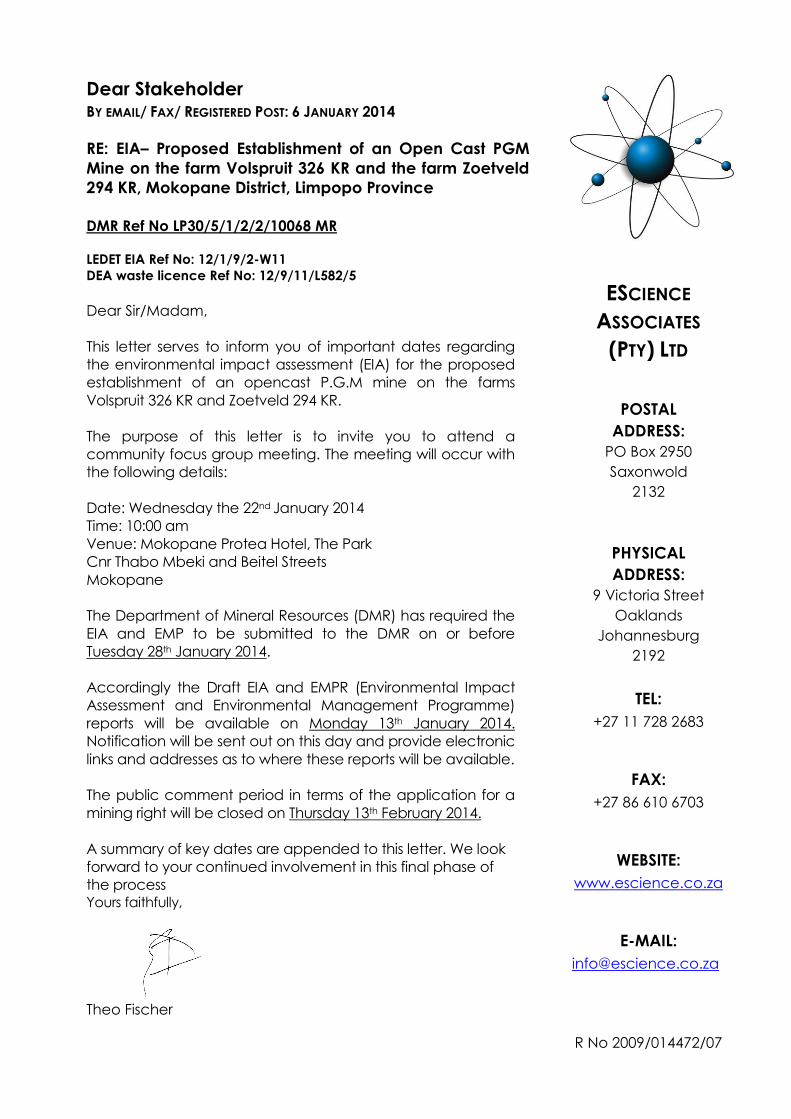
Dear Stakeholder BY EMAIL/ FAX/ REGISTERED POST: 6 JANUARY 2014
RE: EIA– Proposed Establishment of an Open Cast PGM
Mine on the farm Volspruit 326 KR and the farm Zoetveld
294 KR, Mokopane District, Limpopo Province
DMR Ref No LP30/5/1/2/2/10068 MR
LEDET EIA Ref No: 12/1/9/2-W11
DEA waste licence Ref No: 12/9/11/L582/5
Dear Sir/Madam,
This letter serves to inform you of important dates regarding
the environmental impact assessment (EIA) for the proposed
establishment of an opencast P.G.M mine on the farms
Volspruit 326 KR and Zoetveld 294 KR.
The purpose of this letter is to invite you to attend a
community focus group meeting. The meeting will occur with
the following details:
Date: Wednesday the 22nd January 2014
Time: 10:00 am
Venue: Mokopane Protea Hotel, The Park
Cnr Thabo Mbeki and Beitel Streets
Mokopane
The Department of Mineral Resources (DMR) has required the
EIA and EMP to be submitted to the DMR on or before
Tuesday 28th January 2014.
Accordingly the Draft EIA and EMPR (Environmental Impact
Assessment and Environmental Management Programme)
reports will be available on Monday 13th January 2014.
Notification will be sent out on this day and provide electronic
links and addresses as to where these reports will be available.
The public comment period in terms of the application for a
mining right will be closed on Thursday 13th February 2014.
A summary of key dates are appended to this letter. We look
forward to your continued involvement in this final phase of
the process Yours faithfully,
Theo Fischer
ESCIENCE
ASSOCIATES
(PTY) LTD
POSTAL
ADDRESS:
PO Box 2950
Saxonwold
2132
PHYSICAL
ADDRESS:
9 Victoria Street
Oaklands
Johannesburg
2192
TEL:
+27 11 728 2683
FAX:
+27 86 610 6703
WEBSITE:
www.escience.co.za
E-MAIL:
R No 2009/014472/07
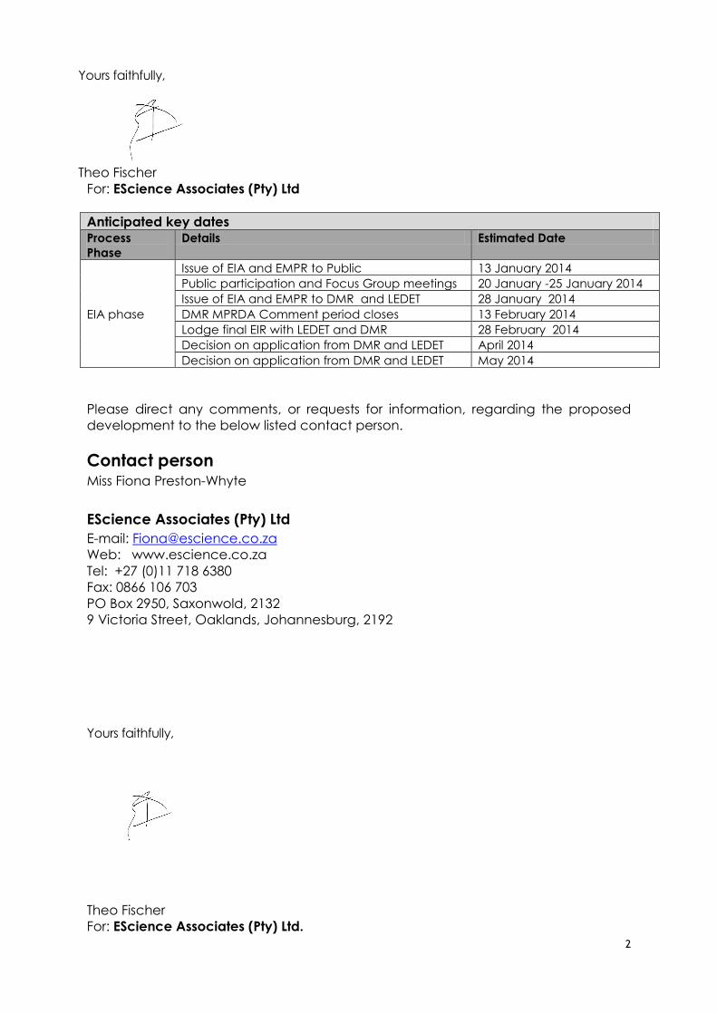
2
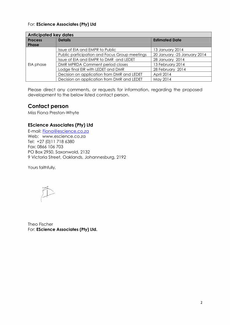
For: EScience Associates (Pty) Ltd
Anticipated key dates Process
Phase
Details Estimated Date
EIA phase
Issue of EIA and EMPR to Public 13 January 2014
Public participation and Focus Group meetings 20 January -25 January 2014
Issue of EIA and EMPR to DMR and LEDET 28 January 2014
DMR MPRDA Comment period closes 13 February 2014
Lodge final EIR with LEDET and DMR 28 February 2014
Decision on application from DMR and LEDET April 2014
Decision on application from DMR and LEDET May 2014
Please direct any comments, or requests for information, regarding the proposed
development to the below listed contact person.
Contact person Miss Fiona Preston-Whyte
EScience Associates (Pty) Ltd
E-mail: [email protected]
Web: www.escience.co.za
Tel: +27 (0)11 718 6380
Fax: 0866 106 703
PO Box 2950, Saxonwold, 2132
9 Victoria Street, Oaklands, Johannesburg, 2192
Yours faithfully,
Theo Fischer
For: EScience Associates (Pty) Ltd.
1
Fiona Preston-Whyte
From: Fiona Preston-WhyteSent: 06 January 2014 08:29 AMTo: Fiona Preston-Whyte ([email protected])Cc: Theo Fischer; Alessio PredieriSubject: SRVM Invitation Grass Root Community Focus Group meeting, in relation to the
proposed Volspruit Opencast PGM Mine EIAAttachments: SRVM IAP community Focus group.pdf
TrackingTracking: Recipient Delivery Read
Fiona Preston-Whyte ([email protected])
Delivered: 2014/01/06 08:29 AM
Theo Fischer Delivered: 2014/01/06 08:29 AM Read: 2014/01/06 10:14 AM
Alessio Predieri Delivered: 2014/01/06 08:29 AM Read: 2014/01/06 08:35 AM
Fiona Preston-Whyte Read: 2014/01/06 10:28 AM
Dear Stakeholder/ Interested and Affected Party RE: EIA Report – Proposed Establishment of an Open Cast PGM Mine on the farm Volspruit 326 KR and the farm Zoetveld 294 KR, Mokopane District, Limpopo Province Dear Sir/Madam, The purpose of this letter is twofold, firstly, to inform you of important upcoming dates in the above mentioned process. Secondarily, to invite you, and/or the organisation that you represent, to a Community focus group meeting on: Date: Wednesday the 22th January 2014. Time: 10:00 am Venue: Mokopane Protea Hotel, The Park Cnr Thabo Mbeki and Beitel Streets Mokopane Please find the official letter and invitation attached. Regards, Fiona Preston‐Whyte
EScience Associates (Pty) Ltd E‐mail: [email protected] Web: www.escience.co.za Tel: +27 (0)11 718 6380 Fax: 0866 106 703 PO Box 2950, Saxonwold, 2132 9 Victoria Street, Oaklands, Johannesburg, 2192
1
Dear Stakeholder BY EMAIL/ FAX/ REGISTERED POST: 6 JANUARY 2014
RE: EIA– Proposed Establishment of an Open Cast PGM
Mine on the farm Volspruit 326 KR and the farm Zoetveld
294 KR, Mokopane District, Limpopo Province
DMR Ref No LP30/5/1/2/2/10068 MR
LEDET EIA Ref No: 12/1/9/2-W11
DEA waste licence Ref No: 12/9/11/L582/5
Dear Sir/Madam,
This letter serves to inform you of important dates regarding
the environmental impact assessment (EIA) for the proposed
establishment of an opencast P.G.M mine on the farms
Volspruit 326 KR and Zoetveld 294 KR.
The purpose of this letter is to also invite you to a Property
owner Focus Group meeting. The meeting will occur with the
following details:
Date: Tuesday 21st January 2014
Time: 10:00 am
Venue: Kanniedood Guesthouse
Directions to Kanniedood Guesthouse: From Gauteng - Take
N1 North to Polokwane, Turn off at the Nyl Plaza +/- 200km
from Pretoria, at T-Junction turn Right (east) onto N11, look
for sign on left, +/- 5 km. From Polokwane – take N1 south,
take the Mokopane turn off and follow the R101 straight
through town centre and beyond. Turn left onto the N11
(Roetan/Marblehall), look for sign on the left
The Department of Mineral Resources (DMR) has required the
EIA and EMP to be submitted to the DMR on or before
Tuesday 28th January 2014.
Accordingly the Draft EIA and EMPR (Environmental Impact
Assessment and Environmental Management Programme)
reports will be available on Monday 13th January 2014.
Notification will be sent out on this day and provide electronic
links and addresses as to where these reports will be available.
The public comment period in terms of the application for a
mining right will be closed on Thursday 13th February 2014.
A summary of key dates are appended to this letter. We look
forward to your continued involvement in this final phase of
the process
ESCIENCE
ASSOCIATES
(PTY) LTD
POSTAL
ADDRESS:
PO Box 2950
Saxonwold
2132
PHYSICAL
ADDRESS:
9 Victoria Street
Oaklands
Johannesburg
2192
TEL:
+27 11 728 2683
FAX:
+27 86 610 6703
WEBSITE:
www.escience.co.za
E-MAIL:
R No 2009/014472/07
2
Yours faithfully,
Theo Fischer
For: EScience Associates (Pty) Ltd
Anticipated key dates Process
Phase
Details Estimated Date
EIA phase
Issue of EIA and EMPR to Public 13 January 2014
Public participation and Focus Group meetings 20 January -25 January 2014
Issue of EIA and EMPR to DMR and LEDET 28 January 2014
DMR MPRDA Comment period closes 13 February 2014
Lodge final EIR with LEDET and DMR 28 February 2014
Decision on application from DMR and LEDET April 2014
Decision on application from DMR and LEDET May 2014
Please direct any comments, or requests for information, regarding the proposed
development to the below listed contact person.
Contact person Miss Fiona Preston-Whyte
EScience Associates (Pty) Ltd
E-mail: [email protected]
Web: www.escience.co.za
Tel: +27 (0)11 718 6380
Fax: 0866 106 703
PO Box 2950, Saxonwold, 2132
9 Victoria Street, Oaklands, Johannesburg, 2192
Yours faithfully,
Theo Fischer
For: EScience Associates (Pty) Ltd.
1
Dear Stakeholder BY EMAIL/ FAX/ REGISTERED POST: 6 JANUARY 2014
RE: EIA– Proposed Establishment of an Open Cast PGM
Mine on the farm Volspruit 326 KR and the farm Zoetveld
294 KR, Mokopane District, Limpopo Province
DMR Ref No LP30/5/1/2/2/10068 MR
LEDET EIA Ref No: 12/1/9/2-W11
DEA waste licence Ref No: 12/9/11/L582/5
Dear Sir/Madam,
This letter serves to inform you of important dates regarding
the environmental impact assessment (EIA) for the proposed
establishment of an opencast P.G.M mine on the farms
Volspruit 326 KR and Zoetveld 294 KR.
The purpose of this letter is to invite you to attend Public
meetings planned as follows:
23 January 2014 Thursday Mokopane
24 January 2014 Friday Mookgopong
Mokopane meeting on Thursday the 23de January 2014:
Time: 10:00 am
Venue: Mokopane Protea Hotel, The Park
Cnr Thabo Mbeki and Beitel Streets
Mokopane
Mookgopong meeting on Friday the 24th January 2014.
Time: 10:00 am
Venue: De Beer Huis
47 Eight Street,
Mookgopong,
Limpopo
The Department of Mineral Resources (DMR) has required the
EIA and EMP to be submitted to the DMR on or before
Tuesday 28th January 2014.
Accordingly the Draft EIA and EMPR (Environmental Impact
Assessment and Environmental Management Programme)
reports will be available on Monday 13th January 2014.
Notification will be sent out on this day and provide electronic
links and addresses as to where these reports will be available.
The public comment period in terms of the application for a
mining right will be closed on Thursday 13th February 2014.
ESCIENCE
ASSOCIATES
(PTY) LTD
POSTAL
ADDRESS:
PO Box 2950
Saxonwold
2132
PHYSICAL
ADDRESS:
9 Victoria Street
Oaklands
Johannesburg
2192
TEL:
+27 11 728 2683
FAX:
+27 86 610 6703
WEBSITE:
www.escience.co.za
E-MAIL:
R No 2009/014472/07
2
A summary of key dates are appended to this letter. We look forward to your continued
involvement in this final phase of the process
Yours faithfully,
Theo Fischer
For: EScience Associates (Pty) Ltd
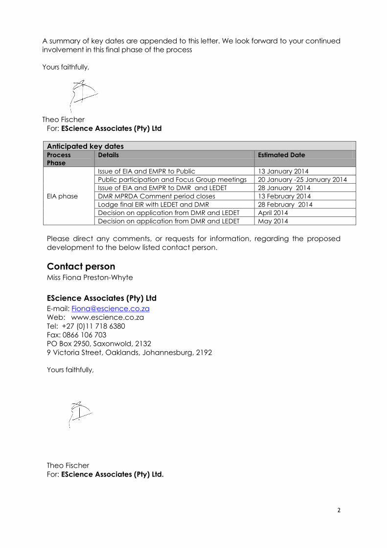
Anticipated key dates Process
Phase
Details Estimated Date
EIA phase
Issue of EIA and EMPR to Public 13 January 2014
Public participation and Focus Group meetings 20 January -25 January 2014
Issue of EIA and EMPR to DMR and LEDET 28 January 2014
DMR MPRDA Comment period closes 13 February 2014
Lodge final EIR with LEDET and DMR 28 February 2014
Decision on application from DMR and LEDET April 2014
Decision on application from DMR and LEDET May 2014
Please direct any comments, or requests for information, regarding the proposed
development to the below listed contact person.
Contact person Miss Fiona Preston-Whyte
EScience Associates (Pty) Ltd
E-mail: [email protected]
Web: www.escience.co.za
Tel: +27 (0)11 718 6380
Fax: 0866 106 703
PO Box 2950, Saxonwold, 2132
9 Victoria Street, Oaklands, Johannesburg, 2192
Yours faithfully,
Theo Fischer
For: EScience Associates (Pty) Ltd.
1
Fiona Preston-Whyte
From: Fiona Preston-WhyteSent: 06 January 2014 08:32 AMTo: Fiona Preston-Whyte ([email protected])Cc: Theo Fischer; Alessio PredieriSubject: SRVM Invitation Public Meeting Focus Group meeting, in relation to the proposed
Volspruit Opencast PGM Mine EIAAttachments: SRVM IAP public meetings.pdf
TrackingTracking: Recipient Delivery Read
Fiona Preston-Whyte ([email protected])
Delivered: 2014/01/06 08:32 AM
Theo Fischer Delivered: 2014/01/06 08:32 AM
Alessio Predieri Delivered: 2014/01/06 08:32 AM Read: 2014/01/06 08:35 AM
'Lukie Steenkamp'
'Jan Klopper'
'Sandy Emmerich'
'Janlo Möller'
'Abbas Shaker'
'Mogalakwena PMU'

2
Recipient Delivery Read

3
Recipient Delivery Read
4
Recipient Delivery Read
'Janlo Möller'
'Charl & Erica vd Merwe'
'Johannes Maree'
5
Recipient Delivery Read
6
Recipient Delivery Read
7
Recipient Delivery Read
Number Cruncher 1 Delivered: 2014/01/06 08:32 AM
8
Recipient Delivery Read
9
Recipient Delivery Read
10
Recipient Delivery Read
'Greeff Ben'
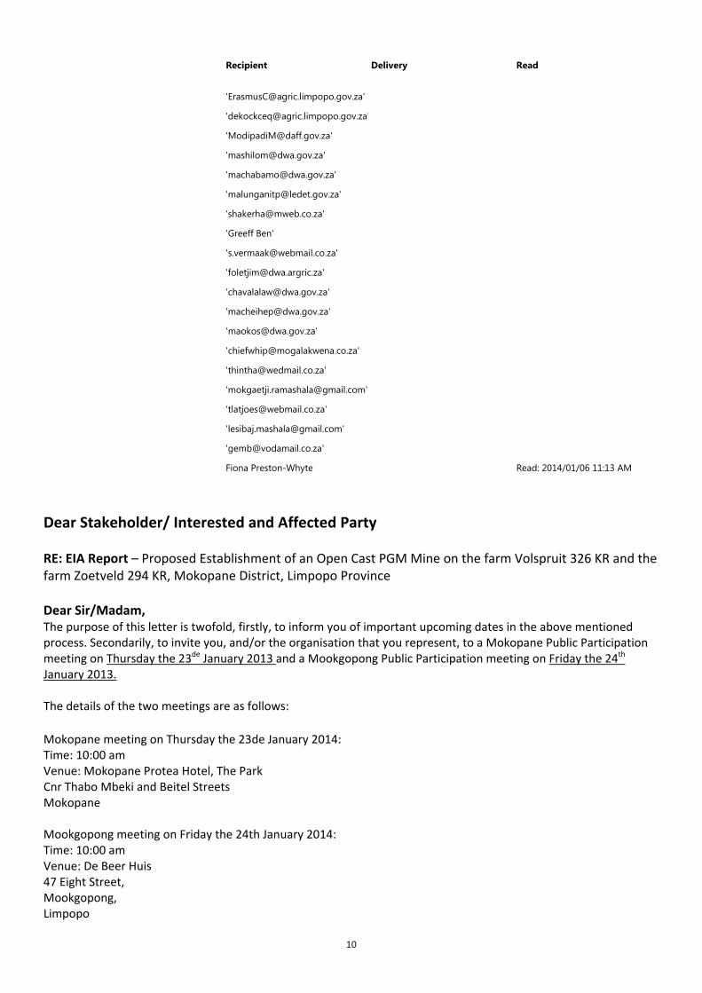
Fiona Preston-Whyte Read: 2014/01/06 11:13 AM
Dear Stakeholder/ Interested and Affected Party RE: EIA Report – Proposed Establishment of an Open Cast PGM Mine on the farm Volspruit 326 KR and the farm Zoetveld 294 KR, Mokopane District, Limpopo Province Dear Sir/Madam, The purpose of this letter is twofold, firstly, to inform you of important upcoming dates in the above mentioned process. Secondarily, to invite you, and/or the organisation that you represent, to a Mokopane Public Participation meeting on Thursday the 23de January 2013 and a Mookgopong Public Participation meeting on Friday the 24th January 2013. The details of the two meetings are as follows:
Mokopane meeting on Thursday the 23de January 2014: Time: 10:00 am Venue: Mokopane Protea Hotel, The Park Cnr Thabo Mbeki and Beitel Streets Mokopane Mookgopong meeting on Friday the 24th January 2014: Time: 10:00 am Venue: De Beer Huis 47 Eight Street, Mookgopong, Limpopo
11
Please find the official letter and invitation attached. Regards, Fiona Preston‐Whyte
EScience Associates (Pty) Ltd E‐mail: [email protected] Web: www.escience.co.za Tel: +27 (0)11 718 6380 Fax: 0866 106 703 PO Box 2950, Saxonwold, 2132 9 Victoria Street, Oaklands, Johannesburg, 2192
1
Fiona Preston-Whyte
From: Fiona Preston-WhyteSent: 26 November 2013 04:41 PMTo: [email protected]; [email protected]; [email protected];
[email protected]; [email protected]; [email protected]; [email protected]; [email protected]; [email protected]; [email protected]; [email protected]; [email protected]; [email protected]; [email protected]; [email protected]; [email protected]; [email protected]; [email protected]; [email protected]; [email protected]; [email protected]; [email protected]; [email protected]; [email protected]; [email protected]; [email protected]; [email protected]; [email protected]; [email protected]; [email protected]; [email protected]; [email protected]; [email protected]; [email protected]; [email protected]; [email protected]; [email protected]; [email protected]; [email protected]; [email protected]; [email protected]; [email protected]; [email protected]; [email protected]; [email protected]; [email protected]; [email protected]; [email protected]; [email protected]; [email protected]; [email protected]; [email protected]; [email protected]
Subject: FW: SRVM: Volpsruit Mine EIA process - Authorities meeting and establishment of a 'Joint Committee'
Dear Member of Authority, I tried to contact you telephonically, earlier today. This email regards the proposed establishment of an open cast PGM Mine on the farm Volspruit 326 KR and the farm Zoetveld 294 KR, Mokopane District, Limpopo Province. We are organising an Authorities meeting regarding this project, of which you are registered as an IAP. The meeting will be an update of the project so far. The meeting will occur on Tuesday the 3de December at 13:00 in Polokwane. An official invitation and venue confirmation will be sent out shortly. Regards, Fiona Preston‐Whyte
EScience Associates (Pty) Ltd E‐mail: [email protected] Web: www.escience.co.za Tel: +27 (0)11 718 6380 Fax: 0866 106 703 PO Box 2950, Saxonwold, 2132
2
9 Victoria Street, Oaklands, Johannesburg, 2192
From: Fiona Preston-Whyte Sent: 26 November 2013 04:35 PM To: '[email protected]'; '[email protected]'; '[email protected]'; '[email protected]'; '[email protected]'; '[email protected]' Subject: SRVM: Volpsruit Mine EIA process - Authorities meeting and establishment of a 'Joint Committee' Dear Members of Authority, I spoke with each of you telephonically earlier today, regarding the proposed Volspruit mine. The proposed authorities meeting will be held on 3de December at 13:00 in Polokwane. Please see below emails for any further information regarding this meeting. An official invitation will be sent out to you shortly, along with a confirmed venue. I will also be sending both this email, as well as, the official invitation to all other Authorities registered in the IAP list. Regards, Fiona Preston‐Whyte
EScience Associates (Pty) Ltd E‐mail: [email protected] Web: www.escience.co.za Tel: +27 (0)11 718 6380 Fax: 0866 106 703 PO Box 2950, Saxonwold, 2132 9 Victoria Street, Oaklands, Johannesburg, 2192
From: Theo Fischer Sent: 26 November 2013 04:05 PM To: Abbas Shaker Cc: Fiona Preston-Whyte; 'Tinyiko Malungani' Subject: RE: SRVM: Volpsruit Mine EIA process - Authorities meeting and establishment of a 'Joint Committee' Dear Dr Shaker and Mrs Malungani Thank you for your confirmation that the 3rd of Dec will suit you for a meeting in Polokwane. The meeting will be held at 13:00 as per request from Mokopane LM and LDA representatives. Formal invitation and venue announcement will follow shortly. Regards Theo
From: Theo Fischer Sent: 18 October 2013 02:15 PM To: 'Abbas Shaker'
1
Fiona Preston-Whyte
From: Theo FischerSent: 18 November 2013 08:46 PMTo: Fiona Preston-WhyteCc: [email protected]; [email protected]; [email protected];
[email protected]; [email protected]; Lukie Steenkamp ([email protected]); [email protected]; [email protected]; [email protected]; [email protected]; '[email protected]'; [email protected]; '[email protected]'; '[email protected]';[email protected]; [email protected]; '[email protected]'; [email protected]; [email protected]; [email protected]; [email protected]; [email protected]; '[email protected]'; [email protected]; [email protected]; Sandy Emmerich; Janlo Möller ([email protected]); [email protected]
Subject: RE: SRVM Invitiation to a EIA Focus Group meeting , in relation to the proposed Volspruit Opencast PGM Mine EIA - 29th November 2013
Importance: High
Dear Stakeholders You are cordially invited to a Affected Farmer/Landowner/ Conservation/ Community Focus Group meeting for the above mentioned EIA process, to be held at the Kanniedood Guesthouse on the 29th of November 2013 from 09:00am to 13:00pm. Directions: From Gauteng ‐ Take N1 North to Polokwane, Turn off at the Nyl Plaza +/‐ 200km from Pretoria, at T‐Junction turn Right (east) onto N11, look for sign on left, +/‐ 5 km. From Polokwane – take N1 south, take the Mokopane turn off and follow the R101 straight through town centre and beyond. Turn left onto the N11 (Roetan/Marblehall), look for sign on the left. Purpose of meeting: The purpose of the meeting is to provide feedback on specialist studies in process for the finalisation of the EIA, to announce the availability of certain draft specialist reports and to allow opportunity for final comment from focus group members on the Scoping report and Terms of Reference for specialist study. Mr Sean O’Beirne have not been able to confirm that he will be able to facilitate the meeting as he may need to attend to another matter, should he not be able to facilitate the meeting an alternative facilitator will be appointed. We propose the following programme which will be finalised at the meeting: Affected Farmer/Landowner/ Conservation/Community Focus Group meeting Welcome Facilitator 09:00 09:15Preliminary findings hydrogeological/ groundwater study T Fischer 09:15 09:45Preliminary findings flood dynamic and integrated water balance T Fischer 09:45 10:15Open floor- Questions and comments Attendants 10:15 12:45Closure Facilitator 12:45 13:00 Please note that due to the specific focus of the workshop as well as the capacity of the venue, should you wish to extend the invitation to other parties that you feel will benefit from attending please be at liberty to extend this invitation but please have the courtesy to copy me on the invitation so that these parties can be catered for at the venue in terms of seating and refreshments. Thank you for your understanding.

2
We look forward to meeting with you. Please kindly confirm your attendance as soon as possible. Kind regards, Theo Fischer EScience Associates (Pty) Ltd E‐mail: [email protected] Web: www.escience.co.za PO Box 2950, Saxonwold, 2132 9 Victoria Street, Oaklands, Johannesburg, 2192 Cell: +27 82 336 2729 Tel: +27 11 718 6380 Fax: 086 610 6703 VAT No: 473 025 4416 Reg No: 2009/014407/07
1
Fiona Preston-Whyte
From: Theo FischerSent: 13 September 2013 01:16 PMTo: Fiona Preston-Whyte; Michael BenjaminCc: [email protected]; [email protected]; [email protected];
[email protected]; [email protected]; Lukie Steenkamp ([email protected]); [email protected]; [email protected]; [email protected]; [email protected]; '[email protected]'; [email protected]; '[email protected]'; '[email protected]';[email protected]; [email protected]; '[email protected]'; [email protected]; [email protected]; [email protected]; Jan Klopper; [email protected]; [email protected]; '[email protected]'; [email protected]; [email protected]; Sandy Emmerich; Janlo Möller ([email protected]); Abbas Shaker; 'Mogalakwena PMU'
Subject: RE: SRVM Invitiation to a Affected Farmer/Landowner/ Community Focus Group meeting , in relation to the proposed Volspruit Opencast PGM Mine EIA - note date change to 4th October 2013
Importance: High
Dear Stakeholders Please note that the meeting below has been rescheduled for the 4th of October 2013 and period of comment on Scoping Report extended to the 14th of October 2013. In order to focus group members more time to engage with the specialists and due to common issues the Conservation/ Water Focus Group will be combined with the Affected Farmer/Landowner/ Focus Group meeting and the meeting is scheduled to span from 09:00‐16:00. It is proposed to have presentations on the way ahead in the morning and discussion in the afternoon, the programme will be finalised by the facilitator in consultation with the attendants. Please kindly confirm your attendance so that we can ensure adequate seating and refreshments are provided. Regards Theo Fischer EScience Associates (Pty) Ltd E‐mail: [email protected] Web: www.escience.co.za PO Box 2950, Saxonwold, 2132 9 Victoria Street, Oaklands, Johannesburg, 2192 Cell: +27 82 336 2729 Tel: +27 11 718 6380 Fax: 086 610 6703 VAT No: 473 025 4416 Reg No: 2009/014407/07
From: Theo Fischer Sent: 09 September 2013 05:06 PM

2
To: 'Theo Fischer' Cc: '[email protected]'; '[email protected]'; '[email protected]'; '[email protected]'; '[email protected]'; 'Lukie Steenkamp ([email protected])'; '[email protected]'; '[email protected]'; '[email protected]'; '[email protected]'; '[email protected]'; '[email protected]'; '[email protected]'; '[email protected]'; '[email protected]'; '[email protected]'; '[email protected]'; '[email protected]'; '[email protected]'; '[email protected]'; '[email protected]'; '[email protected]'; '[email protected]'; '[email protected]'; '[email protected]'; 'Sandy Emmerich'; Janlo Möller ([email protected]); Janlo Möller ([email protected]); Fiona Preston-Whyte ([email protected]); Michael Benjamin ([email protected]) Subject: SRVM Invitiation to a Affected Farmer/Landowner/ Community Focus Group meeting , in relation to the proposed Volspruit Opencast PGM Mine EIA on the 20th of September 2013 from 09:00am to 13:00pm Dear Stakeholders You are cordially invited to a Affected Farmer/Landowner/ Community Focus Group meeting for the above mentioned EIA process, to be held at the Kanniedood Guesthouse on the 20th of September 2013 from 09:00am to 13:00pm. Note that a Conservation/ Water Focus Group meeting will be held from 12:30pm to 16:00pm should you not be able to attend tis meeting you are welcome to attend later in the day, the focus of the latter meeting will however be slightly different from that Affected Farmer/Landowner/ Community Focus Group meeting. Directions: From Gauteng ‐ Take N1 North to Polokwane, Turn off at the Nyl Plaza +/‐ 200km from Pretoria, at T‐Junction turn Right (east) onto N11, look for sign on left, +/‐ 5 km. From Polokwane – take N1 south, take the Mokopane turn off and follow the R101 straight through town centre and beyond. Turn left onto the N11 (Roetan/Marblehall), look for sign on the left. Purpose of meeting: The purpose of the meeting is to discuss the proposed work scope of work and methodology for the finalisation of the EIA, and to obtain feedback and comment from focus group members with a view to finalisation of the Scoping report and Terms of Reference for specialist study. The meeting will be facilitated by Mr Sean O’Beirne. We propose the following programme which will be finalised at the meeting: Affected Farmer/Landowner/ Community Focus Group meeting Welcome S O’Beirne 09:00 09:15History of application& process going forward and timelines T Fischer 09:15 09:30Outline on Scope of Work/ Scoping T Fischer 09:30 10:00Scope of work hydrogeological/ groundwater study Dr. G du Toit 10:00 10:15Scope of flood dynamic and integrated water balance T Fischer 10:15 10:30Open floor- Questions and comments Attendants 10:30 12:00Closure S O’Beirne 12:00 12:15 Please note that due to the specific focus of the workshop as well as the capacity of the venue, should you wish to extend the invitation to other parties that you feel will benefit from attending please be at liberty to extend this invitation but please have the courtesy to copy me on the invitation so that these parties can be catered for at the venue in terms of seating and refreshments. Thank you for your understanding. We look forward to meeting with you. Please kindly confirm your attendance as soon as possible. Kind regards, Theo Fischer EScience Associates (Pty) Ltd E‐mail: [email protected]

3
Web: www.escience.co.za PO Box 2950, Saxonwold, 2132 9 Victoria Street, Oaklands, Johannesburg, 2192 Cell: +27 82 336 2729 Tel: +27 11 718 6380 Fax: 086 610 6703 VAT No: 473 025 4416 Reg No: 2009/014407/07
1
Fiona Preston-Whyte
From: Fiona Preston-WhyteSent: 14 January 2014 05:26 PMTo: Theo FischerCc: Fiona Preston-Whyte ([email protected]); Alessio PredieriSubject: SRVM Draft EIA Report - Proposed Establishment of an Open Cast PGM Mine on
the farm Volspruit 326 KR and the farm Zoetveld 294 KRAttachments: SRVM EIA Report for DMR Exec Summary.pdf; SRVM IAP letter Notice of EIA
20140113 AP TF 1700.pdf
TrackingTracking: Recipient Delivery Read
Theo Fischer Delivered: 2014/01/14 05:26 PM Read: 2014/01/14 05:26 PM
Fiona Preston-Whyte ([email protected])
Delivered: 2014/01/14 05:26 PM
Alessio Predieri Delivered: 2014/01/14 05:26 PM Read: 2014/01/14 05:55 PM
'Lukie Steenkamp'
'Jan Klopper'
'Sandy Emmerich'
'Janlo Möller'
'Abbas Shaker'
'Mogalakwena PMU'

2
Recipient Delivery Read

3
Recipient Delivery Read
4
Recipient Delivery Read
'Janlo Möller'
'Charl & Erica vd Merwe'
'Johannes Maree'
5
Recipient Delivery Read

6
Recipient Delivery Read
7
Recipient Delivery Read
8
Recipient Delivery Read

9
Recipient Delivery Read
10
Recipient Delivery Read
'Greeff Ben'
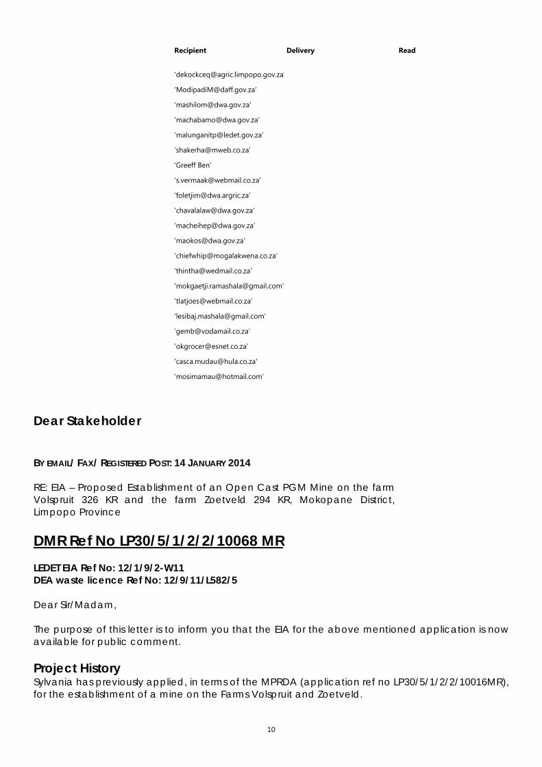
Dear Stakeholder BY EMAIL/ FAX/ REGISTERED POST: 14 JANUARY 2014 RE: EIA – Proposed Establishment of an Open Cast PGM Mine on the farm Volspruit 326 KR and the farm Zoetveld 294 KR, Mokopane District, Limpopo Province DMR Ref No LP30/5/1/2/2/10068 MR LEDET EIA Ref No: 12/1/9/2-W11 DEA waste licence Ref No: 12/9/11/L582/5 Dear Sir/Madam, The purpose of this letter is to inform you that the EIA for the above mentioned application is nowavailable for public comment. Project History Sylvania has previously applied, in terms of the MPRDA (application ref no LP30/5/1/2/2/10016MR),for the establishment of a mine on the Farms Volspruit and Zoetveld.
11
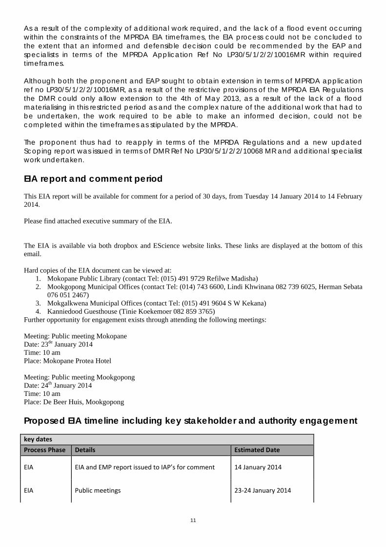
As a result of the complexity of additional work required, and the lack of a flood event occurringwithin the constraints of the MPRDA EIA timeframes, the EIA process could not be concluded tothe extent that an informed and defensible decision could be recommended by the EAP andspecialists in terms of the MPRDA Application Ref No LP30/5/1/2/2/10016MR within required timeframes. Although both the proponent and EAP sought to obtain extension in terms of MPRDA applicationref no LP30/5/1/2/2/10016MR, as a result of the restrictive provisions of the MPRDA EIA Regulationsthe DMR could only allow extension to the 4th of May 2013, as a result of the lack of a floodmaterialising in this restricted period as and the complex nature of the additional work that had tobe undertaken, the work required to be able to make an informed decision, could not becompleted within the timeframes as stipulated by the MPRDA. The proponent thus had to reapply in terms of the MPRDA Regulations and a new updatedScoping report was issued in terms of DMR Ref No LP30/5/1/2/2/10068 MR and additional specialistwork undertaken. EIA report and comment period This EIA report will be available for comment for a period of 30 days, from Tuesday 14 January 2014 to 14 February2014. Please find attached executive summary of the EIA. The EIA is available via both dropbox and EScience website links. These links are displayed at the bottom of thisemail. Hard copies of the EIA document can be viewed at:
1. Mokopane Public Library (contact Tel: (015) 491 9729 Refilwe Madisha) 2. Mookgopong Municipal Offices (contact Tel: (014) 743 6600, Lindi Khwinana 082 739 6025, Herman Sebata
076 051 2467) 3. Mokgalkwena Municipal Offices (contact Tel: (015) 491 9604 S W Kekana) 4. Kanniedood Guesthouse (Tinie Koekemoer 082 859 3765)
Further opportunity for engagement exists through attending the following meetings: Meeting: Public meeting Mokopane Date: 23de January 2014 Time: 10 am Place: Mokopane Protea Hotel Meeting: Public meeting Mookgopong Date: 24th January 2014 Time: 10 am Place: De Beer Huis, Mookgopong Proposed EIA timeline including key stakeholder and authority engagement key dates
Process Phase Details Estimated Date
EIA EIA and EMP report issued to IAP’s for comment 14 January 2014
EIA Public meetings 23‐24 January 2014

12
EIA EIA report issued to the DMR 28 January 2014
EIA EIA and EMPR comments period closed for
submission to the DMR 14 February 2014
EIA Comments and response report updated and
submitted to the DMR 22 February 2014
EIA EIA and EMP comment period closed for submission
to LEDET 13 March 2014
EIA Comments and responses report updated and
submitted to LEDET 21 March 2014
Please Note that the DMR stipulations require the EAP is to conduct the EIA and finalise the EMP, on or before, the28th of January 2014.

13
Please direct any comments, or requests for information, regarding the proposed development to the below listedcontact person. Contact person: Miss Fiona Preston-Whyte EScience Associates (Pty) Ltd E-mail: [email protected] Web: www.escience.co.za PO Box 2950, Saxonwold, 2132 9 Victoria Street, Oaklands, Johannesburg, 2192 Tel: +27 11 718 6380 Fax: 086 610 6703 Please do not hesitate to contact me should you require further information. Regards, Fiona Preston‐Whyte
EScience Associates (Pty) Ltd E‐mail: [email protected] Web: www.escience.co.za Tel: +27 (0)11 718 6380 Fax: 0866 106 703 PO Box 2950, Saxonwold, 2132 9 Victoria Street, Oaklands, Johannesburg, 2192 Dropbox: Final EIA report https://www.dropbox.com/s/jstv8dtejskpqc9/SRVM%20final%20EIA%20Report%20for%20DMR%201000%20FINAL.pdf Appendix 1 LEDET, DEA & DMR correspondence to date https://www.dropbox.com/s/q4or3ygic9aer01/Appendix%201%20LEDET%2C%20DEA%20%26%20DMR%20correspondence%20to%20date_include%20latest.pdf Appendix 2.1 Topo-locality Map https://www.dropbox.com/s/e7lkpjgn1xdymfs/Appendix%202.1%20Topo-locality%20Map.pdf Appendix 2.2 Regional Elevation Map https://www.dropbox.com/s/dp5tjxlyepac1ns/Appendix%202.2%20Regional%20Elevation%20Map.pdf Appendix 2.3 Regional Land use Map https://www.dropbox.com/s/lsm0bme5suad9zg/Appendix%202.3%20Regional%20Land-use%20Map.pdf Appendix 2.4 Mine Site Vegetation https://www.dropbox.com/s/m44ngvpr4l46sdj/Appendix%202.4%20Mine%20Site%20Vegetation.pdf
14
Appendix 2.5 Local Power Distribution https://www.dropbox.com/s/uqznj1i2w6a4uwj/Appendix%202.5%20Local%20Power%20Distribution.pdf Appendix 3.1 Volspruit Site Map https://www.dropbox.com/s/h1y21f64vvh9jui/Appendix%203.1%20Volspruit%20Site%20Plan.pdf Appendix 3.2 Concentrator Block Plan https://www.dropbox.com/s/6zzvb6mmqccu6zy/Appendix%203.2%20Concentrator%20Block%20Plan.pdf Appendix 3.3 Smelter Block Plan https://www.dropbox.com/s/x0ddaja44q6s8i3/Appendix%203.3%20Smelter%20Block%20Plan.pdf Appendix 4 Public Participation Report Part 1 https://www.dropbox.com/s/uyux5i7i7a31b6i/Appendix%204%20Public%20Participation%20Report.pdf Public Participation Part 2 (Appendix 4) https://www.dropbox.com/s/97uu8ol9sj0nzxu/Public%20Participation%20Part%202.pdf Public Participation Part 3 (Appendix 4) https://www.dropbox.com/s/hpojzrd50vkltzl/Public%20Participation%20Part%203.pdf Appendix 5.1 Hydrogeo report https://www.dropbox.com/s/6tobvhxauu8hjtp/Appendix%205.3_Hydrogeo%20report.pdf 5.1 Ground Water Appendix A https://www.dropbox.com/s/ku1lcn2p4c9brt8/5.1%20Ground%20Water%20Appendix%20A%20.pdf 5.1 Ground Water Appendix B https://www.dropbox.com/s/cr13icwyc2rco2l/5.1%20Ground%20Water%20Appendix%20B.pdf 5.1 Ground Water Appendix C https://www.dropbox.com/s/9zvc54h4kblqomv/5.1%20Ground%20Water%20Appendix%20C.pdf 5.1 Ground Water Appendix D https://www.dropbox.com/s/t5ithfaikthh2a8/5.1%20Ground%20Water%20Appendix%20D.pdf 5.1 Ground Water Appendix E https://www.dropbox.com/s/61phs8kj74y5kmn/5.1%20Ground%20Water%20Appendix%20E.pdf 5.1 Ground Water Appendix F https://www.dropbox.com/s/89hkliunxk1e4qa/5.1%20Ground%20Water%20Appendix%20F.pdf Appendix5.2 SRVM Grouting Case Study and literature review 20140112 Final https://www.dropbox.com/s/rgqzbv5vhaivgsa/App5.2%20SRVM%20Grouting%20Case%20Study%20and%20literature%20review%2020140112%20Final.pdf Appendix 5.2 Grouting Assessment https://www.dropbox.com/s/5v1ph26un0qvxog/Appendix%205.2%20Grouting%20Assessment.pdf Appendix 5.3 Surface Water Assessment https://www.dropbox.com/s/ngbppi0op1ast7j/Appendix%205.3%20Surface%20Water%20Assessment.pdf Appendix 5.3 Nyl River Hydrological analysis https://www.dropbox.com/s/t6s1tmn3hodm5de/Nyls%20River%20Hydrological%20Analysis_14Jan2013.pdf Appendix 5.3 C. Clay layer investigation. Prof. Claassens https://www.dropbox.com/s/1qmg641du8idu0w/Report%20Volspruit%20clay%20layer%20survey%20A%20Claassens%20final.pdf

15
Appendix5.3. C_clay layer_prof_Claassens_appendix https://www.dropbox.com/s/jezacet59twhuby/App5.3.%20C_clay%20layer_prof_Claassens_appendix.pdf Appendix5.3 SRVM Soils of the Nyl- Literature Review https://www.dropbox.com/s/9e3hlhqdcqwc53g/SRVM%20Soils%20of%20the%20Nyl-%20Literature%20Review%2020131122%20sans%20FP%20FPW%2011012013.pdf Appendix 5.3 D. Water balance https://www.dropbox.com/s/mqg13184lx87mhd/Volspruit%20Water%20Balance%20Summary%20Report%202.pdf Appendix 5.4 Irrigation Assessment https://www.dropbox.com/s/kpuvj2f92q49baj/Appendix%205.4%20Irrigation%20Assessment.pdf Appendix 5.5 Heritage Impact Assessment https://www.dropbox.com/s/2jh12ep5ejmrwzn/Appendix%205.5%20Heritage%20Impact%20Assessment.pdf Appendix 5.6 Paleontological Desktop Assessment https://www.dropbox.com/s/p4s21uw1ixf7bay/Appendix%205.6%20Paeleontological%20Desktop%20Assessment.pdf Cover letter for biodiversity assessment (appendix 5.7) https://www.dropbox.com/s/4m5ml5qgwkj00ci/Cover%20Letter_SRVM%20Biodiversity%20Assessment_Rev1.pdf?m= Appendix 5.7 Biodiversity report https://www.dropbox.com/s/warqcmjk328qrmc/SRVM%20EIA%20Biodiversity%20Assessment.pdf Appendix 5.8 Soil & Land Capability Assessment https://www.dropbox.com/s/qpzdampfwcqg6hi/Appendix%205.8%20Soil%20%26%20Land%20Capability%20Assessment.pdf Appendix 5.9 SRVM AQIA report (air quality) https://www.dropbox.com/s/rgvb4451cjw5r4k/SRVM%20AQIA%20report%20MET%202014-01-13%201100%20AE%20No%20power%20Final.pdf Appendix 5.10 Noise Impact Assessment https://www.dropbox.com/s/z7stlbvpb0z1kng/Appendix%205.10%20Noise%20Impact%20Assessment.pdf Appendix 5.11 Socio-economic Impact Assessment https://www.dropbox.com/s/skseimrds8hccr6/Appendix%205.11%20Socio-economic%20Impact%20Assessment.pdf cover letter for 5.12 https://www.dropbox.com/s/ti0x0d0ka5vznhd/cover%20letter%20for%205.12.pdf Appendix 5.12 Avi-faunal Impact Assessment https://www.dropbox.com/s/2zi6h4bxynjk9k3/Appendix%205.12%20Avi-faunal%20Impact%20Assessment.pdf Appendix 5.13 ABA Assessment https://www.dropbox.com/s/fnc1ztphesph9jh/Appendix%205.13%20ABA%20Assessment.pdf Appendix 5.14 Visual Impact Assessment https://www.dropbox.com/s/xqsjeicnd4ae8fh/Appendix%205.14%20Visual%20Impact%20Assessment.pdf Appendix 5.15 Geotechnical Assessment https://www.dropbox.com/s/5bwpwh584vf0a4w/Appendix%205.15%20Geotechnical%20Assessment.pdf Appendix 5.16 TSF Assessment https://www.dropbox.com/s/bdydaeq5hs9909p/Appendix%205.16%20TSF%20Assessment.pdf
16
Appendix 6 Environmental management plan (EMPR) https://www.dropbox.com/s/bdt9ir6dhc9sqvq/SRVM%20final%20EMPR%20for%20DMR%2020140114%20FINAL%20with%20App_1..pdf Appendix 7.1 CV T Fischer https://www.dropbox.com/sm/create/SRVM%20EIA%20report%2013%20January%202014/Appendix%207.1%20CV%20T%20Fischer.pdf Appendix 7 CV B Thorpe https://www.dropbox.com/s/v15icyg3ha7h1l5/Appendix%203%202%20CV%20B%20Thorpe.pdf Appendix 8 Conceptual In Situ Strata https://www.dropbox.com/s/fbaeiacsxqgm5gi/Appendix%208%20Conceptual%20In%20Situ%20Strata.pdf Appendix 9 Grouting Strategy & Pit Buffers https://www.dropbox.com/s/csih729jqmlgsoj/Appendix%209%20Grouting%20Strategy%20%26%20Pit%20Buffers.pdf EScience website links: Final EIA report http://www.escience.co.za/project_pdf/SRVM/SRVM%20final%20EIA%20Report%20for%20DMR%201000%20FINAL.pdf Appendix 1 LEDET, DEA & DMR correspondence to date http://www.escience.co.za/project_pdf/SRVM/Appendix%201%20LEDET,%20DEA%20&%20DMR%20correspondence%20to%20date_include%20latest.pdf Appendix 2.1 Topo-locality Map http://www.escience.co.za/project_pdf/SRVM/Appendix%202.1%20Topo-locality%20Map_1.pdf Appendix 2.2 Regional Elevation Map http://www.escience.co.za/project_pdf/SRVM/Appendix%202.2%20Regional%20Elevation%20Map_1.pdf Appendix 2.3 Regional Land use Map http://www.escience.co.za/project_pdf/SRVM/Appendix%202.3%20Regional%20Land-use%20Map_1.pdf Appendix 2.4 Mine Site Vegetation http://www.escience.co.za/project_pdf/SRVM/Appendix%202.4%20Mine%20Site%20Vegetation_1.pdf Appendix 2.5 Local Power Distribution http://www.escience.co.za/project_pdf/SRVM/Appendix%202.5%20Local%20Power%20Distribution_1.pdf Appendix 3.1 Volspruit Site Map http://www.escience.co.za/project_pdf/SRVM/Appendix%203.1%20Volspruit%20Site%20Plan_1.pdf Appendix 3.2 Concentrator Block Plan http://www.escience.co.za/project_pdf/SRVM/Appendix%203.2%20Concentrator%20Block%20Plan_1.pdf Appendix 3.3 Smelter Block Plan http://www.escience.co.za/project_pdf/SRVM/Appendix%203.3%20Smelter%20Block%20Plan_1.pdf Appendix 4 Public Participation Report http://www.escience.co.za/project_pdf/SRVM/Appendix%204%20Public%20Participation%20Report.pdf Public Participation Part 2.1 (Appendix 4) http://www.escience.co.za/project_pdf/SRVM/Public%20Participation%20Part%202.1.pdf
17
Public Participation Part 2.2 (Appendix 4) http://www.escience.co.za/project_pdf/SRVM/Public%20Participation%20Part%202.2.pdf Public Participation Part 3.1 (Appendix 4) http://www.escience.co.za/project_pdf/SRVM/Public%20Participation%20Part%203.1.pdf Public Participation Part 3.2 (Appendix 4) http://www.escience.co.za/project_pdf/SRVM/Public%20Participation%20Part%203.2.pdf Public Participation Part 3.3 (Appendix 4) http://www.escience.co.za/project_pdf/SRVM/Public%20Participation%20Part%203.3.pdf Public Participation Part 3.4 (Appendix 4) http://www.escience.co.za/project_pdf/SRVM/Public%20Participation%20Part%203.4.pdf Public Participation Part 3.5 (Appendix 4) http://www.escience.co.za/project_pdf/SRVM/Public%20Participation%20Part%203.5.pdf Public Participation Part 3.6 (Appendix 4) http://www.escience.co.za/project_pdf/SRVM/Public%20Participation%20Part%203.6.pdf Public Participation Part 3.7 (Appendix 4) http://www.escience.co.za/project_pdf/SRVM/Public%20Participation%20Part%203.7.pdf Public Participation Part 3.8 (Appendix 4) http://www.escience.co.za/project_pdf/SRVM/Public%20Participation%20Part%203.8.pdf Appendix 5.1 Hydrogeo report http://www.escience.co.za/project_pdf/SRVM/Appendix%205.3_Hydrogeo%20report.pdf Appendix 5.1 Ground Water Appendix A http://www.escience.co.za/project_pdf/SRVM/5.1%20Ground%20Water%20Appendix%20A%20.pdf Appendix 5.1 Ground Water Appendix B http://www.escience.co.za/project_pdf/SRVM/5.1%20Ground%20Water%20Appendix%20B.pdf Appendix 5.1 Ground Water Appendix C http://www.escience.co.za/project_pdf/SRVM/5.1%20Ground%20Water%20Appendix%20C.pdf Appendix 5.1 Ground Water Appendix D http://www.escience.co.za/project_pdf/SRVM/5.1%20Ground%20Water%20Appendix%20D.pdf Appendix 5.1 Ground Water Appendix E http://www.escience.co.za/project_pdf/SRVM/5.1%20Ground%20Water%20Appendix%20E.pdf Appendix 5.1 Ground Water Appendix F http://www.escience.co.za/project_pdf/SRVM/5.1%20Ground%20Water%20Appendix%20F.pdf Appendix5.2 SRVM Grouting Case Study and literature review 20140112 Final http://www.escience.co.za/project_pdf/SRVM/App5.2%20SRVM%20Grouting%20Case%20Study%20and%20literature%20review%2020140112%20Final.pdf Appendix 5.2 Grouting Assessment http://www.escience.co.za/project_pdf/SRVM/Appendix%205.2%20Grouting%20Assessment_1.pdf Appendix 5.3 Nyl River Hydrological analysis http://www.escience.co.za/project_pdf/SRVM/Nyls%20River%20Hydrological%20Analysis_14Jan2013.pdf Appendix 5.3 Surface Water Assessment

18
http://www.escience.co.za/project_pdf/SRVM/Appendix%205.3%20Surface%20Water%20Assessment_1.pdf Appendix 5.3 C. Clay layer investigation. Prof. Claassens http://www.escience.co.za/project_pdf/SRVM/Report%20Volspruit%20clay%20layer%20survey%20A%20Claassens%20final.pdf Appendix 5.3. C_clay layer_prof_Claassens_appendix http://www.escience.co.za/project_pdf/SRVM/App5.3.%20C_clay%20layer_prof_Claassens_appendix.pdf Appendix 5.3 C.SRVM Soils of the Nyl- Literature Review http://www.escience.co.za/project_pdf/SRVM/SRVM%20Soils%20of%20the%20Nyl-%20Literature%20Review%2020131122%20sans%20FP%20FPW%2011012013.pdf Appendix 5.3 D. Water balance http://www.escience.co.za/project_pdf/SRVM/Volspruit%20Water%20Balance%20Summary%20Report%202.pdf Appendix 5.4 Irrigation Assessment http://www.escience.co.za/project_pdf/SRVM/Appendix%205.4%20Irrigation%20Assessment_1.pdf Appendix 5.5 Heritage Impact Assessment http://www.escience.co.za/project_pdf/SRVM/Appendix%205.5%20Heritage%20Impact%20Assessment_1.pdf Appendix 5.6 Paleontological Desktop Assessment http://www.escience.co.za/project_pdf/SRVM/Appendix%205.6%20Paeleontological%20Desktop%20Assessment_1.pdf Appendix 5.7 Cover letter for biodiversity assessment http://www.escience.co.za/project_pdf/SRVM/Cover%20Letter_SRVM%20Biodiversity%20Assessment_Rev1.pdf Appendix 5.7 Biodiversity report http://www.escience.co.za/project_pdf/SRVM/SRVM%20EIA%20Biodiversity%20Assessment.pdf Appendix 5.8 Soil & Land Capability Assessment http://www.escience.co.za/project_pdf/SRVM/Appendix%205.8%20Soil%20&%20Land%20Capability%20Assessment_1.pdf Appendix 5.9 SRVM AQIA report (air quality) http://www.escience.co.za/project_pdf/SRVM/SRVM%20AQIA%20report%20MET%202014-01-13%201100%20AE%20No%20power%20Final.pdf Appendix 5.10 Noise Impact Assessment http://www.escience.co.za/project_pdf/SRVM/Appendix%205.10%20Noise%20Impact%20Assessment_1.pdf Appendix 5.11 Socio-economic Impact Assessment http://www.escience.co.za/project_pdf/SRVM/Appendix%205.11%20Socio-economic%20Impact%20Assessment_1.pdf cover letter for 5.12 Avi-faunal Impact Assessment http://www.escience.co.za/project_pdf/SRVM/cover%20letter%20for%205.12.pdf Appendix 5.12 Avi-faunal Impact Assessment http://www.escience.co.za/project_pdf/SRVM/Appendix%205.12%20Avi-faunal%20Impact%20Assessment_1.pdf Appendix 5.13 ABA Assessment http://www.escience.co.za/project_pdf/SRVM/Appendix%205.13%20ABA%20Assessment_1.pdf Appendix 5.14 Visual Impact Assessment http://www.escience.co.za/project_pdf/SRVM/Appendix%205.14%20Visual%20Impact%20Assessment_1.pdf

19
Appendix 5.15 Geotechnical Assessment http://www.escience.co.za/project_pdf/SRVM/Appendix%205.15%20Geotechnical%20Assessment_1.pdf Appendix 5.16 TSF Assessment http://www.escience.co.za/project_pdf/SRVM/Appendix%205.16%20TSF%20Assessment_1.pdf Appendix 6 Environmental management plan (EMPR) http://www.escience.co.za/project_pdf/SRVM/SRVM%20final%20EMPR%20for%20DMR%2020140114%20FINAL%20with%20App._1.pdf Appendix 7.1 CV T Fischer http://www.escience.co.za/project_pdf/SRVM/Appendix%207.1%20CV%20T%20Fischer_1.pdf Appendix 7 CV B Thorpe http://www.escience.co.za/project_pdf/SRVM/Appendix%203%202%20CV%20B%20Thorpe.pdf Appendix 8 Conceptual In Situ Strata http://www.escience.co.za/project_pdf/SRVM/Appendix%208%20Conceptual%20In%20Situ%20Strata_1.pdf Appendix 9 Grouting Strategy & Pit Buffers http://www.escience.co.za/project_pdf/SRVM/Appendix%209%20Grouting%20Strategy%20&%20Pit%20Buffers_1.pdf

1
Dear Stakeholder
BY EMAIL/ FAX/ REGISTERED POST: 14 JANUARY 2014
RE: EIA – Proposed Establishment of an Open Cast PGM Mine
on the farm Volspruit 326 KR and the farm Zoetveld 294 KR,
Mokopane District, Limpopo Province
DMR Ref No LP30/5/1/2/2/10068 MR
LEDET EIA Ref No: 12/1/9/2-W11
DEA waste licence Ref No: 12/9/11/L582/5
Dear Sir/Madam,
The purpose of this letter is to inform you that the EIA for the
above mentioned application is now available for public
comment.
Project History Sylvania has previously applied, in terms of the MPRDA
(application ref no LP30/5/1/2/2/10016MR), for the
establishment of a mine on the Farms Volspruit and
Zoetveld.
As a result of the complexity of additional work required,
and the lack of a flood event occurring within the
constraints of the MPRDA EIA timeframes, the EIA process
could not be concluded to the extent that an informed
and defensible decision could be recommended by the
EAP and specialists in terms of the MPRDA Application Ref
No LP30/5/1/2/2/10016MR within required timeframes.
Although both the proponent and EAP sought to obtain
extension in terms of MPRDA application ref no
LP30/5/1/2/2/10016MR, as a result of the restrictive
provisions of the MPRDA EIA Regulations the DMR could
only allow extension to the 4th of May 2013, as a result of
the lack of a flood materialising in this restricted period as
and the complex nature of the additional work that had to
be undertaken, the work required to be able to make an
informed decision, could not be completed within the
timeframes as stipulated by the MPRDA.
The proponent thus had to reapply in terms of the MPRDA
Regulations and a new updated Scoping report was issued
in terms of DMR Ref No LP30/5/1/2/2/10068 MR and
additional specialist work undertaken.
ESCIENCE
ASSOCIATES
(PTY) LTD
POSTAL
ADDRESS:
PO Box 2950
Saxonwold
2132
PHYSICAL
ADDRESS:
9 Victoria Street
Oaklands
Johannesburg
2192
TEL:
+27 11 728 2683
FAX:
+27 86 610 6703
WEBSITE:
www.escience.co.za
E-MAIL:
R No 2009/014472/07

2
EIA report and comment period
This EIA report will be available for comment for a period of 30 days, from Tuesday 14
January 2014 to 14 February 2014.
Please find attached executive summary of the EIA.
The EIA is available via both dropbox and EScience website links. These links are
displayed at the bottom of this email.
Hard copies of the EIA document can be viewed at:
1. Mokopane Public Library (contact Tel: (015) 491 9729 Refilwe Madisha)
2. Mookgopong Municipal Offices (contact Tel: (014) 743 6600, Lindi Khwinana
082 739 6025, Herman Sebata 076 051 2467)
3. Mokgalkwena Municipal Offices (contact Tel: (015) 491 9604 S W Kekana)
4. Kanniedood Guesthouse (Tinie Koekemoer 082 859 3765)
Further opportunity for engagement exists through attending the following meetings:
Meeting: Public meeting Mokopane
Date: 23de January 2014
Time: 10 am
Place: Mokopane Protea Hotel
Meeting: Public meeting Mookgopong
Date: 24th January 2014
Time: 10 am
Place: De Beer Huis, Mookgopong
Proposed EIA timeline including key stakeholder and authority
engagement
key dates
Process Phase Details Estimated Date
EIA EIA and EMP report issued to IAP’s for comment 14 January 2014
EIA Public meetings 23-24 January 2014
EIA EIA report issued to the DMR 28 January 2014
EIA EIA and EMPR comments period closed for
submission to the DMR 14 February 2014
EIA Comments and response report updated and
submitted to the DMR 22 February 2014
EIA EIA and EMP comment period closed for submission
to LEDET 13 March 2014

3
EIA Comments and responses report updated and
submitted to LEDET 21 March 2014
Please Note that the DMR stipulations require the EAP is to conduct the EIA and
finalise the EMP, on or before, the 28th of January 2014.
Please direct any comments, or requests for information, regarding the proposed
development to the below listed contact person.
Contact person:
Miss Fiona Preston-Whyte
EScience Associates (Pty) Ltd
E-mail: [email protected]
Web: www.escience.co.za
PO Box 2950, Saxonwold, 2132
9 Victoria Street, Oaklands, Johannesburg, 2192
Tel: +27 11 718 6380
Fax: 086 610 6703
Please do not hesitate to contact me should you require further information.
Kind regards
Theo Fischer
EScience Associates (Pty) Ltd
E-mail: [email protected]
Web: www.escience.co.za
PO Box 2950, Saxonwold, 2132
9 Victoria Street, Oaklands, Johannesburg, 2192
Cell: +27 82 336 2729
Tel: +27 11 718 6380
Fax: 086 610 6703

PROPOSED ESTABLISHMENT OF AN OPEN-CAST PGM MINE ON THE FARM VOLSPRUIT 326 KR AND THE FARM ZOETVELD 294 KR, MOKOPANE DISTRICT, LIMPOPO PROVINCE
ENVIRONMENTAL IMPACT REPORT (EIR) MAIN REPORT DMR Ref No LP30/5/1/2/2/10068 MR January 2014
ESCIENCE ASSOCIATES
(PTY) LTD
POSTAL ADDRESS:
PO Box 2950 Saxonwold
2132
PHYSICAL ADDRESS:
9 Victoria Street Oaklands
Johannesburg 2192
TEL:
+27 11 728 2683
FAX: +27 86 610 6703
WEBSITE: www.escience.co.za
E-MAIL: [email protected]
R No 2009/014472/07
ESCIENCE
ASSOCIATES (PTY) LTD
POSTAL ADDRESS:
PO Box 2950 Saxonwold
2132
PHYSICAL ADDRESS:
9 Victoria Street Oaklands
Johannesburg 2192
TEL:
+27 11 728 2683
FAX: +27 86 610 6703
WEBSITE: www.escience.co.za
E-MAIL: [email protected]
R No 2009/014472/07
ENVIRONMENTAL IMPACT ASSESSMENT REPORT: PROPOSED ESTABLISHMENT OF AN OPEN CAST PGM MINE ON THE
FARM VOLSPRUIT 326 KR AND THE FARM ZOETVELD 294KR, MOKOPANE DISTRICT, LIMPOPO PROVINCE
COMPILED BY EAP:
EScience Associates (Pty) Ltd PO Box 2950,
Saxonwold, 2132 9 Victoria Street,
Oaklands, Johannesburg, 2192
Tel: (011) 718 6380
ON BEHALF OF APPLICANT:
PAN PALLADIUM SOUTH AFRICA (PTY) LTD A SUBSIDIARY COMPANY OF SYLVANIA PLATINUM LIMITED Constantia View Estate, Block 3, 2 Hogsback Road
Roodepoort, 1709 SOUTH AFRICA
Tel: +27 11 673 1171 Fax +27 11 673 0365
PREPARED FOR DECISION-MAKING BY:
Limpopo Department of Economic Development, Environment and Tourism (LEDET)
(Reference: 12/1/9/2-W11) Cnr. Suid and Dorp Streets
POLOKWANE 0699
National Department of Environmental Affairs (DEA)
(Reference: 12/9/11/L582/5) Fedsure Building
315 Pretorius Street Pretoria
And Limpopo Department of Mineral Resources (DMR)
(Reference: LP30/5/1/2/2/10016) DMR Building
101 Dorp Street Polokwane
0699
EIA REPORT
PROPOSED VOLSPRUIT OPEN CAST MINE - EIR EScience Associates (Pty) Ltd Page i
EXECUTIVE SUMMARY Introduction: Sylvania Platinum Limited (hereinafter referred to as ‘Sylvania’, or the ‘proponent’) has commissioned the services of EScience Associates (hereinafter referred to as ‘ESA’) to undertake a scoping and Environmental Impact Assessment (S&EIA) process to assess the environmental impact of the possible establishment of a new open cast Platinum Group Metals (PGMs) mine near Mokopane in the Limpopo Province. The environmental impact assessment, and associated development of an environmental management programme (EMP), are being undertaken in support of inter alia applications to the Limpopo Department of Economic Development, Environment and Tourism (LEDET), Department of Environmental Affairs (DEA), Department of Mineral Resources (DMR) and Department of Water Affairs (DWA) for environmental authorisation, a waste management licence, a mining licence and water use licence, respectively. This report (i.e. the Environmental Impact Assessment Report - EIR) presents the findings of the second phase of the aforementioned S&EIA process (i.e. the environmental impact assessment phase); where the scoping phase was ‘completed’ with the acceptance of the final Scoping Report and Plan of Study for EIA by LEDET and the DEA on the 2nd of February and 4th of April 2012 respectively. This report further builds on the Draft EIR that was issued on 12 November 2012 and which was augmented with additional specialist studies that was deemed to be necessary to provide further information. Whereas the scoping phase was aimed primarily at identifying the more pertinent project issues and potential environmental impacts from a wider range of potential impacts and issues, the EIA phase aimed to then assess and evaluate the identified impacts, in terms of their potential significance, with the goal of ultimately allowing for informed comment by interested and affected parties (IAPs) and defensible decision-making competent authorities respectively. An EIA of a proposed mining operation should consist of:
An assessment of the environment likely to be affected by the proposed mining operation, including cumulative environmental impacts;
An assessment of the environment likely to be affected by the identified alternative land use or developments, including cumulative environmental impacts;
An assessment of the nature, extent, duration, probability and significance of the identified potential environmental, social and cultural impacts of the proposed mining operation, including the cumulative environmental impacts;
A comparative assessment of the identified land use and development alternatives and their potential environmental, social and cultural impacts;
A determination of the appropriate mitigatory measures for each significant impact of the proposed mining operation;
Details of the engagement process of interested and affected persons followed during the course of the assessment and an indication of how the issues raised by interested and affected persons have been addressed;
An identification of knowledge gaps and report on the adequacy of predictive methods, underlying assumptions and uncertainties encountered in compiling the required information;
EIA REPORT
PROPOSED VOLSPRUIT OPEN CAST MINE - EIR EScience Associates (Pty) Ltd Page ii
A description of the arrangements for monitoring and management of environmental impacts; and
Technical and supporting information as appendices, if any. History of Application Sylvania has previously applied, in terms of the MPRDA (application ref no LP30/5/1/2/2/10016MR), for the establishment of a mine on the Farms Volspruit and Zoetveld. The scoping phase has been concluded with the acceptance of the final Scoping Report, and the Plan of Study for EIA by LEDET and the DEA on the 2nd of February and 4th of April 2012 respectively, followed by the DMR on 24 July 2012. In terms of the MPRDA EIA Regulations this required the EAP to submit a Scoping Report by the 23rd of August 2012. It also required the EMPR, together with the results of stakeholder consultation, to be submitted to the DMR by the 20th of January 2013 (i.e. 180 days from their acceptance of the mining licence application). In order to comply to the requirements of the MPRDA Regulations, and the performance requirements of the DMR, a draft EIA Report including EMPR and other supporting appendices (including full specialist assessment reports), was made available to key commenting authorities and I&APs for review and comment from the 30th of November 2012 to the 15th of January 2013. Furthermore, a number of focus group workshops/meetings were undertaken with directly affected farmers, landowners and conservation groups in the first week of December 2012, in addition, a public meeting was held on the 7th of December in Mokopane. Comments received during the aforementioned comment period, as well as, from the referenced meetings and workshops were reviewed and registered in a Comments and responses report. These comments have been addressed and responded to in the development of the EIA Report and EMPR for submission. The Draft EIA and EMPR documentation was submitted to the DMR on the 18th of January 2013. As a result of the complexity of additional work required, and the lack of a flood event occurring within the constraints of the MPRDA EIA timeframes, the EIA process could not be concluded to the extent that an informed and defensible decision could be recommended by the EAP and specialists in terms of the MPRDA Application Ref No LP30/5/1/2/2/10016MR within required timeframes. Although both the proponent and EAP sought to obtain extension in terms of MPRDA application ref no LP30/5/1/2/2/10016MR, as a result of the restrictive provisions of the MPRDA EIA Regulations the DMR could only allow extension to the 4th of June 2013, as a result of the lack of a flood materialising in this new time frame, as well as delays in the study of the clay layer separating the Nyl from groundwater systems, the specialist studies required to be able to make an informed decision, could not be completed within the timeframes as stipulated by the MPRDA. As the specialist studies required to provide adequate information to allow informed decisions to be made Sylvania had no choice but to withdraw the application and resubmit an application, starting the application process afresh in terms of the MPRDA whilst the NEMA application was kept open.
EIA REPORT
PROPOSED VOLSPRUIT OPEN CAST MINE - EIR EScience Associates (Pty) Ltd Page iii
Project Overview: Sylvania proposes the mining of two (2) separate ore bodies through open cast mining on the farm Volspruit 326 KP, Mokopane, Limpopo Province. In addition, areas of the remaining extent of the Farm Zoetveld 294 KR are proposed for the establishment of supporting above ground infrastructure (e.g. tailings storage facility and waste rock dump). The mining of these two (2) ore bodies will result in the establishment of two separate opencast pits, the so-called ‘north pit’ and the ‘south pit’. It is estimated that the targeted ore reserves underlying the site equal approximately 56 million tonnes, which suggests that the mine will be in operation for approximately 18-20 years; where the mining of the respective pits will occur in a phased manner. The north pit will be mined between years 1-13, and the south pit between years 13-19. It is proposed that PGMs will be mined to a depth of approximately 180m at the north pit and south pit respectively. Sylvania’s proposal also includes provision for the establishment of an ore processing plant (frother flotation) and smelter complex including a fluidised bed ore roasting plant, a 5MW DC Arc furnace (and an additional 5MW furnace toward ramp up a couple of years into operations) and a Chemical Vapour Metal Recovery Plant for the beneficiation of metal produced. These plants aim to further process the mined mineral baring ore into saleable PGM mineral fractions and beneficiate the ore to high value pure metals. This process will produce significant volumes of waste rock and minerals residues which will require waste rock and tailings disposal facilities. The ‘plant site’ is proposed to be established on the farm Volspruit 326 KP, at a site centrally located to the opencast pits and away from the Nyl River and associated wetland. The site is currently a ‘Green-fields’ site under intense agriculture, as well as having large tracts of undisturbed natural vegetation. All relevant surface infrastructure and other infrastructural requirements for the project will thus need to be developed on the site. Further to the structures and infrastructure mentioned above, the mine’s development will include provision for, inter alia, access roads, administration buildings, workshops, storage/lay-down yards, sewage treatment plants, return water- and storm water dams, explosives store, electricity sub-stations, as well as supporting electrical, sewage and water reticulations. Overview of main Legal Requirements: The proposed project would entail several so-called ‘listed activities’, which may not commence prior to obtaining an environmental authorisation in terms of Section 24 of the National Environmental Management Act, 1998 (Act No. 107 of 1998)[NEMA]. An application for environmental authorisation, in terms of NEMA, for activities listed in Government Notices R.544 and R.545 of 18 June 2010, was submitted to LEDET on 11 March 2011. The reference number 12/1/9/2-W11 has been issued by LEDET for the subject EIA. Furthermore, the National Environmental Management: Waste Act (Act No. 59 of 2008) [NEM:WA] requires so-called listed ‘waste management activities’ to be licensed. Various waste management activities in terms of GN. R.718 of 3 July 2009, promulgated under the NEM:WA, will be ‘triggered’ by the project proposal and a waste management licence application has accordingly been lodged with the National Department of Environmental Affairs (DEA). An application to this effect was submitted to the DEA on 23 March 2011. The

EIA REPORT
PROPOSED VOLSPRUIT OPEN CAST MINE - EIR EScience Associates (Pty) Ltd Page iv
reference number 12/9/11/L582/5 has been assigned by the DEA to this application for a waste management license. GN. R.921 of 29 November 2013 has subsequently replaced GN. R.718 but the application still stands, guided by certain transitional provisions listed in GN. R.921. In terms of the Mineral and Petroleum Resources Development Act, 2002 (Act No. 28 of 2002)[MPRDA], a comprehensive Environmental Management Programme Report (EMPR) must be compiled in support of the proponent’s application for a mining licence. The attached EMPR has been compiled in terms of section 39 of the MPRDA and section 51 of Regulation 527 of 2004 thereunder. The MPRDA also required a scoping and EIA process to be undertaken to inform the compilation of the EMPR. The objectives and reporting format for the required MPRDA scoping and EIA process are largely mirrored by those required for the environmental authorisation and waste licensing procedures. A single scoping and EIA process was thus administered by ESA to meet the objectives of both Acts, and the resulting reports have been compiled to conform to the regulatory requirements of NEMA, NEM:WA and the MPRDA. An application for a mining right was submitted to the Limpopo DMR in early September 2011. In addition, an Integrated Water Use Licence application, in terms of section 21 of the National Water Act, 1998 (Act No. 36 of 1998)[NWA], will be completed and submitted to the Limpopo Department of Water Affairs. In support of this water use licence application, a comprehensive Integrated Water and Waste Management Plan (IWWMP) for the proposed Mine will be compiled. Due to the proposal to establish a smelter and CVMR Plant at the Volspruit mine, certain air emissions will be generated, which are regulated and controlled in terms of emission standards set in Regulations promulgated under the National Environmental Management: Air Quality Act, 2004 (Act No. 39 of 2004 )[NEM:AQA]. Accordingly, an Atmospheric Emission Licence (AEL), as contemplated in NEM:AQA, will also be applied for, for the proposed establishment of the smelter complex and CVMR Plant. Receiving environment of the Project Site / Site Sensitivities: The farms Volspruit and Zoetveld are located approximately 15km south of Mokopane (Limpopo Province), within the Mogalakwena Local- and Waterberg District Municipalities respectively. Approximately 200ha of the farm Volspruit constitutes irrigated croplands, of which approximately 100ha on Ptn. 1 of the farm Volspruit would be directly affected / sterilised by the proposed mining activities. The remainder of the study area is comprised predominantly of one of three major vegetation types, namely i) Central Sandy Bushveld, ii) Subtropical Freshwater Wetlands and iii) Springbokvlakte Thornveld, with Central Sandy Bushveld being dominant amongst the three. Immediately adjacent to and forming the western boundary of the site is the Nyl River and its associated floodplain wetland. The study site lies on the flats to the east of the Nyl River, which is very gently sloping from the south-east towards the river in the west. There is also a small koppie along the northern boundary of the site. The geology of the study area is dominated by Melanorite of the Bushveld Igneous Complex. The Zebediela Fault passes approximately east to west just to the south of the study area and crosses the Nyl River up-stream of the site.
EIA REPORT
PROPOSED VOLSPRUIT OPEN CAST MINE - EIR EScience Associates (Pty) Ltd Page v
The Nyl River floodplain is located within the Limpopo River Catchment (Primary Catchment A), with the Nyl River being a direct tributary of the Limpopo River(catchment A61). The Nyl Floodplain itself stretches across four quaternary catchments, with the proposed mining area being located in catchment A61E. According to DWAF Eco-classification (PES/EIS) data (1999), quaternary catchments A61C-E were classified as being of High Ecological Importance and Sensitivity. This can largely be attributed to the Nyl River floodplain (including the Nylsvley Nature Reserve) which provides valuable feeding, breeding and refuge habitats for terrestrial vertebrates (e.g. otter), amphibians, wetland birds and fish. The Nyl River and associated flood plain is characterised by periodic flooding. The Nylsvley Ramsar Site, which constitutes the ‘Nylsvley Nature Reserve’, is located within the middle reaches of the floodplain, approximately 40km up-stream of the proposed mining area (as the crow flies). The reserve protects around 3000ha of the floodplain (based on the figures quoted, this represents more than 11 % of the floodplain). To be listed as a Ramsar site the floodplain needed to comply with at least one of 11 listed criteria of the Ramsar Convention. Nylsvley Nature Reserve qualified to be listed because it complies with eight of the criteria. At least six of these criteria are directly related to biodiversity and the importance of the floodplain in supporting a diverse array of birds, mammals and plants. Other factors that may lead to parts of the study area having high ecological sensitivity are the presence of a major wetland system on site and the potential presence of at least one plant species of conservation concern, the Vulnerable Oryza longistaminata. This species was confirmed during detailed field surveys to occur within the wetland area on site. There are eight protected tree species that occur in the area and it has been evaluated that at least six of them have a possibility of occurring on site. It was confirmed during the field survey that three of these species occur in or around the site, namely Acacia erioloba, Boscia albitrunca and Sclerocarya birrea subsp. caffra. If any individuals of these trees are affected by proposed infrastructure, a permit will be required. A large proportion of the study area appears to be in a natural condition, although significant areas are cultivated or were previously cultivated. Degraded areas on site are classified as having low sensitivity and conservation value. Terrestrial vegetation is classified as having medium sensitivity and wetland vegetation as having high sensitivity. The ore bodies are within previously disturbed areas or within untransformed terrestrial vegetation. Agricultural land-uses dominate the area, and vary from irrigated cropland (maize, sugar beans, wheat, etc.) and citrus plantations to cattle/game farms and piggeries. The non-operational Grass Valley Mine is located on the farm ‘Grass Valley’ north of the site. Other prominent landscape features include the N1 national highway almost immediately north north west of the site, as well as the N11 road to the east of the site. The study area could be described as a quiet rural farming district. Households residing in the Mogalakwena Local Municipality have relatively the same level of income as the average household in the country and are better off than an average household in the Limpopo Province. A considerably lower percentage of households in the Mogalakwena have no income compared to that of the Limpopo Province. This is related to the fact that the unemployment rate in the Local Municipality is better than the unemployment rate in the Province. All of the above suggests that households residing in Mogalakwena have on average better access to employment opportunities than households in the rest of the Province. This could be explained by the fact that the Local
EIA REPORT
PROPOSED VOLSPRUIT OPEN CAST MINE - EIR EScience Associates (Pty) Ltd Page vi
Municipality has a very well developed mining sector and is strategically located between Pretoria and Polokwane. Households living in the primary study area generally have better access to formal dwellings and electricity. Their access to water and sanitation, however, differs significantly from that observed in the country and in Gauteng. Although most of the households have access to water and sanitation in Mogalakwena, a great share of them have these services outside their dwellings. This is though indicative of the settlement pattern and dwelling structure that are observed in rural areas throughout the country. The labour market in the primary study area comprises of 61 442 employed and 20 443 unemployed people. It has a bigger labour participation rate (39.2%) than in Limpopo but significantly lower participation rate than in South Africa. This however could be explained by the fact that a significant number of working age population is encouraged job-seekers. These people are not considered to be economically active and are not included in the calculation of the unemployment rate. Therefore, the actual unemployment rates are deceiving and do not reflect the actual need to create new employment opportunities for people in the primary study area, as well as the rest of the country. The economy of the Municipality is relatively small (R10.7 billion of GDP-R), but since 1996 its average performance was slightly better than in other study areas under analysis, particularly Limpopo. This was attributed to the sharp increase of the mining sector in the area in the beginning of the century and supported by the growth of the transport industry. The mining sector is the largest sector in the primary-study area’s economy. It contributes 35% to the Municipality’s economy in nominal prices. Such a dependency on mining, however, is not ideal as any fluctuations in commodity prices and demand for commodities would have a notable impact on the local economy. The global recession in 2009 had exactly the same effect on the economy, when the value added of the mining sector dropped by 19%. From the employment perspective, the sectors that create the majority of jobs in the Municipality are the services sectors, such as community services and trade. Given the employment creation targets set by government in its New Growth Path and assuming that it is matched by investment, the economy of Mogalakwena could be growing at a higher rate in the future than it did over the past few years. Environmental impact significance summary: The tables that follow provide a concise overview of the relative impact significance of potential biophysical impacts that may result from the establishment, operation and decommissioning/closure of the proposed Volspruit Mine. Construction It is evident that the construction phase impacts with greatest potential significance are impacts on site biodiversity; where the impact would result predominantly from large-scale clearance of indigenous vegetation (i.e. direct impacts on biodiversity through habitat loss), as well as indirect impacts of construction on site biodiversity (i.e. noise, vehicular movement, water pollution, etc.). The relative impact significance of impacts associated with these activities is deemed high. This is predominantly by virtue of the habitat destruction and potential impact to highly sensitive nature of the wetland habitat on site,

EIA REPORT
PROPOSED VOLSPRUIT OPEN CAST MINE - EIR EScience Associates (Pty) Ltd Page vii
as well as ecological linkages (direct and indirect) thereof with the greater Nylsvlei wetland and the Nylsvley Nature Reserve (Ramsar site), and the location of the site within an internationally recognised important birding area (IBA). No identified construction phase impacts are identified to pose a fatal flaw to the project, provided that the mitigation put forward in this EIA and the attached EMPR are complied with by the proponent during mine establishment. Table 1-1: Tabular Summary of construction phase Impact Assessment
Aspect Impact Significance (No mitigation)
Impact Significance (mitigation)
Construction Noise Moderate Low Cultural / Heritage Resources Moderate Moderate Biodiversity High High Avi-fauna (Habitat loss) High High Avi-fauna (Noise) Moderate Moderate Agricultural Potential / Land use High Moderate Surface Water Hydrology Low Low Ground- & Surface Water Quality Moderate Low Traffic Low Low
Operation The operational phase too has the potential to result in impacts with high relative impact significance on site-, as well as regional biodiversity (both directly and indirectly). This is again by virtue of the highly sensitive nature of the Nylsvlei wetland (ecological and hydraulically) and the linkage of the ‘Volspruit’ wetland both up- and down-stream with the remainder of this system [incl. the Nylsvley Nature Reserve up-stream (a Ramsar site)]. The aforementioned impacts are a potential indirect consequence of groundwater drawdown to be created around the opencast pits as a result of pit dewatering. Pit dewatering (north and south pits) has been modelled to undercut the Nylsvlei wetland during the mining thereof (which may last between 3 and 10 years depending on the exact geohydrological conditions, abstraction rates and grouting). As flooding is somewhat erratic (on average, three times in ten years and some flooding occurs in six out of ten years) there were concerns about potential hydraulic linkage/connectivity between the ‘dewatered’ aquifer beneath the wetland and surface flows (predominantly in the form of seasonal sheet flow/flooding) as it was feared that dewatering may cause a decrease in depth and extent of inundation in the Nylsvlei wetland during a flood event; where floodwater may act to recharge the ‘dewatered’ aquifer, thereby reducing the effective volume of down-stream flow. Such impacts to the flood dynamic could inter alia result in changes to the floral and faunal species composition of the wetland, as well as the ability of migratory aquatic species (fish) to move from down-stream areas up to the Nylsvley Nature Reserve to breed. Accordingly as part of the expanded specialist studies the potential impact of groundwater dewatering on flood dynamics was investigated through an integrated hydrological model, transient groundwater modelling as well as an investigation into the clay layer characteristic of the Nyl floodplain.
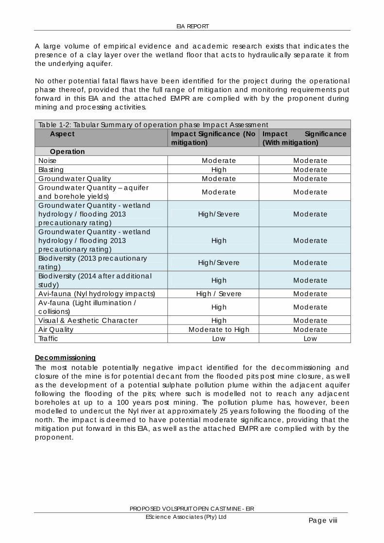
EIA REPORT
PROPOSED VOLSPRUIT OPEN CAST MINE - EIR EScience Associates (Pty) Ltd Page viii
A large volume of empirical evidence and academic research exists that indicates the presence of a clay layer over the wetland floor that acts to hydraulically separate it from the underlying aquifer. No other potential fatal flaws have been identified for the project during the operational phase thereof, provided that the full range of mitigation and monitoring requirements put forward in this EIA and the attached EMPR are complied with by the proponent during mining and processing activities. Table 1-2: Tabular Summary of operation phase Impact Assessment
Aspect Impact Significance (No mitigation)
Impact Significance (With mitigation)
Operation Noise Moderate Moderate Blasting High Moderate Groundwater Quality Moderate Moderate Groundwater Quantity – aquifer and borehole yields) Moderate Moderate
Groundwater Quantity - wetland hydrology / flooding 2013 precautionary rating)
High/Severe Moderate
Groundwater Quantity - wetland hydrology / flooding 2013 precautionary rating)
High Moderate
Biodiversity (2013 precautionary rating) High/Severe Moderate
Biodiversity (2014 after additional study) High Moderate
Avi-fauna (Nyl hydrology impacts) High / Severe Moderate Av-fauna (Light illumination / collisions) High Moderate
Visual & Aesthetic Character High Moderate Air Quality Moderate to High Moderate Traffic Low Low
Decommissioning The most notable potentially negative impact identified for the decommissioning and closure of the mine is for potential decant from the flooded pits post mine closure, as well as the development of a potential sulphate pollution plume within the adjacent aquifer following the flooding of the pits; where such is modelled not to reach any adjacent boreholes at up to a 100 years post mining. The pollution plume has, however, been modelled to undercut the Nyl river at approximately 25 years following the flooding of the north. The impact is deemed to have potential moderate significance, providing that the mitigation put forward in this EIA, as well as the attached EMPR are complied with by the proponent.
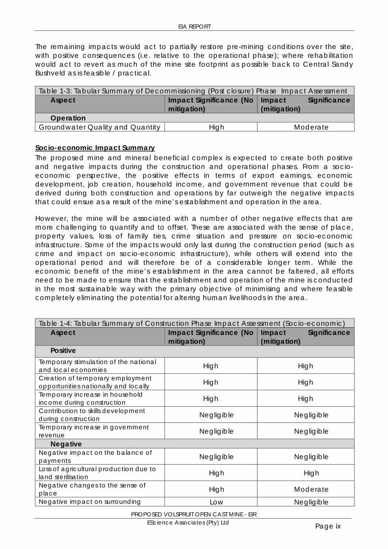
EIA REPORT
PROPOSED VOLSPRUIT OPEN CAST MINE - EIR EScience Associates (Pty) Ltd Page ix
The remaining impacts would act to partially restore pre-mining conditions over the site, with positive consequences (i.e. relative to the operational phase); where rehabilitation would act to revert as much of the mine site footprint as possible back to Central Sandy Bushveld as is feasible / practical. Table 1-3: Tabular Summary of Decommissioning (Post closure) Phase Impact Assessment
Aspect Impact Significance (No mitigation)
Impact Significance (mitigation)
Operation Groundwater Quality and Quantity High Moderate
Socio-economic Impact Summary The proposed mine and mineral beneficial complex is expected to create both positive and negative impacts during the construction and operational phases. From a socio-economic perspective, the positive effects in terms of export earnings, economic development, job creation, household income, and government revenue that could be derived during both construction and operations by far outweigh the negative impacts that could ensue as a result of the mine’s establishment and operation in the area.
However, the mine will be associated with a number of other negative effects that are more challenging to quantify and to offset. These are associated with the sense of place, property values, loss of family ties, crime situation and pressure on socio-economic infrastructure. Some of the impacts would only last during the construction period (such as crime and impact on socio-economic infrastructure), while others will extend into the operational period and will therefore be of a considerable longer term. While the economic benefit of the mine’s establishment in the area cannot be faltered, all efforts need to be made to ensure that the establishment and operation of the mine is conducted in the most sustainable way with the primary objective of minimising and where feasible completely eliminating the potential for altering human livelihoods in the area.
Table 1-4: Tabular Summary of Construction Phase Impact Assessment (Socio-economic)
Aspect Impact Significance (No mitigation)
Impact Significance (mitigation)
Positive Temporary stimulation of the national and local economies High High Creation of temporary employment opportunities nationally and locally High High Temporary increase in household income during construction High High Contribution to skills development during construction Negligible Negligible Temporary increase in government revenue Negligible Negligible
Negative Negative impact on the balance of payments Negligible Negligible Loss of agricultural production due to land sterilisation High High Negative changes to the sense of place High Moderate Negative impact on surrounding Low Negligible
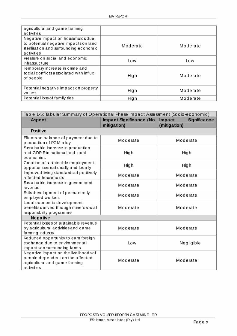
EIA REPORT
PROPOSED VOLSPRUIT OPEN CAST MINE - EIR EScience Associates (Pty) Ltd Page x
agricultural and game farming activities Negative impact on households due to potential negative impacts on land sterilisation and surrounding economic activities
Moderate Moderate
Pressure on social and economic infrastructure Low Low Temporary increase in crime and social conflicts associated with influx of people
High Moderate
Potential negative impact on property values High Moderate Potential loss of family ties High Moderate
Table 1-5: Tabular Summary of Operational Phase Impact Assessment (Socio-economic)
Aspect Impact Significance (No mitigation)
Impact Significance (mitigation)
Positive Effects on balance of payment due to production of PGM alloy Moderate Moderate Sustainable increase in production and GDP-R in national and local economies
High High
Creation of sustainable employment opportunities nationally and locally High High Improved living standards of positively affected households Moderate Moderate Sustainable increase in government revenue Moderate Moderate Skills development of permanently employed workers Moderate Moderate Local economic development benefits derived through mine’s social responsibility programme
Moderate Moderate
Negative Potential losses of sustainable revenue by agricultural activities and game farming industry
Moderate Moderate
Reduced opportunity to earn foreign exchange due to environmental impacts on surrounding farms
Low Negligible
Negative impact on the livelihoods of people dependent on the affected agricultural and game farming activities
Moderate Moderate

EIA REPORT
PROPOSED VOLSPRUIT OPEN CAST MINE - EIR EScience Associates (Pty) Ltd Page xi
SUMMARY OF CONSIDERATIONS The potential socio-economic benefits of the proposed project have been demonstrated to be significant; where the positive effects in terms of export earnings, economic development, job creation, household income, and government revenue that could be derived during both construction and operations are deemed by a socio-economic specialist to outweigh the potentially negative socio-economic impacts that could ensue as a result of the mine’s establishment and operation in the Mokopane area. The need and desirability of the project has further been demonstrated, in terms of inter alia the alignment thereof with the following development growth plans, policies and strategies:
New Growth Path; IPAP 2011/2012-2013/2014; Industrial Development Corporation (IDC) and Development Bank of South Africa
(DBSA) financing plans; Mineral Beneficiation Strategy for South Africa; Limpopo Economic Development Plan; Waterberg LED; and Waterberg Mining Strategy.
A project of this nature cannot, however, be motivated solely on socio-economic grounds alone, and needs to take due consideration of the potentially negative environmental impacts that may result from the project in order for defensible, sustainable, decision-making to occur at the hand of the respective competent authorities. In this regard, the following points are noteworthy for decision-makers: The farms on which the proposed Volspruit Mine fall (i.e. the Farms Volspruit and
Zoetveld) are located in Zones one 1 and 10 of the Waterberg environmental management framework (EMF).
The EMF describes Zone 1 as an area where “Protection of natural vegetation, scenic landscape and rock painting areas, with limited appropriate tourism” should exist, and Zone 10 as: “Agriculture areas with commercial focus”. The EMF goes further to list ‘undesirable activities’ for each zone, as described above, where mining is listed as an ‘undesirable activity’ in both Zone 1 and Zone 10.
When discussing undesirable activities the EMF does state the following: “It does not however mean that undesired activities for example will not be allowed under any circumstances but rather that such activities will have to meet very high standards and be considered very carefully by the relevant competent authorities before they are allowed”
The EIA process followed addresses the extreme standards to which the mine will need to perform specifically with respect to managing impact to water including grouting and pollution control system performance.
The Waterberg District Municipality SDF, 2009 states that: “While mining is recognised as
a pillar of the local economic base and key job provider, the long term impact thereof should be carefully considered. Current indications are that with the exception of one or two protected areas there is no direct conflict between mining and prospective mining activities and the major tourism and conservation areas in the municipality”. The preceding statement clearly indicates that mining is recognised in the SDF as an
economic pillar, however, the impact thereof should be carefully considered. The EIA process followed has indeed sought to better understand and quantify these

EIA REPORT
PROPOSED VOLSPRUIT OPEN CAST MINE - EIR EScience Associates (Pty) Ltd Page xii
potential impacts through a series of linked models as the EIA process has highlighted that issues relating to water supply and wetland integrity and protection demanded detailed analysis careful consideration.
The Mogalakwena SDF (2009) states that: “The increasingly important role of mining in
the local economy is recognised by the Council. However, mining is driven by international commodity prices and economic conditions. The Council will therefore support the mining sector in terms of land and services availability but in such a way that it does not take on responsibilities in terms of business risks of the mines”. The Mogalakwena SDF contains various sections on water; Land use; biospheres etc.
and one of the sections in the SDF described ‘Environmental Features’. These features are described as follows: “The environmental features of the municipal area are dominated by the river (Nyl) and specifically the river buffer along it… River buffers are ecologically important for the protection of ecosystems and should, therefore, be avoided and not disturbed through development. In this respect, river buffers should be protected”.
Significant efforts have been made with the siting of infrastructure and development of pollution control systems to ensure the Nyl River is protected.
Although mining is recognised as an important economic activity locally, regionally and nationally, the potential impacts thereof in appropriate mining activity is pertinently cautioned against and accordingly the sensitive components of the receiving environment need to be well understood before allowing informed decision-making around mining applications. Importantly, the presence of the Nyl River and its ecological importance in the region is recognised in the aforementioned frameworks and thus need to be addressed to consider whether a project can operate within the framework of the above guidelines. In this respect the framework within which decision making need to place need to consider that: The Nysvlei wetland system and associated wetland/aquatic habitat it offers [including
the Nylsvley Nature Reserve in the upper reaches thereof (a Ramsar site)], a section of which traverses immediately west of the proposed mining operations, is deemed by ecological and avi-faunal specialist to be highly sensitive to potential disturbances from the proposed mining activities.
Accordingly the potential impacts of mining on this sensitive habitat that formed a key focus of the EIA and the EIA, furthermore assessed the potential environmental impacts of the project across all relevant environmental aspects and over the full project life cycle, with the attached EMPR documenting the mitigation and monitoring measures required to ensure that such impacts are reduced to within acceptable levels of significance.
The EIA finds none of the environmental impacts identified are deemed to be of such significance that they constitute a fatal flaw to the project (when adequate mitigation measures are implemented).
EIA REPORT
PROPOSED VOLSPRUIT OPEN CAST MINE - EIR EScience Associates (Pty) Ltd Page xiii
BACKGROUND TO CONSIDERATION Given the sensitive nature of the receiving environment within which the mine is proposed, as well as the complexity of the associated hydrological regime associated therewith, a cautionary approach was taken the preliminary EIA issued found that there was inadequate information for authorities to make an informed and defensible decision and recommended that additional work be undertaken to address uncertainty around the prediction of impacts relating to dewatering and potential disruption of flood dynamic and wetland habitat. The preliminary EIA further made the recommendation that no decision-making in respect of this project should be undertaken by competent authorities until such time as specialist investigations have been undertaken so as to allow predictions about the impact of mine related aquifer dewatering with adequate certainty, and until the findings of such studies have been integrated into an updated EMPR and EIA. It is the view of the EAP that the work undertaken to address uncertainty around the prediction of impacts relating to dewatering and potential disruption of flood dynamic and wetland habitat allows the prediction of impacts relating to dewatering and potential disruption of flood dynamic and wetland habitat with adequate certainty to make a defensible decision as the links between surface flood events, groundwater and mine water consumption are understood on various scales ranging from the level of the Nyl catchment A61, to the quaternary catchment A61E and its sub-catchment A61E2 corresponding with the
groundwater modelling domain; to pit dewatering models and dynamic water balances The refinement of conceptual understanding of the clay layer associated with the nyl wetland as well as the development of integrated hydrological models and their verification against hydrograph data alongside the refinement of groundwater models and their coupling has provided a clear understanding of the links between aquifers and surface flows and the extent of separation between floods the underlying aquifer. Furthermore, catchment hydrological models have successfully been linked with groundwater models and catchment water balances, the output of which in turn have been linked with mine drainage models and dynamic water balances. RECOMMENDATION ON PROJECT PROPOSAL The preliminary EIA indicated that approval is only to be considered by competent authorities if separation of the Nylsvlei wetland from the underlying aquifer is found to be such that the function of the wetland is not destroyed or disrupted through the interruption of the flood dynamic through aquifer dewatering. The EIA process followed has concluded that the proposed mine will not destroy the wetland or disrupt it through aquifer dewatering and limited additional water demands can be accommodated by the system, however it is noted that the system is already under significant pressure. The EAP accordingly recommends that the respective applications be viewed favourably subject to certain key requirements being fulfilled most importantly that water use would need to be minimised and water conservation would need to be optimised. In this respect the WULA application process should seek to identify opportunities to save water not only at the mine but also in the study domain (the A61E2 catchment/ groundwater modelling
EIA REPORT
PROPOSED VOLSPRUIT OPEN CAST MINE - EIR EScience Associates (Pty) Ltd Page xiv
domain). Considering that agriculture uses approximately 6Mm3/a opportunities must exist where the proposed mine can seek to further water conservation practises within the agricultural community that is proposed to receive it.
Further work that should be undertaken before mining is to commence In a study with such complexity, an investigation more often than not highlights aspects of interaction between environmental systems to adequately cater for the management during the design of a potential mine. The following follow-up work around surface and groundwater management is recommended before mining may commence:
Establishment of a Volpsruit /Mokopane Chapter of the Mogalakwena Water Users Association Water Forum with representation from conservation, agriculture, and local authority, amongst others; the funding of the water forum administration to be carried by the applicant (Volspruit Water Forum).
The establishment of an Environmental Control Officer team comprised of at least three independent specialist competent by training education and experience with backgrounds in groundwater, wetland management and mining environmental management that will audit the project on a quarterly basis against the EMPR, IWWMP, EIA Authorisation, Atmospheric Emission License and Waste Management license during construction at least on a 2 monthly basis and during operational phase at least on a six monthly basis and reporting to DMR, LEDET, DWA, Volspruit Water Forum and Environmental Monitoring Committee if such an entity is formed by I&APs
A detailed hydrocensus of boreholes within modelled cone of depression utilising the cone of depression as modelled in steady state (a wider area surveyed as precautionary measure). All boreholes utilised for groundwater production by Volpsruit mine as well as those of farmers on neighbouring farms that irrigate crops should have electronic level measurement equipment installed so as to allow for more holistic aquifer management to be undertaken by all water users through the Volspruit Water Forum
Access to water abstraction rates and groundwater levels of existing boreholes located within pits and neighbouring properties to be secured through Volspruit Water Forum;
Improved knowledge of the variation of hydraulic conductivity with depth is needed, and several additional packer tests are recommended to enable grouting design; and
Additional shallow boreholes must be drilled along the Nyl identified by the clay layer investigation as an area of potential decant where flooding may recharge aquifer (depending depth and period of inundation) so as to further improve knowledge of surface water/groundwater interaction and connectivity.
Further groundwater and dynamic water balance modelling from which detailed design of all water pollution control infrastructure including grouting can be designed and mine water management programmes are to be developed.
Further attention also needs to be given to the closure plan (at the end of the lifespan of the proposed mine) of specifically the northern pit as a unique opportunity would then exist to create additional suitable habitat and expand the existing wetland habitat. The
EIA REPORT
PROPOSED VOLSPRUIT OPEN CAST MINE - EIR EScience Associates (Pty) Ltd Page xv
following follow-up work around mine closure is recommended before mining may commence:
The closure landscape should be designed and constructed so as to create a mosaic of habitats that closely approximate the Nyl River habitats including riverine floodplains, flooded basins, seasonally flooded grassland, groundwater fed woodland savannah and open savannah with open shallow shoreline to reed fringed open water and refuge areas such as islands with tall dead trees.
Avifaunal and wetland biodiversity monitoring at quarterly intervals to determine a comprehensive pre-mining baseline form which mining impact can be measured and from which further mitigation measures
Key recommendations as key conditions for authorisation
1. The mine will establish a ‘precautionary environmental buffer zone’ of at least 110m
in extent from the delineated eastern edge of the Nyl wetland into the proposed North pit (as shown in the sequential mining diagram in Appendix 8.1); although this buffer may be considered for extraction in a final ‘cut-back’ in the north pit, any opencast mining within this buffer will be made conditional to an EMPR amendment and application for exemption from NWA Reg. GN704 for approval by DMR and DWA respectively. The mining of the ore body that falls within the buffer area (i.e. the western extremities of the north pit) must be done at the end of the north pit life, when adequate understanding of the ore body and mining impacts has been gained from inter alia: a) Comprehensive ground- and surface water monitoring prior to establishment of,
and during the operational life of mine; b) A geo-technical pit wall failure risk assessment for the final pit wall position within
the buffer, based on detailed pit design; and This buffer aims to provide a margin of safety with respect to potential groundwater flood induced pit wall instability along the north pit perimeter in close proximity to the Nyl River and its associated floodplain wetland. If a grouted ‘curtain’ is constructed in weak material e.g. (soil, or weathered rock) around an opencast pit (as is understood to be the case at Volspruit, with such material extending to approximately 30m below surface), it can lead to geotechnical instability unless a suitable barrier is left between the ‘curtain’ and the edge of the pit wall. The width of such a barrier/cut-back depends on the thickness and properties of
the material in which it has been created. For weathered rock, the width of the barrier should typically be at least twice its
thickness (hence the 2 X 30m = 60m buffer proposed as a precaution). Although surface floods will not affect the pit as a result of the flood protection berm, although seen as unlikely, a rapid rise in groundwater levels associated with a flood event may affect pit wall stability and due to the sensitivity of the adjacent wetland the buffer is proposed as a precautionary measure.
2. Further attention also needs to be given to the water management and closure plan of the mine as part of IWWMP:
EIA REPORT
PROPOSED VOLSPRUIT OPEN CAST MINE - EIR EScience Associates (Pty) Ltd Page xvi
Post-mining, water levels will return to normal levels and groundwater abstraction within mine in general should be managed and in North Pit specifically should limited terminated to achieve a groundwater dynamic with little more than natural seasonal fluctuation, this will allow the establishment of a mosaic of habitat types such that bird species under pressure may be optimally provided with refuge feeding and breeding habitat.
The viability of establishing and maintaining the desired habitats under the hydrological regime likely to occur with the ‘open water body’ should also be assessed in detail, specifically:
Water levels that are likely to fluctuate by several meters and the implications thereof on establishing and maintaining a vegetated shoreline abstraction should be limited with the possible exception of limited abstraction for human use or as part of water quality management measures within the mined-out pit
Expected water quality within the ‘open water body’. In this regard the threat of excessive algal growth due to potentially high background nitrate levels within groundwater needs to be assessed.
It is proposed that this land use or similar mix of extensive agricultural and conservation also be adopted as the final end land use and be stipulated as a condition of approval.
3. A number of water management scenarios have been identified and modelled in
the dynamic water balance and it was established that the mine will initially be a producer of excess water, a number of options have been identified for management of excess water: Base Case (Conservative inflows to the pit areas (grouted, no faults –
conservative water take) utilising Grassvally as buffer (both sourcing and recharging – with sourcing at sustainable yield levels as identified in Grassvally WULA) with irrigation of excess water to farmers apply (irrigation stepped to provide constant supply)
Base case with 20% saving on TSF seepage water losses Base case with no irrigation and all excess water recharged to Grassvally The scenarios should be further investigated alongside closure planning for the North Pit and report to Volspruit /Mokopnae Water Forum and I&APs so as to form the basis for IWWMP and WULA It is recommended that the mine should achieve 20% saving on TSF seepage
water losses (this may be through optimal combination of tailings cut-off trench, herringbone drain, seepage recovery well field and thickened talings disposal)
It is recommended that excess water irrigated to croplands Subject to the approval thereof by the Department of Water Affairs through the WULA process) in the area, to the extent that surplus water dewatered from the pits beyond their own process water requirements allows them to do so sustainably with a targeted saving of 20% of tailings seepage losses to be recovered as per Dynamic Water Balance; and
4. The proponent must comply with all mitigation and monitoring measures put forward
in this EIA, as well as the attached environmental management programme report (EMPR);
EIA REPORT
PROPOSED VOLSPRUIT OPEN CAST MINE - EIR EScience Associates (Pty) Ltd Page xvii
5. The proponent must comply with any additional conditions of authorisation / approval by the respective competent authorities, and other reasonable measures that may be stipulated by authorities that have jurisdiction in matters relevant to this application and update the EMPR accordingly.
1
Dear Stakeholder
BY EMAIL/ FAX/ REGISTERED POST: 14 JANUARY 2014
RE: EIA – Proposed Establishment of an Open Cast PGM Mine
on the farm Volspruit 326 KR and the farm Zoetveld 294 KR,
Mokopane District, Limpopo Province
DMR Ref No LP30/5/1/2/2/10068 MR
LEDET EIA Ref No: 12/1/9/2-W11
DEA waste licence Ref No: 12/9/11/L582/5
Dear Sir/Madam,
The purpose of this letter is to inform you that the EIA for the
above mentioned application is now available for public
comment.
Project History Sylvania has previously applied, in terms of the MPRDA
(application ref no LP30/5/1/2/2/10016MR), for the
establishment of a mine on the Farms Volspruit and
Zoetveld.
As a result of the complexity of additional work required,
and the lack of a flood event occurring within the
constraints of the MPRDA EIA timeframes, the EIA process
could not be concluded to the extent that an informed
and defensible decision could be recommended by the
EAP and specialists in terms of the MPRDA Application Ref
No LP30/5/1/2/2/10016MR within required timeframes.
Although both the proponent and EAP sought to obtain
extension in terms of MPRDA application ref no
LP30/5/1/2/2/10016MR, as a result of the restrictive
provisions of the MPRDA EIA Regulations the DMR could
only allow extension to the 4th of May 2013, as a result of
the lack of a flood materialising in this restricted period as
and the complex nature of the additional work that had to
be undertaken, the work required to be able to make an
informed decision, could not be completed within the
timeframes as stipulated by the MPRDA.
The proponent thus had to reapply in terms of the MPRDA
Regulations and a new updated Scoping report was issued
in terms of DMR Ref No LP30/5/1/2/2/10068 MR and
additional specialist work undertaken.
ESCIENCE
ASSOCIATES
(PTY) LTD
POSTAL
ADDRESS:
PO Box 2950
Saxonwold
2132
PHYSICAL
ADDRESS:
9 Victoria Street
Oaklands
Johannesburg
2192
TEL:
+27 11 728 2683
FAX:
+27 86 610 6703
WEBSITE:
www.escience.co.za
E-MAIL:
R No 2009/014472/07
2
EIA report and comment period
This EIA report will be available for comment for a period of 30 days, from Tuesday 14
January 2014 to 14 February 2014.
Please find attached executive summary of the EIA.
The EIA is available via both dropbox and EScience website links. These links are
displayed at the bottom of this email.
Hard copies of the EIA document can be viewed at:
1. Mokopane Public Library (contact Tel: (015) 491 9729 Refilwe Madisha)
2. Mookgopong Municipal Offices (contact Tel: (014) 743 6600, Lindi Khwinana
082 739 6025, Herman Sebata 076 051 2467)
3. Mokgalkwena Municipal Offices (contact Tel: (015) 491 9604 S W Kekana)
4. Kanniedood Guesthouse (Tinie Koekemoer 082 859 3765)
Further opportunity for engagement exists through attending the following meetings:
Meeting: Public meeting Mokopane
Date: 23de January 2014
Time: 10 am
Place: Mokopane Protea Hotel
Meeting: Public meeting Mookgopong
Date: 24th January 2014
Time: 10 am
Place: De Beer Huis, Mookgopong
Proposed EIA timeline including key stakeholder and authority
engagement
key dates
Process Phase Details Estimated Date
EIA EIA and EMP report issued to IAP’s for comment 14 January 2014
EIA Public meetings 23-24 January 2014
EIA EIA report issued to the DMR 28 January 2014
EIA EIA and EMPR comments period closed for
submission to the DMR 14 February 2014
EIA Comments and response report updated and
submitted to the DMR 22 February 2014
EIA EIA and EMP comment period closed for submission
to LEDET 13 March 2014

3
EIA Comments and responses report updated and
submitted to LEDET 21 March 2014
Please Note that the DMR stipulations require the EAP is to conduct the EIA and
finalise the EMP, on or before, the 28th of January 2014.
Please direct any comments, or requests for information, regarding the proposed
development to the below listed contact person.
Contact person:
Miss Fiona Preston-Whyte
EScience Associates (Pty) Ltd
E-mail: [email protected]
Web: www.escience.co.za
PO Box 2950, Saxonwold, 2132
9 Victoria Street, Oaklands, Johannesburg, 2192
Tel: +27 11 718 6380
Fax: 086 610 6703
Please do not hesitate to contact me should you require further information.
Kind regards
Theo Fischer
EScience Associates (Pty) Ltd
E-mail: [email protected]
Web: www.escience.co.za
PO Box 2950, Saxonwold, 2132
9 Victoria Street, Oaklands, Johannesburg, 2192
Cell: +27 82 336 2729
Tel: +27 11 718 6380
Fax: 086 610 6703
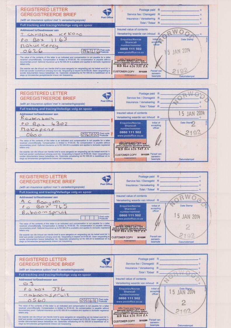
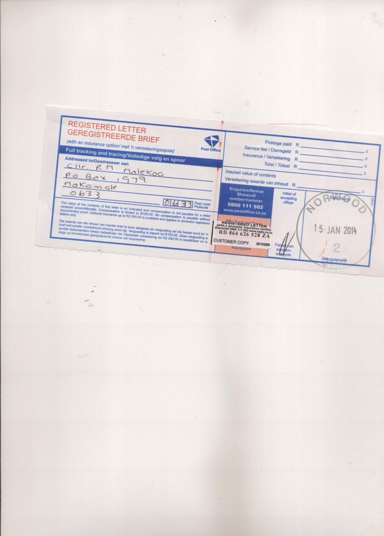


Appendix 4.11.2 Meeting Minutes

SRVM
Meeting minutes
24 January 2014
Public Participation meeting
in relation to the proposed Volspruit Opencast PGM Mine EIA
De Beer Huis, Mookgopong
Attendees:
See attached attendance register
Minutes
Facilitator – welcome
Agenda:
Overview
Visual presentation
Water presentations together (followed by questions)
Lunch
Overview of the EIA findings and the EIA report presentation
Open session of questions
Facilitator mentions the use of the recorder – to help the capturing of the meeting onto the minutes.
Question from a member of the audience - Regarding language, can we speak in Afrikaans?
Facilitator- regarding Afrikaans. The presentations are in English, if you answer in Afrikaans that is
fine. I will translate for the minute takers; the answers will be in English.
Question from a member of the audience – Can we ask all the presenters to look at us not at the
screen, I was at the meeting yesterday, we can’t always hear. I battled yesterday.
Facilitator – Presenters please also raise your voices. (Shows a signal that the audience can use for
upping the volume). Minutes will be distributed to everyone. In word version, you are then welcome
to use track changes for the team to edit and finalise.
………..Presentation by Theo Fisher………………………………………………………………………………………………………
Summary of presentation – see slides:
Aim: Brief overview of the project and locality of the mine.
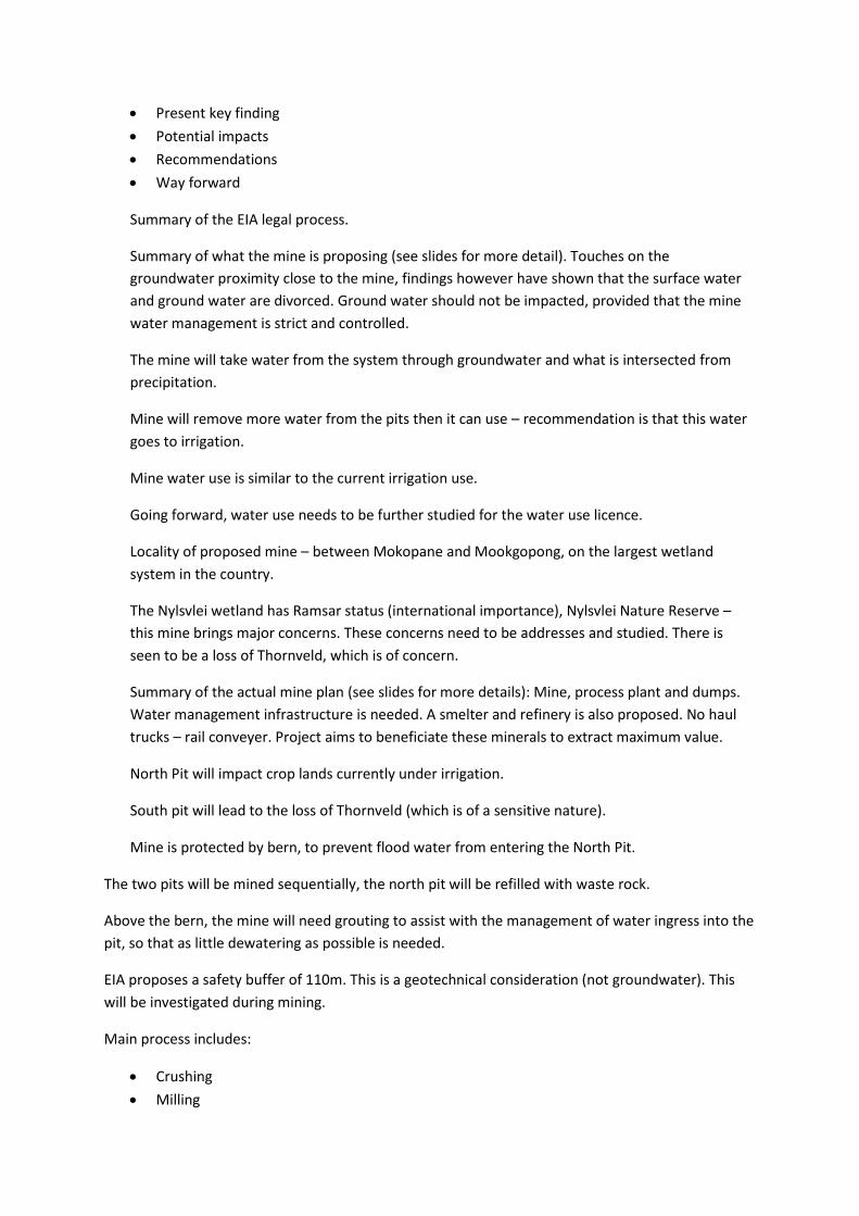
Present key finding
Potential impacts
Recommendations
Way forward
Summary of the EIA legal process.
Summary of what the mine is proposing (see slides for more detail). Touches on the
groundwater proximity close to the mine, findings however have shown that the surface water
and ground water are divorced. Ground water should not be impacted, provided that the mine
water management is strict and controlled.
The mine will take water from the system through groundwater and what is intersected from
precipitation.
Mine will remove more water from the pits then it can use – recommendation is that this water
goes to irrigation.
Mine water use is similar to the current irrigation use.
Going forward, water use needs to be further studied for the water use licence.
Locality of proposed mine – between Mokopane and Mookgopong, on the largest wetland
system in the country.
The Nylsvlei wetland has Ramsar status (international importance), Nylsvlei Nature Reserve –
this mine brings major concerns. These concerns need to be addresses and studied. There is
seen to be a loss of Thornveld, which is of concern.
Summary of the actual mine plan (see slides for more details): Mine, process plant and dumps.
Water management infrastructure is needed. A smelter and refinery is also proposed. No haul
trucks – rail conveyer. Project aims to beneficiate these minerals to extract maximum value.
North Pit will impact crop lands currently under irrigation.
South pit will lead to the loss of Thornveld (which is of a sensitive nature).
Mine is protected by bern, to prevent flood water from entering the North Pit.
The two pits will be mined sequentially, the north pit will be refilled with waste rock.
Above the bern, the mine will need grouting to assist with the management of water ingress into the
pit, so that as little dewatering as possible is needed.
EIA proposes a safety buffer of 110m. This is a geotechnical consideration (not groundwater). This
will be investigated during mining.
Main process includes:
Crushing
Milling
Floatation
Major issue is the generation of tailings.
Smelter complex – ore will be roasted. SO2 will be produced. This needs to be managed.
The entire mine (and processing) will be close to the Nyl River, it needs to be contained, runoff from
tailings will be high in salts, and therefore contaminated water will need to be captured in a series of
water pollution dams.
Elements of cultural heritage – palaeo-archeologically, archeologically, cultural and historical
artefact studys. There are stone tools and graves on the site. There are guidelines over how this
should be managed.
………………………………………………………………………..
Presentation: Visual Presentation Kotie Geldenhuys
Aim: Visual assessment for the proposed mine.
Process that was followed: photo’s where taken of the site. Visual points where determined. A View
Sheet Analysis including number of people and the impact on those people. This study looked at the
development with the design of the placement of the development taking into account visual
impact.
The sense of place is beautiful. Looked at physical characterises of the landfall. Substantial variation
in topography – adds to scenic value.
Vegetation was looked at in August 2011 (dry and tan) and May 2012 (very green); there is a
substantial variation in colour throughout the year.
Agriculture contributes to the visual aspects of the area.
The presence of water contributes to scenic quality – this is present during times of flood.
Scarcity of the biome/topography is also a role in this assessment. The area is unique, but the biome
is not scarce.
Grassvally mine does negatively affect the areas sense of place.
40% is a very substantial scenic quality, it counts as moderate.
Sensitive captures on the N1, N11 and Silverwood Road. The predominate viewers on the N1 (a
substantial number).
(Shows plan of development).
(Shows a 3D model of the plant).
Stack – 30m (10 story building).
View sheet analysis – this is a computer based analysis looking at the areas from which the
development would be visible.
(See slides for details on vantage points).
Shows pictures (from each visual site) simulated how the human eye will see from each site. Shows
pictures which show 140 degrees. Shows colour with central vision, and monochrome as it becomes
peripheral vision. Also 50mm picture is shown (typical camera portion). Also shows the night visions.
(A lot of audience murmuring during the showing of pictures).
The development is often screened by trees in the foreground. However, a number of sites where a
substantial amount of the development will be seen as well.
(The presenter was asked to speak up a number of times during the presentation).
The bern has been proposed to shield the birds from the development and activities.
To accommodate vantage points that haven’t been taken into account, a fly around has been
created.
Conclusions:
The area has a 40% existing scenic value –moderate.
Contrast 83% - high contrast between pre and post development of the proposed site. So this site is
not complementary to the environment.
Also the height and site of the development means that it is very visible.
Moderate visual change, this is due to the distance of the viewers from the site and the trees that
help to shield the development from view
(Shows fly through)
1 km away from site, 10m about ground level
5 km away from site, 10m about ground level
10 km away from site, 10m about ground level
Question from a member of the audience - When you talk about tailing. What are tailings?
Theo Fischer - Most precious metals are found in low concentration. Tailing is rock that has been
crushed and milled. After it has been milled very finely there is sand that remains and that sand is
mixed with water and pumped to the tailings.
Question from a member of the audience - What are those? Are those dumps?
Theo Fischer - Yes those are dumps, very fine dust, which remains after the processing.
Question from a member of the audience - If I may help? It’s a Slack dam.
Theo Fischer - Yes it’s a slack dam

Question from a member of the audience - Are you actually flying? Is it a camera or computer used
for the fly-bys?
Kotie Geldenhuys - No it’s a computer simulation.
Question from a member of the audience - Where’s the flood line of the Nyl?
It’s out of sight, play again (the fly by gets played again). The 100 year flood line intercepts the North
pit (shows on map). Have placed the infrastructure away from the 100 year flood line. Infrastructure
would be after the road.
………………………….end of presentation…………………………………………………………………………………………….
Visual impact questions:
Joseph Attard – Bird Club of Mookgopong - Power line, I presume that the power lines are lower
than the stack? What is the height of the power lines? Will there be additional power lines on site?
Theo Fischer – Power supply would be an existing power supply from Grassvally. I need to confirm
this but I suspect that there would need a new line. How high I don’t know. Not a transmission line,
but a distribution line. You may refer to the avifauna study for recommendations on this.
…………
Benny (Question in Afrikaans) - Concern is that the road that the local farmers use to get to town,
which passes the activities of the mine. There is concern that their visual impact will be high as they
pass it every day. I feel that that has been left out of the visual impact.
Kotie Geldenhuys - This question was also raised on Tuesday. Not true. We have looked at the view
sheet analysis. Most places in the south (where the farms are) – the trees and topography ensure
that the proposed mine is not really seen from this road. Point three covers this area. Point three is
from the road, driving under railway, and past mine - it is very much visible here and has been
extensively analysed. This is covered in detail in the report. I have taken into account regular use of
the road. From all areas the views has been simulated in some way.
………
Mr Barnard – I have a problem, Lots of tests have been done but has a wind study been done or
looked at to see the prevailing wind direction? In terms of a fire/pollution/gas, how far and who
would be impacted? If the wind goes to Potgietersrus there are problems. This pollution would
affect birds. Also, what is the pollution from the smelters and refinery?
Theo Fischer – To confirm, an air quality impact assessment has been done. I am not presenting this
today. The dominate wind direction was given for Mokopane, which is from north to the south down
the valley. Though the wind at Mokopane is not the same as at the south (where the mine is), due to
topographic features, but yes, it’s from the north to the south.
With regards to impacts, we have modelled the SO2 limits, these results are within the legal limits.
It’s not as simple as where it will blow, when the wind blows hard it disperses the gas, allowing for a

lower concentration over a greater area, when the wind doesn’t blow is the problem and then the
gas settles, forming a concentrated plume.
The wind blows from the north roughly to the south. We did not investigate wind here
(Mookgopong). Pollution emitted over there (at the mine) will be marginal by the time it arrives here
(Mookgopong).
Joseph Attard – Bird Club of Mookgopong - A clarification question - The smelter isn’t there yet. Is
this a simulation of a smelter? How realistic is this? Is this information taken from another smelter?
Facilitator – repeat question
Theo Fischer – yes, it is a model developed by the Calpuff model (developed by the US
environmental agency)– state of the art in terms of air quality impact. It is used to calculate impacts
both from proposed and existing plants. This model is fed with key ingredients, namely:
Accurate topography
Accurate meteorology
Accurate emissions of the plant (this is key – if you fudge these emissions you fudge the
model).
Two scenarios were given – SO2 is scrubbed with a scrubber, used legal performance limit. However,
the plant will now capture the SO2 and make it into sulphuric acid (significant environmental
advantages).
Facilitator – so the model uses correct data, based on plants that are exactly the same?
Theo Fischer - Yes, this on the screen is a plant that scrubs SO2 to the legal limit. In this instance the
plant has been further refined. The plan is to capture the SO2 and use it in a sulphuric acid
production plant which sounds dangerous but it is environmentally beneficial. Provided plant
operates within legal operation limits then the impacts will be limited and will be well within
ambient air quality standards. Utilises technology available of the shelf and abatement that the mine
will, must, shall implement.
………………………….
Mr Booysens -
1) I want to know what the eventual size of the slimes dam and waste rock (height and width) will
be?
2) Where will u get 4.5 mega litres of water per day (Facilitator parking this question as it will be
answered in the next presentations).
3) We had a geologist here from UCT (about a year ago) he proposed that though the surface water
is running towards the sea, the underground water runs back into Nylsvlei, can you comment on
this?( Facilitator parking this question to be answered in the next presentations).
4) You are saying that the employees are not our problem. Whose problem is it? Who is then
responsible for the employees? A lot of those people will come from outside this area. Workers and

housing comment – you say they should live in their own town – but many come from outside – how
will you deal with that?
Theo Fischer
1) Size - 50 hectares and 45 m in height (waste rock). 97 hectares and 40m in height (tailings dam).
Comment by – Mr Booysens – this raises my level of concern.
Theo Fischer – Let me discuss the social issue. The mine is not going to build houses on the site, it
doesn’t want a Marikane. The mine will provide a transport and housing allowance. Workers will
need to rent/buy in town. Mine has purchased significant land around the area, they want to
produce venison. This surrounding land will not lie empty or be available for squatting. The mine will
remove squatters from their land. The mine has indicated that they would prefer local community
to work on the mine and take part in the social labour plan.
Question from a member of the audience – My question is that who provided permission for this
project to go ahead, in an internationally recognised heritage site and nature reserve? Who gave
permission?
Question from a member of the audience -Can we please keep these questions relevant in the area
in terms of the agenda. Can we come back to this?
Facilitator – Agreed.
………………………………………………………………………..
Presentation: Ground Water Presentation –Giep du Toit
From Geo Pollution technologies – independent of both the mine and Escience.
See presentation for details on what was presented.
Definition given (not in slides): Hydro conductivity is the ease to which the water moves through the
subsurface.
Based on all the investigations we predicted what the impact of the proposed mine would be on the
groundwater model. We built a groundwater model, from which we predicted the draw down cone
of the proposed model.
We included the Zebedeila Fault (and Magogo Fault) in this investigation.
(Shows pie diagrams showing the quality of the ground water) size of pie equates to the amounts of
solids in water, size of slice, portion of a specific chemical.
In this area, the water quality is very good, except for nitrates, which is high in areas under irrigation
(still within legal/health limits).
Boreholes that were drilled (with in the proposed pit areas) were determined by the geohydrology
surveys. From these boreholes, the water movement for the model (maximum, average and
minimum) was gained.
Shows the zone of impact with the mean value of hydro conductivity. This zone of impact is the cone
of depression, from the top. Cut off point is 5m. Outside line shows the area where the ground
water would drop by 5m. The Nyl Wetland in this area will be undercut by 10-20m.
(Draws on board).
No matter how big or small the hydro conductivity is that is used – the draw down cone will still
undercut the wetland.
The problem lies in the north pit.
Graph shows what the mine will need to pump out of the pit with time. At the beginning the impact
on the river will be small (this gives us a testing period – this is my recommendation). This impact
increases, as the pit gets bigger and closer to the river.
Concern – the mine is lowering the groundwater below the river.
3 types of rivers:
1) Gaining river- Ground water enters the river
2) Losing river -Water flows to the ground water
3) Divorced river – Ground water is below river with little connection between the two
We discovered that the Nyl River is a divorced system – in this specific spot.
Next presentation will say why there is this separation between the surface and ground water.
The area already has over extraction – the groundwater is currently decreasing due to over
extraction.
Sulphates are very low in the rock in the north and south pit, so acid mine drainage is not a problem
at this proposed mine. The problem is the effect of the Nyl and the wetland – that is the problem to
concentrate on.
We recommend that monitoring continues.
…………………………….end of presentation…………………………………………………………………………………..
Presentation: Clay layer Presentation –Mr Theo Fischer
This presentation is presented on behalf of Professor Claassens.
Extensive soil survey, concentrating on the river bed: What will happen to surface flows when the
mine extracts ground water?
Specifically relevant soils:
Rensburg
Arcadia (doesn’t have a g-horizon) - permanently wet
Shortland – very permeable

(Show some of the images of transects of soil profiles dug within the Nyl River).
The Nyl River has a very thick clay layer. On the margin, the Nyl River has a shallow layer of clay soils.
There appears to be water flowing into the river from the West.
Conclusion – the river is underlined by very thick clays which are almost impenetrable. However,
there are areas with a lesser clay layer – in this area; water might leave the surface to the ground
during a flood event. There’s potential of about 6 hectares where water could flow from the surface
water into the ground water. This is not an insufficient number.
Conclusion – The Nyl River, in this lower catchment is divorced from the ground water except in the
peripheral areas of this river.
The mine will aggregate the over extraction of ground water. But, we don’t think that the mine will
affect the surface water flow, we don’t think it will change the system significantly.
…………………………….end of presentation…………………………………………………………………………………..
Presentation: Mine Water Dynamic Model –Mr Theo Fischer
Water needs to be pumped out of the pit to allow for the pit to be mined.
All infrastructure of the mine is linked to different water storage areas with different levels of
contamination.
Grassvally is proposed to be used as a store of water and a source of water. Water from pits will not
be at a constant rate, nor will the demands of the water from the mine be the same throughout the
mines life.
Excess water will provided water for irrigation (not a constant supply).
Integrated study model – Mr Theo Fischer
Finding of this study where reviewed by Dr Pitman, who originally created the model.
Key issue – What is the current water consumption in the Nyl catchment?
What information was used? – Department of Water Affairs register and own calculations regarding
irrigation (using area covered by crops, types of crops and amount of water required by such crops).
The model can successfully model when a flood event occurred.
The majority of the flood is generated upstream.
The system has already lost water that would normally be utilised by plants. So plants are already
affected. If the mine extracts 2 mega cubic meters per annum (worst case scenario), the flood would
be reduced. Additionally the plants will be further affected (by not reaching the ground water). The
mine will affect the surface flow downstream.
There is an imbalance between what water is registered for use and what is used by irrigation
(according to calculations).
The mine has committed in statements that it will try to optimise its water use.
……………………………….end of presentation……………………………….
Covering questions asked beforehand (parked till now):
Facilitator - What direction does the groundwater flow?
Giep du Toit – Groundwater will always flow from a high elevation to a low elevation. I have the
ground water flows. In the studies domain, the Nyl River flows in the same direction as the surface
water.
Facilitator -How much water does the mine use? What is the amount on the application for water
use?
Theo Fischer – The mine is applying for 3.5 mega litres per day, this includes water being passed on
for irrigation. Comes from 3 sources:
Pit dewatering
Precipitation capture
Grassvally mine
……………………………………………………………………………………………………………………………………………………………
Lunch
…………………………………………………………………………………………………………………………………………………………….
Facilitator: question asked was who gave permission for prospecting, who gave permission for EIA to
take place in such a sensitive globally recognised conservation area.
Theo Fischer: you mentioned that the area has been listed as a world heritage site? To my mind thy
Nyl has not been listed as a world heritage site. In so far as it concerns formal protected areas there
are some private nature reserves as well as a wetland that has been declared as having RAMSAR
status. I am not aware of world heritage sites. There is a Waterberg biosphere that we are aware of.
All of the legislation pertaining to protected areas in explained in the EIA.
With regards to authorisation Sylvania is applying for a mining right. They have undertaken
prospecting. That right is granted by the DMR. This application is for a mining right and authorisation
in terms of EIA, water use license application will follow as well as AQIA.
Facilitator: They have authorisation for prospecting.
Mr Joubert: in the introductory notes we were given a good introduction of how important the
system is. It is the most unique wetland system in South Africa. In terms of Nyl system it is still a very
small area that has been focused on. It needs the entire system. It is not only the Nylsvlei nature
reserve but also the system. What is important to me is 18 months ago Susan Shabangu stated she
was in the process of mapping out all the important areas in SA where this would not be allowed.
Who gave this decision for all of this to go ahead? You can say it is a site specific area. Who gave the
prospecting right? That is a strategic decision and nobody was invited for public participation. you
did give us a good run down of the whole process and where we currently stand. At this point in
time the process is well advanced, I think the fatal flaw is that you are being commissioned by the
mining house to do this project. The feeling that I get when I hear all the arguments is that you are
actually supporting the mining house. You are in the kind of position that if you say the mine should
not go ahead your reputation will be tarnished and tomorrow you want to do another EIA who is
going to hire you?
Facilitator summarises questions: who authorised prospecting? Why was there no public
participation? Comment about independence of EAP?
Theo Fischer: regarding the list of places where mining cannot take place. The list hasn’t been
published and I cannot say whether this site is on that list. I hear what you are saying about the Nyl
system and the systems function and we cannot rely on the 4000ha declared as a reserve upstream.
This system has sub systems and I do believe we have looked at it entirely. I have studied this system
along with other specialists and had sleepless nights I can promise you that. The main issue I have
identified is the use of water in the system at it can be used in various ways, town water use but
majority in the system is drawn for crop agriculture. End of the day the study has indicated that the
mine will use additional water. We must look at all water use in the system and say what is fair. I
don’t want to come across as motivating the mine. If I do I must do something about it. Regarding
not biting the hand that feeds you; I’d like to show you on screen that 1 year ago when the report
was due we indicated that there was inadequate information to make an informed decision and we
cannot advise authorities as to what decision to make. In essence we bit the hand that fed us. So in
so far as talking up the mine is concerned, I cannot erase those perceptions but I can tell you this is
official documentation that was submitted last year.
Regarding public participation on prospecting: it’s not within my ability to answer, the first step is an
application for a prospecting right. There is a small public participation process and a small
environmental management document that is generated to inform the environmental management
of prospecting because it involves drilling etc. Anton de Vos can you answer?
Anton de Vos: we have got the prospecting right. We have an old order prospecting right. Those
rights were issued and transferred from one company to another. They were issued without
negotiations. Had a period of 5 years to convert to new order prospecting right. If today we want to
apply you are absolutely right we would need to conduct public participation.
Facilitator: this was called the minerals act and back then you didn’t need public consultation.
Mr Booysen from Mookgopong: this groundwater drawdown time series graph please show it. This
graph is going very steeply up. That groundwater or dryness is shown , you stated that this mine has
a lifetime of 19 years. How come that line does not continue upwards for the life of the mine.
Giep du Toit: this graph is at the Nyl River. If you look at my report I have graphs for middle of North
Pit and middle of South Pit and of course they go to 170m.
Facilitator: explains that the graph is showing that during first 14 years.
Mr Booysen: there is water consumption in and out? Show graphs please. It seems your study is
based on averages? Not so? Now if you take the in and out that means that the rainfall is really going
to the sea. The water that is falling in the Nyl area is going to the sea but not into the ground? I was
a farmer in the Nyl and I had a borehole in the Nyl, when Nyl is dry so is borehole. If you get a dry
season the mine will still require its water what will happen to the rest of the community?
Theo Fischer: this model does not work on averages it is run on a monthly time step. It calculates all
the water use over a hundred use. It is not an average it is what they would term as temporally
resolved. It differentiates over time. in this period there are four floods. Black line is observed or
measured blue line is modelled. The deduction is that there is more water coming in that is going
out. I had a discussion with another gentleman here today. He mentioned that we should take the
study further and include this area a lot further upstream (shown on map). We would like to do that.
But essentially what I can tell you is that this entire is system is largely closed off, this is largely an
inland underground reservoir because it is so flat and like a sponge. There is evidence of this due to
areas with salt build up. What you see on screen is satellite data of all the floods since 1990. We
believe we understand the system. To answer what about other users in a dry season: For instance
this borehole of a neighbouring farm may be affected, and that one (points to screen) in immediate
vicinity there may be affects to farmers.
Mr Joubert: I’d like to ask Giep, you said there is an over extraction. Theo did say that the water
abstracted by mine will be almost as much as agriculture. I think agriculture already extracts too
much. Giep the Zebediela fault is major, does that transport water into the Nyl. Can the mine affect
water going through fault as it is a very important fault in my community?
Giep du Toit: when we introduces the fault we went to the extreme we made it extremely highly
conductive and we made it 200m wide because that was the width of our cells in the model. I also
believe it would have a massive effect and it turned out that it wasn’t the case. I was surprised. I did
not manipulate the model. it is not like a channel. If you look at the flow pattern what you find is
that if the water drops by a meter by this area it is very quickly filled in from the sides. In our worst
case scenarios we found that a small portion of zebediela would see a drop.
Giep du Toit: Theo has presented grouting. The message we convey to mine is let’s make this impact
as little as possible. We brought in grouting specialist. We on our side are really pressing the mine to
use as little water as possible.
Theo Fischer: as part of the dynamic water balance model we looked at different scenarios. The
mines drawdown is shown between two scenarios. Regarding consumption, mine demand shown
on screen. Different scenarios shown on screen. Realistic scenario is consumption of 1.5 Mm3 per
annum. Currently on site 0.7 Mm3 per annum is extracted by agriculture. So that will cease and the
remaining 0.7 Mm3 per annum or 0.8 Mm3 per annum is the surplus that the mine will use. These
relevant questions will be answered in the water use license application.
Isaac Pretorious: the model is based on what is currently in system. I know of applications further
upstream that will also abstract water. It is included because if not then there will be even less
water? And who is going to police all these recommendations?
Theo Fischer: it is correct this model looks at what is most likely to be used today. Essentially we
don’t know what mining may be expected upstream. I am aware of coal and coal mining applications
that may come. I agree that some sort of strategic assessment is required. However this strategic
assessment is not in place. The best we have is this model, it can be queried but we don’t have a
study that gives us the limits of the system across the entire catchment. We would like to support
you and would like to see authorities implement that. That forward looking assessment is something
that we arguably need but is not in place.
Regarding policing; In EIA we have indicated that an environmental panel should be in place and as a
minimum have 3 environmental Officers that are competent and qualified in mining and
groundwater and biodiversity. This panel should review periodically the goings on on the mine. Here
we are in a situation where a facility will use arguably 1.5 Ml they have to employ 3 independent
specialist where rest of the catchment can do as they please. Policing is very important.
Lucas Bornman landowner upstream: to Anton. We have had from many organisations and
institutions promises. We have experience very little positive gain. The impact study indicated there
is no serious harm to wetland provided that the mine does their part. Is there a water management
plan that the mine has drawn up? Will that plan and monitoring thereof be transparent? Will
landowners be involved?
Facilitator: is there a water management plan and is it available?
Theo Fischer: You are right and as I’ve indicated earlier the EAP recommends the establishment of
this independent committee. We have proposed the committee should report to authorities and to a
proposed Volspruit/Mokopane water forum and a community environmental Monitoring
committee. Those specialists have to report to community and to authorities. You asked about
water management plan is available. At this point an EMPR exists that includes water aspects. Part
of the water use licence will be an IWWMP. The proponent must appoint such specialists, that is my
recommendation.
Anton de Vos: there will be a water use license application. It cannot go ahead without consent from
DWAF. If the mine does not comply with the rules then there are consequences. The department will
police the mine.
Audience: can I request that in your recommendation that you request to have landowners on the
forum because they have valuable experience.
Theo Fischer: we can put it forward and I do believe there is an optimal way to involve community.
Bennie: Theo you mentioned lots of the water isn’t registered you said. Are you sure of your facts? I
am cautioning those kinds’ statements or allegations.
Theo Fischer: all I can tell you is we tried repeatedly to get water use figures without success so we
were forced to use an irrigation specialist to calculate these figures. We also got figures from DWAF
and they didn’t match up. Nothing is perfect, there are obviously margins for error. It has limitations
but this is the best we can do/
Joseph Attard: Q1: drawdown you show? Is there not a red line that can be drawn to not go beyond
a specific drawdown?
Q2: the observed vs simulated flood data is quite different?
Q3: on both sides of zebediela fault, why not boreholes on downstream end?
Giep du Toit on Q3: as far as I know we have moved in both directions.
Giep du Toit on Q1: I think given the clay layer that has been found which is impermeable. I don’t
see a red line. Currently due to irrigation that level is between 8-10m and it doesn’t seems as if
anything strange has happened. I honestly don’t see a red line.
Theo Fischer on Q2: you make a valid point. In 2006 it is accurate. 2008 the model over predicts
,2009 fairly accurate and 2010 the model over predicts. So the model has over predicted the water
going out. We only have 5 years of flood info in this area. It is not perfect.
Joseph Attard: to Dr Giep: you showed us impact predictions and there were 3 items. What is your
confidence level? High level of confidence means nothing we want 95%
Q2: how certain are you that the clay layer is sufficient to separate groundwater and surface water?
Giep du Toit: using graphs he shows standard deviation, and finds a 66% confidence. out of
experience that the 90 m/d is well beyond realistic… officially 66% but I would personally be more
confident.
Theo Fischer: there are no statistics on the clay layer. We generated scenarios and we did
experiments. Keep in mind that there is currently a zone of separation similar to what will be when
mine operates. What works for the goose works for the gander..
Facilitator: I know it is not a percentage but I can state from previous meetings that Dr Claassens has
stated he is very confident.
Facilitator: how confident are you that the berm is sufficient?
Theo Fischer: the berm is there to protect water that is flooding downstream from flowing into pit.
What happens if the berm fails or if flood is higher than berm? The flood doesn’t appear overnight.
This flood takes months to materialise and rises very slowly. It is in fact it is an inundation. In the
event that water flows above this berm it is not a train smash. The berm is there as a fence and a
visual barrier for the birds. Should flood ingress the mine it will not be a catastrophic event. It will be
an incident because the mine would have taken water from the flood. That is not on its license. It is
taboo
Theo Fischer presenting
Shows construction phase impacts
Major issue is avifauna. Regardless of mitigation it is of high significance.
Operation phase: we believe most of the impacts can be mitigated to a moderate level except
avifauna due to habitat loss. That begs the question of offsetting
Mine will create employment, 450 employees
EAP recommendations found there are no fatal flaws at this time, a year ago we were not certain.
We weren’t sure about the flood dynamic, the mine had to prove there was adequate water.
We recommend establishment of buffer period of 110m. In this buffer zone there is 60m of ore
body, we indicate this should not be mined until further investigation. Must be excluded from
application
Proponent is to comply with all mitigation measures.
Proponent is to, subject to approval from water affairs, should re-establish irrigated croplands on
the farm Zoetveld or in near proximity. This is something that DWAF will still need to resolve as part
of water use license application which will also include public participation
Way forward:
28th January submit to DEA.
Comments in terms of NEMA remain open until 13 March.
Essentially that will bring us into decision making period.
In terms of MPRDA there is a time limit of 180 days for department to make decision.
NEMA process – department has 60 days to determine adequacy and another 45 days to accept or
reject application.
Trailing this will be a water use license application and atmospheric emissions license. Will still
involve public participation and will include refinement of water management, where closure meets
water management this will also be refined.
Facilitator: that is end of presentations, now we have time for questions.
Mr Joubert friends of Nylsvlei: Theo Fischer said beneficiation would be completed on mine
grounds. For a mine only operating for 19 years doesn’t that beg the question, are they preparing for
something else afterwards? 2 portions that Sylvania have bought, do they have anything else in
pipeline that we should take note of?
Theo Fischer: With regards to smelter and refinery they will operate for 20 years, this is typically a
productive lifeline, sometimes longer. Mine has indicated it doesn’t have the objective to bring in t
material from outside. Mine has also indicated that there are plans to relocate large infrastructure
up north. Mine has also acquired surface and mineral rights to grassvally. Grassvally has been
demonstrated to host significant chrome resources. There was also further platinum mineralisation
discussed but this was deemed not be economically feasible. They only have a prospecting right for
Grassvally.
Anton de Vos: we have four portions, shown on screen. 2 at Volspruit, Grasvally and Zoetveld
Theo Fischer: mine has indicated they would like to participate without community in a venison
breeding operation. The mine at this moment in time has no plans to extend life of facilities.
Lucas Bornman: LEDET produced research docs on volspruit mine have you considered them?
Theo Fischer: we have been in correspondence with Riaan Visagie about status of private nature
reserves. If I may can you please send it to me I would love to look at it.
Charles Wright: I understand pits will fill up with water to level of water table. Will it be open to
public or for fishing, will it be safe?
Theo Fischer: The North Pit is mined first, Waste rock will go onto dump, after pit has been mined
out then material from south with be placed in north. North Pit will be almost filled but not totally
full. In that scenario it will have an open water feature of some 60ha. Some tailings can be placed in
North Pit, but this still needs to be investigated. Where North Pit is not filled in totality but instead of
a large open water it be rehabilitated to form a mosaic of habitats like wetland and water bird
habitats. At that moment berm will still be in place. Then a decision can be made to link Nyl River
and pit and in a flood event allow fish to migrate. I have consulted with wetland and avifaunal
specialists that this is a possibility.
South Pit will be open cavity beaches will be made safe.
Tailings and Waste Rock dumps will be rehabilitated as per rehabilitation plan in EIA.
Joseph Attard: Are the recommendations of avifaunal impact study being looked. Are you looking at
mitigating these impacts? One recommendation is to build a mini-berm on top of big berm to shield
traffic and dust.
Theo Fischer: We have worked in close consultation with Albert Froneman. He has made certain
recommendations and has been involved in berm design and has been consulted in terms of optimal
closure plan; please consult his reports and cover letter in EIA.
Theo Fischer shows placement of mini berm on main berm.
Theo Fischer: he also made recommendations with power lines and lighting at night.
Mr Booysen: raise a concern: this mine could be a foot in the door for other things to come. We
know of coal reserves. I am concerned that this will be used as a sort of foot in the door.
Anton: we only have a prospecting right for PGM. We are not allowed to prospect for coal. As far as I
know geologist didn’t find coal. We are not in business we have no intention of getting into coal
mining.
Theo Fischer: there are significant coal deposits, springbok flats coal field. They are uranium bearing.
What will transpire in that area with coal mining I cannot tell you. I share your concern about over
development. At this point in time we have a large number of people that are unemployed and you
feel that most of our mineral reserves in South Africa will eventually have to be mined while trying
to have the least possible environmental impact.
Joseph Attard: regarding noise pollution from explosives have they done studies on how to minimise
this?
Q2: regarding 450 workers: we at dept. labour often found that all the mines have said they will use
locals but expertise were lacking and so use of locals didn’t materialise? Are there guarantees in
place for this?
Theo Fischer: what I can tell you is that these are all primary explosives. Reaction rate is measured in
thousands of ft/s. the difference between explosives will be marginally different. They do cause
significant noise disturbance locally. The gentleman living opposite North Pit will experience a noise
similar to the slamming of a door, which when you are not expecting can be quite an uncomfortable
noise. These assessments shown on screen did not take into account the berm. We have considered
the noise impact.
Vibration has also been dealt with in the report.
Regarding housing of employees(Q2) there is a skills shortage in South Africa, this mine is more
mechanised and may require more skills than other mines. What I can tell you is Mokopane has
mines to the north, I do believe there is a significant number of people in surrounding communities
with appropriate skills.
Joseph Attard: mine said no workers on premises. I assume then that they will fetch people from
Johannesburg every day?
Q2: report says two 5MW plants not 1?
Q3: excess extraction of water – will be hard to prove in court if it is the mine. Same with SO2.
Theo Fischer on Q1: the mine has indicated they will pay market related salaries. I don’t think it is
reasonable to pay someone to come from Johannesburg every day. People will need to relocate.
Theo Fischer on Q2: With regards to smelter you are right; when mine is at max production an
additional 5MW furnace will be considered. All modelling has been done at max production, i.e. with
two 5MW furnaces
Theo Fischer on Q3: regarding monitoring I believe if a sufficient monitoring network is in place we
will know exactly what is going on and will be able to point the finger.
Theo Fischer: regarding SO2: on line hourly or by the minute SO2 monitoring will be a requirement
on this stack, not just once or twice a year. So as soon as there are exceedances this will be recorded
and these results will have to be made public and passed on to authorities.
Giep du Toit on Q3: it is up to the public, we are involved in about 3 water forums and where the
surrounding people are active it works very well. They are obliged to have meetings and report to
volumes of extraction… obliged to report on water levels… I would really say that it is important in
such a case where the monitoring network is well established and public is involved it is very easy to
see whose fault it is.
Joseph Attard: we already have a discrepancy between usage and what is registered. I don’t think
you will succeed in court. Regarding bird monitoring, who will appoint and who will pay?

Theo Fischer: my recommendation is avifaunal monitoring programme should be dynamic, should
be quarterly and follow flood events; it should happen before and after a flood. It is part of EMPR
report and supposed to be reviewed and policed by environmental control officers and will need to
be reported to public. I do believe there were recommendations by other members of the friends of
the Nylsvlei to include Bird life Africa. It has come out of conservation focus group meeting.
Mr Joubert: irrespective of anything we have considered today. A mine of this magnitude will
demolish entirely the sense of place of the entire Nyl river, above and below not just in area of sight.
Theo Fischer: I am not qualified to respond but I will take us back to visual impact assessment…. I
would tend to agree for a 10km radius it is highly visible. You know the area well there is a big waste
rock or quarry dump that is visible for some distance. I don’t know if this has destroyed the sense of
place?
Joseph Attard: last year we handed comments to DMR and LEDET, this time our comments must be
in by certain time. Do we hand it to you or to department?
Theo Fischer: I believe there is some guidelines by Endangered Wildlife Trust that indicates public
should not only send comments to EAP but also to authorities. But if you only submit to authorities
we may not receive it. Please send to us we will capture them and respond. We will issue that as
part of the comments and response report and will be sent to authorities.
Joseph Attard: we are individual stakeholders and we send in our report to the two departments
that make the decisions. So I object or don’t object to DMR or LEDET. This has nothing to do with
Escience, with due respect. I just don’t understand the procedure?
Facilitator: explains procedure. Sending to both department and EScience is the best thing to do as
the EAP is responsible to compile all the comments. Whereas the department is not.
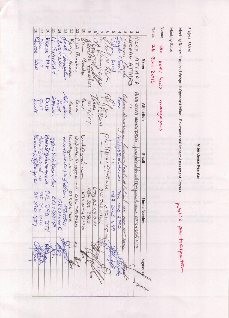

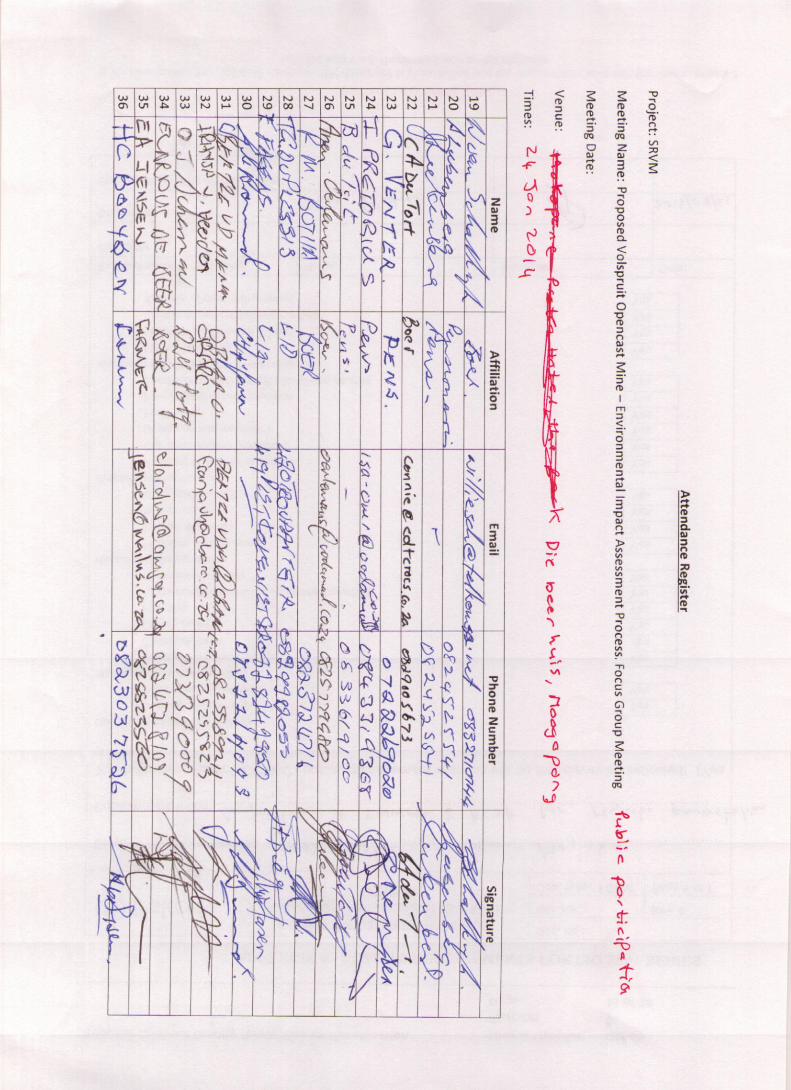

SRVM
Meeting minutes
23 January 2014
Public meeting
At The Protea Hotel, Mokopane
Vici Napier: Introduces herself as independent facilitator and explains procedure for the meeting.
Explains that minutes will be distributed to all attendees and a date will be specified
Hilary Knight: A lot of questions that may not get answered, is there a contingency plan for those?
Facilitator: Contingency plan is that for any question that you need answers for, write them down and
hand them into me or minute takers.
Facilitator: introduces Theo Fischer to provide overview to project
Theo Fischer Overview Presentation
Explains aim of presentation, to give overview of project and receiving environment, specialist studies
will be presented, we will go over recommendations and way forward. Explains the EIA process. It starts
with a screening process to see if project requires an EIA. If that is established then the proposal has to
enter process, go through scoping impact assessment and decision making. Scoping is to determine
what the major issues are. It is to ensure that adequate specialist studies are undertaken. Lastly is the
EIA phase in which specialist studies are undertaken. Using a terms of reference approved by authorities
in scoping phase. Then there is the decision making phase. Documentation including comments will go
to authorities in order for them to make an informed decision.
In a nutshell the project can be summarised: the mine is a PGM mine with a 19 year life. It will include
smelter and refinery. It will employ during operation some 450 people all of which will be
accommodated in their own houses. The mine is situated next to the Nyl River. However it is concluded
after EIA process that if the mine sticks to processes of strict control. The mine will not affect the surface
water flow nor the wetland significantly. The mine will withdraw no more than 3.5 mega litres per day
from the pits and boreholes. Excess water abstracted will be passed on for crop irrigation of on average
some 1.25 Ml per day. This is variable but mostly it will abstract an excess of water. The net use by the
mine is broadly in line with current abstraction of 2 Ml per day for crop irrigation which will cease when
operation begins.
Locality of mine is shown on screen in relation to the Nyl River flood plain and wetland. Nearby is the
protected Ramsar wetland. It is therefore deemed that the environment is sensitive. The sensitivity has
been confirmed as part of ecological study in EIA. Nyl River wetland deemed to be of a very high
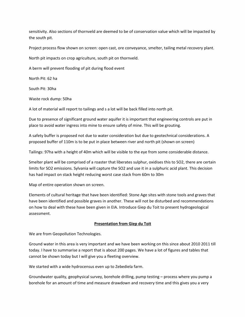
sensitivity. Also sections of thornveld are deemed to be of conservation value which will be impacted by
the south pit.
Project process flow shown on screen: open cast, ore conveyance, smelter, tailing metal recovery plant.
North pit impacts on crop agriculture, south pit on thornveld.
A berm will prevent flooding of pit during flood event
North Pit: 62 ha
South Pit: 30ha
Waste rock dump: 50ha
A lot of material will report to tailings and s a lot will be back filled into north pit.
Due to presence of significant ground water aquifer it is important that engineering controls are put in
place to avoid water ingress into mine to ensure safety of mine. This will be grouting.
A safety buffer is proposed not due to water consideration but due to geotechnical considerations. A
proposed buffer of 110m is to be put in place between river and north pit (shown on screen)
Tailings: 97ha with a height of 40m which will be visible to the eye from some considerable distance.
Smelter plant will be comprised of a roaster that liberates sulphur, oxidises this to SO2, there are certain
limits for SO2 emissions. Sylvania will capture the SO2 and use it in a sulphuric acid plant. This decision
has had impact on stack height reducing worst case stack from 60m to 30m
Map of entire operation shown on screen.
Elements of cultural heritage that have been identified: Stone Age sites with stone tools and graves that
have been identified and possible graves in another. These will not be disturbed and recommendations
on how to deal with these have been given in EIA. Introduce Giep du Toit to present hydrogeological
assessment.
Presentation from Giep du Toit
We are from Geopollution Technologies.
Ground water in this area is very important and we have been working on this since about 2010 2011 till
today. I have to summarise a report that is about 200 pages. We have a lot of figures and tables that
cannot be shown today but I will give you a fleeting overview.
We started with a wide hydrocensus even up to Zebediela farm.
Groundwater quality, geophysical survey, borehole drilling, pump testing – process where you pump a
borehole for an amount of time and measure drawdown and recovery time and this gives you a very
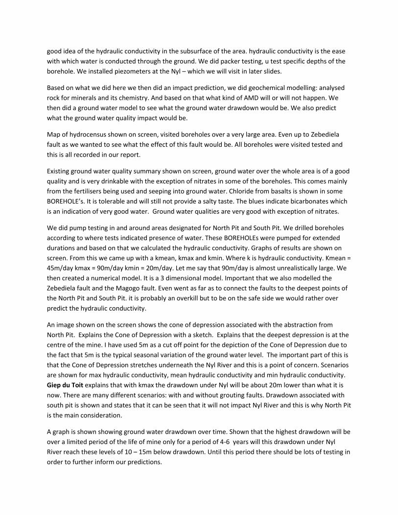
good idea of the hydraulic conductivity in the subsurface of the area. hydraulic conductivity is the ease
with which water is conducted through the ground. We did packer testing, u test specific depths of the
borehole. We installed piezometers at the Nyl – which we will visit in later slides.
Based on what we did here we then did an impact prediction, we did geochemical modelling: analysed
rock for minerals and its chemistry. And based on that what kind of AMD will or will not happen. We
then did a ground water model to see what the ground water drawdown would be. We also predict
what the ground water quality impact would be.
Map of hydrocensus shown on screen, visited boreholes over a very large area. Even up to Zebediela
fault as we wanted to see what the effect of this fault would be. All boreholes were visited tested and
this is all recorded in our report.
Existing ground water quality summary shown on screen, ground water over the whole area is of a good
quality and is very drinkable with the exception of nitrates in some of the boreholes. This comes mainly
from the fertilisers being used and seeping into ground water. Chloride from basalts is shown in some
BOREHOLE’s. It is tolerable and will still not provide a salty taste. The blues indicate bicarbonates which
is an indication of very good water. Ground water qualities are very good with exception of nitrates.
We did pump testing in and around areas designated for North Pit and South Pit. We drilled boreholes
according to where tests indicated presence of water. These BOREHOLEs were pumped for extended
durations and based on that we calculated the hydraulic conductivity. Graphs of results are shown on
screen. From this we came up with a kmean, kmax and kmin. Where k is hydraulic conductivity. Kmean =
45m/day kmax = 90m/day kmin = 20m/day. Let me say that 90m/day is almost unrealistically large. We
then created a numerical model. It is a 3 dimensional model. Important that we also modelled the
Zebediela fault and the Magogo fault. Even went as far as to connect the faults to the deepest points of
the North Pit and South Pit. it is probably an overkill but to be on the safe side we would rather over
predict the hydraulic conductivity.
An image shown on the screen shows the cone of depression associated with the abstraction from
North Pit. Explains the Cone of Depression with a sketch. Explains that the deepest depression is at the
centre of the mine. I have used 5m as a cut off point for the depiction of the Cone of Depression due to
the fact that 5m is the typical seasonal variation of the ground water level. The important part of this is
that the Cone of Depression stretches underneath the Nyl River and this is a point of concern. Scenarios
are shown for max hydraulic conductivity, mean hydraulic conductivity and min hydraulic conductivity.
Giep du Toit explains that with kmax the drawdown under Nyl will be about 20m lower than what it is
now. There are many different scenarios: with and without grouting faults. Drawdown associated with
south pit is shown and states that it can be seen that it will not impact Nyl River and this is why North Pit
is the main consideration.
A graph is shown showing ground water drawdown over time. Shown that the highest drawdown will be
over a limited period of the life of mine only for a period of 4-6 years will this drawdown under Nyl
River reach these levels of 10 – 15m below drawdown. Until this period there should be lots of testing in
order to further inform our predictions.
We then drilled piezometers on both sides of the Nyl. I will focus on PZs closest to North Pit on eastern
edge of river. Graph of the rainfall pattern is shown against the drop in ground water levels due to
irrigation over a 2 year period
Audience: in general all presentations are too small.
Back to presentation:
You get 3 types of rivers, losing, gaining, and divorced river. What we see in this case is a river that is
divorced from the ground water
Over this 2 year period the indications are that there is no connection between surface water and
ground water. We believe that a further drawdown in ground water level by 5 or 10m will not have a
significant impact
Results of geochemical model shown and states that there is no threat of Acid Mine Drainage.
Pollution plumes show that we don’t foresee any health implications regarding ground water impact
from this mine.
Recommendations: the piezometers have been extremely valuable in showing us the relationship; we
recommend that this monitoring continues. We should establish ground water monitoring network and
all Boreholes should be monitored regularly. Grouting should be done continuously.
Facilitator introduces Theo Fischer to conduct clay layer presentation on behalf of Prof Claassens
Purpose of investigation was to investigate link between surface water and ground water. Links are
defined by the soil properties between surface water and ground water. An extensive soil survey was
therefore conducted. The permeability of these various soil layers was investigated. Maps shown on
screen showing volspruit and study area where we can realistically expect the Nyl River to be undercut
by drawdown. In preliminary EIA soil classification was undertaken. The relevant soil types are the
Arcadia and Rensburg soils. These are not uncommon on the springbok flats and are associated with
weathering of basalts. Difference between arcardia and rensburg is the presence of a permanently
saturated section called a G-horizon. Rensburg soil is associated with an extremely low permeability. In
contrast to shortlands soils which is highly permeable. We look at this to determine the quantity of
water that will permeate or conduct through this clay layer. The Darcy equation is explained to indicate
the speed that water will go through a material using the hydraulic conductivity, the hydraulic head and
the layer thickness. To give you an idea of typical characteristics of soils the soil forms are shown on
screen.
Cross sections of the Nyl are shown on screen indicating the results of soil profiling pits dug along
specified cross sections of the river bed. Picture of Cross section A shows the soil forms found at that
particular cross section of river. Cross section B then shown once again showing some soils being
transported from uphill on side of river and deposited. The 2008 flood was superimposed on transects
to show where water would occur during a flood.
Cross section C shows meters thick layers of clay with G-horizons below that are permanently wet.
What the cross sections show as you go is that the G-horizons are not uniform along river bed. A section
of 12ha is shown on map on screen that it was found there are soils with some permeability. This area
during a flood can be inundated with water and flood water will then decant through this soil. A table is
shown that give the amount of water that over a period of a month would 0.7Mm3 would decant
through this area. This is the most conservative scenario. There is potential for limited ingress over
specific area. It can be confirmed that this river does not leak like a sieve. The reason it exists is the clay
layer, had it not had this clay layer it would not support the ecology that it does. The reason that the
ground water is divorced from the surface water is due to this clay layer.
Theo Fischer to present findings of integrated catchment model and dynamic water balance.
A dynamic water balance is a water balance performed on an operation as it develops. At day 1 there is
no development but at year 20 there is an entire plant with rainfall runoff. The key component to this
study is that there is enough water for the mine. And what volumes need to be dewatered from pits in
order to mine. This relied on a number of scenarios, such as no grouting and faults or grouting and no
faults.
This is to indicate that the mine will use from ground water not much more than what is currently
utilised by irrigation. The additional demand is made up by water caught by precipitation on pits rock
dump and tailings. The current use and the additional take are shown. I am going to present one of a
number of scenarios. 20% savings on tailings, with excess water passed on to irrigation and in times of
water excess water is passed on to grassvally and banked to use in times of low water. Polokwane’s
groundwater recharge system is described on DWAF website. Excess water of 2Ml/a reducing to about
1Ml/a. the mine needs a water user over and above itself. If it does not have a partner to use this water
and does not recharge and bank this water it will make the water management at the mine exceedingly
difficult.
The study area for the integrated catchment includes whole Nyl catchment – includes all water uses
(lists). One of the more difficult things we had to address is to quantify the abstraction in the area. This
data was taken form a DWAF study that investigated water use in the Nyl River area. Three peer review
articles have been written on this study. There were some irrigation areas that were inactive during our
period of modelling. What we established is that ground water abstraction in the area is about double
than what is registered with DWAF. A graph is shown that shows the models prediction of when floods
arrive as a result of precipitation vs the observed data of floods.
Essentially under current conditions significant ground water abstraction occurs in the system, majority
is for agriculture. Wetland has been impacted by this already. Mining with addition abstraction of
0.5Mm3/a will result in a net increase of 11%. With mine taking a minimum on top of current
abstraction there will be a reduction in flow report to downstream users.
Summary: crop irrigation currently by far largest user in system, we estimate based on areas planted
and crops grown is double what is registered. The mine will apply to DWAF to legally abstract water. It
will be a fraction of what is currently abstracted. If current abstraction continues and mine goes on it
will lead to an impact. What we find however is that this catchment needs to be holistically managed to
ensure sustainable use of groundwater going forward.
Facilitator: we have a 20-25 minute question session on water
Questions:
Frank pietersen: Q1: you haven’t indicated what your water use is going to be, you have indicated water
balance but for the plant, where is this water coming from for smelter refinery etc?
Q2: you say you will pump water into grassvally? Have you looked at that impact? Has that impact been
assessed?
Theo Fischer on Q1: If you’d like I can show you the workings of dynamic balance. The total water
requirement of mine for all its operations is used mainly by tailings and the plant. As I’ve indicated the
water use of a mine from abstraction from the pits is similar to currently used in irrigation. All water use
is considered, from smelter tailing whatever. There will be more water than the mine needs in pit.
Theo Fischer on Q2: this water balance is run with certain rules. The rules say for instance that this dam
may not overflow, if its 100% then excess water should be passed on to there. 2 rules maybe 3. 1: on
average the abstraction form grassvally should never be more than 1Ml/day it should never exceed
2Ml/day for longer than 2 months. This is based on extensive studies done at grassvally for its water use
license. This was done 10 years ago. The study indicated that grassvally can supply 1Ml/day. If too much
is recharged to grassvally the aquifer will rise. Keeping in mind that it has been mined extensively there
is a large volume of storage. Your question is valid and this needs to be looked at. From the study this
will not have a significant impact if rules are stuck to
Piet from Limpopo wetland forum: this statement that you estimate that water use is double what is
registered is quite biased.
Q2: mine is next to Nyl River and will not significantly affect flow during a flood due to clay layer, explain
why?
Q3: it seems you are focusing on short term climatic events. With all your data you stop very short. If
you continue backwards with this line on the graph you get back to surface.
Q4: why don’t u have piezometers in the wetland itself? are these piezometers or wells?
Theo Fischer: Nobody would give us abstraction rates so Prof Steyn used a crop water use model and he
applied it to all the irrigation in the area and that was the figure that was derived. That is crop use and
that is all registered uses
Regarding Q2: The statement is that the mine will abstract additional water, the wetland is associated
with a significant clay layer. The wetland captures water from a flood and retains water in the reed beds
in the clay. A lot of this water is captured in dams. This was dug in 2008.
Regarding Q3 and Q4 Giep du Toit: they are piezometers, they measure pressure and are sealed at
different levels. Over this period we have seen a steady decline. In the virgin situation in this area I
would not be surprised if the water level at this river was above ground. And irrigation has subsequently
changed this. We also respect that the water is filled back by flooding events; I would have like to
witness that. I would suspect that the water level would increase and then start decreasing. Such a rise
is feasible and it is in my model. You need the necessary permits to drill a piezometer in a wetland which
we don’t have.
Piet from Limpopo wetland forum: if you look at last part of graphs there is a crossover of lines
indicating various flow reversal events that could indicate there is a link?
Giep du Toit: If in a rain event recharge of ground water can take place. There also could be some
margin of error. Also we could not put piezometers in wetland as it is illegal.
Joseph from DWAF: Q1: I want to know when you mine are you going to mine the aquifer or is the
water coming from a different formation.
Q2: I see the fluctuation in the rainfall but I do not see a fluctuation in ground water levels
Giep du Toit: from all the boreholes we have drilled so far we have a picture in that the upper 30 -50m is
highly permeable, below that it is less permeable bed rock with fracture and the fractures diminish with
depth. The mine goes to a depth of 160 – 170m. What we think will happen is that the upper portion will
have to be dewatered. Picture shown on screen showing permeability of different levels. Most of the
water is capture in this upper porous area and this will drain through some prominent cracks and report
to the mine, the fractures at depth will be conduits for water as opposed to sources of water. These will
have to be detected and grouted.
Facilitator clarifies question:
Giep du Toit: our feeling is that it is one aquifer consisting of different materials. Simple reason is that
the whole aquifer is caused by substantial earth movements and in the process the rocks have been
cracked and fractured.
Regarding Q2: in larger rainfall events the water level stabilised in a sense but it was not enough to
recharge aquifer. This found that the method to recharge the aquifer is through the flooding.
Wayne knight local land owner:Q1: I have been very confused by zone of depression and socio-
economic impact of this depression. My interpretation is that the reason the Cone of Depression is so
small I because you have given such an unrealistically high conductivity to the faults.
Q2: Why the obsession with keeping the research so local. Perhaps local farmers are abstracting more
than they should be. What about all the water users upstream? Why is the study localised made out to
seem it is only going to affect this area. What Theo Fischer doesn’t show how inaccurate the amount of
flooding predicted.
Q3: Why do we have to go ahead with this mining application without a flooding event having occurred?
Dr Giep says in the report that ground is homogeneous but now he says it is broken down. Why can’t we
wait for a flood?
Giep du Toit: we can clearly see some sort of a depression in the cone of depression at the point of the
Magogo fault.
Wayne Knight: Where is water in fault coming from?
Giep du Toit: the water in this whole area is rainwater. The second source of water is depletion of the
aquifer
Facilitator: clarifies
Giep du Toit: the answer is that one should not see this fault as a pipe. Let’s say you have a mine and a
fault is running through it. The moment that you hit the groundwater in this pit. You create a depression
along the fault. The water will immediately seep through the walls of the fault from the outside of the
fault.
Theo Fischer regarding Q2: the study area of integrated catchment model consists of entire Nyl
catchment and this consists of various quaternary catchment. This model tracks all the precipitation in
the entire area. One thing that Dr Giep hasn’t mentioned is that this area is extremely flat and at first we
thought that if you dewater in this area you will see water moving up and downstream but it doesn’t.
The water feeding these faults must come from rainfall recharge. We have seen from Terrence
McCarthy’s studies is with the Waterberg area to the west and mountain to the east, the Waterberg is a
significant zone of recharge where you have precipitation. Essentially all the rivers feeding the system
from the west act as rechargers for the aquifer significantly. It is also when these rivers flood that a flood
occurs in the Nyl.
Theo Fischer regarding Q3: WE have identified that a disturbance to the flood dynamic would be a
major concern. We have seen that the volume that the mine will take is small fraction of what is
currently being taken. Our results that the impact to the downstream section will not be significant.
Andy Goetsch, Mokopane business chamber: we are concerned about downstream users from
Mogalakwena. What guarantees can you give the community that if downstream users are affected
there will be a form of compensation? You talk about monitoring, if you find that there is a decrease in
water levels beyond what you expect what guarantees do we have that the mine will stop or act on this.
Giep du Toit: in our report we have tried our best to predict the areas that will be affected. Our models
are a simplification of nature we can expect that there will be variations that is why we want a
monitoring network for regular monitoring. If these boreholes are affected at it is concluded that it is
the mines fault then there must be action. There will be action.
Theo Fischer: with respect to water use, our 2 major concerns which were investigated this year was the
flood dynamics and ecological function and aquifer dewatering. The mine we are certain will use a
fraction of what is currently used for irrigation. Crop irrigation is important. You cannot eat platinum.
The mine will use less of what is being used. The downstream users will see little if any change. You can
take note that a water use license application will be lodged. Water abstraction, use will be covered. As
part of this process we can recommend that if the mine has a larger impact than what has been
predicted in models that the mine should cut back their operations and reduce usage. The water that
reports to communities is water that was not taken by other users upstream. It includes alien
vegetation, farmers, towns and the mine.
Wayne Knight: that is why mine should not happen because we will never prove it.
Audience: Q1: the business chamber supports it but you have concerns, municipality extracts water
from Nyl, has this been considered in the model?
Q2: about the grouting: this mitigation doesn’t seem feasible since the rock is fractured. How effective
will it be?
Theo Fischer: abstraction by municipality is correct, as part of team that undertook model consultants
were contacted that develop the well field. The abstraction of 0.5Ml/annum was received from the
municipality. This figure was used. This is not registered at DWAF.
Theo Fischer: there is a grouting case study report that covers the use of grouting in open cast mines
that explains a lot about grouting and case studies
Giep du Toit: firstly there will be a clay wedge. This technology is rather common. Prof van Schalkwyk
was the one responsible for most of our big dams such as Katse dam because it doesn’t help to build a
big dam and your water seeps below. It is well established technology. Giep du Toit explains grouting
methods: How grouting works: Drill hole at certain distance – put in cement. Then drill other holes if too
much water is still leaking through, and then you fill those with cement etc. Until you reach the amount
of water that can be accommodated. I used the k value – the k value is never zero. Also water enters
the pit from below
Audience disagrees
Joseph Attard, Naboomspruit bird club member:
Q1: study is localised. Very little studies done downstream. There is the Moorddrif dam and it is empty
now.
Q2: water users: your sample size might be too small on number of water users used in this study
Theo Fischer on Q1: report covers a wide area but focuses on a smaller area where the impacts will be
more pronounced. The models looked at impacts to water. Dr du Toit at no point indicated that ground
water impact will proceed beyond the modelling domain. Model indicates system is under stress and
indicated mine will stress it further. This dam provides water to town and whatever dam can give the
town takes. We need a more holistic approach to catchment management.
Theo Fischer on Q2: the larger users were directly investigated, however all water use registered In
entire sub catchment was considered. Refer to section on water use in EIA
Emile Honiball: I had a discussion with Giep du Toit. He indicated that first prize would be to wait for a
flood event and due to time constraints that could not be done. The mining company CEO has come to
our area and have told us all there plans to improve our area. The reason they don’t want to wait is
because they are in jeopardy of losing their mineral rights. If they want us to trust them they would wait
for a flood event. We simply cannot trust them.
Q2: area was declared a subterranean water control area declared as such under previous legislation,
mining in such an area is prohibited. You said you would look into this
Giep du Toit on Q2: I honestly am not aware of this
Theo Fischer on Q2: Emile I cannot answer you at this time as to whether the subterranean control area
act declared under previous laws is still applicable. Give me fifteen minutes and I will get back to you.
I agree we would like to witness a flood event it was stated in EIA that there is no surrogate for
measurements. However from the work we have done we can answer with a high degree of certainty
that the impacts will not amount to a fatal flaw. Is there enough water? Will the mine impact that flood
event significant? We can answer those. We would like to see a flood event. We would like further
monitoring. It is the view of the team that the mine can proceed with an application
Audience member: have you got a record for the past 35 to 40 years of how many times the Nyl has
come into flood?
George: how many of the municipality officials you did invite to this session. I am a councillor but as far
as I know I am the only councillor that got invited I would suggest you present this to council
Theo Fischer to Audience member: good question, what I can say is we have a patchy record, not the
team, our ability to record these events is not too good, we have limited hydrograph data. as system
was developed more hydrographs were installed. We have satellite imagery from the 90’s onwards.
With integrated catchment model the history has been recorded from 1910 to 2010.
Theo Fischer to George: members of the public have been invited, there are periodic authorities
meetings. We are in periodic contact with Dr Shaker with respect to water planning and I do believe an
authorities environmental, committee is being established.
Facilitator: the councillors specifically? How many?

Theo Fischer: Fiona can report on details.
Fiona Preston-Whyte: I was responsible of finding all councillors contact details, we invited 8 councillors
using list on municipality’s website. If you have remaining councillor’s details please give me that list and
will add to list.
George: I am not representing municipality that’s why I suggest this be taken to council so that the
council can reach a resolution on it.
Peggy Drodskie from SA chamber of commerce has taken Escience details to email her questions as she
needs to leave.
Hilary Knight: it is not good enough that we have not been given documentation to leave questions and
comments for people who cannot stay for the entire meeting.
…………………………………………………………………………………………………………………………………………………………………
LUNCH
…………………………………………………………………………………………………………………………………………………………………
Presentation: Visual Presentation Kotie Geldenhuys
Visual assessment for the proposed mine.
Process that was followed:
Started with an exercise of an audit
Assessment of results – visual simulations in stills (on a computer)
Fly around (model)
GIS data was gathered in a view shed analysis
Site visit – panoramic photography, stitching the pictures together to gain the full peripheral
view. So not just a commuter model, but also shows the proposed development on top of
current photographs
8 vantage points where chosen – from where the most amount of people would see the site.
Also documented the sense of place of the area
Legislative data was considered
During the analysis phase, what was considered?
1) Current scenic value
2) Types of people who would be exposed to the development
3) Nature of development
Will show you in detail how it will look from the sky. Very accurately modelled images incorporated
into photographs.
Assessment finding – one needs to consider the area sensitivity
(Showed some photographs here)
Area is beautiful. The area’s sense of place is very pleasant, there is a general type of openness and
it is very pleasing.
Considering the physical characteristics of the environment:
Vegetation
Water
Colour
Adjusted scenery
Cultural modifications
Land form – the scenic value rises with contrast (high mountains and low valleys have a high scenic
value).
There are two koppies on the site. There is substantial variation in topography – low mountains
around plans.
Looked at the study in both dry and wet months, thus, able to consider both the vegetative states.
There is a pictorial charm to this landscape.
Colour changes with seasons. The vegetation in spring is green moving to tan in the dry months.
There are however no complementary colours (opposite colours next to each other).
The Nyl River is subterraneous except in times of high precipitation.
Uniqueness –this area is part of a large biome. It is a unique area with vegetation and topography. It
is however, not as unique as an area that comprises of the only type of rock or biome in the world.
Agriculture activity contributes positivity to the scenic value of the area.
Grassvally (old mine) negatively impacts the areas sense of place.
The area has a 40% scenic value…this is deemed as High.
Viewer types: scenic receptors were chosen based on high traffic where it would be visible. The
predominate viewers on the N1 would see the changes as natural. However, there are viewers on
whom the development will have a great effect as they see it regularly.
(Shows plan of development)
From the N1 the tailings are obscured by the waste dump.
From the N11, the plant is obscured.

(Shows a 3D model of the plant).
This is a category 5 development (includes mining).
View sheet analysis – this is a computer based analysis – which areas would be exposed
(asked to be allowed to talk for 5 minutes more)
(Shows a map) The purple area shows the areas from where the site will be visible.
From the N11 the bush substantially obscures the view of the site.
One of the Tertiary receptors is- Kanniedood Guesthouse.
Will now flip through vantage points quickly. Quick explanation of these pictures, these pictures
show 140 degrees (what we see as humans….shows colour with central vision, and monochrome as
it becomes perioral vision).
Shows:
contrast before and after development
night vision
close up (50 mm).
(See presentation for images)
Goes through all vantage points.
Did not choose spots with trees hiding. Chose the areas with the greatest impact.
To accommodate vantage points that haven’t been taken into account, a fly around has been
created.
Conclusions:
The areas has a 40% existing scenic value.
Contact 83% - high contrast between pre and post development of the proposed site. So this site is
not complementary to the environment.
Also the height and site of the development means that it is very visible.
What decreases the impact slightly is the types and amounts of viewers. Thus, concluding in a
moderate visual change.
Trees help mitigate the visual impact.
………….

Set up sound system
……………
(Shows fly through)
1 km away from site, 10m about ground level
5 km away from site, 10m about ground level
10 km away from site, 10m about ground level
(comment from audience [Hilary Knight]– so you can see it from everywhere basically)
15 km away from site, 1m about ground level
………………………….end of presentation………………………………………………………………………………………..
Theo Fisher responses to Emile Honiball’s earlier subterranean question:
Theo Fisher - I made contact and got a short verbal opinion from an environmental attorney. The
subterranean water control areas, declared under the old water act, are still valid and they remain.
Like the irrigation schemes and water boards provisions are being incorporated into the water use
association and all the provisions control areas and irrigation schemes are administered to by water
associations and the department of water affairs via the water use licences. Used by water affairs in
the water use licensing application. The control areas provisions are not absolute. And deviation
from them needs to be strongly motivated during the water use licence application. Suggests the
mine gets an actual official statement regarding this, that we will share with you.
Emile Honiball - Please incorporate into report, as at this stage it is omitted totally.
………………………………………………………………………………………………………………………………………………………
Questions on Visual impact presentation
Member of the audience -The locality of the smelter, is it finalised to be on site, or here in
Mokopane somewhere?
Theo Fischer - The application is including a smelter and is proposed to be located at the site to the
south of the plant. However, Sylvania has indicated that they might relocate the smelter to a
location where it might make more economic sense. More information –minutes other meetings or
Nigel can give you a formal statement.
Nigel Trevarthen- There is an iron ore project (currently in planning) some 60km north of
Mokopane. Where they plan to build a smelter complex there. That would be orders of magnitude
greater then what we are looking at, to the extent that the co-generation power from that big
smelter would be enough to run our little one, should that project go ahead it would certainly be
ideal for us to move that smelter to the North. However, in terms of this project. This mine does

need an iron ore smelter, if the other project does not go ahead then we would have to leave it
here. Our first prize would be to move it North, however for now, we have to continue with the
planning here.
………………………………………………………………………………………………………………………………………………….
Johannes Langa from the Waterberg (Disability?) Organisation - Firstly, the organising of this event
is not enough. We have structures (chiefs, farming associations) that should be available here as
they are directly involved in this kind of development.
Johannes Langa from the Waterberg (Disability?) Organisation - My question is that have you ever
considered the negative impacts that might be caused through the operation to farmers, animals,
plants, members of the community, because we have people around the area who are using
boreholes. If anything goes into the river, animals are going to be affected, and members of the
community are going to be affected, have you considered this, and how are you going to prevent
this?
Facilitator – I am going to let Mr Fischer’s presentation run, which is on the findings of the EIA, I
think it answers this question. If not, we can return to it.
(Technical issue leads to another visual impact question)
………………………………………………………………………………………………………………………………………………
Gerrit Van der Veen- What can the mine do to make the viability lower? Can anything be recycled?
Can the dumps become lower or something like that?
Kotie Geldenhuys - Yes, that’s the part of the presentation that I ran out of time, we have a list of
recommendation. This was mentioned at the landowners/farmers meeting but not here. How much
smaller the smelter is, already the stack has been reduced in height to 30 m, the smelter is now also
smaller.
Kotie Geldenhuys - The Bern was put in place not only to reduce visual impact but to protect the
avifauna (from passing trucks, noise, lights etc.) the are birds are the reason why the bern is there.
Kotie Geldenhuys - Other management actions comprise of standard management practices,
standard management actions to reduce lights during twilight and night time. Masks with a
maximum of 20m, aimed downward, cut off luminary where ever possible.
Kotie Geldenhuys - Recommendations that structures to be developed on the old grasvalley chrome
mine.
(Confusion here – many people talking at once)
Nigel Trevarthen – the intention is to try and reduce the visual impact. And in terms of the Chrome mine
(Grassvally), that property has been recently purchased by Sylvania, that now gives us the opportunity
to move everything to that already disturbed area and blend the whole lot together. That reduces the
double impact. Other aspect, we are looking to move as much of the waste rock into the north pit, trying
to reduce as much product as kept on the surface as possible. Finally, one of the things that we are
looking at doing is seeing whether the tailings can go in with the waste rock as well. When you place
waste rock into a pit you are left with spaces in-between which we are looking at filling with tailings.
Now, we believe that the tailings are inert and so would be able to be dumped into the pit with the
waste rock, thus reducing the surface structure.
Kotie Geldenhuys - in conclusion the EIA process was used to inform the design allowing structures to
find behind each other. If these are moved to Grassvally, this optimisation would need to happen again.
Gerrit Van der Veen – so u fill up the pits afterward’s. What are you doing with rehabilitation? How
are you doing the rehabilitation?
Facilitator –Theo that is part of your presentation
Theo Fischer – it’s not, but it can be
Billy -Is there a presentation on the rehabilitation? As that will answer these questions. As I
understand it, only one pit will be filled, not the other one. And the existing mine, the chrome mine,
are you not going to use the material there to fill the pit? ……..
Theo Fischer ……………….answers with a rehabilitation/mine development presentation………….
Let me take you through the mine development and what that means in terms of rehabilitation.
Location of waste dump (conceptual) starts in the north advancing to the south. What Nigel has
indicated that this waste dump may now be placed on top of the area which has already been
disturbed at Grassvally (more work needed here).
Pit is now advancing southerly then easterly (this is the north pit). Material coming out of the north
pit is backfilled into itself.
Buffer area might be mined into – needs further work.
South pit waste rock will go into the north pit. North pit will not be fully filled up – it will fill up with
water. Further research is needed here. This North pit could be used to create habitats to allow for
birds and fish. Considering opening up to the Nyl River (read report for more information on that).
Opportunity to reduce impact – put waste on disturbed land as in Grassvally and tailings into the
north pit (in-between waste rock).
The south pit will remain as an open pit – nothing to fill it with.
Disposal of tailings into a water system – now this needs to be researched in terms of the water use
licence. Exactly what the optimal rehabilitation is will have to be in a balance between visual, water
and an exact closure landscape for birds and fish.

Remember the water that arises in this pit will be good quality – can be potentially used to help
birds.
Gerrit Van der Veen -What chemical are used for explosions. Where is it kept?
Theo Fisher –typical chemical used in blasting – (Nigel Trevarthen indicates the use of gels here) –
these are compounds which are high in nitrates (maybe some additives). After explosions, these
materials don’t fully react, so there is a thin coating of it on the waste rock which can wash off. This
could increase nitrate levels of the water filling/seeping through the pit. The nitrates would be fairly
quickly consumed by water plants (might get an algae bloom).
…………………………………………………………………………………………………………………………………………………
Presentation on findings of the EIA by Theo Fischer
There are a number of environmental aspects to this proposed project, potential impact, in need of
mitigation.
With mitigation, these potential impacts can be controlled.
Impact to avifauna to habitat loss, unsure of impact due to the Thornvelt loss.
Operational phase impacts – mitigation is key otherwise there will be an impact on the following:
Groundwater
Biodiversity
Avifauna
Mitigation is key in this mine.
A potential positive impact from proper mitigation and rehabilitation as a fish reserve, this remains
to be seen.
Recommendations and conclusions:
No fatal flaws
Considering that the mine can mitigate all impacts into moderate impacts
EXCEPT with birds
Viewed mine can proceed with very strict conditions
(See presentation slides)
Surface water from pits should got to irrigation
Way forward
Working towards the submission of the EIA report on the 28th January 2014.
(Shows table of dates – see presentation slides)
Comments and responses report will need to be updated.
Authorities make decisions.
Appeals in July and August.
We will keep you updated in this regard.
……………end of presentation…………………………………………………………………………………………………………
…………………………………………………Open Questions session begins………………………………………………….
Jill - Ask Mr Fisher about the drawdown cone and where it intersects the Nyl. I would like to talk
about that. The question is, that drawdown cone is modelled from 5m from the surface, the
majority of the water is between the 5m and the surface. And how do you stop the river from
flowing into the pit, down that drawdown cone?
Facilitator - Question 5m cut off, can you explain that and also how do you prevent the flow of
water from the Nyl into the pit – majority of water is between surface and 5m. How do u stop the
river flowing into the pit.
Giep du Toit – checked if the questioner was here this morning – which she was. I think we clearly
indicated this morning that the Nyl River is underline by a clay layer (by soil specialist).
(Discussions over this isn’t answering the question versus part of the complete answer)
Groundwater is currently at something between 8-10 m below the wetland, due to extraction in the
area. So we know connection between the Nyl River and the ground water.
Facilitator – The 5m line, what does that mean?
Giep du Toit- 5m line: This is the system at rest, this is with the mine. You would have to pump the
water out to mine. There will be a cone of depression going this way and that way. What you see
here is that depiction. These are contours. Red is the middle of the mine. Cut off point is 5 m as this
is the seasonal variation in ground water from wet and dry. That’s where the 5m comes from.
Jill – I do understand all that
Facilitator – what is the effect of this on the boreholes in the area. And what happens if the Nyl
flows, how does that not go into the pit?
Jill –I am not talking about boreholes
Facilitator – I know but the effect of the boreholes answers what that means
Jill – That’s not what I am asking
Facilitator – Well, Giep, can you answer the last part of the question, the Nyl in terms of the pit?
Jill – I want to know what happens in that last 5 m. What happens from the surface to 5m, it Is not
known, so it can’t be modelled. Did they just give up?
(a few people talking at once)
Jill – Mr Fischer while I am talking to you, I have a question for you. Mr Fischer earlier today, you
were telling us that same clay layer gets saturated, but strangely enough only from water that
comes from the catchment area, strangely enough it never gets saturated by the river itself. Is that
true?
Theo Fischer - the G-horizons is indicative of permanent saturation. Those are areas that are
permanently saturated. Other areas may be saturated with a flood, but are not permanently
saturated such that it affects the water chemistry. During a flood water may migrate down very
slowly as a result of it being clay, and it may become saturated, but not permanently saturated. It
would then not affect the G-horizons.
Jill/Facilitator - Do you anticipate a flood event in the life of the mine?
Theo Fischer – I think one can reasonably expect more than one
Jill -has any modelling been done to reflect anything in a flood event?
Giep du Toit – I included flood events in my model. At regular interval (4-5 flood events during the
mine life). Some of my pictures indicate exactly what would happen in such an event. In this case
there would be an exact drawdown below the river and come a flood the drawdown would be less
which means that the water would come up a little bit As far as possible yes. These flood events
were calibrated against observed historical data. We feel that we have modelled it accurately.
Jill - do you have any data during a flood event? If you don’t have this data you cannot extrapolate –
you are just guessing.
Giep du Toit – I used the virgin state as my reference. There is currently a lot of extraction. The
ground water levels reseed as a result of something and I have allowed it to flood to bring the water
up to very close to the surface, and you see the reseeding again. That was my only methods of
calibrating such a flood event.
Jill - I understand what you did, but it is not sufficient. It is not sufficient.
………………….
Hilary Knight - Comment by earlier,please, I have asked repeatedly, I don’t know how many times,
people who can’t stay, must be given the opportunity to note their comments on formal
documentation. People who have to leave are not given the opportunity to leave their questions
that can’t be answered due to time constants. That is my comment.
Hilary Knight - The question part is on behalf of Fatima kachalia: Ask Theo for two questions why the
mining should not go through. Tell him to remove himself as a paid consultant and place himself as a
member of the community in Mokopane.
Theo Fischer – My hat is off.
Issues I would raise from a water point of view would be potential water pollution and then water
extraction to unsustainable levels such that it affects the water to town and the wet land. Those
would be my two water aspects.
Also I can list some aspects relating to air quality.
Now water quality, if I am reasonable, I would look at literature on acid mine and tailing of this type.
I would learn that the mineralogy of these rocks does not pose a significant threat.
Hilary Knight – we don’t want to hear what you want us to hear.
(heated fight about finishing and interruptions)
Theo Fischer – the major concern here is loss of containment at the facility. There is polluted water
and loss of containment of water is a key issue. I am concerned about that. I am not concerned
about the generation of pollution in the pit. I am concerned by pollution in dams. Concerned by loss
of containment, definitely as issue.
Secondary this system is stressed regarding water. I am concerned about vegetation, and about
vegetation already not having access to the water.
My conclusions are that loss of containment leading pollution and over extraction (by any user).
My view is that the mine can continue but under very strict conditions.
Emile Honiball - My concern is, and its related to the subterranean (mentioned earlier). That
comment was made in the past, at least in one meeting in the past. Commented on in past.
Officially. Yet it was never addressed. A grave concern that our comments are not taken into
account, we worry about the EIA and Public Participation process.
Theo Fischer – I acknowledge that it was raised previously. I am fallible, if this has slipped through,
or anything else, please let me know.
Emile Honiball - Issues that are important to us seem to be downplayed. Issues you deem as
important are favoured. Your report seems to be why mining should take place rather then why it
should not.
(Clapping)
Theo Fischer – this process is investigative in nature, it is not there to argue either way. It’s a
process under which fatal flaws are indicated. Previous EIA highlighted that it couldn’t proceed. At
that time those reasons where highlighted why it could not proceed. We cannot put forward at this
time to why it should not proceed.
……………………………………………………….
Deleen - chamber of commerce - Comment - I am not satisfied on the way the answers are given.
Answers are being dodged. Also I don’t like the way the people on the floor are treated.
Deleen - chamber of commerce –Statement- Your short term financial gain will destroy the wetland
forever. At our expensive. Tourism will be compromised.
Deleen - chamber of commerce –How will the mine deal with social problems that arise from its
activities on its own land, surrounding land and government land. This is a concern of the
landowners who have neither the money nor the political clout to deal with such issues.
Theo Fischer – your comments are noted.
Regarding the question: Housing the mine is not providing housing.
Squatting the mine owns land around which it plans to use for game breeding, it will not allow
squatting on its own land.
Issues brought to the mine will be considered on a case by case basis. I cannot vouch for the mine.
Deleen - chamber of commerce - My question is not answered. How will the mine deal with social
impacts that arise from its activities? Not just squatting on its land. Privately owned and municipal
government land. How are you going to assist us as tax payers?
Mine CEO – Terry Mcconnachie -
- We have done many of these projects over many years. Law is straight forward. Reason we are
here to hear your comments.
- Money is spent. Generate jobs. The every reason you pay taxes is so that the police can deal
with problems such as squatters.
- Our social and labour plan aims at upgrading people to give them a livelihood.
………………………..
Wayne knight –
1) Why can’t we see the social labour plan which is in place?
2) Summary of EIA, There is a table looking at all sorts of effects (reads them)a table shows that the
effect of many issues is high or moderate. Yet in the mitigation column, the mitigation methods are
marked as low. These issues fit in with the social labour plan, we can’t see it, so unfortunately we
have to take your word for it. Unfortunately, we as locals are used to dealing with mines.
As you say you will deal with issues as it goes on. We have issue with mines, it is impossible to prove
when the mine is responsible. There I am sceptical, basically it is impossible to prove that the mine is
responsible for the water disappearing. But Theo how can you say that everything is hunky-dory,
who decides that mitigation is adequate? And when the squatters come then what?
Theo Fischer – I am going to focus on mitigation. One of the findings is that the mine can only go
forward on certain conditions.
Instead of an environment officer, an environmental control committee is proposed – must be
competent by:
Education,
Training
Experience
The above must cover:
Mining
Groundwater
Biodiversity
This panel will report to the municipality, water form and a community environmental monitoring
committee. A panel of experts who will review the mitigation will report to the municipality, water
form and a community environmental monitoring committee. That has been done, what has
worked, what is being done?
Facilitator – how did you reach the rating?
Theo Fischer – there is a formula- discussed at some length in the report.
Essentially, we are not denying that this mine will have impacts. It has been shown that the mine
will have some significant and some moderate impacts.
We live in a world of trade-offs, liquidating our natural resources.
Wayne knight – we are trying to save this one.
Nigel Trevarthen - On the confidentiality of the social labour plan, I have shared with you the
concept and intent- the game breeding. The document is sitting with the DMR.
Wayne knight – If this committee exists, what teeth does it have?
If the mine gets going – the horse has bolted. We have no leverage. Once you guys get this licence
we have no say. If the mine has gone too far, if the pollution is too much, if the effects are too much,
if the mitigation isn’t enough, you say that you will pay up if we prove you are responsible. That is
not good enough, we don’t trust you.
Theo Fischer – This recommendation (the panel of experts) should be carried forth into the mining
right and conditions of the mining right. Into the NEMA application. If the authorities do their jobs
properly, it has to happen. It must be a condition of approval. Mmakes sense for the mine to have
this too. It has been demonstrated to work.
Facilitator – is that a recommendation of the EIP in the report?
TF – Yes. (make sure this is on the record)
Gerrit Van der Veen – Comment - When the mine is serious it will mine there. I think that the
committee should be in place before the mine starts.
……………
Pietersen -
1) I haven’t seen anything about a slag dump?
2) Your 110m buffer zone, the law is very clear that you have to stay away from the river or 100 year
flood line? Is your 110m above the legal requirements?
3) As a mitigation measure, are there any chances of these pits going underground (as opposed to
open cast)?
4) You have mentioned that you are looking at cost disposal, but you haven’t assessed this impact.
What is going to the DMR? You have just mentioned that you now have the Grassvally farm. Which
means that you haven’t assessed the impact yet. Also you haven’t assessed the impact of disposal
into the pit?
Facilitator – slag, mining in a wet land, disposal of rock and tailings hasn’t been assessed. Moving
onto Grassvally land- not assessed, smelter might want to move – hasn’t been assessed.
Theo Fischer – You raise a valid point on the slag. The slag falls under a different set of legislation.
The slag is most likely inert. The mine currently plans on beneficiating the slag. Further research it
needed, but this fits under a different act.
With respect to the 100m buffer zone, the Government buffer zone (704 in the National Water Act).
In this instance it will remain 100m from the Nyl River. It will however ingress into the 100 year
flood line – this would need permission by the Department of Water Affairs.
Grassvally – you are right, this impact hasn’t been investigated. Application goes in as is. If the
mining right is granted, the application for amendment –with these aspects would be covered – will
be handed in. With respect to optimising impacts – that would be undertaken in the application for
amendment.
Tailings and waste rock – covered in water use application.
This would take 5m off the top of the tailings facility. Further work is needed regarding this, but the
project can still proceed. These are refinements best made in the water use licence application.
……………………….
Peter -Question for Dr du Toit. (Requests slides of drawdown)
North pit and south pit. As I understand it they will be drained at the same time? How are you going
to back fill if the north pit is full of water?
Giep du Toit –It will take some time to fill. I can’t see why it can’t be backfilled while it is filling with
water.
Peter - So you will not be dewatering at the same time? What guarantee do we have that that will
not happen? As your modelling could change substantially if the pits were built concurrently, what
guarantee is there that this won’t happen?
Giep du Toit – It doesn’t make financial sense
Theo Fischer – in term so of the legal aspect – all water use is covered in detail in the water use
application. This covers all water use, and how it fits together.
Facilitator – time frames of sequential mining would have to be stated in the water uses licence.
Mine CEO - Terry Mcconnachie – I think you underestimate. If we deviate from those EIA standards,
well, it’s our bible. We cannot deviate from the EIA. DMR would stop us immediately. We are trying
to understand people’s concerns, worries, mitigation. You recourse is, if we get this mining right –
we have to do what is in the EIA – whole process has to start again with every amendment. EIA is
your protection.
Peter - Back to that drawdown. You mention the Zebediela fault. Have you considered any effect on
the Zebediela fault? Did you test boreholes on the farm Zebediela?
Giep du Toit- Water levels, we looked at waterlevels.
Peter - When?
Giep du Toit – I am not sure exactly when,
Peter - Was that on the farm Zebediela or up in the mountains (dolomite)?
Giep du Toit – not sure
Peter - I am a farmer and the management of Zebediela – and I have no knowledge of anyone
testing the water. So if you could just let me know when that was etc.? System on the fault and on
the dolomite is very different, and would respond different. Do you understand the fault
sufficiently?
Giep du Toit– we’ve seen that the cone of depression from the mines dose not reach the fault. I’ve
done a steady state model – 100 year mine – showed a small decrease in Zebediela in this area.
However, the new model shows that the cone of depression does not reach it. But we need to keep
monitoring.
Wayne knight - Dr Du Toit I want to follow up on that, based on the same question I asked this
morning, based on the conductivity of that fault. The high conductivity, isn’t it going through the
whole model out. Currently water is so great, hard to predict in reality?
Giep du Toit – (There is agreement between Wayne and Giep that Giep is over predicting)
Fault makes cone of depression more to the south depending on gradient and hydrological
activities. Loss of water out of the system or a decrease. I cannot manipulate. Fault should not be
considered as a channel. Water flows in from the sides. You see it, in the model. Fault effect was less
than even I expected – I went and looked cell to cell to cell. I think we have built a sufficient model.
……………………
Johanne Langa from the Waterberg disability Organisation (indicated question was not answered
by Mr Fischer earlier)
1) Where does the power of the community lie with the decision?
2) Have they (the municipalities) approved of this proposal? How did the municipality respond to
this mine, because research done before indicates that by 2017 there will be a shortage of water?
What is going to be happening after 2017?
3) How are you going to prevent this operation having negative effects on farmers using boreholes?
And negative effects on the flood? Prevent negative impacts on animals and communities
(contamination, pollution etc.).
4) How do you come across the benefit of the shares to plant this type of operation? In terms of
shares, how will the community benefit? (can the community buy, get shares in the mine)?
Theo Fischer -
1) Power – communities can engage through this process. What power? It is important that
communities play a role? Formal provisions and conditions of approval, employer the
community is policing the mining?
2) Local authority – we have engaged with the municipality –Dr Shaker recommended the
establishment of a committee to establish a joint committee. With respect to the water
shortage. The use of water is regulated. In order of priority – the ecological system (humans
take preference in priority) then last agriculture/industrial and mining. This is the responsibility
of the Water Affairs and forestry – I know that they are currently updating the water use
studies.
3) Impacts – we’ve shown that impacts to water availability would be local – (shows cone of
depression again). The EIA document has been clear that the impacts of the mine must be made
good. We have discussed this loss of containment concern; the mine (specifically containment)
needs to be very diligently managed. Provided that the water management system is
maintained, it will be fine.
4) Community will benefit directly and indirectly. Jobs, position and contracts. During Construction
–2000 equivalent fulltime jobs decreasing to 450 during operation. However, members of the
community that get position of contracts will spend this money in the community. Local and
labour plan – benefit. Shares in company need to be discussed by the mine, hands over).
Mine CEO - Terry Mcconnachie – laws with respect to mining, we would get permission to mine if
we didn’t meet the legal commitments. Regarding shares, shares have been allocated to the
workers; they would have an equity state (10%). Also, a community trust will be allocated; these
funds will be used for local community projects such as schools. So you will get shares as stipulated
and controlled by the government.
,…………………………………….
Department of Water Affairs -
Comment, I cannot raise a question as I am merely here to observe. However, I can raise comments.
The point, consultant, of this meeting is to clarify issues properly to the people. I believe that you are
still lodging the application.
So it hasn’t been authorised. There should not be the assumption that it will be authorised.
This is an information gathering exercise by the local people. Their role is not just to object or agree but
to identify issues. The public is free to object. Community, make your objection a formal objection, that
you can then follow up. If some objections are comments and are not answered, and authorisation is
granted – the community can appeal.
Most of the issue here is the issue of water. This is in terms of DMR and Water Affairs. This should be
detailed. What water uses will the mine have? How are you addressing EACH of these? At what stage
will the issues be investigated? This should all be explained very clearly. If you make the audience angry
now, they will not help you later, and you need the community to help you later.
To the community, if the community has strong and sound objections, the authorities can say that the
community points override the scientific evidence.
I am telling you that the farmers understand water better then scientific (clapping).
Don’t dodge the questions. Everything must by clear. The balance must be clear. Saying “moderate” Is
not enough, it means nothing, explain what you mean.
The authority is with the environment putting balance to everything. Let’s make sure the issues are
covered, that they have been documented.
This is based on my observations of this meeting.
………………………………………
Billy (Joseph Attard) –
1) You say that the south pit will not be filled after 19 years. I know the answer is money. But I don’t see
why they can’t fill it.
2) Regarding the north pit, will it be acid free or not. Will it be contaminated over time?
3) You mentioned “we will decide on this and that” – who is we?
4) Comment - in my life no mine has ever had a clean footprint in South Africa. I don’t think this mine
would be different.
Theo Fischer –
1) South pit – The South pit will not be filled, at the end it all comes down to economics. And it
(filling the south pit) concerns double handling of the materials. I believe that it just is not
economically feasible to fill it. If this is a stipulation – then the mine just can’t work.
2) Acid mine drainage – covered in three areas in the report. There are limited sulphites relative to
gold and coal mines. They are less reactive, rocks are self-neutralising, this does however
generates salts, so one will see an increase in saltiness. Not acid mine drainage.
Where did I say “we”?
Wayne knight – I can help here you were talking about the environmental watchdog. Who is ”we” Is it
the community? The mine? DMR?
Theo Fischer – In so far as the we, it can be different people. Authorities decide on conditions.
Conditions informed by recommendations by EIP but also by the public. I think this reference was from
the context of the proposed environmental panel – independent – paid by mine- the mine must pay for
monitoring. Panel has responsibility to report to authorises, public and authorities. We is a complex we.
Hinges around all these structures.
Gerrit Van der Veen indicated that it (the panel) should be formed before the mine starts– I agree.
Mine CEO - Terry Mcconnachie – we don’t mind Public Participation. We note, comment and research.
Your recourse is that the government stops us. Government waits for the public to object. Then looks at
EIA – if the mine has broken the EIA, the mine has to pay a fine. If the mine hasn’t broken the EIA and
there is a problem, then the EIA needs to be adjusted.
Theo Fischer

– The proposal for the environmental control panel is to permit all that. The problem is that this is a very
delicate system. This control panel is to advise the mine and the community.
Regarding the footprint – I agree with you. That’s why the column indicated impacts.
Billy – I want to correct what I said, I said in South Africa but I mean in the world. The mines never clean
up their mess. No mine is not doing what they should do, rehabilitation is costing us as tax payers
(mentioned specific cases) the mines just runaway, they go to other countries, they never clean up their
mess.
Theo Fischer – I would like to respond in the following manner – the legacy of mining is bad (previously
no legislation). Since the time of asbestos mines to now. Legislation has now been introduced to
guarantee rehabilitation can be affective.
…………………………………
Emile Honiball- I have two past requests which have never been answered. And are not in the EIA.
1) Who is the BEE partner of this project? Refused to give this information. We don’t know why.
We are suspicious of this. We don’t know if its political issues that are leading to the retention of
this information.
2) Who is financing the project?
Theo Fischer – I don’t know
CEO Terry Mcconnachie – regarding BEE, we have nothing to hide but, it is confidential information. It
doesn’t have to be disclosed. And we won’t unless our BEE partners are happy for us to do so. You are
welcome to send a letter to the DMR, they know who they are. It’s got nothing to do with this.
Regarding funding – we don’t have to answer that either. But its financial institutions, banks and own
funds. Not related to the environment in our opinion.
Emile Honiball - I think it is an issue to environmental importance as financiers have certain
environmental principles, we want to know that the correct information is given to them
CEO Terry Mcconnachie – The financial instruction would not put 1 cent without all the blocks ticked. By
the times it gets to that stage – we would get it. I am not going to disclose our financial partners.
……………………..
Gerrit Van der Veen –
I think the management is saying that when the EIA report is finished then the bible is written. our
community, from 1981, has seen a change in ground water levels. The first borehole I put into my land
was 3m, at this moment it is around 65m. What I am saying is that this must be brought into the report.
The effect will be on us. The whole thing is what we need to know, communication must not stop with
the EIA, it must continue.
Theo Fischer – I would like to agree with you regarding the continued communication. EIA, models are
very valuable but not perfect. Following communication is one of the parts of the proposed panel. Mine
must have a management system. If there are amendments, this requires further public participation.
These systems have to be put in place before the mine commences.
…………………………
Jill - you say that the acid mine drainage is not a problem, but it worries you.
You have insufficient quality data; I don’t see how you can make any conclusions at all. Your conclusion
are nonsense, you don’t have the data to prove it. (Wetland)
(grouting) The conclusion given on grouting are ridiculous. If you look at the dropbox – the examples
are given do not show sufficient data for the grouting (not relevant to this mine).
Theo Fischer -
Acid mine drainage – I don’t think I have made any admissions on acid mine drainage. I’ve said self-
neutralising, this leads not to acid formation but to salt. As I have indicated to you, this is a complex
system. The water with high salt needs to be contained, this is a significant issue.
Giep du Toit – I analysed many samples regarding the acid mine drainage question. There is a lot of data
on this.
Theo Fischer – Adequacy of data to which to make a decision. I would have agreed with you fully a year
ago. At that time, we did not have enough information on which to base the decision. With regard to
data – you don’t always need data, you can also engage with it contextually. I feel that we do have
adequate information to make this decision.
With regard to grouting – you are one of the few people who has read this- I’d like to thank you for
interrogating the documentation. Why we have included these mines (arctic) as this mine is an example
of a mine that has used various grouting techniques to operate in a wetland
Comment from the audience (Jill) - But its permafrost
Theo Fischer -I acknowledge that its permafrost – but if you read carefully (don’t think it’s in here – but
it’s in the references) there are fractures and unfrozen parts which can conduct water.
The mine that hasn’t opened – it has just been authorised – it has the same issues as this mine –
relevance is that it had to propose grouting and take comprehensive modelling.
Jill - With that De Beers mine – that is precisely my point – its extensive groundwater modelling –
extensive modelling has not been done for Volspruit.
The grouting expert complained about a lack of data.
You don’t have the data to reach these decisions
Theo Fischer - Grouting expert said that it is feasible but without further data it could lead to significant
problems could be encountered. There needs to be sources for more data to allow for detailed planning.
…………….
Hilary Knight – I have a whole page of questions/comments, I am not sure where to start. On Jill’s: On
whose opinion?
I think that worries me the most at the moment is that we have to rely on Theo representing our
information to the authorities. And quite frankly, I have been involved with Mr Fischer for the past two
years. There has not been a day that goes by when I don’t think of this person as someone very terrible.
This person is meant to represent us to the authorities
This is a river and a wetland. It is not mentioned in report that it needs ministerial permission. Take the
social plan, Mr Fischer says that we need to be involved, even the Man here today from the Department
of Water Affairs says that we need to get involved. Yet Mr Fischer continues to compromise us. We
continue to waste our time. He continues to ignore our comments and concerns. Our comments and
responses are left out of the reports. He continues to ignore our questions, leaving questions
unanswered. Mr Fischer needs to know that in terms of the law he needs to be impartial. He is meant to
represent the community, not just the mining company.
Mr Theo’s job is to be impartial – we have no faith in his ability to be impartial. No faith in his company.
People left here today (at lunch), left in disgust at the arrogance of the person who is meant to be
managing this impartially.
That’s my comment, the next thing is. Once again I don’t know where to start. I am so tired of all of this.
We ask for simple things which are not done.
We gave contact details of people who should be attending these meetings, or could form part of the
water forum. We do not believe that they have even been contacted.
I want the mining company to hear this, because we have to work with this man over and over again.
Please as the mining company look into this man, we believe that things are done purposely to
compromise us. This is not fair on any of us, on the community. We believe that Mr Fischer operates as
he does to compromise us.
Theo Fischer – To your statement that the EIA report does not make reference to needing ministerial
permission, it is referenced in a number of instances, in the document search for “704”. This references
a government document which references a buffer zone and what needs to be done in terms of this.
Hilary Knight - it’s never in your conclusions– your conclusions are skewed, revisit them.
Theo Fischer – with respect to conclusions it is indicated that the mining of the before mentioned buffer
would be subjected the Department of Water Affairs approval of an application of exception.
With respect to the mine to take note of how I deliberately obstruct the process, mine please take note
of the frustrations, and maybe give your view of what I have put you through.
Mine CEO - Terry Mcconnachie – I am being facetious when I say he frustrates the hell out of me too, I
sympathise with you. But he has been extremely tough on us aswell, number one he wouldn’t let me get
this through last year. It’s taken a whole year and another 2 million rand. So I think that he has been
very very neutral in these things. Number two, just to negate that, we have recently hired someone else
to peer review this work. That will be made public fairly soon. We are taking cognisance of what you are
saying and we are dealing with them as best we can. I want this thing, when it is finished, to be finished.
That everyone understands what the parameters are that we are allowed to work within, the recourse is
that the government will stop us instantly
Hilary Knight - In all due respect, you are a mining company and that couple of million rands is a lot of
money to you. But you don’t understand how much we have spent (time and money) on things that
have nothing to do with us, time away from our work, our businesses, our families. It is by default that
we happen to be involved. What you have paid is nothing like what we have. The cost in our hours and
hours of work on this, not to mention the specialist that we have had to pay, so that we can make
valuable comments. It is impossible and unfair on our community. It’s unfair that we have to do this
unpaid. All those hours spent by Jill going through those documents that mean nothing to her. The
amount of people contributing towards legal expenses.
It’s unfair, ask Theo on the RENDEM meeting. Was that a fair meeting to be held?
As the mine, you squash to get what you can at any cost. You (the mine) don’t understand the cost
already to this community. You know what, spend your money, do it properly. We will probably have to
go through all this again, some other time. We want to know what recourse we have. You have
everything to gain. We lose everything. You don’t care. We have tried to make our concerns heard
You don’t want to address our concerns, you don’t care. You have the upper hand, especially as you
have the other right hand, Mr Theo Fischer. Look through those glasses of yours from our prospective
and you will have a very different view of this mine. We do not want this mine. This community doesn’t
want this mine. We are not listened too. Look at your study documents. Look at your social study. The
questions are not being addressed. During the scoping report we raised questions that we wanted
looked at. They are not in the EIA. Hence our time is being wasted. You don’t care you put it in a side
report (the social plan). The social problems are huge in mining. Mines are destroying our town. Our
community is suffering from the mines. That’s why we have put the problems put into documentations.
When are we ever going to have our questions answered?
You make sure that the meetings are split, so that the municipals and authorities do not hear the
concerns of the community. It’s not right. You are trying to divide the community. We don’t want to deal
with Theo Fisher.
Theo Fischer – I don’t think there’s an answer to that – I think it’s just an allegation. I Don’t think I am
the right hand of the mine, that you can say “you are with them”, I am sorry I don’t agree with that, if