flash flood case study in bangladesh - wmo.int · tahiya tarannum assistant engineer processing and...
TRANSCRIPT

Case Study of Flash Flood in Bangladesh in 2017
Presented by,
Tahiya Tarannum
Assistant Engineer
Processing and Flood Forecasting Circle
Bangladesh Water Development Board
eMail: [email protected]
South Asia Flash Flood Guidance System (SAsiaFFGS) Follow-
up Operational Workshop (Step 4 training),
New Delhi, India, 5-7 June 2018

Flash Flood Vulnerability
Flash flood mainly occurred in the North
eastern (NE) Haor area in Bangladesh (mainly
in Sunamganj, Sylhet, Netrokona, Habiganj,
Sherpur and Molvi Bazar districts).
Rainfall hit the Northeastern zone at the end of
March, 2017.
The flash flood was triggered by high intensity
rainfall in Bangladesh and the neighboring
Indian catchments located in Meghalaya.
Flash floods in the months April and May
damage Boro rice paddy just before the
harvesting.
Rising water overflow and breeched
embankment in many places and inundated
vast areas of croplands.
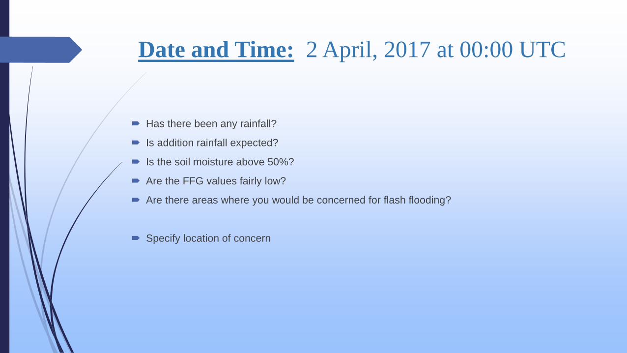
Date and Time: 2 April, 2017 at 00:00 UTC
Has there been any rainfall?
Is addition rainfall expected?
Is the soil moisture above 50%?
Are the FFG values fairly low?
Are there areas where you would be concerned for flash flooding?
Specify location of concern

Date and Time: 2 April, 2017 at 00:00 UTC
Consider the following questions:
Has there been any rainfall? YES
Is addition rainfall expected? YES
Is the soil moisture above 50%? YES
Are the FFG values fairly low? YES.
Are there areas where you would be concerned for flash flooding? YES
Specify location of concern: North eastern basins in Sunamganj and Sylhet

Meteorological Conditions…

Has there been any rainfall?


What type of system is prevailing?

Is there indication that the system is strengthening or
weakening?

Include forecaster remarks about confidence in
precipitation estimates.

Hydrologic Conditions…

What are the soil moisture saturation levels?

What is the trend in soil moisture? (Drying/wetting)
Is the area(s) flash flood prone?
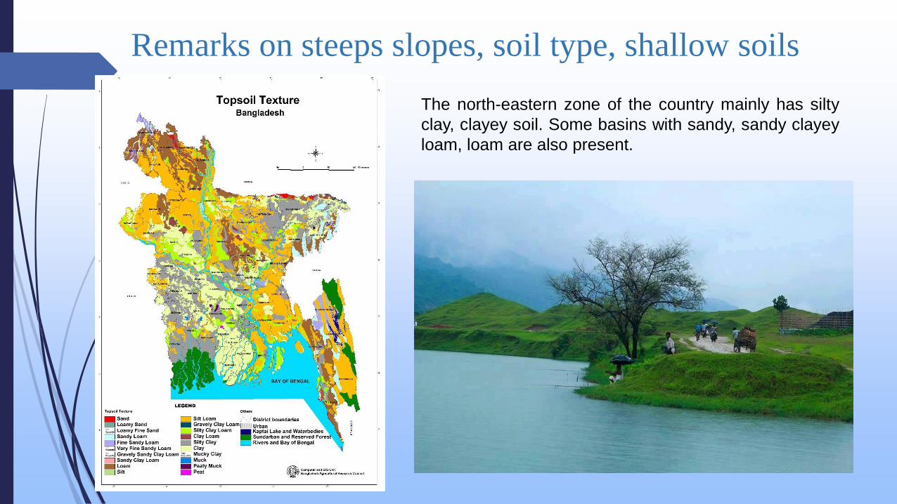
Remarks on steeps slopes, soil type, shallow soils
The north-eastern zone of the country mainly has silty
clay, clayey soil. Some basins with sandy, sandy clayey
loam, loam are also present.

Are there streamflow records in this area?
What is the trend in streamflow?

-2
0
2
4
6
8
10
12
-100 0 100 200 300 400 500 600
Re
du
ced
Leve
l (m
/PW
D)
Distance from the left bank (m)
River Jadukata near Laurergarh, Tahirpur in 2016
2016 DL
0.00
200.00
400.00
600.00
800.00
1000.00
March April May
Ra
infa
ll (m
m)
Time (month)
Monthly total rainfall near Laurergarh
2012 2013 2014 2015 2016 2017
0.00
2.00
4.00
6.00
8.00
10.00
12.00
14.00
1-Mar 1-Apr 1-May
Wa
ter
Le
ve
l (m
)Time (days)
River Jadukata near Laurergarh2012
2013
2016
2017
Danger LevelDL
0.00
10.00
20.00
30.00
40.00
50.00
60.00
70.00
80.00
90.00
1 6 11 16 21 26 31
Rain
fall
(mm
)
Time (day)
Daily Rainfall in Laurergarh
2012 2013 2014 2015 2016 2017

Is rainfall expected to continue?
Is the system strengthening or weakening?
What is the outlook beyond 6 hours?
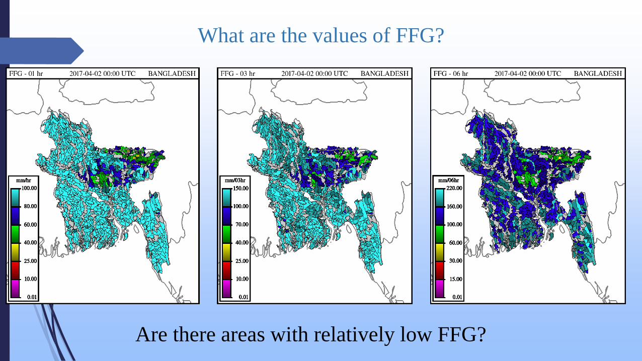
What are the values of FFG?
Are there areas with relatively low FFG?


Does the expected rainfall exceed the FFG?

Comparison between MAP and Gauge
Precipitation accumulation

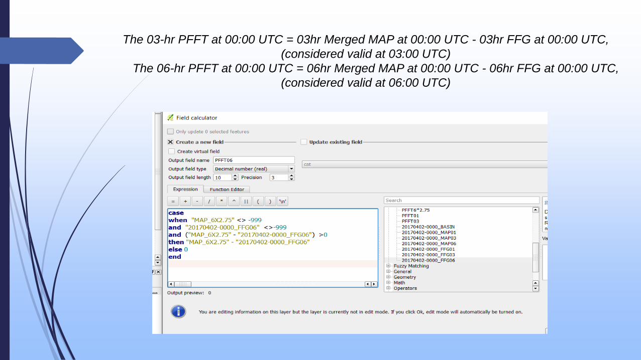
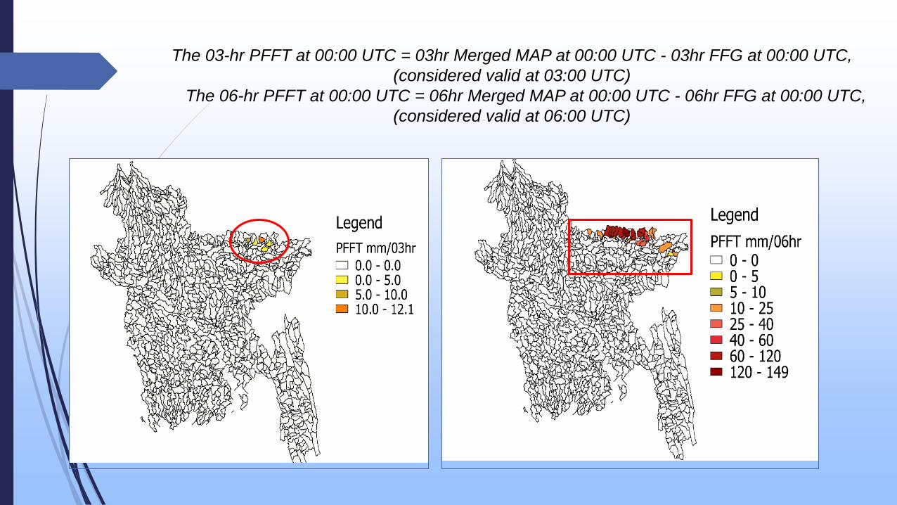
The 03-hr PFFT at 00:00 UTC = 03hr Merged MAP at 00:00 UTC - 03hr FFG at 00:00 UTC,
(considered valid at 03:00 UTC)
The 06-hr PFFT at 00:00 UTC = 06hr Merged MAP at 00:00 UTC - 06hr FFG at 00:00 UTC,
(considered valid at 06:00 UTC)
The 03-hr PFFT at 00:00 UTC = 03hr Merged MAP at 00:00 UTC - 03hr FFG at 00:00 UTC,
(considered valid at 03:00 UTC)
The 06-hr PFFT at 00:00 UTC = 06hr Merged MAP at 00:00 UTC - 06hr FFG at 00:00 UTC,
(considered valid at 06:00 UTC)


Thank you