flood risk management strategy - brent council · d6 brent strategic flood risk assessment ... e9...
TRANSCRIPT

1 | P a g e
Flood Risk Management Strategy
Managing the Floods Risk in Brent

2 | P a g e
Foreword 1.0 Executive Summary 2.0 Introduction 2.1 Why is a Strategy Needed? 2.2 Who is the Strategy aimed at? 2.3 Benefits of a Flood Risk Strategy? 2.4 Legislative Context 2.5 Corporate Plans and Priorities 2.6 Objectives 2.7 Stakeholders 2.8 Climate Change and Flood Risk 3.0 Flood Risk in Brent 3.1 History 3.2 Brent Geography 3.3 Sources of flood risks 3.3.1 Surface Water Flooding 3.3.2 Sewer Flooding 3.3.3 River (fluvial) Flooding 3.3.4 Groundwater Flooding 3.3.5 Reservoir, Dam Or Canal Breach Or Failure 3.4 Getting A Better Understanding of Flood Risk 3.4.1 Modelling Surface Water Flood Risk 3.4.2 Flood Investigation Reports 3.5 Flood Risk Overview for Brent 3.6 Future Flood Risk 4.0 Management of Flood Risk 4.1 Investigating Flooding Incidents 4.2 Recording And Maintaining Assets 4.2.1 Asset Register And Record 4.2.2 Maintaining Assets 4.2.3 Designation Of Assets 4.3 Responding to Flood Incidents 4.3.1 Response To A Major Flooding Incident 4.3.2 Recovery After A Flood Incident 4.4 Delivering Flood Risk Alleviation Schemes 4.4.1 Defra Grant 4.4.2 Flood Defence Grant in Aid (FDGiA) 4.4.3 Scheme Prioritisation 4.4.4 Maintenance 4.5 Approving New Developments 4.5.1 Planning Policy 4.5.2 Strategic Flood Risk Assessment 4.5.3 SuDS (Sustainable Drainage Systems) 4.6 Partnership Working 4.6.1 North West London Flood Risk Management Group 4.6.2 Flood Risk Management Group 4.6.3 Regional Meetings

3 | P a g e
4.7 Communicating With the Public About Flood Risk 4.8 Regulation of Ordinary Watercourses
5.0 Flood Risk Management Action Plan 6.0 Scrutiny and Review 6.1 Overview and Scrutiny 6.2 Flood Documents Review 6.3 Review of Action Plan Appendices A Glossary B Contact Details B1 Brent Council B2 The Environment Agency B3 Thames Water B4 Affinity Water C Guide to Relevant Legislation C1 Flood and Water Management Act 2010 C2 The Flood Risk Regulations 2009 C3 The Climate Change Act 2008 C4 The Civil Contingencies Act 2004 C5 The Strategic Environmental Assessment (SEA) Directive 2001 C6 The Land Drainage Act 1991 C7 The Water Framework Directive 2000 C8 Reservoirs Act 1975 C9 The Water Industry Act 1991 C10 The Highways Act 1980 D Guide to Relevant Documents
National documents D1 National Strategy for Flood and Coastal Erosion Management D2 The UK Climate Change Risk Assessment D3 National Planning Policy Framework
Regional Documents D4 Managing risks and increasing resilience: The Mayor’s climate change
adaptation strategy D5 London Strategic Flood Framework
Local documents D6 Brent Strategic Flood Risk Assessment D7 Preliminary Flood Risk Assessment D8 Surface Water Management Plan D9 Local Development Framework E Roles and Responsibilities E1 Risk Management Authorities and Other Interested Parties E2 London Borough of Brent

4 | P a g e
E3 Thames Water E4 Environment Agency E5 Transport for London E6 Residents and Businesses E7 The Greater London Authority E8 Canal & River Trust E9 Network Rail E10 Neighbouring London Boroughs E11 Summary of Responsibilities F Significant Infrastructure G Flood Risk Management Action Plan
5 | P a g e
Foreword Brent was fortunate to avoid the serious floods elsewhere in the country of 2007 and 2012, which caused so much damage and disruption for those affected. However Brent did suffer floods in 2007 and 2010 though much of this occurred on the highway, open spaces and gardens The probability of such events happening again is only likely to grow as climate change increases the frequency of extreme weather. While Brent will not see flooding as regularly as other parts of the country, when it does happen the impact could be serious due to densely populated nature of the borough. Flooding can have major economic and social impacts, with people unable to return to their homes and suffering stress as a result. For this reason reducing the long-term risk of flooding is not only a sensible investment but also an important task, not just for the Council but for everyone. It’s not something that any one organisation can do on its own, because it needs co-operation between public agencies, businesses and households. This strategy highlights both the good work we already do to manage flood risk and the steps we are looking to take. This document is a first step in explaining how the various organisations plan to work together and who is responsible for what. Under the legislation, the strategy has to explain what is being done to manage ‘local flood risk’, for example flooding from groundwater, ordinary watercourses and surface water. It also provides a unique opportunity to provide information on all sources of flooding and to discuss the links between them. It would not be possible to stop all flooding, even with unlimited funding. The strategy aims to identify priorities representing the best way to manage the risk. Taking effective steps to reduce flood risk, especially at a time of limited funds, requires an evidence-based assessment to ensure that efforts and resources are appropriately focused. Practical steps can be taken to reduce both the likelihood of severe rainfall leading to flooding and also the impact of any flooding that does occur. While flooding hopefully never will be something that is constantly on the mind of residents, this strategy seeks to ensure that if and when it does happen, we are as prepared as we reasonably can be.
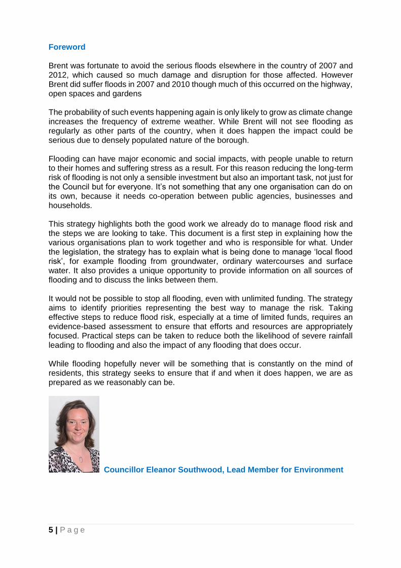
Councillor Eleanor Southwood, Lead Member for Environment

6 | P a g e
1.0 Executive Summary Following extensive flooding in 2007, the Government gave powers and responsibilities to local authorities enabling them to manage flood risk more effectively. The Flood Risk Regulations 2009 and the Flood and Water Management Act 2010, have increased the statutory responsibilities of unitary authorities such Brent Council, which has a new role as the Lead Local Flood Authority (LLFA) for the borough. The Flood Risk Regulations 2009 introduced duties onto Local Lead Flood Authorities (LLFAs) to prepare preliminary assessment reports, to identify Flood Risk Areas and to prepare a Flood risk Strategy. The Flood and Water Management Act 2010 aims to provide better, more comprehensive management of flood risk for people, homes and businesses. It identifies “risk management authorities”; bodies with an interest in flood risk management. The Act outlines the responsibility of the lead local flood authority to “develop, maintain, apply and monitor” a strategy for local flood risk management This strategy builds on the work already carried out in the Preliminary Flood Risk Assessment and Surface Water Management Plans, and details what actions the Council and other key stakeholders are taking to manage flood risk in Brent. The Strategy has five objectives:
Improving the understanding of flooding risks In Brent Reducing the risk of flooding for people and businesses in Brent. Providing clear information on the roles and responsibilities of everyone
involved in flood risk management in Brent Ensuring that emergency plans and responses to flood incidents in Brent are
effective. To take a sustainable and holistic approach to flood management, seeking to
deliver wider environmental and social benefits
Improving the Understanding of Flooding Risks in Brent
The Strategy sets out the flood risk to Brent, by discussing the flooding history, the geography of Brent, likely sources of floods and the overall risk of flooding for Brent. From the historical incidence of flooding, Brent has a low to moderate flood risk. The key flood risk to Brent is from surface water flooding. Surface water flooding occurs when the volume and intensity of a rainfall event exceeds the capacity of the drainage system, the responsibility for which lies with Thames Water. Brent also has a small risk of groundwater flooding which occurs when the water table rises to ground level and inundates low lying areas, though more work may be required to understand this. If there was a breach in the Welsh Harp Reservoir, the effects would be severe; however the risk of this happening is low. Responsibility for maintaining the Welsh Harp Reservoir lies with the Canals & River Trust. Brent is at no risk of flooding from the sea. The responsibility for risk of flooding from rivers lies with the Environment Agency.

7 | P a g e
Getting a better understanding of flood risk will involve more studies modelling the risk posed by surface water, and from information gathered by investigations into flooding events.
Reducing the Risk of Flooding for People and Businesses in Brent The strategy details what is already being done towards managing the flood risk in Brent; including systems set up to investigate Flooding Incidents and the register of flood risk assets - all structures or physical features that have an effect on flood risk in Brent. If a rainfall event is severe enough, maintenance alone will not stop flooding however maintaining existing assets is important in alleviating the effects of flooding. The Strategy includes a summary of the actions that Brent Council and the risk management authorities in Brent will be undertaking to deliver the objectives of the Strategy (Appendix G). Providing clear information on the roles and responsibilities of everyone involved in flood risk management in Brent This Flood Risk Management Strategy heralds a more coordinated approach to work in this important area. The strategy will draw together the work of other important risk management authorities within the borough, such as water companies and the Environment Agency. This document is a first step in explaining how all the relevant organisations plan to work together, and who is responsible for what.
Communicating with the Public about Flood Risk is important. Flood risk is an emotive issue and explaining the risk to residents and businesses has to be done appropriately. The key messages are:
Flooding is rare in Brent but when it does occur the impact could be severe and
it is important that everybody is prepared for it. It is important that we increase our knowledge of where there is a risk of flooding
so that we can look to reduce that risk. Without this knowledge we cannot act. It is important to report flood incidents because it adds to our knowledge on
areas at risk and frequency of incidents. This information informs how activities are prioritised.
We can never be sure down to the level of individual properties where will be affected by flooding.
The council has a programme of work to improve flood risk where practical affordable solutions can be found.
Publically consulting on this strategy will be first step in engaging with residents about flood risk.
Ensuring that emergency plans and responses to flood incidents in Brent are effective Flooding comes in a variety of forms with varying levels of seriousness ranging from ponding, to disruptive flooding and then to damaging or dangerous flooding. The strategy sets out the Council’s response in each case; preparation for responding to “damaging or dangerous flooding” is part of ‘emergency planning’. Emergency planning is the general term for the work that the

8 | P a g e
government, the emergency services (i.e. fire and rescue, police and ambulance services), the health services and the Council does in preparing plans and procedures for dealing with any emergency that might affect large numbers of people. It has two main elements: response and recovery. To take a sustainable and holistic approach to flood management, seeking to deliver wider environmental and social benefits Flood risk management is an environmental activity and the strategy needs to support both local and national plans for sustainable development i.e. development which recognises the interlinking of social, economic and environmental needs and ensure that it can satisfy the needs of today while making sure that future generations can also look forward to the same quality of life. It does this by considering key national plans such as the Water Framework Directive and the Strategic Environment Assessment (SEA) directive, as well as local plans such as Brent’s planning framework.

9 | P a g e
2.0 Introduction 2.1 Why is a Strategy Needed?
The Flood and Water Management Act, 2010, gave the Council strategic responsibility for managing flood risk within Brent. This Flood Risk Management Strategy (FRMS) explains how we and other stakeholders will manage flood risk. The strategy:
Identifies the likelihood of flood risk in the borough
Outlines which stakeholders are responsible for different types of flooding to ensure a common understanding of roles, responsibilities and priorities within the borough.
Explains how stakeholders are working together to reduce flood risk
Provides an overview of the ongoing flood risk management work underway across Brent. The work identified in this strategy will help to reduce the risk of flooding but cannot stop flooding occurring. All stakeholders will work to decrease both the probability and the impact of flooding but it may still happen. This is why it is important that all residents, businesses and other institutions are aware of their responsibilities. Information about roles and responsibilities can be found in Appendix E
2.2 Who is the strategy aimed at?
The strategy is a source of information for all those individuals, communities and businesses which may be prone to flood risk. It is also of relevance to authorities with flood risk management responsibilities, and other partners, to ensure there is a common understanding of roles and responsibilities and priorities within Brent.
2.3 Benefits of a Flood Risk Strategy Improving the understanding of the risks of flooding from for example surface
runoff, groundwater and ordinary watercourses in Brent. Reducing the risk of flooding for people and businesses in Brent. Ensuring that development in Brent takes account of flood risk issues and plans
to effectively manage any impacts. Providing clear information and guidance on the role of the public sector, private
sector and individuals in flood risk management, how those roles will be delivered and how authorities will work together to manage flood risk.
Ensuring that emergency plans and responses to flood incidents in Brent are effective and that communities understand the risks and their role in an emergency.
2.4 Legislative Context Sir Michael Pitt undertook a review of the serious flooding that occurred across
England in the summer of 2007. Nationally its effects were significant. Of particular importance was the high proportion of flooding that came from surface water runoff, rather than rivers.
The Pitt Review (June 2008) made 92 recommendations intended to change the way that local flood risk was managed. Many of these recommendations

10 | P a g e
were based on upper tier local authorities, such as Brent Council, playing a greater role in the management of local flood risk as the Local Lead Flood Authority (LLFA). The roles and responsibilities of Brent Council and our partners in relation to flood risk management are principally defined by two key pieces of legislation: The Flood Risk Regulations 2009 This introduced the following duties onto Local Lead Flood Authorities ( LLFAs) ;
the duty to prepare preliminary assessment reports;
the duty to identify Flood Risk Areas and
the duty to prepare a Flood Risk Strategy See also Appendix C2 for further information on these Regulations. Flood and Water Management Act 2010 The Flood and Water Management Act aims to provide better, more comprehensive management of flood risk for people, homes and businesses. The Act identifies risk management authorities, which are bodies with an interest in flood risk management. Brent Council takes on the role of Lead Local Flood Authority, and has the ‘lead’ role in managing local flood risk from surface water, groundwater and ordinary watercourses across Brent. The Act outlines the responsibility of the lead local flood authority to “develop, maintain, apply and monitor” a strategy for local flood risk management. See also Appendix C3 for further information on this Legislation.
2.5 Corporate Plans and Priorities
The Brent Borough plan 2015-19 was agreed at meeting of full council in March 2015. The plan aims to deliver “Better lives, Better place and Better Locally” Better lives means:
making sure that local people have the best possible life chances, regardless of their starting position
supporting local enterprise, generating jobs for local people, helping people into work and promoting fair pay
making sure that our schools are amongst the best and that our children and young people achieve to their potential
enabling people to live healthier lives and reducing health inequalities supporting vulnerable people and families when they need it.
Better place means
making sure that Brent is an attractive place to live, with a pleasant environment, clean streets, well-cared for parks and green spaces
continuing to reduce crime, especially violent crime, and making people feel safer
increasing the supply of affordable, good quality housing supporting good quality, accessible arts and leisure facilities.
Better locally means

11 | P a g e
building resilience and promoting citizenship, fairness and responsibility amongst local people and strengthening the sense of community amongst the people who live and work here
promoting cohesion and integration amongst our communities making sure that everyone has a fair say in the way that services are delivered,
that they are listened to and taken seriously making sure that inequalities in the quality of life in different parts of the borough
are tackled by a stronger focus on local needs building partnership - between local service providers and between local
services and residents - to find new ways of providing services that are more finely tailored to individual, community and local needs.
Implementing the objectives of the Flood Risk Management Strategy aligns with the “Better Place” aspect of the Brent Borough plan. 2.6 Objectives
The objectives for the Brent Flood Risk Management Strategy (FRMS) reflect the requirements of the Flood and Water Management Act 2010 and the National Flood and Coastal Erosion Risk Management Strategy, 2011.The objectives of the Strategy are as follows:
Improving the understanding of the risks of flooding in Brent Reducing the risk of flooding for people and businesses in Brent. Providing clear information on the roles and responsibilities of everyone
involved in flood risk management in Brent Ensuring that emergency plans and responses to flood incidents in Brent are
effective. To take a sustainable and holistic approach to flood management, seeking to
deliver wider environmental and social benefits. Flooding is a natural event that will sometimes occur despite all efforts to prevent it. However, through the strategy we will coordinate our services so that flood risk is reduced and the aftermath of flood incidents is minimised. The strategy provides a real opportunity for us to work together as no single organisation can effectively manage flood risk alone and co-operation is needed from public agencies, the private sector and households. Effective flood risk management can reduce long-term flood damage costs and is a worthwhile investment for both the public and private sector.
2.7 Stakeholders
The Flood and Water Management Act 2010 identifies the Council, the Environment Agency and Thames Water as the risk management authorities (RMAs) for the area with new responsibilities. Additionally, the following stakeholders have been identified:
Residents and businesses
Greater London Authority/Transport for London
City of London Corporation
Neighbouring London boroughs
Network Rail
Canal & River Trust

12 | P a g e
Appendix E gives an overview of stakeholders’ responsibilities.
Case study – working with stakeholders on project appraisal 2.8 Climate Change and Flood Risk
Climate change is likely to continue for many decades to come. The Brent Climate Change Adaptation Strategy identifies the expected changes that the borough will face, which include an increasing magnitude and frequency of intense rainfall events. Flooding is a natural process and the speed of inundation and duration varies greatly. With climate change, however, the frequency, velocity, depth, patterns and severity of flooding are forecast to increase causing flash flooding, and heavier average winter precipitation that will put us at greater risk of flooding. The Brent Climate Change Adaptation Strategy is based on the UK Climate Projections 2009 (UKCP09). These scenarios are generated based on probability. No climate model can give a single definite answer to what the future will look like, however, under the high emissions scenario (which looks the most likely) peak rainfall is likely to increase significantly.
3.0 Flood Risk in Brent 3.1 History
Brent is very fortunate that we have not experienced major flooding incidents in last 20 years. The most recent floods were in 2007 and 2010 and much of this occurred on the highway, open spaces and gardens. The key flood risk to Brent is from surface water flooding which occurs when the volume and intensity of a rainfall event exceeds the capacity of the drainage system. (which is the responsibility of Thames Water) Flooding from main rivers and ordinary watercourses has been minimal. The main rivers in the borough are maintained by Environment Agency and we will work with them to ensure that they are inspected and maintained regularly.
3.2 Brent Geography
The Brent covers approximately 4,310 hectares of North West London (Figure 1.1). This includes the urban areas of Brondesbury Park, Kensal Rise, Kenton, Kilburn, Kingsbury, Sudbury, Wembley and Willesden.

13 | P a g e
Figure 3.1
Brent is bordered by the London Boroughs of Barnet, Camden, Westminster, Kensington and Chelsea, Hammersmith and Fulham, Ealing and Harrow. Within the borough there are several areas of high ground which range from 75–65 m Above Ordnance Datum (AOD). These ridges of high ground divide the borough up into two main river catchments. The River Brent intersects the borough running from the north-east to south-west and the Wealdstone Brook runs through the London Borough of Harrow to the north of the LBB down to its confluence with the River Brent near the centre of the borough (Figure 3.1). There are several smaller watercourses which form tributaries of the River Brent: Mitchell Brook and Wembley Brook. The Grand Union Canal runs along the south-western boundary of the LBB with a connecting feeder channel running from the Welsh Harp reservoir to the north-east of the borough.

14 | P a g e
Figure 3.2
The lower lying areas of the borough in the river valleys range from 37–22 m AOD along the River Brent and to 40–33 m AOD along Wealdstone Brook. Approximately 93% (40km2) of the LBB is urbanised. There are small pockets of open land with the largest being Fryent Country Park to the north east of the borough.
3.3 Sources of flood risk This section describes the various forms of flooding that can be experienced. Whilst the responsibilities for flooding are divided between different risk management authorities (see Appendix E), there is interaction between the different systems within a catchment that can lead to flooding. A rainstorm may bring rainfall to a catchment, which will soak into the soil and eventually may replenish groundwater. If the soil is saturated or the land is covered by impermeable surfaces, it will flow to local watercourses through land drains or sewers. The local watercourses will flow to the rivers, collecting rain from more drains and sewers on the way. The river will flow towards the sea, collecting water from more local watercourses on the way or from groundwater if the water table is high enough. A diagram of a catchment is shown in Figure 3.3.

15 | P a g e
Figure 3.3 - A Catchment Area (US EPA) There are a number of sources of potential flooding: 3.3.1 Surface water flooding
Surface water flooding occurs when heavy rainfall exceeds the capacity of the ground and local drainage network to absorb it. This sort of flooding is typically caused by short, intense rainfall. Surface water flooding is most problematic when catchments are already saturated or frozen, and in urban areas where a substantial proportion of the land surface is impermeable. This is due to the presence of houses and other buildings, roads and pavements Flooding associated with the highway network is the most common form of localised flooding and occurs during or immediately after heavy storms. It is most commonly caused by blocked gullies or the surcharging of outfall pipes, which take the water away from roads with tarmac-type surfaces. The Risk to Brent from this form of flooding is covered in Section 3.5. To improve our understanding of surface water flood risks (and other local sources of flooding) surface water management plans have been undertaken in areas identified as high risk in the Preliminary Flood Risk Assessment. Surface Water

16 | P a g e
Management Plans are studies into the local flood risks of an area which tell us what risks the area faces and provide a plan for managing any significant risks. The Preliminary Flood Risk Assessment and Surface Water Management Plans will be published along with this Strategy in 2016.
3.3.2 Sewer flooding
Sewers are designed to cope with the majority of storms, but occasionally storms are so heavy that they overwhelm the system. This type of flooding is particularly severe when a combined sewer (a sewer that carries both surface water and foul water) floods as it causes effluent to be discharged that can pose a risk to health and the environment. Sewer flooding is the responsibility of the sewerage undertaker. The following factors are increasing the risk of a sewer flooding:
• population growth - leading to increased housing and associated development • paving over of green spaces and undeveloped land - preventing natural
infiltration and drainage • disposal of fat, oil and grease - which harden in the sewers • climate change - leading to more intense storms.
The risk to Brent from this form of flooding is minimal. In 2014/15, only 2 properties were affected by flooding due to inadequate capacity in the drainage system.
3.3.3 River (fluvial) Flooding
River flooding (sometimes known as fluvial flooding) is caused when rivers do not have its enough capacity in their natural channel to contain the water flowing in them. A river bursting banks is usually caused by prolonged periods of heavy rainfall. The Environment Agency is responsible for main rivers and smaller watercourses of strategic drainage importance, which includes the rivers in Brent. The Flood Maps use data from modelling and past flood events to map flood extents and can be publicised to help increase awareness of flood risk. They are used by a range of organisations, including local authorities, insurers and developers. Property owners can view the information on the Environment Agency website, 'what's in your backyard?' Brent’s Flood maps will be published along with this strategy in 2016 The Environment Agency's National Flood Risk Assessment (NaFRA) shows the likelihood of flooding across England and Wales. It assesses the probability of flooding from rivers and the sea. It takes account of the location, type and condition of defences and maps the risks in three probability bands - significant, moderate and low. The borough has the River Brent running through it north-east to south-west and the Wealdstone Brook runs down to its confluence with the River Brent near the centre of the borough (Figure 3.1). There are several smaller watercourses which form tributaries of the River Brent: Mitchell Brook and

17 | P a g e
Wembley Brook. The risk to Brent from this form of flooding is very low and no reports of flooding have been received in the last few years.
3.3.4 Groundwater Flooding
Groundwater flooding generally occurs in low-lying areas, as the result of groundwater rising above the surface of the land. The risk of groundwater flooding is influenced by the underlying geology. There can be substantial time-lags between persistent or heavy rainfall which leads to rising groundwater levels, and flooding resulting from the emergence of groundwater. This is due to the relatively slow rate at which water percolates into and moves through the ground The risk of groundwater flooding can be affected by development, which alters the natural flow patterns and pathways. At present, our understanding of the risk of groundwater flooding in Brent is limited. Work needs to be done to assess the risk posed by groundwater flooding and then a decision can be taken as to whether further study is required.
3.3.5 Reservoir, Dam or Canal Breach or Failure Although the safety record for reservoirs is excellent, if a situation did occur, flood incidents would be instantaneous with significant movement of debris. Reservoirs hold large volumes of water and the safe operation and management of reservoirs to reduce flood risk is vital. In Brent there is only one reservoir (Welsh Harp) which is the responsibility Canals and Rivers Trust.
3.4 Getting a better understanding of Flood Risk
As extreme rainfall events do not happen regularly but cause serious damage when they do occur, we need to model the effect of such rainfall events on the borough. This is particularly important because climate change has been predicted to increase the likelihood of major rainfall events. However it would be risky to rely just on modelling, so it is important that any significant flood events are investigated fully as well.
3.4.1 Modelling Surface Water Flood Risk High level modelling has been carried out to better understand the surface water flood risk to the borough. This is not detailed enough to determine which individual properties would be affected. There will always be factors that cannot be captured on a model which will prevent models being fully accurate to a fine level of detail. This modelling process was begun by Drain London, the GLA programme to improve understanding of surface water flood risk in Greater London. Drain London helped deliver Preliminary Flood Risk Assessments (2011) and Surface Water Management Plans (2011) for every London borough. This process helped provide a consistent baseline across the whole London In addition to this; Brent has undertaken work to meet its responsibilities under the Flood Risk Regulations 2009.

18 | P a g e
As part of the work to develop the Preliminary Flood Risk Assessment, Greater London was identified as one of the 10 major surface water flood risk zones in England. As a result, Flood Hazard and Flood Risk Maps for Greater London were published in June 2013 The Brent Strategic Flood Risk Assessment (SFRA) provides the results of the latest flood risk modelling and mapping for the borough and this document is used when Planning applications are considered. Neighbouring boroughs’ SFRAs and Local Flood Risk Management Strategies provide further evidence of the risks elsewhere in London which may affect Brent. At present, a drainage study is being carried out by Thames Water in order to establish the flow characteristics and capacity in the river and drainage system. On completion of this study, this will provide detail information on areas affected by flooding and solutions. The study is being carried out on the behalf of North Brent and Harrow Flood Stakeholders Group. This group comprises of representatives from Brent, Harrow, Thames Water and Environment Agency.
3.4.2 Flood Investigation Reports Under Section 19 of the Flood and Water Management Act, as the LLFA, the Council has a responsibility to investigate the cause of flooding and notify the relevant risk management authority.
(1)On becoming aware of a flood in its area, a lead local flood authority must, to the extent that it considers it necessary or appropriate, investigate (a) which risk management authorities have relevant flood risk management functions, and . (b) whether each of those risk management authorities has exercised, or is proposing to exercise, those functions in response to the flood. (2)Where an authority carries out an investigation under subsection (1) it must (a) publish the results of its investigation, and . (b) notify any relevant risk management authorities.
The decision of whether a flood event is significant and so requires investigation (or not) is at the discretion of the LLFA. The Council will therefore carry out an initial appraisal where internal flooding of a single residential property, business or office premises has occurred, or where a flooding incident impacted on an identified item of critical infrastructure (as detailed in Appendix E.)
This initial appraisal will determine the main source of flooding and therefore the risk management authority responsible for resolving the incident, which will then be notified. Where the source of flooding is deemed to be the responsibility of Brent Council i.e. flooding from ordinary watercourses, surface water or groundwater, an investigation will be carried out. The aim is for flood investigation reports to bring all useful information together in one place, providing an understanding of the possible causes of flooding and potential long-term solutions.
19 | P a g e
Further recommendations will also be made to highlight potential flood risk management actions. Reports will seek to provide a clear and thorough understanding of the flooding situation, but our duty to investigate does not guarantee that problems will be solved. Decisions to take action must be taken by the responsible parties and we cannot force other authorities into action. However the investigations can act as a catalyst for change.
A summary of the results of the full flood investigations will be published on the Council’s website. All S.19 flood reports will be recorded to extend the Council’s historic incident records.
3.5 Flood Risk Overview for Brent
According to the Environment Agency‘s property count for their national Flood Map for Surface Water (FMfSW) dataset, approximately 35,500 residential properties and 4,400 non residential properties in Brent could be at risk of surface water flooding of greater than 0.1m (10 cm) depth during a rainfall event with a 1 in 200 probability of occurrence in any given year.
Furthermore, of those, 12,600 residential properties and 4,400 non-residential properties are estimated to be at risk of flooding to a depth of greater than 0.3m (30 cm) during the same modelled rainfall event.
3.6 Future Flood Risk Under United Kingdom Climate Projections 2009 (UKCP09), predictions for future rainfall in the UK up to 2080 are that there could be around three times as many days in winter with heavy rainfall (defined as more than 25mm in a day). It is plausible that the amount of rain in extreme storms (with a 1 in 5 probability of occurrence in any given year (20% AEP) or rarer) could increase locally by 40%.
Within the Thames River Basin District, if emissions follow a medium future scenario, UKCP09 projected changes by the 2050s relative to the recent past are:
Winter precipitation increases of approximately 15% (very likely to be between 2 & 32%);
Precipitation on the wettest day in winter up by approximately 15% (very unlikely to be more than 31%);
Relative sea level at Sheerness very likely to increase between 10 and 40cm from 1990 levels (not including extra potential rises from polar ice sheet loss);
Peak river flows in a typical catchment likely to increase between 8 and 18%. The risk of overloading the urban drainage system and surface water flooding in the Borough is therefore likely to increase into the future unless steps are taken to manage and mitigate this form of flooding.

20 | P a g e
4.0 Management of Flood Risk This section explains how flood risk management will be operated in Brent through the following ongoing activities:
Investigating Flooding Incidents Recording And Maintaining Assets Responding to Flood Incidents Funding And Delivering Flood Risk Alleviation Schemes Approving New Developments Partnership Working Communicating With The Public About Flood Risk Regulation of Ordinary Watercourses
4.1 Investigating Flooding Incidents
Investigate all flooding complaints, keep records of flooding, identifying the cause and arrange remedial works where deemed necessary as detailed in Section 3.4.2.
4.2 Recording And Maintaining Assets 4.2.1 Asset Register and Record
As the LLFA, the Brent Council is obliged to establish and maintain a register “Flood Risk Assets,” which are all structures or physical features that have an effect on flood risk in an area. These include everything from the Welsh Harp Reservoir to highways gullies. DEFRA has provided full guidance on what constitutes a flood risk asset, which can be found in Appendix D.
This must be available for inspection at all reasonable times. Brent Council must also produce a Record detailing the ownership and state of repair of each asset, which is not publically accessible. Brent uses the “Floodstation” asset register software to record all its Flood risk assets
The recording and maintenance of flood risk assets is an important element of flood risk management because well maintained assets, such as drainage systems, ensure that water flows are directed away from buildings and important local infrastructure The LLFA must determine the criteria for deeming an asset as having a significant effect. In Brent, an asset is deemed to be significant if it is: Features and structures that have a significant effect on local flood risk will be ones which, if compromised in any way, may contribute to a risk of a significant flood event (as defined in section 3.4.2) The register stating the key assets in the borough will be published on our website in 2016 and will be updated annually with new assets and changes in ownership recorded. The record will be shared with all the organisations which have contributed data to it.

21 | P a g e
Figure 4.1 – Floodstation asset register software
4.2.2 Maintaining Assets Well maintained assets cannot prevent flooding happening but they can lessen its impact and probability. All asset owners are responsible for maintaining their own assets. Council assets are maintained by a variety of services and each service is responsible for maintaining and checking their condition (see also section 5.4.4).
4.2.3 Designation of Assets The Council and the Environment Agency are the ‘designating’ authorities of assets. If an asset becomes designated, its owner cannot alter or remove it without first consulting the designating authority. The aim of designating flood risk assets is to safeguard them against unchecked works which could increase flood risk in the area. It is not possible to designate assets owned by a risk management authority so Thames Water assets cannot be designated although this does not diminish their responsibilities for maintaining them, as asset owners. A process for designating assets will be designed in partnership with neighbouring authorities to ensure that there is consistency across the different boroughs.
4.3 Responding To Flood Incidents
For the sake of clarity, flood incidents will be divided into the following types:
• Ponding - This is a common occurrence after heavy rain and is characterised by puddles. The water is neither causing serious disruption nor threatening buildings or critical infrastructure. Persistent ponding can be investigated and resolved as a maintenance activity; localised severe ponding can be dealt with through the council’s highway Emergency Call Out function.
• Disruptive flooding - This is flooding which is making it harder for people to
carry on as normal by blocking roads and pathways or forcing the cordoning off

22 | P a g e
of parks and other open spaces. It is not threatening buildings or critical infrastructure.
• Damaging or Dangerous flooding - a major flooding incident - This is flooding that enters buildings or critical infrastructure causing damage or is flowing at such rates as to cause serious danger to people. For Actions to take when the above types of flooding occurs, please refer to the councils website https://brent.gov.uk/emergencies/severe-weather/flooding Preparation for responding to “damaging or dangerous flooding” is part of ‘emergency planning’. Emergency planning is the general term for the work that the government, the emergency services (i.e. fire and rescue, police and ambulance services), the health services and the Council does in preparing plans and procedures for dealing with any emergency that might affect large numbers of people. It has two main elements: response and recovery.
4.3.1 Response to a Major Flooding Incident
The Councils’ Emergency Planning Team will take action according to the information set out on the Council’s website https://brent.gov.uk/emergencies The Met Office’s national severe weather warning service provides warnings of severe or hazardous weather to the public. These warnings are available on the Met Office website http://www.metoffice.gov.uk/public/weather/warnings The warnings are for broad areas and there is very little warning time for how it will affect specific neighbourhoods. Due to the uncertainty and very short timeframe for warnings there is very little the Council can do other than to be ready to respond to reports of flooding and react where flooding is taking place.
In a major rainfall event, the ability of local emergency services to be able to help everybody is limited and will focus on preservation of life. In major flood events, we will look to help those who are vulnerable and cannot help themselves through family and friends by organising short term temporary shelter in respite centres. The Environment Agency provides an online flood warning service that can be viewed at http://apps.environment-agency.gov.uk/flood/31618.aspx. This service provides 3 day warnings, river levels and a live flood warning map. Brent Council Emergency Planners have also published a Multi Agency Flood Plan covering flood events and are able to provide assistance during and after a severe flood event including recovery
4.3.2 Recovery after a Flood Incident

23 | P a g e
Recovery from an incident will begin as soon as possible. As the floodwater recedes, the emergency response may still be on-going while the recovery phase begins. If it is a minor flood, recovery activities such as cleaning of streets will usually form part of normal operations without special arrangements. If it is a severe flood affecting many people and properties, it will require a co-ordinated response which will determine local strategies in recovery, prioritising needs and allocating resources appropriately so that the community returns to normality as soon as possible. The Council would take a lead role in managing the recovery process.
4.4 Delivering Flood Risk Alleviation Schemes
There is no obligation on any organisation to deliver flood defence or mitigation schemes to residents or businesses that are at risk of flooding. New developments should be designed to be resilient to major flood events and will not receive any government support for flood mitigation schemes in the future. For existing homes and offices, there is limited central government funding available to support flood risk mitigation projects when there is a strong benefit to cost ratio.
5.4.1 Defra Grant
In order to support the delivery of the Flood and Water Management Act 2010, Defra provides a grant to lead local flood authorities for the duration of the current spending review period. Brent Council received £136,000 in 2015/16 and is likely to receive similar amount for future years. This money will be used by Brent to fund the new responsibilities we have under the Act. This includes staff costs to undertake these new responsibilities and financing investigations into local flooding. We already work in partnership with other neighbouring lead local flood authorities and Environment Agency to identify flooding areas so that bids can be made for funding.
5.4.2 Flood Defence Grant in Aid (FDGiA)
Flood defences and coastal erosion risk management schemes are funded from a government grant called Flood Defence Grant in Aid (grant in aid) which is administered by the Environment Agency on behalf of Defra. Until recently schemes would receive full grant in aid funding if they met a certain cost-benefit ratio, while schemes that did not achieve this ratio would receive no grant. Under this mechanism many schemes never achieved the required cost-benefit ratio and could never be delivered. Defra has changed the way grant in aid will work from April 2012. The new partnership funding approach determines what proportion of the cost of a scheme can be funded by grant in aid. Some schemes will be fully funded, others only partly funded, according to how much public benefit they will give, for example by reducing flood risk to homes and vital infrastructure, (e.g. power stations and water treatment works). Any shortfall in the amount of grant in aid required to construct the scheme will need to be found from elsewhere. This could be from local levy funding from the local levy, from local businesses or other parties who will benefit from the scheme.

24 | P a g e
This change provides an opportunity for local communities to have more influence on how flood defences are delivered in their communities. However it also means that local communities may have to find funds to contribute to flood risk management schemes.
We monitor and review flooding incidents to identify any flooding areas that require flood alleviation schemes and bid for funding when appropriate.
4.4.3 Scheme Prioritisation
It is not possible to prevent all flooding, and with limited resources and funding flood risk management work will need to be prioritised.
Schemes of local importance These schemes are to manage flood risk that is more localised and require works that are small, therefore they may not be eligible for grant in aid these, but they are still locally important. Prioritisation for funding for drainage schemes is covered in Brent’s Highway Asset Management Plan which was adopted by the Council on 17th February 2014. The full document can be found here: www.brent.gov.uk/media/9244640/Brent-HAMP-2014.pdf The scheme programme for carriageways footways and drainage is drawn up and then approved by the Lead Member for Environment on an annual basis, in the early part of the calendar year, so that an quick start can be made on the scheme programme early in the new financial year.
4.4.4 Maintenance
Brent Council is are responsible for maintaining over 24,500 gullies covering all adopted roads except the A406 North Circular Road, which is maintained by Transport for London. Gully cleansing is carried out by through the LoHAC (London Highways Alliance Contract) by contractor ConwayAecom on cyclical basis with all gullies cleaned at least once every 18 months and the most important gullies being cleaned twice a year. The frequency with which gullies are cleansed is based on best practice guidance and historic data which has identified the gullies in known flooding areas or where the impact of a blocked gully would have a serious impact, for instance at the bottom of a hill.
The gully cleansing programme is closely monitored to make sure it stays on target, and audits are carried out to ensure that gullies have been cleaned. Any faults found during cleansing – for instance a collapsed pipe or a jammed gully grate - are reported by the contractor and the council issues works orders to rectify faults, according to priorities and available budget. More serious problems may require further investigation, such as a CCTV survey of the pipe network, before the problem can be identified and resolved.

25 | P a g e
In this way the drainage network is maintained, so that it can work as effectively as it can in draining away highway surface water.
4.5 Approving New Developments It is vital for good flood risk management that new developments are safe from flood risk and do not increase it elsewhere. Planning policy is led by the Council in its role as the local planning authority. The Environment Agency and Thames Water advise planning authorities on very large sites. We will be working closely with developers, to seek funding opportunities that will combine flood storage and SuDS objectives and open space improvements that will provide benefits to habitat, biodiversity, water quality and accessibility for education and healthier lifestyles by encouraging more outdoor activity.
4.5.1 Planning Policy
The Local Development Framework in Brent, states that we will require all development to take measures to minimise the effects of, and adapt to, climate change and encourage all development to meet the highest feasible environmental standards that are financially viable during construction and occupation by ensuring buildings and spaces are designed to cope with, and minimise the effects of, climate change. Over the years, the increase in buildings and development in Brent has covered previously permeable ground which means increased rainwater that will run off the surface down drains and into the sewers We will require major developments or development that increases the amount of impermeable surfacing to adequately manage the increases in surface water or sewage discharge. Development will also be required to take account of known sewer flooding problems by including appropriate mitigation measures to avoid increased drainage problems and flood risk downstream. Where possible, they should look to reduce the flood risk. In particular, developments in areas which have been identified as being at risk of surface water flooding must be designed to cope with storm events with a 1% chance of happening in any one year/ 1 in 100 year return period (including 30% allowance for climate change). This is in order to limit the flooding of, and damage to, property. It is also important to address climate change which has resulted in wetter winters and heavier showers in the summer months which is predicted to get worse over the coming decades. This will put additional pressure on an ageing sewer system. Air Pollution can also contribute to floods. A 10 year study published in Nature Geoscience by Zhanqing Li found that air pollution, impedes gentle rains while exacerbating severe storms. http://www.nature.com/ngeo/journal/v4/n12/full/ngeo1313.html This shows the need for the council to continue to help reduce the sulphur, nitrogen and

26 | P a g e
hydrocarbon emissions within Brent through its policies to improve transport sustainably, reduce congestion and hence pollution.
Regarding Sustainable design and construction: the way development is delivered in the borough will have a significant effect on environmental, social and economic outcomes. The core strategy should promote the principles of sustainable design and construction as set out in the Code for Sustainable Homes (DCLG 2006), and the Decent Homes and Decent Communities Programme (DCLG 2006), as well as the London Plan Supplementary Planning Guidance on Sustainable Design and Construction (GLA 2006). The core strategy should also promote Brent Supplementary Planning Guidance 19: Sustainable Design, Construction and Pollution Control.
4.5.2 Strategic Flood Risk Assessment
As a planning authority, the Council is required to produce a Strategic Flood Risk Assessment (SFRA) to provide evidence for the Local Development Framework. We produced a joint SFRA with the other seven north London boroughs in the North London Waste Partnership. This was published in August 2008.
4.5.3 SuDS (Sustainable Drainage Systems) Sustainable urban drainage systems (SuDS) will now be a planning requirement for developments of ten dwellings or more and equivalent non-residential schemes from April 2015 unless developers can demonstrate that SuDS would be inappropriate. Schedule 3 of the Flood & Water Management Act (FWMA) and the approval of SuDS by a SuDS Approving Body (SAB) is now replaced by changes to the National Planning Policy Framework (NPPF). The Government laid a Statutory Instrument making LLFAs a Statutory Consultee by adding the consultation requirements to Schedule 4 of the Development Management Procedure Order from 15 April 2015. This confirms that in considering planning applications, local planning authorities should consult the relevant Lead Local Flood Authority on the management of surface water; satisfy themselves that the proposed minimum standards of operation are appropriate and ensure through the use of planning conditions or planning obligations that there are clear arrangements in place for on-going maintenance over the lifetime of the development. The changes will strengthen existing planning policy to ensure that sustainable drainage systems will be provided in new major developments where appropriate.
On 24 March 2015, the Government laid a statutory instrument making the Lead Local Flood Authority a statutory consultee by adding the consultation requirement to Schedule 4 of the Development Management Procedure Order. This came into effect from 15 April 2015.

27 | P a g e
Government has considered the new burden, in consultation with the Local Government Association, of making the Lead Local Flood Authority a statutory consultee in the planning process. The final assessment gained clearance from the Department of Communities and Local Government and Her Majesty’s Treasury, allowing Defra to issue contracts for funding to all 152 Lead Local Flood Authorities on 18 March 2015.
4.6 Partnership Working 4.6.1 North West London Flood Risk Management Group.
Brent will manage flooding incidents more efficiently and promote partnership working with other stakeholders by through the North West London Flood Risk Management Group. Brent is bordered by the London Boroughs of Barnet, Camden, Westminster, Kensington and Chelsea, Hammersmith and Fulham, Ealing and Harrow. As part of Drain London, London boroughs were divided in to 8 groups (see Appendix E7)
The group consists of Drain London groups 1 and 2 and comprises of London Boroughs of Barnet, Ealing, Harrow, Hillingdon, Hounslow and Brent. The Group will provide a platform for the NW London Boroughs to assist with delivering the requirements of the FWMA and Flood Risk Regulations in the sub-region. This will be attended by external partners and stakeholders who have an interest in flood risk management and the meetings are held quarterly.
5.6.2 Flood Risk Management Group In order to manage Flood Risk Strategy more effectively, an internal Brent group will be set up to oversee the delivery of Brent’s Flood Risk Strategy. In addition to regular meetings, ad-hoc meetings will be held after storm events to discuss problem encountered and lessons learned.
4.6.3 Regional Meetings
In order that Brent’s flood risk planning is co-ordinated with the rest of London, Brent will continue to attend Regional meetings, Drain London and LoDEG (London Drainage Engineering Group) has been established by all 33 London Boroughs and meetings are held quarterly. Information from these meetings will be reported back to the Brent Flood Risk Management Group.
4.7 Communicating with the Public about Flood Risk
Flood risk is an emotive issue and explaining the risk to residents and businesses has to be done appropriately. The key messages are:
Flooding is rare in Brent but when it does occur the impact could be severe and
it is important that everybody is prepared for it It is important that we increase our knowledge of where there is a risk of flooding
so that we can look to reduce that risk. Without this knowledge we cannot act. It is important to report flood incidents because it adds to our knowledge on
areas at risk and frequency of incidents. This information informs how activities are prioritised

28 | P a g e
We can never be sure down to the level of individual properties where will be affected by flooding.
The council has a programme of work to improve flood risk where practical affordable solutions can be found.
Publically consulting on this strategy will be first step in engaging with residents about flood risk. We will also develop a communication plan to publish flood risk management information on the Council’s website, enabling residents to help themselves.
4.8 Regulation of Ordinary Watercourses
The Flood and Water Management Act 2010 has transferred existing powers to regulate the proper function of ordinary watercourses to Brent. These powers consist of two parts:
• The enforcement obligations to maintain flow in a watercourse and repair watercourses, bridges and other structures in a watercourse; and
• The power to give consent for structures in the watercourse and changes to the
alignment of the watercourse
The enforcement powers have been transferred from local authorities and the consenting powers have been transferred from the Environment Agency. These are permissive powers, not duties, Brent can choose to exercise them
It is advised that anyone considering any works in or near a watercourse contact the relevant authority to discuss the need for consent
5.0 Flood Risk Management Action Plan
A summary of the actions that the Brent and the risk management authorities will be undertaking over the next year and beyond to deliver the objectives of the local strategy forms Appendix G.
6.0 Scrutiny and Review
6.1 Overview and Scrutiny Flooding falls under the remit of the London Borough of Brent Council Cabinet Member for Environment, who will receive the bi-annual report from the Flood Risk Management Group. Other risk management authorities will continue to review their own activities and plans through their governance arrangements.
6.2 Flooding Documents Review We will review the Brent Preliminary Flood Risk Assessment, which is a key evidence base for this strategy, in 2017. All of these actions will then be repeated on a six yearly cycle so a new PFRA is expected in 2017, a new Flood Hazard and Flood Risk Maps in 2019 and a new Flood Risk Management Plan in 2021.

29 | P a g e
However, given that our knowledge and understanding on flood risk will improve significantly in the coming years, there must be opportunities to update the strategy as new information becomes available. For this reason the strategy should be viewed as a ‘living document’.
6.3 Review of Action Plan
We will refresh the action plan annually. They will reflect, as far as possible, all activities planned by risk management authorities and partners to address the objectives in the strategy.

30 | P a g e
Appendix A - Glossary
Term/ abbreviation Definition
Aquifer An underground layer of waterbearing permeable material from which groundwater can be extracted.
Basin A normally dry depression designed to control water flow or undergo treatment of the water.
Biodiversity The degree of variation of life.
Brent Flood Risk Areas
Areas of Brent that are at risk of river or surface water flooding as defined in the Brent Local Plan
Canal An artificial water channel for transportation or water supply.
Catchment An area contributing to surface water flow to a certain point in a drain or river.
Chalk strata A layer of chalk in the ground.
Culvert Channel to transport water underneath artificial construction - such as a road, railway or embankment.
Channel The physical confine of a watercourse.
Defence (flood) A structure designed to reduce flood risk and/ or impact.
Defra The Government’s Department for Environment, Food and Rural Affairs
Ditch A small to moderate artificial depression to transport water
Drain Or drainage well
is a system to collect excess surface water and groundwater in urban areas.
Drain London Multi agency partnership co-ordinated by the Greater London Authority to provide pan London information and advice on flood risk
FMfSW A Flood Map for Surface Water ; National scale maps published by the Environment Agency showing surface water flood risk
Flood board A flood defence measure that physically obstructs a doorway to stop water entering a building
Floodplain The land adjacent to a watercourse that would be subjected to repeated flooding in natural conditions.
Flood Zones Environment Agency defined zones with varying probabilities of river flooding
Flood Zone 1- Low probability of flooding - less than 1 in 1,000 annual probability of river or sea flooding (<0.1%)
Flood Zone 2 – Medium probability of flooding - between a 1 in 100 and 1 in 1,000 annual probability of river flooding (1% – 0.1%)
Flood Zone 3 - High probability of flooding - a 1 in 100 or greater annual probability of river flooding (>1%)
Fluvial Something associated with rivers and streams.
Green roof A roof with vegetation on its surface, contributing to local biodiversity. A green roof provides a level of retention, attenuation and treatment of rainwater.

31 | P a g e
Groundwater The water below the surface of the ground and in direct contact with the ground or subsoil
Gully A large ditch or small valley, created by running water eroding sharply into soil. Can also be used to describe a street gutter or drain
Infiltration The passage of surface water into the ground.
Impermeable Something that will not let water pass through
Lead Local Flood Authority LLFA
The local authority with the statutory responsibility for flood risk management in its local area.
Local flood risk The flood risk from surface runoff, groundwater and ordinary watercourses
Local Flood Risk Management Strategy
Strategy for managing flood risk at a local level as required by the Flood and Water Management Act 2010
Main river Watercourses shown on the statutory main river map (held by the Environment Agency and Defra).
Manhole An access point for performing maintenance to a buried public utility.
Multi Agency Flood Plan
Emergency Plan for responding to flooding
National Planning Policy Framework
The government’s statement of planning guidance to local planning authorities, issued by the Department of Communities and Local Government in March 2012. Brent must take account of it in preparing and implementing its planning policies.
Ordinary watercourses
Any watercourse (including ditches and streams) that is not identified as main rivers on the Defra register. A watercourse that does not form part of a main river. For the purposes of the strategy it includes lakes, ponds or other areas of water that flow into an ordinary watercourse
Permeable Something that will let water through.
Pond A basin that is permanently wet, designed to retain storm water, permit settlement of undissolved particles and treatment of the water
Retention The regulation of water flow by detaining
Reservoir Artificial body of water as a result of the construction of a dam.
Risk management authorities
These are outlined in the Flood and Water Management Act 2010 (section 6 (6)) as: a) the Environment Agency b) a lead local flood authority c) a district council for an area for which there is no unitary authority d) an internal drainage board e) a water company f) a highway authority
Riparian owner A landowner whose land lies on, or adjacent to the boundaries of, any watercourse.

32 | P a g e
Runoff Above ground water flow that is not in a watercourse. Occurs when ground is impermeable, saturated or the rainfall is intense.
Sewer Pipe or channel to transport domestic foul and/ or surface water from buildings and urban areas. A separate sewer will be one or the other only; a combined sewer will be both.
Sluice gate Water flow control gate that operates by allowing water to flow underneath it
Soakaway Underground structure where collected surface water is held to allow it to pass into the ground over time
Surface water flooding
Rainwater or other precipitation on the surface of the ground that has not entered a watercourse, drainage system or public sewer.
Sustainable A way to describe something that will not restrict the ability of others, now or in the future. Will also stimulate economic growth, maximize wellbeing and protect the environment, while not impacting future generations to do the same
Swale A shallow vegetated channel designed to direct and retain water, while also permitting infiltration and with the vegetation providing filtration
Treatment To improving the quality of water through physical, chemical or biological means.
Watercourse Includes all rivers, streams, ditches, drains, cuts, culverts – any passage where water flows.
Wetspot/Hotspot The term used by the lead local flood authority to describe the location of a flood incident that has been reported

33 | P a g e
Appendix B - Contact details
B1 Brent Council
Telephone: Contact Centre 020 8937 1234 Email: [email protected] Web: www.Brent.gov.uk
B2 The Environment Agency
Telephone: Incident Hotline 0800 807060 Floodline Warnings Direct 0845 988 1188 General Enquiries 03708 506 506 Email: General Enquiries [email protected] Web: www.environment-agency.gov.uk
B3 Thames Water
Telephone: Leakline 0800 009 3961 Non-bill enquiries/ Emergency 0845 9200 800 Email: Customer Services [email protected] Web: www.thameswater.co.uk
B4 Affinity Water
Telephone: Technical enquiries/ Emergency 0845 782 3333 Email: Customer Services [email protected]. Web: www.affinitywater.co.uk

34 | P a g e
Appendix C - Guide to Relevant Legislation
Contents
C1 Flood and Water Management Act 2010 C2 The Flood Risk Regulations 2009 C3 The Climate Change Act 2008 C4 The Civil Contingencies Act 2004 C5 The Strategic Environmental Assessment (SEA) Directive 2001 C6 The Land Drainage Act 1991 C7 The Water Framework Directive 2000 C8 Reservoirs Act 1975 C9 The Water Industry Act 1991 C10 The Highways Act 1980 C1 Flood and Water Management Act 2010
The Flood and Water Management Act aims to provide better, more comprehensive management of flood risk for people, homes and businesses. The Flood and Water Management Act identifies risk management authorities – bodies with an interest in flood risk management. They include:
• Environment Agency • lead local flood authorities (LLFA) • borough councils • water companies
Under the provisions of the Flood and Water Management Act these authorities have specific responsibilities Brent Council takes on the role of lead local flood authority, and has the ‘lead’ role in managing local flood risk from surface water, groundwater and ordinary watercourses across Brent. The Environment Agency has a national overview role in relation to flood and coastal erosion risk management. The Flood and Water Management Act outlines the responsibility of the lead local flood authority to “develop, maintain, apply and monitor” a strategy for local flood risk management.
C2 Flood Risk Regulation 2009
The Flood Risk Regulations came into force in December 2009 and transposed the EU Floods Directive into law for England and Wales. The Flood Risk Regulations require three main pieces of work:
• Preliminary Flood Risk Assessment (PFRA) – This involves collecting
information on past and future floods from surface water, groundwater and small watercourses, assembling the information into a PFRA report (the report for the London Borough of Brent can be found on the Environment Agency website (www.environment-agency.gov.uk ) and identifying Indicative Flood Risk Areas.

35 | P a g e
There is an Indicative Flood Risk Area which covers the whole of Greater London.
This report was completed and submitted to Environment Agency in September 2011 and contains following:
(a) past floods (b) the possible harmful consequences of future floods. (c) human health, (d) economic activity (e) the environment
• Flood Hazard and Flood Risk Maps – Following the identification of Flood Risk
Areas, the Environment Agency and Lead Local Flood Authorities are required to produce hazard and risk maps for Indicative Flood Risk Areas by 22nd December 2013.
• Flood Risk Management Plans – The final stage is for the Council to produce
a Flood Risk Management Plan for the Indicative Flood Risk Areas by 22nd December 2015. This will be based on the Local Strategy and the Surface Water Management Plan.
All of these actions will then be repeated on a six yearly cycle with a new PFRA expected in2017, new Flood Hazard and Flood Risk Maps in 2019 and a new Flood Risk Management Plan in 2021.
C3 The Climate Change Act (2008) This act requires a UK-wide Climate Change Risk Assessment every five years, the first of which was published in 2012 (see Appendix D2). This is to be accompanied by a National Adaptation Programme to tackle the risks identified in the climate change risk assessment. Once it is published it will also be reviewed every five years. The Act has given the Government powers to require public bodies and statutory organisations such as water companies to report on how they are adapting to climate change.
C4 The Civil Contingencies Act (2004)
This legislation provides a single framework for civil protection in the UK and sets out the actions that need to be taken in the event of a flood. The CCA is separated into two substantive parts: local arrangements for civil protection (Part 1) and emergency powers (Part 2). The Civil Contingencies Act is the legislative basis for the Multi-Agency Flood Plan and the London Strategic Flood Framework
C5 The Strategic Environmental Assessment (SEA) Directive (2001)
This legislation aims to increase the consideration of environmental issues during decision making related to strategic documents such as plans, programmes or strategies. The SEA identifies the significant environmental effects that are likely to result due to the implementation of a plan, programme or strategy.

36 | P a g e
An SEA has been produced for this work and can be found alongside the Strategy on the website.
C6 The Land Drainage Act (1991)
This act outlines the duties and powers to manage land drainage for a number of bodies including the Environment Agency, Internal Drainage Boards, local authorities, navigation authorities and riparian owners.
C7 The Water Framework Directive (2000)
This is the most substantial piece of European Commission water legislation to date and is designed to improve and integrate the way water bodies are managed throughout Europe. It came into force on 22 December 2000 and was transposed into UK law in 2003. Member States must aim to reach good chemical and ecological status in inland and coastal waters by 2015. The Water Framework Directive establishes new and better ways of protecting and improving rivers, lakes, groundwater, transitional (where freshwater and sea water mix) and coastal waters. It is designed to:
• prevent deterioration in the classification status of aquatic ecosystems, protect them and improve the ecological condition of waters;
• achieve at least good status for all waters. Where this is not possible, good status should be achieved by 2021 or 2027;
• promote sustainable use of water as a natural resource; • conserve habitats and species that depend directly on water; • progressively reduce or phase out release of individual pollutants or groups of
pollutants that present a significant threat to the aquatic environment; • progressively reduce the pollution of groundwater and prevent or limit the entry
of pollutants; and • contribute to mitigating the effects of floods and droughts.
To deliver this, the Environment Agency has embarked on river basin management planning with the aim to develop new and better ways of protecting and improving the water environment. It is important that measures to manage local flood risk do not cause deterioration of water bodies and should consider opportunities to improve water bodies in conjunction with local flood risk management.
C8 Reservoirs Act (1975)
This act focuses on the management of reservoirs and provides the following definitions: a. a reservoir is a “raised reservoir” if it is designed to hold, or capable of holding, water above the natural level of any part of the land adjoining the reservoir; and b. a raised reservoir is a “large raised reservoir” if it is designed to hold, or capable of holding, more than 25,000 cubic metres of water above that level. The undertaker of a reservoir is the person who controls the use of the reservoir. They are obliged to produce onsite reservoir flood plans. The Environment Agency is responsible for regulating this. The Flood and Water Management Act changed the legislation so that all reservoirs over 10,000m3 must have flood plans.

37 | P a g e
C9 The Water Industry Act 1991 This act outlines the roles of Water Supply and Water and Sewerage Companies. The relevant section for Flood Risk Management is Part IV which deals with sewerage services. It also looks at the general powers and duties of water companies including concerning water supply and their ability to charge for services. The act was principally amended by The Water Industry Act 1999 and the Water Act 2003.
C10 The Highways Act 1980
The Highways Act covers a large range of activities and responsibilities that Highways Authorities have. In Brent, the two highways authorities are Transport for London for the North Circular Road and Brent Council for all other adopted roads. The Highways Act states that the highway authority may construct drains and take actions to divert surface water into them for the purpose of draining the highways. Highways have a responsibility for ensuring that the highways drain fully and can take actions to clean out drains and watercourses which prevent this happening.

38 | P a g e
Appendix D: Guide To Relevant Documents
National documents
D1 National Strategy for Flood and Coastal Erosion Management The National Strategy for Flood and Coastal Erosion Management is a statutory document required by the Flood and Water Management Act 2010. The Environment Agency is responsible for delivering it and produced the first strategy in June 2011. The overall aim of the strategy is to ensure the risk of flooding and coastal erosion is properly managed by using the full range of options in a co-ordinated way. The strategy is designed to provide a framework so that all sources of flooding as well as coastal erosion are managed in a co-ordinated way. It is designed as a resource for all the risk management authorities in England as well as other stakeholders. It sets out a series of high level principles which all risk management authorities are expected to apply when making difficult decisions around flood risk management. These are: • Community focus and partnership working- This includes giving communities a bigger say in what action is taken, ensuring that decisions are taken at the lowest appropriate level and guaranteeing that risk is managed in a co-ordinated way beyond authority boundaries through strong partnership working. • A catchment and coastal “cell” based approach- This ensures that the impacts on other areas downstream of the catchment or coast are fully considered. • Sustainability- Flood risk and coastal erosion management authorities should support communities by managing risks in ways that take account of all impacts (environmental, economic and social) and the whole-life costs of any investment should be considered. • Proportionate, risk-based approaches- Because it is not technically, economically or environmentally feasible to prevent flooding and coastal erosion altogether, a risk-based management approach is required to target resources to those areas where they have greatest effect. • Multiple benefits- FCERM can bring significant economic, environmental and social benefits such as contribute to regeneration and economic growth and protect infrastructure and transport links. It is important that these benefits are considered and taken advantage of in any flood risk management schemes and that no damage is inflicted on the natural or historic environment. • Beneficiaries should be encouraged to invest in risk management- when flood and coastal erosion risks are managed the benefits achieved are in many cases localised and lead to personal or private gain through the protection of specific individuals, communities and businesses. Because of this, it is important that contributions, in all forms, are found locally as otherwise it can become an unfair burden on taxpayers and redistribute resources in an inequitable way. The strategy looks to achieve these outcomes through five key activities:
39 | P a g e
Understand the risks of flooding and coastal erosion, working together to put in place long term plans to manage these risks and making sure that other plans take account of them;
• Prevent inappropriate development in areas of flood and coastal erosion risk and being careful to manage land elsewhere to avoid increasing risks;
• Manage the likelihood of harm to people and damage to the economy, environment and society through building, maintaining and improving flood and coastal erosion management infrastructure and systems to reduce the likelihood of harm;
• Help people to manage their own risk through increasing public awareness of the risk that remains and engaging with people at risk to make their property more resilient and take other appropriate measures;
• Improve flood prediction, warning and post-flood recovery working closely with the Met Office and Local Resilience Forums.
D2 The UK Climate Change Risk Assessment
The UK Climate Change Risk Assessment consists of a Government Report and an Evidence Report both of which were laid before Parliament on 25 January 2012. The Evidence Report sets out the main risks and opportunities for the UK, arising from climate change, over the coming years while the Government Report outlines the UK Government’s views on the main issues raised in the Evidence Report. The reports are the product of the Climate Change Act 2008 which requires: 1. A UK-wide climate change risk assessment (CCRA) that must take
place every five years; 2. A national adaptation programme (NAP) which must be put in place
and reviewed every five years, setting out the Government’s objectives, proposals and policies for responding to the risks identified in the CCRA;
3. Adaptation Reporting Powers (not applicable in Northern Ireland) which enable the Secretary of State to direct “reporting authorities” to prepare climate change adaptation reports. The Climate Change Risk Assessment looks at over 100 risks from a number of disparate sectors, focussing on risks where decisions need to be made in the near future (i.e. the next five years). It focuses on the impact on five sectors: Agriculture and Forestry, Business, Health and Wellbeing, Buildings and Infrastructure and the Natural Environment. It does not consider societal change to make the baseline more reliable.
The key risks identified which relate to flooding are:
Crop losses and other impacts on high quality agricultural land due to flooding and agricultural land lost to coastal erosion.
Possible decrease in output for UK businesses due to an increase in supply chain disruption as a result of extreme events.
Risk of increase in monetary losses as a result of interruption to business from flooding.
Increased flooding would increase the risk of deaths, injuries and people suffering from mental health effects as a result of the impacts of flooding

40 | P a g e
Increased temperatures and changed rainfall patterns may lead to an increased health risk from water, vector and food borne diseases.
Energy Infrastructure at significant risk of flooding.
Road and railways at significant risk of flooding.
Scouring of road and rail bridges.
Damage to property due to flooding and coastal erosion.
Flooding and coastal erosion impacting on key coastal habitats and other ecosystem services (including the extent of beaches and nature sites for tourism).
D3 National Planning Policy Framework
The National Planning Policy Framework is a new document published by the Department for Communities and Local Government in March 2012. It consolidates all Planning Policy Statements into one document with additional technical guidance. The key section on flooding states that inappropriate development in areas at risk of flooding should be avoided by directing development away from areas at highest risk. Where development is necessary, they should be designed to make the development safe from flood risk without increasing flood risk elsewhere It states that local plans should be supported by Strategic Flood Risk Assessments and apply a sequential, risk-based approach to the location of development. This is to avoid, wherever possible, development in areas of potential flood risk to people and property and, where it is necessary, to manage any residual risk, taking account of the impacts of climate change. This should be done through the Sequential Test, which is explained in more detail in the technical guidance. Although the NPPF focuses mainly on the risk from river and coastal flooding it does expect new iterations of the Strategic Flood Risk Assessment to include surface water flood risk as well and for this to be considered in future site allocations.
Regional Documents D4 Managing risks and increasing resilience: The Mayor’s climate change
adaptation strategy The Mayor of London published a Climate Change Adaptation Strategy in October 2011. It looks not just at flooding but also at drought and overheating. The aim of the Strategy is to assess the consequences of climate change on London and to prepare for the impacts of climate change and extreme weather to protect and enhance the quality of life of Londoners. When the Localism Bill becomes law, a new London Environment Strategy will replace this strategy and amalgamate it with the other statutory strategies and plans concerning the environment that the Mayor is required to publish under the GLA Act (1999).
D5 London Strategic Flood Framework
41 | P a g e
The London Strategic Flood Framework is part of the Mayor of London’s emergency plans under the umbrella of the London Strategic Emergency Plan. It was published in April 2012. The framework relates to flooding with “London-wide” impacts. This may be severe flooding in one location requiring a London-wide response, or a greater number of less severe flooding incidents in multiple locations within London. The framework also covers the “pre-flooding” or “potential flooding” phases, meaning that it can be activated prior to any impacts occurring on the ground, and may be activated in preparation even if impacts do not occur. The reason for having a specific flood framework in place is due to the complex nature of flooding and the consequences that arise, requiring a comprehensive and often sustained response from a wide range of organisations. This plan aims to:
• Provide strategic direction to London responders, before, during and after a significant flooding incident in London
• Provide the necessary links to existing plans and procedures
• Identify triggers and mechanisms for invoking a London-wide response
• Provide responders with guidance about warning the public before, during and after a flood
• Confirm the actions responders should take at each stage of a flooding incident
Local documents
D6 Brent Strategic Flood Risk Assessment The London Borough of Brent Strategic Flood Risk Assessment (SFRA) has been carried out to meet the following key objectives:
To collate all known sources of flooding, including river, surface water (local drainage), sewers, groundwater, canal and reservoir that may affect existing and/or future development within the Borough;
To delineate areas that have a ‘low’, ‘medium’ and ‘high’ probability of flooding within the Borough. The functional floodplain and the likely impact of climate change on the high probability outline will also be mapped, in accordance with Planning Policy Statement 25 (PPS25), and to map these.
Within flood affected areas, to recommend appropriate land uses (in accordance with the PPS25 Sequential Test) that will not unduly place people or property at risk of flooding
Where flood risk has been identified as a potential constraint to future development, recommend possible flood mitigation solutions that may be integrated into the design (by the developer) to minimise the risk to property and life should a flood occur (in accordance with the PPS25 Exception Test). The outcome of the SFRA was The Borough of Brent was delineated into zones of low, medium and high probability of flooding, based upon existing available information provided by the Environment Agency. Detailed flood risk mapping was made available for the River Brent and its tributaries, developed on behalf

42 | P a g e
of the Environment Agency as part of the Brent Flood Risk Management Strategy, and adopted as part of the SFRA
D7 Preliminary Flood Risk Assessment The preliminary flood risk assessment is a statutory document required by the Flood Risk Regulations 2009. This legislation requires that Lead Local Flood Authorities prepare a preliminary assessment report in relation to flooding from surface runoff, groundwater and ordinary watercourses in its area. The PFRA is a high level screening exercise based on already available information about historic flooding and modelling for potential future flooding. The PFRA was delivered as part of the wider Drain London project, which involves the delivery of Surface Water Management Plans (SWMP) and Preliminary Flood Risk Assessments (PFRA) for each of the thirty three London Boroughs. Brent was part of Group 2 which consisted of Barnet, Brent and Harrow. A specific consultant was assigned to deliver PFRAs and SWMPs for all of these boroughs as they were recognised as broadly sharing a catchment. The PFRA was delivered to the Environment Agency for approval in June 2011 and published in December 2011 on their website here http://www.environment-agency.gov.uk/research/ planning/135542.aspx
The study used Environment Agency maps which identified Greater London as one of 10 Surface Water Flood Risk Areas within England. It was by far the largest with 290,000 people identified as being potentially at surface water flood risk in an extreme rainfall event with a 0.5% chance of happening in any one year.
Individual organisation and community D8 Surface Water Management Plan
Surface Water Management Plans (SWMPs) are non-statutory documents, which outline the preferred surface water management strategy for a particular area. Lead Local Flood Authorities can choose to produce them in order to better understand their surface water flood risk and inform the local flood risk management strategies. The Brent Surface Water Management Plan was completed in July 2011 as part of the Drain London project. The Surface Water Management Plan will be published on the website alongside the final version of this strategy in 2016. The SWMP had the following objectives:
• Develop a robust understanding of surface water flood risk in and
around the London Borough of Brent, taking into account the challenges of climate change, population and demographic change and increasing urbanisation in London;
• Identify, define and prioritise Critical Drainage Areas, including further definition of existing local flood risk zones and mapping new areas of potential flood risk
• Make holistic and multifunctional recommendations for surface water management which improve emergency and land use planning, and enable better flood risk and drainage infrastructure investments;

43 | P a g e
• Establish and consolidate partnerships between key drainage stakeholders to facilitate a collaborative culture of data, skills, resource and knowledge sharing, and closer coordination to utilise cross boundary working opportunities;
• Undertake engagement with stakeholders to raise awareness of surface waterflooding, identify flood risks and assets, and agree mitigation measures and actions;
• Identify outputs to enable a real change on the ground rather than just reports and models, whereby partners and stakeholders take ownership of their flood risk and commit to delivery and maintenance of the recommended measures and actions;
The generic actions can be grouped as follows:
• Communications/partnerships actions to communicate risk internally or externally to LLFA or create/improve flood risk related partnerships
• Flood and Water Management Act (FWMA)/Flood Risk Regulations (FRR) duties and actions as required by the FRR and FWMA – Refer to Appendix A of the LGA ‘Preliminary Framework to assist the development of the Local Strategy for Flood Risk Management’ (February 2011) for minimum requirements.
• Financial/resourcing/capacity building actions to secure funding internally/externally to support works or additional resources to deliver actions.
• Policy action spatial planning or development control actions. • The SWMP is a one off project with the actions from it being incorporated
into the Local Flood Risk Management Strategy. The actions from it will be reviewed in line with the rest of the strategy.
D9 Local Development Framework
Brent's Local Plan is a collection of planning documents that, in conjunction with national planning policy and the Mayor's London Plan, sets out our strategy for future development in Brent. Our Local Plan comprises of the following documents. Core Strategy The core strategy sets out the vision, objectives, key policies and monitoring framework for future development in Brent. It also reflects community aspirations and provides an integrated approach Site Specific Allocations Development Plan Document The Site Specific Allocations Development Plan Document (DPD) allocates sites for specific land uses and sets out policies to guide their development. This DPD links to relevant policies within our community and core strategies.

44 | P a g e
For Wembley please refer to Site Allocations in the Wembley Area Action Plan, with the exception of site allocation W11 Former Wembley Mini-Market as this has now been delivered
Wembley Area Action Plan The Wembley Area Action Plan sets out the strategy for growth and regeneration in Wembley over the next 15 years. Brent adopted the Wembley Area Action Plan at the Full Council Meeting on 19 January 2015. Saved UDP policies The Unitary Development Plan (UDP) was adopted in 2004 and some of the policies in it still make up part of our development plan for Brent.
D10 Brent Climate Change Adaptation Strategy The council has produced a Climate Change Strategy which contains mitigation and adaptation measures to reduce the impact of climate change on Brent. Climate change adaptation and reducing green house gas emissions are priorities of Brent’s Local Area Agreement and will be measured by National Indicators. Policies contained throughout the LDF seek to fulfil these objectives. The council's own 'Climate Change Strategy' takes a Borough-wide view of requirements to meet its strategic mitigation obligations by linking carbon reductions from the council's own corporate operations, and from local community/business/other partnership initiatives, with reductions from ongoing development activity in Brent.
The council will take a holistic approach to mitigate and adapt to climate change including the improvement of green infrastructure and will seek to ensure the security of supplies from key services such as water, by promoting water efficiency and maximising water recycling in new developments. Developers should consult "Adapting to Climate Change: for detailed information on adaptation measures that can be incorporated into developments. Measures to cope with some more frequent weather events which may result from climate change, e.g. heat waves, drought, storms and flooding, will need to be built into new developments. Brent has produced a Strategic Flood Risk Assessment (SFRA) for the borough, which details areas of flood risk (from rivers, surface water, ground water, sewer, canal and reservoir flooding) and this should be referred to when considering building in the borough
D11 Brent Multi-Agency Flood Plan
The Brent Multi-Agency Flood Plan (MAFP) was prepared in January 2014 and is maintained by the Brent Council Emergency Planning and Control unit in conjunction with its partners. The intended audience of this plan is all relevant category 1 and 2 responders under the Civil Contingencies Act 2004 and key voluntary organisations. This plan will be updated annually. However, any new risk assessments which emerge, lessons identified from incidents or exercises, re-structuring of organisations and any pertinent changes to key organisational personnel will prompt a review of the plan.

45 | P a g e
This plan outlines the procedures for a multi-agency response to a major flood incident in the London Borough of Brent and covers the following flooding scenarios:
- Surface, fluvial or sewer flooding in the Borough of Brent
- Flooding resulting from a failure and/or overtopping of the Welsh Harp Reservoir
- Flooding resulting from a structural failure of the Grand Union Canal Aqueduct over the A406

46 | P a g e
Appendix E: Roles and Responsibilities E1 Risk Management Authorities and other interested parties
The Flood and Water Management Act 2010 recognises the following authorities as risk management authorities:
Lead Local Flood Authorities (LLFA)
The Environment Agency
Water companies
Highways authorities
Internal Drainage Boards (not relevant to Brent)
District and borough councils
These risk management authorities have a duty to co-operate with each other in exercise of their duties and the power to take on flood risk functions from other authorities by mutual agreement.
The relevant risk management authorities for Brent as LLFA for the borough; also the Environment Agency exercises a national and regional role in co-ordinating flood risk management.
Thames Water is the water company and sewerage undertaker for Brent and Transport for London as the Highways Agency.
A number of other authorities, although not defined as risk management authorities, have a role to play in the management of flood risk in Brent. These include the Greater London Authority (GLA) which manages the Drain London project, improving information on flood risk for London.
TfL and Network Rail which manages mainline stations within the borough; the Emergency Services and first responders in tackling flooding incidents and neighbouring boroughs as LLFAs for their areas since they also influence Brent’s flood risk management.
E2. London Borough of Brent
The Flood and Water Management Act 2010 identified Brent as the Lead Local Flood Authority for its administrative area. This gives Brent a strategic role in overseeing the management of surface water runoff and groundwater flood risk as well as the following new powers:
• Power to do works to manage flood risk from surface runoff or groundwater; • Power to designate structures and features that affect flooding; • Powers to request information from any person in connection with the
authority’s flood and coastal erosion risk management functions;
It also gives the Lead Local Flood Authority new responsibilities which can be divided into the following areas:
• Strategic Leadership- bringing together stakeholders and leading on developing a strategy to manage flood risk in the borough.

47 | P a g e
Meeting the Flood Risk Regulations • Producing Flood Investigation Reports • Maintaining Register and Record of Assets • Designating Assets • Recording Flood Incidents As well as these new roles, some of Brent’s longstanding responsibilities have important roles to play in flood risk management. These include: • Responsibilities as a planning authority • Responsibilities as a highways authority • Responsibilities for emergency planning • Responsibilities for parks and open spaces • Responsibilities for social housing E3 Thames Water
Thames Water is responsible for both the supply and drainage of water in the borough. It has the following responsibilities for flood risk management:
• Provide, maintain and operate systems of public sewers and works for the
purpose of effectively draining an area, including maintenance of all drains which serve more than one property or which extend beyond the property boundary.
• Respond to flooding incidents involving their assets. • Undertake capacity improvements to alleviate sewer flooding problems with
priority being given to more frequent internal flooding problems • Adopt all new lateral drains and sewers that are to connect to a public sewer
from 1 April 2013. • Maintains its reservoirs according to the standards of the reservoir act. Please note Thames Water does not have responsibility for: • highway drainage or land drainage until it reaches the sewer network; • drainage within the property boundary and serving one property
E4 Environment Agency
The Environment Agency has an important strategic role in flood risk management across England including the following tasks:
• Publishing the National Strategy which provides a clear national framework for all forms of flood risk management
• Managing the Regional Flood and Coastal Committees (RFCCs) and support their decisions in allocating funding for flood defence and flood resilience schemes.
• Reviewing and supporting Lead Local Flood Authority activities • Providing the data, information and tools to inform government policy and aid
risk management authorities in delivering their responsibilities.
48 | P a g e
• Reporting and monitoring flood and coastal erosion risk management. The Environment Agency also has a large operational role which mainly focuses on flooding from main rivers and the sea, which do not affect Brent. However the following two operational roles do affect Brent:
• Statutory consultee for all planning applications (other than minor development) in areas where there is a risk of flooding and for any site greater than 1 hectare in size. The Agency will provide advice on Flood Risk and help the local planning authority to technically interpret developer’s flood risk assessments that have been submitted as part of the evidence base in support of a planning application.
• Enforcement authority for reservoirs that are greater than 10,000m3 ensuring they have flood plans although reservoir owners are responsible for carrying out work to manage reservoir safety. The Environment Agency is also responsible for establishing and maintaining a register of reservoirs, and making this information available to the public.
E5 Transport for London
Transport for London (TfL) is the local government body responsible for most aspects of the transport system in Greater London. It is responsible for the London Underground and its gullies and culverts and for ensuring that these assets do not cause flood risk. As a highways authority it is identified by the Flood and Water Management Act as a risk management authority with all the responsibilities that role entails.
Other key stakeholders: E6 Residents and Businesses
It is the responsibility of residents and businesses to look after their homes and properties, including protecting them from flooding. While in some circumstances other organisations or property owners may be liable due to neglect of their own responsibilities, there will be many occasions when flooding occurs despite all parties meeting their responsibilities. For this reason there are some easy steps that all those with ground floor and basement homes or in premises in areas susceptible to surface water flooding should consider doing:
• Ensure they have flood insurance • Put important documents out of flood risk and protect in polythene • Identify what you would need to take with you if you had to leave your home • Identify who can help you/ who you can help • Make a flood plan and prepare a flood kit
A flood plan is a short plan providing important contact details and a checklist of actions you should take when at risk of flooding. The Environment Agency has designed one which can be found on the Environment Agency website www.environment-agency.gov.uk. Some residents will be at greater risk of flooding in a major rainfall event than others. It is important that you understand your level of risk. Those who are based in areas of greater flood risk may also wish to consider protection

49 | P a g e
measures for their home to stop flood water coming in or resilience measures to stop it causing lasting damage.
E7 The Greater London Authority
The Greater London Authority (GLA) is the strategic regional authority with powers over transport, policing, economic development and fire and emergency planning. Transport for London is a delivery agency of the GLA.
The GLA is not a lead local flood authority and has no statutory role in flood risk management. However it developed the Drain London project to improve knowledge of flood risk in London. It helped Brent produce a Surface Water Management Plan and Preliminary Flood Risk Assessment as required by the Flood Risk Regulations. Brent is bordered by the London Boroughs of Barnet, Camden, Westminster, Kensington and Chelsea, Hammersmith and Fulham, Ealing and Harrow. The Drain London project divided up boroughs into 8 groups, loosely based on catchments. As part of Drain London, London boroughs were divided in to 8 groups as follows:
E8 Canals & Rivers Trust
The Canals & Rivers Trust, formerly British Waterways, It is the responsibility of the Canal & River Trust to ensure that no flooding occurs from the canals network. The two main structures managed by Canals & Rivers Trust in Brent are Welsh Harp reservoir and Grand Union canal.
1
2
3
4
5
6 7
8

50 | P a g e
E9 Network Rail
Network Rail is responsible for 6 mainline stations in Brent: All other stations are managed by either Transport for London or the mainline railway company. However Network Rail does manage the entire track from national rail services and the London Overground including cuttings, culverts and tunnels which can be crucial for flood risk. They are not risk management authorities but are responsible for ensuring that their assets are maintained and do not increase flood risk.
E10 Neighbouring London Boroughs
All London boroughs are Lead Local Flood Authorities for their area, with the same responsibilities as Brent. However water, of course, flows across organisational boundaries and so it is crucial to work closely with neighbouring boroughs to recognise where issues in Brent are caused by the situation in other boroughs and vice versa. The boroughs directly surrounding Brent are Ealing, Harrow, Barnet, Camden Westminster, Kensington & Chelsea Hammersmith & Fulham

51 | P a g e
E11 Summary of Responsibilities
Authority Function Responsibilities
Brent Lead Local Flood Authority
Strategic role in overseeing the management of local flood risk i.e. flood risk from surface water runoff, groundwater and ordinary watercourses. This includes responsibility for:
Preparing a Local Flood Risk Management Strategy
Investigation of flooding incidents and preparation of flood incident reports
Maintaining register of assets that impact on flood risk and registering appropriate
Implementing SuDS Approval Body (SAB) assets
Brent Planning Authority Ensuring that development does not increase vulnerability to flood risk for new and existing properties
Brent
Category 1 responder under the Civil Contingencies Act
Ensuring that systems and processes are in place to provide emergency response to flooding
Brent Highway Authority Duty to maintain the highway including responsibility for drain and gully maintenance on non-strategic roads in the borough.
Environment Agency Strategic Role National strategic responsibility for overseeing flood risk actions with regard to the Flood Risk flood risk actions with regard to the Flood Risk Regulations 2009 and Flood & Water Management Act 2010
Environment Agency Operational role Management of flooding from reservoirs, main rivers and the sea Advisory Emergency Planning role in assessment of Multi Agency Flood Plans Advisory Planning role in assessment of flood risk

52 | P a g e
associated with planning policy and development
Thames Water Sewerage undertaker
Responsible for provision and maintenance of the sewer network Upgrade of sewer network to facilitate increased drainage capacity requirements Responsible for implementation of Thames Tideway Tunnel to prevent sewer outflows into the Thames
Transport for London Transport infrastructure provider
Responsible for provision and maintenance of strategic road network and London Underground and bus networks ensuring their resilience to flood risk
Network Rail Transport infrastructure provider
Responsible for provision and maintenance of railway network serving mainline stations and their resilience to flood risk
Greater London Authority
Drain London Facilitation of co-ordinated working on flood risk Drain London Facilitation of co-ordinated working on flood risk across London including provision of guidance and information
Neighbouring boroughs
LLFA s for their areas
Strategic role in overseeing the management of local flood risk in their areas and liaison with other LLFAs affected.
Businesses and Residents
Property owners Responsible for flood resistance and resilience and emergency and contingency planning associated with properties
Utility companies Utility providers Responsible for provision and maintenance of Responsible for provision and maintenance of utility infrastructure – electricity , gas, telecommunications etc. and ensuring its resilience to flood risk

53 | P a g e
Appendix F - Significant Infrastructure There are a large number of critical infrastructure assets distributed throughout the London Borough of Brent (Figure F1)
Figure F1

54 | P a g e
These assets have been split into three sub-categories based on the Flood Vulnerability Categories from the PPS25 guidance.
Category Description
Essential Infrastructure
Essential transport infrastructure
Mass evacuation routes
Tube stations and entrances
Essential utility infrastructure
Electricity generating power stations, grids and sub stations (large installations which generate and supply electricity to large areas of the borough)
Highly Vulnerable Police stations, ambulance stations, fire station, command centres and telecommunication installations
Emergency dispersal points
Installations requiring hazardous substances consent
More Vulnerable Hospitals
Health services
Educational establishments
Landfill, waste treatment & hazardous waste management facilities
Electricity installations (street level electricity supply control units)
Sewage treatment works
Prisons

55 | P a g e
Within the LBB there are the following critical infrastructure asset types.
Type Number Category
Essential Transport Infrastructure
(Main Roads & Railway)
25 Essential
London Overground & Tube Stations 25 Essential
Essential Utility (Gas Pipeline 1 Essential
Electricity Sub Stations 312 Essential
Emergency Services
(Ambulance, Fire and Police Stations)
24 Highly Vulnerable
Hazardous Waste Consent Sites 6 Highly Vulnerable
Telecommunication Masts 48 Highly Vulnerable
Hospitals 11 More Vulnerable
Health Services (GPs, Health Centre and Care Homes)
135 More Vulnerable
Educational Establishments 99 More Vulnerable
Hazardous Waste Disposal Sites 10 More Vulnerable
Electricity Installations 364 More Vulnerable

56 | P a g e
Appendix G - Flood Risk Management Action Plan
Objective Action Lead Organisation
Timescales
Improving the Understanding of Flooding Risks In Brent
As a planning authority, the Council is required to produce a Strategic Flood Risk Assessment (SFRA) to provide evidence for the Local Development Framework. Brent produced a joint SFRA with the other seven north London boroughs in the North London Waste Partnership
LB Brent Complete 2008
Improving the Understanding of Flooding Risks In Brent
Production of the Preliminary Flood Risk Assessment.
LB Brent Complete 2009
Improving the Understanding of Flooding Risks In Brent
Production of the Surface Water Management Plan
GLA (Drain London)
Complete 2009
Improving the Understanding of Flooding Risks In Brent
Production of Flood Hazard and Flood Risk Maps
Environment Agency
Done, June 2013
Improving the Understanding of Flooding Risks In Brent
Production of Preliminary Flood Risk Assessment
LB Brent Done
Improving the Understanding of Flooding Risks In Brent
Flood investigations reports for any new flood incidents
LB Brent As and when they occur.
Improving the Understanding of Flooding Risks In Brent
A summary of the results of the full flood investigations will be published on the Council’s website. All S.19 flood reports will be recorded to extend the Council’s historic incident records.
LB Brent Apr-16
Improving the Understanding of Flooding Risks In Brent
Work needs to be done to assess the risk posed by groundwater flooding and then a decision can be taken as to whether
LB Brent Apr-16

57 | P a g e
Objective Action Lead Organisation
Timescales
further study is required.
Improving the Understanding of Flooding Risks In Brent
Communication activities will promote of the work that is carried out to address flooding within the borough (with publication of this strategy)
L B Brent Apr-16
Providing clear information on the roles and responsibilities of everyone involved in flood risk management in Brent
The lead local flood authority will undertake general communication activities on the roles and responsibilities of risk management authorities, landowners and riparian owners (with publication of this strategy).
L B Brent/EA Apr-16
Providing clear information on the roles and responsibilities of everyone involved in flood risk management in Brent
Made available all latest flood risk management publications/ reports/ planning documents on website
L B Brent Apr-16
Providing clear information on the roles and responsibilities of everyone involved in flood risk management in Brent
We will also develop a communication plan to publish flood risk management information on the Council’s website, enabling residents to help themselves
L B Brent Apr-16
Providing clear information on the roles and responsibilities of everyone involved in flood risk management in Brent
The lead local flood authority will lead on communications activities to raise awareness of surface water flood risk. This will include practical promotion of activities residents and businesses
L B Brent Ongoing

58 | P a g e
Objective Action Lead Organisation
Timescales
can undertake such as rainwater harvesting.
Providing clear information on the roles and responsibilities of everyone involved in flood risk management in Brent
Brent will manage flooding incidents and promote partnership working with other stakeholders by establishing a Flood Risk Management Steering Group through a West London Strategic group.
L B Brent Ongoing
Reducing the risk of flooding for people and businesses in Brent.
Continue to closely monitor gully cleansing programme. Consider a more targeted approach to gully clearing, based on silt levels.
LB Brent Ongoing
Reducing the risk of flooding for people and businesses in Brent.
Drawing up of an asset register of the most significant flood assets in the borough
LB Brent
Complete and will be updated as required
Reducing the risk of flooding for people and businesses in Brent.
Publication of the asset register of the most significant flood assets in the borough
LB Brent Apr-16
Reducing the risk of flooding for people and businesses in Brent.
Designation of significant assets to ensure they are maintained in current form where necessary
LB Brent Ongoing
Reducing the risk of flooding for people and businesses in Brent.
In order to manage Flood Risk Strategy more effectively, an internal Brent group will be set up to oversee the delivery of Brent’s Flood Risk Strategy
L B Brent Apr-16

59 | P a g e
Objective Action Lead Organisation
Timescales
Reducing the risk of flooding for people and businesses in Brent.
In order that Brent’s flood risk planning is co-ordinated with the rest of London, Brent will continue to attend Regional meetings, Drain London and LoDEG (London Drainage Engineering Group) has been established by all 33 London Boroughs and meetings are held quarterly
L B Brent and all London LLFA's
Ongoing
Reducing the risk of flooding for people and businesses in Brent.
Transportation / Planning teams working together to keep pace with Planning Legislation and how it affects flood risk management
L B Brent/Planning
Ongoing
Reducing the risk of flooding for people and businesses in Brent.
Transportation / Planning teams working together with other internal and external partners in promoting SuDS and how they will affect flood risk management locally
L B Brent/Planning
Ongoing
Reducing the risk of flooding for people and businesses in Brent.
Continue to deliver Brent Capital and Revenue Flood alleviation Program
LB Brent Ongoing on an annual basis
To take a sustainable and holistic approach to flood management, seeking to deliver wider environmental and social benefits
To continue to work within the relevant policy framework
L B Brent/Planning
Ongoing